Madagascar
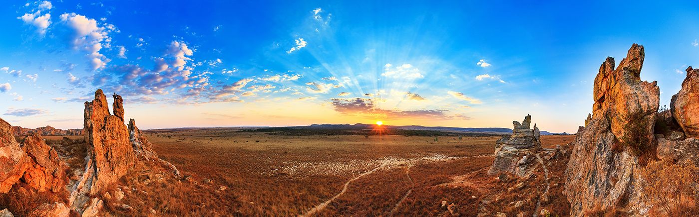
The island country of Madagascar offers a unique adventure, with an amazing number of endemic plant and animal species, diverse ecosystems including tropical rainforests, spiny forests, deserts, mangroves, 3 000 miles of oceanfront, endless natural beauty, and no end of things to see and do.
Madagascar's is the world's fourth largest island and was once part of the ancient supercontinent of Gondwana, splitting away from Africa around 165 million years ago and from the Indian subcontinent around 88 million years ago. Its long period of isolation has led to an incredibly high occurrence of endemism on the island, with over 90% of its fauna and over 85% of its flora found nowhere else.
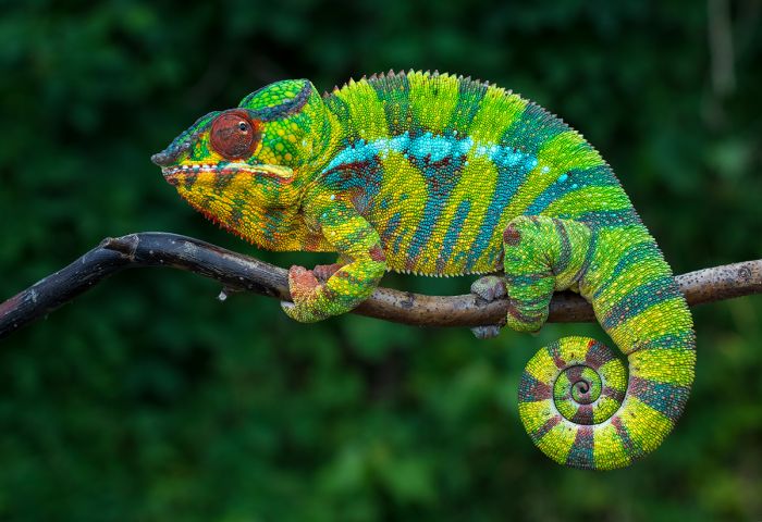
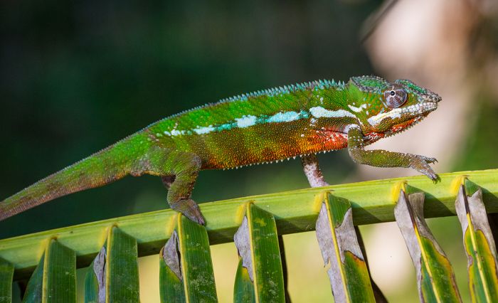
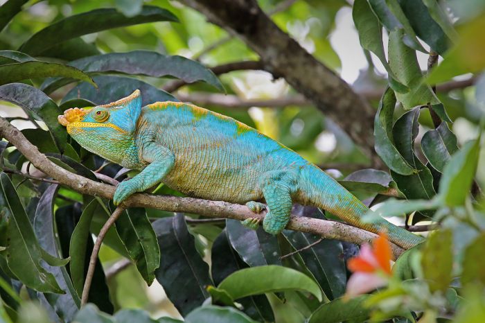
A colorful panther chameleon (Furcifer pardalis), one of around 100 species of chameleon found in Madagascar, all of which are endemic to the island.
Attractions
Madagascar offers a unique blend of Asian and African cultures, with the earliest arrival of humans going back to 2 500 years ago, but the earliest continuous human presence beginning around 350-490 CE, when boats from Borneo are believed to have arrived, making it one of the last major landmasses on Earth to be settled by humans.
Madagascar is perhaps best known for its 100+ (currently 109 described) species of lemur, which are wet-nosed primates that are found only on the island. Most lemur species are considered highly endangered due to habitat loss and some human hunting. Most lemur species have a "cute" appearance and they gained popularity in Western culture in recent times from various motion pictures, including the animated film Madagascar, which features several talking lemur characters.
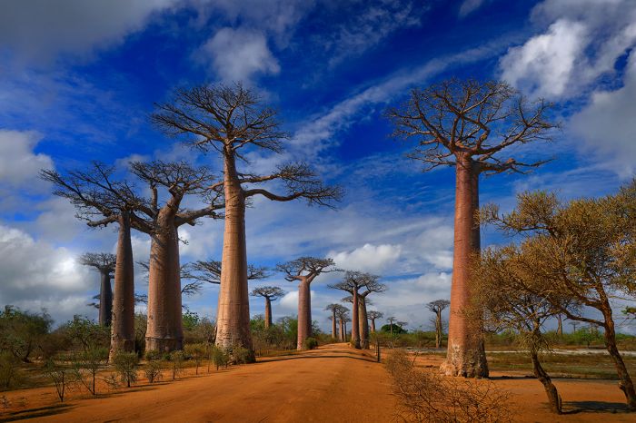
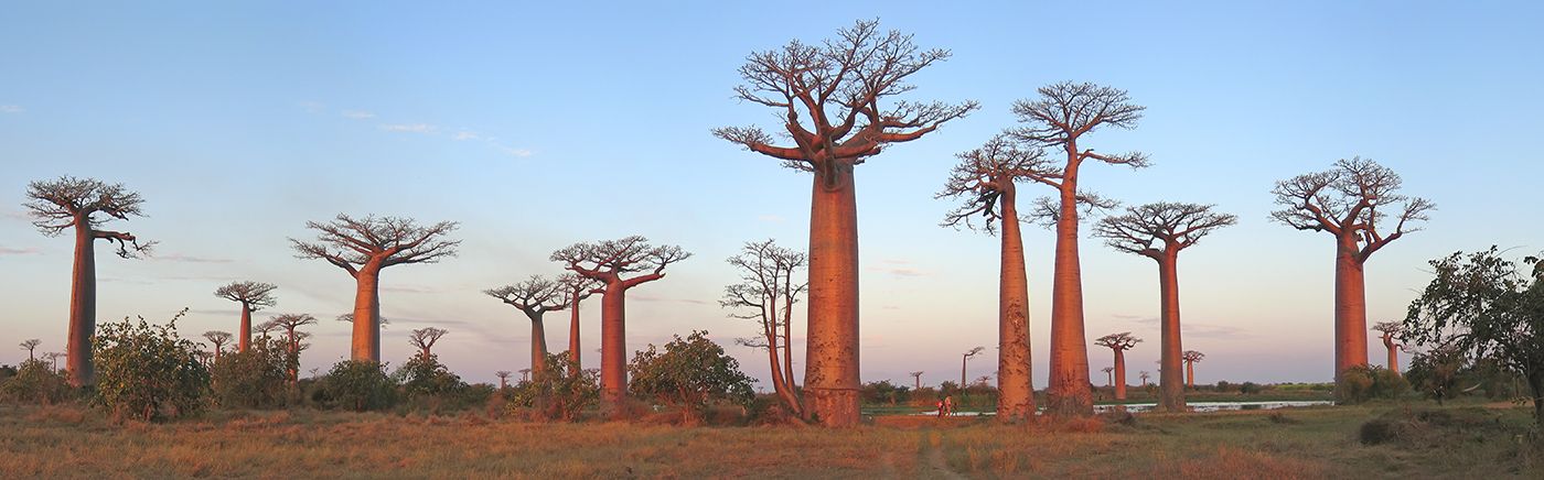
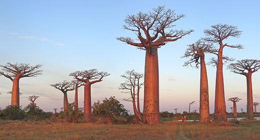
Grandidier's baobabs (Adansonia grandidieri) line the famous 'Avenue of the Baobabs' in western Madagascar.
A notable feature of Madagascar is its floral and faunal diversity and the high level of endemism (found nowhere else on Earth). The island has been designated as one of the planet's 36 Biodiversity Hotspots by Conservation International.
Specifically, Madagascar is home to an astounding 13 000 plant species, of which around 86% are endemic and it is estimated that there are another 2 500 species yet to be discovered or described.
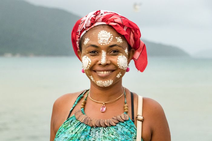
A Malagasy woman with her face painted in the Vezo-Sakalava tradition in Nosy Be, Madagascar.
Madagascar has only five groups of mammals (excluding humans): lemurs, tenrecs, carnivores, rodents, and bats. The Malagasy species within four of these groups (all except bats) are endemic to the island (found nowhere else). It is also noteworthy that within each of these four mammal groups, the species living in Madagascar are each descended from a single ancestor that arrived from the African mainland and colonized the island.
In terms of bird life, Madagascar has good diversity (307 species have been recorded, including seabirds offshore), but the level of endemism is very high, with 109 species found nowhere else.
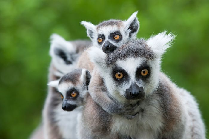
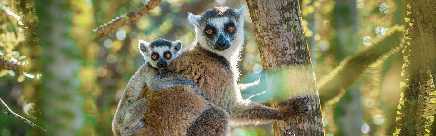
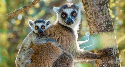
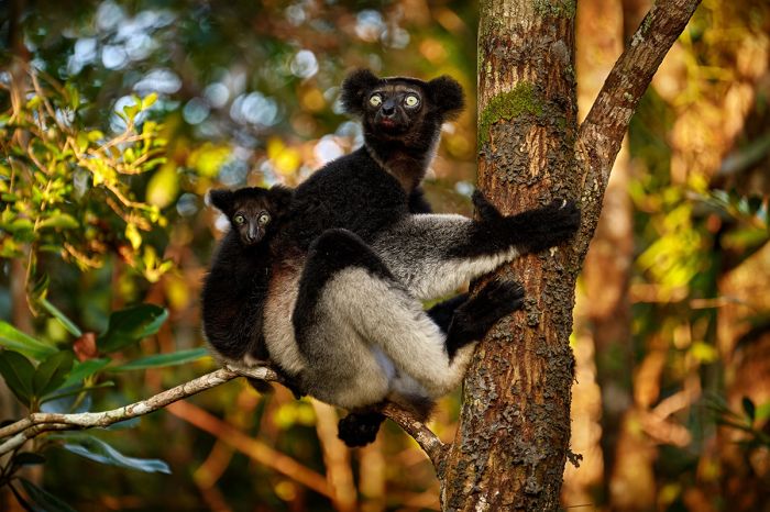
A ring-tailed lemur (Lemur catta) with her babies.
Visiting Madagascar
Madagascar is a very large island (226k sq miles / 587k sq kms), so trying to see everything is not practical unless you have a month or more to spend. The road network is not comprehensive and most of the roads are not what one would consider in 'good' condition, so driving from place to place takes time. Local airlines are also not always reliable, so delays and cancelled flights are a possibility.
Madagascar also experiences a rainy season (January thru March are the wettest months) and some area of the inland can become inaccessible during this time, so some of the accommodations and wildlife parks and reserves shut down until the rain ends. Check our When to Visit section (tab at top) for more information.
Generally speaking, when visiting Madagascar, more time is better and being flexible is a plus.
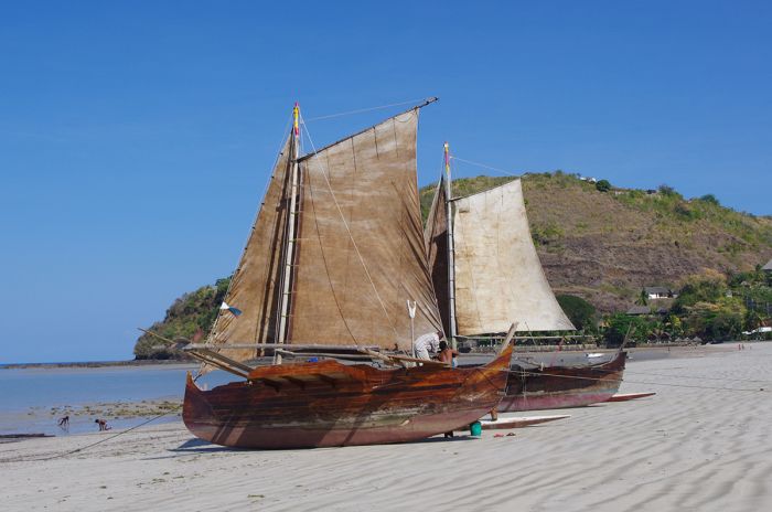
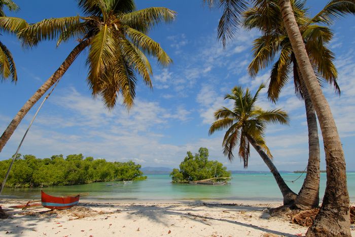
Traditional boats on Nosy Be, Madagascar.
GEOGRAPHY
Madagascar is located in the southwestern Indian Ocean, around 260 miles (420 kms) from the African continent and due east of the country of Mozambique. The stretch of ocean separating Madagascar from Mozambique is called the Mozambique Channel.
Madagascar consists of the large main island, which is elongated roughly north to south in shape, measures 980 miles (1 575 kms) at its longest point and 355 miles (572 kms) across at its widest point. Its total area is 226 657 square miles (587 040 sq kms). There are also some small islands off its west coast that are part of the country.
It is the fourth-largest island in the world (after Greenland, New Guinea, and Borneo) and the second-largest island-based country (after Indonesia, which consists of over 17 000 islands, including parts of Borneo and New Guinea).
Then highest point on Madagascar is Maromokotro, a volcano in the Tsarantana Massif in the north of the island, which reaches 9 436 feet (2 876 kms) in elevation. There are other scattered massifs and peaks situated throughout the island, some also reaching over 2 000 meters (6 560 feet).
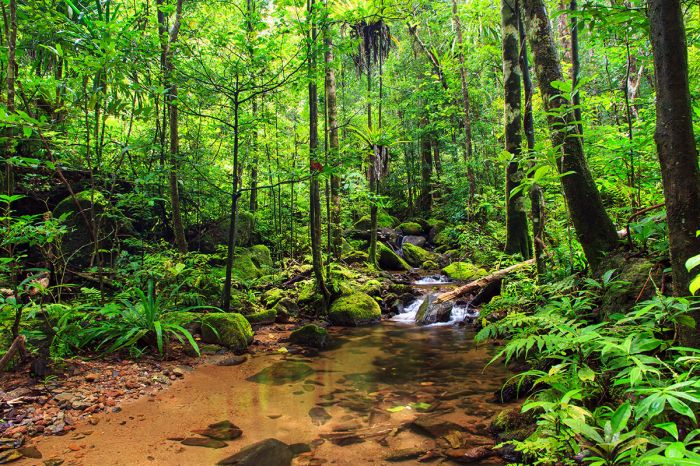
Beautiful rainforest scenery in Masoala National Park, Madagascar.
The island encompasses a range of ecosystems, most notably the massive escarpment of the eastern slope, which rise up inland and parallel to the coastline. This escarpment is exposed to the moist trade winds that blow in off the Indian Ocean, creating high rainfall and nourishing what remains of what were once-massive rainforests along the eastern side of the island.
The eastern escarpment also creates a vast rain shadow across the rest of the island. The central portion of the island's interior is characterized by a high and mostly dry plateau of grasslands, which drops away gradually towards deciduous woodlands along the western side of the island and the spiny forests of the semi-desert southwest.
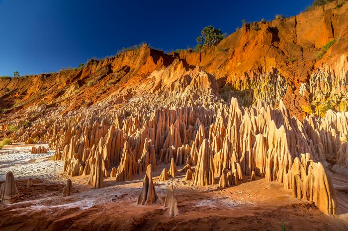
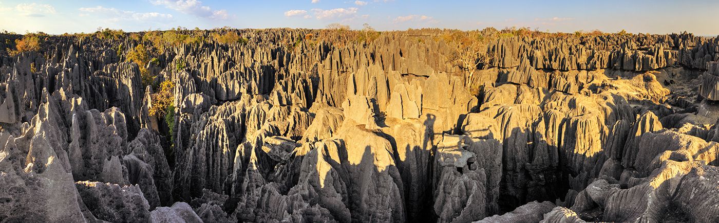
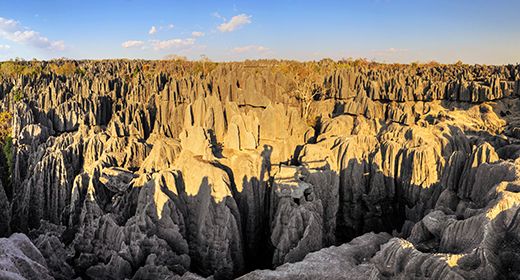
Tsingy formations in Madagascar.
Geographic Regions
Madagascar can be segmented into four main geographic regions, as follows.
Central Highlands: Most of Madagascar consists of a contiguous high plateau covering the central portion of the island's interior. Elevations range from 2 625-5 906 feet (800-1 800 meters). This huge, uplifted region is clearly defined by the steep escarpment on the eastern side, which runs roughly parallel and well inland from the eastern coast, but less so on the western side, which slopes gently all the way to that coastline.
East Coast: This region consists of a narrow (around 30 miles/50 kms wide) band of lowlands and an intermediate zone of 20 miles (30 kms) that is composed of steep bluffs and ravines that border a steep escarpment. The escarpment rises up around 1 600 feet (500 meters) and directly to the west, the central highlands begin. The eastern coastline is essentially straight, with the exception of its most prominent feature, the Masoala Peninsula, which is protected as a national park.
Tsaratanana Massif: The Tsaratanana Massif is the region covering the north end of the island, and includes Maromokotro volcano (9436 feet / 2 876 meters), the highest-elevation point on the island and several protected areas including Montagne D'Ambre National Park, which features beautiful forest with waterfalls and crater lakes. Along the far northern coastal tip is the port city of Antsiranana, which was called Diego-Suárez prior to 1975. Accessing this beautiful region is difficult by road.
West Coastline: The jagged western coastline of the island contrasts sharply from the essentially straight eastern coast, and includes numerous harbors and deep bays, making it a historically active place for early explorers, traders, and pirates from the Far East, Europem and Africa going back to ancient times. The coast includes alluvial plains, beaches, swamps, and mangroves.
Coastal beach view in Madagascar.
Rivers and Lakes
The gentle slope from the island's central plateau to the west coast produce numerous, slow-flowing rivers the flow into the Mozambique Channel. Significant westward-flowing rivers include Mangoky, Betsiboka. The island's eastward-flowing rivers tend to be short and fast-flowing, some with spectacular waterfalls. Noteable east-flowing rivers include the Mangoro, Mananara, and Maningory.
The Maningory River flows east out of Madagascar's largest lake, Lake Alaotra, which is located in northeast of Antananarivo and covers 350 square miles (900 sq kms). Other significant lakes include near the west coast and not far from the Betsiboka Estuary, Lake Itasy in the Central Highlands, and Lake Ihotry in the southwest.
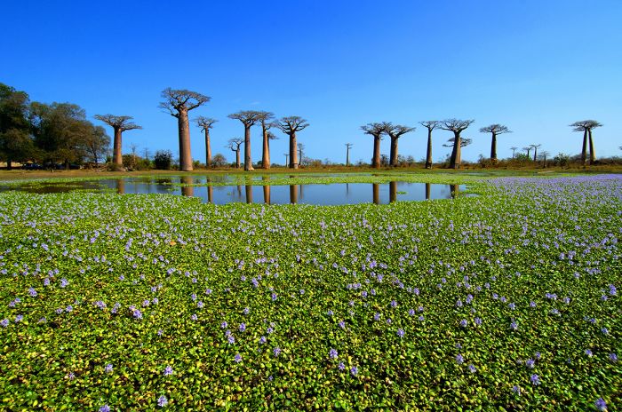
Baobab trees beside a lake in western Madagascar.
FLORA
Owing to the island's incredible abundance of plant and animal species, most of which are Malagasy endemics (found only in Madagascar), it has been designated as one of the planet's 36 Biodiversity Hotspots by Conservation International. Specifically, Madagascar is home to an astounding 13 000 species of flowering plant, of which 11 200 (~86%) are endemic and it is estimated that there are another 2 500 species yet to be discovered or described.
Although there are many other countries with a higher overall number of plant species (Brazil and China each have over 30 000, Columbia has 24 000, etc), none of these countries can come close to Madagascar in terms of the rate of endemism (most of these other countries have around 50% endemics). For its size, Madagascar is by far the world's number one floral hotspot.
In terms of endemic plants by family, Madagascar is home to over 1 000 species of orchid, of which over 90% are endemic, and over 200 species of palm tree, of which 95% are endemic. In the humid forests of northeastern Madagascar, there can be almost 50 species of palm in a single square kilometer. The 2020 IUCN Red List of threatened species reports that over 80% of Madagascar's native plant species are threatened with extinction.
The southwest and west coast of the island receives less than 40cm of rain per year and it is here that Madagascar's succulent plants reign. Madagascar is home to around 150 species of succulent plant.
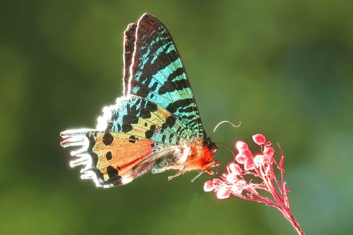
A Madagascan sunset moth (Chrysiridia rhipheus) visits one of the many endemic floral species on the island.
Madagascar's baobabs
The island's most iconic plant is surely the baobab. The baobab tree, which is sometimes called "the upside-down tree" (originating from various myths) may be well known to safari-goers who have visited Botswana, South Africa, Tanzania or other sub-Saharan countries in Africa. Baobabs are native to Africa, Madagascar, and Australia, but have been introduced in Asia and other places.
These deciduous trees are classifies in the genus Adansonia and they are amongst the longest-lived of the vascular plants. One individual baobab in Africa was radiocarbon dated at 2 450 years when it died in 2011, but baobabs commonly live over 1 000 years.
Baobabs produce large flowers that are only reproductive for around 15 hours. The flowers open at dusk, sometimes so quickly that the movement can even be detected by the human eye, but are usually faded by the next morning, after which they fall to the ground, where they are often relished by various herbivorous animals.
There are nine described species of baobab in the world and six of them are endemic to Madagascar. The best known and most visited baobabs in Madagascar are in a place called "Avenue of the Baobabs", which is on the western coast near Kirindy. The baobabs along this rural stretch of road are of the species Adansonia grandidieri (Grandidier's baobab or the giant baobab).
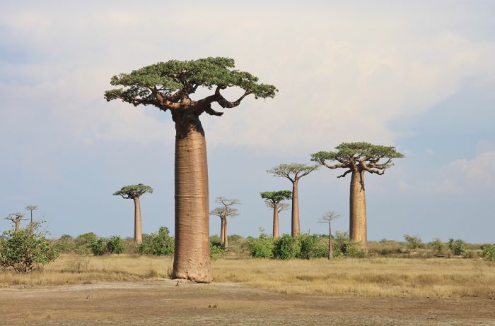
Baobab trees growing along the famous 'Avenue of the Baobabs' in western Madagascar.
FAUNA
Unlike its immensely rich floral wealth, Madagascar's fauna is much less diverse and unlike the African mainland lying not far to its west, Madagascar has no large mammals like lion, leopard or elephant, no herds of grazing herbivores, and no great apes nor monkeys. However, just like the island's flowering plant species, Madagascar's wildlife is predominantly (over 80%) endemic (found nowhere else) and the majority are notably unique.
Madagascar (with India still attached) broke free from the African continent around 165 million years ago and later from the Indian subcontinent around 88 million years ago, leaving the island's wildlife to evolve separately and almost entirely without predators. That is, until the arrival of Earth's most destructive predator, Homo sapiens, who arrived around 350 CE.
Within a span of around 1 000 years, humans on Madagascar had eradicated a good portion of the island's once-immense rainforests and deciduous forests and wiped out around 25 species of its largest animals, including 17 species of lemur (some the size of a mountain gorilla) and the island's three endemic species of elephant bird, the largest of which stood almost 10 feet (3 meters) tall.
In terms of present-day endemic wildlife, Madagascar is home to eleven endemic families of mammals and six (or seven, depending on taxonomic interpretation) endemic families or endemic sub-families of birds.
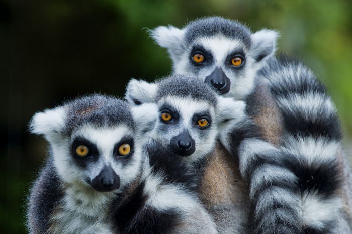
Madagascar is best-known for its lemurs; here a family of ring-tailed lemurs (Lemur catta).
MAMMALS
Contrasted with the large, iconic mammals that roam the savannas and forests of the African mainland, Madagascar is inhabited by smaller, less familiar species. The island's forest canopies contain lemurs, the animal that Madagascar is best known for, while the Malagasy carnivores are represented by just ten species, the largest of which is the fossa, a cat-like mammal that is at home on the ground and in the trees.
In all, there are only five mammal groups (besides humans) inhabiting Madagascar: lemurs, tenrecs, carnivores, rodents, and bats. Interestingly, it is currently accepted that four of these mammal groups (all except bats) are each descended from a single ancestor that arrived from the African mainland and colonized the island.
Madagascar's extant mammals are summarized in the table below:
- Lemurs: 109 extant species, 100% endemic, five endemic families.
- Tenrecs: 31 extant species, 100% endemic, one endemic family.
- Carnivores: 10 extant species, 100% endemic, one endemic family.
- Rodents: 27 extant species, 100% endemic, one endemic family.
- Bats: 45 extant species, 78% percent (35 species) endemic, 3 endemic families, 5 non-endemic families.
Marine Mammals
Note that the analysis above does not consider marine animals that may be seen from Madagascar's coastal shore or offshore from a boat. Numerous species of cetacean (whales and dolphins) can be viewed in the ocean water surrounding the island, some seasonally, and some all year.
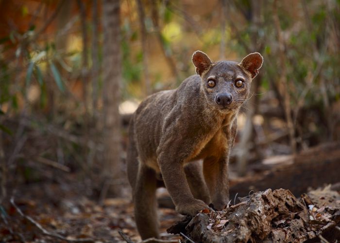
The fossa (or fosa) (Cryptoprocta ferox) is Madagascar's largest predator.
Lemurs
Lemurs (superfamily Lemuroidea) are primates that are classified in a group called prosimians, meaning 'pre-monkey', that also includes pottos and galagos (both are in Africa) and lorises and tarsiers (both are in Asia). Prosimians are considered to have characteristics that are more ancestral than those of simians (humans, apes, monkeys).
Many lemur species are diurnal and some also live in family groups, with the females being dominant, which is not the case in monkeys and apes. Lemurs (and the other prosimians) also differ from other primates in that they have relatively smaller brains and large olfactory lobes, which gives them an extremely keen sense of smell.
By the time the first primates evolved, around 60 million years ago, Madagascar had already broken away from Africa and India and was in its current position off of Africa's southeast coast. Therefore, the current accepted theory is that prosimians arrived on Madagascar as unwitting travelers from the African mainland across the Mozambique Channel on floating rafts of vegetation, likely washed out to see during storms. The date of the ancestral lemur's arrival to the island is estimated to be 40-50 million years ago. The lucky animal(s) that survived the crossing provided the gene pool that led to the great diversity of lemurs found on the island today.
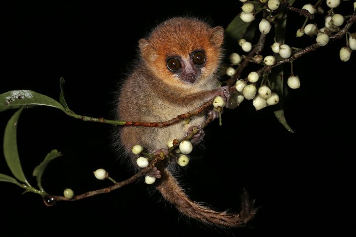
A brown mouse lemur (Microcebus rufus) photographed in the rain forest of Ranomafana National Park.
Apparently no predators or potential lemur-competitors were able to survive any such ocean journey, so the prosimians were able to evolve and exploit all niche habitats on the island.
Today, as it appears has always been the case, lemurs are the only primate inhabiting Madagascar and they are found nowhere else on Earth. Lemurs vary greatly in appearance, ranging from the diminutive Madame Berthe's mouse lemur (Microcebus berthae), which has a body length of only 3.6 inches (9.2 cm) and weighs just 1.1 ounce (30 grams), to the indri (Indri indri), the largest extant lemur which has a body length of up to 28 inches and weighs up to 21 pounds (9.5 kg).
There are currently 109 described species of lemur surviving on Madagascar and an additional 17 species that have become extinct since the arrival of the first humans on the island some 1 500-2 000 years ago, all of which were larger in size than today's lemurs. Large parts of the island that are now devoid of forests, were once home to diverse lemur communities, with more than 20 species of lemur covering the full range of their sizes.
Red-bellied lemurs (Eulemur rubriventer).
The now-extinct family of giant sloth lemurs comprised eight species, some of which were comparable in size to a mountain gorilla, weighing an estimated 440 pounds (200 kg). Today, all of Madagascar's lemurs are considered threatened or endangered in terms of their survival as a species.
Out of the 109 extant lemur species, the most recent IUCN Red List (from 2020) has classified 45 species (42%) as "Endangered" and 33 species (31%) as "Critically Endangered".
Lemurs are currently classified under five extant families as summarized below. Click for more detail info on each family. Extinct lemurs are discussed further below.
- Lemuridae (true lemurs); 4 extant genera with 21 extant species, 1 extinct genera with 2 extinct species.
- Indriidae (indris); 3 extant genera with 19 extant species.
- Lepilemuridae (sportive lemurs); 1 extant genus, 26 extant species.
- Cheirogaleidae (dwarf lemurs, mouse lemurs); 5 extant genera, 42 extant species.
- Daubentoniidae (aye-ayes); 1 genus with 1 extant species and 1 extinct species.
A red lemur (Eulemur rufus).
True lemurs
(family Lemuridae - 4 extant genera with 21 extant species, 1 extinct genera with 2 extinct species).
The true lemurs include the most recognizable of the lemurs and in particular, Madagascar's national animal, the ring-tailed lemur (Lemur catta), which has become synonymous with Madagascar. Ring-tailed lemurs live in the semi-desert southwest and southern forests. They form large social groups and are highly vocal, with an early-morning vocalization sounding much like the meowing of a cat (thus the species name: catta). Ring-tailed lemurs are the most terrestrial of the lemurs.
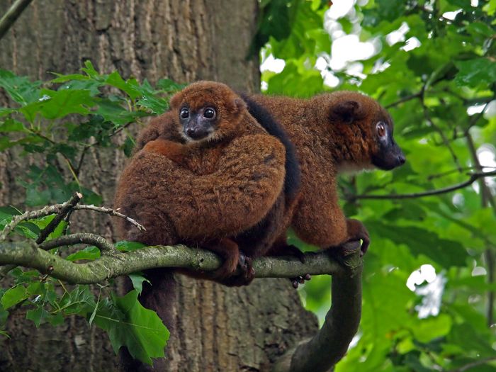
Other true lemurs include the brown lemurs (genus Eulemur) - 12 species, bamboo lemurs (genus Hapalemur - 6 species), and ruffed lemurs (genus Varecia - 2 species), which are specialized fruit eaters. This family also includes two species of giant lemur (genus Pachylemur) that are now extinct.
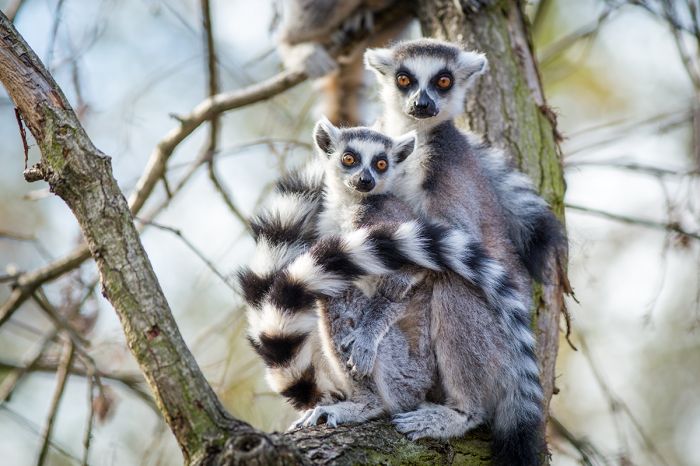
An adult ring-tailed lemur (Lemur catta) with her offspring.
Indris
(family Indriidae - 3 genera, 19 extant species)
(indris, woolly lemurs, sifakas).
The nominate species, the indri (Indri indri), is the largest extant lemur. Indris live in in the eastern rainforests and pair for life, living in small family groups, which normally comprises an adult pair and their variously-aged offspring. They give birth to a single infant each year. The are black and white in coloration and essentially tailless, with just a small vestigial remnant.
Indris are quite vocal, communicating using somewhat eery songs that have been described as similar to those made by whales under water and their cries carry a long distances. The males and females often synchronize their calling, alternating in a rhythmic duet that can go on for several minutes.
The indri (Indri indri) is found in Madagascar's eastern rainforests.
Indris are diurnal and arboreal, but since they do not have tails, they are clingers and leapers and hold their bodies upright when traveling through the branches and using its string hind legs to propel themselves from trunk to trunk. Indris have many humans-like qualities and love to sit and sunbathe in the morning with legs crossed, hands low and palms facing upward or resting on their knees, and eyes half-closed. All of these traits have led to various myths and legends, and the local Malagasy people regard the indri as a sacred animal, not to be hunted. Nonetheless, they are quite endangered, mainly due to habitat loss.
Other members of the indri family include the woolly lemurs (genus Avahi - 9 species) which are the only nocturnal members of the indri family, and the sifakas (genus Propithecus - 9 species). The Indriidae lemurs vary considerably in size and morphology, with avahis measuring only around 12 inches (30 cm) in length. Indris have only a stub for a tail, while sifakas have tails that are as long as their bodies.
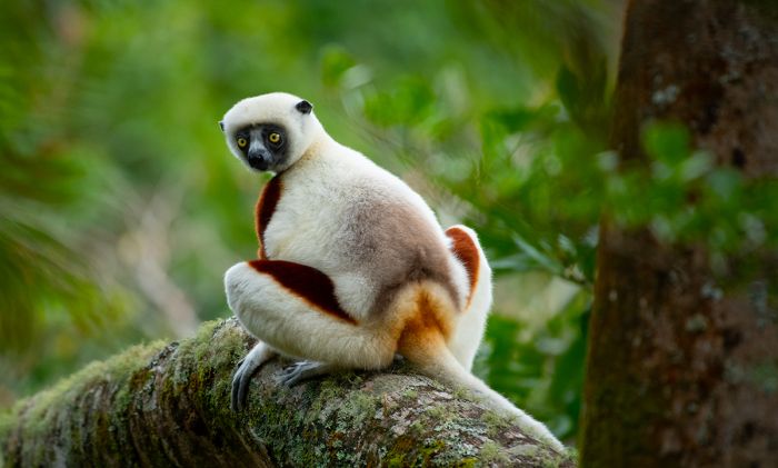
A Coquerel's sifaka (Propithecus coquereli) seen in Andasibe-Mantadia National Park.
Sportive lemurs
(family Lepilemuridae - 1 extant genus, 26 extant species).
Also sometimes called weasel lemurs, this family, which all belong to genus Lepilemur, are mostly quite difficult to differentiate, so geographic location is key to identification, as their ranges do not overlap. They occur throughout the coastal areas of the island.
Sportive lemurs grow to 12-14 inches (30-35 cm) in length and weigh up to 2 pounds (0.9 kg). They are reddish or brownish in coloration on the backs and head and whitish yellow underneath. Sportive lemurs are strictly nocturnal and mostly arboreal, moving between branches and trees with long jumps propelled by their strong hind legs. Despite being nocturnal, sportive lemurs are most often seen during the day, peering from tree hollows or partially hidden in tree foliage.
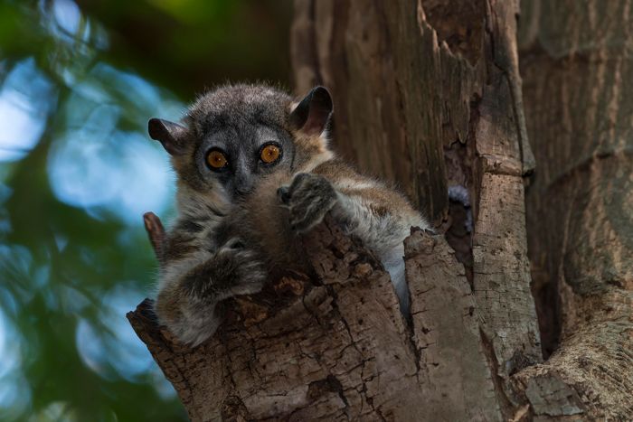
A white-footed sportive lemur (Lepilemur leucopus) peeks from its hideout.
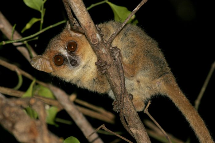
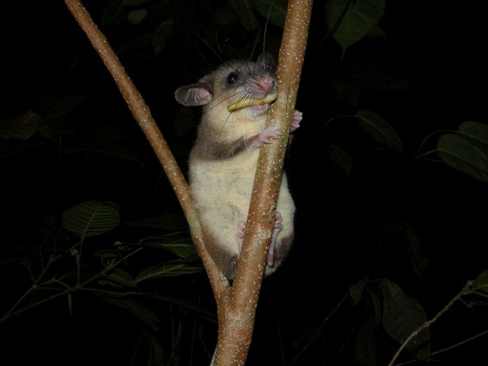
Dwarf lemurs and mouse lemurs
(family Cheirogaleidae - 5 extant genera, 42 extant species).
The smallest of all primates, these lemurs have long tails that are up to 1.5 times their body length, relatively large, close-set eyes, and short legs. These diminutive lemurs grow only up to 5-11 inches (13-28 cm) and weigh no more than 1.1 pounds (500 grams).
Dwarf and mouse lemurs are strictly arboreal and nocturnal, sending their days in tree hollows are leaf nests. They propel themselves through the branches by jumping using all four limbs. Unlike many of the larger species of lemur, which are strictly vegetarian, these diminutive lemurs are omnivorous, consuming fruits, leaves, flowers, insects, spiders, and small invertebrates.
Madame Berthe's mouse lemur (Microcebus berthae), which is only found in the forests of Kirindy on the island's western side, is the world's smallest primate, measuring only 3.6 inches (9.2 cm) and weighing a mere 1.1 ounces (30 grams).
The family is divided into several genera as follows: dwarf lemurs (genus Cheirogaleus - 10 species), mouse lemurs (genus Microcebus - 25 species), giant mouse lemurs (genus Mirza - 2 species), fork-marked lemurs (genus Phaner - 4 species), and the hairy-eared dwarf lemur (only species of genus Allocebus).
Mouse lemurs are arboreal and nocturnal. Here a golden-brown mouse lemur (Microcebus ravelobensis) is illuminated while foraging in a tree.
Aye-ayes
(family Daubentoniidae - 1 genera with 1 extant species and 1 extinct species).
The aye-aye (Daubentonia madagascariensis) is surely one of the world's most bizarre-looking primates, with rodent-like teeth that never stop growing, and a specialized ultra-thin middle finger. This specialized digit appears to be inordinately long upon observation, but in fact it is proportional to other primates' middle finger (including humans), but it is skeletally thin, covered in just skin and no flesh and looking more like the leg of a spider than a primate's finger, giving it the illusion of extra length.
The aye-aye is the largest extant nocturnal primate, with a body measuring 14-17 inches (36-43 cm) in length and weighing around 4 pounds (2 kg). The aye-aye has a tail that is longer than its body, reaching 22-24inches (56-61 cm).
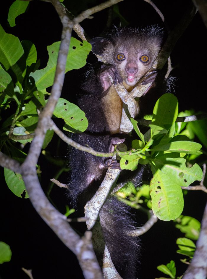
An aye-aye (Daubentonia madagascariensis), photographed near Maroantsetra (Copyright © James Weis).
The aye-aye has an unusual method for finding food. It taps it's very thin middle finger on tree trunks or branches and uses its ultra-acute hearing to listen for grubs inside the tree. When it hears one moving, it gnaws a hole in the wood using its forward-slanting incisor teeth to create a hole, into which it then inserts its specialized middle finger to extract the grub. This method of locating food is called percussive foraging and the only other species known to forage this way are the striped possums, which are marsupials found in New Guinea and Australia.
Sadly, the aye-aye's strange appearance and behavior have resulted in various contradictory Malagasy superstitions. Some villages believe that the aye-aye is an omen of evil, sickness, or bad luck, while other folklore maintains that the aye-aye contains the reincarnated spirit of ancestors. Some of these beliefs of course continue and the poor creature is often feared and persecuted.
The proper classification of the aye-aye is still not completely agreed upon. Early naturalists classified the aye-aye as a squirrel (which are rodents) due to its incisors and some believe that the ancestors of aye-ayes colonized Madagascar separately from lemurs, which are widely accepted to have descended from a single ancestor that rafted over from the African mainland.
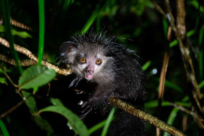
The aye-aye (Daubentonia madagascariensis) is a very unusual-looking lemur.
There are three families of totally extinct lemurs, comprising 7 genera and 14 species. There are also 2 extinct species of giant lemur in the extant family Lemuridae (true lemurs), and one extinct species of the aye-aye family (Daubentoniidae), which also has 1 extant species.
All of Madagascar's extinct lemurs were larger in size and mass than any extant lemurs.
- Archaeolemuridae (monkey lemurs); 2 extinct genera with 3 extinct species.
- Megaladapidae (koala lemurs); 1 extinct genera with 3 extinct species.
- Palaeopropithecidae (sloth lemurs); 4 extinct genera with 8 extinct species.
Giant lemurs (family Lemuridae - 1 extinct genera, 2 extinct species).
These two species were most similar to the extant ruffed lemurs (genus Varecia), but far more robust and 3-4 times larger, with an estimated body weight of 22-29 pounds (10-13 kg). Like today's ruffed lemurs, the giant lemurs specialized in eating fruits. They are thought to have become extinct between 700-1000 CE.
Monkey lemurs (family Archaeolemuridae - 2 extinct genera, 3 extinct species).
Sometimes referred to as baboon lemurs, these lemurs are thought to have been more comfortable with terrestrial living than any of today's lemurs and weighed 40-77 pounds (18-35 kg).
Koala lemurs (family Megaladapis - 1 extinct genus, 3 extinct species).
Very different from any living lemur with large canine teeth and weighing up to 310 pounds (140 kg).
Sloth lemurs (family Palaeopropithecidae - 4 extinct genera, 8 extinct species).
Not related to sloths, these large lemurs do have cranial and other morphological similarities to South American sloths. All sloth lemurs were primarily arboreal and specialized in eating various kinds of leafs, nuts, and fruit. These were the largest lemurs (and one of the largest primates) to have evolved, with an estimated body mass of 350-440 pounds (160-200 kg) and a body that was roughly the size of an adult male mountain gorilla.
Aye-ayes (family Daubentoniidae - 1 extant genera with 1 extant species, 1 extinct species).
The now-extinct giant aye-aye (Daubentonia robusta) is believed to have been similar morphologically to the present-day aye-aye (read more above), but around 2 to 2.5 times larger.
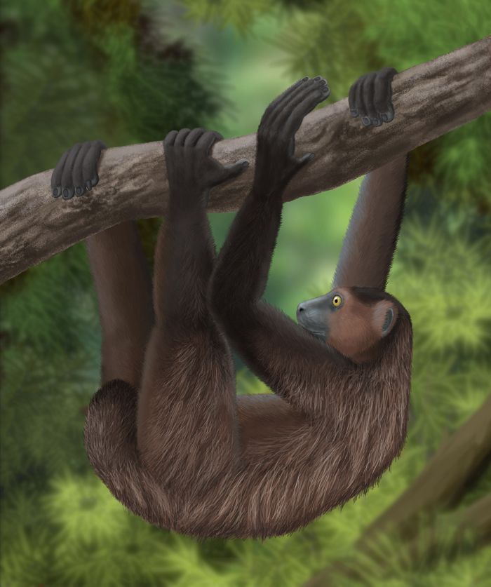
Artist's rendering of an extinct sloth lemur (Babakotia radofilai) based on a photograph of its skeleton and correspondence with Dr. Laurie Godfrey (image: Wikimedia Commons).
Tenrecs
As with Madagascar's three other terrestrial mammal groups (lemurs, carnivores, rodents), tenrecs, which evolved on Madagascar, are now accepted to have come from a single, common ancestor. In the case of the tenrec, that common ancestor is estimated to have arrived some 30-40 million years ago, after rafting across from the African mainland. Over the millennia that followed, the animals multiplied and expanded into the island's different habitats and evolved to best take advantage of niche resources.
Today, a few species of tenrec have radiated from Madagascar onto some of the smaller regional islands, as well as to the African mainland.
Tenrecs are found in both dry and humid regions of Madagascar and are classified within the family Tenrecidae, which contains three subfamilies, 8 genera, and 31 extant species. There are also three known tenrec species that have become extinct. The subfamily Tenrecinae, which are known as spiny tenrecs, contains 4 genera and 5 species; the subfamily Oryzorictinae, which are sometimes called furry tenrecs, contains 3 genera and 25 species; and there is a single species, the large-eared tenrec, in the subfamily Geogalinae.
Tenrecs are all small in size, but within the 31 species, they show great diversity and occupy numerous habitats, although the majority of species live in the humid forests. The smallest tenrec, the pygmy shrew tenrec (Microgale parvula) has a body length of just 1.5 inches (3.8 cm) and weighs a mere 0.1 ounce (3 grams). The largest tenrec, the common (or tailless) tenrec (Tenrec ecaudatus), measures up to 15 inches (39 cm) and weighs around 4.5 pounds (2 kg).
A lowland streaked tenrec (Hemicentetes semispinosus) seen near Maroantsetra (Copyright © James Weis).
All tenrec species are at least somewhat omnivorous, with their primary food source being invertebrates. One species, the web-footed tenrec (Microgale mergulus), is semi-aquatic, with a flat tail to assist it when swimming. It inhabits areas around streams and feeds primarily on aquatic insects and larvae, but also on small fish and crustaceans. During the day, it sleeps in a stream-side burrow and only emerges after dark, so it is rarely seen.
Most tenrecs are nocturnal and have poor eyesight; however, their other senses, especially smell and hearing, are well-developed. Tenrecs give birth to numerous, relatively undeveloped young, with an average brood size of 20-25 babies. The females have 17 pairs of nipples, the most for any mammal. Young tenrecs become independent after 35 days.
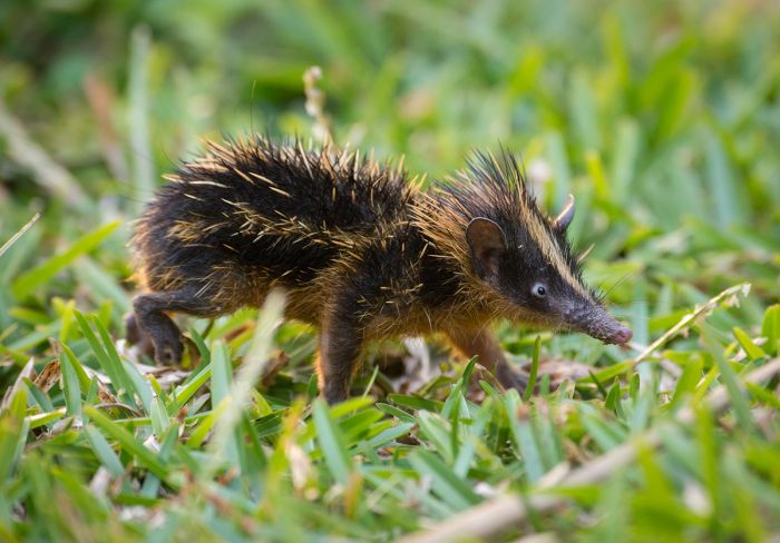
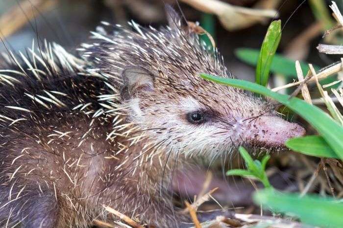
Amongst the interesting tenrec species are the two hedgehog tenrecs (greater and lesser hedgehog tenrecs), which have a coat of hardened spines on their upper bodies and have the ability to raise their quills and roll into a defensive ball when threatened, similar to those of the true hedgehogs. The greater hedgehog tenrec (Setifer setosus) lives throughout much of the island in a variety of habitats, while the lesser hedgehog tenrec (Echinops telfairi) is restricted to the dry regions in the southwest part of the island.
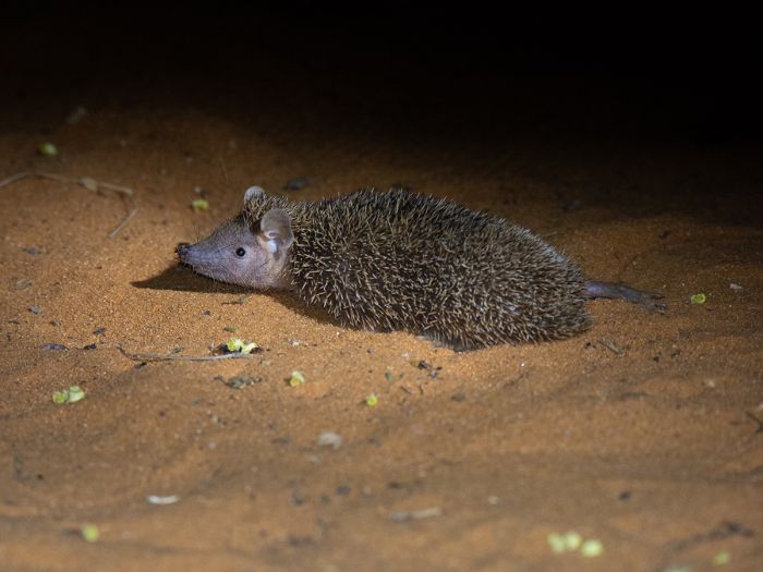
A lesser hedgehog tenrec (Echinops telfairi) seen on an early morning walk in a spiny forest neat Ifaty in southwest Madagascar (Copyright © James Weis).
The genus Microgale contains 21 species that are grouped together as the shrew tenrecs. These small creatures are mainly furry rather than spiny and they occupy the humid forest regions of the island. The group is diverse, with some species having long, prehensile tails to assist in climbing tree branches, while others are more often found on the forest floor. The various species often share the same habitat and the majority are very similar in appearance, making identification quite difficult.
The most commonly seen tenrecs in the humid forests are the two species of streaked tenrec: highland streaked tenrec (Hemicentetes nigriceps) and lowland streaked tenrec (Hemicentetes semispinosus). Both species have sharp, rigid, yellow or white spines that are interspersed with a coat of softer black quills. The rigid spines can be raised when agitated and can be detached into a predator that attempts an assault; a similar defense mechanism to that of a porcupine. The spines on the neck can also be raised and vibrated to produce a rattling sound that acts as a warning to predators. Both species have elongated snouts, which they use to burrow under leaves and soft earth to find earthworms, their primary food source.
The large-eared tenrec (Geogale aurita) is the only member of the monotypic genus Geogale. It lives in a variety of habitats in segmented populations in forests and scrubland. It is somewhat specialized, using its large, projecting ears to locate insects, particularly termites, which it finds using its keen sense of hearing.
The tailless (or common) tenrec (Tenrec ecaudatus).
Carnivores
There are only 10 extant species (plus one extinct species) of carnivore in Madagascar and their taxonomic classification has been somewhat confusing and is still not completely clear.
Initially, biologists studying the island's carnivores classified the various species based on their appearance, with some looking much like civets and others looking like mongooses.
The list below details Madagascar's carnivores, grouped using their original taxonomic classification.
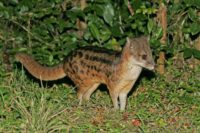
A Malagasy civet (Fossa fossana); also known as a striped civet or 'jabady'.
Species originally thought to be related to civets were placed in the family Viverridae (civets, genets, oyans):
- Fossa: Cryptoprocta ferox. New common name: fosa.
- Giant fossa: Cryptoprocta spelea (extinct).
- Malagasy civet (or striped civet): Fossa fossana. New common name: jabady.
- Eastern falanouc: Eupleres goudotii. New common name: eastern fanaolka.
- Western falanouc: Eupleres major. New common name: western fanaolka.
Species originally thought to be related to mongooses were placed in the family Herpestidae (mongooses, meerkats, kusimanses):
- Ring-tailed mongoose: Galidia elegans. New common name: vontsira-mena.
- Broad-striped Malagasy mongoose: Galidictis fasciata. New common name: vontsira-fotsy.
- Grandidier's mongoose: Galidictis grandidieri. New common name: Grandidier's vontsira-fotsy.
- Narrow-striped mongoose: Mungotictis decemlineata. New common name: boki-boki.
- Brown-tailed mongoose: Salanoia concolor. New common name: salano.
- Durrell's mongoose: Salanoia durrelli. New common name: Durrell's salano.
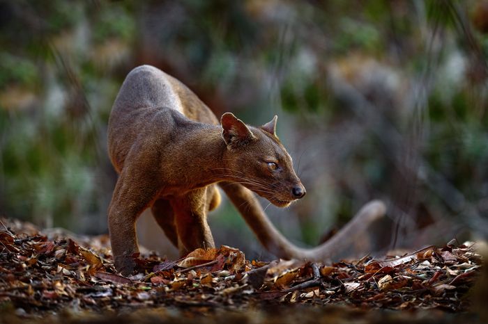
Madagascar's largest carnivore, the fosa (Cryptoprocta ferox), photographed in the Kirindy Forest.
More recent and advanced genetic research beginning around 1990 has revealed very compelling data suggesting that all ten of Madagascar's carnivores evolved from a single common ancestor which, like the ancestor of the island's 109 lemurs, rafted over to the island from mainland Africa some 18-24 million years ago. This means that all of Madagascar's carnivores belong to a 'clade'.
Based on current genetic evidence, all ten carnivore species are now grouped in the same family: Eupleridae. The species originally classified in the Viverridae family are placed in the subfamily Euplerinae, while those originally classified in the Herpestidae family are now placed in the subfamily Galidiinae.
As can be seen in the species list above, the original common names and their relative genera are quite confusing in some instances. For example, the fossa is not even in the genus Fossa (rather, the Malagasy civet is) and now that none of the island's carnivores are considered to be civets or mongooses, the commonly-used names for many of the species are illogical.
In an effort to remove the confusion over Madagascar's carnivores, a shift is underway to begin using new common names which reflect the local Malagasy names for these animals. The new common names are shown for each species in the list above.
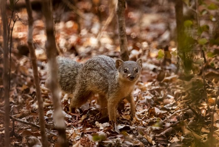
One of Madagascar's predators, the narrow-striped Mongoose (Mungotictis decemlineata), seen in Kirindy.
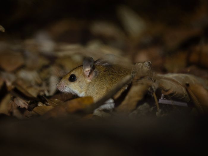
Rodents
Just as is the case with Madagascar's three other terrestrial mammal groups (lemurs, carnivores, tenrecs), all of Madagascar's rodents are accepted by biologists to have evolved from a single, common ancestor. In the case of rodents, it is estimated that their common ancestor made it to the island some 20-25 million years ago, after rafting across from the African mainland.
Throughout the world, rodents (order Rodentia) comprise more than 40% of all mammal species. A primary characteristic of rodents is their two pairs of sharp incisor teeth, one pair in the upper jaw and the other in the lower jaw, which continually produce enamel and must be kept in check by gnawing. The name rodent comes from the Latin rodere, meaning 'to gnaw'.
Malagasy rodents are classified in the family Nesomyidae, which also includes many species living on mainland Africa. Madagascar's rodents are further classified under the endemic (found only on Madagascar) subfamily Nesomyinae, comprising 9 genera, 27 extant species, and 3 extinct species.
A mouse of the genus Eliurus seen in Marojejy National Park (image: Wikimedia Commons).
The various Malagasy rodents (which comprise 27 extant species) include the following nine genera:
- Brachytarsomys (white-tailed rats, 2 extant species, 1 extinct species).
- Brachyuromys (short-tailed rats, 2 extant species).
- Eliurus (tufted-tailed rats, 12 extant species).
- Voalavoanala (voalavoanala, 1 extant species).
- Hypogeomys (giant rat, 1 extant species, 1 extinct species).
- Macrotarsomys (big-footed mice, 3 extant species).
- Monticolomys (Malagasy mountain mouse or Koopman's montane voalavo, 1 extant species).
- Nesomys (red forest rats, 3 extant species, 1 extinct species).
- Voalavo (voalavos, 2 extant species).
The Malagasy rodents are diverse in terms of their appearance and behavior, but most are small, varying from mouse to rat size, with the exception of the unique Malagasy giant rat, which grows to the size of a rabbit. The various species occupy a wide range of habitats and eco-niches, and can be arboreal, terrestrial, or semi-fossorial (living underground).
Most of the island's rodents are nocturnal, which is typical of tropical rodents. Exceptions on Madagascar include the three species of red forest rat, which due to their diurnal lifestyle, are the most commonly seen rodents, especially in the eastern rainforests of Ranomafana and Antasibe-Mantadia.
The bastard big-footed mouse (Macrotarsomys bastardi) is found along the southern half of the west coast and in the extreme southern part of the island.
The two species of white-tailed rat are completely arboreal (tree-dwellers) and live in the humid rainforests. They are superb climbers. The 12 species of tufted-tailed rats are nocturnal and arboreal; as their common name suggests, they have brush-like tufts at the tip of their tails, which are longer than their bodies. Big-footed mice are the smallest Malagasy rodents and all three species inhabit the dry forests and savannas of the west and south.
The giant rat (Hypogeomys antimena), also known as the votsotsa, votsovotsa, or giant jumping rat, is Madagascar's largest rodent, reaching a length of 13 inches (33 cm) and weighing 2.6 pounds (1.2 kg); however, its behavior is truly something different. This species is only known from the Manabe region of western Madagascar, which includes the Kirindy Forest.
The giant rat is completely nocturnal and lives in large underground burrows with multiple entrances and when out foraging, moves on all fours in search of fallen fruits, seeds, nuts, and leaves. When alarmed, the giant rat switches to a kangaroo-like method of movement, hopping quickly on its powerful hind legs. They are also one of the few rodents known to practice monogamy, mating for life or until one of the pair dies. Females give birth to a single offspring and both males and females are extremely protective of their baby, which remains with its parents for 1-2 years.
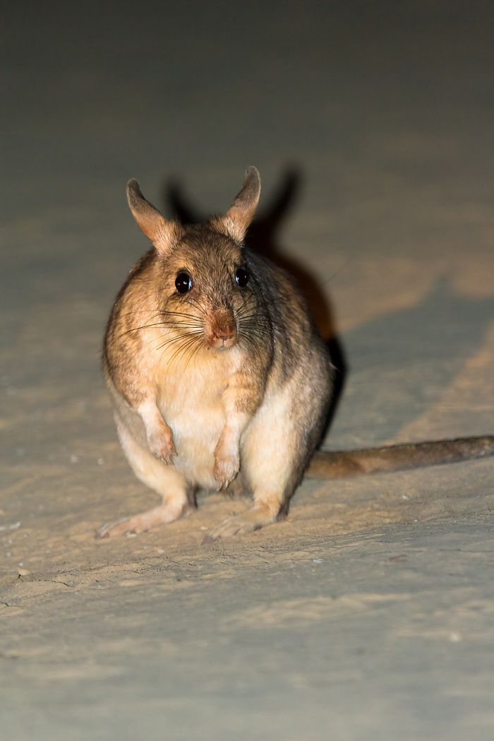
The Malagasy giant rat (Hypogeomys antimena), also known as the votsotsa or votsovotsa, is Madagascar's largest rodent.
Bats
Bats have forelimbs that are adapted as wings, with their spread-out digits covered with a thin membrane (or patagium). Bats belong to the order Chiroptera, the second-largest order of mammals (after rodents), comprising around 20% of all classified mammals, with over 1 400 species worldwide. The name Chiroptera is derived from Ancient Greek: cheir, meaning 'hand' and pteron, meaning 'wing'.
The most distinguishing bat feature is that they are the only mammals that are capable of true and sustained flight. Bats are classified into two superfamilies based on their body size and other features:
- Pteropodidae (the megabats or fruit-eating bats).
- Microchiroptera (smaller and typically insectivorous bats). Microbats use echolocation, whereas megabats do not. Some Microchiroptera also eat other foods, including birds lizards, frogs, other bats, and fish. Three species of Microchiroptera (vampire bats) feed on the blood of large mammals or birds.
Unlike Madagascar's other four groups of mammals (lemurs, tenrecs, carnivores, and rodents), the island's bats are not 100% endemic nor are they all derived from a common ancestor. Whereas the other four Malagasy mammal groups are 100% endemic to the island, of the extant 45 species of bats currently identified on Madagascar, 35 species (78%) are endemic to the island. The fact that all Malagasy bats are not endemics is hardly surprising, since bats can fly over long distances.
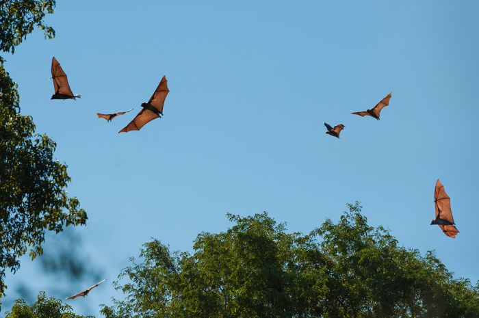
The Madagascar flying fox (or Madagascar fruit bat) (Pteropus rufus) is a Malagasy endemic and the largest bat found in Madagascar. They area usually seen roosting during the day.
Madagascar is home to three megabat (family Pteropodidae) species, each in its own genus and all of which are endemics. Like other megabats, they are all frugivores (fruit-eaters).
- Madagascar fruit bat (Eidolon dupreanum).
- Madagascar flying-fox (Pteropus rufus).
- Madagascar rousette (Rousettus madagascariensis).
The Madagascar flying fox (Pteropus rufus) is the island's largest bat, with a body length of 9-10.5 inches (23-27 cm), weight of 1.1-1.65 pounds (500-750 grams), and a wingspan of 39-49 inches (1-1.25 meters). These large bats can often be seen roosting during the daytime, hanging upside-down from tree branches (with their wings folded around their bodies) in colonies that can number a dozen or up to several hundred, sometimes more. These bats are major seed dispersers for fruiting trees and may also pollinate certain species of trees by visiting their flowers.
Besides the island's 3 megabats described above, there are an additional 42 extant species of microbats found on Madagascar (members of the superfamily Microchiroptera) belonging to 7 families with 32 extant endemics and 10 extant non-endemics. There are also 2 extinct endemics. Three of the Microchiroptera families (totaling 9 extant species) are endemic to Madagascar.
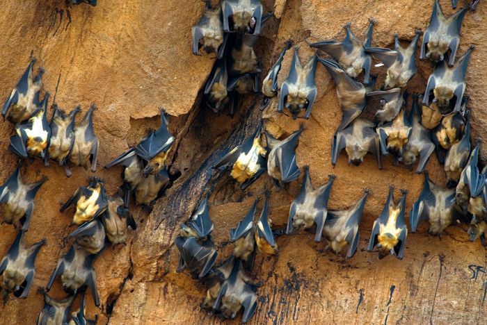
A colony of roosting Madagascar flying foxes (Pteropus rufus).
The diversity amongst the island's bats is astounding and the following list summarizes the 7 families of Malagasy Microchiroptera.
- Emballonuridae (sac-winged or sheath-tailed bats); 3 genera, 2 extant endemics, 2 extant non-endemics.
- Hipposideridae (leaf-nosed bats); 4 genera, 5 extant endemics, 2 extinct endemics. The family is endemic to Madagascar.
- Miniopteridae (bent-winged or long-fingered bats); 1 genus, 9 extant endemics, 2 extant non-endemics.
- Molossidae (free-tailed bats); 5 genera, 5 extant endemics, 3 extant non-endemics.
- Myzopodidae (sucker-footed bats); 1 genus, 2 extant endemics. The family is endemic to Madagascar.
- Nycteridae (slit-faced or hollow-faced bats); 1 genus, 1 extant endemic. The family is endemic to Madagascar.
- Vespertilionidae (mouse-eared bats, vesper bats, pipistrelles, serotines); 5 genera, 8 extant endemics, 3 extant non-endemics.
Most of Madagascar's microbats are difficult to observe and identify, as they usually roost in well-hidden locations during the day and feed mainly on the wing only at night.
Peters's sheath-tailed bat (Paremballonura atrata) is a Malagasy endemic found on the eastern side of Madagascar.
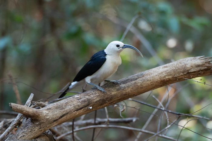
Birds
If you have read through the information above on Madagascar's flora and mammals, it should come as no surprise that the island contains a proportionally significant number of endemic bird species (35.5% of all species recorded to date). Of course, birds can fly over long distances, so there are numerous avian species that can be found on Madagascar that are also found elsewhere.
Madagascar's bird list is currently 307 species (all birds recorded on the island or in its coastal waters), with 109 endemic species (found nowhere else). Note: Species numbers may vary, depending on which birding authority list is used; we adhere to the Clements/ebird list for information here.
In addition to the 109 Malagasy endemics, there are many more bird species that are considered near-endemics, as they are only shared with other West Indian Ocean islands, including the Comoros, Seychelles, Aldabras, and the Mascarene group (Mauritius, and Réunion).
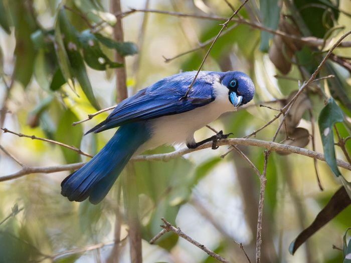
One of Madagascar's most colorful birds, the endemic blue vanga (Cyanolanius madagascarinus), photographed in Ankarafantsika National Park (Copyright © James Weis).
In terms of endemic birds, Madagascar has five endemic (or near endemic) families (meaning all species within the family are only found on Madagascar), as follows:
- Mesitornithidae (mesites); 2 genera, 3 endemics species.
- Brachypteraciidae (ground-rollers); 3 genera, 5 endemic species.
- Philepittidae (asities); 2 genera, 4 endemic species.
- Vangidae (vangas, helmetshrikes, and allies); 15 genera, 21 endemic species. (See note below).
- Bernieridae (Malagasy warblers); 8 genera, 11 endemic species.
Note: The 2022 Clements/ebird authority list has split blue vanga into two species: Comoros blue vanga and Madagascar blue vanga, with the Comoros species occurring only in the Comoro Islands (located to the northwest, between Madagascar and the African mainland), so this family is no longer 100% endemic to Madagascar, but 21 of 22 species are Malagasy endemics.
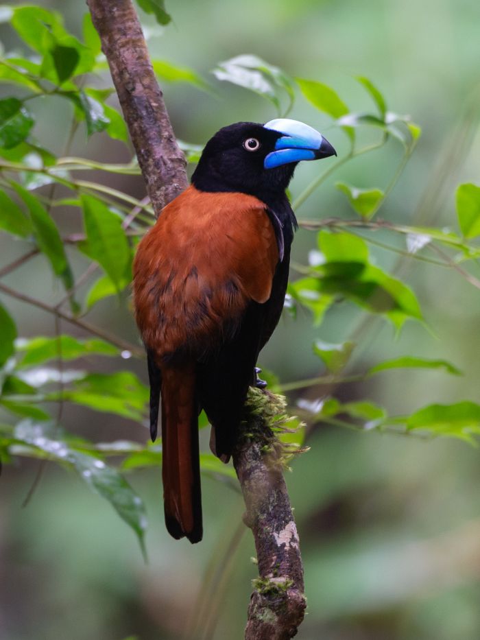
A sickle-billed vanga (Falculea palliata) seen in Ankarafantsika National Park (Copyright © James Weis).
Birding in Madagascar
Birding on Madagascar is quite rewarding, but a serious birding trip for an enthusiast looking to see most of the island's endemic species will require several weeks, plenty of travel around the island, and significant effort in terms of hiking and exploring the protected areas.
An organized birding trip or hiring a local birding guide are the best recommendations for maximizing time and effort. A hard-core birding trip to the island can get you all (or nearly all) of the island's 109 endemic birds and over 200 species in total, depending on the time of year and whether one includes seabirds along coastal areas or via offshore boating.
Below are some of Madagascar's most productive birding 'hotspots', with the approximate number of possible bird species that can be seen.
- Ifaty spiny forests: 160
- Périnet (Analamazaotra Special Reserve): 155
- Ranomafana National Park: 155
- Andasibe-Mantadia National Park: 150
- Ankarafantsika National Park: 150
- Berenty Reserve: 140
- Toliara: 140
- Masoala National Park: 130
- Zombitse-Vohibasia National Park: 115
- Betsiboka River Estuary: 115
- Isalo National Park: 115
- Fort Dauphin: 110
- Analamazaotra Forest Station: 110
- Kirindy Forest: 105
- Nosy Ve: 105
- Tsingy de Bemaraha National Park: 105
One of Madagsacr's most impressive birds, the helmet vanga (Euryceros prevostii), seen in Masoala National Park (Copyright © James Weis).
Extinct birds of Madagascar
Sadly, Madagascar has lost some of its most important birds, all since the arrival of humans on the island. Read further for more information on some of them:
Elephant bird: The elephant birds of the order Aepyornithiformes comprised three species of flightless birds that were endemic to Madagascar. The largest of the three species, Aepyornis maximus, is the largest known bird to have ever lived, standing 10 feet tall (3 meters) and weighing up to 520 pounds (235 kg). Like the cassowaries, ostriches, rheas, emu, and kiwis, elephant birds had vestigial wings and could not fly, and its breast bone had no keel. All three species of elephant bird are believed to have become extinct by around 1260 CE, most likely as a result of human activity.
Alaotra grebe (Tachybaptus rufolavatus): Also known as Delacour's little grebe or rusty grebe, this waterbird was known only from Lake Alaotra on Madagascar. It declined in the course of the 20th century, mainly because of habitat destruction, entanglement with monofilament gill-nets and predation by the blotched snakehead (Channa maculata) an introduced species of fish. Due to its small wings, it was unable to fly long enough distances to disperse to safer areas on the island.
Delalande's coua (Coua delalandei): Also known as the snail-eating coua or Delalande's coucal, this endemic, non-parasitic cuckoo became extinct by around 1850. A total of 14 specimens exist, most of which were taken by the surgeon and naturalist, Joseph Bernier. The species was known only from the coastal rainforests on Nosy Boraha, an island just off the eastern coast of Madagascar. It likely became extinct due to deforestation, but introduced rats and cats, brought to the island by pirates may also have contributed to the bird's demise.
Malagasy crowned eagle (Stephanoaetus mahery): Also known as the Madagascar crowned hawk-eagle, this was a large bird of prey, roughly the size of a golden eagle, that inhabited Madagascar until becoming extinct around 1500 CE. Females (which are typically larger than males amongst raptors) are estimated to have weighed 15 pounds (7 kg). Human overhunting of the eagle's chief source of food, the larger lemurs (which are also now extinct), likely contributed to its demise.
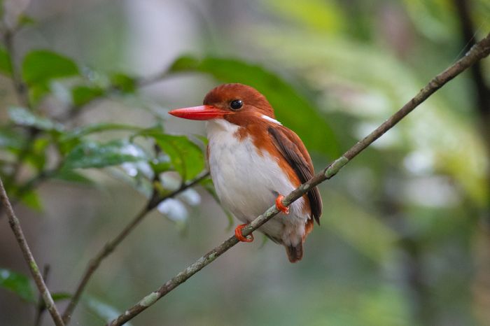
The endemic Madagascar pygmy kingfisher (Corythornis madagascariensis) seen in Andasibe National Park (Copyright © James Weis).
Reptiles
Madagascar's reptiles may be of only casual interest to most visitors, but anyone with even a slight love in nature will likely want to see what the island has to offer with regards to reptiles.
As with Madagascar's other groups of wildlife, the island is home to an incredible variety of reptiles, the majority of which are endemic (found nowhere else), including chameleons, geckos, iguanas, various other lizards, tortoises, and turtles. The nile crocodile is also found in some freshwater habitats on the island. We discuss some of these groups below.
The panther chameleon (Furcifer pardalis) is one of Madagascar's largest and colorful chameleon species (Copyright © James Weis).
Chameleons
Although most people are not big fans of reptiles (which typically means they don't like, or are afraid of, snakes), most people are curious about and would like to see chameleons in the wild. Madagascar has a huge variety of these interesting reptiles.
Chameleons (family Chamaeleonidae) are perhaps best known as the colorful lizards that are capable (in most species) of changing their colors. Most chameleons (though not all), can actively change their skin coloration, which they do for various reasons, including to signal their mood, physiological condition, or as a means of camouflage to avoid predation.
Chameleons are primarily arboreal and they have specialized feet that are well adapted for climbing and moving around the branches in trees. A chameleon has five toes that are fused together into two groups, one group of two toes and the other with three toes, and each toe is equipped with a sharp claw. These foot adaptations allow a chameleon to grip tightly onto narrow or rough branches. Most species also have a prehensile tail that acts as a fifth limb, for safely holding on to branches and which can be coiled up when resting.
The nose-horned chameleon (Calumma nasutum) is a tiny chameleon growing to only about 1-2 inches in length (Copyright © James Weis).
Chameleons also have the most distinctive eye of any reptile. Their upper and lower eyelids are joined and extend out from the head like an upside-down funnel,0the outward end of which is a small opening that is just large enough for the pupil. Each eye protrusion can swivel and independently and each eye can focus independently, brining two separate images to the brain. This extraordinary adaptation allows the lizard to look in two directions simultaneously without moving its head, giving near-complete 360-degree vision around their bodies in all directions.
The other well-known characteristic of chameleons is their ultra-long, projectile tongue, which is used to catch their primary food source, insects. The chameleon's tongue is 1.5 to 2 times (sometimes even more) the length of its body (excluding the tail). When a food item is detected, a chameleon focuses both eyes on the object, giving them accurate distance information to their prey. The tongue is then projected out from its mouth at a very high rate of speed, like a missile, and the insect is grabbed using its muscular tongue-tip, which acts like a sticky suction cup. After securing the insect on its sticky tongue, it is pulled back to its mouth and consumed.
Most chameleons are oviparous (egg-laying), but some species are ovoviviparous (the possess embryos that develop inside eggs that remain in the mother's body until they are ready to hatch). The ovoviviparous species are born within the sticky, transparent membrane of its yolk sac. The mother chameleon presses each egg onto a branch, where it sticks. The membrane bursts soon after and the newly hatched chameleon frees itself and climbs away to live independently.
Peyrieras's pygmy chameleon (Brookesia peyrierasi), seen on the island of Nosy Mangabe, is one of the world's smallest chameleons.
All of Madagascar's chameleon species are egg-layers. The larger chameleon species have widely varying clutch sizes, laying 20-200 eggs, which are deposited in a hole in the ground dug by the female. The tiny Bookesia species, which are only an inch or so in length, lay just 2-4 eggs. The eggs hatch after 4-12 months, depending on the species; some take even longer.
Chameleons are preyed upon by a variety of animals, including birds, snakes, and small mammals. Since chameleons are slow moving, they rely upon their 360-degree vision to spot predators, after which they use their body camouflage, changing their color to blend in with their surroundings and remaining motionless to avoid detection.
If detected, a chameleon will adopt a defensive body position and may puff itself up to appear larger, while warning with an open mouth and sometimes hissing sounds. As a last resort, they will hurl themselves from their perch to escape (they almost always survive a fall from any height).
Parson's chameleon (Calumma parsonii) is another of Madagascar's large and colorful species.
Madagascar's chameleons
There are currently 229 described species of extant chameleons on Earth, distributed primarily in sub-Saharan Africa (including Madagascar), but also some in southern Europe, the Middle East, India, Sri Lanka, and islands in the western Indian Ocean. There are a number of recently discovered species awaiting taxonomic classification and surely more to follow.
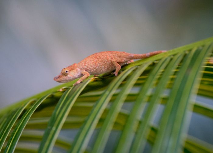
Madagascar is home to 98 of the world's known chameleon species, some 42.8 percent of all species, and all Malagasy chameleons are endemic to the island (found nowhere else). Madagascar's chameleons vary tremendously in terms of morphology and include the world' largest and smallest chameleons.
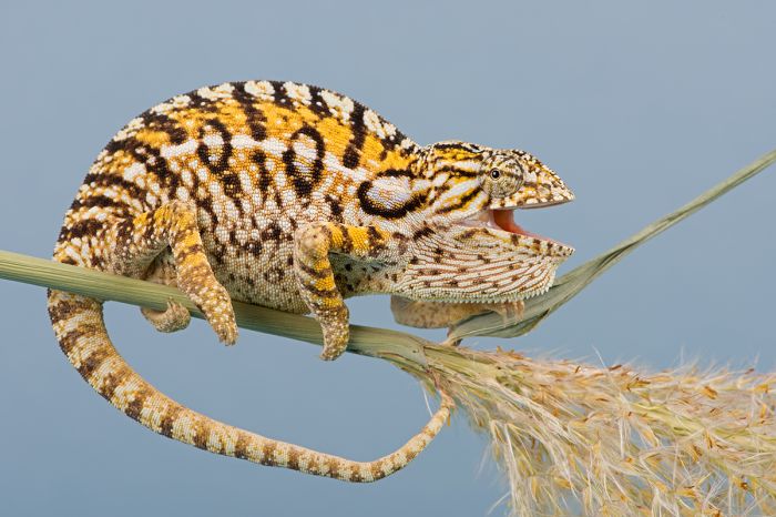
The title of largest chameleon goes to either Parson's chameleon (Calumma parsonii), which is the largest by mass, weighing up to 2.5 pounds (1.1 kg) or the Malagasy giant chameleon (Furcifer oustaleti), which has the longest length, reaching up to 27 inches (68.5 cm), including its tail. Both of these jumbo-sized chameleons live only in Madagascar.
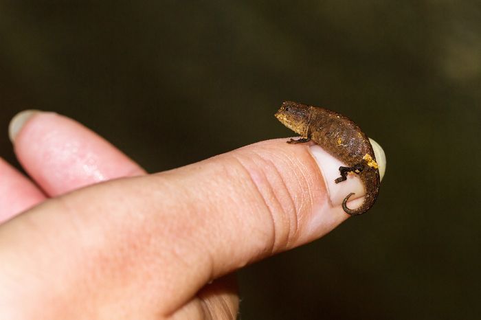
The world's smallest chameleon, the nano-chameleon (Brookesia nana) was only discovered in 2021 in rainforest on Madagascar's Sorata massif. Adult females measure only 1.1 inches (29 mm) in total length (including tail), while males are slightly smaller. Madagascar is home to other tiny chameleons in this size range, including the Nosy Hara leaf chameleon (Brookesia micra), Nosy Be pygmy leaf chameleon (Brookesia minima), Peyrieras's pygmy chameleon (Brookesia peyrierasi), and Mount d'Ambre leaf chameleon (Brookesia tuberculata).
When you visit Madagascar, the guided forest hikes are a great place to see some of the island's colorful chameleons; be sure to let your guide know you would love to see some!
Like all of Madagascar's roughly 100 species of chameleon, the carpet chameleon (Furcifer lateralis) is found nowhere else.
Other lizards
Besides the beautiful and often colorful chameleons discussed above, Madagascar is home to other equally impressive lizards, including geckos, iguanas, plated lizards, skinks, and one species of agama.
Geckos
Geckos (order Squamata, infraorder Gekkota) are small, carnivorous lizards found in warm-climate regions around the world and are found on every continent except Antarctica. Geckos are unique amongst lizards for their vocalization abilities, which differ by species. Most geckos are nocturnal and have excellent night vision, but some species are diurnal.
Many species of gecko have specialized toe-pads that enable then to easily grip onto smooth surfaces, including vertical walls and even upside-down. Some gecko species are well known to people that live in warm climates, as they are often found in human habitations, where they actively hunt small insects by climbing interior walls, windows, and even ceilings. Most people appreciate and welcome these efficient little lizards into their homes for the free insect-removal (particularly mosquitos and moths) service they provide!
The very colorful Madagascar giant day gecko (Phelsuma grandis).
Like most lizards, geckos can lose their tails and re-grow them. This is a primary defense mechanism as a predator may nite the wriggling tail, allowing the gecko to escape. Geckos are polyphyodonts - meaning they continually replace their teeth; they replace each of their 100 teeth every 3 to 4 months. There are currently (as of April 2023) 1 553 described and extant species of gecko on Earth.
Unlike most lizards, geckos have relatively small clutch sizes, laying just one to three hard-shelled eggs, which are glued onto a rock surface, the undersides of a leaf, or in the substrate.
Madagascar's geckos
Madagascar currently has 103 extant and described species of gecko, of which 94 species (91.3%) are endemic. Being mostly nocturnal, most geckos are not colorful, but the diurnal geckos are the exception, and they are brilliantly colored little lizards.
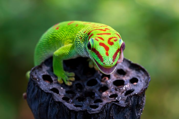
The day geckos (genus Phelsuma), of which there are 35 species found in Madagascar, are something to behold, with the majority having a base color of bright emerald-green and further decorated with various spots and markings of red, blue, orange, or black.
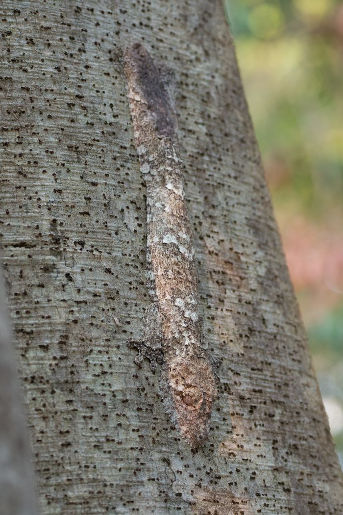
The mossy leaf-tailed gecko (Uroplatus sikorae) is one of 14 leaf-tailed gecko species found in Madagascar (Copyright © James Weis).
Leaf-tailed geckos
Perhaps the most interesting of Madagascar's geckos are the leaf-tailed species (genus Uroplatus), of which there are 14 described species, all of them endemic to Madagascar. Leaf-tailed geckos are distinguished for their amazingly cryptic (the ability of an animal or a plant to avoid observation or detection by other animals) camouflage. The genus name derives from two Greek words (οὐρά - meaning tail, and platys - meaning flat).
Uroplatus species are nocturnal and spend the daytime house motionless to avoid detection by predators, which are mainly birds - couas and vangas. The larger species of Uroplatus resemble tree bark, and they rest with their heads pointed down on a vertical tree trunk, making themselves almost invisible. The smaller species resemble dry leaves.
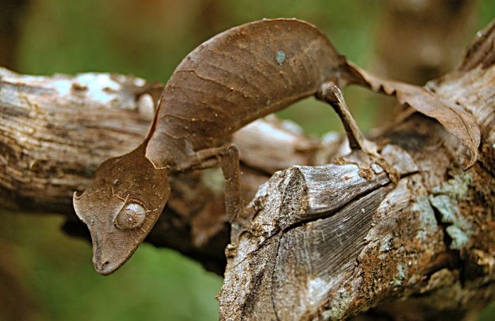
The satanic leaf-tailed gecko (Uroplatus phantasticus).
Iguanas
Iguanas (clade Iguanomorpha) are a multi-family clade of of lizard that includes around 2 000 species that are collectively referred to as iguanids. These lizards live in warm, tropical climates and include 14 families, including chameleons (Chamaeleonidae), iguanas (Iguanidae), helmeted lizards (Corytophanidae), anoles (Corytophanidae), South American swifts (Liolaemidae), and others.
Madagascar's iguanas are classified separately in the family Opluridae, which has seven species, all of which are endemic of the island. Malagasy iguanas are mainly found in the drier areas of the island, in the west, southwest, and some dry areas of the central highlands.
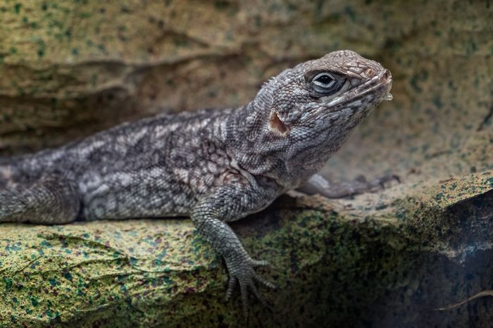
Merrem's Madagascar swift (Oplurus cyclurus) is one of only seven species (all endemic) of iguana in Madagascar.
Plated Lizards
Plated lizards (family Gerrhosauridae) live in Africa and Madagascar and are comprised of seven families. Gerrhosauridae is split into two subfamilies, Zonosaurinae, which has 19 species, all but one of which are found only in Madagascar (one species is also found in the Seychelles Islands), and Gerrhosaurinae, which has 19 African species.
Madagascar's plated lizards are vividly colored and patterned, with green or brown background and stripes of black, gold, or creamy-yellow. The Malagasy species use the common name 'girdled' lizard (genus Zonosaurus) or 'keeled' lizard (genus Tracheloptychus). They are mainly terrestrial, with only a couple of tree-dwelling species.
A Madagascar plated lizard (Zonosaurus madagascariensis) seen in Tsingy De Bemaraha National Park.
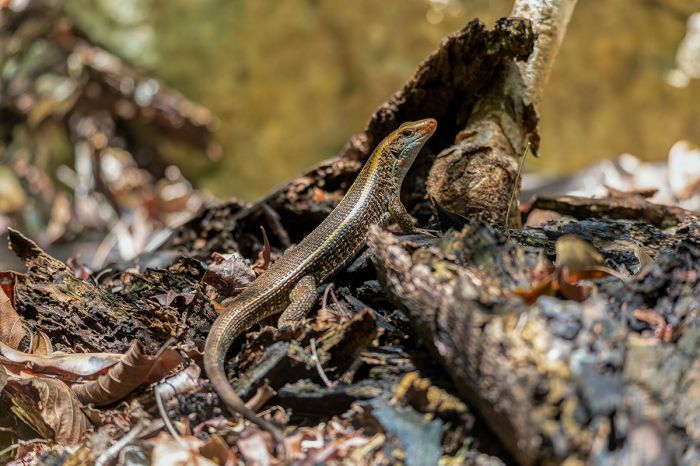
Skinks
Skinks (family Scincidae) are one of the most diverse families of lizard, with over 1 500 described species worldwide and over 100 genera. Skinks are characterized by small legs (proportional to their body size) and no pronounced neck. Some genera have no limbs at all.
Skinks are mostly terrestrial and many have evolved to a digging and burrowing lifestyle. They are generally carnivorous, feeding on a variety to prey including flies, bottles, crickets, caterpillars, millipedes, snails, slugs, earthworms, isopods, and moths. Some of the larger species will also eat other lizards and even small rodents. Their prey is swallowed whole.
Skinks are found throughout most of the world, except the arctic and subarctic. There are 76 described species living in Madagascar, all except for one of which are endemic. The sole outlier is found on the nearby Comoro Islands.
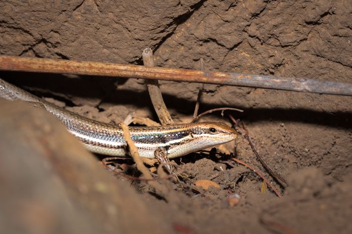
A Gravenhorst's mabuya (or skink) (trachylepis gravenhorstii) seen on Nosy Komba, a small island off the northwest coast of Madagascar.
Snakes
Madagascar has five families of snake, as follows:
- Boas (Boidae) - 3 species (all endemic);
- Big-eyed snakes (Psammophiidae) - 2 species (both endemic);
- Pseudoxyrhophiidae - 85 species (80 endemic);
- Blind snakes (Typhlopidae) - 12 species (11 endemic);
- Malagasy blind snakes (Xenotyphlopidae) - 2 species (both endemic). Endemic family.
Many people are familiar with the nonvenomous boa snakes - sometimes called boa constrictors, due to their popularity in the pet trade. There are 67 described species of boa, most of which occur in the Americas, but there are some found in Africa, Asia, and Southern Europe. Boas include some of the world's largest snake species. Female boas are generally larger than males.
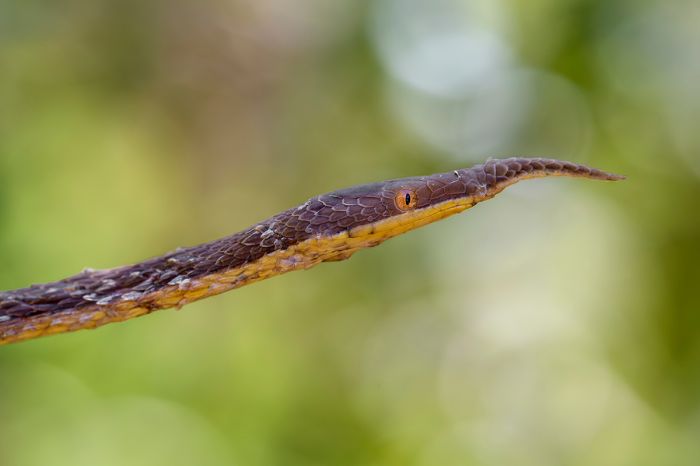
A male Malagasy leaf-nosed snake (Langaha madagascariensis), one of around 100 endemic snake species found in Madagascar.
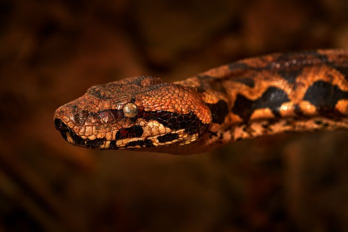
Madagascar has 3 boas, all of which are endemics, as follows:
- Madagascar ground boa (Acrantophis madagascariensis). Madagascar's largest snake, looking similar to the ones found in Central and South America. Adult females can grow to 10 feet (3 meters) in length, but average 8 feet (2.4 meters). Found in the north and west regions of the island. Hunts mainly at night; prey items include lemurs and other small mammals.
- Dumeril's boa (Acrantophis dumerili). Adult females grow to 6.5 feet (2 meters) in length. Found in semi-arid regions along the western coast and southwestern region of the island. Feeds on small animals, including birds, lizards, small mammals, and other snakes.
- Madagascar tree boa (Sanzinia madagascariensis). The smallest and most common of the three species of Malagasy boa. As its common name suggests, it is arboreal. It resides in the humid forests of the east and west regions of the island. Snakes from the different regions have distinct color variation, with the eastern species being more greenish and those from the west, more brownish in color. They are mainly nocturnal and hunts small animals in trees, but also occasionally on the ground. Grows to 4-5 feet 122-152 cm) in length.
None of Madagascar's snakes are venomous, which may be good information for visitors to know. Commonly seen species include hog-nosed snakes of the genus Leioheterodon and the bcommon dig-eyed snake (Mimophis mahfalensis).
In all, there are 104 described species of snake found in Madagascar, of which 98 species (93.3%) are endemic
A Madagascar tree boa (Sanzinia madagascariensis), one of three boa species in Madagascar.
Turtles
Tortoises
Tortoises are a family (Testudinidae) of turtles (order Testudines) and like all turtles, they have a shell that serves to protect them from predation and other threats. Their shell is hard and they can retract their neck and head directly backwards into their shell for further protection.
Turtles include both land-dwelling and sea-dwelling species, but all tortoises are slow-moving, terrestrial species. Tortoises are the longest-living land animals in the world, and the giant tortoise species (Chelonoidis niger) living in the Galápagos Islands is known to live up to 150 years or more.
Tortoises are found from southern North America to southern South America, Southern Europe (around the Mediterranean basin), across Eurasia to Southeast Asia, in sub-Saharan Africa, Madagascar, and some Pacific islands. Most species inhabit semi-arid habitats, though some species are known from wet evergreen forests.
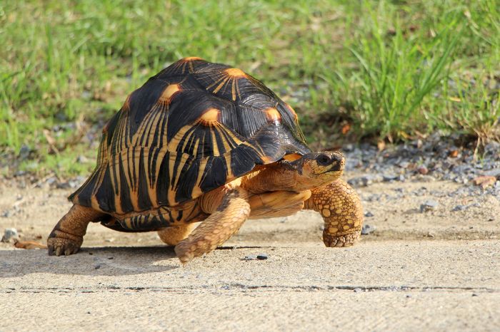
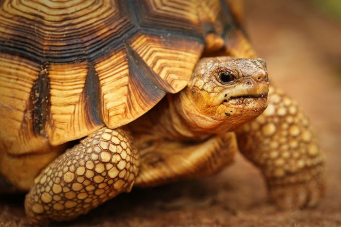
A radiated tortoise (Astrochelys radiata), one of five extant species of tortoise (all endemic) found in Madagascar.
Madagascar has five species of extant tortoise, four of which are endemic to the island, as follows:
- Radiated tortoise (Astrochelys radiata) - endemic.
- Angonoka tortoise (Astrochelys yniphora) - endemic.
- Bell’s Hingeback Tortoise (Kinixys zombensis).
- Spider tortoise (Pyxis arachnoides) - endemic.
- Flat-backed spider tortoise (Pyxis planicauda) - endemic.
There are currently 47 described and extant species of tortoise worldwide. Madagascar is home to five species of tortoise, four of which are endemic to the island. Two endemic and now extinct species of giant tortoise once roamed Madagascar: the abrupt giant tortoise (Aldabrachelys abrupta) and Grandidier's giant tortoise (Aldabrachelys grandidieri). Both species were wiped out by humans after their arrival on the island.
Today there are only two living species of giant tortoise remaining worldwide: the Aldabra giant tortoise (Aldabrachelys gigantea) known from the Seychelles Islands and the Galápagos giant tortoise (Chelonoidis niger) found on the Galápagos Islands.
Until relatively recently, giant tortoises could be found on nearly every major island group, including the Bahamas, the Greater Antilles (including Cuba and Hispaniola), the Lesser Antilles, the Canary Islands, Malta, the Seychelles, the Mascarene Islands (including Mauritius and Reunion), and Madagascar. Most of these tortoise species were wiped out after the arrival of humans, who hunted them to extinction.
The angonoka tortoise, also known as the ploughshare tortoise (Astrochelys yniphora), is a critically endangered species found only in Madagascar.
Freshwater Turtles
Besides tortoises (discussed above), Madagascar is also home to four species of freshwater turtle, as follows:
- African helmeted turtle (Pelomedusa subrufa).
- East African black mud turtle (Pelusios subniger).
- Yellow-bellied mud turtle (Pelusios castanoides).
- Madagascan big-headed turtle (Erymnochelys madagascariensis) - endemic.
The single endemic species, the Madagascan big-headed turtle (Erymnochelys madagascariensis) is critically endangered. It is one of only eight surviving species of the ancient Podocnemididae family, which were once widely distributed in 20 genera and 30 species. The other seven extant species of this family all live in South America.
The Madagascan big-headed turtle is only found in restricted areas in the western lowlands of the island near permanent streams. There is a breeding project at Ankarafanstsika to try to save this species from extinction.
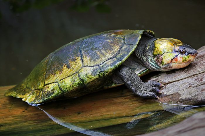
The Madagascan big-headed turtle (Erymnochelys madagascariensis) is critically endangered and one of just four freshwater turtles in Madagascar.
Sea turtles
Two species of sea turtle are known to use the sand beaches along Madagascar's western coast as egg-laying spots. The green sea turtle (Chelonia mydas) and hawksbill sea turtle (Eretmochelys imbricata) are regular visitors to the offshore waters on the west coast, but locals are known to dig up their eggs for food. The tiny island of Nosy Iranja, just offshore from Madagascar's northwest tip, has a remote beach and is a known breeding site for hawksbills.
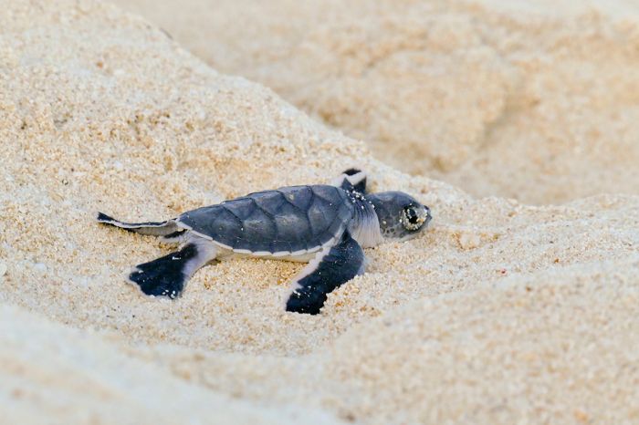
A hawksbill sea turtle (Eretmochelys imbricata) hatchling heads towards the water on Nosy Iranja island.
Amphibians
There are currently (Jun 2023) 8 653 described and extant amphibians (class Amphibia) worldwide. They are classified under three groups as follows:
- Salientia (frogs and toads) - 7 627 species.
- Caudata - (salamanders, newts) - 805 species.
- Gymnophiona (caecilians: limbless, worm-like amphibians) - 221 species.
As shown above, frogs are by far the most abundant amphibian worldwide.
FROGS
The only family of amphibian represented in Madagascar is frogs (order Anura), but there are no native toads. Newts and salamanders live only in the northern hemisphere, so their absence is a given. There are no caecilians (limbless, worm-like amphibians) living in Madagascar, which is perhaps puzzling, as they are found on the African mainland, as well as in the nearby Seychelles Islands.
One explanation for frogs being Madagascar's only group of amphibians is the following:Madagascar had long-since broken away from the Indian subcontinent by the time the island's first frogs appeared. Moreover, amphibians have semi-permeable skin and they cannot survive exposure to saltwater, so how the first frogs arrived in Madagascar, which is surrounded by seawater, is not known.
Presumably, at least one frog ancestor somehow successfully rafted across miles of Indian Ocean from the African mainland to the island, where it laid eggs and thus began the colonization and evolution process which resulted in the hundreds of frog species there today.
A green bright-eyed frog (Boophis viridis) seen in Andasibe-Mantadia National Park (Copyright © James Weis).
Today, there are 413 species of frogs living in Madagascar, but there is also a huge backload of DNA samples taken from un-described species that will add hundreds more to this number and new discoveries continue to be made. All of Madagascar's frog species (except 2 introduced species) are endemic to the island (several are also found on nearby Mayotte Island).
Frogs are particularly reliant on fresh water to survive, so it is understandable that Madagascar's frogs are mainly found in the humid forests of the eastern and far northern regions of the island, with a limited number of species having adapted to the somewhat drier forests in the west and southwest. Most of the frogs living in Madagascar's drier areas are dormant for much of the year and only breed when there is heavy rainfall, at which time they lay their eggs in huge aggregations.
Below are the families of frogs found on Madagascar:
- Reed frogs (Hyperoliidae) - 11 species, all endemic.
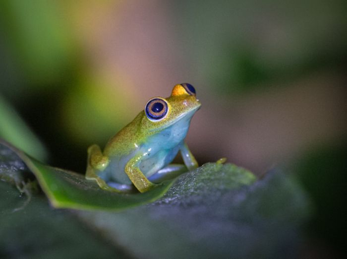
- Bright-eyed frogs, Malagasy Poison Frogs (Mantellidae) - 269 species, all endemic.
- Narrow-mouthed frogs (Microhylidae) - 131 species, all endemic.
- Grassland frogs (Ptychadenidae) - 2 species, widespread and presumed introduced.
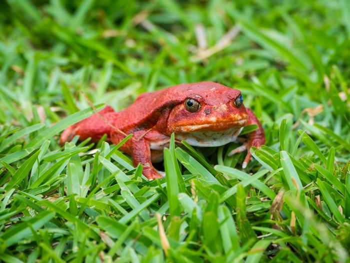
A bright red Madagascar tomato frog (Dyscophus antongilii) photographed in Maroantsetra (Copyright © James Weis).
The poison frogs of Madagascar are, just like those found in Central and South America, brightly colored, which gives a warning to potential predators about their toxic skin secretions. Many of these species are terrestrial, but some are arboreal, and others aquatic.
The genus with the most frog species in Madagascar is Boophis, the bright-eyed frogs, with 80 described species (so far). These are strictly arboreal frogs. Boophis frogs have expanded toe discs, long hind-limbs, and large, colorful, and often intricately-patterned eyes. Many species of Boophis have almost transparent skin, allowing bones and internal organs to be seen, leading to the vernacular name 'skeleton frogs' for some members of the genus.
The majority of frog species in Madagascar are listed as threatened, mainly due to deforestation, but also from over-collection for the pet trade. Some of the larger species are also taken for food by local people.
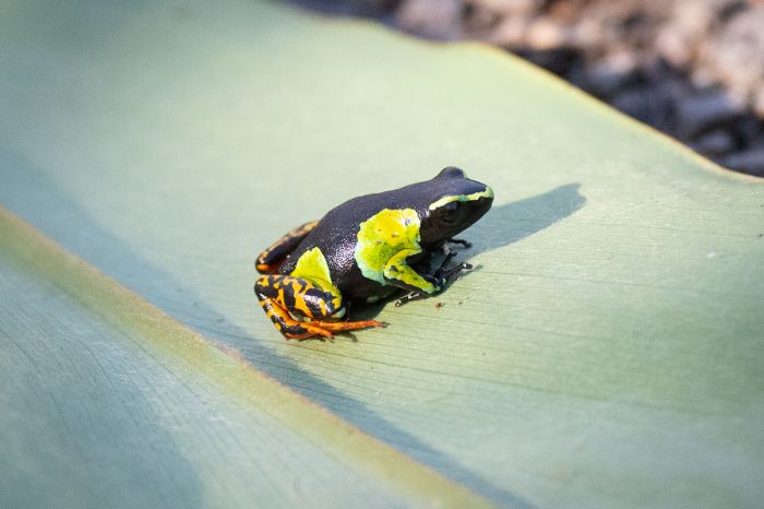
Baron's mantella (Mantella baroni) is one of Madagascar's endemic poisonous frogs; photographed in Ranomafana National Park (Copyright © James Weis).
Protected Areas
Madagascar protects around 10% of its area under the following classifications:
We discuss these protected areas in some detail below.
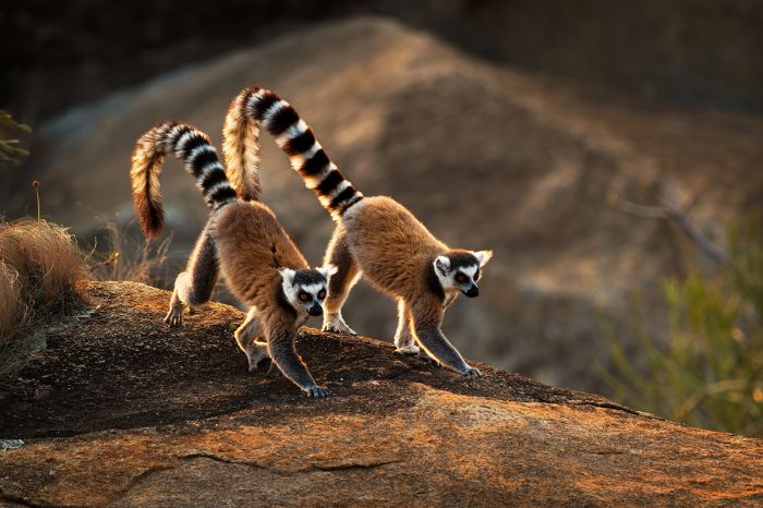
A pair of ring-tailed lemurs (Lemur catta).
National Parks
A national park (IUCN Category II) has a main objective of protecting functioning ecosystems. National parks are managed in a way that may contribute to local economies through promoting educational and recreational tourism on a scale that will not reduce the effectiveness of conservation efforts.
Following are Madagascar's 25 national parks. Additional information on each is included further below this list.
- Amber Mountain National Park - Protects an isolated volcanic mountain, which is covered in rainforest. One of the island's most biologically diverse places and home to numerous species of lemur, the fossa, reptiles, and birds. Excellent for hiking
- Analamazaotra National Park (Périnet) - Small forested park connected to Andasibe-Mantadia NP. Good hiking and wildlife.
- Andasibe-Mantadia National Park - One of the country's most popular destinations; located near Antananarivo and offering excellent wildlife and hiking.
- Andohahela National Park - Located in the far southeast and offering three distinct eco-zones: rainforest, dry spiny-forest, and transitional forest. Diverse flora and fauna, including 15 species of lemur and, a multitude of reptiles, amphibians, and birds.
- Andringitra National Park- Excellent for trekking, with spectacular vistas, interesting rock formations, world class rock-climbing, over 1 000 species of plants, and 13 species of lemur. The island's second tallest mountain, Imarivolanitra, lies within the park. Receives few visitors, but is worth a visit for the hiking.
- Ankarafantsika National Park - Protects dry, deciduous forest in the northwest, with excellent hiking trails, boating on Lake Ravelobe (for birds and crocodiles), and a successful captive-bredding center for the rare ploughshare tortoise. Abundant lemurs and excellent birding.
- Baie de Baly National Park - Protects the unique ecosystem at the intersection of the marine reefs, the mangrove-lined coastal habitats, and the dry deciduous forests of the northwest, providing refuge for species such as the dugong, ploughshare tortoise, and big-headed turtle. A variety of lemurs and superb birding. Camping only.
- Isalo National Park - Madagascar's most visited park protects a sandstone massif that has eroded over time to form dramatic and colorful canyons, plateaus and valleys. Seventeen rivers cut through the arid landscape, which is dotted with palms and inhabited by six species of lemur, numerous reptiles, and 100 species of bird.
- Kirindy Mitea National Park - Protects fauna and flora of the hot and dry transitional zone between the island's western and southern ecosystems. Less visited than the privately-managed Kirindy Reserve just to the north. A variety of lemurs, a high density of baobab trees, and contains a designated Ramsar Wetland consisting of two lakes used by migratory birds (including greater flamingos) for breeding and nesting.
- Lake Tsimanampetsotsa National Park - Protects a sacred soda lake, spiny desert, mangroves, flooded caves, and the westernmost edge of the Mahafaly Plateau in the far southwest part of the island and close to the coast. Camping only or a day-trip from Anakao. Part of an UNESCO Biosphere Reserve.
- Lokobe National Park - Located on the small island of Nosy Be off the far northwest coast of Madagascar. Protects three critically-endangered lemur species, as well as reptiles, amphibians, and birds. A few very good hiking trails.
- Mananara Nord National Park - Seldom visited park along the northeast coast. Difficult drive to get there and camping is the only option. Humid forest, coastal sandy forest, mangrove, plains, marshes. The small marine section protects coral reefs, dugongs, and three small islands, one of which can be listed by boat.
- Marojejy National Park - Protects low and mid-elevation rainforest, cloud forest, and mountain peaks up to 6 995 feet (2 132 meters). The rare silky sifaka can be seen, but the main activity is montane trekking. Few visitors and very high floral and faunal diversity. Three campsites available en route to the summit.
- Marolambo National Park - Large, but somewhat degraded park along the central portion of the eastern escarpment. Mainly rainforest, secondary forest, and savanna. Farms have encroached and there are even farms within the park boundaries. Little in the way of infrastructure.
- Masoala National Park - Masoala contains four parcels of primary rainforest ranging from sea level to 1,300 meters, and three adjacent marine parcels. Very remote, with superb wildlife and birding.
- Midongy du sud National Park - Little in the way of tourist infrastructure and challenging to get to, this park is seldom visited but protects the second-largest remaining tract of contiguous rainforest on the island. Rich in flora and wildlife.
- Nosy Hara National Park - Protects a group of more than a dozen tiny islands and surrounding marine habitat located off the far northwest tip of Madagascar. Camping only on the largest of the islands, for which the park is named. Hiking, snorkeling, rick climbing. Home to a ting, endemic chameleon and dwarf lemurs.
- Nosy Tanikely National Park - Tiny island and marine park offshore from the very popular tourist resort-island of Nosy Be in the far northeast. Only a 30-minute boat ride from Nosy Be and allows day visitors only. Beaches, swimming, snorkeling, and hiking. Excellent coral reef and marine life for snorkelers.
- Nosy Ve-Androka National Park - Marine park protecting coral reefs and marine life off the far southwest coast of the island. Segmented into eight disparate areas along the coastline. Part of an UNESCO Biosphere Reserve.
- Ranomafana National Park - Part of an UNESCO World Heritage Site, the park protects mid-altitude rainforest in the east-central region. Home to 13 species of lemur (including the park-endemic golden bamboo lemur), ~120 species of bird, and diverse reptiles, amphibians, and insects, especially butterflies. Well-maintained, but challenging hiking trails
- Sahamalaza National Park - Comprised of multiple tracts of both terrestrial and marine areas that protects the region's last remnants of a once massive, lowland, coastal forest, as well as coral reefs and open water in the Radama islands lying offshore. Numerous locally-endemic species living in the Ankarafa Forest. Camping only for most of the park.
- Tsingy de Bemaraha National Park - Protects the island's largest area of tsingy fields, as well as dry forest, bush, rainforest, and savanna. High floral and faunal biodiversity, with around 45% locally endemic. An UNESCO World Heritage Site.
- Tsingy de Namoroka National Park - Protects fascinating tsingy fields, as well as sub-humid forest, cave systems, canyons, and savanna. Home to eight lemur species, over 30 reptile species, and 80+ species of bird. Closest accommodation is 30 miles away, so visitors usually opt for Tsingy de Bemaraha NP, which is better developed for tourists and has good accommodations.
- Zahamena National Park - Seldom visited park (due to challenging access and camping only) protecting the northern edge of the island's eastern escarpment. Almost entirely covered in rainforest of varying elevations. Thirteen species of lemur, 50 species of reptiles. Under threat from rural farmers and gem prospectors.
- Zombitse-Vohibasia National Park - Protects three separate forests in the transition zone between the island's west and south. The area has otherwise been deforested, so these forests are crucial for protecting wildlife and flora. Eight species of lemur and superb birding.
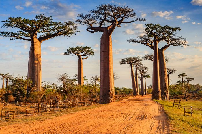
The iconic baobab trees at Morondava.
Strict Nature Reserves
A strict nature reserve (IUCN Category Ia) is an area which is protected from all but light human use in order to protect its biodiversity and also possibly its geological/geomorphic features. These reserves are closed to all except research personnel under specific permit.
These areas are often home to dense native ecosystems where all human disturbance except scientific study, environmental monitoring, and education is prohibited. Because these areas are so strictly protected, they provide ideal pristine environments that enable measurement of external human influence by means of comparison with other areas.
Following are Madagascar's 4 strict nature reserves. Additional information on each is included further below this list.
- Tsingy de Bemaraha Reserve - Protects the area north of the Bemaraha National Park, which is reserved for scientific research and conservation of the highly endemic and diverse flora and fauna living in this incredible ecosystem.
- Betampona Reserve - Small reserve protecting fragile rainforest along the eastern escarpment. Researchers only under special permit.
- Tsaratanana Reserve - Protects both lowland and high-elevation rainforest in the Tsaratanana Massif, which include the island's highest peak, atop Maromokotro volcano.
- Zahamena Reserve - Protects the core portion of Zahamena National Park, which is home to critically-endangered and endemic flora and fauna.
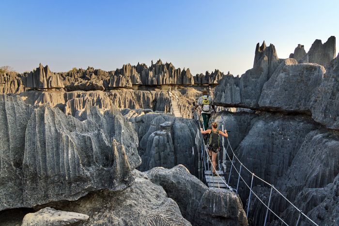
Tourists traversing the walkways in Tsingy de Bemaraha Strict Nature Reserve in Madagascar.
Special Reserves
Madagascar's 'Special Reserves' fall under IUCN Category IV (habitat or species management area). This type of reserve focuses on specific areas of conservation, such as an identifiable species or habitat that requires continuous protection rather than that of a natural feature. These protected areas are supposed to be sufficiently controlled to ensure the maintenance, conservation, and restoration of particular species and habitats, possibly through traditional means and public education.
Following are Madagascar's 21 special reserves. Additional information on some is included further below this list.
- Ambatovaky Special Reserve - Protects eastern escarpment rainforest and dry deciduous forest. A designated BirdLife International IBA.
- Amber Forest Special Reserve - Adjoins Amber Mountain National Park, providing an additional 18.6 square miles (48.1 sq kms) of additional buffer zone to help protect the wealth of biodiversity and endemism common to both areas, including over one-thousand floral species.
- Ambohijanahary Special Reserve - Protects sclerophyllous (adapted to long periods of dryness and heat) forest, savanna, and sandy terrain in the transitional zone between the western and central ecosystems. No infrastructure for tourists.
- Ambohitantely Special Reserve - Small reserve located about three hours' drive north of Tana. Protects the last remnant of a once-vast central highlands forest. Walking circuits and campsites provided for visitors.
- Analamerana Special Reserve - Protects dry, deciduous forest and coastal mangroves in the extreme north. Possibly the best place to see the critically-endangered Perrier's sifaka. Very remote and no tourist facilities, but camping trips can be arranged.
- Andranomena Special Reserve - Small reserve located very close to the popular 'Avenue des Baobabs' and just inland from the central-west coast. Day trips only. Access via one-hour drive from Morondava.
- Anjanaharibe-Sud Special Reserve - Protects primary, mountainous rainforest in the north. Poor roads mean somewhat challenging to access. Hiking, lemurs, birds. Camping or day trips.
- Ankarana Special Reserve - Protects a portion of the limestone and basalt Ankarana Massif in the far north. Dry, deciduous forest, 'tsingy', extensive cave systems, and great diversity of flora and fauna. Day trips, camping, or staying in nearby accommodations.
- Bemarivo Special Reserve - Small reserve just inland from the central-western coast. A designated BirdLife International Important Birding Area (IBA). No tourist infrastructure.
- Beza Mahafaly Special Reserve - Tiny reserve in the southwest protecting two distinct parcels, one with riparian, gallery-forest and the other with arid, spiny-forest. Mainly used for research by several universities since the 1970s. Habituated lemurs. Camping and a research camp.
- Bora Special Reserve - Very small reserve located in the transitional zone between the humid forests of the north and the dry forests of the west. No accommodations.
- Cap Sainte Marie Special Reserve - Protects the southernmost point on the island. Home to thousands of endangered radiated tortoise. Superb hiking, fascinating vegetation, sea caves, and interesting history. Can be done as a full- or half-day visit en route east or west.
- Kalambatritra Special Reserve - Located in the southeast at the convergence of several regional biomes (eastern lowland rainforest, southern dry-spiny-forest, central temperate forest). Good for lemurs and birds. No accommodations, so day trips only.
- Kasijy Special Reserve - Protects two forested karst massifs, as well as savanna, marsh, and rivers. Goos wildlife, including lemurs, chameleons, tortoises, and birds. No tourist infrastructure in the vicinity and poor roads, so not easy to plan a visit.
- Mangerivola Special Reserve - Protects low-, mid-, and high-elevation rainforest along the eastern escarpment. Great diversity of flora and fauna, including many species of lemurs. Day trips from Toamasina (30 miles away) are only option, but the road is not good, so few visitors.
- Maningoza Special Reserve - Protects dry, deciduous forest and savanna along the western side of the island. Declared a BirdLife IBA. Five species of lemur. No tourist accommodations.
- Manombo Special Reserve - Small reserve on the southeast coast, protecting remnants of coastal rainorest. Very high diversity of land snails, as well as some highly-endangered lemur species. No accommodations but day visits are rewarding.
- Manongarivo Special Reserve - Located in the far northwest within a mountainous massif, the reserve protects low- and mid-elevation humid forest and a good number of rare lemur species. Declared a BirdLife IBA. No tourist accommodation nearby and not easy to access.
- Marotandrano Special Reserve - Protects mid-elevation, humid, evergreen forest on the western edge of the eastern escarpment in the north-central part of the island. Declared an BirdLife IBA. Good variety of lemurs. Camping permitted in the reserve or basic accommodations 30 miles north.
- Pic d'Ivohibe Special Reserve - Small reserve protecting low- and mid-elevation rainforest in the southeast. Variety of lemurs and other wildlife. Challenging roads to access and camping only.
- Tampoketsa Analamaitso Special Reserve - Protects forests that include ecosystems of both the eastern and western regions of the island in the Northern region of the island. Difficult to access and no tourist accommodations.
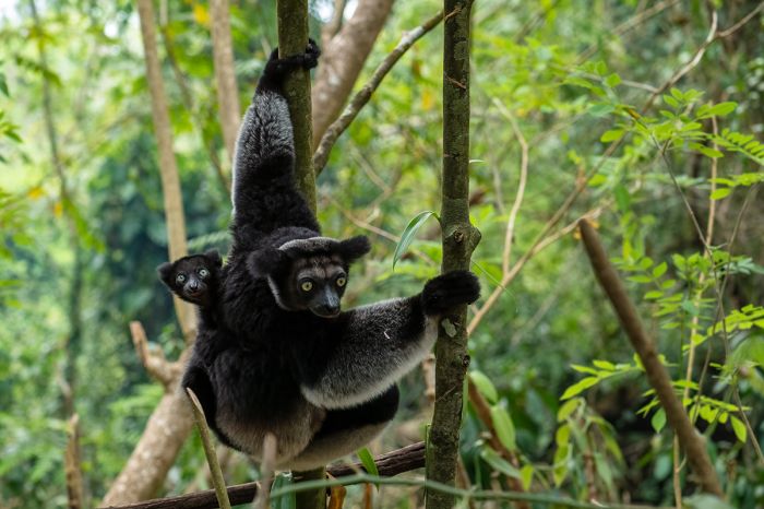
An indri (Indri indri) with her offspring. Indris are found in rainforests in the northeastern parts of the island.
Private Reserves
Besides the long list of nationally protected areas listed above, Madagascar has some excellent privately-managed protected areas, as listed below.
- Kirindy Forest - One of Madagascar's best wildlife-viewing destinations and your best bet for seeing the elusive fossa. The forest is also home to numerous species of lemur, a variety of reptiles, and is excellent for birding.
- Berenty Reserve - A small and very popular reserve in the far southeast, offering superb viewing habituated lemurs (ring-tailed and Verreaux's sifaka), easy walking trails, and excellent birding.
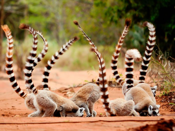
A group of ring-tailed lemurs (Lemur catta) eating soil for minerals in the Berenty Reserve.
UNESCO World Heritage Sites
The United Nations Educational, Scientific and Cultural Organization (UNESCO) is a specialized agency of the United Nations whose mission is to promote world peace and security through international cooperation in education, the arts, the sciences, and culture. The Convention concerning the Protection of the World's Cultural and Natural Heritage was signed in November 1972 and ratified by the 189 UN member "states parties".
A World Heritage Site is a landmark or area which is geographically and historically identifiable and has special cultural or physical significance. To be selected as a World Heritage Site, a nominated site must meet specific criteria and be judged to contain "cultural or natural heritage of outstanding value to humanity". An inscribed site is categorized as cultural, natural, or mixed (cultural and natural). As of 2021, there were over 1 100 sites across 167 countries.
Madagascar has three UNESCO World Heritage Sites:
- Rainforests of the Atsinanana (since 2007, Natural) - Comprises six national parks (north-to-south: Marojejy, Masoala, Zahamena, Ranomafana, Andringitra, and Andohahela) distributed along the eastern side of the island. These relict forests are critically important for maintaining ongoing ecological processes necessary for the survival of Madagascar’s unique biodiversity, which reflects the island’s geological history. These rainforests are of critical importance to both ecological and biological processes as well as their biodiversity and threatened species living within.
- Tsingy de Bemaraha Strict Nature Reserve (since 1990, Natural) - Tsingy de Bemaraha Strict Nature Reserve comprises karstic landscapes and limestone uplands cut into impressive 'tsingy' peaks and a 'forest' of limestone needles, as well as the spectacular Manambolo river canyon. The undisturbed forests, lakes, and mangrove swamps are the habitat for rare and endangered lemurs and birds.
- Royal Hill of Ambohimanga (since 2001, Cultural) - Located a short distance north of Antananarivo, the Royal Hill of Ambohimanga consists of a royal city and burial site, as well as other sacred places. It is associated with strong feelings of Malagasy identity and has maintained its spiritual and sacred character both in ritual practice and the popular imagination for the past 500 years. It remains a place of worship for locals.
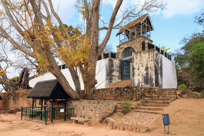
A portion of the outer wall and structures at the Royal Hill of Ambohimanga, an UNESCO Heritage Site not far from Antananarivo.
Ramsar Wetlands of International Importance
The Ramsar Convention on Wetlands is an international treaty for the conservation and sustainable use of wetlands. It was the first of the modern global nature conservation conventions, negotiated during the 1960s by countries and non-governmental organizations concerned about the increasing loss and degradation of wetland habitat for birds and other wildlife. The convention is named after the city of Ramsar in Iran, where the convention was signed in 1971.
Presently there are some 75 member States to the Ramsar Convention throughout the world which have designated over 2 300 wetland sites onto the Ramsar List of Wetlands of International Importance.
Madagascar has 21 sites designated as Wetlands of International Importance (Ramsar Sites) as follows.
- Ambaro Bay Mangroves - Extensive mangroves along the far northwest where coastal forests meet the shoreline. Important habitat for a large diversity of plants and animals, including 100 species of bird, of which 44 are specific to wetlands. The site also protects lemurs and fishes. Threats include human pressure from fishing and agriculture. (208 sq miles/540 sq kms)
- Ambondro and Sirave Lakes Complex - Located directly south of Kirindy Mitea National Park. Features a variety of habitats including two permanent 'dune' lakes, mangrove forests, intertidal zones, and marshes. It supports a remarkable diversity of species, including lemurs and is used by migrating waterbirds, including greater flamingos, as a breeding and nesting site. (56 sq miles/145 sq kms)
- Ambondrobe Wetlands - Site near the central-western coast on the floodplain of the Manambolo River. The wetlands include the permanent Lake Ambondrobe, as well as swamps and transitional forest ecosystems. Provides habitat for over 10 000 birds, especially herons, egrets, and other waterbirds, as well as amphibians, including the endangered Madagascan big-headed turtle (Erymnochelys madagascariensis). Lemurs, other amphibians, and a variety of small mammals also live here. (50 sq miles/130 sq kms)
- Ankarafantsika Wetlands - Located within Ankarafantsika National Park. Protects two permanent lakes in separate locations. The lakes are home to a high diversity of flora and fauna, providing critical habitat for waterbirds, fish, amphibians, and reptiles. (128 sq miles/331 sq kms)
- Antrema Wetlands - Located on the western coast adjacent to the Betsiboka Estuary, the site consists of permanent and seasonal lakes, rivers, streams, small estuaries, intertidal areas, and mangroves. The site also contains coastal forest, with five species of lemur, 18 species of reptile, and over 70 species of bird. The aquatic zones are home to 21 species of fish. (80 sq miles/206 sq kms)
- Barren Islands - The Barren Archipelago is located offshore and to the southwest of the western coastal town of Maintirano and consists of tiny islands and sand banks. The site extends from the west coast of Madagascar and offshore, encompassing an offshore reef complex, extensive areas of sea grass, and open water, as well as estuarine marshes, mangrove forest, coastal dunes, and dense, semi-humid coastal forest on the mainland. The site includes enormous biodiversity, including 39 species of coral, 150 species of fish, sharks, sea turtles, sea mammals, and abundant bird life. Hundreds of fishermen live on the islands for part of each year, living in makeshift houses made of palms, tarpaulins, and pieces of wood. (1 788 sq miles/4 632 sq kms)
- Bedo Wetlands - Located along the central-western coast of the island and bordering the western edge of Kirindy Forest, Bedo is an important site for both resident and migrating birds. The forested areas are home to lemur and endemic tortoises, while the aquatic zones are home to a variety of endangered fishes. The natural resources in this site, including bulrushes and fish, are utilized by local communities. (7.6 sq miles/19.6 sq kms)
- Bemanevika Wetlands - The site is located in the far northwest and comprises disjointed blocks of dense, montane rainforest, as well as grasslands, lakes, marshes, swamps, rivers, and small streams. The mix of habitats supports the survival of bird species and the forested sections are home to seven species of lemur. (38.6 sq miles/100 sq kms)
- Lake Alaotra Wetlands and Watersheds - Located in the east-central area of the island, this site includes Lake Alaotra itself, as well as four4 surrounding rivers (Sahabe, Sasomanga, Sahamaloto and Anony) and their catchment areas. The wetlands are linked to the Indian Ocean by the eastward-flowing Maningory River. Includes includes nine of the twenty natural inland wetland types identified in the Ramsar system of classification, as well as seven of the ten human-made wetland types. It is the only known habitat for the critically-endangered Lac Alaotra gentle lemur (Hapalemur alaotrensis), which is the world's only primate that lives exclusively in reed beds. (2 790 sq miles/7 225 sq kms)
- Lake Kinkony - Lake Kinkony is located in the west-central area, roughly 15 miles (25 kms) from the western coast of the island. This important freshwater catchment is crucial for the livelihoods of several local communities which depend on it for fishing and lakeside rice production. The dominant natural vegetation around the lake is reeds (Phragmites mauritianus), which provide refuge and nesting grounds for 45 species of waterbirds, some of them endangered. The lake provides habitat for 18 species of fishes, as well as the Madagascan big-headed turtle (Erymnochelys madagascariensis). Overfishing and drainage of the basin for agriculture are serious threats. (49.4 sq miles/128 sq kms)
- Lake Sofia - Located in the far north, the site encompasses a small, permanent lake - Lake Sofia - and its peripheral Cyperus swamps, as well as some rivers and streams as they enter and exit the lake. There are also areas around part of the lake that are covered in introduced eucalyptus and guava trees. The lake support 36 species of bird, and there are often more than a thousand individual birds on the lake. The lake also supports fish and a great variety of aquatic and shoreline plants. Some of the swamps have been converted into rice paddies. (6.4 sq miles/16.5 sq kms)
- Manambolomaty Lakes Complex - Located in the western-central part of the island and 10 miles (17 kms) inland from the coast, the site comprises four lakes (Anerika, Ankerika, Befotaka, Soamalipo) and some of the surrounding Manambolomaty Forest. The lakes are habitat for an estimated 9% of the total population of the endangered Madagascar fish-eagle (Haliaeetus vociferoides), as well as numerous other waterbirds and the critically-endangered Madagascan big-headed turtle (Erymnochelys madagascariensis). The forests are rich in flora, including many Malagasy endemics. (29 sq miles/75 sq kms)
- Mandrozo Wetland - Lake Mandrozo is situated in the central-west part of the island, just 10 miles (15 kms) inland from the coast. It is Madagascar's fourth-largest lake. The site encompassed the lake and surrounding marshes, rice paddies, areas of dry deciduous-forest, and grasslands. The wetland supports diverse birdlife, fishes, reptiles, amphibians, and flora. The surrounding communities depend on the lake for fishing and irrigation. (58 sq miles/151 sq kms)
- Nosivolo River and Tributaries - Comprises an 80-mile (130-km) section of the Nosivolo Rover, which is located in the eastern-central part of the island. In addition to this river, the site encompasses a mosaic of tributary waterways, islets, lakes, marshes, remnants of dense rainforest, fragmented gallery-forest, secondary vegetation covering once-forested areas, and irrigated farmland. The site includes the island's highest concentration of endemic freshwater-fishes, with 19 species. The site is also home to a variety of birds, ten species of lemur, plus reptiles and amphibians. (1 384 sq miles/3 585 sq kms)
- Nosy Ve Androka Barrier Reef - Marine site protecting coral reefs and marine life off the far southwest coast of the island. Segmented into eight disparate areas along the coastline. Part of an UNESCO Biosphere Reserve.
- Onilahy Wetlands - Located in the far southwest, the site covers 47-mile (75-km) section of the lower Onilahy River and bordering habitat that includes side-channels, marshes, small lakes, and sections of riparian gallery-forest on plateaus that rise on both sides of the river. The site includes diverse flora and wildlife, including 27 species of mammas (six of them lemurs). Other fauna includes 56 species of reptile, a variety of amphibians and fishes, and 79 species of bird. Agriculture is the main threat. (166 sq miles/430 sq kms)
- Sahamalaza Wetlands - Located along the far northwest coast of the island, the site is synonymous with Sahamalaza National Park (also called Iles Radama). The park is a multi-parcel protected area that comprises ten disconnected sections on both land and water (three are strictly marine, while the remainder are located on the main inland along or very close to the coast). The site includes coral reefs, mangroves, and dense forest. (100 sq miles/260 sq kms)
- Tsarasaotra Park - Small, private nature park located in the middle of Antananarivo, comprising two lakes, woodland, an islet, and a walking trail for visitors. The wooded area is mainly comprised of eucalyptus and camphor trees and there are Cyperus reeds fringing the lakes. This refuge within an urban environment provides nesting sites for waterbirds, especially herons and ducks. Popular with birdwatchers. (0.04 sq miles/.10 sq kms)
- Torotorofotsy Marshes and Watersheds - Located in the central-east within the Ankeniheny-Mantadia-Zahamena forest corridor, the site encompasses the watersheds of three rivers: Mokaranana, Ankahelava, and Ambasimbavy. There are permanent and seasonal marshes, seasonal wetlands, primary forest, and secondary forest. The forests are fragmented by farming, mainly rice paddies. The marshes are very rich in biodiversity, with over 100 species of bird, and an abundance of amphibians. This is the only known locality of the criticlly-endangereg golden mantella frog (Mantella aurantiaca). (38.5 sq miles/100 sq kms)
- Tsimanampetsotse National Park - Protects a shallow, coastal soda lake that provides habitat for many species of waterbird, as well as streams and a network of limestone caves.
- Tsiribihina Mangroves - Situated along the central western coast, the site includes coastal mangroves extending 10 or some miles on both sides of the Tsiribinha River mouth. Besides the extensive mangrove forests, there are also sandbanks, lagoons, mud flats, salt flats, marshland, and dry land. These habitats provide refuge for 44 identified species of birds, many of them shorebirds and waterbirds, that number and estimated 40 000 individuals. The forested areas are also home to several species off lemur. Hawksbill turtles (Eretmochelys imbricata) use the sand banks for besting. Upstream deforestation is a major risk. (182 sq miles/472 sq kms)

A group of Lac Alaotra gentle lemurs (Hapalemur alaotrensis). Lake Alaotra and its surrounding wetlands are a designated Ramsar Wetland.
Other IMPORTANT SITES
Besides for the island's long list of protected natural areas, the following locations are worth consideration when planning your trip.
- Andrafiamena Reserve - Bordering the Analamarana Special Reserve in the far north, with similar wildlife. Moist, semi-deciduous forest. One decent accommodation for visitors.
- Nosy Be - A small island off the northwest tip of Madagascar and the country's busiest tourist destination. Lots of hotels and resorts, many of them exclusive and pricey compared to most accommodations in the country. Lots to do, including diving, fishing, boating, horseback riding, and much more.
- Nosy Ve - Tiny, barrier reef island lying a short distance offshore in the far southwest. The main attraction is a breeding colony of red-tailed tropicbirds. Day trips only via 30-minute boat ride, which can be challenging depending on the sea and the type of watercraft.
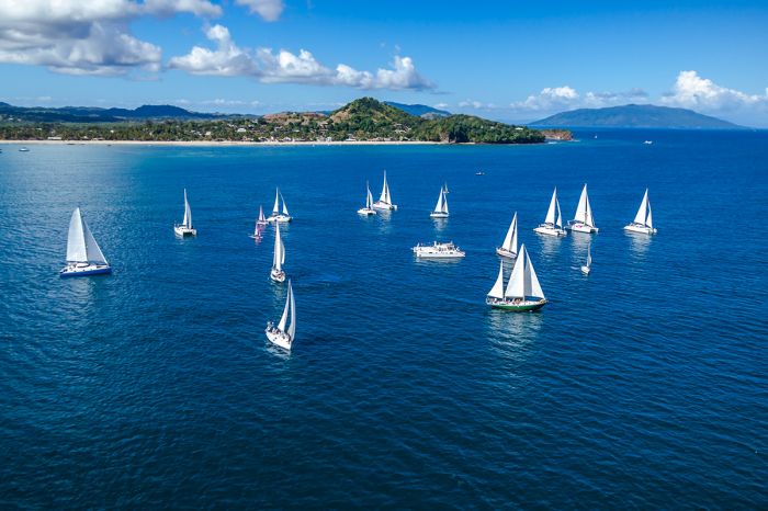
Sailboats on the water offshore from Nosy Be, Madagascar.
URBAN AREAS
Several of Madagascar's urban areas are worth noting, as they are likely to be visited on the more popular circuits of the island. Info on the more important towns and cities follows below. Info on each follows further below.
- Antananarivo (Tana) - The capital city and almost every visit to the island will begin and end here. By far the biggest city in Madagascar and the historical site of the island's first rulers, who build their city atop three converging hills. Not a true destination and most guests spend a night or two.
- Toamasina (Tamatave) - Madagascar's second-biggest urban area and its principal port, located along the central-east coast. Historical buildings from the French colonial period still stand along palm-lined boulevards.
- Antsirabe - The island's third-largest city, located southeast of Tana in the Central Highlands. Founded by missionaries in 1872 to take advantage of the pleasant climate and natural hot springs. Considered the agricultural and industrial center of the island. Some interesting buildings remain from the colonial era.
- Mahajanga (Majunga) - The island's second-largest port, located along the northwest coast. Dates back many centuries and has a significant Indian community. Nearby sites worth visiting include the Betsiboka Estuary and Ankarafantsika National Park.
- Fianarantsoa (Fianar) - Considered Madagascar's educational and intellectual center, located in the southeastern highlands. The town dates back to 1830 and has an 'old town' section which is worth seeing. City tours, a market, museum, and a nice tea estate located outside of town.
- Toliara (Tuléar) - Southwestern coastal town dating back to 1895, but sailors (including pirates) have been visiting St. Augustine's Bay just south of the town for centuries. The Onilahy River mouth located just to the south has mangroves, sand dunes, and caves.
- Antsiranana (Diego-Suarez) - Coastal port town on the northernmost tip of the island with a colorful history. Named for two Portuguese explorers (Diogo Dias and Herman Suarez). The site of an Allied forces invasion in 1942 during World War II. Very remote location with a cosmopolitan populace and an interesting place to visit.
- Taolagnaro (Fort Dauphin) - Coastal town in the far southeast dating back to the early 1500s. It was the first French Settlement on the island, named for the future King Louis XIV of France. Poor roads into and out of the town, so flying his the best option. Most come to see nearby Berenty Reserve.
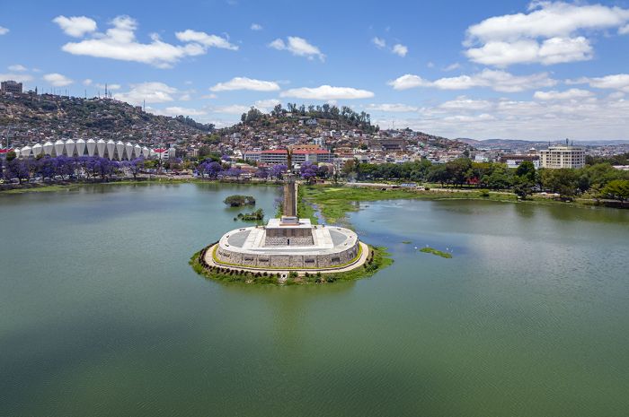
Surrounded by Madagascar's capital, Antananarivo, the manmade Lake Anosy replaced a swamp during the reign of Radama I in the early 1800s. The French-built 'Monument aux Morts' is located on the small island and commemorates soldiers who died during the First World War.
Andasibe-Mantadia National Park
Consisting of two adjoined parks (Andasibe and Mantadia), these parks are located a short drive east from Antananarivo (the capital city and place where nearly all visits to Madagascar begin and end).
Andasibe is by far the more visited of the two parks and is home to 11 species of lemur, including the largest species, the indri. The park is also home to some of Madagascar's endemic birds, chameleons, tenrecs, and insects. Commonly seen lemurs species include grey bamboo lemur, one of the woolly lemurs, and common brown lemur.
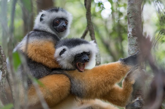
Diademed sifakas (Propithecus diadema) seen in Andasibe-Mantadia National Park.
Mantadia is the larger of the two adjoined parks, but far less developed and the walking trails are much more challenging, with some rugged terrain. That said, for nature enthusiasts and keen birders, it is exceptionally rewarding. In contrast to Andasibe, Mantadia has virtually untouched primary forest and visitors should be ready to work when walking the sometimes steep trails.
Hikers in Mantadia's forest will see superb bird life and may also encounter the diademed sifaka and possibly indri as well. Guides are available for hire and a full-day hike with packed lunch is the best option to do this park justice.
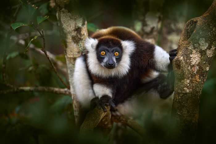
A black-and-white ruffed lemur (Varecia variegata) seen in Andasibe-Mantadia NP.
Mitsinjo Forest
There are also several privately-managed forests adjoining the Andasibe-Mantadia National Parks, the best of which is Mitsinjo Forest, which is run by a local NGO. Indri are almost a guaranteed sighting here and the knowledgeable guides provide an exceptionally good experience for visitors. The national parks do not allow visitors after dark, but Mitsinjo's night walks are not to be missed, with excellent chances to see some of Madagascar's 24 species of mouse lemur, as well as frogs, and other nocturnal critters.
The conservation-minded NGO that manages Mitsinjo, also runs the nearby (6.8 miles / 11 kms to the west) Torotorofotsy Marsh Area (a designated Ramsar Wetland).
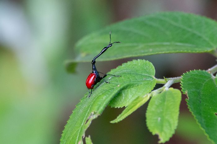
The very unusual giraffe weevil (Trachelophorus giraffa) can be seen along the trails in Andasibe-Mantadia National Park (Copyright © James Weis).
Analamazaotra National Park
Very close to and south of Andasibe NP is Analamazaotra National Park, which was created in 2015 by combining the Analamazaotra Special Reserve (established in 1970 and also known as Périnet-Analamazaotra) with the adjacent Analamazaotra Forest Station.
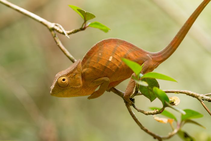
Parson's chameleon (Calumma parsonii) is one of the largest chameleon's in the world and can be seen in Analamazaotra NP.
Lemur Island
Located within Andasibe National Park, 'Lemur Island' is a small and managed bit of property set up for tourists to provide interaction with wild, but very habituated lemurs.
The experience is quite remarkable and visitors get to spend an hour in close proximity to several species of lemur, including ring-tailed lemur (Lemur catta), back-and-white ruffed lemur (Varecia variegata), common brown lemur (Eulemur fulvus), eastern lesser bamboo lemur (Hapalemur griseus), diademed sifaka (Propithecus diadema), and a few others.
Getting to the 'island' is a one-minute canoe ride and once-there, you are free to wander about and interact with the friendly lemurs. Some fresh bananas are provided to attract the lemurs, which savor these fruits, and the lemurs will most likely perch on your shoulders and eat straight out of your hands. The photographic opportunities are incredible, and even though it is a contrived experience, anyone with a fondness for these amazing primates will get plenty of enjoyment and not soon forget the day.
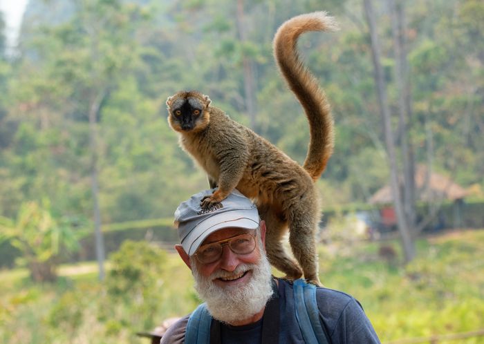
A very friendly common brown lemur (Eulemur fulvus) saying hello to a visitor at Lemur Island (Copyright © James Weis).
Masoala National Park
Situated on a peninsula on the northeastern coast, Masoala (pronounced 'Mash-wall') is Madagascar's largest protected area, covering 889 square miles (2 300 sq kms) of land and an additional 39 square miles (100 sq kms) offshore. There are large areas of primary forest with a network of decent hiking trails and some lovely beaches.
The park is home to 11 species of lemur, including the red-ruffed lemur, which is only found here. The birding is also outstanding with 85 species possible, but be prepared to walk on some challenging trails. There is only basic accommodations, but it is well worth the visit. The peninsula is typically accessed via boat from the town of Maroantsetra.
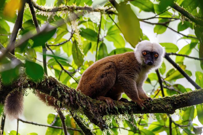
A white-headed lemur (Eulemur albifrons) in Masoala National Park.
Montagne d'Ambre (Amber Mountain) National Park
Named for the massif of the same name, Montagne d'Ambre (Amber Mountain) National Park is located in the extreme northern region of the island and protects 71 square miles (185 sq km) of this isolated, volcanic mountain. The massif is covered in montane rainforest and is one of Madagascar's most biologically diverse places, with over 75 species of birds, 25 species of mammals, 60 species of reptiles, and over 1 000 species of plants.
The massif ranges in altitude from 2 790 feet to 4 850 feet (850-1475 meters) and, owing to its elevation, experiences more rainfall than the surrounding dry lowlands, making it similar to the humid rainforests of the island's eastern coast. The forests covering the mountain are lovely, with numerous rivers and streams, some cascading over waterfalls and there are massive trees, many reaching 130 feet (40 meters) in height.
It rains almost daily in the montane forest, creating a spectacularly lush environment with lofty trees tree ferns, epiphytic bird's nest ferns (which grow on trees), massive fig trees, the Madagascar cycad (Cycas thouarsii), and myriad other species of flora.
The park is home to numerous species of lemur, the most commonly encountered being the diurnal species: Sandford's brown lemur (Eulemur sanfordi), crowned lemur (Eulemur coronatus), and ring-tailed lemur (Lemur catta). The other lemur species are mainly nocturnal and include the Amber Mountain fork-marked lemur (Phaner electromontis), northern rufous mouse lemur (Microcebus tavaratra), northern sportive lemur (Lepilemur septentrionalis), Montagne d'Ambre dwarf lemur (Cheirogaleus andysabini), and the rarely seen aye-aye.
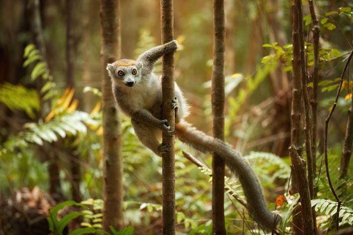
A crowned lemur (Eulemur coronatus) in Montagne d'Ambre National Park.
Other than lemurs, the park's mammals include vontsira-mena (ring-tailed mongoose), fossa, and western fanaolka. The park is home to several species of fauna that are highly localized endemics, including the Amber mountain rock thrush (Monticola erythronotus), which is only known from one area on the mountain, and the Montagne d'Ambre leaf chameleon (Brookesia tuberculata), a minuscule species that is one of the world's smallest reptiles.
There are a selection of hiking trails in Montagne d'Ambre ranging from easy trails that take one hour or so to more strenuous day-long hikes of 4-8 hours. The trail leading to Cascade Sacrée (sacred waterfall) is an easy hike and you will likely see lemurs, a variety of birds, chameleons, and beautiful flora, including orchids. A longer option is the trail to Cascade Antomboka, ending at an imkpressice waterfall that plumets 262 feet (80 meters) into a lush grotto below. The trail offers good birding, lush vegetation, and a good chance of seeing lemurs.
There are other trails that lead to other waterfalls and some trails that lead to one of the park's crater lakes. Some of the best crater lake hikes include Lac de la Coupe Verte, Lac Maudit, and Lac Grand. There is also a 6.8-mile (11-km) trail that goes all the way to the summit of the mountain at 1 475 meters and although it can be done in a single day, it is better to camp at Lac Grand for one night en route. The view from the top is amazing.
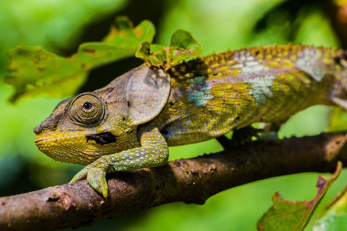
A short-horned chameleon (Calumma brevicorne) in Montagne d'Ambre National Park.
Kirindy Forest
Located a short distance inland near the central-western coast, the privately-managed Kirindy Forest (also known as the Kirindy Private Reserve and not to be confused with Kirindy-Mitea National Park, which is located just to the south) is one of the most rewarding natural areas on the island.
In terms of wildlife, Kirindy is the best place to see the fossa (Cryptoprocta ferox), a slender, cat-like mammal and Madagascar's largest predator, which unsurprisingly, is a Malagasy endemic. The fossa is rarely seen thorughout much of the island, so a visit to Kirindy is your best chance.
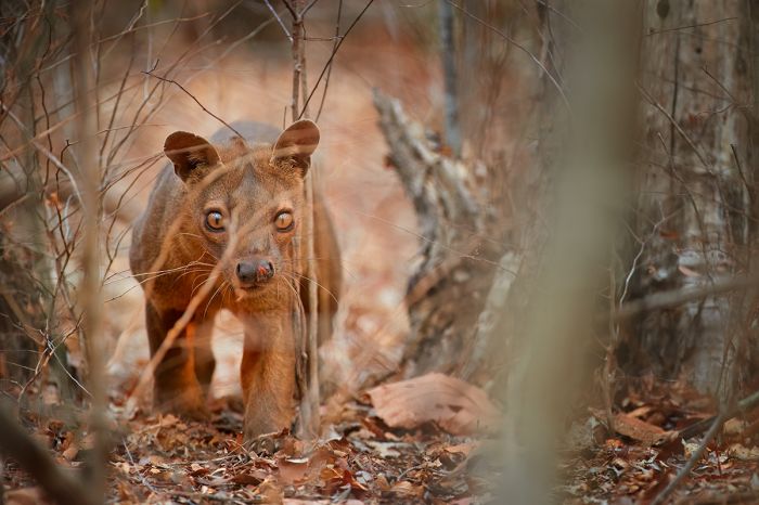
Madagascar's top predator, the fossa (Cryptoprocta ferox), can be seen at Kirindy.
In addition to the fossa, Kirindy is home to other interesting mammals, including Madame Berthe's mouse lemur (Microcebus berthae), which us the smallest primate in the world and only known to exist the Kirindy area, and the Malagasy giant rat (Hypogeomys antimena), the island's largest rodent, which look and behave more like rabbits, commonly jumping on their strong hind legs to move quickly, but also moving around on all fours.
In addition to Madame Berthe's mouse lemur, other species of lemur found in Kirindy include Verreaux's sifaka, red-tailed sportive lemur, pygmy mouse lemur, gray mouse lemur, Coquerel's giant mouse lemur, pale fork-marked lemur, fat-tailed dwarf lemur. Other interesting mammals here include common tenrec, greater hedgehog tenrec, and narrow-striped mongoose.
Reptile viewing is also rewarding in Kirindy, several species of chameleon and some snakes. Staying at the park's rustic accommodation is a good idea for those who want to enjoy guided nighttime walks to see the nocturnal life here.
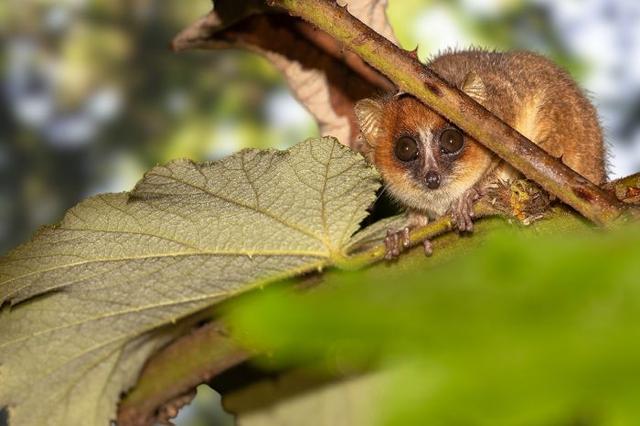
The tiny Madame Berthe's mouse lemur (Microcebus berthae) can be reliably seen in the Kirindy Forest.
Andohahela National Park
Located in the extreme southeast of the island close to the coastal town of Fort-Dauphin, Andohahela covers 293 square miles (760 sq kms) and contains three distinct eco-zones: rainforest, spiny forest, and transitional forest.
Trade winds blowing in from the east off the Indian Ocean give rise to high rainfall on the eastern side of the park as the moist air hits the mountains and rises. After dumping its rain, the air descends the mountains as it continues westward and the western edge of the park is very dry, resulting in the dry spiny-forest that is typical of the southern part of the island.
The rainforest zone (Malio) offers good hiking on varied terrain ranging from 330 feet (100 meters) to the summit of Pic d' Andohahela at 6 417 feet (1 956 meters). The lowland and montane rainforest here is prime habitat for diverse flora, including tree ferns orchids, and wild vanilla. Hiking the trails will surely provide sightings of lemurs and plenty of birds.
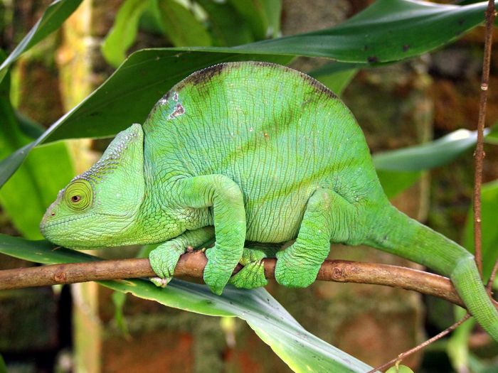
The large and colorful Parson's chameleon (Calumma parsonii) can be seen in Andohahela.
The spiny forest zone (Ihazofotsy-Mangatsiaka) consists of dry spiny-forest on terrain offering little shade and ranging from 330 feet (100 meters) to 3 300 feet (1 005 meters) at the summit of Pic de Vohidagoro. This zone is home to sifakas, small mammals like tenrecs, reptiles, and loads of birds.
The transitional forest zone (Tsimelahy) is relatively flat at an elevation of 400 feet (125 meters) and is particularly rich in flora, including the rare triangle palm (Dypsis decaryi), which is endemic to the park. Although this species is now commonly cultivated in a variety of climates, there are only about 1 000 specimens growing wild in its native habitat here in Andohahela National Park.
The park's diverse habitats mean that there is also a great diversity of both flora and fauna. Fifteen species of lemur have been recorded, including the iconic ring-tailed lemur and Verreaux's sifaka. The park is also home to over 65 species of reptile, over 50 species of amphibian, and 130 species of bird.
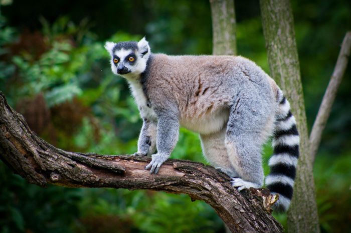
Ring-tailed lemurs (Lemur catta) are commonly seen in Andohahela National Park.
Berenty Reserve
This small, private reserve is located in the far southeast of the island, about 3-hours by road from the coastal town of Fort-Dauphin. Berenty is one of the most popular destinations in Madagascar, due to its abundance of lemurs and the wide and easy walking trails that allow for near-guaranteed views of both ring-tailed lemurs and and Verreaux's sifakas, both of which are well-habituated to humans, making for superb viewing.
Berenty is located on the bank of the Mandrare River, so although it is located in an otherwise very dry region, has plenty of riparian gallery forest for the lemurs and other wildlife living here.
The reserve is home to around 500 ring-tailed lemurs and they can be viewed with ease on the trails, while some are so tame they will take food from your breakfast table if you aren't watchful, although they are not at all aggressive.
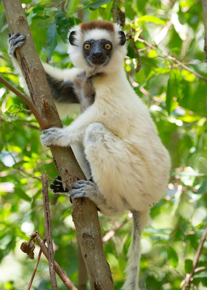
Verreaux's sifakas (Propithecus verreauxi) are one of numerous species of lemur found in Berenty Reserve (Copyright © James Weis).
The reserve is also home too around 300 Verreaux's sifakas, which although habituated to humans, are not as tame as some of the ring-tailed lemurs here.
There are also red-fronted lemurs and an array of nocturnal lemurs that can potentially be seen on night walks, including white-footed sportive lemur and gray mouse lemur. The park is also good for a variety of chameleons and excellent for birding, with over 100 species recorded.
The well-run Berenty Lodge offers good accommodation and guides and is the recommended place to stay.
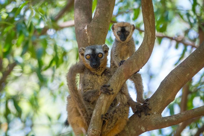
Red lemurs (Eulemur rufus) photographer in Berenty (Copyright © James Weis).
Ranomafana National Park
Another of Madagascar's very popular lemur destinations, Ranomafana is situated on the eastern side of the island (~ 57 miles inland from the coast) in the southern half of the island. The park covers 161 square miles (416 sq kms) of mid-altitude (2 645-3 937 feet / 800-1 200 meters) rainforest and is home to diverse flora and fauna.
Ranomafana was proclaimed as Madagascar's fourth national park in 1991 after the discovery of the golden bamboo lemur (Hapalemur aureus) by American primatologist Dr. Patricia Wright, who advocated strongly for the establishment of the park. The park later (in 2007) became part of one of Madagascar's three UNESCO World Heritage sites (Rainforests of the Atsinanana).
Long before becoming a national park, the area was popular in colonial times for its hot springs the name Ranomafana translates as 'hot water' in the Malagasy language).
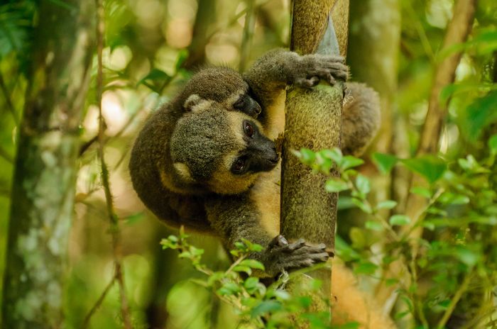
Ranomafana National Park was declared after the discovery of the locally endemic golden bamboo lemur (Hapalemur aureus).
The park is rich in wildlife, with 13 species of lemur (7 diurnal and 6 nocturnal species), 120 species of bird (including 36 country endemics), 112 species of frog, 90 species of butterfly, 22 species of snake, and 22 species of lizard (these numbers all subject to change as new species are discovered).
The park has well-maintained hiking trails, but be warned that the trails are somewhat challenging, with moderate to steep paths that are frequently slippery due to the regularity of rain here. The popular tails take 2-3 hours to complete, but for those wishing to see more primary forest, there is a superb trail that takes 6-8 hours. A local guide is required for all hikes. Wildlife viewing and incredible scenery (waterfalls and spectacular flora) await visitors to the very special park.
There are numerous accommodations to choose from, some very close to the park entrance and others a distance away in Ranomafana village.
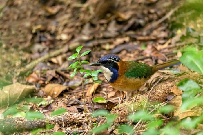
Ranomafana is one of the best locales to see the pitta-like ground roller (Atelornis pittoides).
Isalo National Park
Located within the southern portion of the island's central highlands, Isalo covers 315 square miles (815 sq kms) of dry, rugged, sandstone-dominated terrain and is Madagascar's most popular national park.
The landscape is characterized by rocky outcrops, plateaus, extensive plains, and deep canyons carved by ancient waterways and further eroded by the wind. Elevations range between 1 675-4 160 feet (510-1 268 meters). The climate here is hot and arid, receiving an average of just 8 inches (200 mils) of rain per year. Caves in the walls of the park's canyons have been used as burial sites by the local Mara tribe for hundreds of years.
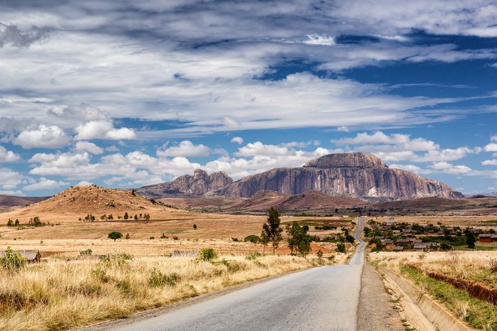
View from the tarred road leading to Isalo National Park.
The park protects numerous endemic plant species and its woodlands are dominated by the endemic tapia tree (Uapaca bojeri). Wildlife in Isalo includes six species of lemur, including ring-tailed, Verreaux's sifaka, and red-fronted lemur. The area is also very good for birding, with over 100 species possible, including Benson's rock thrush (Monticola sharpei bensoni), which is only found in the area around the park. Around 50 species of reptile are found in the park.
There are several good trails for exploring the park's different biomes and offering chances to see some wildlife and flora. Some of the trails pass by or terminate at natural swimming pools, which can be used for a refreshing dip after a typically hot morning or afternoon of hiking. A local guide is required for visitors entering the park.
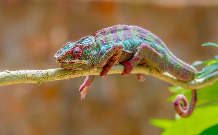
Beautiful colors on this panther chameleon (Furcifer pardalis) in Isalo.
Andringitra National Park
Located in the southeast part of the island, Andringitra National Park protects the Ampiadianomilahy Massif, which contains the island's second-highest peak: Imarivolanitra, the name of which translates to 'close to the sky'. The summit is 8 721 feet (2 658 meters) in elevation.
The park covers 120 square miles (312 sq kms) of granitic mountains, valleys, and plains with elevations ranging from 2 300 feet (700 meters) to the summit of Imarivolanitra at 8 721 feet (2 658 meters). The park was established in 1999 and in 2007 it became one of five national parks included in an UNESCO World Heritage Site (Rainforests of the Atsinanana).
The main attraction in Andringitra is trekking and the spectacular landscapes. There are five hiking circuits to choose from, each covering different terrain, from rainforests, dry forest, valleys with waterfalls, and the high-altitude trek to the summit of Imarivolanitra, which takes 2-3 days and must be planned in advance to organize porters.
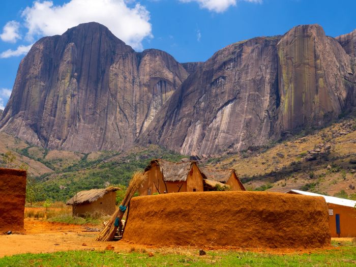
Local dwellings and Mount Imarivolanitra in Andringitra National Park.
The park's forested sections are home to diverse flora, with over one-thousand species identifies, including over 30 species of orchid. Besides the beautiful landscapes and flora, the park is home to 13 species of lemur, including ring-tailed lemurs, which due to the higher altitudes, have thicker fur here and were originally thought to be a subspecies. Bird life is prolific and diverse, with around 100 species and around 60 species of frog have been identified so far.
The park receives relatively few visitors and is one of the island's best-kept 'secrets' in terms of a wilderness experience. Visitors should be prepared for challenging hikes and have proper footwear, as well as warm layers, as the temperatures can become frigid on cloudy days and overnight - snowfall occurs in the higher elevations and the islands lowest temperature (18°F/-8°C) was recorded here.
Visitors on a trek to Pic Boby (also known as Imarivolanitra) in Andringitra National Park.
Ankarafantsika National Park
Located along the Betsiboka River, just 65 miles (108 kms) inland from the west coast town of Mahajanga, Ankarafantsika National Park covers 527 square miles (1 65 sq kms) of mostly dry, deciduous forest. The park was established in 2002 by combining two nature reserves, one on either side of the RN4 roadway, which now cuts through the park.
The park has an excellent walking tail network and one can easily spend a few days here without covering the same ground twice. Flora in the park extremely diverse, with over 800 species of plant identified, but the wildlife is also worth the visit. There are eight species of lemur, including the beautiful Coquerel's sifaka (Propithecus coquereli), which are almost always hanging around at the main car park area.
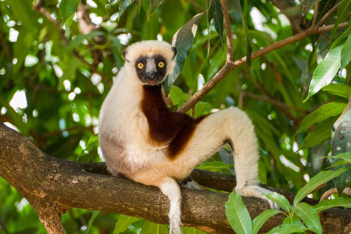
A Coquerel's sifaka (Propithecus coquereli) seen in Ankarafatsika National Park.
Other lemurs that may be seen include golden-brown mouse lemur (Microcebus ravelobensis), western woolly lemur (Avahi occidentalis), and some of the sportive lemurs. Birding in Ankarafantsika is very good, with around 130 species recorded. Reptiles are well represented, with over 45 species, as are amphibians.
Besides for the excellent hiking, one should definitely take a guided boat ride onto Lake Ravelobe, which is great for waterbirds and also offers a good chance to see crocodiles.
The park's very successful Angonoka Project, which is a captive-breeding program for the highly endangered ploughshare (or angulated) tortoise (Geochelone yniphora), which is endemic to the nearby Baie de Baly. Devastated in the past as food for maritime consumption, habitat burning is the now the main threat. Tortoise habitat, which is surrounded by savannah, is regularly burnt to create new grass growth for domestic cattle and the tortoises are killed in the process. Illegal collection for the international pet trade also poses a major threat. The species is protected under national law and is also classed at Annexe 1 under CITES.
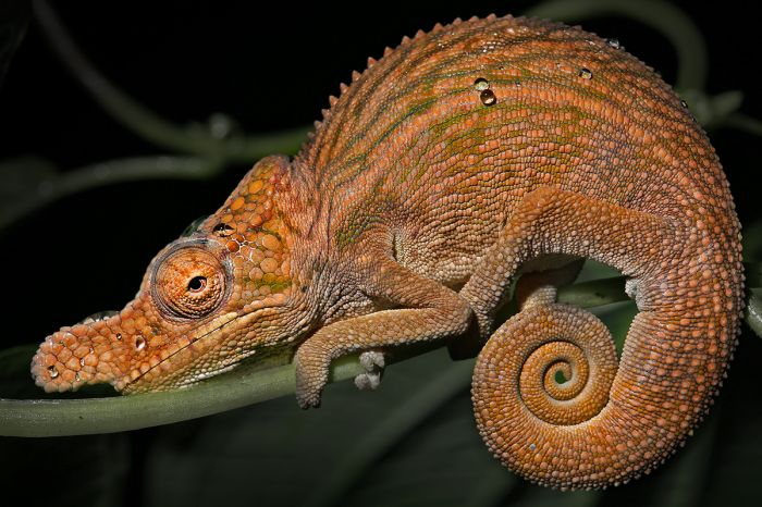
A rhinoceros chameleon (Furcifer rhinoceratus) in Ankarafatsika National Park.
Ramsar Wetland
The park contains a designated Ramsar Wetland Site (Ankarafantsika Wetlands) which covers 128 square miles (332 sq kms) in two separate locations. It consists of a complex of six permanent lakes, as well as rivers, seasonal streams, and raffia-palm swamps. Some of the lakes are considered sacred. Dry forest surrounding the lakes include a great diversity of flora.
The lakes also provide habitat to large numbers of waterbirds, fish, amphibians, and reptiles, including the critically-endangered Madagascan big-headed turtle (Erymnochelys madagascariensis) and good numbers of Nile crocodile.
Ankarafantsika includes a Ramsar Wetland, which provides habitat for a great diversity of wildlife, including Nile crocodiles.
Marojejy National Park
Marojejy is located in the far northeast of the island and protects part of the Marojejy Massif, which is part of a mountain range that stretched from the Tsaratanana Reserve further northwest to Masoala National Park to the southeast. The park covers 214 square miles (554 sq kms) of rugged terrain, with elevations ranging from 246 to 6 995 feet (75 to 2 132 meters).
The wide range of elevations makes for diverse habitats, with warm, thick rainforest at the low elevations, more stunted forest in the mid-elevations, cloud forest in the high elevations, and montane scrub near the peaks.
Set aside as a strict nature reserve in 1952, the park was restricted to research personnel only until 1998, when it was converted to a national park and opened to the public. In 2007, the park was included in one of Madagascar's three UNESCO World Heritage Sites (Rainforests of the Atsinanana), which includes five additional national parks.
Mountainous terrain in Marojejy National Park.
Marojejy's star attraction in terms of wildlife are the silky sifakas (Propithecus candidus), a lovely, all-white lemur that is found only in this small area and is one of the world's most critically endangered primates. Besides the silky sifaka, Marojejy is home to ten additional species of lemur, at least 15 species of tenrec, and the fossa. The park's reptile and amphibian diversity is the highest of any area on the island, with a combined total of around 150 species, including around 20 that are only found in the park.
Trekking adventures should be booked in advance and will include guides, porters, and a cook to accompany you. The park has a single trail that leads from the info center to the highest peak, with three camps situated along the way at different altitudes. The climb to the summit should be spaced out over 2-3 days to allow for wildlife sightings and enjoyment.
The only permanent accommodations are a distance away at the towns of Andapa and Sambava.
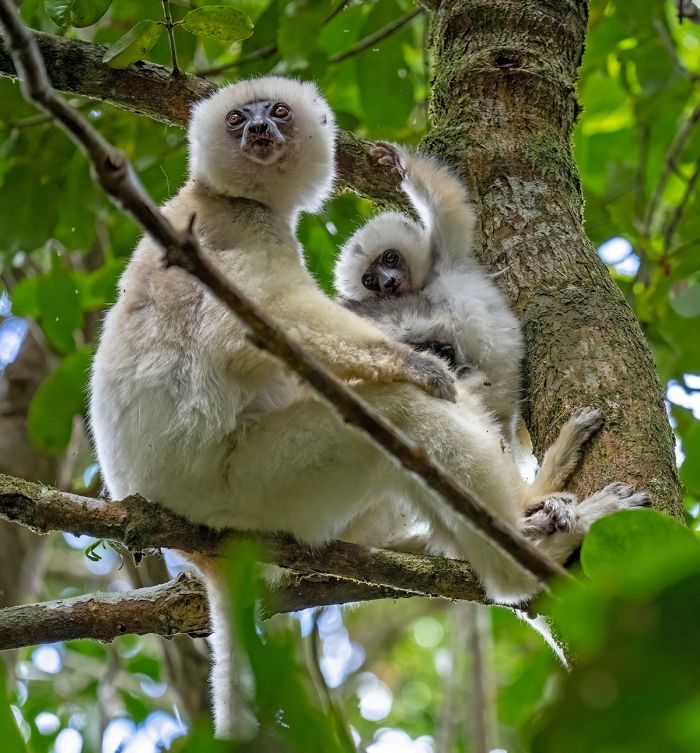
The star attraction at Marojejy NP is the silky sifaka (Propithecus candidus).
Zahamena National Park
Located 110 miles northeast of Antananarivo, Zahamena National Park protects an area of 163 square miles (423 sq kms) at the northern edge of the island's eastern escarpment. The park was established in 1997 and in 2007, Zahamena was included in one of Madagascar's three UNESCO World Heritage Sites (Rainforests of the Atsinanana), which includes five additional national parks.
Zahamena is characterized by rainforest and numerous river valleys, some draining east to the ocean and others draining into Lake Alaotra, which lies 16 miles (25 kms) to the west. Elevations in the park range from 833 feet (254 meters) to 5 118 feet (1 560 meters).
The park protects some of Madagascar's most pristine rainforest, with a high floral biodiversity growing on the varying elevations of the escarpment. The park is almost entirely covered by forest. The low-elevation rainforest has a canopy reaching 66 feet (20 meters), while the higher elevations are covered in dense montane forest.
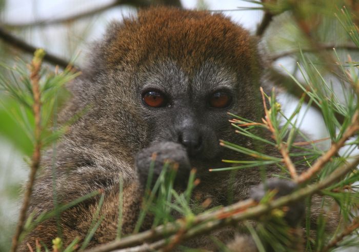
A Lac Alaotra gentle lemur (Hapalemur alaotrensis) at Zahamena NP.
As can be expected in such a rich forest, wildlife in the park is diverse and plentiful, with 13 species of lemur, including the diademed sifaka (Propithecus diadema), indri, black-and-white ruffed lemur (Varecia variegata), hairy-eared dwarf lemur (Allocebus trichotis), Aye-aye, and the locally endemic Lac Alaotra gentle lemur (Hapalemur alaotrensis).
Around 50 species of reptile, mainly lizards and chameleons, have been recorded in the park. Bird life is also prolific and diverse, with 112 species recorded.
The park is under threat from rural farmers living on the periphery. The park receives few visitors due to the relative difficulty in getting there compared to similar rainforest parks. There are several camping sites in the park.
Zahamena Strict Nature Reserve
The central portion of Zahamena National Park receives added protection as a strict nature reserve for the conservation of several endemic and highly-endangered plant and animal species. It is also the watershed of the Lake Alaotra region, the highest producing agricultural area of the country. The reserve covers 85 square miles (221 sq kms).
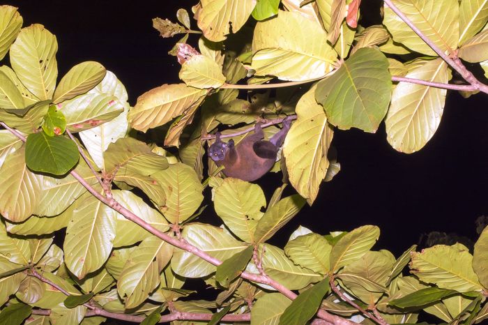
The hairy-eared dwarf lemur (Allocebus trichotis) is locally endemic and can be seen in Zahamena National Park.
Tsingy de Bemaraha National Park & Reserve
Located near the west coast near the middle (north-to-south) of the island, Tsingy de Bemaraha National Park protects Madagascar's largest area of existing tsingy. Tsingys are karstic (soluble carbonate rock) plateaus that have been eroded by water into caverns and razor-sharp, spike-like pinnacles, creating an incredible landscape of limestone "needles".
The protected area includes the national park (280 square miles / 723 sq kms) to the south and the contiguous strict nature reserve (322 square miles / 834 sq kms) to the north. The area has been protected since 1927 and mostly off-limits to the public, until the establishment of the national park in 1997. The nature reserve was declared an UNESCO World Heritage Site (one of three in Madagascar) in 1990.
Visitors to the national park can enjoy the awesome landscape from carefully crafted walkways, which include suspension bridges, boardwalks, and ladders. The network of pathways allow traversing the tsingys in safety, which would otherwise be quite a risky endeavor due to the sharp limestone, which can easily cut through flesh and equipment.
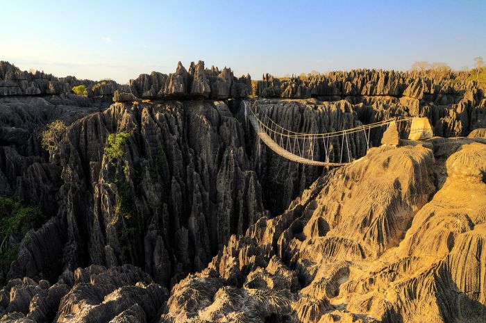
The incredible 'tsingy' topography can be viewed from walkways at Tsingy de Bemaraha National Park.
Besides the spectacular tsingys, the park also protects areas of dense, dry, deciduous forest and savannas. The dry habitat abounds with diverse flora, dominated by succulents and other drylands plants, including Pachypodium, Euphorbia, Commiphora, Pandanus, Dracaena, and Hildegardia species. The plants find footholds in crevices amongst the tsingys, making the experience of visiting even more surreal.
Wildlife also finds a home amongst, with numerous lemur species, including the critically-endangered and locally endemic Bemaraha woolly lemur (Avahi cleesei), Decken's sifaka (Propithecus deckenii), and red-fronted lemur (Eulemur rufifrons). The park is also home to a variety of reptiles, including the locally endemic Antsingy leaf chameleon (Brookesia perarmata), one of the islands many species of dwarf chameleon.
The Bemaraha woolly lemur (Avahi cleesei) is named for John Cleese of Monty Python fame, who is a big supporter of lemur conservation efforts.
The park office and several good accommodations are located at the far southwest end of the park. Access to the reserve is nearly impossible during the rainy season (usually late November to sometime in April), so the park and lodges close during this time.
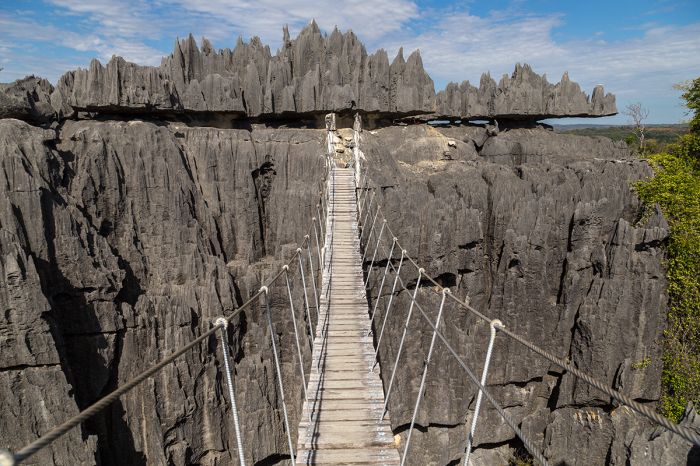
A dramatic footbridge at Tsingy de Bemaraha National Park.
Tsingy de Namoroka National Park
Tsingy de Namoroka is located 30 miles (45 kms) inland the west coast and in the north-central part of the island. Madagascar's larger and far more-visited Tsingy de Bemaraha NP lies 150 miles (240 kms) to the south.
Tsingys are karstic (soluble carbonate rock) plateaus that have been eroded by water into caverns and razor-sharp, spike-like pinnacles, creating an incredible landscape of limestone "needles". The park covers 85 square miles (221 sq kms) and has been under protection since 1927, but was only established as a national park in 2002.
There are three walking circuits for visitors, each taking around three hours to complete. The trails showcase the many interesting facets of the area, including the tsingy formations, sub-humid forests, caves, natural swimming pools, canyons, and savannas.
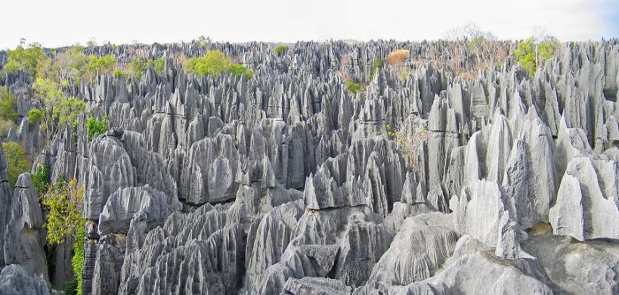
The incredible tsingy formations are the main attraction at Tsingy de Namoroka NP.
The diverse habitats are home to a variety of wildlife, including eight species of lemur, including Decken's sifaka (Propithecus deckenii), Masoala fork-marked lemur (Phaner furcifer), fat-tailed dwarf lemur (Cheirogaleus medius), eastern lesser bamboo lemur (Hapalemur griseus), Milne-Edwards' sportive lemur (Lepilemur edwardsi), red lemur (Eulemur rufus), gray mouse lemur (Microcebus murinus), and the aye-aye (Daubentonia madagascariensis). The park also provides habitat for over 30 species of reptile, at least five species of frog, and over 80 species of bird.
There is no accommodation in the park, but there is a small hotel located in the settlement of Soala, located 30 miles (50 kms) to the north.
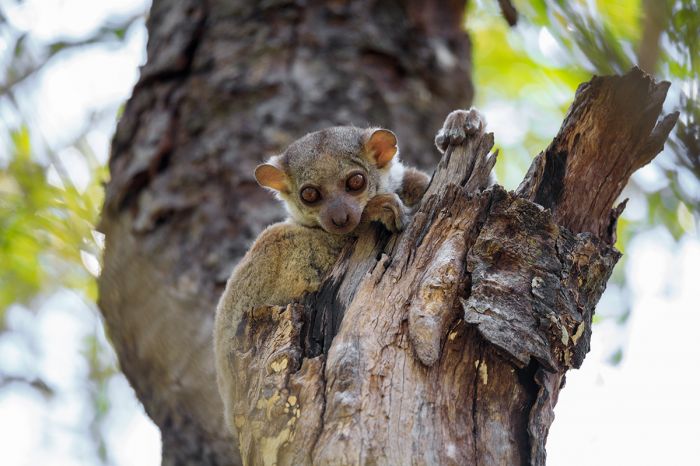
Milne-Edwards' sportive lemur (Lepilemur edwardsi) is one of the lemur species that can be seen at Tsingy de Namoroka NP.
Baie de Baly National Park
Located on the island's west coast, approximately 93 miles (150 kms) south of the town of Mahajanga, Baie de Baly National Park protects a variety of coastal ecosystems, including mangrove forest, coastal dunes, dry deciduous forest, bamboo scrub, permanent lakes, swamps, and some savanna.
The park is divided into four core zones covering 220 square miles (571 sq kms). The terrain undulates gently, with low hills and cliffs rising to 260 feet (80 meters). There are numerous seasonal waterways, two permanent rivers, and several permanent lakes in the park. The park contains serval types of palm tree and clumps of bamboo. The highly-endangered ploughshare Tortoise (Astrochelys yniphora) lives in these bamboo clumps.
Other endangered animals protected within the park include the Madagascan big-headed turtle (Erymnochelys madagascariensis), as well as the dugong, a marine mammal. Dolphins are often seen just offshore.
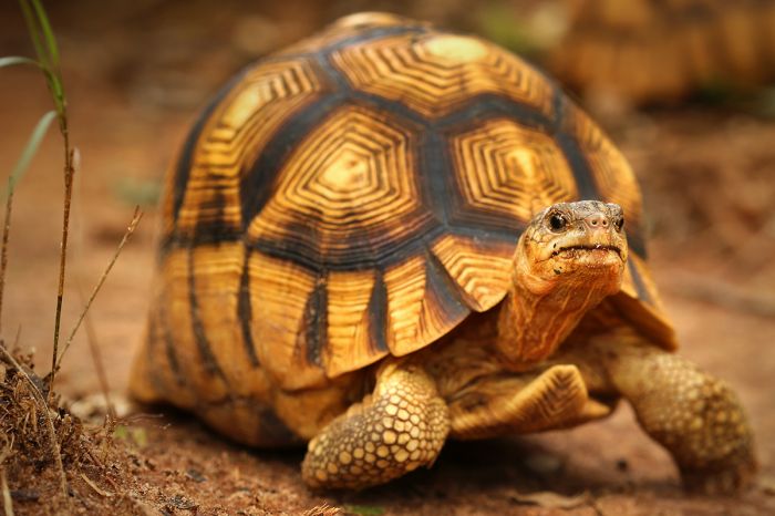
One of world's most endangered reptiles, the angonoka or ploughshare tortoise (Astrochelys yniphora), is found in Baie de Bay National Park.
Lemur species that may be seen in the park include gray mouse lemur (Microcebus murinus), fat-tailed dwarf lemur (Cheirogaleus medius), western lesser bamboo lemur (Hapalemur occidentalis), red lemur (Eulemur rufus), Decken’s sifaka (Propithecus deckenii), and pygmy mouse lemur (Microcebus myoxinus).
Bird life is prolific and the park is a BirdLife International Important Birding Area (IBA). There have been over 120 species of bird recorded to date in the park, of which 35 are endemic to the island, including the Madagascar fish-eagle. During the summer (rainy season), gatherings of over 10 thousands terns (mainly lesser crested and common) are seen along the western coastline of the park near Cape Amparafaka.
There are no accommodations either in the park or in the nearby town of Soalala; however, camping is permitted, although there are no facilities.
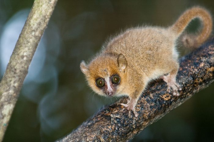
The gray mouse lemur (Microcebus murinus) is one of numerous species that can be seen in Baie de Bay National Park.
Kirindy Mitea National Park
Located along the central-western coast, Kirindy Mitea National Park (not to be confused with the more popular, privately-managed Kirindy Reserve, located a short distance north) protects a variety of habitats, including dry deciduous forest, spiny forest, dunes, mangroves, permanent lakes, marshes, beaches, intertidal zones, and an offshore marine area that protects coral reefs and seven small islands.
Kirindy-Mitea is one of the island's larger national parks, covering an area of 604 square miles (1 564 sq kms).
The park receives few visitors - mainly because most travelers visit the nearby Kirindy Reserve just to the north, which has better accommodations and more established infrastructure. Nonetheless, Kirindy Mitea is worth visiting for both its wildlife and flora, which includes a spectacular density of baobab trees (three different species). Note that the very popular and much photographed 'Avenue des Baobabs' is along the route between the national park and the private reserve.
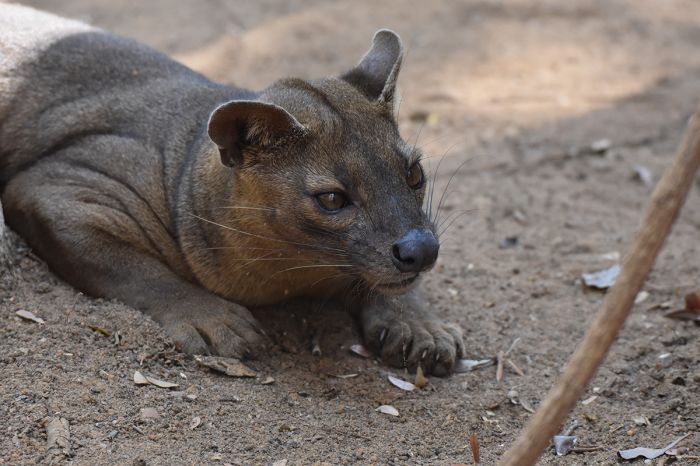
Madagascar's largest predator, the fossa (or fosa) (Cryptoprocta ferox) is found in Kirindy Mitea NP.
Wildlife in the park includes eleven species of lemur, including Madame Berthe's mouse lemur (Microcebus berthae), red-fronted lemur (Eulemur rufifrons), pale fork-marked lemur (Phaner pallescens), Verreaux's sifaka (Propithecus verreauxi), and red-tailed sportive lemur (Lepilemur ruficaudatus). The ring-tailed lemur (Lemur catta) lives in the park and is at the northernmost extent of its range here.
Other wildlife in the park include the fossa (or fosa) (Cryptoprocta ferox), Madagascar's largest predator, and a bird list that numbers around 50 species and around 25 species of reptile.
Ramsar Wetland
The park contains a designated Ramsar Wetland (the Complex of Lakes Ambrondo and Sirave), which supports a great diversity of wildlife, including lemurs and birds and is an important breeding and nesting area for migratory waterbirds. Greater flamingos use the site for feeding and are sometimes seen in large numbers.
The two lakes in the Ramsar Site (Ambondro and Sirave), which are located just inland from the beach and dunes, are considered taboo ('fady' in Malagasy language) and legends have it that many dangerous beasts live there, including a mangrove swamp monster named 'Bahisatsy' and a wild man named 'Hako'. Due to these legends, the lakes have been left in their natural state.
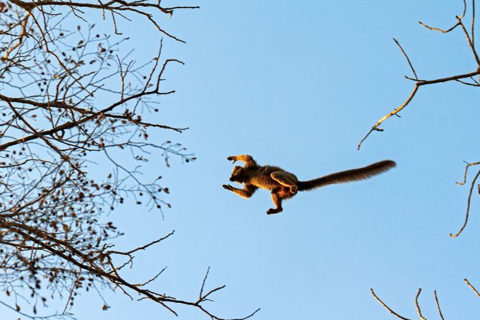
A red-fronted lemur (Eulemur rufifrons) takes to the air to move to another tree in Kirindy Mitea National Park.
Nosy Be
Pronounced 'nossy bay' and meaning 'big island' in the Malagasy language, the island of Nose Be lies 5 miles (8 kms) off the northwest coast of Madagascar and is the country's busiest tourist destination. The island covers 124 square miles (320 sq kms) and has a permanent population of around 110 thousand resident.
The island was colonized by the French beginning in 1840 when they started an outpost they called Hell-ville (named for the French Admiral Anne Chrétien Louis de Hell). The French-controlled island became an important trade harbor in the Mozambique Channel and French settlers developed agriculture on the island, with sugarcane being the main crop.
Today, the island consists mainly of hotels and resorts that are extremely popular with French and Italian tourists, who make up the majority of visitors to the island.
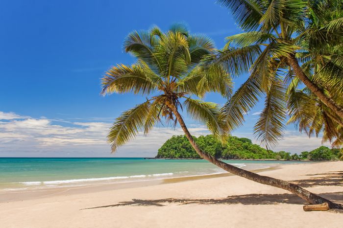
Tranquil beach and ocean scene on Nosy Be island.
Hell-Ville (now locally called Anodoany) is located on the southern coast and is the island's only significant town and offers banking, airline services, and is the location of the ferry dock. Note that Nosy Be's airport is located halfway north up the island on the eastern coast. There are only basic accommodations in Helle-Ville and no good beach, so most tourists stay along the western coast, where the better beaches and hotels are located.
The beachfront village of Ambatoloaka is located on the southwest coast and offers numerous hotels, good restaurants, and a lively nightlife scene. The hotels further north along the west coast offer the best beaches and are much more remote, crowd-free, and luxurious. Some of the smaller islets surrounding Nosy Be, especially Nosy Komba and Nosy Sakatia, offer even more private getaways.
A beautiful beachfront resort on Nosy Be.
Lokobe National Park
Located in the southeast corner of Nosy Be is Lokobe National Park. Once a closed-to-the-public 'strict nature reserve", the reserve is now a national park covering 2.85 square miles (7.4 sq kms) of land and a additional, smaller portion of offshore marine area. The park has three hiking trails and is home to three species of lemur: the locally-endemic Bemanasy mouse lemur (Microcebus manitatra), the locally-endemic Hawks' (or Nosy Be) sportive lemur (Lepilemur tymerlachsoni), and the black lemur (Eulemur macaco).
The park also protects over 50 species of reptile, including the locally-endemic subspecies of panther chameleon, which has a vibrant blue in color in this locale, 20 species of amphibian, and around 50 species of bird.
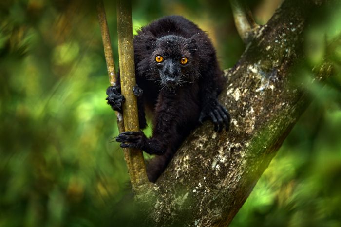
The black lemur (Eulemur macaco) is striking in appearance and cab be seen in Lokobe National Park.
Mananara-Nord National Park
Located along the northeast coast, Mananara-Nord National Park protects 93 square miles (240 sq kms) of humid forest, sandy coastal forest and plains, mangroves, and marshes. The park extends offshore to protect a small marine area that includes productive coral reefs.
The park is seldom visited by tourists, owing to the difficult road conditions that must be endured to get there from nearby Mananara town (the bumpy ride takes a half-day in a 4x4 vehicle).
The forests are home to several species of lemur and there are dugongs in the waters off the beaches. The marine section also protects three tiny islands (Nosy Antafana, Nosy Hely, and Nosy Rangontsy). Large numbers of flying foxes can be seen easily on Nosy Antafana, but the boat ride is 2 hours each way, so camping overnight is recommended for any intrepid visitors.
Camping is the only option at the park.
Dugongs (manatees) can be seen in the waters offshore from Mananara-Nord NP.
Marolambo National Park
Marolambo is one of the larger national parks in Madagascar, covering 750 square (1 943 sq kms) of eastern rainforest and savanna. The forested areas are interspersed with degraded forest and farms, which have encroached into the protected land.
The park offers little in the way of infrastructure and, as a result, is seldom visited.
There are reportedly thirteen species of lemur recorded in the park, as well as good numbers of reptiles and amphibians.
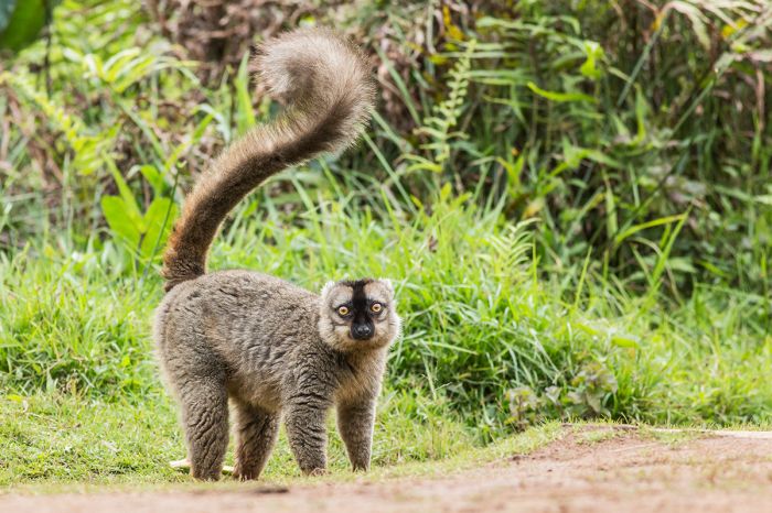
The common brown lemur (Eulemur fulvus) can be seen in Marolambo.
Midongy du Sud National Park
Midongy is another of Madagascar's eastern rainforest parks, situated in the far southeast part of the island and covering an area of 741 square miles (1 920 sq kms). The park protects the second-largest remaining tracts of contiguous rainforest on the island. The park is divided into two sections: the Befotaka Forest and the Soarano Forest.
The park is accessed by unpaved roadways that often become impassable during the rainy season (December to June) and the park has little in the way of tourist infrastructure, making it one of the least visited on the island.
The terrain in the park is rugged, with steep mountains and deep valleys, which range in elevation from 2 260 feet (689 meters) to the summit of Mont Papangp at 5 509 feet (1 679 meters). The humid air coming off the Indian Ocean rises upon hitting the mountain and rainfall is significant, averaging 63-140 inches (160-360 kms) per year.
The park is rich in flora, with around 400 species of plant identified so far. Four species of lemur live in the rainforest, including the critically endangered greater bamboo lemur (Hapalemur simus) and there is undoubtedly a great diversity of birds, reptiles, and amphibians living here as well.
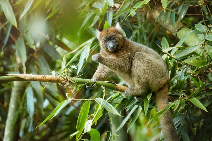
The greater bamboo lemur (Hapalemur simus) can be seen in Midongy du Sud.
Nosy Hara National Park
Nosy Hara is an uninhabited island situated about 5 miles (9 kms) off the far northwest tip of the island in the Baie du Courrier (Courrier's Bay). The name is derived from the Malagasy 'harana', meaning mountains and it aptly describes this island, which is comprised of a karst formations of jagged 'tsingy' limestone. The high elevation on the island is 341 feet (104 meters).
The island measures just 2.3 miles (3.5 kms) in length and 0.8 miles (1.3 kms) wide at its widest point, covering 1 square mile (27 sq kms). The national park covers much more than just Nosy Hara island, protecting the entirety of the bay and more than a dozen other small islets. The park's total protected area of land and water covers 483 square miles (1 250 sq kms), almost all of which is marine habitat.
Marine wildlife in these waters is abundant, with multiple species of whale and dolphin, as well as five species of marine turtle and dugong. Beneath the surface, the park protects high-quality coral reefs.
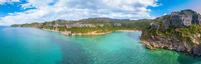
Aerial view of Nosy Hara island.
Camping is the only option for visitors and trips should be arranged well in advance. The inland has shelters for pitching tents, a rudimentary 'kitchen', and sanitary facilities, but no running water. The drive from Antsiranana town to the coastal village of Ampasindava takes 90 minutes and from there, the boat trip to the island takes another 90 minutes.
The difficulty in reaching the island means one should consider staying two nights instead of a single night. Activities for visitors to the island include snorkeling, rock climbing, and hiking in the forest.
Nosy Hara island is home to one of the world’s smallest reptiles, the Nosy Hara leaf chameleon (Brookesia micra). This tiny leaf chameleon is only found on the island and adults only grow to 11 inches (29 mm) in length. Also living on the island is a yet-to-be described species of dwarf lemur (Cheirogaleus species).
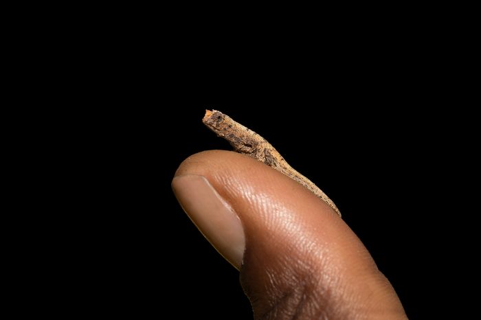
The Nosy Hara leaf chameleon (Brookesia micra) is one of the world's smallest reptiles.
Nosy Tanikely National Park
Located just 4.3 miles (7 kms) off the southern coast of Nosy Be (an island just offshore the far northwest coast of Madagascar), this combination land- and marine-based national park is one of the country's newest, established in 2011.
Nosy Tanikely (also sometimes spelled 'Tanihely') is a tiny, roughly square island, measuring only 0.3 miles (0.5 kms) at its widest point. The national park protects the entirety of the island, as well as the surrounding marine habitat offshore, covering an area of 1.3 square miles (3.4 sq kms). The island is uninhabited but is a very popular destination for tourists staying on nearby Nosy Be island and almost always has day trippers.
Nosy Tanikely can only be reached by small boat and there are no overnight accommodations on the island. The travel time from Nosy Be is only 30 minutes.
Aerial view of the tiny island of Nosy Tanikely.
The island is surrounded by a well-preserved coral reef, which stretches offshore for up to 0.4 miles (700 meters) and fishing boats are prohibited from these waters. Snorkeling on the reef is exceptionally good, with plenty of reef fishes, starfish, sea urchins, sea cucumbers, lobsters, sea turtles, and sometimes dolphins.
The eastern side of the island is bordered in entirety by a lovely, sandy beach with palm trees and shallow swimming water offshore.
The interior of the small island, which is covered in secondary forest, can be explored via a hiking path. The forest is home to black lemurs, chameleons, and a colony of flying foxes. The island's lighthouse can also be visited.
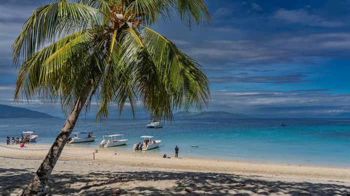
Snorkeling and dive boats ready to leave from a sandy beach on Nosy Tanikely.
Nosy Ve-Androka National Park
Nosy Ve-Androka is a marine-based national park located in far southwest Madagascar. The park covers 353 square miles (915 sq kms) of marine habitat stretching from the shoreline and into the offshore Indian Ocean water. The park is segmented into two clusters, each composed of four parcels, with core areas covering just over 30 percent of the park and buffer areas, the remainder.
The park protects a variety of marine habitats, including barrier reef, coral reef beds, seagrass fields, open ocean, rock-strewn shoreline, and sand beaches. The coral reefs protects in the park contain over 140 species of identified coral and over 250 species of fishes. The rich coral reefs lying offshore that make up one of the largest reef systems in the world.
Besides fish and coral, the park provides crucial habitat for marine turtles, dolphins, whales, coelacanths, and dugongs. The sand beaches in the park are also used by marine turtles as nesting sites.
Just inland from the protected marine habitat of Nosy Ve-Androka lies Lake Tsimanampetsotsa National Park. The two parks comprise one of five UNESCO Biosphere Reserves in Madagascar (the Tsimanampesotse – Nosy Ve Androka Biosphere Reserve). This combined reserve is considered a biodiversity hotspot due to its vulnerable ecosystems, which include coral reefs, beaches, sand dunes, brackish marshes, mangroves, gallery forest, and littoral forest.
Humpback whales and other marine life are the main attraction in Most Ve-Androka National Park.
Ramsar Wetland
Nosy Ve-Androka National Park is also a designated Ramsar Wetland. The site and national park protect over 140 species of coral and 250 species of fish, as well as mollusks, echinoderms, marine phanerogams, and the rare and endangered coelacanth (Latimeria chalumnae).
These protected waters are home to five species of marine turtle (green, hawksbill, olive ridley, loggerhead, and leatherback), dugongs, whales, and dolphins. The coral reefs are home to myriad fishes, including three damselfish that are endemic to the western Indian Ocean.
The nearby island of Nosy Ve (which is oddly not officially protected within the national park) is the breeding location for a colony of red-tailed tropicbird.
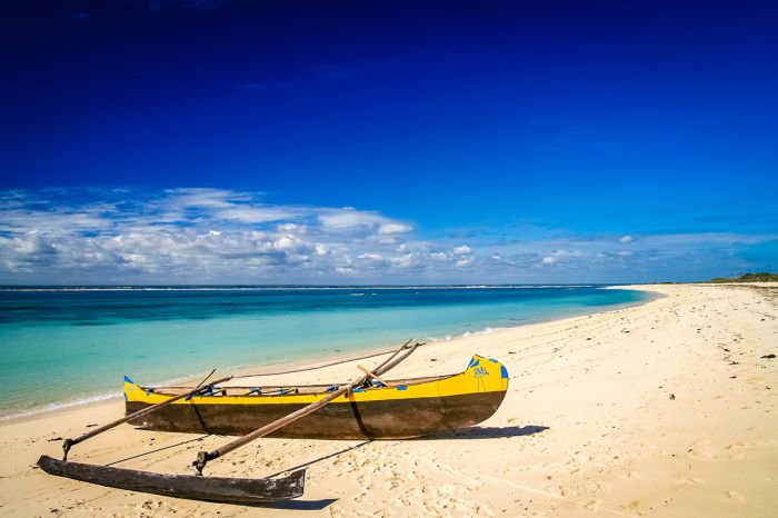
A traditional pirogue on the beach at Nosy Ve island.
Nosy Ve
Although not within the boundaries of Nosy Ve-Androka National Park, the nearby inland of Nosy Ve is located 2.25 miles (3.6 kms) offshore and is protected in a sense by local taboo, as the local Malagasy consider it a sacred site.
Nosy Ve is a pristine, uninhabited, barrier-reef island, fringed by lovely, white-sand beaches and measures only 1 mile in length by 0.3 miles at its widest point. The interior of the island is covered in scrub vegetation and there are no trees.
The little island was first explored by the Dutch in 1595 before their conquest of the main island. Later, in 1888, it was taken over by the French.
A colony of red-tailed tropicbird (Phaethon rubricauda) nests on Nosy Ve island (Copyright © James Weis).
Today, visitors come to Nosy Ve via pirogue or motorized boat in order to see the world's southernmost breeding colony of red-tailed tropicbirds (Phaethon rubricauda), which breed in the southern part of the island all year, laying the eggs in ground nests under bushes. These beautiful birds are seldom seen elsewhere unless out at sea. The birds can be photographed with ease at relatively close range.
Visitors can also snorkel from the beach. There is no shelter from the sun on this island, so a canopy tent if a must of you are spending the day on the beach.
A nesting red-tailed tropicbird (Phaethon rubricauda) on Nosy Ve island (Copyright © James Weis).
Lake Tsimanampetsotsa National Park
Lake Tsimanampetsotsa National Park (sometimes spelled Tsimanampetsotse) is named of its chief attraction, a long and narrow alkaline lake lying just inland from the far southwest coast of the island. The lake measures 12 miles (20 kms) in length and is 1.25 miles (2 kms) wide at its widest point. The lake is also quite shallow, with a maximum depth of around 6 feet (2 meters).
The name 'Tsimanampetsotsa' translates to 'lake without dolphins' in Malagasy and it is considered a sacred place to the locals, which has kept the lake free of pollution and human abuse. Swimming and boating on the lake has long been prohibited. The lake's water, mud, and some plants are sometimes used for traditional medicine.
The lake is situated in a collapsed basin on the Mahfaly Plateau and was once a much larger paleo-lake. The lake's water is highly mineralized, with high concentrations of ammonia and phosphate and salt concentrations approaching that of sea water.
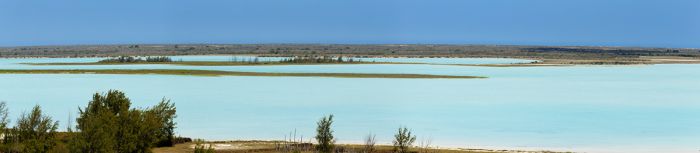
View over Lake Tsimanampetsotsa.
The national park is much larger than the actual lake for which it is named, covering an area of 167 square miles (437 sq kms). Besides the lake, the park also protects a large area of 'spiny forest' vegetation, with a large number of locally-endemic floral species, including baobab trees, pachypodiums, fig trees. The park has some of the island's highest levels of plant endemism, with about 50% of the genera and 95% of the species found only in this region.
The park is also home to five species of lemur, including white-footed sportive lemur (Lepilemur leucopus), ring-tailed lemur (Lemur catta), reddish-gray mouse lemur (Microcebus griseorufus), Verreaux's sifaka (Propithecus verreauxi), fat-tailed dwarf lemur (Cheirogaleus medius).
Birding in the park is quite rewarding, especially around the lake, with over 112 species possible. Over 40n species of reptile have been identified in the park, including chameleons, lizards, and tortoises. The broad-striped Malagasy mongoose (Galidictis fasciata) is common in the park and will visit campsites looking for food.
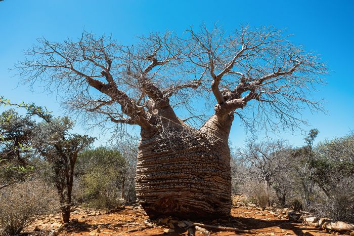
The unusually-shaped fony baobab (Adansonia rubrostipa) can be seen in Lake Tsimanampetsotsa NP.
The park has a variety of walking trails and a driving track that runs along the eastern side of the lake. There is also a network of both flooded and dry caves, some of which provided well-reserved bones os some of the island's now-extinct elephant birds and giant lemurs. Cave diving is possible.
Lake Tsimanampetsotsa National Park is well worth a visit and can be done as a day trip from Anakao, a coastal village located 30 miles (50 kms) to the north, but a multi-day visit is necessary to explore the park properly. The only accommodation inside the park is a rudimentary camping site, but guides are available for anyone interested.
Offshore from the park is the protected marine habitat of Nosy Ve-Androka National Park. Together, the two parks comprise one of five UNESCO Biosphere Reserves (the Tsimanampesotse – Nosy Ve Androka Biosphere Reserve). This combined reserve is considered a biodiversity hotspot due to its vulnerable ecosystems, which include coral reefs, beaches, sand dunes, brackish marshes, mangroves, gallery forest, and littoral forest.
The roots of the fig species Ficus grevei create a small forest in Lake Tsimanampetsotsa National Park.
Ramsar Wetland
Lake Tsimanampetsotsa National Park is also a designated Ramsar Wetland, with the lake itself being the core of the site. The lake's open waters and mudflats support large breeding colonies of the vulnerable Madagascar grebe (Tachybaptus pelzelnii). Some 90% of the site’s flora and fauna are endemic.
Huge baobabs and banyan trees and dense xerophilous thickets cover the calcareous plateau inside the park and offer ideal habitat for sizable populations of migratory shorebirds, notably greater and lesser flamingos, which are the main attractions in the area.
Bats, birds, snakes and the emblematic blind fish (Typhleotris madagascariensis) are all supported by the park's underground networks of streams and limestone cave systems.
The spiritual and historical ties between the park and its communities testify to its strong cultural importance as well as its natural beauty.
Typhleotris madagascariensis is a species of blind fish in the family Milyeringidae, found in Tsimanampetsotsa National Park.
Sahamalaza National Park
Located along the far northwest coast of the island, Sahamalaza National Park (also called Iles Radama) is a multi-parcel park containing ten disconnected areas on both land and water (three are strictly marine, while the remainder are located on the main inland along or very close to the coast). The marine parcels are situated amongst the Radama Archipelago, which are located 2-15 miles (3-24 kms) offshore.
Sahamalaza National Park is also a designated Ramsar Wetland.
The total combined area of the national park covers 100 square miles (260 sq kms) and includes a variety of habitats, including dry, coastal forest, mangroves, open water, coral reefs, seagrass beds, coastal mudflats, and beaches. Several marine estuaries are protected, including those of the Maetsamalaza, Berondra and Manambaro rivers.
The mangroves, which comprise around 40 square miles (100 sq kms) of the park, are home to all eight species of mangrove tree found in Madagascar. The rich marine ecosystems protected within the park include reefs with over 200 species of coral, and over 250 species of fish.
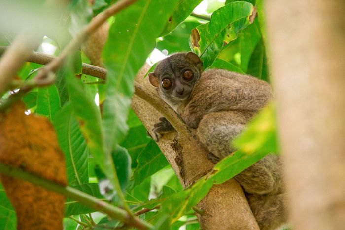
The locally-endemic Sahamalaza sportive lemur (Lepilemur sahamalaza), can sometimes be seen in Ankarafa Forest.
The park protects small, fragmented remnants of forest, which are all that remains of what was once a massive, lowland, coastal forest that was cut down by humans over the centuries. The Ankarafa Forest (one of the terrestrial sectors of the park) is the best remaining tract of remaining forest and offers several hiking trails for visitors.
Ankarafa is home to the critically endangered, locally-endemic blue-eyed black lemur (Eulemur flavifrons). The blue-eyed black lemur is the only primate other than humans to have blue eyes. There is a basic campsite in the forest, so visitors interested in seeing this rare species can do so, but the road to the forest is usually only passable during the dry season (May to November).
The Ankarafa Forest is also home to the locally-endemic Sahamalaza sportive lemur (Lepilemur sahamalaza), a nocturnal species that is not easy to see, even within its small range. The locally-endemic Ankarafa skeleton frog (Boophis ankarafensis) is only known from this forest.
The park office is located in Maromandia and visits to the various sectors can be arranged there. The tourist infrastructure of the park is still being developed, but guided outings on offer include boating, snorkeling, hiking, birding, and cultural visits. Camping is the only option for seeing much of the park.
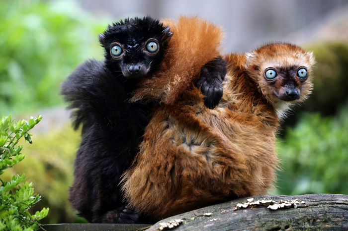
A pair of the critically endangered, locally-endemic, blue-eyed black lemur (Eulemur flavifrons).
Zombitse-Vohibasia National Park
Located in the dry southwest, along the road between Isalo National Park and the coastal town of Toliara, Zombitse-Vohibasia National Park protects three isolated pockets of forest in a region that has been largely deforested by human activity.
The park is comprised of three, non-contiguous parcels, covering a total of 140 square miles (363 sq kms) of land. The southernmost sector (the Zombitse forest) was first set aside as a protected area in 1962, while the central sector (the Isoky-Vohimena forest) and the northern sector (the Vohibasia forest) were given protection in 1997. The three forests were combined into a national park in 2002.
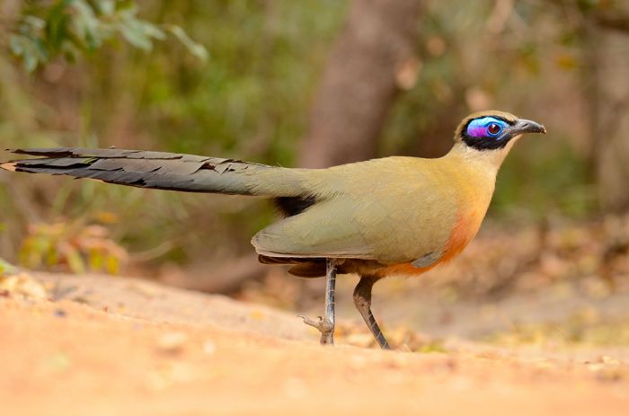
A giant coua (Coua gigas) in Zombitse-Vohibasia National Park.
The main landscapes found in the park are forests, woodlands, and open grasslands. Baobab trees are common, as are numerous species of euphorbia and members of the Fabaceae (pea and bean) family.
The region is quite dry, so there are no major watercourses, but the springs and small wetlands in the park act as a reservoir for the animals living in the park. The three separate forest sections have many similarities, but the Isoky-Vohimeni sits on the shoulder of the Isalo Massif, and so has more similarities with Isalo National Park, which is located around 50 miles (90 kms) to the east.
The forests protected by the park occur within the transition zone between the western and southern vegetation types and are classified as Madagascar succulent woodlands. This ecoregion is known for having a high level of floral endemism, with both spiny thicket and dry deciduous species present. Nearly 300 species in eighty-four plant families are present in the park's forests, with two of the families endemic to Madagascar.
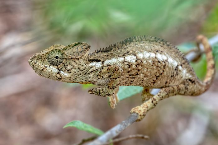
An Oustalet's chameleon (Furcifer oustaleti) in Zombitse-Vohibasia National Park.
Besides the high level of floral diversity in these forests, there is also a great wealth of fauna including in particular, mammals, reptiles, and birds. A total of eight species of lemur can be found in the park, including ring-tailed lemur (Lemur catta), Verreaux's sifaka (Propithecus verreauxi), red-fronted lemur (Eulemur rufifrons), gray mouse lemur (Microcebus murinus), fat-tailed dwarf lemur (Cheirogaleus medius), Coquerel's giant mouse lemur (Mirza coquereli), pale fork-marked lemur (Phaner pallescens), and Hubbard's sportive lemur (Lepilemur hubbardorum).
Hubbard's sportive lemur (also known as Zombitse sportive lemur) (Lepilemur hubbardorum) is a critically-endangered and locally endemic species first described in 2006 and found only in the forests of Zombitse-Vohibasia.
Over 90 species of birds are known from the park, including Appert's tetraka (also known as Appert's greenbul) (Xanthomixis apperti), which is regionally endemic. Over 30 species of reptile have been identified within the park.
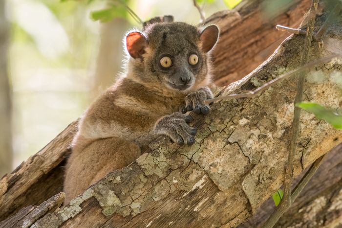
Hubbard's sportive lemur (Lepilemur hubbardorum) in Zombitse-Vohibasia National Park.
Betampona Strict Nature Reserve
This small reserve is located along the eastern escarpment and 25 miles (40 kms) northwest of the coastal city of Toamasina. The reserve protects a fragile, lowland rainforest ecosystem. As with all strict nature reserves, Betampona is only open to researchers under specific permit. The reserve was created in 1927 and covers just 8.6 square miles (22.3 sq kms).
Betampona was once connected to Zahamena National Park to its northwest, but human deforestation for agriculture has left the reserve isolated. The reserve is rich in north flora and fauna.
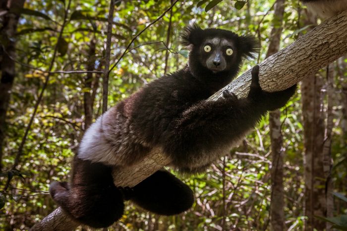
The indri (Indri indri) is found in Betampona SNR.
Tsaratanana Reserve
The Tsaratanana Strict Nature Reserve protects part of the Tsaratanana Massif in the northern end of the island. The reserve includes the Maromokotro volcano (9 436 feet / 2 876 meters), the highest-elevation point on the island. The reserve is closed to the public and requires a specific research permit to gain entrance.
Those who are intrepid can also obtain a permit for climbing to the top of Maromokotro, but this is a serious climb, requiring 14 days round-trip.
The Tsaratanana Reserve covers an area of 576 square miles (1 491 sq kms) of mountainous terrain that includes both lowland and high-elevation rainforest ecosystems.
Sadly, experts report that the forests in Tsaratanana are being burned and cleared primarily to make space for fields of marijuana, vanilla, and rice, causing immeasurable loss to both flora and fauna, much of which has yet to be surveyed.
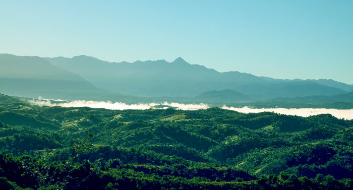
The Tsaratanana Massif with Madagascar's highest peak, Maromokotro, visible in the center.
Ambatovaky Special Reserve
Located along the northern extent of the island's eastern escarpment, the Ambatovaky Special Reserve protects 359 square miles (930 sq kms) of rainforest and deciduous dry forest.
It is one of the last remaining habitats for the critically endangered Perrier's sifaka (Propithecus perrieri), an almost entirely black lemur. An additional five species of lemur can be found in the reserve, as well as the Malagasy civet (Fossa fossana) and the fossa.
The reserve is also a designated Birdlife International Important Birding Area (IBA), with 92 species are known from the site, of which 55 are endemic to Madagascar. The reserve is the only known eastern site for the white-breasted mesquite (Mesitornis variegatus), which is only known from six site on the island, making it possible that this is a separate taxon.
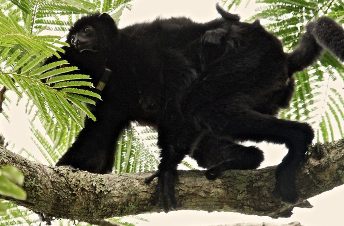
The highly endangered Perrier's sifaka (Propithecus perrieri) is restricted to a small area in northern Madagascar, including the Ambatovaky SR (image: Wikimedia Commons).
Ambohijanahary Special Reserve
The Ambohijanahary Special Reserve protects 96 square miles (248 sq kms) of sclerophyllous (adapted to long periods of dryness and heat) forest, savanna, and sandy terrain in the transitional zone between the western and central ecosystems. The reserve is located roughly in the middle (north-to-south) of the island. Altitudes range between 650-2 950 feet (200-900 meters).
The reserve is known to be home to Decken's sifaka (Propithecus deckenii), eastern woolly lemur (Avahi laniger), and ring-tailed mongoose (Galidia elegans). There are also twenty-one species of reptiles, nine species of amphibians, and fifty-seven species of birds that have been identifies here. There is no infrastructure for tourists.
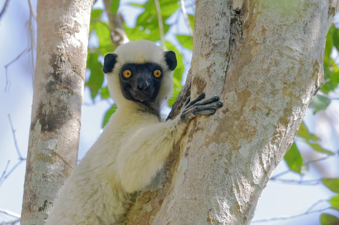
Decken's sifaka (Propithecus deckenii) is found in the Ambohijanahary Special Reserve.
Ambohitantely Special Reserve
Ambohitantely is located around 90 miles (145 kms) north of Antananarivo and protects 21.6 square miles (56 sq kms) of primary rainforest and savanna grassland. This is the last remnant of what was once a vast forest that once covered the central highlands of the island.
The forest section contains a mix of high-elevation rainforest on the east and sclerophyllous (adapted to long periods of dryness and heat) forest on the western side. Elevations in the reserve range between 4 300-5 410 feet (1 300-1 650 meters). The reserve's forest are rich in Malagasy endemic plants, including many that are classifieds as threatened like the Manambe palm (Dypsis decipiens).
There are three species of lemur living in the small reserve: eastern woolly lemur (Avahi laniger), common brown lemur (Eulemur fulvus), and brown mouse lemur (Microcebus rufus). The reserve is also rich in birds, with over 70 species identified, as well as reptiles (17 species) and amphibians (20+ species). The Darth Vader giant pill millipede (Zoosphaerium darthvaderi) is known only from this reserve.
There are six hiking circuits for visitors, each of which can be done in a couple hours. Those wishing to stay overnight can use one of the reserve's camping sites (toilets and showers provided). The winter months (May thru October) can be quite chilly at night due to the elevation.
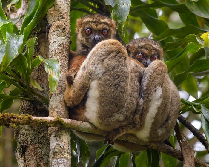
A pair of eastern woolly lemurs (Avahi laniger) in the Ambohitantely SR.
Analamerana Special Reserve
Located in the extreme northern tip of the island, Analamerana protects 290 square miles (750 sq kms) of dry deciduous forest and coastal mangroves. Elevations range from sea-level to 2 130 feet (650 meters).
The forest in Analamerana is the best place on the island to find Perrier's sifaka (Propithecus perrieri), one of the world's most endangered primates. Other lemurs living in the reserve include crowned lemur (Eulemur coronatus), Sanford's brown lemur (Eulemur sanfordi), northern rufous mouse lemur (Microcebus tavaratra), Montagne d’Ambre fork-marked lemur (Phaner electromontis), Ankarana sportive lemur (Lepilemur ankaranensis), and Western lesser bamboo lemur (Hapalemur occidentalis).
Visitors who want to see the forest and its lemurs must be prepared to camp and be self-sufficient, as there are no tourist facilities. Trips usually depart from Diego Suarez and a knowledgable guide is a must.
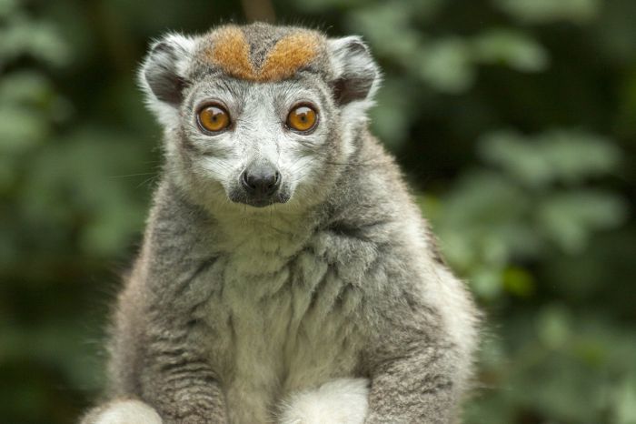
The crowned lemur (Eulemur coronatus) is found in the Analamerana SR.
Andrafiamena-Andavakoera Reserve
Located in the extreme northern tip of the island and borderline the Analamerana Reserve, this nationally protected forest covers 283 square miles (733 sq kms) and has been proposed as a future national park. The reserve is comprised mainly of moist, semi-deciduous forest growling atop limestone, sandstone, shale, and dolomite. There are numerous limestone outcrops throughout, as well as grassy plains and thickets. There are also untold numbers of caves.
Wildlife is much the same as in the the neighboring reserves, including good chances to see the critically endangered Perrier's sifaka (Propithecus perrieri) and other lemur species.
Roads leading into the reserve are not in good condition, but there is a decent, though basic lodge with bungalows and guides.
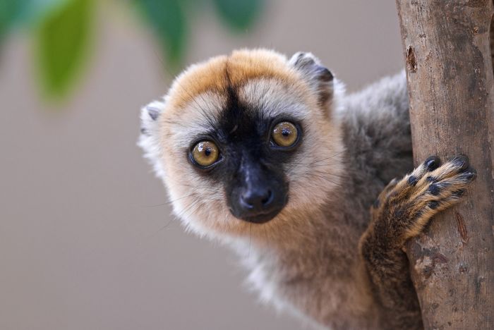
Sanford's brown lemur (Eulemur sanfordi) can be seen in the Andrafiamena-Andavakoera Reserve.
Andranomena Special Reserve
This small reserve is nestled between the very popular Kirindy Forest (to the north) and Kirindy-Mitea National Park (to the south). It is also located directly north of the oft-visited 'Avenue des Baobabs', one of the most picturesque places in Madagascar.
The reserve covers just 24.8 square miles (64.2 sq kms), protecting dense, dry scrubland and deciduous forest, including three species of baobab tree. The awe-inspiring Grandidier's baobab (Adansonia grandidieri) can be seen here. The reserve also has several small, seasonal lakes surrounded by grassy swamps that attract myriad waterfowl.
The reserve is home to 10 species of lemur, including Madame Berthe's mouse lemur (Microcebus berthae), red-fronted lemur (Eulemur rufifrons), red-tailed sportive lemur (Lepilemur ruficaudatus), and pale fork-marked lemur (Phaner pallescens). The fossa, Madagascar's largest carnivore, can also be seen if you are fortunate.
The reserve can be reached by road from Morondava in about one hour. There are two hiking trails in the reserve, the Antsarongaza Circuit and the Circuit of the Four Lakes. The former is best for seeing reptiles and lemurs, while the latter is best for seeing birds (note that during the dries months June-October, the lakes sometimes dry up completely).
There are no permanent accommodations and camping is not permitted in the reserve, so day visits are the only option.
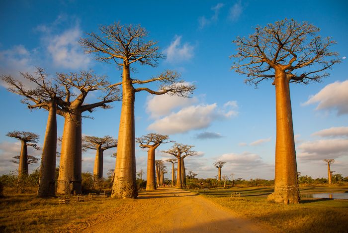
The oft-visited 'Avenue des Baobabs' is located directly south of the Andranomena SR..
Anjanaharibe-Sud Special Reserve
Located in the north and just south of Marojejy National Park, Anjanaharibe-Sud protects 146 square miles (375 sq kms) of mountainous rainforest on the eastern slopes of the Anjanaharibe Massif, with elevations ranging from 1 640-6 772 feet (500-2 064 meters). The name 'Anjanaharibe' translates to 'place of the Great God' in the Malagasy language.
Anjanaharibe-Sud protects some of the last intact stands of virgin mid- and high-elevation rainforest remaining in the country. The reserve's variable topography means that the flora is diverse, with humid forest in the lower elevations and montane forest in the higher elevations. Plans are supposedly underway to expand the reserve to include the western slopes of the massif.
There are twelve species of lemur known to live in the reserve, including a very dark morph of the indri (Indri indri), silky sifaka (Propithecus candidus), and white-headed lemur (Eulemur albifrons). Birding in the reserve is also rewarding
despite its close proximity to the town of Andapa, getting to the reserve is challenging due to poor road conditions. There is a rugged, but easy-to-follow hiking trail that winds through primary forest to a series of hot springs. Camping is the only option for those staying overnight, but day trips are possible.
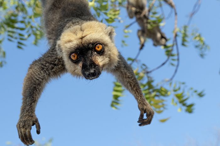
The white-headed lemur (Eulemur albifrons) is found in Anjanaharibe-Sud SR.
Ankarana Special Reserve
Ankarana is located in the far north of the island and protects 187 square miles (485 sq kms) of dry, deciduous forest atop a limestone massif. The massif has eroded over time to create what are called 'tsingy' (a Malagasy word), which are spires and pinnacles of sharp rock left behind as the surrounding soluble rock dissolves.
The reserve also contains extensive cave systems with subterranean rivers, many of them mapped, but more that are still unexplored. The Ankarana Massif contains the longest known cave systems in Madagascar, and most likely in all of Africa. The caves and underground rivers are home to crocodiles, which are thought to be the only troglodytic crocodiles in the world.
The spectacular topography in the reserve, including the incredible cave systems, tsingy formations, deep gorges, steep walls, and basalt boulders, make this a place worth visiting for intrepid travelers.
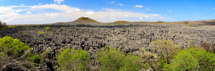
Tsingy rock formations in the Ankarana Reserve.
The forested sections of the reserve are home to large diversity of lemur species, including crowned lemur (Eulemur coronatus), Sanford's brown lemur (Eulemur sanfordi), northern sportive lemur (Lepilemur septentrionalis), Masoala fork-marked lemur (Phaner furcifer), eastern woolly lemur (Avahi laniger), brown mouse lemur (Microcebus rufus), fat-tailed dwarf lemur (Cheirogaleus medius), Perrier's sifaka (Propithecus perrieri), western lesser bamboo lemur (Hapalemur occidentalis), and aye-aye (Daubentonia madagascariensis).
The reserve is also superb for seeing reptiles, amphibians, and birds.
Cave explorations on various expeditions have also uncovered the fossils of some of Madagascar's now-extinct lemurs, including the so-called 'sloth lemurs'.
Visiting Ankarana can be arranged as day visits or overnight stays by camping. There are several campsites within the reserve, as well as numerous options for staying outside the reserve in permanent accommodations.
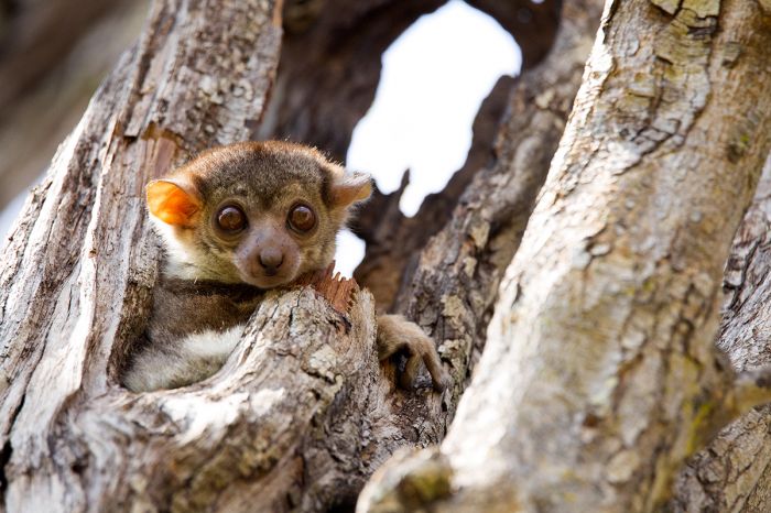
The Ankarana sportive lemur (Lepilemur ankaranensis) is known from northern Madagascar, including the Ankarana Reserve.
Bemarivo Special Reserve
Bemarivo is a small reserve in the central-western region, just 3 miles (5 kms) inland from the coast. The reserve protects 46.5 square miles (120 sq kms) of land comprising dry, dense, deciduous forest, secondary grassland, seasonal lakes, marshes, the permanent Bemarivo River, and several seasonal tributaries.
Over 200 species of plant have been identified thus far, although there are surely many more than this waiting for identification. Six species of lemur are known to inhabit the forest and over 25 species of reptile have been recorded, including the Nile crocodile and Madagascar ground boa (Acrantophis madagascariensis).
Over 80 species of birds have been identified in the reserve and it has been designated by BirdLife International as an Important Birding Area (IBA). The wetland areas are particularly good for birding.
There is no tourist infrastructure in the reserve.
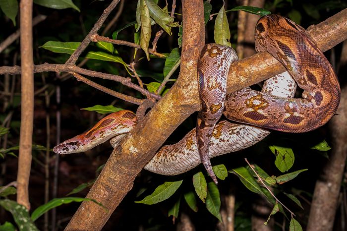
The Madagascar ground boa (Acrantophis madagascariensis) can sometimes be seen in the Bemarivo SR.
Beza Mahafaly Special Reserve
This tiny reserve is located in the dry, southwest part of the inland and is segmented into two distinct parcels of protected land. One parcel is a fenced section of riparian gallery-forest covering around 0.4 miles (1 square km) and the other covers 2 square miles (5.2 sq kms) of arid, spiny forest. The two sections of the park are separated from each other by 5 miles (8 kms).
The reserve was originally created in 1975 after community leaders formed a partnership with three educational institutions (Yale University, Washington University-St Louis, and University of Antananarivo) to protect the remaining forest here. Wildlife research in the reserve has been funded by these universities since 1978.
Studies of two lemur species living in the reserve - Verreaux's sifaka and ring-tailed lemur - have been an ongoing project. The reserve ESSA-Forêts host an annual 10-day field school for Malagasy students to give them exposure to conservation techniques. Additional group workshops, outreach events, and training courses are offered every year to local school children, adults, university students, teachers, and government officials.
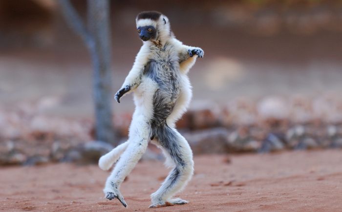
A Verreaux's sifaka (Propithecus verreauxi) in its characteristic two-legged dance.
Although small in size, a visit to this reserve is sure to be productive in terms of seeing lemurs, many of which are habituated to seeing humans due to the ongoing research protects mentioned above. In all, there are four species of lemur found in the reserve: ring-tailed lemur (Lemur catta), Verreaux's sifaka (Propithecus verreauxi), reddish-gray mouse lemur (Microcebus griseorufus), and white-footed sportive lemur (Lepilemur leucopus).
The reserve is also home to four species of tenrec, numerous species of reptile including the radiated tortoise (Astrochelys radiata), and over 100 species of bird.
Although mainly visited by researchers and local people, tourists are most welcome and can choose between four hiking trails that take 1-4 hours to complete. There is a research camp that has a number of permanent rooms that can be reserved when research staff is not using them and there are also tent pitches for camping. There is also a small museum in the reserve that is open to tourists.
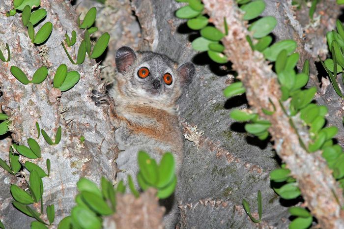
The diminutive and nocturnal white-footed sportive lemur (Lepilemur leucopus) can often be found in Beza Mahafaly.
Bora Special Reserve
Bora is a very small reserve, covering just 18.6 square miles (48.4 sq kms) of forest in the transitional zone between the northeastern humid forests and the dry western forests. Due to its location between two vegetation zones, the small reserve has a great variety of floral species.
The landscape is mostly flat, with some small hills and volcanic rock. Dry, deciduous-forest is the predominant vegetation type, but there are also areas of savanna, riparian gallery-forest, degraded secondary-forest, and some infringement by local people who have created rice paddies.
There are at least six species of lemur living in the reserve, as well as a good diversity of birds, reptiles, amphibians, and at least two hundred identified floral species.
There are no tourist accommodations.
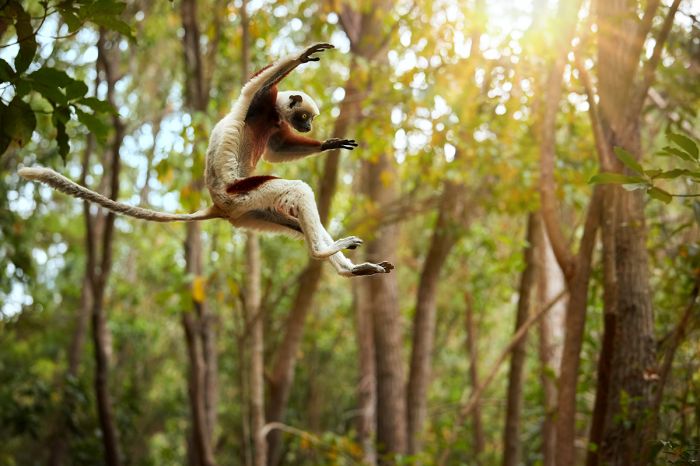
There are at least six lemur species living in Boa, including Coquerel's sifaka (Propithecus coquereli).
Cap Sainte Marie Special Reserve
The Cap Sainte Maries Special Reserve reserve protects Cape Sainte Marie (also known as Cape Vohimena), the southernmost point of the island. Besides its special geographic location, the reserve is best known for being home to thousands of endangered radiated tortoises (Astrochelys radiata). The reserve covers 24.3 square miles (63 sq kms).
The actual headland is covered in fascinating, dwarf vegetation that is stunted by the constant wind that blows onto the cape from the sea. From the cape, one can gaze southward knowing there is nothing but ocean until Antarctica, which lies 2 800 miles (4 500 kms) away.
Guided walks are highly recommended to learn about the vegetation, sea fronting caves, and history of the area. There are two hiking circuits and both can be completed in a full- or half-day visit. Keep an eye out for egg shell fragments from the now-extinct elephant bird that once roamed this region until around 1 000 years ago.
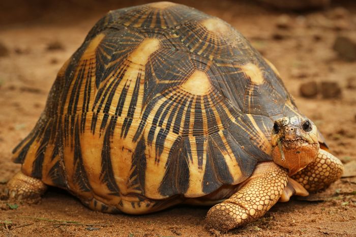
Cap Sainte Marie is home to thousands of critically-endangered radiated tortoises (Astrochelys radiata).
Kalambatritra Special Reserve
Located in the southeast, the Kalambatritra Special Reserve protects 109 square miles (283 sq kms) of humid evergreen forest, undulating hills, savanna grassland, marshlands, and steep summits within the Antaivondro-Kalambatritra massif. The reserve encompasses several biomes, including eastern lowland rainforest, southern dry-spiny-forest, and central temperate forest.
The reserve is home to diverse flora and fauna, including over 700 species of plants (so far identified). Wildlife includes five species of lemur, numerous amphibians, and at least 80 species of bird. Lemurs include ring-tailed lemur (Lemur catta), southern lesser bamboo lemur (Hapalemur meridionalis), collared brown lemur (Eulemur collaris), Wright's sportive lemur (Lepilemur wrightae), and aye-aye (Daubentonia madagascariensis).
Access to the park is not easy and there are no accommodations available in the reserve or nearby, so day trips are the only viable option for visitors.
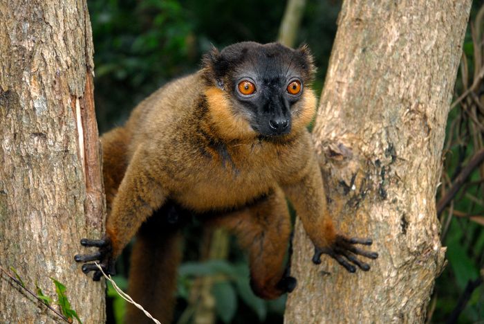
The collared brown lemur (Eulemur collaris) is one of the species that may be seen in Kalambatritra.
Kasijy Special Reserve
Covering 88.6 square miles (230 sq kms)in the central-northwest part of the island, Kasijy protects two forested outcrops of karst (limestone which has been partially eroded): the Kasijy massif and the smaller Analamajera massif. The reserve is bounded on three sides by ivers: the Mahavavy River in the east, Andranomaitso River in the north, and the Mahiarere river in the south.
The northern portion of Kasijy is covered by dense, semi-deciduous forest, including numerous specimens of baobab tree. The southern section is mainly grassland savanna, with woody scrubland. The reserve also protects swamps, open water, and steppes.
In terms of wildlife, Kasijy is home to 16 species of mammal, of which six are lemurs, including gray mouse lemur (Microcebus murinus), red-tailed sportive lemur (Lepilemur ruficaudatus), western lesser bamboo lemur (Hapalemur occidentalis), red lemur (Eulemur rufus), Decken's sifaka (Propithecus deckenii), and crowned sifaka (Propithecus coronatus).
Numerous reptiles and amphibians are also found in the reserve, including tortoises, geckos, chameleons, and crocodiles. Birdlife is also abundant, with 54 species identified and the reserve has been designated as a BirdLife International Important Birding Area (IBA).
Access to Kasijy is challenging due to the poor roads and there are no tourist accommodations in the reserve or nearby vicinity, so visitor numbers are very low. The reserve is closed during the rainy season (December thru April).
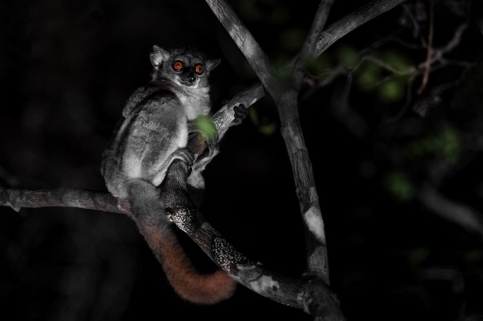
The small and nocturnal red-tailed sportive lemur (Lepilemur ruficaudatus) is found in the Kasijy SR.
Mangerivola Special Reserve
Mangerivola protects 104 square miles (270 sq kms) of low-, medium-, and high-altitude rainforest along the eastern escarpment some 30 miles (50 kms) southwest of the coastal town of Toamasina. The predominant vegetation is humid, evergreen forest with areas of canopy forest and secondary forest
The reserve was first established in 1958 to protect the great variety of bird life living in the forests and the reserve has been designated as a BirdLife International Important Bird Area (IBA). Seventy-eight species are currently known from the reserve, of which 49 species are endemic to the island.
The reserve contains a great diversity of floral species, with over 300 species identified to date, of which 180+ are endemics. Besides the abundance of birds discussed above, wildlife in the reserve includes a variety of reptiles, amphibians, and mammals. The reserve has a great variety of lemurs, including indri (Indri indri), diademed sifaka (Propithecus diadema), black-and-white ruffed lemur (Varecia variegata), common brown lemur (Eulemur fulvus), red-bellied lemur (Eulemur rubriventer), eastern lesser bamboo lemur (Hapalemur griseus), eastern woolly lemur (Avahi laniger), greater dwarf lemur (Cheirogaleus major), and aye-aye (Daubentonia madagascariensis).
There are some rudimentary trails, but there are no tourist accommodations close to the reserve, so day visits from Toamasina are the best option.
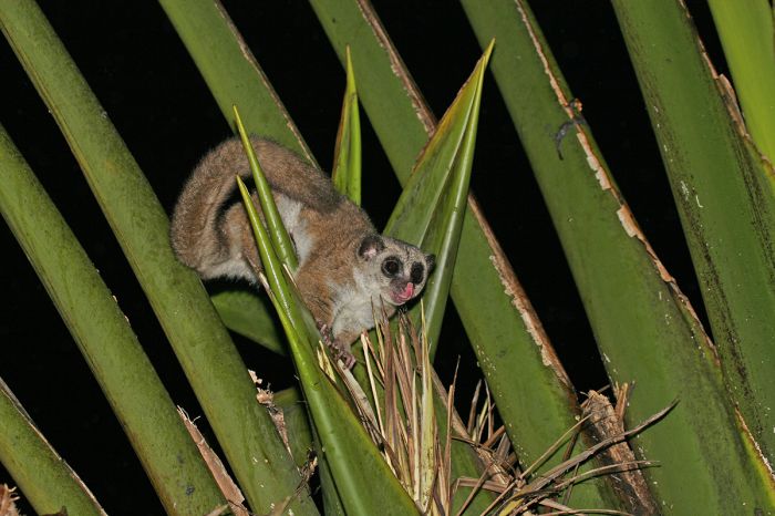
The greater dwarf lemur (Cheirogaleus major), also known as the Geoffroy's dwarf lemur, can be found in the Mangerivola SR.
Maningoza Special Reserve
Located in the central-west some 40 miles (66 kms) inland from the coast, the Maningoza Reserve protects 23 square miles (60 sq kms) of mostly dry, deciduous forest. The reserve was established in 1956.
The reserve is predominantly dry, deciduous forest, but there are also areas of savanna, scrubland, and stands of palms and bamboo. The area is not well studied, but is known to have rich birdlife, mammals, and reptiles.
Maningoza has been designated as a BirdLife International Important Bird Area (IBA) and 52 species are known from the reserve, of which 25 are Malagasy endemics.
The reserve is also home to 15 species of mammal, of which five are lemurs, including eastern lesser bamboo lemur (Hapalemur griseus), gray mouse lemur (Microcebus murinus), fat-tailed dwarf lemur (Cheirogaleus medius), red-fronted lemur (Eulemur rufifrons), and Decken's sifaka (Propithecus deckenii).
As with many of the island's smaller special reserves, there are no tourist accommodation nearby, so visitors are few to this reserve.
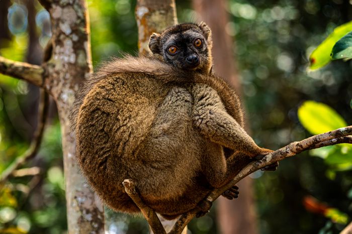
A red-fronted lemur (Eulemur rufifrons) in the Manangoza SR.
Manombo Special Reserve
The small reserve is located along the southeast coast of the island, around 15 miles (25 kms) south if the coastal town of Farafangana. The reserve protects 80 square miles (205 sq kms) of endangered coastal, lowland rainforest.
The adjoining Manomboa Classified Forest covers an additional 39 square miles (100 sq kms). It is hoped that the classified forest section will be added to the special reserve to give it better protection.
The reserve boasts a very high diversity of land snails, with 52 species, all of which are Malagasy endemics. Manombo is also the only protected area giving shelter to the highly endangered Bernhard's mantella (Mantella bernhardi), a poisonous frog.
Manombo's forest is the best place on the island for seeing the highly endangered southern race of the black-and-white ruffed lemur (Varecia variegata editorum) and the gray-headed lemur (Eulemur cinereiceps). Besides these two very special endangered species, the reserve is also home to James' sportive lemur (Lepilemur jamesorum), Ramanantsoavana's woolly lemur (Avahi ramanantsoavani), greater dwarf lemur (Cheirogaleus major), southern lesser bamboo lemur (Hapalemur meridionalis), and aye-aye (Daubentonia madagascariensis).
Guided visits to Manombo can be truly rewarding in terms of seeing these special lemurs. There are no tourist accommodations, but visitors can arrange to camp at the reserve office along the main road about 2.5 miles (4 kms) from the reserve entrance.
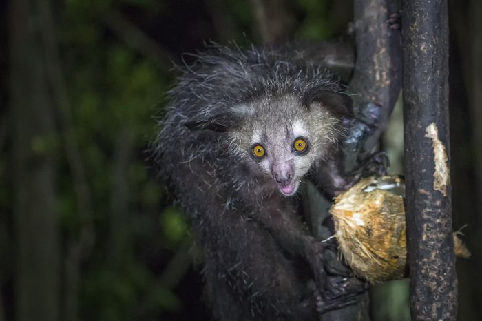
The incredible-looking aye-aye (Daubentonia madagascariensis) is a very lucky sighting!
Manongarivo Special Reserve
Situated in the far northwest of the island, Manongarivo protects 248 square miles (644 sq kms) of dense, low- and mid-elevation humid forest growing of a mountainous massif. Amongst the steep mountain slopes are valleys that are littered with large boulders.
The reserve protects a crucial watershed for the area, including the headwaters of the Manongarivo River, and tributaries of the Sambirano, Djangoa and Ambahatra rivers.
Manongarivo has been designated as a BirdLife International Important Bird Area (IBA), with 60 species known from the reserve, of which 30 are Malagasy endemics.
Manongarivo is a good place for seeing lemurs and is one of the best places to see the Sambirano mouse lemur (Microebus sambiranensis) and the Sambirano woolly lemur (Avahi unicolor), although both are difficult to see.
Other lemur species found in the reserve include Pariente's fork-marked lemur (Phaner parienti), gray-backed sportive lemur (Lepilemur dorsalis), northern giant mouse lemur (Mirza zaza), black lemur (Eulemur macaco), western lesser bamboo lemur (Hapalemur occidentalis), common brown lemur (Eulemur fulvus), and probably the aye-aye (Daubentonia madagascariensis).
The reserve is not easily reached and there is no accommodation at the reserve, but there are hotels in the towns of Ambanja and Ankify, both of which are a good distance away. For these reasons, Manongarivo is seldom visited by tourists.
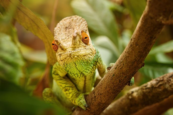
A Parson's chameleon (Calumma parsonii), one of the world's largest chameleon species.
Marotandrano Special Reserve
Situated in the northeast, Marotandrano protects 157 square miles (407 sq kms) of dense, mid-elevation, humid evergreen forest along the westernmost edge of the eastern escarpment. The reserve was designated in 1956.
The headwaters of several rivers that flow east to the Indian Ocean rise on the upper slopes of the reserve, including the Amboaboa, Andranokelilalina and Andramy.
Marotrandano is home to an abundance of wildlife and has also been declared a BirdLife International Important Bird Area (IBA), with 76 species known from the reserve, of which 49 are Malagasy endemics.
Lemurs which may be seen here include red-bellied lemur (Eulemur rubriventer), the variegated subspecies of black-and-white ruffed lemur (Varecia variegata variegata), diademed sifaka (Propithecus diadema), hairy-eared dwarf lemur (Allocebus trichotis), indri (Indri indri), and possibly aye-aye (Daubentonia madagascariensis).
There is basic accommodation available in the town of Mandritsare (30 miles/50 kms north), but a 4x4 is definitely required and access is only possible during the dry season (May thru November). Those wishing to stay in the reserve can do so by camping.
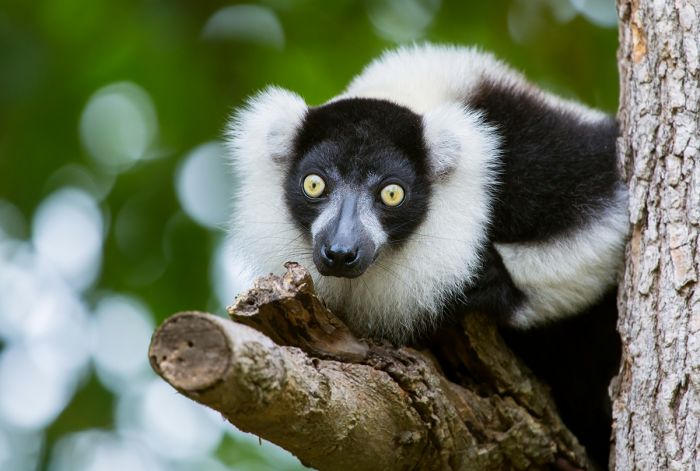
The strikingly beautiful black-and-white ruffed lemur (Varecia variegata) lives in the Marotrandano Special Reserve.
Pic d'Ivohibe Special Reserve
This small reserve in the southeast covers 13.3 square miles (34.5 sq kms) of dense, low- and mid-elevation rainforest in the southern section of the Andringitra Massif. The reserve lies 12 miles (20 kms) south of Andringitra National Park. The western side of the reserve is covered in savanna.
The reserve is home to a variety of wildlife and birds. Lemurs found here include red-fronted lemur (Eulemur rufifrons), red-bellied lemur (Eulemur rubriventer), brown mouse lemur (Microcebus rufus), greater dwarf lemur (Cheirogaleus major), southern lesser bamboo lemur (Hapalemur meridionalis), ring-tailed lemur (Lemur catta), and possibly aye-aye (Daubentonia madagascariensis).
Access to the reserve is from Ihosy, but the roads are in poor condition, so visitor numbers are very low. There are no tourist accommodations, but camping is an option.
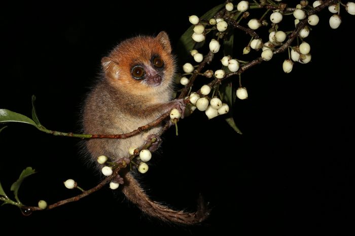
The cute and diminutive brown mouse lemur (Microcebus rufus) can be seen (typically after dark) in the Pic d'Ivohibe Special Reserve.
Tampoketsa Analamaitso Reserve
Tampoketsa is located in the northern part of the island, roughly in the middle, where it protects transitional forest types that includes dense, mid-elevation, humid, evergreen forest typical of the eastern ecosystems and dry deciduous forest that is typical of much of western Madagascar. There reserve covers 66.2 square miles (171.5 sq kms).
The mix of forest types means that the reserve is home to a wide variety of flora and fauna. Several species of lemur are known to inhabit the reserve, including Brown mouse lemur (Microcebus rufus), Common brown lemur (Eulemur fulvus), and some of the dwarf lemur species (Cheirogaleus genus).
This reserve is challenging to access and is only feasibly visited during the dry season. There are no tourist accommodations.
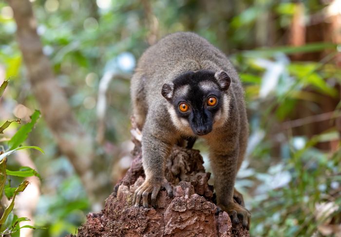
Common brown lemurs (Eulemur fulvus) can be seen in Tamboketsa.
--- NOTABLE URBAN AREAS ---
Antananarivo
Madagascar's capital and most populous urban area is Antananarivo, which has a 2023 population of 1.39 million people. Together with its surrounding suburban areas, the total metropolitan population is 3 million. 'Tana', as it is commonly referred to, is situated on the central plateau, roughly in the middle of the island, at an elevation of 4 100-4 750 feet (1 250-1 450 meters).
Tana was founded around 1610 as the capital of the Merina people, who constitute the largest ethnic group in Madagascar. The Merina ruler at that time, King Andrianjaka expelled the Vazimba (believed to be the earliest inhabitants of the island) people from their village, which they called Analamanga. The city kept the name Analamanga until the reign of King Andriamasinavalona (1675–1710), who renamed it Antananarivo ("City of the Thousand") in honor of the soldiers who protected it.
Today, Tana remains the capital city and almost every tourist who visits Madagascar will arrive at Tana's Ivato International Airport (TNR). Due to the relatively poor road conditions in the country, most itineraries involve some domestic flying and many of those flights connect through Tana, so most visitors will spend at least a couple of days here.
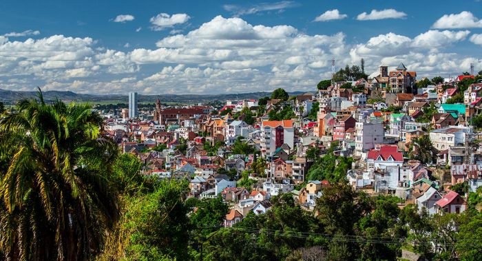
The main sections of Antananarivo are situated atop elevated ridges that give views over the surrounding plains.
To save time, more and more tourists are opting to stay at hotels close to thew airport, as driving in the city normally takes 45-60 minutes, depending on traffic. Moreover, domestic flights are notorious for last-minute schedule changes, so being close to the airport is not a bad idea.
Tana's is situated on the island's Central Highlands and the area is quite hilly. The core section of the city is built upon three elevated ridges of land that converge at their highest point in a 'Y' formation, some 660 feet above above the Betsimitatatra plains and rice paddies below. As the city grew, it expanded from its central elevated position atop the sacred ridges to the surrounding flat terrain.
The Greater Antananarivo urban area expands beyond the city's official borders for 5.6 miles (9 kms) north-to-south and 3.7 miles (6 kms) east-to-west.
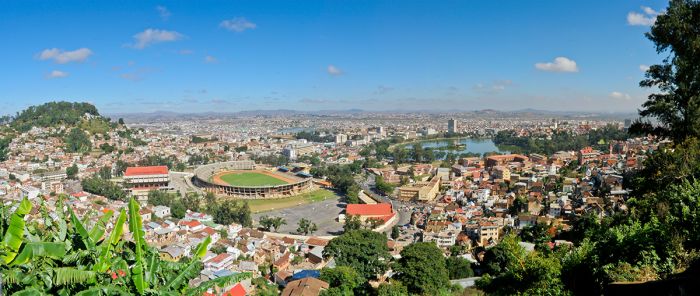
View over Madagascar's capital city, Antananarivo.
Atop the highest hill in Tana is the Manjakamiadana Royal Palace (or 'rova'), which was originally constructed by the Merina King Andrianjaka during the early 1600's. The Avenue de l'Indépendance is a broad boulevard that was built during the French Colonial period (late 1800's / early 1900's) and runs through the Central Valley of the city. The avenue terminates at the grand colonial railway station, which opened in 1910 and is now beautifully restored and serves as a shopping mall.
At first glance, Tana is a lovely capital city, with hilly terrain and plenty of greenery, but upon inspection visitors will notice that the city is fairly rife with poverty and squalor. Traffic jams are a near-constant reality in Tana, so it is best to avoid spending too much time in a car when visiting; this said, if you choose to walk, it is best to have a guide with you and/or walk in groups and do not carry items of value.
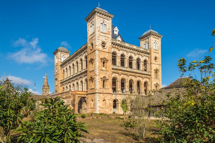
The royal palace complex (or 'Rova' of Antananarivo).
In terms of things to do and see, there are several places worthy of mention:
- Rava Manjakamiadana: Also known as 'The Queen's Palace', it was the largest structure within the rova (royal residences) of early Antananarivo. Sadly, its stone exterior was the only remnant of a 1995 fire which ravaged the rova. The palace has since been partially restored (funded mostly by UNESCO) and was reopened to the public in 2012 (note that one can still not go inside, but the exterior is worth a visit). Some of the other restored royal buildings can also be visited. The views from the high vantage point are actually worth the trip!
- Andafiavaratra Palace: Built in 1872 atop the royal hilltop, this was the residence of Prime Minister Rainilaiarivony, who governed the island kingdom from 1864 to 1895. Rainilaiarivony's 31-year reign is the longest in Madagascar's history. He married three queens in succession during is time in power: Rasoherina, Ranavalona II and Ranavalona III. Rainilaiarivony was immediately deposed by the French after their conquest of the island in 1895. He was exiled to French Algeria, where he died less than a year later. Today, the palace is a museum which houses items which were salvaged from the rova fire of 1995.
- Tsarasaotra Park: A small, private nature park located in the middle of Antananarivo, comprising two lakes, woodland, an islet, and a walking trail for visitors. The park is a designated Ramsar Wetland and a natural refuge within the urban environment. The site provides nesting sites for waterbirds, especially herons and ducks. Popular with birdwatchers. Best to visit in the early morning and tickets are required for entry (must be purchased in advance).
There are plenty of hotels to choose from in Tana, from luxury to very affordable. As mentioned above, the drive between the airport and the city takes 45-60 minutes and there are accommodation options close to the airport if you're just overnighting and flying out again. For those with a day or more to spend and who want to see a few sights, then staying somewhere in the city is a better option.
Andafiavaratra Palace was the residence of Prime Minister Rainilaiarivony, who governed the island kingdom from 1864 to 1895.
Toamasina
Still widely called by its unofficial French name - 'Tamatave', Toamasina is located along the central-east coast of the island and is Madagascar's principal seaport. The city is located 135 miles (215 kms) northeast of Antananarivo, connected by the RN2 roadway. Toamasina is the country's second-most populous city (after Tana), with 206 thousand people.
Under French colonial rule, Toamasina was the location for several French officials, as well as foreign consuls. Today, the oceanfront town has a ramshackle elegance, with once-beautiful colonial houses lining its palm-lined boulevards.
For those spending a night or two, a guided city tour is the best option, but you can explore on your own as well. There are several museums worth visiting, the best of which is the Musée du Port, which is located in the harbor area.
Palm trees along the ocean in the seaside city of Toamasina, Madagascar.
Nosy Alanana
Nosy Alanana (Prune Island) is located 6 miles (10 kms) northeast of Toamasina and 3 miles (4.5 kms) offshore. The island is fringed by beach and has a forested interior, covering 0.11 square miles (0.28 sq kms). The main attraction is the lighthouse, which was constructed in 1932, is the tallest lighthouse in Africa, and the fourth-tallest in the Southern Hemisphere, rising 197 feet (60 meters).
Guided tours of the island are a fun outing; activities include climbing the lighthouse, walking thew island perimeter, snarling, and swimming. The boat ride to the island takes 40 minutes.
The lighthouse on Nosy Alanna is the tallest in Africa (image: Wikimedia Commons).
Antsirabe
Madagascar's third-most-populous city, Antsirabe is located in the central highlands, around 70 miles (120 kms) southwest of Antananarivo, connected by the RN7 roadway. The city is known for its cool climate, which is due to its relatively high elevation of 4 900 feet (1 500 meters). Antsirabe's population in 2023 was 186 thousand people. The name in the Malagasy language means 'the place of much salt'.
Antsirabe was founded in 1972 by Norwegian missionaries, who were attracted to the location for its pleasant climate and its thermal hot springs. Today, the city is the agricultural and industrial center of the island, with the surrounding area growing fruit trees (apples, plums, pears, and others), The city has numerous factories, producing textiles, processed foods, tobacco, soap, mineral water, grains, and beer.
There are several buildings dating back to the early 1900's including the Thermal Baths Centre (opened in 1917), Hôtel des Thermes (1922), the railway station (1923), and the residence for French retirees (1934). Visitors can take a tour of the city, enjoy the Saturday markets, and visit the city's handicrafts sector to see the skilled craftsmen at work. Two nearby volcanic lakes (Tritriva and Andraikiba) are easily reachable for day trips out of the city.
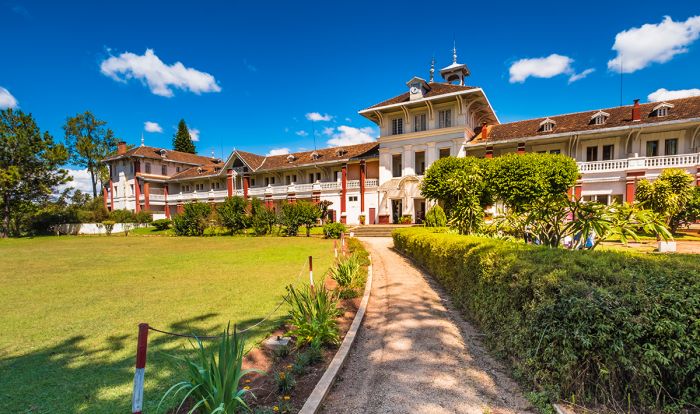
Antsirabe City Centre.
Mahajanga
The city of Mahajanga (also known as 'Majunga') is located along the northwest coast and is Madagascar's second-most-important port (after Toamasina). The city is situated on the northern edge of Bombetoka Bay, which is where the Betsiboka River empties into the Mozambique Channel. Directly inland in the river mouth is the Betsiboka River Estuary, which is rich in mangrove forests and wildlife. The city's 2023 population was 155 thousand.
Mahajanga likely dates back to around the 10th century, which merchants from East Africa, the Middle East, and the Far East visited the island's ports to trade for slaves. By at least 1764, Mahajanga was a busy, cosmopolitan port that was oft visited by European ships. The town at this time already had a significant Indian and Muslim population, with many stone buildings, including mosques. Today, the Indian population in Mahajanga remains one of the largest on the island.
The town is interesting for its historical buildings and there is a well-marked map that can be used to take a self-guided, waking tour, with numerous numbered plaques demarcating points along the route. The wide, seafront boulevard ends at the lighthouse and along the way is a huge baobab tree, estimated to be over 700 years old.'
Things to see and do outside of Mahajanga include a boat excursion into the Betsoboka Estuary, which a a spectacular place with mangrove forests and excellent birding opportunities. Ankarafantsika National Park, one of the best wildlife destinations on the island, is located 50 miles southeast along the paved RN4 roadway (which eventually leads to Antananarivo).
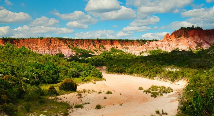
Canyon landscape near Mahajanga.
Fianarantsoa
Fianarantsoa (also known as 'Fianar') is a city of 167 thousand inhabitants (2023 data) located in the central/southeast and lying inland from the east coast by around 75 miles (125 kms). The town dates back to 1830 and means 'good learning' in the local Malagasy language.
Today, the city is considered the cultural centre of the island, with several educational institutions (Université de Fianarantsoa, Faculté de Médecine de Fianarantsoa, Collège Saint François Xavier Fianarantsoa, Collège Français René-Cassin) located here. The city is also home to some of Madagascar's oldest Protestant and Lutheran cathedral.
Things to do include a visit to the 'old town' section and its market (reachable only on foot), which is considered an historical site. There Sahambavy Valley is located within driving distance (10 miles/17 kms) due east of the town and offers an interesting tea estate, which makes for a nice day trip.
Located 25 miles (40 kms) northeast is the very popular Ranomafana National Park, which offers an outstanding wildlife and nature experience and is one of the best on the island.
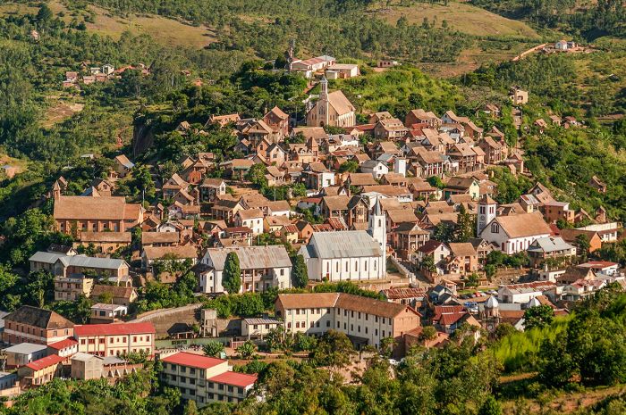
The 'old town' section of Fianarantsoa.
Toliara
Also commonly known by its French name, 'Tuléar', Toliara (pronounced 'too-lee-ar') is located on the southwest coastline and has a population of 115 thousand (2023 data), making it the island's sixth-largest city. This coastal area was first visited by Europeans when French sailors landed in the Bay of St. Augustine at the mouth of the Onilahy River (just south of today's town) in the 17th century, but was only officially founded in 1895 by the French colonization period. The bay was also frequented by pirates in those days.
Toliara is a popular stop for tourists visiting the southern extent of the island, but has no good beach in town, so most visitors head north to the beaches in Ifaty or south to Anakao. Those interested in snorkeling and diving should also head north to Ifaty, which has some nice, offshore coral reefs.
St. Augustine's Bay stretches for 8.6 miles (14 kms) and is naturally beautiful, with sand dunes, mangroves, and some sea caves. A portion of the bay is protected as the Tsinjoriake Protected Area and here there are are several hiking circuits that offer a great way to explore and see highlights, which include Toliara's 'table mountain' and the caves on the Sarodrano Peninsula.
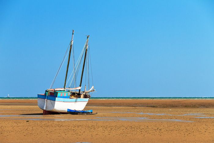
Low tide on the beach at Toliara.
Antsiranana
This coastal town at the northern tip of Madagascar dates back to the 16th century and has an eventful history. On 10 August 1500, a Portuguese ship captained by explorer Diogo Dias (brother of the more famous Bartolomeu Dias) arrived at this location, becoming the first European ship to officially discover the island. A short time later in 1506, Portuguese Admiral Herman Suarez visited the same location zand the official name of the place thus became a contraction of the names of these two sailors: Diego-Suarez.
During the 1880s, the French coveted the strategic port as a coaling station for its steamships. In December 1885, Queen Ranavalona III (the last of Madagascar's sovereigns before the colonization by France) signed a treaty granting France a protectorate over the bay and surrounding territory, as well as the islands of Nosy-Be and Ste. Marie de Madagascar. Thus became what would later become France's colonization of the entire island.
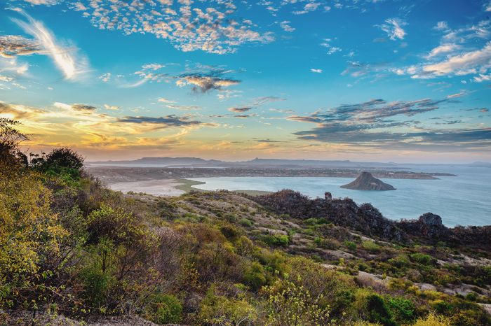
Beautiful land and seascape showing the bay at Antsiranana (Diego Suarez).
By 1886, the town of Diego Suarez (also known as Antomboko at that time) had a population of 2 500 inhabitants. In 1942, Diego-Suarez became the primary objective of 'Operation Ironclad', a British campaign to capture the Vichy French-controlled island during World War II, particularly to deny Madagascar's ports to the Imperial Japanese Navy.
Madagascar was granted independence by France in 1960, but France maintained an operational military base in Diego-Suarez until 1975, when the last of its troops were withdrawn. Today and since 1975, the town's official name is Antsiranana. The 2023 population was 83 thousand people.
Antsiranana Bay stretches for 12 miles (20 kms) is the town has one of the largest deep-water harbors in the Indian Ocean. Inspire of this, Antsiranana's remote location means it is still of little importance for freight traffic.
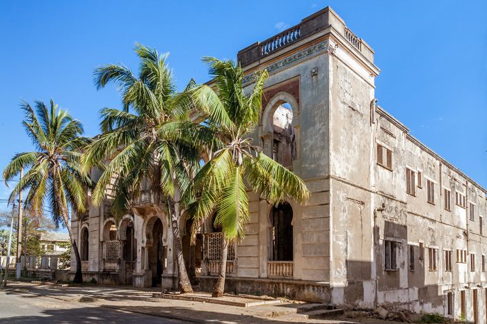
Colonial architecture in Diego Suarez (Antsiranana).
The road to the town has historically been in disrepair and its distance location means that most visitors fly. The town is well worth a visit and is distinct from most places in Madagascar in terms of its populace, which, due to its colorful history of foreign occupation, is quite cosmopolitan.
Self-guided walking-tour maps are sufficient for seeing the sights, although a guided tour will surely impart more information. Places to see include the British War Cemetery, which is the final resting place for 315 soldiers from various African and European regiments. The French War Cemetery is closely, alongside the local cemetery.
The Montagne des Français Reserve is a protected area located 7.5 miles (12 kms) east of the town. The name reflects is a memorial to the French soldiers killed here during the war. The reserve protects part of a massif with dry, deciduous forest, ranging from 325-1 500 feet (100-450 meters) in elevation. The forests are rich in flora and fauna. There is a hiking trail leading to the summit which takes roughly two hours.
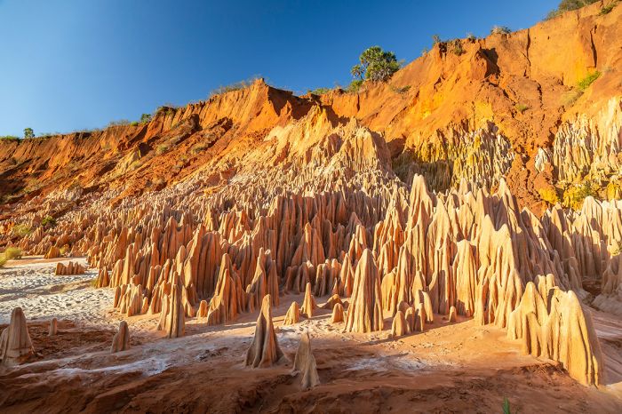
Red tsingy formations near Antsiranana (Diego Suarez) in northern Madagascar.
Taolagnaro
Located on the far southeastern coast of the island, Taolagnaro is one of Madagascar's oldest settlements, dating back to 1504, when a group of 80 shipwrecked Portuguese sailors became accidental colonists and built a small fort, which is still standing and is the oldest building on the island.
The town was officially named Fort Dauphin in 1643 when the French East India Company built a fort there and named the port in honor of the crown prince (and future King Louis XIV of France). The future king at that time bore the title of French heirs apparent: Dauphin (meaning 'dolphin'). The port became the first French colony on the island, but was abandoned by them in 1674.
The town itself is relatively quiet, with a population of around 45 thousand. The main part of town is situated on a short, narrow peninsula with beaches on three sides and lush, green mountains rising directly inland, eventually leading to spiny forest further west.
The roads into and out of the town are not in good condition, so most tourists fly in, mainly to visit the nearby Berenty Reserve, located just a three-hour drive to the west.
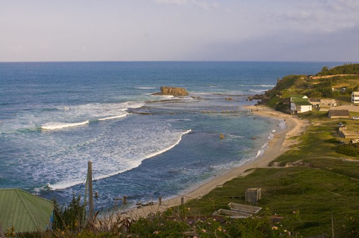
Beach along the coast at Fort Dauphin (Taolagnaro).
Quick Facts & TRAVEL TIPS
- Madagascar is an island country located roughly 300 miles (500 kms) off the southeast coast of Africa in the Indian Ocean, directly east of the mainland country of Mozambique.
- It is the fourth-largest island in the world and lies south of the equator (mostly between 12 and 26 degrees south).
- Madagascar has a tropical climate, with the east coast being a characterized mostly by rainforest climate; the environment becomes progressively drier as one moves to the west, which has semi-arid along the west coast and desert conditions in the southwest.
- The island has a rainy season from November through April and a dry season from May through October. The higher elevations in the central portion of the island can become chilly, while the east and west coasts are temperate all year.
- There are three unofficial languages: Malagasy (the native Austronesian language), French (the island was a French colony), and English. There are 18 Malagasy dialects spoken.
- The national currency is the Malagasy Ariary (MGA), but US Dollars, UK Pounds, and Euros are accepted almost everywhere throughout the country.
- The US Dollar and Euro have consistently favorable exchange rates (4 000+ to 1) versus the Malagasy Ariary.
- Credit and debit cards are NOT widely accepted in Madagascar, but are usually accepted in the main cities, hotels, and larger restaurants. Visa and MasterCard are the most widely accepted cards.
- The country uses 220v electricity and require types C and E plug adapters.
- Madagascar observes East African time, which is GMT+3 and does not observe daylight savings time (DST); it is 7 hours ahead of New York (8 hours during DST).
- The population of the country (as of 2023) is 30.5 million, with over 12 million living in urban areas. The capital city of Antananarivo is the largest metro area, with a population of 3.9 million.
- Madagascar covers and area of 226 658 square miles (587 041 sq kms) with only 135 people per sq mile (52 people per sq km). Roughly 40% of the population is urban.
- The majority of the population (90%+) are of mixed Austronesian and East African origin. There are also populations of Indians, Arabs, and Chinese. Within the Malagasy population there are separate ethnic groups, including Marina ('highlanders'), Betsimisaraka (east-central and northern coast), and Betsileo.
- The majority of the population (85%) are Christians, 3% are Muslims, and 5% observe traditional beliefs. The other 7% are not affiliated with any faith.
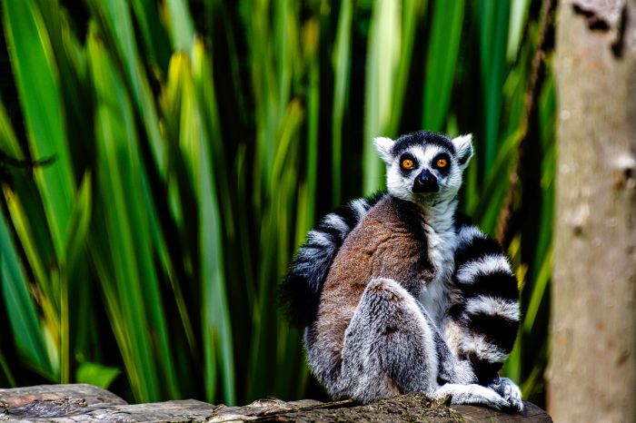
The ring-tailed lemur (Lemur catta) is Madagascar's most iconic mammal.
ENTRY / VISA REQUIREMENTS
- For stays of up to 90 days, a single-entry tourist visa may be obtained prior to traveling or upon arrival, regardless of the visitor's nationality.
- Proof of onward travel / return is required.
- Visas may be purchased at the port of entry using US Dollars, Euros, or Malagasy Ariary, but credit cards are not accepted.
- A passport is required and it must be valid for at least six (6) months beyond the date of entry and also have at least three (3) unused (blank) pages labeled Visa when presented.
- A yellow fever certificate is required only if the applicant has been to a yellow-fever-endemic country within the last six months before entering Madagascar.
- Note: Visa pages referred to above do not include pages reserved for Endorsements, Amendments or Observations.
Note: entry/visa requirements are subject to change without notice, so please check with the official government pages shown below
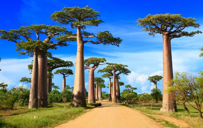
Baobab Alley is one of Madagascar's most-visited sites.
Official Government Pages
Great Good Fair Poor
- Jan
- Feb
- Mar
- Apr
- May
- Jun
- Jul
- Aug
- Sep
- Oct
- Nov
- Dec
Dry Season (May-October)
May through October is the dry season in Madagascar and this period is generally the best time to visit the island.
These months comprise the driest and also the coolest time of the year.
Wildlife viewing is also generally good during the dry season.
The beaches are at their peak during September-October and many of the lemur species give birth during October.
Nights can be downright chilly, especially in the higher altitude regions.
Finally, the number of tourists (as well as rates) is highest during this period.
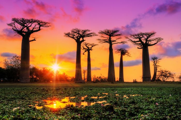
Majestic baobab trees in Madagascar.
May
May is considered a shoulder month between the prior wet season and the onset of the dry season.
Rainfall levels are declining to almost nothing as the dry season begins.
Temperatures average 75°F (24°C) during the day, while nighttime temps fall to around 55°F (13°C).
June-September
June through September are very dry months and temperatures are at their lowest level, reaching a mild 72°F (22°C) during the day and dropping to around 52°F (11°C) overnight. Rainfall is very uncommon.
October
October marks the end of the dry season and temperatures being to rise. Daytime temps average 79°F (26°C) and overnight temps begin to rise a bit, reaching 57°F (14°C). The first rains typically begin to fall during October.
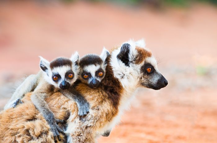
A ring-tailed lemur (Lemur catta) with her two youngsters.
Wet Season (November-April)
November through April is the season for rainfall in Madagascar and one should be sure to pack waterproof outerwear for hiking.
Despite the strong chance for rain during a stay of a week or more, this can also be a very rewarding time to visit.
As with the southern part of the African mainland, migratory birds are present, flying south from Europe, Asia, and Northern Africa to breed during the summer months when rain brings an abundance of food sources.
Also, the warmer temperatures during the rainy season means that reptiles and some mammal species are more active.
The Indian Ocean 'cyclone' season occurs on the eastern coast from January to March.
Some of the parks and reserves are inaccessible during the wet season and those that are open can have slippery, muddy walking trails.
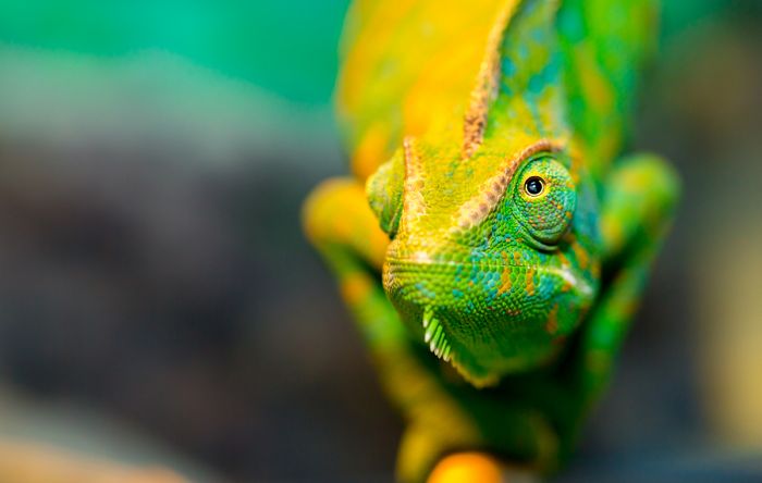
Madagascar is home to around 100 species of chameleon.
November
November marks the start of the rains (although some early rains usually occur during October) and the temperatures are on the rise, reaching a daytime average of 81°F (27°C).
December-February
Rains can occur daily from December through February and the air becomes quite humid. Be sure to pack rain gear for walking. The temperatures are very warm, averaging 79-81°F (26-27°C) and nighttime temps falling to 63-64°F (17-18°C).
March-April
The heavier rains have passed by this time and precipitation decreases steadily, but March can still be very rainy. Temperature begin to decrease during April, with daytime highs around 79°F (26°C) and overnight temps averaging 59°F (15°C).
A tropical beach scene on Nosy Be.
CLIMATE
Madagascar lies mostly within the tropics and has a corresponding tropical climate. The island is elongated, aligned roughly north-to-south, and situated between the latitudes of 12° and 25° South.
A high plateau running north-to-south covers much of the central interior of the island. The eastern edge of the central plateau is a steep escarpment that rises just inland and roughly parallel to the eastern coast, while the western side of the plateau descends on a gentle gradient to the western coast and the Mozambique Channel.
The prevailing Indian Ocean trade winds bring moisture-laden air from the east and when this air collides with the eastern escarpment, it is forced to rise up and over the escarpment, where it consequently drops most of the islands rain on the eastern side of the island. The western side of Madagascar, particularly the southwest, which is a semi-desert, exists in a near-permanent rain shadow.
During Madagascar's summer months (January thru March), a monsoon blows in from the north and brings with it wet air, with rain effects dwindling as one moves southward.
The combined effects of the trade winds from the east and the monsoon from the north, creates a double rainfall gradient, which declines in magnitude both east-to-west and north-to-south. The result is that the northeast is the island's wettest region and the southwest is the driest.