Tanzania
Region Links: Great Migration, Kilimanjaro & Arusha, Ngorongoro & Manyara, Serengeti, Southern Tanzania, Tarangire, Western Tanzania, Zanzibar
Highlights
- One of Africa’s top safari destinations.
- Experience the Great Migration on the Serengeti Plains.
- Climb Mount Kilimanjaro, the highest peak in Africa.
- The Ngorongoro Crater and its abundant wildlife.
- Gombe and Mahale offer exciting chimpanzee treks.
- Visit Selous and Ruaha for a true wilderness safari.
- Enjoy a tropical escape in Zanzibar.
Tanzania is one of the world's greatest wildlife destinations, home to the renowned Serengeti and its Great Migration. Mount Kilimanjaro is Africa's tallest peak and Zanzibar offers a tropical paradise with a rich history.
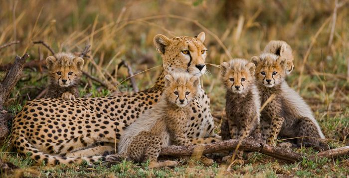
A cheetah and her little cubs in the Serengeti National Park, Tanzania.
The Serengeti National Park is home to Africa's greatest number of large mammals and, along with the contiguous Masai Mara in Kenya, hosts the world's greatest migration of mammals every year. A safari in the Serengeti is something everyone should experience in the lifetime!
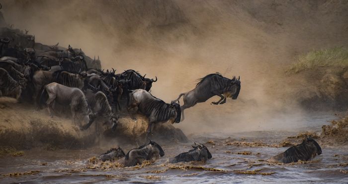
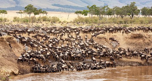
Wildebeests in the Great Migration crossing the Mara River in Tanzania.
The Ngorongoro Crater is the world's largest intact volcanic caldera and is often referred to as the Eighth Wonder of the World. Wildlife densities in the caldera are the highest on the continent, with an estimated 30 000 large mammals, including Africa's Big Five, living in the crater. Ngorongoro safaris are spectacular.
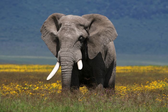
A bull elephant in the Ngorongoro Crater.
Mount Kilimanjaro is Africa's highest peak and multi-day treks to its summit are another of Tanzania's must-do adventures. No technical skills or gear are required to climb "Kili", making it a very popular tourist destination.
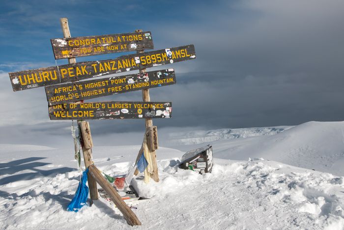
The summit of Mount Kilimanjaro.
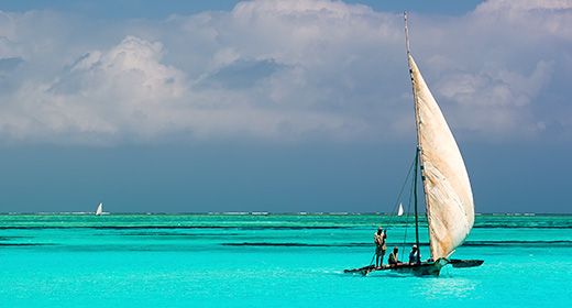
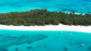
The Zanzibar Islands lie just off Tanzania's east coast in the warm, blue waters of the Indian Ocean. A great add-on to a Tanzania safari, Zanzibar offers a tropical sojourn with history, culture, beaches, snorkeling, diving, boating, and more.
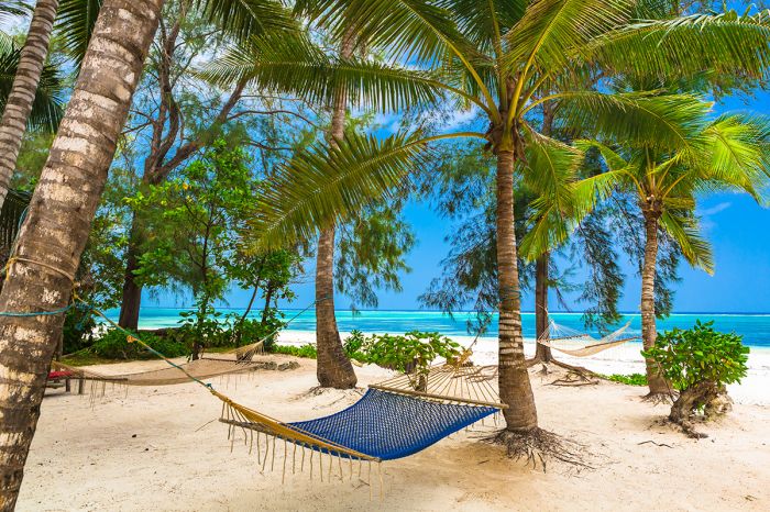
Tropical beauty in Zanzibar.
Tarangire and Lake Manyara are two national parks worth considering as compliments to a Serengeti/Ngorongoro safari. Both offer a diverse experience and are located on the northern Tanzania driving route from Arusha.
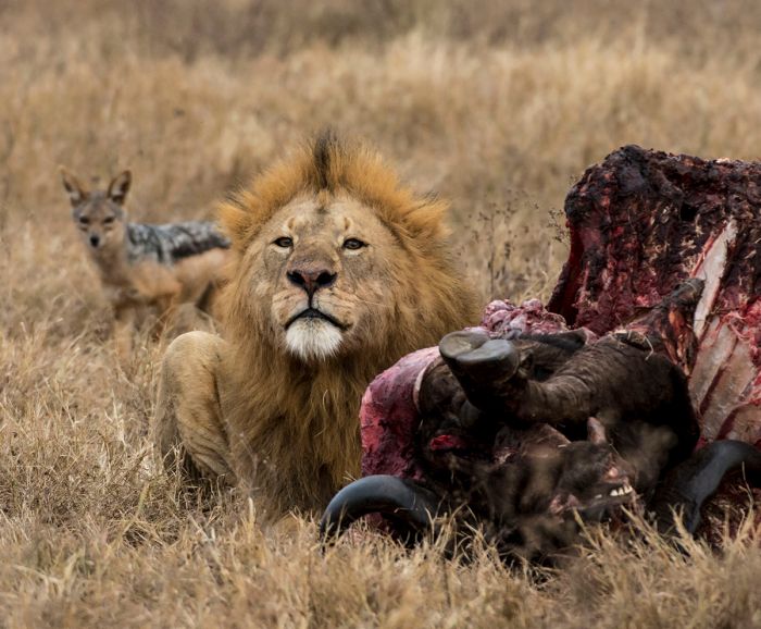
A male lion guards his kill in Tarangire National Park.
Southern Tanzania offers an authentic safari experience as it was 100 years ago. Nyerere National Park and Ruaha National Park are both wilderness destinations with diverse wildlife and very few tourists. Those looking for a 'step-back-in-time' adventure will find this region rewarding.
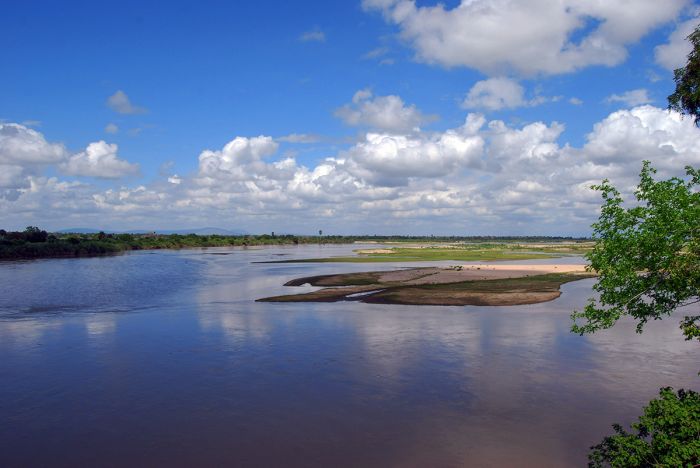
The Rufiji River in the combined Nyerere National Park / Selous Game Reserve.
Western Tanzania is the country's least visited region and is dominated by beautiful Lake Tanganyika, which is part of Africa's Great Rift Valley. Two small national parks, Gombe and Mahale Mountains, offer chimpanzee trekking, while a third, Katavi National Park, is home to diverse wildlife and crowd-free big game safaris.
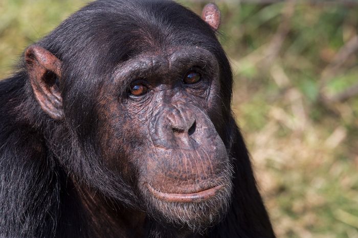
A chimpanzee in Gombe National Park.
Indulge your dreams of Africa and explore the diverse wonders of Tanzania!
TANZANIA REGIONS
Kilimanjaro (incl. Arusha, Mount Meru & Mount Kilimanjaro)
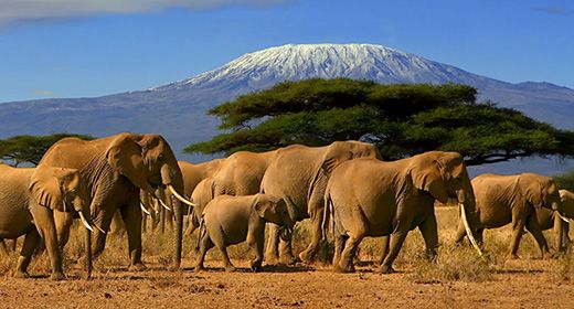
Climbing Mount Kilimanjaro, the continent's tallest peak, is one of Africa's great adventures. Choose one of the numerous multi-day routes to the summit and explore the diverse habitats along the way. No technical skills required! more
Ngorongoro & Manyara (incl. Ngorongoro Crater & Lake Manyara)
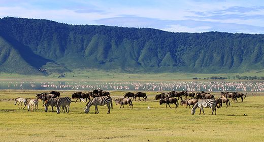
See Africa's Big Five animals in one of the most beautiful wildlife havens on earth. The world's highest density of large mammals living in the world's largest intact volcano caldera in a spectacle that must be seen! More
Serengeti National Park (incl. Grumeti, Ikorongo, Maswa & Loliondo Reserves)
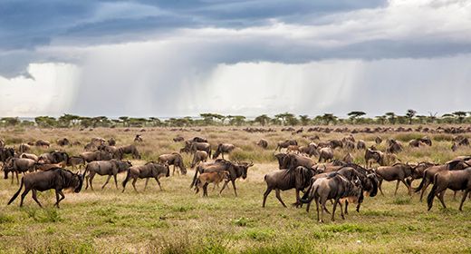
Enjoy an unforgettable safari in Tanzania's oldest and most popular national park. Experience the annual migration of two million mammals as they move across the open plains and see the attendant predators, including lions, cheetahs, leopards. hyenas, crocodiles and more. More
Southern Tanzania (incl. Selous, Ruaha, Saadani, Udzungwa Mountains, Dar Es Salaam)
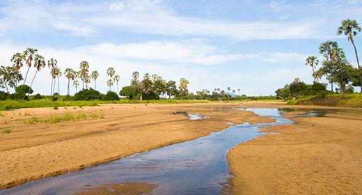
Go on safari in one of the Africa's most remote and untouched regions, where the experience is as it was in the days of old. Selous and Ruaha are home to diverse wildlife and very few tourists. Dar es salaam is Tanzania's largest city. MORE
Tarangire National Park (incl. Tarangire Conservation Area)
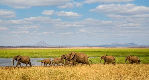
A hidden gem on the northern Tanzania safari route, Tarangire is regarded as the country's best kept safari secret. See the Big Five, experience the mini migration, and view other animals in this unspoiled wildlife haven. More
Western Tanzania (incl. Lake Tanganyika, Mahale, Gombe & Katavi)
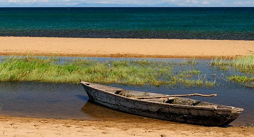
Tanzania's most remote region includes Lake Tanganyika and two national parks, Gombe and Mahale Mountains, both of which offer chimpanzee viewing in pristine settings. Katavi National Park offers superb dry-season safaris with diverse wildlife, including lions, buffalo and more. MORE
Zanzibar Archipelago (incl. Unguja Island, Pemba Island, Stone Town)
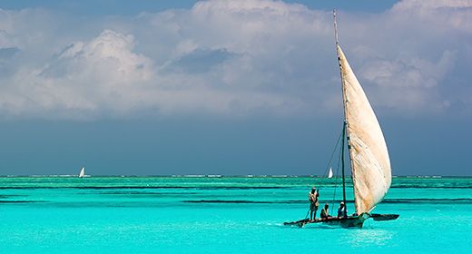
Known as the "Spice Islands," the Zanzibar archipelago offers a tropical adventure with clear blue Indian Ocean water, beaches, diving, boating, snorkeling, and other water sports. Stone Town offers a glimpse back into the slave trade of the 1800s. MORE
Read More...
Main: Flora, Geography, Important Areas, National Parks, Protected Areas, Ramsar Sites, UNESCO Sites, Urban Areas, Wildlife
Detail: Arusha, Dar es Salaam, Gombe, Great Migration, Katavi, Kilimanjaro, Lake Manyara, Lake Tanganyika, Lake Victoria, Mahale, Ngorongoro, Rift Valley, Ruaha, Selous, Serengeti, Tarangire, Zanzibar
Admin: Travel Tips, Entry Requirements/Visas
Geography
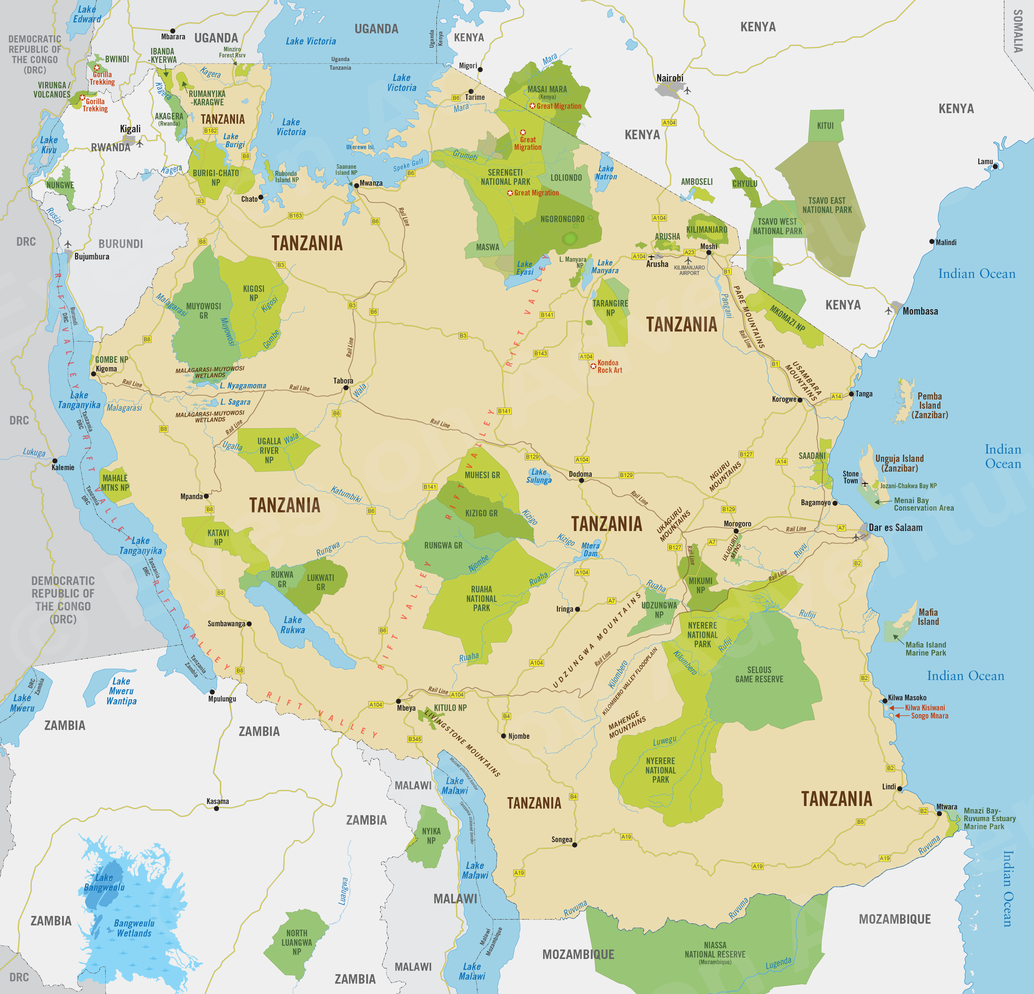
Tanzania is located in what is commonly referred to as East Africa. It shares borders with Kenya, Uganda, Rwanda, Burundi, the Democratic Republic of Congo, Zambia, Malawi, and Mozambique. To the east are the warm waters of the Indian Ocean and the Zanzibar Archipelago, which is a semi-autonomous region of Tanzania with its own government.
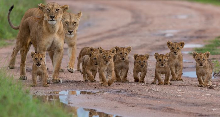
Big cats are found in abundance in Tanzania's Serengeti National Park.
Tanzania comprises mountain ranges, volcanos, lakes, grasslands, notable rivers, and miles of ocean coastline. The country is home to Africa's highest point, the summit of Mount Kilimanjaro, and its lowest point, the floor of Lake Tanganyika.
The Gregory Rift, which is the eastern branch of the East African Rift, cuts through northern Tanzania and on its floor are a number of large saline lakes, including Lake Natron, Lake Eyasi, and Lake Manyara. The rift also encompasses the volcanic Ngorongoro Highlands, which includes the wildlife-rich Ngorongoro Crater, the world's largest intact caldera and one of Tanzania's biggest tourist draws.
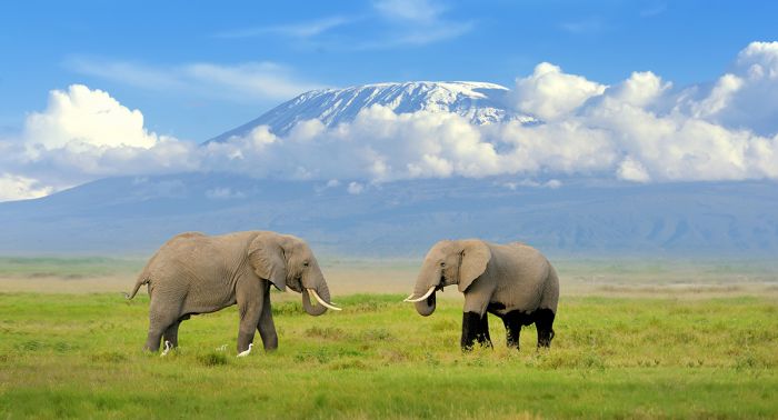
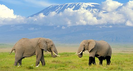
Elephants in Kenya's Amboseli National Park, with Tanzania's Mount Kilimanjaro in the background.
West of Ngorongoro is the Serengeti-Masai Mara ecosystem, which is arguably Africa's greatest wildlife destination. The spectacular Great Migration of a combined two million wildebeests and zebras wander through this ecosystem on their endless trek. The migration is the world's largest procession of mammals and wildlife lovers from around the world come to witness the drama of this natural spectacle. The Serengeti is well known for its big cats, including lions, cheetahs, and leopards.
Southeast of the Serengeti is the renowned Olduvai Gorge, where the planet's earliest hominid fossils were discovered.
The northwest of the country is dominated by the southern half of Lake Victoria, Africa's largest freshwater lake by area, covering 23 146 square miles (59 947 sq kms). The country's western border runs along the Albertine Rift (the western branch of Africa's Great Rift) and through the middle of Lake Tanganyika, the world's second-deepest lake (after Lake Baikal in Siberia). Chimpanzee viewing is offered in two national parks on the shores of Tanganyika, Gombe and Mahale Mountains.
The central and southern portion of Tanzania is comprised of the East African Plateau, which includes grasslands and miombo woodlands. This region of the country is far less visited than the more popular north, but offers superb wildlife viewing in destinations such as the Selous-Nyerere and Ruaha National Park.
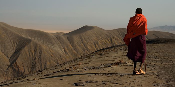
A Maasai man looking over a dramatic Rift Valley landscape in Tanzania.
The eastern border of Tanzania is the Indian Ocean coastline and includes the country's largest city, Dar es Salaam. Just offshore are the Zanzibar Archipelago, which are known for the slave- and spice-trading history operated by the Omani sultans, who once presided over the islands.
Notable rivers in the central and southern portion of the country include the Rufiji, Great Ruaha, and Rovuma, which flow east into the Indian Ocean. Smaller rivers in Western Tanzania flow into Lake Tanganyika, which drains west into the Congo River. Northern Tanzania's watershed drains mostly into Lake Victoria, which empties from Uganda into the Nile River. A small portion of southwest Tanzania drains into Lake Malawi, which drains south into the Zambezi River.
Approximately 35% of Tanzania is conserved as protected areas, with 23 national parks and 7 UNESCO World Heritage Sites. Tourism is a major sector of the economy, contributing almost 20% of the country's GDP.
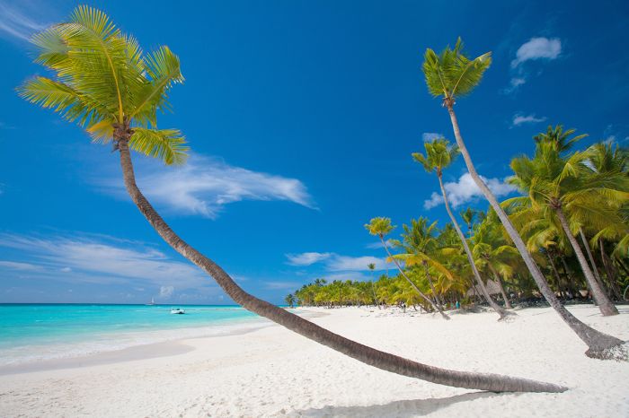
A tropical paradise on a beach in Zanzibar.
Flora
Tanzania has a diverse assortment of habitats, ranging from grassland savanna, wooded grassland, Acacia bushland, Miombo woodland, coastal forest, Afro-montane forest, floodplain grassland, low rainforest, swamp forest, mangrove, lakes, rivers, semi-desert, and off-shore coral reefs.
Grasslands
Savanna grassland interspersed with Acacia trees and scrub is a common sight for anyone that visits the Serengeti National Park in northern Tanzania. These northern grasslands, much of which grow atop rich, volcanic soils, extend north into Kenya's Masai Mara Game Reserve and are home to East Africa's largest concentration of wildlife.
It is here in the 'Serengeti-Mara' that millions of herbivores graze on the nutrient-rich grasses covering this extensive region and where the Great Migration occurs. The combination of volcanic soil and healthy seasonal rains, which fall between November and April, creates a haven for a great abundance of grazers and browsers, as well as the predators which depend on them for survival.
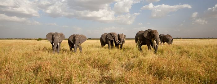
Elephants on the rich grasslands of the Serengeti National Park.
Southern Acacia–Commiphora Bushlands and Thickets
The central, western, and northern Serengeti are part of the 'Southern Acacia–Commiphora Bushlands and Thickets' ecoregion or biome that is dominant across a large swath of northern and central Tanzania. This biome extends from the Serengeti south and southeast through the eastern Ngorongoro Conservation Area, into the eastern portion of Ruaha National Park, and east along the Kenyan border to the Pare Mountains and Western Usambara Mountains.
The dominant vegetation types in this biome are open grassland savanna and open-canopy woodland, with species of Commiphora, Acacia, and Crotalaria being the most dominant. Protected Tanzanian areas in the 'Southern Acacia–Commiphora bushlands and thickets' include the northern half of Serengeti National Park, a portion of the Ngorongoro Conservation Area, Tarangire National Park, and the eastern portion of Ruaha National Park and the reserves bordering it to the north.
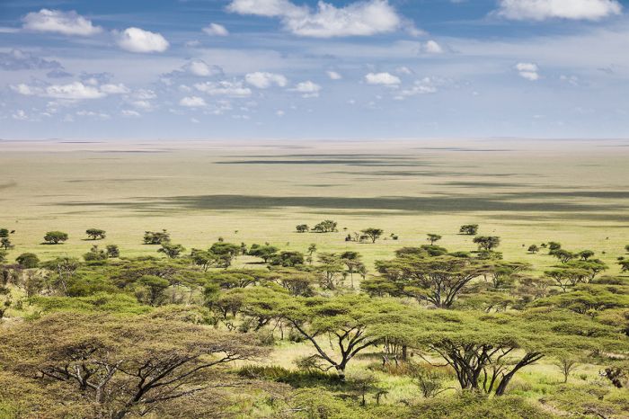
A classic example of Acacia grassland in Tanzania's Serengeti.
Serengeti Volcanic Grasslands
The southern and eastern Serengeti and northwest Ngorongoro Conservation Area is part of the 'Serengeti Volcanic Grasslands' biome. These grasslands are distinctively rich in nutrients, as they grow upon soils derived from volcanic ash.
A second section of this ecoregion is situated south and east of the Ngorongoro Highlands. The landscape in this biome characterized by open grassland, with low shrubs, open woodland, and some wetland. The mostly flat or slightly undulating plains are interrupted by the occasional rocky outcrops (locally called a 'kopje'),
Over 85% of the 'Serengeti Volcanic Grasslands' ecoregion is officially protected, including the southern and eastern portions of Serengeti National Park (and its bordering reserves), most of Lake Manyara National Park, and northwest Ngorongoro Conservation Area.
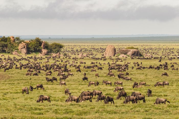
The Great Migration of wildebeest (and some zebra) in the Serengeti National Park. The rocky outcrops (called 'kopjes') are a distinctive feature in parts of the Serengeti.
Victoria Basin Forest–Savanna Mosaic
The Victoria Basin Forest–Savanna Mosaic lies mostly in Uganda, surrounding a large area on the northern and western sides of Lake Victoria. A small portion of this ecoregion extends east into western Kenya along the northern side of Lake Victoria and into extreme northwest Tanzania on the western side of Lake Victoria.
The predominant vegetation in this biome is a mixture of grassland savanna, moist Combretum woodland, Lake Victoria transitional rainforest, dry Combretum wooded grassland, evergreen bush-thickets, seasonal floodplains, swamp forest, and papyrus swamp and other wetland occurring in some of the river-fed lakes.
Human activity around Lake Victoria dating back centuries has transformed much of the original rainforest into various types of savanna or agriculture and plantations. The remaining transitional rainforest (meaning they contain vegetation of both lowland and higher-elevation Afromontane forest) is only found in small areas along the eastern and western side of Lake Victoria. The swamp forests are found along the lower Kagera River in both Uganda and northwest Tanzania.
Around 15% of the entire biome is protected, including Queen Elizabeth National Park (Uganda), Murchison Falls National Park (Uganda), Lake Mburo National Park (Uganda), Mabira Forest (Uganda), Akagera National Park (Rwanda), and Kakamega Forest Reserve (Kenya). The Tanzanian portion receives some protection as the Minziro Forest Reserve, located along the Kagera River.
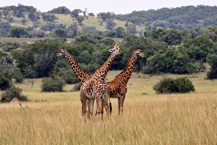
Giraffes in the forest-savanna biome which exists around Lake Victoria in northwest Tanzania.
Zambezian Flooded Grasslands
One of the richest ecoregion types in terms of wildlife is the 'Zambezian Flooded Grasslands'. These grasslands are located on seasonally or permanently flooded lowlands in the basins of the Zambezi and other significant rivers in parts of eastern and southern Africa.
Flora in this ecoregion includes low lying grassland bordering rivers, which spill over seasonally and inundate the plains. The silt that is left after the plains dry again builds up over the years and creates extremely fertile soils that support nutrient-rich grasses. These grasses attract large numbers of grazing mammals, including buffalo, elephant, zebra, hippo, puku, lechwe, and others. The rich grasslands and the associated wetlands also attract large numbers of birds, especially waterbirds.
Some of the larger examples of this rich biome are the Okavango Delta (Botswana), the Busanga Floodplains (Zambia), the Kafue Flats (Zambia), and the Bangweulu Wetlands (Zambia). Tanzania's most significant examples of this ecoregion are the Malagarasi-Muyowosi Wetlands and Ugalla River Floodplain in the northwest and the Kilombero Valley Floodplain in the southeast.
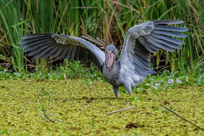
The shoebill stork (Balaeniceps rex) can be seen in Tanzania's Malagarasi-Muyowosi Wetlands.
Southern Rift Montane Forest–Grassland Mosaic
The 'Southern Rift Montane Forest-Grassland Mosaic' ecoregion occurs primarily in higher-elevation areas around the northern portion of Lake Malawi in southern Tanzania and northern Malawi. There are small patches extending into northern Mozambique and eastern Zambia.
The predominant plant communities are montane grassland, scrubland, and evergreen forest.
The most significant example of this biome is the Nyika Plateau in Malawi's Nyika National Park. In Tanzania, this ecoregion is found in Kitulo National Park, which protects a portion of the Livingstone Mountains just north of Lake Malawi and the Ufipa Plateau, located west of Lake Rukwa and the Mbizi Mountains.
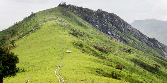
The higher-elevation areas around northern Lake Malawi, including Tanzania's Liviingstone Mountains, are covered in a forest and grassland mosaic.
Woodlands
After grasslands, the second-largest portion of Tanzania is covered in various types of woodland. Woodlands are differentiated from forests in that a woodland is comprised of trees that are spaced out enough that they do not create an interlocked canopy, while a forest has a closed canopy.
Most of central and western Tanzania is covered in Miombo woodland, which is characterized by infertile soils and is dominated by trees from the Brachystegia and Julbernardia genuses, but often include other trees, including various Acacia species and baobab trees.
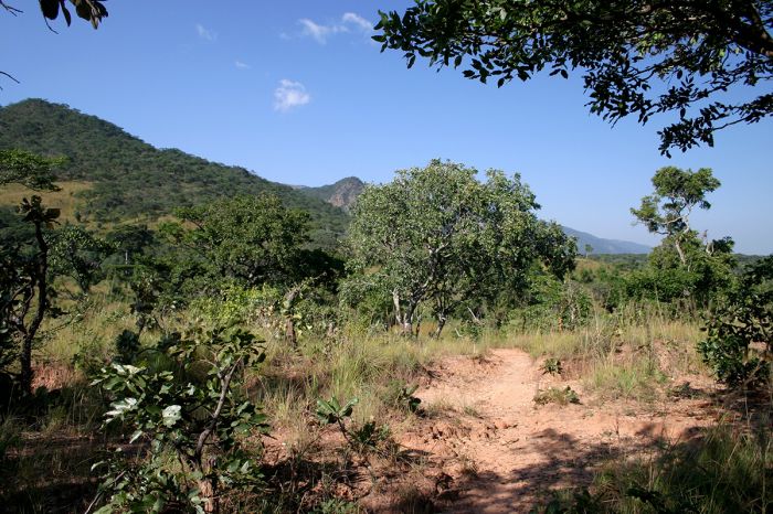
Miombo woodland covers much of western and southeastern Tanzania (photo: Wikimedia Commons)
Central Zambezian Miombo Woodlands
The western side of Tanzania is dominated by the 'Central Zambezian Miombo Woodlands' biome. This biome extends into southeastern Democratic Republic of the Congo (DRC), southern Burundi, a large portion of northern and central Zambia, and much of Malawi. In Tanzania this ecoregion covers the landscape from Lake Victoria southwest to Lake Tanganyika, and south to Lake Malawi.
Central Zambezian Miombo Woodland is characterized by mostly flat landscapes, with poor soils. The vegetation is characterized by Miombo woodland (which refers to trees mostly from the Brachystegia, Julbernardia, and Isoberlinia spp.). The trees grow tall and there is low shrub, grassland, and herbaceous plants below. The biome supports a variety of wildlife and birds.
Protected Tanzanian areas in the 'Central Zambezian Miombo Woodlands' include the southern portion of Burigi-Chato National Park, the north/east/west portions of Kigosi National Park/Muyowosi Game Reserve, all of Katavi National Park and Rukwa/Lukwati Game Reserves, and the western portion of Ruaha National Park and the reserves bordering it to the north.
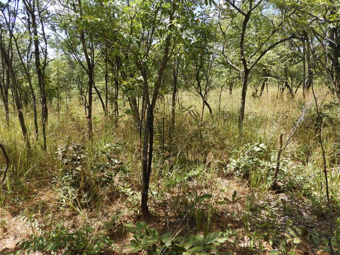
Open woodlands cover a large proportion of Tanzania's uncultivated land.
Eastern Miombo Woodlands
Southern and east-central Tanzania is part of the 'Eastern Miombo Woodlands' biome. This ecoregion extends south from Tanzania into northern Mozambique and southeastern Malawi. The dominant trees are "Miombo" (Brachystegia, Julbernardia, and Isoberlinia spp.) and Baikiaea.
In Tanzania, the biome extends from the border with Mozambique in the south, north through all of the Selous-Nyerere protected areas, the lowlands surrounding most of the Eastern Arc Mountains (including the isolated Udzungwa, Mahenge, Ukaguru, Nguru, and Muluguru ranges), and further north to the western side of Saadani National Park. This biome supports a large variety of wildlife, including grazers, browsers, and predators.
Protected Tanzanian areas in the 'Eastern Miombo Woodlands' ecoregion include all but the eastern portion of Selous Game Reserve/Nyerere National Park, all but a small northern section of Mikumi National Park, and the low-lying areas of Udzungwa Mountains National Park.
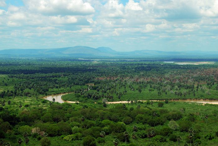
Eastern Miombo woodland, including plenty of lofty palm trees, surrounding the Rufiji River in the Selous-Nyerere ecosystem in southeast Tanzania.
Forests
True forests cover only about one percent of Tanzania and most are associated with mountains. Tanzania's forests are the most ecologically diverse of any of its biomes.
The lowland forests in the far west are historically associated with the Congo rainforests and are protected in three locations: Mahale Mountains National Park, Gombe National Park, and Rubondo Island National Park. Mahale and Gombe also have sections of highland forest.
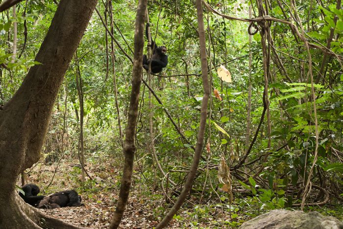
Small areas of lowland forest still remain in far Western Tanzania along the Lake Tanganyika shores. Shown are wild chimpanzees in the forest at Gombe National Park.
Northern Zanzibar-Inhambane Coast Forest Mosaic
Most of Tanzania's eastern coast along the Indian Ocean and inland is part of the 'Northern Zanzibar-Inhambane Coast Forest Mosaic' ecoregion (also known as the "Northern Swahili coastal forests and woodlands"). The natural areas that remain along the coast are a mix of lowland tropical broadleaf rainforest, scrub forest, mangroves, swamps, and savanna.
This coastal biome extends along the Indian Ocean coast from southern Somalia, through all of Kenya, to the Lukuledi River, which empties into the Indian Ocean at the coastal town of Lindi in southern Tanzania. It also encompasses the Zanzibar Islands. Moving west from the coast, this ecoregion transitions into drier open scrublands and woodlands. Protected Tanzanian areas in this biome include Saadani National Park, the eastern portion of the Selous Game Reserve-Nyerere National Park, and Jozani-Chwaka Bay National Park.
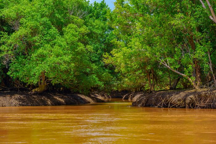
Riparian forest along the Wami River in Saadani National Park near the Indian Ocean coast.
Southern Zanzibar-Inhambane Coast Forest Mosaic
The far southern coastal area of Tanzania falls into the 'Southern Zanzibar-Inhambane Coast Forest Mosaic' ecoregion (also known as the "Southern Swahili coastal forests and woodlands"). This biome extends south through almost all of Mozambique, ending just north of the Zambezi River mouth.
The biome consists of coastal lowland rainforest, wetlands, mangroves, flat savanna grassland, isolated plateaus and inselbergs, and rolling hills. The landscape transitions to drier open Miombo woodlands on its western extent.
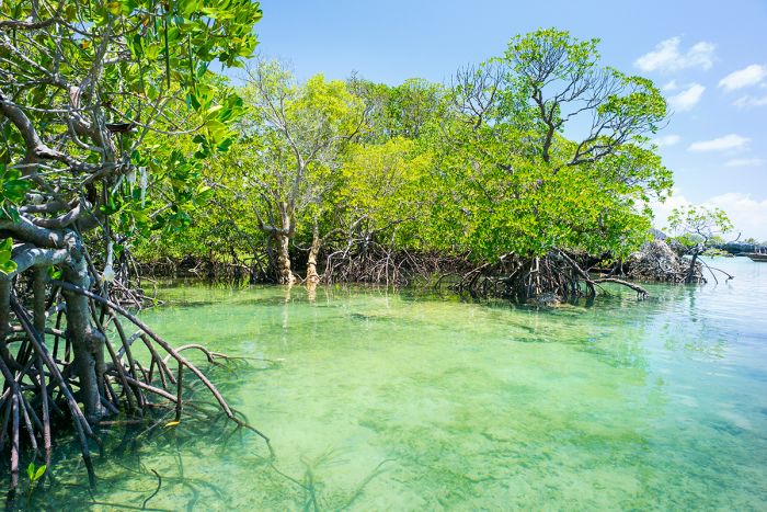
Coastal mangrove in Tanzania.
East African Montane Forests
East African Montane Forests occur in disparate highlands as far north as Mount Kinyeti in the Imatong Mountains of Southern Sudan, and include mountains in eastern Uganda. In Kenya and Tanzania, this biome follows the mountainous highlands on either side of the Gregory Rift, which city through western Kenya and enters Tanzania just east of the Serengeti.
The Tanzanian locales of this biome include the Ngorongoro Highlands, Mount Kilimanjaro, and Mount Meru. Further south are two isolated locations on Mount Marang (situated west of Katavi National Park) and the Mbulu Highlands (between Lake Eyasi and Lake Manyara).
Flora in this ecoregion includes montane forest and grassland savannas that occur from 4 900-6 600 feet (1 500-2 000 meters) in elevation. Common trees include Podocarpus and Afrocarpus spp. Other trees include Prunus africana, Hagenia abyssinica, Juniperus procera, and Olea spp. These forests transition to montane moorlands, scrublands, and alpine grasslands on the high peaks.
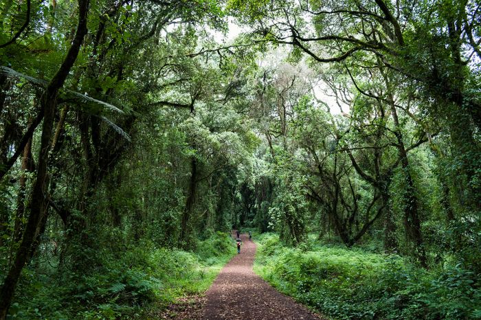
Hikers passing through lower-elevation montane forest on Mount Kilimanjaro's Machame Trail.
Eastern Arc Forests
The Eastern Arc are a chain of mountains that run roughly north to south in a broad arc, starting in southeast Kenya (the Taita Hills) and extending south into northeast Tanzania (at the Pare and Usambara Mountains) and southwest to the Udzungwa Mountains. The range consists of various blocks of highlands that are isolated from each other by lowland areas.
The main vegetation is classic montane forest with bamboo forest on the lower slopes and high-elevation grasslands, heathland, and moorland on the upper elevations. At low elevations, the montane forests are mainly surrounded by Miombo woodland and substantial agriculture, which is an increasing threat to the forests.
These Eastern Arc forests are rich in wildlife and are home to substantial numbers of endemic birds, reptiles, amphibians, and even some mammals. The largest protected area in this biome is Udzungwa Mountains National Park.
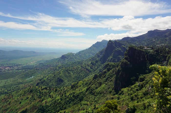
View from the lower slopes of the Usambara Mountains near Lushoto, Tanzania. These and other mountains in the Eastern Arc range hold disparate fmontane forests.
Albertine Rift Montane Forests
The name 'Albertine Rift' applies to the western branch of the East Africa Rift. This western branch cuts down the western side of Lake Victoria along the eastern border of The Democratic Republic of the Congo and includes various Rift Valley Lakes, including Lakes Albert, Edward, Kivu, Tanganyika, and Rukwa.
The formation of the rift not only created basins which became the lakes discussed above, but also mountains and escarpments on either side of the valley.
The mountains created along this western branch of the rift are also named 'Albertine'. From north-to-south, the Albertine Mountains consist of the Lendu Plateau (northwest of Lake Albert in the DRC), the Rwenzori Mountains (on the border between Uganda and the DRC), the Virunga Mountains (on the borders between Uganda, Rwanda, and the DRC), and the Itombwe Mountains (on the northwest side of Lake Tanganyika in the DRC).
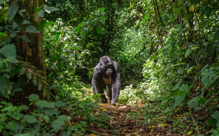
Montane forests along the Albertine Rift are home to the critically endangered mountain gorilla.
Isolated mountain blocks further south include Mount Bururi (in southern Burundi), the Mahale Mountains (on the eastern side of Lake Tanganyika in western Tanzania), and the Marungu Mountains (on the western side of Lake Tanganyika in the DRC).
Note: In 1864, the British explorers Samuel Baker and Flóra von Sass encountered a large lake and renamed it 'Lake Albert' after the recently deceased (in 1861) Prince Albert, who was the consort of the British monarch, Queen Victoria. The Albertine Rift and Mountains are also named for Prince Albert.
The montane forests associated with the highlands discussed above are home to a rich and diverse variety of Afromontane flora and fauna. The last surviving populations of wild mountain gorilla are found in these forests. The forests also provide refuge for chimpanzees and other endangered primates, including L'Hoest's monkey (Allochrocebus lhoesti).
In Tanzania, these forests are only found in small patches along Lake Tanganyika at Gombe National Park and Mahale Mountains National Park.
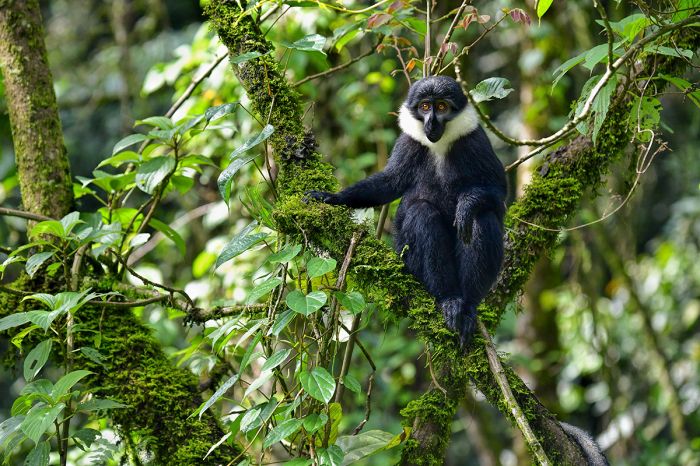
The endangered L'Hoest's monkey (Allochrocebus lhoesti) is found in Albertine Rift montane forests.
Wildlife
Tanzania offers a wide selection of wildlife destinations. Below are some of the best places to see wildlife in Tanzania and a brief description of what animals are likely to be seen on a safari. Full details on all of Tanzania's wildlife destinations can be found further down on this page.
Serengeti Wildlife
Tanzania (along with Kenya) is the top wildlife destination in East Africa and the Serengeti-Masai Mara ecosystem is undoubtedly the premier venue for seeing a diversity and incredible abundance of large mammals in all of Africa. The Serengeti-Mara ecosystem straddles both Kenya and Tanzania and is the location of the renowned Great Migration.
The Great Migration involves over two million blue wildebeests and plains zebras that engage in a never-ending trek in search of fresh grazing. The massive herds that traverse the grasslands of both the Serengeti (in Tanzania) and Masai Mara (in Kenya) attract thousands of wildlife enthusiasts, who come for a safari to bear witness to this spectacle of the natural world. Tanzania's Serengeti hosts the migration for around nine months of the year (from November through July) and they are in Kenya's Masai Mara for roughly three months (August through October).
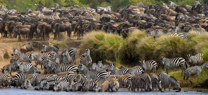
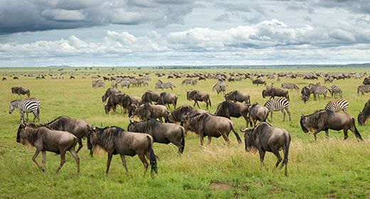
The 'Great Migration' of zebra and wildebeest in Tanzania's Serengeti National Park.
The Serengeti also boasts large numbers of non-migratory resident animals, including both herbivores and predators. Big cats, including lion, cheetah, and leopard are found in good numbers and you have an excellent chance of seeing all three on any given day, although leopard can sometimes be elusive.
The Serengeti is one of, if not the very best place in the world, to see cheetah in their natural habitat. Spotted hyena are found in large numbers in the Serengeti and smaller predators like serval, and jackal are also likely to be seen.
Plains game is abundant in the Serengeti and includes all of East Africa's iconic species, including elephant, giraffe, zebra, topi, wildebeest, Thomson's gazelle, hippo, crocodile, warthog, and many more.
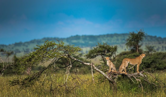
A cheetah and her cubs in the Serengeti National Park.
Ngorongoro Crater Wildlife
Sometimes called the 'Eighth Wonder of the World', the Ngorongoro Crater is one of several calderas in the Ngorongoro Highlands, which lie east of the Serengeti. The crater was formed by the eruption of a massive volcano around 2.5 million years ago.
Today, the crater is a verdant haven for wildlife, with some 30 000 large mammals living in the 108-square mile caldera. No accommodations are allowed in the crater, so most of the safari lodges are situated atop the crater rim, which is 2 000 feet (610 meters) above the crater floor, while others are just a short distance away from the crater.
Wildlife in the crater includes all of Africa's Big Five animals (lion, leopard, elephant, buffalo, and rhino) and four of these species are a near-guarantee during a day-long safari (leopard is the only one that may not be seen). Spotted hyena are the most common predator in the crater, but the lion population is healthy. The other commonly seen predator in the crater is black-backed jackal.
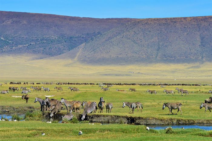
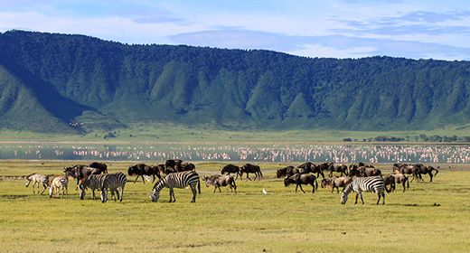
Abundant wildlife in the Ngorongoro Crater, Tanzania.
The crater floor is predominantly savanna grassland, which is ideal for grazing herbivores, which are here in high densities. Commonly seen plains species include blue wildebeest, plains zebra, buffalo, Grant's gazelle, Thomson's gazelle, Coke's hartebeest, topi, mountain reedbuck, and warthog. Elephants, including some impressively large bulls, are always around and seen with relative ease. Giraffe and impala are not found in the crater.
Birding in the Ngorongoro Crater is excellent, with a variety of species, including waterbirds and plains species. Flamingos are sometimes seen on Lake Magadi on the floor of the crater. Over 280 species have been recorded in the crater.
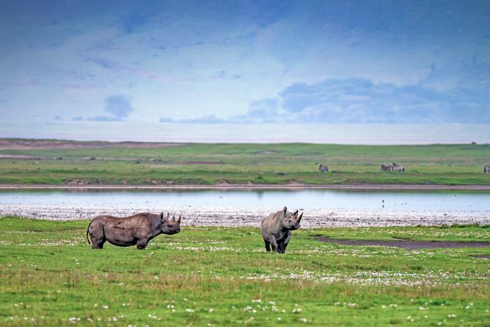
Black rhinos in the Ngorongoro Crater.
Lake Manyara Wildlife
Located in Tanzania's northern circuit of safari areas, Lake Manyara National Park is a small but worthwhile stopover for safaris leaving from Arusha and driving to Ngoronogo and/or the Serengeti.
More than half of the park is covered by the shallow, alkaline lake for which it is named, with the land portion of the park located on the lake's western side. The park has a diverse array of habitats, including evergreen groundwater forest, Acacia woodland, extensive marshland, and saline mud flats that vary in size depending on the lake's water level.
Wildlife at Lake Manyara includes good numbers of elephant, buffalo, giraffe, hippo, zebra, impala, blue wildebeest, warthog, klipspringer, and bushbuck. Primates, including olive baboon, blue monkey, and vervet monkey, are commonly seen in the forested sections of the park.
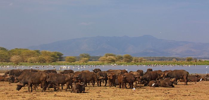
A herd of buffalo at Lake Manyara, with white pelicans and yellow-billed storks in the water.
Manyara is one of the few places in Africa where the resident lions have adopted a 'tree-climbing' behavior. In most places, lions do not spend time in trees, as they are not especially comfortable off the ground due to their large size (unlike leopards, which are commonly seen in trees almost anywhere they are found). The lions in Manyara are thought to spend time in the trees to escape biting insects and to help moderate their body temperatures. Leopards are also sometimes seen on a safari in Manyara.
Birding at Lake Manyara is excellent, with over 380 species recorded. Flamingos are seasonally seen on Lake Manyara during times of adequate water and algae growth.
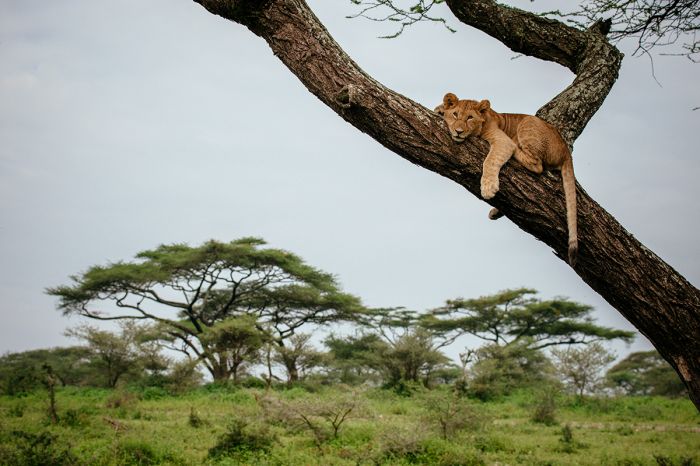
A young lion rests in a tree in Lake Manyara National Park.
Tarangire National Park Wildlife
Located on Tanzania's northern safari circuit, Tarangire National Park is too often skipped on safari itineraries that depart from Arusha and drive to the Ngorongoro Crater and Serengeti National Park. Tarangire is certainly worth including for a few days, as it offers the second-highest concentration of wildlife in the country (after the Serengeti).
Tarangire even has its own migration, with animals arriving from outside the park's boundaries at the onset of the dry season, usually around late July. The migration consists of some 25 000 blue wildebeest and 30 000 zebras (far smaller than the Serengeti's Great Migration) that converge on the park's permanent water source, the Tarangire River. Around 2 500 elephants also arrive in Tarangire at this time, some having traveled from as far away as Amboseli National Park in Kenya!
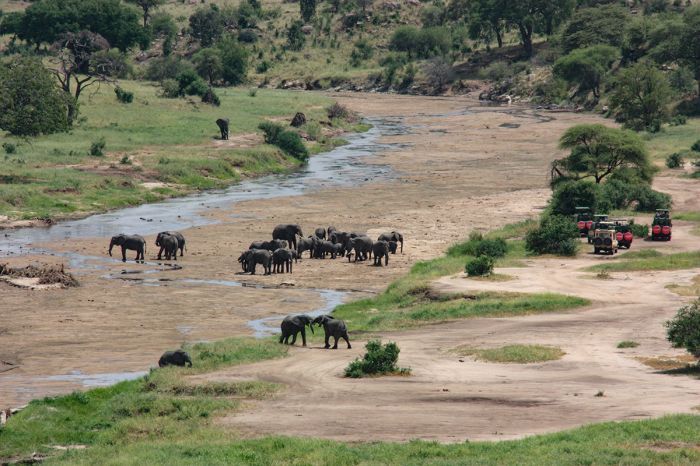
Elephants drinking in the semi-dry Tarangire riverbed in Tarangire National Park.
The majority of Tarangire's wildlife are full-time residents, with the most commonly seen species being lion, leopard, black-backed jackal, buffalo, zebra, giraffe, eland, Coke's hartebeest, impala, Thomson's gazelle, bushbuck, waterbuck, blue wildebeest, warthog, and elephant. Cheetah and spotted hyena are uncommon, as are gerenuk, striped hyena, and lesser kudu. Olive baboon and vervet monkey are common in the riparian forests.
Birding in Tarangire is very good, with over 500 species recorded. The marsh areas are excellent for waterbirds as is anywhere along the Tarangire River. Just west of the park boundary is Lake Burunge, which attracts large numbers of waterbirds throughout the year and hosts large flocks of flamingo during the dry season.
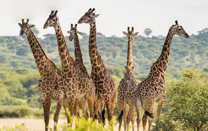
Masai giraffes in Tarangire National Park, Tanzania.
Selous-Nyerere Wildlife
Located in Tanzania's southern safari circuit, the combined protected area of the Selous Game Reserve and Nyerere National Park is the largest in Africa and one of the largest in the world.
Until 2019, Selous was a single game reserve and much of it was used for trophy hunting, but the majority of the area is now protected as Nyerere National Park. The combined protected area is still commonly referred to as "the Selous". The safari camps are mostly situated along the Rufiji River, which traverses the northern section of the park and provides the best game viewing.
The combined park and reserve are one of Africa's greatest remaining wilderness areas and home to around 700 000 large mammals, with substantial populations of buffalo and elephant. Large numbers of crocodile and hippo are found in the Rufigi River and the area is home to Africa's largest remaining populations of the endangered African wild dog.
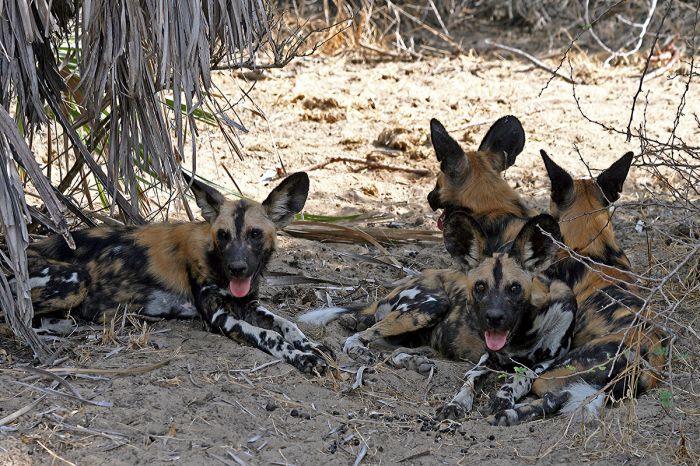
Selous-Nyerere is home to the largest population of African wild dog on the continent.
Lion and leopard are common in the Selous and usually not difficult to see, as are spotted hyena, Masai giraffe, zebra, and impala. Other plains game seen regularly in the park/reserve includes puku, waterbuck, blue wildebeest, Lichtenstein's hartebeest, Roosevelt's sable, and reedbuck. Cheetah are also found in the Selous, but seen less frequently.
Primates found in the Selous include yellow baboon, vervet monkey, black-and-white colobus, blue monkey, and red colobus. Bird life is abundant, especially along the Rufiji River and throughout the park/reserve during the wet season between November and April. Over 400 species of birds have been recorded in the Selous.
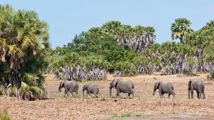
Classic scenery in the Selous, with elephants and palm trees.
Gombe & Mahale Wildlife
Located in the very remote far western extent of Tanzania, along the eastern shore of Lake Tanganyika, are two small national parks that are seldom visited: Gombe and Mahale Mountains. These two parks are best known for providing refuge for some of Africa's last wild populations of chimpanzee.
Gombe National Park became well-known in the 1960s, when Dr. Jane Goodall published articles on her groundbreaking work with the chimpanzees living in Gombe's forests. The park is remote and pristine and there are no roads, so walking in the forests to see the chimps and other primates living there is the main activity. The Gombe Stream Research Center (GSRC) coordinates the ongoing research on the park's chimps and offers treks to visit the wild, but semi-habituated apes.
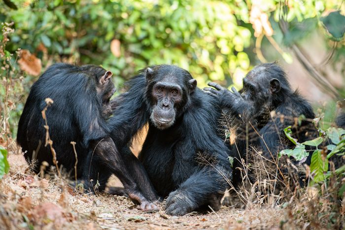
Chimpanzees in Gombe National Park.
Other primates that are likely to be seen in Gombe include blue monkey, olive baboon, vervet monkey, and red-tailed monkey. A number of small forest-dwelling antelopes are also found in Gombe. Birding in the forests is rewarding, with over 250 species possible.
Mahale Mountains National Park is located about 85 miles (135 kms) south of Gombe and also on the Lake Tanganyika shore. The park is named for the small range of mountains which occupy a peninsula jutting out into the lake. Like Gombe, Mahale's main focus for tourism and protection are its population of chimpanzees. Mahale is home to around 700 wild chimps, which is the largest single population of these apes in the world. Chimpanzee treks are the main focus in Mahale.
Other primates in Mahale include an endemic race of black-and-white colobus, as well as yellow baboon, vervet monkey, blue monkey, red colobus, and red-tailed monkey. Mahale is very productive for birding, with over 250 species recorded.
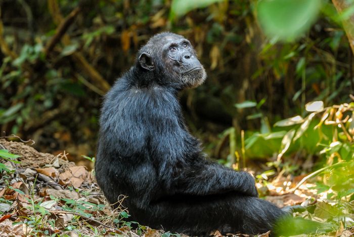
Mahale Mountains National Park has the largest population of wild chimpanzees in the world.
Protected Areas
Tanzania defines its protected land as either Fully Protected Areas or Lesser Protected Areas.
Tanzania's Fully Protected Areas comprise 17% of its land surface and include: national parks (eco-tourism/no hunting), game reserves (trophy hunting allowed), forest reserves (selective logging is allowed), and the Ngorongoro Conservation Area (national park status, except cattle grazing by the Maasai people is allowed).
Tanzania's Lesser Protected Areas comprise 18% of its land surface and include: game controlled areas (sometimes also called wildlife management areas) and "open areas". The Lesser Protected Areas allow extraction of resources under license only.
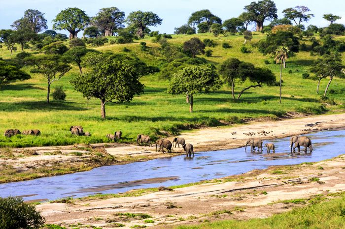
Elephants crossing the Tarangire River in Tarangire National Park, Tanzania.
New Tanzanian national parks in 2019
According to Tanzania's Ministry of Natural Resources and Tourism, more than 1.2 million tourists visited Tanzania in 2017, contributing around $2 billion US dollars to the economy and generating 17.5% of the country's gross domestic product. Most of these tourists only visited destinations in the popular northern circuit (primarily Serengeti, Kilimanjaro, and Ngorongoro).
In order to expand tourism into the less-visited southern and western regions of the country, both of which are seldom included on eco-tourism itineraries, the Tanzanian government decided in 2018 to upgrade numerous game reserves (most of which allowed hunting) in those neglected areas to fully-protected national parks, with plans to add infrastructure and market the new parks to tourists. The transformation of the reserves to national parks was made official in 2019.
Following are the Tanzanian reserves which became national parks in 2019:
- Biharamulo, Burigi, and Kibisi Game Reserves: three reserves were combined to create the Burigi-Chato National Park (located in far northwest Tanzania);
- Ibanda Game Reserve: converted into the Ibanda-Kyerwa National Park (located in far northwest Tanzania);
- Kigosi Game Reserve: converted into the Kigosi National Park (located in northwest Tanzania);
- Rumanyika Game Reserve: converted into the Rumanyika-Karagwe National Park (located in far northwest Tanzania);
- Selous Game Reserve - more than 50% of the reserve was converted into the Nyerere National Park (located in southeast Tanzania);
- Ugalla River Game Reserve: converted into the Ugalla River National Park (located in western Tanzania).
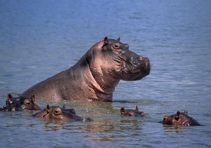
Hippos in the Rufigi River, in the combined Nyerere National Park / Selous Game Reserve.
National Parks
Following are Tanzania's 23 national parks. By far, the most visited Tanzania parks are located in the northern part of the country, close to or on the border with Kenya. The parks in the west, central and east are considered remote, but offer exceptional experiences with few to no tourists. Additional information on each park is included further below this list:
- Arusha National Park - Located close to Mount Kilimanjaro and just north of the town of Arusha. The park (and an adjoining forest reserve) protects volcanic peaks, craters, forest, lakes, and a good variety of wildlife. Mount Meru, the country's second-highest peak, is the main attraction.
- Burigi-Chato National Park - Located in the far northwest corner of Tanzania, bordering Rwanda in the west and Lake Victoria in the east. Good variety of wildlife, but not much infrastructure yet. Self-camping.
- Gombe National Park - One of Tanzania's smallest national parks, located in the far west of the country along the remote Lake Tanganyika shore. Gombe was made famous in the 1960s by Dr. Jane Goodall, whose long-term study of chimpanzees revealed new insights into chimps and their culture. Seldom visited park, but an outstanding experience for those choosing to make the journey.
- Ibanda-Kyerwa National Park - Small park in the remote northwest corner of Tanzania, bordering both Uganda and Rwanda. A northern extension of Rwanda'a Akagera National Park. Park infrastructure not yet developed, so just self-camping for now.
- Jozani-Chakwa Bay National Park (Zanzibar) - Located on Unguja Island, this is Zanzibar's only national park, protecting indigenous forest, mangrove, and part of Chakwa Bay offshore. Various primates, small mammals, birds, and butterflies. Good hiking. Day visits only.
- Katavi National Park - Remote and seldom visited park in western Tanzania. Seasonally superb wildlife viewing that peaks during the latter part of the dry season, when large numbers of herbivores can be found on the drying floodplains. Lions are present in good numbers. Katavi is never crowded and offers an authentic wilderness experience.
- Kigosi National Park - Located in very remote northwest Tanzania and infrequently visited. Along with the Muyowosi Game Reserve, protects a portion of the Malagarasi-Muyowosi Wetlands. Plenty of wildlife, but suffers from human encroachment / cattle grazing.
- Kilimanjaro National Park - Protects Mount Kilimanjaro, Africa's tallest peak at 19 354 feet (5 899 meters), as well as the extensive Kilimanjaro Forest Reserve on the lower elevation slopes. Round-trip treks to the summit of 'Kili' take 5-8 days and are only permissible with a licensed guide. No technical mountaineering skills or experience is required, just a level of endurance. Shorter guided hikes (half- or fully-day) are also offered in the lower elevation forests.
- Kitulo National Park - A small park in within the highlands of the Livingstone Mountains in southwest Tanzania. The park includes a grassland plateau and montane forests, with a very high level of floral diversity. Seldom visited, but spectacularly beautiful. Self-camp or stay in nearby towns.
- Lake Manyara National Park - Located in northern Tanzania, the park protects a portion of Lake Manyara, a shallow, alkaline lake and a strip of land on the northwest side of the lake. Elephants, the famous 'tree-climbing' lions, and often hundreds of flamingos on the lake. Commonly included on overland safaris headed west from Arusha town to the Serengeti.
- Mahale Mountains National Park - Located on the shores of Lake Tanganyika in western Tanzania. Home to the largest remaining population of wild chimpanzees in the world. Chimpanzee treks are the main activity. Very remote and reachable only by charter flight. Outstanding experience in a true wilderness setting.
- Mikumi National Park - Bordering Nyerere/Selous, a mid-sized park which is unfortunately bisected by the Tanzam roadway. The area north of the road offers good wildlife viewing. Affordable lodges and camping are offered.
- Mkomazi National Park - Located on Tanzania's northern border and contiguous with Kenya's Tsavo West National Park. Not a prime game-viewing destination due to years of neglect by the government. Decent wildlife numbers, including elephant that visit form Tsavo during the wet season (November-May).
- Nyerere National Park - Proclaimed in 2019 from land partitioned out of the Selous Game Reserve in order to restrict trophy hunting and expand ecotourism. Safari camps along the Rufiji and Ruaha Rivers offer a true wilderness experience and excellent wildlife. Offers a glimpse of the safaris from the early days of yesteryear.
- Ruaha National Park - Located in the Rift Valley in southern Tanzania, Ruaha is one of the largest national parks in the country. A vast wilderness that protects a variety of habitats and is based upon the Great Ruaha River. Good numbers and diversity of wildlife, never crowded, and a true wilderness experience. A selection of good safari camps.
- Rubondo Island National Park - Small park on southwestern Lake Victoria close to the mainland. Protects a surprising abundance of wildlife, including chimpanzees, elephant, giraffe, sitatunga, and more. Well-preserved forests are also home to a variety of birds, butterflies, and flowers.
- Rumanyika-Karagwe National Park - Small park in the remote northwest corner of Tanzania, close to the borders with Uganda and Rwanda. Park infrastructure not yet developed, so just self-camping for now.
- Saadani National Park - Located in northeast Tanzania along the Indian Ocean, with a good diversity of wildlife and habitats. Lion, leopard, crocodile, and hippo are just some of the 30 large mammals that can be see. Game drives, walking, boating, snorkeling, and more.
- Saanane National Park - A tiny island-based national park in southeast Lake Victoria, lying a short distance offshore from the mainland. Mostly visited by locals for day trips. The endangered De Brazza's monkey is found on the island, as well as other primates, small mammals, reptiles, and birds.
- Serengeti National Park - Arguably Africa's prime wildlife destination and the best place to experience the Great Migration of over 2 million animals. Offers a mind-boggling number and diversity of large mammals, including all of Africa's iconic species: lion, leopard, cheetah, elephant, giraffe, zebra, buffalo, and many more.
- Tarangire National Park - An often overlooked park in northern Tanzania, Tarangire offers exceptionally good game viewing, particularly in the dry season (July thru October) when the Tarangire Migration returns to the park. Easy to combine with Serengeti and other northern circuit destinations.
- Udzungwa Mountains National Park - Located just west of Nyerere/Selous, the park protects a portion of the Udzungwa Mountains, which are part of the Eastern Arc mountain range the starts in southern Kenya. The park is one of the most biodiverse places in Africa. Hiking is the only activity, with trails of varying length. Accommodation is self camping.
- Ugalla River National Park - Another of Tanzania's lesser-known and seldom visited western wildlife destinations. Based around the Ugalla River, which flows west through the center of the park, it offers good wildlife viewing during the dry season (June thru October).
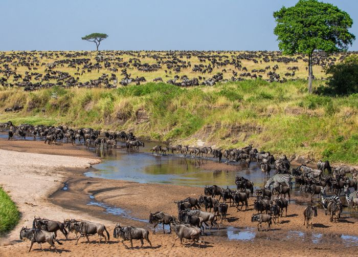
Tanzania's Great Migration of over two million wildebeest and zebra.
Important Areas
Important areas of note in Tanzania include game reserves, marine parks, wildlife management areas (WMA), game controlled areas (GCA), forest reserves, general regions, and other attractions that are worth consideration when planning your trip. For national parks, read above.
- Grumeti Game Reserve - Small, privately-managed eco-tourism reserve bordering the Serengeti National Park's Western Corridor. Excellent game viewing all year, with the Great Migration passing thru during June and July. Small number of five-star safari camps and few visitors make for a very exclusive safari experience.
- Ikona Wildlife Management Area - A small community-run, mixed-use area on the northern side of the Grumeti Game Reserve and close to the Serengeti National Park, for which it serves as a buffer zone. Attractions include good wildlife, especially when the Great Migration passes through (May/June), and a colonial-era fort built by the Germans.
- Ikorongo Game Reserve - One of the buffer-zone conservation areas that surround the Serengeti National Park. Excellent wildlife, especially when the Great Migration passes through between May and July. Commonly used for game drives by the safari camps in the Grumeti Game Reserve.
- Kijereshi Game Reserve - A small reserve at the western tip of Serengeti National Park's Western Corridor, not far from the Lake Victoria shore.
- Kizigo Game Reserve - Large reserve located north of Ruaha National Park. Plenty of wildlife, but the reserve is mainly used for trophy hunting safaris.
- Lake Manyara - A shallow, alkaline Rift Valley lake in northern Tanzania. The northeast portion of the lake is protected by Lake Manyara National Park, which offers very good wildlife safaris.
- Lake Natron - A highly alkaline soda lake located east of the Serengeti along the border with Kenya. The area is very arid and hot and the lake's waters are only used by salt-loving cyanobacteria, a few fish, and lesser flamingos, for which the lake is crucial for their breeding. Natron's waters are often colored red, orange, or pink by the bacteria.
- Lake Rukwa - Located in western Tanzania in the Western Branch of the Rift Valley. Rukwa is shallow and dependent on unpredictable inflows, so it has varied in size greatly over history. Crocodiles, hippos, and a huge variety of birds. The northeast side of the lake is protected by the Rukwa and Lukwati Game Reserves.
- Lake Tanganyika - One of Africa's Rift Valley lakes along Tanzania's western border. The world's longest freshwater lake and the second-deepest lake on Earth. The lake's aquatic life boasts a very high degree of endemism, including 250 species of cichlid fishes. Two small national parks on the Tanzania side: Gombe and Mahale Mountains.
- Lake Victoria - The largest lake in Africa (by surface area), with 49% of its water located within Tanzania. Not a popular destination for tourism, but there are two small island national parks, one of which (Rubondo Island) is definitely worth consideration.
- Loliondo Game Controlled Area - Mixed use land that directly borders the Serengeti National Park to the east. Loliondo is primarily used for trophy hunting, so eco-tourism unfortunately takes a back seat unless the local Maasai decide to change their position on how best to use this large wildlife area in northern Tanzania.
- Lukwati Game Reserve - Located in western Tanzania near Katavi National Park on the eastern side of Lake Rukwa. Good wildlife, but mostly used for trophy hunting.
- Mafia Island & Mafia Island Marine Park - Located 20 miles offshore in the Indian Ocean and south of Zanzibar. The marine park protects pristine waters and marine habitats. Tourists come primarily for diving and sport fishing.
- Makao Wildlife Management Area - A mixed-use (hunting is permitted) buffer zone reserve bordering Lake Eyasi south of the Serengeti National Park.
- Maswa Game Reserves - Three contiguous areas of mixed use land that directly borders the Serengeti National Park to the southwest. Once primarily a hunting concession, Maswa is now converting to eco-tourism, with several operators opening tented safari camps. Good wildlife, especially when the Great Migration moves through (January-April).
- Menai Bay Conservation Area - A marine reserve protecting coastline and offshore water along the southern coast of Unguja Island in Zanzibar. The reserve protects abundant and diverse marine life.
- Mnazi Bay-Ruvuma Estuary Marine Park - A combined terrestrial and marine park in the far southeast, along the border with Mozambique. The Ruvuma River Estuary, coral reefs, and offshore water are home to a great diversity of marine life, including sea turtles, whales, dolphins, fishes, hippos, crocodiles, and birds.
- Mount Kilimanjaro - Africa's tallest peak at 19 354 feet (5 899 meters). 'Kili' is located in northern Tanzania near the border with Kenya. Summit climbs are well organized and only permissible with a licensed guide. Round-trip treks to the summit take 5-8 days and require absolutely no mountaineering skills or experience.
- Mount Meru & Mount Meru Forest Reserve - Protects lush montane forests surrounding several volcanic mountains and craters, including Mount Meru, Tanzania's second-highest peak. The forests are further protected as part of Arusha National Park, which is part of the same ecosystem.
- Muhesi Game Reserve - Large reserve located north of Ruaha National Park. Plenty of wildlife, but the reserve is mainly used for trophy hunting safaris.
- Muyowosi Game Reserve - Located in very remote northwest Tanzania and infrequently visited. Along with the Kigosi National Park, protects a portion of the Malagarasi-Muyowosi Wetlands. Plenty of wildlife, but suffers from human encroachment / cattle grazing.
- Mwiba Wildlife Reserve - A privately-managed reserve located south of the Serengeti National Park. Excellent game viewing, particularly when the Great Migration passes through (December-April). Exclusive experience with few tourists.
- Ngorongoro Conservation Area - Located in northern Tanzania to the east of the Serengeti, the region is home to volcanic highlands and several impressive volcanic craters, including the Ngorongoro Crater, where predators and other wildlife are visited on day-long safaris by tourists staying in accommodations along the crater rim. West of the highlands are open plains that merge with the Serengeti. Olduvai Gorge is the site of important early hominid fossil discoveries.
- Rift Valley - Two branches of the East African Rift are located in Tanzania: the eastern branch (the Gregory Rift) cuts through Central Tanzania, while the western branch (the Albertine Rift) runs through Lake Tanganyika on the country's western border.
- Rukwa Game Reserve - Located in western Tanzania near Katavi National Park on the eastern side of Lake Rukwa. Good wildlife, but mostly used for trophy hunting.
- Rungwa Game Reserve - Large reserve located directly north of Ruaha National Park. Plenty of wildlife, but the reserve is mainly used for trophy hunting safaris.
- Selous Game Reserve - Once the largest single reserve in Africa, more than half became Nyerere National Park in 2019. The remaining Selous portion is still used for trophy hunting. The combined reserve and park are a haven for wildlife, particularly along the Ruaha-Rufiji river system in the north.
- Tarangire Conservation Area - Community owned land managed by the local Maasai people and adjoining Tarangire National Park. Offers a similarly excellent wildlife experience to the national park, with a selection of eco-tourism camps from which to choose.
- Zanzibar Archipelago - A semi-autonomous group of some 50 islands lying just offshore the northern Tanzania coast. Zanzibar has a rich history as the center of Africa's Indian Ocean spice, slave and ivory trade with merchants from the east. Great beaches and water sports. Excellent add-on to a safari itinerary.

View of Tanzania's Ngorongoro Crater. The crater is home to thousands of animals, including all of Africa's Big Five (lion, leopard, elephant, rhino, and buffalo) and is part of an UNESCO World Heritage Site.
UNESCO World Heritage Sites
The United Nations Educational, Scientific and Cultural Organization (UNESCO) is a specialized agency of the United Nations whose mission is to promote world peace and security through international cooperation in education, the arts, the sciences, and culture. The Convention concerning the Protection of the World's Cultural and Natural Heritage was signed in November 1972 and ratified by the 189 UN member "states parties".
A World Heritage Site is a landmark or area which is geographically and historically identifiable and has special cultural or physical significance. To be selected as a World Heritage Site, a nominated site must meet specific criteria and be judged to contain "cultural or natural heritage of outstanding value to humanity". An inscribed site is categorized as cultural, natural, or mixed (cultural and natural). As of 2021, there were over 1 100 sites across 167 countries.
Tanzania has seven UNESCO World Heritage Sites:
- Kilimanjaro National Park (since 1987, Natural) - Mount Kilimanjaro is Africa's highest peak at 19 354 feet (5 899 meters) above sea level and the world's largest free-standing volcanic mass. The now dormant volcano is one of the continent's most iconic natural features. The slopes of 'Kili' are covered in montane forest, providing habitat for numerous mammal and bird species. The mountain and surrounding forest are protected as a national park.
- Kondoa Rock-Art Sites (since 2006, Cultural) - Located along the eastern edge of the Gregory Rift Valley, the over 150 sites include rock paintings dating back at least 2 000 years. Natural rock shelters formed by overhanging slabs of sedimentary rock include vertical planes, which were used for artistic paintings by hunter-gatherers and later by agro-pastoralists who lived here over several millennia.
- Ngorongoro Conservation Area (since 1979, Cultural+Natural) - The Ngorongoro Conservation Area includes large areas of savanna, highland plains, woodlands, forests, and numerous volcanic craters. The Ngorongoro Crater is the largest intact volcanic caldera in the world and is home to the continent's highest density of large mammals. The annual migration of wildebeests and zebras passes thru the area on its way south from Kenya, heading towards the Serengeti to the west. Significant archeological sites are found here, including Olduvai Gorge, where some of the first discoveries of early hominids dating back almost two million years were made.
- Ruins of Kilwa Kisiwani & Songo Mnara (since 1981, Cultural) - Two small islands located very close to one another just offshore from the early historic port town of Kilwa, where Indian Ocean merchants traded African gold, silver, and ivory for goods from Arabia, China, India, and Persia from the 11th thru the 16th century. The ruins are the remains of early Swahili towns, which declined in the 16th century after the Portuguese established a fort on Kilwa Kisiwani. The ruins include numerous mosques, urban buildings, houses, and burial grounds.
- Selous Game Reserve (since 1982, Natural) - The original Selous Game Reserve was partitioned in 2019 into Nyerere National Park and Selous Game Reserve, and both are included in the site. The area covers an enormous 21 000 square miles (54 600 sq kms) of wilderness and is home to large numbers of iconic African mammals, including elephant, black rhino, lion, leopard, buffalo, zebra, giraffe, African wild dog, cheetah, hippo, crocodile, and many more. The Rufiji River flows thru the reserve en route eastward to the Indian Ocean, providing prime habitat for the abundant wildlife. The combined national park and reserve include diverse habitats including Miombo woodland, open grassland, riparian forest, and swamps.
- Serengeti National Park (since 1981, Natural) - The grassy plains of the Serengeti cover some 5 700 square miles (14 763 sq kms) and are one of the world's richest wildlife areas. The annual migration of between two and three million blue wildebeest and zebra spends roughly 9 months of the year here (the other three months in Kenya's Masai Mara to the north). Between 150 and 200 thousand tourists visit the Serengeti annually to see its wildlife. Full-time resident wildlife includes elephant, black rhino, lion, leopard, buffalo, cheetah, various gazelles and antelopes, crocodile, hippo, and abundant bird life.
- Stone Town of Zanzibar (since 2000, Cultural) - Stone Town is the oldest section of Zanzibar City on Unguja Island, Zanzibar, dating back around 150 years. The town is well preserved and retains its original Swahili feel, with major buildings dating from the 18th and 19th centuries. As the hub of Africa's trade across the Indian Ocean, the town reflects the merger of various cultures, including African, Indian, Arab, and European. The town was the site of the largest African slave market supporting the Indian Ocean trade, with an estimated 50 000 slaves passing through Stone town during the mid-19th century.
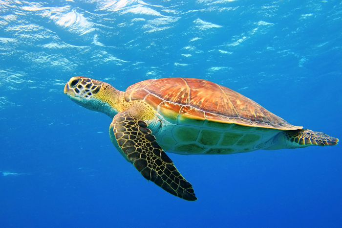
A green turtle (Chelonia midas) in the Indian Ocean water near the coast of Unguja Island, Zanzibar.
Ramsar Wetlands of International Importance
The Ramsar Convention on Wetlands is an international treaty for the conservation and sustainable use of wetlands. It was the first of the modern global nature conservation conventions, negotiated during the 1960s by countries and non-governmental organizations concerned about the increasing loss and degradation of wetland habitat for birds and other wildlife. The convention is named after the city of Ramsar in Iran, where the convention was signed in 1971.
Presently there are some 75 member States to the Ramsar Convention throughout the world which have designated over 2 300 wetland sites onto the Ramsar List of Wetlands of International Importance.
Tanzania has four sites designated as Wetlands of International Importance (Ramsar Sites) as follows.
- Kilombero Valley Floodplain - Located along the Kilombero River (which feeds into the Rufiji River), southwest of the Udzunwa Mountains, the valley is 162 miles (260 kms) long and 32 miles (52 kms) wide at its widest point. The plains sometimes flood completely during the wet season and the grasses support high concentrations of wildlife, including puku, buffalo, elephant, hippo, lion, and many more species. The valley is home to the largest population of puku antelope in Africa and has a very large population of Nile crocodile as well. The floodplains support large numbers of fish and bird life, with a population exceeding 20 000 waterbirds during the wet season. Human activities include fishing and some agriculture. (3 076 sq miles/7 967 sq kms)
- Lake Natron Basin - Lake Natron is located in the Rift Valley in far northern Tanzania on the border with Kenya. The highly saline soda lake is variable in size depending on rains. The lake is the only regularly consistent breeding grounds for lesser flamingos in East Africa, with up to 2.5 million birds present during breeding season. The site also offers feeding and roosting for an estimated 100 000 additional waterbirds, many of them Palaearctic migrants. The Natron tilapia (Alcolapia alcalica) is a near-endemic fish living in only two lakes (Natron and Magadi). Human activity includes livestock grazing by the Maasai people, small-scale agriculture, soda ash production, and some illegal poaching. (868 sq miles/2 248 sq kms)
- Malagarasi-Muyowosi Wetlands - The Malagarasi-Muyowosi Wetlands are a massive and complex riparian floodplain in the Malagarasi River basin in northwest Tanzania. Besides the Malagarasi, four other significant rivers (the Muyowosi, Kigosi, Gombe and Ugalla) feed the basin. The site comprises open water and lakes in the dry season, covering about 8% of the wetland, a permanent papyrus swamp covering 6% of the area, and floodplains that become inundated to a widely varying extent depending on rainfall and inflows from the rivers. The site is surrounded by extensive Miombo woodland and partially wooded grasslands. The site is crucial for a variety of large mammals, migratory and resident waterbirds, fishes, and flora. Endangered species include the shoebill stork, wattled crane, sitatunga antelope, West African slender-snouted crocodile, and various endemic fishes. Human activities include fishing, subsistence hunting, honey gathering, harvesting of plants, and cattle grazing. About 95% of the site receives some form of protection via reserves. (12 550 sq miles/32 500 sq kms)
- Rufiji-Mafia-Kilwa (RMK) Marine Ramsar Site - The RMK site covers the area beginning in the north at the Rufiji River delta and across the Ocean channel to Mafia Island, which lies 15 miles (25 kms) offshore to the southwest. The site comprises estuarine, coastal, and marine habitats, including coastal mangrove forest, intertidal flats, Mafia Island and its smaller surrounded islets, the Songo-Songo archipelago further south along the coast, coral reefs, sandbars, seagrass beds, and open water. Five species of globally threatened marine turtles are found in the site and two (green turtle and hawksbill turtle) nest here. Dugongs are also present, though in low numbers. Other marine species at the site include a large variety of corals, prawns, shrimps, sea cucumbers, octopus, and a great diversity of fishes. The Rufiji River delta and mangroves provide habitat for thousands of waterbirds, and the intertidal flats of Mafia Island and Congo-Songo are used by seabirds. Human activities at the site include fishing, mangrove tree harvesting, seaweed farming, rice farming, and tourism/watersports. (2 305 sq miles/5 970 sq kms)
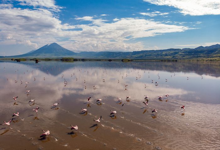
Lesser flamingos on Lake Natron in northern Tanzania. The Ol Doinyo Lengai volcano is in the distance. Lake Natron has been declared a Ramsar Wetland of International Importance.
Urban Areas
Tanzania's important urban areas in terms of travel include one major city (Dar es Salaam), an historic port city on the Indian Ocean, and one smaller tourism-based town (Arusha). Info on each follows below.
- Arusha Town - Located close to Mount Meru in the far north of Tanzania, Arusha's Kilimanjaro International Airport (JRO) is almost always the entry point for travelers visiting northern Tanzania's numerous wildlife reserves and national parks. Arusha is a relaxed and enjoyable town and tourism is the main industry here. Most overland safaris to the northern reserves, including the Serengeti, Ngorongoro, Lake Manyara, and Tarangire, begin in Arusha town.
- Dar es Salaam - Tanzania's most populous city and previously its capital (now moved to Dodoma), with over 4 million residents. 'Dar' is an important and historic port city on the Indian Ocean coast. Not considered a tourist destination, though some travelers pass through its airport en route to other destinations in Tanzania.
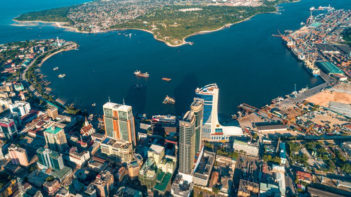
Aerial view over Dar es Salaam on Tanzania's Indian Ocean coastline.
The Serengeti
The Serengeti is located in northern Tanzania along the border with Kenya and is contiguous with that country's Masai Mara Reserve. The Tanzania side of this large ecosystem includes Serengeti National Park, as well as several game controlled areas, privately managed reserves, and the Ngorongoro Conservation Area.
The Serengeti is undoubtedly Tanzania's top wildlife destination and one of the most popular in all of Africa. The extensive Serengeti grasslands are part of a greater ecosystem called the Serengeti-Mara that spans across north-central Tanzania and into southwest Kenya. The name 'Serengeti' is derived from Maa, the language of the Maasai people who inhabit the area, and means 'endless plains'.
The combined Serengeti-Mara ecosystem, including the adjoining private reserves and other protected lands, covers 15 000 square miles (39 000 sq kms) and is a wildlife haven for an enormous number and great diversity of large mammals.
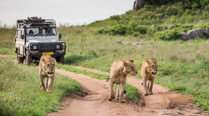
A game drive with lions in the Serengeti National Park.
The Great Migration
The Mara-Serengeti ecosystem is the setting for one of the animal kingdom's greatest spectacles, the 'Great Migration'. Throughout the year, over two million herbivores, primarily blue wildebeests and Burchell's (or plains) zebras, complete a clockwise cycle around the Serengeti and Masai Mara in a continuous search for fresh grass on which to graze.
The movement of the herds is coordinated and yet imprecise, with the timing of their arrival in specific areas somewhat determined by local rainfall. The herds are always considerably spread out due to the large number of animals, but in general, the bulk of the wildebeests and zebras spend around three months (from late July thru early October) on the Kenya side (Masai Mara) of the grasslands and the other nine months in Tanzania's Serengeti, in the southern portion of the ecosystem.
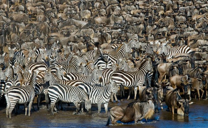
Africa's Great Migration tales place on the plains of the Serengeti (in Tanzania) and the Masai Mara (in Kenya).
There are no substantial fences in the Serengeti-Masai Mara, so for the migrating animals, it is just one large environment with the only barriers along their route being rivers. The most significant obstacle for the herds, and one that brings safari enthusiasts to the region time and again, is the Mara River, which must be crossed in most places by swimming. It is here that numerous Nile crocodiles lay in wait for a chance to gorge themselves on the herbivores that jump in to swim to the opposite bank
The dramatic scenes that unfold during a river crossing can be harrowing to witness, but are always filled with excitement for those lucky enough to be present for such an event. Some of the crocodiles living in the Mara River are massive and may not have eaten anything substantial for many months, so when the migrating herds finally arrive, the reptiles make good use of their opportunities when they come.
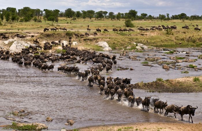
A herd of blue wildebeest, part of the Great Migration, crossing a river in the Serengeti.
Migration Timing
The continuous, roughly clockwise movement of 1.5 to 2 million blue wildebeests and several hundred thousand plains zebras is known as The Great Migration and is one of the world's greatest wildlife spectacles. The wildebeests and zebras do not move as a single gigantic herd, but rather as a spread-out multitude of animals that form herds of various sizes, covering a substantial area, yet still moving in a seemingly coordinated manner if viewed from far above.
The migration completes a 500-mile (800-km) clockwise cycle through the Serengeti, Masai Mara (in Kenya), and Ngorongoro Conservation Area once per year, spending approximately nine months of the cycle in Tanzania and the other three months in Kenya. The movement of the migration is not precise and is dictated at least partially by local rainfall, as the animals are constantly seeking out fresh grasses on which to graze.
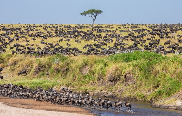
Wildebeests and zebras on their constant search for fresh grazing is what comprises the Great Migration through the Serengeti and Masai Mara.
A female blue wildebeest is able to produce one baby per year (although this is not always the case for every female) and the timing of the breeding cycle is synchronized. Within the mass of migrating wildebeests, about 80 percent of the pregnant females give birth within a two- to three-week period sometime between January and early March, during the rainy season. Approximately 500 000 calves are born during this period, while the bulk of the migrating herds are located in the Serengeti's Southern Plains. At the peak of the birthing period, around 10 000 babies are being born each day.
The synchronization of the wildebeest births is actually a survival adaptation, as even though many newborns do not survive due to predation by hyenas, jackals, cheetahs, leopards, and lions, there are only so many that the predators can take and so, like fish laying thousands of eggs, most wildebeests do survive.
After coming into the world, a newborn wildebeest can stand up within a few minutes and is able to run at a slow pace within 10 minutes. They babies grow quickly and those that are not preyed upon in their first two weeks of life, have an excellent survival rate. The babies stay close to their mother and will feed on milk for around six months, though they can also eat grass after only 10 days. Females are able to procreate at 16 months and males at around two years.
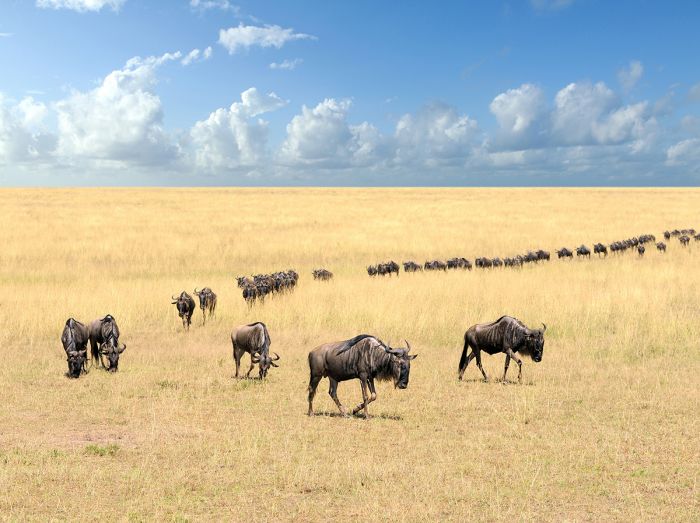
A long line of blue wildebeests in the Great Migration.
The enhanced herds, increased in size with all the young calves, remain in the Southern Plains until late March, feeding on the nutrient-rich grasses so the calves can grow stronger. By April, the herds begin moving north into the Seronera (central Serengeti) area, some of them spreading out west into the Western Corridor where they remain until July. The herds continue slowly moving north and begin crossing into Kenya and the Masai Mara around late August, where they will remain for three months, before turning back south into Tanzania again in late October or early November.
The movements and timing of the wildebeests and zebras is never the same year-to-year, with rainfall and availability of fresh grasses seemingly the driving force in terms of herd movements. Some years, the animals may move away from the Southern Plains earlier, while other years they may remain in the area for a week or even a month longer. This means timing a visit to see the migration is not a perfect science.
Generally speaking, the best months for seeing the largest number of animals in the Serengeti is during February and March, when there are lots of babies on the Southern Plains. During April, May, and June, the Seronera area is great for seeing dense concentrations of animals. River crossings at the Grumeti River are usually at their peak during June, while crossings further north at the Mara River occur in July and August.
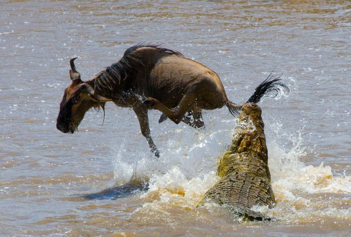
River crossings can be dramatic, with large crocodiles hoping for sustenance, while the wildebeests and zebras use their great numbers to lessen the chance for an individual to be taken.
Serengeti Resident Wildlife
Besides the annual and endless trek of the wildebeests and zebras on their 'Great Migration', the Serengeti is home to a great abundance and variety of other wildlife, the majority of which are resident and do not migrate.
Commonly seen plains game species in the Serengeti include blue wildebeest, plains zebra, Masai giraffe, Thomson's gazelle (or 'tommies', as they are sometimes called), elephant, eland, topi, Coke's hartebeest (a local subspecies of hartebeest also known as 'kongoni'), Grant's gazelle, roan antelope, waterbuck, common reedbuck, warthog and others. A small population of black rhino still exists in the Serengeti and Masai Mara.
Predators, particularly the 'big cats', are common throughout the Serengeti-Mara, with its vast open grasslands being especially suitable for cheetah, which need open space to chase down their prey. Cheetah are certainly a highlight in the Serengeti, but there are also good populations of lion, leopard, spotted hyena, two species of jackal (side-striped and black-backed), and serval.
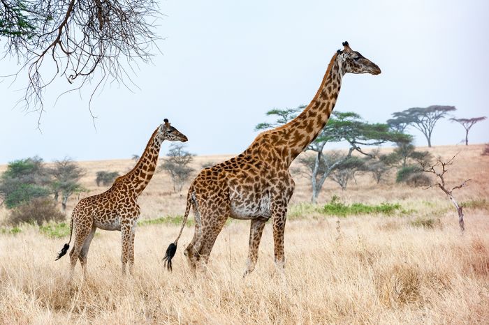
Masai giraffe are one of many resident species that are found in the Serengeti.
Visiting the Serengeti
There is a large assortment of accommodations to choose from in the Serengeti, from ultra-high-end luxury lodges to rustic, bucket-shower 'bush' camps, with pricing accordingly covering a wide range. Some visitors want to stay in luxury, while others, regardless of their budget, prefer a more 'classic' experience.
Another popular type of accommodation in the Serengeti is the 'Seasonal' or 'Migration' camp. This type of tented camp is set up in a specific region in the park and on a temporary basis (typically for 2-4 months) to allow guests to locate within the heart of the Great Migration. After the big herds move away from an area to continue their migratory cycle, the safari camp is taken down and relocated again, so as to always be situated in the best position near the bulk of the abundant wildebeests and zebras.
Game drives are the main activity in the Serengeti, which typically means two drives each day, one in the morning and a second in the afternoon. All-day drives are also an option, which means packing a lunch. The full-day safari drives are most common when visiting an area further from camp or for those choosing to wait at the one of the major rivers, in hopes of seeing a river crossing by the migrating herds of wildebeest and zebras. Regardless of the game drive duration, there is always plenty to eat and drink in the vehicle.
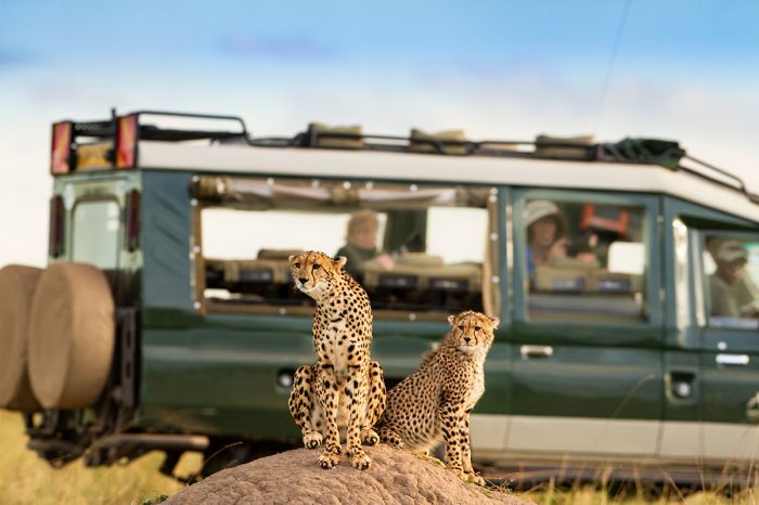
Up close cheetah viewing on a safari in the Serengeti National Park.
Besides game drives, activities in the Serengeti include the always popular and breathtaking hot-air balloon safaris, which take off each day just prior to sunrise and offer stunning, bird's-eye views over the landscape. A balloon safari gives a one an appreciation for the magnitude of the Serengeti plains and usually offers some wildlife viewing from above. After a hot-air balloon safari, which lasts between 60 and 90 minutes, guests enjoy a breakfast at the landing spot, followed by their morning game drive.
A significant component of visiting the Serengeti is the opportunity to meet and interact with the local Maasai people, who have lived in the region since the 17th century. Most of the safari guides that work in the Serengeti are members of one of the local Maasai communities, as are most of the staff working in the safari camps and lodges.
The Maasai people have a distinctly tall and slender form and are usually found wearing their traditional and colorful 'kikoi', a body-wrap garment, as well as metal and beaded jewelry. A visit to a Maasai village is highly recommend and is usually available from any safari camp in the Serengeti.
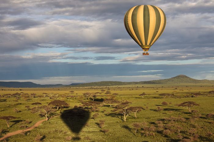
Hot-air balloon safaris are a great way to see the vastness of the Serengeti.
When to Visit the Serengeti
Choosing when to visit the Serengeti is important, as it will determine much of your experience.
The rains in the Serengeti fall mainly between November and May, with two fairly distinct seasons: the 'short rains', which come during November and December, followed by a typically dry period from January into March, and then the 'long rains', which fall in March and April. The short rains in November/December are not usually not significant enough to interfere with safari activities, but from March thru May, the rains can be quite heavy, which causes muddy roads and most days have some precipitation.
One of the main reasons people first visit the Serengeti is to experience the Great Migration. The annual trek of blue wildebeests and zebras traverses the Masai Mara and Serengeti throughout the year and are at their peak in the Serengeti from November thru June or early July, so this is an excellent time to be in the Serengeti for witnessing this spectacle. (Read more on the timing of the Great Migration above).
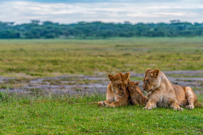
Two lioness with a young cub in the Southern Serengeti. The landscape is rich with fresh grasses after recent rains.
Despite the region's biggest attraction being The Great Migration, overall game viewing in the Serengeti is superb even when the migration has moved north into Kenya, with all of the resident predators and other plains game always present. Another consideration in planning a visit to the Serengeti is that the migration months are also the busiest and most crowded in terms of visitors.
Temperatures are mild throughout the year, with the summer (November thru March) averaging lows of 66-68°F (18-20°C) and highs of ~86°F (~30°C). May thru August have slightly cooler temps, with early mornings averaging 57-61°F (14-16°C) and daytime highs reaching 79°F (26°C).
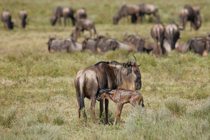
A newly born wildebeest baby with its mother in the Southern Plains of the Serengeti. Calving season takes place in January / February.
Serengeti National Park (SNP)
Declared in 1951, Serengeti was Tanzania's first national park and is the country's most popular destination for wildlife safaris. The park covers 5 700 square miles (14 763 sq kms) and the ecosystem is further protected on the northern side by Kenya's Masai Mara National Reserve.
On the Tanzanian side, Serengeti National Park (SNP) is bordered by numerous other protected areas, including the Ngorongoro Conservation Area (NCA), which together with SNP are a UNESCO Biosphere Reserve (declared in 1981). The entire region is almost entirely used for eco-tourism, but some trophy hunting does occur in Loliondo (bordering SNP to the east) and in some of the buffer reserves in the southwest.
Geography of the SNP
Visitors to SNP typically come for a week or more and it makes sense to stay in more than a single camp or lodge so one may experience the different habitats within the park. In terms of geography, the park can be roughly divided into four regions or sectors: the Northern Serengeti (extending to the Kenya-Tanzania border), the Southern Plains & Kopjes (a 'kopje' is a small, usually rocky hill), Seronera in the central portion of the park, and the Western Corridor, a narrow arm extending almost to Lake Victoria.
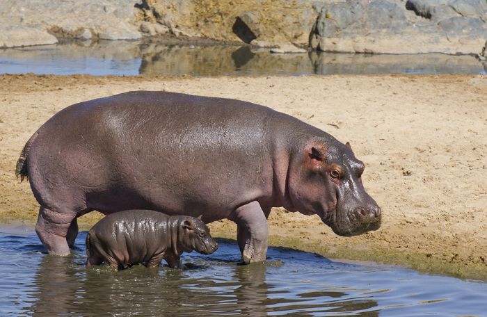
A hippo and her baby in the Serengeti National Park.
Northern Serengeti: The northern portion of Serengeti National Park (SNP) stretches to the Tanzanian border, beyond which is Kenya's Masai Mara National Reserve. The defining feature of the Northern sector is the Mara River, which enters the park in a southerly direction from the Masai Mara and then turns west as it flows through this section of SNP.
The Great Migration of wildebeests and zebras cross through the Northern Serengeti during the latter half of July and throughout much of August (timing of the animal movements is imprecise and varies year to year), crossing the Mara River on their way north to the Masai Mara. Dramatic scenes involving hundreds of animals swimming across the Mara River while trying to evade Nile crocodiles are not for the faint of heart, but many photographers and safari enthusiasts time their visits to this region in hopes of witnessing one or more river crossings.
Besides the Mara River, the Northern Serengeti is mainly dominated by Acacia trees, rolling grassland, and riverine forest along both the Mara and Grmueti Rivers. The resident wildlife in the north is fairly plentiful, but the overall game viewing is less spectacular than the wide open plains of the central and southern parts of SNP. Most of the park's elephant are found in the north and there are also healthy numbers of buffalo, zebra, gazelles (Thomson's and Grant's), and topi.
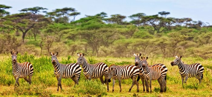
Zebras and Acacia trees in the Northern Serengeti.
Most of the safari camps in the Northern Serengeti sector are located on the banks of the Mara River or a short distance away. Many of the camps have excellent views of the Mara River and this enables the safari guides at these camps to keep an eye on the herds so guests are able to be at the river whenever a river crossing is likely or imminent.
The eastern side of the Northern Sector is called 'Lobo' and this area is good later in the year when the wildebeests and zebras are returning to the Serengeti after their three-month stay in Kenya's Masai Mara (this is generally around late September and during much of October). The 'Lobo Kopjes', which are an impressive group of granite boulders, are a good place to look for resident lions, which love to lounge atop the rocks. The Lobo area is also good for spotted hyena, leopard, and sometimes cheetah.
The small triangular-shaped section of land in the far northwest of the park, north of the Mara River and adjoining the Kenya border and the Masai Mara is called the 'Lamai Wedge'. There are only a few safari camps in the Lamai Wedge, but it offers superb views of the river crossings, with the wildebeests and zebras coming towards the safari vehicles parked on the north side of the Mara River.
Wildlife viewing in Lamai is good year-round as well, with regular sightings of elephant, topi, eland, buffalo, Grant's gazelle, Thomson's gazelle, spotted hyena, jackal, and all of the big cats, including lion, leopard, and sometimes cheetah.
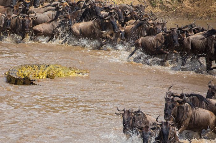
Crossing the Mara River in the Northern Serengeti is not without serious risk for the wildebeests.
Southern Plains and Kopjes: Characterized by open, semi-arid grasslands, the Southern Plains of the Serengeti are the core grazing area for the wildebeests, zebras, gazelles, and other herbivores that live in SNP. The Great Migration arrives to the Southern Plains beginning in January and remaining into April. The wildebeest calving season occurs almost immediately after they arrive to the Southern Plains, with the rich grasses providing nutrition for the new mothers that are now producing milk for their babies. This is an incredible time to visit this part of the Serengeti.
The rich grasses in the Southern Plains are created by the volcanic soils, which were laid down long ago by volcanic eruptions in the Ngorongoro Highlands located directly east of the Serengeti. The volcanic substrate on these plains contains high levels of minerals, which along with the rich grass, are savored by the herbivores, and particularly lactating females. The Southern Plains extend beyond the borders of Serengeti National Park, stretching east into the Ngorongoro Conservation Area and west into the Maswa Game Reserves.
Resident wildlife is plentiful on the Southern Plains, with healthy numbers of topi, Coke's hartebeest, Thomson's gazelle, Grant's gazelle, warthog, and other species. Predators include lion, cheetah, spotted hyena, and jackal.
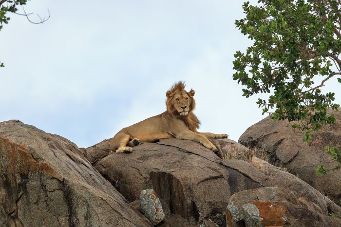
The Southern Plains are interrupted in various places by rocky uprisings called 'kopjes'. These rocks are are favorite for lion, leopard, and sometimes cheetah, which all use them for lookouts and relaxing in the sun.
Located on the border between the SNP and the Ngorongoro Conservation Area (NCA) is Lake Ndutu, a shallow and alkaline lake that attracts large numbers of animals, especially the migrating herds of wildebeest and zebra, between December and April. Numerous safari operators set up their mobile camps at sites around Lake Ndutu and the smaller Lake Masek just to the south to take advantage of the prime game viewing in the area at this time of year. Day trips into the NCA are feasible from Ndutu.
The Southern Kopjes (a 'kopje', pronounced "kope-ee" and in Dutch or Afrikaans meaning "little head") are low-lying, semi-eroded granite inselbergs that are found in several locations in the Southern Plains of the Serengeti. These rocky hills are like islands in the 'sea' of grassy plains which were pushed up from below millions of years ago and have since been partially eroded by wind and rain. Lions are often found sunning atop the rocks and they are also used as a protective shelter by females with young cubs.
The 'Moru Kopjes', located west of the Mbalageti River, contain a natural rock shelter that was used by the Maasai people before they were evicted from this land to create the national park. The rocks in the shelter have various rock paintings depicting tribal shields, human figures, and various animals.
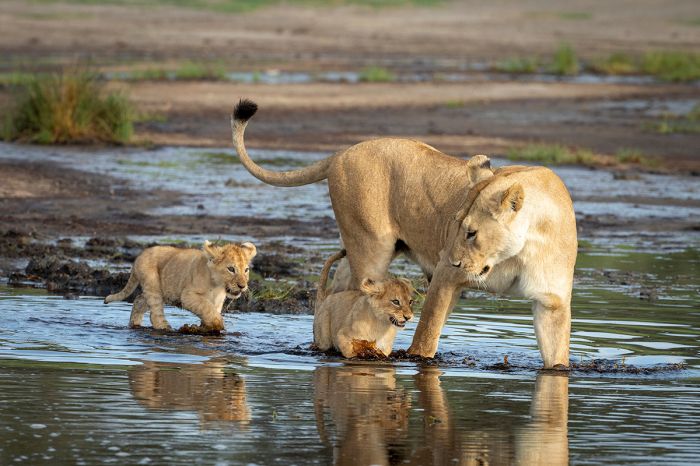
The area around Lake Ndutu in the extreme south of the Serengeti National Park is known simply as 'Ndutu' and is extremely productive for wildlife viewing between December and March.
Seronera: The central portion of the Serengeti National Park is called 'Seronera'. The area is characterized by a network of small rivers, most of which only flow seasonally after good rainfall. Between the rivers are wooded riparian valleys and savanna grasslands. Seronera is the heart of the national park, with the park's headquarters and staff village located in the center of the area. The Acacia woodlands and riparian thickets along the waterways provide excellent habitat for a large variety of wildlife.
The Great Migration moves into Seronera from the Southern Plains sometime in April, with thousands of young wildebeests increasing the numbers in the herds immensely. Seronera is prime habitat for predators like leopard and lion, which take advantage of the arrival of tens of thousands of wildebeest and zebra.
Resident wildlife in Seronera is plentiful and includes buffalo, Masai giraffe, waterbuck, Coke's hartebeest, topi, impala, reedbuck, dik-dik, warthog, Thomson's gazelle, Grant's gazelle, and others. Wildlife densities in Seronera peak between November and May, when rains produce rich grasses on the fertile, volcanic soils here.
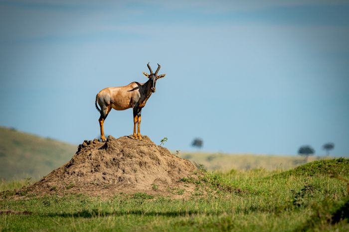
Topi are fairly common in the Seronera region and are often seen standing atop termite mounds as they scan the surrounding plains for any danger.
Permanent water is scarce in Seronera, with the Orangi and Mbalageti Rivers only flowing seasonally during the rains. The small and saline Lake Magadi, which is fed by the Mbalageti River, sometimes attracts great numbers of birds, including flamingos.
The Seronera Visitor Centre (located at the park headquarters) is worth a quick visit to see the educational exhibits, as well as to get updated information on wildlife sightings and road conditions.
Seronera is arguably the best region in the park for overall wildlife viewing, but it is also usually the busiest in terms of visitors and vehicle traffic. There are numerous safari camps and camping sites in Seronera.
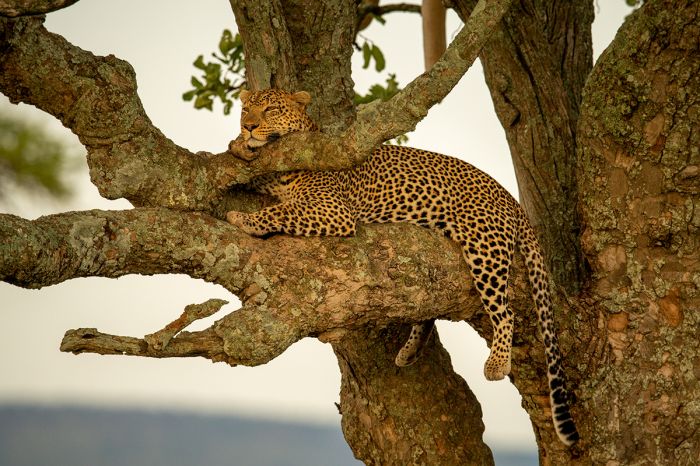
A lovely leopard in repose in the Seronera area of Serengeti National Park.
Western Corridor: The 'arm' of land extending west from Seronera and ending just before the Lake Victoria shore is appropriately called 'The Western Corridor'. The key feature of the corridor is the Grumeti River, which flows west thru this section towards Lake Victoria. Forest and some swamps lie north of the Grumeti River, while south of the river there are hilly grasslands.
The Western Corridor is more densely vegetated than most of SNP. Flowing parallel and to the south of the Grumeti River is the much smaller Mbalageti River, which flows only seasonally and also empties into Lake Victoria just outside the park's boundaries to the west.
Wildlife in the Western Corridor is good throughout the year, with plentiful numbers of Masai giraffe, buffalo, Coke's hartebeest, topi, impala, eland, waterbuck, Thomson's gazelle, zebra, and blue wildebeest.
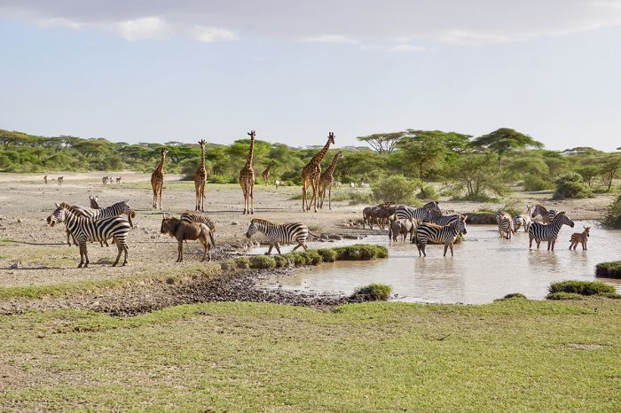
A rain-filled pan is visited by a variety of wildlife in the Western Serengeti.
The herds of the Great Migration typically arrive to the Western Corridor sometime in May, remaining in the area through July, before continuing on their journey north and towards Kenya's Masai Mara. Dramatic scenes of hundreds of wildebeests and zebras crossing the Grumeti River, with Nile crocodiles attempting to catch a meal, are exciting, but can be too much for some guests to watch.
Besides the crocodiles, resident predators in the Western Corridor include lion, leopard, spotted hyena, cheetah, serval, and jackal. Birding is very good in this region, with the forested areas offering numerous species not seen elsewhere in the park. There is a resident population of black-and-white colobus monkey that lives in the forest.
Read full details on the Serengeti National Park and its safari camps and lodges here.
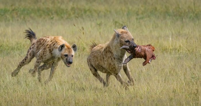
Spotted hyenas with the remains of a topi in the Serengeti's Western Corridor.
Grumeti Game Reserve
Situated along the northern side of the Serengeti's Western Corridor, the Grumeti Game Reserve was established by the Tanzanian government in 1994 to protect the path of the migrating wildebeests and zebras on their Great Migration, as well as the plentiful resident wildlife living there.
The Grumeti Reserve is a long and slender strip of land running east-west and covering 540 square miles (1 400 sq kms). The reserve is bordered on the north by the Ruwana River and on the south by the Serengeti National Park (Western Corridor). The reserve is named for the Grumeti River, which flows through the eastern part of the reserve.
In 2002, management of the Grumeti Reserve was granted to the non-profit Grumeti Community and Wildlife Conservation Fund (now known as Grumeti Fund) and four years later, in 2006, the Singita Company also became involved in managing the reserve and built several high-end, but low impact safari lodges in the Grumeti and neighboring Ikona Wildlife Management Area, from which it leases land.
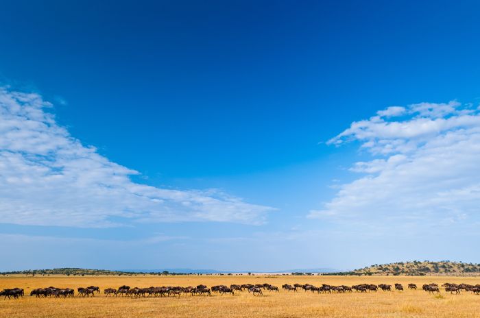
The best months for the Great Migration in Grumeti are July and August.
Wildlife in Grumeti Reserve is good throughout the year, but the prime months to visit are July and August, when the Great Migration of wildebeests and zebras pass through on their way north towards Kenya's Masai Mara. Outside of the peak migration months, Grumeti still offers excellent wildlife viewing, with large numbers of predators and plains game all year.
Lions are present in large prides and spotted hyenas are here as well in good numbers. Other predators include leopard, cheetah, black-backed jackal, and serval. Plains game is abundant in Grumeti, and includes elephant, buffalo, topi, Masai giraffe, Thomson's gazelle, Grant's gazelle, impala, waterbuck, eland, bushbuck, Bohor reedbuck, Coke's hartebeest, blue wildebeest, plains zebra, oribi, warthog, roan antelope, and many more.
Lesser known than the well-publicized crossings of the Mara River, with wildebeests and zebras swimming a gauntlet of crocodiles waiting, the Grumeti River offers the same experience. Migrational river crossings on the Grumeti River usually occur from late June into early July.
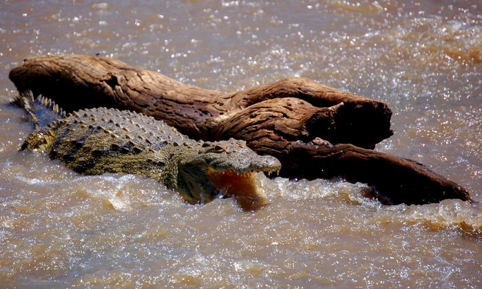
A crocodile in the Grumeti River.
There are upscale accommodations in the Grumeti Reserve, all operated by Singita, which co-manages the reserve with the non-profit Grumeti Fund. All are top-notch places to stay, with excellent guiding and five-star facilities. Regardless of the accommodation, the experience in Grumeti is exclusive and free from any of the crowds found in many places throughout the Serengeti National Park.
Besides the exclusivity of the accommodations and the lack of any crowds, the Grumeti Reserve is not subject to the game-drive restrictions of the national park. So guests can partake in night drives and the 4x4 vehicles will go off-road to follow animals to make the most of special wildlife sightings, like following a leopard or a pride of lions.
Read full details on the Grumeti Game Reserve and its safari camps and lodges here.
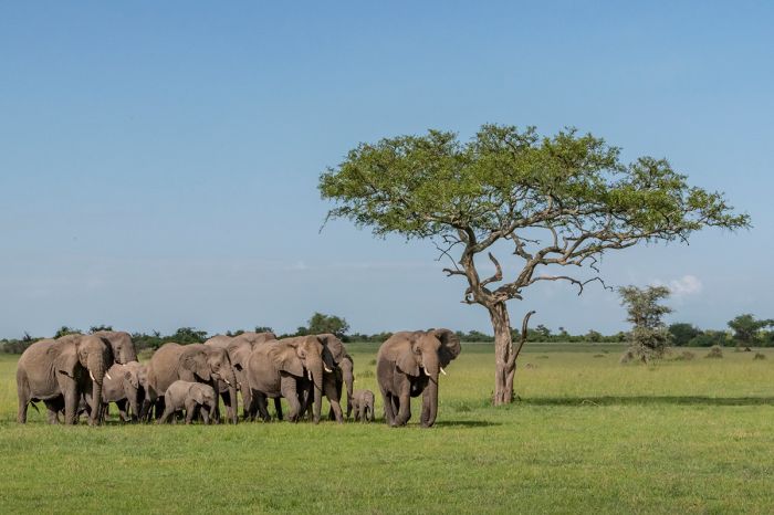
The Grumeti Game Reserve offers good wildlife viewing all year.
Loliondo Game Controlled Area
Bordering the Serengeti National Park directly to its east is the Loliondo Game Controlled Area. The Loliondo GCA covers 1 500 square miles (4 000 sq kms) and is home to a substantial number of Maasai people, many of whom are descendants of Maasai who were forced to relocate here after the Serengeti was declared a national park.
The Great Migration of wildebeests and zebras passes through Loliondo beginning in late October, as the herds head south from Kenya's Masai Mara towards the grasslands in Tanzania.
A 'Game Controlled Area' affords a far lower level of protection for wildlife than a national park, and trophy hunting is permitted in Loliondo. The balance between eco-tourism and hunting revenue is an ongoing debate for the local Maasai in Loliondo. The area has great potential for eco-tourism, but for now, the area is primarily used for cattle grazing and hunting.
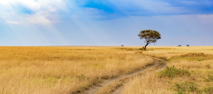
Loliondo GCA is an extension of the Serengeti grasslands.
Maswa Game Reserves
Bordering the Serengeti National Park to the southwest, Maswa consists of three contiguous reserves (north-to-south: Maswa North, Maswa Mbono, and Maswa Kimali) covering a vast area of around 800 square miles (2 100 sq kms) of mostly savanna grassland. Similar in topography to the southern Serengeti, there are rocky 'kopjes' and rolling hills that are partially covered in Acacia thickets and seasonally-flowing streams.
Maswa was historically used only for trophy hunting, but is now opening up to eco-tourism as a replacement for hunting, with several operators opening up tented safari camps. Maswa also serves as a buffer zone between the Serengeti and the Maasai villages to its west.
The wildlife in Maswa is abundant and diverse, especially when the Great Migration arrives around January where they calve and feed on the fresh nutrient-rich grasses. Lion, leopard, cheetah, and spotted hyena are found in good numbers in Maswa, as are the rest of the Serengeti's diverse plains game, including Masai giraffe, Coke's hartebeest, topi, Grant's gazelle, Thomson's gazelle, and many more.
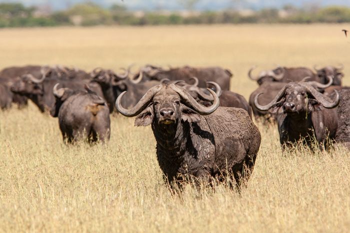
Maswa Kimali has converted from trophy hunting and is now used for eco-tourism, providing more options for photographic safaris.
Ikona Wildlife Management Area
Located on the northern side of the Grumeti Game Reserve, the Ikona Wildlife Management Area is another of the buffer zones that surround much of the Serengeti National Park in northern Tanzania. Established in 2007, Ikona covers 94 square miles (243 sq kms) and is a managed by the local Massai community.
Activities in Ikona are eco-tourism only at present, but it is classified as a mixed-use area. Wildlife is abundant and similar to that in the Grumeti and Serengeti. The Great Migration passes through the Ikona area between May and June, after the herds have moved north from the Southern Plains of the Serengeti and are making their way north towards Kenya and the Masai Mara.
Ikona leases its land to the Grumeti Fund and there are several high-end eco-tourism camp operated by the Singita Company located in this reserve.
An interesting tourist attraction in Ikona is the colonial-era 'Fort Ikoma', which was built by the Germans in 1905 when present-day Tanzania was part of the German East Africa colony. The fort was used by the German colonial authorities as a garrison and administrative center. Later, during the First World War, the Germans used the fort as a heliograph station. The fort is still an impressive sight and worth the time to stop and have a look.
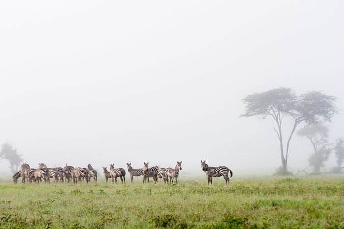
Zebras in early morning mist, Ikona Wildlife Area.
Ikorongo Game Reserve
Located at the juncture of the Northern Serengeti and the Western Corridor, the Ikorongo Game Reserve is another of the smaller, mixed-use buffer zones that surround much of the Serengeti National Park. Ikorongo was established in 1994 as a government-controlled reserve, covering 232 square miles (602 sq kms). Trophy hunting is technically permitted in Ikorongo, although it is functionally used only for eco-tourism.
Wildlife is exceptionally good in Ikorongo, particularly along the Grumeti River, which cuts through the reserve. The Great Migration passes through Ikorongo between May and July and game drives from the camps in the Grumeti Reserve and Ikona WMA often head here to watch the migrating herds and other wildlife.
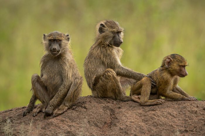
Yellow baboons (Papio cynocephalus) are common throughout wooded areas of the Serengeti.
Kijereshi Game Reserve
Located on the southern side of the western end of Serengeti National Park's Western Corridor, the Kijereshi Game Reserve covers an area of around 25 square miles (66 sq kms). Kijereshi was established in 1994, along with several others reserves bordering the Serengeti and it serves as a small but important buffer zone for the animals living here.
The reserve's landscape is predominantly grassland, much of it lightly wooded, and the rest open savanna. There is also a stretch of riparian forest along a small river in the reserve.
Kijereshi offers good wildlife viewing, particularly when Great Migration (of wildebeests and zebras) passes through the reserve from May to July. The reserve is designated for eco-tourism only.
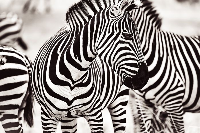
Plains zebras are one of two species that are part of the Great Migration (the other being the blue wildebeest).
Mwiba Wildlife Reserve
Situated south of the Serengeti, the privately-managed Mwiba Wildlife Reserve is leased from the Makao Wildlife Management Area, which is owned by the Massai people of the Makao Village. The lessee is an eco-tourism safari operator and the land is now used strictly for photographic safaris and conservation. Mwiba covers an area of 195 square miles (506 sq kms), with Maswa Kimali Game Reserve to the north, Makao to the west and south, and the Ngorongoro Conservation Area to the east.
Like the various other reserves and wildlife areas bordering the Serengeti National Park on its western and southern borders, Mwiba acts as a buffer zone against growing human population that is encroaching on the park.
Mwiba's landscape is characterized by rolling grasslands, Acacia scrub thickets, 'kopjes' (small, rocky outcrops), and normally dry riverbeds that only flow during the rains. Mwiba borders the Eyasi Escarpment and the views over Lake Eyasi and beyond to the Yaida Valley further south are magnificent.
Mwiba offers very good wildlife viewing, with only limited exposure to the national park's tourists, which allows those staying in Mwiba to enjoy an exclusive safari experience free from vehicle traffic. The Great Migration of wildebeests and zebras pass through Mwiba between December and April and this is a prime time to visit.
Accommodation in Mwiba consists of Mwiba Lodge and mobile camps that set up here seasonally for the Great Migration.
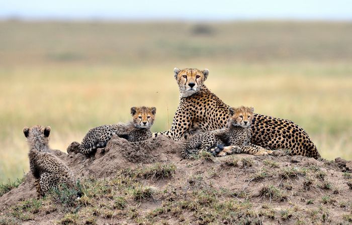
A cheetah and her cubs in the Serengeti.
Makao Wildlife Management Area
Makao is a community-owned "game ranch" which serves as a buffer zone for the Serengeti National Park. Trophy hunting is permitted in Makao, with revenues going to the Makao villagers. A parcel of the Makao-owned land on the east (the Mwiba Wildlife Reserve) is leased to a private eco-tourism company and used for photographic safaris and wildlife conservation.
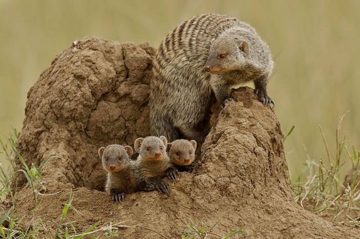
A banded mongoose at a den site with her youngsters.
Ngorongoro Conservation Area
The Ngorongoro Conservation Area (NCA) is located in northern Tanzania, bordering the wildlife-rich Serengeti National Park (SNP) to the southeast. It is one of the most visited tourist destinations in Tanzania.
History
The land that is currently the NCA was initially included as part of the Serengeti National Park (SNP), which was proclaimed in 1951, but when the British colonial authorities evicted the Maasai people from their land to create the park, the Maasai rebelled.
After a period of protest by the Maasai, the British agreed to cede the eastern side of the new national park to the Maasai for resettlement, and this land became "multiple use" land, which allowed the Maasai to live and graze their cattle on some of their previous land.
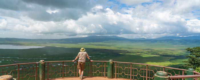
A visitor gazes into the massive Ngorongoro Crater from a lookout point along the crater rim.
Unfortunately for the traditionally pastoralist Maasai people, settlements in the NCA were later banned in 1974 and cultivation, which they had been forced to undertake as a way of survival since being evicted from the SNP, was outlawed in the NCA in 1975. Cattle grazing inside the Ngorongoro Crater (a major tourism destination) was banned in the early 1990s, denying the Maasai and their cattle critical watering and grazing during the dry season.
Much like the Native Americans in North America, the Maasai have been marginalized and increasingly denied rights to their ancestral lands, resulting in a substantial level of destitution amongst their people.
The name "Ngorongoro" is a Maasai word that has an onomatopoeic origin, referring to the sound that the bell worn around the neck of the lead cow of a Maasai herd makes as it walks.
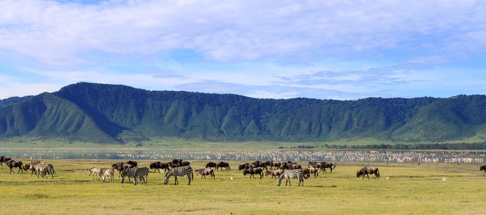
Full-day safaris into the Ngorongoro Crater offer opportunities for exceptional wildlife viewing.
Ngorongoro Geography
The NCA covers 3 200 square miles (8 300 sq kms) and has a diverse topography ranging from volcanic highlands to low-lying grasslands, forests, and seasonal rivers.
The southeastern portion of the NCA is defined by a network of eight mostly extinct shield volcanos that are part of the Gregory Rift (the eastern branch of the East African Rift fracture system). Three of the volcanoes have collapsed into craters, while the other five are still dome-shaped cones.
The largest of the craters is named Ngorongoro and is home to thousands of animals, including all of Africa's Big Five (lion, leopard, elephant, rhino, buffalo). The two smaller craters located northeast of Ngoronogo Crater are named "Empakaai" and "Olmoti".
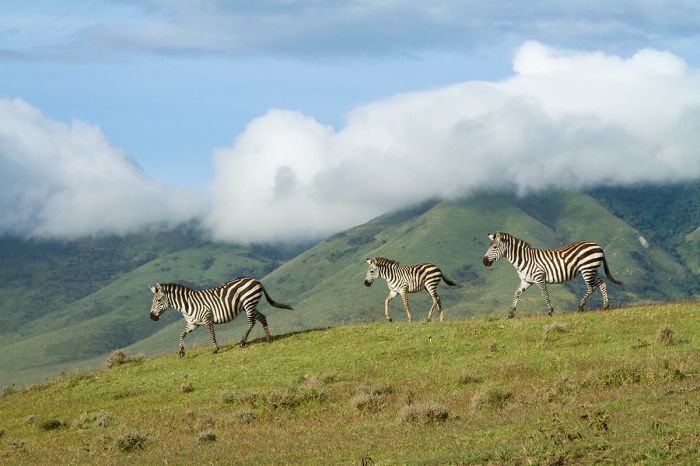
Zebras in the Ngorongoro Highlands.
West of the Ngorongoro Highlands, the land drops down to open plains that are covered in nutrient-rich grasses atop volcanic soil. The Salei Plains lie just west of the highlands and further west are the Southern Plains of Serengeti National Park, which adjoins the NCA.
The Olduvai River rises on the slopes of Mount Lemagurut and flows west into Lake Masek and Lake Ndutu, both of which are very popular sites for wildlife viewing in the Southern Serengeti. The Olduvai Gorge, carved out by the river, is a 30-mile-long (48-kms) ravine in the Salei Plains, where fossils of early humans were discovered by Louis and Mary Leakey over a period of three decades beginning in 1931.
Northwest of the highlands are the Gol Mountains, while the southwest border is formed by the shallow and only seasonally flooded Lake Eyasi.
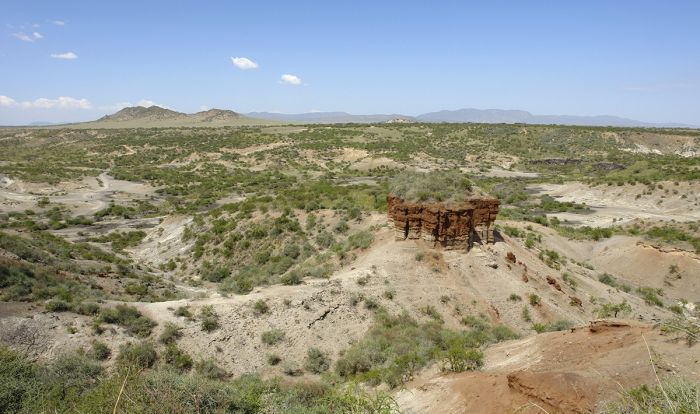
Olduvai Gorge is renowned for providing numerous fossil discoveries of early hominids.
Ngorongoro Crater
The Ngorongoro Crater is the remains of a massive volcano that once stood an estimated 19 000 feet (5 800 meters) high. The volcano erupted and collapsed some 2.5 million years ago. The explosive eruption formed a crater measuring 2 000 feet (610 meters) deep and 12 miles (19 kms) in diameter. The crater covers 108 square miles (280 sq kms), making it the largest intact and un-flooded caldera on Earth.
Today, the Ngorongoro Crater is a wildlife haven for somewhere between twenty-five and thirty thousand large mammals and has the highest density of predators in all of Africa. So spectacular is the crater and its teeming wildlife, that it is sometimes referred to as the "Eighth Wonder of the World".
There are no safari camps nor camping sites inside the Ngorongoro Crater, so visitors that come to see this incredible wildlife on the crater floor, stay in one of the many accommodations available along the crater rim. The rim of the crater is at an elevation of 7 500 feet (2 286 meters) and the crater floor lies 2 000 feet (610 meters) below. Each day, a line of game drive vehicles descends from the crater rim for day-long safaris inside the crater and all visitors ascend back up to their lodges at dusk.
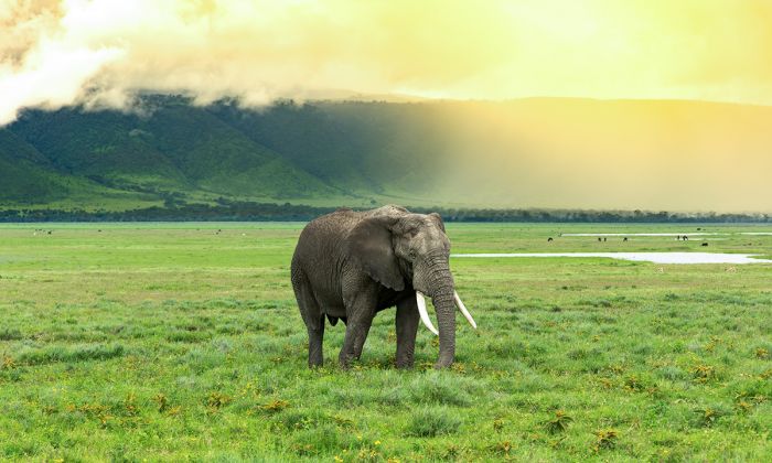
A bull elephant grazes in early morning light in the Ngorongoro Crater.
The descending track is bumpy and steep and typically bumper-to-bumper with 4x4 safari vehicles every morning at dawn. The misty highland forests come alive with bird call each morning and fog flows through ancient trees, ferns, and other rich vegetation, creating a feeling of the days before Europeans arrived to the region and lending an ethereal mood to the air, as first-time visitors descend into the crater for a day of game viewing.
The defining feature of the crater floor is Lake Magadi, a shallow and alkaline lake which is fed by localized rains and runoff from the higher land to the north of Ngorongoro Crater. Lake Magadi sometimes attracts large flocks of flamingos, particularly during the dry months if the lake is still holding water.
There are interesting burial cairns on the lake's western side, which are believed to have been left by the Datoga tribe, who lived in the region before the Maasai came and displaced them.
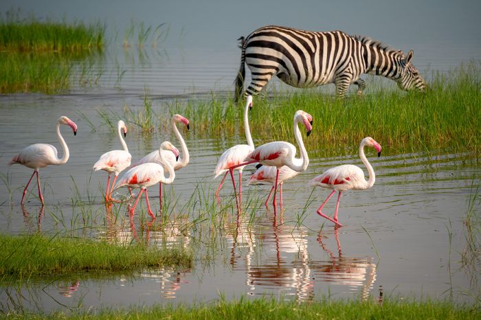
Greater flamingos in Lake Magadi, Ngorongoro Crater.
Wildlife inside the Ngorongoro Crater is abundant and very diverse, with all members of the Big Five (lion, leopard, buffalo, rhino, and elephant) present. Four of the five are almost a guarantee to see during a day-long safari in the crater, with the only possible miss being leopard, which is sometimes elusive. Black rhino have found a safe haven in the crater, and the population here is around twenty. The most abundant of the predators in the crater is the spotted hyena, which number between 300 and 400 individuals. Two species of jackal are also found here.
The southern side of Lake Magadi is the site of the crater's only forested area, consisting almost entirely of "fever-tree" Acacias. The forest is named Lerai Forest and this is the best place to see bushbuck, waterbuck, eland, and leopard.
The majority of the crater floor is covered in open savanna, which is ideal for the numerous grazing herbivores living here. Zebra and blue wildebeest are very common, and there are good numbers of Grant's gazelle, Thomsosn's gazelle, buffalo, Coke's hartebeest, topi, mountain reedbuck, eland, and warthog.
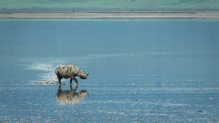
A lone black rhino crossing the shallow Lake Magadi in the Ngorongoro Crater.
Elephants are commonly seen and they move into and out of the crater as they wish. Some very impressive "big tusker" bull elephants are full-time residents of Ngorongoro Crater. There are several well-visited hippo pools, which are a guarantee for these large mammals. Two notable species not present in the crater are impala and giraffe.
Birding inside the crater is excellent, with flamingos often seen on Lake Magadi, along with a variety of waterbirds. Ostrich and kori bustard are common and seen easily on the grasslands, and raptors are also seen in good numbers. The crater's bird list is around 280 species.
Similar to a national park, there are strict guidelines for visitors and game drives in the Ngorongoro Crater, with absolutely no off-road driving permitted and leaving the vehicle restricted only to designated picnic posts.
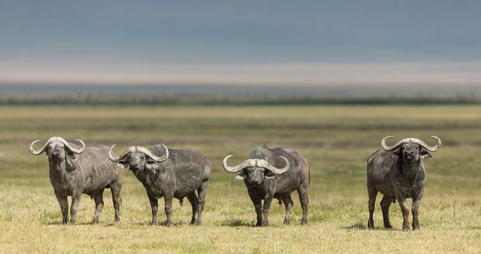
Four impressive buffalo bulls in the Ngorongoro Crater.
Empakaai and Olmoti Craters
Located northeast of the Ngorongoro Crater are two smaller craters, named Empakaai and Olmoti. Neither of these two craters comes anywhere close to Ngorongoro Crater for wildlife viewing and they are not often visited, but for those interested in hiking and being in a place where there are virtually no tourists, both craters are worth a visit and can be reached as a day trip from any of the camps in the highlands.
Only a short distance north of the Ngorongoro Crate is the shallow Olmoti Crater, which is mainly covered in grassland and offers a chance to see modest numbers of grazing herbivores, including buffalo and bohor reedbuck.
The local Maasai also graze their cattle in the Olmoti Crater. The Munge River flows out of Olmoti and descends into Ngorongoro Crater, were it feeds into Lake Magadi. Olmoti's rim has an elevation of 9 974 feet (3 040 meters) and the crater floor lies only 788 feet (240 meters) below. Guided walks into the crater are possible.
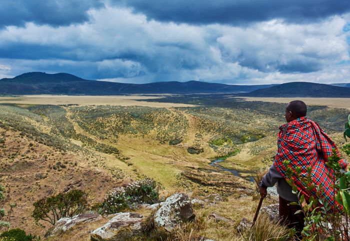
Hiking into the Olmoti Crater in the Ngorongoro Highlands.
Further north from Olmoti is the slightly larger Empakaai Crater, with an elevation of 10 564 feet (3 220 meters) at its rim and a crater floor lying 1 771 feet (540 meters) below. Almost 50 percent of Empakaai Crater's floor is covered by Lake Empakaai, a 200-foot-deep (60-meter) soda lake. The steep forested walls of the crater and covered in rich forest vegetation and the only way into the crater is on foot.
Empakaai's lake is often a great place to see flamingos and there is always a variety waterbirds. Elephants are present and sometimes seen and leopards live in the crater, but are rarely seen. Other wildlife in Empakaai includes bushbuck, buffalo, and blue monkey, the latter being seen mostly along the crater rim. Birding in Empakaai is very good.
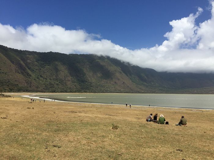
Tourists visiting Lake Empakaai inside the Empakaai Crater, Ngorongoro Highlands.
Olduvai Gorge
Formed by the flowing of the Olduvai River, which originates on the slopes of the Lemagurut volcano (elevation 10 276 feet/3 132 meters), the Olduvai Gorge is renowned as the location of a significant paleontological site where fossils of and tools used by early hominids have been discovered.
Olduvai Gorge spans 30 miles (48 kms) and reaches a depth of nearly 500 feet (150 meters) in some places. The local Maasai people call it "oltupai", which is their word for the sisal plant, which grows in abundance around the gorge.
The first fossil discoveries at Olduvai Gorge were made in 1911 by Wilhelm Kattwinkel, a German paleontologist and neurologist, who undertook an expedition to what was then German East Africa to investigate the causes of "sleeping sickness". It was only by chance that Kattwinkel discovered the fossil of a three-toed horse in Olduvai Gorge, which he brought back with him to Germany. A subsequent German expedition explored the site in 1913, and found the first fossilized remains of early hominids.

The spectacular Olduvai Gorge in the Ngorongoro Conservation Area.
In 1931, after World War I and with present-day Tanzania now under British administration, a British expedition to Olduvai Gorge led by Louis Leakey started excavating and searching for fossils at Olduvai Gorge. Leakey and his wife Mary worked for almost three decades at Olduvai, but it was only in 1959 that they succeeded in finding stone tools used by early hominids that dated back 1.8 to 1.2 million years.
Soon after and also in 1959, the Leakey's made a major discovery, unearthing the skull of a 1.75-million-year-old Australopithecus boisei, which they nicknamed 'Nutcracker Man'. At the time of the discovery, it was the oldest known hominid fossil ever found.
The Leakey's continued to work on excavations in Olduvai Gorge and soon uncovered two additional hominid fossils: one of Homo habilis, which they called 'Handy Man' and another of Homo erectus, which they called 'Upright Man'. Both of these early hominids lived contemporaneously with Nutcracker Man. These two species became the first to be named under the Homo genus and both are believed to be ancestral species of modern humans (Homo sapiens).
Guided walking tours around Olduvai Gorge are popular, as is the Olduvai Museum, a very informative museum located near the gorge. Just north of the gorge is another place of interest called 'Shifting Sands', which is a small collection of sand dunes made of black volcanic ash. The crescent-shaped, three-million-year-old dunes are slowly traveling east at a rate of some 50 feet (15 meters) per year.
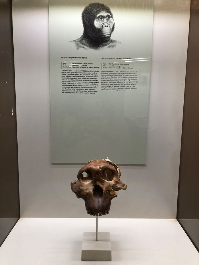
A display at the at the Olduvai Gorge Museum with a cast of the Australopithecus boisei fossil skull discovered by Mary Leakey at the gorge in 1959. (Photo: Wikimedia Commons)
Lake Ndutu & Lake Masek
On the far western side of Ngorongoro Conservation Area (NCA) are two small lakes: Lake Ndutu and Lake Masek. The larger of the two lakes is Lake Ndutu, which is technically part of Serengeti National Park, while only a stone's throw to the southeast is Lake Masek, located in the NCA.
Both Ndutu and Masek are shallow, soda lakes, which attract large numbers of wildlife, especially during the months when the Great Migration of thousands of wildebeest and zebra pass through the area (typically between December and April). Numerous seasonal safari camps set up around the lakes during the migration months to take advantage of the exceptionally good wildlife viewing during this time.
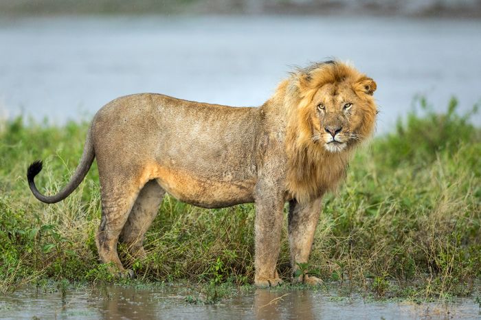
Wildlife viewing is seasonally superb in the Ndutu area of the Serengeti-Ngorongoro.
When to Visit Ngorongoro
The Ngorongoro Conservation Area (NCA) and in particular the Ngorongoro Crater, offers very good game viewing all year, as almost all the animals in the crater are full-time resident of this unique ecosystem.
Rainfall in northern Tanzania occurs between November and May, with a 'short rains' period from mid-November to mid-December and a 'long rains' period during April and May. The short rains are lighter and less impactful, with short sporadic showers, but not every day, while the long rains are much heavier, with some rain almost every day, especially in the afternoon. The period between the two rain seasons (January and February) does receive some unpredictable rain, but it is typically only occasional.
The long rains can certainly impact safaris in negative way, with roads becoming muddy and slippery and extended downpours cutting into game drive activities. The short rains are not typically much to worry about in terms of a multi-day safari itinerary.
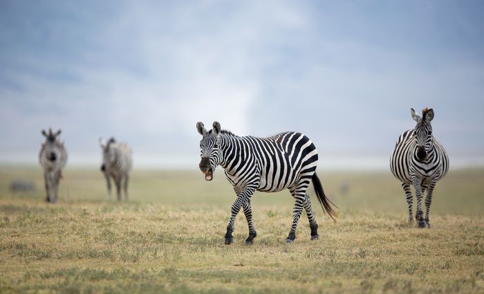
Plains zebras in the Ngorongoro Crater.
Temperatures in the Ngorongoro region are generally mild, but vary considerable when venturing up into the highlands, with the higher elevations meaning cooler temps during the day and chilly to cold overnight. The plains to the west of the highlands are at low elevation and are much more temperate.
Daytime temps on the Ngorongoro Crater floor are pleasant, averaging 68-73°F (20-23°C), but overnight temps on the rim of the crater can drop significantly and can approach freezing during the dry months (June thru October) and average 45°F during there rainy months (November thru May).
The Great Migration of over 2 million herbivores (mostly blue wildebeests but also several hundred thousand plains zebras) passes thru the western side of the NCA from December thru April. Most of the animals avoid the Ngorongoro Highlands and are only found in good numbers on the western side, where the rich grasses grow plains enriched with volcanic soils.
The area around Lake Ndutu is a spectacular place to be when the Great Migration arrives, with wildebeests, other plains game, and predators in good numbers and baby wildebeests arriving around early February.
Read full details on the Ngorongoro region and its safari camps and lodges here.
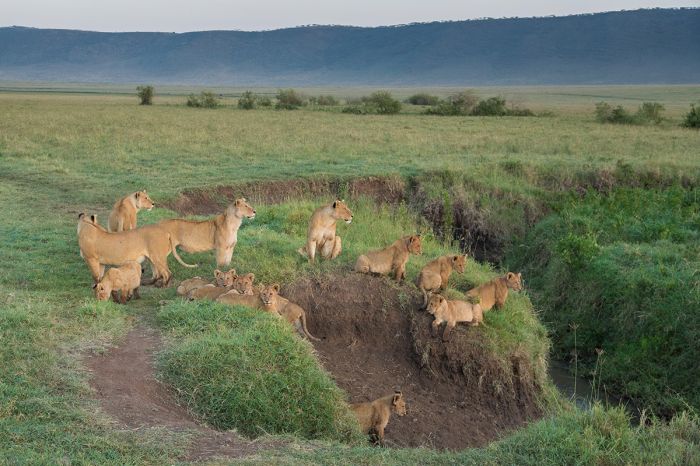
A pride of lions in the Ngorongoro Crater.
Lake Natron
Located along Tanzania's northern border with Kenya and just east of the Serengeti is the shallow and alkaline Lake Natron. The lake is is mostly located in Tanzania, with just a small portion of its northern shores extending across the border into Kenya.
Lake Natron is located along the Gregory Rift and was formed around 1.5 million years ago. Natron is shallow, reaching a maximum depth of around 10 feet (3 meters). Natron's size varies considerably based on water inflows and rain, with an average length of 35 miles (57 kms) and a width of 13 miles (22 kms).
Lake Natron is fed primarily from the north by Kenya's Southern Ewaso Ng'iro River and it has no outlet, but it also receives water from volcanic springs and seasonal streams flowing from Ol Doinyo Lengai, a large volcanic mountain located just south of the lake. Rainfall around the lake falls irregularly and averages only around 16 inches (400 mm), but due to the hot and arid environment, much of the rain is "phantom rain", meaning that the rain drops evaporate before reaching the ground or lake surface.
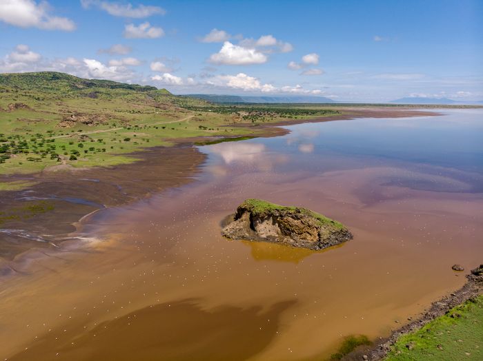
Aerial view over Lake Natron with flamingos scattered in the shallow water.
The land surrounding Lake Natron is extremely arid and hot, with daytime temperatures averaging 104°F (40°C), but sometimes getting much warmer. The extreme conditions at Lake Natron cause high levels of evaporation, leaving behind 'natron' (sodium carbonate decahydrate) and trona (sodium sesquicarbonate dihydrate). The precipitated salts in Lake Natron result in highly alkaline water, with a pH averaging around 10.5, but sometimes reaching as high as 12.
The word 'natron' refers to the naturally occurring mixture of sodium bicarbonate (NaHCO3, also called baking soda) that is often produced in highly saline lake beds located in arid environments. The modern chemical symbol for the chemical element sodium is 'Na', which is an abbreviation of its Latin name 'natrium'.
Lake Natron often appears red, pink, or orange in color. This coloration is caused by salt-loving microorganisms called 'halophiles' that use photosynthesis to create their own food as plants do. These cyanobacteria contain photosynthetic pigments, which absorb energy from sunlight. Each type of pigment absorbs light more efficiently in a different part of the light spectrum and change the color of the water accordingly.
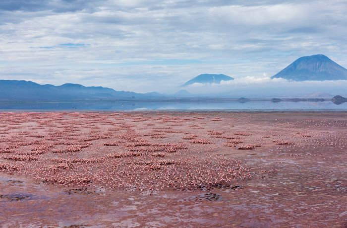
Thousands of flamingos on Lake Natron. The water is tinted pink like the birds due to pigments in the lake's cyanobacteria. Natron is critical to the flamingos, which use the site for breeding and feeding on the algae.
Due to Natron's corrosive waters and the inhospitable environment surrounding the lake, very few animals are ever seen here. The exception are some salt-tolerant fish and flamingos.
Lake Natron is the top breeding location in East Africa for lesser flamingos, which are highly dependent on the lake and congregate here in numbers over two million to breed and feed on the lake's cyanobacteria. The breeding season occurs from August to October. The harsh environment around Lake Natron provides an additional barrier for the birds against predation. Smaller numbers of greater flamingo also breed on the lake's mud flats.
Visiting the lake is possible on an overland safari that continues to or from the Serengeti or Ngorongoro.
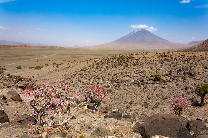
The landscape surrounding Lake Natron is arid and inhospitable to most life. In the foreground are a number of desert rose (Adenium obesum) plants that can thrive in this harsh environment. Ol Doinyo Lengai volcano towers in the distance.
Kilimanjaro
Africa's tallest peak is Mount Kilimanjaro, which rises 19 354 feet (5 899 meters) above sea level and is undoubtedly one of the most iconic topographical features on the continent. Most of the best images of 'Kili', as the mountain is often called, with majestic elephants walking the plains in the foreground, are taken in Amboseli National Park, a short distance away and across the border in Kenya.
Climbing Kilimanjaro is extremely popular and each year thousands of tourists ascend the mountain on guided multi-day treks up the various routes to the summit.
The lower-elevation Mount Meru (elevation 14 977 feet; 4 565 meters) is located just to the southwest and forms the defining feature of Arusha National Park.
The main airport for travelers coming to any of northern Tanzania's destinations (including Serengeti National Park, the Ngorongoro Crater, Lake Manyara, and Tarangire National Park) is Kilimanjaro International Airport (JRO). After arriving at the airport, guests almost always spend a night or more in nearby Arusha town, which is the starting point for almost every safari to the destinations just mentioned.
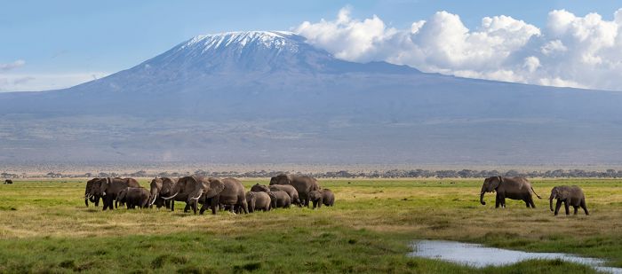
Mount Kilimanjaro as viewed from Amboseli National Park.
Mount Kilimanjaro
Also known as "Kili", Mount Kilimanjaro is a dormant strato-volcano and the highest peak in Africa at 19 354 feet (5 899 meters) and one of Tanzania's prime tourism destinations, with thousands of visitors from around the world coming to participate in multi-day treks to the summit.
Although there are over one hundred peaks that reach above 20 000 feet (~ 6 000 meters), Kilimanjaro is the world's highest free-standing (not part of a range of mountains) peak. The base of Kili covers an area of 245 square miles (635 sq kms) and it is ranked as the world's fourth-most topographically prominent peak.
Another feature of Kilimanjaro is that, despite its impressive height, it is not technically challenging to climb, making it accessible to almost anyone with a good level of fitness. No technical mountaineering skill or experience is required to climb Kili.
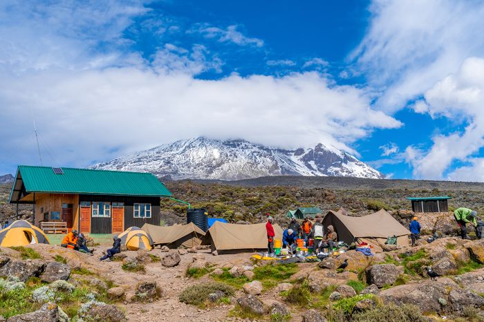
There are numerous operators that offer climbing expeditions on Kilimanjaro. Nights are spent in tents along the way.
Kilimanjaro is located just inside Tanzania's northern boundary with Kenya, with some of its base technically extending into Kenya, but the high altitude portion of the mountain is entirely located within Tanzania. There are three significant peaks on Kilimanjaro: Kibo, Shira, and Mawenzi. The highest point of the mountain is Uhuru (which means "freedom" in Swahili) Peak, located on Kibo's crater rim and this is the point to which most climbers ascend.
Kilimanjaro experienced its first eruption around one million years ago at 'Shira', the oldest and westernmost of the three peaks, which collapsed about 500 000 years ago. The more recent cones, located to the east of Shira and called Kibo and Mawenzi, continued to grow and erupt after Shira collapsed, with lava flows from Kibo slowly filling the Shira caldera and creating a feature called the 'Shira Plateau'. Kibo has long since gone dormant.
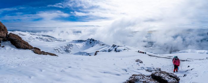
Climbers on the snow-covered upper elevations of Mount Kilimanjaro.
Climbing Kilimanjaro
As mentioned above, Kilimanjaro offers anyone with a good level of fitness and endurance a very good chance to reach the summit, as there are no technical sections requiring mountaineering expertise or experience. That said, do not be misled by anyone that says the climb is an easy one. The effects of exertion at high altitudes is very much a factor when climbing Kili and only about two of every three climbers make it to the summit at Uhuru.
All climbers must join a guided team with a registered Kilimanjaro climbing operation and be led by a licensed guide (the climbing ratio is one guide for every two climbers). Porters will also be on the trek to assist with carrying the gear, which includes tents and other camping gear, food, and water. The ratio for porters is generally two or three per climber, with strict enforcement of weight limits permissible for porters.
Anyone planning to climb Mount Kilimanjaro should physically prepare themselves well in advance of the climb by exercising extensively to increase endurance. Good preparation prior to the trek will increase your chances of a successful and enjoyable experience.
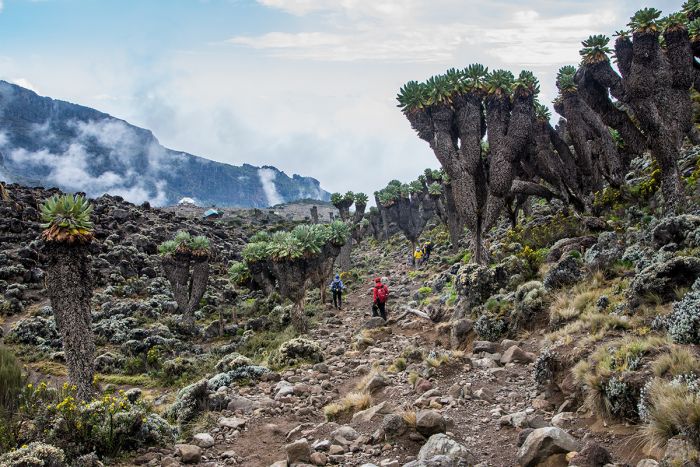
Climbers passing through otherworldly vegetation en route up Mount Kilimanjaro.
Kilimanjaro Routes
The are numerous climbing routes on Mount Kilimanjaro, but the most frequently used are Machame, Marangu, and Lemosho. Each of the routes, like all aspects of trekking on the mountain, are strictly regulated in terms of dates and numbers allowed on each route at any given time. The text below discusses some of the more popular routes on Kilimanjaro.
Machame Route: Machame is a popular trail that is also known as the "Whiskey Route", apparently because it is perceived to be the route chosen by upscale travelers. Machame is long and somewhat challenging, with long hours of hiking each day. Machame can be completed in a minimum of six days, but seven or eight days is much more common. The longer duration of Machame compared with some other routes means climbers acclimatize better and success rates are higher.
Machame starts from the south and meanders through richly forested slopes en route to the Shira Plateau. The route then turns east, passing below the southern ice field and then on to the summit at Uhuru. This is one of, if not the most scenically beautiful of the routes, passing thru a variety of vegetation zones, including rain forest, moorland, alpine desert, and snow fields. Machame's popularity means it is commonly busier in terms of climbers. The descent is via the Mweka Route. Nights are camping in tents.
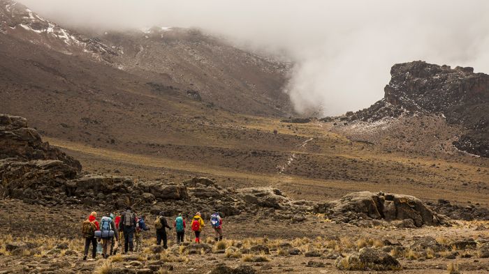
Climbers on their way up the Machame Route approach a lava tower.
Marangu Route: Marangu is a very popular trail and Kilimanjaro's oldest and most established trekking route. Marangu is also considered the easiest route to climb and offers the shortest round-trip duration, at just 5 days. Most operators using this route suggest a six- or seven-day trek to allow for better acclimatization.
Also known as the "Coca-Cola Route", Marangu is quite eroded in many places and like Machame, can be somewhat crowded with climbers. Depending on the season and recent rains, the lower elevation portions on Marangu can be muddy and slippery.
Marangu is the only trekking route that offers sleeping huts (the others all utilize tented camping). The huts are very basic structures, with dormitory sleeping. The route begins in the southeast and proceeds up a gradual gradient on a direct route. Anyone opting for the five-day option should be aware that proper acclimatization is not always possible and so we recommend the 6- or 7-day options. The descent follows the same route as the ascent.
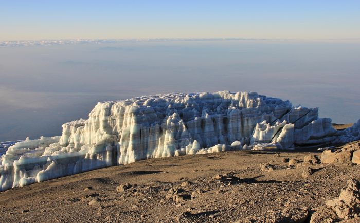
Glacial ice atop Uhuru Peak on Mount Kilimanjaro.
Lemosho Route: One of the most scenic routes on Kilimanjaro is the Lemosho Route, which ascends from the west and heads directly towards the Shira Ridge, where it then joins with the Machame Route on the fourth day near the base of the Kibo cone. Lemosho is considered the most scenic route on Kilimanjaro, offering incredible panoramas throughout the trek.
The early days of Lemosho take climbers through the lower-elevation rain forest and the climbing all the way to the Shira Ridge is relatively easy. This part of the route, before it joins with the Macahame Route, has very low climber traffic. After meeting Machame, there are many more climbers, as teams from both trails then use the same "Southern Circuit" route.
Lemosho can be completed in six days minimum, but a seven- or eight-day trek is more leisurely and provides better acclimatization. The descent follow the Mweka Route down the southern side. Nights are camping in tents.
For info on all the Kilimanjaro climbing routes, go to the Kilimanjaro Region page.
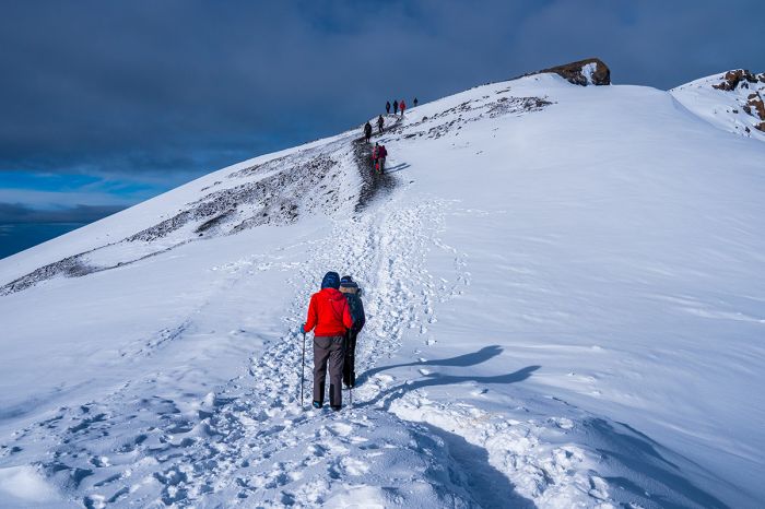
Climbers nearing the summit on Mount Kilimanjaro.
When to Climb Kilimanjaro
Kilimanjaro can be climbed at any time during the year, but it is best to climb when the chances for rain are low, because recent rains can mean muddy and slippery trails, making for a riskier experience.
The chances for rain on Kilimanjaro are highest from early November to early December and again from late March to early May, so climbing outside of these two periods is recommended. The southeast slopes of the mountain receive the most rain, so those routes (Machame, Umbwe, Mweka, and Marangu) can sometimes be slippery while the routes on the west (Lemosho and Shira) and the one route on the north (Rongai) are overall more likely to be dry.
The optimal periods for climbing Kilimanjaro are late June thru October and mid-December thru early March. June can also experience some rains. The warmest months on the mountain are September and October and these are also usually the busiest in terms of climber traffic. Many climbers like the idea of summiting on full moon nights (every 2935 days), so the summits on these days are always very busy.
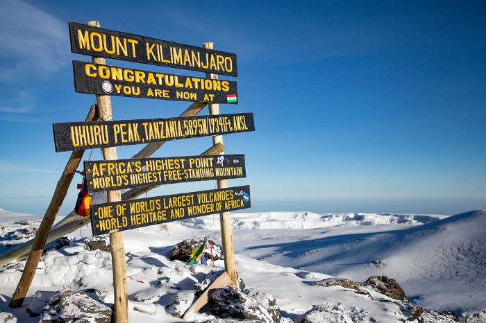
The sign atop Uhuru Peak on Mount Kilimanjaro (19 341 feet / 5 895 meters).
Kilimanjaro National Park
Kilimanjaro National Park was created in 1973 to protect the mountain and at the time of its formation, only included terrain above 9 000 feet (2 750 meters) plus some forest corridors extending down to about 6 500 feet (2 000 meters). The boundaries of the park were expanded in 2005 to include the entire montane forest at the lower altitudes, which had previously been unprotected.
Visitors who do not have the time or inclination to take part in a multi-day summit climb of Kilimanjaro can still enjoy half or full-day hikes in the lower elevation rain forest, which provides an excellent experience and opportunities to see waterfalls, birds, beautiful flora, and perhaps some wildlife. Guided hikes depart from both Machame and Marangu.
Read full details on Mount Kilimanjaro, the Kilimanjaro region, and its safari camps and lodges here.
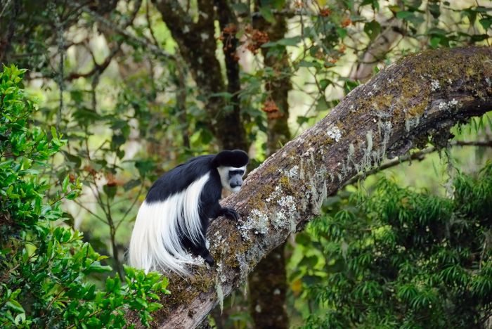
A black-and-white colobus monkey in the lower-elevation montane forest in Kilimanjaro National Park.
Arusha National Park & Mount Meru
Located 37 miles (60 kms) southwest of Mount Kilimanjaro and directly north of the popular tourist town of Arusha is Arusha National Park. The park and forest are best known for the volcanic peaks and craters, especially Mount Meru, Tanzania's second-highest peak, rising to 14 977 feet (4 565 meters) in elevation.
Mount Meru is the dominant feature in the region and towers prominently over the town of Arusha. Viewed from Arusha town, Mount Meru appears to be a well-rounded cone, but the eastern side of the volcanic mountain was ripped apart by a cataclysmic eruption around 250 000 years ago. The massive explosions sent huge boulders of volcanic rock flying through the air up to 40 miles (64 kms) away to the northeast. Before Meru's eruption, it stood even taller than Kilimanjaro! Meru is mostly dormant now, but there are occasional tremors and there was a mini-eruption in 1910.
The national park was established in 1960 and along with the surrounding forest reserve, protects the majority of Mount Meru, including the 2-mile-wide (3.2 kms) Meru Crater and Ngurdoto Crater in the foothills to the east of Meru. Ngurdoto is a slightly larger crater than Meru's and it is home to diverse wildlife that is plentiful enough to earn it the nickname "Little Ngorongoro". A northern extension of the national park protects a chain of small lakes known as "Momela Lakes". Flamingos can often be seen on these lakes.
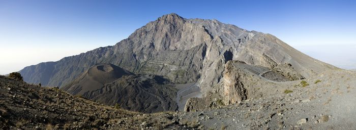
Mount Meru with its ash crater clearly visible.
Besides the impressive volcanic peaks and craters, the national park and forest are a good place to see some wildlife, including elephant (rarely seen), buffalo, zebra, a variety of antelopes like duiker and bushbuck, warthog, black-and-white colobus, blue monkey, and others. Giraffe are commonly seen around Momela Lakes. Spotted hyena and leopard are present in the park and forest, but infrequently seen.
Trekkers will enjoy climbing Mount Meru, which can be summited without any technical skills or climbing experience. A round-trip summit excursion can be accomplished in two days, but three- or four-day trips are better, allowing for more time to enjoy the scenery. Although Meru is smaller than Kilimanjaro, acclimatization to the altitude is still a consideration, so a longer trip is advisable for most people.
Summit treks begin at Momela Gate (4 900 feet/1 500 meters) and the trail heads west towards the summit. Trekkers will camp on the trail. Camping gear and supplies are carried by porters. Little Meru (12 533 feet/3 820 meters) is along this same route and is another option.
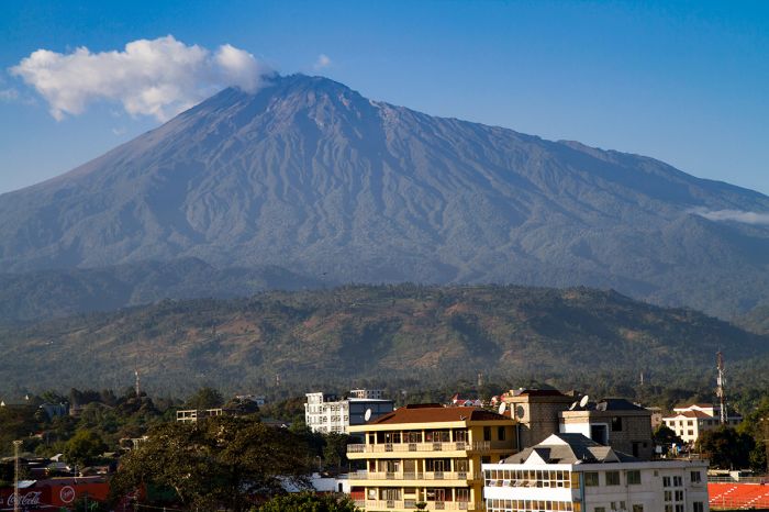
Mount Meru rising above Arusha town.
Lake Manyara National Park
Lake Manyara National Park is located just southeast of the Ngorongoro Conservation Area (NCA) and is therefore often included in overland safaris in northern Tanzania (which typically begin in Arusha Town and head west, ending in the Serengeti).
The park was established in 1960 and the name 'Manyara' comes from Maa (the language of the Maasai people that live in the region) word for the Euphorbia tirucalli plant that grows in the region and is used by the Maasai to construct their cattle bomas.
The national park covers 127 square miles (330 sq kms), two-thirds of which is occupied by the northwestern portion of Lake Manyara.
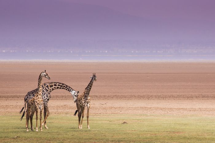
Masai giraffes in front of a hazy Lake Manyara.
Lake Manyara
Lake Manyara, which covers 181 square miles (470 sq kms), is a shallow (reaching a maximum depth of just 6 feet; 1.8 meters) alkaline (the water has a pH of ~9.5) lake.
The lake is partially fed by underground springs and seasonal streams, but 99% of its water comes from direct rainfall, which means that Manyara's water levels fluctuate significantly year to year based on the rains. In very dry periods, the water in the lake can almost completely evaporate. Lake Manyara is classified as an endorheic basin, meaning that there are no outflows.
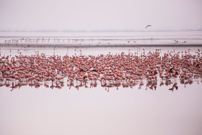
Flamingos are sometimes found in great numbers on Lake Manyara.
Lake Manyara Features
The non-lake portion of Lake Manyara National Park (LMNP) covers a narrow strip of land on the northern half of the western shores of Lake Manyara, extending west and protecting a variety of habitats.
Biomes in the park include grassy plains, Acacia woodland, large areas of marsh, evergreen groundwater forest (fed by subterranean springs), saline mud flats that fluctuate in size inversely with lake water levels, and a rocky escarpment along the western border of the park. There are also sulfurous hot springs in an area alongside the lake.
Wildlife in LMNP is diverse and fairly abundant, but of course nowhere near on the scale of the Serengeti. Nonetheless, the park is well worth two or three nights on a northern Tanzania itinerary.
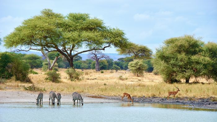
Zebras and impalas in Lake Manyara National Park.
The elephants in LMNP are fairly easy to find and are almost always very relaxed around safari vehicles, making it a pleasure to observe them. Other wildlife in LMNP includes buffalo, Masai giraffe, waterbuck, zebra, blue wildebeest, impala, warthog, bushbuck, and klipspringer antelope. Hippos are also present, particularly in the "Hippo Pool" at the extreme north end of the lake and park. Primates are abundant and include blue monkey, vervet monkey, and olive baboon.
The well-known "tree-climbing" lions in LMNP are one of the reasons people come for a visit. The lions at Lake Manyara are believed to have learned this fairly uncharacteristic (for lions) behavior as a way to stay cooler and also to escape insects on the ground. There are lions that climb trees in other parts of Africa, Kidepo Valley in Uganda for instance, but the lions at Manyara seem to do it more regularly. Leopard are also present in the park, but not as easy to see.
Birding in LMNP is very good, with a diversity of species both on the lake itself and in the park's diverse habitats. LMNP has a bird list totaling around 380 species. Large numbers of flamingo often visit the lake to feed on algae.
Read full details on Lake Manyara, the national park, and its safari camps and lodges here.
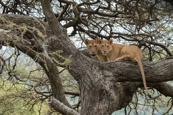
'Tree-climbing' lions at Lake Manyara National Park.
Tarangire National Park
Tarangire is another of the northern Tanzania wildlife destinations, but is the least visited in the circuit. This is surprising, because the park offers a high density of wildlife and it makes for a crowd-free wildlife experience in a wilderness setting. Tarangire is certainly Tanzania's best-kept secret in terms of safari destinations. Tarangire is based around the Tarangire River, which flows south to north thru the park before emptying into Lake Burunge near the northwest border of the park.
Tarangire's protected area is comprised of the national park and the Tarangire Conservation Area (TCA), which adjoins the park on the northeast. Together the protected land occupies roughly 1 236 square miles (3 200 sq kms) of wilderness land along Africa's Great Rift Valley.
Tarangire's core protected area is the national park, which was declared in 1970 and covers 1 010 square miles (2 616 sq kms). The smaller TCA covers an additional 226 square miles (585 sq kms) and the Maasai Steppes, which lie to the east of the TNP and TCA, occupies 1 900 square miles (5000 sq kms) of unprotected, but almost totally uninhabited land.
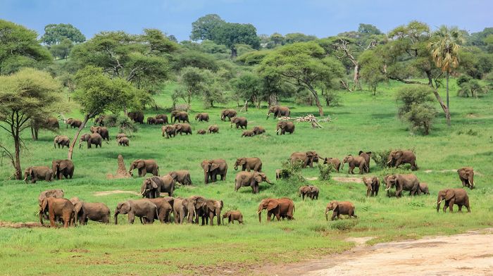
Elephants in Tarangire National Park.
The defining feature of Tarangire National Park is the Tarangire River, which provides water to a multitude of wildlife. The northern section of the park is the prime safari area, particularly where the Tarangire River's course bends to the west towards Lake Burunge. Wildlife is abundant in this area and there is a good road network for wildlife viewing in this section. The land in the north is characterized by Acacia woodland, hilly grasslands, and sparse riparian woodland along the river. There are numerous baobab trees here as well.
Moving south into the central portion of Tarangire National Park, the land gradually transforms into an extensive network of seasonal marshes that extend into the southern portion off the park. These marshes become a spectacular setting for an enormous number of birds which arrive to feed and breed during the rainy period, which begins in November and continues until May. The roads in the central part of the park are mostly passable all year, though some become difficult during the rainy season.
The far southern portion of the park is very remote and becomes impassable during the rains, making it only accessible during the dry season (July thru October). Even during the dry months, very few game drives head to this remote area.
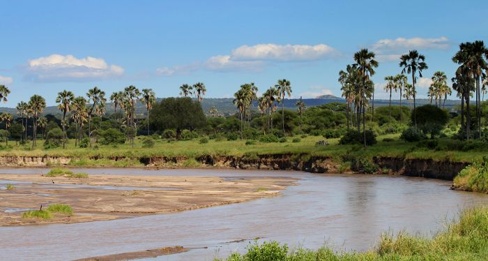
The park is based around the life-sustaining Tarangire River.
Game viewing is best in Tarangire during the peak of the dry season between August and October, when the animals congregate along the Tarangire River and are never far from this last source of water before the rains. Although the river doesn't actually flow during the peak dry months, there are still pools of water in the riverbed to sustain the wildlife.
During the driest months, large numbers of elephant, zebra, wildebeest, and other plains game are found in good numbers along the river. Once the 'short rains' begin (in November), the wildlife disperses into the surrounding areas.
The marshes in the central part of Tarangire National Park are also great for game viewing during the dry months (June thru October). At this time, the swamps recede, but the remaining wet areas attract plentiful wildlife, especially buffalo, elephant, and lion.
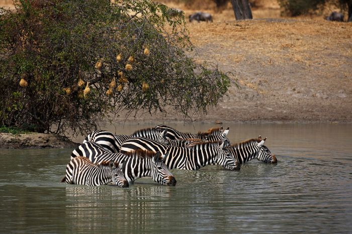
Zebras at a waterhole in Tarangire.
Tarangire Migration
Most people are aware of the Great Migration, which occurs northwest of Tarangire on the grasslands of the Serengeti and Masai Mara, but few are familiar with the smaller-scale migration in the Tarangire region. Tarangire's migration consists of around 25 000 blue wildebeest, 30 000 plains zebra, smaller numbers of fringe-eared oryx, and some 2 500 elephant. These animals migrate into Tarangire during the dry season (July thru October) to take advantage of the water remaining in the Tarangire River.
The migration into Tarangire begins arriving around late July and the herds remain until the rainy season begins sometime during November. Once the rains begin, the wildebeest and zebra move off from Tarangire and head north towards Lake Manyara or east into the Maasai Steppes. The 'long rains' arrive in April/May, and by this time the migration has spread out over a vast area covering ten times the size of TNP. Some of the elephants that were in Tarangire during the dry months will have walked all the way to Kilimanjaro or even into Amboseli National Park, across the border in Kenya.
When the 'long rains' have ended and the land is starting to dry again (mid-May into early-June), the animals again start to head back towards Tarangire and by August, they have arrived in the park in substantial numbers again and the cycle repeats.
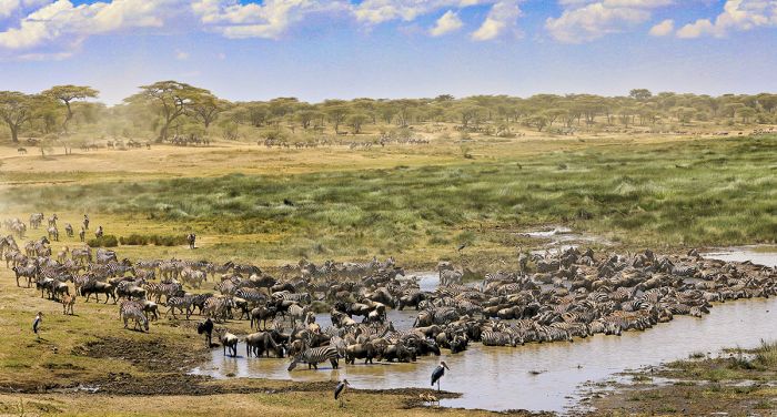
Thousands of blue wildebeests and plains zebras migrate back to Tarangire National Park beginning around July every year.
Tarangire Wildlife
Besides the animals that migrate in and out of Tarangire (discussed just above), the park's resident wildlife includes elephant, Masai giraffe, buffalo, eland, plains zebra, Coke's hartebeest, impala, Thomson's gazelle, waterbuck, bushbuck, warthog, hippo, crocodile, and others.
Predators in Tarangire include leopard, lion, jackal, serval, spotted hyena (small population) and cheetah (a small number). Primates include olive baboon and vervet monkey. Less commonly seen wildlife found in Tarangire includes striped hyena, lesser kudu, and gerenuk.
Birding in Taragangire is also very good, with an incredible 500 species recorded in the park. The swamps and areas along the Tarangire River are particularly good for birds.
Just outside the northwest border of the national park is Lake Burunge, which attracts an abundance and good variety of waterbirds all year and often hosts large flocks of flamingos during there dry season. Lake Burunge is easily reachable as a half-day or full-day trip from one of the safari camps in the northern sector of Tarangire.
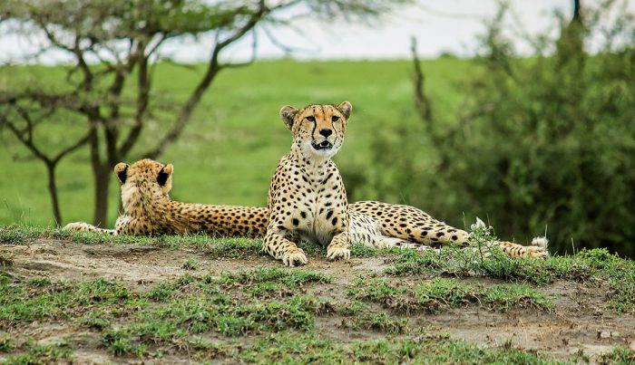
Two cheetahs in Tarangire National Park.
Tarangire Conservation Area (TCA)
Bordering the Tarangire National Park on the northeast is the Tarangire Conservation Area (TCA), Tanzania's first community-run wildlife area. The TCA was established in the 1990s by returning the land to the local Maasai people, who ended trophy hunting on the land and implemented eco-friendly photographic safaris.
The primary watershed of the Tarangire River originates in the TCA and these seasonal rivers help provide pools of drinking water to wildlife during the dry season. Wildlife viewing in the TCA is excellent and can even be better than in the national park. Besides daytime game drives, the TCA is not subject to national park restrictions, so it can offer night-drives and walking safaris. There are a handful of good accommodations to choose from in the TCA.
Read full details on Tarangire and its safari camps and lodges here.
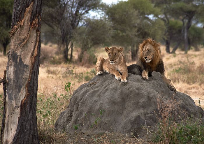
A lion couple atop a termite mound in Tarangire.
Mkomazi National Park
Originally established as two contiguous game reserves (Mkomazi in the west and Umba in the east) in 1951, both reserves were used primarily for trophy hunting. In 2006, the Mkomazi and Umba reserves were combined and designated as Mkomazi National Park. The park is located in northeast Tanzania and is contiguous with Kenya's Tsavo West National Park across the border to the north.
Mkomazi covers an area of 1 330 square miles (3 446 sq kms) and has a history that is rife with conflict. Upon the initial designation of the two game reserves in 1951, the British colonial government allowed the Parakuyo ethnic group, who occupied the land on the eastern side (the Umba Reserve), to remain and to continue to graze their substantial herds of livestock (cattle, sheep, and goats) on the land. The Maasai people, who occupied the western side (the Mkomazi Reserve), were however evicted.
By the 1980's, the number of cattle in the reserves (which numbered around 80 000) were badly degrading the land at the expense of wildlife, so in 1988, the Kenyan government evicted all people and cattle from the reserves. The evicted Maasai and Parakuyo people contested the legality of the evictions in court, but lost their case.
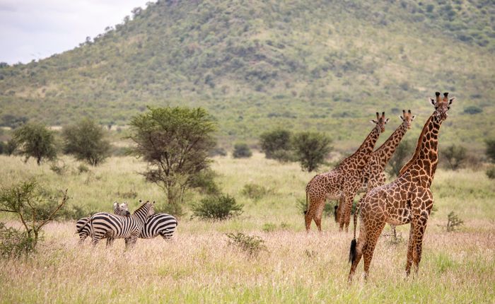
Masai giraffes and zebras in Mkomazi National Park.
Today, despite ongoing attempts to revitalize the park and attract tourism, Mkomazi is seldom included on northern Tanzania travel itineraries, and the park receives very few visitors.
Mkomazi's landscape consists of vast areas of Acacia scrub, open savanna grassland, and Miombo woodland. The reserve offers good views of the Usambara and Pare Mountains on clear days.
Wildlife in Mkomazi is not on a par with that inside Tsavo in Kenya (in terms of game viewing and numbers of animals), but regularly seen species include blue wildebeest, Masai giraffe, topi, eland, Grant's gazelle, plains zebra, warthog, and dik-dik. During the rainy season (November through May), elephants arrive in good numbers from Tsavo to graze on the grass and bush.
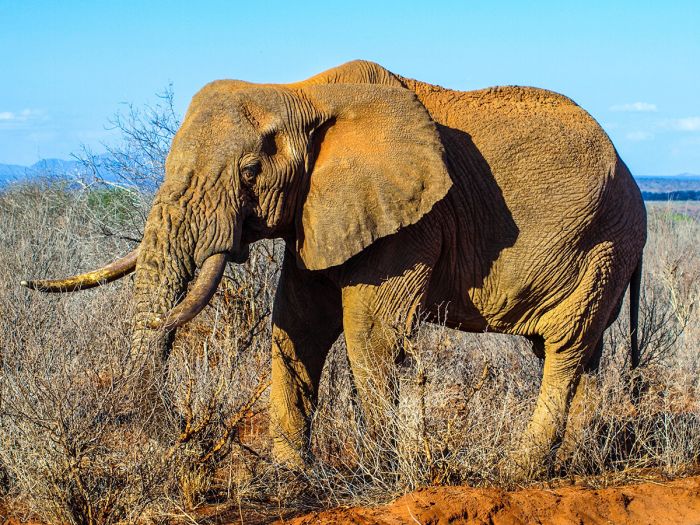
Elephants move freely between Kenya's Tsavo region and Mkomazi National Park in Tanzania.
Less common species that can be seen in Mkomazi include the fringe-eared oryx, lesser kudu, and gerenuk. Black rhino and African wild dog are also in the park, but are held in captive areas for protection.
Birding in Mkomazi is very good, with over 450 species recorded. The park is the only place in Tanzania where one scan see the vulturine guineafowl. Other common birds include ostrich, kori bustard, secretarybird, and southern ground hornbill. Migratory Palaearctic birds arrive around November and leave again in April/May, which is another reason to visit during the wet season.
The dry season is usually the best time for wildlife in northern Tanzania, but as Mkomazi is not a prime destination for game viewing, the wet season (November thru May) is recommended, as elephants are commonly seen and the scenery, including views of the nearby Pare Mountains, is best at this time.
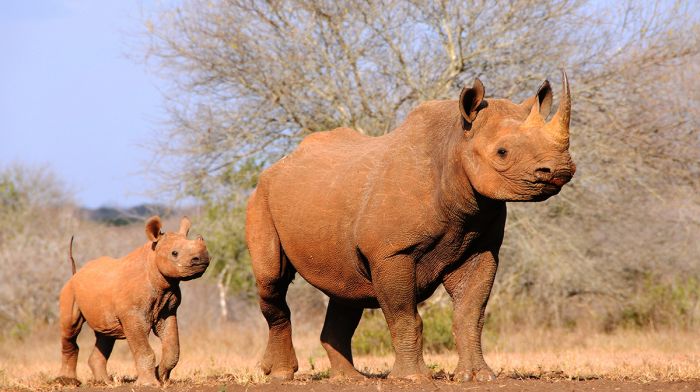
Mkomazi's black rhinos are kept in a secure fenced off area for their protection.
Selous Game Reserve / Nyerere National Park
The Selous Game Reserve was proclaimed in 1922 to give partial protection (hunting was still permitted) to approximately 21 000 square miles (54 600 sq kms) of wilderness land in southeastern Tanzania. The area of the reserve surrounds two significant rivers, the Rufiji and the Great Ruaha, as well as numerous tributary waterways like the Luwegu River. The massive reserve became the largest in Africa, covering twice the area of the Serengeti and three times that of Kruger National Park (in South Africa).
In 2019, Tanzania decided to enhance the eco-tourism potential of the Selous Game Reserve, which until this point had allowed trophy hunting in most of the reserve, by creating a new national park named for the country's first leader upon its independence, Julius Nyerere. The new Nyerere National Park includes all of the land north, west, and south of the Rufiji-Ruaha-Luwegu river system and effectively bans hunting in the majority of the previously unrestricted reserve.
Despite being separated into two distinct protected areas, the combined Selous Game Reserve and Nyerere National Park are still commonly referred to collectively as "the Selous".
All of the safari camps and lodges have always existed in the much smaller northern sector of Selous, but with the massive national park now protecting most of the land, the opportunity for more safari camps to the south is a hopeful sign of a potentially bright future for the wildlife living in Selous.
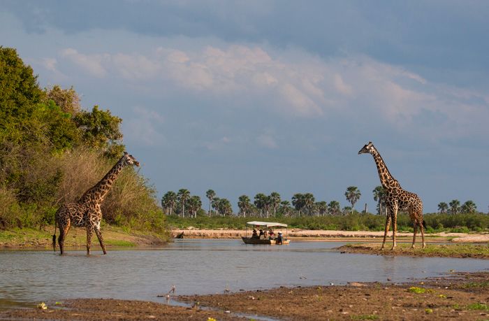
Boating safari on the Rufiji River in the Selous/Nyerere.
The Selous ecosystem is given life by the Rufiji-Ruaha-Luwegu river system that have their confluence in the northern sector where most of the safari camps are located. Along the rivers there is riparian woodland, and in certain areas, swamps, marshes, islands, and small lakes.
Away from the rivers, Selous is dominated by large areas of savanna grassland, Miombo woodland, hilly Acacia scrub, gallery and groundwater forest, and rocky hills. In the northern sector, there are large areas of wooded grassland that are seasonally flooded by the rising water of the Rufiji River, which creates a very dynamic habitat.
Wildlife in Selous is highly diverse and abundant, with an estimated 700 000 large mammals. Plains game species are well represented and include elephant, buffalo, plains zebra, Masai giraffe, greater kudu, hartebeest (Lichtenstein's and Coke's), Roosevelt's sable, reedbuck (common and bohor), eland, impala, blue wildebeest, common waterbuck, puku, klipspringer, duiker (blue and Natal red), topi, Sharpe's grysbok, oribi, and others. There are also an estimated 100 endangered black rhinos roaming the Selous.
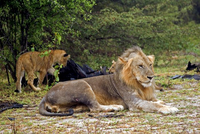
Lions with a buffalo kill in Nyerere National Park (the Selous).
Predators in Selous include lion, African wild dog (the largest population of any area in Africa), leopard, cheetah, spotted hyena, side-striped jackal, caracal, serval, and other small predators like genets and mongooses. Lions are the most commonly seen of the predators and due to the abundance of prey species, especially buffalo, the pride sizes are rather large in the Selous. Leopards are quite common, but more difficult to see.
Primates include yellow baboon, vervet monkey, Sanje crested mangabey, Udzungwa red colobus, and eastern black-and-white colobus. Hippo and crocodile are abundant in the Rifiji River in the northern sector of the park.
Bird life in the Selous is diverse, with over 400 species recorded including the endemic Udungwa partridge (Xenoperdix udzungwensis) and Rufous-winged sunbird (Cinnyris rufipennis).
Activities in the Selous/Nyerere include game drives, boating on the river (water levels permitting), and walking with a guide. Getting to the Selous is most often via small aircraft (from Dar Es Salaam or Arusha town) to one of the camp airstrips. Driving from Dar Es Salaam is also possible, but the drive is 150 miles (240 kms) and due to road conditions, may be quite bumpy and take six to seven hours.
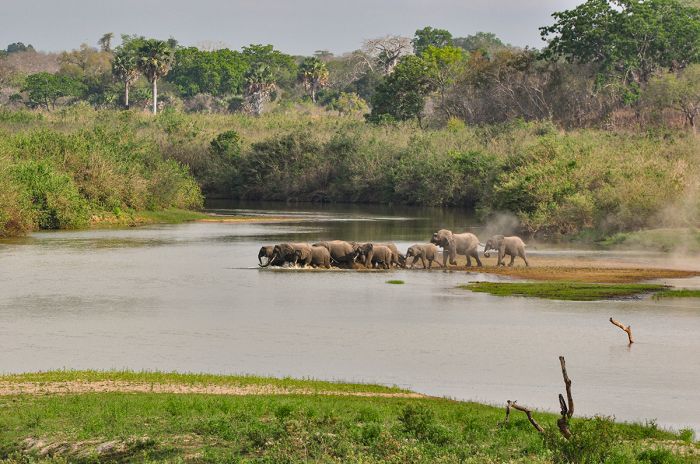
A herd of elephants entering the Rufiji River in the Selous.
Udzungwa Mountains National Park
Just west of the Nyerere/Selous are a range of mountains called the Udzungwa, covering an area of around 6 200 square miles (16 000 sq kms). The Udzungwa Mountains are part of the Eastern Arc Mountains, a chain of mountains that extends from southeast Kenya (the Taita Hills) into northeast Tanzania (the Usambara Mountains) and arcing southwest to the Udzungwas.
The Eastern Arc range of mountains was formed at least one hundred million years ago along a fault located east of the East African Rift. Around thirty million years ago, this mountain range was covered in a vast rainforest, but around ten million years ago, the low-lying areas between the mountains became savanna, leaving the mountains as "islands".
The montane forests flourished, fed by the moisture-rich winds blowing in from the Indian Ocean. The isolation of each of the montane forests in the range has resulted in a high level of endemism and extremely diverse flora and fauna. The Eastern Arc Mountains are one of the world's top twenty biodiversity hotspots.
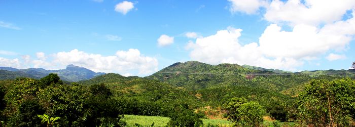
A small section of the Udzungwa Mountains.
A small portion of the Udzungwa Mountains are protected as the Udzungwa Mountains National Park, a forested wilderness covering 768 square miles (1 990 sq kms) in one of the most biodiverse ecosystems on Earth. The park was declared in 1992.
Due to the steep terrain on the upper slopes of these mountains, human activity has always been limited to the lower slopes, so the forests on the middle and upper slopes of the park are mostly untouched.
The virgin forests on the Udzungwa range extend from 800 to 6 500 feet (250 to 2 000 meters) and the diverse habitats on the slopes include bamboo, Miombo, montane rainforest, lowland rainforest, heathland, and grassland. The highest peak in the park is Luhomero, at 8 451 feet (2 576 meters).
Udzungwa is one of the most biodiverse parks in Africa, with more than 400 species of bird, 2 500 floral species (of which one-quarter are endemic), and an unknown but large number of butterfly species. The park also has twelve primate species, four of which are locally endemic, including the Iringa red colobus monkey, Sanje crested mangabey, and two species of dwarf galago. Other primates in the park include black-and-white colobus, blue monkey, vervet monkey, and yellow baboon.
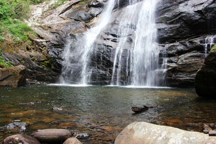
Udzungwa Mountains National Park protects numerous waterfalls in its forests.
Besides primates, other mammals in the park include buffalo, elephant, various species of duiker, including Harvey's red duiker, Abbott's duiker, and blue duiker, klipspringer, bushbuck, civet, honey badger, and bush pig. Leopard are in the park, but rarely seen.
Activities in Udzungwa National Park are restricted to hiking in the forests, as there are no roads in the park. There are numerous hiking trails ranging in duration from the one-hour Sonjo Trail and the very challenging six-day Lumemo Trail, which requires camping gear. A favorite is the four-hour Sanje Waterfalls Hike, which leads to a 558-foot (170-meter) high waterfall and offers swimming in the plunge pool below.
The only accommodation in the park is at self-camping sites. The nearby village of Mang'ula offers some basic guesthouses. The best time to visit Udzungwa is during the dry months from December to February and June to October.
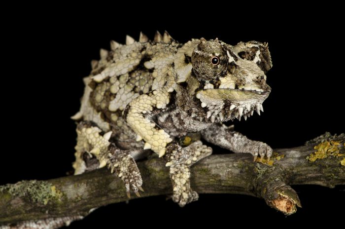
The spiny-flanked chameleon (Trioceros laterispinis) is endemic to the Udzungwa Mountains.
Mikumi National Park
Bordering the Nyerere National Park to the north is the 1 250-square-mile (3 230-sq-km) Mikumi National Park. The park was established in 1964 and the A7 roadway (also known as the Tanzam Highway, as it connects southwest to Zambia) and national rail line pass through the park.
The main game-viewing area in Mikumi is to the north of the roadway, which has good wildlife numbers and is characterized mainly by grassland savanna. The bisection of the park by the roadway is the main reason this park is left off most safari itineraries to southern Tanzania.
Plains game in the northern section of Mikumi is well represented, with good herds of blue wildebeest, plains zebra, buffalo, and impala. Elephants are commonly encountered and there is a healthy population of Masai giraffe. Other herbivores in Mikumi include eland, greater kudu, waterbuck, bohor reedbuck, sable antelope, and warthog. Primates in the park include yellow baboon and vervet monkey.
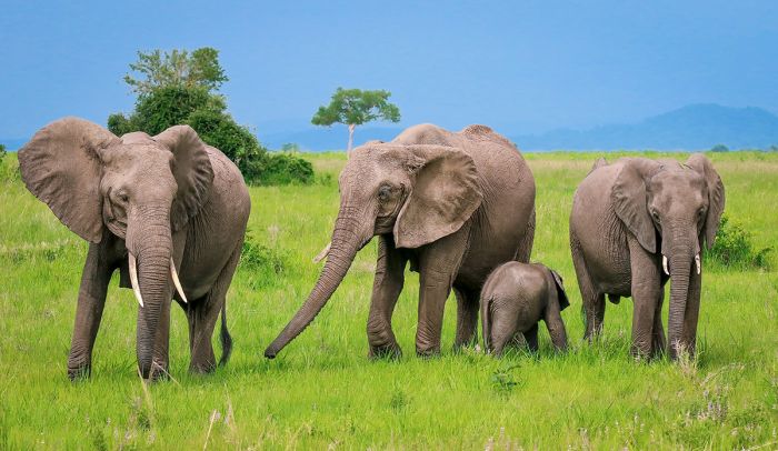
Elephants in Mikumi National Park.
Predators are also well represented in Mikumi, with good numbers of lion that are usually found without much difficulty. Other predators include spotted hyena, black-backed jackal, and occasionally African wild dog. Birding in the park is very good, with over 400 species recorded.
There are basic safari lodges in the national park, as well as camping sites. There are also some accommodation options outside the park, but close enough to visit Mikumi for a day safari. As with other wildlife destinations in southern Tanzania, the best time to visit Mikumi is during the drier months between June and October.
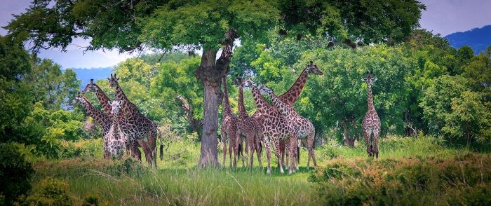
A herd of Masai giraffes in Mikumi.
Ruaha National Park
Located in southern Tanzania within the Great Rift Valley is Ruaha National Park. The park is named for the Great Ruaha River that flows along the eastern boundary and is the most significant source of water for the park's abundant wildlife. The Great Ruaha marks the northeastern boundary of the park and continues to the east, where it flows into the Nyerere/Selous and joins the Rufiji River, which eventually empties into the Indian Ocean.
Ruaha NP was originally part of the much larger Saba Game Reserve, which was established in 1910 by the German colonial authorities. After World War II, the British gained control of Tanganyika (present-day Tanzania) and they re-gazetted the Saba Reserve as the Rungwa Game Reserve, forcing the local inhabitants of the area to relocate. Three years after Tanzania's independence (which came in 1961), the southern portion of the Rungwa Reserve was given full national park protection and in 1964, the new Ruaha National Park was created.
Ruaha was extended in 2008 to protect additional grassland and swamp, essentially doubling the size of the park, which today covers an area of 7 840 square miles (20 300 sq kms), making it the the country's second-largest national park (after Nyerere NP).

A herd of buffalo in the Great Ruaha River bed, Ruaha National Park.
A large area of land to the north of the park is also protected and Ruaha is thus the core of a much larger protected ecosystem that includes three additional contiguous game reserves: Rungwa Game Reserve (directly north of Ruaha and the remnant of the original reserve established by the Germans), Kizigo Game Reserve (bordering Rungwa to the north), and Muhesi Game Reserve (bordering Kizigo to the north).
Ruaha's landscape includes a variety of habitats, including grassland savanna, Acacia woodland, riparian forest, and swamps. Baobab trees are abundant in some areas of the park and the terrain has a similar appearance to that of Tarangire National Park further north and also within the Rift Valley.
Ruaha is home to diverse and abundant wildlife, with a large list of herbivores that includes elephant, buffalo, plains zebra, eland, impala, Grant's gazelle, Masai giraffe, common reedbuck, sable antelope, roan antelope, greater kudu, lesser kudu, Lichtenstein's hartebeest, defassa waterbuck, bushbuck, klipspringer, and Kirk's did-dik.
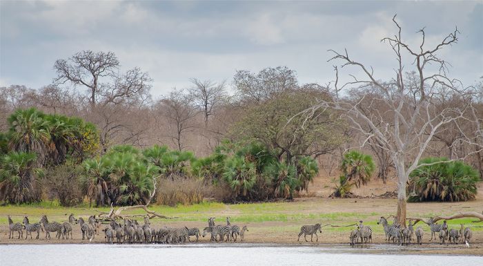
Zebras gathered along the Great Ruaha River in Ruaha National Park.
Predators are well represented in Ruaha and include lion, leopard, spotted hyena, cheetah, African wild dog, caracal, serval, and others. Nile crocodiles and hippos are found in the Great Ruaha River. Birdlife is also abundant in Ruaha, with over 500 species recorded in the park.
Accommodations in Ruaha include a number of good safari camps and lodges, all situated at or near the best game viewing area, which is along the Great Ruaha River in the central and southern portions of the park. The main safari activity in Ruaha is game drives in 4x4 vehicles, but walking with a guide is also an option. The park is never crowded and is still very much a wilderness destination.
The best time to visit for wildlife viewing is during the dry season months between June and October, when wildlife densities are highest near the river.
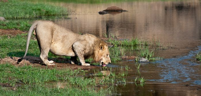
A male lion drinking at the Great Ruaha River.
Rungwa, Kizigo & Muhesi Reserves
Bordering Ruaha National Park to the north are three large game reserves. The areas covered by each are as follows:
- Rungwa: 3 497 square miles (9 057 sq kms);
- Kizigo: 1 544 square miles (4 000 sq kms);
- Muhesi: 1 657 square miles (4 283 sq kms);
- The combined area covered by the three reserves is 6 695 square miles (17 340 sq kms).
According to recent aerial surveys, these reserves are home to the largest population of elephant in Tanzania, with an estimated 16 000 individuals. The reserves are unfenced and there are rural human populations living along the borders in the north and west, as well as a public roadway, which has resulted in ongoing human-elephant conflict when elephants leave the reserve to raid crop farms.
The landscape in these three reserves is characterized by scrubland, open Acacia woodland, grassland, and riparian forest. The main activity in the reserves is trophy hunting, so Ruaha National Park, which lies to the south of Rungwa/Kizigo/Muhesi is the destination for eco-tourists.
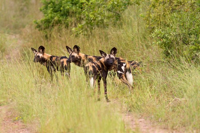
Endangered African wild dogs roam throughout the Ruaha-Rungwa ecosystem.
Kitulo National Park
The small and seldom visited Kitulo National Park is located south of Ruaha National Park and close to Tanzania's southwest border with Malawi. The park was established in 2005 and protects 160 square miles (413 sq kms) of afro-alpine grassland atop a highland plateau (elevation 8 500 feet/2 600 meters) and montane forests in the Livingstone Mountains (also known as the Kipengere Range).
Kitulo is known locally as "Bustani ya Mungo" (which means "Garden of God") and it is a botanist's dream come true, with an incredible assortment of wildflowers, many of the endemic, including over 50 species of terrestrial orchid. The rich volcanic soils and plentiful rainfall in Kitulo create a near-perfect setting for the park's rich vegetation and floral diversity.
The rainy season between November and May is the prime time to visit Kitulo, as this is when the plateau's savanna becomes a floral paradise, with a blanket of colorful wildflowers covering the landscape. The park is also very good for butterflies and birds. There are some good hiking trails, but is otherwise not well developed. Visitors can self-camp in the park or stay in the nearby town of Mbeya, located just west of the park.
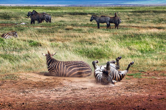
Zebras on the savanna plateau in Kitulo National Park.
Lake Tanganyika
Lake Tanganyika Geology
Lake Tanganyika is the world's longest freshwater lake, spanning 421 miles (677 kms) north-to-south and averages 31 miles (50 kms) in width. It is the world's second-deepest lake (after Lake Baikal in Siberia). Tanganika is the second-largest lake in the world by water volume (after Lake Baikal) and the largest by volume in Africa (Lake Victoria is larger by area, but Tanganyika holds seven times more water due to its great depth). Tanganyika is the world's fifth-largest lake by surface area (after Lakes Superior, Victoria, Huron, and Michigan).
The total surface area covered by Lake Tanganyika is 12 700 square miles (32 900 sq kms) and it has a shoreline measuring 1 136 miles (1 828 kms). The mean depth of the lake is 1 870 feet (570 meters) and it has a maximum depth (in its northern basin) of 4 826 feet (1 471 meters).
Lake Tanganyika is located within the Albertine Rift, which is the western branch of the East African Rift and it forms the westernmost boundary of Tanzania. The lake is confined by mountainous ridges on the east and west. Tanzania occupies 46% of the lake and its waters are also shared by the Democratic Republic of the Congo (40% on the western side), Zambia (a small portion in the southwest), and Burundi (in the northeast).
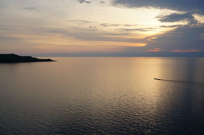
Sunset view over Lake Tanganyika.
Lake Tanganyika is fed by over 50 rivers, but the primary inflows are the Ruzizi River, which flows from Lake Kivu in Rwanda/DRC into Tanganyika in the far north, the Malagarasi River, which enters on the northeast from Tanzania, and the Kalambo River, which forms the boundary between Tanzania and Zambia and enters the lake in the far southeast. Approximately 90% of Tanganyika's water comes from direct rainfall on the lake's surface and most of the lake's water is lost via evaporation.
The only major outflow from Lake Tanganyika is the Lukuga River, which drains out the western side of the lake at the town of Kalamie in the DRC. The Lukuga is a tributary of the Lualaba River, which is the greatest headstream of the Congo River by water volume. The Congo flows to the Atlantic Ocean. Depending on the water levels in Lake Tanganyika, which can vary considerably based on local rainfall, the outflow of the Lukuga River may become intermittently blocked by sandbars and weed masses. The Lukuga itself continues to flow when this happens, as it receives water from numerous other rivers in the DRC.
Lake Tanganyika has three basins of different ages that were at times three separate lakes. The central basin formed 9-12 millions years ago, the northern basin 7-8 million years ago, and the southern basin 2-4 million years ago.
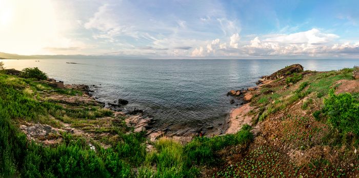
Shoreline of Lake Tanganyika near the Tanzania-Burundi border.
There are no large islands on Lake Tanganyika, but numerous small islands, including Tanzania's Manda Island (not to be confused with the island of the same name in the Lamu Archipelago of Kenya), several in Zambia, and others in DRC.
Lake Tanganyika's waters are alkaline, with a pH around 9 at depths down to 330 feet (100 meters). Below this depth, the pH decreases gradually, reaching a measure of 8.3-8.5 in the deepest parts of the lake. The lake water is warm at the surface, averaging 75°F (24°C) in the dry months between June and August and increasing to 82-84°F (28-29°C) at the end of the rainy season during March/April.
Tanganyika's water is stratified and seasonal mixing via upwellings and downwellings does not extend below a depth of 490 feet (150 meters); as a result, the deep water basins of the lake contain "fossil water". Tanganyika's layered stratification means that in its deeper parts, the water is anoxic (contain no oxygen), which essentially limits fish and other aerobic organisms to the upper layer of the lake.
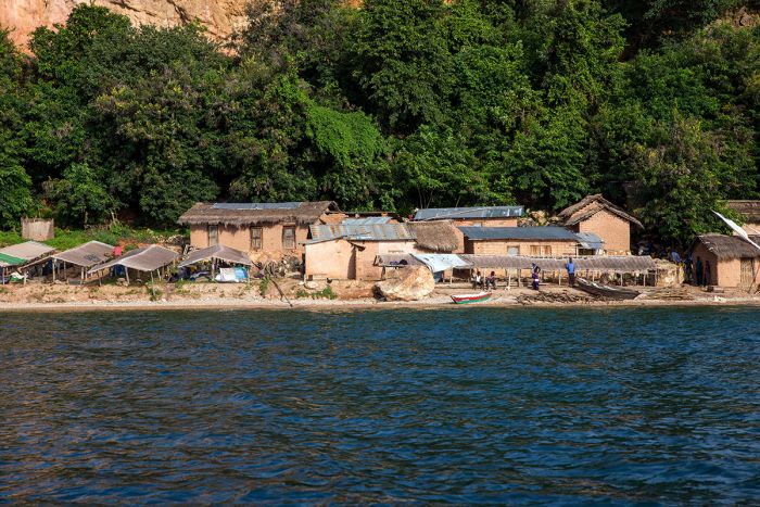
A small fishing village on the Lake Tanganyika shore near Gombe National Park.
Lake Tanganyika History
Early hominid fossils dating back to 1.9 million years ago have been discovered at Olduvai Gorge (in present-day northern Tanzania) and in other paleontological dig sites in Kenya, indicating that the East African region was occupied by our earliest ancestors and they would have surely lived alongside Lake Tanganyika during that time.
Evidence of early hunter-gatherer people has been found around Lake Tanganyika dating back to the Stone Age. These people surely fished on the lake's waters and hunted in the forests fringing the lake.
By the early 1800s, demand for African slaves led Arab traders into the African interior. The town of Ujiji became a major lakeshore trading center for slaves brought from across the lake to the west in the Congo River basin (present day Democratic Republic of the Congo). Slaves were transported across the lake to Ujiji and then led on a grueling 750-mile journey on foot across Tanzania to the Indian Ocean coastal town of Bagamoyo.
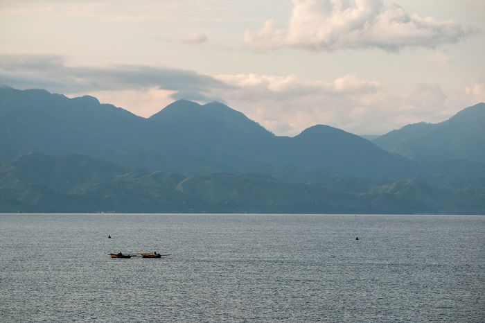
Fishing boats returning after a night spent fishing on Lake Tanganyika.
The slave caravan treks to the coast took three to six months, during which many of the slaves perished from exhaustion or by being shot attempting to escape. From Bagamoyo the slaves were loaded onto boats and transported to Zanzibar, where they were sold at the major slave market in Stone Town. Over one million Africans are estimated to have been enslaved and transported along this route, many of them forced to carry elephant tusks, which were also an important item for the Indian Ocean trade.
The first known Europeans to discover the lake were the British explorer team of John Speke and Richard Burton, who arrived at Ujiji on the northern shore of the lake in February 1858 during their expedition to discover the source of the Nile River.
On 10 November 1871, the famous meeting between Henry Morton Stanley and David Livingstone also occurred in Ujiji. Stanley later claimed to have greeted Livingstone with the now-famous pithy line "Dr. Livingstone, I presume?". Stanley joined Livingston and they further explored the lake and region, determining that there was no connection between Lake Tanganyika and the River Nile.
Stanley was told by the local Wajiji, a Bantu-speaking tribe, that they called the lake "Tanganyika". Though the locals could not give Stanley a definite meaning of the name, he determined that the word "nika" was used by the Jiji to describe a large plain, and it is thought that "tanganyika" was used to describe any large body of water that spreads out like a great plain.
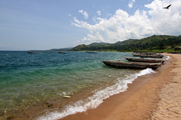
Fishing boats on a Lake Tanganyika beach.
In the 1880s, Germany claimed present-day Tanzania as a protectorate that they named "German East Africa". To facilitate travel and trade in the protectorate, the Germans started construction of the Central Line Railway in 1905. The rail line originated at Dar Es Salaam (just south of Bagamoyo) and followed the same path used by the slave caravans, ending at Kigoma, which replaced Ujiji as the major port on the Lake Tanganyika shore. The railway was completed in 1914, just before the start of World War I.
Today, there are two ferries operating on Lake Tanganyika, both of which transport cargo and passengers along the eastern (Tanzanian) shores of the lake. The MV Liemba operates between Kigoma and Mpulungu (Zambia) and the MV Mwongozo between Kigoma and Bujumbura (Burundi).
There are two small Tanzanian national parks on the shores of Lake Tanganyika: Gombe National Park in the far north and Mahale Mountains National Park further south. Chimpanzees are the main draw for both of the parks in terms of tourism. Gombe became well known in the Western world during the 1960s when Dr. Jane Goodall published articles about her work with the chimps living in Gombe.
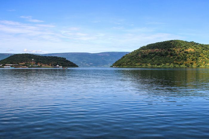
Hilly terrain along the Lake Tanganyika shore.
Lake Tanganyika Fish
Lake Tanganyika's remote location and its geographic isolation from any major urban areas has meant that the lake is almost totally free from human pollution and it is one of the best-preserved aquatic ecosystems in the world.
Tanganyika's waters are home to over 400 species of fish, of which around 250 species are members of the highly diverse "cichlid" (Cichidae) family. Cichlids are a highly evolved family of fish, whose distant ancestors are believed to have originated in the oceans and swam upstream into rivers, eventually reaching lakes. Some cichlids still live in the brackish water of these rivers near their drainages to the ocean.
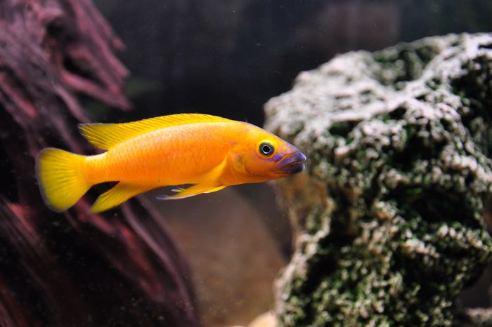
Neolamprologus leleupi, known as the 'lemon cichlid' in the aquarium hobbyist trade, is another endemic cichlid found in Lake Tanganyika.
Cichlids form one of the largest extant vertebrate families on Earth. Cichlids (pronounced 'sick-lids') are members of the order Perciformes (which means "perch-like"), which includes ray-finned, bony fishes. Cichlid fishes are present and diverse in Central/South America and Africa, with Africa alone having an estimated 1 800 species, while the world population is estimated at around 3 000 species.
About 98% of Lake Tanganyika's cichlids are endemic (found nowhere else) and like Lake Malawi and Lake Victoria, Tanganyika is an important stronghold for this family of fish. Lake Tanganyika's cichlids (as well those in Lake Malawi and to a lesser extent in Lake Victoria) have provided important clues to evolution and speciation.
Lakes Malawi and Victoria have experienced relatively rapid species radiations and both have far more species of cichlid than Tanganyika: Malawi has around 1 100 species of cichlid, Victoria has around 500 cichlid species, and Tanganyika has 250 cichlid species. Although Tanganyika's cichlid count is far lower than the other two lakes, its cichlids are much more morphologically and genetically diverse; this is because Tanganyika is a much older lake than Malawi or Victoria. Lake Tanganyika has the larger number of endemic cichlid genera of any lake in Africa.
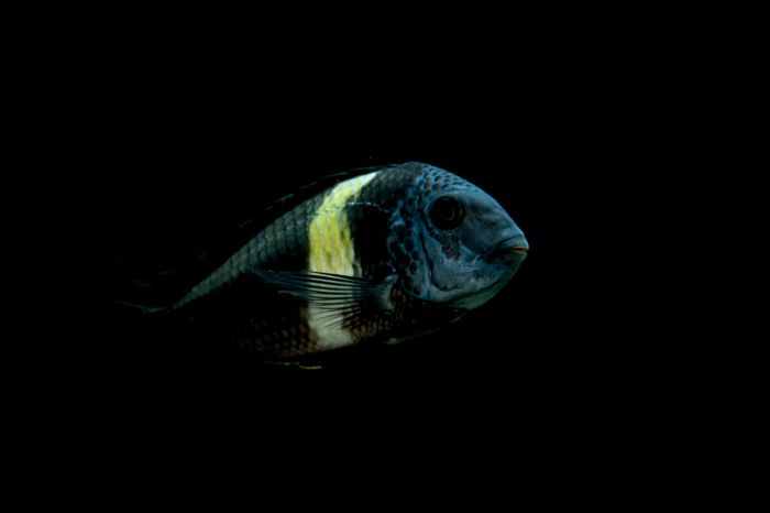
Tropheus duboisi, an endemic cichlid species of Lake Tanganyika.
As is the case in Lake Malawi and Lake Victoria, most of Tanganyika's cichlids live very close to the shoreline in water down to around 330 feet (100 meters), though some deep-water species can live in deeper water.
Like the cichlids from Lakes Malawi and Victoria, many species from Lake Tanganyika are popular in the freshwater aquarium hobby due to their bright coloration and patterns, as well as their interesting behaviors. There are numerous cichlid-breeding enterprises around the world that sell cichlids to pet stores or direct to consumers in the aquarium hobbyist trade.
Some of Tanganyika's cichlids are "mouthbrooders" (although this behavior is much more prevalent in Lake Malawi). Mouthbrooding begins with the female cichlid scooping up her eggs with her mouth as she lays them one at a time. As the female gathers each egg, the male releases milt to fertilize the eggs. After all eggs are released and fertilized, the female holds them in her buccal cavity (mouth), providing a very safe place during the early stages of their life.
The young fry are occasionally released to forage in a safe spot amongst small crevices in rocks, but they quickly dash back into the female's mouth at her signal if danger approaches. Once the babies have grown too big to remain in their mother's mouth, they are permanently released, but by this time, they are strong enough to fend for themselves. Mouthbrooding effectively ensures a very high initial survival rate.
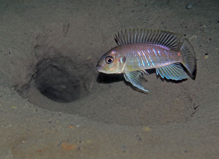
Triglachromis otostigma is an endemic cichlid species of Lake Tanganyika and the only member of its genus.
Besides cichlids, Lake Tanganyika is home to around 150 species of non-cichlid fishes, of which around 60% are endemic to the lake. Tanganyika also hosts around 90 freshwater snail species (78% are endemic) and 11 bivalve species (8 are endemic). Crustaceans (crabs and various shrimps) in the lake number around 200 species, of which over half are endemic. Lake Tanganyika far surpasses all other Rift Valley lakes in terms of crustacean and freshwater snail endemism.
Fishing in Lake Tanganyika is an important source of protein for the estimated 10 million or so people living around its borders. It is estimated that around 100 000 people are directly involved in fishing on the lake. Tanganyika's fish are also exported to other regions in East Africa. Commercial fishing in Lake Tanganyika starting during the mid-1950s and the industry has had a significant negative impact on some of the fish species in the lake.
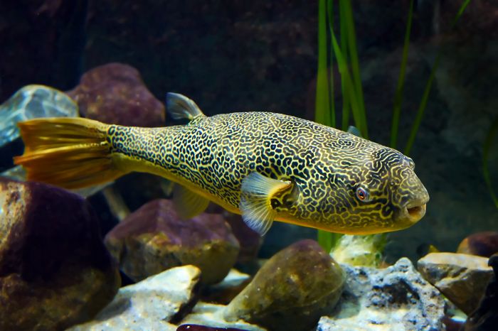
The 'Mbu puffer' (Tetraodon mbu), also known as the giant freshwater puffer, lives only in the middle and lower sections of the Congo river and in Lake Tanganyika, particularly near the Malagarasi River mouth.
Gombe National Park
Located on the northern shore of Lake Tanganyika in western Tanzania, Gombe is one of the country's smallest national parks, covering just 20 square miles (52 sq kms). In 1960, Dr. Jane Goodall began her groundbreaking and well-publicized study of the chimpanzees living at Gombe under the patronage of the famous Kenyan paleontologist, Louis Leakey. Goodall's work with Gombe's chimps made Gombe a household name in much of the Western world and in 1968, Gombe was declared a national park.
Gombe covers a small sliver of hilly forest that rises up from the Tanganyika's lakeshore. The forest at Gombe is cut by thirteen river valleys that begin atop the Rift Valley escarpment that rises inland to the east of the lake. The forested slopes of the escarpment are rich in flora, creating an ideal environment for primates, birds, and other fauna. Due to its remote location, Gombe is not frequently visited by tourists and those that make the trip come primarily to spend time with the chimpanzees.
The Gombe Stream Research Center (GSRC) was establish by Dr. Goodall in 1967 and the chimpanzee research in Gombe continues today, making it the world's longest-running field study of animals in their natural environment. Goodall lived in Gombe nearly full-time for fifteen years and her long-term work revealed insights into chimpanzee culture that was groundbreaking at the time. The ongoing research by the GSRC has further supplemented Goodall's initial work over multiple chimpanzee generations since then.
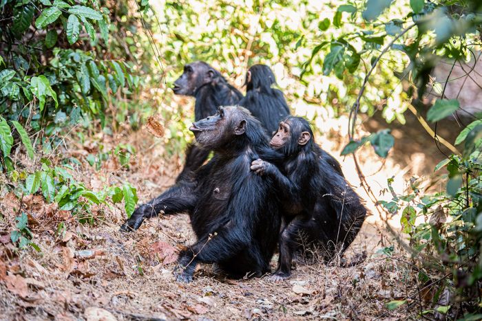
Chimpanzees are the main attraction in Gombe National Park.
Gombe has no roads, so exploring the forest on foot is the primary activity, especially chimpanzee trekking. Gombe has around 100 chimpanzees that comprise three distinct chimp communities. Tourists visiting Gombe participate in guided chimpanzee treks to visit the long-studied and semi-habituated Kasekela chimp community.
Chimpanzee treks in Gombe require a degree of physical fitness for participants as the often steep and varied terrain can be challenging, depending on the location of the chimps on any given day.
During the drier months (mid-December to January and July to mid-October), the chimpanzees tend to spend the majority of their time on the lower slopes of the various river valleys in the park, making it rather easy to reach them on a trek. Conversely, during the rainy months (February to June and mid-October to mid-December), the chimpanzees are usually found at the higher elevations where their preferred foods become more plentiful, and trekking to the chimps at this time becomes more difficult.
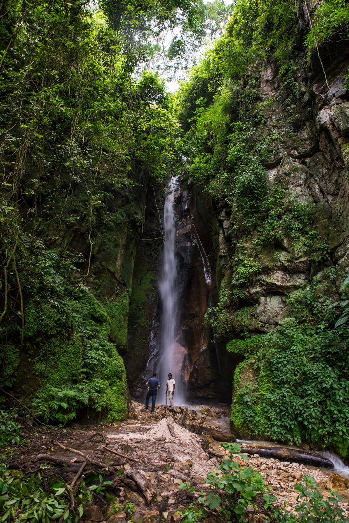
Spectacular waterfall in the forest at Gombe National Park.
Besides the chimpanzees, which are by far the main attraction at Gombe, other primates that are likely to be seen include red colobus, red-tailed monkey, blue monkey, olive baboon, and vervet monkey. Other than primates, the only mammals likely to be seen are bushbuck and grey duiker. Birding is also quite good at Gombe, with 250 species recorded.
Gombe is one of Tanzania's least visited wildlife destinations, mostly because of its remote location, far from the most common safari circuit in northern Tanzania. Furthermore, while Gombe was once the only reliable place in Africa to see wild, but habituated chimpanzees, the establishment of a combined research and tourism-based chimpanzee trekking program in Uganda's Kibale National Park has created an alternative to Gombe.
Getting to Gombe involves a two- to three-hour flight to Kigoma from either Dar es Salaam or Arusha, followed by a boat ride of under one hour along the shore of Lake Tanganyika north to the park. We recommend Gombe Forest Lodge for accommodation in Gombe.
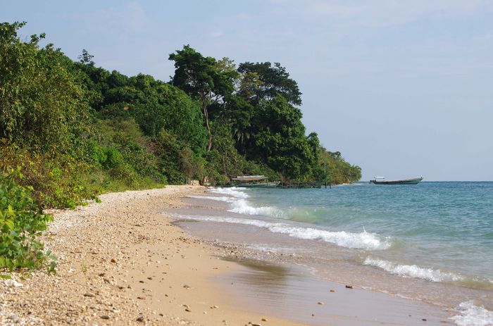
A beach on the shore of Lake Tanganyika, Gombe National Park.
Mahale Mountains National Park
Located in far western Tanzania on a large peninsula jutting out into Lake Tanganyika, Mahale Mountains is the country's least accessible national park. The peninsula and park are located 75 miles (120 kms) south of Kigoma (the only significant urban area on the Tanzanian side of the lake). The park is named for the Mahale Mountains, which are home to the largest remaining population of chimpanzees in the world, numbering around 700 individuals.
Like the chimps at Gombe National Park to the north, Mahale's chimpanzees have been under continuous study since the early 1960s. Mahale's chimpanzees comprise 15 to 20 communities and research is conducted by Japan's Kyoto University.
Mahale was established in 1985 and protects 623 square miles (1 613 sq kms) of lush montane forest on the slopes that rise up and tower over the sandy beaches on the lakeshore in this remote location. Similar to Gombe National Park further north along the lake, chimpanzees are the main attraction for those who visit Mahale.
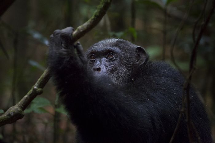
A chimpanzee in Mahale Mountains National Park. Mahale has the largest remaining population of wild chimps in the world.
Mahale encompasses a wide range of habitats, including beaches, steep forested slopes, river valleys, and even savanna in the eastern portion of the park. There are no roads in Mahale, so getting around the park is accomplished by hiking only.
Chimpanzee trekking is the main activity in Mahale, which means a level of fitness is required for participants. The chimpanzees live on the forested slopes of the mountains and treks to see them often mean hiking on steep and uneven terrain. Although the chimpanzee population is Mahale is greater than at Gombe National Park, the size of the chimpanzee territory is far greater in Mahale, so this can mean much longer treks in order to get to the chimps on any given day.
The best time for chimpanzee trekking at Mahale is during the latter part of the dry season, from July through October. During this time, the chimpanzees spend most of their time on the lower slopes of the mountains, making the treks to locate them much shorter in duration and less difficult. Sometimes the chimps even pass through the safari camps or can be seen on the lakeshore beaches.
During the rainy season (February to June and mid-October to mid-December), the chimps are much more difficult to locate, as they tend to head to higher elevations in search of their favorite foods. Trekking during the wet months can be extremely challenging and may mean missing the chimps entirely.
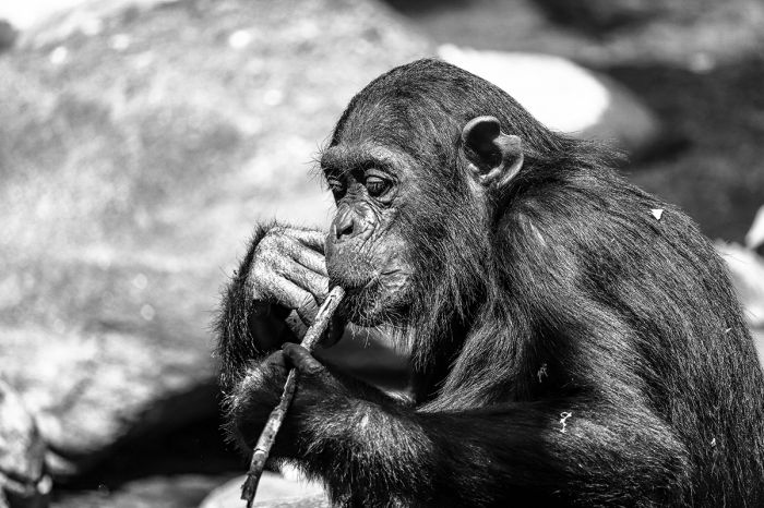
The chimpanzees in Mahale Mountains have learned to use sticks to extract carpenter ants, which they eat. Gombe's chimps also use sticks as tools, but in Mahale the chimps eat termites, while avoiding ants.
Other primates living in Mahale include red colobus monkey, vervet monkey, blue monkey, yellow baboon, and an endemic race of black-and-white colobus monkey. Interestingly, the baboon species at Gombe (which has olive baboons) and Mahale (yellow baboons) are different, even though the parks are not far from each other and both on the Lake Tanganyika shore.
The much drier savanna ecosystem of Mahale, which is located on the eastern side of the mountains, is home to entirely different wildlife, but the tourism accommodations are all located on the western side of the Mahale Mountains and there are no roads in the park, so seeing the eastern side of Mahale is unlikely except on a multi-day camping excursion.
Wildlife on Mahale's eastern side includes lion, African wild dog, spotted hyena, Masai giraffe, elephant, buffalo, eland, zebra, and many more species. It is noteworthy that Mahale is the only park in Africa that is home to both lion and chimpanzee.
There are no good roads leading into Mahale, nor any roads in the park, so getting to Mahale is only feasible by flying to the private airstrip in the northwest corner of the park. After landing at Mahale's airstrip, visitors take a boat transfer to one of the few accommodation choices in the park. Charter flights to Mahale are available from Dar es Salaam (2 hours), Arusha (3-4 hours), and Kigoma (30 minutes).
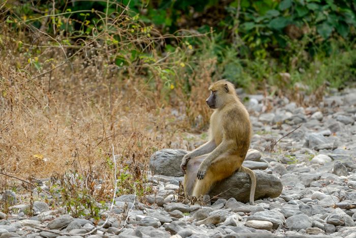
A yellow baboon relaxes on the Lake Tanganyika shore in Mahale Mountains National Park.
Katavi National Park
Katavi is another of Tanzania's remote wilderness destinations and the least-visited of the country's classic (game-drive based) wildlife safari areas. Katavi National Park was established in 1974 to protect the wildlife and diverse ecosystems along the eastern side of the Albertine Rift (the western branch of the East African Rift) that runs roughly north-south through Uganda, Rwanda, Burundi, the DRC, Tanzania, and northern Zambia.
The total area protected by Katavi NP is 1 726 square miles (4 471 sq kms) and its major habitats include Acacia woodland, savanna grasslands, seasonal floodplains, and marshland. The Kapapa and Katuma are seasonal rivers that flow through the park, feeding Lake Chada and Lake Katavi. Both lakes become mostly or completely dry by the end of the dry season (October).
The best time for wildlife viewing in Katavi is during the latter part of the dry season, from August until early November. During this period, large numbers of elephant, plains zebra, buffalo, impala, Lichtenstein's hartebeest, topi reedbuck and defassa waterbuck can be seen on the floodplains that border the seasonal waterways in the park. Predators in Katavi include lion, cheetah, leopard, African wild dog, and spotted hyena. The Acacia woodlands attract less wildlife, but species like roan, sable, and eland can often be seen there.
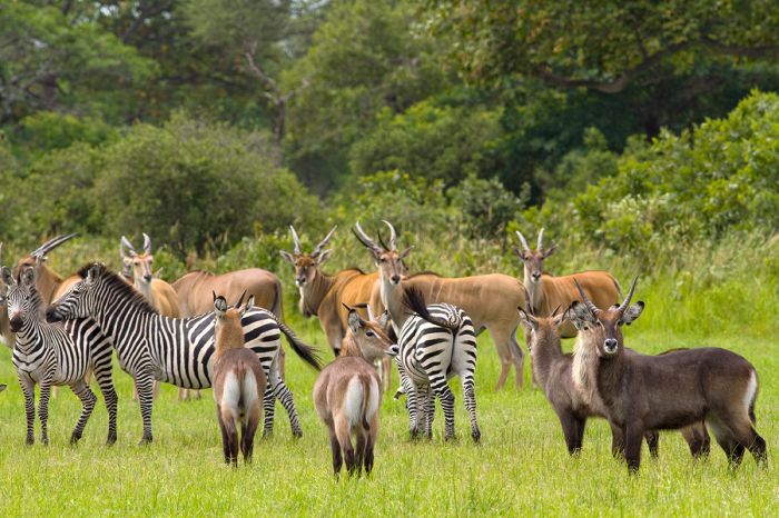
Katavi is home to a good diversity of large mammals. Shown are zebra, defassa waterbuck, and eland.
Katavi is home to large numbers of hippo, which can sometimes be seen massed together in large pods of several hundred during the dry season, when the dwindling water pools becomes overcrowded. There is also a significant population of crocodiles in the park. Birding in Katavi is very good, with a species list of around 400 species.
Katavi is never crowded and those who decide to go will be in for an experience that few safari destinations can offer. It is a true wilderness with good numbers of wildlife and very few people. Visitors remark that it seems like stepping back in time.
There are a handful of all-inclusive safari camps available in Katavi National Park, which is best reached via charter flight. Flights may be arranged out of Dar es Salaam, Arusha, or one of the other parks further to the east, such as Nyerere/Selous or Ruaha. Anyone planning a circuit to Tanzania's southern or western parks should include some time in Katavi.
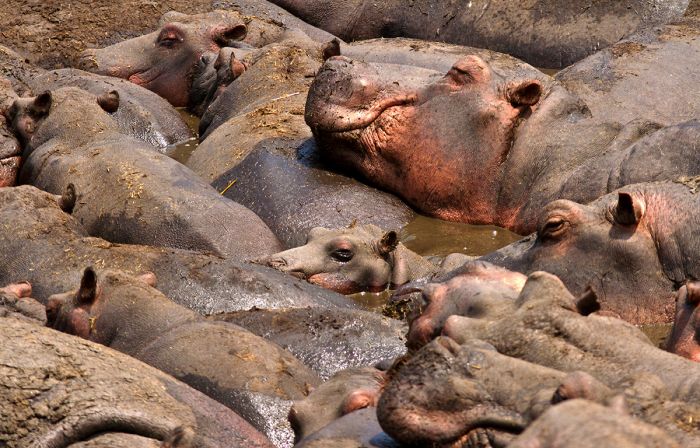
During the dry season, hippos congregate in high densities at Katavi's shrinking lakes and waterholes.
Lake Rukwa
Tanganyika has two parallel branches of the Rift Valley that separate north of Lake Victoria: the Western Rift (or Albertine Rift) runs southward through Lakes Edward (Uganda/DRC), Kivu (Rwanda/DRC), Tanganyika, and Rukwa, while the Eastern Rift (or Gregory Rift) runs through western Kenya and into central Tanzania. The two branches merge just south of Lake Rukwa and continue south into Lake Malawi.
Data suggests that during the early period of Africa's rifting, Lake Rukwa was part of a much larger basin that encompassed the basins of Lake Tanganyika and Lake Malawi, but uplifting occurred and separated the three lakes. Ancient shorelines suggest that Lake Rukwa last overflowed into Tanganyika around 33 000 years ago.
Excavations around Lake Rukwa have uncovered evidence of Iron Age settlements dating back to at least the 13th century. These early inhabitants around Rukwa used a combination of agriculture, pastoralism, and hunting for survival.
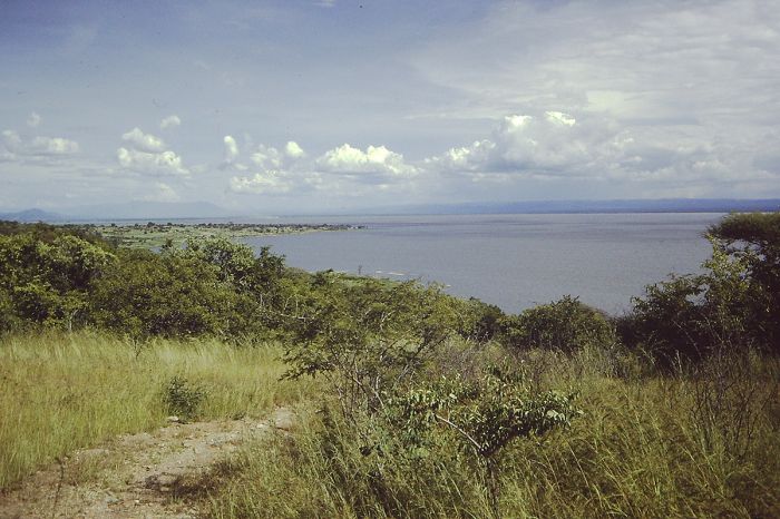
View of Lake Rukwa from the northern shore. (Photo: Wikimedia Commons)
Lake Rukwa is Tanzania's third largest inland body of water, lying at an elevation of around 2 600 feet (800 meters). The lake is an endorheic basin (no outflows) and due to its shallow depth (average of around 10 feet/3 meters), has experienced great fluctuations in its size and volume over the years based on varying rainfall and inflows from its river sources. Rukwa's water is alkaline and brackish, with salt pans on its southwest side fed by hot springs.
Since the early 2000s, Lake Rukwa has measured around 110 miles (180 kms) in length and 20 miles (32 kms) in width, giving it a surface area of around 2 220 square miles (5 750 sq kms). During dry periods, Rukwa may split into two lakes, with a narrow swamp belt separating the two lakes.
Records show that Lake Rukwa dried almost completely during the 1820's and 1830s, and when John Hanning Speke passed by during his expedition to search for the source of the River Nile in 1859, he described the lake as an impassable swamp. Later records show that in 1929, the lake was only 30 miles (48 kms) long, but it increased greatly by 1939 to a length of 80 miles (128 kms).
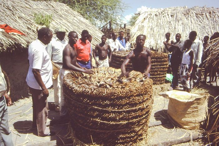
Dried fish from Lake Rukwa being prepared for export. (Photo: Wikimedia Commons)
Wildlife in Lake Rukwa includes large numbers of crocodile and hippo, as well as plentiful fish, including Tilapia, which are caught in good numbers by subsistence fishermen and even exported to Zambia and the DRC by the lake's commercial fishery.
Birding is particularly rewarding at Lake Rukwa, with over 350 species recorded. The lake attracts tens of thousands of waterbirds during their breeding season, including great white pelicans.
The rural area surrounding Katavi-Rukwa has a human population of roughly 1.5 million, most of whom subside on agriculture (maize and paddy are the main crops) and livestock farming. It is estimated that around 80% of Lake Rukwa's water is used for domestic livestock and water usage from the lake is a major concern at present.
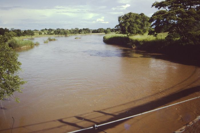
View of the Momba River very close to its mouth at Lake Rukwa. (Photo: Wikimedia Commons)
Rukwa & Luwati Game Reserves
Established in 1995, Rukwa Game Reserve adjoins Katavi National Park on its north, with the Rungwa River demarcating its northern border, the Kavuu River its western border, and Lake Rukwa its southern border. The Lukwati Game Reserve adjoins Rukwa on the east.
The Rukwa Reserve covers an area of 768 square miles (1 988 sq kms) that is characterized by Acacia and Miombo woodland, Acacia scrub, seasonal floodplains, and grassland savanna.
Lukwati Game Reserve was established in 1997 and is a further continuation of the protected land on the eastern side of Lake Rukwa. Lukwati covers an area of 1 215 square miles (3 147 sq kms) and has similar habitat to that of Rukwa, with Acacia and Miombo woodlands and some seasonal floodplains.
Both reserves have good numbers of wildlife, including buffalo, elephant, sable, greater kudu, roan, eland, Lichtenstein's hartebeest, defassa waterbuck, common reedbuck, oribi, impala, common duiker, and bush pig. Predators include lion, leopard, spotted hyena, and black-backed jackal. Crocodile and hippo are present and abundant in Lake Rukwa.
Both Rukwa and Lukwati Reserves are primarily used for trophy hunting.
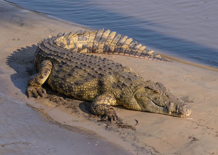
A Nile crocodile on the shore of Lake Rukwa.
Rift Valley
The Great Rift of Africa, also known as the East African Rift, is one of the most notable geographic features on Earth. This massive fault in our planet's crust has already led to separation of great land masses (including Madagascar from the African continent) and in a few million years, more of Africa will likely separate along this rift.
The East African Rift originates far to the north of Tanzania in the Red Sea and cuts southwest before separating into two branches. The eastern branch, known as the 'Gregory Rift' cuts south through western Kenya and central Tanzania and it includes several Rift Valley lakes including Turkana, Baringo, Bogoria, Nakuru, Naivasha, and Natron.
The western branch of the rift is known as the 'Albertine Rift' and it traverses to the west of Lake Victoria and includes more Rift Valley lakes, including Albert, Edward, Kivu, and Tanganyika. The two branches merge in southern Tanzania, and the rift continues into Lake Malawi.
The Gregory Rift is named in honor of British geologist John Walter Gregory, who explored the rift in 1892–93 and again in 1919. Gregory's 1896 book The Great Rift Valley is considered a classic. The Albertine Rift is named for Prince Albert of Saxe-Coburg and Gotha, who was the consort of Queen Victoria from 1840 until his death in 1861.
Lakes Tanganyika, Natron, Eyasi, Manyara, and Rukwa are all Rift Valley lakes in Tanzania.
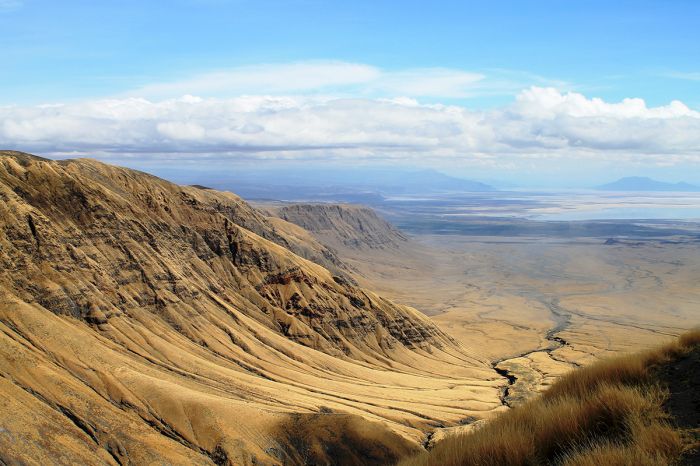
A view into part of the Gregory Rift in northern Tanzania.
Zanzibar Islands
History of Zanzibar
The Zanzibar Islands have a rich history, with early humans living on Unguja and Pemba at least 20 000 years ago during the Stone Age. Ships from Persia (present-day Iran), Arabia, and India have visited Zanzibar for at least 2 000 years (based on archeological finds and early Greco-Roman texts).
The Indian Ocean coast that includes present-day Somalia, Kenya, Tanzania, and northern Mozambique, including the offshore islands along this same stretch, including the Lamu Archipelago, Comoro Islands, and Zanzibar, is often called the "Swahili Coast". During the first millennium AD, the Romans referred to same region as "Azania", while the Chinese, Indians, and Middle Easterners called it "Zinj" or "Zanj", which is believed to mean the "place of the black people". The word "Zanj" is what eventually led to the name "Zanzibar".
Trading with merchants from the east, across the Indian Ocean, became increasingly important to Bantu-speaking tribes living along the coast of present-day northern Tanzania starting around the 8th century. By around the 10th century, Unguja and Pemba had attracted immigrants from Arabia and Persia, who commingled with the local Bantu-speaking Africans living along the coast and on the islands, creating the beginning of a new culture called "Swahili".
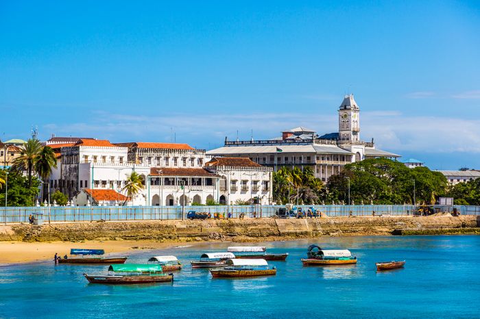
View of Stone Town on Unguja Island, Zanzibar.
The emerging Swahili culture included the development of a new language (also called Swahili and still spoken throughout East Africa today), which was a mix of vocabulary from Bantu, Middle Eastern, India, and centuries later, Portuguese, when they occupied the Swahili Coast.
Traders arriving on ships from the east across the Indian Ocean began using present-day Zanzibar (Unguja Island) as their base and a settlement began to grow at present-day Stone Town on Unguja.
Vasco da Gama, a Portuguese explorer became the first European to visit Zanzibar in 1498. The Portuguese wanted control of the lucrative Indian Ocean trade, and in 1503, Portugal took control of Zanzibar the the Tanzanian coast to the west, which they held for the next two centuries.
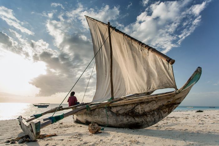
A traditional dhow on a beach on Unguja Island, Zanzibar.
In 1698, the Sultanate of Oman drove the Portuguese out of Zanzibar and during the first four decades of the 1800s, numerous wealthy Omani merchant princes settled on Zanzibar, where they became elite rulers and landowners. In 1840, Said bin Sultan, the Sultan of Muscat and Oman, moved his empire from Muscat in Oman to Unguja Island at Stone Town. Zanzibar thus became an Arab state and the centre of a growing and already lucrative ivory, slave, and spice trade.
During the second half of the nineteenth century, Stone Town, a section of present-day Zanzibar City, became the main trading port for slaves and elephant tusks (ivory) shipped across the Indian Ocean. An estimated 50 000 African slaves and untold tons of elephant tusks passed through Stone Town during the nineteenth century.
By the 1880s, European colonization of Africa was well underway, and in 1885, present-day Tanzania became part of the German East Africa (a colony which also included present-day Burundi and Rwanda). In 1890, Zanzibar became a British protectorate (not a colony), but continued under the sovereignty of the Sultan of Zanzibar.
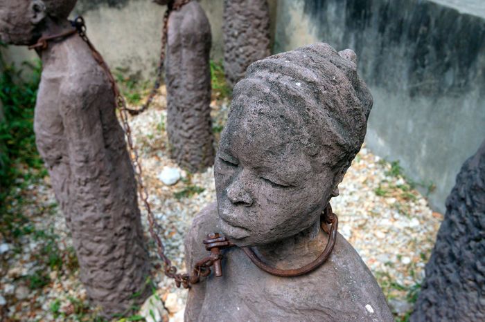
Slaves memorial in Stone Town, Unguja Island, Zanzibar.
In 1963, Zanzibar gained independence from Britain and in 1964, merged with Tanganyika (mainland Tanzania), which had already gained its independence from Britain in 1961.
Today, Zanzibar is inhabited by a diverse mix of people from the various cultures that have passed through Zanzibar during its past, including the descendants of Bantu-speaking Africans, slaves from the interior of Africa, Arabs, and Portuguese. The people here refer to themselves as "Shirazi". Swahili is the most-commonly used language in Zanzibar, but Arabic and English are also widely spoken. The total population on the Zanzibar Islands is around 1.3 million.
Zanzibar, which refers to all of the islands, is part of Tanzania, but remains a semi-autonomous region and has its own government.
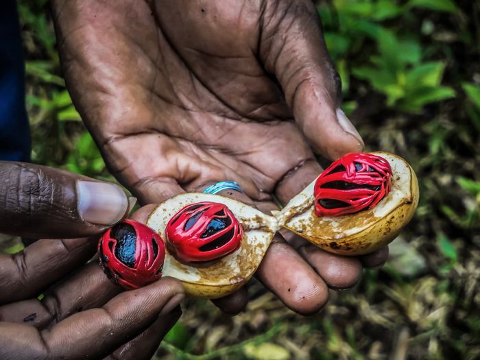
A fresh nutmeg fruit on a farm Unguja Island. The nutmeg tree (Myristica fragrans) is indigenous to the Maluku Islands of Indonesia and was brought by traders to Zanzibar centuries ago. The seed is used to make the nutmeg spice, while the red 'aril' that covers the seed is used to make a spice called mace, which has a similar but more delicate flavor to nutmeg. Most farms in Zanzibar grow cinnamon, vanilla, and nutmeg.
Visiting Zanzibar
Getting to Zanzibar is most often by scheduled flight from either Arusha, Kilimanjaro Airport (JRO) or Dar es Salaam Airport (DAR). A ferry boat from Dar es Salaam is another less used option. There are regularly scheduled flights between Unguja and Pemba islands.
The weather in Zanzibar is tropical and warm all year, but the dry season (June through October) is the best time to visit. The 'short rains' occur in November/December with sporadic and normally lighter showers. January and February are typically dry, with only occasional rain, so this is also a good time to visit. The 'long rains' occur from March through May, and they can be heavy, so avoid this time in Zanzibar.
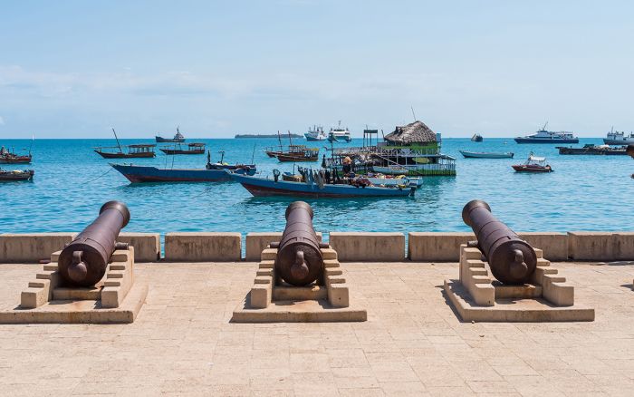
Cannons on Zanzibar's 'Old Fort', which was built by the Portuguese in 1701.
Unguja Island
The Zanzibar Archipelago consists of two main islands: Unguja Island, also called Zanzibar Island, and Pemba Island. Zanzibar also includes around fifty smaller islands or islets, all of which are located some 25-50 miles (40-80 kms) off the northern Tanzania coastline in the Indian Ocean. Collectively, the entire group of islands are referred to as 'Zanzibar'.
The vast majority of people living on the Zanzibar islands are located on the two large islands, Unguja and Pemba, with about two-thirds (900 000) of these on Unguja and the other third (400 000) living on Pemba.
Unguja Island (also known as Zanzibar Island) is the largest island in the archipelago, covering an area of 643 square miles (1 666 sq kms). Unguja is 53 miles (83 kms) long, north-to-south, and 19 miles (30 kms) wide east-to-west at its widest point. The capital of Zanzibar is Zanzibar City on Unguja island and it is the only significant urban area on any of the islands.
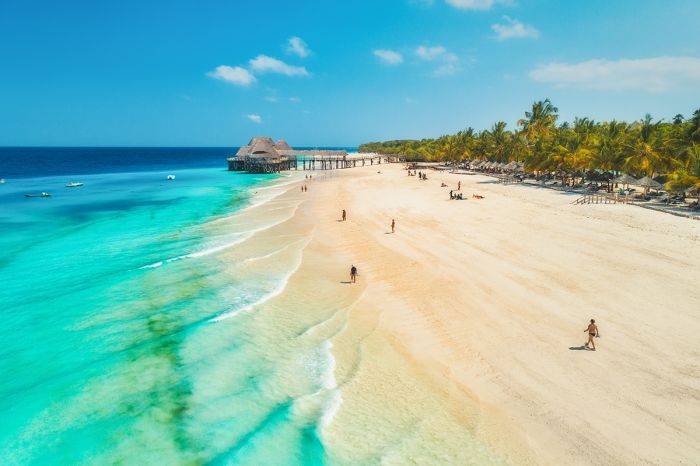
Wide sand beaches and warm Indian Ocean water are a main attraction on the Zanzibar Islands.
Stone Town
The oldest section of Zanzibar City is called Stone Town and it is a popular destination for tourists, who come to see this historic Arabian-style quarter. Stone Town has the appearance of a North African 'Medina', with Arabian-style architecture. Stone Town's streets are narrow and winding, lined with bazaars, shops, markets, and mosques. Tourists can safely enjoy walking the streets of Stone Town or better yet, take a guided tour.
Stone Town was declared an UNESCO World Heritage Site in 2000; however, most of the oldest buildings in Stone Town are in constant need of restoration, as the humid air and fragile nature of the coral stone used to build them means that they deteriorate over time.
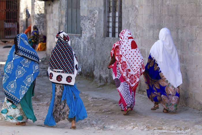
Local Zanzibari women in colorful attire walking the narrow streets in Stone Town, Zanzibar.
Must-see landmarks in Stone Town include:
- The Old Dispensary: built in 1887 to celebrate Queen Victoria's Golden Jubilee.
- The Palace Museum: built in the late 1800s and was the residence of the last Omani sultan, who was exiled in 1964.
- The House of Wonders: constructed in 1883 and one of six palaces built by Barghash bin Said, the second sultan of Zanzibar.
- The Old Fort: Zanzibar's oldest building, built in 1701 by the Portuguese.
- Jubilee Gardens: an open-air street food market that opens daily after sunset and offers local Zanzibari cuisine.
- Kelele Square: the historic open-air slave market used in the 19th century.
- Tippu Tip's House: the original home of the famous Arab-Zanzibari slave and ivory trader.
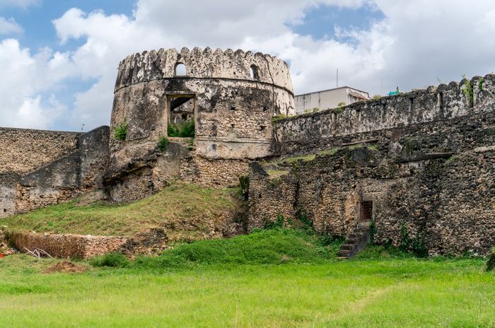
Zanzibar's oldest building is the Old Fort, located in Stone Town on Unguja Island.
Attractions on Unguja
Besides Stone Town, Unguja Island offers plenty of things to see and do, including numerous resorts and beach-front accommodations offering a wide variety of offshore activities like snorkeling, diving, and other water sports.
The far northern region of Unguja is by far the most popular beach destination and also the most crowded, while the southern part of Unguja is far less popular, but still offers some great beaches.
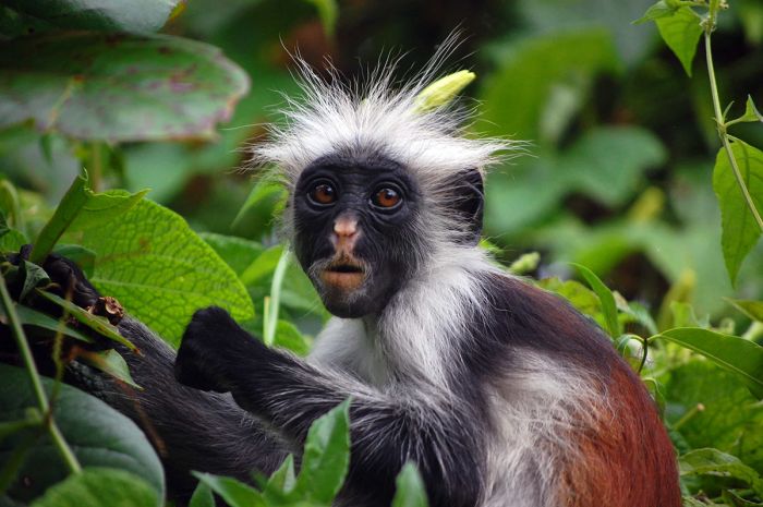
The Zanzibar red colobus (Piliocolobus kirkii) is endemic to Zanzibar and can be seen with relative ease in the Jozani-Chakwa Bay National Park on Unguja Island.
Key places of interest on Unguja Island (for a more complete list, check the Zanzibar region page):
- Jozani-Chwaka Bay National Park: Located in the central part of the island, this is Zanzibar's only national park, covering 19 square miles (50 sq kms) and offering hiking trails in spectacular forest. The endangered Kirk's red colobus monkey is likely to be seen and there are a host of other small mammals in the park, as well as birds and butterflies. The park also extends into a small offshore area in Chakwa Bay on the eastern side of the island.
- Menai Bay Conservation Area: Protects the entire southern coastline of Unguja and an offshore area of 180 square miles (470 sq kms) that includes coastal waters, coral reefs, sea grass beds, mangrove forests, sandbanks, and beaches. These waters are home to myriad marine life, including Indo-Pacific humpback dolphins, bottlenose dolphins, sea turtles, and a huge number and variety of fish. Boat tours are available.
- Nungwi and Kendwa: Small but busy tourist enclaves on the northern tip of Unguja forming the island's most popular beach resort destination. The resorts and bustling towns offer water sports of every imaginable type, with exceptionally good snorkeling and diving. Lots of accommodation choices, restaurants, and a lively nightlife scene.
- Mnemba Island: A small privately-owned island situated 1.5 miles (2.5 kms) off the northeast coast of Unguja with an exclusive resort offering excellent diving and snorkeling to its guests.
- Kiwengwa-Pongwe Forest Reserve: Located along the eastern coast towards the north part of the island, the reserve protects 13-square-miles (33-sq-kms) of Unguja's most biodiverse habitat. Habitats include a coral rag forest, which grows atop the rubbly limestone of an ancient coral reef. Small mammals can be seen including the endangered Zanzibar red colobus monkey and Ader's duiker. Birding in the reserve is also good, with around 50 species possible. Visitors can hike the nature trails and explore caves.
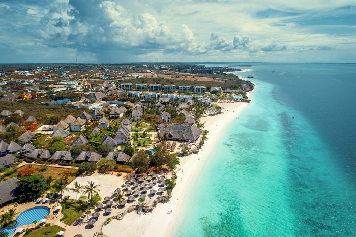
Aerial view over Nungwi beach showing some of the ocean-front resorts.
Pemba Island
The second largest island in the Zanzibar Archipelago is Pemba Island, which is situated 25 miles (40 kms) due north of Unguja. Pemba is sometimes referred to as the "Green Island", due to the dense vegetation that covers most of the island. Pemba covers an area of 381 square miles (988 sq kms) and spans 42 miles (67 kms) north-to-south and 14 miles (22 kms) wide at its widest point. Pemba is hilly, but mostly low lying, with a high point of 330 feet (100 meters) in elevation.
The main industry on Pemba is clove farming and the island has a distinctively fragrant spice aroma. There are no large urban areas on Pemba, but the largest town is Chake, its capital.
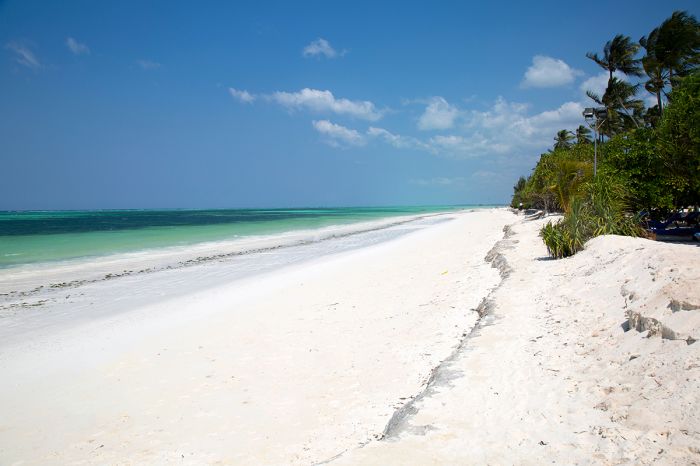
A beautiful white-sand beach on Pemba Island, Zanzibar.
There are three small protected areas on Pemba Island, all of them located in the far north of the island, the largest of which is the Ngezi-Vumawimbi Nature Reserve. The reserve protects the Ngezi forest, a remnant of a once-vast indigenous forest that once covered more than half the island, before clove farming claimed most of it.
The rich forest that remains has beautiful teak trees and some endemic wildlife, including the Pemba vervet monkey, Pemba blue duiker, and Pemba flying fox. There are also four endemic birds in this forest: the Pemba green-pigeon, Pemba sunbird, Pemba scope-owl, and Pemba white-eye.
Pemba receives far fewer tourists than Unguja and has a much lower level of infrastructure, but is definitely worth a visit if you are looking for natural beauty, superb diving, and pristine beaches. There are a handful of very good accommodations to choose from on Pemba Island.
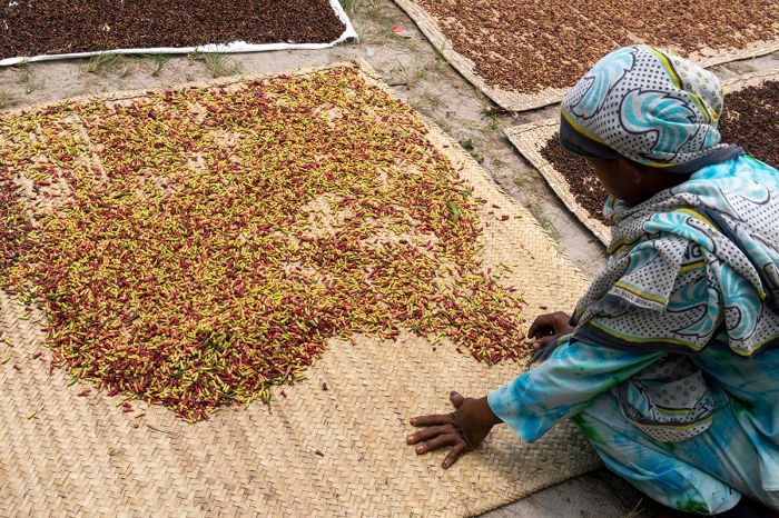
A local woman spreads cloves on a thatch mat to dry, Pemba Island, Zanzibar.
Saadani National Park
Located along Tanzania's Indian Ocean coast just 50 miles north of Dar es Salaam and directly west of Zanzibar's Unguja Island is Saadani National Park. Saadani was established in 2005 and covers an area of 410 square miles (1 062 sq kms). The park's unique location on the coast gives it a diverse combination of habitats, including marine, terrestrial, and riverine biomes.
Prior to becoming a national park, Saadani was used primarily for trophy hunting, but the wildlife has had time to recover and the game viewing is now good. Several eco-tourism camps have opened, allowing visitors to enjoy this unusual reserve.
Wildlife in Saadani includes a diverse selection of over thirty large mammal species, including elephant, buffalo, plains zebra, Masai giraffe, Lichtenstein's hartebeest, greater kudu, Roosevelt's sable, roan, blue wildebeest, common waterbuck, warthog, yellow baboon, and several species of monkey. Predators in Saadani include leopard, lion, and Nile crocodile. Hippo are common in the Wami River.
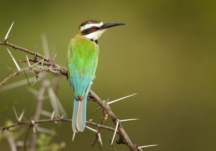
A white-throated bee-eater (Merops albicollis) in Saadani National Park.
Marine wildlife in Saadani includes various dolphins, sharks, and sea turtles. Green turtles are known to nest along Saadani's beaches and the park's Incubation and Hatching Centre provides crucial conservation for the turtles. Baboon and waterbuck are occasionally seen on the beaches as well.
The safari camps in Saadani offer game drives, walking safaris, boating on the Wami River, and snorkeling from the beach. Birding in the park is excellent due to the diverse habitats, with over 330 species recorded.
June through October is the dry season and the best time to visit Saadani, with animals tending to stay close to the Wami River. The period between the two rain seasons (January/February) is also an excellent time to be in Saadani, with verdant colors and plenty of new life. The heaviest rains come in April and May, when road conditions can be difficult.
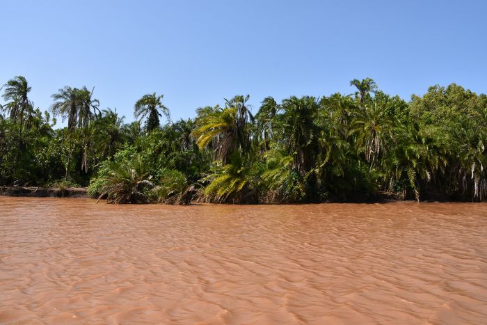
Boating on the Wami River is an excellent safari activity in Saadani National Park.
Mafia Island
Mafia Island is located 12 miles (20 kms) offshore of the central Tanzanian coastline in the Indian Ocean, not far from the Rifiji River delta. Mafia is the third largest island in Tanzania's ocean territory (after Unguja and Pemba, both of which are part of Zanzibar). Mafia covers an area of 152 square miles (394 sq kms) and is part of a small archipelago that includes several other small islands.
Mafia and the other islands in the archipelago are characterized by scrub and grassland in the interior, as well as mangroves and coastal forest along the island perimeters. The population on Mafia Island is around 40 000 and its economy is primarily based on fishing, with some subsistence farming.
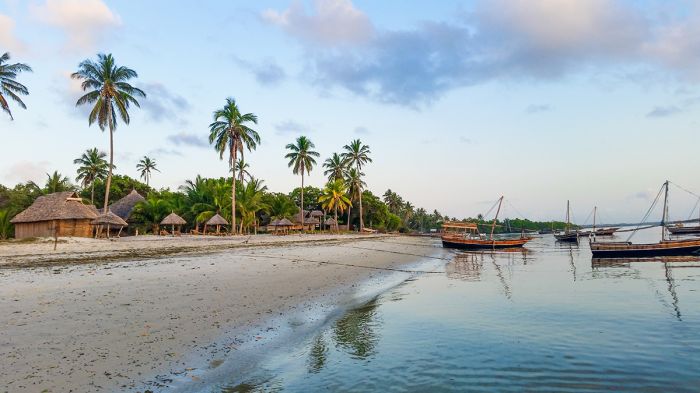
A simple beachfront resort on Mafia Island.
Most of the island's wildlife is marine-based or avian, but Mafia is home to a large colony of Seychelles fruit bat (Pteropus seychellensis), which is only found in two other locations (the Seychelles and Comoros). A 444-square mile (1 150-sq-kms) area encompassing Chole Bay on the eastern side of Mafia has been designated a Birdlife International Important Birding Area (IBA), as it supports populations of Terek sandpipers, crab plovers, and western reef-herons.
There are several historic ruin sites on Mafia, some dating back to the 13th century.
Most tourists that visit Mafia Island come for SCUBA diving, sport fishing, and birding.
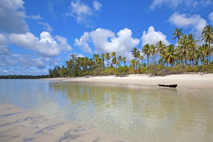
A pristine beach on Mafia Island.
Mafia Island Marine Park
Established in 1995, the Mafia Island Marine Park protects coastal and marine habitats covering roughly half of the island's coast and a substantial area offshore, totaling 317 square miles (822 sq kms). The habitats protected in the park include coral reefs, seagrass beds, inter-tidal flats, coastal mangroves, and a small remnant of lowland coastal forest.
Green and hawksbill turtles use some of the protected beaches as nesting sites and the offshore reefs and open water are home to around 380 species of fish. Another endangered species that is found in the marine park is the dugong.
Humpback and sperm whales migrate into the waters off Mafia Island from August through November and there are several species of dolphin that are resident in the park. Whale sharks are also commonly seen.
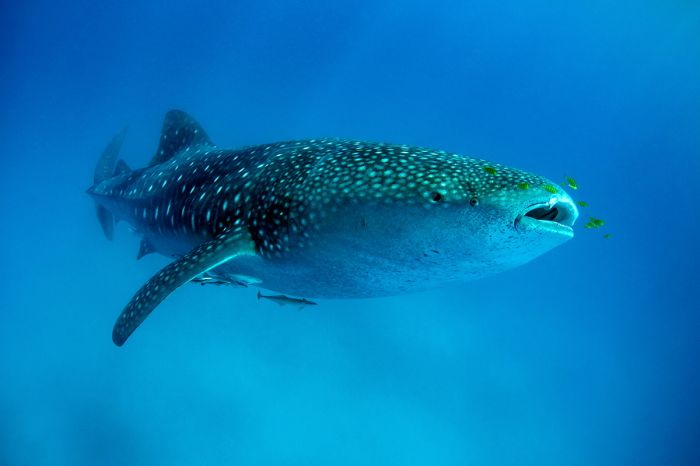
A whale shark with golden trevally pilotfish (Gnathanodon speciosus) in attendance. Mafia Island is a very popular diving destination.
Mnazi Bay-Ruvuma Estuary Marine Park
Established in 2000, the Mnazi Bay-Ruvuma Estuary Marine Park is located in the far southeastern corner of Tanzania, extending to the border with Mozambique. The park was created to protect globally important marine bio-diversity at the mouth of the Ruvuma River (which forms the boundary with Mozambique), plus additional area inland and offshore as well. The total combined protected area spans 251 square miles (650 sq kms), of which approximately one-third is on land.
The diverse habitats protected in the park include mangrove forest along the Ruvuma Estuary, seagrass beds, coral reefs, rocky and sandy shoreline, mud flats, salt pans, lagoon, open coastal water, three islands (Mongo, Namponda, and Kisiwa Kidogo), and numerous rocky islets.
The protected beaches are used as nesting grounds for hawksbill and green turtles and the offshore waters are used by humpback whales, sperm whales, spinner dolphins, and Indo-Pacific humpback dolphins. The best season for seeing whales here is when they migrate through from August to November. The Ruvuma Estuary is home to crocodiles, hippos, and several species of terrapin.
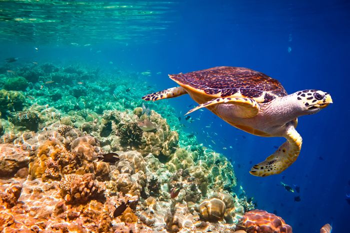
The beaches in Mnazi Bay are used as nesting grounds for the hawksbill sea turtle (Eretmochelys imbricata), a critically endangered species.
The park is also designated as a Birdlife International Important Birding Area (IBA), as it provides habitat, breeding, and roosting sites for numerous species of seabird and shorebird, including a healthy population of crab plovers. The last confirmed sighting of a dugong was in 1992, but there are ongoing unconfirmed sightings
Surveys of the park have found 400 species of reef-dwelling fish, 250 species of hard coral, and over 100 species of echinoderm within the coral reefs.
Approximately 30 000 people live inside the park, mostly depending on marine resources for their livelihoods, and poverty is widespread.
The beaches and estuary at Mnazi Bay have been designated as a Birdlife International Important Birding Area (IBA), protecting endangered species like the crab-plover (Dromas ardeola).
Malagarasi-Muyowosi Wetland
The Malagarasi-Muyowosi Wetland is located in the remote northwest portion of Tanzania and is fed by a network of rivers in a vast catchment area covering over 35 000 miles (92 000 sq kms) or about 10% of the entire country. The wetland receives water from numerous rivers flowing from both the north and south that converge and join the Malagarasi River, which ultimately feeds into Lake Tanganyika to the west of the wetland.
The Malagarasi River was once part of the upper catchment feeding into the Congo River system (which drains into the Atlantic Ocean), but during the uplifting associated with the formation of the Rift Valley to the west (where Lake Tanganyika is now), the flow of the Malagarasi became blocked, resulting in the formation of a large shallow lake where the wetland is today.
Eventually over a very long period, the Malagarasi River cut through the uplifted earth and rock and connected west into Lake Tanganyika, dropping the level in the lake and leaving the current network of smaller lakes, permanent swamps, and floodplains that form the current wetland.
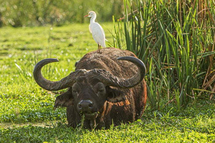
A buffalo with a cattle egret as passenger. The Malagarasi wetlands provide superb habitat for an abundance of large mammals.
Three main rivers, the Malagarasi, Muyowosi, and Ugalla, plus their numerous tributaries, feed into the wetland. The Malagarasi and Muyowosi rise in the highlands to the north, while the Ugalla system flows in from the south and east. TheSE rivers converge on the western edge of the wetland and continue flowing west into Lake Tanganyika.
The wetlands are comprised of three components, arranged geographically from north to south. The core portion of the wetland is the northern section, which covers around 1 235 square miles (3 200 sq kms). This section is made up of permanent swamps, lakes, and floodplains along the Muyowosi, Malagarasi, and Gombe Rivers. This northern area of the wetland lies to the north of the road and railway that pass east-west just to the south.
The central portion of the wetland is comprised of an extensive lake-swamp-floodplain system along the Zibwe River and Lake Sagara, covering 360 square miles (930 sq kms), with extensive floodplains and swamps lying southeast of the lake towards the Ugalla River. The southern section of the wetland follows the Ugalla-Wala River system, expanding out onto an extensive floodplain southeast of Ugalla River National Park.
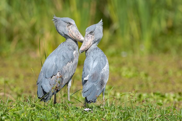
The core area of the Malagarasi wetlands are home to good numbers of the critically endangered shoebill (Balaeniceps rex).
There is a high diversity of wetland types in this large ecosystem, including seasonal and permanent freshwater lakes, seasonal and permanent rivers, papyrus swamp, non-forested peatland, floodplain grassland, floodplain woodland, groundwater forest, and riparian forest. Non-wetland habitats bordering the wetland include extensive Miombo woodlands, open grasslands, and large areas of scrubland.
The river systems and lakes in the wetland support large numbers of Nile crocodile and hippo. Other large mammals found in the woodlands and grasslands bordering the wetland include zebra, buffalo, topi, common reedbuck, bohor reedbuck, Maasai giraffe, Lichtenstein’s hartebeest, defassa waterbuck, roan, sable, bushbuck, oribi, warthog, and yellow baboon.
Predators in the vicinity of the wetland include leopard, lion, spotted hyena, and African wild dog. The wetland is one of the few places in Tanzania where the sitatunga antelope is found. The wetland harbors one of Africa's largest populations of Cape clawless otter and a population of the critically endangered African slender-snouted crocodile, (Crocodylus cataphractus).
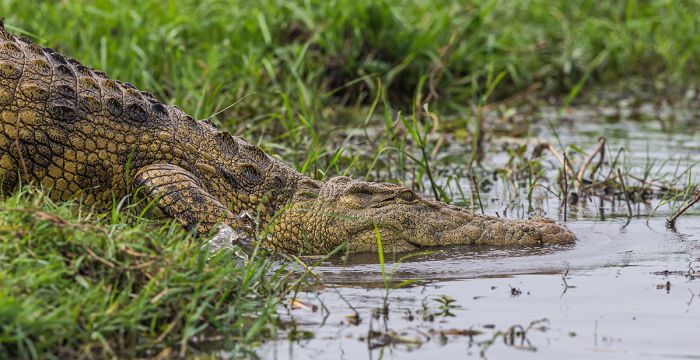
Crocodiles are found in the lakes, rivers and permanent swamps in the Malagarasi-Muyowosi Wetlands.
Birds are present in the thousands in this pristine wetland, and the swamps and lakes are home to good numbers of shoebill stork, wattled crane, and Pel's fishing owl, all of which are critically endangered species. Waterbirds are present in huge numbers and the wetland is used by migrating Palaearctic species as a stopover feeding and resting grounds. The wetlands are also home to a number of range-restricted and endemic fish species.
The wetlands are threatened by human encroachment, especially illegal livestock grazing, which occurs in the officially protected areas (Kigosi National Park, Muyowosi Game Reserve, and Ugalla River National Park). An aerial survey conducted in 2014 found that there were over 50 000 head of cattle grazing in the Muyowosi-Kigosi Reserves.
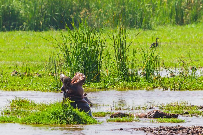
Hippos are found throughout the Malagarasi wetlands.
Kigosi National Park & Muyowosi Game Reserve
Originally established as a game reserve in 1983 (and used primarily for trophy hunting), the Kigosi Game Reserve was upgraded to a national park in 2019. The park covers an area of 3 191 square miles (8 265 sq kms) in the remote and very infrequently visited northwest part of the country.
Kigosi National Park, along with the Muyowosi Game Reserve which lies directly to its west, protect a portion of the core northern section of the Malagarasi-Muyowosi Wetlands, which lies at the southern end of both reserves.
The Muyowosi Game Reserve borders Kigosi National Park to the west, with the two reserves separated by Muyowosi River. Muyowosi was established in 1981 and is slightly larger than Kigosi, covering an area of 4 413 square miles (11 430 sq kms). Trophy hunting is the primary activity in the Muyowosi Reserve.
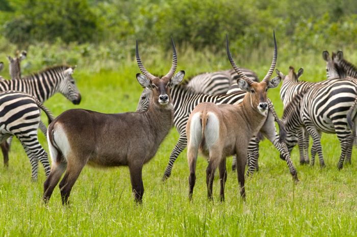
Zebra and defassa waterbuck are found throughout Kigosi National Park and Muyowosi Game Reserve.
While the southern portion of Muyowosi and Kigosi are characterized by swamp and wetlands, the terrain becomes progressively drier as one moves north, changing over to dry Miombo woodlands, Acacia scrub, riparian forest and thickets, and savanna grassland.
Neither of these protected areas are visited much, although there are some hunting operators in Muyowosi, which helps protect the wetland to a degree from even more human encroachment.
The best time to visit Kigosi for a safari is during the dry season, from June through early October or the relatively dry period in December/January. Accommodation in Kigosi consists of self-camping sites.
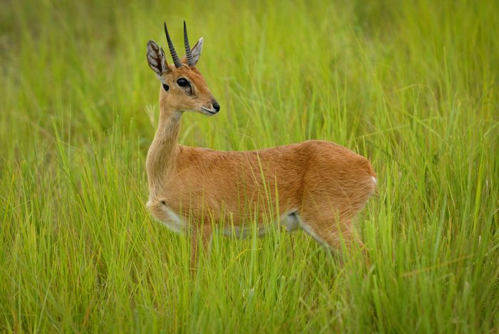
The diminutive oribi is found in the Kigosi-Muyowosi ecosystem.
Ugalla River National Park
Situated in western Tanzania and originally established in 1965 as the Ugalla River Game Reserve, the reserve was upgraded to a national park in 2019. The park covers 1 492 square miles (3 865 sq kms) and is named for the seasonal Ugalla River, which flows west through the middle of the reserve on its way to the Malagarasi-Muyowosi Wetland and eventually into Lake Tanganyika.
Ugalla is situated on low-lying terrain and is dominated by open grasslands. The plains along the Ugalla River become seasonally flooded during the rains. Lofty palms line the Ugalla River, which even during the dry season, provides enough remnant water pools to sustain the park's wildlife until the rains arrive again. Away from the river, the landscape shifts to Miombo woodland, open woodland, and Acacia scrub.
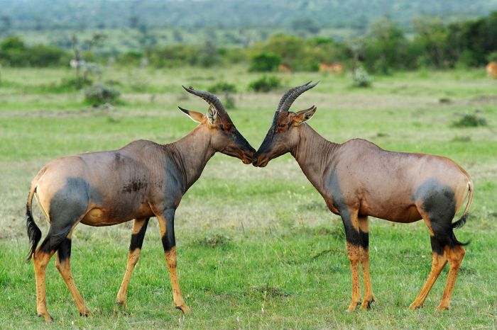
Topi antelopes are common in Ugalla River National Park.
Wildlife in Ugalla River includes a diverse assortment of herbivores including buffalo, Lichtenstein’s hartebeest, Masai giraffe, zebra, topi, roan, sable, greater kudu, impala, bohor reedbuck, common reedbuck, eland, oribi, warthog, yellow baboon, dik-dik, bush pig, and duiker. Ugalla River harbors good numbers of hippo and crocodile. Predators include lion, leopard, spotted hyena, black-backed jackal, and African wild dog. Elephants are uncommon.
As with most of Tanzania's wildlife destinations, the dry season months from June through October are the best for a visit to Ugalla. The short rains occur in November and the long rains start in March, continuing through early May in most years. Ugalla is mostly inaccessible from January to April, as there is often extensive flooding along the Ugalla River. Accommodation consists of self-camping sites.
Prior to being upgraded to a national park in 2019, the reserve was used primarily for trophy hunting.
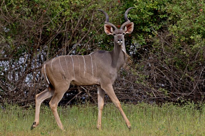
Greater kudu are one of numerous large mammal species that can be seen in Ugalla River National Park.
Burigi-Chato National Park
Established in 2019, Burigi-Chato was created by merging three existing game reserves (Burigi, Kimisi, and Biharamulo, all created in the 1970s) in the far northwest corner of Tanzania.
Burigi-Chato covers an area of 1 817 square miles (4 707 sq kms) with elevations ranging between 3 200-5 000 feet (1 000-1 500 meters). The park is bounded by the border with Rwanda on the west and a small stretch of Lake Victoria on its eastern side. The northeast border of the park runs through Lake Burigi.
Lake Burigi is a narrow lake, measuring 19 miles (30 kms) in length and 2.5 miles (4 kms) wide at it widest point, with a maximum depth of around 25 feet (8 meters). Burigi is an endorheic (no outlet) lake, which makes its water quite saline and alkaline. There are large areas of papyrus swamp along the northern shores of Lake Burigi.
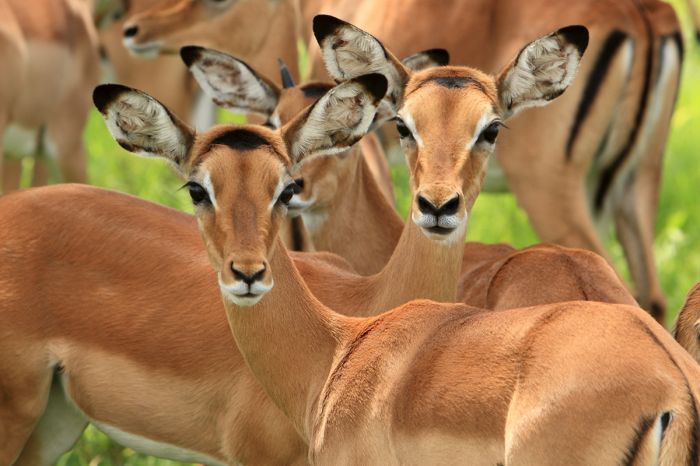
Burigi-Chato offers diverse wildlife like these impala.
Burigi-Chato's landscape includes several freshwater lakes, vast areas of medium- and tall-grass savanna, Miombo woodland, rivers, valleys, riparian forest, and rocky crags.
Wildlife in Burigi-Chato is varied and includes elephant, buffalo, defassa waterbuck, eland, impala, sable, roan, topi, zebra, Masai giraffe, oribi, warthog, olive baboon, and others. Predators in the park include lion, leopard, and jackal. Hippo, crocodile and sitatunga are found in Lake Burigi. Biding in the park is excellent and visitors may be lucky to spot an endangered shoebill stork in one of the park's lakes.
Game drives, walking and fishing are the main activities offered and accommodation is only by self-camping at this time.
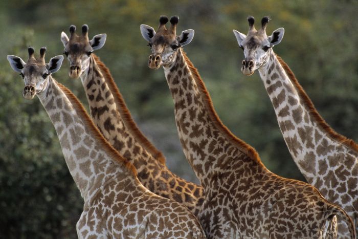
Masai giraffe are fairly common in Burigi-Chato National Park.
Rumanyika-Karagwe National Park
Established in 2019 (from what was the Rumanyika Game Reserve), Rumanyika-Karagwe National Park is another of Tanzania's remote parks, located in the far northwest corner of the country and close to the borders with Uganda and Rwanda. The park is small, covering just 95 square miles (247 sq kms) and the infrastructure in terms of game drive tracks and accommodation is still being developed.
The core of the park is a deep river valley, with some freshwater lakes and swamps. The slopes of the valley are comprised of tall-grass savanna, open Acacia woodland, Miombo woodland, and areas of thick bush and scrub. There are patches of montane forest atop some of the higher elevations.
Confirmed wildlife in the park includes buffalo, elephant, giraffe, impala, eland, leopard, defassa waterbuck, hippo, common reedbuck, roan, warthog, duiker, olive baboon, and vervet monkey, but there are certainly other species here as well.
Accommodation at this time is only by self-camping.
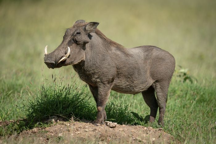
A warthog in Rumanyika-Karagwe National Park.
Ibanda-Kyerwa National Park
Established in 2019 (from what was the Ibanda Game Reserve), Ibanda-Kyerwa National Park is located at the extreme northwest corner of Tanzania and includes the intersection of three countries: Uganda, Rwanda, and Tanzania. The park is small, covering just 77 square miles (200 sq kms) and development of the game drive roads and other infrastructure is under way.
The new park forms a northern extension to Rwanda's Akagera National Park.
The landscape in Ibanda-Kyerwa consists of hilly grassland, river valleys, open Acacia woodland, and scrubland. The seasonal rivers feed some small freshwater lakes and swamps.
Wildlife is essentially the same as Rumanyika-Karagwe National Park, which lies a short distance away to the east, with elephant, topi, impala, eland, hippo, buffalo, giraffe, defassa waterbuck, and other species present. Leopard are the most common predators though they are infrequently seen. Lions have been reintroduced in Akagera and are expected to be present in Ibanda-Kyerwa as well.
Accommodation at this time is only by self-camping.
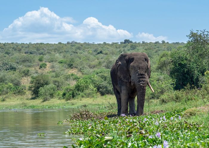
Elephants roam freely between Rwanda's Akagera National Park and Ibanda-Kyerwa National Park in Tanzania.
Lake Victoria
Lake Victoria Geology
Lake Victoria is Africa's largest lake by surface area and the world's largest tropical lake. Victoria is also the world's second-largest fresh water lake (by surface area), covering 23 145 square miles (59 947 sq kms); only Lake Superior in North America is larger.
Considered one of Africa's "Great Lakes" (along with Lake Tanganyika and Lake Malawi), Lake Victoria is situated between two arms of the East African Rift. The western rift (or Albertine Rift) incorporates Lake Albert (Uganda/DRC), Lake Edward (Uganda/DRC), Lake Kivu (Rwanda/DRC), and Lake Tanganyika (Burundi, Tanzania, DRC, Zambia), while the eastern rift (or Gregory Rift) runs through western Kenya and central Tanzania. The two rifts rejoin in southern Tanzania and continue south as a single rift into Lake Malawi.
Using volume of water as the measure, Lake Victoria is the ninth-largest lake in the world (not including dam-created reservoirs). Lake Tanganyika, which is far deeper than Lake Victoria, but smaller by surface area, is the third largest lake on Earth by volume and Lake Malawi is the fifth largest lake on Earth by volume. Both Tanganyika and Malawi contain more water than Victoria. Asia's Caspian Sea is the world's largest lake by volume.
A storm over Lake Victoria. The lake receives most of its water via direct rainfall.
Lake Victoria has a maximum depth of 276 feet (80 meters) and an average depth of 130 feet (40 meters). Like Lakes Malawi and Tanganyika, Lake Victoria is home to a high diversity of fish, most which belong to the highly evolved Cichlidae family of bony fishes (known as cichlids). Cichlid fishes have been studied for decades and have provided many clues to evolution.
In geologic terms, Lake Victoria is a relatively young lake, formed some 400 000 years ago when uplifting occurred along Africa's Great Rift, effectively blocking westward-flowing rivers, which subsequently emptied into the depression formed east of the escarpment.
Based on evidence obtained from core samples taken from the bottom of the Victoria basin, the lake has completely dried up at least three times, each of the occurrences having taken place during past ice ages, when the planet's precipitation was dramatically reduced. The most recent historical dry period for Lake Victoria began around 17 300 years ago and lasted until 14 700 years ago.
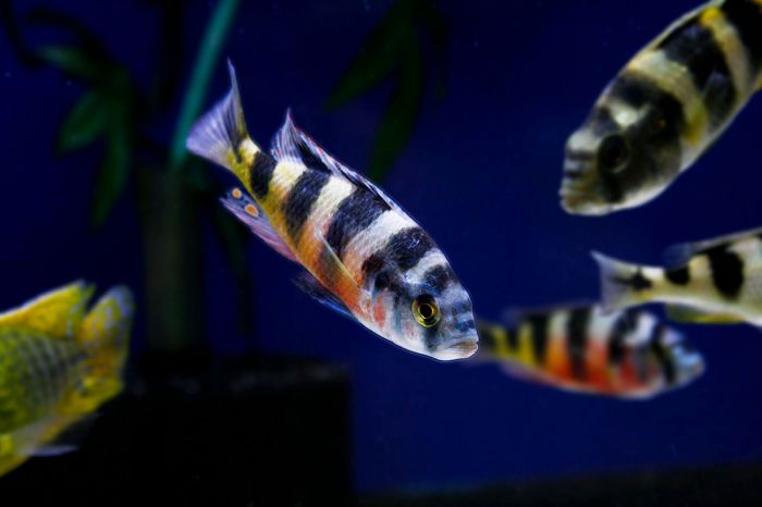
Astatotilapia latifasciata (known as 'zebra obliquidens' in the tropical fish hobbyist trade) is a cichlid fish endemic to Lake Victoria.
Most of Lake Victoria's water (about 80%) is received by direct rainfall. The reminaing 20% of the lake's water comes in through rivers and numerous small streams. The most significant river contributing to Lake Victoria is the Kagera River, which flows into the lake on its western side. The Kagera River originates far to the south and has tributaries in Rwanda, Burundi, Uganda, and Tanzania.
The only outflow from Lake Victoria is the Victoria Nile River, which is also referred to as the White Nile. The Victoria Nile flows out of Lake Victoria on its northern side, close to the small town of Jinja (in Uganda).
Lake Victoria is shared by three countries: 45% is in Uganda, 49% is in Tanzania, and 6% is in Kenya.
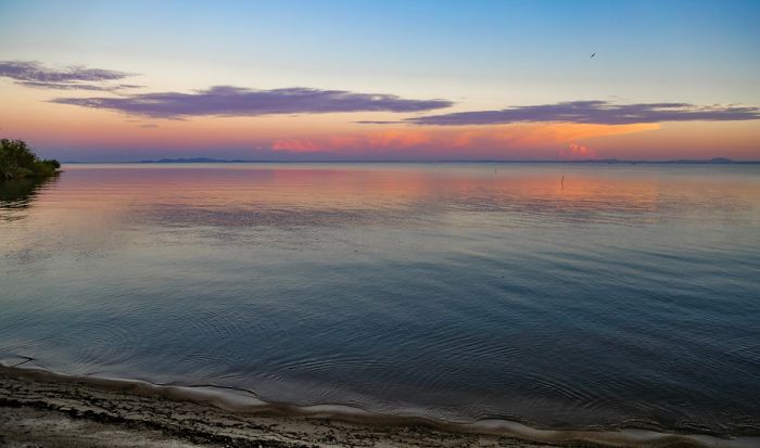
Sunset over Speke Gulf on Lake Victoria, Tanzania.
History of Lake Victoria
The British explorer John Hanning Speke became the first European to see the lake in 1858 during his expedition with Richard Francis Burton to discover the source of the Nile River. Speke is credited with naming the lake after Britain's monarch, Queen Victoria.
Speke only saw a small part of the southern side of the lake and by this time, much of the expedition's survey equipment had been lost or damaged, so important questions about the elevation of the lake's surface could not be determined with accuracy.
In spite of this, Speke estimated that the elevation of the lake was 4 000 feet (1 220 meters) by observing the temperature at which water boiled at the shoreline and he surmised (which was later proven to be true) that the lake was in fact the source of the Nile River.
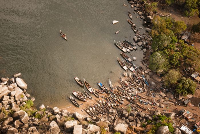
Local fishing boats at Mwanza on the Tanzanian shore of Lake Victoria.
Note1: Years after the Speke/Burton expedition, Henry Stanley surveyed the entire shoreline of Lake Victoria by boat and established that Lake Tanganyika and the Nile River were not connected in any manner. Stanley determined that the headwaters of the Nile River was the Victoria Nile River (also called the White Nile River).
The Victoria Nile is Lake Victoria's only outlet, beginning at Jinja (in present-day Uganda) on the northern side of the lake. The Blue Nile River, which has its origin further north in Ethiopia's Lake Tana, is the other significant source of the River Nile.
Note2: There is still debate over what is the most distal source of the River Nile, but this source is certain to be one of the various tributary waterways that join the Kagera River (although it is not certain which one). The Kagera originates in Burundi (or possibly Rwanda) and flows into Lake Victoria.
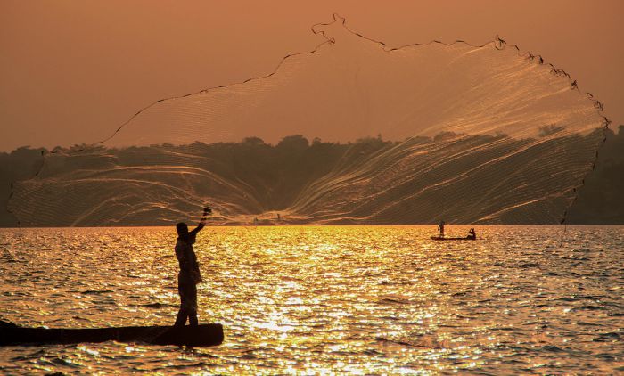
Fisherman throwing his net on Lake Victoria.
Nile Perch in Lake Victoria
The purposeful introduction of the highly predatory "Nile Perch" (Lates niloticus) into Lake Victoria in the 1950s is now viewed by ecologists as a very unfortunate human blunder. The Nile perch was introduced to Lake Victoria in hopes that they would multiply (they did) and create a source of protein and export revenue.
The plan did work, but sadly, as often happens when humans try to control nature, the result has been an ecological disaster that has resulted in the extinction of hundreds of native cichlid fish species, many of which were endemic to Lake Victoria.
Traditionally, indigenous cichlid fishes (and other small fish species) were caught by local fishermen and sun-dried for consumption. After the introduction of the Nile Perch, the fishermen targeted this larger species, as a single fish can grow to a length of 6.5 feet/2 meters and weigh up to 450 pounds (200 kgs).
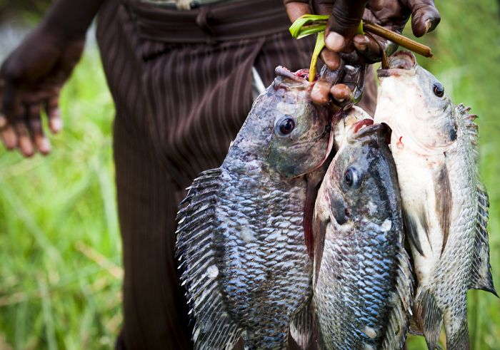
Freshly caught Nile perch from Lake Victoria.
The combination of the perch's size and its high body-fat content, means that they cannot be sun-dried, so to preserve the fish for later consumption, local fishermen must now smoke their catch, which has greatly increased the need for firewood and had led to increased deforestation around the Lake Victoria.
Commercial sales of Nile perch are mainly to Europe, bringing in millions of Euros every year, which is of course seen as a huge success, but in ecological terms, the introduction of the perch to Lake Victoria has been a man-made disaster. Darwin's Nightmare, a documentary film released in 2004, details the social and environmental impacts of the Nile perch introduction to Lake Victoria.
The loss of hundreds of species of Lake Victoria fishes (almost all of which were cichlid fishes and most of those endemic species) notwithstanding, Lake Victoria is still home to more than 500 species of fish, which is the second-highest total (after Lake Malawi) for any lake in the world.
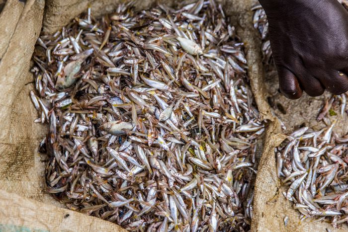
Before the introduction of the Nile perch, local fishermen used throw nets to catch small fish like these, which were then sun-dried for preservation and later consumption.
Rubondo Island National Park
Rubondo Island is located in the far southwest of Lake Victoria and just over 2 miles (3.5 kms) offshore from the Tanzanian mainland at its closest point.
Established in 1965, Rubondo Island is one of two Tanzanian island national parks in Lake Victoria (the other being Saanane NP). Covering the entirety of the main island of Rubondo in the extreme southwest corner of the lake, the park's boundaries also incorporate eleven minor rocky islets and surrounding offshore water.
In total, the park protects 176 square miles (457 sq kms), of which about half is land and the rest water. The main island measures 12.4 miles (28 kms) in length and is 2-6 miles (3-10 kms) wide. Rubondo and the surrounding islets are part of a partially submerged rift consisting of four volcanic hills linked by three flat sections.

View of the beach at Rubondo Island Camp. (Copyright © Rubondo Island Camp)
The landscape on Rubondo is dominated by moist evergreen and semi-deciduous forest much of which has dense understory. These forests covers around 80 percent of the island, with the remainder being interspersed with open grassland, Miombo woodland, and Acacia woodland.
Despite being volcanic in origin, there are granitic outcrops scattered across the main island. The eastern shore is characterized by sandy beaches and rocky areas, while the western shore is dominated by extensive papyrus swamp, bordered by date palms.
Rubondo Island has an interesting history. The island had long been inhabited by a small community who survived by fishing on the lake, but in 1965, the island was made an official game reserve, which meant the island's inhabitants, numbering around 400, had to relocate to the mainland.
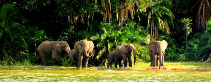
Elephants on the shore of Rubondo Island in Lake Victoria. (Copyright © Rubondo Island Camp)
In 1966, Bernhard Grzimek, a trained German veterinarian and Director of the Frankfort Zoological Garden (which he had saved from ruin after the end of World War II), visited Tanzania.
Grzimek, who was also President of the Frankfurt Zoological Society, convinced the Tanzanian government to allow him to introduce sixteen chimpanzees that had been rescued from zoos and circuses onto Rubondo Island, where they were allowed to live free in the wild. The adaptable chimps thrived and the island's population now numbers over forty.
In 1977, Rubondo Island was upgraded from a game reserve to a national park.
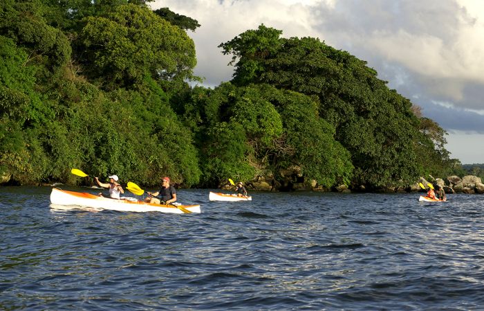
Kayaking is one of the activities offered on Rubondo Island. (Copyright © Rubondo Island Camp)
After the successful introduction of the captive-born chimpanzees, other species were introduced onto Rubondo, including elephant, black rhino, giraffe, roan antelope, black-and-white colobus, and the endangered suni antelope. The rhinos and roan didn't survive (due to poaching), but the other species are still present. In 2000, around 40 gray parrots that had been confiscated from illegal trade were released on Rubondo Island and they flourished and can be seen relatively easily.
Besides the introduced species discussed above, native wildlife that can be seen on Rubondo includes hippo, crocodile, civet, genet, spotted-necked otter, marsh mongoose, vervet monkey, bushbuck, bush pig, and sitatunga.
Birding on Rubondo is excellent, with over 400 species recorded. African fish-eagles are particularly abundant, and there are a variety of kingfishers, herons, storks, bee-eaters, raptors, and forest dwellers that will keep any avid birder busy each day on the island. Butterfly enthusiasts will love Rubondo and those interested in botany will enjoy seeing some of the over forty species of orchid that grow on the island.
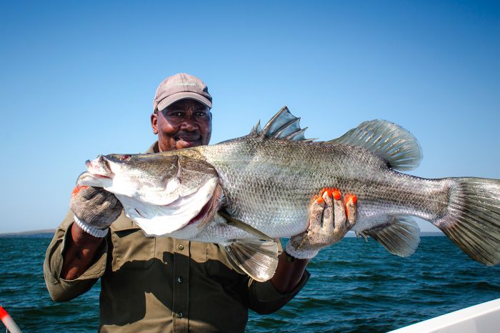
Sport fishing for Nile perch at Rubondo Island. (Copyright © Rubondo Island Camp)
Rubondo is one of Tanzania's best preserved wildlife destinations, but attracts only a small number of tourists. Rubondo Island Camp is the only accommodation and it provide an excellent experience. Activities include forest nature hikes, sport fishing, the chimpanzee habituation experience, and canoeing.
The best time to visit Rubondo depends on your interest: the dry season (June-October) is best for clear skies and good weather, but the rainy months (November-December and March-May) are best for flowers, butterflies, and the abundance of birds, with many migrant species present and breeding.
The island can be accessed by charter flight direct to the island's airstrip or by boat from the mainland.
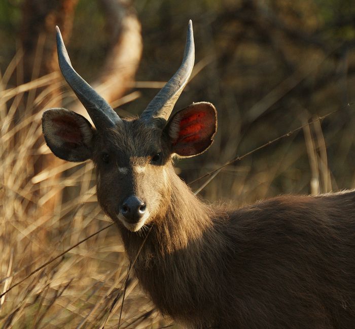
A young male sitatunga at Rubondo Island. (Copyright © Rubondo Island Camp)
Saanane National Park
Originally the location of Tanzania's first zoo, created in 1964 by the then owner of the island, Mzee Saanane Chawandi (for home the island is named), Saanane is Tanzania's smallest and one of two island-based national parks (the other being Rubondo Island).
On 29 March 1979, during the latter stages of the 1978-1979 war between Uganda and Tanzania, Saanane (which was then called the "Saa Nane Island Game Sanctuary") was bombed accidentally by Tupolev Tu-22 bombers operated by Muammar Gaddafi's Libyan Air Force.
Gaddafi had sent troops and aircraft to Uganda to assist Idi Amin in his conflict with Tanzania and had ordered the bombing of the the fuel depot in the mainland town of Mwanza. The five anti-personnel rockets completely missed their target, hitting Saanane instead and killing large numbers of animals on the island sanctuary.
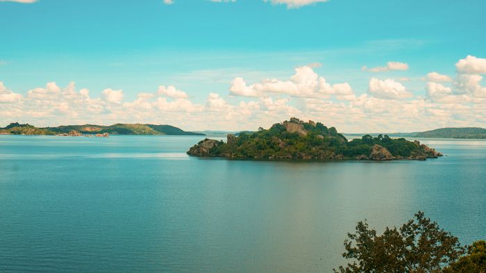
The tiny island called Saanane is Tanzania's smallest national park.
Saanane Island became a protected game reserve in 1991 and was upgraded to a national park in 2013.
The island-based park is located just offshore (1.2 miles/2 kms) from Mwanza town in the far southeast of Lake Victoria. The national park, which covers a total area of just 0.84 square miles (2.18 sq kms), encompasses the main island of Saanane, plus two other islets and the surrounding water.
The island is dominated by forest and grassland, interspersed with large granitic boulders and rocky outcrops. Wildlife on the island includes the endangered De Brazza's monkey, vervet monkey, Nile crocodile, two species of tortoise, rock hyrax, Cape clawless otter, and other small mammals and reptiles. Birding on the island is also good.
Today the park is a nice getaway for day trips (mostly by locals), offering hiking on well marked trails. Access is by boat (about 5 minutes duration) from Mwanza town.
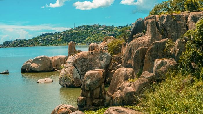
View over the water to the mainland town of Mwanza from Saanane Island.
Dar es Salaam
Tanzania's most populous city and urban area is the Indian Ocean port city of Dar es Salaam. Often referred to simply as "Dar", the metropolitan area is home to over four million people and growing. Dar was once Tanzania's capital (it has since moved to the much smaller Dodoma), but Dar remains the country's most important city in terms of commerce, art, and media.
Dar has experienced good economic growth over the past decade or so, but still has a very high level of impoverished citizens, who live in the city's overcrowded slums without running water, electricity, or basic sanitation.
Dar's Julius Nyerere International Airport (DAR) is often the entry point for tourists arriving in Tanzania, but many opt instead to fly directly to Kilimanjaro International Airport (JRO), which is located closer to the country's northern safari circuit. Dar has a good number of tourist hotels, most of them located on or very near the coastline, but like most large cities in Africa, Dar is not a true destination, but rather a stopover for a night or two.
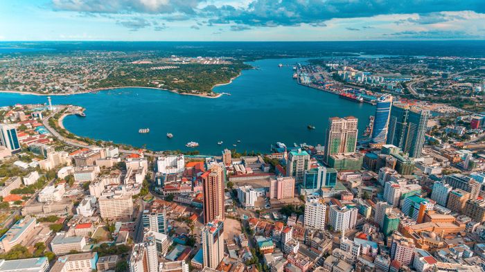
The major port city of Dar es Salaam is Tanzania's largest urban area.
Arusha Town
Arusha is Tanzania's third-largest urban area (after Dar es Salaam and Mwanza), but is by far its most important destination city/town in terms of eco-tourism. The town is located a short drive from Kilimanjaro International Airport (JRO) and is commonly the starting point for travelers embarking on a northern Tanzania safari circuit (which nearly always includes the Serengeti National Park).
Arusha has a population of 420 000, with an additional 330 000 in the surrounding district. Despite the somewhat large population, the town maintains a relaxed vibe. Tourism is the main commerce in Arusha, with numerous locally-based overland (driving) safari operators running customized or scheduled group trips to the Serengeti, Ngorongoro Crater, Lake Manyara, Tarangire, and Kilimanjaro.
Travelers have a good selection of accommodations to choose from in Arusha, many of them quaint guest houses. On clear days, Mount Meru, which is located just to the north of town, provides a spectacular backdrop. The outskirts of town lead to agricultural fields, where coffee, cabbage, bananas, and other vegetables are cultivated.
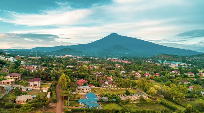
Image from outskirts of Arusha town showing Mount Meru.
Quick Facts & Travel Tips
- Tanzania has a diverse climate owing to its large size and variable topography, but is generally temperate throughout the country.
- Rainfall in most regions occurs during two periods: mid-Nov to mid-Dec (short rains) and Mar/April (long rains).
- Over 100 languages are spoken in Tanzania, but Swahili is the national language. English is spoken in the safari camps and city hotels.
- The national currency is the Tanzanian shilling (TZS), but US Dollars, UK Pounds, and Euros are accepted almost everywhere throughout the country.
- The US Dollar and Euro have consistently favorable exchange rates (2000+ to 1) versus the Tanzanian shilling.
- Credit and debit cards are not widely accepted, except at the higher-end hotels and safari camps.
- Tanzania uses 230v electricity and type D and type G plug adapters.
- Tanzania time is GMT+3 and does not observe daylight savings time (DST). 8 hours ahead of New York (7 during DST).
- The population of the country is around 60 million, with about 7 million in the greater Dar es Salaam metro area.
- Tanzania covers 365 000 square miles (945 000 sq kms) with only 175 people per sq mile (67 people per sq km); however, Dar es Salaam has a very high population density.
- The majority of the population (95%) are of Bantu-speaking origin. Sukuma is the largest ethnic group in the country and represents around 16% of the population.
- There are also groups of Nilotic and nomadic Maasai and Luo populations, along with two smaller groups who speak languages in the Khoisan family specific to the Khoikhoi and Bushman people.
- The majority of Tanzanians are Christians, accounting for just over 61% of the population, with an additional 35% being Muslim.
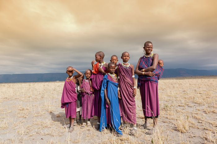
A Maasai family in Tanzania.
ENTRY / VISA REQUIREMENTS
- A passport valid for at least six months beyond the date of entry to Tanzania is required by nationals of USA/Canada/Australia/UK/EU.
- The passport must contain at least three (3) unused (blank) pages labeled Visa when presented for entry.
- Note: Visa pages referred to above do not include pages reserved for Endorsements, Amendments or Observations.
- Single-entry and transit visas can be obtained on arrival, but it is recommended to apply for a tourist visa in advance.
- Visa services are no longer offered through the Tanzanian Embassy in Washington, D.C. Instead, apply online here.
- Single-entry visas are valid for three months and multiple-entry visas are valid for either six or twelve months.
- Proof of yellow fever vaccination is required on arrival if you are traveling from a country with risk of yellow fever, including transit >12 hours in an airport located in a country with risk of YF virus transmission.
- Zanzibar is a semi-autonomous region of Tanzania and has its own immigration procedures. You may have to present your passport, but the Tanzania visa is used and no separate visa is required for Zanzibar.
Note: entry/visa requirements are subject to change without notice, so please check with the official government pages shown below.
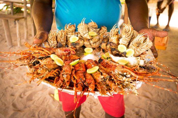
Fresh shellfish platter in Zanzibar.
Official Government Pages
- US Department of State info: click here
- Tanzanian Consulate - USA: click here
- Tanzania eVisa application: click here
- Tanzania Home Affairs: click here
- CDC information: click here
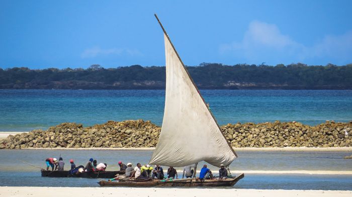
Traditional dhows off the coast near Dar es Salaam, Tanzania.
Read More...
Main: Flora, Geography, Important Areas, National Parks, Protected Areas, Ramsar Sites, UNESCO Sites, Urban Areas, Wildlife
Detail: Arusha, Dar es Salaam, Gombe, Great Migration, Katavi, Kilimanjaro, Lake Manyara, Lake Tanganyika, Lake Victoria, Mahale, Ngorongoro, Rift Valley, Ruaha, Selous, Serengeti, Tarangire, Zanzibar
Admin: Travel Tips, Entry Requirements/Visas
Great Good Fair Poor
- Jan
- Feb
- Mar
- Apr
- May
- Jun
- Jul
- Aug
- Sep
- Oct
- Nov
- Dec
The chart directly above should be taken as a very rough overall indicator of best times to visit Tanzania, as there are significant variations regionally and based upon elevation. More information on the specific national parks and reserves is found on the previous Details tab.
Click on a Region Link above or visit the Details Tab to read more about best times to visit a specific region or destination.
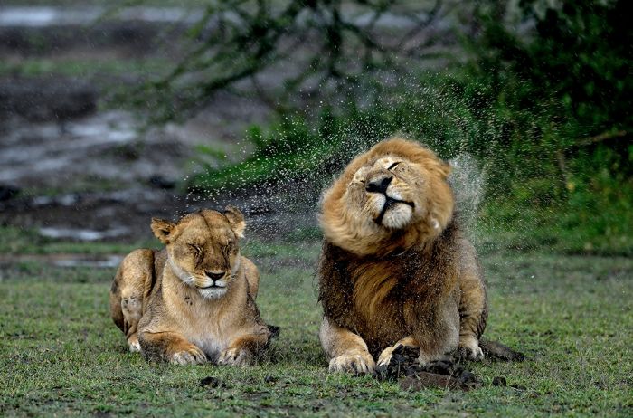
Lions wait out a rain shower near Lake Ndutu in the southern Serengeti.
Climate, Regions, Best Times
For wildlife viewing the best time to visit Tanzania is during the dry season (which extends from late June to the end of October). There are two rain seasons in Tanzania - the 'long rains' occur from mid-March through May (the heaviest in April/May), while the 'short rains', which are difficult to predict precisely, occur for about one month during November-December.
Generally speaking, most of Tanzania's low-lying areas are warm to hot during the day all year and moderate overnight. Areas like the Ngorongoro Highlands and other higher-elevation destinations like Mount Kilimanjaro are of course chilly to cold depending on the altitude.
The pricing and tourist numbers generally follow from people's general avoidance of rain on their vacations. July through September are overall the busiest months in Tanzania's wildlife areas and are typically excellent for safaris throughout the country.
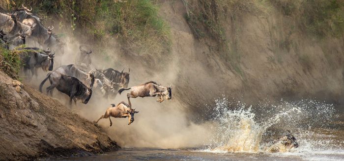
Wildebeests crossing the Mara River on the Great Migration through Tanzania.
The Great Migration arrives into the Serengeti just before or just after the short rains have started (late November or early December) and remains in Tanzania for 8-9 months before the herds of wildebeest and zebra cross back into Kenya sometime around October.
The parks in the north are rewarding safari destinations all year around. It is best to avoid the coastal region, including Zanzibar, during the rainy months as the humidity can make it uncomfortable.
For further details on the best times to visit specific regions or destinations in Tanzania, please visit the applicable Tanzania region pages (see links at top of page) or visit the Details Tab.
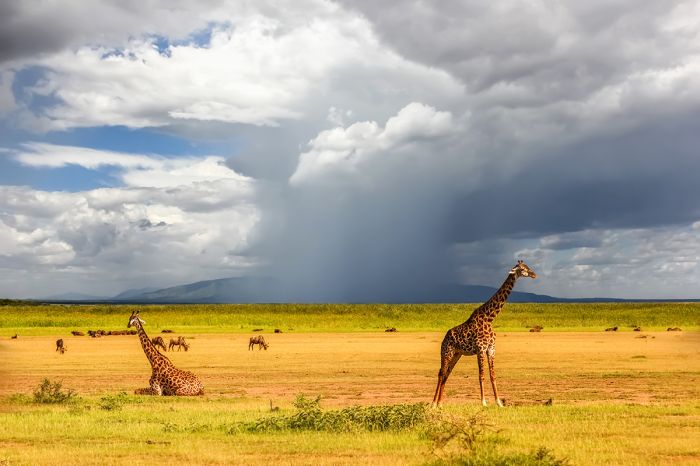
Giraffes and stormy skies at Lake Manyara.
Showing 1–20 of 30 results
Located on the lush grounds of one of Tanzania's oldest coffee plantations. Excellent dining options, a diversity of activities, and only 10 minutes from Arusha Airport.…
A classic East African safari camp situated between the Southern Serengeti and Seronera. Offers excellent year-round game viewing, easy access to the Moru Kopjes, Lake Magadi, and the annual migration. …
Upscale lodge located in the remote Western Corridor of the Serengeti, which has fewer visitors and vehicles than most of the park. Well positioned along the route of the Great Migration of more than two million herbivores.…
Stylish and contemporary camp situated in Ruaha's prime wildlife location. Spectacular scenery, abundant wildlife, day and night game drives, epic bush walking, and conservation experiences.…
Exclusive and romantic tropical-beach getaway for couples. Large Middle-Eastern-style villas offer total privacy on 50 acres of lush gardens and an exclusive white-sand beach. Fabulous cuisine infused with island flavors.…
Located in a large private land concession with no other camps or lodges, so very exclusive safari experience. Located along the route of the Great Migration traversed annually by more than two million herbivores. Hilltop site with incredible views.…
Classic, tented camp situated in Ruaha's prime wildlife location on the banks of a river. Spectacular scenery, diverse wildlife, day and night game drives, excellent guides, bush walking, and conservation experiences.…
The only lodge in the remote southern section of Lake Manyara NP, which means an exclusive experience. Diverse park with plenty of wildlife. Activities include game drives, walking, biking, and cultural visits.…
Located on the quiet northeast coast of Unguja Island along a calm lagoon and white-sand beach. Endless activities, well-suited to couples, groups, families. Delicious Zanzibari cuisine prepared with fresh ingredients and island spices.…
Romantic villas located on the quiet northeast coast of Unguja Island along a calm lagoon and white-sand beach. Endless activities, plenty of privacy, and a dedicated butler. Delicious Zanzibari cuisine prepared with fresh ingredients and island spices.…
A small private island in the Zanzibar Archipelago offering an exclusive tropical getaway in the warm Indian Ocean. Activities include snorkeling, diving, kayaking, dhow cruises, paddle boarding, sea turtle nesting, fishing, yoga, and more. Fresh and delicious cuisine.…
Located in the remote and uncrowded eastern Serengeti, with excellent year-round wildlife viewing and in the path of the Great Migration. The area is especially good for big cats, particularly cheetah.…
Situated on the rim of the Ngorongoro Crater, one of the best wildlife destinations in Africa. Incredible views into the crater, superb wildlife viewing, plus hiking, sightseeing, and cultural activities.…
A classic, mobile tented camp that moves its location between the northern and southern Serengeti to stay close to the migrating herds of wildebeests and zebras. An authentic safari experience with creature comforts and superb wildlife viewing.…
Classic safari camp located in the remote southern portion of the park with easy access to the wildlife-rich swamps. Superb wildlife viewing during the dry season, including the Tarangire Migration. Day and night drives, walking, ballooning.…
Located in The Selous, a vast wilderness and Africa's largest wildlife sanctuary. Abundant wildlife, diverse landscapes, game drives, bush walks, boating safaris, and catch-release fishing. No crowds. Perfect add-on to Serengeti safari.…
The only accommodation on Africa's largest island-based national park. Chimpanzee trekking, forest walks, boating, fishing for Nile perch, kayaking, fly camping, and treehouse sleep-outs.…
Located close to the Mara River in the Northern Serengeti. Quick access to the river for viewing dramatic crossings during the migration. Excellent year-round wildlife. Game drives, walking, cultural experiences.…
Located in the path of the Great Migration, but in a secluded location to the south of the much busier Mara River / Kogatende area. Close enough to the river for day trips for those wanting to view crossings. Abundant year-round wildlife.…


