Kilimanjaro & Arusha
(incl. Mount Kilimanjaro, Arusha NP, Arusha Town, Mount Meru)
Region Links: Great Migration, Kilimanjaro & Arusha, Ngorongoro & Manyara, Serengeti, Southern Tanzania, Tarangire, Western Tanzania, Zanzibar
Highlights
- Mount Kilimanjaro, Africa's highest peak
- Climb to the summit of Kilimanjaro (5 to 8 days)
- Arusha town is the start of most safaris in the north
- Sample the excellent coffee, famous in this region
- Mount Meru, Tanzania's second-highest peak
- Arusha National Park and Meru Forest
- Cultural tours to visit local tribes
EOA Recommends: Hog Hollow Country Lodge, Lamai Serengeti Lodge, Serengeti Kati Kati Tented Camp
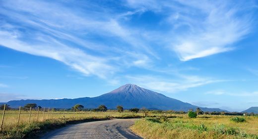
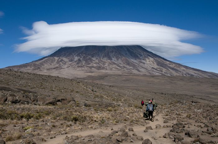
Mount Kilimanjaro, an ancient and now dormant volcano, is Africa's highest peak and trekking to the summit is one of the great adventures on the continent.
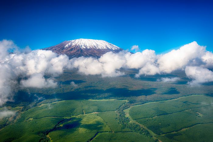
Airplane view over Mount Kilimanjaro.
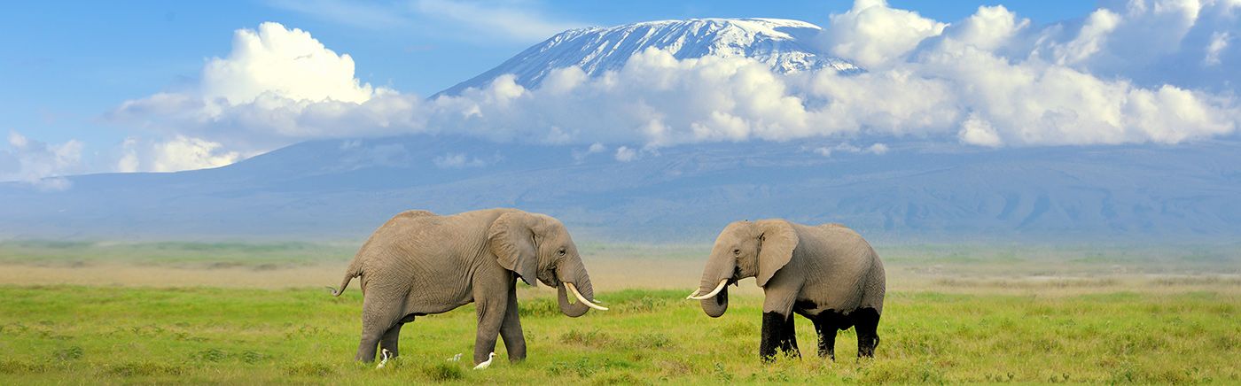
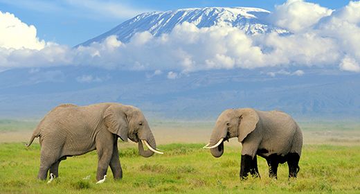
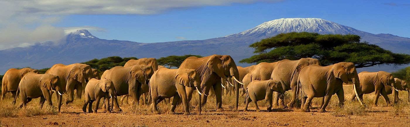
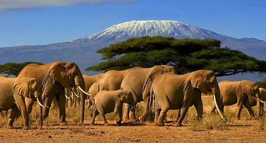
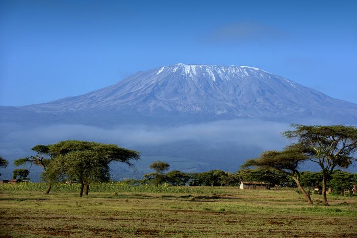
Kilimanjaro, also called 'Kili', stands 19 354 feet (5 899 meters) above sea level and is one of Africa's most iconic symbols. Towering over nearby Amboseli National Park (across the border in Kenya), the mountain is a spectacular backdrop for the herds of elephants that roam the surrounding plains.
Each year, thousands of adventurers from around the world embark on multi-day treks up various routes to the summit of Uhuru, Kili's highest peak. No technical gear or skill is required to climb Kili.
Climbers on the Rongai Route, Mount Kilimanjaro.
The surrounding region includes Mount Meru and Arusha National Park. Both are destinations worth visiting.
Kilimanjaro International Airport is the arrival point for most tourists and the nearby town of Arusha is the launching point for nearly all safaris in Northern Tanzania, including trips to the Serengeti and Ngorongoro Crater.
Climbers atop Mount Kilimanjaro.
Read More...
Arusha Town, Arusha National Park, Climbing Kilimanjaro, Climbing Routes, Coffee, Kilimanjaro National Park, Moshi Town, Mount Kilimanjaro, Mount Meru, Seasons, Terrain Zones, When to Climb
Mount Kilimanjaro
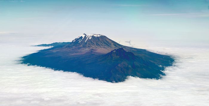
Kilimanjaro (also called "Kili") is Africa's highest mountain, reaching an altitude of 19 354 feet (5 899 meters) and casting a distinctive silhouette that is one of the continent's most iconic images. It is classified as a dormant, strato-volcano.
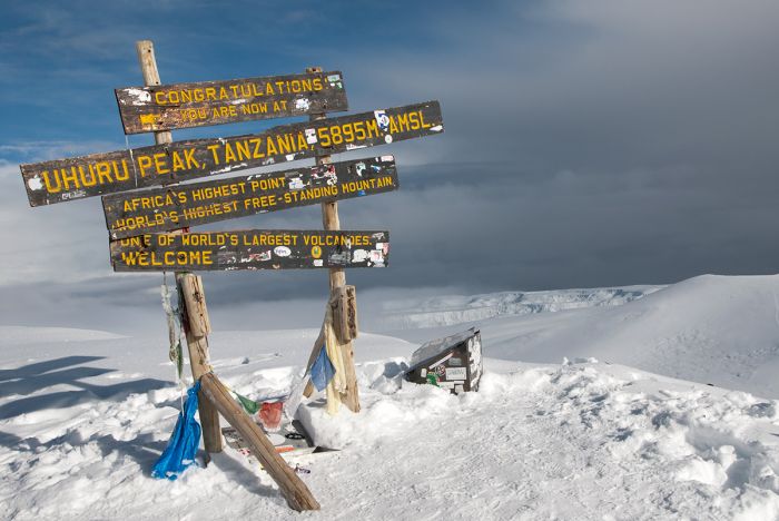
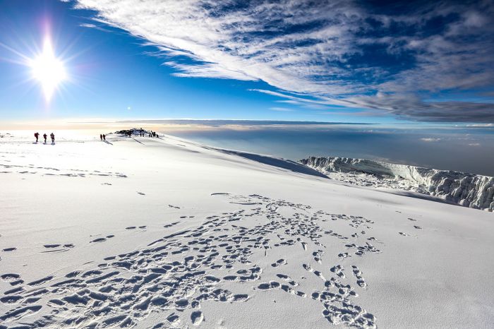
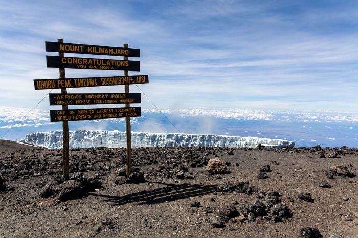
Uhuru Peak, the highest summit of Mount Kilimanjaro's Kibo crater rim.
There are well over 100 peaks worldwide that reach over 20 000 feet (~6 000 meters), but Kili is unique in several respects. Kilimanjaro is the world's largest and highest free-standing (not part of a mountain range) entity. Its base covers 245 square miles (635 sq kms). It is ranked #4 amongst the world's most topographically prominent peaks (after Everest, Aconcagua, and Denali).
Kili is also unique in that, unlike other significant peaks, it is climbable by just about anyone with good fitness and some walking sticks - no technical mountaineering gear or experience is required.
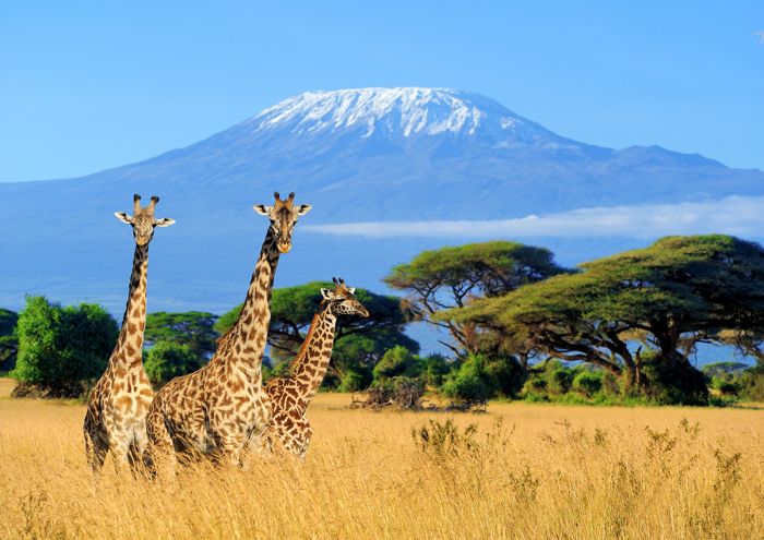
Giraffes with Mount Kilimanjaro in the background.
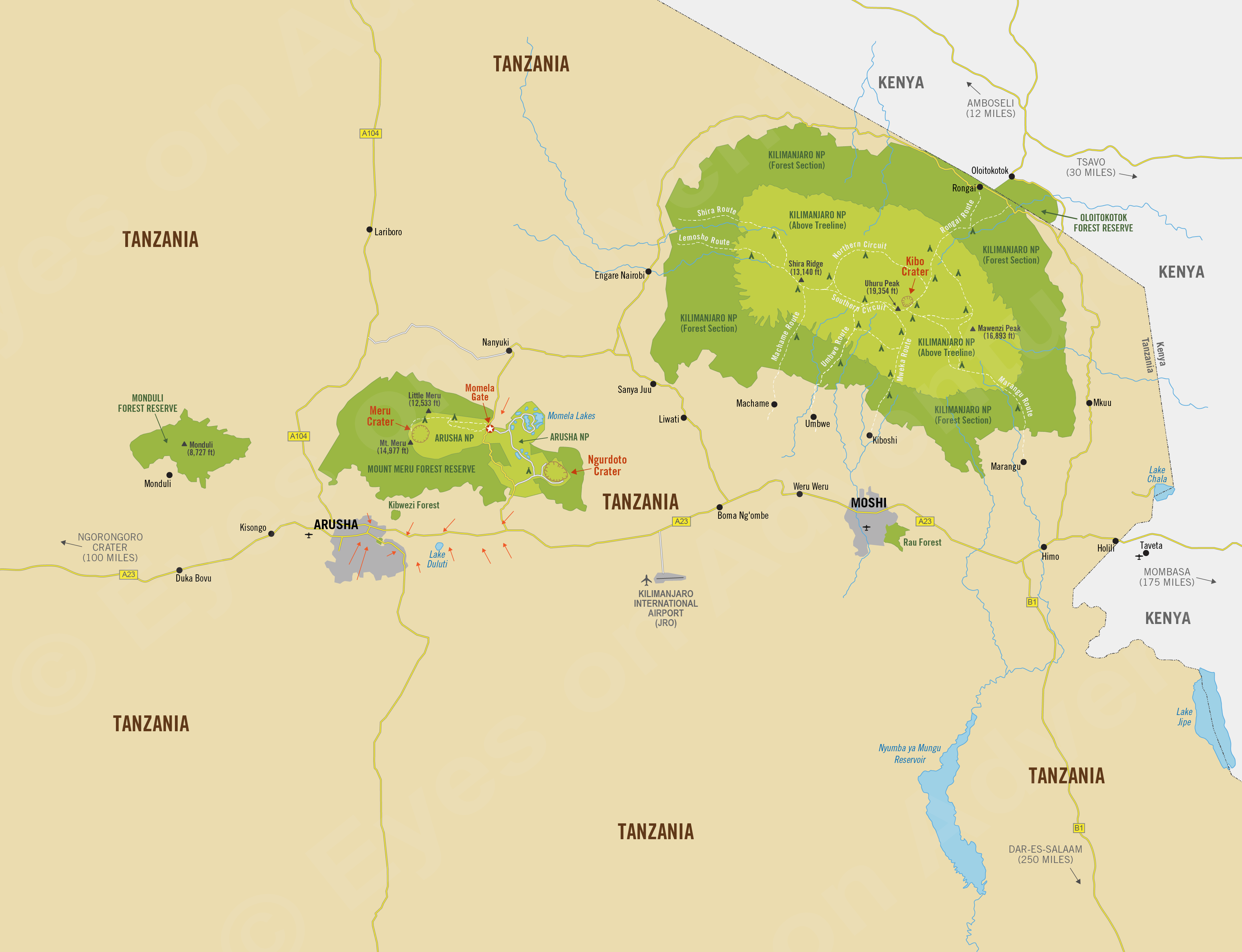
Kili straddles the international border between Tanzania and Kenya, but its three peaks are all located in Tanzania and they can only be climbed from the Tanzania side. The three peaks are actually volcanic cones: Kibo, Mawenzi, and Shira. Uhuru Peak is the highest summit on Kibo's crater rim and the peak most climbers ascend.
The mountain was formed by volcanic activity with its first eruption occurring about one million years ago. The oldest peak furthest to the west is Shira, which collapsed around 500 000 years ago. The other two cones to the east, Kibo and Mawenzi, continued to grow and erupt. Lava flows from eruptions on Kibo filled the Shira caldera, creating the present-day Shira Plateau. Kibo is now long dormant.
Mount Kilimanjaro and the cultivated lowlands surrounding it.
Climbing Kilimanjaro
Each year over 10 000 people from around the world make the attempt to climb Kili. Numerous operators offer guided multi-day excursions to climb Kili's various routes to the Uhuru summit. There are multiple routes which take from five to eight days round trip.
No technical expertise is required to climb Kilimanjaro.
No technical skills are required to climb Kili, but don't be fooled into thinking it's an easy trek. The high altitude means that there is less and less oxygen as one ascends higher and the days include plenty of walking. Only about two-thirds of climbers make it to the top of Uhuru in a given year and success rates are highly dependent on matching your stamina with the appropriate route.
All trekkers are required to climb with a registered climbing company and be accompanied by a licensed guide (ratio is one guide for every two trekkers). You will be provided with guides and porters to help you on your journey. There will typically be 2-3 porters per climber, as the amount each can carry is strictly regulated.
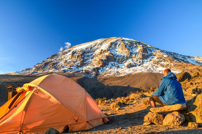
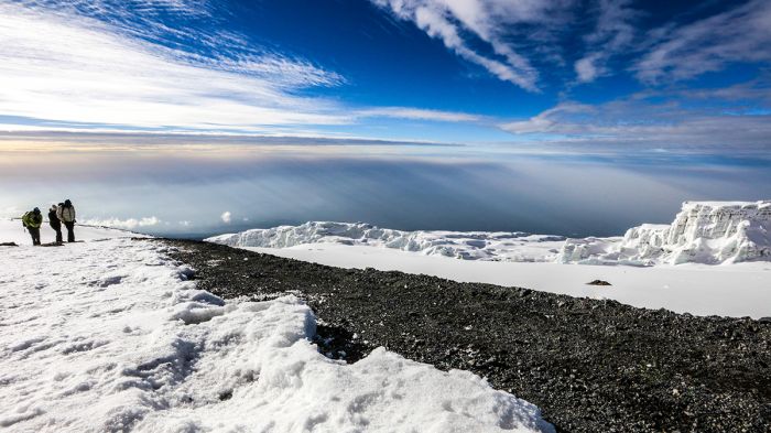
View of Uhuru Peak on Kilimanjaro from Karanga Camp at 13 107 feet (3 995 meters).
Physical preparation in advance of the trip is strongly recommended. More days on the mountain will mean a better chance for proper acclimatization to the altitude and will increase your chances for a successful journey.
The most popular routes are Marangu, Machame, and Lemosho. The routes are strictly regulated and all climbers must be accompanied by an officially accredited guide team from a licensed trekking operator. Following is information on the routes.
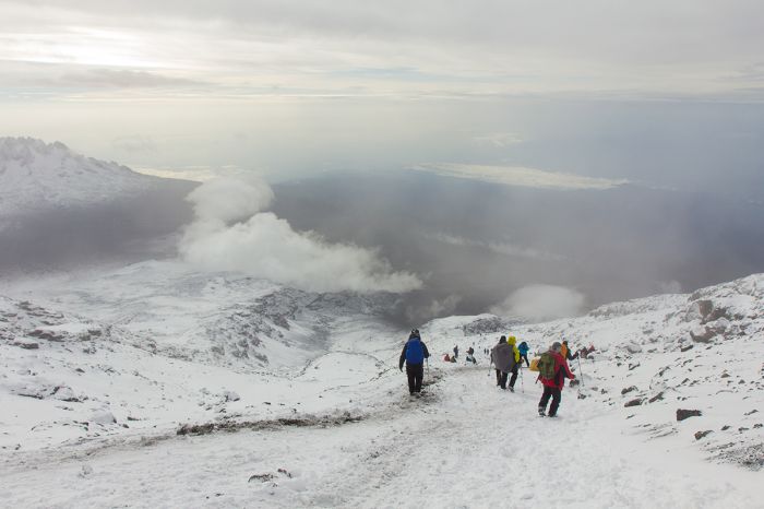
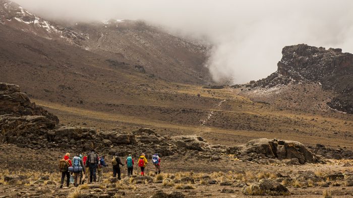
Climbers descending from the summit of Kilimanjaro.
Kilimanjaro Climbing Routes
Marangu Route: Kili's oldest and most well established route is Marangu. This very popular trail is considered the easiest and offers the shortest possible round-trip route on the mountain at just five days. Because of its popularity, Marangu, which is also called the "Coca Cola Route", can be crowded and is quite eroded in many places. Depending on the season, the path can also be muddy on the lower slopes.
Marangu is the only route offering sleeping huts, which are basic, dormitory-style structures, in lieu of tent camping. The path ascends from the southeast on a gradual and direct route, but on a 5-day trip, altitude acclimatization is difficult. Many operators offer a 6 or 7-day trip on Machangu to allow for acclimatization time. The ascent and descent are along the same path.
Camping on Kilimanjaro with Mawanzi Peak in the distance.
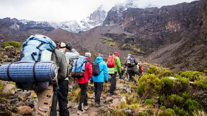
Machame Route: Kili's other very popular trail, Machame is also known as the "Whiskey Route", as it is more upscale than Marangu. The route is long and the daily walks are steeper than Marangu, making it a more challenging trek. The minimum time for a Machame climb is six days, but seven or eight are more often used. Although longer and more difficult than Marangu, acclimatization is easier on Machame and success rates are higher.
The route starts from the south and proceeds through the rain forest leading to the Shira Plateau before heading east and beneath Kili's southern ice field before reaching the summit. Machame allows you to see a lot of the mountain, winding through distinct zones, including forest, moorland, alpine desert, and snow fields. The route is beautiful, but like Marangu, it can be crowded. The descent follows the Mweka route. Nights are spent camping in tents.
Trekkers on the Machame Route on Kilimanjaro.
Lemosho Route: The very scenic Lemosho route starts from the western side and leads trekkers across the Shira Ridge, where it meets the Machame Route on day four at the foot of the Kibo cone. Lemosho is considered the most beautiful route, with spectacular panoramic views along the way.
The first two days are spent walking thru the rain forest to Shira Ridge and are relatively easy. Lemosho has low climber traffic until it joins the Machame route, after which it follows the same route along the southern base of Kibo, known as the "Southern Circuit". Lemosho can be completed in six days, although a seven- or eight-day trip is more common. The descent is made using the Mweka route. Nights are spent camping in tents.
View along the Lemosho Route, Mount Kilimanjaro.
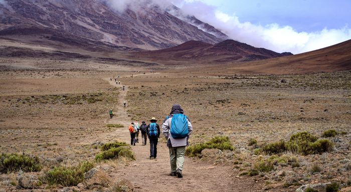
Rongai Route: The moderately difficult Rongai route (also called Loitokitok) is the only trail that approaches from the north, starting close to the Kenya border. It is also one of the quietest routes, owing to the time it takes to drive from Moshi to the start point. Rongai is a good choice during the rainy periods (Nov to early Dec / April to early May), as the northern side of Kili generally gets lower precipitation.
Rongai is less scenic than the western routes, but it spends days in virtual wilderness before joining the Marangu route. Rongai's ascent is via a gradual slope and can be completed in six days, but a seven-day trek is recommended. The descent is made using the Marangu route. Nights are spent camping in tents.
Trekkers in the moorland zone along the Rongai Route, Mount Kilimanjaro.
Shira Route: Shira was the original route approaching from the west, while Lemosho is the newer route. Shira is very similar to Lemosho, but climbers are transported by vehicle past the rainforest and begin hiking on the Shira Ridge at 11 800 feet (3 600 meters). Climbers then cross the entire Shira plateau and then join up with the Lemosho route, which traverses the Southern Circuit.
Starting the trek at a high elevation on day one increases the chance that climbers will experience altitude related symptoms, making this route less favorable than the newer Lemosho Route. The route is offered as a seven- or eight-day trek. The descent is made using the Mweka route. Nights are spent camping in tents.
View of the Shira Plateau on Mount Kilimanjaro.
Umbwe Route: Umbwe is a short and direct, but steep route approaching from the south. It is by far the most challenging of the routes to the summit. The route has constant altitude increase and does not leave time for acclimatization, thus increasing the chance for altitude-related issues. The route should only be attempted by very strong trekkers who are confident in their ability to acclimatize quickly.
Umbwe is never crowded, but due to its difficulty, the success rate is low. After the initial direct climb, the trail heads east along the Southern Circuit. The route is offered as a six- or seven-day climb. The descent is made using the Mweka route. Nights are spent camping in tents.
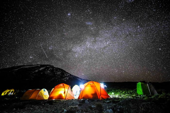
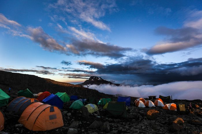
Starry night over a campsite on Kilimanjaro.
Seasons / When to Climb
Climbing Kilimanjaro is best when the weather is good, as rain, mud, and cold weather will adversely affect climbing conditions and make the climb less safe. Lying very close to the equator, Kili does not experience extreme temperature swings, although the air is cooler as you ascend to higher elevations. The most important consideration for climbing is dry versus wet conditions.
Trekking toward's Kilimanjaro's summit.
Kili can be climbed at any time during the year, but climbing when the chances for rain are lowest is recommended. The highest probability for rain occurs from late March to early May and from early November to early December. The southeast slopes of the mountain receive the most rainfall, so Lemosho, Shira and Rongai are the safest routes to use if climbing in the rain months. Snow near the summit is possible all year, but chances are highest during and just after the rainy seasons.
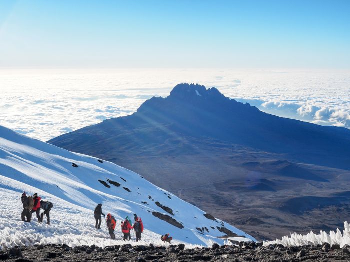
Climbers near the summit on Kilimanjaro with Mawanzi Peak across the saddle.
The best months to climb in terms of weather are mid-December thru early March and late June thru October. There is a slight chance for rain in June and September/October can be very hot. These are also the busiest times on the mountain.
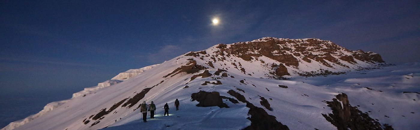
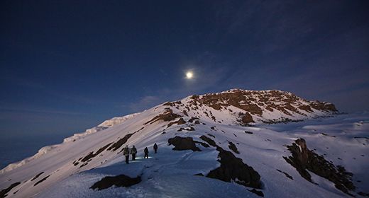
Many climbers wish to summit on full moon nights, which occur every 29.5 days throughout the year. Treks scheduled for full moon summits are always very busy on summit night, so avoid these if you want to avoid crowds.
Uhuru Peak, the highest point on Kilimanjaro's summit.
Terrain Zones, Flora & Fauna
Kilimanjaro is home to five types of biome, and most climbs will pass through each of them.
Cultivation Zone: At the ground level, the areas around the base of the mountain are occupied by banana and corn farms, with small villages scattered about.
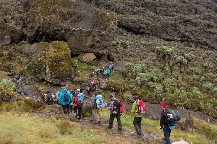
Forest Zone: Starting at around 6 000 feet (1 800 meters), cultivation gives way to humid cloud-forest, which are home to lush and very diverse vegetation, abundant birds and some wildlife. Animals you may see include blue monkey, black-and-white colobus monkeys, galago (bushbaby), mountain reedbuck, and Abbot's duiker. Leopard live in the forests but are unlikely to be seen.
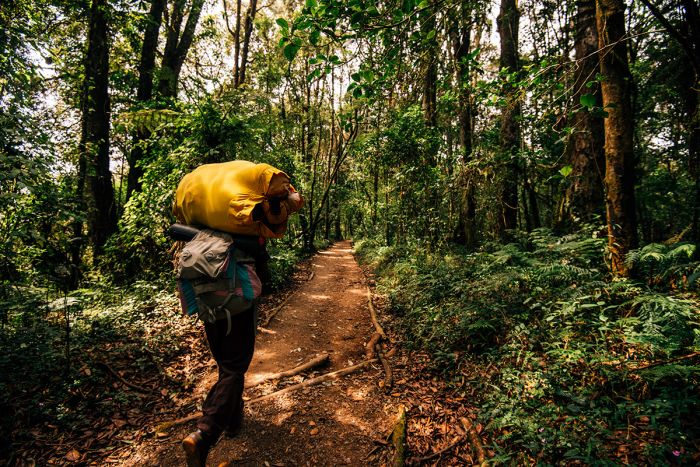
Trekking through Kilimanjaro's forested zone.
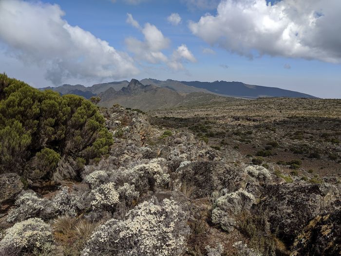
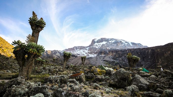
Moorland Zone: Above the forest zone, starting at around 9 200 feet (2 800 meters), the vegetation changes to afro-montane moorland and upland grassland. The shrub/heath vegetation in this zone is often called "the land of giants", with giant lobelias, giant heather, and giant groundsels, which survive amongst the much drier conditions up to about 12 500 feet (3 800 meters). Mammals passing through the moorland zone include grey duiker, eland, bushbuck, and red duiker. Bird's are not diverse at this altitude, but white-necked raven are often seen.
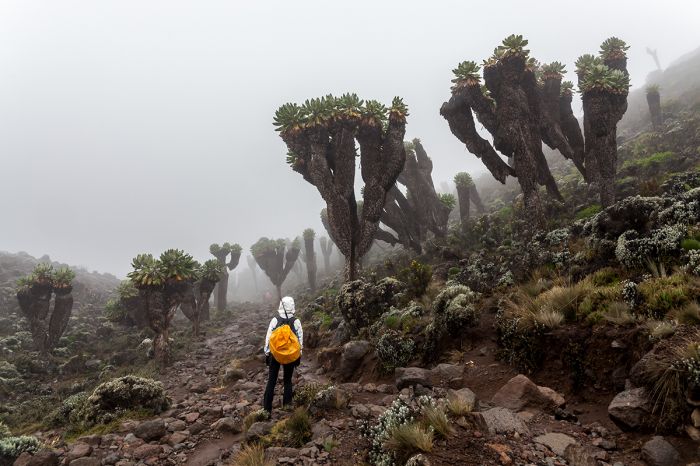
The moorland zone on Kilimanjaro, showing giant groundsels.
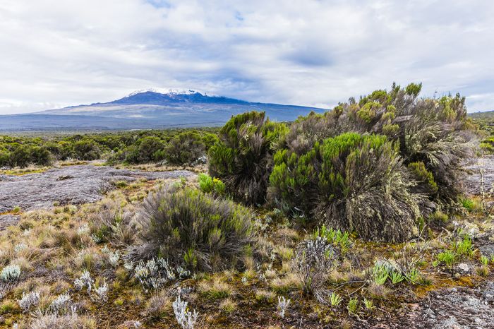
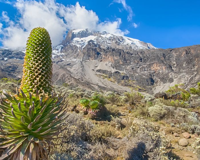
Alpine Desert Zone: Above the heath zone is the mostly barren alpine desert one, which is characterized by extremely dry and cold conditions. Only a few plants like hardy mosses and lichens are able to survive here. The terrain is characterized by volcanic lava rock fields. The desert zone continues to around 16 000 feet (4 900 meters), where it becomes glacier, and more lava.
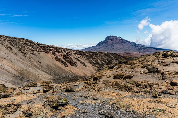
Alpine desert zone on the Lemosho Trail showing Mawenzi Peak.
Glacier Zone: Kilimanjaro's beautiful glaciers, which have existed on its uppermost elevations for over 11 000 years, are rapidly disappearing due to global temperature increases. Some experts estimate that Kili's ice will disappear by the year 2050, so get there while you can still see the spectacular ice fields.
Glacier and lava atop Kilimanjaro.
Kilimanjaro National Park
Kilimanjaro National Park was established in 1973 and at that time it only included the mountain beginning above the tree line from about 9 000 feet (2 750 meters) along with some forest corridors extending down to about 6 500 feet (2 000 meters). In 2005, the national park boundaries were expanded to include the entire montane forest, which had previously been an unprotected buffer zone called Kilimanjaro Forest Reserve.
Giant Lobelia in the Moorland Zone, Mount Kilimanjaro.
Visitors the the region who do not wish to climb to the top of Kilimanjaro can opt instead to do any of a variety of half- or full-day hikes into the rain forests to see the lush flora, waterfalls, and hopefully some wildlife and birds. Guided hikes leave from Marangu and Machame villages.
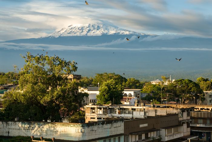
Arusha Town
Arusha town is located very close to the region's main gateway airport, Kilimanjaro International Airport (JRO) and is almost always the first overnight for travelers to Northern Tanzania.
Despite being a growing city with a population of over 420 000 plus 330 000 in the surrounding Arusha District, the town itself has a rather relaxed atmosphere. Tourism is the main focus of the town and Western culture is evident, but with a mixture of Maasai people in their traditional dress.
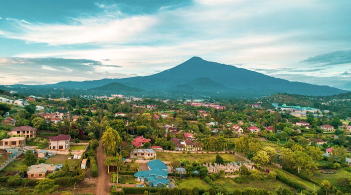
Arusha town with Mount Meru in the distance.
Arusha offers lots of accommodation, ranging from very basic to high-end guest houses. The leafy, eastern suburbs of Arusha have some of the nicest choices for overnight stays. On clear days, one can view nearby Mount Meru, which stands watch over the town and offers a lovely backdrop.
Higher elevation areas near the town are home to farmers growing coffee, bananas, cabbage, potatoes, and other vegetables. Beans, corn and wheat are also grown in the lower lying outskirts.
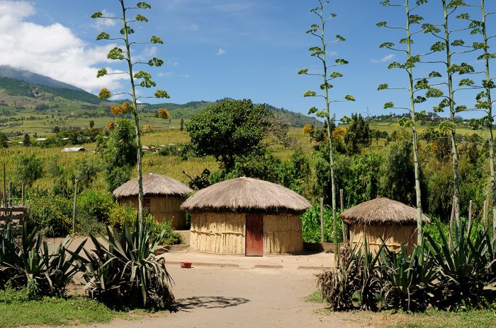
Traditional dwellings near Arusha.
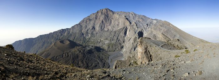
Arusha National Park & Mount Meru
Located just north of Arusha Town, Arusha National Park and the adjoining Mount Meru Forest Reserve is a little-visited reserve offering volcanic peaks, lovely rainforest, and plentiful wildlife.
Mount Meru, Tanzania.
Tanzania's second-highest peak, Mount Meru, which rises to an elevation of 14 977 feet (4 565 feet), is the dominant feature of Arusha National Park. Appearing as a near-perfect cone when viewed from town, the eastern side has been literally ripped open by a cataclysmic eruption some 250 000 years ago. The explosions sent lava boulders flying over 40 miles (64 kms) away to the east.
Prior to this event, Meru was even taller than Kilimanjaro. Today Meru is considered dormant, but tremors still occur and a mini eruption last occurred in 1910.
The national park (established in 1960) and the surrounding forest reserve protects most of the mountain, including the 2-mile wide Meru Crater and Ngurdoto Crater in the eastern foothills. Ngurdoto is a 2-mile wide caldera with diverse wildlife and is sometimes referred to as "Little Ngorongoro". The Momela Lakes are known for their birdlife, in particular flamingos.
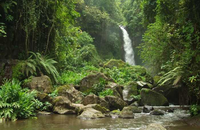
Lovely waterfall in the Meru Forest Reserve.
Wildlife in the reserve and national park include buffalo, elephant, hippo, warthog, zebra, various antelopes, blue monkey, black-and-white colobus, and others. Giraffe can be seen around the Momela Lakes. Leopard and spotted hyena are here but rarely seen.
Like Kilimanjaro, Mount Meru can be climbed without any technical equipment or experience. Round trip treks are either three or four days; two days for the ascent and one or two days to descend. Although not as high as Kilimanjaro, altitude sickness and acclimatization are still an issue on Meru. The route to the summit starts at Momela Gate (which is at 4 900 feet/1 500 meters). Little Meru Peak is slightly lower than the main summit and is also an option.
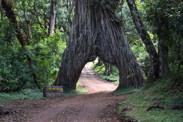
Fig Tree Arch in Arusha National Park.
Moshi
About one hour east of Arusha along the A23 road, the bustling town of Moshi is located directly south of Mount Kilimanjaro. Views of Kili are spectacular when the mountain is not covered with a blanket of clouds. The town's name 'Moshi' means smoke in Kiswahili, referring to either the frequent cloud cover or perhaps alluding to its last minor eruption in the 1700s.
Moshi Town with Kilimanjaro in the distance.
Moshi's population is around 200 000, but it has a much more relaxed atmosphere than Arusha. Much of the land surrounding the town is utilized for farming corn and beans. The town is most often used as a base for those climbing Kilimanjaro, although many opt instead to stay in Arusha.
Coffee
The Kilimanjaro Region produces high-quality coffee, with many smallholding farms that sell their beans to the Kilimanjaro Native Cooperative Union (KNCU), which markets the product. The coffee bushes flower during the short rains (Oct-Nov), giving off a delightful jasmine-like scent. The beans are harvested between July and September. Make sure to sample some local coffee during your visit!
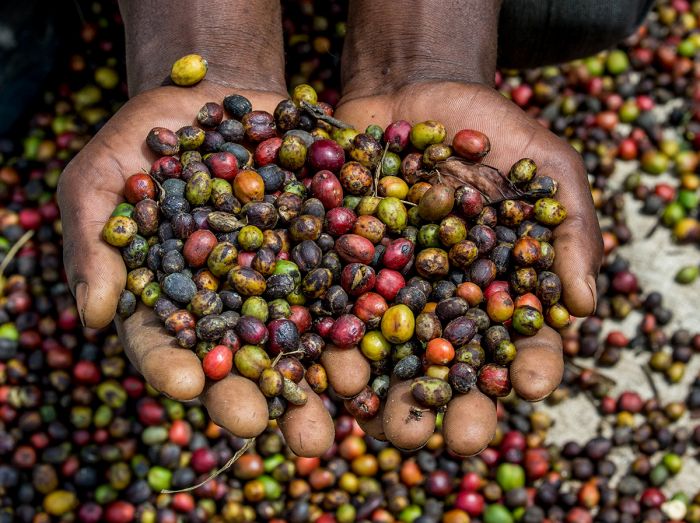
Freshly harvested coffee beans, Arusha, Tanzania.
Read More...
Arusha Town, Arusha National Park, Climbing Kilimanjaro, Climbing Routes, Coffee, Kilimanjaro National Park, Moshi Town, Mount Kilimanjaro, Mount Meru, Seasons, Terrain Zones, When to Climb
Climbing Kilimanjaro
Great Good Fair Poor
- Jan
- Feb
- Mar
- Apr
- May
- Jun
- Jul
- Aug
- Sep
- Oct
- Nov
- Dec
The best time for climbing Kilimanjaro is December through February, due to the mostly clear weather. June thru September months are also good, but there is a possibility of rain in early June and in September the temperatures on the mountain can be frigid.
March through May and October-November have a higher risk of rains with muddy terrain in the lower elevations and a much higher risk of cloudy skies higher up the mountain.
Snowfall is possible on or near the summit throughout the year but the chances for snow are highest during and just after the rainy months.
Climbers on Kilimanjaro's Machame route.
Arusha and Lowlands
Great Good Fair Poor
- Jan
- Feb
- Mar
- Apr
- May
- Jun
- Jul
- Aug
- Sep
- Oct
- Nov
- Dec
Most visitors come to Arusha as their starting and/or ending location for a Northern Tanzania safari circuit. For this reason, most travelers spend no more than 3 nights here, but the following information applies to most of the popular safari destinations you will visit.
For most destinations in northern Tanzania, it is advised to avoid visiting during March and April, when heavy rains typically occur. June to mid-October is excellent in terms of the wildlife and the weather, but this is also when accommodation pricing is the highest.
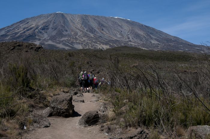
Mount Kilimanjaro viewed from near the Kenya border.
RAINS
The rainy season in northern Tanzania is from November thru mid-May, with two distinct rain seasons. The "Short Rains" (locally called the "mvuli") fall from mid-November to mid-December and are generally lighter and less impactful to safari activities. The "Long Rains" (locally called the "masika") occur between March and May, brining afternoon showers on a near daily basis.
Short Rains
The short rains occur for about one month sometime during November and December (the exact time varied somewhat year to year). This period is called the 'short' rains because the duration of an individual rain event is short and it is rare to have an all-day rain event. Most rain falls as an afternoon shower, while mornings are typically overcast or clear.
Long Rains
The long rains occur between March and May, with April being the wettest month of the year. During this time, rain should be expected almost every day and the showers can last for hours at a time, although all-day rain is not typical. The roads into and out of the Ngorongoro Crater can be quite difficult during the long rains, which can mean longer times getting in and out. Cloudy skies are typical and temperatures can be chilly at times.
The period between the short and long rains (January and February) also receives rainfall, but many days are clear and the amount and duration of the rain events is unpredictable, with some afternoon showers and the odd long and heavy shower.
The moorland zone is often called the Land of the Giants.
TEMPERATURES
The temperatures in the Arusha region do not experience wide fluctuations throughout the year, as the region lies just over three degrees south of the equator. In general, daytime temperatures are comfortably warm and overnights and early mornings are chilly. Bring a fleece and rain jacket regardless of the timing of your visit.
Arusha's climate is generally mild, with the coldest temps occurring between May and August, where days start out at 57-61°F (14-16 °C) and reach a midday high of 78-80°F (25-27°C). November to March are the warmest months (this coincides with the rainy season), averaging lows of 66-68°F (18-20°C) overnight and daytime highs 84-88°F (29-31°C).