Malawi
Highlights
- Kayaking and snorkeling on Lake Malawi, Africa's third largest lake with colorful tropical fish.
- Wildlife safaris in Liwonde National Park and Majete Wildlife Reserve.
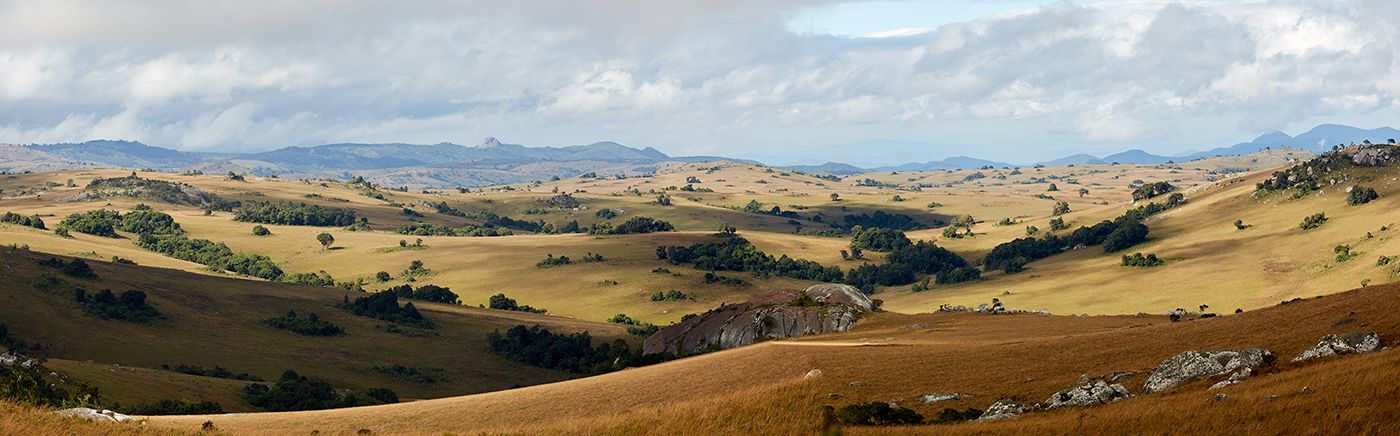
- Nyika Plateau offers a wild, highlands experience with roan, zebra, eland and wildflowers.
- Likoma Island on Lake Malawi for a relaxing step back in time in a pristine aquatic paradise.
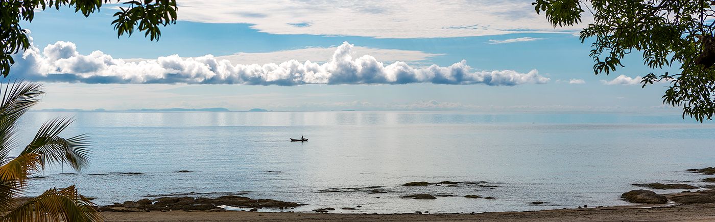
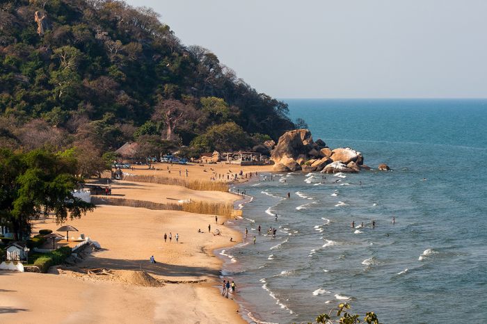
Mostly overlooked by visitors to the continent, Malawi is known as "The Warm Heart of Africa" for its relaxed, tropical atmosphere and the warmth and friendliness of its people. Malawi is dominated by its main geographical feature, Lake Malawi, which fills part of Africa's Great Rift Valley and covers 25% of the country.
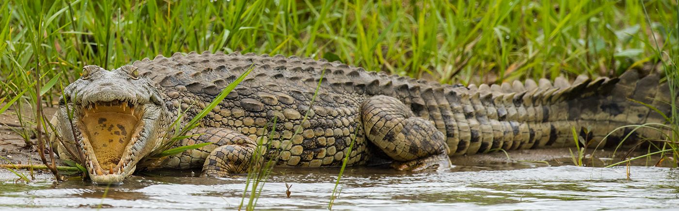
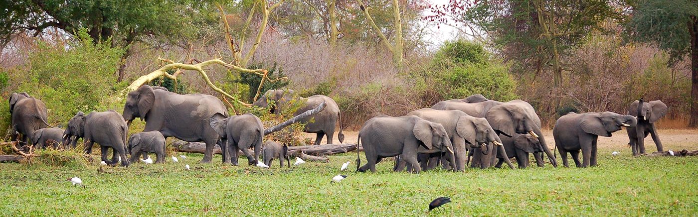
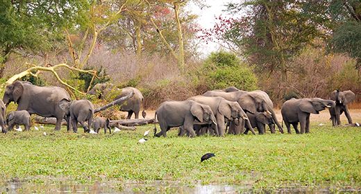
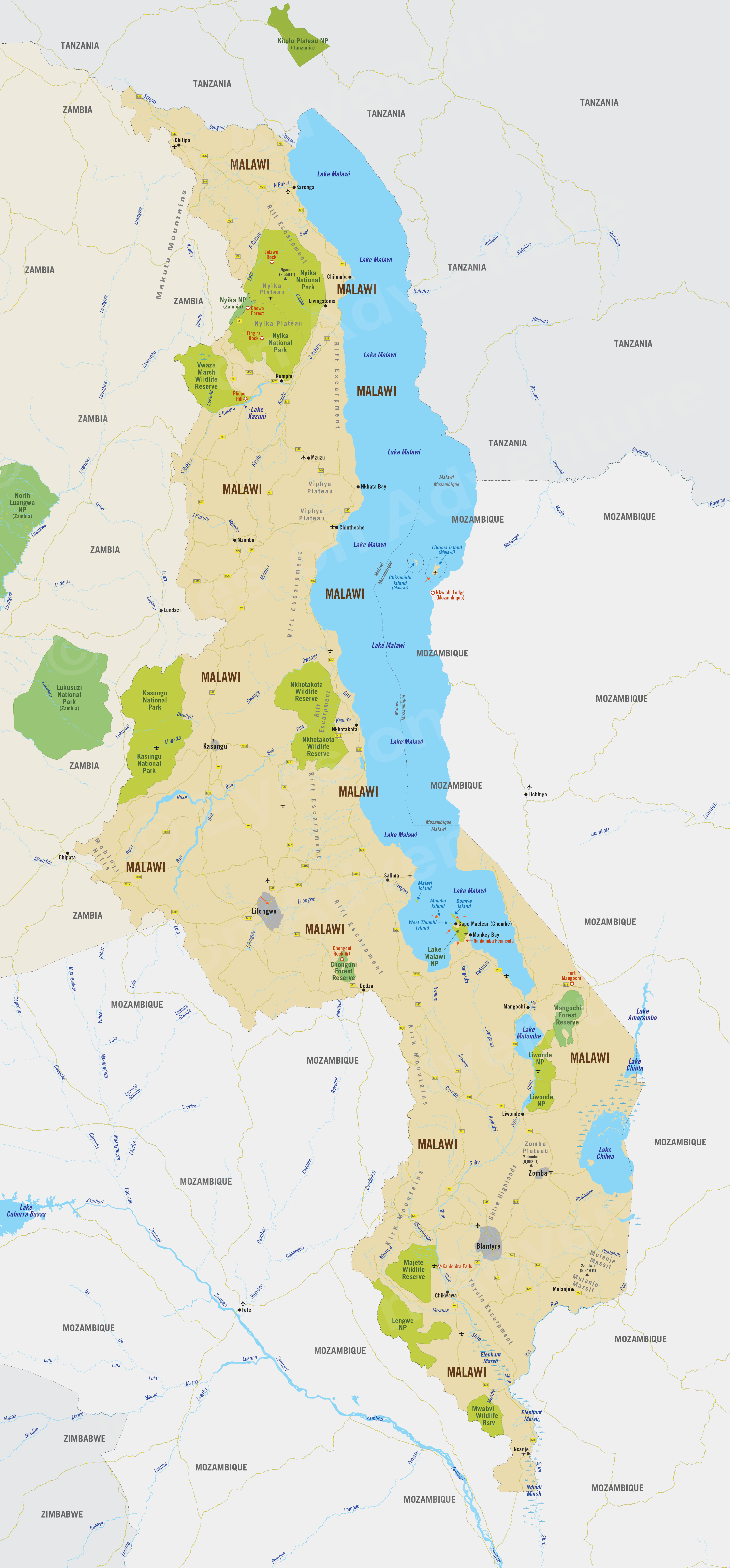
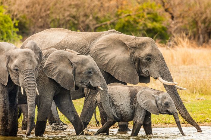
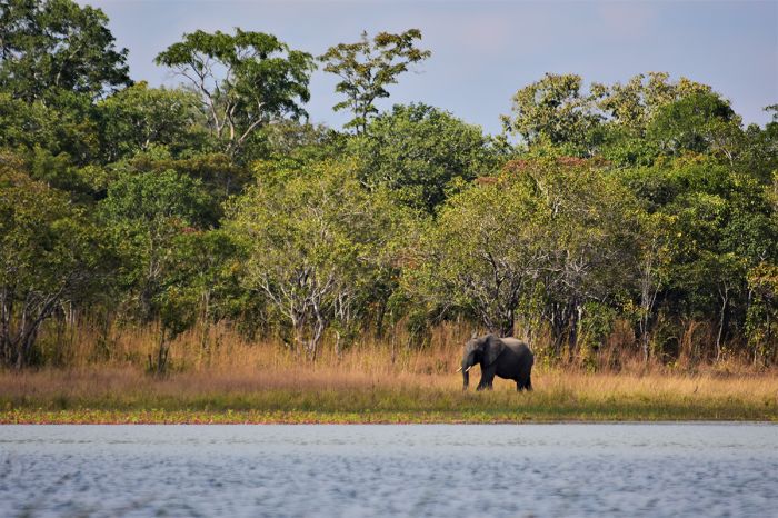
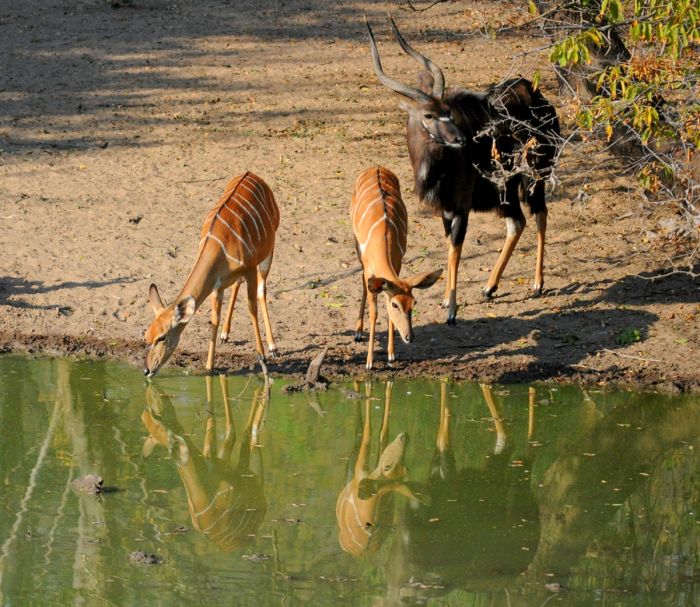
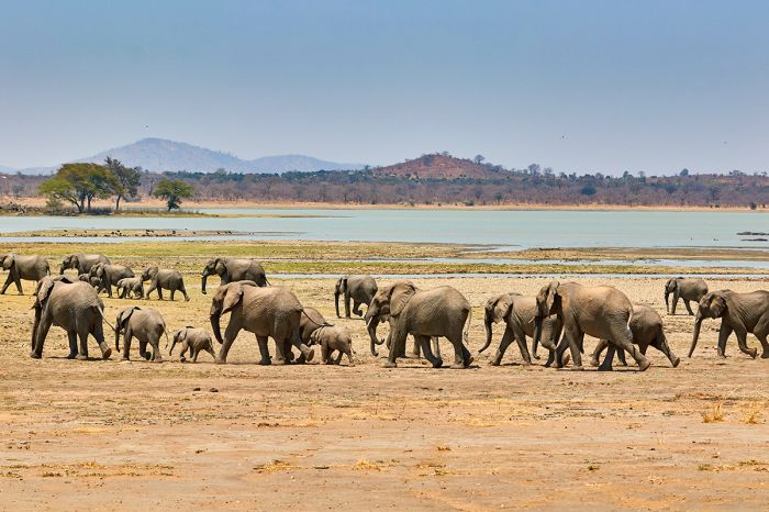
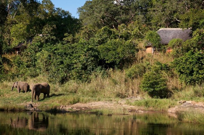
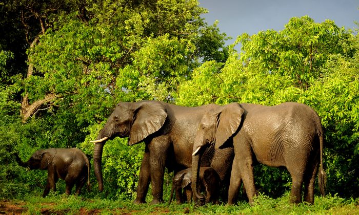
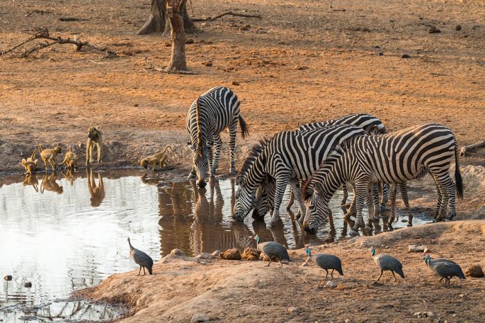
Elephants in the Shire River, Liwonde National Park, Malawi.
Malawi lacks the large savanna-based East African safari ecosystems of countries like Kenya and Tanzania, but its national parks and reserves offer diverse habitats, wildlife, and adventure activities for those seeking authentic experiences without the crowds.
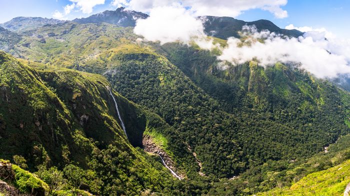
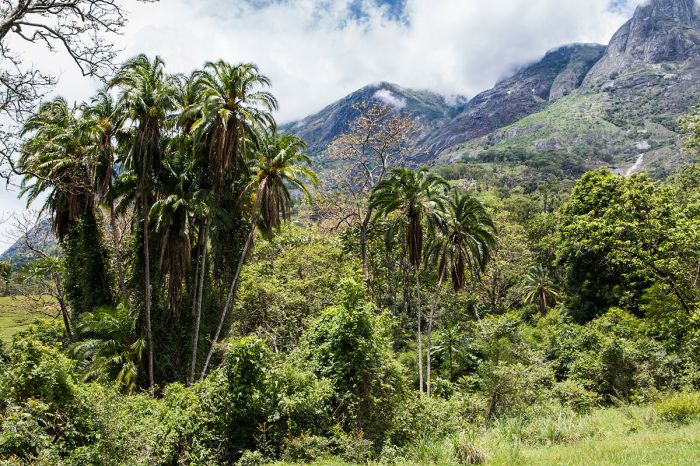
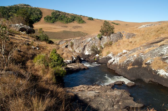
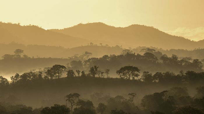
Lake Malawi is one of Africa's 'Great Lakes' that fill parts of the Albertine Rift and the continent's third largest lake. The lake covers most of Malawi's eastern boundary and is partially shared with Mozambique. To the immediate west of the lake, Malawi's land rises steeply to the Rift Escarpment and several mountain ranges span these highlands from the north to the south of the country.
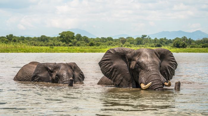
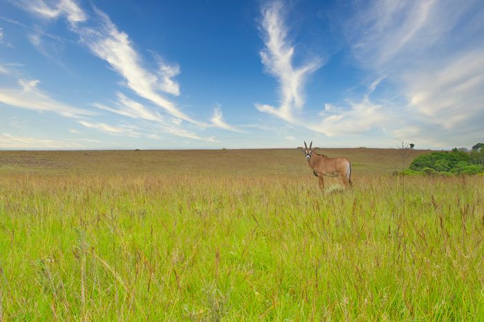
Zebras and roan antelopes on the Nyika Plateau.
Some of Malawi's most beautiful and pristine protected areas are situated atop its highlands, including Nyika National Park, and Nkhotakota Wildlife Reserve.
The Shire River drains Lake Malawi and flows south through the Rift Valley into Mozambique, where it joins the Zambezi River en route eastward to the Indian Ocean. Malawi's premier wildlife safari destinations are located along the Shire River south of Lake Malawi: Liwonde National Park and the Majete Wildlife Reserve, both of which are expertly managed by the non-profit African Parks.
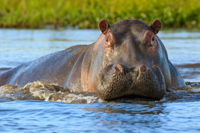
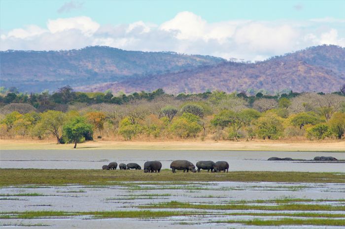
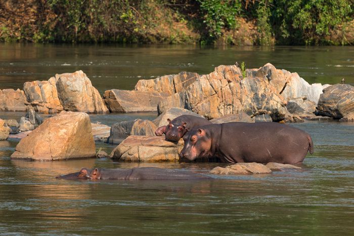
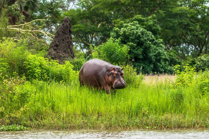
A hippo in the Shire River, Liwonde National Park, Malawi.
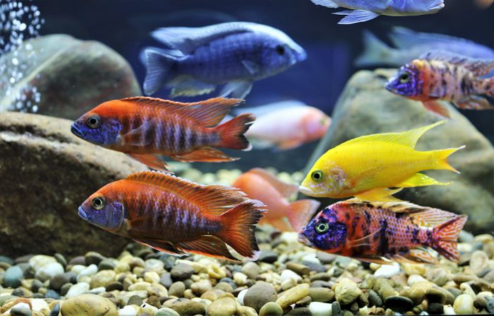
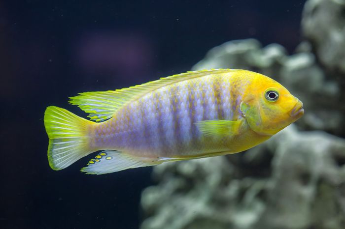
Perhaps the most interesting and certainly the most visited protected area in Malawi is Lake Malawi National Park (LMNP), situated at the southern end of the lake. LMNP protects a combination of a headland peninsula, offshore waters, and nine islands. These waters are home to colorful "cichlid" fishes that are very popular in the aquarium hobbyist market. Snorkeling and diving to view these amazing fish is the main attraction in LMNP.
Malawi's other protected areas, including Vwaza Marsh Wildlife Reserve, Kasungu National Park, Lengwe National Park, and Mwabvi Wildlife Reserve offer a remote wilderness experience, but wildlife-viewing expectations should be tempered for these reserves, as they were all negatively impacted by hunting during the 1970s and 1980s and are still recovering.
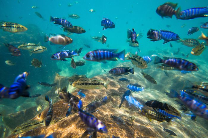
Colorful cichlid fishes in Lake Malawi National Park.
Other areas worth consideration in Malawi include Elephant Marsh, a vast and beautiful wetland in the lower Shire Valley with scenery similar to Botswana's Okavango Delta, and Lake Chilwa, which is home to hundreds of thousands of waterbirds; both are Ramsar Wetland Sites.
The Chongoni Rock Art Site near Lilongwe is the location of prehistoric paintings, some dating back over 2 000 years. Chongoni is one of Malawi's two UNESCO World Heritage Sites (Lake Malawi National Park is the other).
Malawi offers a lot for a country of such small size and can easily be combined with Zambia, Tanzania, or Kenya and for many visitors who do decide to visit, it becomes a highlight of their trip.
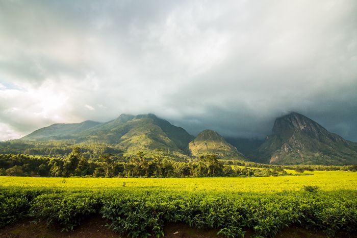
A tea plantation below the Mulanje Massif in Malawi.
Read More...
Main: Flora, Geography, Important Areas, National Parks, Protected Areas, Ramsar Sites, UNESCO Sites, Urban Areas, Wildlife
Detail: Blantyre, Chizumulu, Chongoni, Elephant Marsh, Highlands, Kasungu, Lake Chilwa, Lake Malawi, Lake Malawi NP, Lengwe, Likoma, Lilongwe, Liwonde, Majete, Mangochi, Mwabvi, Nkhotakota, Nyika, Rift Valley, Vwaza Marsh
Admin: Travel Tips, Entry Requirements/Visas
Geography
Malawi is a landlocked country located in the southern portion of Central Africa and is one of the smallest countries in sub-Saharan Africa. It occupies a narrow strip of land between Zambia to the west, Tanzania to the east, and Mozambique, which wraps around Malawi in the south. It's major features are the Great Rift Valley, which traverses the country north-to-south and Lake Malawi (formerly Lake Nyasa), which fills part of this deep valley.
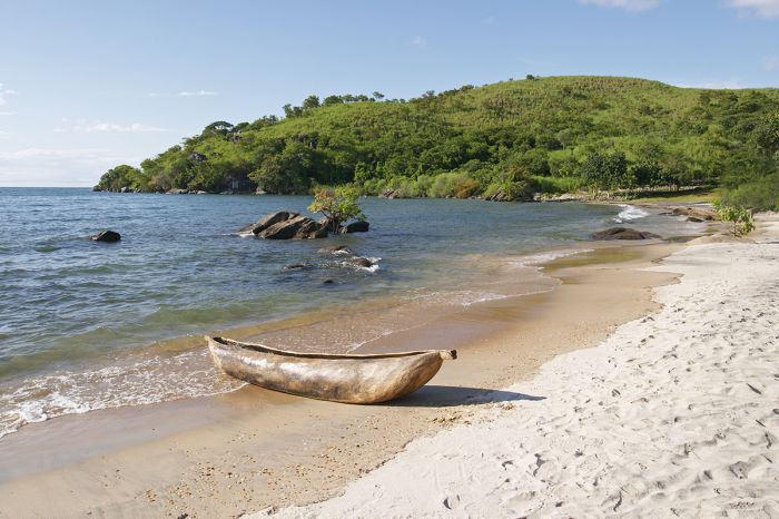
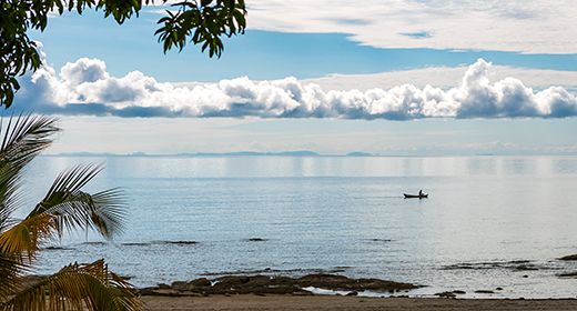
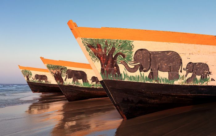
Traditional dugout on a Lake Malawi beach near Chinteche.
Rift Valley and Lake Malawi
The Great Rift of Africa (also called the East African Rift) begins far to the north, at the southern tip of the Red Sea and runs southwest through Africa, branching into the Gregory Rift (to the east) and the Albertine Rift (to the west). Lake Malawi fills the southernmost portion of the Albertine Rift, which also includes several of the Great Lakes of Africa (Albert, Edward, Kivu, Tanganyika, and Malawi).
Lake Malawi is the third largest lake by area and second deepest lake in Africa. It is the world's fifth largest lake by volume and the ninth largest by area. The lake is 364 miles long (587 kms) and 52 miles (84 kms) wide at its widest point.
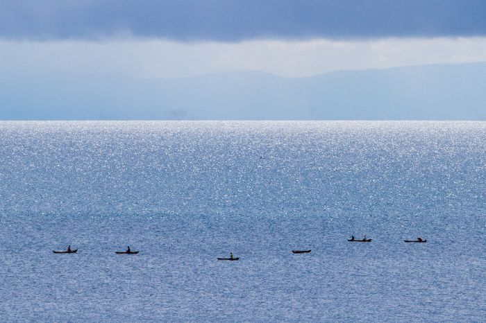
Fishing boats on Lake Malawi.
Lake Malawi makes up of 75% of Malawi's eastern boundary and around 25% of the country's surface area. The lake's surface lies at an elevation of 1 500 feet (460 meters) and its deepest point is 2 300 feet (700 meters), which is 700 feet (210 meters) below sea level. The lake is drained at its southern end by the Shire River, which flows through southern Malawi before joining the Zambezi River in Mozambique.
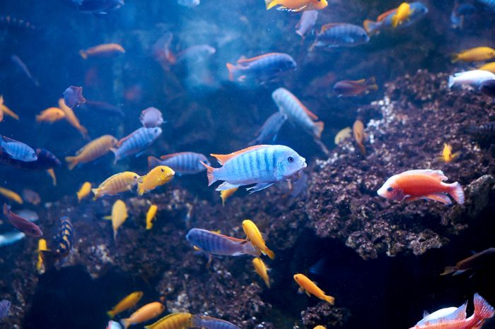
Lake Malawi is home to more species of fish than any lake in the world, many of them colorful species called cichlids, which are extremely popular amongst tropical fish hobbyists.
Lake Malawi's colorful cichlids are popular aquarium fishes.
Highlands
Plateaus and highlands rise to the east and west of the Rift Valley. Immediately west of Lake Malawi, the western Rift Valley Escarpment rises steeply to elevations averaging 3 000-4 000 feet (900-1 200 meters). Several plateaus and mountain ranges lie along this escarpment, including the Nyika Plateau, which is protected by a national park, and the Viphya Plateau/Mountains near Nkhata Bay.
South of Lake Malawi are more mountains and highlands, which are part of the eastern Rift Escarpment. Significant highlands south of Lake Malawi include the Mulanje Massif, which contains Central Africa's highest peak- Sapitwa (9 850 feet/3 002 meters), and the Zomba Plateau, which rises to 7 000 feet (2 100 meters). The Shire Highlands rise to 2 000-5 200 feet (600-1 600 meters) east of the Shire River, which drains Lake Malawi to the south via the Rift Valley.
Waterfall on the Ruo River, Mulanje Massif, Malawi.
The western Rift Escarpment merges into the Kirk Mountains south of Lake Malawi, decreasing in a southerly direction from 5 500 feet (1 675 meters) near Dedza to 1 400 feet (425 meters) around Blantyre. In the far south of there country, the Shire River enters the Zambezi River lowlands, where elevations are only 200-300 feet (60-90 meters).

View from the Zomba Plateau.
Flora
Malwai's predominant native vegetation type is the miombo woodland, which is defined by grasslands, savannas, and shrub-lands, with wooded areas consisting primarily of Brachystegia and Julbernardia species. Unfortunately, the centuries of human habitation west of Lake Malawi have seen much of the country's native vegetation cleared for agriculture. The exceptions are in the highlands, where there are still considerable tracts of land that has remained largely untouched by humans.
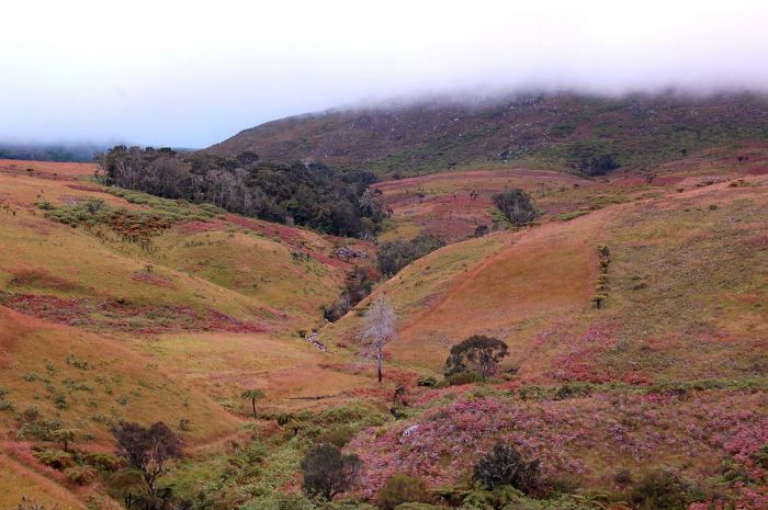
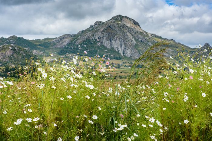
Montane grassland savannas cover around 6% of Malawi and are found in the Nyika Plateau, Mulanje Massif, Zomba Plateau, and Vhipya Plateau. Here the land is still as it always was, with heaths and various grasses, heathers, and wildflowers. Malawi is rich in orchids, with over 400 species in 60 or more genera recorded to date. The rainy season, which runs from November to early April, is the best time to see Malawi's flowers, with January/February being the peak months.
Montane grassland on the Mulanje Massif, Malawi.
Evergreen and semi-evergreen forests are reduced to about 4% of Malawi and can only be found today on the slopes of the country's mountains, including those at Zomba, Mulanje Viphya, and Nyika. Sadly, by far the most common forest found in Malawi today are exotic plantations, especially eucalyptus and pine. These trees are cultivated for firewood and timber and arguably do keep the remaining indigenous forests from being completely eliminated.
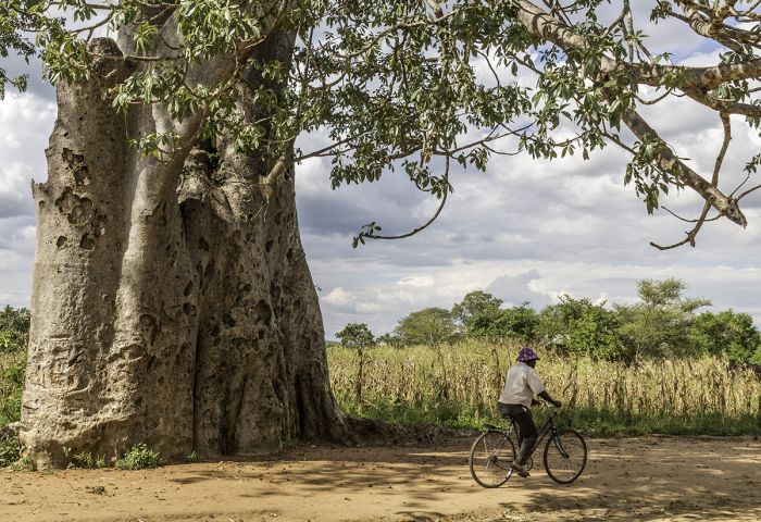
Notable trees in Malawi include four species of palm, as well as the iconic baobab. The baobab tree can live well over 1 000 years and is a characteristic feature of the country's lower-elevation areas, particularly along the shores of Lake Malawi and in the Shire River Valley
A baobab tree beside a road in rural Malawi.
The lofty Borassus palm (Borassus aethiopum) can grow to over 60 feet (20 meters) tall and is common in riparian habitats and areas with lots of permanent water, including the Vwaza Marsh Reserve and Liwonde National Park. The other tall palm is the doum palm (Hyphaene thebaica), which is common along the Lake Malawi shores, as well as in the Shire River Valley, particularly at Elephant Marsh in the far south.
Wild date palms (Phoenix reclinata) can become tall, thin stemmed trees or more commonly, grow as low bushes; they are common along the Shire River, particularly in Liwonde NP. The Rafia palm (Raphia farinifera) has leaves that are among the longest in the plant kingdom; they are common in the Shire Highlands.
Palm trees growing alongside montane grasslands near Mulanje.
Wildlife
Malawi offers a good diversity of animal species in its national parks and reserves, although many of its protected areas suffered from rampant poaching during the 1970s and 1980s, and are still recovering.
The best places in Malawi for wildlife safaris are Liwonde National Park, and Majete Game Reserve. Both reserves offer abundant wildlife and are managed by African Parks, a non-profit organization with a great track record of restoring wildlife areas throughout Africa.
Like much of the continent, Malawi's wildlife have long suffered from human encroachment and habitat loss, but in recent decades, the country has made great efforts at protecting its remaining ecosystems and wildlife with the goal of increasing eco-tourism revenues.
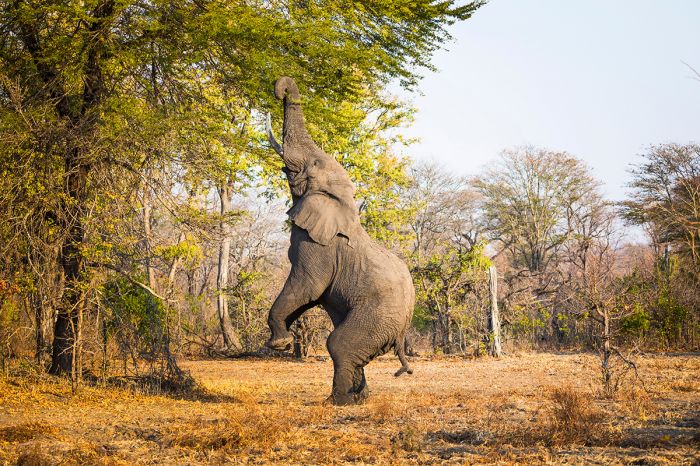
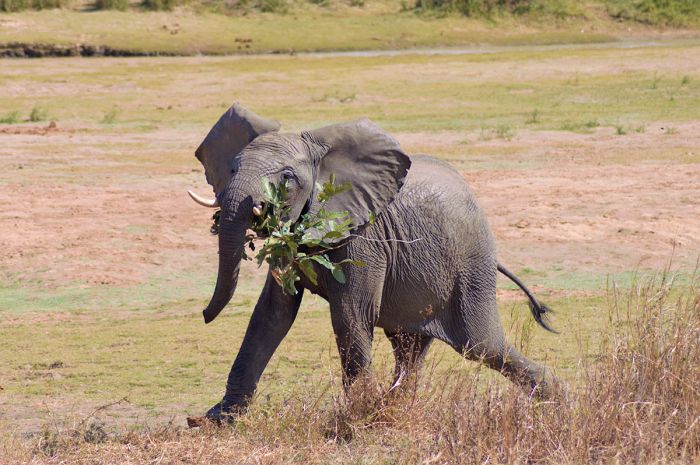
An elephant reaches high for tasty leaves in Liwonde National Park.
Although Malawi is a relatively small country compared to neighboring countries like Zambia and Tanzania, its position along the Rift Valley gives it a diversity of habitats at a range of elevations, providing niche ecosystems for wildlife.
The most commonly seen large predators in Malawi are lion and spotted hyena, both of which are best seen in Liwonde, Majete, and Nkhotakota. Leopard are present in most parks and reserves throughout the country, but are difficult to see.
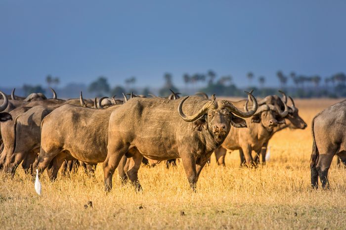
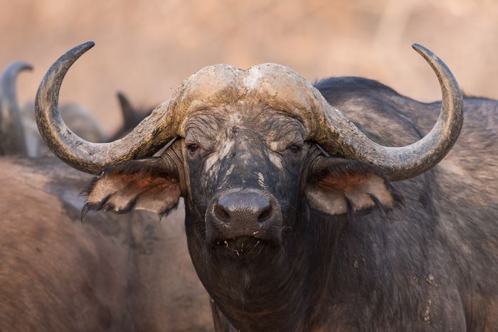
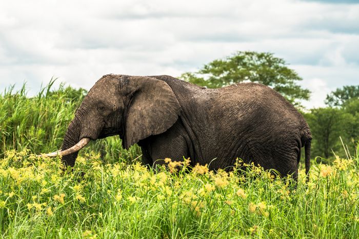
Besides lion and leopard, the other three animals in Africa's Big Five are elephant, buffalo, and rhino. Elephants are common in several protected areas in Malawi, including Liwonde, Majete, Nkhotakota, and Vwaza Marsh. Buffalo are the easiest of the Big Five to see, as they are found in most of the larger lowland reserves, including Liwonde, Majete, Nkhotakota, Vwaza Marsh, Kasungu, Lengwe, and others. As in much of Africa, rhinos are under great threat and are only found in two reserves in Malawi where they have been reintroduced in Liwonde and Majete.
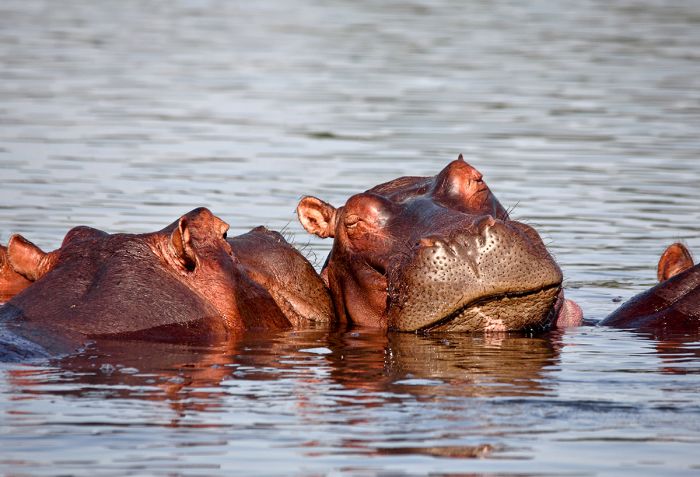
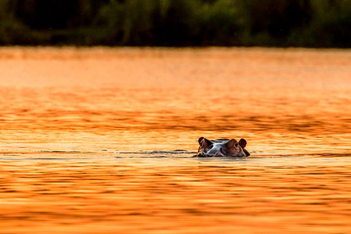
Hippos in the Shire River, Malawi.
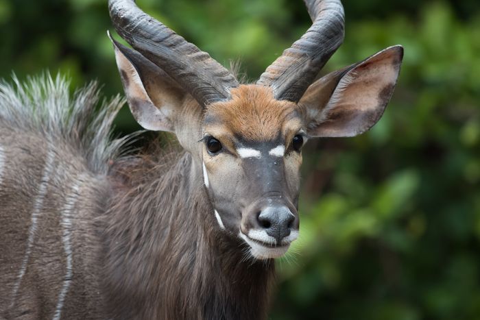
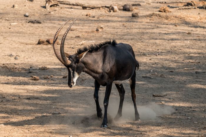
Malawi's parks and reserves are home to a diversity of antelopes, including nyala, impala, sable antelope, Lichtensteins' hartebeest, waterbuck, eland, zebra, roan antelope, greater kudu, puku, reedbuck, bushbuck, duiker, and grysbok. Giraffe are only found in Majete. Primates include yellow baboon, vervet monkey, blue monkey, and samango monkey.
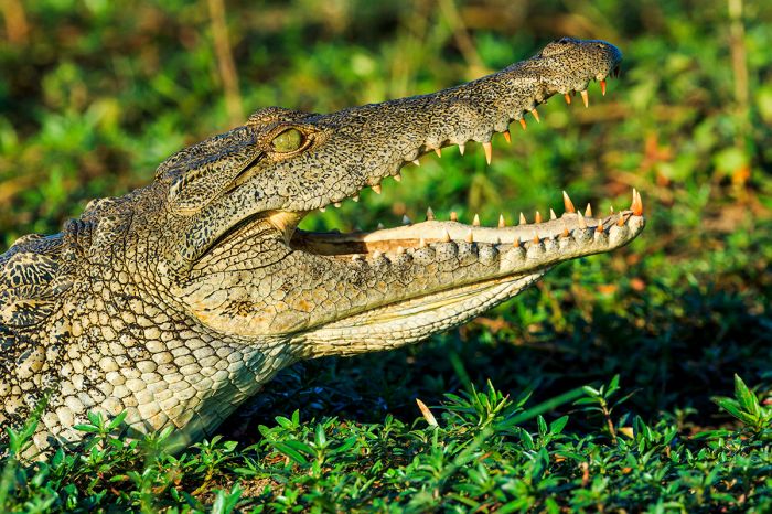
Hippo and crocodile are best seen along the major rivers, including the Shire River, which flows through Liwonde, Majete, and Elephant Marsh, and the South Rukuru River, which flows through Vwaza Marsh.
Malawi is an excellent birding destination, with around 700 species recorded. Malawi's two Ramsar Wetland sites (Lake Malawi NP and Lake Chilwa), as well as Elephant Marsh offer and abundance of waterbirds.
Lake Malawi has the greatest number of freshwater fish species of any lake in the world, and Lake Malawi National Park was created to protect the "cichlid" fishes, which are colorful and a favorite amongst tropical fish hobbyists.
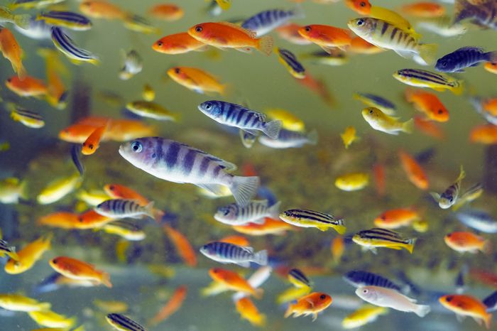
Colorful assortment of cichlid fishes from Lake Malawi.
Protected Areas
Malawi's small size and dense population mean that it cannot support massive wilderness areas like some of its neighboring countries, but its diverse topography give it a variety of ecosystems including, Lake Malawi, the Rift Valley Escarpment and its various mountain ranges, plateaus, montane forests, savannas, river valleys, wetlands, and several smaller lakes. Malawi has protected these habitats, some of them offering iconic African wildlife, in five national parks and four wildlife reserves.
Otter Point at Cape Maclear, Lake Malawi National Park.
National Parks
Following are Malawi's five national parks. Additional information on each is included further below this list:
- Kasungu National Park - Miombo woodland and unspoiled bush habitat on the border with Zambia. Elephant and an assortment of antelopes and other plains game. Beautiful wildflowers seasonally. Prehistoric rock art sites. Good birding.
- Lake Malawi National Park - Protects most of the Nankumba Peninsula and offshore waters at the southern end of the lake. The underwater portion protects the diverse and colorful cichlid fishes that can be viewed by snorkeling or SCUBA diving.
- Lengwe National Park - Set in the lower Shire Valley, bordering Mozambique. Good populations of buffalo and nyala. Baobabs, palm trees, and thickets of dense vegetation. Good birding.
- Liwonde National Park - Malawi's top wildlife destination protects large areas of woodland, grassland, reed swamp, and riparian habitat along the Shire River. Good for elephant, hippo, and plentiful plains game. Lion, black rhino and cheetah recently reintroduced. Great birding.
- Nyika National Park - Malawi's largest and highest elevation protected area. Scenic montane grasslands and herds of zebra, roan antelope, and eland. Plentiful wildflowers seasonally. Good birding.
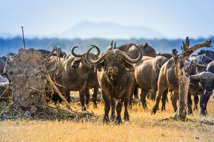
A herd of buffalo in Liwonde National Park, Malawi.
Important Areas
Other important areas of note in Malawi include wildlife reserves, which receive a lower level of conservation priority than national parks, forests, and other places worthy of consideration when planning your visit.
- Chongoni Rock Art Area - Situated in the Chongoni Forest, with 127 rock art sites, some dating back over 2 000 years.
- Elephant Marsh - A vast wetland emanating from the lower Shire River and home to spectacular scenery and wildlife.
- Lake Chilwa - Malawi's second-largest lake supports several hundred thousand resident waterbirds and is a crucial source of fish for the country.
- Likoma and Chizumulu Islands - Situated in Mozambican waters, these Malawian island exclaves offer a relaxed tropical getaway with excellent diving and snorkeling.
- Majete Wildlife Reserve - Miombo woodland with a variety of species including buffalo, zebra, elephant, diverse antelopes, and other plains game with part of the reserve bordered by the Shire River. Good birding.
- Mangochi Forest - Contiguous with Liwonde National Park and managed by Africa Parks.
- Mwabvi Wildlife Reserve - Remote and infrequently visited, with dense woodlands, gorges, and rocky outcrops. Unspoiled wilderness, good walking, good birding, and decent variety of antelope.
- Nkhotakota Wildlife Reserve - Set along the Rift Valley Escarpment just west of Lake Malawi, with healthy wildlife populations and one of Malawi's last holdouts for lions. Elephant, buffalo, spotted hyena, and a variety of antelope and other plains game. Game drives, montane hikes, bush walking, and good birding.
- Vwaza Marsh Wildlife Reserve - Flat and low-lying, with woodlands, wetlands, and riparian habitat. Wildlife moves freely to Zambia's Luangwa Valley to the west. Buffalo, elephant, and a variety of antelopes. Very underrated with good game viewing.
Exploring the highlands on Malawi's Nyika Plateau.
UNESCO World Heritage Sites
The United Nations Educational, Scientific and Cultural Organization (UNESCO) is a specialized agency of the United Nations whose mission is to promote world peace and security through international cooperation in education, the arts, the sciences, and culture. The Convention concerning the Protection of the World's Cultural and Natural Heritage was signed in November 1972 and ratified by the 189 UN member "states parties".
A World Heritage Site is a landmark or area which is geographically and historically identifiable and has special cultural or physical significance. To be selected as a World Heritage Site, a nominated site must meet specific criteria and be judged to contain "cultural or natural heritage of outstanding value to humanity". An inscribed site is categorized as cultural, natural, or mixed (cultural and natural). As of 2021, there were over 1 100 sites across 167 countries.
Malawi has two UNESCO World Heritage Sites:
- Chongoni Rock Art Area (since 2006, Cultural) - Home to culturally significant ancient BaTwa rock art sites.
- Lake Malawi National Park (since 1984, Natural) - Located at the southern tip of Lake Malawi, the site is synonymous with a national park, which protects numerous endemic species of cichlid fishes.
Ramsar Wetlands of International Importance
The Ramsar Convention on Wetlands is an international treaty for the conservation and sustainable use of wetlands. It was the first of the modern global nature conservation conventions, negotiated during the 1960s by countries and non-governmental organizations concerned about the increasing loss and degradation of wetland habitat for birds and other wildlife. The convention is named after the city of Ramsar in Iran, where the convention was signed in 1971.
Presently there are some 75 member States to the Ramsar Convention throughout the world which have designated over 2 300 wetland sites onto the Ramsar List of Wetlands of International Importance.
Malawi has 2 sites designated as Wetlands of International Importance (Ramsar Sites) as follows.
- Elephant Marsh - Mosaic of rooted swamp vegetation, floating flora, and open water with reed beds and grassy margins. Numerous islands with reeds, shrubs, and palm trees. Habitat and breeding site for over 20 000 waterbirds, as well as hippos, fish, and aquatic invertebrates. Crucial for flood control and water storage. Threats are poaching and removal of large trees bordering the marsh. (238 sq miles/615 sq kms)
- Lake Chilwa - Shallow, saline lake with seasonal variation in water levels, surrounded by dense swamp, marshes, and seasonally flooded grassy plains. Numerous islands, two of which are inhabited. Habitat protects large number of waterbird species (153 resident, 30 migratory). Fishing, agriculture, livestock grazing, hunting of birds are major threats. (868 sq miles/2 248 sq kms)
Urban Areas
The following urban areas are worth noting, as travelers may find them of interest as a destination or have at least a day to spend after arrival in Malawi. Info on each follows further below.
- Blantyre - Malawi's oldest city, located in the southern part of the country.
- Lilongwe - Malawi's capital and largest city. It is the main port of entry for international visitors.
Snorkeling in Lake Malawi to see the colorful cichlid fishes.
Liwonde National Park
Originally proclaimed as a Controlled Hunting Area in 1962, in order to protect what wildlife remained after the British Colonial era, Liwonde was upgraded to a Game Reserve in 1969, and received national park status in 1973
Liwonde National Park is Malawi's premier game viewing destination, though it cannot be said to be on a par with Africa's top safari destinations. Liwonde offers guests an authentic safari experience with good wildlife viewing and the best birding in the country.
The park covers 212 square miles (548 sq kms) and is dominated by the lazily flowing Shire River, which forms a portion of Liwonde's western border, along with a section of Lake Malombe's shoreline.
Elephants drinking at the Shire River in Liwonde National Park.
Lake Malombe covers 66 square miles (170 sq kms) and is very shallow, with an average depth of only 8 feet (2.4 meters) and during long dry spells, the water recedes substantially. The lake bed was dry for several hundred years until it refilled again during the mid-1800s.
The nonprofit African Parks (AP) organization has managed Liwonde in collaboration with the Department of National Parks and Wildlife (DNPW) since 2015. AP removed tens of thousands of wire snares from the park, which has historically had high levels of human-wildlife conflict. AP erected an electrical fence around the perimeter of the park, which has greatly reduced conflicts between the animals and the 100 000 people that live nearby.
In 2018, the adjacent Mangochi Forest Reserve, was also brought under African Parks' management, which has nearly doubled the size of the combined protected area.
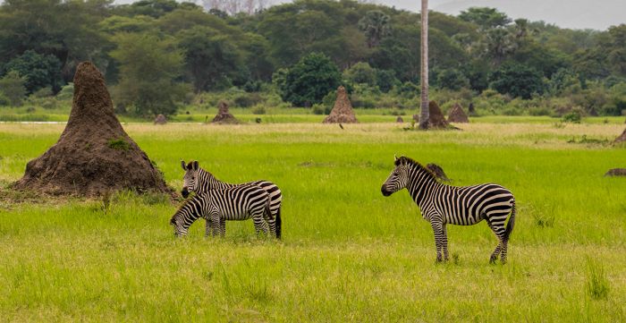
Burchell's zebras and termite mounds in Liwonde NP.
The dominant habitat in Liwonde is woodland and tall grass savanna. There are large areas of mopane tree forests, semi-deciduous riparian woodlands along the Shire River, lagoons, fertile floodplains, ancient baobab trees, and tall Borassus palms.
Due to years of poaching by the thousands of rural Malawians living around the park, the park was in critical decline when African Parks took over. In a move to reduce pressure on Liwonde's natural habitats and address the ongoing human-wildlife conflicts, African Parks completed one of the largest translocations of elephants ever attempted. Some 336 elephants were moved out of Liwonde and into Nkhotakota Wildlife Reserve in Central Malawi.
Next AP began reintroducing key wildlife species that had been poached out. Cheetah were brought back to the park after an absence of 20 years in Malawi and 100 years since any had been sighted in Liwonde. A founder population of ten lions were brought in from South Africa and even more notably, 17 black rhinos were relocated to Liwonde from South Africa's Hluhluwe Imfolozi Game Reserve by WWF’s Black Rhino Range Expansion Project (BRREP).
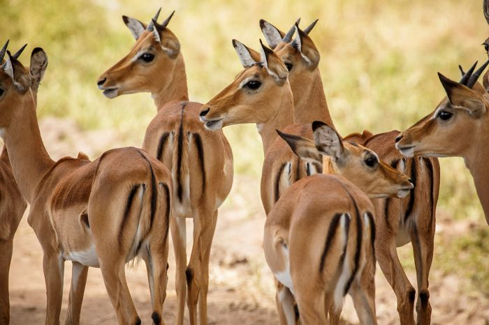
Juvenile impalas in Liwonde.
Healthy populations of plains game mammals are present in Liwonde, as well as a large population of elephant. There are 1 000 buffalo, 2 000 hippos, and over 600 elephants in the park. The elephants gather along the Shire River on a daily basis. Crocodiles are very common, some of them immensely large.
A variety of antelopes reside in Liwonde, including waterbuck, impala, sable antelope roan antelope, eland, Burchell's zebra, greater kudu, Lichtenstein's hartebeest, common reedbuck,and bushbuck. Warthogs are common, as are vervet monkey and yellow baboon.
Besides the small population of reintroduced cheetah and lion, Liwonde's predators include side-striped jackal, serval, and a small population of spotted hyena. Leopards are also here, but infrequently seen. Birding in Liwonde is excellent, with over 400 species recorded.
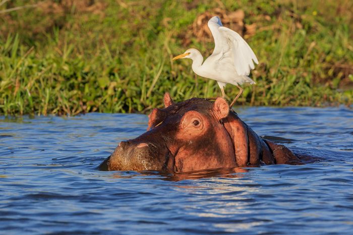
A cattle egret atop a hippo in the Shire River, Liwonde National Park.
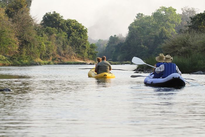
Activities in Liwonde
The safari camps in Liwonde offer a variety of wildlife viewing activities, including game drives in 4x4 vehicles, boating safaris on the Shire River, and bush walks. Drives along the sand tracks fronting the river are typically very productive for wildlife, as well as on the tracks surrounding the flood plains, which are favored by grazing animals for the rich grasses.
Boat excursions on the Shire River are sure to produce excellent views of plenty of hippos and also likely some crocodiles. Elephants are commonly seen feeding along the banks in reed beds or drinking and swimming. Waterbuck, impala, and sable antelope are also seen often from the water. Birding is superb on these boating safaris.
Early morning bush walks are another great way to experience Liwonde. You are unlikely to see much wildlife, as the animals will see you coming and likely stay a distance, but exploring on foot gives a real feel of adventure and a great way to see the little things that the experienced guides can point out. Guests may also be offered the opportunity to accompany rangers on their regular black rhino check-ups, which is an exciting way to see these critically endangered and iconic African animals.
Liwonde is home to good numbers of buffalo.
Weather and When to Go
The best game viewing in Liwonde is during the latter part of the dry season, from July thru October. At this time, animals congregate along the Shire River and never stray far, as ground water away from the river and Lake Chilwa has dried up.
The wet season runs from November thru early April, but December thru March receive the majority of the rain. January/February are the rainiest months and near the end of the rainy season, game drives may be challenging due to muddy conditions. May thru mid-November is the dry season, during which Liwonde receives very little rain.
Liwonde lies in the tropics at the relatively low-lying elevation of 1 500-2 500 feet (475-800 meters) and therefore experiences warm to hot daytime temps all year.
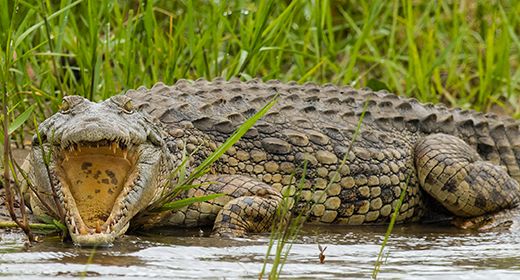
A nile crocodile thermoregulates in Liwonde.
The warmest period coincides with the spring and summer months from September thru April, during which time the daytime temps average 82-90°F (28-32°C) and overnight temps average 66-70°F (19-21°C). October is extremely dry and hot, with daytime temps averaging 91°F (33°C), but peaking even higher some days, making the heat oppressive. The first rains, which fall late October or early November, bring relief and lower temps.
The early and middle part of the dry season (May thru August) are the fall and winter months and this is when the temperatures are at their coolest in Liwonde. Daytime temps average 75-80°F (24-27°C) and overnights 55-60°F (13-15°C). Early morning activities will require a fleece and a layer beneath for when the day warms up.
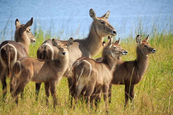
Waterbucks are one of many species of plains game in Liwonde.
How to Get There
Scheduled or charter flights are available from Lilongwe, Likoma Island, and Monkey Bay to the national park airstrip near Mvuu. The main park gate is just east of Liwonde town and the safari camp operators will arrange transfers.
Sunset on the Shire River, Liwonde National Park.
Nyika National Park
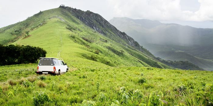
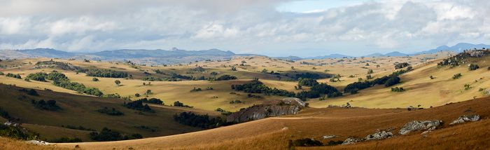
Malawi's largest protected area, Nyika National Park protects 1 210 square miles (3 134 sq kms) of the high-elevation Nyika Plateau on the western side of the Rift Valley Escarpment. The park was proclaimed in 1965, but has been a government-protected area since the 1940s. The name 'Nyika' translates as "where the water comes from", as the plateau's high elevation means that it receives more rain than the surrounding areas.
The main feature of the park is indeed the highland plateau, which has an average elevation of 6 900-7 200 feet (2 100-2 200 meters) and a high point at Nganda Peak (8 547 feet/2 605 meters). The plateau covers roughly one-third of the national park, with the remaining portions being the lower slopes of the highlands.
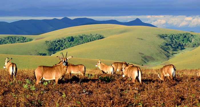
Roan antelopes on the Nyika Plateau, Malawi.
The Nyika Plateau consists of rough montane terrain, with heather and fern grasslands atop rolling hills, broad valleys containing streams, and pockets of exotic pine and eucalyptus trees. The lower elevation slopes are covered in miombo woodland and Protea scrub, but are not readily accessible to visitors without effort.
The main attraction for visitors is the spectacular highland scenery, with a landscape that is not found elsewhere in Malawi and one that is more similar to some European regions. Nyika's seemingly endless grasslands are rich with wildflowers throughout the year, but the peak period for seeing them is from January and February, during the wetter months. Orchidologists and botanists will be particularly enticed by Nyika's list of over 200 orchid species, including a dozen or so endemics.
The Nyika Plateau provides spectacular vistas.
Besides, the esthetic enchantments of the Nyika Plateau, there are healthy populations of a good diversity of large mammals that can readily be seen over the course of a few days at one of the lodges. Nearly 100 species of mammal have been recorded in the park.
The more commonly seen mammals include Crawshay's zebra (a subspecies of Burchell's zebra), roan antelope, eland, common reedbuck, and bushbuck. Elephant are sometimes seen, as are leopard and serval. Although rare, lions are seen on occasion, but their status in terms of residency in the park is uncertain. Side-striped jackal are seen regularly and sometimes spotted hyena.
Birding is very good in the grasslands of the plateau and if one ventures into the small pockets of forest or the woodlands on the lower slopes, there are many more species to be found, but reaching these areas will require exploring on foot. The Chowo Forest, which straddles both sides of the Malawi-Zambia border, is particularly good for birding, where many localized 'specials' can be seen. Nyika's bird list includes around 370 species.
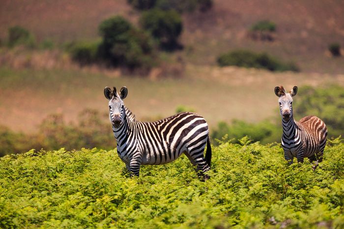
Crawshay's zebras in Nyika National Park, Malawi.
Activities in Nyika
The Nyika Plateau has vast areas of scenic beauty, with a well-developed network of roads and trails from which to explore. If one is visiting for several days at least (highly recommended), then a combination of game drives to explore the area and see the wildlife, combined with hiking the almost unlimited trails, will provide a lovely experience. Mountain biking is also available at some of the safari camps.
Hiking with a guide provides by far the most rewarding and informative experience, but there are also a multitude of short hikes that do not require a guide that take no more than 2-4 hours beginning around the Chelinda properties. For the more adventurous, there are a number of longer wilderness trails requiring a guide, with varying durations between one and five nights (camping in tents). These trails offer a great adventure and also an opportunity to see animals not often seen on the Nyika Plateau, such as buffalo, greater kudu, and elephant.
View from above the Chelinda River in Nyika National Park.
Further afield are various forests, viewpoints, and other points of interest that are certainly worth consideration. Jalawe Rock is one of the greatest viewpoints in all of Malawi, with vistas reaching all the way to Lake Malwai's eastern shores in Tanzania.
Nganda Peak is the highest in northern Malawi at 8 550 feet (2 606 meters) and only requires a 1-mile (1.5-km) steep hike from the road to reach the top. Finger Rock is a large, dome-shaped piece of granite with a cave on one side that was used as a human shelter long ago. Excavations uncovered human remains in the cave dating back 3 000 years and there are ancient rock paintings on the cave walls.
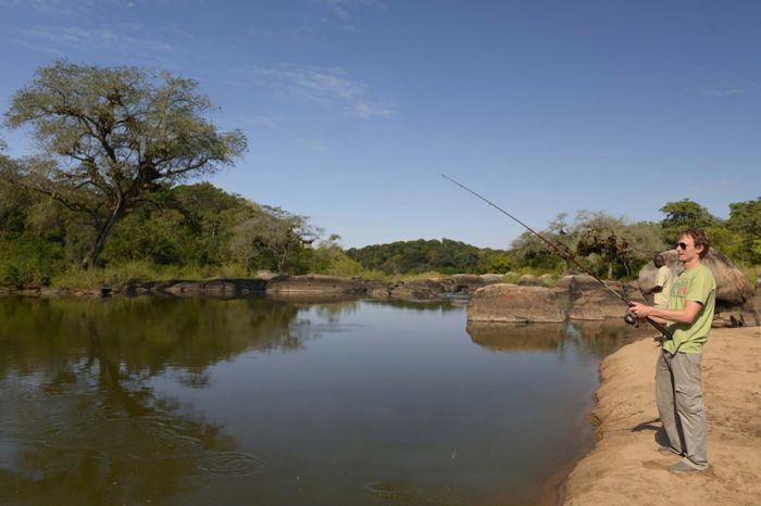
Birders should consider a drive to the park's border with Zambia to explore the Chowo Forest, which technically lies in Zambia, but may be explored from Nyika. Night game drives are offered at some of the lodges and provide the best chances at seeing leopard and serval. For those interested in fishing, the rivers and dams on the plateau are stocked with rainbow trout and fishing season is open from April thru September. Permits can be arranged at Chelinda.
View from the small bridge over the Nyika River.
Weather and When to Go
Due to its relatively high elevation, the weather on the Nyika Plateau does not follow the typical pattern of most safari regions in Malawi in terms of best times to visit. The wet or rainy season is actually the better time to visit the plateau, as during the dry season, the temperatures become quite cold and some of the animals move off the plateau to lower elevations to avoid the chilly weather.
The wet season occurs from mid-November thru mid-April, with substantial rain falling consistently through these months. The temperatures at this time are warm, but moderated by the high elevation, averaging 74-82°F (23-28°C) during the day and 54-62°F (12-16°C) overnight. This is a nice time to visit Nyika, as the daytime temps are pleasant, and although it rains most days, the showers are not typically lasting, the animals are numerous on the plateau, and there are plenty of wildflowers.
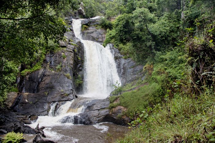
Chisanga Falls on the North Rukuru River, Nyika Plateau, Malawi.
The dry, winter season spans mid-April thru mid-November. Early May and late October may experience the odd shower, but June thru September receive virtually no rain. Temperatures are chilly to cold (June and July are the coldest months), although by October, the warm days are returning. Daytime temps average 66-69°F (19-21°C) in June/July and overnight temps drop to 45-49°F (7-9°C); May and August/September are slightly warmer with daytime temps of 73-77°F (23-25°C) and nighttime temps of 47-50°F (8-10°C).
October temps are similar to those during the rainy season, and late October sometimes sees the first rains of the season. As the temperatures drop during this timeframe, some of the wildlife moves off the plateau and into the less accessible lower-elevation woodlands.
A roan antelope in montane grassland on the Nyika Plateau, Malawi.
How to Get There
While driving to Nyika is possible, the trip is long (~7 hours from Lilongwe and ~11 hours from Blantyre). The roads near Nyika are also steep and bumpy and require a good 4x4 vehicle to navigate them. Most guests fly via private or shared charter to the airstrip at Chelinda.
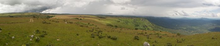
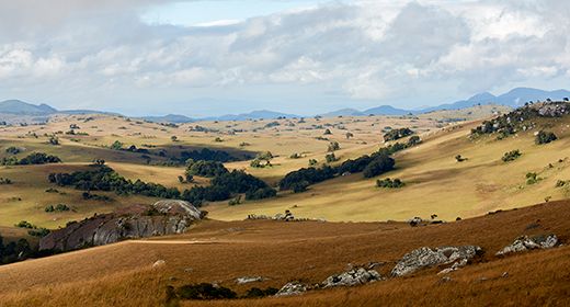
Panoramic vista from the Nyika Plateau.
Kasungu National Park
Malawi's second largest protected area, Kasungu National Park covers 910 square miles (2 358 sq kms) of miombo woodland along the Zambian border, just west of Kasungu town. The land was originally protected as a forest reserve in 1922 by the British Colonial Government and later designated as a game reserve in 1930. Kasungu was proclaimed a national park in 1970.
The park has an average elevation of 3 300 feet (1 000 meters) and is largely covered by sparse woodlands with smaller areas of open grassland. Two major rivers, the Lingadzi and the Dwanga, and various smaller streams traverse the park.
An elephant in Kasungu National Park, Malawi.
Kasungu was at one time a wonderful game viewing destination, with diverse and plentiful wildlife, but these populations were greatly reduced by poaching, especially during the 1970s and 80s. The park once supported the largest population of elephant in Malawi, but their numbers are greatly reduced today.
Kasungu does still have wildlife, including elephant, buffalo, Burchell's zebra, puku, greater kudu, sable antelope, roan antelope common reedbuck, Lichtenstein's hartebeest, and warthog, but the wildlife densities are still low compared to Malawi's other national parks. Kasungu does support a very healthy hippo population. Black rhinoceros were plentiful in the early days of Kasungu, but like most of Malawi, they are now extinct in the park, as are African wild dog and cheetah. In terms of predators, lion and leopard are both present, but seldom seen.
Game drive road thru Brachystegia woodland in Kasungu NP.
What Kasungu does offer visitors is an authentic bush experience in a very large ecosystem, with few to no tourists. Guests should just remember to keep expectations low in terms of seeing abundant herds and lots of predators, as this will not be the case. Besides wildlife, there are some prehistoric sites that offer rock paintings and the remains of walled villages.
Like the rest of lowland Malawi, the dry season in Kasungu is from May thru October and the rains fall from mid-November thru mid-April. The winter months of June and July can be especially chilly overnight, but clear and pleasant during the day. Throughout the wet months, and especially in January and February, a profusion of wildflowers can be seen in the park.
Access to the park is via the town of Kasungu, which has a small airport or is reachable by tarred road from Malawi's other major urban areas.
Rural scene near Kasungu, Malawi.
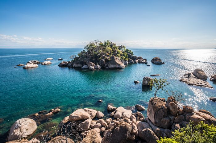
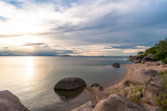
Lake Malawi National Park
Covering 37 square miles (95 sq kms) of both land and water (2.7 sq miles/7 sq kms is aquatic), Lake Malawi National Park (LMNP) was created in 1980 primarily to protect the aquatic habitat and cichlid fishes that live throughout Lake Malawi. LMNP is located on the Nankumba Peninsula, a mountainous finger of land that juts northward from the southern end of the lake.
The park occupies most of the peninsula, including the headland and coastlines on both side, except for a densely populated stretch along the western side where several fishing villages have grown into busy urban centers, the largest of which is called Cape Maclear. The protected land encircles the coastal urban enclave on three sides.
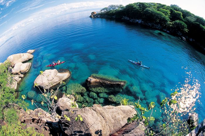
Kayaking in Lake Malawi National Park.
Besides the land and waters along the peninsula, nine rocky islands lying offshore are also protected as part of LMNP, the largest of which are Domwe, Mumbo, Thumbi West, and Maleri. The offshore waters are also protected as part of the national park, including all underwater vegetation and important breeding sites for the cichlid fishes of the area.
The interior of Nankumba Peninsula is essentially uninhabited, with steep and densely forested slopes that rise from the lakeshore's elevation of 1640 feet (500 meters) to Nkhunguni Peak at 3 750 feet (1 143 meters). The dense forests of LMNP's slopes are home to good numbers of birds, mammals, and reptiles.
View over the water from Domwe Island, Lake Malawi National Park.
Lake Malawi National Park was inscribed as a UNESCO World Heritage Site in 1984 due to its global importance for biodiversity conservation of its fishes. Lake Malawi is thought to have by far the most freshwater fish species of any lake in the world and an extremely high rate of endemism for those species.
Besides the aquatic wildlife (fishes, hippos, and otters) that the park was primarily created to protect, the interior of the park includes decent diversity of terrestrial species that can be seen if one takes the time to hike and explore.
Land-based species in LMNP include the commonly seen yellow baboon, vervet monkey, rock hyrax, and monitor lizard. Less often seen species include greater kudu, Burchell's zebra, klipspringer, impala, bushbuck, grey duiker, bush pig, grysbok, leopard, and serval. There are crocodiles living in Lake Malawi, but they are almost never seen anywhere near the national park.
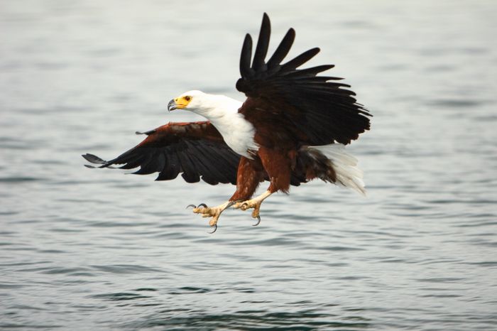
An African fish-eagle tries for a fish, Lake Malawi National Park.
Monkey Bay
The largest urban area on the peninsula is Monkey Bay, with a population of around 15 000. The town's harbor is the embarkation point for the MV Ilala passenger ferry that travels most of Lake Malawi's length every week with multiple stops along the way and ending at Chilumba before heading south again. The Ilala has a capacity of 450 passengers and has been cruising Lake Malawi since 1951.
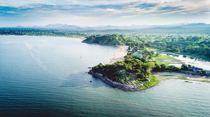
Aerial view of Monkey Bay, Nankumba Peninsula, Lake Malawi.
Cape Maclear (Chembe)
Cape Maclear, called Chembe by the locals, is the second-largest urban settlement on the peninsula and is separate from and not part of the national park. David Livingstone named this little fishing village after his friend Sir Thomas Maclear in 1851. The village was the original location of the Livingstonia Mission, which was built in 1875 (it was moved to the Rift Escarpment in 1881 due to the prevalence of Malaria at the lakeshore).
In the 1970s, Cape Maclear became a hip hangout for backpackers overlanding between Nairobi, Kenya and Victoria Falls, and it gained a reputation as a party place with a chilled out atmosphere. Today the enclave is still popular, with various accommodations and some night life, plus operators offering aquatic activities, including kayaking, paddle-boarding, snorkeling, diving, sailing, and motor-boat excursions on the lake.
Otter Point at Cape Maclear, Lake Malawi.
Activities in Lake Malawi NP
Besides the multitude of aquatic activities mentioned above, there are some specific points around the peninsula that are worth visiting.
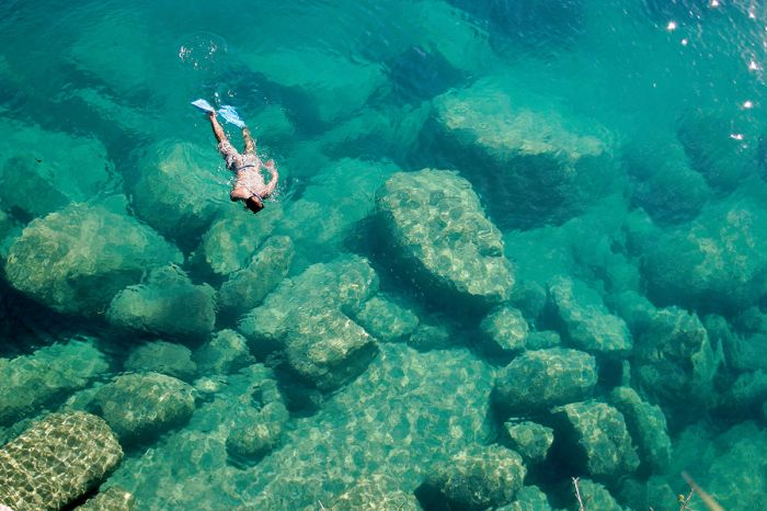
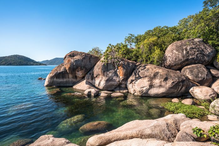
- Otter Point, located just south of Cape Maclear and just inside the entrance gate to LMNP, is the best mainland snorkeling location in the area, with plenty of cichlid fishes in their dazzling array of colors. Spotted-necked otters are seen here often.
- West Thumbi Island offers the best snorkeling in the national park, especially at Mitande Point, which has a huge diversity of cichlid species.
- Mission Graves is on the site of the original Livingstonia Mission, which was established in 1875, but later moved. The cemetery is all that remains and it is preserved as a national monument.
- Hiking the trails in LMNP is a great full- or half-day trip, but is best done with a local guide. Some of the park's wildlife and birds will no doubt add to the enjoyment of exploring the forested slopes.
Colorful fishing boats at Cape Maclear, Lake Malawi.
Cichlid Fishes of Lake Malawi
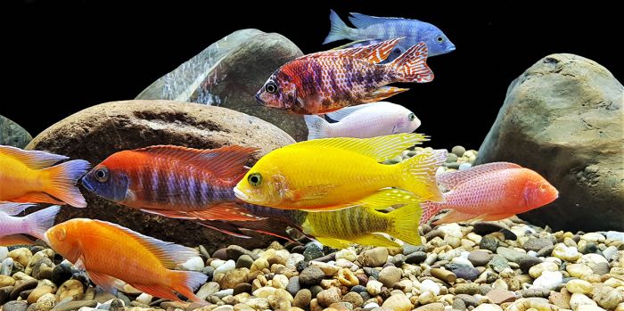
The Cichlidae family of fish is one of the largest extant vertebrate families on Earth. Cichlids (pronounced 'sick-lids') are members of the order of fishes called Perciformes, which includes bony, ray-finned fish and means "perch-like". Cichlids are present and diverse in both Africa and Central/South America, with Africa alone having an estimated 1 800 species and the world total estimated at around 3 000 species.
Lake Malawi's cichlid species number around 1 000, most of which are endemic to the lake, and there are more species being described all the time. Some 2 000 species of cichlid have been scientifically described worldwide. Some cichlids, particularly Tilapia, serve as important food sources, while others are highly-sought after sport fishing species.
Cichlids typically live in shallow-water habitats (due to their oxygen requirements not being met in deeper water) and in Lake Malawi, most of the cichlids live in the shallow shoreline areas around large boulders along the rocky shoreline and islands of the lake. The freshwater Cichlid fishes of the world are thought to have distant ancestors that lived in the oceans that swam upstream into rivers, gradually evolving to became tolerant of fresh water. Today, there are cichlids in Africa that live in the brackish water of rivers near the drainages to the ocean.
The beautiful cichlid fishes of Lake Malawi.
Many of the cichlids in Lakes Malawi and Tanganyika (and to a lesser extent Lake Victoria) have provided clues to evolution, somewhat similar to the way the finches of the Galápagos Islands have done so. The evolutionary hints are tied to the fact that Lake Malawi's cichlids live mostly in and around rocks and boulders.
Malawi's "rock loving" cichlids (known locally as 'mbuna') do not stray far from the safety of the rocks, which provide cover for them against larger and faster-moving piscivorous fishes which prey on them. Beneath the lake's surface, open sandy areas between piles of rocks and boulders, some covering minimal distances of only 10 feet (3 meters), create barriers which the cichlids will not dare to cross, and over time (hundreds or thousands of years), this has created underwater habitat 'islands' where speciation occurs.
Further, Malawi's mbuna feed primarily on "aufwuchs", a German word which means "surface growth" or "overgrowth", and refers to the collection of algae, other vegetation, and small animals (invertebrates, crustaceans, and microorganisms) that adhere to open surfaces in aquatic environments, such as the boulder-strewn shallows and rocky shoreline of Lake Malawi. The variable shapes and sizes of these rocks and boulders created the impetus for the evolution of different mouth shapes and spatial location of the mouth on the mbuna, such that they best take advantage of every food source within their specific biotope.
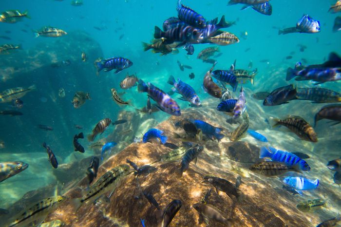
Underwater view of rock-loving 'mbuna' (cichlids) in Lake Malawi.
Contributing to the abundance of speciation of the cichlids in Lake Malawi has been the fluctuating water levels of the lake. It has been discovered that about 25 000 years ago, the water level of Lake Malawi was about 1 300 feet (400 meters) lower than today. This means that all inhabited cichlid biotopes present today were not inhabited 25 000 years ago because these habitats at that time were on dry land.
When the lake levels began to rise, new rocky habitats were created along the margins of the lake as the rocky coastline of the lake gradually disappeared beneath the rising water. Available cichlids living in the lake would have spread into these new habitats and "adapted" to their new environment. The process of fluctuating lake levels would have increased the number of new species over time, as what was once a single species spread to the new rocky habitats and over time evolved along distinct paths, separated by small stretches of rock-free sand bottom and open water that prevented reduced co-mingling and resulting in adaptive changes and eventually, new species.
The speciation that has occurred with Lake Malawi's cichlids is called adaptive radiation, a term used to describe the process whereby organisms diversify rapidly from an ancestral species into a multitude of new forms, particularly when a change in the environment makes new resources available, alters biotic interactions, or opens new environmental niches.
Lake Malawi's cichlids are very popular aquarium fish.
Another fascinating feature of Africa's cichlids, particularly those of Lake Malawi, is an adaptation called "mouth brooding". Almost all of Lake Malawi's cichlids are mouth brooders. While most open water fishes lay thousands of eggs to ensure the chance survival of some (most of the eggs of these species are either consumed by other fish of perish in other ways), Lake Malawi's mbuna lay only 10-30 eggs on average, but they have evolved a technique which ensures a very high rate of survival for each of the eggs into small fry.
The process of laying eggs for mouth-brooding mbuna involves the female swimming in a tight circle in a crevice, cave, or other protected spot, with her mate following closely behind her. The female deposits a single egg at a time onto a rock or substrate and on her next circle past the egg, she scoops it up into her mouth. Most of mouth-brooding species have small "egg spots" on their anal fins, which look exactly the same (size and color) as that species' eggs.
During the courtship and in between laying individual eggs and picking them up, the female will nibble at the egg spots on the male's anal fin, which presumably she believes are her own eggs. The nibbling behavior of the female stimulates the male to release milt (seminal fluid), some of which enters the female's mouth and, as it passes over the eggs in her buccal cavity, fertilizes them. This process continues one egg at a time and eventually, all her eggs are laid, scooped up, and fertilized.
A male Lake Malawi cichlid with 'egg spots' visible on its anal fin.
The mouth-brooding survival adaptation extends even further, as now the fertilized eggs can develop free from predation, in the safety of the female's mouth. Hatching normally occurs within two weeks, during which time the female does not eat. The safety of the buccal cavity ensures that the eggs are kept free from parasites and are protected from being eaten. A fresh flow of water through the female's mouth and gills keeps the eggs properly oxygenated and eventually the eggs hatch, with the tiny newborn fry emerging but still remaining inside her buccal cavity.
The fry initially feed on micro-organisms that pass through the female's mouth and as they grow stronger, the female will find safe places amongst the rocks, where she can temporarily release her brood of babies so they can forage a bit for themselves. If danger is sensed (normally other cichlids), she will motion with her head to the fry and they instinctively clamor back into her mouth in a flash. Eventually the young are big enough and strong enough (and she can no longer fit them in her mouth) to have a strong chance of survival, and the female releases the fry from her mouth permanently to live on their own.
The multitude of cichlid species from Lakes Malawi, Tanganyika, and Victoria, most with colors usually only otherwise seen in ocean reef fishes, have made them popular amongst aquarium hobbyists around the world. African cichlids, particularly the mbuna, are also quite adaptable to aquariums and thrive well, living long lives and not needing much space. There are numerous commercial enterprises that breed cichlids worldwide for sale to pet stores and aquarium enthusiasts directly.
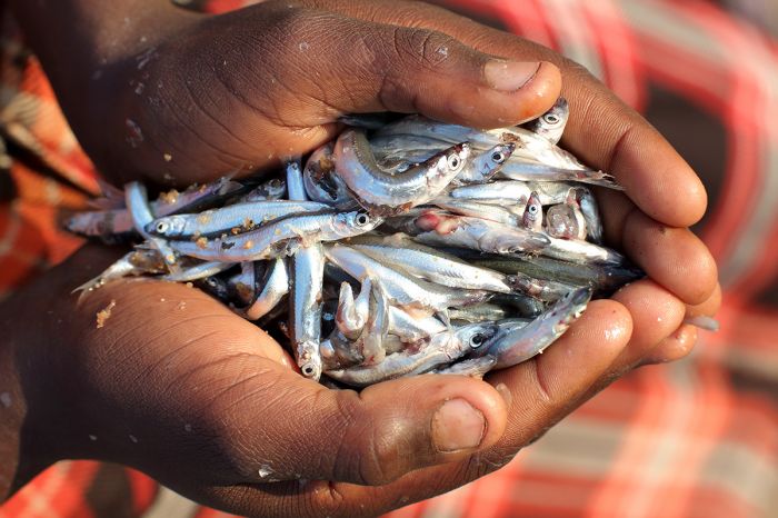
Lake Malawi fishes (these are not cichlids) are also a food source for local people.
Weather and When to Go
Lake Malawi National Park is a year-round destination with the exception of the middle of the rainy season, from December thru February, which can bring daily rain. Temperatures are fairly constant all year, as follows:
- May thru August: daytime temps 75-77°F (24-25°C); overnight temps 63-66°F (17-19°C).
- September thru April: daytime temps 79-82°F (27-28°C); overnight temps 70-73°F (21-23°C).
The dry season spans the months of May thru October, with the prime months being July thru September, when there is little chance of rain and warm and sunny during the day. The rains fall between November and April, with Jan/Feb being the wettest months. Mosquito activity coincides with the rains.
How to Get There
The drive from Lilongwe to Cape Maclear is 134 miles (215 kms) and takes around 3.5 hours. The other option is a flight to Monkey Bay airport, where your accommodation will arrange a road (and possibly boat) transport to the lodge.
Beach on the Nankumba Peninsula, Lake Malawi National Park.
Lengwe National Park
Located in Malawi's Lower Shire Valley, Lengwe National Park was originally established as a game reserve in 1928 by the British Colonial Authorities to protect what was, at that time, the northernmost population of nyala antelope (they have since been introduced to Majete Wildlife Reserve just to the north).
The original game reserve covered 200 square miles (520 sq kms), but was later reduced to only 46 square miles (120 sq kms) when land was reallocated for agriculture. This much smaller remaining portion is now referred to as "Old Lengwe".
A buffalo stare-down in Lengwe National Park, Malawi.
Old Lengwe did not include any Shire River tributaries, so the year-round water supply was no longer available to the reserve's wildlife. Therefore, between 1964 and 1970, a number of boreholes were dug to create artificial water sources for the animals. In 1970, Lengwe was given national park status.
In 1975, a large land extension was added to the park, greatly increasing its area to 342 square miles (887 sq kms) and spanning all the way west to the Mozambique border. This land was added to protect catchment area for the Mwanza and Shire rivers and it greatly increased the dispersal area for the park's wildlife.
Lengwe is dominated by dense bush and the climate is quite arid, with relatively low annual rainfall. The small rivers flow only after rains, but provide healthy riparian habitat for most of the year. The remainder of the park is mainly woodlands, interspersed with some savannas. Baobab and palm trees are common in some areas of the park.
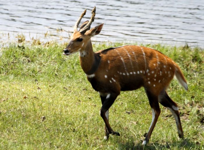
Nyala antelopes in Lengwe National Park, Malawi.
The only part of Lengwe that has been developed for tourism, is the Old Lengwe section on the eastern side. Old Lengwe has a good road network, the waterholes, and some game-viewing hides, as well as an inexpensive safari camp and a campsite.
Game viewing in Lengwe is not up to the level of the neighboring Majete Wildlife Reserve and can be challenging with the thick bush. The only large predators found in Lengwe are spotted hyena and leopard, but neither is commonly seen. Besides nyala, the small and localized suni antelope is found in the park. Other species that can be seen include, impala, yellow baboon, bushbuck, vervet monkey, samango monkey, warthog, greater kudu, and sometimes buffalo.
Birding in Lengwe is good, especially in the rainy months between November and March.
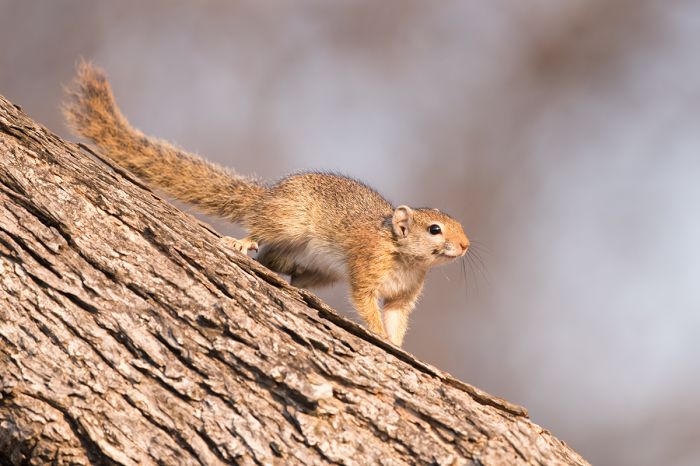
A mutable Sun Squirrel (Heliosciurus mutabilis) in Lengwe NP.
Activities in Lengwe
Activities in Lwengwe include game drives and bush walking (recommended with a guide only). The nearby Elephant Marsh, which is located southeast of Lengwe along the Shire River, is well worth consideration if you have made it this far south!
Weather and When to Go
The climate in Lengwe is warm to hot all year, with temperatures highest during the summer months and cooler during the dry, winter months. Temperatures are fairly constant all year, as follows:
- May thru August: daytime temps 78-84°F (25-29°C); overnight temps 57-61°F (14-16°C).
- September thru April: daytime temps 88-99°F (31-37°C); overnight temps 68-75°F (20-24°C).
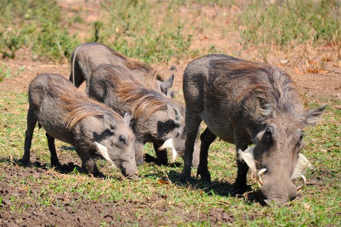
Warthogs in Lengwe National Park, Malawi.
Lengwe's dry season is from mid-April thru October (some early rains possible late Oct), when almost no rain falls at all. During the latter part of the dry season, especially July thru early October, the wildlife is concentrated near the park's pumped waterholes.
The rainy season in Lengwe is from mid-November thru March, with December, January, and February experiencing the most rain. The park may be closed between January and March if the rains have been heavy and the roads become too difficult.
How to Get There
Lengwe is accessed by road via the M1 tarred road from Blantyre. There is also an airstrip directly east of Lengwe, close to the M1 road.
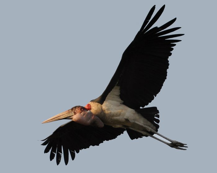
A marabou stork takes flight in Lengwe NP.
Vwaza Marsh Wildlife Reserve
Located just south of Nyika National Park, the Vwaza Marsh Wildlife Reserve covers 379 square miles (981 sq kms) of miombo and mopane woodland along the Zambian border. Besides the aforementioned woodlands, Vwaza has riparian habitat along the South Rukuru River, which forms its southern boundary, as well as wetland habitats. Vwaza takes its name from an extensive marsh in the northeast of the reserve.
Contrasting with the nearby highlands of Nyika, Vwaza is characterized by flat, low-lying (3 200-4 000 feet/1 000-1 200 meters) terrain and has a humid and typically hot climate. The heat and humidity are highest during the rainy season months between December and March, and mosquitos and tsetse flies can be a problem at this time.
A large herd of elephant in Vwaza Marsh Wildlife Reserve, Malawi.
The main focus for game viewing and tourist activity centers around Lake Kazuni, which is part of the South Rukuru river system that forms the southern boundary of the reserve. There is inexpensive accommodation and a camping area located near the lake, although tourist numbers to Vwaza are quite low.
Wildlife in Vwaza has suffered greatly from poaching over the years and is seasonal in terms of numbers and species. The open border between the reserve and Zambia's Luangwa Valley to its west means that wildlife from moves freely between Luangwa and Vwaza. Buffalo and elephant are almost always somewhere in Vwaza, as well as a good variety of antelope, including greater kudu, Lichtenstein's hartebeest, roan antelope, puku, impala, and eland.
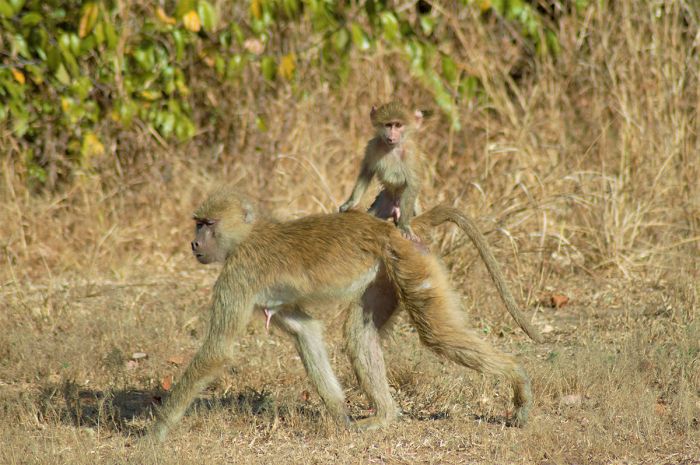
A baby yellow baboon gets a ride with mum, Vwaza Reserve, Malawi.
In terms of predators, lion and leopard are resident in Vwaza, though not easily seen. African wild dogs are seen occasionally, likely moving between the Luangwa ecosystem and Vwaza. Lake Kazuni is a lovely setting for wildlife viewing and is home to large numbers of hippos, as well as crocodiles. A steady flow of animals come to the lake/river to drink, including elephant, buffalo, yellow baboon, and the herds of antelope.
Vwaza is excellent for birding, with more than 340 species recorded.
Hippos in Vwaza Marsh Reserve, Malawi.
Activities
Game drives are the main activity in Vwaza, but walking is also permitted.
Weather and When to Go
Game viewing peaks during the the dry season, particularly from July thru October. At this time, wildlife viewing is exceptionally good along the Rukuru River and at Lake Kazuni. Be forewarned that in spite of October's excellent game viewing, it can be oppressively hot.
November thru March experience substantial rains and hot, humid conditions. December thru February receive the most rain. May thru October are virtually rain-free.
A baby elephant on the move in Vwaza Marsh Wildlife Reserve.
Temperatures in Vwaza are warm to hot year-round, owing to the relatively low elevation of the reserve.
- May thru August: daytime temps 73-77°F (23-25°C); overnight temps 53-56°F (11-13°C).
- September thru April: daytime temps 81-84°F (27-29°C); overnight temps 59-64°F (15-18°C). October can get very hot, with daytime highs reaching 92F°F/33°C. Early rains can come in October, which brings relief.
How to Get There
Access to Vwaza is easy along the tarred roads from the nearby town of Rumphi. Those visiting Nyika National Park are already close and adding a visit to Vwaza is logistically simple.
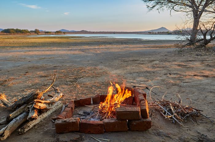
Campfire in the Vwaza Marsh Reserve.
Nkhotakota Wildlife Reserve
One of Malawi's largest protected areas, Nkhotakota Wildlife Reserve covers 696 square miles (1 802 sq kms) of rugged and wild land just west of Lake Malawi and the town of Nkhotakota. Established in 1954, Nkhotakota is set atop the Rift Escarpment and is dominated by hilly terrain and miombo woodlands, with several significant rivers (the Dwaanga, Bua, and Kaombe) flowing thru the reserve en route to Lake Malawi.
The terrain covers elevations from around 1 640 feet (500 meters) on its eastern side, to its highest peak atop Mount Chipata at 5 374 feet (1 638 meters) further west on the escarpment. The reserve is bisected by the M18 tarred road connecting Kasungu and Nkhotakota town, but until recently, the reserve experienced very little tourism and only offered a couple lodges.
The Bua River, Nkhotakota Wildlife Reserve (Image: Tongole Lodge).
Like other reserves in Malawi, Nkhotakota's wildlife suffered greatly from decades of poaching, particularly the elephants, which once numbered 1 500 in the reserve. By 2015, Nkhotakota's elephant population had been reduced to a mere 100 individuals and other key species had been eradicated. With most of the reserve's wildlife gone, tourism to the reserve collapsed.
In 2015, African Parks signed on to manage Nkhotakota in partnership with Malawi's Department of National Parks and Wildlife (DNPW) and began preparations for what would become one of Africa's largest wildlife translocations ever completed. The plan was to supplement Nkhotakota's elephant population and restore the reserve as a main driver of ecotourism for the country.
Elephants at the Bua River, Nkhotakota Wildlife Reserve (Image: Tongole Lodge).
A fence was erected around the reserve in anticipation of the wildlife infusion and USD 1.6 million of funding was secured from sources including Nationale Postcode Loterij, the Wyss Foundation, and others. Over a two-year period ending in August 2017, over 500 elephants and 2 000 other large mammal species were translocated to Nkotakota from Liwonde National Park and the Majete Wildlife Reserve in southern Malawi. England's Prince Harry participated during both years of the relocation project.
To ensure the long-term viability of Nkhotakota's wildlife and its new tourism potential, African Parks implemented law enforcement (anti-poaching) teams, sourced partially from the local communities to remove the hundreds of snares, fill in pit traps, and confiscate illegal firearms from the surrounding villages. Additionally, bee-keeping was introduced to the surrounding communities, scholarships were provided to local children, and local communities were offered employment to vest them in the reserve.
So far the revitalization of Nkhotakota is working well and there is great hope and possibility for its future success as a significant wildlife destination.
Nyala antelope, Nkhotakota Wildlife Reserve (Image: Tongole Lodge).
The habitat in Nkhotakota is primarily Brachystegia/miombo woodlands, with some dense riparian forests along the rivers, smaller areas of grassland, and mid-altitude montane forest atop Mount Chipata. The lowland riparian forests support raffia palms and numerous fruiting trees.
Wildlife in the reserve includes some 600 elephants, of which 500 were introduced as described above, as well as buffalo, eland, sable antelope, greater kudu, bushbuck, impala, waterbuck, common reedbuck, Burchell's zebra, nyala, bush pig, and warthog. Primates found in the reserve include yellow baboon, blue monkey, and vervet monkey. Hippos are present in small number, as are roan antelope.
Nkhotakota's large predators include leopard, spotted hyena, and Malawi's largest population of lion. Plans to re-introduce black rhino and African wild dog are being considered. Nkhotakota's bird list is around 300 species and serious birding enthusiasts could easily tick 100+ species over a few days in the reserve's varied habitats and elevations.
Kayaking on the Bua River, Nkhotakota Wildlife Reserve (Image: Tongole Lodge).
Activities
Game drives are the main activity in Nkotakota, but bush walks are also offered. Other activities include hiking up the escarpment and Mount Chipata, fly fishing on the Bua River, canoeing on the Bua River, and cultural visits to a nearby village.
Weather and When to Go
Nkhotakota experiences warm weather all year and has distinct rainy and dry seasons. The rains typically arrive in November and can be substantial from December thru March, ending sometime in mid-April. Afternoon showers are common on a daily basis during the wet season, with dramatic thunderstorms on occasion. The dry, winter months are from May thru October, when rainfall is extremely rare.
Fishing in the Nkhotakota Wildlife Reserve (Image: Tongole Lodge).
The best game viewing occurs from July thru October, as water in the majority of the park has evaporated and the rivers become the only sources for the animals to quench their thirst. October can be stiflingly hot, but also sometimes receives early rains, which can cool things down.
Daytime temps in Nkhotakota are warm all year, but overnight temps can be quite chilly during the dry season, particularly in June and July.
- May thru August: daytime temps 73-78°F (23-25°C); overnight temps 55-59°F (13-15°C).
- September thru April: daytime temps 81-86°F (27-30°C); overnight temps 63-68°F (17-20°C). October can get very hot, with daytime highs reaching 90F°F/32°C. Early rains can come in October, which brings relief.
How to Get There
Access to Nkhotakota is via the tarred roads from either Lilongwe (3-hour drive) or Blantyre (5.5-hour drive).
Cultural visit to a local community, Nkhotakota Wildlife Reserve (Image: Tongole Lodge).
Majete Wildlife Reserve
Established by the British Colonial Government in 1955, Majete Wildlife Reserve covers 270 square miles (700 sq kms) of primarily miombo woodland in southern Malawi near Balantyre, Malawi's second-largest city. The northeast portion of the park lies along the western banks of the Shire River, which is where the best wildlife viewing occurs and where wildlife safaris are mainly conducted.
Majete's habitat is dominated by Brachystegia woodland, tall grass savanna, and rich riparian forests along the Shire River. Majete is a relatively low-lying reserve, with elevations ranging from 475-2 500 feet (145-760 meters).
Elephants enjoying the lush greenery during Majete's rainy season.
Majete historically supported a large variety of wildlife, including all of Africa's Big Five animals (lion, leopard, rhino, elephant, buffalo), but even after being proclaimed a protected area, Majete remained so in name only, being largely neglected for most of its existence until recently.
During the 1970s and 1980s, Majete's land and wildlife suffered greatly from tree felling for charcoal burning, as well as rampant animal poaching, which decimated most species to the point of extinction by the early 1990s. Nearly all of Majete's elephants were killed for their ivory, while lion, buffalo, African wild dog, eland, zebra, sable antelope, and Lichtenstein's hartebeest were hunted to local extinction. By the end of 2000, only a few antelope species and some spotted hyena remained in Majete.
Zebras, yellow baboons, and helmeted guineafowl at a waterhole in Majete Wildlife Reserve, Malawi.
In 2003, Majete's fortunes took a turn for the better with the arrival of African Parks, which signed an agreement to manage the park for the following twenty-five years. At this time, not a single tourist had visited Majete in over three years. African Parks began work to resuscitate the wasteland that was Majete, securing a portion of the land with fencing and working with the local communities to bring back trees and wildlife.
The initial fenced sanctuary was used to protect the reintroduced wildlife, with the long-range plan of rehabilitating the entire park. Black rhinos were reintroduced in the first year and significant numbers of other species were relocated from other parks and reserves in Malawi. Species brought in by African Parks include buffalo, nyala, impala, sable antelope, Lichtensteins' hartebeest, waterbuck, eland, zebra, and warthog. Elephant were reintroduced to Majete in 2006, lion in 2012, giraffe in 2018, and cheetah in 2019. With the reintroduction of lions, Majete became Malawi's first Big Five destination.
Hippos in the Shire River, Majete Wildlife Reserve, Malawi.
Other wildlife now commonly seen in Majete include, hippo, crocodile, greater kudu, duiker, common reedbuck, Sharpe's grysbok, suni antelope, vervet monkey, yellow baboon, leopard, and spotted hyena. Birding is very good in Majete, with over 300 species recorded.
Since African Parks took over management of Majete, the park's wildlife have repopulated so successfully, that in 2017, surplus elephants and several other species were actually relocated out of Majete to help repopulate Nkhotakota Wildlife Reserve, located further north in Malawi.
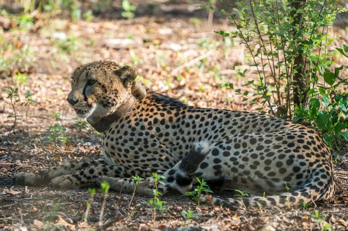
A cheetah (with tracking collar) in the Majete Reserve.
The efforts of African Parks have brought tourism back to Majete, providing jobs and revenue for the surrounding communities. Currently over 140 local people are employed at Majete, including a growing ranger and anti-poaching team. Poaching has been virtually eliminated and Majete is now one of Malawi's best wildlife destinations.
There is a community-managed campsite and the top-notch Mkulumadzi Lodge opened in 2011. Tourism is on the rise in Majete, with over 11 000 tourists visiting in 2019.
A male nyala antelope in Majete.
Activities
Activities in Majete include game drives, bush walks, game-viewing hides, and cultural visits to a nearby village. Kapichira Falls along the Shire River, where David Livingsatone's upriver naval expedition en route to Lake Malawi stalled, is worth a visit.
Weather and When to Go
Majete is a relatively low-lying reserve, situated along the Shire River Valley in the east, and gradually rising in elevation towards the western side of the park, giving it a warm to hot climate all year. There are distinct rainy and dry seasons, with most rainfall occurring between mid-November and mid-April. December thru February are the wettest months, with rain falling most days, but rarely more than afternoon showers.
Mid-April thru mid- to late-October are virtually rain-free months. The best wildlife viewing is from July thru October, when the bush becomes very dry and the animals congregate along or near the Shire River for its water.
Sable antelope in Majete Wildlife Reserve, Malawi.
Majete's temperatures are warm throughout the year, but October can be brutally hot before the arrival of the first rains. The dry, winter months experience the coolest temps.
- May thru August: daytime temps 81-84°F (27-29°C); overnight temps 57-63°F (14-17°C).
- September thru April: daytime temps 88-95°F (31-35°C); overnight temps 66-72°F (19-22°C). October can get very hot, with daytime highs reaching 100F°F/38°C. Early rains can come in October, which brings relief.
How to Get There
Majete is located in the southern part of Malawi, some 250 miles (400 kms) from Lilongwe, but only 40 miles (65 kms) from Blantyre. Driving from Lilongwe will take 5-6 hours and from Blantyre, about 2 hours. Chileka Airport in Blantyre has scheduled flights from Lilongwe and Zambia. Charter flights in a small aircraft from Lilongwe to Majete Airstrip take 75 minutes.
Sunrise landscape in the Majete Reserve, Malawi.
Mwabvi Wildlife Reserve
First protected as the Thangadzi Game Reserve in 1928, Mwabvi covers just 133 square miles (344 sq kms) in the extreme south of the country, making it Malawi's smallest protected area. Originally a smaller reserve, the reserve was expanded in 1953 and renamed for the Mwabvi River, a tributary of the Shire River. More land was added to Mwabvi in 1975, extending the reserve to the Mozambique border and protecting the watershed of the Mwabvi River.
Like much of southern Malawi's protected areas, Mwabvi fell victim to rampant poaching during the 1970s and 1980s, resulting in the loss of most of its indigenous wildlife, including the last known black rhino in Malawi at that time (they have since been reintroduced to the country). Unlike the Majete Reserve, which has seen an incredible rejuvenation, Mwabvi is lacking in terms of a wildlife safari experience compared to Malawi's other parks and reserves.
Hiking in Mwabvi Wildlife Reserve (image: Malawi Tourism).
Mwabvi's landscape is dominated by mopane, Brachystegia, Combretum, and Acacia woodlands, interspersed with savannas, shallow wetlands, and riparian woodlands. There are also rugged gorges and rocky outcrops on the western side of the reserve.
In 2007, management of Mwabvi was handed over to Project African Wilderness (PAW), which has been working to bring wildlife and tourism back to the reserve, but progress has been slow. Lacking good numbers of wildlife, Mwabvi is nonetheless a beautiful wilderness.
Wildlife in Mwabvi includes lion, which visit from neighboring Mozambique, leopard, buffalo, sable antelope, greater kudu, impala, warthog, yellow baboon, and vervet monkey. At present, there are only campsites for visitors to Mwabvi.
Activities
Mwabvi is great for walking and does have a small network of game drive roads (4x4 with good clearance required). The hope is that in years to come, Mwabvi will follow the path that has led Majete back from oblivion into a true wildlife safari destination, but until then, it is best visited only by those seeking a true wilderness experience with a low expectation of wildlife viewing.
Weather and When to Go
The climate is Mwabvi is warm all year, with the highest temps occurring during the rainy months between November and March. The dry season is from June thru October and the earlier of these months are the more temperate months with cooler daytime temps. October can be unbearably hot.
How to Get There
Mwabvi is Malawi's least accessible protected area and is accessed from Blantyre by road (90 miles/2 hours). Visitors staying in Lengwe can visit Mwabvi as a long day trip (the drive from Lengwe to Mwabvi takes around 80 minutes).
Elephant Marsh
Named by David Livingstone in 1859, who counted upwards of 800 elephants in a single sighting, Elephant Marsh is an unprotected, but spectacular wetland emanating from the borders of the lower Shire River between the towns of Chikwawa and Nsanje in the far south of Malawi.
The British Colonial government proclaimed the marsh a protected game reserve in 1896, prohibiting hunting, but all of the elephants were shot out anyway by 1910, and the reserve was then degazetted.
Elephant along the Shire River.
Elephant Marsh, which varies in size seasonally between 100-250 square miles (250-650 sq kms), is a mosaic of seasonal ponds, channels, and open water covered in floating and rooted vegetation, with grassy margins. There are numerous small islands fringed by reed-beds, shrubs, palm trees, and lofty baobabs.
Paradoxically, the marsh is located in an area that receives very low annual rainfall and varies in size year to year, based on runoff from the Shire and Ruo rivers, as well as tributaries rising in the nearby Thyolo Escarpment.
Elephant Marsh is home to a large number of hippos.
Today Elephant Marsh is not formally protected in any way, but it was declared a Ramsar Wetland Site in 2017 due to its importance as a breeding site for numerous water birds, as well being a crucial habitat for numerous fish, reptiles, and large mammals.
Around 200 species of bird have been recorded in Elephant Marsh, of which 26 use the wetland for breeding and an average of 20 000 birds are supported by the marsh. Other key species found in Elephant Marsh are good numbers of hippo and crocodile, and aquatic mammals such as otter.
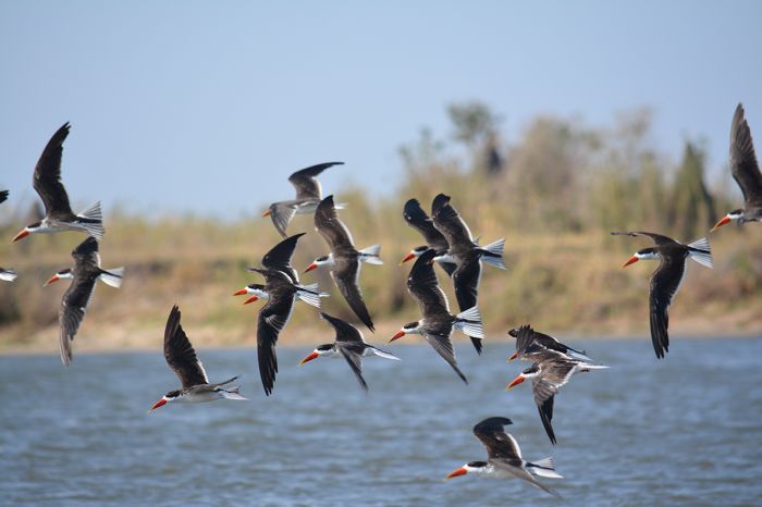
African skimmers fly over the Shire River, Malawi.
In the southern section of the marsh, the wetland is covered in flowering hyacinth and water lilies, making for incredible photography. Guided dugout canoe excisions are available and it is a magical experience to glide slowly through the water and lush vegetation with purple and white flowers in all directions and birds everywhere.
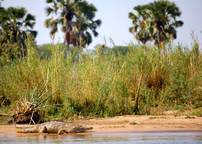
Crocs are found in abundance in Elephant Marsh.
Mangochi Forest Reserve
Covering 157 square miles (407 sq kms) and contiguous with Liwonde National Park, Mangochi Forest Reserve is home to a huge floral diversity and is a critical adjunct to the national park. Both Liwonde NP and Mangochi Forest are managed by African Parks.
Mangochi Forest's terrain spans a wide range of elevations from 1 650-5 750 feet (500-1 750 meters), with Brachystegia woodland covering most of the forest. The higher elevations are characterized by montane forest and some open grassland. Mangochi is not often visited, but provides a key spillover habitat for Lilongwe's elephants, as well as various antelope species and small numbers of lions, leopards, some 175 species of bird, and an unknown, but substantial number of butterfly species.
Baobab trees in the Mangochi Forest, Malawi.
A site of historical significance near Mangochi Forest is Fort Mangochi, which was built by the British Colonial authorities in 1897 to assist in its efforts to end the slave trade to Mozambique. It served as a prison for 30 years before being abandoned in 1928. The ruins of Fort Mangochi are open to visitors who want to make the steep climb of 2 130 feet (650 meters) on foot from the M3 road east of Mangochi town.
Chongoni Rock Art Site
Covering an area of 49 square miles (126 sq kms) north of Dedza town (Malawi's highest-elevation town at 5 200 feet/1 580 meters) and east of the M1 tarred road is the culturally significant Chongoni Rock Art Site. The site is located in the Chongoni Forest Reserve on the Central Malawi Plateau.
Chongi Forest is a scenically beautiful place with massive granite inselbergs, rocky outcrops, plantation forests, Brachystegia woodland, and some intact evergreen forest patches.
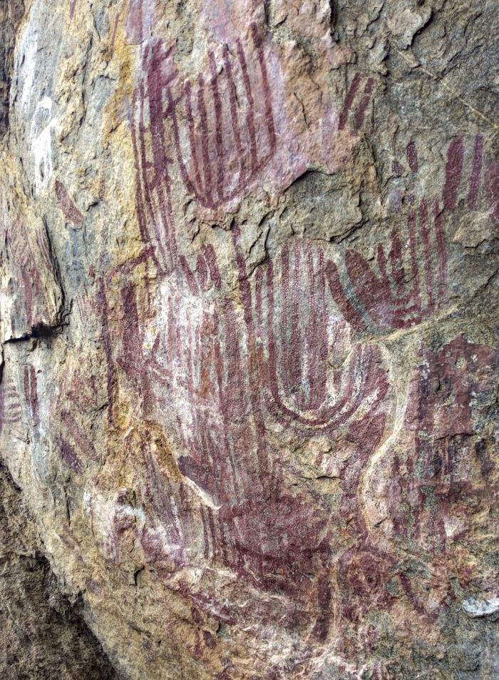
BaTwa rock art at the Chongoni Forest, Malawi.
Inscribed as an UNESCO World Heritage Site in 2006, Chongoni features 127 individual rock art sites on rock faces and within natural shelters that were created by two separate cultures that lived there: the BaTwa people and the Chewa people.
The BaTwa (or Twa) lived throughout Central Africa and were some of the first indigenous people to live in present-day Malawi. The Twa paintings at Chongoni date back at least 2 000 years. The Twa were eventually displaced by Bantu speaking tribes and moved to more marginalized areas.
Wildflowers and view to the Chongoni Rocks.
Beginning around 1480, the Chewa, a Bantu agriculturalist people, established a kingdom in present-day Malawi and added their own art to the sites at Chongoni. The Chewa people are remnant of the Maravi Empire, which ruled over the region in the 16th century. The Chewa art at Chongoni is strongly associated with women and the site has cultural significance to them today.
Some of the sites at Chongoni are open to the public and can be visited by following the signs from the M1 road to the car park areas and then hiking. The main sites at Chongoni are Chencherere, the core site where six rock shelters are found, Namzeze, and Mphunzi.
Chongoni Forest is a great place to explore on foot and is home to some wildlife, the most commonly seen being yellow baboon, vervet monkey, grey duiker, klipspringer antelope, and rock hyrax. The evergreen forests are also home to samango monkey and leopard. Bird life is plentiful and varied.
An African harrier-hawk flies over the Chongoni Forest, Malawi.
Likoma and Chizumulu Islands
Likoma and Chizumulu are Lake Malawi's only permanently inhabited islands. Both Likoma and Chizumulu are located within Mozambican waters, but are exclaves of Malawi.
In 1880, Anglican missionaries from Britain's Universities Mission to Central Africa (Oxford, Cambridge, Durham, and Trinity College) established their headquarters on Likoma Island and as a result, both islands were assigned to Malawi and not Mozambique (which was a Portuguese territory).
Likoma Island is densely populated, with around 11 000 inhabitants in a dozen settlements, the main two being Chipyela and Likoma town. Chizumulu Island has a population of around 4 000. The main activity on both islands is fishing, though both rice and cassava are cultivated as well. There are no paved roads on either island and very few motor vehicles. Electricity is provided by generators, which are powered off at night.
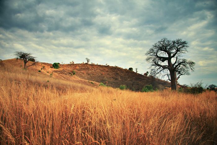
Baobab tree and dry landscape of Likoma Island, Lake Malawi.
The Anglican Cathedral of St Peter on Likoma was constructed by the missionaries from 1903-1905, and is one of the largest churches in Africa. The cathedral is built on the site where Chauncy Maples, the first Bishop of Likoma, witnessed and unsuccessfully tried to prevent, witches burned at the stake in 1889. Anyone visiting the island should certainly make a visit to this beautiful cathedral.
Both Likoma and Chizumulu offer a relaxed, chilled out atmosphere, with unspoiled beaches, palm, baobab and mango trees, sandy bays, and beautiful blue waters. The main activities are aquatic sports, with superb diving and snorkeling around the shorelines of both isles, which are home to myriad colorful cichlid fishes (read more above). The very upscale Kaya Mawa Lodge on Likoma offers a spectacular experience.
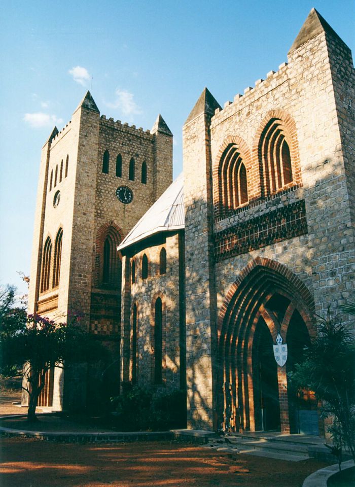
St Peter's cathedral in Likoma town (photo: Wikimedia Commons).
Located a short boat ride to the east, on the Mozambique shore is the spectacular Nkwichi Lodge, which is part of the award-winning Mana Wilderness Project. Although Nkwichi is a Mozambique property, its remoteness means that it is often accessed from Malawi. Like Likoma's Kaya Mawa Lodge, Nkwichi Lodge is very upscale.
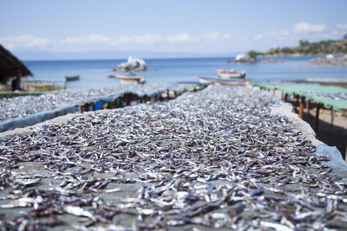
Local fish market on Chizumulu Island, Lake Malawi.
Lake Chilwa
Lake Chilwa is the second-largest lake in Malawi, located south of Lake Malawi and on the border with Mozambique. Chilwa is a shallow, somewhat saline, endorheic lake (no outlet) that covers a seasonally fluctuating area dependent on local rains and evaporation. Lake Chilwa is fed primarily by runoff from the surrounding Mulanje and Zomba highlands.
In recent times, Lake Chilwa's size has been a maximum of 37 miles (60 kms) long by 25 miles (40 kms) wide, with a total surface area of around 675 square miles (1 750 sq kms); however, when David Livingstone first viewed the lake in 1859, he reported that its southern boundary reached as far as the Mulanje Massif, which would mean the Chilwa was at least 20 miles (32 kms) longer than it is today. In 1968, Lake Chilwa disappeared completely during a severe regional drought.
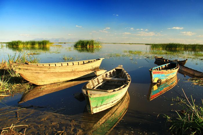
Fishing boats on Lake Chilwa, Malawi.
Chilwa is a shallow lake, with a maximum depth of less than 16 feet (5 meters) and is surrounded by dense swamps, marshes, and seasonally inundated floodplain grasslands. There are numerous islands in Lake Chilwa, two of which are permanently inhabited.
Lake Chilwa and its surrounding wetlands are home to large numbers of birds, in particular some 30 palearctic (migratory) waterbird species that use the lake for breeding. Some 150 species of bird are resident at Chilwa, with an estimated population of 350 000, but during the breeding season, the total bird population on the lake is estimated to be in excess of one million.
Lake Chilwa once covered a much larger area that is now grassland.
Chilwa's surrounding human population is comprised of 60 000 people living in over 30 villages, many of whom engage in fishing on the lake, pulling in roughly 20% of all fish caught in the country (some 17 000 metric tons each year). Subsistence hunting of birds is taking a toll on the avian population of Lake Chilwa and several once common species of large waterbirds have become locally extinct.
Due to its critical importance as a home and breeding site for numerous species of bird, as well as being an important source of fish for the local communities, Lake Chilwa and its surrounding wetlands were designated a Ramsar Wetland Site in 1996.
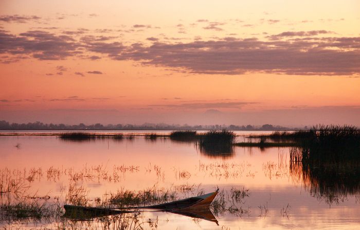
Dusk over Lake Chilwa, Malawi.
Lilongwe
Founded in 1904 as a British Colonial administrative center, Lilongwe is the current capital of Malawi (since 1975, replacing the previous capital at Zomba). In the 1920, the emergence of the tobacco industry in the fertile Central Plateau surrounding Lilongwe and its location at the crossroads of several major roads, including one going to Zambia, led to its emergence as an important agricultural centre for the country.
Lilongwe is comprised of two major sections: Old Town (in the south) and Capital Hill (in the north), each with a distinctly different character. Old Town is Lilongwe's oldest area and its primary commercial centre, with shopping malls, outdoor markets, a bus station, restaurants, and cafes.
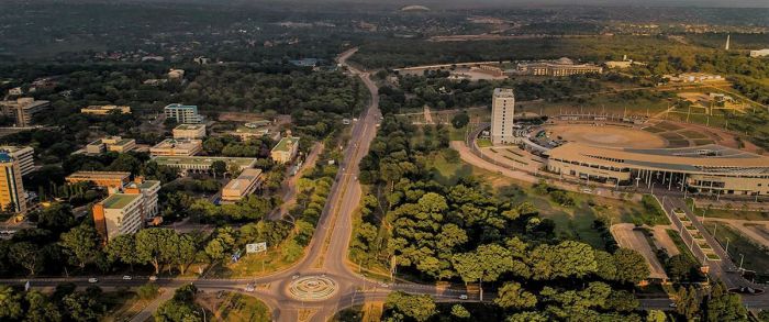
Aerial view over Lilongwe, Malawi (photo: Wikimedia Commons).
The newer Capital Hill section, purposely built to become Malawi's new capital during the Hastings Banda regime (construction began in 1968), is home to the government buildings, embassies and tall office buildings. Some of the city's nicest guest house accommodations are found in the Capital Hill area.
President Banda's decision to make Lilongwe the economic growth centre for Northern and Central Malawi included the construction (in 1977) of a new and modern international airport. Kamuzu International Airport (LLW), located 10 miles (17 kms) north of Lilongwe, is Malawi's main gateway for international flights.
Bingu International Conference Center in Lilongwe, Malawi (photo: Wikimedia Commons).
At the time of Malawi's independence in 1964, Lilongwe's population was less than 20 000, but since becoming Malawi's capital in 1975, Lilongwe's population has skyrocketed. By 1980, Lilongwe's population reached 100 000, and it surpassed Blantyre as Malawi's most populous city by the start of the 21st century, with a population of around 500 000. Today, Lilongwe has a population of around 990 000 people and a total metro area population of over 1 million.
Lilongwe offers a good range of accommodations at all price points and individual preferences, from larger chain hotels, to exclusive and upmarket guest houses, to budget-minded bed-and-breakfasts. Lilongwe's central location means that it's a good place to arrive in country before setting off north or south to explore Malawi's various national parks and other destinations.
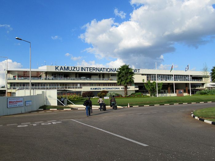
Kamuzu International Airport, Lilongwe, Malawi (photo: Wikimedia Commons).
Blantyre
Founded in 1876, Blantyre is Malawi's oldest city (and one of the oldest anywhere in Central/East Africa) and its main commercial centre. Originally established as a missionary station by the Established Church of Scotland, the town is named after the Sottish village that is the birthplace of David Livingstone.
In 1878, the African Lakes Corporation (ALC) was formed as a major water transportation company and it chose Blantyre as the site of its headquarters, beginning the city's history as a major commercial centre for the country. In 1882, the ALC finished construction on its new, two-story-tall headquarters building called Mandala House, which still stands today and is the oldest building in Malawi.
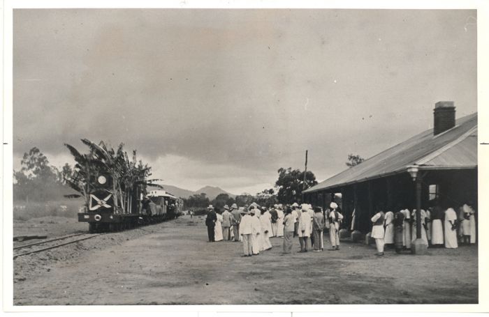
A train arrives in Blantyre, Malawi in 1908 (photo: Wikimedia Commons).
In 1883, Blantyre became the location of a British Colonial consulate and it was given municipality status in 1885. Between 1888 and 1891, the Scottish Mission in Blantyre constructed the St Michael and All Angels Church using bricks made on site from local clay and fired in wood-fueled kilns. The church is one of numerous National Monuments located in Blantyre.
In 1895, the Shire Highlands Railway Company (SHRC) was founded in order to construct a railway connecting Blantyre with the navigable portion of the Shire River at a port called Chiromo (where the Shire River meets the Ruo River) that was reachable by steamers from the Indian Ocean Coast. The ultimate plan was to connect Blantyre to the Indian Ocean by rail. The SHRC based its new headquarters some 2 miles (6 kms) east of Blantyre, creating a separate township for its workers, which they called Limbe.
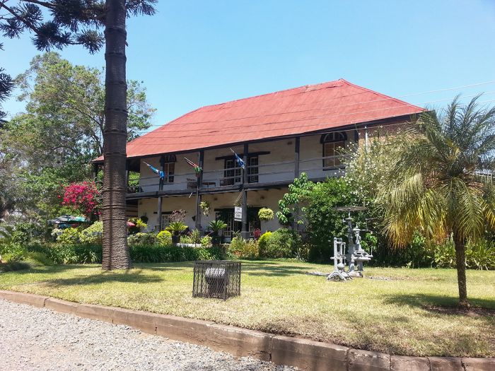
Mandala House is the oldest building in Blantyre, Malawi (photo: Wikimedia Commons).
In 1910, the Imperial Tobacco Group was formed and it based its factory and other facilities in Limbe, which soon surpassed Blantyre in terms of population. Multiple retail shops sprang up in Limbe and its population grew quickly. In 1956, Limbe was incorporated in Blantyre and the combined metropolis remains Malawi's most important commercial hub today.
For most of the 20th century, Blantyre/Limbe was Malawi's most populous urban area, but was recently surpassed by Lilongwe. Today Blantyre has a population of around 800 000, trailing the country's most populous city, Lilongwe, by a small percentage.
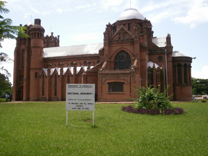
St Michael and All Angels Church, in Blantyre, Malawi (photo: Wikimedia Commons).
Chileka International Airport (BLZ) is Blantyre's main port of entry for international visitors, but Lilongwe is by far the most common entry point to the country.
Blantyre offers a diverse range of accommodations, including exclusive guest houses, upmarket and moderately-priced hotels, budget-minded hostels, and inexpensive guest houses. There is not much to see and do in Blantyre, but an historic tour of the city is worth it if you have layover time to spend.
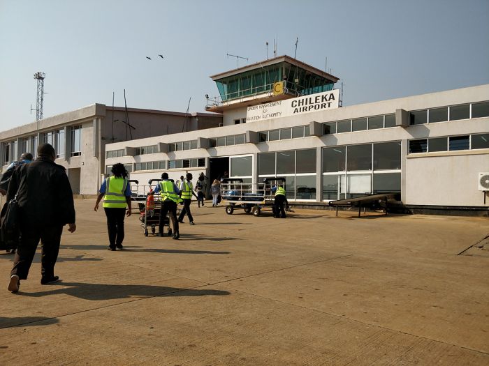
Chileka International Airport, Blantyre, Malawi (photo: Wikimedia Commons).
Quick Facts & Travel Tips
- Malawi is considered part of Southern Africa (though sometimes grouped with Central Africa). It is located south of the equator and has a tropical climate that is moderated in its highland regions.
- Malawi receives good rainfall (30-50 inches/800-1 300mm per year). The rains fall between mid-November and mid-April, while May thru October receive little to no rain. October is the hottest month and June/July are the coolest.
- There are two official languages in Malawi: English and Chichewa (a Bantu language). English is the statutory language of Malawi and is taught in the schools. Chichewa is the primary language for about one-half of the population, particularly in the central and south of Malawi. There are at least 16 languages spoken in Malawi, including Yao, Tumbuka, Sena, and Tonga.
- The national currency is the Malawi Kwacha (MWK). Its sub-unit, the Tambala, is one-hundredth of a kwacha. Kwacha is the Chichewa word for "dawn", symbolizing Malawi's independence. In 2005, the MWK was pegged (fixed rate) to the US dollar, but this was repealed in 2012. US Dollars, UK Pounds, Euros and South Africa Rand (old bills often not accepted) are readily accepted in the cities and hotels.
- Credit card acceptance in Malawi is very limited, except in the larger cities, hotels and at some camps and lodges.
- Malawi uses 230v electricity and type G plug adapters.
- Malawi time is GMT+2 and it does not observe daylight savings time (DST); 7 hours ahead of New York (6 during DST).
- The population of Malawi is around 19.5 million, with about 1.2 million living in its largest metro area, Lilongwe. About 19% of the population is urban.
- Malawi's land area covers 36 402 square miles (94 280 sq kms) with around 526 people per sq mile (203 people per sq km).
- Malawi's main ethnic groups are the Chewa (34%), Lomwe (19%), Yao (13%), Ngoni (10%), Tumbuka (9%), Sena (4%) and numerous others. These ethnic groups are all Bantu in origin. There are an estimated 8 000 whites of European descent and several thousand Asians living in Malawi.
- About 75% of Malawians are Christians, while Muslims account for about 20% of the population. Traditional African beliefes are also adhered to by a small percentage of the population.
Entry / Visa Requirements
- Passport holders from USA/Canada/Australia/UK/EU can obtain a visa on arrival, from their local embassy, or online.
- Passports must be valid for six (6) months from the date of intended departure.
- Passports must have one (1) unused (blank) page labeled Visa.
- Note: Visa pages referred to above do not include pages reserved for Endorsements, Amendments or Observations.
- To save time at the airport, it is recommended to obtain a visa in advance.
- Multiple-entry visas must be obtained in advance.
- Single-entry visas are valid for three (3) months. Multiple-entry visas are valid for either six (6) months or one (1) year.
- Proof of yellow fever vaccination is required on arrival if you are traveling from a country with a risk of yellow fever, including transit >12 hours in an airport located in a country with risk of YF virus transmission. This applies to anyone 1 year of age or older.
Note: Entry/visa requirements are subject to change without notice, so please check with the official government pages shown below.
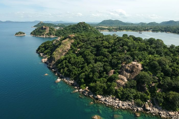
Aerial view of Lake Malawi at Monkey Bay.
Official Government Pages
- US Department of State info: click here.
- Malawi Consulate - USA: click here.
- Malawi eVisa application: click here.
- Malawi Tourism website: click here.
- Malawi Home Affairs: click here.
- CDC information: click here.
Read More...
Main: Flora, Geography, Important Areas, National Parks, Protected Areas, Ramsar Sites, UNESCO Sites, Urban Areas, Wildlife
Detail: Blantyre, Chizumulu, Chongoni, Elephant Marsh, Highlands, Kasungu, Lake Chilwa, Lake Malawi, Lake Malawi NP, Lengwe, Likoma, Lilongwe, Liwonde, Majete, Mangochi, Mwabvi, Nkhotakota, Nyika, Rift Valley, Vwaza Marsh
Admin: Travel Tips, Entry Requirements/Visas
Read More...
Banda Rule, Central African Federation, Clans & Kingdoms, Colonization, David Livingstone, Early History, Hastings Banda, Independence, Recent History, Slave Trade
Early History
Prehistoric History
It is widely acknowledged that the evolution of modern humans began along Africa's Great Rift Valley and the surrounding plains. The archeological discoveries made by Louis Leakey and his team at Olduvai Gorge (in Tanzania's Ngorongoro region) are perhaps the most famous evidence that Earth's earliest hominins lived in the region we now call East Africa.
While the specific territory encompassed by present-day Malawi has not been the site of as many human archeological discoveries as neighboring countries like Tanzania, Kenya, and Ethiopia, there is little doubt that the ancestors of modern humans, chimpanzees, and the other great apes roamed these lands as well.
The Hominid Corridor Research Project (HCRP) began a longterm study of early human remains found in northern Malawi's "Hominid Corridor" or "Malawi Rift" in 1983, and has uncovered evidence of early Hominins dating back 2.5-2.3 million years.
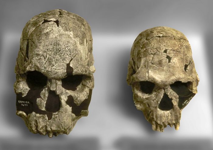
H. rudolfensis and H. habilis skulls (photo: Wikimedia Commons).
The Uraha Hill site in Northern Malawi is known for the discovery an ancient Hominin jaw bone dating to 2.4 million years ago. The Uraha Hill jawbone is the oldest-known specimen of the genus Homo, filling a key geographical gap between the sites of East and Southern Africa.
More recently, current-day Malawi would have experienced the same influx of modern humans from further north in Africa beginning around 3 000 years ago. These early migrators are commonly referred to as the Batwa (or Twa) people and their lifestyle was one of hunter-gatherer. The Twa are slight of size and are sometimes referred to as pygmies today. Much further south in present-day Botswana and South Africa, they are referred to as "Bushmen".
Rock-art paintings found throughout Southern and East Africa are largely attributed to these early hunter-gatherer cultures. Malawi's Chongoni Rock-Art Area is home to some 127 individual sites and is considered the richest concentration of rock art in Central/East Africa. The paintings at Chongoni are dated to both late Stone Age Batwa and more the contemporary Chewa agriculturalists.
UR 501, the oldest H. rudolfensis specimen from Uraha, Malawi (photo: Wikimedia Commons).
The southern expansion of Bantu-speaking people occurred in Central/East Africa (including present-day Malawi) between 700 BC and 500 AD. These Bantu tribes gradually displaced the indigenous Batwa, who were forced into less hospitable mountainous areas throughout the region.
The Bantu-speaking people brought Iron Age technology to the region no later than 100 AD, and evidence of metallurgy (iron smelting to make carbon steel-based tools for farming and weapons), pottery, agriculture, and pastoralism has been discovered at various sites in present-day Malawi.
Notable Iron Age cultures in Malawi include Nkope (near Monkey Bay; 250-1000 AD), Kapeni (along the Shire River; 800-1100 AD), Longwe (~1000 AD), Mawudzu (Lake Malawi shore; 1200-1750 AD), and Nkhudzi (Nkhudzi Bay; 8th century AD).
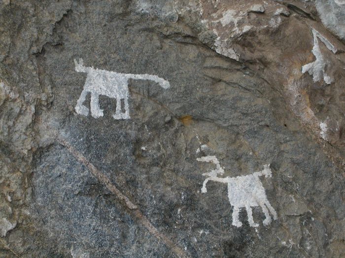
Prehistoric rock paintings at the Chongoni Rock-Art Area (photo: Wikimedia Commons).
Clans and Kingdoms
Traders from Arabia, Persia, and India are thought to have been conducting commerce with Bantu-speaking African tribes along the East Coast of the continent for around 2 000 years. The earliest Arab traders began venturing into the African interior from the Indian Ocean Coast sometime around the mid-8th century, following various routes including the Zambezi River from present-day Mozambique and passing thru present-day Malawi.
The opening of trade from Africa's interior led to a shift in social structures in the region from clans, which were generally small groups of loosely related people led by a clan chief and a kin-group of elders, towards larger groups of people organized into dynasties or kingdoms. In the case of present-day Malawi, the shift towards centralized kingdoms was given impetus by the ivory trade, which began in earnest during the 14th century.
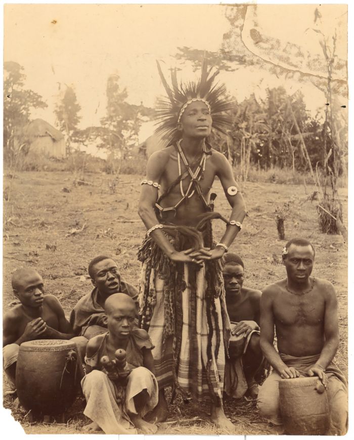
A member of the Yao tribe performing a dance (photo: Wikimedia Commons).
The most important kingdom in what is now Malawi was that of the Maravi, which straddled the current borders of Mozambique, Zambia, and Malawi. The Maravi Empire was founded in 1480 by the Amaravi people, a Bantu people that migrated to the region from the Congo. Maravi was an economically prosperous dynasty, benefiting from trade and agriculture.
The Maravi Kingdom was led by a king, called a 'Kalonga' (or 'Karonga'), who ruled from its capital located at Manthimba, on the southwest shore of Lake Malawi. The main language of the Maravi was 'Chewa' (also called Nyanja, Chinyanja or Chichewa) and this Bantu-based dialect is still widely spoken in southern and central Malawi today.
The country's present-day name is thought to derive from the Chewa word "malaŵí", which means "flames".
A mask from the Chewa people in Malawi (photo: Wikimedia Commons).
Slave Trade (1700s & 1800s)
In an effort to prosper from the growing trade between Eastern Africa and the Far East, the Portuguese took control of the Zanzibar Islands (off the coast of Tanzania) in 1503 and maintained control over much of the Indian Ocean trade for nearly two centuries.
In 1616, during the Portuguese control of the Indian Ocean Coast, Gaspar Boccaro, a Portuguese trader, likely became the first European to visit present-day Malawi. Boccaro traveled inland from the Indian Ocean along the Zambezi River to Tete (present-day Mozambique) and from there, marched all the way to Kilwa on the Tanzanian coast, north of Dar es Salaam. This amazing journey of some 680 miles (1 100 kms) led Boccaro thru present-day Malawi, which first put Lake Nyasa (Lake Malawi) on Portuguese maps.
In 1698, the Sultanate of Oman gained control of Zanzibar and moved his capital from Muscat, Oman to the island of Unguja (Zanzibar), effectively making the islands an Arab state and the focus of a lucrative Omani-controlled slave, ivory, and spice trade. That same year, the Omani Empire conquered Mombasa (present-day Kenya) after a 33-month-long siege on the Portuguese stronghold at Fort Jesus.
Zanzibari Arabs took control of the Indian Ocean slave trade (photo: Wikimedia Commons).
Throughout the 1700s and up until the late 1800s, the Omani Sultanate controlled most of Africa's Swahili Coast, which covered all coastline from Lamu (present-day northern Kenya), Mombasa, Zanzibar, and all lands south to the mouth of the Zambezi River (present-day central Mozambique).
Although slavery had always been a component of the Indian Ocean trade, prior to the 1800s, it was superseded by gold, which was sourced in great quantities from the Zambezi River Valley, and elephant ivory. By the 1830s however, the gold fields were declining and slaves became the main component of the Omani Empire trade along the African coast.
By the mid-1800s, an estimated 40 000-50 000 African slaves per year, mostly from the regions around the Rift Valley lakes, including present-day Malawi, were being taken to Zanzibar for sale. After sale, most of the slaves were exported to Persia (Iran), Arabia (the Ottoman Empire), or Egypt, while some slaves remained to work on clove or coconut plantations in the Zanzibar Islands.
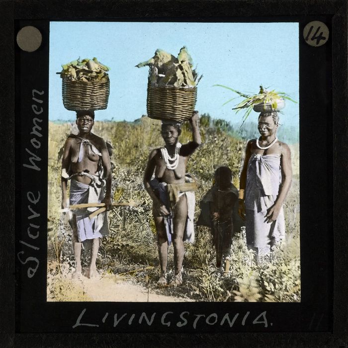
Slave women in Livingstonia, Nyasaland, circa 1910 (photo: Wikimedia Commons).
There were several groups of slave traders that based themselves in present-day Malawi, the foremost of which were the Jumbes. The Jumbes were a dynasty of Arab traders founded by Salim bin Abdallah, an Arab from Zanzibar who had previously been involved with the slave trade to the north in present-day Tanzania.
The Jumbes were based in Nkhotakota, on the western shores of Lake Nyasa (Malawi). The Jumbes transported some 20 000 slaves per year across the lake in dhows and then onward to the port town of Kilwa (Kilwa Masoko) and its slave market (present-day southern Tanzania). The journey from Lake Nyasa to the coast took three to four months on foot, which the slaves made whilst carrying ivory or other supplies for their captors. From Kilwa, the slaves were transported to Zanzibar, where they were sold again. The Jumbes also exported ivory, which they paid hunters to collect from the area to the west of Nkhotakota.
Another group that exploited the local clans and people of present-day Malawi were the Yao, a Bantu tribe that were traditionally fisherman and farmers from the Rovuma River valley east of Lake Nyasa (Malawi). When the Arabs arrived and gained dominance along the coast, the Yao began trading with them. Beginning around 1840, the Arabs started utilizing the Yao to capture slaves from present-day Malawi and northern Mozambique, while at the same time converting them to Islam. In exchange for slaves, the Arabs traded the Yao weapons, textiles, and other goods.
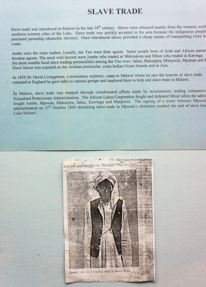
Jumbe, the slave trading chief at Kota-Kota (photo: Wikimedia Commons).
David Livingstone (1813-1873)
The famous explorer David Livingstone was instrumental in shaping Malawi's future, beginning with his arrival in the region in the 1850s. Livingstone trained as a physician in Glasgow and London before joining the London Missionary Society (LMS) to train as a missionary. During this time, Livingstone became strongly interested in the growing anti-slavery movement.
While in London, Livingstone met Robert Moffat, who ran the LMS mission in Kuruman, South Africa, but was home on leave. Moffat was a staunch abolitionist, who shared with Livingstone his vision of ending the African slave trade through the influence of "legitimate trade" and the spread of Christianity in interior Africa. Livingstone was excited by Moffat's ideas and focused his ambitions on Africa going forward.
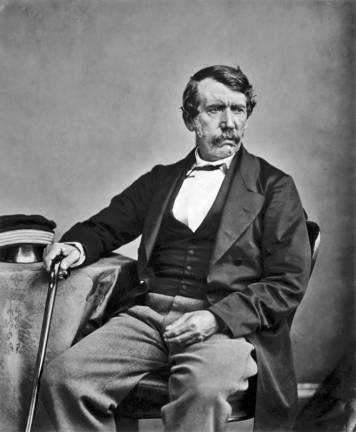
David Livingstone in 1864 (photo: Wikimedia Commons).
Livingstone's first mission was at at Mabotsa, Bechuanaland (Botswana) in 1843 and over the next 7-8 years, he was stationed at two other LMS missions in Bechuanaland. Livingstone left his last mission (Kolobeng Mission near Gabarone) in 1851 and decided to explore Africa in preparation for his goal of evangelizing Africans and mapping legitimate trade routes in the interior of Africa.
Livingstone's first exploration started from the village of Linyanti in northern Bechuanaland and followed the Zambezi River upstream to the Northwest, believing that this would be the best trade route into Africa from the west. With the help of over two dozen African guides, Livingstone made it to the Portuguese-controlled city of Luanda (present-day Angola) on the Atlantic Ocean. He came close to dying from fever along the way and realized this route would be too difficult for future traders, so he returned to Linyanti.
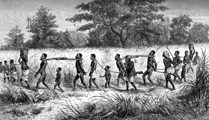
Slave traders and their captives bound in chains and collared with 'taming sticks'. From Livingstone's Narrative of an Expedition to the Zambesi and its Tributaries (image: Wikimedia Commons).
Livingstone borrowed more local guides and this time travelled downstream along the Zambezi River. In 1855, Livingstone become the first European to see 'Mosi-o-Tunya' ('the smoke that thunders') waterfall, which he named "Victoria Falls", after Queen Elizabeth. Eventually he reached the mouth of the Zambezi at the port town of Quelimane (present-day Mozambique). Livingstone thus became the first European to cross south-central Africa from coast to coast, which made him quite famous.
Livingstone advocated strongly for the establishment of trade and Christian missions in Central Africa, but his primary focus was the abolition of the African slave trade that was being conducted by Portuguese and Arab traders. Livingstone coined the mission phrase "Christianity, Commerce and Civilization", which he hoped would bring about the end of African slavery. He returned to Britain and wrote a book on his travels.
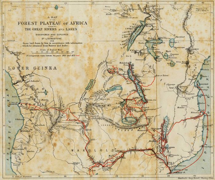
Map showing the explorations of Livingstone in Africa between 1851 and 1873 (image: Wikimedia Commons).
In 1857, Livingstone resigned from the LMS in order to focus full time on his new mission. In 1858, he convinced the British government to finance another expedition to better map and open up a trade route along the Zambezi River. Livingstone's team included the artist, Thomas Baines and the botanist and physician, John Kirk.
Livingstone's hopes of being able to navigate the Zambezi River by boat were crushed when they encountered the Kebrabasa Rapids west of Tete (present-day Mozambique). Next he tried to navigate the Shire River, a tributary of the Zambezi, and the sole drainage from Lake Nyasa (Malawi), but this route was also blocked, this time by the Kapichira Falls near present-day Blantyre, Malawi.
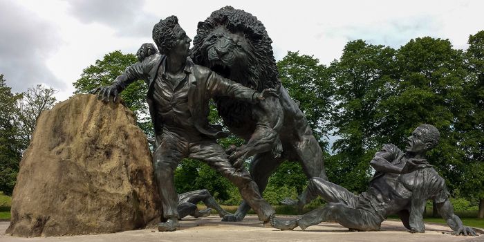
Livingstone Memorial Sculpture in Blantyre, Scotland, depicting the lion attack he suffered in Bechuanaland (present-day Botswana) in 1844 (photo: Wikimedia Commons).
Not deterred, Livingstone and Kirk explored what is today southern Malawi on foot during 1859, including the Mulange Mountains, the Shire Highlands, the Zomba Plateau, and Lake Chilwa. Livingstone sent word to Britain, requesting clergy to establish the first Chritian mission in Central Africa. The missionaries, including Bishop Charles Mackenzie, arrived in 1861 and set to work establishing the mission at Magomero, between present-day Blantyre and Zomba (Malawi).
In 1861, Livingstone and Kirk travelled by boat up Lake Nyasa (Malawi), stopping at the Jumbe slave market in Nkhotakota, which Livingstone termed a place of "bloodshed and lawlessness". Reaching Nkhata Bay to the north, but still shy of the northern banks of the lake, the team exhausted and some ill, they turned back south. Malaria claimed the lives of some of the Magomero missionaries, including Bishop Mackenzie and the mission was pulled from the area, to be relocated in Zanzibar. Livingstone's wife, Mary (Robert Moffat's daughter), joined her husband around this time, but she died in 1862 from malaria.
Image showing Livingstone reading the Bible to a group of African men (image: Wikimedia Commons).
Livingstone continued his explorations in the region and attempted to navigate the Rovuma River, east of Lake Nyasa (Malawi), but failed because floating human bodies thrown into the river by slave traders continued to foul the boat's paddles. Most of Livingstone's team was now dead or had abandoned the expedition, and in 1864, he returned to Britain.
Livingstone would make one last expedition to Africa, this time to search for the source of the River Nile. The expedition lasted from 1867 to 1874 and his famous meeting with Henry Stanley on the shores of Lake Tanganyika at Ujiji (present-day Tanzania) occurred during this trip in 1871.
Depiction of the famous meeting between explorer and missionary David Livingstone and journalist and explorer Henry Morton Stanley in Ujiji in 1871 (image: Wikimedia Commons).
Livingstone died from malaria and internal bleeding due to dysentery at the age of 60 in 1873 near Lake Bangweulu (present-day Zambia). His loyal expedition members, James Chuma and Abdullah Susi, removed Livngstone's heart and buried it under a famous baobab tree with an inscription they carved in his honor.
The rest of Linvginstone's remains, together with his journal, were carried over 1 000 miles (1 600 kms) by Susi and Chuma to the coastal town of Bagamoyo (Tanzania), where a ship then transported his body back to Britain for burial, where he is interred at Westminster Abbey.
Image depicting a very ill David Livingstone during his last days in 1873, being carried by Jala and Chuma (Susi had gone ahead to prepare for a river crossing) (image: Wikimedia Commons).
After Livingstone's death, several British and Scottish missions were established at various places around Lake Nyasa, including the Livingstonia Mission at Cape Maclear. In 1875, the Scotts established the Blantyre Mission in the Shire Highlands, its location later becoming the site of Malawi'a largest city.
David Livingstone, colored wood engraving, 1870 (image: Wikimedia Commons).
British Colonization (1890-1960)
In the late 1880s, Germany made claims to vast territories in Central and Eastern Africa, including what is today much of Tanzania, plus portions of present-day Kenya, Uganda, Malawi, and Zanzibar. In 1890, Germany and Britain signed an agreement whereby Britain would give Heligoland, a strategic island in the North Sea, to Germany in exchange for all of Germany's African claims in this region, except for Tanganyika (Tanzania).
Britain named its now-sizable new territory the British Central African Protectorate and assigned Harry Johnston as Commissioner. One of Johnston's early mandates was to eradicate the slave trade in the region. Zanzibar had officially abolished slave trading in 1876 under strong British pressure, but operations were still going strong between Lake Nyasa (Malawi) and Kilwa.
Harry Johnston, Special Commissioner and Governor of the British Central African Protectorate (photo: Wikimedia Commons).
Johnston negotiated with the Jumbe and convinced them to halt slave trading in exchange for British protection but many other slave traders, particularly the Yao people and others along the northern shores of the lake ("the so-called “north end Arabs”) refused. Johnston's troops fought with the holdout slave traders for several years, but by 1895, he had succeeded in stamping out all slave trading around Lake Nyasa.
The presence of the British led to a peaceful period, with the abolition of slavery and the end of decades of inter-tribal fighting in the region.
Map showing Africa in 1880, prior to most European colonization (image: Wikimedia Commons).
Map showing Africa in 1913, after the European 'scramble' to colonize the continent (image: Wikimedia Commons).
In 1907, the British decided to divide their Central African Protectorate into two territories: Nyasaland, named for Lake Nyasa (present-day Malawi) and Northern Rhodesia, named for Cecil Rhodes (present-day Zambia). Lying just south of Northern Rhodesia was another British colony, that of Southern Rhodesia (present-day Zimbabwe).
Of these three closely situated British colonies, Nyasaland was by far the least developed, largely because it lacked any known natural resources, like gold or other minerals. Furthermore, Nyasaland was far more densely populated, which prohibited large-scale agriculture by potential settlers. As a result, Nyasaland remained relatively free from alien settlement, with only around 10 000 foreigners living in the protectorate as late as 1953. The population of Nyasaland at this time was roughly 2.5 million, with a density six times that of Southern Rhodesia and ten times that of Northern Rhodesia.
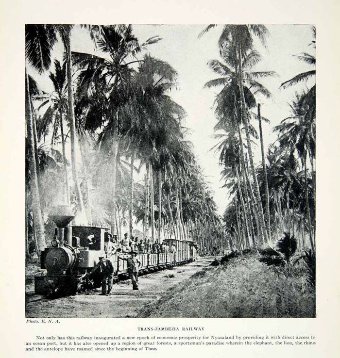
Photo from 1925, showing the Trans-Zambezi Railway in Nyasaland (present-day Malawi) (photo: Wikimedia Commons).
Hastings Banda (1898-1997)
Born in rural present-day Malawi near Kasungu in 1898, Hastings Kamuzu Banda became the most important figure in his homeland's politics for the last 4 decades on the 20th century. Banda left Nyasaland in 1915 and worked for a time in Southern Rhodesia and later in Johannesburg, South Africa, where he worked at the Witwatersrand Deep Mine on the Transvaal Reef for several years. While living in South Africa, Banda became well acquainted with Bishop William Tecumseh Vernon of the African Methodist Episcopal Church (AME), who offered to pay his tuition fee at a Methodist school in the United States.
In 1925, Banda began studies at Wilberforce Institute, an African American AME college, now known as Central State University, in Wilberforce, Ohio, and graduated in 1928. Banda studied for a year as a pre-med student at Indiana University, but in 1930, transferred to the University of Chicago, majoring in history and graduating with a Bachelor of Philosophy degree in 1931.
A young Hastings Banda (photo: Wikimedia Commons).
Receiving financial support from various benefactors, Banda was able to enroll at Meharry Medical College in Tennessee, a historically black medical school affiliated with the United Methodist Church. Meharry was one of six medical institutions established between the years of 1876 and 1900 in Tennessee after the end of the Civil War when the slaves had been freed and there were, as yet, few African-American physicians to treat the freedmen. In 1937, Banda earned an M.D. degree from Meharry.
After graduating, Banda wished to return to Nyasaland to practice as a doctor, but in order to practice medicine in the territories of the British Empire, Banda required a second degree and license from Great Britain. Banda moved to Edinburgh, Scotland, where he attended the University of Edinburgh and was awarded his diploma and license.
Upon looking for work in Nyasaland in 1941, Banda's applications were repeatedly denied, as white nurses refused to work for a black doctor. The colonial administrators finally agreed to offer Banda work at Zomba, but only if he agreed not to socialize with the white doctors. Banda declined this offer and instead worked as a doctor for the next four years in North Shields, near Newcastle-upon-Tyne.
Banda graduated from Edinburgh University, shown here circa 1827 (image: Wikimedia Commons).
In 1945, just two months after the end of World War II, Banda moved to London and bought a medical practice in the North London suburb of Harlesden. Later that same year, Banda became politically active in the newly formed Nyasaland African Congress (NAC). The NAC was formed in 1943 to organize Nyasaland native associations and local organizations of indigenous people in the protectorate. Banda contributed to the NAC financially and also held meetings at his London home. Banda met numerous African nationalist movement leaders during this period in London, including Kwame Nkrumah and Jomo Kenyatta, the future leaders of Ghana and Kenya, respectively.
In 1953, Banda moved to the Gold Coast (a British Crown Colony in West Africa that would later become the independent country of Ghana) with his receptionist, Margaret French, a married woman with whom he was romantically involved. Banda was named as a co-respondent in the divorce case and it was rumored that Mrs. French was carrying Banda's child, although this was never confirmed.
Banda (left) and Jomo Kenyatta (right) first met in London in the 1940s; this photo shows them in later years (photo: Wikimedia Commons).
Federation of Rhodesia and Nyasaland (1953-1960)
Hastings Banda's growing political activism included campaigning against the proposed federation between Southern and Northern Rhodesia with Nyasaland. The overtly racist white government in Southern Rhodesia was pushing hard for the federation, as it would give them sovereignty over the other two colonies and hopefully prevent the growing movement for African nationalism from reaching them.
Black Africans in both Northern Rhodesia and Nyasaland opposed the federation for the same reasons that the whites were in favor of it. Despite the opposition of the African people in its protectorates, Britain agreed to the federation, officially creating the Central African Federation (also known as the Federation of Rhodesia and Nyasaland) in 1953.
Evolution of the Federation of Rhodesia and Nyasaland (image: Wikimedia Commons).
In 1958, at the urging of several influential NAC leaders, including Henry Chipembere and Gladstone Chisiza, Banda finally returned to Nyasaland after some 42 years away from his homeland. Banda took over leadership of the NAC and began speaking publicly against the Central African Federation, urging the growing number of NAC supporters to protest.
In early 1959, the NAC staged a number of protests that turned violent, with police firing tear gas and killing dozens of protestors. In March 1959, the NAC was officially banned by the British Colonial Government. Simultaneously, the government initiated 'Operation Sunrise', which resulted in the arrest of hundreds of NAC supporters and most of the NAC's leaders, including Banda.
Following the banning of the NAC, a successor party called the Malawi Congress Party (MCP) was formed by Orton Chirwa, a black African attorney and one of the NAC's leaders. Upon his release from jail in April 1960, Banda was made president of the MCP, replacing Chirwa.
Hastings Banda speaks after arriving back in Malawi, 1958 (photo: Wikimedia Commons).
Independence (1960-1964)
In August 1960, Banda travelled to London to meet with the British about the withdrawal of Nyasaland from the Central African Federation and subsequent independence. Nyasaland elections were held in August 1961, with the MCP party winning 94% of the vote and 22 of 28 parliamentary seats. Banda was elected Minister of Land, Natural Resources and Local Government, making him the de facto Prime Minister of Nyasaland, a title officially granted him in February 1963.
In November 1962, Britain agreed to a plan to allow self-government in Nyasaland and announced that it could withdraw from the Central African Federation (CAF). In December 1962, the CAF was officially dissolved and on 6 July, 1964, Nyasaland became independent from Britain and renamed itself The Republic of Malawi, with Banda as its first president.
Prime Minister Banda meets with USA President John F. Kennedy at the White House in October 1963 (photo: Wikimedia Commons).
Malawi under Banda (1964-1994)
Immediately after independence, it became clear that Hastings Banda planned to run the country in an autocratic way and resisted any attempts by his cabinet members to suggest ideas or changes to Banda's own ideas and policies. In August 1964, a group of Malawi's cabinet ministers led by Orton Chirwa confronted Banda with their grievances regarding his leadership and foreign policies. Banda responded by dismissing Chirwa and three other ministers from his cabinet. Another three ministers resigned, including Henry Chipembere, essentially reducing the cabinet to members that would not disagree with Banda.
Following his resignation from the cabinet, Chipembere became publicly critical of Banda, making defiant speeches and garnering support for Banda's removal. In February 1965, Chipembere led a group of some 200 supporters on an armed rebellion, intending to invade Zomba (which was then Malawi's capital) and conduct a coup d'état, but they were thwarted by the Malawi Army. Chipembere was exiled and spent time over the following ten years in the US and Tanzania. He died in California in 1975 at the age of 45 years.
His Excellency the Life President of Malawi, Dr. H. Kamuzu Banda at the inauguration of Diesel Locomotives in Limbe, 1963 (photo: Wikimedia Commons).
Another failed rebellion in 1967, led by Yatuta Chisiza, one of the fired cabinet ministers, was also thwarted. Chisiza was killed by Malawi Army soldiers. Rebels loyal to the ex-ministers led guerrilla assaults against Banda's government for several more years, but by 1970, all opposition had been arrested or killed.
Malawi adopted a new constitution in July 1966, with Banda given a 5-year term as its president, with far-reaching executive and legislative powers. It also declared that the MCP was the country's only legal political party, effectively making Banda more of a despotic ruler than an elected leader.
In July 1971, Banda declared himself 'President for Life' of both the MCP and the country of Malawi. Banda's official title was "His Excellency the Life President of the Republic of Malawi, Ngwazi Dr. Hastings Kamuzu Banda." The title 'Ngwazi' translates as "chief of chiefs" or literally "great lion" in the Chichewa language.
Banda with with Israeli president Zalman Shazar at Beit HaNassi in Jerusalem, May 1968 (photo: Wikimedia Commons).
Globally, Banda was viewed as a benign leader, albeit a bit eccentric, with his three-piece English suits, walking stick, and fly whisk. However, this external persona was merely a mask for his rigid and authoritarian style of rule. Even by standards in Africa at this time, Banda's despotic dictatorship was extreme. Banda believed he was the law and that everything he said was law. Malawi had become a police state and overt opposition was not tolerated. Anyone outwardly critical of him was arrested, exiled, 'disappeared', or died suspiciously.
While Banda's regime was not on the ultra-murderous level of Uganda's Adi Amin, it is conservatively estimated by historians that over 250 000 Malawi citizens were arrested and imprisoned without trial during his long reign of power. Torture was widely used in his prisons and his security police were feared by the populace.
Censorship was rampant during Banda's reign, with books, magazines, films, and some Western music banned for various reasons, some just by the personal preference of Banda. The radio stations were widely used as propaganda tools for the government. History books that covered "pre-Banda" times were discouraged and some burned.
Banda (left) being met by Tanzania's Julius Nyerere (photo: Wikimedia Commons).
Much of the Western world, and particularly Britain, accepted Banda's despotic regime, primarily because he was conservative and a well-known Anglophile. Banda's government did achieve some positive outcomes during his 30-year rule. The country achieved peace after suffering decades of persecution at the hands of slave traders and neighboring tribes. Economic growth was also positive, averaging 5% per year, and infrastructure was greatly improved, especially the road network, which was built using foreign aid. In spite of all this, at the end of Banda's presidency, Malawi was still one of Africa's poorest countries.
In March 1992, Malawi's Catholic bishops issued a powerful Lenten Letter, which condemned the Banda administration, detailing its abuses of and failings of the country and its people. The letter reached the BBC and quickly received worldwide attention. Over the next few months, domestic unrest grew, with riots and worker strikes throughout the country. Worldwide press coverage, which had been literally nonexistent since Malawi's independence, meant that Banda had to act carefully now that the world was watching. A major protest in Lilongwe in May 1992 resulted in police killing dozens of protestors and in October 1992.
President Banda with Margaret Thatcher at 10 Downing Street in 1985 (photo: Wikimedia Commons).
The Chirwas (1964-1993)
Orton Chirwa, one of the ministers fired by Banda in 1964, had fled Malawi with his wife shortly afterwards in fear of his life, resettling in Tanzania. In Tanzania, Chirwa taught and practiced law and formed a new political party, the Malawi Freedom Movement, which gained little traction in Malawi. On Christmas Eve 1981, Chirwa, his wife Vera and their youngest son were vacationing in Zambia when they were kidnapped by Banda's security forces and taken back to Malawi on charges of high treason.
The Chirwas stood trial, but it was a 'fixed' affair and they were both sentenced to death and taken to the central prison in Zomba. Both were held in virtual solitary confinement and not even allowed to see one another. In 1990, Amnesty International launched an investigation into their fate and named the couple "Prisoners of Conscience". Orton Chirwa died suspiciously in Zomba Prison in October 1992 at the age of 73, while Vera was eventually released in 1993.
President Banda (right) with Zambian President Kenneth Kaunda. (photo: Wikimedia Commons).
End of the Banda Regime (1994)
Banda was left with few choices, as unrest continued to escalate and his popularity waning, so he announced a referendum to decide whether multi-party elections should be allowed. Voting took place in March 1993, with the results overwhelmingly in favor of change. Several new political parties quickly formed and in March 1994, national elections were held.
Voting results were regionally and ethnically driven, and the new United Democratic Front (UDF), which membership was mainly from the heavily populated southern portion of the country, won the day, with its leader, Baliki Muluzi elected as Malawi's new president.
Banda was tried in 1995 for ordering the execution of three of the cabinet ministers in the 1964, but was acquitted on all charges. He died naturally in 1997 at the age of between 98 and 101, depending on which of multiple dates given for his birth was accurate.
Hastings Banda ruled over Malawi from its independence in 1964, until 1994 (photo: Wikimedia Commons).
Recent History (1999-present)
Elections were again held in 1999 with Baliki Muluzi and the UDF narrowly winning the popular vote. Malawi's post-Banda constitution allowed for only two presidential terms, so in the 2004 elections, a new UDF candidate, Bingu wa Mutharika, who co-founded the UDF party, ran for office and won.
Mutharika resigned from the UDF party in 2005 after his attempted anti-corruption reforms upset party leaders. The president started a new political party called Democratic Progressive Party (DPP). The DPP and Mutharika dominated the 2009 elections. During Mutharika's second term, he prioritized policies designed to enhance agriculture, education, transportation, energy generation, rural development, irrigation and water development, youth development, and anti-corruption in government and commerce.

Malawi President Bingu Wa Mutharika at the 2008 World Economic Forum on Africa in Cape Town, South Africa, June 4, 2008 (photo: Wikimedia Commons).
Mutarika died while still in office in April 2012 at the age of 78. Vice-President Joyce Banda (no relation to former president Hastings Banda) was sworn in and became the first female president of Malawi.
In the 2014 elections, Peter Mutharika, the younger brother of former president Bingu wa Mutharika stood as the DPP candidate and won with 36% of the vote. Other candidates included Lazarus Chakwera of the Malawi Congress Party (MCP) and Joyce Banda of the People's Party (PP). Mutharika's presidency was marked by strong public discontent due to corruption, food shortages and power shortages. In 2018, thousands of Malawians took to the streets of several of it large cities to protest and denounce alleged corruption committed by the president.
USA President Barack Obama and First Lady Michelle Obama greet His Excellency Arthur Peter Mutharika, President of the Republic of Malawi, and Mrs. Gertrude Hendrina Mutharika, in the Blue Room during a U.S.-Africa Leaders Summit dinner at the White House, Aug. 5, 2014 (photo: Wikimedia Commons).
Malawi's next elections were held in 2019 to elect a new president, members of parliament, and local government councillors. Peter Mutharika ran for the DPP in hopes of winning a second term. President Mutharika was re-elected by a narrow margin over Lazarus Chakwera of the MCP. The election was marred with controversy and claims of fraud, vote tampering, and voter intimidation. The MCP applied to the High Court of Malawi to nullify the election results and conduct another election.
In February 2020, the Constitutional Court ruled to nullify the 2019 election results, citing irregularities by the Malawi Electoral Commission and ordered a new election to be held in 150 days. In the ensuing June 2020 elections, Lazarus Chakwera of the MCP defeated Mutharika by margin of 59% to 40%, becoming Malawi's current president.

Malawi's current president, Lazarus McCarthy Chakwera, at his inauguration speech in 2020 (photo: Wikimedia Commons).
Read More...
Banda Rule, Central African Federation, Clans & Kingdoms, Colonization, David Livingstone, Early History, Hastings Banda, Independence, Recent History, Slave Trade
Great Good Fair Poor
- Jan
- Feb
- Mar
- Apr
- May
- Jun
- Jul
- Aug
- Sep
- Oct
- Nov
- Dec
The chart directly above should be taken as a very rough overall indicator of best times to visit Malawi, as there are significant variations regionally and based upon elevation. More information on the specific national parks and reserves is found on the previous Details tab.
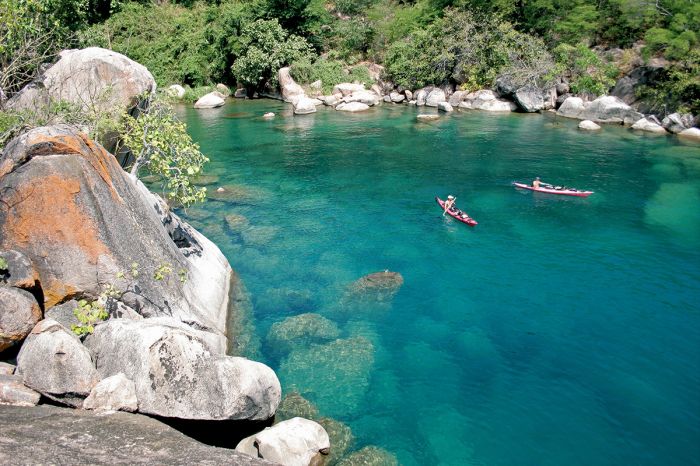
Kayakers in Lake Malawi National Park.
Temps
Malawi is located in the tropics, south of the equator and experiences good rainfall, with warm to hot days and mild to warm nights. However, extensive highlands cover the country north to south as part of Africa's Great Rift Escarpment and in these higher elevation regions, the temperatures are much lower than in the low-lying valleys along the shores of Lake Malawi and in the Shire River Valley.
Lowland Areas: An example of a low-lying area in Malawi is Liwonde National Park, which is located in the Shire River Valley at elevations between 1 500-2 500 feet (475-800 meters). Liwonde experiences average daytime temps between 82-90°F (28-32°C) and overnight temps averaging 66-70°F (19-21°C).
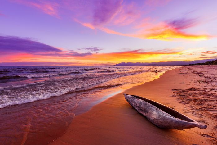
Sunset over Kande Beach, Lake Malawi.
Highland Areas: An example of a highlands region in Malawi is the Nyika Plateau, which is located along the Rift Escarpment west of Lake Malawi and has an average elevation of 6 900-7 200 feet (2 100-2 200 meters). Temperatures on the plateau average 74-82°F (23-28°C) during the day and 54-62°F (12-16°C) at night.
In all areas, October experiences the warmest temps, becoming oppressively hot in the low-lying regions. June and July are the months with the lowest temperatures, become quite chilly or even cold in the highlands.
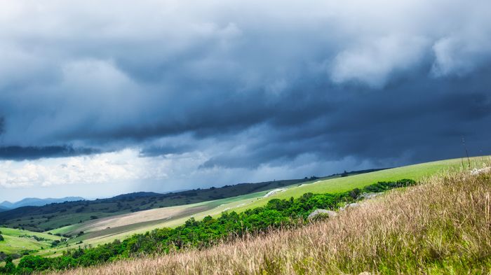
Rain approaching over the highlands on the Nyika Plateau, Malawi.
Rain and Seasonality
Most of Malawi experiences two distinct seasons, which are based mostly on rain. The rainy season is during the warmer months from November thru April, with the majority of rain falling between December and March.
The dry season is from May thru October and almost no rain falls during this time. Despite the fact that 25% of Malawi's surface area is covered by water (Lake Malawi), the country has been prone to droughts in the past.
Typically, wildlife viewing on a safari is best during the middle and latter part of the dry season, when animals are forced to remain close to permanent water sources. For detailed information on Malawi's destinations and when to visit them, please see the Details Tab.
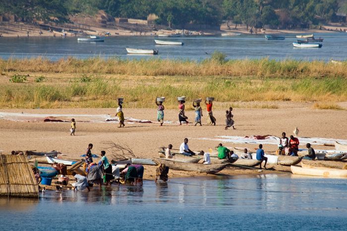
Rural scene, Lake Malawi shoreline.