
Namibia
Region Links: Caprivi / Zambezi, Damaraland & Waterberg, Etosha, Namib Desert & Sossusvlei, Skeleton Coast, Kaokoland & Kunene, Swakopmund, Windhoek
Highlights
- Visit the Namib, the world's oldest desert and climb towering red dunes.
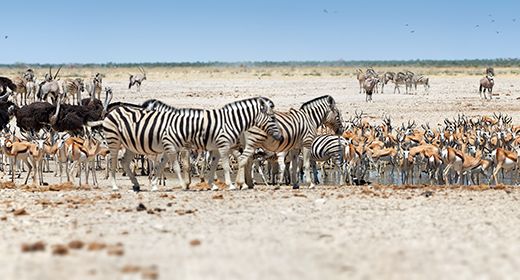
- See the Etosha National Park, Namibia's premier wildlife destination.
- Damaraland offers desert-adapted wildlife and Bushman rock art sites.
- Explore the Skeleton Coast for dunes, mountains, and miles of remote coastline.
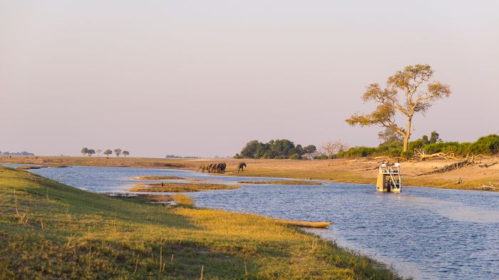
- Experience boating safaris on the Chobe and Zambezi rivers in the Caprivi.
The mostly desert country of Namibia is arguably the most scenic destination in Africa. Come experience the "sand dune sea," miles of ocean coastline, regionally abundant wildlife, and indigenous cultures.
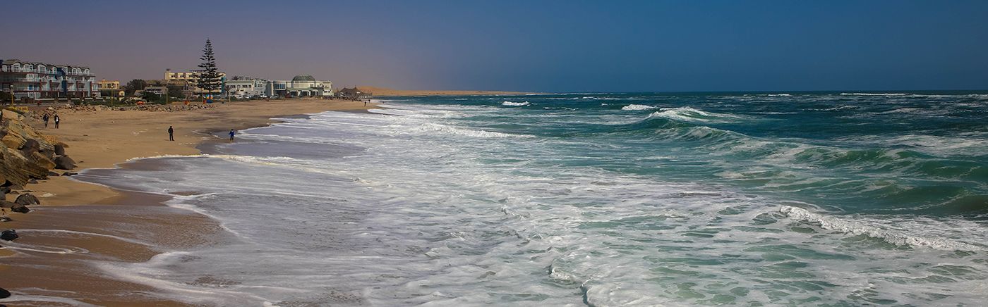
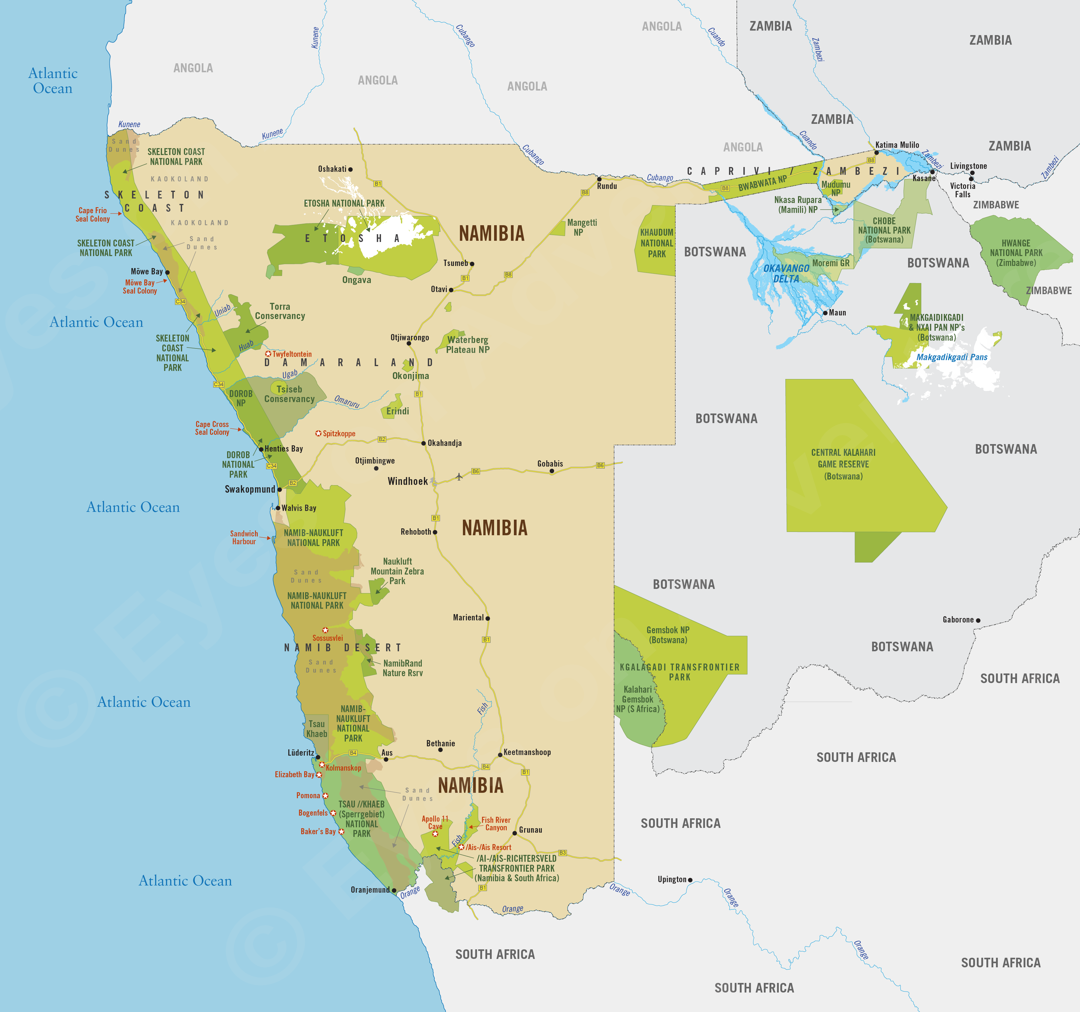
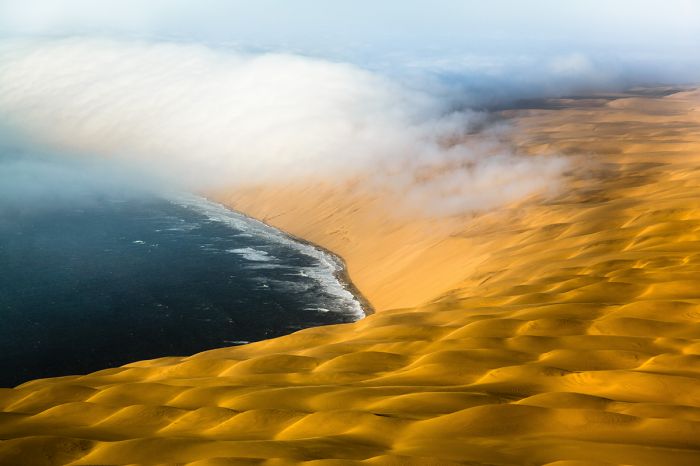
Sand dunes meet the sea near Sandwich Harbor, Namibia.
A German colony until 1990, Namibia is a place of vast distances, massive deserts with towering red-sand dunes, wild and remote coastal reserves, and the second-lowest population density of any country worldwide.
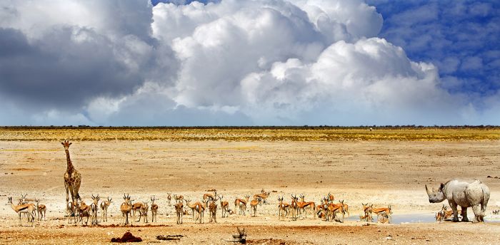
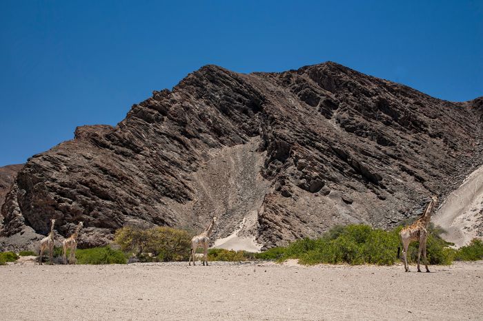
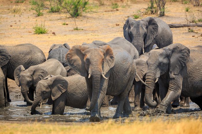
Etosha National Park is the country's only true wildlife destination, where large herds live around the remnant of an ancient inland lake that is now a salt pan so large, it can be seen from outer space.
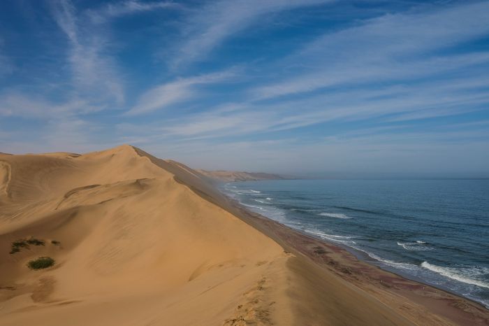
Elephants and giraffes at a waterhole in Etosha National Park, Namibia.
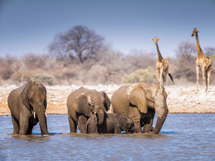
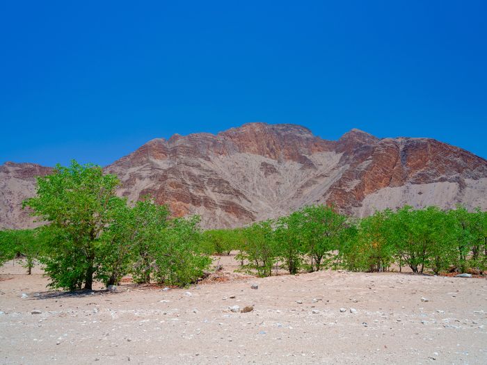
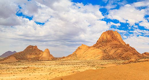
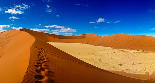
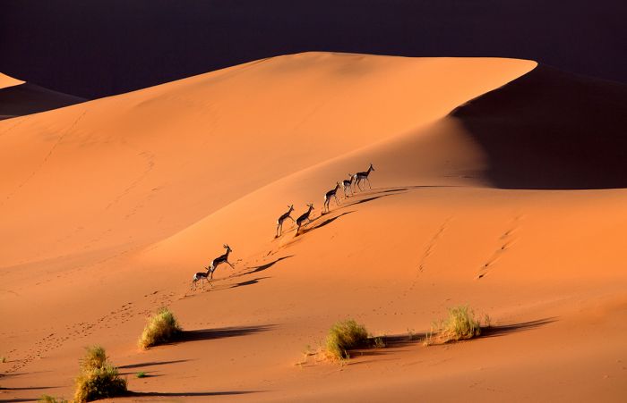
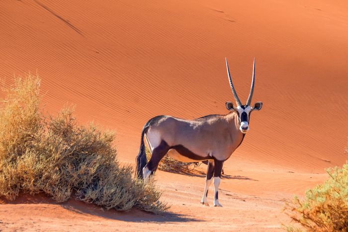
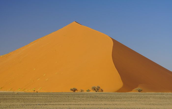
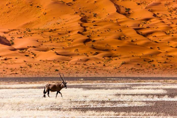
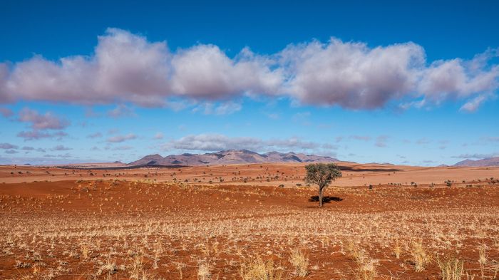
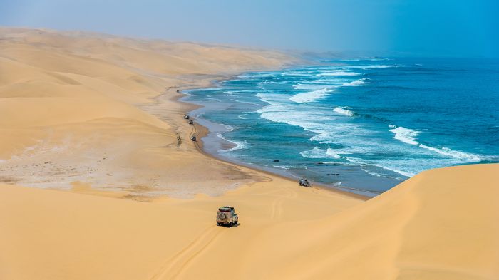
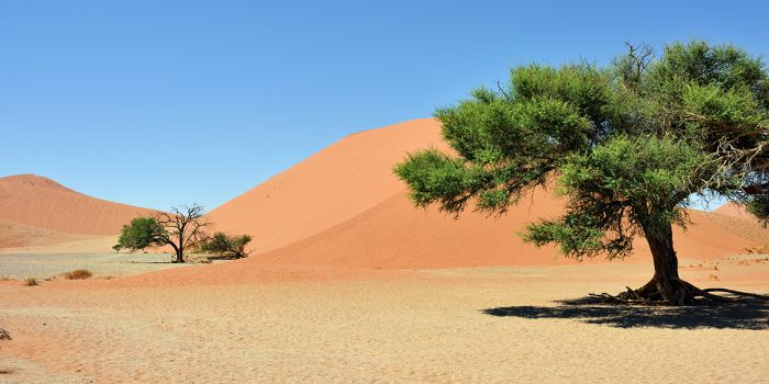
The Namib Desert is the oldest on Earth and the huge sea of sand that stretches along Namibia's coast is one of the most spectacular places you will ever see. The Sossusvlei region is of of the country's biggest attractions, where you can climb dunes and explore surreal landscapes.
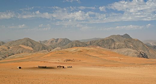
The Skeleton Coast and Damaraland are Namibia's most remote destinations. Coastal dunes, desert mountain ranges, ancient rock art sites, remote seal colonies, desert-adapted elephants, and other-worldly landscapes make them unique destinations.
Spectacular red dunes at Sossusvlei, Namibia.
The Caprivi / Zambezi is Namibia's only non-arid region. The long finger of land was a strategic pawn in the Scramble for Africa during colonial times and today offers an experience more like Botswana, with diverse wildlife, seasonally inundated floodplains, and river-based safari experiences.
Namibia is not typically included on a first trip to Africa, as it is not a true wildlife destination; however, it is a wild, diverse, incredibly scenic place like no other in Africa.
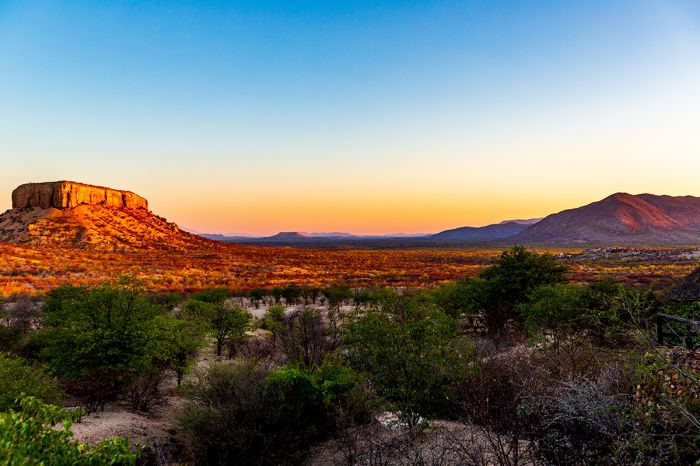
Damaraland landscape, Torra Conservancy, Namibia.
Namibia Regions
Caprivi / Zambezi (incl. Bwabwata, Mudumu, Nkasa Rupara, Khaudum, Chobe/Zambezi rivers)
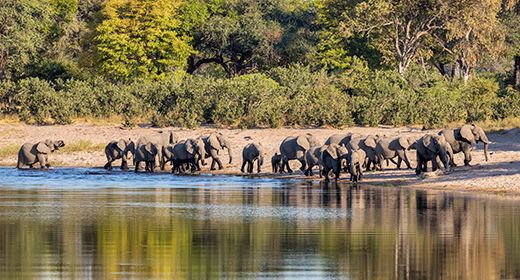
Resembling northern Botswana more than typical Namibia, the Caprivi offers good wildlife in remote reserves, epic rivers, forests, floodplain wilderness, and boating safaris. More
Damaraland & Waterberg (incl. Torra Conservancy, Waterberg Plateau, Okonjima)
Damaraland offers desert-adapted wildlife including elephants, zebra, giraffe and more in a magnificent setting with mountains, valleys, and Bushman rock art sites. Safaris in the protected Waterberg Plateau and Okonjima add to this diverse region. More
Etosha (incl. Etosha Pan, Ongava Game Reserve)
Namibia's premiere wildlife destination is located in a spectacular setting with the massive Etosha salt pan as its focus. Abundant herds of zebra, springbok, giraffe, oryx are joined by lion, leopard, cheetah, elephant, rhino and more. The Ongava Reserve offers exclusive safaris. More
Namib Desert & Sossusvlei (incl. NamibRand Nature Reserve, Namib-Naukluft National Park)
The 55-million-year-old Namib Desert is known for its extensive "sand sea", with red dunes towering over 1 000 feet tall. Sossusvlei is one of the most beautiful places you will ever visit, with postcard imagery everywhere. The NamibRand Reserve protects desert-adapted wildlife. More
Skeleton Coast & Kaokoland (incl. Kunene River, Skeleton Coast National Park)
So named for the hundreds of shipwrecks along its shores, this wild, remote, and little visited region feels like nowhere else on earth. Coastal dunes and desolate gravel plains meet mountains further inland. The semi-nomadic Himba people are often encountered. More
Swakopmund

Namibia's only beach resort destination, Swakopmund is located where the desert meets the ocean. With nearby Walvis Bay, the region is known for adventure activities on the dunes, like quad biking and sand boarding. The town has a distinct European feel. More
Read More...
Main: Flora, Geography, Important Areas, National Parks, Protected Areas, Ramsar Sites, UNESCO Sites, Urban Areas, Wildlife
Detail: /Ais-/Ais Hot Springs, /Ais-/Ais-Richtersveld, Bwabwata, Caprivi, Damaraland, Dorob, Etosha, Fish River Canyon, Kaokoland, Khaudum, Kolmanskop, Lüderitz, Mamili, Mangetti, Mudumu, Namib Desert, Namib-Naukluft, NamibRand, Naukluft Mountain Zebra, Nkasa Rupara, Okonjima, Ongava, Sandwich Harbour, Skeleton Coast, Sossusvlei, Sperrgebiet, Swakopmund, Tsau-//Khaeb, Walvis Bay, Waterberg, Windhoek, Zambezi
Admin: Travel Tips, Entry Requirements/Visas
Geography
Namibia is a country in Southern Africa with the Atlantic Ocean on its western border. To the south is South Africa, to the north is Angola, and to the east is Botswana. The long finger of land extending off the northeast of the country is known as the Caprivi Strip or Zambezi Region and it shares additional borders with Zambia and Zimbabwe.
Damaraland landscape in northern Namibia.
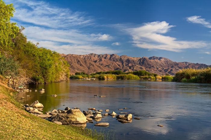
The southern border with South Africa is determined by the Orange River, while portions of its northern borders are made by the Kunene, Cubango, and Zambezi rivers.
The country's climate is mostly very arid and includes a portion of the Kalahari Desert and most of the Namib Desert. It has the least rainfall of any country in Sub-Saharan Africa. The coastal areas are heavily influenced by the cold, north-flowing Benguela Current of the Atlantic Ocean, which results in very low precipitation, frequent dense fog, and overall lower temperatures than in the rest of the country.
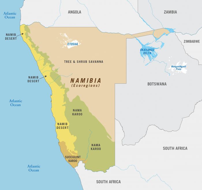
The major biomes consist of five geographical areas, the Central Plateau, the Namib Desert, the Great Escarpment, the Bushveld, and the Kalahari Desert.
Thick fog rolls in over the dunes along Namibia's coast.
The Central Plateau makes up much of the middle of the country, including its capital city, Windhoek. The Great Escarpment is mostly within South Africa, but the northern extreme reaches into southwest Namibia. The Kalahari Desert covers large portions of Botswana and northwest South Africa and also extends into southeast Namibia.
The Namib Desert is a major component of the country. Considered one of the two oldest deserts in the world, the Namib is a massive expanse of dunes (often called the 'dune sea') and arid, gravel plains, extending along Namibia's Atlantic Ocean coast from the Angola border to the foot of the Great Escarpment.
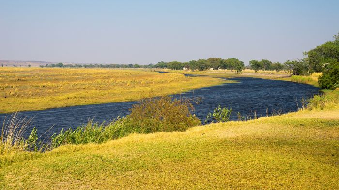
View along the Chobe River in the Caprivi region.
The only Bushveld in Namibia is found in the Caprivi/Zambezi Region, which is vastly different to the rest of the country and are closely resembles northern Botswana. Rainfall in the eastern Caprivi averages 16 inches (400mm) per year and is influenced by major river systems including the Chobe and Zambezi.
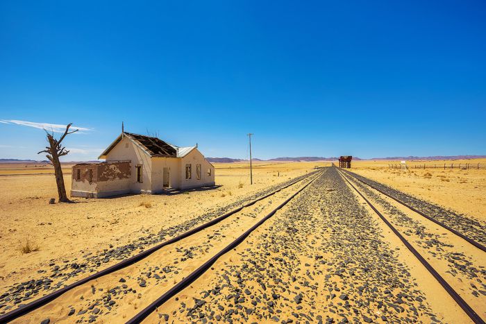
Abandoned Garub Railway Station on the route to Lüderitz.
Flora
Despite being a predominantly arid country, with a large portion of its western land covered by the Namib Desert, Namibia's diverse topography supports a variety of flora.
Most of the western coast and inland for some 50-100 miles (80-160 kms) is covered by the sands and gravelly plains of the Namib Desert. Flora in the desert is limited by the low rainfall and exists primarily along river courses that flow only sporadically from the highlands further east. The cold Benguela Current waters along Namibia's coast mix with the hot desert air to create heavy morning fog on most days, and this moisture is used by desert-adapted plants to survive without rain.
Map showing Namibia's major ecoregion (Copyright © James Weis).
Desert-adapted plants like the Shepherd's tree (Boscia albitrubnca), Damara milk bush (Euphorbia damarana), and the incredible Welwitschia plant (Welwitschia mirabilis) thrive in the dry Damaraland region inland from the Skeleton Coast on the northern coast. The Welwitschia plant can live for hundreds of years.
Further inland in the north is the remnant of an ancient lake that is now a dried salt pan called Etosha. The pan does receive water most years, and the vegetation around the salt pan includes grassland savanna and open mopane tree woodlands, which support large numbers of animals.
South of the Namib Desert, beginning roughly at Lüderitz and continuing into South Africa, the ecoregion becomes 'Succulent Karoo'. This region is defined by high biodiversity and is thought to have the world's richest flora of succulent plants, harboring around one-third of the planet's 10 000 species of succulent plants. About 40% of the succulents in the region are endemic.
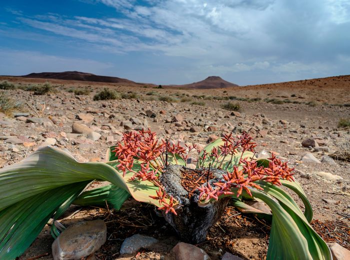
The Welwitschia plant (Welwitschia mirabilis) is one of the longest-living plants on Earth.
Inland and east from the Namib Desert and Succulent Karoo is a band that widens greatly in the south called 'Nama Karoo'. The ecoregion is characterized by its very dry climate and low-shrub vegetation. It is not particularly rich in plant species or endemism, with plants that are highly adapted to these harsh conditions. The Nama Karoo covers South Africa's Central Plateau and extends well into southern Namibia.
The majority of northern Namibia lying inland from the Namib Desert is covered by 'Tree and Shrub Savanna'. Mopane trees (Colophospermum mopane) are one of the most common in this wide region, as these trees thrive in arid, sandy soils and are found throughout much of the Kalahari Desert, which extends through much of northern Botswana, southern Angola, northwest South Africa, and southern Zambia. Elephants and browsing herbivores like oryx, impala, and greater kudu are very fond the mopane tree leaves.
Namibia's annual rains, which are never a given in the desert regions covering much of the country, fall between December and April, and on 'good' years, the desert will receive rainfall, which creates a floral explosion that is truly a spectacle to see.
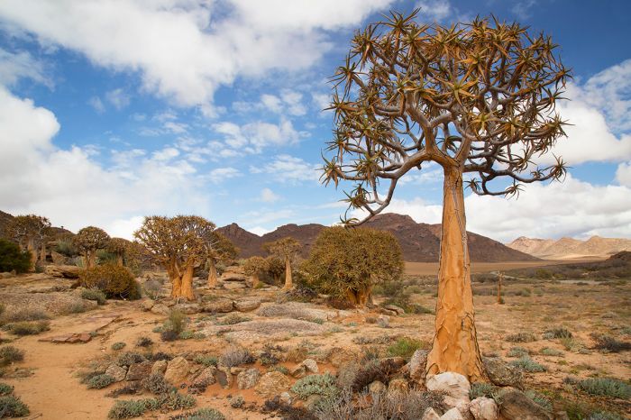
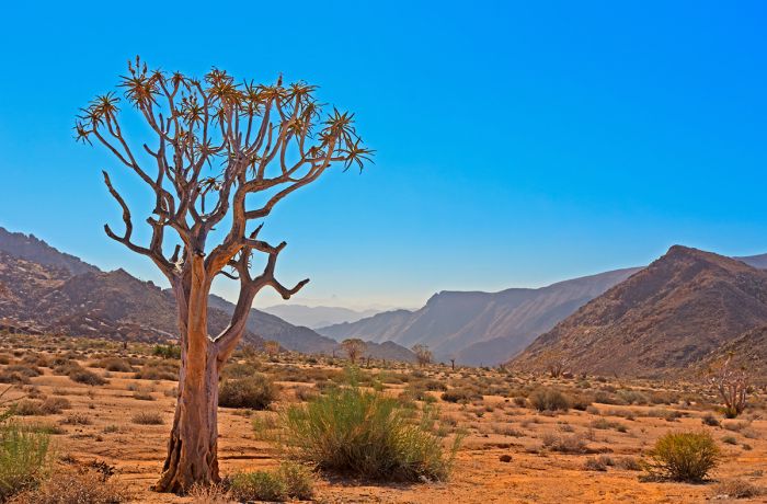
A quiver tree or 'kokerboom' (Aloidendron dichotomum), is a common plant of the Succulent Karoo ecoregion in southwest Namibia.
Wildlife
Namibia is not known for being a wildlife safari destination in the way that its neighboring countries, Botswana and South Africa are, but there are several destinations in the country where large and iconic mammals are commonly seen. Etosha is undoubtedly Namibia's top wildlife destination and is a favorite for its waterholes, which attract thirsty animals in large congregations during the dry season.
In terms of large predators, lions can be reliably seen in both Etosha and the neighboring Ongava Reserve, as well as in the Caprivi region far to east on the border with northern Botswana. Leopard are very common throughout much of the country, but are not easy to see, with the Caprivi region being the best bet for encountering one on a safari.
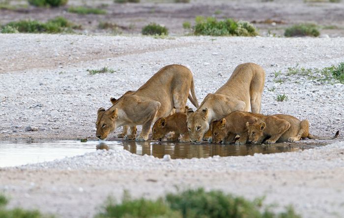
Lions in Etosha National Park, Namibia.
Outside of Etosha, cheetah are the most commonly seen of the big cats in Namibia, as their favored prey of smaller antelopes are much more common than the larger prey species lions require. Moreover, Namibia's wide open spaces are preferred by cheetah, which do not ambush their prey as lion and leopard do, but rather run down the antelopes on which they survive.
Cheetahs live primarily on farmlands in Namibia, where farmers tend to kill off lions and hyenas, which would kill their cattle. Smaller antelopes like springbok coexist with the livestock and the cheetahs primarily leave livestock alone, preferring the smaller prey. Namibia is home to the largest wild population of cheetah of any country, with around 40% of Africa's total.
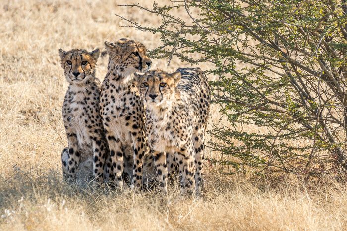
Cheetahs do well in many of Namibia's wide open spaces.
Spotted hyena, the most common of the hyena species in most parts of Africa, where they often live in loose clans numbering ten or more individuals, are mostly uncommon in Namibia. Spotted hyenas are found in parts of northern Namibia and even in small numbers on the central desert area, but they are less common than the solitary brown hyena, which is widespread in the country. Brown hyenas can often be see in the Skelton Coast, where they scavenge for prey at the Cape fur seal colonies.
African wild dogs are very uncommon in Namibia, only being found in the area of Khaudum National Park, on the border with Botswana, where they are far more common. Attempts to reintroduce wild dogs to Etosha were not successful.
Buffalo, which are typically found only in areas where there is plentiful grass and a good source of water, are only found in the Caprivi region, which has permanent water sources along the Kwando, Cubango, and Zambezi Rivers.
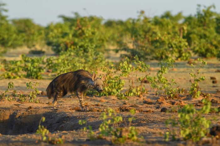
The solitary brown hyena is widespread in Namibia.
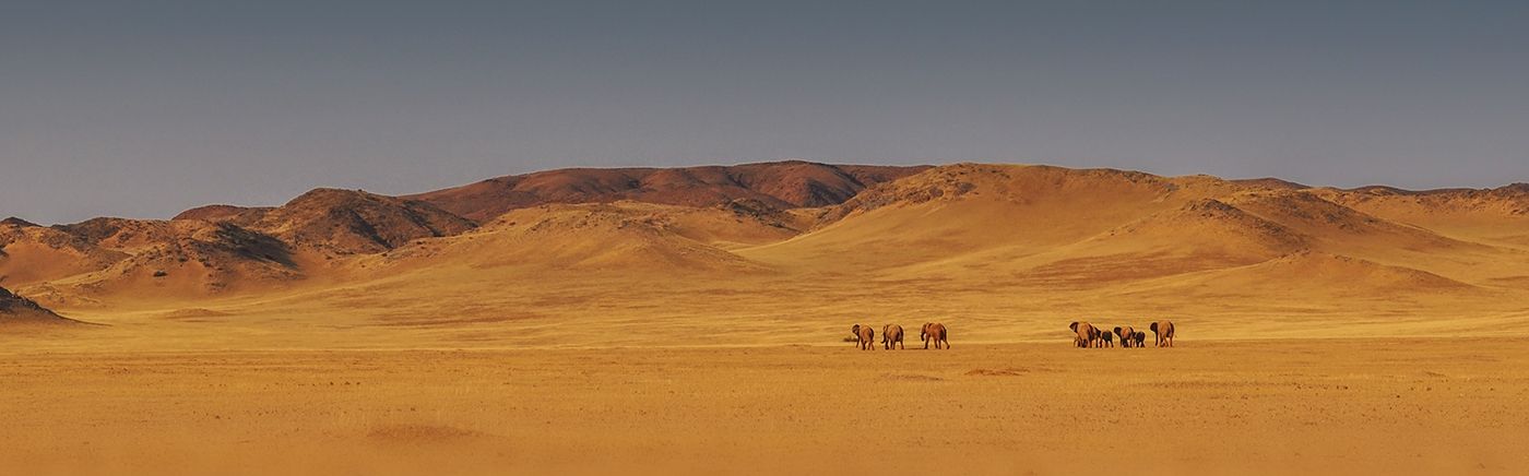
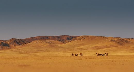
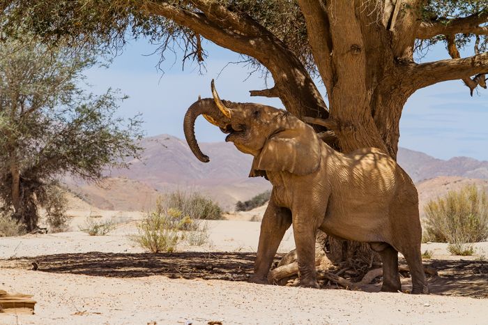
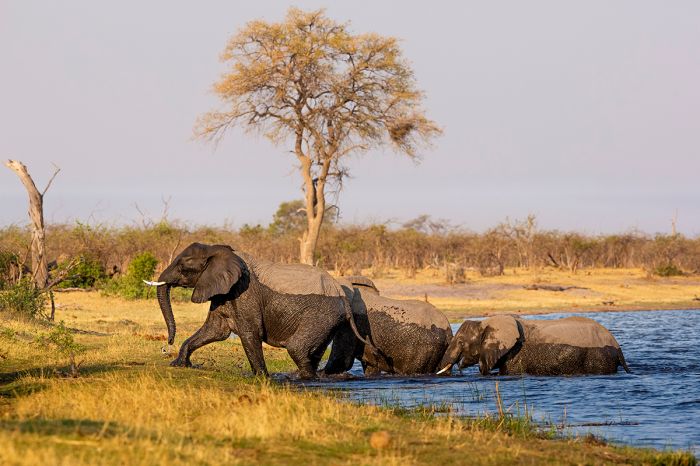
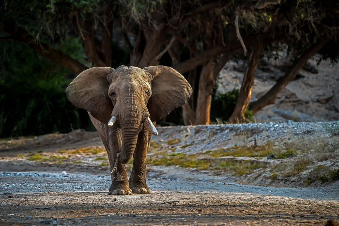
Elephant have adapted to survival in northern Namibia, where they exist in small numbers. These elephants, sometimes called 'desert elephants', have learned where the few reliable water sources are along river beds, and have passed the info down from generation to generation. The desert elephants walk long distances to cover the ground between drinking locations, while finding enough food along the way. Elephants can be seen in the Skeleton Coast, Kaokoland, Damaraland, Khaudum, and Etosha. They are also found in the Caprivi/Zambezi region.
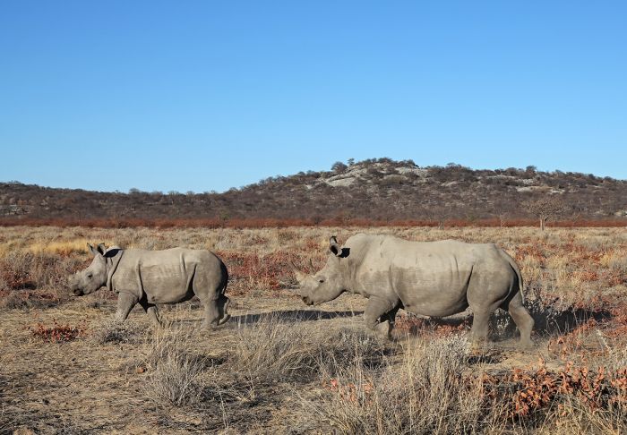
Black rhino are particularly suited to northern Namibia's harsh, desert environment, feeding on plants like the Damara milk bush (Euphorbia damarana), which is toxic to all other animals except greater kudu. Black rhino can be reliably seen at the safari camps in northern Damaraland in and around the Torra Conservancy. White rhino have been successfully reintroduced in Etosha and the Waterberg Plateau, where they are doing well.
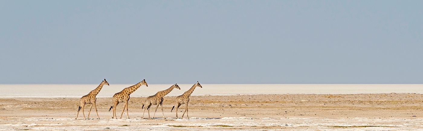
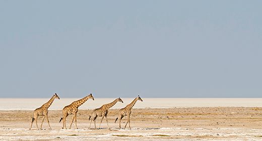
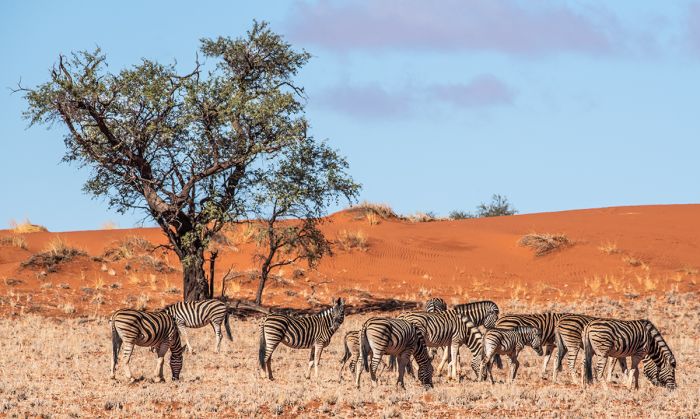
Giraffe and zebra are also animals that can adapt to desert conditions and are found in small numbers in northwest Namibia, at Etosha, Damaraland, Kaokoland, and the Skeleton Coast. Greater kudu are well-adapted to dry conditions and are fairly common throughout northern Namibia.
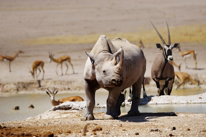
Black rhino, oryx, and springbok in Etosha National Park, Namibia.
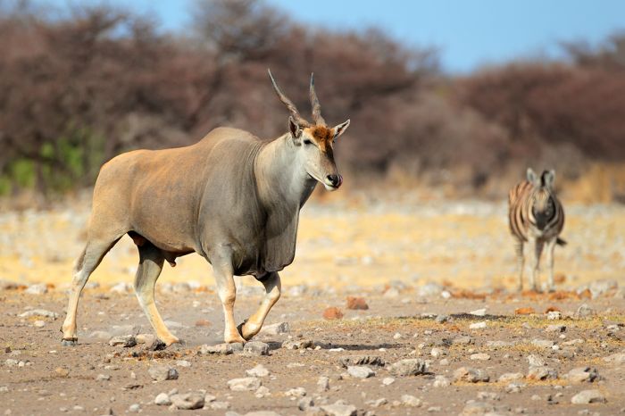
Antelopes are well represented in Namibia, with springbok and oryx both well adapted to desert conditions, and occurring from the far north along the Kunene River, all the way south to South Africa. The regionally endemic 'black-faced' subspecies of impala can be seen in northwest Namibia and into Angola. Red hartebeest, wildebeest, roan antelope, and eland are fairly common in Etosha. Sable antelope and red lechwe are only found in the Caprivi. Sitatunga can only be found in the permanently flooded areas of far eastern Caprivi/Zambezi.
Smaller antelopes include the klipspringer, a rock-dwelling species found throughout Namibia's mountains. Duikers are common throughout the country except in the desert sand. The endemic Damara did-dik, a tiny antelope, can be reliably found in Kaokoland, Damaraland, and Etosha.
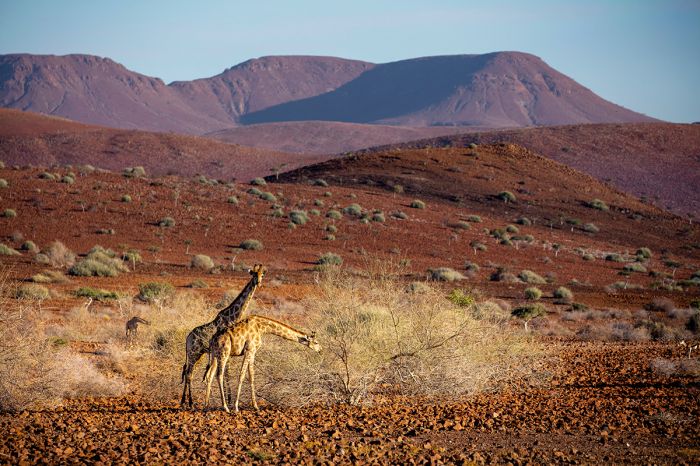
Giraffes in the Damaraland region of Namibia.
Birds
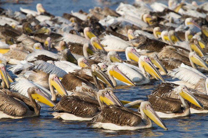
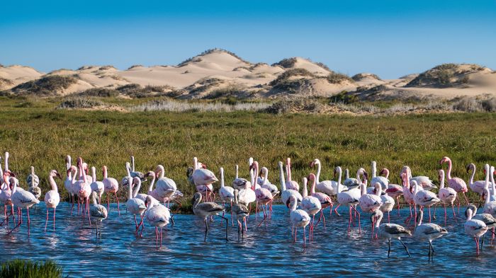
Birdlife in most of Namibia consists of dry-land species, but many are localized and so they may be treasured finds for ardent birders. The coastal wetlands, particularly at Walvis Bay and Swakopmund, are superb birding locations, with pelicans, flamingos, and a multitude of waders and seabirds. The Caprivi offers a much different birding experience, with many species there more commonly seen in Botswana, especially in the Zambezi Floodplain and along the major rivers flowing south from Zambia and Angola.
September and October is when the Palearctic migrants arrive and the number of species to be found increases dramatically, particularly at Etosha, the Caprivi/Zambezi, and any of the Ramsar Wetland sites in the country.
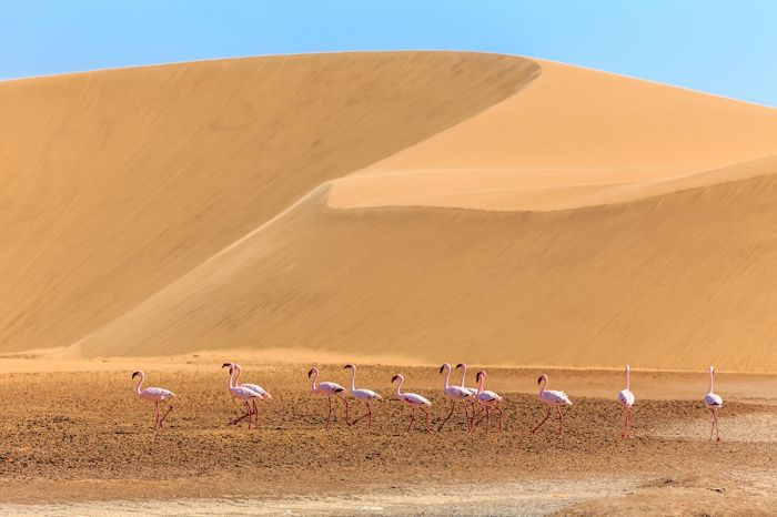
Lesser flamingos and sand dune near Walvis Bay, Namibia.
Protected Areas
Namibia has protected large swaths of its land as national parks, reserves, and transfrontier parks. Other than a small section around the seaside towns of Swakopmund and Walvis Bay, Namibia's 977-mile (1 572-km) Atlantic Ocean coastline in entirely protected as four contiguous national parks.
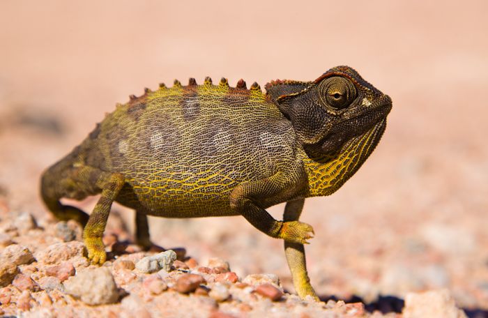
The Namaqua chameleon (Chamaeleo namaquensis) is endemic to the Namib Desert.
National Parks
Following are Namibia's eleven national parks. Additional information on each is included further below this list:
- Bwabwata National Park - Located in the central portion of the Caprivi Strip between Angola and Botswana, with decent wildlife viewing on its eastern and western ends.
- Dorob National Park - Atlantic Ocean park south and contiguous with the Skeleton Coast. Very remote and pristine. Cape Cross Seal Reserve and the towns of Swakopmund and Walvis Bay.
- Etosha National Park - Namibia's premier wildlife destination protects herds of antelope, zebra, oryx, giraffe, rhinos, lions, and other predators. Best in the dry season when animals congregate at the waterholes.
- Khaudum National Park - Wild and remote park in northern Namibia, bordering Botswana. Wildlife is good but the park is seldom visited.
- Mangetti National Park - Small park in northern Namibia with a dry climate on Kalahari sands. Converted from a private game farm and not yet open to the public.
- Mudumu National Park - Situated in the Caprivi Strip along the Kwando River. Good wildlife viewing along the river.
- Namib-Naukluft National Park - Africa's largest national park protects much of the coastal Namib Desert, one of the oldest deserts on Earth.
- Nkasa Rupara (Mamili) National Park - Protects the Linyanti Swamp wetland, a beautiful ecosystem similar to Botswana's Okavango Delta. Good wildlife viewing.
- Skeleton Coast National Park - Starkly beautiful and wild; one of the most remote national parks in Africa. Named for the hundreds of shipwrecks along its Atlantic Ocean shoreline.
- Tsau //Khaeb (Sperrgebiet) National Park - Protects the southern portion of the Namib Desert. Tourism is prohibited except for the diamond mining ghost towns along the coast, of which Kolmanskop is the most popular.
- Waterberg Plateau National Park - Excellent destination for hiking, this park protects a 30-mile long plateau located southeast of Etosha in Northern Namibia. Good variety of reintroduced wildlife.
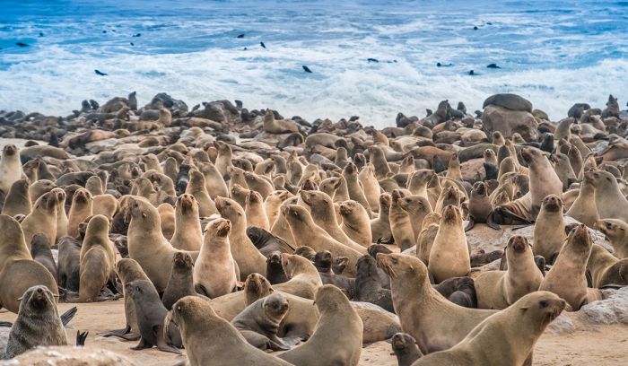
Cape fur seals at the Cape Cross Seal Reserve, Namibia.
Important Areas
Other important areas of note in Namibia include wildlife and nature reserves, as well as general regions that are worth consideration when planning your trip.
- /Ai-/Ais-Richtersveld Transfrontier Park - Combined parks spanning southern Namibia and Northern South Africa. Home to the Fish River Canyon, /Ais-/Ais hot springs, and Richtersveld Community Land inhabited by the Nama people.
- Caprivi / Zambezi - Long finger-shaped strip of land extending east from northern Namibia, with several land-based national parks and the spectacular Zambezi Floodplain at its eastern end.
- Damaraland - Spectacularly scenic region in northern Namibia with excellent wildlife viewing, dramatic mountains and rock formations, and numerous prehistoric rock art sites.
- Kaokoland - Harsh and beautiful, with the Himba people, desert-adapted elephants, and black rhinos. Only a few safari camps.
- Lüderitz / Kolmanskop - Popular seaside tourist town (Lüderitz) and ghost town remnant (Kolmanskop) that grew during the early 1900s 'Diamond Rush' along Namibia's southwest coast.
- NamibRand Nature Reserve - One of the best options for accommodation in the Sossusvlei region, with superb wildlife viewing and a wide range of activities on offer.
- Naukluft Mountain Zebra Park - Seldom visited park established to protect Hartmann's mountain zebras on the eastern border with Namib-Naukluft National Park.
- Okonjima Natiure Reserve - Home of the AfriCat Foundation, a conservation organization that protects native carnivores. Guest accommodation offered.
- Ongava Game Reserve - Small, private reserve adjoining the southern side of Etosha National Park. Excellent all-inclusive accommodations offering game drives on the reserve and into the national park.
- Sossusvlei - One of Namibia's most popular destinations located in the Namib Desert. Scenically beautiful, with towering red sand dunes, ephemeral rivers valleys, and desert-adapted wildlife.
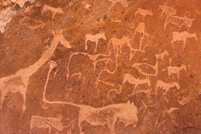
Ancient rock engravings at Twyfelfontein in Namibia.
UNESCO World Heritage Sites
The United Nations Educational, Scientific and Cultural Organization (UNESCO) is a specialized agency of the United Nations whose mission is to promote world peace and security through international cooperation in education, the arts, the sciences, and culture. The Convention concerning the Protection of the World's Cultural and Natural Heritage was signed in November 1972 and ratified by the 189 UN member "states parties".
A World Heritage Site is a landmark or area which is geographically and historically identifiable and has special cultural or physical significance. To be selected as a World Heritage Site, a nominated site must meet specific criteria and be judged to contain "cultural or natural heritage of outstanding value to humanity". An inscribed site is categorized as cultural, natural, or mixed (cultural and natural). As of 2021, there were over 1 100 sites across 167 countries.
Namibia has two UNESCO World Heritage Sites:
- Namib Sand Sea (since 2013, Natural) - Towering sand dunes colored red and orange covering some 12 000 square miles (32 000 sq kms) in the Namib Desert.
- Twyfelfontein or /Ui-//aes (since 2007, Cultural) - The world's largest outdoor rock art site located in Southern Damaraland, with thousands of engravings dating back 6 000 years.
Ramsar Wetlands of International Importance
The Ramsar Convention on Wetlands is an international treaty for the conservation and sustainable use of wetlands. It was the first of the modern global nature conservation conventions, negotiated during the 1960s by countries and non-governmental organizations concerned about the increasing loss and degradation of wetland habitat for birds and other wildlife. The convention is named after the city of Ramsar in Iran, where the convention was signed in 1971.
Presently there are some 75 member States to the Ramsar Convention throughout the world which have designated over 2 300 wetland sites onto the Ramsar List of Wetlands of International Importance.
Namibia has 5 sites designated as Wetlands of International Importance (Ramsar Sites) as follows.
- Bwabwata-Okavango - Lower Okavango River as it enters the Okavango Delta Panhandle. Seasonally and permanently flooded marshes and floodplains bordered by riparian forest or open woodland. Habitat for large numbers of endangered mammals and birds. (181 sq miles/470 sq kms)
- Etosha Pan - System of ephemeral rivers and pans, with seasonally flooded grasslands, palm-tree savanna, woodland, and dry bushland. Provides crucial water for sparse human population and large numbers of wildlife. (2 317 sq miles/6 000 sq kms)
- Orange River Mouth - Multi-country site shared with South Africa where the Orange River enters the Atlantic Ocean. Floodplain of small islands and sand bars in an otherwise arid area. Provides important habitat for large number of birds. (2 sq miles/5 sq kms)
- Sandwich Harbor - Two distinct wetlands and associated mudflats. One of Namibia's most important coastal wetlands with large numbers of wading birds. (64 sq miles/165 sq kms)
- Walvis Bay - A tidal lagoon with adjacent intertidal areas. Mudflats and sandbars are exposed at low tide. Supports large numbers of wetland birds, including flamingos. (49 sq miles/126 sq kms)
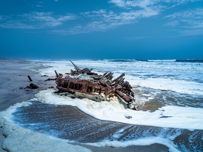
An old shipwreck in the Skeleton Coast, Northern Namibia.
Urban Areas
Namibia's urban areas include its main port of entry, as well as small coastal enclaves. Details on each follows further below.
- Swakopmund - Popular ocean-front resort town on the edge of the vast sand dunes in central Namibia.
- Walvis Bay - Smaller and less popular sister town to Swakopmund. Popular for birding.
- Windhoek - By far Namibia's biggest city, it is the capital and main port of entry for International visitors.
Etosha National Park
Based around the enormous Etosha Pan, an expansive salt-encrusted remnant of a large lake, Etosha National Park is Namibia's premier wildlife-viewing destination. While the pan itself covers a large portion of the park and is not suitable for any wildlife to live on, the spring-fed waterholes along the margins of the long-dried lake sustain a great diversity and number of animals.
Outside the borders of the large pan are grassy savannas and scrubland vegetation, that are home to good numbers of zebra, giraffe, springbok, blue wildebeest, oryx, ostrich and both black and white rhino. Predators at Etosha include lion, leopard, cheetah, spotted hyena, black-backed jackal, and brown hyena.
Etosha's waterholes are great for wildlife viewing; shown are a black rhino, giraffe, and springboks.
Elephant are seen regularly at Etosha, as are roan antelope, greater kudu, impala, eland, warthog, and other species. Birding in Etosha is very good and ostrich are seen easily, as are kori bustard, secretarybird, and black korhaan.
The waterholes along the southern edge of the Etosha Pan provide the best game viewing in the national park. During the driest months (June thru October), these waterholes are the only source of water for many miles and are always busy with wildlife and the game viewing can be spectacular. It is not uncommon to see up to ten species at a single waterhole during this time.
There are numerous choices for accommodation at Etosha, from basic self-catering rest camps to all-inclusive lodges, most of which are situated at the eastern side of the park near the entrance gate.
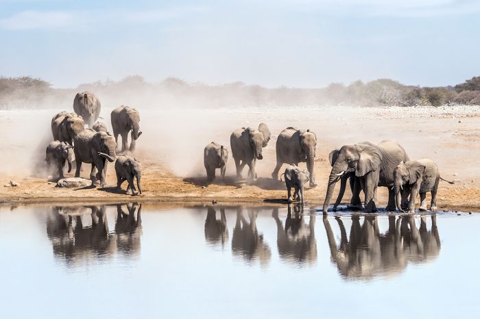
Elephants rush to drink at an Etosha National Park waterhole.
Ongava Game Reserve
Adjoining Etosha on the southern side is the Ongava Game Reserve, a small, private reserve with several excellent all-inclusive lodges and easy access to the national park. Ongava is one of the best places in Africa to reliably see both species of rhino, and offers excellent overall game viewing, including night drives.
Read full details on Etosha National Park and Ongava Game Reserve here.
White rhinos in the Ongava Game Reserve near Etosha, Namibia.
Namib-Naukluft National Park
Nambia's largest protected area, the Namib-Naukluft National Park covers a massive 19 215 square miles (49 768 sq kms) of land along the country's Atlantic Ocean coastline and inland some 75 miles (120 kms), effectively protecting a large part of the Namib Desert and its sand dunes. Namib-Naukluft is the largest national park in Africa and one of the world's largest.
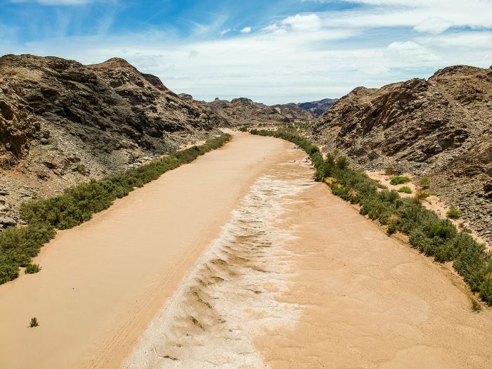
The Namib Desert covers a 1 200-mile (2 000-km) stretch of coastline from southern Angola in the north, all the way through Namibia and into the northern part of South Africa. It is the only true desert in Southern Africa. The desert is estimated to be 55-80 million years old, which makes it one of the oldest deserts on Earth.
On rare occasions, the dried pans of the Namib Desert receive water from the ephemeral rivers.
The Namib's great 'Sand Sea' consists of wind-blown dunes stretching from Swakopmund in the north to Lüderitz in the south and inland for 90 miles (150 kms) in some places, covering 12 000 square miles (32 000 sq kms). Some of the dunes in this sea of sand are huge and many of the more impressive dunes have been given names, such as 'Big Daddy' and 'Dune 45'.
Besides the massive sea of dunes that dominates much of the park's area, there are ephemeral rivers, that flow west through valleys into pans in the desert or all the way to the Atlantic Ocean. Much of the time, these rivers flow only beneath the surface, supporting trees and lush vegetation, and giving sustenance to the wildlife that manage to survive in the harsh environment.
Springboks running on the sand in the Namib-Naukluft National Park, Namibia.
Other notable features of the park's landscape are expansive gravel plains, as well as granite or limestone inselbergs (islands of rock). Many of the park's rock formations have become submerged beneath the sand, but some protrude from the sand or exist in the gravel-strewn areas.
There are two significant protected areas that are adjuncts to the national park's eastern border: the NamibRand Nature Reserve and the Naukluft Mountain Zebra Park.
Read full details on Namib-Naukluft National Park (including Sossusvlei) here.
Oryx are well adapted to life in the Namib-Naukluft National Park.
Skeleton Coast National Park
Spanning the northern third of Nambia's Atlantic Ocean coast is the stark and beautiful Skeleton Coast, protected as a national park of the same name. The park begins on the country's northern border with Angola, on the banks of the Kunene River and continues south for 315 miles (510 kms) to the Ugab River.
Named by Portuguese sailors as the 'Coast of Death', there are still the remains (skeletons) of some of the hundreds of shipwrecks that have occurred along this perilous stretch of Namibia's ocean coast.
A desert-adapted elephant in the dry Hoarusib River near Purros.
Tourists to this remote part of Southern Africa will invariably describe it as 'otherworldly', and the difficulty of getting there means that those visitors who are lucky enough to visit, will feel they are in one of the world's last great wildernesses.
The landscape along the coast is dominated by sand dunes that stretch for miles inland in some places, flat sand beaches, and rocky patches. The ocean waters here are frigid, brought north from the Antarctic by the Benguela Current, and when the cold water meets the hot desert air, it causes dense coastal fog in the morning on most days. Rainfall is very low throughout the park.
Exploring the vast wilderness of the Skeleton Coast (Copyright © James Weis).
Several ephemeral rivers flow west to the ocean but their waters remain underground for most of the year, flowing above ground only on rare occasions. The subterranean water below the surface in the riverbeds can be reached by the region's desert-adapted elephants, which dig holes with their trunks to reach the fresh water.
Besides the desert-adapted elephant, wildlife in the Skelton Coast is sparse but seen regularly and includes oryx, Hartmann's mountain zebra, giraffe, springbok, black-backed jackal, and brown hyena. Lion and cheetah are seen, but are rare. Several Cape fur seal colonies are located along the beaches, the largest being the one at Cape Frio, with some 20 000 seals.
Desert-adapted giraffes in the Skeleton Coast National Park, Namibia.
The native Himba people are mostly nomadic and can be visited as a cultural experience at one of their settlements, particularly in the far north along the Kunene River. The Himba are distinctive looking, as they coat their bodies and hair with an ochre-colored paste made from butterfat, sand, and clay.
Read full details on the Skeleton Coast National Park here.
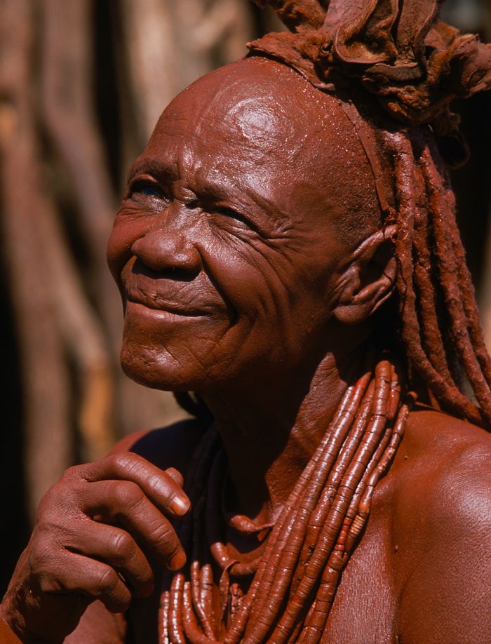
A Himba woman in the Skeleton Coast (Copyright © James Weis).
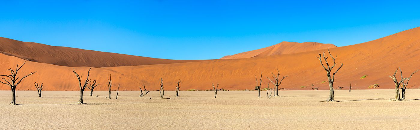
Sossusvlei
By far the most visited place in The Namib Desert is the scenically beautiful Sossusvlei region. A photographer's paradise, the dunes and grasslands in this part of the desert are spectacular, with towering sand dunes colored red, orange, and gold and ever-changing light that produces hues of pink and mauve in the early morning hours.
Fed by the ephemeral Tsauchab River, which flows west seasonally from the Naukluft Mountains, Sossusvlei is actually one of numerous small clay-covered pans that only occasionally fill with water from the river.
'Dune 45' in the Sossusvlei region of the Namib Desert.
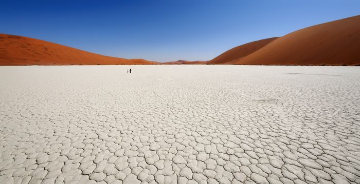
The pans here are all surrounded by the tall, orange dunes that make up the 12 000-square-mile (32 000-sq-km) 'sand sea' stretching all the way to the Atlantic Ocean coast in the west. The pans are endoheric (drainage basins with no outflows) and are usually dry, with a hard, whitish, mineral, clay, and sand surface.
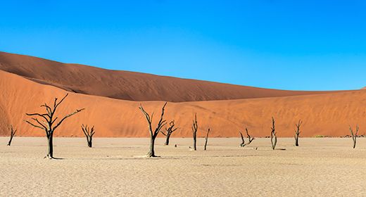
Some of the dunes in this area reach elevations over 1 000 feet (300+ meters) above the plains. The famous 'Big Daddy' dune at Deadvlei is 1 066 ft (325 meters) high and is very popular for climbing, offering incredible views from the top. The imagery at Deadvlei, with its ancient and long-dead skeletal camelthorn trees still standing on the white pan with surrounding red dunes is the stuff of dreams.
The surreal 'Dead Vlei' is a must-see when visiting the Sossusvlei region.
In spite of the desert climate and harsh environment, the Sossusvlei region has plenty of desert-adapted wildlife. Commonly seen species include oryx, springbok, and Hartmann's mountain zebra. The nearby NamibRand Nature Reserve offers excellent accommodation and the best wildlife viewing in the area, with easy access to the dunes and Sossusvlei.
A visit to Sossusvlei (minimum three nights recommended) is a must for any comprehensive trip to Namibia. Plan on taking lots of images regardless of what level of photographer you may be, as the imagery here is unlike anything most people will have ever seen.
Read full details on Sossusvlei here.
An oryx walks along the plain at Sossusvlei in the Namib Desert, Namibia.
Damaraland
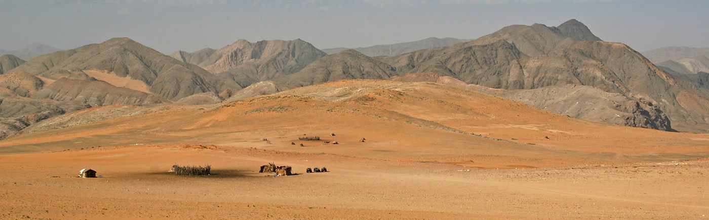
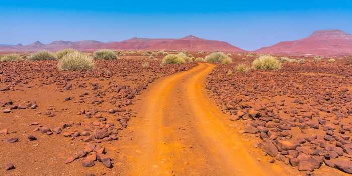
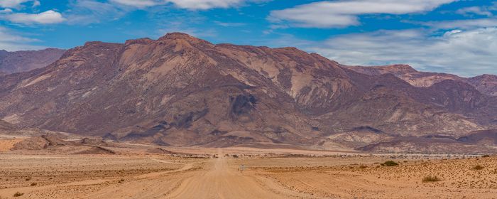
Named for the indigenous Damara people that live there, Damaraland is situated south of Etosha and inland from the coastal national parks of the Skeleton Coast and Dorob. Like much of the country, Damaraland is characterized by an arid desert climate, with spectacular mountain landscapes, with wind-blown hills, gravelly plains, red-rock inselbergs, lava fields, and ephemeral rivers.
There are two distinct regions in Damaraland: Northern Damaraland and Southern Damaraland. Northern Damaraland offers the best wildlife viewing, but is much less accessible, typically requiring a fly-in transfer, while Southern Damaraland is more accessible by road and is popular for its rock art sites and geologically interesting attractions.
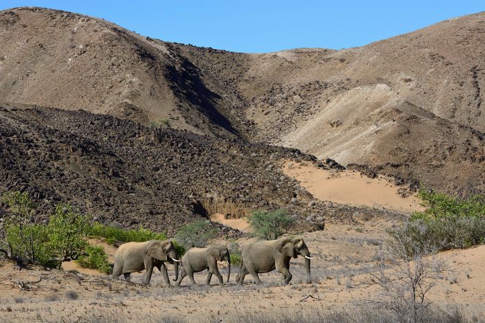
Desert-adapted elephants in the dry Huab riverbed, Damaraland, Namibia.
There are several protected land concessions in Northern Damaraland that are the primary tourism destinations and the best wildlife viewing is in the Torra Conservancy. There are several all-inclusive safari camps in Torra, offering wildlife safari experiences to see desert-adapted species like elephant and black rhino. Leopard, lion, and cheetah are sometimes seen. Other wildlife commonly seen in Torra includes greater kudu, oryx, Hartmann's mountain zebra, klipspringer, springbok, and others.
North of Torra and closer to Etosha, the region becomes slightly less arid, with more vegetation that supports even more wildlife, including elephant, eland, black-faced impala, and the endemic and diminutive Damara dik-dik antelope. Birding for drylands species is exceptionally good.
Damaraland landscape in the Torra Conservancy.
Southern Damaraland is less of a wildlife destination that the northern region and is characterized by beautiful landscapes, dramatic mountains, rock formations, and Bushman rock art. Spitzkoppe is a popular site for photographers and geology fans, with its lovely granite inselbergs that rise 5 800 feet (1 765 meters) above the plains. There are over thirty bushman rock art sites at Spitzkoppe.
Twyfelfontein is a UNESCO World Heritage Site and the most popular tourist attraction in Southern Damaraland, offering the world's largest outdoor rock art site. There are thousands of engravings on boulders scattered over a wide area, some dating back to around 6 000 years ago.
Read full details on Damaraland here.
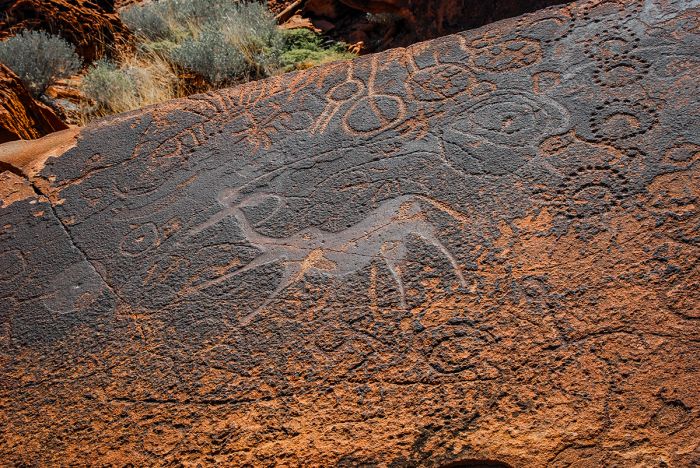
Petroglyphs at Twyfelfontein in Southern Damaraland, Namibia.
Caprivi / Zambezi
(Including three national parks: Bwabwata NP, Mudumu NP, and Nkasa Rupara (Mamili) NP)
Namibia's 'Caprivi Strip' is the narrow 'finger' of land protruding east from the far north of the country and extending north along the Botswana border and south of Angola/Zambia for some 281 miles (450 kms). Due to its location, the Caprivi is quite atypical for Namibia in terms of its landscape and climate, being much more similar to northern Botswana than the typical desert-like conditions prevalent in most of Namibia.
The Caprivi (also known as the 'Zambezi Region') is defined mostly by the major river systems and wetlands that flow through its terrain.
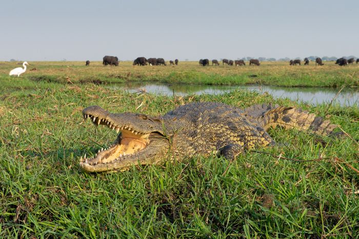
A crocodile on the Chobe River banks in Namibia's Eastern Caprivi region (Copyright © James Weis).
There are several small national parks in the Caprivi/Zambezi: Bwabwata National Park, Mudumu National Park, and Nkasa Rupara (Mamili) National Park. None of these parks are often visited, mostly because of the lack of development and actual protection they have been afforded in the past. Khaudum National Park lies just to the west, but is not technically within the Caprivi Region.
At the far eastern end of the region lies the Zambezi Floodplain, a rich and mostly pristine wetland where the Chobe and Zambezi Rivers meet. The floodplain becomes seasonally inundated with water, and boating in this water wonderland at that time is an incredible experience.
Elephants on the Kuando River in Bwabwata National Park, Namibia.
There are safari lodges in the Zambezi wetland, both along the Chobe River, which offers excellent wildlife viewing from a boat, as well as some lodges specializing in fishing, located further to the north along the Zambezi River. Multi-day houseboat stays are another excellent way to experience the Zambezi Wetland.
Birding is outstanding all year, with thousands of waterbirds like herons, egrets, kingfishers, fish-eagles and more. Wildlife in the region is also abundant, with elephant, red lechwe antelope, buffalo, hippo, crocodile, and many more species.
Scenic river view in Bwabwata National Park, Caprivi region, Namibia.
Bwabwata National Park
Bwabwata National Park is located along the Caprivi's narrow 'central' section that separates Botswana and Angola and between the Cubango/Okavango River in the west and the Cuando/Kwando River in the east. This region has been the site of civil war fighting and rampant poaching, going back to the 1960s and has never received appropriate national park protection.
The middle section of Bwabwata is classified as a "Multiple Use Area" and wildlife viewing here is lacking, but the Core Areas located along the rivers on the eastern and western sides offer rich wildlife habitat and have healthy wildlife populations and excellent bird life. Elephants are common and other herbivores like buffalo, reedbuck, waterbuck, sable antelope are also seen regularly.
The area around the Kwando River on the eastern end is the best location for wildlife, with additional species including giraffe, greater kudu, lion, cheetah, spotted hyena, and African wild dog.
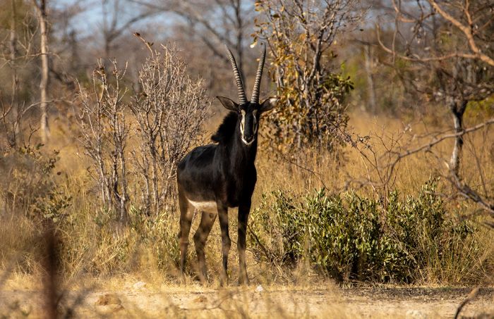
A sable antelope in Bwabwata National Park.
Mudumu National Park
Further south along the eastern banks of the Kwando River is the small Mudumu National Park. The park was subject to heavy poaching in the 1990s, but wildlife in Mudumu is now recovering and commonly seen species include elephant, zebra, buffalo, red lechwe, impala, blue wildebeest, hippo, crocodile and more. Birding is excellent along the Kwando River.
Elephants in Mudumu National Park, Namibia.
Nkasa Rupara (Mamili) National Park
Furthest south in the Caprivi is Nkasa Rupara National Park. Previously named Mamili, the park protects Namibia's largest permanent wetland area, which is also known as the Linyanti Swamp or Linyanti Marsh. This wetland is created by the south-flowing Kwando River as it fills a trough, which empties to the east as the Linyanti River.
The Nkasa Rupara wetland is beautiful, pristine, and very similar to permanently flooded areas further south in Botswana's Okavango Delta. Wildlife is abundant, with elephant, hippo, crocodile, puku, red lechwe, reedbuck, greater kudu and m any others. Birdwatching here is superb, particularly for waterbirds like herons, egrets, and fish-eagles.
Read full details on the Caprivi/Zambezi Region here.
Great white pelicans in Nkasa Rupara National Park.
NamibRand Nature Reserve
Bordering the Namib-Naukluft National Park and to the east of Sossusvlei is the NamibRand Nature Reserve. The reserve covers 810 square miles (2 100 sq kms) of desert grassland, with dunes, mountains, rocky hills, gravel plains, and wide stretches of grassy plains.
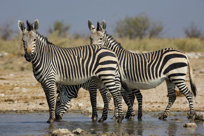
The NamibRand offers some of the best desert-adapted wildlife viewing in all of Namibia, with Hartmann's mountain zebra, springbok, oryx, red hartebeest, greater kudu, black-backed jackal, spotted hyena, bat-eared fox, and more. Dryland birding is excellent in the reserve.
Zebras in the NamibRand Nature Reserve, Namibia.
There are a variety of excellent safari lodges and camps in and bordering the reserve, all of which offer diverse activities, including game drives, walking, hot-air balloon rides over the dunes, and daily outings to Sossusvlei, Deadvlei, and the towering red dunes located a short drive to the west.
Read full details on the NamibRand Nature Reserve here.
Scenic view of the landscape in the NamibRand Nature Reserve, Namibia.
Waterberg Plateau National Park
Located east of Damaraland, in north-central Namibia, The Waterberg Plateau National Park protects a spectacular sandstone plateau spanning 30 miles (50 kms) in length, 10 miles (16 kms) in width, and rising 820 feet (250 meters) above the surrounding plain.
Activities in Waterberg Plateau include game drives to see the park's wildlife, as well as excellent hiking. Organized multi-day hikes are offered, but there are also various hikes that can be accomplished in less than a day. The park is home to a good variety of mostly reintroduced wildlife, including both black and white rhino species, various antelope species, giraffe, buffalo and more. Birding in the park is very good.
Read more about Waterberg Plateau National Park here.
Spectacular vista in the Waterberg region of Namibia.
Kaokoland
Kaokoland lies just inland and east of the Skeleton Coast and is a land of gravelly sand desert, rugged mountains, and sparse scrub vegetation. The indigenous Himba people survive here, maintaining their ancestral traditions, as do some desert-adapted wildlife.
Elephants survive in this arid region despite the lack of much water, living in small herds and traveling long distances to find food and water. The other common species living in Kaokoland is the black rhino, which is almost perfectly suited for the environment, feeding on plants that are toxic to most other animals and gaining their needed water intake from these succulent desert plants.
There are only a few lodges here, but the experience is well worth a visit.
A desert-adapted elephant in the Kaokoland region of Namibia.
Okonjima Nature Reserve
This reserve is home to AfriCat, a conservation initiative that provides a refuge for Namibia's native predators in a natural habitat. Wildlife includes leopard, cheetah, brown hyena, and plenty of herbivorous species. Ongoing research projects on leopards, pangolins, and brown hyena are conducted on the reserve. A lodge offers accommodation and safari activities.
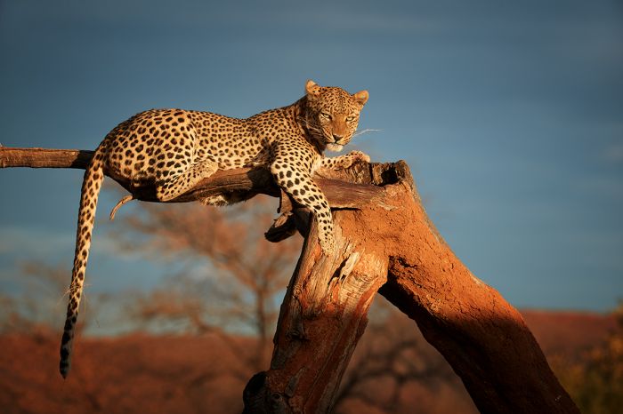
A leopard in repose on a dead tree in the Okonjima Nature Reserve, Namibia.
Naukluft Mountain Zebra Park
Naukluft Mountain Zebra Park adjoins the eastern border of the Namib-Naukluft National Park and was originally created as a sanctuary for its population of Hartmann's mountain zebras. The park does not have any permanent accommodation, but there are camping sites and several well-marked hiking trails, making it a great destination for self-sufficient travelers.
The Naukluft Zebra Park was created to protect Hartmann's mountain zebras.
Dorob National Park
Located directly south of Skeleton Coast National Park on the Atlantic Ocean coast, Dorob National Park, continues south for another 990 miles (1 600 kms), where it connects with the Namib-Naukluft National Park at the coastal town of Swakopmund. Together, these three national parks protect the entirety of Namibia's Atlantic coast (except for a small area around the towns of Swakopmund and Walvis Bay).
Previously called the Walvis Bay Reserve, Dorob was proclaimed a national park in 2010. Dorob means 'dry place', and the park is essentially a continuation of the Skeleton Coast landscape, with a narrow belt of coastal dunes and gravelly plains. The Omaruru River bisects the park, flowing west into the Atlantic Ocean at the small town of Henties Bay.
The Cape Cross Seal Reserve, which protects one of the largest colonies of Cape fur seals, is the most popular destination in Dorob.
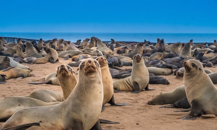
The Cape Cross Seal Reserve in Dorob National Park, Namibia.
Bird life is prolific along the coast in Dorob, with many species including terns, grebes, oystercatchers, plovers and gulls nesting and feeding along its lengthy shoreline.
The towns of Walvis Bay and Swakopmund are both located just south of the park and are the most popular places to find accommodation. Driving to the Cape Cross seal colony is very easy from either town, taking around 90 minutes from Swakopmund and another 30 minutes from Walvis Bay. The scenery is spectacular, so add time for obligatory stops to enjoy the views and do some photography.
Desert and mountains in Dorob National Park, Namibia.
/Ai-/Ais-Richtersveld Transfrontier Park
In 2003, Namibia's Hot Springs Game Park and South Africa's Richtersveld National Park were combined into a single transfrontier park called /Ai-/Ais-Richtersveld Transfrontier Park.
The Namibian side of the transfrontier park is best known for the Fish River Canyon, which is the largest canyon in Africa and Namibia's second-most visited tourist attraction, as well as the Hot Springs, for which the park was previously named.
Desert landscape in the /Ais/Ais-Richtersveld Transfrontier Park, Namibia.
Fish River Canyon
The world's second largest canyon (after the Grand Canyon in the USA), Fish River Canyon is 100 miles (160 kms) long, up to 17 miles (27 kms) wide, and reaches a depth of 1 800 feet (550 meters) in the inner canyon. It is one of the most impressive settings in Africa and can easily be visited on a day trip from Keetmanshoop.
Hiking is the main activity in the canyon, and the five-day, 53-mile (85-km) Fish River Hiking Trail is a spectacular adventure and one of Southern Africa's best trails. The route is open from 15-April to 15-September and only one group per day is permitted, so book in advance.
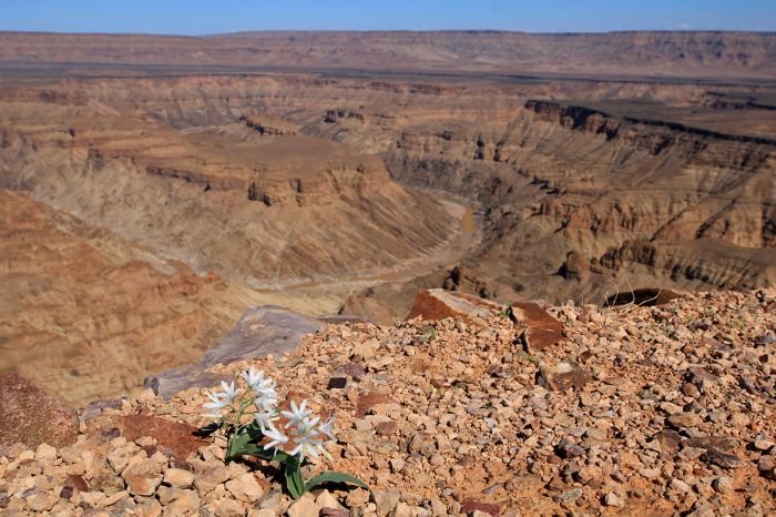
Lilies in bloom at the edge of the Fish River Canyon, /Ai-/Ais-Richtersveld Transfrontier Park, Namibia.
/Ai-/Ais Hot Springs
The other major attraction on the Namibian side of the park is the /Ai-/Ais Resort and its mineral hot springs. The natural hot springs emanate from beneath the Fish River and were reportedly discovered by a nomadic Nama shepherd in the 1850s. The springs became a national monument in 1964 and a conservation area in 1969. The water of the springs has an average temperature of around 140°F (60°C) and is pumped into a series of indoor and outdoor pools and jacuzzis.
The South African side of /Ai-/Ais-Richtersveld is mainly used as the homeland of the Nama people, who continue to live in their traditional style, grazing their livestock and making use of this fragile ecosystem. The region just south of the South African portion of the park is also part of the 'Richtersveld Cultural and Botanical Landscape' and was declared an UNESCO World Heritage Site in 2007.
View over the dry Fish Riverbed near the /Ais-/Ais Hot Springs, Namibia.
Language / Naming Notes
The name '/Ai-/Ais' means 'hot as fire' or 'scalding hot', in the Khoekhoe language. The Khoekhoe language is also known by other ethnic names (Nama, Damara, and formerly as Hottentot) and is the most widespread of the non-Bantu languages in Southern Africa. It is primarily spoken in parts of Namibia, but also in the Central Kalahari region of Botswana.
The Khoekhoe language makes heavy use of 'click consonants' and the written form of this language uses International Phonetic Alphabet (IPA) symbols (in this case the '/' symbol) to denote the clicking sound.
The Orange River, which is the border between Namibia and South Africa, flows through the /Ais-/Ais-Richtersveld Transfrontier Park.
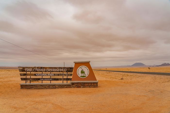
Tsau //Khaeb (Sperrgebiet) National Park
The southernmost of Namibia's contiguous Atlantic Ocean coastal national parks is Tsau //Khaeb. The park covers a massive 8 422 square miles (21 812 sq kms), spanning from the Orange River and South African border in the south to Lüderitz town in the north and includes a small coastal piece of land extending some 45 miles (72 kms) north of Lüderitz.
In 1908, alluvial diamonds were discovered on the beach near the small town of Lüderitzbucht (now called Lüderitz), in the German colony of South West Africa (present-day Namibia). Over the ensuing few years, rich deposits of diamonds were discovered along the Atlantic Ocean south from Lüderitz Bay to the Orange River at Oranjemund, where loose diamonds could be found on the beach or on the ocean floor just offshore.
Tsau //Khaeb National Park is still mostly off limits to tourism.
Prospectors rushed to the region in droves (the great 'diamond rush') hoping to get rich quickly and within six months, the German authorities created a restricted diamond mining area known as the 'Sperrgebiet' (meaning "Prohibited Area") to allow the Deutsche Diamantengesellschaft, or German Diamond Company, unrestricted access to the suspected enormous diamond deposits in the area.
When South Africa was given administrative control of South West Africa after World War I, the diamond mining operation was taken over by the DeBeers Company. In 1990, The Namibian government purchased a 50% share of the operation and diamond rights from DeBeers.
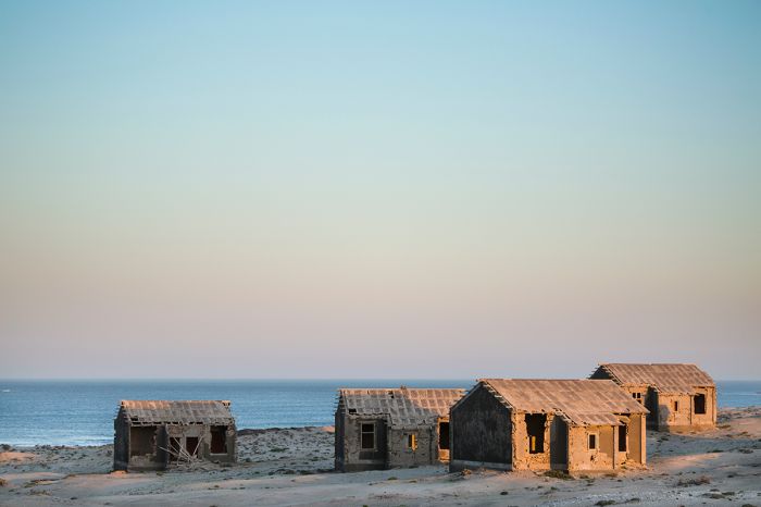
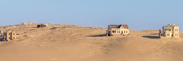
Elizabeth Bay ghost town is just south of Kolmanskop in Tsau //Khaeb National Park, Namibia.
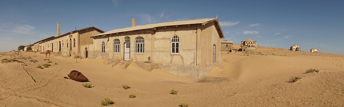
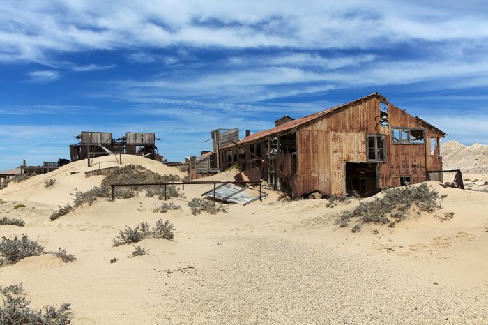
In 2008, Sperrgebiet was converted into a national park (renamed as Tsau //Khaeb), covering a vast area of the Namib Desert. The park and region are mostly undeveloped and remains inaccessible to visitors except for the small section occupied by abandoned diamond mining towns, including Kolmanskop, Elizabeth Bay, Baker's Bay, Pomona, and Bogenfels.
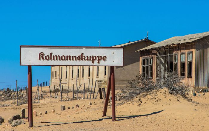
Kolmanskop is by far the most popular and picturesque of the diamond rush ghost towns, but visiting requires a special permit and a nationally certified guide. Visitor restrictions are in place partly to protect the environment, but primarily because there are still lots of diamonds in the area.
Pomona is one of several diamond-mining ghost towns in Tsau //Khaeb National Park, Namibia.
Security is very tight, with visitors and diamond workers searched by guards and scanned by X-ray machine on the way out. To prevent smuggling of diamonds in vehicles, no piece of equipment that enters the mining area is ever permitted to leave. Every truck and digging machine used in Sperrgebiet since the 1920 has remained inside.
The many years of protection afforded this vast region, of which only around 5% is used for diamond collection, had made it one of the most pristine and untouched places in Africa. Wildlife like springbok, oryx, and brown hyena live here with complete protection and have done so for over a century. Then coastal beaches in Tsau //Khaeb are home to colonies of Cape fur seals numbering over 500 000 individuals, which is roughly one-half the world population.
It is expected that portions of Tsau //Khaeb will become available to tourism in the future.
One of the long-abandoned homes at Kolmanskop, in the Tsau //Khaeb National Park, Namibia.
Khaudum National Park
The wild and remote Khaudum National Park is located on northern Namibia's eastern border with Botswana and is dominated by dry woodland and savanna atop Kalahari sand. The park is seldom visited, but offers good wildlife and a true wilderness setting.
Animals commonly seen include elephant, tsessebe, blue wildebeest, greater kudu, eland, and others. African wild dog are known to frequent the park, and Kahudum is the best place in Namibia to see these interesting predators.
Read more about Khaudum National Park here.
Elephants in Namibia's Khaudum National Park.
Mangetti National Park
Proclaimed in 2008 and covering only 162 square miles (420 sq kms), Mangetti National Park is located in far northern Namibia in the remote eastern Kalahari woodlands, due west of Kahudum National Park and along the road south from Rundu town.
Like Khaudum to the east, Mangetti is characterized by woodlands and vegetation growing on Kalahari sands, with Acacia, Terminalia, and Combretum species common. Wildlife in the park includes dryland antelopes like sable, greater kudu, gemsbok, blue wildebeest, eland, and duiker. African wild dogs move in and out, and resident predators include leopard, and caracal. Elephant are sometimes seen.
Previously the site of a private game park and breeding site for endangered species, the park is still not open to tourists and needs further development before it can be recommended as a safari destination.
Eland are one of the antelopes that live in Mangetti National Park, Namibia.
Lüderitz and Kolmanskop
Following the discovery of a single diamond near Angra Pequeña (present-day Lüderitz) in April 1908, German prospectors arrived in droves and the 'diamond rush' began. A town grew up around the little harbor and by 1912, the boom town of Lüderitz had 1 100 inhabitants, plus a substantial population of indigenous people.
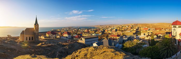
The town of Lüderitz on the southern coast of Namibia.
Facing "diamond madness" spiraling out of control, Germany intervened and in September 1908, it declared the 'Sperrgebiet' (German, meaning "Prohibited Area") extending from Lüderitz in the north and all the way south to the Orange River, which is the border with South Africa. This 'Forbidden Zone' (also called Diamond Area 1) extended around 60 miles (100 kms) inland and independent prospecting was henceforth prohibited. Multiple mining companies were formed by the prospectors and commerce was fast and furious for many years.
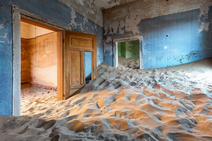
The original miners grew wealthy and an additional settlement was built 10 kms away to house the diamond mining community. The village was called Kolmanskop (named for a transport driver named Johnny Coleman) and it was constructed using an architectural style to resemble a German town. It had all the luxuries of a wealthy German town, including a ballroom, theatre, casino, ice factory, skittle-alley, power station, school, hospital, and the southern hemisphere's first x-ray facility.
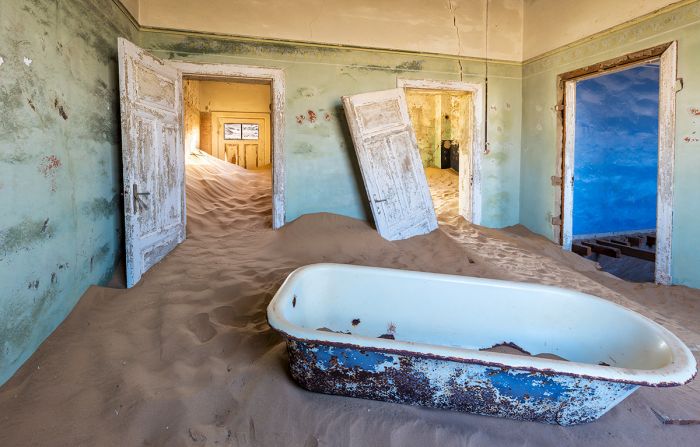
Abandoned home in the ghost town of Kolmanskop.
After World War II, the diamond fields were mostly depleted and by the 1950s, the entire area was declining. Kolmanskop's last inhabitants left in 1956 and the sand dunes have been encroaching on the abandoned town ever since. Today the ghost town of Kolmanskop is a popular tourist destination, especially with photographers. The arid conditions have kept the town's structures from disintegrating.
Lüderitz is also a popular tourist town, with German architecture and coastal wildlife as the main attractions.
The old diamond-mining town of Kolmanskop.
The Sperrgebiet, off limits to the public for most of the 20th century, was declared a national park in 2008. The reserve is one of huge diversity and encompasses the northern portion of the Succulent Karoo biome, extending up from South Africa. The park includes vast dune fields and a diverse range of well preserved flora and fauna, owing to the minimal human intervention over the last 100+ years. The park was recently renamed Tsau //Khaeb National Park.
Kolmanskop is a ghost town in Namibia.
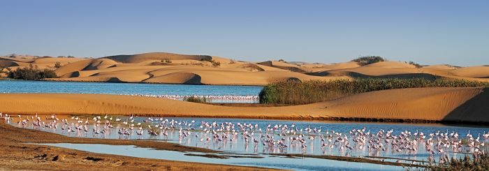
Sandwich Harbour
Sandwich Harbour is a natural lagoon situated on the Atlantic Ocean coast some 34 miles (55 kms) south of Walvis Bay. The harbor was once used by whalers and fish processors for its access to fresh water, but is today a protected wetland.
The northern part of the harbour is comprised of a tiny wetland area fed by freshwater springs on its northern side, and tidal mudflats covering around 8 square miles (20 sq kms) on its southern side. Sandwich Harbour is considered to be the most important wetland for waterbirds in southern Africa, with counts exceeding 300 000 birds in some years.
Greater and lesser flamingos at the Sandwich Harbor wetland, Namibia.
Shorebird densities at Sandwich Harbour exceed 7 000 birds per square km, amongst the highest recorded in the world. The most common birds include flamingos, terns, sandpipers, stints, cormorants, plovers, turnstones, sanderlings, and gulls.
The dunes at Sandwich Harbour disappear into the sea and driving along the beach in a 4x4 vehicle is a wondrous experience. The views here are impossibly beautiful, with the towering dunes looking over the blue ocean surf.
Driving along the beach at Sandwich Harbour, Namibia.
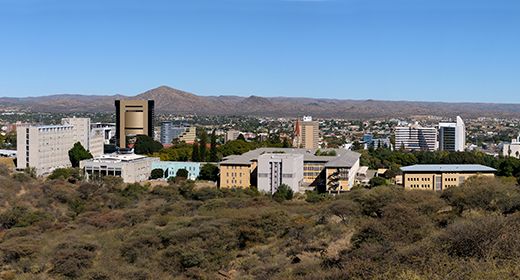
Windhoek
The capital city of Namibia, Windhoek is the main entry point for international flights, which arrive at Hosea Kutako International Airport (WDH), located 28 miles east of the city. Situated in the center of the country, most tours of Namibia start and end in Windhoek.
First settled by the Oorlam people in 1840, the Germans used the location for its colonial garrison, building the Alte Feste (Old Fortress) in 1890, which served as the headquarters for the Stutztruppe. Today, Windhoek is Namibia's most populous city, but has a modest population of only 330 000.
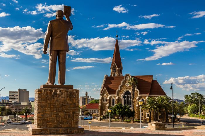
Statue of Sam Nujoma, Namibia's first president in Windhoek.
Windhoek is not considered a primary destination and most tourists spend at most one night before heading off to various parts of the country and perhaps another night at the back end of the trip.
For those that have a day or two to spend in the city, there is lovely architecture, various craft markets, and some museums. The Daan Viljoen Game Reserve is located only 11 miles (18 kms) west of Windhoek and offers hiking and good game viewing (no dangerous animals like lion, elephant, or buffalo).
Read full details on Windhoek here.
Parliament building (also called Tintenpalast) in Windhoek, Namibia.
Swakopmund
Namibia's only ocean-front resort town, Swakopmund is a very popular destination, with lots to see and do. The town was built by the Germans in the late 1800s and it has a distinctly European charm, with beautiful colonial architecture, palm-lined streets, sidewalk cafés, and a beachfront promenade.
The town is nestled in between the Atlantic Ocean and the extensive 'sea of sand dunes' that make up a large portion of the Namib Desert, that stretches inland and far to the south along the coast.
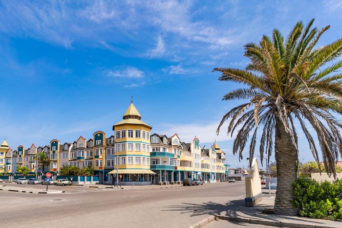
Colorful buildings and palm trees in Swakopmund, Namibia.
Swakopmund is also known for offering adventure sports, both in and along the ocean and inland on the sand dunes. Activities include quad-biking, sand boarding, dune buggy rides, desert tours, dune hikes, and horseback riding along the beach.
Located 80 miles (130 kms) north of Swakopmund is the Cape Cross Seal Reserve, which protects the largest colony of Cape fur seals in the world. The drive from Swakopmund takes around 90 minutes, with excellent coastal views along the way and places to stop for photos.
A day tour to Welwitschia Plain, located about 30 miles east of Swakopmund, is another interesting option where one can see and learn about the unique plants of the desert, with one species that can live up to and over 1 000 years.
Read full details on Swakopmund here.
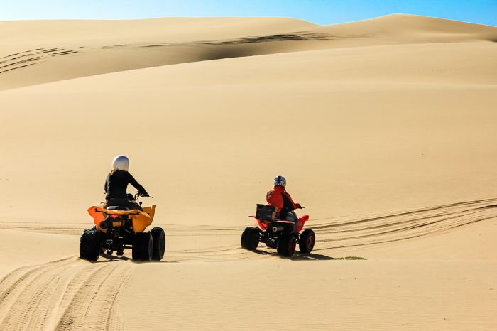
Quad biking in the dunes just outside town at Swakopmund, Namibia.
Walvis Bay
Situated only 27 miles (43 kms) south of Swakopmund is the town of Walvis Bay. Lacking the character and charm of Swakopmund, most visitors to the area choose to stay in Swakopmund, but birdwatchers may be the exception, as the Walvis Bay Lagoon offers spectacular birding.
The wetlands south and west of the town make up the natural areas of Walvis Bay Lagoon and include intertidal mud flats and the eastern side of a 6-mile-long (10-kms) sand spit called Pelican Point, which provides protection to the wetlands from the ocean swells. A saltworks is located at the southern end of the lagoon and its artificially flooded ponds are also great for birding.
Flamingos in the lagoon at Pelican Point, Walvis Bay, Namibia.
The bay is a popular tourist destination as it is a haven for an estimated 100 000 birds, including 20 000-60 000 flamingos, sandpipers, terns, plovers, avocets, grebes, sanderlings, gulls, oystercatchers, and other waterbirds.
Walvis Bay Lagoon is a Ramsar Wetland Site and a BirdLife International IBA (Important Bird and Biodiversity Area).
Read more about Walvis Bay (and Swakopmund) here.
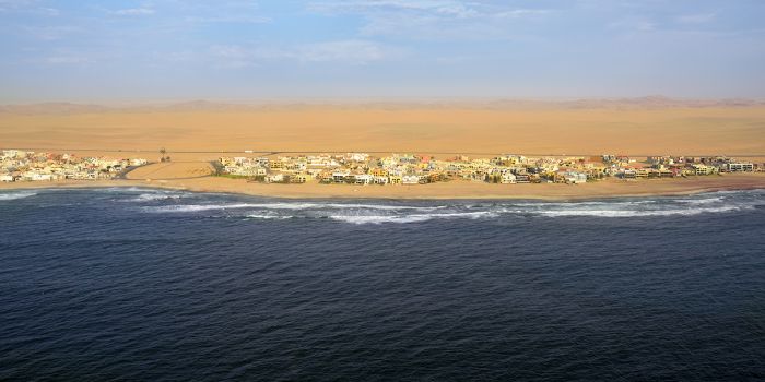
Aerial view of Walvis Bay and the dunes of the Namib Desert in the distance.
Quick Facts & Travel Tips
- The majority of Namibia has a hot, dry, desert-like climate, but destinations along the coast can be chilly in the mornings and overnight.
- English is the official language, but German, Afrikaans and indigenous languages are more widely spoken outside of tourist areas.
- The Namibian dollar (N$) is still tied to the South African Rand, a holdover from the years when the country was administered by South Africa.
- The US Dollar and Euro have consistently favorable exchange rates (10-16 to 1) versus the Namibian dollar.
- Credit and debit cards are widely accepted in the cities and at tourist destinations.
- Namibia uses 220v electricity and type D and M plug adapters.
- Namibian time is GMT+2, does not observe daylight savings time (DST); 8 hours ahead of New York (7 during DST).
- The population of the country is around 2.6 million, with ~ 326 000 in the greater Windhoek metro area
- Namibia has the second-lowest population density of any country (after Mongolia), with only 8 people per sq mile (3 people per sq km).
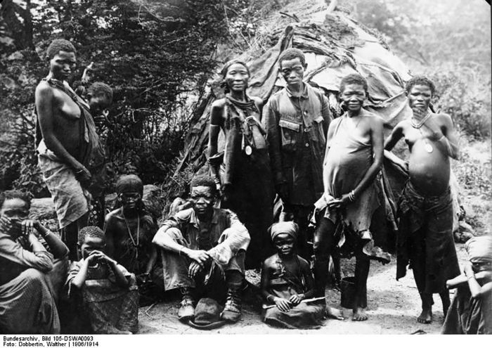
- The majority of the population are of Bantu-speaking origin. Ethnically, about half the population are Ovambo, with other major groups including the Herero and Himba, which speak a similar language, and the Damara, who speak in the "click" language of the Nama.
- Besides the Bantu majority, there are significant groups of Khoisan people, such as the Nama and San, who are decended from Southern Africa's original inhabitants. Whites make up 5-7% of the population.
- The majority of Namibian's are Christians, accounting for 80-90% of the population.
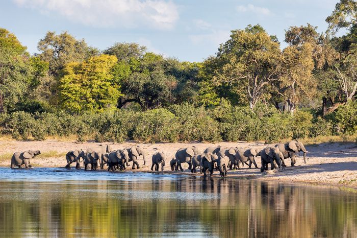
Boating safari with elephants on the Chobe River, Caprivi, Namibia.
Entry / Visa Requirements
- Citizens of USA/Canada/Australia/UK/EU visiting the Republic of Namibia for ninety (90) days or less for tourism purposes do not need visas.
- Yellow fever certificate is required only if the applicant is passing through yellow fever belt area before entering Namibia.
- Visitors must have a passport valid for six (6) months from the date of entry.
- The passport must contain at least three (3) unused (blank) pages labeled Visa when presented for entry.
- Note: Visa pages referred to above do not include pages reserved for Endorsements, Amendments or Observations.
- Parents traveling with children under the age of 18 must supply an unaltered birth certificate showing the details of both parents.
- If only one parent is traveling with the child, a legalized parental consent document signed by the absent parent must be produced.
Note: entry/visa requirements are subject to change without notice, so please check with the official government pages shown below.
Official Government Pages
- US Department of State info: click here
- Namibian Consulate - USA: click here
- Namibia Home Affairs: click here
- CDC information: click here
Dune 45 in the Sossusvlei region of the Namib Desert.
Read More...
Main: Flora, Geography, Important Areas, National Parks, Protected Areas, Ramsar Sites, UNESCO Sites, Urban Areas, Wildlife
Detail: /Ais-/Ais Hot Springs, /Ais-/Ais-Richtersveld, Bwabwata, Caprivi, Damaraland, Dorob, Etosha, Fish River Canyon, Kaokoland, Khaudum, Kolmanskop, Lüderitz, Mamili, Mangetti, Mudumu, Namib Desert, Namib-Naukluft, NamibRand, Naukluft Mountain Zebra, Nkasa Rupara, Okonjima, Ongava, Sandwich Harbour, Skeleton Coast, Sossusvlei, Sperrgebiet, Swakopmund, Tsau-//Khaeb, Walvis Bay, Waterberg, Windhoek, Zambezi
Admin: Travel Tips, Entry Requirements/Visas
Read More...
Bantu Arrivals, Basters, Decolonization, Early History, European Arrivals, German Control-1800s, German Control-1900s, Herero Uprising, Independence, Oorlam, Recent History, Sam Nujoma, South African Control
Early History
Evidence of the first known humans to have lived in present-day Namibia was discovered in the Huns Mountains (in the /Ai-/Ais-Richtersveld Park) in the form of rock art paintings. Between 1969 and 1972, a German archeologist named W. E. Wendt discovered seven quartzite slabs with paintings depicting animals in a cave he named 'Apollo 11' after the recent moon landing. These painted slabs have been dated to around 25 000 years ago (the Middle Stone Age) and are among the oldest works of art yet discovered anywhere in the world.
Early hunter-gatherer people known today as the San (a collective name for Khoisan-speaking people of Southern Africa, often grouped with the Khoekhoe), lived throughout much of present-day Namibia, Botswana, southern Angola, and parts of South Africa from very early times. The San are among the oldest cultures on Earth. San rock art at Twyfelfontein (Damaraland region of Namibia) dates back to around 6 000 years ago.
Painted stone slab from the Apollo 11 Cave in southern Namibia (photo: Wikimedia Commons).
Bantu tribes began expanding south from Central Africa into the southern African region during the period from 700 BC to 500 AD, absorbing, displacing, and mixing with the San. Sometime between 400 BC and 100 AD, some of the Bantu people in the region began using metallurgy (iron smelting to make carbon steel-based tools for farming and weapons).
Around the beginning of the first century AD, the San hunter-gatherer people were joined by pastoralists known as the Nama people, who are sometimes grouped together with the San under the broader Khoekhoe group). Like the San, the Nama language uses 'click' sounds, which distinguishes their language from that of the Bantu peoples. The Nama lifestyle involved keeping sheep, cattle, and goats, as well as foraging. Their non-native livestock was presumably acquired from early Bantu people living in the region.
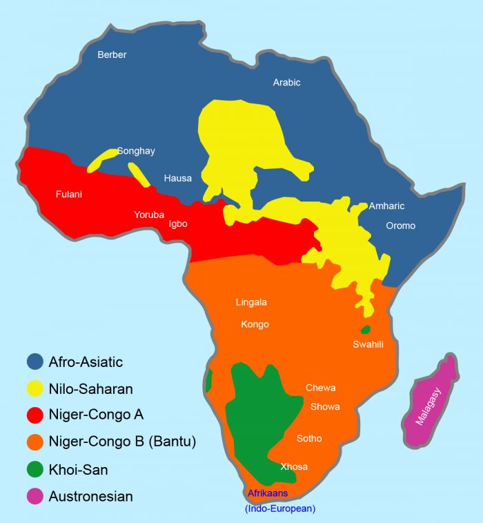
Map showing the distribution of Bantu and other African languages. The Bantu area is in orange (image: Wikimedia Commons).
A sub-group of the Nama people known as the Damara people are recognized as living in present-day Namibia from around the 9th century, using farming as a lifestyle, which is more widely accepted as being a characteristic of the Bantu people, leading some to postulate that the Damara derive from Bantu origin. Nevertheless, the Damara also speak a Khoisan language.
Today, the Nama make up the largest group of remaining Khoekhoe/Khoikhoi people, most of whom have disappeared, but for small populations surviving in Namibia and Botswana. The current name of the country and its great desert derives from the Nama word 'namib' meaning "vast place".
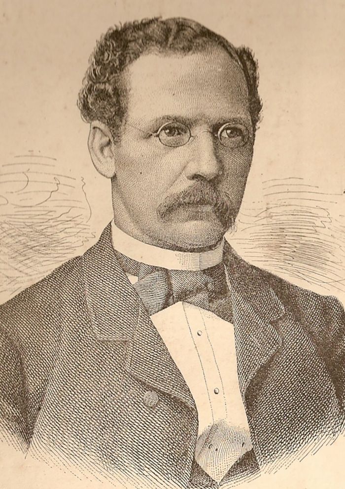
A family of Nama people from around 1906 (photo: Wikimedia Commons).
Bantu Arrivals
By around the 1500s, many Bantu people from Central Africa were arriving into present-day Namibia. These Bantu are known today as the Herero people. Oral histories describe the Bantu arriving at the Kunene River (the present-day border between Namibia and Angola) are the middle of the 16th century. The Herero were pastoralists, raising cattle and goats for milk and occasional meat, and they took up residence on the open plains of the Kaokoland region.
Note: The Himba people, who paint themselves with an ochre-colored paste and who still live in northwest Namibia today, are descended from these early Herero people. The Herero were very successful, using iron-based tools and displacing the San people from the region, expanding their cattle herds south into present-day Central Namibia.
Samuel Maharero, leader of the Herero people - 1907 (photo: Wikimedia Commons).
European Arrivals
The first known European to reach present-day Namibia was Portuguese navigator Diogo Cão, whose ship reached Cape Cross, north of present day Swakopmund, in 1485 during a two-year voyage to explore the western coast of Africa.
In 1488, Portuguese explorer Bartolomeu Dias anchored his flagship 'São Cristóvão' in what is now Walvis Bay during his expedition around the southernmost tip of Africa to find a sea route connecting Europe to Asia. The Portuguese found the coast of present-day Namibia to be far too barren to be of any practical use, so they did not stake any claim to Walvis Bay or anywhere else along the coast.
In 1652, the Dutch established a permanent refreshment station for their ships following the route between Europe and Asia at the southwest tip of the continent, which they called The Cape Colony (present-day Cape Town, South Africa).
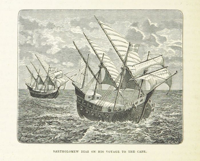
An 1887 illustration of Bartolomeu Dias' two caravels, the São Cristóvão and the São Pantaleão (Image: Wikimedia Commons).
In 1726, the Dutch West India Company sent commercial whaling boats to the southwest coast of Africa, which had large populations of Southern Right and Humpback whales. By 1780, French, American, British, and Norwegian whalers were all killing whales off the coast and Walvis Bay, the only substantial deep water port on the coast, was utilized for processing the whales (note that 'Walvis' is the Dutch word for 'whale').
In 1793, the Dutch took possession of Walvis Bay for its strategic use as a whaling station. In 1795, the Flanders Campaign (part of the French Revolutionary Wars) saw France successfully invade and conquer Holland. The downfall of the Dutch in Europe prompted Britain to launch a military expedition against the Dutch at their Cape Colony (present-day Cape Town, South Africa). The Dutch were defeated and Britain assumed control of the Cape, as well as Walvis Bay to the north.
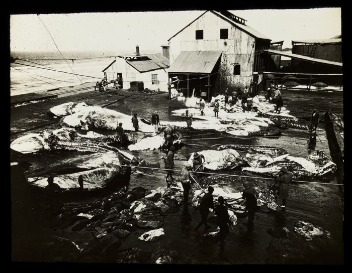
A whaling station in southern Africa, circa 1920-1930 (photo: Wikimedia Commons).
The Oorlam
By the late 1700s, Dutch settlers in the Cape were expanding rapidly north and east into the interior, including territory occupied by the native Khoikhoi people in northwestern South Africa. The settler population in the Dutch Cape Colony the early 1790s was over 13 000, plus a total slave population of nearly 15 000.
After the Cape Colony fell to the British, a Dutch exodus from the Cape occurred, as they fled the new British rule. The ousted Dutch took with them their slaves and forced servitude on the native people in the lands they conquered. These Dutch settlers became known as the 'Boers', the Dutch word for farmers.
Map of the Dutch Cape Colony in 1795 (photo: Wikimedia Commons).
By the 1830s, a mixed-race group of people known as the 'Oorlam' had developed from the descendants of the Boers and their servants, which included the native Khoikhoi people, and slaves imported from India, Mozambique and Madagascar.
In 1840, Jonker Afrikaner, the leader of the Oorlam, led a large group of his people into present-day Namibia to escape the servitude being imposed on them by the Boers. Jonker established a settlement with 1 500 Oorlam followers at present-day Windhoek. The town prospered, but after Jonker's death in 1861, many resident began to leave and by the early 1870s, the settlement at Windhoek was abandoned.
In 1878, the British began developing Walvis Bay as a stopover for their ships and by 1884, the territory around the bay was annexed into the British Cape Colony.
Jonker Afrikaner illustration from the 1861 book Lake Ngami (image: Wikimedia Commons).
The Basters
The last group of immigrants into present-day Namibia were called the Basters (also known as Baasters, Rehobothers or Rehoboth Basters). The Basters at this time were first generation descendants of White European men (mainly South African Boers) and Black African women, usually of Khoisan origin, but sometimes also slave women from the Cape that resided in the Dutch Cape Colony.
The name 'baster' derives from the Dutch word for 'bastard' or 'crossbreed', which is typically a derogatory word, but in this case, the group proudly claimed it as a new ethnic group. The Basters had a higher socioeconomic position in the Cape Colony than true slaves, and were often given supervisory roles or even treated as members of a white family.
In the early 18th century, some Basters owned farms in the Colony, but growing competition for land amongst the whites and the pressure of race discrimination eventually led to the oppression and ousting of the Basters. Some ultimately joined the 'Coloured' (also mixed-race) servant class, but some sought independence and moved to the frontier of settlement.
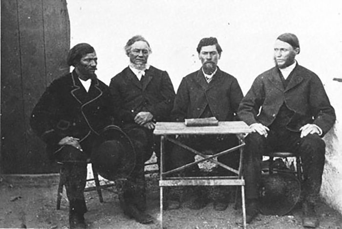
The first council of the Rehoboth Basters 1872 From left to right: Paul Diergaardt, Jacobus Mouton, Hermanus van Wijk, and Christoffel van Wijk. On the table lies the Rehoboth Constitution (photo: Wikimedia Commons).
In 1868, a group of around 90 Baster families living on the northern fringes of the Cape Colony crossed the Orange River (the southern border of present-day Namibia) in search of new lands to settle. The immigrants ended up choosing the high plateau in what is today Central Namibia in a place they called Rehoboth, located 55 miles (90 kms) south of Windhoek.
The Rehoboth Basters established a community called the Free Republic of Rehoboth (Rehoboth Gebiet) with their own constitution and a German-influenced national flag. Families from the Cape Colony continued to join the new settlement in Rehoboth and the community numbered 800 by 1876. The Rehoboth economy was mainly based on managing herds of cattle, sheep, and goats.
The Basters Current History
Upon the country's independence in 1990, Namibia's new ruling party, the South West African People's Organisation (SWAPO) announced it would not recognize any special legal status for the Baster community. The current Baster population in Namibia is believed to be around 35 000 to 40 000. Baster politicians and activists have called the present-day Namibian government's policies oppressive towards their community.
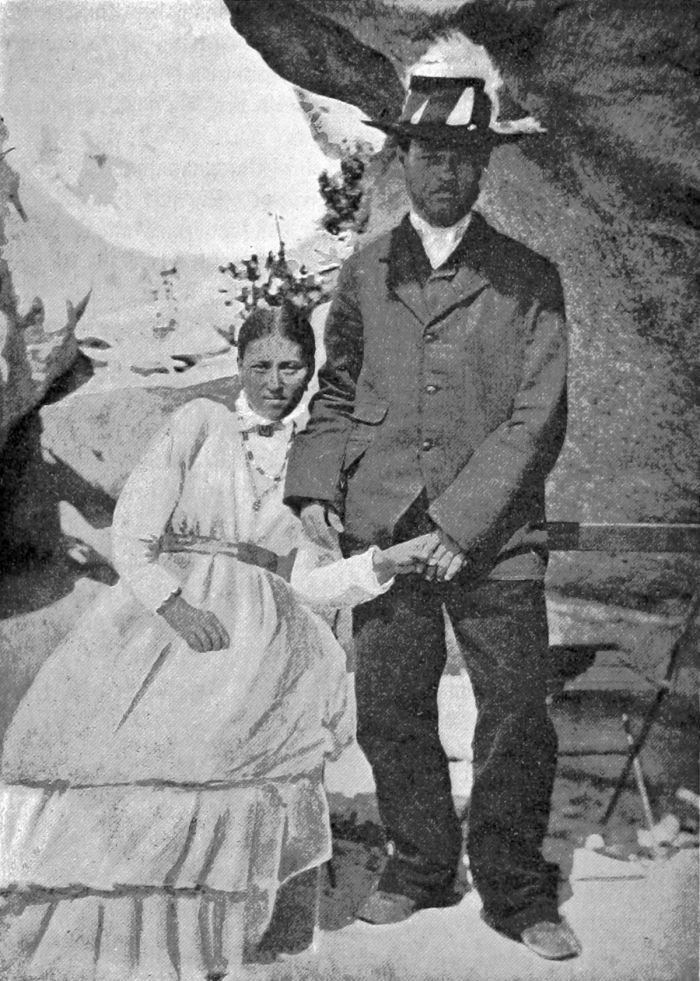
A Rehoboth Baster couple circa 1896 (photo: Wikimedia Commons).
German Control (Late 1800s)
In 1881, Adolf Lüderitz, a German merchant, purchased the anchorage at Angra Pequeña (present-day Lüderitz town), paying £100 in gold and 200 rifles to Josef Frederiks II, the tribal chief of the Oorlam people living at the settlement of Bethanie (present-day southern Namibia). Three months later, Frederiks sold Mr. Lüderitz a stretch of land 87 miles (140 kms) wide, extending from the Orange River to Angra Pequeña for £500 and 60 rifles.
Facing pressure from the British Cape Colony in present-day South Africa, who already controlled Walvis Bay, on 7 August 1884, German South West Africa was officially declared by the hoisting of the German flag at Angra Pequeña.
Adolf Lüderitz circa 1885 (image: Wikimedia Commons).
Lüderitz commissioned multiple expeditions into the vast lands north along the coast and inland. He purchased land from other chiefs until he owned the entire coastal strip of present-day Namibia from South Africa to Angola, an area covering some 220 000 square miles (580 000 sq kms).
In 1885, after failing to find the rich gold and mineral deposits he had hoped for, Lüderitz was forced to sell his vast land holdings to the German Colonial Society for Southwest Africa, a private enterprise of bankers, industrialists, and politicians.
In 1888 the first group of Schutztruppen, German colonial protectorate troops, arrived to protect the German colonial base at Otjimbingwe. In 1890, the entirety of what is present day Namibia (with the exception of Walvis Bay) was declared a German Crown Colony, and more troops were sent.
The present-day town of Lüderitz on Namibia's southern coast.
In July 1890, The Heligoland–Zanzibar Treaty gave Germany control of the 'Caprivi Strip', a thin finger of land extending east from the north of South West Africa, in return for giving Britain the small, but strategic island of Heligoland in the North Sea. Germany desired the Caprivi for its better access to the Zambezi River and trade routes into the interior and the Indian Ocean.
By the end of 1890, the borders of Germany's new protectorate had been established and the new colony of German South West Africa was created. The Imperial Shutztruppe established garrisons at Windhoek and Swakopmund.
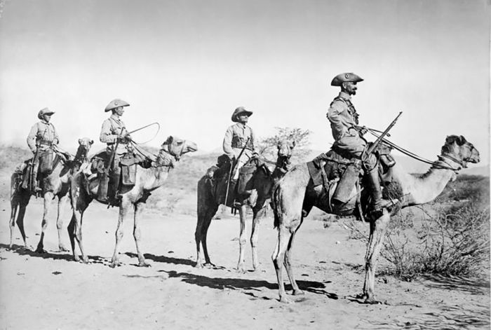
Four German soldiers in a Camel-Schutztruppe patrol, 1906 (photo: Wikimedia Commons).
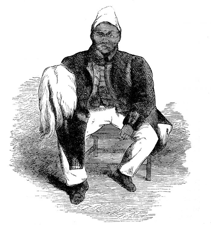
Herero / Nama Uprising (1892-1907)
By 1892-93, local opposition to German rule by the Oorlam and Nama people was building, and in 1893, the first armed uprising against the Germans was led by Hendrik Witbooi, a chief of the /Khowesin people (a sub-tribe of the Khoikhoi). Dubbed the first 'Hottentot Uprising' (Hottentot was a derogatory term used by Europeans to refer to the indigenous San and Khoikhoi people), it was the first of many local armed revolts against the Germans during 1893-94.
The progressive German claims to more and more of the Herero's land led to increasing resentment and tensions continued over the ensuing decade. In early 1904, the chief of the Herero, Samuel Maharero, appealed to the Nama (led by Hendrik Witbooi) and other tribes to join in an organized and coordinated effort to defeat the Germans.
Later in 1904, Herero tribesmen massacred some 100 German men on the area around Okahandja, which officially started the conflict. The Herero used guerrilla tactics, which were effective in preventing the Germans from using their artillery and machine guns.
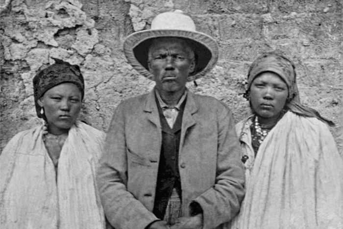
Hendrik Witbooi with family members (photo: Wikimedia Commons).
The Herero succeeded initially, taking numerous German farms and small outposts, as well as severing the railway line linking Windhoek and Swakopmund. The Germans soon sent in a ruthless General named Lothar von Trotha, who began an assault to repel the Herero, using a large number of German troops, as well as heavy artillery. Eventually the Germans pinned the Herero back to their stronghold at the Waterberg Plateau.
At the historic Battle of Waterberg on 11 August 1904, the Germans defeated the Herero troops, who outnumbered them six-to-one, but could not withstand the overwhelming German firepower. Although not an overwhelming victory, by the end of the day, the Herero had mostly scattered east into the Kalahari Desert.
In October 1904, German General Lothar von Trotha ordered his troops to kill every male Herero and drive the women and children into the desert, issuing his infamous extermination order: "Any Herero found within the German borders with or without a gun, with or without cattle, will be shot". While most of the Nama/Herero has escaped the Battle of Waterberg alive, these orders would have a different outcome.
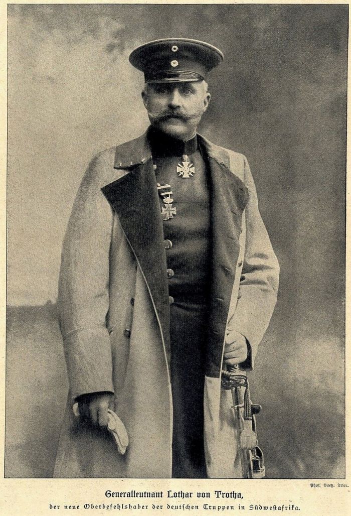
Lieutenant General Lothar von Trotha, the new commander-in-chief of German troops in South West Africa, 1904 (photo: Wikimedia Commons).
The German soldiers drove the Herero eastward into the Kalahari/Omaheke Desert lands towards British-controlled Bechuanaland (present-day Botswana). In the ensuing genocide, an estimated 50 000-100 000 Hereros, 10 000 Namas, and an unknown number of San died. Initially, a huge number of Hereros that had been forced into the arid desert perished form starvation and dehydration. Many more were captured and placed in concentration camps.
The largest of the prison camps was at Shark Island at Lüderitz. The precise number of deaths at the camp are unknown, but a report by the German Imperial Colonial Office estimated 7 682 Herero and 2 000 Nama died at all camps in German South West Africa, of which a significant portion died at Shark Island. Most died from abuse, disease, and exhaustion. Shark Island was operational between 1905 and April 1907.
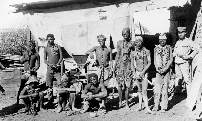
Prisoners from the Herero and Nama tribes during the 1904-1908 war against Germany (photo: Wikimedia Commons).
Despite German patrols and a large bounty offered for his capture, Samuel Maharero and some 1 000 of his men successfully crossed the Kalahari Desert into the Bechuanaland Protectorate, where he was given asylum by the British.
For the next several years, the Nama groups continued to wage effective guerrilla war against the German colonial forces, using the desert for their bases, where the German artillery could not follow. In 1905, Hendrick Witbooi was killed in action and by 1908, the remaining Nama surrendered their fight, asking for peace.
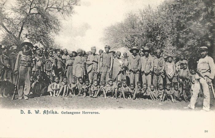
Deutsch-Südwestafrika (German South West Africa) postcard showing captured Hereros during the uprising (photo: Wikimedia Commons).
German Control (Early 1900s)
After the Herero uprisings had been put down, stability returned to South West Africa and this led to a growth in German settler immigration to the colony. New settlers were given large landholdings in the most productive areas for farming. European immigrants became prosperous, while local Namibians became increasingly marginalized and used mainly as a source for labor in the growing towns.
The railway, which had been opened in 1902 connecting Windhoek and Swakopmund, was expanded between 1905-1908 to include a route from Windhoek to Aus and then to the southern coast. Zacharias Lewala, a railway employee working on the new line discovered a diamond at Grasplatz Station (just east of present-day Lüderitz), triggering a diamond rush to the area. The huge influx of prospectors to the area led to the development of the mining settlements of Lüderitz, Kolmanskop, and others.
The colony and its settlers thrived through the next several decades, until the outbreak of World War I.
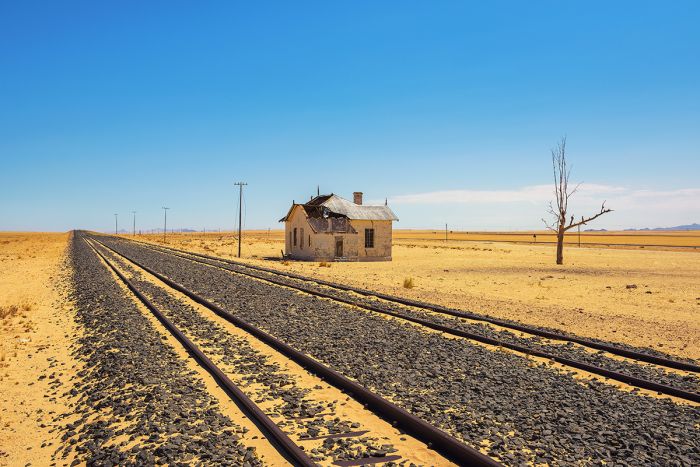
The old Garub Railway Station just east of Lüderitz.
South African Control (Post-World War II)
After World War I ended and with Germany on the losing side, a United Nations mandate granted control of South West Africa to Britain, with the agreement that it become a 'Trust Territory' with South Africa acting as its administrator. The Caprivi Strip was incorporated into Bechuanaland (but was returned twenty years later).
Over the following several years, a large number of settlers from South Africa were given land in the new Trust Territory of South West Africa, with the native population becoming more and and more restricted to areas that were unsuitable for farming by the new immigrants.
In 1947, South Africa announced its intention to the United Nations that it planned to annex South West Africa, but the UN opposed this idea. South Africa essentially ignored the UN in this regard, and exploited the territory and its people as it saw fit.
In the late 1940s, South Africa began implementing apartheid policies at home and in South West Africa. Forced racial segregation in Windhoek began in 1959.
Map showing planned ethnic segregation of Namibia into Bantustans or Homelands, by the ruling South African government, 1964 (image: Wikimedia Commons).
Decolonization (1960-1988)
During the late 1950s and early 1960s, movements striving for self-determination and decolonization began forming in colonial Africa. Nationalist organizations in South West Africa included the South West African National Union (SWANU) and South West African People's Organisation (SWAPO), which both made efforts towards an independent country.
Between 1961-68, the United Nations attempted to cancel South Africa's trusteeship over South West Africa, but these legal efforts were unsuccessful.
In 1966, SWAPO launched an armed insurgency, with material assistance coming from the Soviet Union and China, that escalated into what has been called the South African Border War or the Namibian War of Independence. The fighting between the South African Defence Force (SADF) and the People's Liberation Army of Namibia (PLAN), an armed wing of SWAPO, was some of the most intense on the continent since World War II. The conflict became closely intertwined with the Angolan Civil War.
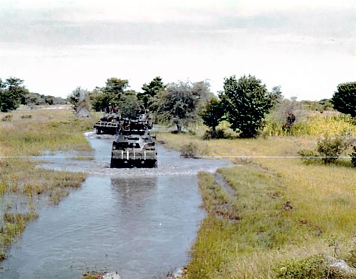
South African armoured column in Ohangwena, Ovamboland, 1975; Columns of vehicles like these were the primary target for PLAN ambushes and mines (photo: copyright © Sam van den Berg / Wikimedia Commons).
In 1968, the United Nations declared that South Africa's occupation of South West Africa was illegal and it changed the country's name to Namibia. Attempts by the UN to apply economic sanctions against South Africa failed however, largely because Western country members of the UN Security Council vetoed such efforts in order to protect their investments in multinational companies operating in the territory.
In 1975, Angola became an independent country and it provided support to SWAPO, allowing the freedom fighters a safe refuge to the north.
Between 1975 and 1988 the SADF staged raids into Angola and Zambia to eliminate PLAN's forward bases. The fighting resulted in Angolan casualties and severe collateral damage to the Angolan economy. In 1984, the Soviet-backed People's Armed Forces of Liberation of Angola (FAPLA) began confronting the SADF with the assistance of thousands of Cuban troops.
In December 1988, the South African Border War was virtually ended by the Tripartite Accord, mediated by the United States, which committed to a withdrawal of Cuban and South African military personnel from Angola and Namibia.
SADF soldiers of Troop 3 of D Squadron, October 1975 (photo: copyright © Sam van den Berg / Wikimedia Commons).
Independence (1989-1990)
The official process to initiate independence began in April 1989, with the UN Transition Assistance Group providing workers to set up 200 voting locations throughout the country to ensure a fair election. Voting took place in November 1989, with over 700 000 Namibians (97% turnout) showing up to cast their ballots.
A total of 72 members were elected to seats in the new Constituent Assembly, representing seven different political parties. SWAPO won 41 seats, but did not meet the two-thirds majority it needed to single-handedly control the Assembly, which gave the minority parties a hand in writing the country's new Constitution.
On 21 March 1990, the new Namibian flag was hoisted in Windhoek, signaling the country's independence as the Republic of Namibia. Sam Nujoma, a founding member and the first president of SWAPO, became the first President of Namibia.

Jan-Nico Scholten, Chairman of the Association of West European Parliamentarians for Action against Apartheid (left) and SWAPO leader Sam Nujoma (right) at the Apartheid Conference with South Africa held in Zambia in September 1985 (photo: Wikimedia Commons).
Nujoma Presidency (1990-2005)
One of Sam Nujoma's early achievements as Namibia's first president was to declare a policy of "national reconciliation", which was aimed at improving relations among the country's various racial and ethnic groups.
In 1990, Nujoma initiated a land reform plan, whereby land would be redistributed from whites to blacks. The redistribution process was slow, as Namibia's constitution only allowed land to be purchased from willing sellers. Furthermore, land in Namibia is quite expensive, further complicating the process. Nevertheless, by 2007, around 12% of Namibia's commercial farmland had been sold by white owners to black citizens.
On 01 March 1994, after three years of negotiations between Namibia and South Africa, the coastal enclave of Walvis Bay, as well as twelve offshore islands, were ceded to Namibia by South Africa.

Sam Nujoma in Holland, 1978 (photo: Wikimedia Commons).
1994 Elections
In December 1994, Namibia held its second ever national elections with two separate votes, one for president and one for members of the National Assembly. SWAPO won both, with 53 of the 72 seats on the Assembly and incumbent Sam Nujoma reelected as president with 76% of the votes. Mishake Muyongo of the Democratic Turnhalle Alliance (DTA) party came in second in the race for president, receiving 24% of the votes. The DTA also won 15 Assembly seats. Voter turnout was 76%.
In 1998, Nujoma brought Namibia into the Second Congo War, giving support to the Democratic Republic of the Congo's President Laurent Kabila against the 'Banyamulenge' (Tutsi rebels backed by both Rwanda and Uganda).
Kabila stated that Namibia became involved in the Congo on behalf of its commitment to the Southern African Development Community (SADC), but he was also a long-time personal friend and ally of Kabila and the SWAPO party had interests in Kinshasa, including lucrative fish export contracts and reputedly held a stake in the Miba Diamond Mining Company.

Sam Nujoma, President of (SWAPO), with Nicolae Ceausescu, President of Romania, in 1979 (photo: Wikimedia Commons).
Namibian Defense Force (NDF) personnel in the Congo numbered between 1 000 and 2 000 during 1998-2001 and it was costing the country around US $150 000 per day. Opposition parties in Namibia, the South African government, and multiple Western donors were public displeased with Namibia's involvement in the conflict. Namibia withdrew all of its personnel by 2002.
Namibia's Constitution stated that a president may serve a maximum of two consecutive terms in office, so it was expected that Nujoma would step down after the end of his second five-year term. To get around this rule, the Constitution was amended so that Nujoma could seek a third term, since for his first term, he was nominated by the members of the Constituent Assembly and not elected by direct, universal and equal suffrage.

Sam Nujoma with Joop den Uyl, Prime Minister of the Netherlands, 1977 (photo: Wikimedia Commons).
1999 Elections
In November 1999, elections national elections were held to elect the president and the National Assembly. Incumbent president Nujoma was elected for a third term, receiving 77% of the vote and the SWAPO party retaining its majority in the Assembly, winning 55 of 72 elected seats. Ben Ulenga, a former SWAPO party member and deputy minister, who left the party in 1988 to found an opposition party, the Congress of Democrats (COD), received 10.5% of the votes. The COD and Democratic Turnhalle Alliance (DTA) parties each won 7 seats. Voter turnout was 62%.
In 1999, the government defeated a secessionist attempt in the Caprivi Strip initiated by rebel group called the Caprivi Liberation Army (CLA). It strived for the secession of Caprivi Strip and formation of an independent Caprivi society.
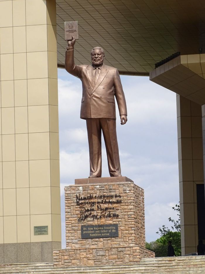
Sam Nujoma statue in front of the Independence Memorial Museum, Windhoek (photo: Wikimedia Commons).
In March 2001, President Nujoma announced that there would be a national purge of gays and lesbians, saying "the police must arrest, imprison and deport homosexuals and lesbians found in Namibia." Addressing students at the University of Namibia in Windhoek, Nujoma said "The Republic of Namibia does not allow homosexuality or lesbianism here. Police are ordered to arrest you and deport you and imprison you too."
Nujoma blamed "foreign influences" for homosexuality in Namibia, which he said threatened to destroy the nation. Although the government did not aggressively follow through on these threats to criminalize sexual diversity, Nujoma's comments have led to serious discrimination in the country against people of diverse sexual identities.
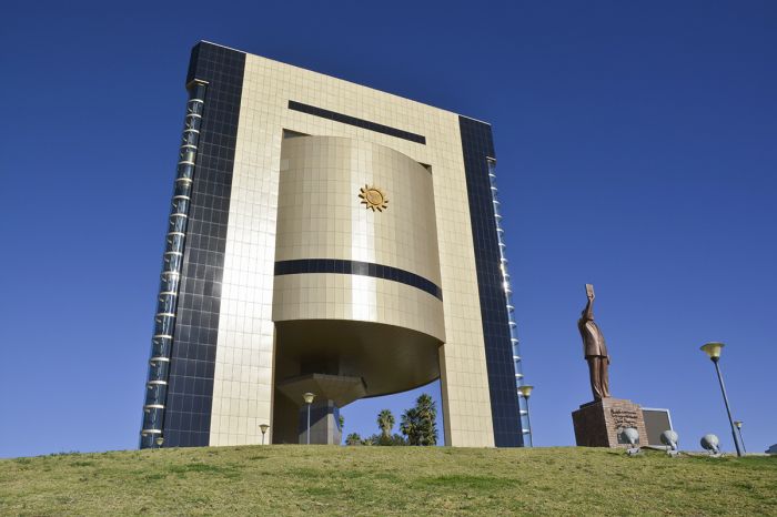
Sam Nujoma statue stands in front of the Independence Museum in Windhoek.
Recent History (2004-Present)
2004 Elections
General elections were held in November 2004 to elect the President and National Assembly. Once again, the SWAPO party was the dominant winner, with its candidate, Hifikepunye Pohamba, winning over 76% of the votes and the party winning 55 of 72 elected Assembly seats. The next closest candidate for president received just over 7% of the vote, making it a landslide victory for Pohamba, who became Namibia's second president. Pohamba had narrowly won the SWAPO Party candidacy, which required a second runoff vote, but SWAPO itself retained its dominancy over Namibian politics.
Pohamba's rise to the presidency was been partly facilitated by Sam Nujoma, who openly backed Pohamba as the SWAPO candidate. Some described Pohamba as Nujoma's "hand-picked successor".
Pohamba quickly made it known that he would focus on carefully rooting out any and all corruption in the country's government, but besides this, Pohamba's five-year term was rather unspectacular.
Leading up to the 2009 national elections, there was speculation that Nujoma would return to seek re-election as SWAPO's president in the 2007 party election, with a goal of running again for Namibian president in 2009. Nujoma eventually decided not to run, and declared he was stepping down from party leadership in favor of Pohamba. Pohamba was the sole candidate to be nominated for SWAPO president, no voting was needed within the party.
President Barack Obama and First Lady Michelle Obama greet His Excellency Hifikepunye Pohamba, President of the Republic of Namibia and Ms. Penehupifo Pohamba, in the Blue Room during a US-Africa Leaders Summit dinner at the White House, Aug. 5, 2014 (photo: Wikimedia Commons).
2009 Elections
General elections were held in November 2009, the fourth general elections since independence. Incumbent President Pohamba and his SWAPO Party were victorious, with Pohamba receiving 76% of the vote and SWAPO winning 54 of the 72 elected National Assembly seats. Twelve candidates ran for president, and Hidipo Hamutenya, a former SWAPO member, of the Rally for Democracy and Progress (RDP) party came in second, with only 11% of the votes. Voter turnout was 69%.
Pohamba's second term was unremarkable and without major incident. Having served two consecutive terms, Pohamba would be unable to run in the next elections, due to constitutional term limits. President Pohamba finished his second term with high approval ratings, being hailed as a champion for gender equality and increased focus on housing and education.
In keeping with President Pohamba's continued focus on improving the country's gender equality and in anticipation of the upcoming elections, in which Pohamba would not be allowed to run, major changes were made to Namibia's constitution regarding the makeup of the National Assembly.
The changes were significant in that women would now be required to fill one-half of the seats. Additionally, a new "zebra system" was to be in place, meaning that if a Minister of Parliament (MP / Assembly seat holder) was a woman, then the deputy minister must be a man, and vice versa.
Because the current Assembly had far more male MPs, the constitution expanded the number of Assembly seats from 78 (92 elected, 6 appointed) to 104 (96 elected, 8 appointed), to ensure that male MPs would not lose their seats as a result of the new gender equality policy. The SWAPO-controlled National Assembly approved the changes to the constitution one month prior to the upcoming general elections, against the votes of the minority opposition parties.
Detail from a Namibian bank note showing the country's first three presidents: Sam Nujoma, Hifikepunye Pohamba, and Hage Geingob.
2014 Elections
General elections were held in November 2014, the first on the African continent to use electronic voting. Nine candidates ran for president and sixteen political parties contested for seats in the National Assembly. The SWAPO party candidate, Hage Geingob was declared the winner and the third President of Namibia, with nearly 87% of the votes. In the newly expanded National Assembly, SWAPO now had 77 of the 96 elected seats.
Geingob's first term as President was not remarkable. In August 2018, Geingob was elected to a one-year term as Chairperson of the Southern African Development Community (SADC).

His Excellency Hage Gottfried Geingob, President of the Republic of Namibia (photo: Wikimedia Commons).
2019 Elections
General elections were held in November 2019 using 100% electronic voting. Eleven candidates ran for president and fifteen political parties contested for seats in the National Assembly. The incumbent president, Hage Geingob of the SWAPO party, was declared the winner to serve his second term as President. A notable change from all the prior general elections since Namibia's independence in 1990, was that the SWAPO candidate's vote share was only 56%, by far the lowest share received for a SWAPO candidate in the party's history.
It is noteworthy that if no Presidential candidate receives more than 50% in the election, a run-off will be held between the top two finishers. No previous presidential votes in Namibia have gone to a run-off.
For the first time in Namibia's history, an independent candidate, Panduleni Itula, ran for president. Itula came in second in the vote, but received an impressive 29% of the vote, mainly because two of the opposition parties, the Namibian Economic Freedom Fighters (NEFF) and the Republican Party (RP), withdrew their candidates and instead endorse Itula in hopes of removing SWAPO's two-thirds majority in the National Assembly. Esther Muinjangue of the National Unity Democratic Organisation (NUDO) was the first female presidential candidate in Namibia.
SWAPO again won a majority of the Assembly seats, winning 63 of the 96 elected seats, but narrowly missing the extra seat needed to give them a two-thirds majority, which it had held since 1994. Consequently, opposition parties gained voting power, most prominently the Popular Democratic Movement (PDM), which obtained a 16% vote share in the National Assembly.
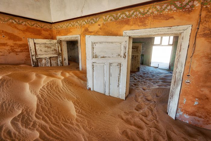
View from inside an old house in the ghost town of Kolmanskop.
Read More...
Bantu Arrivals, Basters, Decolonization, Early History, European Arrivals, German Control-1800s, German Control-1900s, Herero Uprising, Independence, Oorlam, Recent History, Sam Nujoma, South African Control
Great Good Fair Poor
- Jan
- Feb
- Mar
- Apr
- May
- Jun
- Jul
- Aug
- Sep
- Oct
- Nov
- Dec
The chart directly above should be taken as a very rough overall indicator of best times to visit Namibia, as there are variations regionally. More information on the specific national parks and reserves is found on the previous Details tab.
Click on a Region Link above to read more about best times to visit a specific region or destination.
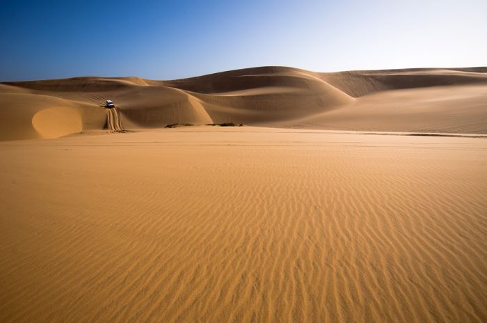
Sand dunes near Sandwich Harbor, Namibia.
Year-Round Destination
Namibia is a year-round destination, with most of the country receiving daily sunshine and little to no rain. The climate, other than the Caprivi, is classified as arid and much of the country is covered by desert-type conditions. The country has the lowest rainfall of any country in Sub-Saharan Africa.
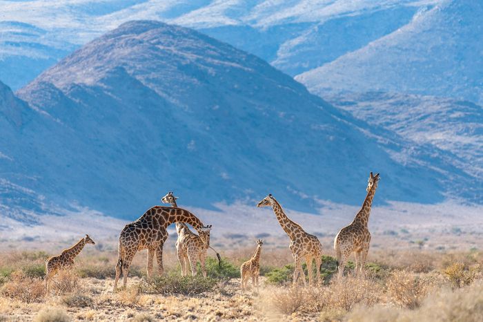
Giraffes in the Damaraland, Namibia.
The coastal region is influenced by the cold Benguela Current, which moves north and brings cold water from the southern ocean near Antarctica. This results in a much cooler climate and dense morning fog on most days, when the cool water meets the hot desert air.
The Caprivi/Zambezi experiences a climate similar to northern Botswana, with rainfall coming during the summer months of December thru March/April and cooler, dry conditions from May thru August/September. October is hot and dry.
Namibia's only real wildlife destination is Etosha. Game viewing is best during the drier winter months of May thru September, when the plentiful waterholes are the only source of water and the herds congregate to drink.
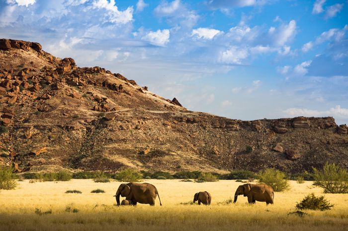
Desert-adapted elephants in Damaraland, Namibia.
Showing 1–8 of 8 results
Located in one of the best wildlife areas in Namibia in a dramatic semi-desert with mountains, ephemeral rivers, rock-strewn plains. Activities include nature drives, walking, cultural visits with local Damara farmers, and a visit to Twyfelfontein.…
Located in a remote and starkly beautiful desert setting and offering the most authentic black rhino tracking in Africa, both on foot and by vehicle under the guidance of Save the Rhino Trust (SRT) monitors.…
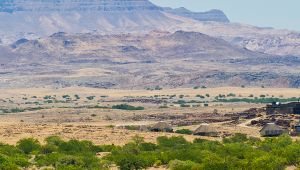
Located in a dramatic semi-desert setting, with spectacular mountains, rock-strewn plains, valleys, and dry riverbeds. Activities include nature drives, walking, cultural visits with local Doro !…
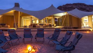
A stylish camp in one of Africa's most remote safari destinations. Explore the sand dunes, mountains, and Atlantic Ocean coastline for dramatic vistas and desert-adapted wildlife.…
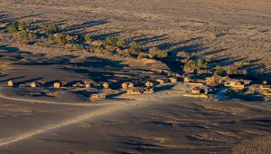
Situated in a private reserve with an exclusive-access entry to the Namib-Naukluft National Park and its spectacular desert landscapes. Nature drives, dune climbing, cycling, hot-air ballooning, and a great value.…
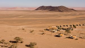
Situated in a private reserve with an exclusive-access entry to the Namib-Naukluft National Park and its spectacular desert landscapes. Nature drives, dune climbing, quad-biking, cycling, hot-air ballooning, and more.…
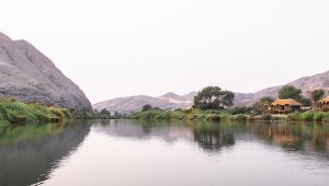
Located along a remote and untouched section of the Kunene River and surrounded by sand dunes, mountains, and valleys, the camp offers nature drives, quad biking, walking, and cultural interactions with the indigenous Himba people.…