

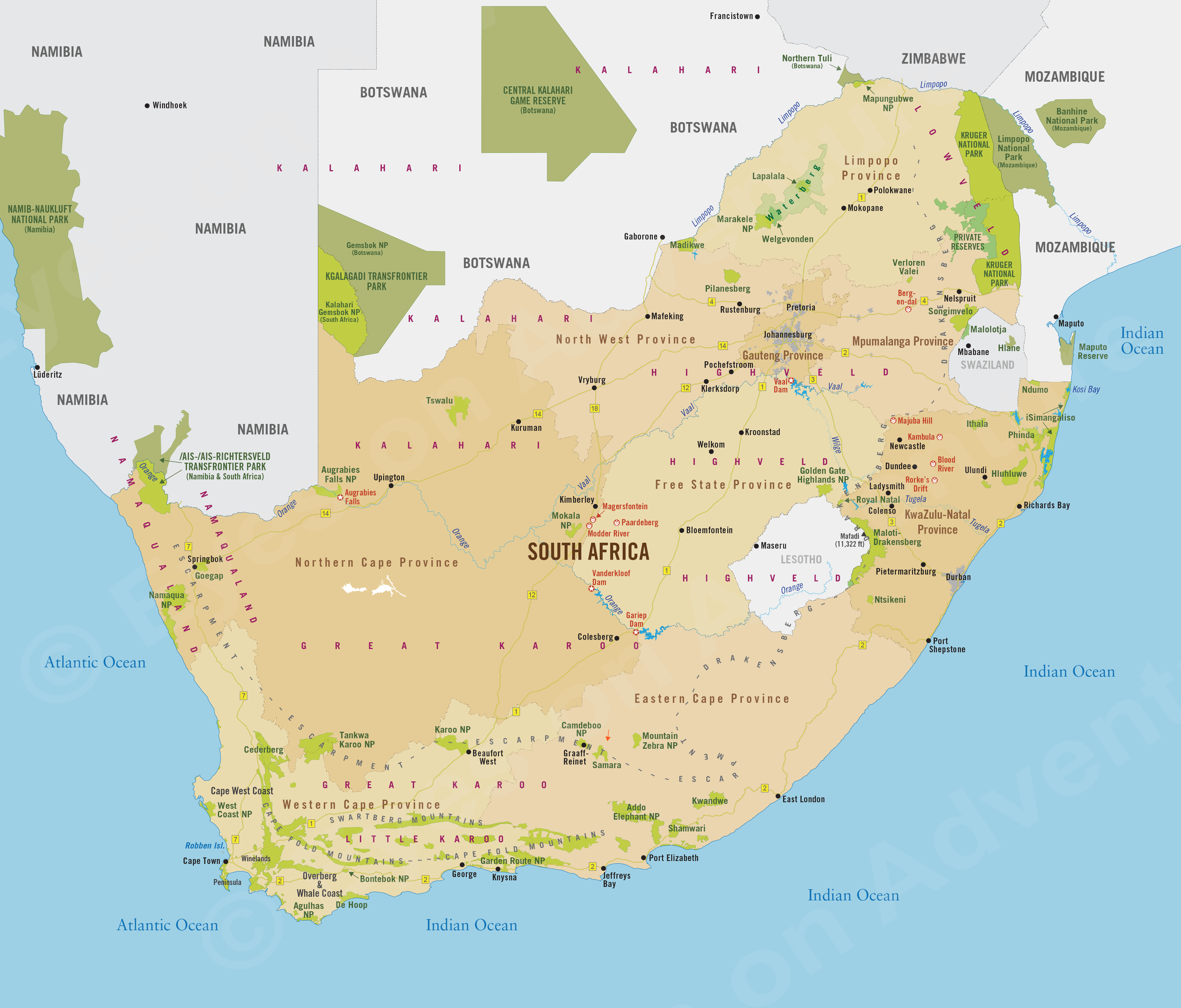
South Africa
Region Links: Cape Peninsula, Cape Town, Cape West Coast, Cape Winelands, Eastern Cape, Garden Route, Gauteng Province, Johannesburg, Kruger Park & Lowveld, Kruger Private Reserves, KwaZulu-Natal, Madikwe, Overberg & Whale Coast, Pilanesberg & Sun City, Sabi Sand Reserve
Highlights
- One of Africa's top safari destinations.
- Cape Town is Africa's most beautiful city and a true destination; don't miss it.
- The Cape Winelands offer delicious wines, great dining, and 300-year-old estates.
- The Kruger Private Game Reserves are the best place to see Africa's Big Five animals.
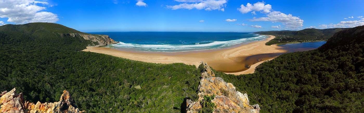
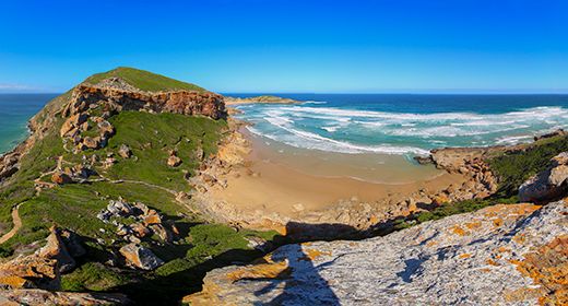
- Tour the Garden Route for its miles of coastal beauty.
- The Whale Coast and Overberg offer outdoor adventure and great whale watching.
South Africa is often referred to as A World in One Country. The country offers the most diverse experiences of any in Africa, including safaris, culture, history, adventure, winelands, mountains, miles of coastline, and more. There's no wonder it's our top destination!
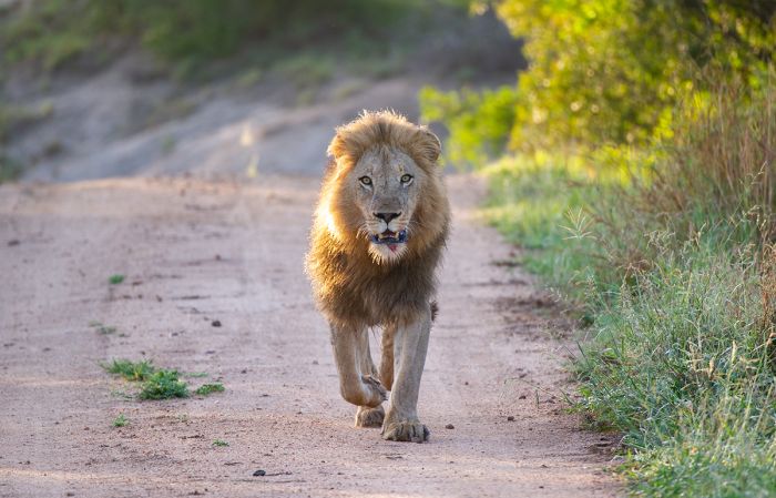
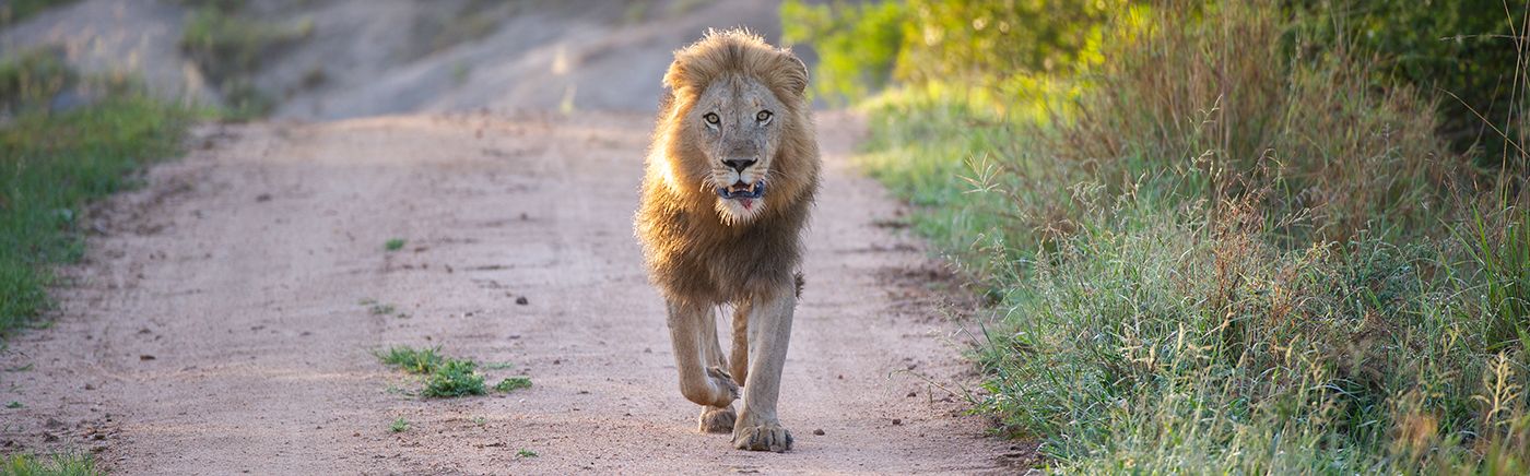
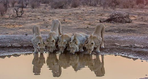
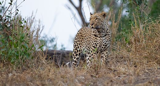
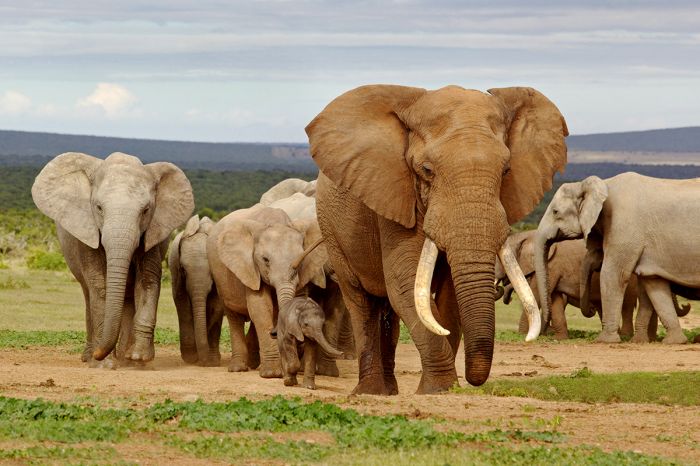
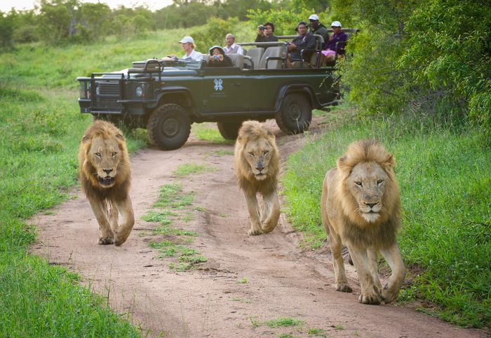
Lion in the Sabi Sand Game Reserve near Kruger National Park (Copyright © James Weis).
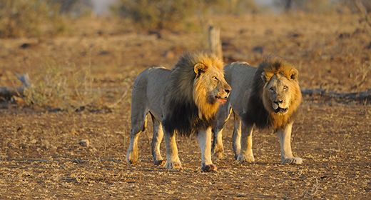
One of the top wildlife destinations in the world, South Africa can boast all of the Big Five (lion, leopard, elephant, rhino, buffalo) and the Private Reserves bordering the Kruger National Park are renowned for offering the best safari experience in Africa.
South Africa's cultural diversity derives from centuries of European and Asian influence blending with indigenous African peoples. Today there are over thirty indigenous languages spoken in South Africa, of which eleven are official languages.
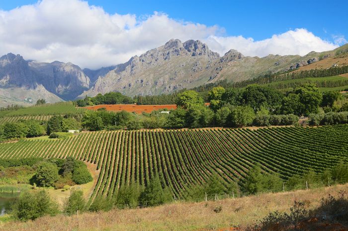
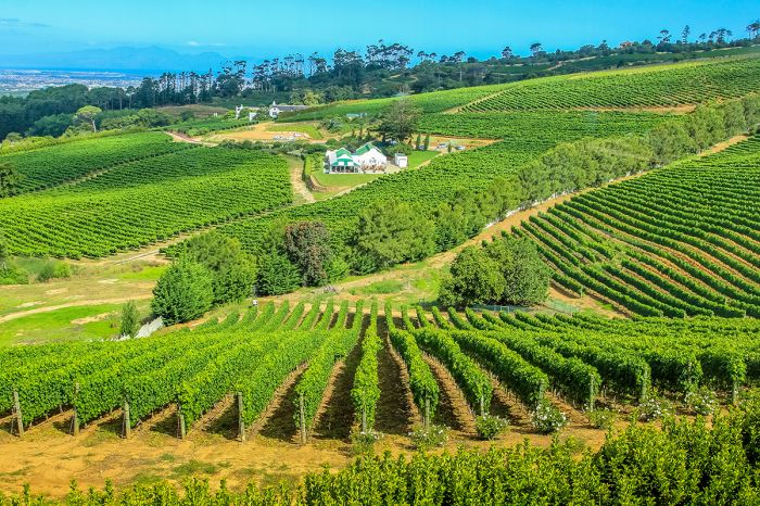
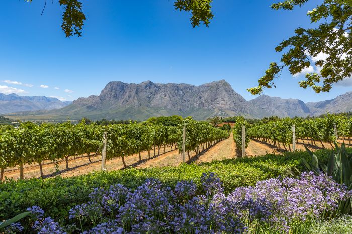
Vineyard and mountain scenery in the Cape Winelands.
Johannesburg, known as the 'City of Gold', is the gateway to the entire southern African region and the bustling economic center of the country.
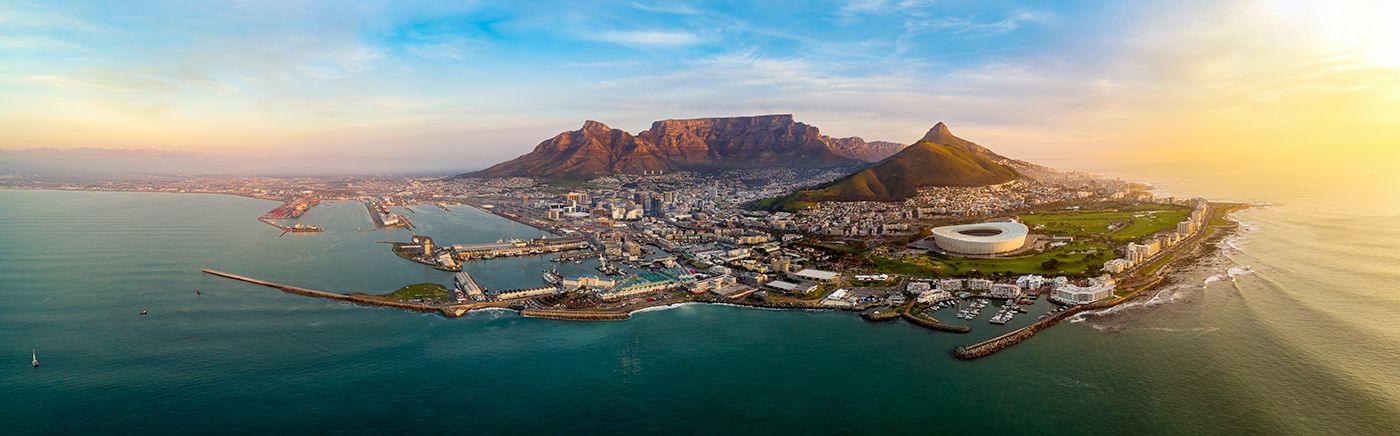
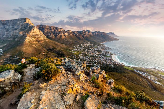
Cape Town is truly a destination worthy of several days or more on any itinerary. It is one of the world's most beautiful cities, with mountains, beaches, and historic Winelands a short drive away.
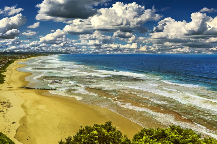
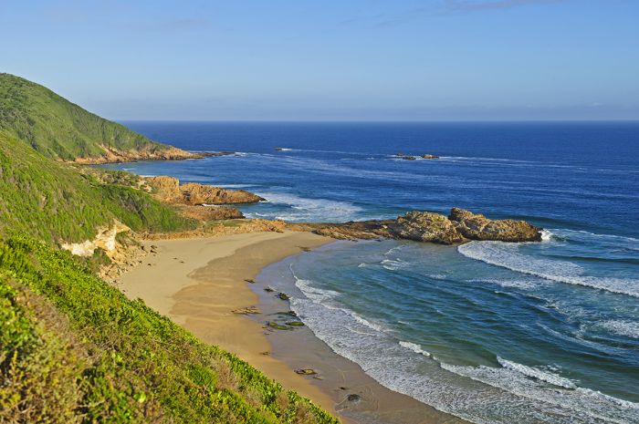
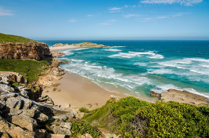
The lovely sand beach at Wilderness along the Garden Route.
The southern coast is a popular self-drive region known as the Garden Route. This spectacular area offers beaches, whale-watching, game reserves, hiking in coastal forests, adventure activities, and quaint seaside towns.
The more remote West Coast offers miles of coastal wilderness, rugged mountains, and amazing wildflowers in the springtime.
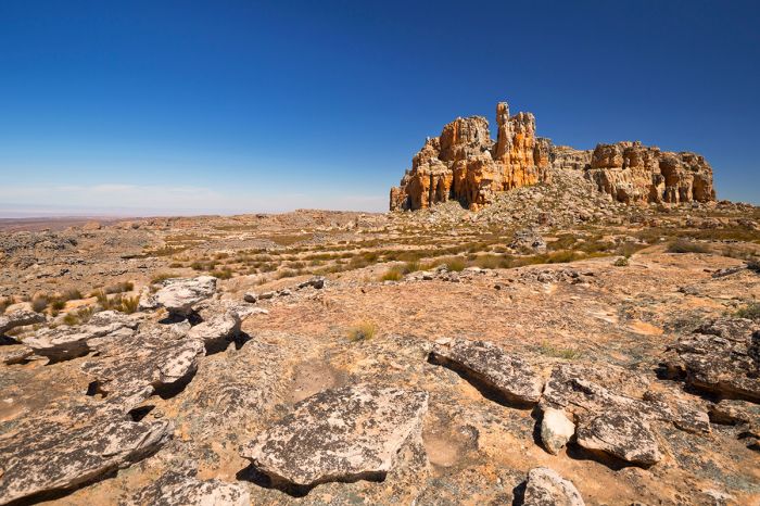
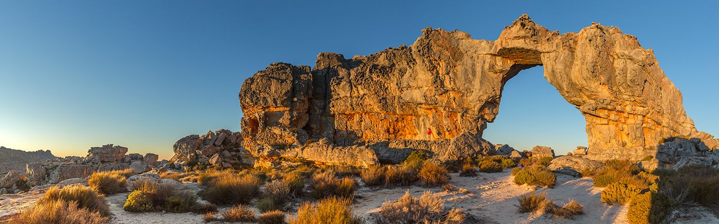
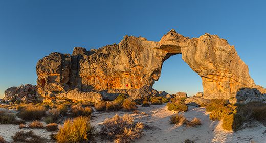
Dramatic landscape in the Cederberg Mountains, South Africa.
SOUTH AFRICA Regions
Cape Peninsula (incl. Cape Town, Table Mountain, Constantia Winelands)
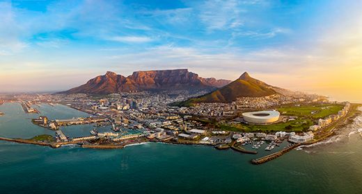
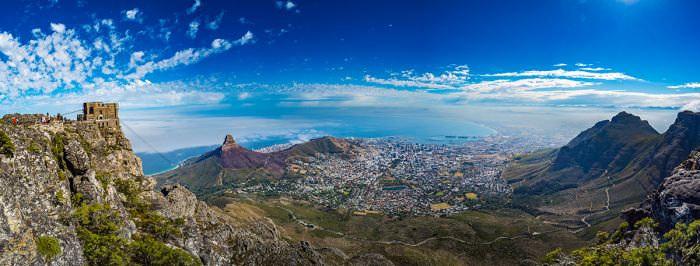
The Cape Peninsula is where European settlers first landed in the 1600s. Today that settlement is Cape Town, Africa's most beautiful city. Table mountain, Robben Island, Constantia Winelands and lots of history. More
Cape Town (incl. Table Mountain, Victoria & Alfred Waterfront)
Cape Town is one of the world's most scenic cities, dating back to the 1600s. Table Mountain towers above the city centre and is one of Africa's great icons. Cape Town offers hotels, guest houses, great dining, entertainment, museums, and world-class shopping. More
Cape West Coast (incl. Cederberg, Riebeek, West Coast NP)
The West Coast of South Africa is remote and wild, with miles of beach and a few coastal towns. The fertile Swartland has vineyards and farming. The rugged Cederberg Mountains offer superb hiking and ancient rock art paintings. The spring wildflowers are spectacular. More
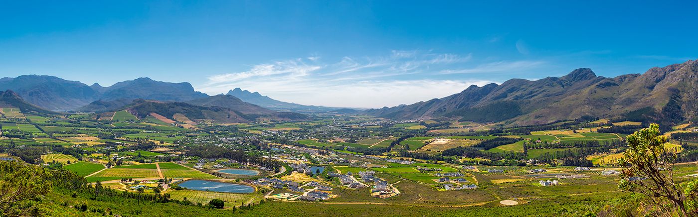
Cape Winelands (incl. Stellenbosch, Franschhoek, Paarl)
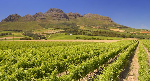
Only 45 minutes from Cape Town are 300-year-old vineyards and historic towns. Dozens of wine estates on organized wine routes offer tours, tastings, accommodations, and some of the country's best restaurants. Come sample the world-class wines. More
Eastern Cape (incl. Addo, Shamwari, Kwandwe, Port Elizabeth)
Often overlooked, the Eastern Cape offers malaria-free, Big Five game reserves, including Addo Elephant National Park, Shamwari, and Kwandwe. Port Elizabeth is a quick flight from Johannesburg and the popular Garden Route lies directly to the west. More
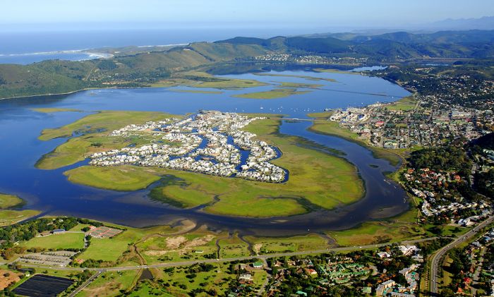
Garden Route (incl. Mossel Bay, Knysna, Plettenberg, Tsitsikamma, Oudtshoorn, Little Karoo)
This popular self-driving region along the south coast offers beaches, hiking, forests, adventure, incredible scenic beauty, and whale watching along miles of mostly undeveloped coastline. Quaint seaside towns offer accommodations along the way. More
Gauteng (incl. Johannesburg, Pretoria, Pilanesburg, Sun City)
Home to the large cities of Johannesburg and Pretoria, Gauteng is the country's main economic center. Nearby are the malaria-free Pilanesberg Game Reserve, Sun City Resort & Casino, the Cradle of Humankind, and the Magaliesberg Mountains. More
Johannesburg (incl. OR Tambo Airport, Sandton)
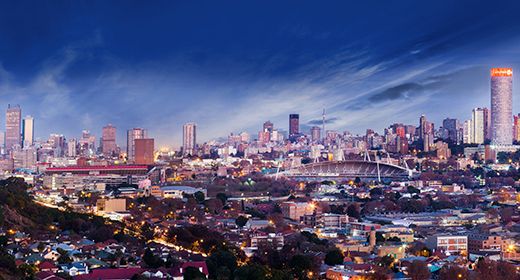
South Africa's largest city and main port of entry. Most tourists don't stay long, but nearby attractions include the Cradle of Humankind, Apartheid Museum, Soweto, golfing, and excellent shopping. Stay near the airport or the popular Sandton area. More
Kruger & Lowveld (incl. Kruger National Park, Panorama Route, Drakensberg Mountains)
Kruger National Park and the exclusive private game reserves on its border offer South Africa's best safaris. The popular self-drive Panorama Route winds through the spectacular Blyde River Canyon and several historic towns. More
Kruger Private Reserves (incl. Sabi Sand, Timbavati, Manyaleti, Kapama, Thornybush)
Adjoining the famous Kruger National Park, the exclusive private game reserves offer a world-class wildlife experience. Top-notch safari lodges, superb guiding, off-road driving, and excellent dining make a stay here unforgettable. More
Madikwe Game Reserve
A conservation success story, Madikwe Game Reserve offers exclusive, malaria-free, Big-Five safaris. Up-scale, family-friendly accommodations are combined with expert guiding and abundant wildlife to provide an exceptional game viewing experience. More
Northern Kwa-Zulu Natal (incl. Phinda, Thanda, iSimangaliso, Hluhluwe-iMfolozi, Elephant Coast)
Home to the Zulu tribal culture, Northern KwaZulu-Natal Natal offers well-managed game reserves and excellent Big-Five wildlife safaris. The Elephant Coast includes coastal forests, sand dunes, miles of pristine beaches, and superb diving in the warm Indian Ocean waters. More
Overberg & Whale Coast (incl. Hermanus, Gansbaai, Agulhas, De Hoop, Breede River Valley)
South Africa's southernmost region is diverse and is known for whale watching, coastal dunes, wine routes in Hermanus and the Breede River Valley, several mountain ranges, wheat fields, sheep farms, the Little Karoo, and the De Hoop Nature Reserve. More
Pilanesberg & Sun City
Contained within the caldera of an long-extinct volcano and only a 3-hour drive from Johannesburg, Pilanesberg Game Reserve and the Sun City hotel and entertainment complex offer a great combination of game viewing, a casino, golfing and the Valley of Waves water park. More
Sabi Sand Game Reserve
Justifiably renowned as Africa's most reliable destination for the Big Five and in particular, leopards, the Sabi Sand Reserve offers guests exclusive safaris, expert guiding and a very high density of wildlife. All of this only an hour's flight from Johannesburg. More
READ MORE...
Main: Flora, Geography, Important Areas, National Parks, Protected Areas, Ramsar Sites, UNESCO Sites, Urban Areas, Wildlife
Detail: Addo, Blyde River Canyon, Cape Town, Constantia, Drakensberg, Garden Route, Johannesburg, Karoo, Kruger NP, Kruger Reserves, Madikwe, Namaqualand, Sabi Sand, Table Mountain, Tswalu, Waterberg, Winelands
Admin: Travel Tips, Entry Requirements/Visas
Geography
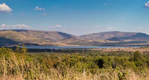
Africa's most southerly country, South Africa is bounded by the warm Indian Ocean on the east and south and the cold Atlantic Ocean on the west. Its total ocean coastline stretches for 1 739 miles (2 798 kms). Neighboring countries to the north include Namibia, Botswana, Zimbabwe, and Mozambique. The small countries of Swaziland and Lesotho also share borders with South Africa.
View to Table Mountain and the coast from Lion's Head in Cape Town.
South Africa is home to a large variety of habitats, including mountains, grasslands, desert and semi-desert, riparian forest, coastal forest and dunes, and many more. The Cape Floristic Kingdom, the smallest of only six such kingdoms worldwide, is completely contained within the country and represents 10% of Earth's known plant species.
The country's main topographic feature is the Great Escarpment that follows the coastline and which divides South Africa into several regions of altitude: the cool Highveld, lying inland from the escarpment, the low-lying and warm Coastal Strip, the Lowveld, which lies along the northern borders with Botswana, Zimbabwe, and Mozambique, and the escarpment itself.
The Cape Fold Mountains are distinct from the Great Escarpment and include numerous small mountain ranges extending parallel from the coast from the Cederberg in the west to near Port Elizabeth. Mountain ranges in the Cape Ford Belt include the Cederberg, Boland, Hex River, Hottentots-Holland, Langeberg, Swartberg, Outeniqua, Tsitsikamma, Kouga, and more.
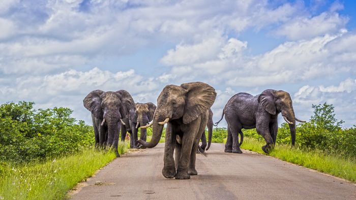
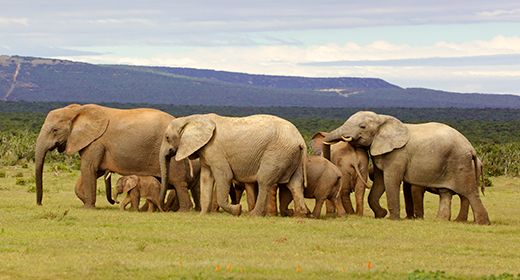
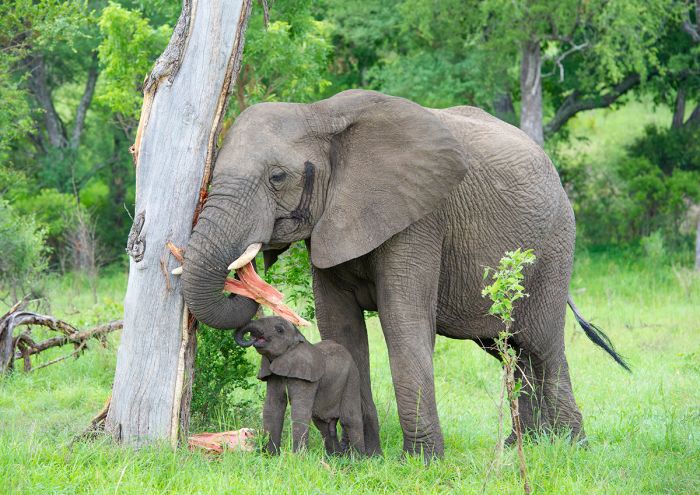
Elephants in the Kruger National Park, South Africa.
Other notable geographic areas include the Karoo (divided into the Great and Little), a semi-desert region located inland from the Cape Fold Mountains and on both sides of the Great Escarpment. North of the Karoo is the Kalahari region, a desert extending up into and through much of Botswana. Along the northwest coast of the country is Namaqualand, an arid region extending into Namibia, north of the Orange river, and known for its incredible wildflowers in the spring.
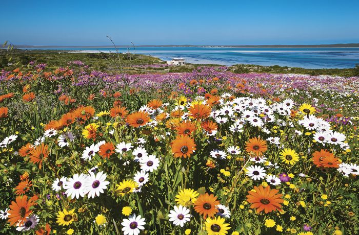
Spring wildflowers in the Cape West Coast.
Flora
South Africa is a country of varied habitats, with high mountains, grasslands, savanna woodlands, forests, desert and semi-desert, succulent Karoo, coastal dunes, and miles of ocean coastline. The wide variation of its many biomes makes for exceptional floral diversity.
Perhaps the most notable of South Africa's many biomes is the Cape Floral Kingdom, which is one of only six such botanic kingdoms on the planet and although it is the smallest, it is the most diverse. Located in the Western Cape, the Cape Floral Kingdom supports over 9 000 plant species, of which 70% are endemic.
Most of the endemic species here are known as 'fynbos' (literally 'fine bush'), which are an exceptionally biodiverse, fire-dependent, heath-like, collection of ground cover plants that include the country's national flower, the King Protea (Protea cynaroides).
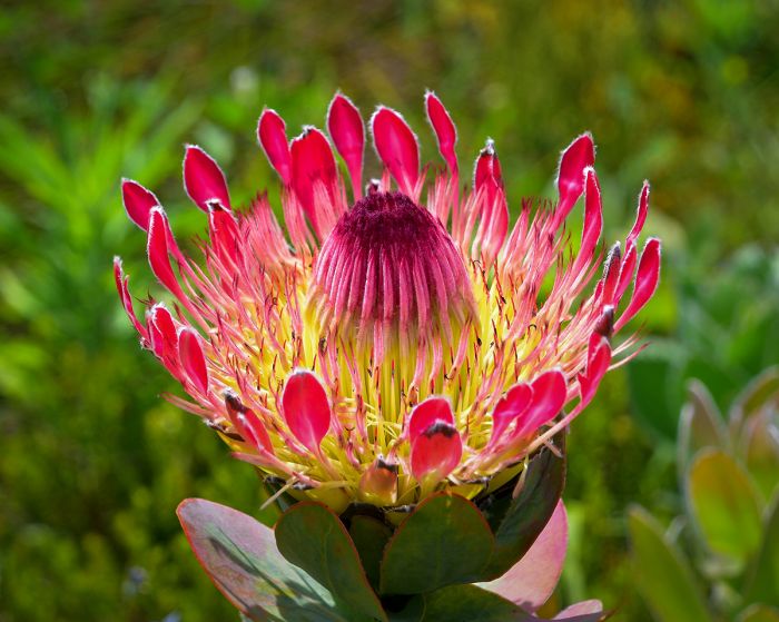
The Cape Floral Kingdom contains many species of Protea, like this Protea eximia or broad-leaved sugarbush.
Savanna woodland, which is characterized by sparsely wooded, open-canopy woodlands atop grassy ground cover, covers around one-third of South Africa.
An area of particular interest to botany enthusiasts is the Namaqualand region in the Western Cape, which produces spectacular springtime displays of wildflowers.
Visitors to Cape Town should consider a visit to the Kirstenbosch Botanical Gardens, which is located on the slopes of Table Mountain.
To read more about the specific flora in South Africa, click on the protected areas links below and/or the region links at the top of the page.
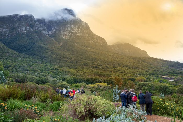
Kirstenbosch Botanical Gardens, near Cape Town, is an excellent place to discover the diverse flora of South Africa.
Wildlife
South Africa is arguably the top overall wildlife viewing country in Africa, with numerous protected areas offering a high diversity of species, including many that offer excellent opportunities to view Africa's Big Five animals (lion, leopard, elephant, buffalo, and rhino).
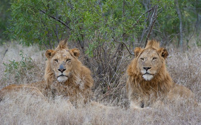
South Africa's national parks and reserves offer superb wildlife viewing, including Africa's Big Five: lion, leopard, elephant, buffalo, and rhino (Copyright © James Weis).
Greater Kruger Wildlife
The world-famous Kruger National Park and its adjoining Private Reserves are the country's premier wildlife destinations and undoubtedly the best place in all of Africa to see the Big Five, mostly due to its relatively large population of white and black rhino species.
The Sabi Sand Reserve in particular is renowned for its relaxed and relatively easy-to-find leopards. Seeing the Big Five on a single game drive is not uncommon in this reserve. Lion, elephant, and buffalo are all also very common in the Greater Kruger region.
Other commonly seen predators Kruger region include cheetah, spotted hyena, and African wild dog. After the big cats, wild dogs are the most popular predator species for wildlife enthusiasts and Kruger is one of the most reliable places on the continent to see these interesting and highly social animals. Smaller predators include two species of jackal: black-backed and side-striped, serval, caracal, African wild cat, genet, several species of mongoose, and African civet.
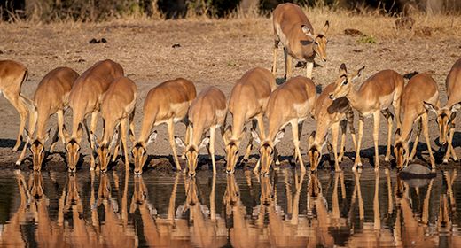
Plains game is plentiful in Kruger, with commonly seen species including giraffe, zebra, blue wildebeest, greater kudu, nyala, waterbuck, and impala. A regional specialty that lives atop cliffs or rocky outcrops in the small klipspringer antelope. Crocodiles and hippos are numerous in the larger rivers around Kruger. The common primate species are chacma baboon and vervet monkey.
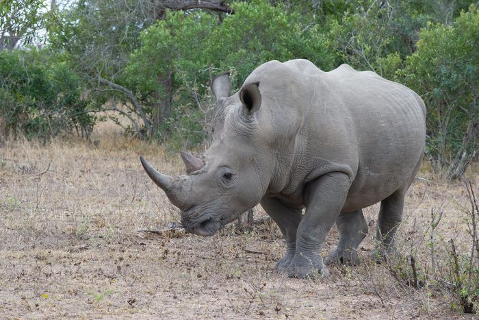
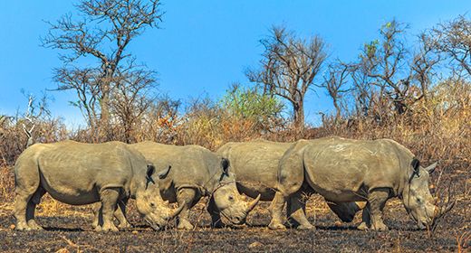
Kruger National Park and the various Private Reserves that lie west of the park are some of the best places in Africa to see rhinos. Here a white rhino (Ceratotherium simum) seen in the Sabi Sand Reserve (Copyright © James Weis).
Eastern Cape Wildlife
Beyond the superb wildlife viewing offered in the Kruger Park region, South Africa's Eastern Cape reserves are the next best option and make for an excellent complimentary destination for those looking for more wildlife in a distinctly different habitat.
The Addo Elephant National Park is of course well-known for its elephants, but also offers incredible coastal habitats, including offshore protection of marine mammals, including dolphins and whales, which breed along this coastline.
Other reserves in the Eastern Cape include Kwandwe, Shamwari, Amakhala, Lalibela, Kariega, Pumba, and Sibuya. All of these reserves offer the Big Five animals, albeit in smaller and distinct areas, and the safari camps and lodges are generally good to excellent here. The Eastern Cape reserves are malaria-free, which is attractive to families with young children.
Besides the Big Five, the Eastern Cape reserves offer an excellent diversity of animals and many of the reserves are focused on conservation projects. Travelers interested in self-driving along the spectacular southern coastline of South Africa, which includes the beautiful Garden Route, are encouraged to spend some time in the wildlife reserves of the Eastern Cape.
Addo Elephant National Park is a great destination for wildlife and scenery.
Other Wildlife Destinations
Besides Kruger and the Eastern Cape, other excellent wildlife-viewing destinations include Madikwe Game Reserve, Pilanesberg Game Reserve, and Tswalu Kalahari Reserve. Both Madikwe and Pilanesberg offer all of the Big Five and are easily reachable by road from Johannesburg. Madikwe is famous for its wild dog sightings, while Pilanesberg is famous for elephant and rhino. Both parks offer superb safari camps. Pilanesberg has the option of self-driving through the park.
Tswalu is an incredible destination located in the Kalahari region and is famous for its huge diversity of species, outstanding guiding, and its two excellent safari camps. Tswalu offers four of the Big Five (elephant missing) and is renowned for its excellent chances to see the usually elusive aardvark.
All three of these reserves (Madikwe, Pilanesberg, and Tswalu) are conservation success stories that were developed on previously farmed land, restored to their natural state, and restocked with wildlife that had been eradicated by European settlers.
South Africa offers a huge number of wildlife and nature reserves beyond the ones discussed above, all of which offer wildlife viewing to some degree. Read more about South Africa's protected areas below.
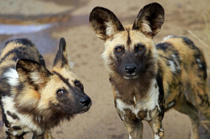
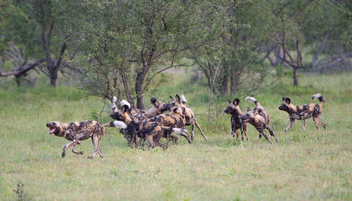
African wild dogs (Lycaon pictus) are one of many species that are commonly seen in the Madikwe Game Reserve.
Birds
South Africa offers an excellent birding experience for avid enthusiasts or casual observers. The country has a bird checklist of over 800 species, with 18 endemic species. The country's best places for birding are protected areas like the Kruger National Park and iSimangaliso Wetland Park. There 99 BirdLife International Important Birding Areas in South Africa.
Seasonally, the South African spring and summer, which spans September through March, are the best time for maximizing species, with resident populations boosted by numerous Palearctic migrant species that arrive from Europe, Asia, and North Africa to breed. A typical safari day in the Kruger Park or adjacent reserves can easily produce over 100 species and a three-week birding trip could render upwards of 500 species.
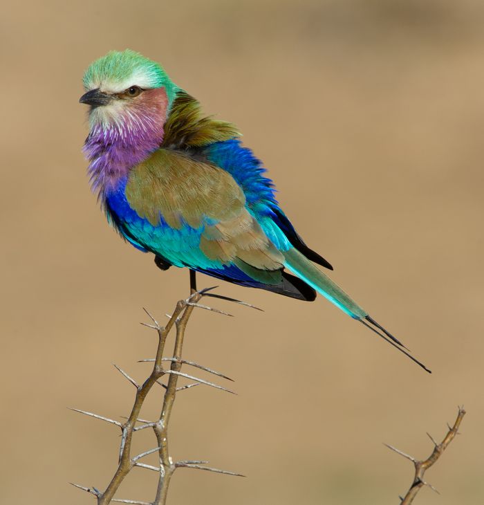
The lilac-breasted Roller (Coracias caudatus) is one of the birds commonly seen in the Kruger National Park and Kruger Private Reserves (Copyright © James Weis).
Protected Areas
South Africa has protected a large amount of its land as national parks, wildlife reserves, nature reserves, and provincial parks. Read about the details of each below.
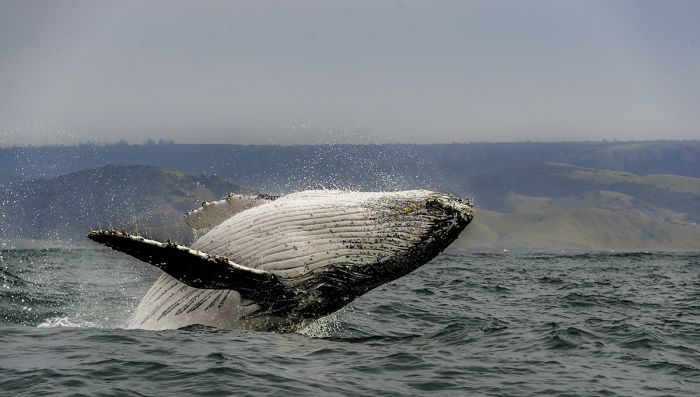
A humpback whale breaches off the southern coast of South Africa in the Addo Marine Protected Area.
National Parks
Following are South Africa's 19 national parks (and one transfrontier park). Additional information on each is included further below this list:
- /Ai-/Ais-Richtersveld Transfrontier Park - Combined parks spanning southern Namibia and Northern South Africa. Home to the Fish River Canyon, /Ais-/Ais hot springs, and Richtersveld Community Land inhabited by the Nama people.
- Addo Elephant National Park - South Africa's third largest national park located in the Eastern Cape near Port Elizabeth. Excellent wildlife experience, particularly for elephants and home to the 'Big Five', coastal dunes, and marine wildlife offshore.
- Agulhas National Park - Protects land along the Whale Coast, including Cape Agulhas, the southernmost most point on the continent. Dunes, wetland, and rough seas. Over 150 ships have wrecked on the Agulhas Reef.
- Augrabies Falls National Park - Protects the impressive Augrabies Falls on the Orange River as it approaches the Namibian border. Sparse desert-adapted wildlife.
- Bontebok National Park - Tiny protected area in the Overberg region, created to preserve the country's then dwindling population of bontebok antelopes.
- Camdeboo National Park - Small park surrounding the historic town of Graaff-Reinet in the Great Karoo. A scenic destination, with rugged desert mountains and valleys. Hiking the trails is a highlight, though there is some wildlife. Accommodations in town or camping in the park.
- Garden Route National Park - Combination of multiple protected areas into one disjointed national park, with indigenous forest, dramatic coastline, wetlands, and marine waters offshore. Famous multi-day hiking trails are a highlight.
- Golden Gate Highlands National Park - The Free Stat Province's only national park, located in the foothills of the Maloti Mountains on the border with Lesotho and now part of the Maloti-Drakensberg Transfrontier Park.
- Kalahari Gemsbok National Park - Forms the South African side of the Kgalagadi Transfrontier Park, which is shared with Botswana.
- Karoo National Park - Rugged desert landscape in the Great Karoo along the Great Escarpment near the town of Beaufort West. Chalets, cottages, and camping available. Good game viewing for desert-adapted wildlife and dry-land birds.
- Kgalagadi Transfrontier Park - Shared park with Botswana located in the Kalahari Desert on the border with Namibia. Good for predators and desert-adapted antelopes. Self-drive or visit on an organized tour.
- Kruger National Park - World famous wildlife destination and Africa's second-oldest national park. Offers the Big Five (lion, leopard, elephant, buffalo, rhino) and mostly affordable accommodation. No off-road driving so can be crowded. The Private Reserves to the west offer a higher level experience in the same ecosystem.
- Mapungubwe National Park - Situated along the shared borders between South Africa, Botswana, and Zimbabwe. Set aside to protect the archeological sites of Iron Age inhabitants. Good wildlife and birding. A self-drive destination.
- Marakele National Park - Small park in the Waterberg region. Diverse wildlife, including the Big Five, but predators are hit or miss. The Marataba private concession offers all-inclusive safaris and accommodation.
- Mokala National Park - Small park located in the transition zone between the Great Karoo and the Kalahari Desert, near the diamond-mining town of Kimberley. Excellent variety of plains game. No elephants nor large predators.
- Mountain Zebra National Park - Small park in the Great Karoo, established in the 1930s to protect the Cape mountain zebra, which was in danger of extinction. Plenty of antelopes and some predators. Few visitors.
- Namaqua National Park - Coastal park located in the Namaqualand region of northwest South Africa. Protects the diverse floral life, including succulents and wildflowers, which bloom here in profusion during the Spring.
- Table Mountain National Park - Park protecting around two-thirds of the Cape peninsula, including Table Mountain and the interior all the way south to the southern tip at Cape Point.
- Tankwa Karoo National Park - Small park in the southwest corner of the Great Karoo. One of the driest places in the country, with no infrastructure other than self-drive roads. Good birding.
- West Coast National Park - Located north of Cape Town along Atlantic Ocean, the reserve protects the Langebaan Lagoon, a critical water bird haven. The park comes alive with wildflowers in the Springtime.
Coastal view on along South Africa's spectacularly scenic Garden Route.
Important Areas
Other important areas of note in South Africa include wildlife and nature reserves, as well as general regions that are worth consideration when planning your trip.
- Blyde River Canyon Nature Reserve - Part of the 'Panorama' driving route set in the Drakensberg Escarpment west of Kruger National Park. Spectacular vistas and numerous attraction along the way make this a favorite destination with locals and international visitors.
- Cape Peninsula - Home to Cape Town, Table Mountain, white shark excursions, Robben Island, beautiful beaches, the country's oldest vineyards and wine estates, and much more.
- Cape West Coast - Spectacularly diverse and scenic region located north of Cape Town. Coastal towns, Springtime wildflower profusion, the Cederberg Mountains with excellent hiking, scenery, ancient rock art, agriculture and viticulture, with wine routes.
- Cape Winelands - Spectacularly beautiful region with mountains and valleys just an hour's drive from Cape Town. World-class wines and fine dining in Stellenbosch, Paarl, and Franschhoek.
- Constantia Winelands - Small valley producing some of South Africa's best wines located just south of Cape Town city. The birthplace of wine growing in the country, with the first vines planned in 1685. Excellent restaurants.
- De Hoop Nature Reserve - Located in the Whale Coast, this reserve protects pristine white sand dunes and extends offshore to protect whale calving grounds. Hiking the 5-day Whale Trail is a highlight.
- Drakensberg Mountains - The eastern portion of Southern Africa's Great Escarpment, which lies primarily in South Africa. Home to hundreds of Bushman (San) people rock art sites and the location of Southern Africa's highest peaks.
- Garden Route - Very popular self-drive route on the southern coast of South Africa. Seaside towns, hiking the nature trails along the coast or through inland forests, lovely beaches, blue lagoons, and very safe. Great for families.
- Goegap Nature Reserve - Namaqualand reserve at the town of Springbok, showcasing indigenous flora of the region. Gppd all year, best during wildflower season (Springtime).
- Great Karoo - Vast and arid region situated directly north of the Little Karoo and covering most of South Africa western interior in the Northern Cape Province. Several protected areas along the Great Escarpment in the south.
- Hluhluwe-iMfolozi Game Reserve - Created by combining two of the country's oldest reserves, located in northern KwaZulu-Natal. Good wildlife, including the 'Big Five.
- iSimangaliso Wetland Park - Large park protects extensive wetlands, coastal dunes, sand forest, inland lakes, and offshore reefs on the Indian Ocean coast bordering Mozambique in the KwaZulu-Natal Province. Abundant wildlife in certain sections, Beaches used by marine turtles for nesting.
- Kruger Private Reserves - Exclusive wildlife reserves located on land bordering the western side of Kruger National Park. Excellent lodges offer professionally guided safaris, including off-track driving to follow key species (a major difference versus the national park).
- Kwandwe Game Reserve - Pristine game reserve in the Eastern Cape along the Great Fish River. Good wildlife including the 'Big Five'. Only two lodges offering an exclusive experience. Malaria-free.
- Lapalala Wilderness Reserve - Small private reserve in the Limpopo Province's Waterberg region. Decent wildlife, including the Big Five, but more of a wilderness and scenic destination. Day safaris.
- Little Karoo - A semi-desert region located north of the Cape Fold Mountains. Incredible mountain scenery and South Africa's most dramatic mountain passes offer an excellent, though slow-going,z driving route between Cape Town and the Garden Route.
- Madikwe Game Reserve - Created from disused farmland and located on the Botswana border in the North West Province. Mostly upscale accommodation, excellent game viewing and guiding, and malaria-free. Reachable by road from Johannesburg in 4 hours or less.
- Maloti-Drakensberg Transfrontier Park - Created from numerous previously designated parks and reserves in the Drakensberg Range along the shared borders of South Africa and Lesotho.
- Namaqualand - Loosely defined region along the northwest coast, reaching into Namibia. Part of the 'Succulent Karoo' biome, the region is mainly visited in the Spring for the incredible displays of colorful wildflowers.
- Overberg - Located east of the Cape Winelands and inland from the Whale Coast. Scenically beautiful with sheep and wheat farms, mountains, and the Breede River Valley, which is home to numerous wine estates. Great to self drive en-route to/from the Garden Route.
- Phinda Game Reserve - Private wildlife reserve in northern KwaZulu-Natal created from farming land and restored to its natural state. Very successful project, with community involvement, excellent safaris and accommodation.
- Pilanesberg Game Reserve - Located entirely within the caldera of an extincet volcano 3-hours northwest of Johannesburg. Good game viewing, including the 'Big Five. Sun City Resort borders the reserve.
- Royal Natal Provincial Park - Tiny protected area in the KwaZulu-Natal portion of the Drakensberg Range and home to the world's second-highest waterfall. Incorporated into the Maloti-Drakensberg Transfrontier Park.
- Sabi Sand Game Reserve - The most visited of the Private Reserves bordering Kruger National Park. Exceptionally good wildlife safaris with excellent camps and lodges including Londolozi, MalaMala, Singita, Sabi Sabi, and others.
- Samara Game Reserve - Private reserve created from reclaimed livestock farms in the southeastern Great Karoo. Offers excellent game viewing experience and is the only 'Big Five' destination in the Karoo.
- Shamwari Game Reserve - Private malaria-free reserve located close to Port Elizabeth and Addo National Park in the Eastern Cape. Excellent wildlife safaris, including the 'Big Five' and plenty of camps and lodges.
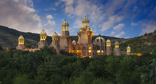
- Sun City Resort - Large resort and entertainmenmt complex located 3 hours northwest of Johannesburg and adjacent to the Pilanesberg Game Reserve, which is located in a volcanic caldera. Four hotels, golfing, casino, and a superb waterpark.
- Tswalu Kalahari Reserve - Privately owned reserve in the Kalahari region of the Northen Cape Province. High diversity of species and four of the Big Five (elephant missing). Highly recommended.
- Waterberg - Located in Limpopo Province and named for the mountainous massif that dominates the land. Numerous private reserves and one national park. Big Five safaris, lovely wilderness, popular for locals as it is easy to reach from Johannesburg.
- Welgevonden Game Reserve - Exclusive private reserve in the Waterberg region of Limpopo Province. Numerous safari lodges offering very good wildlife safaris and accommodation. No self-driving permitted. Popular with locals for easy access from Johannesburg.
- Whale Coast - Named for the waters offshore that are the annual breeding and calving grounds for large numbers of whales, most notably the Southern right whale. The seaside town of Hermanus is a very popular destination here.
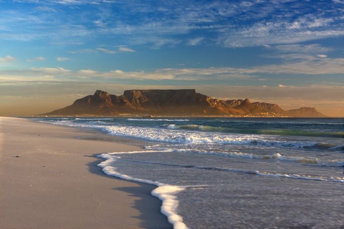
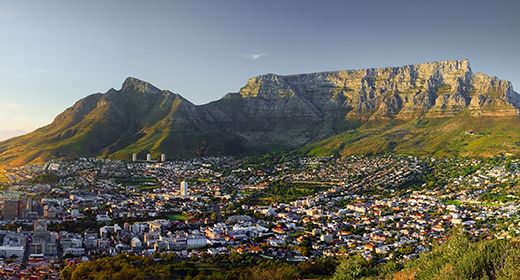
Table Mountain, which overlooks Cape Town, is one of South Africa's most iconic geographic features.
UNESCO World Heritage Sites
The United Nations Educational, Scientific and Cultural Organization (UNESCO) is a specialized agency of the United Nations whose mission is to promote world peace and security through international cooperation in education, the arts, the sciences, and culture. The Convention concerning the Protection of the World's Cultural and Natural Heritage was signed in November 1972 and ratified by the 189 UN member "states parties".
A World Heritage Site is a landmark or area which is geographically and historically identifiable and has special cultural or physical significance. To be selected as a World Heritage Site, a nominated site must meet specific criteria and be judged to contain "cultural or natural heritage of outstanding value to humanity". An inscribed site is categorized as cultural, natural, or mixed (cultural and natural). As of 2021, there were over 1 100 sites across 167 countries.
South Africa has ten UNESCO World Heritage Sites:
- /Khomani Cultural Landscape (since 2017, Cultural) - Located along South Africa's borders with Namibia and Botswana, within the Kalahari Gemsbok National Park. Protects the land that has long been inhabited by the semi-nomadic Khomani and related San people.
- Barberton Makhonjwa Mountains (since 2018, Natural) - Essentially synonymous with the Songimvelo Nature Reserve on the border with Swaziland, the site protects much of the Barberton Makhonjwa Mountains, which encompass the best-preserved, oldest and most diverse sequence of volcanic and sedimentary rocks on Earth.
- Cape Floral Region Protected Areas (since 2004, Natural) - A huge area covering a large portion of South Africa's Western Cape Province, including multiple national parks, nature reserves, wilderness areas, forests, and mountain catchment areas. Protects one of the world's six Floral Kingdoms, this being the smallest and by far the most diverse. The region is strongly associated with the so-called 'fynbos' vegetation, which is adapted to a Mediterranean climate and periodic fires.
- Fossil Hominid Sites of South Africa (since 1999, Cultural) - Protects various archeological sites associated with ancient hominid fossils, mostly within caves, including Sterkfontein, Kromdraai, Swartkrans, the Makapan Valley, and the Tuang Skull Site.
- iSimangaliso Wetland Park (since 1999, Natural) - Synonymous with iSimangaliso Wetland Park, which protects diverse habitats, including coral reefs, sand beaches, coastal dunes, extensive lake systems, swamps, and wetlands, as well as a high diversity of terrestrial and marine wildlife.
- Maloti-Drakensberg Park (since 2000, Cultural+Natural) - Synonymous with the Maloti-Drakensberg Transfrontier Park. The mountains are home to hundreds of rock art sites painted by the Bushmen (San) people.
- Mapungubwe Cultural Landscape (since 2003, Cultural) - Located on the border with Botswana and home to an one of the first Bantu kingdoms in Southern Africa, dating back to Ad 900-1300. The same land is protected as Mapungubwe National Park.
- Richtersveld Cultural and Botanical Landscape (since 2007, Cultural) - Home to the semi-nomadic and pastoral Nama people, who have lived here for over 1 500 years and still practice their traditional livelihood. The land also support a huge botanical biodiversity, including a large number of desert-adapted succulents.
- Robben Island (since 1999, Cultural) - Historic island offshore from Cape Town used by the Dutch and British as a prison, hospital, and military base. Gained notoriety for housing anti-Aparthied political prisoners including Nelson Mandela, who was imprisoned there for 18 years. It is now a museum and tourist attraction.
- Vredefort Dome (since 2005, Natural) - Located very close to Pochefstroom, this is the oldest, largest, and most deeply eroded known astrobleme (an eroded meteorite impact crater) on Earth, dating back over 2 million years. It is considered to be the site of the world’s greatest single, known energy release event.
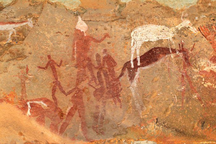
San bushman rock art in the Drakensberg Mountains, South Africa.
Ramsar Wetlands of International Importance
The Ramsar Convention on Wetlands is an international treaty for the conservation and sustainable use of wetlands. It was the first of the modern global nature conservation conventions, negotiated during the 1960s by countries and non-governmental organizations concerned about the increasing loss and degradation of wetland habitat for birds and other wildlife. The convention is named after the city of Ramsar in Iran, where the convention was signed in 1971.
Presently there are some 75 member States to the Ramsar Convention throughout the world which have designated over 2 300 wetland sites onto the Ramsar List of Wetlands of International Importance.
South Africa has 27 sites designated as Wetlands of International Importance (Ramsar Sites) as follows.
- Barberspan - One of the few permanent and natural water bodies in the high veld. The freshwater lake supports a plankton community, numerous fish species, and is a seasonally important staging and breeding ground for migrating birds. (12 sq miles/31 sq kms)
- Blesbokspruit - One of the few permanent natural water bodies in the Transvaal region, located on the southeastern outskirts of Johannesburg. The site was formed in the 1930s, during road and pipeline construction for the mining industry. The Marievale Bird Sanctuary is located within the site. Seasonally important for several species of migratory birds. (7.2 sq miles/18.6 sq kms)
- Bot-Kleinmond Estuarine System - Estuarine system formed at the mouth of the Bot River as it enters the Atlantic Ocean just west of Hermanus. An important wetland for waterbirds and fishes. The estuary is also used by tourists for fishing, boating, and swimming. (5.2 sq miles/13.5 sq kms)
- Dassen Island Nature Reserve - Small island off the coast of Western Cape near Yzerfontein. The island provides habitat for large numbers of seabirds and migrating shorebirds. Large numbers of the threatened African penguin use the island for breeding, as do pelicans and cormorants. (2.8 sq miles/7.4 sq kms)
- De Hoop Vlei - Coastal lake which varies in water level and salinity seasonally. The lake was formed when coastal dunes blocked the course of the Salt River on its way to the sea. The site provides an important staging and breeding grounds for significant numbers of waterbirds. Protected within the De Hoop Nature Reserve. (2.9 sq miles/7.5 sq kms)
- De Mond - The Heuningnes River Estuary is located in the coastal De Mond Nature Reserve near Cape Agulhas in the Western Cape. Shifting coastal sand dunes have isolated the estuary and salt marsh. The site is important as a wintering, staging, and feeding grounds for numerous birds and provides habitat for various other wildlife. (3.5 sq miles/9.2 sq kms)
- Dyer Island Provincial Nature Reserve and Geyser Island Provincial Nature Reserve - Two islands located offshore south of Gansbaai in the Western Cape. A sandy channel known as shark alley separates the two islands and the surrounding waters are inhabited by at least 11 species of shark, including the great white (Carcharodon carcharias). The site is a popular for boat-based whale watching and shark cage diving. (1.1 sq miles/2.9 sq kms)
- False Bay Nature Reserve - Located in the Cape Flats area just south of Cape Town and very close to Muizenberg. Site protects wetland and sand-based terrestrial vegetation. Includes two lakes, Rondevlei and Zeekoevlei, of which Rondevlei Bird Sanctuary protects one while the other is used for recreation. Both lakes support large numbers of waterbirds, including pelicans and flamingos, as well as numerous mammals. (6 sq miles/15.4 sq kms)
- Ingula Nature Reserve - Located at the source of the country's main watershed in the Drakensberg Mountains. The site protects the Wilge River catchment, which drains into the Vaal River and out to the Atlantic Ocean, and the Tugela River catchment, which drains into the Indian Ocean. Site protects wetlands and grassy plains, which provide habitat for over 300 species of bird, as well as numerous mammals, reptiles, butterflies, and plants. (31 sq miles/81 sq kms)
- Kgaswane Mountain Reserve - Covers a section of summit, eastern slopes, and foothills of the Magaliesberg Mountains, just south of Rustenberg. Protects a crucial catchment area, as well as endemic and threatened flora, antelopes, leopard, and over 300 species of birds. Supports recreation and tourism. (49 sq miles/126 sq kms)
- Kosi Bay - Located along the Indian Ocean coast of Koa-Zulu Natal, the site consists of four coastal lakes that are subject to tidal influence, and which are connected by an estuarine channel. The lakes are filled by three permanent rivers. Site protects diverse habitat including extensive swamps, reedbeds, mangrove forest, woodlands, coastal grasslands, and coastal dunes. Protects numerous species of invertebrate, fish, birds, mammals, butterflies, and flora. Human activity includes subsistence farming and fishing. (42 sq miles/110 sq kms)
- Lake Sibaya - South Africa's largest natural freshwater lake, separated from the Indian Ocean by coastal dune forest and wet grassland. Supports large numbers of hippopotamus, as well as numerous endangered and endemic species of bird, reptile, fish, other mammals, and flora. The lake supports diverse zooplankton and 43 species of mullosc. Human activity includes livestock grazing and cultivation. Partially protected by the iSimangaliso Wetland Park. (30 sq miles/78 sq kms)
- Langebaan - Inland extension of Saldanha Bay and protected as part of West Coast National Park, the large shallow, marine lagoon includes roadbeds, sand flats, saline marshes, shrubland, islands, and reedbeds. Important as a nursery for numerous fish species and provides wintering and staging habitat for huge numbers of seabirds and waders. Supports the largest colony of gulls in the country. (23 sq miles/60 sq kms)
- Makuleke Wetlands - Located in far north of Kruger National Park and bordered by the Limpopo River. Sier protects floodplain grasslands, riparian forest, seasonal pans, and river channels. Provides crucial habitat for diverse wildlife, including hippo, antelopes, other mammals, and birds. (30 sq miles/78 sq kms)
- Natal Drakensberg Park - Synonomous with the Maloti-Drakensberg National Park located along the eastern border of Lesotho in the Drakensberg Mountains. Protects crucial water catchment that supports extensive wetlands, as well as numerous endangered and endemic plant and animal species. Numerous ancient rock art sites also preserved. (938 sq miles/2 428 sq kms)
- Ndumo Game Reserve - Protects the largest floodplain system in South Africa, with five types of wetland: brackish, permanent lakes, ephemeral lakes, marshes, and pools, as well as riparian and cathedral forest. One of the best birding locations in the country, with over 430 species recorded. Human activity includes low-density tourism, reed and sedge harvesting, and fishing. (39 sq miles/101 sq kms)
- Ntsikeni Nature Reserve - Located in the foothills of the Drakensberg Mountains in Kea-Zulu Natal, the site is one of the country's largest high-elevation wetlands. Important breeding site for the endangered wattled crane and habitat for numerous mammals and amphibians. (36 sq miles/92 sq kms)
- Nylsvley Nature Reserve - Located along the Nel River between Pretoria and Mokopane, protects seasonally flooded grasslands. Provides habitat for roan antelope and serves as a breeding ground for eight red-listed waterbirds. The only locale for Oryza longistaminata, a type of wild rice. A popular birdwatching destination. (15 sq miles/40 sq kms)
- Orange River Mouth - Shared by South Africa and Namibia, the site includes extensive salt marshes, freshwater lagoons, sand banks, and reed-beds. Important habitat for resident birds and staging ground for migratory waterbirds. Diamond mining in Namibia and flow regulation of the Orange River via dams are the main threats. (7.8 sq miles/20 sq kms)
- Prince Edward Islands - Located 1 100 miles (1 740 kms) offshore to the southeast in the Subantarctic Indian Ocean. Consists of two volcanic islands (Marion and Price Edward) that provide important breeding grounds for several species of seabird, including wandering albatross, white-chinned petrel, sooty albatross, and yellow-nosed albatross. Three penguin species (king, macaroni, eastern rockhopper) also breed on the islands. (145 sq miles/375 sq kms)
- Seekoeivlei Nature Reserve - Largest inland wetland in South Africa's Highveld, located 25 miles (40 kms) northwest of Newcastle in the Free State. Site provides crucial water for the populous Gauteng Province and habitat for abundant birdlife and some mammals. Habitats include seasonal lakes, riparian floodplain grasslands, and marshes. Human activity includes low-level tourism and livestock grazing. (18 sq miles/48 sq kms)
- St. Lucia System - Part of iSimangaliso Wetland Park in Koa-Zulu Natal along the Indian Ocean coast. Protects coastal wetlands associated with Lake St. Lucia. Diverse habitats provide for the country's largest prawn nursery, migratory bird staging areas, feeding grounds for flamingos, and home for over 80 species of fishes. Also breeding ground for crocodiles, and habitat for hippos. Human activities include tourism, recreation, and fishing. (598 sq miles/1 550 sq kms)
- Turtle Beaches/Coral Reefs of Tongaland - Included in the iSimangaliso Marine Protected Area. Site provides crucial nesting grounds and offshore habitat for five species of marine turtle, as well as habitat for 1 200 species of fish, 16 species of coral, 41 species of marine mammal, and 49 species off bird. Human recreation is primarily marine recreation, including diving. (153 sq miles/395 sq kms)
- uMgeni Vlei Nature Reserve - Located in the eastern foothills of the Drakensberg Mountains in Kwa-Zulu Natal. Site is at an elevation of 6 000 feet (1 840 meters) and consists mostly of grassland with some permanent freshwater marshes and pools. Habitat protects endemic and threatened flora and is an important breeding ground for three species of crane (blue, wattled, and crowned). (3.7 sq miles/9.6 sq kms)
- Verloren Valei Nature Reserve - Provincial reserve located in northern Mpumalanga near the border with Limpopo and at an altitude of 6 500 feet (2 000 meters). Protects wetlands and grasslands in a crucial catchments area. Site has high botanic diversity and is breeding grounds for blue, wattled, and gray crowned cranes. Numerous mammal species and many other species of birds are also resident. Main human activity is low-density tourism. (23 sq miles/59 sq kms)
- Verlorenvlei - Coastal freshwater lake created by water from the Verloren River that is partly blocked by coastal sand dunes at the town of Elands Bay in the Western Cape. Important breeding ground for pelicans and other birds, as well as fish and is used as a staging grounds for migrating waders. Often support large numbers of flamingos. Human activity includes cattle grazing and pumping of water for irrigation and drinking. (5.8 sq miles/15 sq kms)
- Wilderness Lakes - A series of three permanent interconnected coastal lakes protected as part of Garden Route National Park (Wilderness Section). Site includes coastal dunes, woodlands, marshes, roadbeds, and vegetated thickets. Crucial breeding and staging ground for numerous species of birds. Supports 32 fish species, diverse marine invertebrates, and over 250 species of flora. (5 sq miles/13 sq kms)
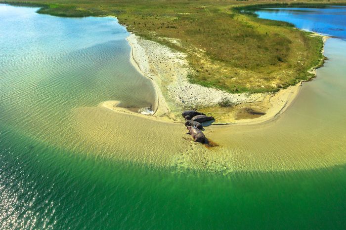
Aerial view of hippos in the St Lucia Estuary, which is protected as part of iSimangaliso Wetland Park, South Africa. St. Lucia is a Ramsar Wetland of International Importance.
Urban Areas
The following South African urban areas are worth noting, as some are destinations in their own right, while others are typically only visited via airports on the way to nearby places. Info on each follows further below.
- Cape Town - A true destination city and without peer on the African continent. Offers unmatched natural beauty and plenty to see and do, including Table Mountain, Robben Island, Winelands, beaches, shopping, hiking, museums, and much more.
- Durban - Major port city on the eastern Indian Ocean coast. Not typically a destination city.
- Johannesburg - Main entry point for international visitors and by far the largest urban area in the country.
- Port Elizabeth - Indian Ocean coastal port with a lovely climate. The gateway to Eastern Cape reserves and the Garden Route.
- Pretoria - Administative capital of the country located very close to Johannesburg. Luxury trains depart from the city.
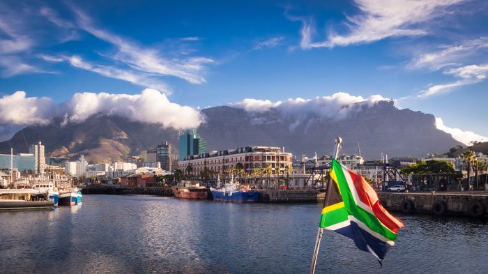
Table Mountain viewed from the Victoria & Alfred Waterfront in Cape Town.
Kruger National Park
The Kruger National Park is surely one of the most recognized of all wildlife reserves in Africa, and rightly so, it offers all of the African Big Five animals (lion, leopard, elephant, rhino, buffalo) and is one of the country's most popular destinations. Established in 1926, Kruger is Africa's second oldest national park; only Virunga National Park (previously named Albert NP) is older, established in 1925.
When discussing Kruger, it is important to note that the term 'Kruger' often refers to not just the national park itself, but also to the numerous private game reserves that border the park on its western side. The park is partially unfenced on the west, which means the wildlife are free to move between the national park and the private reserves. These 'private' reserves generally offer a much more exclusive experience and are not open to self-drive visitors, requiring a stay in one of the safari lodges within the specific reserve, while the national park is open to self-drivers. The private reserves are of course far more expensive as well.
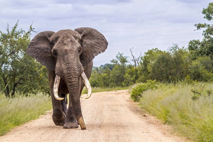
A magnificent bull elephant in Kruger National Park.
Kruger National Park covers an area of 7 523 square miles (19 485 sq kms) in a long north-south-oriented rectangle shape, along South Africa's eastern border with Mozambique. The northern tip of Kruger extends all the way to the border with Zimbabwe. The majority of the national park is a network of tarred and sand roads and there are numerous lodgings, most of which are of the self-cater variety and very inexpensive. A small number of private concessions have been carved out of the park in recent times, with private up-scale lodging and access restricted to those guests staying at the lodges.
Outside of these few concessions, off-road driving is prohibited in Kruger and this is the main difference between staying in the national park versus at one of the Kruger private concessions or the Kruger Private Reserves. Following a leopard as it crosses the road into the bush (standard practice in the private reserves) versus simply watching as it disappears (the only option in the national park) provides for a much more immersive experience.
Kruger's main roads can become quite busy with vehicles, while the private reserves are limited to vehicles from the private camps, which is another reason that those who can affords the private reserves will have a much better overall experience. The safari guides at the private camps are also expert at finding animals and putting the 4x4 vehicles in the best position to see the wildlife.
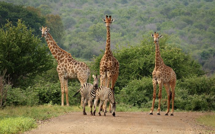
Kruger National Park offers abundant wildlife like these giraffes and zebras.
Kruger's wildlife is diverse and includes all of Southern Africa's popular species, including zebra, giraffe, buffalo, elephant, both black and white rhino, and buffalo. The herbivores list also includes impala, which are the park's most common antelope by far, greater kudu, nyala, bushbuck, waterbuck, reedbuck, blue wildebeest, warthog, klipspringer, and many others.
Predators are well represented in Kruger, with healthy populations of leopard, lion, spotted hyena, Africa wild dog, cheetah, serval, black-backed jackal, side-striped jackal, and other smaller predacious mammals. Crocodile and hippo are common in the park's major rivers, as well as in some of the larger dams and waterholes. Bird watching in Kruger can only be described as superb, with a list of over 500 species. Enthusiastic birders can easily top 100 species in a day's birding in Kruger.
Read full details on Kruger National Park here.
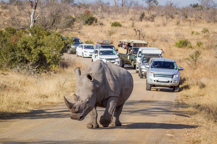
A white rhino stops vehicle traffic in Kruger National Park.
Kruger Private Reserves
(Including numerous reserves: Sabi Sand, Timbavati, Manyaleti, Thornybush, Kapama, Klaserie, Balule, Umbabat, Makalali Reserves)
When the Kruger National Park became South Afrca's first national park in 1926, the land bordering the newly protected land on the west was mainly utilized for farming or big game hunting by its owners. Years later in the late 1940s, some of these land owners decided to merge their properties into private wildlife reserves.
In 1948, the Sabi Sand Reserve (named for the two major rivers, the Sabi and the Sand, which flow through this land) became the first such private reserve bordering Kruger National Park, offering guided safaris and accommodation paying guests. Other landowners further north of the Sabi Sand Reserve followed suit, joining their properties together to create additional private wildlife reserves, including the Thornybush, Timbavati, Klaserie, and Manyaleti reserves.
The Sabi Sand Reserve is renowned for its high density of big cats (Copyright © James Weis).
When Kruger National Park was created, a fence was constructed around its perimeter, but in 1993 the fencing that separated the national park from the private reserves to the west was removed to allow the wildlife to roam freely in a much larger ecosystem.
Unlike the national park, the private reserves manage their own land and therefore allow the safari guides to drive the 4x4 safari vehicles off the dirt tracks and into the 'bush' in order to give guests a much higher quality experience, particularly when following high-profile species like lion, leopard, African wild dog, rhino, etc.
While the national park's main tarred roads can and do become congested with self-drive visitors, particularly when there is a sighting of lions or other sought-after species, the private reserves offer a much lower-density tourism, with never more than a few vehicles allowed at a sighting.
The properties in the private reserves typically have only one or perhaps a few lodges on a large tract of land, so guests can sometimes have wildlife sightings all to themselves (but never a crowd as can happen in the national park). Additionally, guests enjoy having a professional safari guide, who knows the property and its resident animals well.
The Private Reserves bordering Kruger National Park offer some of the best game viewing experiences in all of Africa (Copyright © James Weis).
Wildlife in most of the Kruger Private Reserves is the same as that found in Kruger National Park (since many of the reserves are directly adjoined to the park with no fencing separating them). The Big Five (lion, leopard, elephant, buffalo, and rhino-both black and white species) are all found in good numbers and can even be seen on a single game drive without a great deal of luck.
Other common species include zebra, giraffe, impala, nyala, sable, bushbuck, waterbuck, reedbuck, blue wildebeest, and many more. Commonly seen predators include the aforementioned lion and leopard, plus spotted hyena, African wild dog, black-backed and side-striped jackal, and other smaller predators like African wild cat, serval, and several species of mongoose.
Hippos and crocodiles are found throughout the major rivers and larger dams. Birding in the reserves is on a par with Kruger, particularly in the reserves directly bordering the national park.
Many of the Kruger Private Reserves have have good numbers of African wild dogs (Copyright © James Weis).
The Sabi Sand Reserve is without doubt at the top of the list when it comes to the Kruger Private Reserves. It is the oldest of the reserves and borders the prime southern habitat of the national park, with two major rivers, the Sabi and the Sand, flowing through its land. World-renowned properties like MalaMala, Londolozi, and Singita all have lodges in the Sabi Sand Reserve.
Other private reserves that offer excellent wildlife safari experiences include Timbavati, Manyaleti, Thornybush, Kapama, and Makalali. All of the Kruger Private Reserves offer a distinctly superior experience to a self-drive safari in the Kruger National Park, though at a much higher price.
Today the private game reserves west of the Kruger National Park offer some of the highest quality photographic safaris anywhere in Africa and surely the best in South Africa.
Read full details on the Private Reserve of Kruger here.
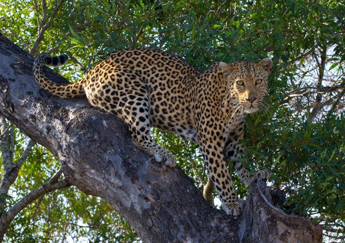
The Sabi Sand Reserve is well known for its leopard sightings (Copyright © James Weis).
Cape Town
Known as the 'Mother City', Cape Town is undoubtedly the top urban destination in all of Africa (in our opinion). Home to the majestic Table Mountain, which rises above the Cape Peninsula, Cape Town's natural beauty is undeniable. Anyone making a first time trip to South Africa will surely want to experience two things at a minimum: a wildlife safari and a visit to Cape Town.
Cape Town's City Centre is itself rather small, but the surrounding neighborhoods each have their own distinct character. The popular Victoria & Alfred Waterfront is South Africa's most visited tourist destination, offering shopping, restaurants, boat excursions, scenic helicopter flights, outdoor entertainment, and a wide assortment of hotels right along the water. The Cape Town Aquarium is also located in the V&A Waterfront and is fun for all ages. Walking and exploring here is completely safe and a great place for families.
Looking down on Cape Town city from the top of Table Mountain The cable car station can be seen on the left. Table Bay is in the distance.
In terms of things to do, Cape Town is a place to experience outdoors and the list is long. A week here would barely scratch the surface, so bear this in mind when planning a visit.
Hiking to the top of Table Mountain, which rises 3 500 feet above the city, or either of the two neighboring peaks, Lion's Head and Signal Hill, will provide good exercise and rewarding views from the top. For those wanting a more relaxing trip to the top of Table Mountain, the cable car gets you there and down in comfort while providing superb views of the city and ocean.
Robben Island, another major tourist attraction, is South Africa's version of Alcatraz Island, where Nelson Mandela was imprisoned for nearly two decades. The Constantia Winelands lie just south of the city and the much larger Cape Winelands are an easy day trip just east of Cape Town.
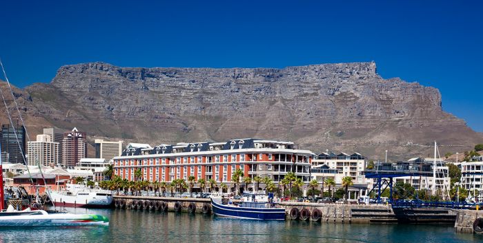
View of Table Mountain from the Victoria & Alfred Waterfront, Cape Town, South Africa.
Greenmarket Square is the site of a lively market, with outdoor vendors selling a huge variety of items from African curios, textiles, food and more. The area around the square will be of interest for anyone who enjoys architecture, with its mix of art-deco and old Cape colonial buildings.
Table Mountain National Park encompasses the entirety of the the Cape Peninsula outside of the city and a few suburbs.
Cape Town experiences a warm, Mediterranean climate, with mild to chilly and rainy winters (mid-May thru August) and warm, dry summers (November thru March). This climate is in contrast with most of South Africa, which experiences most of its rain during the summer months.
Reaching Cape Town is typically by air from Johannesburg, with multiple flights operating daily and a fly time of around 2 hours.
Read full details on Cape Town here.
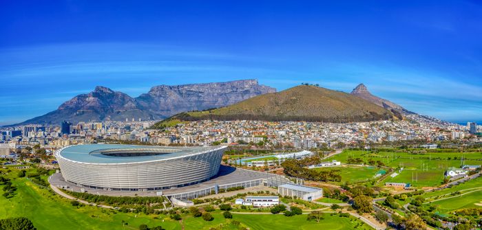
Cape Town Stadium (sometimes referred to as Green Point Stadium) was built for the 2010 FIFA World Cup.
Constantia Winelands
Located only 6 miles (10 kms) south of Cape Town city centre, in a small valley on the southern side of Table Mountain lies the Constantia Winelands. Constantia was named for Simon van Der Stel, the first Governor of the Dutch Cape Colony, who established an estate here in 1685 and planted the country's first grape vines.
Constantia wines gained international renown in the 18th and 19th century, when the Cloete family, who purchased a portion of the original estate after van Der Stel's passing, produced a dessert wine called Vin de Constance. This particular sweet wine, which is still produced by the Klein Constantia estate today, was beloved by Napoleon Bonaparte, King Edward VIII, and other notable historical characters.
Some of the Cape's best known wines are located in Constantia, including Groot Constantia, Klein Constantia, and Buitenverwachting. Besides the excellent wines, Constantia is renowned for some of South Africa's best fine dining, with numerous award-winning restaurants, many at the wineries, offering local and international cuisine.
The vineyards in Constantia, close to Cape Town.
Cape Peninsula
(including one national park: Table Mountain National Park)
Home to Table Mountain, South Africa's Cape Peninsula is a thin finger of land extending some 40 miles (60 kms) south from Cape Town into the Atlantic Ocean along the country's south west coast. A range of mountains dominates the peninsula, which is almost entirely protected as the Table Mountain National Park.
Table Mountain, one of Africa's most iconic natural features, rises above the small enclave of Cape Town, wWhich sits below and to the north, wrapping around the mountain along the Atlantic coast and to the east, where the urban sprawl reaches almost all the way to the Cape Winelands.
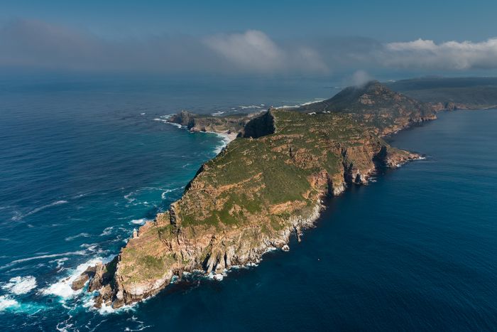
Aerial view above the tip of the Cape Peninsula. Table Mountain National Park protects most of the land.
Table Mountain National Park
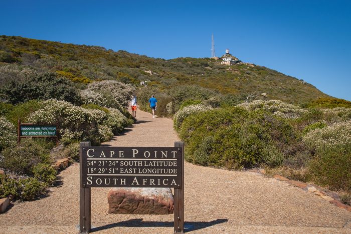
Table Mountain National Park (TMNP) protects the mountains, including Table Mountain, Lion's Head, Signal Hill, and the Twelve Apostles, as well as the beaches and around two-thirds of the entire peninsula, covering essentially all the natural areas and only excluding the Constantia Winelands and the few urban areas on the peninsula. Cape Point is the rocky terminus at the far southern tip of the peninsula, which is a popular vantage point for tourists.
Lion, spotted hyena, elephant, black rhino, and other iconic large mammals once roamed the Cape Peninsula, but the arrival of Europeans quickly led to the extinction of these species. Today the national park includes numerous re-introduced herbivores including Cape mountain zebra, bontebok, eland, and red hartebeest. Smaller antelope found in TMNP include klipspringer, common duiker, grey rhebok, grysbok, and steenbok. Chacma baboon are common throughout the park. Birding in the park is very good, owing to the diversity of habitats.
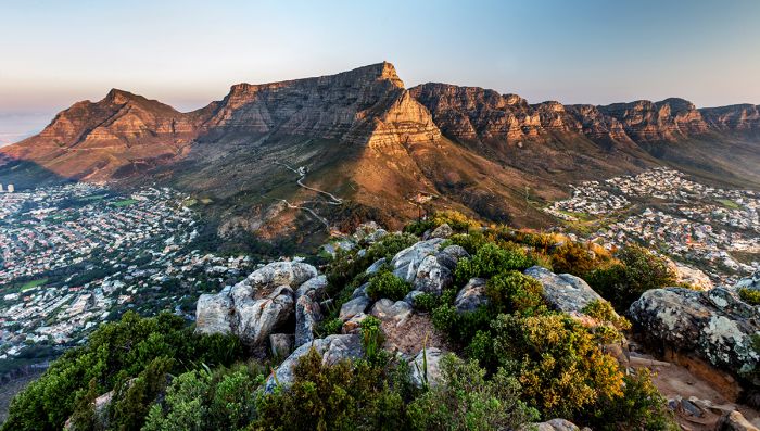
Table Mountain National Park protects the mountains and about two-thirds of the entire peninsula.
There are numerous small coastal enclaves that offer a variety of places to dine or stay overnight, including Camp's Bay, Hout Bay, Clifton, Noorhoek, Kommetjie, Simon's Town, and Fish Hoek.
A trip to the top of Table Mountain (via hiking or the cable car) is surely a must for first-time visitors, as is a half-day trip to Robben Island, where Nelson Mandela was imprisoned for 18 years.
Directly south of Table Mountain are the small but beautiful Constantia Winelands, which have been used for wine growing since 1685. Some of South Africa's finest wines are still produced here and the historic estates are lovely places to stop for lunch, sample wines, or even stay for a night or two.
Kirstenbosch Botanical Garden on the eastern slopes of Table Mountain was opened in 1913 and is another must-see for any visitor to the Cape. The gardens include over 7 000 species of plants, with a heavy emphasis on the native plants that grow in the Cape Floral Kingdom, the smallest and relatively most diverse of the world's six recognized floral kingdoms.
The peaks of the Twelve Apostles are protected within Table Mountain National Park.
There are beaches along both sides of the peninsula, some very popular and often crowded, but many that are secluded and seldom visited. The water on the western side of the peninsula is dominated by the northern-flowing Benguela Current, which brings icy waters from the Antarctic, while the water on the eastern side, which is False Bay, is typically warmer, but still far from tropical.
False Bay, on the eastern side of the peninsula, has gained some fame for being a place to see great white sharks, though their numbers have dwindled in recent years. Shark-viewing excursions, which seek to show guests these apex predators from a boat (or in a shark cage if you have the courage) depart from Simon's Town seasonally.
Another popular destination on the Cape peninsula is Boulders Beach at Simon's Town, where one can see the permanent colony of African penguins.
Read full details on the Cape Peninsula here.
Cape Point, at the southernmost tip of the peninsula.
Cape Winelands
South Africa produces some very high quality wines and its Cape Winelands are located in a region filled with incredible natural beauty. Visiting the Cape Winelands can be done as a day trip from Cape Town (45-minutes to one hour drive) or as a multi-day trip, staying at any of the many accommodations offered in the towns or at one of the wine estates.
Many of the wine estates in the Cape Winelands were established in the 1600s and some are still owned by descendants of the original families. The region is filled with history of the early days of South African colonialism, when the Dutch settlers and French Huguenots first arrived, some bringing grape vines from France. See more about the colonial era on the History tab.
The two most popular destinations in the Winelands are Stellenbosch and Franschhoek, both of which are small towns that grew from farming and wine producing settlements dating back to the 17th century. Nearby are the smaller towns and wine region of Paarl and Wellington. The entire area is spectacularly beautiful, with mountains encircling valleys and wine estates dotted along the various country roads.
The Cape Winelands offer spectacular scenery and excellent wines.
Self-driving in the Cape Winelands is quite easy to do and taking in the lovely vistas is part of the magic. Driving over the mountain passes en route to the next wine estate can be somewhat slow going due to the incredible postcard views that will invariably make one stop numerous times along the way.
Besides for the world-class wines on offer in the Cape Winelands, the region is renowned for some of the country's finest dining experiences, with innovative chefs running award-winning restaurants at many of the wine estates.
There are over 500 wineries in South Africa, and the Cape region makes up only a portion of the total wine production in the country. Many more wineries, albeit in lesser densities, occur further to the north in regions such as Swartland, Robertson, Breedekloof, Worcester, and others.
Read full details on the Cape Winelands here.
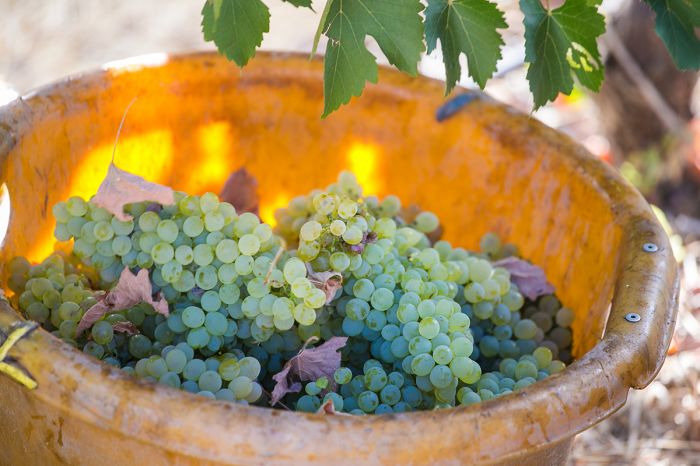
Freshly harvested grapes on a wine farm in Stellenbosch, Cape Winelands, South Africa.
Garden Route
(Including one national park: Garden Route National Park)
South Africa's Garden Route is one of the most scenic destinations in the country and one that can be visited on your own, with no guide and driving your own rented vehicle. Beautiful coastal views, charming small towns, bed and breakfast lodging, sandy beaches, hiking trails along the coast and through the forests, and easy-to-navigate roads make the Garden Route an excellent option for those who want to explore on their own.
Located on South Africa's southern coast, the Garden Route includes quaint seaside towns like George, Mossel Bay, Knysna, Plettenberg Bay, Nature's Valley, and Wilderness. These towns offer good restaurants, with local fare including excellent seafood, art galleries, craft shops, plus a good selection of accommodations from family-owned bed-and-breakfast guest houses to larger hotels and lodges.
For travelers with families, the Garden Route offers plenty to do, with outdoor activities in a very safe environment. Hiking is a top activity in the Garden Route, with two popular multi-day trails, the Otter Trail and the Outeniqua Trail, traversing different sections of the disjointed Garden Route National Park. The world's highest commercial bungee jump from the bridge over the Bloukrans River is for those seeking some adrenaline!
The Robberg Peninsula, located along South Africa's Garden Route near Plettenberg Bay.
Garden Route National Park
The Garden Route National Park (GRNP) is a disjointed combination of land, extending for miles along the coast and inland, some of it previously protected as national parks and reserves, and some of it newly added to create one large national park, which was proclaimed in 2009.
The already protected portions of the GRNP include what was the Tsitsikamma Coastal National Park (proclaimed in 1964), the Tsitsikamma Marine Protected Area (proclaimed in 1964), the Knysna Lake National Area (proclaimed in 1985), and Wilderness National Park (proclaimed in 1987). The combined GRNP covers an area of 470 square miles (1 210 sq kms) between the town of George in the west and the Groot River in the east.
The Tsitsikamma section of GRNP lies on the eastern side and is made up of what was the Tsitsikamma National Park, extending along the coast from Nature's Valley in the west to the Groot River in the east. This section also includes an area that protects the waters offshore for 6 miles (10 kms) offshore, as these waters provide crucial breeding and calving grounds for whales and habitat for myriad fish and other marine wildlife. Inland from the ocean, the Tsitsikamma section protects indigenous forests. The multi-day Otter Trail hiking path offers one of South Africa's greatest adventures along this dramatic coastline.
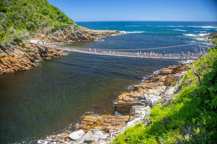
Visitors crossing a suspension bridge in Garden Route National Park (Tsitsikamma Section).
The western side of GRNP is made up of what was the Wilderness National Park, extending along the coast between the towns of George and Knysna. This section protects three small tracts of indigenous forest, as well as sections of 'fynbos' vegetation, plus pristine wetlands.
Inland from the coastline are the Outeniqua and Tsitsikamma Mountains, which separate the Garden Route from the Little Karoo region further to the north.
Reaching the Garden Route can be done by driving from either Cape Town (470 miles/750 kms) to the west or from Port Elizabeth (115 miles/185 kms). Renting a car in either city is easy, with airport drop-off and onward flight.
Read full details on the Garden Route here.
The Knysna Lagoon and town of Knysna are popular destinations on the Garden Route.
Whale Coast
(Including one national park and one reserve: Agulhas National Park and De Hoop Nature Reserve)
Located on South Africa's southern coast directly east of the Cape Peninsula, the Whale Coast is aptly named for the whales which breed and calve in its waters. The seaside town of Hermanus, which overlooks Walker Bay, is known as the best land-based whale watching location in South Africa and is therefore a popular tourist destination.
Southern right whales are the most common species of whale found along this coast, but an additional eight species can be seen from Hermanus and eastward. July thru October is the best time to see whales and there are boat-based whale-watching excursions for those that want a better view. The annual Whale Festival is held in Hermanus every September and is worth planning a visit around.
The small but excellent Hermanus Wine Route offers some of South Africa's best wine from grapes that are cultivated in the Hemel-en-Aarde Valley just inland from the town.
White shark viewing boat excursions depart from the small town of Gansbaai and head to Dyer Island and 'shark alley'. These shark viewing trips have become renowned for offering up-close viewing of these marine predators!
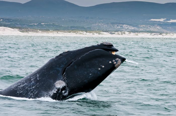
A southern right whale breaching offshore at Hermanus in South Africa's Whale Coast.
Agulhas National Park
Further east along the coast is Cape Agulhas, the southernmost point on the African continent, and the Agulhas National Park. The park, which covers an area of 80 square miles (210 sq kms), protects around 2 000 species of plants, as well as marine life. There is a wetland that offers refuge to numerous birds and amphibians.
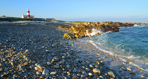
The Agulhas Lighthouse, built in 1849, is the second-oldest in South Africa. Cape Agulhas is the dividing point between the Atlantic Ocean to the west and the Indian Ocean to the east. Over 150 ships have wrecked on the Agulhas Reef over the years, including the De Zoetendal, HMS Birkenhead, and the HMS Arniston. The Shipwreck Museum in the nearby town of Bredasdorp includes stories and recovered pieces of the ships.
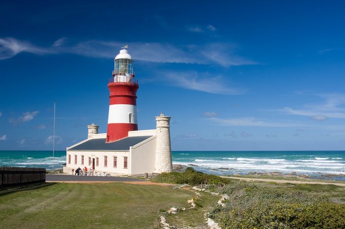
The lighthouse at Cape Agulhas, the southernmost point on the African continent.
De Hoop Nature Reserve
On the eastern end of the Whale Coast is the De Hoop Nature Reserve, which protects the largest remaining tract of coastal 'fynbos' (one of six global floral kingdoms). De Hoop also protects tall white sand dunes and good numbers of local wildlife, including bontebok, eland, Cape mountain zebra, and some 250 species of bird.
The De Hoop Reserve extends offshore for 5 miles (8 kms), protecting whale calving waters and plentiful marine life as the De Hoop Marine Protected Area. Whale watching is best along the Whale Coast from July thru October.
The De Hoop Reserve can only be explored on foot, as there are no roads, but there are plenty of excellent hiking trails. The 5-day, 34-mile (55-km) Whale Trail is one of the best walking with wildlife experiences in all of Southern Africa. The trail must be reserved in advance, as only one group at a time is allowed on the trail.
Read full details on the Whale Coast here.
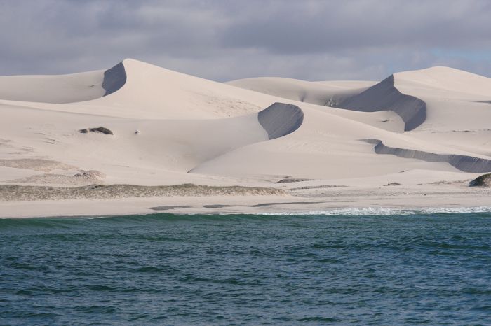
Towering coastal dunes in De Hoop Nature Reserve on South Africa's Whale Coast.
Overberg
(Including one national park: Bontebok National Park)
Overberg means 'over the mountain' in Afrikaans (the language of the original Dutch farming settlers known as the 'boers') and the Overberg region lies directly inland from the Whale Coast and east of the Cape Winelands. In the early days of the Dutch Cape Colony (present-day Cape Town), the little settlements of Franschhoek and Stellenbosch were outposts on the edge of the colony, and the Overberg was the hinterland.
Today the Overberg is still not a substantial draw for tourists, but it does offer scenic beauty, with sheep farms, wheat fields, the Riviersonderend Mountains, and the Breede River Valley.
The Breede River flows between several mountain ranges en route southeast thru the Overberg towards the Indian Ocean and its valley is home to lovely montane scenery, fruit farming, and wine estates. Several small towns have grown from the agricultural endeavors of these farms, including Worcester, Robertson, and Swellendam. The climate and soils in the valley are near perfect for viticulture and the grapes grown here produce some of South Africa's best known labels. Wine tastings are recommended!
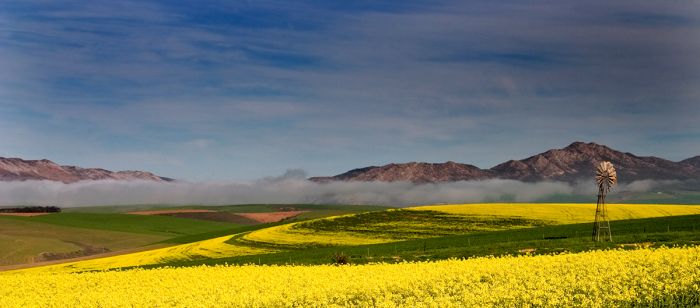
Windmill and canola (rapeseed) fields near Caledon in the Overberg Region of South Africa.
Bontebok National Park
Near the town of Swellendam on the eastern side of the Overberg is the small Bontebok National Park, which covers only 10.75 square miles (28 sq kms). It was established in 1931 to preserve the country's endangered population of bontebok antelopes. The park offers visitors hiking, fishing, and swimming in the Breede River.
Self-drivers en route to or from the Garden Route, which lies directly east of the Overberg, may want to add a day or two in the Overberg to explore this region along the way.
Read full details on the Overberg here.
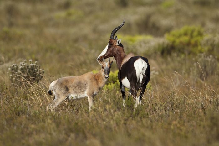
Bontebok antelope with her calf in Bontebok National Park, South Africa.
Little Karoo
The Little Karoo region lies north of the Overberg/Whale Coast in the west and extends eastward to the north of the Garden Route. The Little Karoo is separated from the more lush coastal areas by various mountain ranges that make up the greater Cape Fold Mountains.
The word 'karoo' is derived from the San word for 'thirst' and the Little Karoo (as well as the much larger Great Karoo further north) are indeed some of the most arid regions in South Africa. The climate in the Karoo is defined as semi-desert, with low rainfall, warm to hot days, and chilly nights.
Driving thru the Little Karoo offers an alternative for those visiting the Garden Route, which is most often done by taking the coastal N2 road. The route thru the Little Karoo is full of some of South Africa's most dramatic mountain passes, including Kogmanskloof Pass, Gamkaskloof Pass, Elands Pass, Prince Alfred's Pass, Tradouw Pass, and Swartberg Pass.
The Little Karoo offers miles of lovely mountain scenery.
The gravel road traversing between the R328 and the Swartberg Pass and the valley to the west at Gamkasklood (also known as Die Hel) is iconic with mind-blowing scenery and tight switchbacks the whole way. The road from Cape Town to the small town of Worcester, en route to the Little Karoo, also provides incredible vistas of mountains and valleys.
The town of Montagu, which is called the 'Gateway to the Little Karoo', is known for fruit cultivation, particularly apricots and peaches, as well as its natural hot springs, which can be visited at the Montagu Springs Resort.
Driving east from Montagu to Barrydale provides mountain scenery and postcard views all the way. Turning south from Barrydale will take you over the Langeberg Mountains towards Swellendam and over the Troudow Pass, which is impossible to go thru without stopping for some photos.
Other towns worth visiting in the Little Karoo include Calitzdorp, Prince Albert, Matjiesfontein, and Oudsthoorn, which is known for its ostrich farms (tourists welcome) and the nearby Cango Caves.
Read more about the Little Karoo on our Garden Route and Overberg pages.
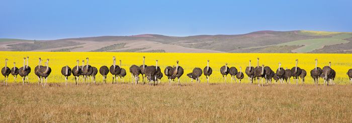
Ostriches near Oudtshoorn in South Africa's Little Karoo region, with yellow rapeseed (canola) fields in background.
Great Karoo
(Including four national parks and one reserve, listed geographically west-to-east: Tankwa Karoo National Park , Karoo National Park, Camdeboo National Park, Samara Game Reserve, Mountain Zebra National Park)
The Karoo is a vast region in the northwest of South Africa that is characterized by a semi-desert climate, with very low rainfall, dry air, mostly cloudless skies, and the typical desert extremes of heat and cold.
The Karoo region does not have well-defined borders, but there is a distinction between what are called the Great Karoo and the Little Karoo, with the two regions separated by the Swartberg Mountains. The Great Karoo lies to the north of the Swartbergs (part of the Cape Fold Mountain Range), which runs parallel to the coast, while the Little Karoo is to the south.
The northern extent of the Great Karoo blends into what is known as Bushmanland, home of the Nama people, and extends well into southern Namibia, where the region is termed the Nama Karoo (and towards Namibia's southwest coast, the Succulent Karoo).
There are five protected areas worth noting in the southern reaches of the Great Karoo:
- Camdeboo National Park
- Karoo National Park
- Mountain Zebra National Park
- Samara Game Reserve
- Tankwa Karoo National Park
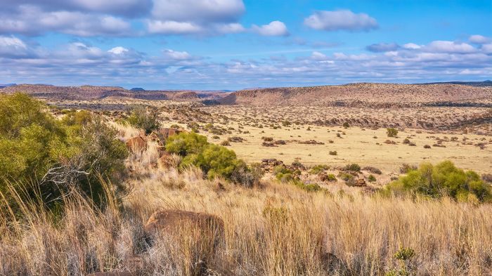
A typical landscape in the Great Karoo region of South Africa. The flat topped hills are known as 'karoo koppies'. Image is taken near Coleberg in the Free State Province.
Camdeboo National Park
(Including the town of Graaff-Reinet)
Established in 2005, Camdeboo National Park covers 72 square miles (186 sq kms) in the foothills of the Sneeuberge (Snow Mountains). The park surrounds the small town of Graaff-Reinet on three sides and the park entrance is only 3 miles (5 kms) from the town centre. The park was made possible by the World Wide Fund for Nature in South Africa (WWF-SA), which donated the Karoo Nature Reserve (established 1979), as the foundation for the new park.
The park is mainly a scenic destination, where one can enjoy the semi-arid Karoo landscape and enjoy the hiking on well marked trails. The dramatic and deep Valley of Desolation is a highlight, with its pillars of dolerite rock towering up over 325 feet (100 meters). The views from the cliffs overlooking the valley (which can be reached by road) are spectacular.
A visitor enjoys a view of the Valley of Desolation in Camdeboo National Park.
Wildlife in Camdeboo includes Cape mountain zebra, springbok, black wildebeest, red hartebeest, buffalo, greater kudu, and ostrich. There are no big cats or dangerous predators. The park's bird list tops 225 species, with a highlight being the resident population of Verreaux's eagle.
Camdeboo experiences typical Karoo weather, with hot days and chilly nights. The winter months are the most pleasant, but the nights can be very cold. Rain can fall throughout the year, but is uncommon, with only around 15 inches (400 mm) per year.
Visitors can stay in the town of Graaff-Reinet and choose from various cottages or guest houses or self-camp in the park.
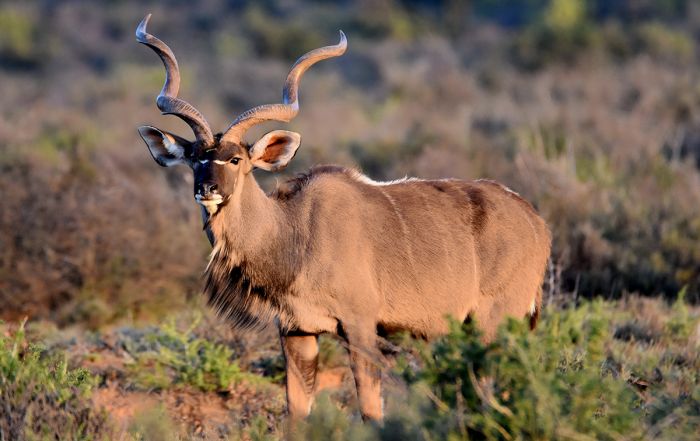
A magnificent male kudu in Camdeboo National Park, South Africa.
Graaff-Reinet
Established in 1786 by the Dutch East India Company, Graaff-Reinet is the fourth-oldest town in South Africa, after Cape Town, Stellenbosch, and Swellendam. The town was originally established as a frontier trading post for the Dutch Cape Colony and is named after then-governor of the Cape Colony, Cornelis Jacob van de Graaff.

The town of Graaff-Reinet is located adjacent to Camdeboo National Park.
Karoo National Park
Established in 1979, the Karoo National Park covers 317 square miles (822 sq kms) of dramatic and rugged desert mountain landscapes near the town of Beaufort West on the N1 roadway. Unlike the lands further north in the Great Karoo, the park's location in the southern part of the Karoo means that it does receive rains, averaging around 8 inches (200 mm) per year.
Karoo National Park is located along the Nuweberg section of the Great Escarpment, which lies to the north of the Cape Fold Mountains and forms the southern edge of the Central Plateau covering most of South Africa's interior.
Although certainly not to be considered a prime game viewing destination, Karoo National Park offers a good variety of wildlife, including healthy populations of oryx (gemsbok), springbok, Cape mountain zebra, Burchell's zebra, eland, greater kudu, red hartebeest, klipspringer, and black wildebeest. Black rhino and lion have been reintroduced, but are hard to find as much of the park in inaccessible.
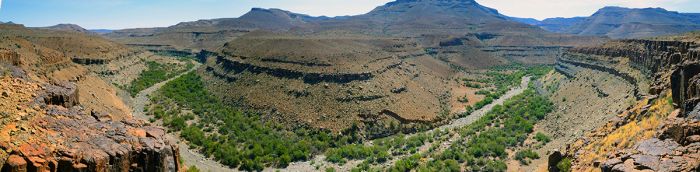
Panoramic view of Karoo National Park in South Africa's Great Karoo.
Birding for dry-land and desert species is very good in Karoo NP, with a list of some 200 species. Verreaux's eagles are seen regularly, and there is a dam which attracts waders and other water birds. Migrant species arrive from the north around October/November and stay to breed until April.
There is decent park infrastructure, with maintained roads, a main rest camp with furnished chalets and cottages, a shop and restaurant, and an environmental education centre. There is also a camping site.
May thru September is bone dry, with hot days and bitterly cold nights. The summer months (November thru March) are mainly dry as well, with the occasional rain shower and thunderstorm possible.
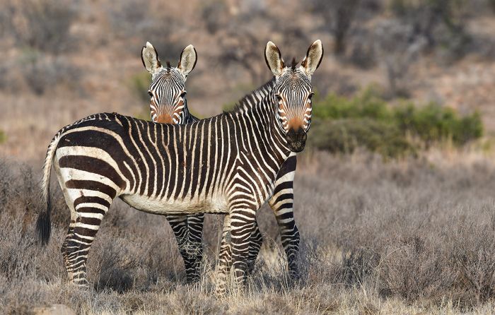
Cape mountain zebras in Karoo National Park, South Africa.
Mountain Zebra National Park
Located in the Great Karoo region of the Eastern Cape Province is one of South Africa's oldest protected areas, the Mountain Zebra National Park (MZNP). The park was established in 1937 to conserve what was at that time, a population of only six Cape mountain zebras (five stallions and one mare) remaining in the newly created park.
The initial park only covered 6.6 square miles (17 sq kms). By 1950, only two of the park's original stallions remained, but a neighboring farmer agreed to donate eleven of his zebras to the park, which enhanced the gene pool and helped save the species from extinction.
As of 1964, the Cape mountain zebra population in MZNP had grown to 25 and the park's land had been expanded to an area of 25 square miles (65 sq kms). Further donations of mountain zebras from other conservation-minded individuals further enhanced the population and by the 1970s, there were over 150 zebras in the park. In 1975, a number of the zebras in MZNP were relocated to the De Hoop Nature Reserve in the Western Cape.

A black rhino in Mountain Zebra National Park, South Africa.
Since 1978, the capture and relocation of mountain zebras from MZNP for relocation to areas within their historical range has become part of the routine management of the species. As of 2015, the population of Cape mountain zebra in MZNP was around 700 animals, with around 20 zebras relocated from the park every year. Additional land surrounding the park has been added over the years, and the current size of MZNP is 131 square miles (339 sq kms).
Besides the zebras, for which the park is named, other wildlife found in MZNP includes buffalo, springbok, black wildebeest, eland, red hartebeest, oryx (gemsbok), and blesbok. Black rhino, lion, and cheetah have been reintroduced, but are not not easily seen. Leopard and brown hyena are also here. Smaller predators include caracal and bat-eared fox. Chacma baboon and vervet monkeys are common in MZNP. Birding in the park is good with a list of around 300 species.
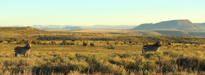
Mountain Zebra National Park saved the Cape mountain zebra from extinction.
Like other parks in the Karoo, MZNP has a semi-arid climate, with low rainfall that can occur any time during the year. The winter (May thru September) experiences very chilly nights, comfortable days, clear skies, and very little rain. Summer temperatures are mild to very warm and rain is somewhat more possible, though seldom heavy, with drizzling rain the most common.
Self-drive game viewing is the primary activity, but there are also guided activities offered by the national park, including game drives, bush walks, cheetah tracking, and visits to caves to see San rock art paintings.
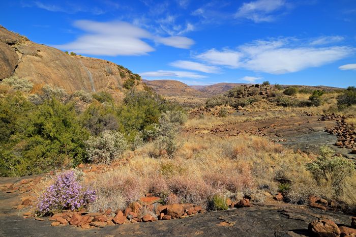
Wildflowers and rugged landscape in Mountain Zebra National Park, South Africa.
Samara Game Reserve
Situated in the Eastern Cape's Great Karoo, the Samara Private Game Reserve covers 105 square miles (271 sq kms) of semi-desert landscape. Samara was created in 1997 with the goal of restoring a collection of eleven degraded livestock farms to their natural state, including the reintroduction of wildlife and indigenous flora.
Samara is located in one of the world's 36 Biodiversity Hotpots as defined by Conservation International. To qualify as a global hotspot, a region must must have at least 1,500 vascular plants as endemics and it must have 30% or less of its original natural vegetation (i.e., it must be threatened). Samara is part of the Maputaland-Pondoland-Albany Hotspot and encompasses five defined biomes: Savanna, Nama Karoo, Forest, Grassland, and Albany Thicket.
In 1998, SANParks and a group of conservation NGOs developed a plan to link the Camdeboo National Park with the Karoo National Park via protected ecological corridors. Samara, which is located between these two parks, is an integral part of this plan.
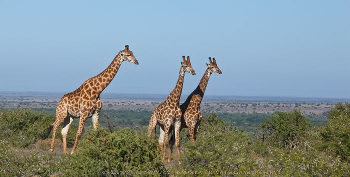
Giraffes are one of the many species of wildlife living in the Samara Game Reserve (Copyright © Etienne Oosthuizen / Samara).
As a step towards realizing this plan, in 2016, the 'Mountain Zebra – Camdeboo Protected Environment' was officially created, which implemented various levels of environmental protection for around 1 000 square miles (2 600 sq kms) of land. The final goal would mean a mega-park that protects some 2 000 square miles (5 250 sq kms) of land.
Three centuries ago, the region was home to a huge abundance of wildlife, including immense herds of springbok, eland, and buffalo. Black rhinos thrived in the arid thickets and elephants traveled north from the coast to feed on the vegetation. Cape lion and the zebra-like quagga also lived in the region, but both are now extinct. Most of the Great Karoo is now fenced and used for sheep and goat farming and much of the wildlife from yesteryear is long gone.
Sanmara's owners hope to restore the reserve to its wildlife-rich days as much as possible, and have worked diligently to restore the damaged landscape by planting indigenous flora. Next came the reintroduction of animal species, including greater kudu, Cape mountain zebra, red hartebeest, and others. In 2004 cheetahs were reintroduced - the first to roam the region in some 125 years. Elephant were reintroduced in 2017 after an absence of 150 years. Both species of rhino (black and white) were reintroduced, as were buffalo.
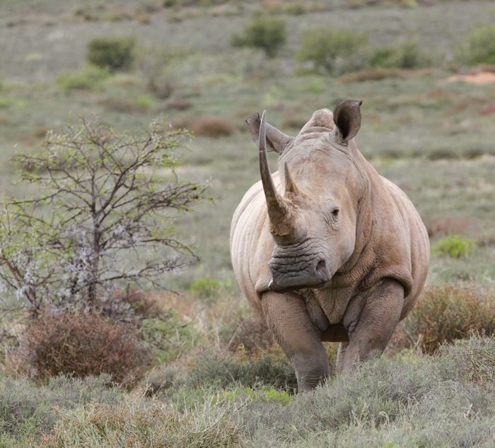
A white rhino in the Samara Game Reserve (Copyright © Samara).
With the reintroduction of lions in 2019, Samara became the first 'Big Five' free-roaming reserve in the Great Karoo, with populations of lion, leopard, elephant, rhino, and buffalo.
Wildlife found today in Samara includes rhinoceros (both black and white species), buffalo, elephant, Cape mountain zebra, Burchell's zebra, greater kudu, springbok, eland, oryx (gemsbok), giraffe, waterbuck, red hartebeest, black wildebeest, blesbok, nyala, mountain reedbuck, klipspringer, steenbok, common duiker, warthog, bushpig, and grey rhebok.
Predators at Samara include lion, leopard, cheetah, black-backed jackal, Cape fox, bat-eared fox, several species of mongoose, caracal, aardwolf, brown hyena, African wild cat, small spotted cat small-spotted genet, and meerkat.
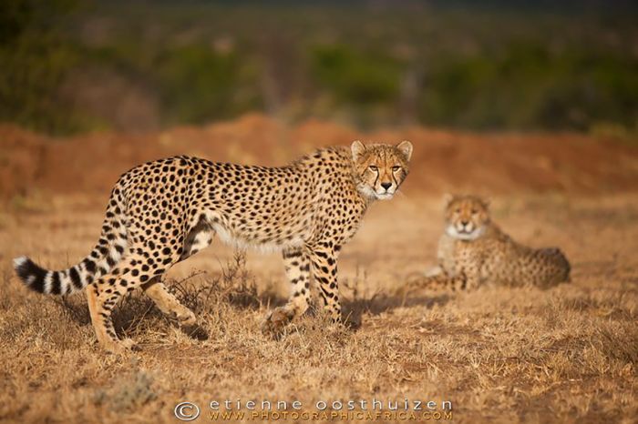
Cheetahs in Samara Game Reserve (Copyright © Etienne Oosthuizen / Samara).
Birding in Samara is excellent, with around 225 species on the list, including the endangered Ludwig's bustard, big flocks of blue crane, Cape vulture, and several Karoo endemics.
There are two excellent safari lodges in Samara, both offering a wide array of activities, including guided game drives, walking safaris, mountain biking, cheetah tracking, fly camping, and more.
The Karoo can be extremely hot during the summer (December thru February), but the occasional thunderstorm often cools things down. Winter is much more mild, with days averaging 68°F (20°C), but has very chilly nights and early mornings. The Spring months of September thru November offer excellent game viewing and the best weather.
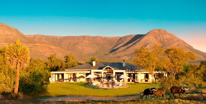
Samara Manor is one of only two properties for guests staying in Samara Game Reserve (Copyright © Samara).
Tankwa Karoo National Park
Proclaimed in 1896, Tankwa Karoo National Park covers a modest 549 square miles (1 422 sq kms) in one of the most arid regions in South Africa, along the Great Escarpment in the far southwest corner of the Great Karoo and straddling the Northern Cape and Western Cape Provinces. The park was created to protect the high biodiversity of desert-adapted vegetation and animals, including many species of succulent plants.
Some of the land in the park was used for sheep farming in the past, but South African National Parks (SANP) are in the process of reintroducing indigenous wildlife that was historically found in the area. Birding in the park is excellent, with around 190 species recorded, including dry-land specials like Ludwig's bustard, black-eared sparrow-lark, and black-headed canary.
There is currently no tourism infrastructure on the park, but there are a few rudimentary accommodations and self-camping sites outside the park where visitors can stay.
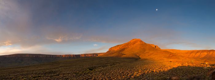
Desert landscape in the Tankwa Karoo, Northern Cape Province, South Africa.
Addo Elephant National Park
Located in the Eastern Cape and inland from the coastal city of Port Elizabeth, Addo Elephant National Park was first created as a municipal reserve to protect elephants in 1921. Addo became a national park in 1931, when only 11 elephants remained in the region.
Addo is South Africa's third largest national park, covering a huge 6 564 square miles (17 000 sq kms). The park is separated into multiple sectors or areas, most of which are contiguous with the original 'Main Area', but those along the coast are disjointed from the larger main area. Addo is designated as a 'malaria-free' destination, making it an attractive option for those concerned with this disease.
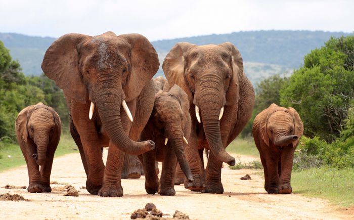
A breeding herd of elephants on the road in Addo Elephant National Park, South Africa.
Addo's 'Main' and 'Colchester' areas offer the best wildlife viewing, with around 700 resident elephants, which can be viewed from very close proximity, as they have become very used to visitors. All of the 'Big Five' are found in this section of the park. Commonly seen species in this part of the park includes buffalo, black rhino, zebra, greater kudu, red hartebeest, and more. Predators include lion, leopard, cheetah, spotted hyena, and black-backed jackal.
The coastal portion of Addo is protected in two sections, the 'Colchester' and 'Woody Cape' Areas. These coastal areas protect the sand dunes which line the Indian Ocean shoreline here. The Addo Marine Protected Area (established in 2005) protects the waters offshore, which are home to whales, dolphins, and myriad other marine life.
Within the marine protected area are two groups of small islands: the St. Croix group and the Bird Island group. These islands are protected as part of the Greater Addo National Park, due to their importance as breeding grounds for multiple species of seabirds, as well as providing habitat to roughly 40% of the global population of African penguins. Bird Island is a key breeding location for Cape gannets.
Read full details on the Addo Elephant National Park here.
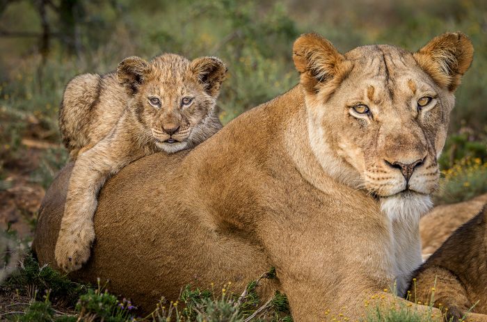
A lioness with her cub in Addo Elephant National Park.
Shamwari Game Reserve
Shamwari is directly east of Addo National Park and only 1.5 hours from Port Elizabeth by road. Created in 1992 from disused farmland, Shamwari covers 97 square miles (250 sq kms), Shamwari offers excellent game viewing, including all of Africa's 'Big Five' animals in a malaria-free environment.
Within the Shamwari Reserve are two Born Free Big Cat Sanctuaries, which provide home and a good life for leopards and lions that have been rescued from zoos and other private locations around the world. The sanctuaries are open for visitation to guests in the reserve. Shamwari offers numerous safari camps and lodges as overnight accommodation, offering a full range of activities, with the focus on game drives.
Two additional reserves adjoin Shamwari, to form a greater expanse of land for wildlife: Amakhala Game Reserve to the south and Lalibela Game Reserve to the east. Further accommodation is available in both of these excellent reserves. Slightly further east is the Pumba Game Reserve, which offers more accommodation and safaris. All of the reserves are malaria-free.
Read more about Shamwari and the game reserves of the Eastern Cape here.
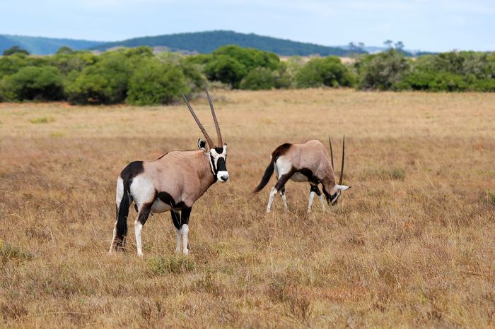
Two oryx (also called gemsbok in South Africa) in Shamwari Game Reserve.
Kwandwe Game Reserve
Located in the Eastern Cape along the Great Fish River, Kwandwe covers 85 square miles (220 sq kms) of pristine wilderness. Wildlife includes all of the 'Big Five', with both black and white rhino, zebra, giraffe, greater kudu, oryx, black wildebeest, cheetah, spotted hyena, brown hyena, and many more species.
There are only two lodges in the reserve, both run by the same operator, making the experience very exclusive for guests. Game viewing is offered via guided game drives and boating on the river. Walking safaris and fishing are also offered. Family safaris are a specialty at Kwandwe. Kwandwe, like the other Eastern Cape reserves, is malaria-free.
Read more about Kwandwe and the game reserves of the Eastern Cape here.
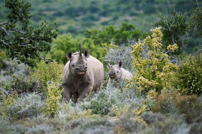
A black rhino with her calf in the Kwandwe Game Reserve, South Africa.
Blyde River Canyon Nature Reserve
The third-largest canyon in the world, Blyde River Canyon is located along the Drakensberg Escarpment and only 50 miles (75 kms) west of the Kruger National Park. This popular and scenic destination is part of South Africa's 'Panorama Route', a driving journey taking in some of the sights in this region.
The Panorama Route offers spectacular vistas along the way and plenty of notable spots to stop and explore, including Bourke's Luck Potholes, Three Rondavels, Lisbon Falls, Berlin Falls, Mac Mac Falls, God's Window, and more.
Read more about Blyde River Canyon and the Panorama Route here.
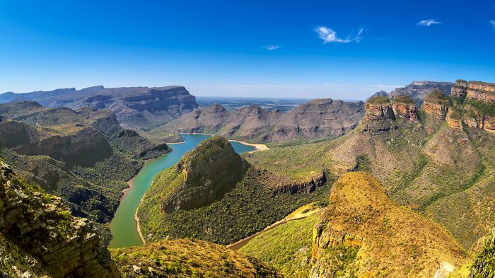
Blyde River Canyon, the largest 'green' canyon in the world. The three dolomite peaks on the right are known as The Three Rondavels.
The Drakensberg
(Including two parks - one national and one provincial - plus one transfrontier park: Royal Natal Provincial Park, Golden Gate Highlands National Park, Maloti-Drakensberg Transfrontier Park)
The Drakensberg is the name given to part of the eastern side of Southern Africa's Great Escarpment, which are the steep slopes that descend from the high Southern African Plateau towards the oceans that surround Southern Africa on three sides. The Great Escarpment lies primarily in the country of South Africa, but it extends further north in the west into Namibia and Angola and further north in the east into Eastern Zambia (as the Muchinga Escarpment).
The name of this range of mountains comes from the earliest Dutch settlers, who called it 'Drakensbergen', or 'Dragons Mountains'. The highest section of the Great Escarpment, which lies along the border between South Africa's border with Lesotho, is known in the local Zulu language as 'uKhahlamba', and in the Sotho language as 'Maloti', both of which mean "barrier of spears".
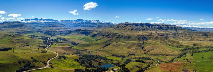
Aerial view of a section of the Drakensberg Mountains.
The Drakensberg Escarpment stretches for over 600 miles (1 000 kms) from the Eastern Cape Province, along the southern and eastern boundaries of the country of Lesotho, forms the border between the Free State and KwaZulu-Natal, runs north along the western border of Swaziland, then north through Mpumalanga and the Limpopo Provinces, where it includes popular tourist destinations such as the Blyde River Canyon and God's Window.
Further north in the Limpopo Province, the escarpment continues into southeastern Limpopo Province where it is known as the 'Klein Drakensberg' and then shifts west towards Tzaneen town, where it is called the Wolkberg Mountains.
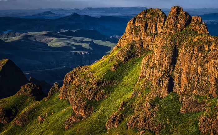
View from the Sentinel Peak hiking trail that leads to Tugela Falls, Drakensberg Mountains, South Africa.
The Drakensberg reaches its highest elevations (6 562-11 424 feet / 2 000-3 482 meters) along the eastern border of Lesotho with South Africa. The high treeless peaks above 8 200 feet (2 500 meters) are part of the Drakensberg alto-montane grasslands and woodlands ecoregion. These high slopes are the most southerly high mountains in Africa.
The high rainfall in the high peaks along the South Africa/Lesotho border generates many mountain streams and is the source of the Orange River, the longest river in Southern Africa, as well as the Tugela River. The Tugela Falls, in the small Royal Natal Provincial Park, is the world's second-tallest waterfall (after Angel Falls in Venezuela).
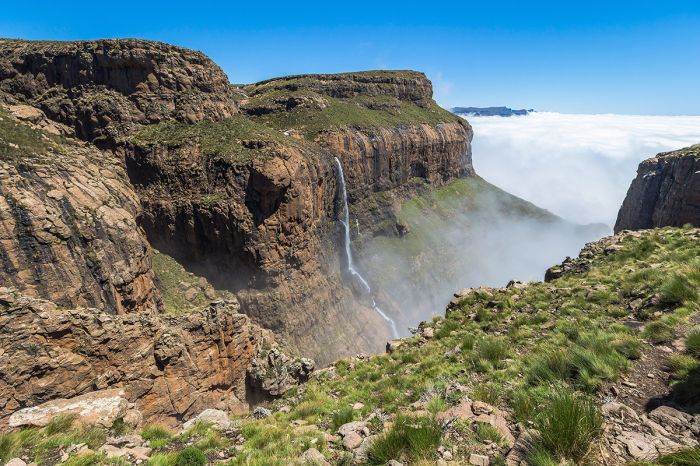
Tugela Falls in the Drakensberg Mountains, Royal Natal Provincial Park, South Africa.
Royal Natal Provincial Park
The tiny Royal Natal Provincial Park covers just 31 square miles (81 sq kms) in the Drakensberg Mountains near the South African border with Lesotho. Royal Natal is not a national park, as it is managed by Ezemvelo KZN Wildlife, a KwaZulu-Natal provincial governmental organization.
The main features and attractions in the park are the 'Drakensberg Amphitheatre', a rock wall that spans 3 miles (5 kms) long by up to 3 900 ft (1 200 meters) high, Mont-Aux-Sources, the high peak where the headlands of the Orange and Tugela rivers, and the 3 110-foot tall (948 meters) Tugela Falls, the world's second-highest waterfall.
Royal Natal Provincial Park is now part of the Maloti-Drakensberg Transfrontier Park.
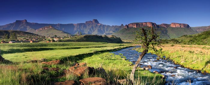
View of the 'Drakensberg Amphitheatre' in Royal Natal Provincial Park, South Africa. Royal Natal is incorporated into the Maloti-Drakensberg Transfrontier Park.
Golden Gate Highlands National Park
Located in the Free State Province (the only national park in the province), the scenically stunning Golden Gate Highlands National Park covers an area of 130 square miles (340 sq kms) on the border with Lesotho. The park protects the foothills of the Maloti Mountains, which are part of the Drakensberg Range.
The name 'Golden Gate' refers to the park's most notable feature, which are the golden- and orange-colored, heavily eroded sandstone cliffs and buttresses, and particularly 'Brandwag Rock'. There are numerous caves in the park, many displaying San rock paintings.
The park was proclaimed in 1963, with more land added in 1981 and again in 1988. In 2007, the adjacent QwaQwa National Park was incorporated into the Golden Gate Highlands, increasing the park's area to its current size.
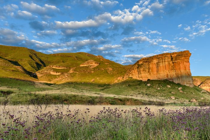
Brandwag Rock in Golden Gate National Park, Free State Province, South Africa.
The park's primary flora is a rich mix of montane grassland species, with abundant flowering plants. The park also has sections of Afromontane forest and high-altitude Austro-Afro alpine grassland. The 'ouhout' (or oldwood) (Leucosidea sericea), an evergreen tree or large shrub, is the most common tree species in the park. Several introduced exotic species, including Lombardi poplars and weeping willows, have been allowed to remain due to their historical and cultural significance with the region.
Wildlife in the park includes several species of antelope, including mountain reedbuck and grey rhebok.
Golden Gate Highlands National Park is now part of the Maloti-Drakensberg Transfrontier Park.
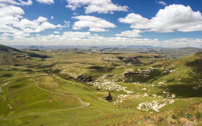
View of the lush mountains in Golden Gate Highlands National Park, South Africa. Image taken from 'Generaalskop', one of the peaks of the Drakensberg Mountains.
Maloti-Drakensberg Transfrontier Park
The Maloti-Drakensberg Transfrontier Park (MDTP) was proclaimed in 2001 by combining various already established national parks and reserves in both South Africa and Lesotho, all of which protected sections of the Drakensberg Mountains.
The Maloti-Drakensberg Transfrontier Park combined together the following protected areas:
- uKhahlamba Drakensberg Park (KwaZulu-Natal Province);
- Royal Natal Provincial Park (KwaZulu-Natal Province);
- Sterkfontein Dam Nature Reserve (Free State Province);
- QwaQwa National Park (Free State Province);
- Golden Gate Highlands National Park (Free State Province);
- Sehlabathebe National Park, (Lesotho).
The MDTP is home to hundreds of rock art sites and thousands of images painted by the Bushmen (San) people. Southern Africa's highest peaks are located in the Drakensberg, including Thabana Ntlenyana (11 424ft/3 482m in Lesotho) Thabo Putsoa (11 335ft/3 455m in Lesotho) and Mafadi (11 322ft/3 451m, shared by Lesotho and South Africa).
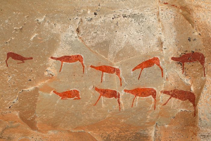
Bushman rock art in the Maloti-Drakensberg Park, South Africa.
iSimangaliso Wetland Park
South Africa's third largest protected area, the iSimangaliso Wetland Park is situated on the northern coast of the KwaZulu-Natal Province from Kosi Bay at the Mozambique border in the north to the Umfolozi River in the south. The park extends for 174 miles (280 kms) of Indian Ocean coastline.
The name of the park 'iSimangaliso' means "miracle" or "something wondrous" in the Zulu language. The park's name was changed in 2007 from the Greater St. Lucia Wetlands Park to iSimangaliso Wetland Park.
iSimangaliso protects a great variety of ecosystems, including many miles of sand beach, coastal sand forest, some of the world's highest highest coastal vegetated dunes, inland lakes and vast wetlands, estuaries, papyrus marshes, grasslands, mountains, and offshore coral reefs. The park today consists of an amalgamation of several previously protected areas and, as such, the park has differently named sectors that refer to the prior park names.
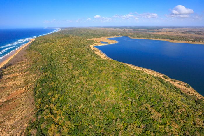
Aerial view along the coast of Sodwana Bay in iSimangaliso Wetland Park, KwaZulu-Natal Natal Province, South Africa. The image shows the southern end of Lake Sibaya.
- uMkhuze Section - inland from the coast and bordering the Phinda Game Reserve (formerly Mkuze Game Reserve).
- Maputaland Coastal Forest Section - far northern coastal section stretching to the Mozambique border (formerly the Maputaland Coastal Forest Reserve).
- Maphelane Section - far southern section around the Umfolozi River (formerly Maphelane Nature Reserve).
- St. Lucia Section - the original central coastal section that includes Lake St. Lucia and its associated wetlands (formerly the Greater St. Lucia Wetlands Park).
There are four Ramsar Wetlands of international importance located within iSimangaliso: Kosi Bay, Lake Sibaya, St. Lucia System, and Turtle Beaches/Coral Reefs of Tongaland.
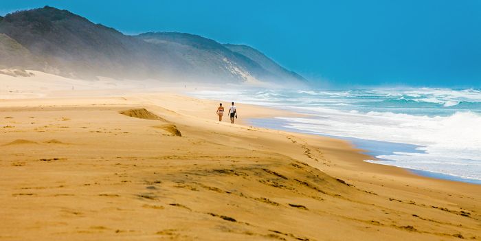
Beautiful sand beach with towering, vegetated coastal dunes in iSimangaliso Wetland Park, South Africa.
Wildlife in the park includes various antelope species, including greater kudu, waterbuck, reedbuck, bushbuck, red duiker, and others. Lion and leopard are present but seldom seen. Hippo and crocodile are common in the larger water bodies. Elephant and both species of rhino (black and white) are found in portions of the park. Birding in the park is excellent due to the great diversity habitats in the park, with a species list topping 500 species.
The more remote section on the far north, previously known at the Maputaland Coastal Forest Reserve, offers some of the best SCUBA diving in South Africa, with the coral reefs offshore a haven for tropical fish and other marine life.
The beaches along this northern part of the park are used as nesting sites by five species of marine turtle, including the critically endangered loggerhead and leatherback turtles. Visitors at the nearby Rocktail Camp can ride along with researchers on their nest monitoring runs or take part in a hatchling release.
Read more about iSimangaliso and the KwaZulu-Natal Reserves here.
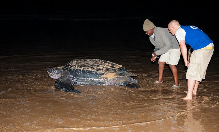
Researchers watch as a leatherback turtle returns to the ocean after laying her eggs (Copyright © James Weis).
Phinda Game Reserve
Phinda is a private game reserve located in the northern portion of the KwaZulu-Natal Province, just inland and contiguous with iSimangaliso Wetland Park.
Phinda covers an area of 85 square miles (220 sq kms) of old farm land that has been restored to its natural state by the AndBeyond company, which also owns and operates the reserve and its safari lodges. The word 'Phinda' comes from a Zulu phrase meaning 'the return', a fitting description to this highly successful project.
Phinda is home to abundant wildlife, including all the 'Big Five' (lion, leopard, rhino, elephant, buffalo), as well as a huge variety of antelopes and other animals. Phinda is one of the best places (arguably THE best) in Southern Africa to view cheetahs. Other common species in Phinda include Burchell's zebra, giraffe, greater kudu, impala, nyala, reedbuck, waterbuck, blue wildebeest, warthog, spotted hyena, side-striped jackal, crocodile, hippo, chacma baboon, vervet monkey, and many more.
The safaris in Phinda are very good, with open 4x4 game drive vehicles, superb guides, and excellent accommodations.
Read more about Phinda and the KwaZulu-Natal Reserves here.
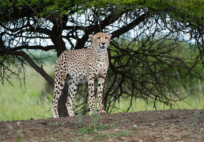
Phinda Game Reserve is renowned for offering excellent opportunities to see cheetah (Copyright © James Weis).
Hluhluwe-iMfolozi Game Reserve
The Hluhluwe-iMfolozi Game Reserve was created as a combination of two of South Africa's oldest game reserves, Hluhluwe (pronounced "shloo-shloo-wee") and iMfolozi, both of which were established back in 1895. Both reserves have long been fenced, with a tarred transit road separating the two reserves, but in 1989, the parks were combined and the fence separating the two removed.
The combined reserve offers excellent game viewing, including all of the 'Big Five' animals (lion, leopard, elephant, rhino, buffalo), plus cheetah, spotted hyena, giraffe, nyala, blue wildebeest, zebra, African wild dog, and many more.
The Hluhluwe-iMfolozi Game Reserve is well known for its conservation work to protect white rhinos.
Read more about Hluhluwe-iMfolozi and the KwaZulu-Natal Reserves here.
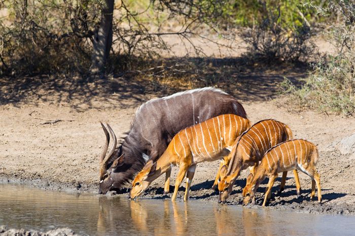
Nyala drinking at a waterhole in Hluhluwe-Imfolozi Game Reserve, South Africa.
Madikwe Game Reserve
Madikwe is a private reserve located in the North West Province, on the border with Botswana. Madikwe was created from disused farming land and restored to its natural state, beginning in 1991. The restored land is now completely fenced and covers an area of 293 square miles (760 sq kms) and the safari experience here is superb.
Madikwe is surely one of the most exclusive wildlife destinations in South Africa, with numerous four- and five-star lodges to choose from, including many that are designed especially for families or groups.
The game viewing in Madikwe is also excellent, with a high diversity of species, including all of the 'Big Five' (lion, leopard, rhino, elephant, buffalo). Other predators include cheetah (in small numbers), both brown and spotted hyena, serval, caracal, and a very healthy population of African wild dog. Both species of rhino (white and black) are found in the reserve.
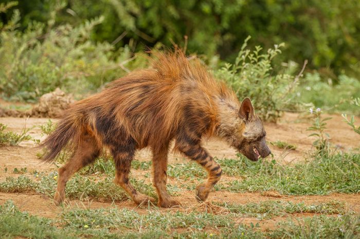
Madikwe Game Reserve offers diverse wildlife, including hard-to-find species like brown hyena.
Plains game and other herbivores commonly seen include giraffe, blue wildebeest, zebra, oryx (gemsbok), eland, greater kudu, red hartebeest, reedbuck, springbok, sable, tsessebe, waterbuck, and warthog. Baboon and vervet monkey are common. Crocodile and hippo are found in the rivers and larger waterholes.
Birding in Madikwe is superb, with a list of over 350 species.
All in all, Madikwe is nearly on a par with the Kruger Private Reserves in terms of wildlife viewing, albeit in a much smaller ecosystem. The guiding, accommodations, and overall safari experience here is top notch, but the pricing of the mostly upscale camps and lodges is not inexpensive.
Madikwe is easily reachable from Johannesburg by road in 3-4 hours (there are also private airstrips for those who wish to fly).
Read full details on Madikwe Game Reserve here.
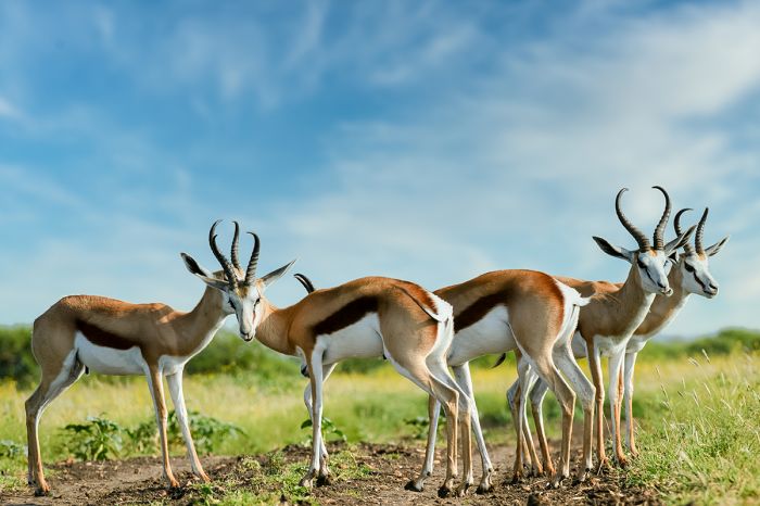
Springbok in the Madikwe Game Reserve, South Africa.
Pilanesberg Game Reserve
Located entirely within the caldera of a long-extinct volcano, the Pilanesberg Game Reserve covers an area of 221 square miles (572 sq kms) in the North West Province. The entire reserve is fenced and the popular Sun City Resort & Casino is located on Pilanesberg's southern side.
Wildlife in Pilanesberg includes all of Africa's 'Big Five' animals (lion, leopard, rhino, buffalo, and elephant), as well as abundant and diverse herbivores, including giraffe, oryx (gemsbok), springbok, tsessebe, eland, blue wildebeest, zebra, greater kudu, waterbuck, impala, and many others.
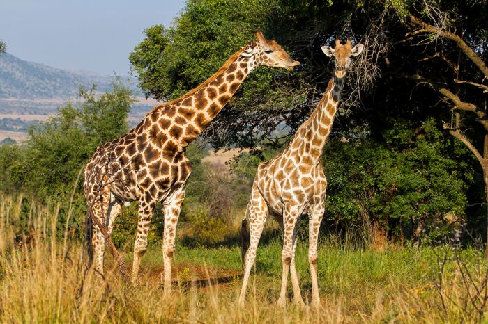
Giraffes in Pilanesberg Game Reserve, South Africa.
Besides lion and leopard, Pilanesberg has good populations of African wild dog, cheetah, and brown hyena. Spotted hyenas were never reintroduced, in order to reduce pressure on overall predation and to reduce competition for cheetah and wild dog.
Birding in the Pilanesberg Reserve is very good, with over 300 species on the list. Avid birders should be able to 'tick' around 100 species on a good day in the reserve.
Pilanesberg is easy to get to, with a drive time of around 3 hours from Johannesburg (flying to the reserve takes 40 minutes).
Read full details on Pilanesberg Game Reserve here.

African wild dogs are seen regularly in Pilanesberg.
Sun City Resort & Casino
Owned by Sun International, this massive resort includes four hotels with a total of over 1 200 rooms, two 18-hole golf courses, a world-class casino, and the Valley of the Waves waterpark. The ultra-luxurious Palace of the Lost City Hotel is something to behold,
Sun City is located adjacent to the Pilanesberg Game Reserve and can be reached by road from Johannesburg in around 3 hours.
Read about the Sun City Resort here.
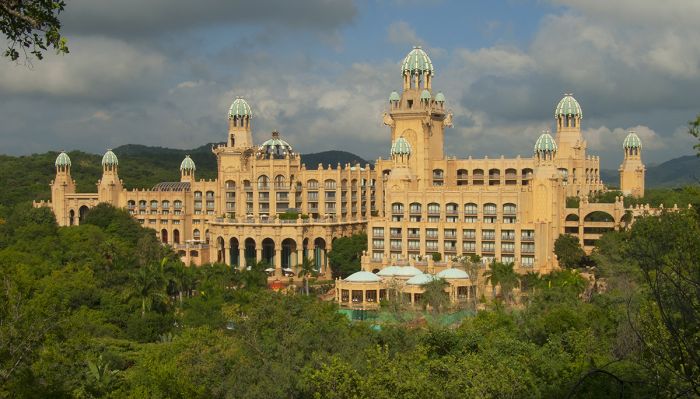
The Palace of the Lost City Hotel at Sun City, South Africa.
Cape West Coast
(Including one national park: West Coast National Park)
The very remote Cape West Coast region is located directly north of Cape Town along the Atlantic Ocean and inland to the Cederberg and other mountains on the western side of the Great Escarpment. This area of South Africa is visited by few, yet is one of the most beautiful wildernesses in the entire country.
The region offers solitude and wide open spaces, and during the wildflower season (August thru October), huge areas of land along the coast and inland to the mountains become carpeted in a profusion of color with an explosion of wildflowers that is almost impossible to believe.
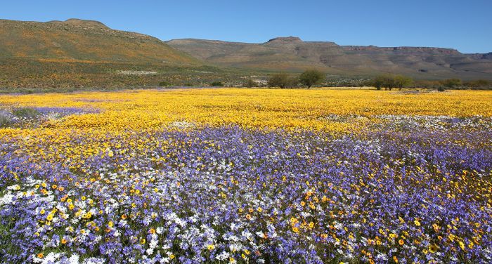
Wildflowers in the Cape West Coast region of South Africa.
West Coast National Park and Langebaan
The most visited destination in the region is the coastal town of Langebaan, which is located on Saldanha Bay. The calm waters of Langebaan Lagoon are popular with locals for kayaking, windsurfing, and kitesurfing. Just south of the town is West Coast National Park, which protects a beautiful wilderness of dunes covered in 'fynbos' vegetation and grassland.
Birdwatching in the national park is extremely productive, particularly in the Springtime (September thru December), when the Palearctic migrant species arrive to breed and raise their young. The mud flats and salt marshes on the southern edge of Langebaan Lagoon become a haven for multiple species, including flamingos, stilts, avocets, curlews, sandpipers and other water bird species.
The tip of land to the northwest of the lagoon is called the Postberg Section, and is only open during wildflower season. This section is home to some wildlife, including oryx (gemsbok), zebra, blue wildebeest, and bat-eared fox.
West Coast National Park can be reached from Cape Town (drive time is about 1.5 hours) as a day trip, but staying a night or two will enhance the experience.
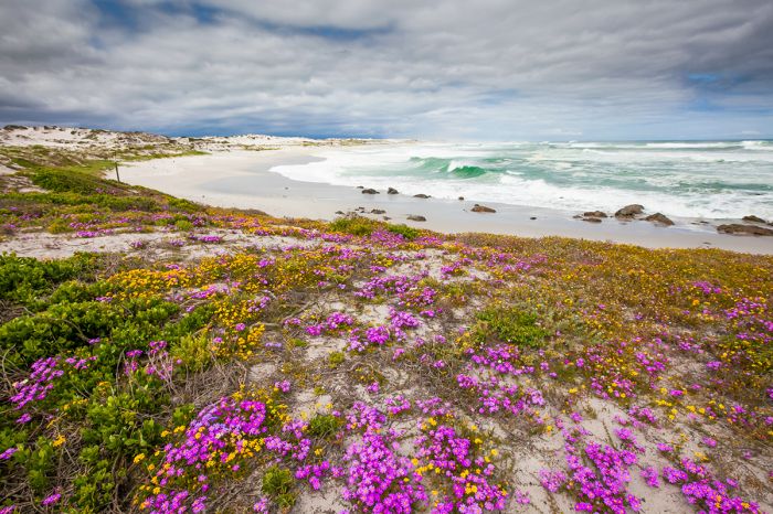
South Africa's Cape West Coast region has an extremely low population density and miles of wilderness to explore.
Other West Coast Highlights
Besides West Coast National Park, the Cape West Coast has a multitude of options and one could easily spend two weeks or longer exploring this vast and interesting part of South Africa.
Wildflowers are a major seasonal draw, particularly for anyone that likes photography. The wildflower season is best during the Springtime months of August thru October.
The Swartland (meaning Black Country, referring to the rich soils) region is home to wide open spaces used primarily for farming, especially for wheat, dairy, wine grapes, and tobacco. The small wine route here is definitely worth the time to experience. The 'twin' towns of Riebeek-West and Riebeek-Casteel are very popular weekend hangouts for Capetonians, who come for the restaurants, wine estates, and art galleries.
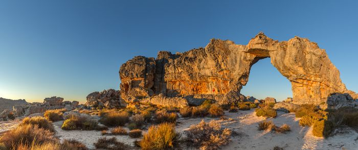
The Cederberg Mountains are a popular destination for hiking in the Cape West Coast of South Africa.
The Atlantic Ocean coast also has numerous quaint towns that are interesting to visit, including Yzerfontein, Velddrif, Elands Bay, and Lambert's Bay. Several good nature reserves also dot the coastline, including (from south to north) Koeberg, Jaakalsfontein, Columbine, Groot Paternoster, Rocherpan, Elandsbaai, and Zevenputs.
Lying some 40-50 miles inland from the Atlantic coast are several mountain ranges the rise up to the Great Escarpment, including (from north to south) the Cederberg, Winterhoek, Matroosberg, Hawequas, and Hottentots-Holland ranges.
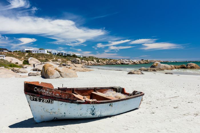
A fishing boat on the beach at Paternoster, Cape West Coast, South Africa.
The most notable mountains in the region are the Cederberg, which lies just east of the Olifants River Valley. Named for the cedar trees which once covered much of the range, the Cederberg Mountains and water catchment are protected by the Cederberg Wilderness Area. The Cederberg is a wonderful destination for hiking, with some 150 miles (250 kms) of marked trails, some which lead to caves that are ancient Bushmen (San) rock art sites.
Further south and to the west of the mountains is the Ceres Valley, which is famous for it fruit tree cultivation, including pears, peaches, apricots, apples, cherries, and nectarines. The region is also popular with anglers, who come for the excellent trout fishing is the Dwars River. The nearby Tulbagh Valley offers more good wine estates.
Read full details on the Cape West Coast region here.
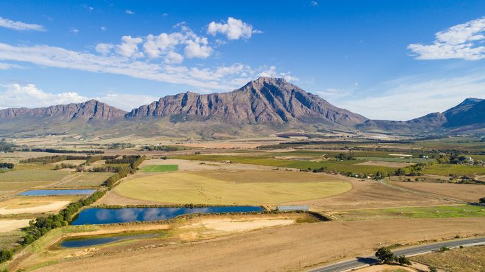
Mountains and cultivation in the Tulbagh Valley, Cape West Coast, South Africa.
/Ai-/Ais-Richtersveld Transfrontier Park
The combined protected area straddling the border between South Africa's Northern Cape Province and southern Namibia is known as /Ai-/Ais-Richtersveld Transfrontier Park. This park was created in 2003 by joining together South Africa's Richtersveld National Park and Namibia's Hot Springs Game Park.
The South African side of the park protects the desert landscape known as the Richtersveld, which is characterized by rugged mountains and cliffs of volcanic rock rising from sandy plains. The Richtersveld is regarded as the only arid biodiversity hotspot in the world and much of the area is included as an UNESCO World Heritage Site. The Orange River flows westward through the park and into the Atlantic Ocean.
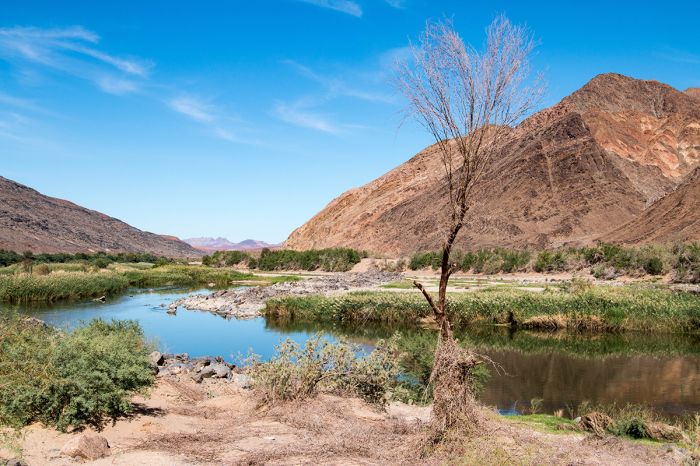
The Orange River in the /Ai-/Ais-Richtersveld Transfrontier Park, which is shared by South Africa and Namibia.
The Nama people live and graze their cattle in the area and have claim to the Richtersveld, including the protected land on the South African side, which is jointly managed by the Richtersveld community and the South African National Parks Board.
The Namibian side of the park is best known for the Fish River Canyon, which is Africa's largest canyon and one of Namibia's most visited tourist attractions.
The climate in this region is harsh, with extreme temperatures rising to above 104°F (40°C) during the summer, while nights can become frigidly cold. Water is very scarce, and life in the Richtersveld is dependent upon moisture obtained from morning fog.
The name of the park '/Ai-/Ais' means 'scalding hot' or 'hot as fire' in the Nama/Khoekhoe language. This language is distinct from all Bantu languages and makes use of 'click consonants', which are denoted in written form by use of symbols (in this case the '/' symbol).
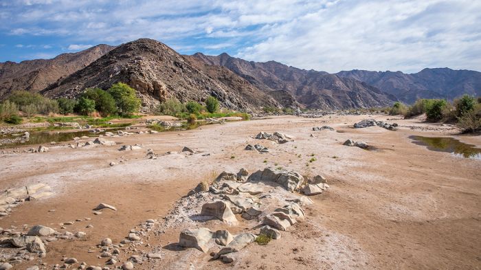
The Orange River sometimes becomes just pools of water in the desert environment of the /Ai-/Ais-Richtersveld Transfrontier Park.
Namaqualand
(Including one national park and one reserve: Namaqua National Park, Goegap Nature Reserve)
Derived from the phrase 'Nama-kwa' in the Khoekhoe/Nama language, which means "land of the Nama", Namaqualand is a loosely defined region in northwest South Africa and extending north from Eland's Bay along the Atlantic Ocean coast for roughly 600 miles (1 000 kms) to the Orange River and into southern Namibia and eastward, where it merges with the Great Karoo.
The Namaqualand region has become synonymous with vast savannas covered in colorful carpets of wildflowers. In fact, the region is part of the semi-desert 'Succulent Karoo' biome and is classified as a biodiversity hotspot. The Succulent Karoo, including Namaqualand, has the highest concentration of succulent plants on Earth. There are in excess of 5 000 plant species found throughout the Succulent Karoo, including around one-third of the world's succulents. Roughly 40% of the floral species in the region are endemics.
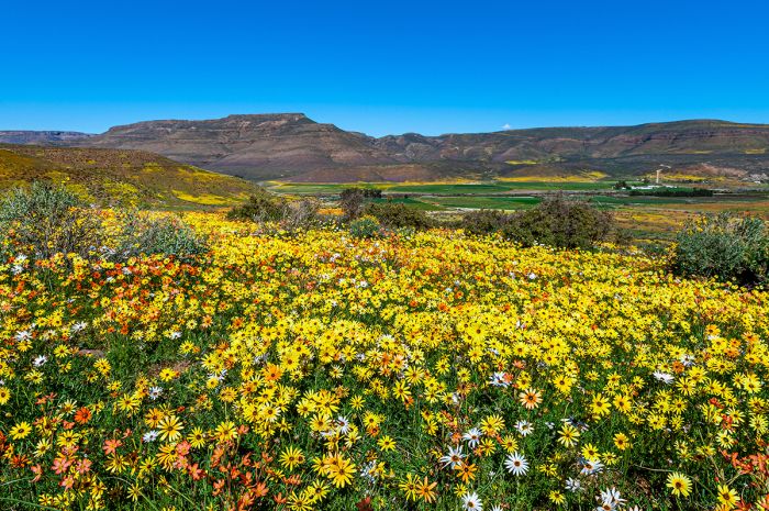
Wildflowers in bloom during August in South Africa's Namaqualand.
Visitors come to Namaqualand mainly to see the wildflowers, which explode in a great profusion during the months of August and September every year. Even outside of the main wildflower season, there are patches of purple, white, and orange daisies that dot the wide open landscapes of the region.
The town of Springbok, which was called Springbokfontein until 1911, is the main town in Namaqualand. The town is set in a narrow valley between the granite domes of the Klein Koperberge (small copper mountains), which gives a hint to the town's history. In 1852, the first copper mine in the region became operational and the town grew up around the mining industry. The town's supply of fresh water comes from an underground spring, and made it the obvious location for the small municipality. Today Springbok has a population of around 13 000, made up mainly of the 'Coloured' or mixed-race ethnic group.
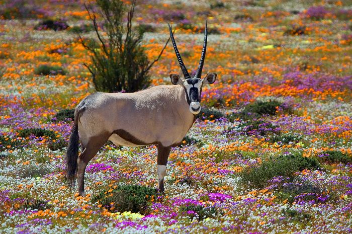
An oryx (gemsbok) stands amongst the wildflowers of Namaqualand, South Africa.
Namaqua National Park
A very small portion of the Succulent Karoo biome (which includes the Namaqualand region) is protected. The largest and most significant protected area is the Namaqua National Park.
Covering an area of 528 square miles (1 368 sq kms) in southwest Namaqualand, The Namaqua National Park was proclaimed in 1999 to protect the diverse flora of the region, most notable the succulents and wildflowers. The park's location was chosen for its particularly high diversity of floral species.
During much of the year, there is little in the way of noticeable flora besides for the hardy, desert-adapted shrubs and grasses in the park's arid landscape. During the Springtime however and after the winter rains (which typically fall between May and August), the wildflower bloom occurs and bright colors carpet the land for many miles.
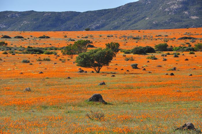
Wildflowers carpet the landscape during the springtime in Namaqua National Park, South Africa.
The park's land was once partially used for the cultivation of wheat, and these old agricultural fields are now some of the most reliable places to see wildflowers, even during years with low rainfall. The tourist facilities in the park include a scenic driving route, nature trails for hiking, picnic stops, and a visitors' information centre. The Skilpad Section of the park is only open to tourists during flower season in the Spring. Some basic accommodations are available, but most visitors camp or stay in the nearby town of Springbok.
The wildflowers only open during bright sunshine, so its best to plan for several days here, in case there is a cloudy day. Seeing the wildflowers involves plenty of driving and planning a route ahead of time is wise. The flowers typically only open from 11am to 3pm and they face the direction of the sunlight, so it's also smart to drive in a westerly direction in the morning and to the east in the afternoon.
Visiting Namaqualand can be done on one's own if you have a vehicle or as part of an organized tour, typically leaving from Cape Town. As expected, accommodation rates are highest during the wildflower season.
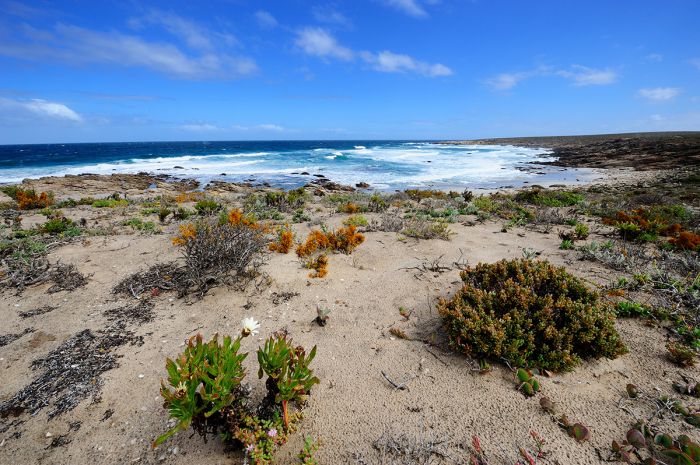
The coastal portion of Namaqua National Park offers desolate beauty.
Goegap Nature Reserve
The small but interesting Goegap Nature Reserve is located very close to the town of Springbok in Namaqualand. The reserve was proclaimed in 1966 on land previously used for livestock grazing. Goegap was previously known as the Hester Malan Nature Reserve.
The reserve covers and area of 58 square miles (150 sq kms) and the name 'Goegap' comes from the Nama/Khoekhoe word meaning 'waterhole'. The reserve declares itself as the 'Mini Namaqualand' and offers visitors a great introduction to the region, with informative gardens that showcase some of the region's plant life. There are driving tracks for both 4x4 and regular clearance vehicles, as well as hiking trails that start at the visitors' centre.
The reserve is of course best visited during the wildflower season in August and September, but the reserve is a good place to see at any time during the year. There is some wildlife in this fenced reserve, including bat-eared fox, ostrich, klipspringer, oryx, and Hartmann's mountain zebra. Birding is also quite good in Goegap.
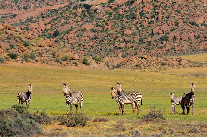
Hartmann's mountain zebras in the Goegap Nature Reserve, Namaqualand, South Africa.
Augrabies Falls National Park
Located in the North West Province, just west of Upington town along the Orange River is Augrabies Falls National Park. The park was created in 1966 to protect the spectacular waterfall of the same name, which cascades 183 feet (56 meters) down into a deep canyon in a dramatic semi-desert landscape. The name is derived from the Nama/Khokhoe word 'Ankoerebis', which means 'place of great noise'.
In years of rare high-water flooding, the Augrabies Falls have recorded over 280 000 cubic feet (7 800 cubic meters) of water per second, which is roughly three times the average high season flow rate of Niagara Falls. The average flow rate is, of course, much lower at around 11 000 cubic feet (300 cubic meters) per second.
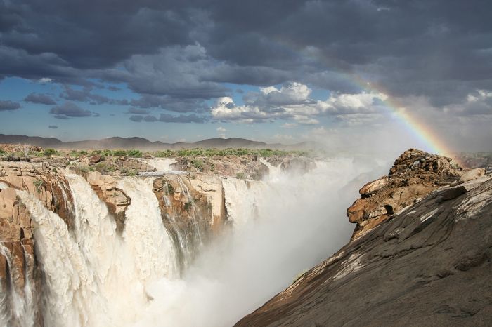
The Orange River flows over the Augrabies Falls during high water.
The gorge carved out of the granite rock below the falls is 800 feet (240 meters) deep and continues for 10 miles (18 kms). Since 1966, over twenty people have died by falling into the gorge at the falls and somehow, two people have survived after being swept over the falls.
Augrabies Falls National Park covers an area of 186 square miles (482 sq kms), and besides the waterfall, protects arid, semi-desert land on both sides of the Orange River on the eastern section of the park, while in the central and western sections, the park extends only on the southern side of the river.
The park is home to a good amount and diversity of wildlife, including eland, springbok, oryx (gemsbok), klipspringer, giraffe, bat-eared fox, black-backed jackal, caracal, and African wildcat. Birding in the park, mainly for drylands species, is very good, particularly along the river banks.
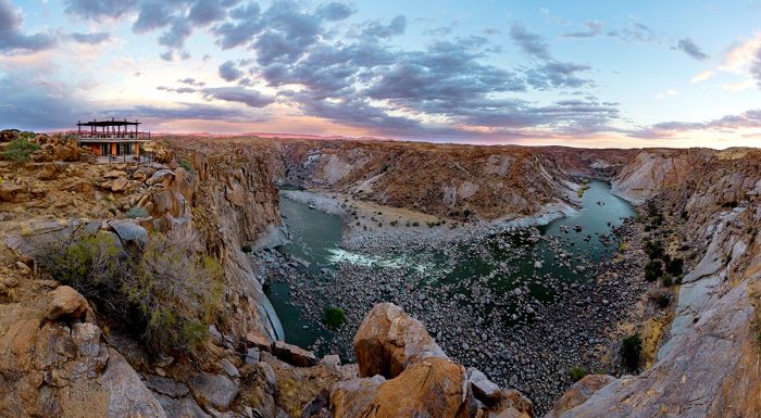
The gorge below Augrabies Falls, South Africa.
The landscape is quite dramatic in certain places, with bold rock formations, including 'Moon Rock' a massive granite dome measuring 2 300 feet (700 meters) wide and 98 feet (30 meters) high. Activities include hiking trails and drives to look for wildlife.
The park can be reached by road from Cape Town in about 8 hours and from Johannesburg in around 10 hours. The best time to visit Augrabies is from March thru May, when the desert temperatures are more mild and the Orange River is at its maximum water flow after the summer rains in the catchment area in Lesotho. The park can easily be visited as a day trip from the town of Upington, but there are various accommodations inside and near the park itself.
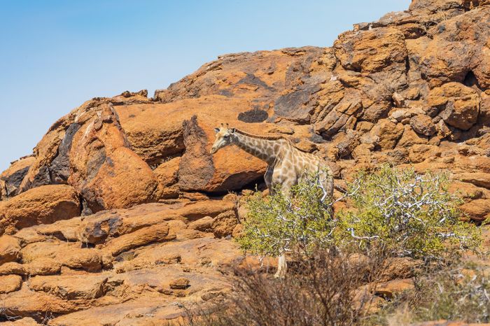
Augrabies Falls National Park is home to diverse desert-adapted wildlife, like this giraffe.
Kgalagadi Transfrontier Park
(Including two national parks: Kalahari Gemsbok National Park in South Africa, Gemsbok National Park in Botswana)
The first of Africa's multi-country 'peace parks', the Kgalagadi Transfrontier Park straddles the countries of Botswana and South Africa in the southern Kalahari Desert, effectively combining already established protected areas from each country. The name of the park comes from the Tswana words 'kgala' and 'gadi', meaning 'great thirst'.
South Africa's Kalahari Gemsbok National Park was proclaimed in 1931 (by the then Union of South Africa) to protect herds of wildlife that migrate through this region, particularly the oryx (gemsbok). Botswana's Gemsbok National Park was initially declared as a game reserve by the Bechuanaland Protectorate in 1932 and later became a national park of Botswana in 1971.
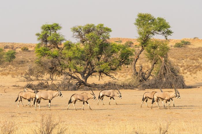
The South African portion of the Kgalagadi Transfrontier Park is called 'Kalahari Gemsbok National Park', and is so named for these oryx, which are called gemsbok.
In 1948, an informal verbal agreement was made between the Union of South Africa and the Bechuanaland Protectorate to set up a joint committee to manage the adjacent reserves as a single protected area. This agreement was not formalized until 1999, when the two countries agreed in writing to fully cooperate in tourism, including the sharing of park entrance fees. The tourist facilities are still managed separately on either side of the border.
The combined park covers a massive 13 861 square miles (35 900 sq kms), of which the smaller South African side comprises 3 702 square miles (9 590 sq kms) and the Botswana side 10 159 square miles (26 310 sq kms). The national boundary between the two countries follows that of the perpetually dry Nossob River bed, as well as one of the park's roads. The border is unfenced, which allows the wildlife to roam freely and use their timeworn migration routes. The western boundary of the park is the Namibian border.
Most of the park is characterized by dunes of red Kalahari sand, with sparse vegetation and the occasional trees. The rivers in the park, the two most notable being the Nossob and the Auob, supposedly only flow every one hundred years or so, but there is water beneath the surface in these dry beds, which provides moisture for the grasses and camelthorn trees that grow there. Boreholes have also been drilled along these rivers, which provides drinking water for the park's wildlife.
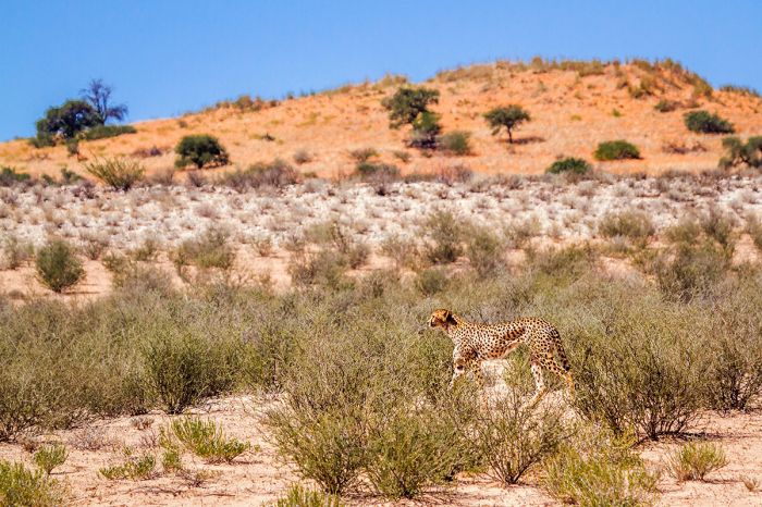
A cheetah on the hunt in the Kgalagadi Transfrontier Park.
Roads in the park follow the dry riverbeds, and this is where the best game viewing is typically found. For a place of such dry conditions, with very little water, the park is renowned for its excellent wildlife viewing. Animals are typically only abundant in places with flowing rivers and more vegetation, but the safari experience in Kgalagadi is outstanding, provided you are willing to do some long drives and have patience.
Kgalagadi is particularly well known for its predators, including cheetah, both spotted and brown hyena, lion, leopard, and caracal. Large herbivores include good numbers of oryx (gemsbok), blue wildebeest, eland, red hartebeest, and springbok, with gemsbok and springbok being the most abundant. Other animals that may be seen include bat-eared fox, black-backed jackal, and meerkat. African wild dogs are seen on occasion.
Birding in Kgalagadi is excellent, with plenty of raptors, ostrich, secretarybirds, and bustards. The species list goes up between November and April, when many migratory species arrive.
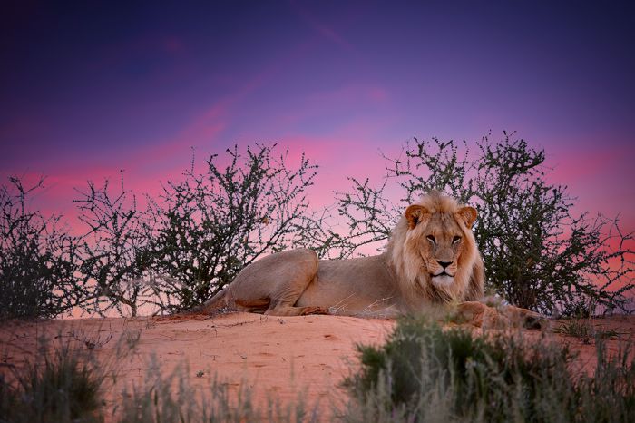
A male lion relaxes on the Kalahari sand in the South African portion of the Kgalagadi Transfrontier Park.
Weather in this region can be extremely hot in the summer, with temperatures in January and February reaching in excess of 104°F (40°C) during the day. Typical of desert climates, the temperatures overnight drop significantly, and can be frigid during the winter months between May and August, often approaching or falling below freezing.
Rain, when it occurs, is most likely between November and April, with January and February being the wettest months. The best time for a visit is probably between March and May, when the rains have mostly ended, but there is still some green vegetation and the heat has decreased somewhat. The Springtime is also good, between August and October, before the high temps arrive.
Facilities in the park include various rest camps, campsites, and some traditional safari lodges, some of which offer full amenities, including air conditioning. The rustic camping sites require that visitors be self-sufficient in terms of food and water.
Reaching the Kgalagadi can be done by road from Johannesburg, which is a long 10-hour drive to the Twee Rivieren Gate. Flying to Upington and renting a 4WD is another option. Many operators offer overland trips, and we can arrange all the details for you.
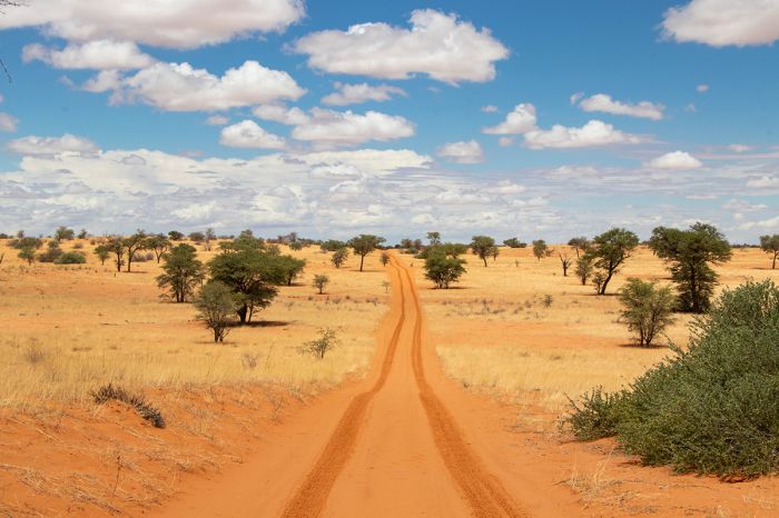
Acacia scrub atop reddish Kalahari sand dominated much of the Kgalagadi Transfrontier Park.
Tswalu Kalahari Reserve
Located at the foot of the Korannaberg Hills in the Northern Cape Province's Kalahari Desert, Tswalu Kalahari Reserve is another of South Africa's conservation success stories. Owned and operated by the Oppenheimer family, who took over custodianship form the late Stephen Boler in 1988, the Tswalu Reserve was created from old farmland that has been restored to its natural state. 'Tswalu' means "new beginning" in the Tswana language
Mr. Boler, an English entrepreneur, who later turned conservationist, purchased dozens of private farms to create the initial reserve in one of the most ambitious private conservation projects ever undertaken in Africa. In a timeframe of around four years, Boler fenced roughly 385 square miles (1 000 sq kms) and reintroduced thousands of large mammals, including black rhino, roan antelope, buffalo, and cheetah.
When Boler passed in 1998, his will specified that Nicky Oppenheimer, one of the heirs of the De Beers diamond business in South Africa, should have first refusal of the Tswalu property and the reserve was thus purchased by the Oppenheimer family.
The Oppenheimers stopped all hunting on the reserve, removed many old farming structures, including buildings and fences, and purchased additional farms surrounding the reserve, thus increasing the size of the reserve. Today Tswalu covers an area of around 460 square miles (1 200 sq kms), making it by far the largest private reserve in South Africa.
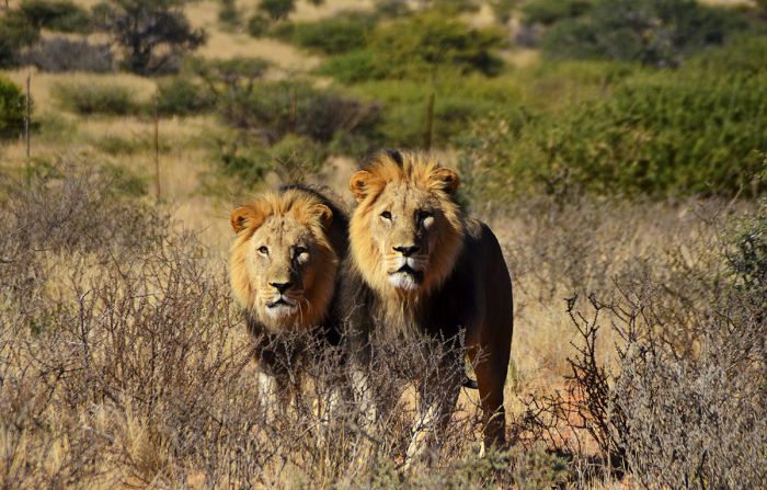
Two lovely male lions at Tswalu Kalahari Reserve in South Africa.
Tswalu's landscape can be categorized into five types of habitat: Bushveld, Plains/Shrubveld, Montane Shrubveld, Duneveld, and Calcrete Scrubveld. The reserve sits on wind-blown Kalahari sands, with the Korannaberg range of low mountains in the eastern portion of the reserve. Camelthorn and shepherd's trees are common throughout Tswalu, while more specialized hardy trees like the Namaqua rock fig grow in the hilly areas on the eastern side of the reserve. The wind-blown dunes are located on the western side of the reserve, and here the vegetation is more sparse, with grasses and shrubs dominating the terrain. Tswalu's diversity of habitats makes it a special place to visit.
The wildlife at Tswalu is diverse and abundant. Herbivores include buffalo, giraffe, Burchell's zebra, Hartmann's mountain zebra, black rhino, white rhino, eland, oryx (gemsbok), red hartebeest, impala, greater kudu, nyala, roan antelope, sable antelope, springbok, tsessebe, waterbuck, mountain reedbuck, blue wildebeest, black wildebeest, warthog, and others. Tswalu has four of Africa's 'Big Five' animals, with only elephant missing.
Predators at Tswalu include lion, leopard, cheetah, spotted hyena, brown hyena, African wild dog, caracal, black-backed jackal, African wild cat, Cape fox, bat-eared fox, and more. Primates living in Tswalu include chacma baboon and vervet monkey. Because Tswalu is fully fenced, the populations and species are managed, and lions are restricted to the northeast sector of the reserve in order to control predation on certain species in the reserve. There is also a small restricted area in the far north of the reserve which is used for breeding sable and roan antelope.
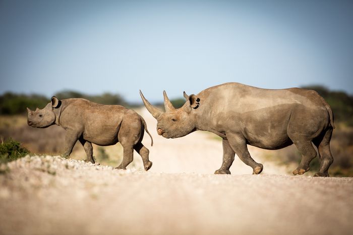
Tswalu offers diverse wildlife in a spectacular Kalahari Desert setting. Here a black rhino is led by her calf across a gravel track.
Tswalu has gained a reputation for being the best place in Africa to get good sightings of the elusive aardvark, a burrowing and mostly nocturnal animal that feeds exclusively on ants and termites, which they dig out using their sharp front claws and strong legs. They are very shy and rarely seen almost anywhere they exist, but sightings at Tswalu are quite common and special game drives to find them are offered. The name aardvark comes from the Afrikaans language, and literally translates as 'earth pig' (though it is not closely related to pigs).
Other somewhat uncommon species that are frequently seen at Tswalu include striped hyena, pangolin, and aardwolf. The researchers and guides at Tswalu have worked with a community of meerkats to get them used to human visitors, and spending a few hours with the spectacularly entertaining small mammals is another highlight for adults and children alike.
Birding at Tswalu is very good, with a species list of 260 species. The gigantic community nests of the sociable weaver (Philetairus socius) are interesting to observe and the reserve is home to myriad dry-land species. The reserve is also very good for those interested in reptiles.
Tswalu offers two high-end accommodations, one of which is well-suited for large private groups. The reserve is very well suited to families, including children of any age, with special activities to engage and educate the kids. Tswalu is a 'malaria-free' reserve, making it even more child-friendly. The maximum number of guests at Tswalu is only 28 adults. The cuisine at Tswalu is superb. Tswalu has its own staff village, with a school and healthcare centre. Various research projects are ongoing within the reserve.
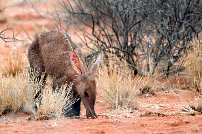
Tswalu is surely the best place in all of Africa to get reliable sightings of the very elusive and usually shy aardvark.
Activities at Tswalu focus on guests' individual requests, and include game drives, bush walks, meerkat visits, horseback riding, and stargazing. Other activities include visits to San rock art sites, scenic helicopter flights, overnight sleep outs, and more.
The climate at Tswalu is typical of a desert, with very warm to hot days and chilly to cold night. Temperatures are highest during the summer months between November and February, while winters (May thru August) are quite comfortable during the day, but can be near freezing overnight. Rainfall occurs between October and May, with November thru March receiving the majority of precipitation.
Tswalu can be reached by road (8-9 hours from Johannesburg, 11-12 hours from Cape Town) or via the reserve's tar airstrip, which can accommodate planes as large as corporate jets. Air charters and shuttle flights are available from Johannesburg (90 minutes) and Cape Town (2 hours) to the Tswalu Airstrip. Helicopter transfers are also available from nearby Upington Airport.
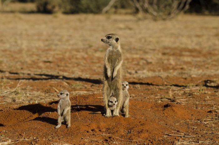
Tswalu has a group of semi-habituated wild meerkats, which are star attractions with guests.
Mokala National Park
Mokala National Park was created in 2007 to provide refuge for animals in the former Vaalbos National Park, which was de-proclaimed after the local people successfully filed a land claim to obtain diamond prospecting rights on the site of the old park. The new park is located just south of the previous park and just southwest of the historic diamond mining town of Kimberley in the Northern Cape Province. The name 'Mokala' is the Tswana language word for the camelthorn tree (Acacia erioloba) that is very common in this region.
Mokala covers an area of 108 square miles (280 sq kms), with a landscape consisting of a mix of Succulent Karoo and hilly, semi-desert savanna. The park is located in the transition zone between the Great Karoo and the Kalahari Desert regions. The small Rift River forms a large portion of the park's northern boundary and there is a network of artificial waterholes throughout the park to sustain the wildlife. Mokala is a malaria-free destination.
Wildlife in Mokala is abundant and extremely diverse, but is restricted to plains game and small predators. There are no elephants, no big cats, nor any other large predators in the park.
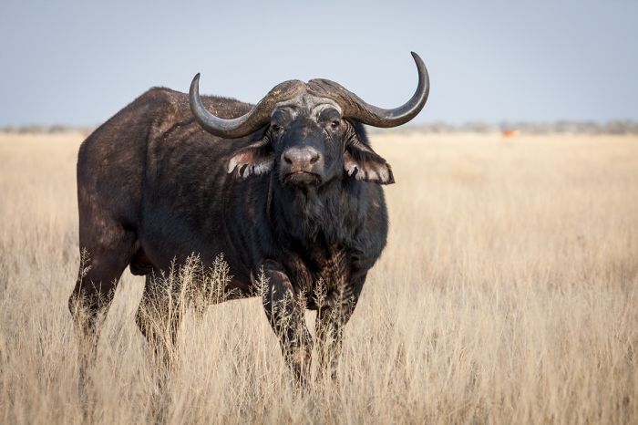
A big male buffalo in Mokala National Park, South Africa.
The large mammal species list includes buffalo, giraffe, Burchell's zebra, black rhino, white rhino, roan antelope, blue wildebeest, black wildebeest, eland, sable antelope, tsessebe, greater kudu, oryx (gemsbok), red hartebeest, impala, nyala, waterbuck, mountain reedbuck, blesbok, springbok, grey duiker, steenbok, klipspringer, warthog, as well as numerous other small mammals.
The zebras in the park have an intermediate striping pattern between the typical plains zebra and those of the now-extinct quagga, which had very pale rumps, with little to no striping on their hind side and legs.
Birding in the park is excellent, with a good variety of both dry-land, desert-adapted species, as well as water birds, which can be seen along the Riet River and at waterholes. Raptors are particularly well represented in Mokala.
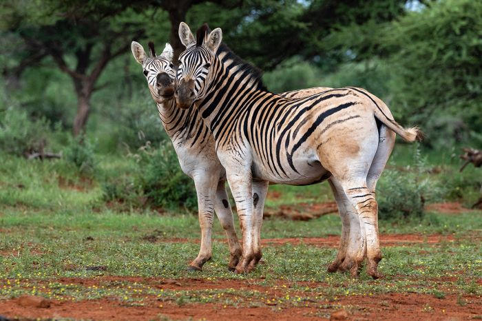
Interestingly, the zebras in Mokala National Park exhibit a striping pattern which is a blend of the well-striped plains zebra and the paled-rumped quagga, which is now extinct.
Weather in the park is typical of the region, with warm to hot days and chilly to very cold nights. The park receives only around 15 inches (400 mm) of rain per year, most of which falls during the summer months of November thru March. Temperatures during the summer can be very extreme, with daytime highs exceeding 104°F (40°C). Overnight temps during the coldest winter months of June and July can drop below freezing.
The main accommodations in Mokala are self-catering chalets, with one option at each of the park's two entrance gates. There are also additional cottages suitable for small groups or families, as well as a 'tree house' accommodation. Finally, there are also self-camping sites that include ablution blocks with running water.
The road network in the park is decent and no problem for regular clearance cars, except during the rainy season, when a 4WD is the safest bet. Self-drive game viewing is the main activity, but the park office offers guided game drives and bush walks, including visits to Bushmen (San) rock art sites. Catch-and-release fly-fishing is offered in the Riet River.
The park is accessed by road from the nearby town of Kimberley, which is about 40 miles (70 kms) away.
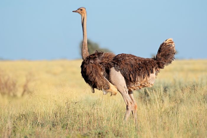
Ostrich are common in South Africa's Mokala National Park.
Waterberg
(Including one national park and two reserves: Marakele National Park, Welgevonden Game Reserve, Lapalala Wilderness)
The Waterberg is an area in the Limpopo Province of northern South Africa that is dominated by an elevated plateau or massif and which is home to one national park and several privately-managed reserves.
Much of the land in the Waterberg was once used for farming and cattle ranching during colonial times, but today the area is mostly known as a game-viewing and wilderness destination, offering a less crowded, though also much less wildlife-rich, alternative to the Kruger National Park and Reserves of the Lowveld.
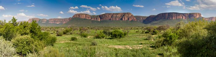
The elevated plateau in South Africa's Waterberg.
There are numerous small, private nature reserves located throughout the Waterberg and two of these protected areas, Marakele National Park and the privately owned Welgevonden Game Reserve, offer classic safaris with Africa's 'Big Five' (lion, leopard, elephant, rhino, buffalo).
The Waterberg was declared a UNESCO Biosphere Reserve in 2001, which means that it has been selected for its balanced relationship between people and nature, while promoting solutions reconciling the conservation of biodiversity with its sustainable use. Biosphere reserves are nominated by national governments and remain under the sovereign jurisdiction of the states where they are located.
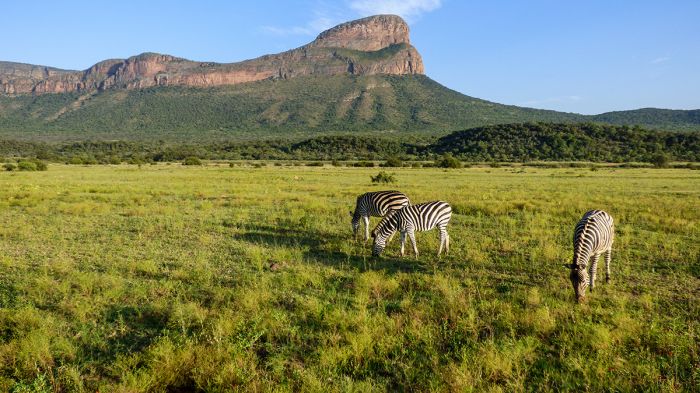
Zebras in the Entabeni Reserve in South Africa's Waterberg.
Marakele National Park
Proclaimed in 1994, Marakele National Park covers 226 square miles (586 sq kms) on the western end of the Waterberg and is dominated by an assortment of dramatic rock buttresses, cliffs, plateaus, and other rock formations known as the Kransberg. The park is divided into two sections, one of which has roads that can be navigated easily by regular-clearance vehicles, but has only fair wildlife viewing, while the other section is much more wild, with roads recommended only for 4WD vehicles, and which has more reliable game viewing.
Wildlife in Marakele includes all of the Big Five (all except leopard were reintroduced from Kruger National Park), but finding them is not always a given. The park also has a good variety of antelope and other plains game, including giraffe, zebra, blue wildebeest, eland, greater kudu, impala, common reedbuck, mountain reedbuck, tsessebe, sable antelope, roan antelope, red hartebeest, waterbuck, and others. White rhino are fairly common.
Predators in Marakele include lion, cheetah, leopard, and brown hyena, but predator sightings are uncommon. The elephants tend to stay in the less accessible northern section of the park. Birding in Marakele is quite good, with a list of over 400 species. The highlight is the park's population of endangered Cape vultures. The cliffs and buttes of the Kransberg are used by over 800 breeding pairs of Cape vulture, making it the largest breeding site in the world.
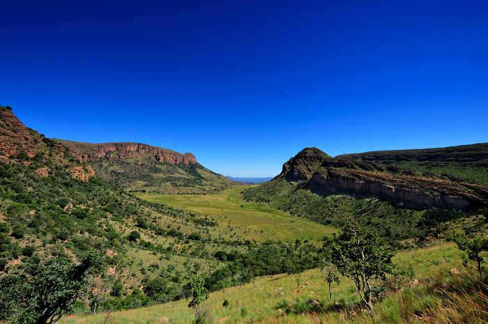
Dramatic landscape in Marakele National Park, Waterberg region, South Africa.
Marataba
Within Marakele National Park is a privately managed section comprising 81 square miles (210 square kms) called Marataba. This exclusive part of the national park includes several all-inclusive upscale safari lodges that offer a variety of game-viewing and other activities and this section is only accessible to guests staying there.
Marakele is easy to reach from Johannesburg by road (3 hours), but a quick 45-minute charter flight to the park's airstrip is another option. Generally speaking, Marakele offers fairly good wildlife, with white rhinos being the star attraction, but the rugged scenery of this beautiful wilderness destination is the top reason for a visit. Marakele is a malaria-free destination.
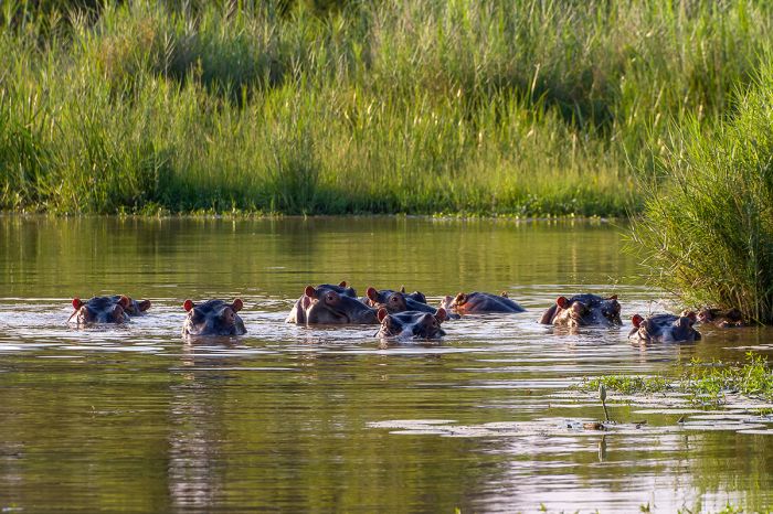
Hippos in the Marataba section of Marakele National Park, Waterberg, South Africa.
Welgevonden Game Reserve
Privately owned by a collective of land owners, Welgevonden Game Reserve covers 143 square miles (370 sq kms) of wilderness in the Waterberg. Welgevonden borders Marakele National Park, which lies to its west. The reserve's name is derived from Afrikaans or Dutch and means literally 'well found'. Welgevonden is the culmination of a conservation effort begun in the 1980s by Pienkes Du Plessis, the original owner of the Welgevonden farm. The initial formation of the reserve was completed in 1993.
Welgevonden's land can best be described as mountainous bushveld, with dramatic rock formations and deep ravines, as well as open grassland savannas. The reserve is characterized by four main habitat types, namely 'mixed Burkea africana woodland', 'Burkea africana open woodland', 'rocky plateau open woodland', and 'old lands'. Burkea africana refers to the wild syringa tree, which is common on the reserve. Old lands refers to land that was previously farmed and is still undergoing restoration back to its natural state.
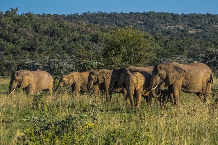
Elephants in the Welgevonden Game Reserve, located in South Africa's Waterberg.
Welgevonden has around 20 safari lodges to choose from and all are considered upscale. The reserve does not permit self-drive safaris and guests driving to Welgevonden must park their vehicles at reception, where they will be met and picked up by lodge staff and transferred to their accommodation. The lodges in the reserve are all-inclusive, and a variety of activities are offered, with the main focus being game drive safaris. Bush walks are also offers, including visits to Bushman (San) rock art sites in the hills.
The reserve offers excellent diversity in terms of wildlife, with all the 'Big Five' animals present. Predators at Welgevonden include lion, leopard, cheetah, spotted hyena, brown hyena, black-backed jackal, serval, African wild cat, and various other small carnivores. The plains game is plentiful, with all the iconic species like giraffe, elephant, buffalo, black rhino, white rhino, warthog, and hippo. Antelopes are well represented, with species including blue wildebeest, Burchell's zebra, eland, impala, greater kudu, nyala, sable antelope, red hartebeest, springbok, and waterbuck, and many others.
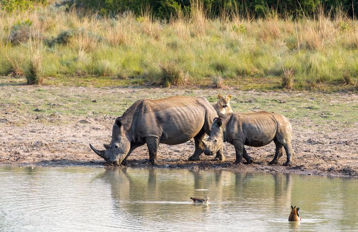
Two white rhinos drink at a waterhole, while a lioness watches. Image from Welgevonden Game Reserve, South Africa.
Birding at Welgevonden is excellent, with over 300 species recorded, including 'specials' like blue crane, and Denham's bustard. The rocky terrain in the reserve is favored by a variety of raptors.
Like all small fence-enclosed wildlife reserves, conservation management is a tricky issue at Welgevonden, especially with large mammals like elephant, which consume large amounts of vegetation, and lion, which consume the prey species. Welgevonden is on the forefront of developing ethical and sustainable practices to balance the reserve's biodiversity while providing excellent value for its guests in terms of their game viewing experience. The use of contraceptive vaccines to slow the reproductive rate of elephants has proved to be promising, while augmenting the gene pool for the lion population has been challenging.
Welgevonden may be reached by road from Johannesburg in around 3 hours, but the reserve has its own airstrip for those who would prefer to fly (45 minutes from Johannesburg). Welgevonden is a malaria-free reserve.
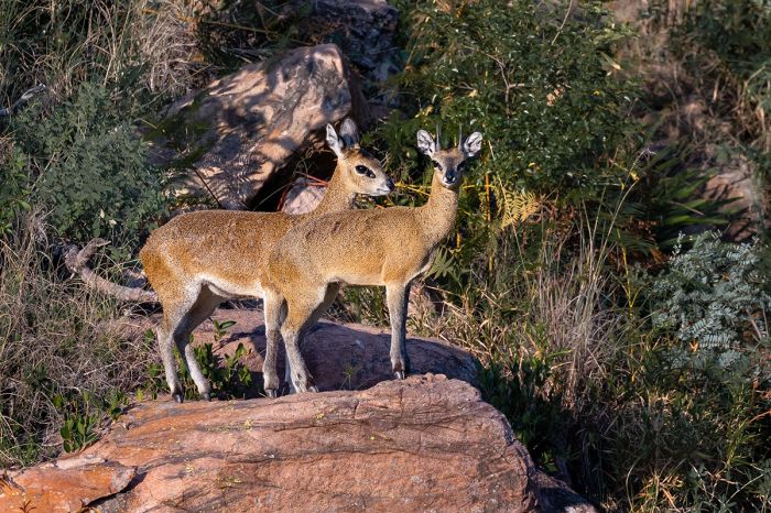
A pair of klipspringer antelopes in the Welgevonden Game Reserve, South Africa.
Lapalala Wilderness Reserve
Covering an area of 185 square miles (480 sq kms) in the Limpopo Province's Waterberg region is the Lapalala Wilderness Reserve. Like the other reserve in the Waterberg, Lapalala is characterized by spectacular rock formations, with cliffs, and valleys and an abundance of flora. The reserve was created in 1981 and is known for its early forays into wildlife conservation, particularly the black rhino.
Wildlife in Lapalala includes the 'Big Five' (lion, leopard, rhino, elephant, and buffalo), plus a diverse cast of plains game like impala, eland, Burchell's zebra, blue wildebeest, bushbuck, giraffe, roan antelope, and many more species. Large predators on the reserve include lion, leopard, cheetah, African wild dog, brown hyena, and crocodile. Hippo are present in the reserve as well.
Various research projects are ongoing in Lapalala and the reserve is also well known for its Wilderness School. The Lapalala Wilderness School offers one-week courses to thousands of African children, instructing them on the priciples of conservation, while giving them exposure to nature at close quarters.
Day safaris are available for guests who wish to experience Lapalala.
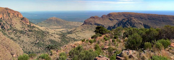
The Lapalala Wilderness Reserve offers wildlife and spectacular landscapes in South Africa's Waterberg.
Mapungubwe National Park
Covering an area of 108 square miles (280 sq kms) on the far northern border of the Limpopo Province is Mapungubwe National Park. The park was proclaimed in 1995 to protect the rich cultural history of the land, which is the site of early Iron Age settlements. Mapungubwe borders both Botswana and Zimbabwe to its north.
Mapungubwe's most notable feature is 'Mapungubwe Hill', which is believed to be the centre of a kingdom of early people known as the Bakalanga. The Kingdom of Mapungubwe was centered on this piece of land from around 1075-1220 AD and at its height, had around 5 000 people. Mapungubwe has become an important archeological site and was declared an UNESCO World Heritage Site in 2003.
The park is divided into an eastern and a western sector, with an area of private farms in between. The eastern section is the main entrance point to the park and also where Mapungubwe Hill is located, as well as most of the places to stay.
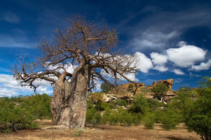
A baobab tree growing in the rocky landscape of Mapunbugwe National Park.
The park is a place of great natural beauty, with dramatic sandstone rock formations, riparian forest, Mopane tree woodlands, and iconic baobab trees. Wildlife in the park includes elephant, white rhino, giraffe, lion, leopard, spotted hyena, oryx (gemsbok), eland, Burchell's zebra, blue wildebeest, red hartebeest, greater kudu, warthog, and many others.
Birding in the park is quite good, with over 400 species recorded and the park offers a treetop walk and a birding hide for keen birders.
Mapungubwe is mainly a self-drive destination, but many of the roads are only possible with a sturdy 4WD vehicle with good clearance. There is no upscale accommodation. In the park, but there are good self-catering options. Overnight visitors can also join a guided morning game drive or bush walk. The park offers an excellent museum and interpretive centre.
Visiting Mapungubwe in the summer (November thru March) means it will be extremely hot, so we suggest visiting during the cooler months between June and September.
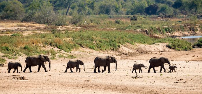
Elephants heading to the Limpopo River to drink during the midday heat, Mapungubwe National Park, South Africa.
--- Notable Urban Areas ---
Johannesburg
Located in the Gauteng Province, Johannesburg is South Africa's largest and most populous city (metro area population of 10.5 million) and is the main entry point for international air travel visitors. Known to locals as 'Joburg', the city is also the country's main economic hub and most visited urban area.
Most visitors to Joburg do not stay long, just arriving at O.R. Tambo International Airport and heading straight onward to a safari or other destination with perhaps an overnight to acclimatize to the time change. However, the city does have plenty to offer for visitors interested in dining, shopping, taking in a flea market, or touring the city.
Johannesburg's history began with the discovery of gold in the late 1880s, when prospectors rushed to the area looking to get rich. The town sprang up around the mines and was named for the then president of the South African Republic, Paul Johannes Kruger.
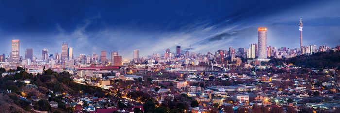
Evening view of the city skyline of Johannesburg, South Africa.
For international visitors, the northern suburbs of Joburg, including Sandton, Rosebank, and Melrose, offer excellent hotels, world-class shopping, art galleries cafés, restaurants, and antiques shops. Joburg's northern suburbs are also the location of much of the country's wealth, with banking and other business centered here.
The southern side of Joburg is much less visited by tourists, the exceptions being the Soweto township and the Apartheid Museum, both of which are highly recommended places to visit.
Outside of the city and its suburbs, a highly recommended day-tour is the paleontological site known as the 'Cradle of Humankind', which is located just 25 miles (40 kms) northwest in the Magaliesberg region.
Read full details on Johannesburg here.
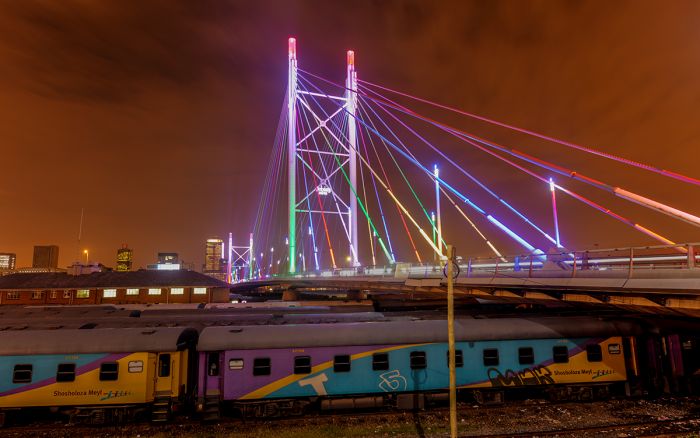
The Nelson Mandela bridge in Johannesburg, South Africa.
Cape Town
Located in the Western Cape Province, Cape Town is South Africa's second-most populous city (metro area population of 4.7 million), but more of a destination than any other city in the country. Read about Cape Town above.
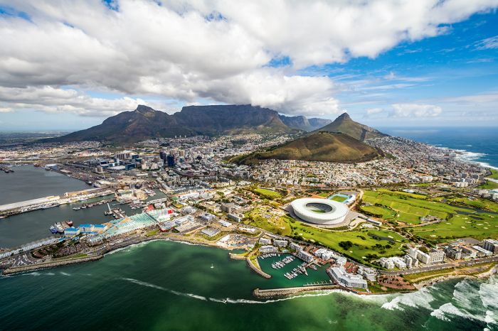
Aerial view above Cape Town, South Africa.
Pretoria
Located 35 miles (60 kms) north of Johannesburg in the Gauteng Province is South Africa's administrative capital, Pretoria. The city was founded in 1855 and named for one of the leaders of the Boer Voortrekkers (immigrant farmers fleeing the British rule in the Cape), Andries Pretorius.
Pretoria is certainly one of the country's more attractive cities, with beautiful old architecture, lovely suburban areas, botanical gardens, and lots of jacaranda trees that transform the city with their lavender flowers in the Springtime (October and November). For those interested in history, Pretoria offers plenty of historical monuments and museums.
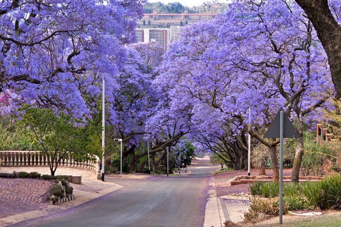
Jacaranda trees in bloom in Pretoria, South Africa.
There are three universities in Pretoria, as well as numerous governmental buildings, banks, shopping centers, and corporate headquarters. The Central Business District has three buildings that could be called 'skyscrapers'.
Pretoria Station is the central departure point for South Africa's two cross-country luxury trains, the Rovos Rail and the Blue Train. The Gautrain high-speed commuter rail line connects Pretoria with Johannesburg.
Read full details on Pretoria and the Gauteng Province here.
A statue in Pretoria, South Africa, commemorating the Anglo Boer Wars.
Durban
South Africa's third most populous city (metro area population of 3.4 million), Durban is located along the Indian Ocean coastline in the KwaZulu-Natal Province. The city is situated at the mouth of the Umgeni River, which demarcates parts of Durban's north city limit. Durban has a natural harbor, Durban Harbour, which is the busiest port in South Africa and is the fourth-busiest port in the Southern Hemisphere.
Durban can be dated back to 1824, when a small settlement was created by the British at present-day Durban, which was then called Port Natal. Fifteen years later in 1835, the Boer Voortrekkers established the Republic of Natalia, with their capital located inland at present-day Pietermaritzburg. Fearing they would lose Port Natal, the British constructed a fortification in Port Natal, that is known as 'The Old Fort'. The city was renamed in 1835 to 'Durban' after Sir Benjamin D'Urban, a British general and then Governor of the Cape Colony.
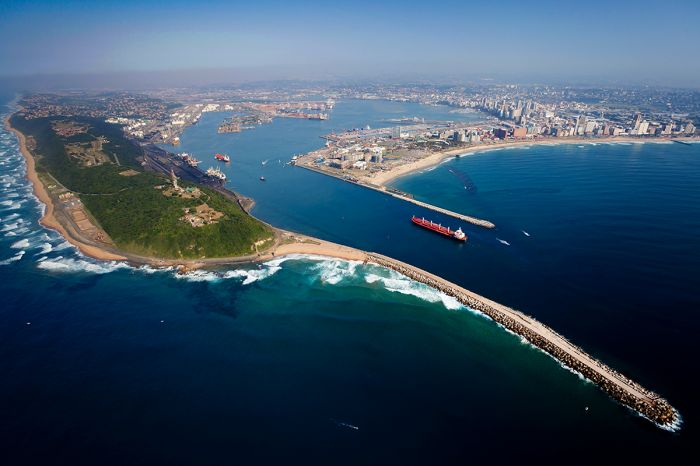
Aerial view above Durban and its harbor.
Durban is an ethnically diverse city, with Africans of Zulu descent being the largest group, but the city also has a strong Indian influence. The South African Indian community in Durban is largely descended from Indians who arrived in the country from 1860 onwards, with the original immigrants brought in by the British as indentured servants, who were purchased to work on sugarcane plantations in the Natal Colony. During the following 50 years, around 200 000 Indians arrived as indentured laborers, many working in mines and on railway construction. Today, the Indian population in South Africa is 1.3 million, most of them living in Durban.
The climate in Durban can best be described as humid subtropical, with hot and humid summer conditions (November thru March) and warm, dry winters. Rain occurs throughout the year, but the majority falls between mid-October and March.
Durban is not generally included on travel itineraries for tourism purposes, other than perhaps passing thru the city's main airport, King Shaka International Airport (KSIA). For those who decide to visit 'Durbs', things to do include city tours, beaches, museums, botanical gardens, and more. Durban has plenty of restaurants, with a wonderful mix of African and Indian cuisine.
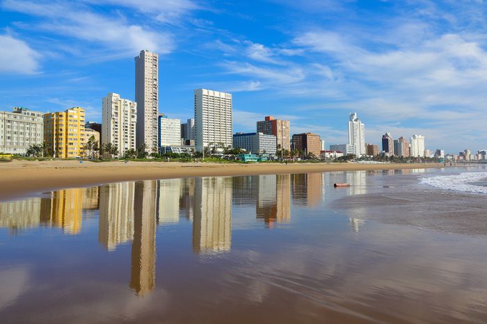
The 'Golden Mile' beachfront in Durban, South Africa.
Port Elizabeth
The largest city in South Africa's Eastern Cape Province, Port Elizabeth (metro area population of 1.2 million) is located along the Indian Ocean coastline and serves as a major port for the country. Known by locals as 'PE', the city is one of the oldest in the country, founded in 1820 by the British Colonial government. PE is also known as "The Friendly City" or "The Windy City".
The Port Elizabeth Airport (PLZ) is a common arrival point for tourists visiting the Eastern Cape wildlife reserves, as well as a common starting or ending point for the very popular self-drive tours of the Garden Route. Flights from Johannesburg to PE operate several times daily, with a fly time of 80 minutes.
There are plenty of things to do in PE, including a number of very good beaches, historic city tours, golfing, and some excellent dining options. The Route 67 Art and Heritage Walk, which celebrates Nelson Mandela's struggle for equal rights and freedom, is highly recommended.
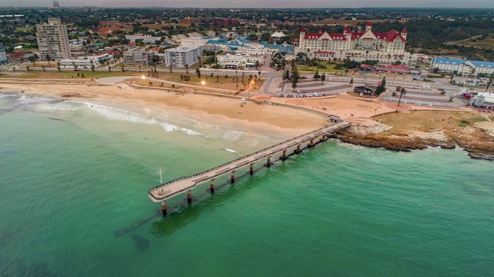
Aerial view above the beach and Shark Rock Pier in Port Elizabeth, South Africa.
PE's climate is classified as 'maritime' and it lies in the intermediate zone between the winter rainfall 'Mediterranean' climate zones prevalent further west along the coast, and that of the summer rainfall climates typical of most of the country. PE is a very popular destination for South Africans during summer months, as the heat and humidity are far more tolerable than along the South African coast further east and north.
Ethnically, PE is home to the following populations: black (60%), white (14%), and colored (23%) people, Asian (1%).
Read full details on Port Elizabeth and the Eastern Cape Province here.
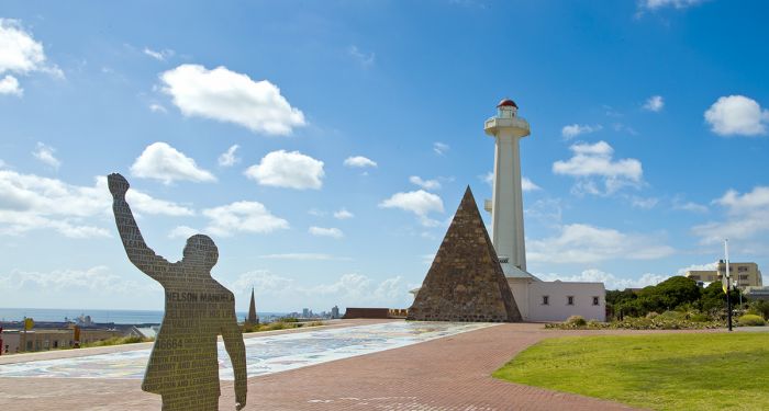
The Donkin Monument and Lighthouse in Port Elizabeth, South Africa.
Quick Facts & Travel Tips
- South Africa lies just south of the Tropic of Capricorn and winter mornings, especially inland from the coast, can be quite chilly.
- South Africa has 11 official languages, but English is widely spoken, especially in tourist areas.
- The national currency is the South African Rand (ZAR), but US Dollars, UK Pounds, and Euros are accepted almost everywhere throughout the country.
- The US Dollar and Euro have consistently favorable exchange rates (10-16 to 1) versus the South African Rand.
- Credit and debit cards are widely accepted in the cities and at safari camps.
- The country uses 220v electricity and type D, M, and N plug adapters.
- South Africa time is GMT+2 and does not observe daylight savings time (DST); 8 hours ahead of New York (7 during DST).
- The population of the country is around 60 million, with over 10 million in the greater Johannesburg metro area.
- South Africa covers 468 376 square miles (1 213 090 sq kms) with only 127 people per sq mile (49 people per sq km). Roughly 67% of the population is urban.
- The majority of the population (80%) are of black African origin. Whites comprise 9%, while another 9% are "Coloured" (a South African term for mixed race), and 2-3% are Indian or Asian.
- The majority of South Africans (81%) are Christians, while 4% identify as other faiths. The other 15% are not affiliated with any faith.
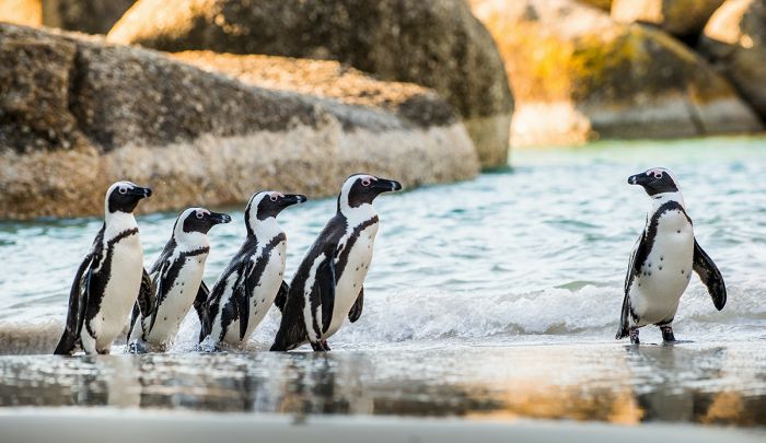
African penguins at Boulders Beach, Cape Town, South Africa.
Entry / Visa Requirements
- All USA//UK/EU passport holders are required to have a visa prior to entering South Africa. Visas will not be issued upon arrival.
- Canada and Australia passport holders do not require a tourist visa.
- Yellow fever certificate is required only if the applicant is passing through yellow fever belt area before entering South Africa.
- Visitors must have passports / travel documents valid for thirty (30) more days after the intended return date from South Africa.
- The passport must contain at least two (2) unused (blank) pages labeled Visa when presented at the Embassy or Consulate.
- One blank page is for affixing the visa or permit at the Embassy/Consulate and the other blank page is for endorsement of entry/departure stamp by the South African Immigration Services.
- Note: Visa pages referred to above do not include pages reserved for Endorsements, Amendments or Observations.
Note: entry/visa requirements are subject to change without notice, so please check with the official government pages shown below.
Official Government Pages
- US Department of State info: click here
- South African Consulate - North America: click here
- South Africa Home Affairs: click here
- CDC information: click here
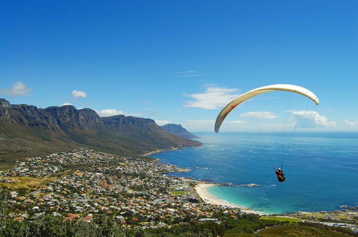
Paragliding, Cape Town, South Africa.
READ MORE...
Main: Flora, Geography, Important Areas, National Parks, Protected Areas, Ramsar Sites, UNESCO Sites, Urban Areas, Wildlife
Detail: Addo, Blyde River Canyon, Cape Town, Constantia, Drakensberg, Garden Route, Johannesburg, Karoo, Kruger NP, Kruger Reserves, Madikwe, Namaqualand, Sabi Sand, Table Mountain, Tswalu, Waterberg, Winelands
Admin: Travel Tips, Entry Requirements/Visas
Read More...
Anglo-Zulu War, Apartheid Era, Between World Wars, Boer Republics, British Takeover, Dutch Colonization, Early History, End of Apartheid, First Boer War, Great Trek, Mandela Presidency, Recent History, Sea Route to India, Second Boer War, Voortrekker-Zulu Conflicts, Union of South Africa, Witwatersrand Gold Rush, World War I, World War II, Zulu Empire
Early History
South Africa's human history dates back at least 2 million years, with plentiful evidence of early hominids discovered at the Sterkfontein Caves in an area known as the Cradle of Humankind near Johannesburg. Numerous early 'human' fossil discoveries have been made in present-day South Africa, including the skull of a 2.5-million-year-old Australopithecus africanus (named 'Taung Child') found in 1924 in Biombos Cave near Cape Town, and a nearly complete Australopithecus skeleton found at Sterkfontein in 1994, which is estimated to be between 2.2 and 3.5 million years old.
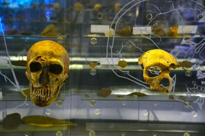
Early hominid skulls displayed at the Sterkfontein Museum, South Africa.
Descendants of these early humans were Stone Age, semi-nomadic hunter-gatherers known as the San people (also called Bushmen), who lived throughout the entire southern African region. Evidence of the San is found in their rock art paintings throughout the Drakensberg and Cederberg mountains, most dating back to between two and three thousand years ago, but some dating to 30 000 years ago.
Another group of early humans living in present-day South Africa at that time were the Khoikhoi, who are not ethnically distant from the San, but rather lived a different lifestyle and had a different social construct. Whereas the San led a hunter-gatherer lifestyle, the Khoikhoi were pastoralists, with herds of cattle, sheep, and goats. It is presumed that the Khoikhoi obtained their cattle from Bantu tribes that arrived along the eastern side of the country, bringing their livestock with them.
Prior to the arrival of livestock, the concept of 'private property' had little meaning for the hunter-gatherer San people, as everything they needed for survival was obtained through their environment.
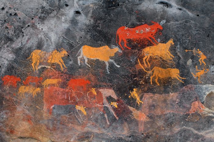
San (Bushman) rock art in South Africa.
The current belief is that domesticated cattle, sheep, and goats originated in the 'Fertile Crescent', an area in the Middle East along the Euphrates and Tigris Rivers in Mesopotamia (Syria, Turkey, and Iraq) and extending into the Nile River Valley of Egypt. Archeological findings indicate that livestock herding began to spread into Egypt around 8 000 years ago.
Further findings show that herders had migrated south and into present-day Kenya by around 5 000 years ago. Evidence exists that prove pastoralist settlements had spread across most of East Africa by 3 000 years ago and that livestock herding reached present-day South Africa by around 2 000 years ago. Evidence of livestock bones on the Cape Peninsula indicate that Khoikhoi herders were settling there about 2 000 years ago.
Bantu-speaking tribes are believed to have reached Southern Africa from the Congo Basin as early as 400 BC. The Bantu integrated with, but also displaced the Khoikhoi/San people, pushing most of them out of the rich forested areas into more marginalized land, such as the arid Kalahari Desert. Some of the early Bantu arrivals (ancestors of the Xhosa, Zulu, Ndebele, and Swazi) chose to inhabit the eastern side of present-day South Africa, in what is now KwaZulu-Natal, while others (ancestors of the Sotho and Tswana) settled on the interior plateau of South Africa.
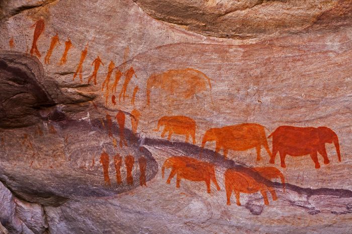
San rock paintings located near Stadsaal Caves in the Cederberg area, Western Cape, South Africa.
Early Iron Age settlements date back to the Mapungubwe region, at the shared borders between present-day Botswana, Zimbabwe, and South Africa (northern Limpopo Province) from around AD 1 000 to 1 300. This area is now protected as Mapungubwe National Park.
The inhabitants of the Kingdom of Mapungubwe were considered wealthy, keeping cattle, sheep, and goats, and there is evidence they also kept dogs to help them. They farmed millet, sorghum, and cotton, which they traded at the Indian Ocean coast (via the Limpopo River) with people from the Far East (China, Arabia, and India). Mapungubwe was abandoned in the 14th century, presumably due to climatic changes that resulted in much drier conditions, which made their livelihood impossible in the area.
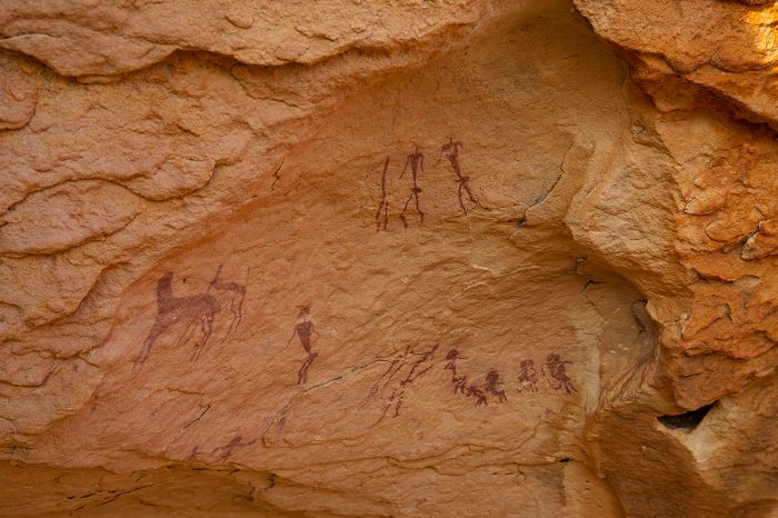
San (bushman) rock paintings at Mapungubwe, South Africa.
Sea Route to India (1400s)
During the early 1400s, Portugal began sending ships down the west coast of Africa in hopes of discovering a sea route between Europe and India. Portugal wanted a less costly way to trade with India, and in particular, it wanted spices, which were very expensive due to the danger and time involved with traveling between Europe and India by land. None of these early expeditions rounded the Cape, but they expanded Portugal's knowledge of the coast.
Finally, in 1488, the Portuguese maritime explorer Bartolomeu Dias became the first European to round the Southern tip of Africa, which he named 'Cabo das Tormentas', meaning 'Cape of Storms', which was the original name of the 'Cape of Good Hope'.
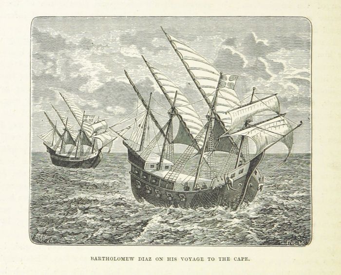
An 1887 illustration of Bartolomeu Dias' two caravels, the São Cristóvão and the São Pantaleão, en route to the Cape of Africa (image: Wikimedia Commons).
Years later, on 08 July 1497, Portugal sent a fleet of four ships led by Vasco da Gama and a total crew of some 170 mariners in an attempt to sail all the way to India. The expedition followed the route mapped by Bartolomeu Dias and made landfall on the African coast on 04 November 1497. The ships reached the southeastern coast of Africa around Christmas and the crew named this coastal part of present-day South Africa 'Natal', the Portuguese word for 'Christmas'.
The expedition next landed on 02 March 1498 in present-day northern Mozambique, where Da Gama was met with defiance by the Arabs that already controlled this land. On 29 March 1498, Da Gama and his crew were forced to flee the local populace, which had become suspicious of the Europeans. The expedition next landed at present day Mombasa, Kenya in April 1498, where they were also met with hostility and forced to leave.
One 14 April 1498, Da Gama reached a friendlier port at Malindi, Kenya, where they met a sailor from India, who agreed to guide them the rest of the way to Calicut, on the southwest coast of India. The ships set sail on 24 April 1498, headed for India and they made landfall at Calicut on 20 May 1498.
Map showing the route of Vasco da Gama's voyage to India.
Relations with the King of Calicut did not go well, and after several months, Da Gama was eager to return home. The ships set sail for their return voyage on 29 August 1498. Unfortunately, they ignored the local knowledge of monsoon wind patterns that were still blowing onshore and the journey was a harrowing one. Sailing with the summer monsoon winds at their backs on the original eastward journey across the Indian Ocean had taken Da Gama 23 days; the westward journey back, sailing against the wind took 132 days.
Da Gama's ships arrived back in Malindi on 07 January 1499 and by this time, around half the crew had perished during the disastrous crossing and many of the living were afflicted with scurvy. Left without enough crew to manage the three remaining ships, Da Gama scuttled (deliberately sank) the São Rafael (one of his fleet), with the crew redistributed on the remaining two ships, the São Gabriel and the Berrio.
The remaining journey went much better and on 20 March 1499, the ships rounded the Cape and headed north towards Portugal. Although the mission was costly in terms of the lost ships and men and had failed in its principal mission of securing a commercial treaty with Calicut, it was invaluable in the knowledge obtained as to what Portugal must do in order to secure the trade route. Portugal began making plans to secure land on the east coast of Africa, which it deemed essential for providing fresh water, provisions, timber, harbors for repairs, and a refuge where its ships could wait out unfavorable weather.
Vasco da Gama, engraving from 1883.
Dutch Colonization (1652-1814)
Despite their successful nautical accomplishment of navigating the cape, the Portuguese showed no interest in colonizing Southern Africa and instead focused their efforts on the eastern coast at Zanzibar and Mozambique. The Portuguese maintained dominance over the trade with the Far East until the late 1500s, when the British and Dutch began to compete with them for trade with the East.
Ship stopovers at the Cape became commonplace for fresh water replenishment and to obtain fruit for scurvy-afflicted crews. One of the major players sailing the spice route and trading with the East was the Dutch East India Company (in Dutch, "Vereenigde Oostindische Compagnie", or VOC). The VOC decided to set up a replenishment way station at the Cape and on 07 April 1652, an expedition of three ships led by Jan van Riebeeck and accompanied by 82 men and 8 women landed at Table Bay (present-day Cape Town, South Africa). Van Riebeeck was made 'Commander of the Cape', a position he retained for ten years.
A painting depicting Jan van Riebeeck arriving in Table Bay in April 1652. Source: Suid-Afrikaanse Geskiedenis in Beeld (1989) by Anthony Preston (image: Wikimedia Commons).
Van Riebeeck was charged with the task of building a fort at the Cape, improving the anchorage in Table Bay, and planting crops to supply the ships that stopped to resupply. The initial plan was to limit the growth of the colony to a small, clearly defined area around the fortress and to employ a small number of VOC employees and servants to produce food, while obtaining cattle from the Khoikhoi.
Repeated crop failures forced the VOC to change plans, and they released some of their employees from their contracts, allowing them to establish farms away from the fortress. This proved very successful and more farms were established, growing vegetables, fruit, wheat, and wine grapes. Eventually livestock farms were also created with animals procured from the Khoikhoi.
Between 1666 and 1679, the VOC built a new fort at the Cape Colony to replace the old one, which was made of wood and clay. The new fort was called the Castle of Good Hope, and it is now the oldest building in South Africa.
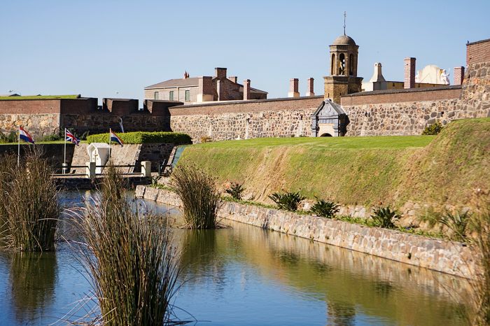
The Castle of Good Hope is the oldest building in South Africa, built between 1666 and 1679 by the VOC.
In 1679, Simon van Der Stel became the new Commander of the Cape (years later, in 1691, the title Commander was changed to Governor) and he pursued an expansionist agricultural policy to increase the number of farms at the Cape, which was struggling to grow enough crops to supply the ships.
The VOC employees that set up the initial farms in the Cape were known as the 'free burghers' and the majority were of Dutch ancestry and belonged to the Calvinist Reformed Church of the Netherlands, but there were also some Germans and Scandinavians. In 1688, there was an influx of settlers known as French Huguenots, a religious group of French Protestants who decided to leave their homeland due to the religious persecution of Protestants under King Louis XIV.
Meanwhile, despite the continued arrival of more settlers from Europe, the Cape still had a labor shortage, and to this end, the VOC began making indentured servants of the Khoikhoi, as well as importing thousands of slaves from Madagascar, India, Mauritius, and the Dutch colonies in the East Indies.
Many of the slaves ended up marrying with white settlers and their mixed-race descendants became known as Cape Coloureds and Cape Malays. Most interestingly, Simon van Der Stel himself, was of mixed race. His father, Adriaan van der Stel, was a VOC official and his mother, Maria Lievens, was the daughter of a freed Indian slave woman known as Monica of the Coast of Goa, or Monica da Costa.
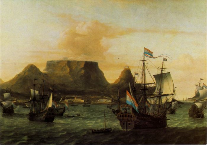
A painting of Table Bay showing Dutch VOC ships and Table Mountain, circa 1683 (image: Wikimedia Commons).
The Colony continued to expanded outward and the Khoikhoi were pushed out, killed or made servants. Afrikaans, the language which evolved as a hybrid of Dutch and languages of the indigenous people and slaves from the east, soon became the predominant tongue of the Cape settlers.
As more settlers continued to arrive in the later part of the 17th century, the farmers (or burghers) continued to expand into the interior, spreading north and east from the Cape, many of them leading a semi-nomadic, pastoralist way of life similar to that of the Khoikhoi people, whom they were actively displacing.
These were the first of the Trekboere (or wandering farmers, later shortened to Boers), who led their lives completely independent of official controls and laws, and were totally self-sufficient and sometimes isolated. Many of the original settlers also left the Cape Colony to escape the autocratic rule of the VOC.
Many of the earliest settlements in present-day South Africa were first settled by the Boers, including Stellenbosch (founded 1679 and the second oldest town in the country), Paarl (settled in 1688), and Franschhoek (settled in 1688).
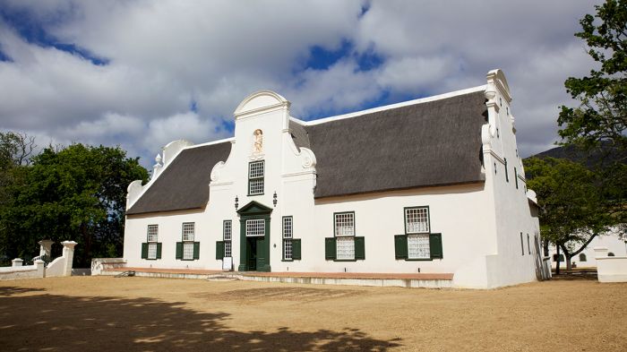
The manor house at Groot Constantia, built by Simon van Der Stel in 1692.
Simon van Der Stel retired from his position as Governor of the Cape in 1699, and was replaced by his son Willem van der Stel. Simon moved full-time into his estate, Groot Constantia, where he tended to the production of wine grapes until his death in 1712. The massive estate was divided up and sold at auction in 1716, and the wine farms from the original estate are still producing wine today.
Despite the VOC's attempts to prevent its settlers from leaving the Colony, the frontier continued to expand, as the Cape authorities lacked the means to police the Colony's borders. By the 1740s, the Boers had settled parts of the Little Karoo and by the 1760s, they reached north into the Great Karoo.
The VOC continued to import slaves to the Cape Colony in huge numbers, mostly from the Dutch East Indies, and by the early 1700s, there were more slaves than burghers in the growing colony. By 1713, the expanding VOC lands had completely pushed out the Khoikhoi, taking all their land and cattle. European diseases like smallpox, to which the indigenous people had never been exposed, further decimated the Khoikhoi populations and by the mid-1700s, those who survived had become servants of the colonists.
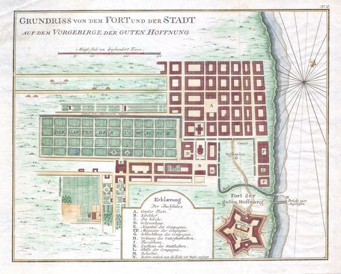
A map of Cape Town in 1750, by the French cartographer Jacques-Nicholas Bellin (image: Wikimedia Commons).
British Takeover (1795-1814)
In 1795, during the French Revolution, France invaded the Netherlands and its ruler, William V, Prince of Orange, fled his country to England, where he issued the 'Kew Letters', ordering his commanders aboard naval ships and in the Dutch Colonies to resist the French in cooperation with the British. The letters ordered the Dutch Colonial authorities to surrender their colonies to the British.
The VOC militia had no intention of obeying the letter from William, and when the British sent a fleet of nine warships to anchor offshore of Simon's Town at the Cape, the Battle of Muizenberg ensued. The battle was quick and the Dutch governor surrendered the colony. In 1798, the VOC went bankrupt and it transferred its territories and claims to the Dutch Batavian Republic.
A map showing the extent of the Dutch Cape Colony in 1795 (image: Wikimedia Commons).
The British occupied the Cape Colony until 1802, when the Cape Colony was returned to the Dutch as part of the Treaty of Amiens, which temporarily ended the hostilities between France and Great Britain at the end of the War of the Second Coalition, marking the end of the French Revolutionary Wars.
By late 1805, the temporary peace between Britain and Napoleonic France had ended and hostilities resumed, prompting the British to again invade the Cape in order to prevent Napoleon from taking over the colony. After the Battle of Blaauwberg, which began on 08 January 1806, Britain took control of the Cape Colony and established British Rule over the Cape via Articles of Capitulation signed by the Batavian Governor of the Cape, General Janssens on 18 January 1806.
British forces occupied the Cape until 13 August 1814, when the Dutch government formally ceded sovereignty over the Cape to the British, under the terms of the Convention of London.
A British East India Company ship off Table Bay, circa 1819 (image: Wikimedia Commons).
The Great Trek (1815-1850)
The British began formally expanding their new colony in the Cape and in 1820, in an attempt to strengthen the eastern boundary of the colony, Britain invited citizens in England, Ireland, Scotland and Wales to apply for land grants to settle in the Cape Colony in what is today the Eastern Cape Province. Some 4 000 applicants were approved, granted land, and supplied with food and equipment to start farms. Many of the farms failed, but the '1820 Settlers' all remained in the Colony, some moving into nearby towns and others further north into the Natal region (Zululand).
In 1834, Britain formally abolished slavery in the colony, a drastic social change which most of the original Dutch settlers, the Boers, greatly resented and resisted. The Boers also had a great distaste for the Imperial English language and culture.
A map of the first wave of the Great Trek (1835-1840) illustrating the paths of the largest parties of Voortrekkers across Southern Africa (image: Wikimedia Commons).
By 1835 a mass migration of the Dutch-speaking settlers in the British-controlled Cape Colony began, with thousands of settlers heading east and inland by wagon train in an effort to live their lives beyond the reach of the British Colonial administration. The participants in the mass exodus from the Cape are known as the Trekboers, or Voortrekkers, meaning 'pioneers' or literally, 'fore-trekkers' in Dutch or Afrikaans.
The Trekboers settled far inland around the central and eastern parts of present-day South Africa and this ultimately led to the formation of several Boer Republics including the Natalia Republic (founded 1839), the South African Republic (also known simply as the Transvaal; founded 1852), and the Orange Free State (founded 1854).
The first big wave of Voortrekkers lasted from 1835 until 1840, during which time an estimated 6 000 people (around 20% of the entire population of the Cape Colony) left on these treks. There was no clear consensus amongst the various parties of trekkers on where to settle, but they all had the idea of settling on a river which would give access to the sea.
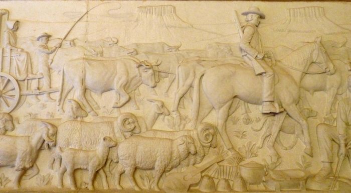
Panels in the Voortrekker Monument depicting the exodus of farmers from the eastern Cape Colony in 1836/37 (photo: Wikimedia Commons).
Zulu Empire (Early 1800s)
By the early 1800s, various Bantu-speaking tribes living in present-day KwaZulu-Natal Province were at war with one another, chiefly over grazing land for their cattle. The two major tribes were the Mthethwa and the Ndwandwe, who had a major confrontation in the late 1810s, which ended with the defeat of the Mthethwa. In the aftermath of this major battle, a young warrior named Shaka, of the small and almost powerless Zulu tribe, emerged as the region's overall leader, and he proceeded to consolidate many tribes under his reign.
Shaka's rise to power and rule over the region coincided with the beginning of the 'Mfecane' ("Upheaval" or "Crushing"), a period of devastating warfare and chaos in southern Africa between 1815 and 1840 that severely depopulated the region of its indigenous tribal people. Many fled the ruthless Zulu war parties, departing from their ancestral lands and leaving vast tracts of land unoccupied, just in time for the arrival of the Voortrekkers, who were looking for land themselves.
King Shaka of the Zulu people (image: Wikimedia Commons).
By 1820, Shaka's army was estimated to be some 30 000 warriors and he continued to consolidate his power by incorporating defeated tribes into the Zulu, thus building his army and empire. He was known for his revolutionary military tactics, including changing from the long throwing 'assegai' spear to a shorter stabbing spear called the 'iklwa'. His army trained barefoot and was forced to do long marches to toughen them.
Perhaps the most well-known of Shaka's military reforms was the 'Bull Horn' combat formation. The Bull Horn consisted of three elements: the chest, the horns, and the loins. The main Zulu force, 'the chest', was comprised of senior veterans that closed with the enemy in melee combat. The 'horns', made up of young and fast junior warriors, would flank the enemy and encircle it. The 'loins' were positioned behind the chest, seated and in waiting, with their backs to the battle to avoid losing confidence, and were called upon if the enemy threatened to break out from the other forces.
Shaka was ultimately assassinated in 1828 by two of his half-brothers, Dingane and Mhlangana, with Dingane assuming power and control of the Zulu Kingdom. Dingane carried on leadership and control of the region with the powerful Zulu forces and continued Shaka's ruthless dominance over the land.
Zulu "impi" (warriors) during a battle (image: Wikimedia Commons).
Voortrekker-Zulu Conflicts (1838)
With the arrival of the Voortrekkers into the eastern portion of present-day South Africa, conflicts arose with the indigenous tribes living there. While many of the meetings between the local people and the new arrivals were peaceful, others, particularly those with warring tribes like the Zulu, ended in violence, some causing casualties.
One of the famous Voortrekkers at this time was Pieter Mauritz Retief, a spokesperson for the greater population of frontier farmers and leader of one of the trekking groups. Retief wrote the "Voortrekkers' Declaration" at the onset of their departure from the colony and was elected as governor of the first wave of trekkers. Retief proposed that the migration settle in Natal and selected the spot for its future capital (now named Pietermaritzburg in his honor).
In early 1838, Retief negotiated a land treaty with Dingane, King of the Zulu tribe (after killing his half-brother Shaka ten years earlier and assuming the throne). The treaty gave the Voortrekkers land around the Tugela River and from there southeast to the Indian Ocean coast. After the official signing of the treaty, which took place on 06 February 1838, Dingane invited Retief's party to a celebration of the treaty and to watch a special performance by his soldiers at his residence at uMgungundlovu.
Panel in the Voortrekker Monument in Pretoria, showing Piet Retief and Dingane signing the treaty granting the Voortrekkers land to the south (photo: Wikimedia Commons).
Retief Massacre
The Voortrekkers were asked to surrender their weapons at the entrance to the royal kraal (as per protocol when appearing before the king) and while the Voortrekkers were being entertained, Dingane suddenly accused the visiting party of witchcraft and ordered his soldiers to take Retief and the Voortrekkers prisoner.
Retief and his party of about 100 men, which included his son, various other Voortrekkers, and their Coloured servants, were summarily clubbed to death by Dingane's soldiers. The bodies were left to be consumed by animals, as was Dingane's custom with his enemies.
After the 'Retief Massacre', Dingane sent 7 000 of his 'Impi' warriors to kill the remaining Voortrekkers, who were encamped at various locations in the Drakensberg foothills, including at Doringkop, Bloukrans, Rensburgspruit, Moordspruit, and other sites along the Bushman River. The warriors spared no-one, including women and children, and over 500 Voortrekkers, Khoikhoi and Basuto people were killed.
The town of Weenen, which is one of the oldest European settlements in KwaZulu-Natal, was established some two months after the massacres. Weenen is the Dutch word for 'cry' or 'weep'.
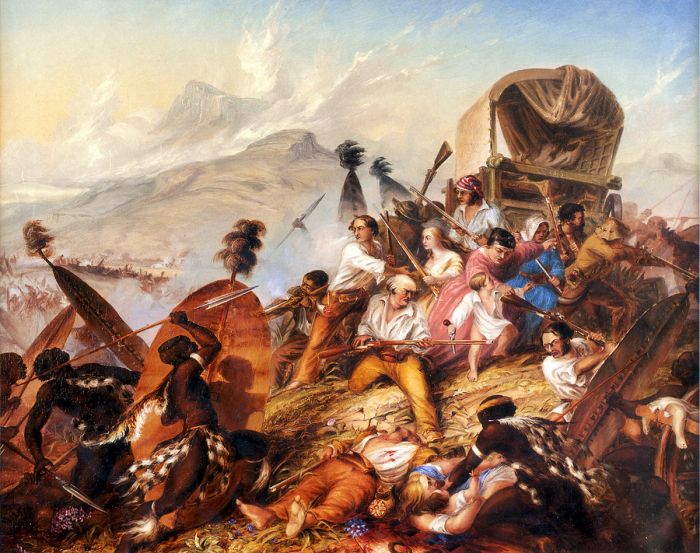
A painting by Thomas Baines depicting the Weenen Massacre in February 1838 (image: Wikimedia Commons).
After the massacres, the surviving Voortrekkers from Retief's party appealed to other treks nearby for help, particularly those of Piet Uys and Hendrik Potgieter in the Orange Free State. Both treks responded by sending commandos to assist in a retaliation. Unfortunately, the two party leaders could not agree on who would be the overall leader of the combined force, so each party ended up fighting separately but for the same cause. This arrangement would prove to be a disastrous.
The combined Boer force consisted of 347 men, which set out in two divisions on 05 April 1838. The Boer commandos initially succeeded in capturing a contingent of Zulu Impi scouts and the captives disclosed the location of the main Zulu army encampment at uMgungundlovu, the royal capital of the Zulu and one of several military complexes (amakhanda) which Dingane maintained. The name uMgungundlovu derives from the Zulu phrase 'ungungu we ndlovu', which means "the secret conclave of the elephant".
The Voortrekkers headed straight to the Zulu capital and encountered two large battalions of impi, numbering an estimated 8 000 in total, and each Voortrekker party, one led by Uys and the other by Potgieter, attacked one of the impi parties separately. In the confusion, Uys' party fought bravely and lost numerous men, including Uys himself and his son, while the Potgieter contingent was repelled and fled. Due to the outcome of the battle, the Potgieter forces involved in the battle subsequently became known as the Vlugkommando (Flight Commando).
A panel in the Voortrekker Monument, Pretoria, depicting the Battle of Italeni on April 6, 1838. Dirkie Uys defends his wounded father, Piet Uys, until they are overpowered by the Zulu impi (image: Wikimedia Commons).
Battle of Blood River (16 Dec 1838)
The Voortrekker losses at the hands of the Zulus were devastating and left them without an overall leader, so the arrival of Andries Pretorius, a descendant of the earliest Dutch settlers at the Cape Colony, was a fortuitous event. Pretorius was an outspoken advocate for Boer independence and was well trusted by most of the Voortrekkers. Pretorius arrived at the Trekkers' main encampment on 22 November 1838 and was immediately appointed as chief commander of the Voortrekker commandos, who still sought punitive action against Dingane.
The Trekker forces included 64 wagons and over 460 heavily armed Boer soldiers. Pretorius did not wish to engage the Zulu on a battlefield of their choosing, and so on 06 December 1838, he led his commandos on a march towards the Zulu capital at uMgungundlovu, practicing laager tactics every night along the way.
Instead of attacking the Zulu capital, Pretorius hoped they would come to him and a site of his choosing, and he chose a location in a ravine of the Ncome River (now also called the Blood River). The defensive position was protected on two flanks, with a wide-open frontal area that provided no cover whatsoever as the only possible approach for an attacking force.
Artist's depiction of the Battle of Blood River in December 1838 (image: Wikimedia Commons).
Pretorius had also brought a 6-pound naval carronade (a type of cannon used by the Royal Navy) with him from the Cape. The carronade was mounted on a gun carriage improvised from a wagon axle, and named 'Grietjie'. Pretorius also had a 4-pound smoothbore cannon. Both guns were used to fire devastating 'grapeshot' (like a giant shotgun).
During the night of 15 December 1838, thirty-six Zulu regiments, each consisting of around 900 to 1 000 warriors, arrived near the Voortrekker position. One half of the Zulus forces crossed the Ncome River and amassed near the Voortrekker laager, while the more elite forces of the Zulus, called 'the Black and White Shields' waited on the opposite bank, splitting the Zulu forces.
At dawn on 16 December 1838, the Zulu forces that had crossed the river attacked, but their short spears were only effective at short range and best for melee fighting, and the Voortrekker muskets and cannons mowed them down like grass.
The original carronade brought by Andries Pretorius from the Cape and used during the Battle of Blood River. The canon is now located in the museum at the Voortrekker Monument, Pretoria (image: Wikimedia Commons).
After two hours of fierce battle, with the Zulus suffering catastrophic losses as numerous waves of attacking impi were gunned down, Pretorius gave the order to open the laager gates and confront the Zulus on horseback and on foot to disrupt their formations and avoid running out of ammunition. The Zulu withstood the attacking Voortrekker attacks for some time, but eventually scattered. The battle was won, with an estimated 3 000 Zulus killed and only three Voortrekkers wounded.
After Dingane's defeat at Blood River, unrest ensued amongst the Zulu, which led to Dingane's desire to assassinate any potential successors to his throne, one of which was his half-brother Mpande. Thousands of impi in the Zulu army were already loyal to Mpande, and in 1839, Pretorius and the Voortrekkers decided to support Mpande, hoping to gain concessions if they could help him oust Dingane.
In 1840, Mpande's army defeated Dingane at the Battle of Maqongqo. Dingane was soon found and executed. Mpande was crowned as the new Zulu king in Pietermaritzburg and agreed on the Tugela River as the border between Zululand and the Boer Republic of Natalia.
Replicas of the Boer wagen laager at the Battle of Blood River Monument in KwaZulu-Natal (image: Wikimedia Commons).
Boer Republics (1839-1854)
Pretorius and the Boers now had land on which to settle and they proclaimed their Republic of Natalia in 1839, with the capital at Pietermaritzburg, named in honor of Trekker leaders Piet Retief and Gerrit Maritz. Just southeast of Pietermaritzburg was the Indian Ocean settlement of Port of Natal (present-day Durban).
The Boers sought independence from the British Cape Colony, but the British refused to accept Natalia's independence. The British were also concerned about losing control of the eastern coast, and to that end, they dispatched a force to establish military control of Port Natal in 1842. The British constructed a fort in the city (late named 'The Old Fort')
In 1843, the British annexed the Republic of Natalia as a British colony, thus ending the first of the Boer Republics. Many of the Natal Boers continued to vehemently oppose British rule, and they left Natalia, trekking over the Drakensberg Mountains into lands and forming two new Boer Republics (Transvaal Republic and Orange Free State).
Photo of a Boer family taken in 1886 (photo: Wikimedia Commons).
In January 1852, the British agreed to formally recognize the independence of the Boers and grant them land north of the Vaal River. The agreement was formalized by the Sand River Convention (named for the farm at which the convention was signed).
The Boers now had their own official land and full rights to self-govern, free from any and all British interference. Part of the agreement was that the Boers agreed not to have slaves in their new country. The new Boer state was named the South African Republic (Afrikaans: "Zuid-Afrikaansche Republiek" or ZAR), also commonly known as the Transvaal Republic in reference to the area over the Vaal River.
The capital of the ZAR was established at Potchefstroom (in 1860 the capital was moved to Pretoria, which is named for Andries Pretorius). The parliament was called the 'Volksraad' and had 24 members. The first president of the ZAR was Marthinus Wessel Pretorius, the son of Andries Pretorius.
Two years later, in February 1854, a second convention was signed between the Boers and the British, this one giving the Boers the territory south of the Vaal River all the way to the Orange River. The Orange River Convention (sometimes also called the Bloemfontein Convention) thus granted the Boers another formally recognized republic, which they called the Orange Free State.
Map showing the Boer Republics and the British Cape Colony (image: Wikimedia Commons).
Leading up to both the Anglo-Zulu War (1879) and the First Boer War (1880-81), key developments were taking place that were contributing factors to these conflicts:
- In 1867, significant diamond deposits were discovered near the Vaal River, near the shared boundary between the Boer Republic's Orange Free State and the British Cape Colony.
- In 1873, the ensuing diamond rush led Britain to annex West Griqualand, site of the diamond deposits and inhabited by the Griqua, Tswana, and Khoisan people. The Griqua were a semi-nomadic Afrikaans-speaking people of mixed-race origin, who originally emigrated from the Cape Colony.
- Competition amongst European powers to colonize and expand their control of Sub-Saharan Africa was intensifying, with Germany, Portugal, France, and Belgium all acquiring land, which greatly concerned the British.
- Britain's desire to control the trade routes to India meant that the key ports on the Eastern coast of Africa were crucial.
- In January 1877, the British annexed the ZAR (or Transvaal Republic), which was completely bankrupt and in conflict with various native tribes, particularly the Zulus, who were now ruled by Mpande's son, Cetshwayo, who had become ruler upon his father's death in 1873. The Boers in Pretoria were caught between two enemies and because the threat from the Zulus was significant, they feared that if they diverted their strength to contest the British annexation, then the Zulus would attack them.
Portrait of Thomas François Burgers, President of the South African Republic from 1872 to 1877 (image: Wikimedia Commons).
Anglo-Zulu War (1879)
British Invasion of Zululand (Jan 1879)
By 1878, the British had become increasingly concerned about the Zulu threat to Natal, especially since some Zulus had by now acquired old muskets and out-of-date firearms. Britain also had plans to create a Confederation of Southern Africa from the various British colonies, Boer Republics and native states, and the Zulus seemed to be the major obstacle threatening to derail this goal.
On 11 January 1879, Henry Bartle Frere, the British High Commissioner for Southern Africa, without authorization by the British government in London and acting of his own accord, invaded Zululand in an effort to eliminate the Zulus and help ensure his ambition of becoming the first British Governor-General of a Federated British Southern Africa.
Portrait of Sir Henry Bartle Frere (painted by George Reid), who ordered the initial invasion of Zululand in 1879 (image: Wikimedia Commons).
Frere sent his forces, which were commanded by Frederic Thesiger, 2nd Baron Chelmsford, across the Buffalo (Mzinyathi) River at Rorke's Drift, an old Irish trader's post that had become a Church of Sweden mission station, and into Zululand.
Lord Chelmsford led the main central column of soldiers, which numbered 7 800 men, while the right flank column headed to the coast under Colonel Charles Pearson, with orders to attack the Zulu at Ulundi, and the left flank column under Colonel Evelyn Wood headed northwest. Cetshwayo's Zulu army numbered around 35 000 men, but most were stationed throughout Zululand in their home villages.
Battle of Isandlwana (22 Jan 1879)
On 22 January 1879, the Battle of Isandlwana became the first major encounter of the war. A Zulu force of some 20 000 warriors attacked one of the three columns of the British invasion force, consisting of 1 800 men. Despite the British's vast advantage in weapons technology, which included Martini–Henry breechloading rifles and two 7-pounder mountain guns deployed as field guns, the Zulus overwhelmed the British force, killing over 1 300 troops.
The Zulu forces lost anywhere between 1 000 and 3 000 warriors. The British lost all their supplies, ammunition, and transport and caused Chelmsford to retreat from Zululand.
An 1885 painting of the Battle of Isandlwana, by Charles Edwin Fripp (image: Wikimedia Commons).
Battle at Rorke's Drift (22-23 Jan 1879)
In the aftermath of the resounding British defeat at Isandlwana, some survivors of the battle arrived back at Rorke's Drift, which served as the British forces' encampment, supply depot, and field hospital, and which was guarded by only a small garrison of 400 auxiliary soldiers. The survivors warned the men that the Zulus were headed their way.
Later that afternoon, about 100 Natal Native Horse (a calvary unit) arrived back to the station, strengthening the British numbers and work quickly ensued to prepare to defend their position. The Zulu forces arrived, some 3 000-4 000 strong and all of them fresh, as this contingent had not fought at Isandlwana (it had served as the reserve battalion or 'loins' in Shaka's military lexicon).
Several hundred of the British soldiers, many of them exhausted form the earlier battle, fled when they saw the approaching Zulu Impi, which vastly outnumbered the British. The departure of many of the British soldiers left the garrison with only about 150 men. The Zulu vanguard of around 600 men attacked in the late afternoon and the British opened fire. The Zulus got thru and engaged the British in hand-to-hand fighting. The British endured continuing attacks until around 2am and after having fought for around ten hours, they were running low on ammunition and almost every man was wounded.
As dawn broke, the British found that the Zulus had departed. A total of 351 Zulu bodies were counted, but an estimated 500 more had been wounded. Any Zulus found on the battlefield still alive were shown no mercy by the British and all were dispatched. Many accounts of this battle say that the Zulus suffered closer to 600 casualties.
An 1880 painting of the Battle of Rorke's Drift, by Alphonse de Neuville (image: Wikimedia Commons).
Continued Fighting in Natal (Mar 1879)
The left and right flanks of the invading British forces retreated from Zululand after hearing of the disaster at Isandlwana and the first British invasion of Zululand had been a failure. The British forces under Lord Chelmsford used the next two months to regroup and build a fresh invading force. Meanwhile, the British government sent seven regiments of reinforcement soldiers to Natal, along with two artillery batteries.
On 12 March 1879, a British supply convoy marching to the village of Lüneberg was defeated by 500 Zulus at the Battle of Intombe. The British lost 80 soldiers and all of their ammunition, food, and other supplies.
On 28 March 1879, Sir Evelyn Wood's troops attacked the Zulu stronghold at the Battle of Hlobane. A Zulu force of 20 000 mean counterattacked, causing the British forces to retreat and it turned into a rout, with the British suffering 225 casualties.
Photo of Zulu impi warriors taken in 1882 (photo: Wikimedia Commons).
Battle of Kambula (29 Mar 1879)
On 29 March 1879, the Zulu force, which now numbered 21 000 impi and included forces that had already fought and defeated the British at Isandlwana, attacked Wood's heavily fortified camp at Kambula.
Wood's forces included 121 Royal Artillery and Royal Engineers, 1,238 infantry and 638 mounted men. The British forces were also reinforced by Raaffs Horse (or Raaff's Transvaal Rangers), an irregular unit raised by Pieter Johannes Edward Raaff with a strength of approximately 140 men. The Transvaal Rangers enlisted men from both European and Coloured ethnicity and recruited men from the Kimberley diamond fields.
Although heavily outnumbered, the British position was extremely well designed defensively, consisting of a hexagonal laager formed with wagons which were tightly locked together. The position was further fortified via trenches, earthen parapets, and a stone redoubt on a rise above the laager to cover the assumed approach by the Zulus. A palisade formed an effective blockade between the main kraal and the redoubt, while four 7-pounder guns were positioned between the redoubt and the laager. Two more 7-pounder guns in the redoubt provided cover in the other directions.
British map of the Battle of Kambula from the 1895 book Illustrated Battles of the Nineteenth Century (image: Wikimedia Commons).
The Zulus sent wave after wave of men at the British position for about 5 hours during that afternoon, with the British guns exacting a devastating toll on the impi. In the end, the Zulus never breached the British position and upon their retreat, the British pursued the remaining Zulus on horseback, firing at the fleeing impi with carbines from the saddle and spearing them with discarded assegai spears. No prisoners were taken. Following the cavalry, the British infantry troops combed the field, killing any wounded or hiding Zulu they found.
Kambula was the decisive battle of the war. In only five hours, the British fired 138 000 rounds and 1 077 shells and demonstrated that the shield and assegai spear of the Zulu were no match for an entrenched force with heavy artillery and adequate rifle weaponry. The Zulu casualties numbered 785 near the camp, but their total losses were certainly far greater, with the actual estimate being around 2 000 dead, with many surely succumbing to their injuries away from the scene of the battle. The British casualties included 18 British soldiers killed, 8 officers and 57 men wounded, with 11 of the wounded dying later.
Sketch of the Battle of Kambula by Melton Prior, for The Illustrated London News, 24 May 1879 (image: Wikimedia Commons).
Battle of Gingindlovu (02 Apr 1879)
After the resounding British victory at Kambula, Lord Chelmsford turned his attention to rendering aid to Colonel Charles Pearson's column, which had been hunkered down at their fortified position at Eshowe. Pearson had established an advanced base at Eshowe in preparation of attacking the imps at Ulundi, the Zulu capital. Eshowe at that time consisted of a deserted church, a school, and the house of a Norwegian missionary.
Pearson's fortified position and advanced weaponry (rifles and artillery) was able to keep the Zulus from overrunning the encampment, but the garrison was running very low on rations and other supplies and was unable to retreat due to the presence of the large Zulu force.
Portrait of Frederic Augustus Thesiger, 2nd Baron Chelmsford (image: Wikimedia Commons).
Chelmsford organized a relief column comprised over 5 600 troops, including men from the Natal Native Contingent, plus a variety of artillery, including two 9-pounder guns, four 24-pounder rocket tubes, and two Gatling guns. Chelmsford's column departed Fort Tenedos, on the Zulu side of the Tugela River on 29 March 1879 and arrived within eyeshot of Eshowe on 01 April 1879.
Chelmsford arrived and provoked the Zulus into attacking his wagons. The British infantry opened fire with the gatling guns and cannons with devastating results for the Zulu warriors. In just a couple of hours, the Zulus had fled and the British soldiers took up the grim task of killing the Zulu wounded left behind. Some 700 Zulu bodies were counted at the scene and another 300 killed by mounted calvary as they chased down the fleeing warriors. The British lost eleven men, with 48 more wounded.
The battle to relieve Pearson's troops after the two-month-long siege at Eshowe was a big success for the British. Chelmsford decided that the defensive position at Eshowe should be abandoned and the Zulus burned it down the next night.
Artist's depiction of Lord Chelmsford (center on horseback) observing the action (image: Wikimedia Commons).
Second Invasion / Battle of Ulundi (Jun-Jul 1879)
Lord Chelmsford was due to be replaced as commander of the British troops and wished to make a statement before leaving his command. Despite an offer from Zulu King Cetshwayo to negotiate peace, Chelmsford would only accept complete surrender. Chelmsford now had 25 000 troops at his disposal, but this was too large a number for the supply and transport capabilities of Natal, so he was forced to plan his next invasion with a smaller column that could be sustained in the field.
On 03 June 1879, Chelmsford again invaded Zululand, but this time with more caution, building well-fortified camps along the way and heading directly to the Zulu Royal Kraal at Ulundi. He led a force of 1 000 calvary, 9 000 infantry, and an additional 7 000 troops with 24 big guns, including the first ever British Army Gatling gun battery. The supply column included 600 wagons, 8 000 oxen, and 1 000 mules.
An historic sidenote: Just two days prior to the second British invasion of Zululand, on 01 June 1879, Imperial Prince Napoleon Eugene Bonaparte, the only child of Napoleon III, Emperor of the French, who had moved his family to England after his father's death in 1873 and volunteered for the British Army, was killed in a skirmish with a group of Zulus.
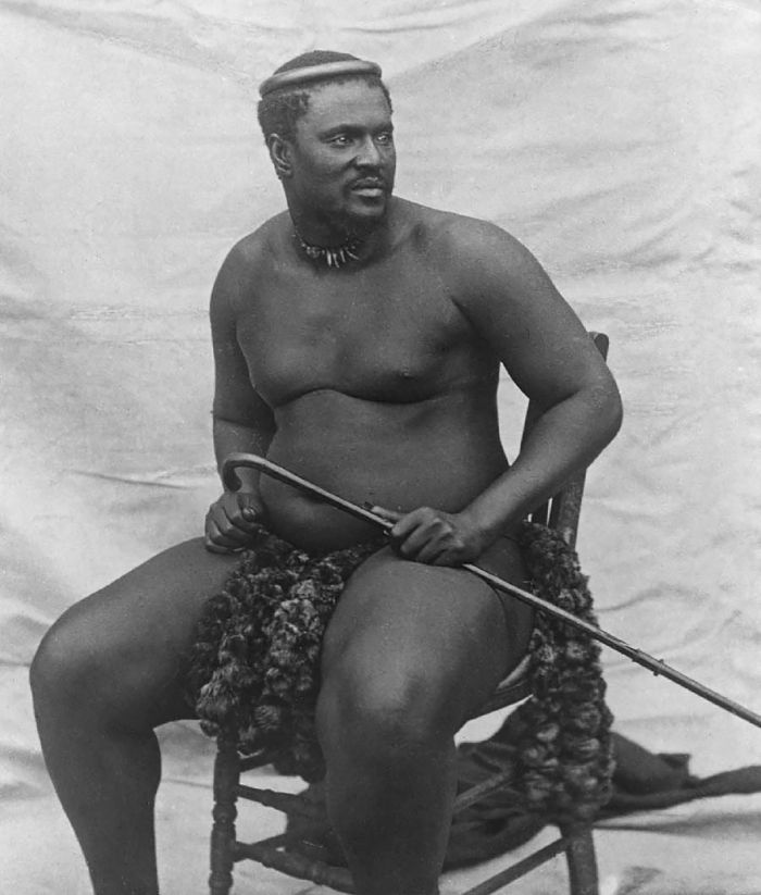
Photograph of Cetshwayo kaMpande, king of the Zulus, circa 1875 (image: Wikimedia Commons).
Still hoping for a negotiated peace agreement, King Cetshwayo refrained from attacking the lengthy and vulnerable British supply lines as they marched across Zululand. Cetshwayo sent envoys from Ulundi to the British lines, requesting terms required to cease hostilities. Chelmsford replied back with terms in writing.
Meanwhile, Lord Chelmsford's replacement, Field Marshal Garnet Wolseley, had already arrived in Cape Town, and on 28 June 1879, Chelmsford received a cable from Wolseley ordering him not to undertake any serious military action, but Chelmsford ignored the command. A second cable received two days later was also ignored.
Cetshwayo's envoys again arrived at the British lines, this time with some of the demanded items requested by Chelmsford, including oxen, elephant tusks, the promise to turn over firearms, and other items. Chelmsford turned the Zulu representative away without accepting the items and replied that the British advance would only be delayed one day to allow the Zulu king to surrender one regiment of his warriors. Battle was imminent.
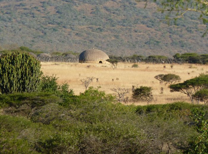
A recreation of a royal Zulu kraal, this one at uMgungundlovu (photo: Wikimedia Commons).
On the morning of 03 July 1879, the British moved out and met the Zulu force, which numbered 12 000 to 15 000 warriors. The Zulus charged but the British guns cut them down with non-stop fire. It was a killing field and no Zulu managed to get close to the British troops, so no hand-to-hand combat occurred. The Zulus began to flee, abut the British calvary sped after them, killing every last Zulu on the battleground. The battle lasted just over one hour. Zulu casualties numbered 500 and another 1 000 or so wounded. The British lost 10 men with 87 wounded.
The hunt was under way to locate and capture Cetshwayo, but he was not found until 28 August 1879, hidden at a kraal in the Ngome Forest, where he was captured, sent to Cape Town, and imprisoned at Robben Island. Cetshwayo was released in 1883 and allowed to return to Zululand, where he died in 1884.
Zululand was portioned up by the British, with pro-British chiefs installed in each of the chiefdoms.
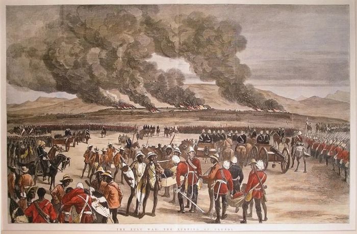
Artist's rendering of the burning of the royal Zulu kraal at Ulundi (image: Wikimedia Commons).
First Boer War (1880-1881)
With the Zulus now defeated, the Zulu pressure on the Transvaal Boers dissipated and they focused on protesting against the British annexation of the Transvaal, which occurred in 1877.
Resentment was growing and finally boiled over on 11 November 1880, when a Boer named Piet Bezuidenhout refused to pay what the Boers claimed was an illegal tax (as they refused to accept the legality of the Transvaal's annexation), causing British police to seize his wagon and attempt to auction it off. A mob of 100 armed Boers disrupted the auction and reclaimed the wagon, and violence ensued when British troops tried to intervene.
The First Boer War actually consisted of small sieges conducted by independent groups of Boers against British Army garrisons throughout the Transvaal. The Boers were extremely independent, but had no actual regular army. When need arose in a district or town, a civilian militia was formed into units called commandos and officers elected. The Boers had no uniform and each man used his own weapon, typically a hunting rifle, as well as his own horse.
Map of Southern Africa in 1880, showing the various British-controlled colonies, including Natal, which they had just taken from the Zulus (image: Wikimedia Commons).
The Boer commando units were primarily made up of farmers that spent their days on horseback and were expert hunters. The typical firearm used by the Boers was a single-shot breech-loading rifle, usually a .450 Westley Richards, which was accurate up to 600 yards. As hunters, the Boers had learned to fire from behind cover and from a prone position, knowing that they had to make the first shot count, because if they missed, the game animal would be long gone in the time it took to reload.
The Boer commandos made for extremely good calvary units, with good riding skills and accurate marksmanship. The British's red uniforms also made them easy targets for the Boers, even at long distances.
The first serious action of the war was at Bronkhorstspruit on 20 December 1880, when a Boer unit intercepted a unit of British soldiers marching towards Pretoria and ordered them to turn back, stating that the territory was again a Boer Republic and that any advance by the British would be an act of war. The British refused and the fighting ensued. The British troops were annihilated, with 56 killed and 92 wounded.
The Boers proceeded to siege six small British forts in the Transvaal, which between them held some 2 000 British soldiers. The forts were located at Lydenburg in the east, Wakkerstroom and Standerton in the south, Marabastad in the north, and Potchefstroom and Rustenburg in the west.
Paul Kruger, the leader of the Boers, circa 1880 (image: Wikimedia Commons).
Battle of Laing's Nek (28 Jan 1881)
Major-General Sir George Pomeroy Colley, the British Governor of Natal and British Military Commander, had requested troop reinforcements to counter the Boer sieges, but was told these would not arrive until mid-February. Colley feared that the besieged forts would not hold out until then, so he decided to attempt to support them with his small column of Natal Field Force men, which amounted to only 1 200 troops.
Colley's troops were not only outnumbered, they were also further disadvantaged, as few were mounted, while most of the Boers were mounted and excellent riders. Nonetheless, Colley's force set out on 24 January 1880 from Newcastle, near the Transvaal border, heading north to relieve the nearest forts as Wakkerstroom and Standerton.
The Boers were commanded by Piet Joubert, Commandant-General of the Boer Republic, who had mustered a force of around 2 000 men from the surrounding area, with 400 of them fortifying a ridge in the foothills of the Drakensberg Mountains (called Laing's Nek) that blocked the road between Newcastle and Standerton.
On 25 January 1881, Colley's forces arrived at the Laing's Nek pass and attempted to force the Boers off the heights using bombardment from their big guns (two 7-pound guns and four 9-pound guns), as well as calvary charges on the Boer troops stationed on the lower slopes. The attacks were repelled and after just 2.5 hours, the battle was over, with the British forced to retreat. The British suffered 84 killed (including two commanding officers), 113 wounded, and 2 soldiers captured. The Boers lost 14 men, with an additional 27 wounded.
Painting of the Battle of Laing's Nek by Elizabeth Thompson (image: Wikimedia Commons).
Battle of Schuinshoogte (08 Feb 1881)
After the costly defeat at Laing's Nek, Colley retreated south to Newcastle to await reinforcements. On 07 February 1881, he learned that Boer patrols had forced back a mail escort on its way to the British outpost. The next day (08 February 1881), determined to keep the British supply and communication lines open, Colley personally led a group of 240 infantrymen, 38 cavalry, and two pieces of artillery, to escort the mail wagon.
The Boers attacked at around noon with a force of 300 men and the fighting went on for five hours. Boer sharpshooters picked off the British, who were exposed and wore dark uniforms that stood out in contrast against the light-colored terrain. Heavy rainfall began at 5pm, and the battle abruptly ended.
The Ingogo river swelled with rainwater and the British were at risk of being trapped in their position, so they had to make a desperate night march to cross the river with their horses and artillery. The British managed to make it, although several men drowned. The Boer failure to assault the British and allowing them to escape with their guns is considered their only major error during the war.
The British lost 69 men, including seven officers, and 77 wounded. The Boers lost eight men, with an additional 10 wounded. The men were buried on the battlefield the next day.
Illustration of the monument for fallen British soldiers at the Battle of Schuinshoogte. Majuba Hill can be seen in the background (image: Wikimedia Commons).
Battle of Majuba Hill (27 Feb 1881)
During the night of 26–27 February 1881, Colley sent a group of 405 of his soldiers to the top of a hill not far from Laing's Nek called Majuba Hill. The hill overlooked the main Boer position on Laing's Nek, but was difficult to ascend, so the British brought no artillery with them. It is thought that Colley expected the Boers would retreat once they saw that their position on the Nek was untenable, but this was not to be the case.
The arrival of the British troops atop Majuba Hill went unnoticed by the Boers until daybreak, when the British troops began shaking their fists and shouting down the hill in defiance, hoping to cause a Boer retreat. At first the Boers, who were led by General Nicolaas Smit, did start to panic, expecting an artillery attack was imminent, but when this did not transpire, the Boers formed three storming groups of 100-200 mean each from their volunteer ranks.
General Sir George Colley at the Battle of Majuba Mountain Just Before He Was Killed. Illustration by Melton Prior published in The Illustrated London News, 14 May 1881 (image: Wikimedia Commons).
The Boer groups began a slow advance up the hill, and with their keen marksmanship, began picking off British soldiers, one by one. Over the next hour, the Boers made serious incursions on the hill, taking advantage of the scrub and tall grass covering the slopes, while inflicting damage to the British troops. Discipline amongst the British began to crumble and the troops started to panic, as they could not see the enemy and were taking mounting casualties.
British soldiers began abandoning their posts and fleeing from the hill. The British line was broken, but Colley tried to rally his troops, ordering a fighting retreat. During the retreat, General Colley was killed by a Boer marksman. As the British turned and ran down the hill, many more were killed by the Boers, who now held the summit and fired down upon the retreating British troops.
The British casualties numbered 92 killed, 131 wounded, and 50 men taken prisoner. The Boers suffered one killed and six wounded. The taking of Majuba Hill took under an hour, and the defeat was a devastating blow to Britain in the conflict. Many of the Boers fighting on this day could be considered boys, and the shame felt by the British in losing a battle to farmers and their sons using rifles cannot be understated.
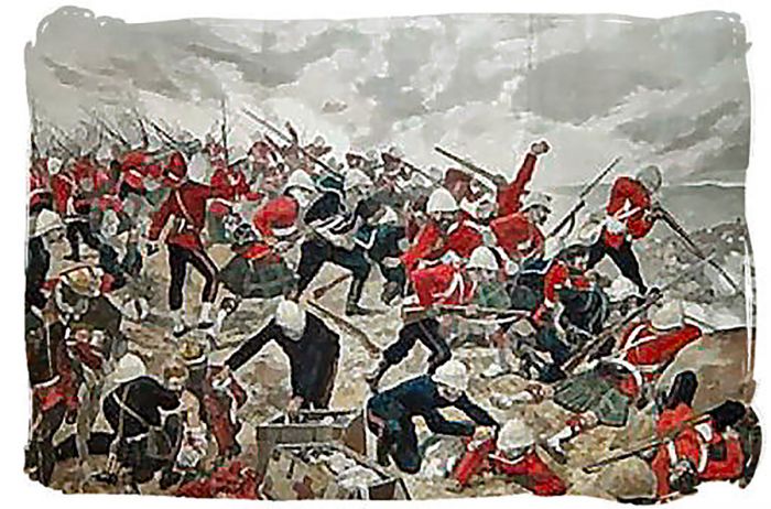
Painting of The Battle of Majuba, by Richard Caton Woodville Jr. (image: Wikimedia Commons).
British Defeat (March 1881)
The battle at Majuba Hill marked the end of the war, since the British realized that further action would require substantial investment, including significant troop reinforcements, and that it could become a protracted and messy war. For these reasons, the British government asked for a truce with the Boers.
An armistice was signed on 06 March 1881 by Sir Evelyn Wood (Colley's replacement), and a peace treaty was signed with Paul Kruger of the Boers on 23 March 1881, which officially ended the war.
The Boer Executive Council; Standing (left to right): Jacobus Marthinus Andries Wolmarans, Francis William Reitz, Schalk Willem Burger, Johannes Hermanus Michiel Kock. Sitting (left to right): Piet Joubert, Paul Kruger, Piet Cronje (image: Wikimedia Commons).
The final negotiated agreement, called the Pretoria Convention, was signed on 03 August 1881, with the British officially giving complete Boer self-government in the Transvaal as a tributary state under British authority. The agreement gave the British nominal rule and control over the Boer state in terms of external relations, African affairs, and native districts. The South African Republic (Zuid Afrikaansche Republiek, ZAR) was once again a recognized independent state.
At this time, what later became South Africa was comprised of four distinct entities: the two British colonies of Natal and Cape, and the two Boer republics of the South African Republic or ZAR (also called the Transvaal) and the Orange Free State.
A panel on the Kruger statue on Church square in Pretoria, depicting Sir Evelyn Wood negotiating with Paul Kruger to end the First Boer War (image: Wikimedia Commons).
Witwatersrand Gold Rush (1886)
In June 1884, an explorer and prospector named Jan Gerrit Bantjes discovered the Witwatersrand gold reef in the middle of the Boers' South African Republic (ZAR). News of the gold discovery spread quickly and reached Cecil John Rhodes at the diamond mines in Kimberley. Rhodes promptly rode to Bantjes' camp at Vogelstruisfontein, which would eventually become Roodepoort (part of the present-day Johannesburg municipality).
Rhodes purchased the gold found by Bantjes for £3 000 and the gold rush was underway. News of the gold spread worldwide and prospectors arrived from around the globe, but mainly from Britain, creating a growing mining community that eventually became Johannesburg.
The discovery of the apparently massive deposits of gold made the Transvaal Republic the richest and potentially most influential nation in southern Africa; however, the Boers lacked the manpower and industrial base to develop its new resource on its own. For this reason, the Boer government agreed to allow the immigration of 'uitlanders' (foreigners), which were mostly men from England.
Ferreira's Camp in 1886, soon after the "gold rush" began. This was the first settlement in what became Johannesburg (image: Wikimedia Commons).
By 1896, Boer President Paul Kruger had become fearful that the number of British foreigners living in the Transvaal (approximately 60 000) far outnumbered the Boers (approximately 30 000 white Boer men). Kruger was keenly aware that with the discovery of the rich gold deposits, the British may want to retake the Transvaal for themselves.
Fearful of losing their independent republic, Kruger decided to put in place a heavy taxation on the sale of dynamite to non-Boer residents, which mainly affected the British miners. The tax led to considerable discontent amongst the foreign miners and tensions escalated.
Meanwhile, Cecil John Rhodes, Prime Minister of the Cape Colony, wanted to incorporate the Boer republics into a federation under British control. Rhodes and his business partner, Alfred Beit had recently combined their commercial diamond mining interests at Kimberley into the De Beers Mining Corporation and desired to control the Transvaal gold mining industry as well.
The small and dirty mining settlement that eventually became Johannesburg was initially known as Ferreirasdorp, named after Colonel Ignatius Ferreira, leader of the original group of diggers who settled in this area in 1886. Within ten years, the town had become the largest in the entirety of Southern Africa, outstripping even Cape Town, which was 200 years older.
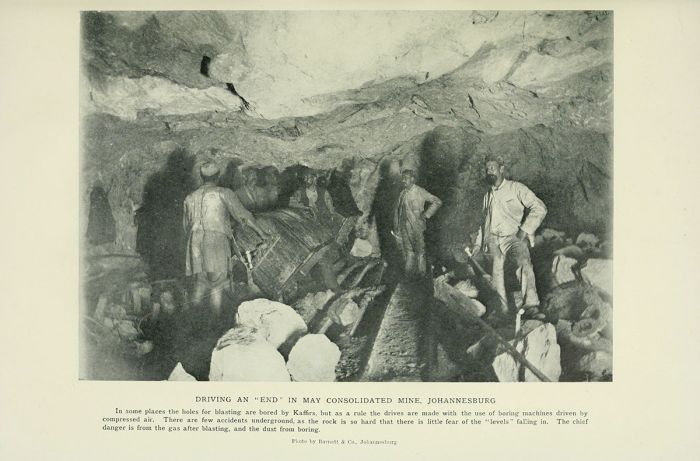
Men working in one of the early gold mines in Johannesburg, circa 1903 (image: Wikimedia Commons).
Second Boer War (1899-1902)
Boer Offensive (Oct-Dec 1899)
The discovery of the Witwatersrand gold gave the British mining magnates (known as the 'Randlords'), including Cecil Rhodes (who was also Prime Minister of the Cape Colony), Alfred Beit, Barney Barnato, and Lionel Phillips, reason enough to push for annexation of the Boer republics in order to profit from the gold as they had from the diamonds at Kimberley. Rhodes and the other wealthy British financiers envisioned a quick war and takeover of the Boer republics and used the pretense of the miners' grievances to spur on the conflict.
Leading up to the war, the foreign miners had been outwardly protesting against their taxation without representation and the British government was pushing for voting rights for its citizens in the Transvaal. Given that the British 'uitlanders' by this time far outnumbered the domestic Boer citizens, granting them voting rights would ultimately mean the loss of Boer control of their own republic.
Cecil John Rhodes (left) and Alfred Beit, South African mining magnates (photo: Wikimedia Commons).
In May 1899, Martinus Steyn, the Boer President of the Orange Free State, invited Alfred Milner, Governor of the British Cape Colony, and Paul Kruger, President of the Transvaal Republic, to a conference in Bloemfontein, hoping to avert war, but the talks quickly broke down, as Kruger had no intention of granting meaningful concessions.
Kruger convinced Steyn to join him in defying the British and they mobilized their joint forces. On 09 October 1899, President Kruger issued an ultimatum to the British, giving them 48 hours to remove their troops (though they had very few in fact) from both the South African Republic (ZAR) and the Orange Free State, failing which the Transvaal, united with the Orange Free State, would declare war. Britain refused to remove its troops, and war imminent.
Martinus Theunis Steyn, photographed during the 2nd Anglo-Boer War, circa 1900 (photo: Wikimedia Commons).
Battle of Kraaipan (12-13 Oct 1899)
The Boers went on the offensive beginning on 12 October 1899, winning a decisive victory at the Battle of Kraaipan, where 800 Boers under the command of General Piet Cronjé and General Koos de la Rey, attacked and captured the British garrison and railway siding at Kraaipan, effectively cutting off the British railway and telegraph lines between Vryburg and Mafeking in the northern Transvaal. An armored train was captured, along with two 7-pounder cannons, ammunition, and supplies. No soldiers were killed on either side, though the British suffered nine wounded.
Armored Cape Government Railways locomotive in the service of the Imperial Military Railways derailed at Kraaipan on 12 October 1899 (photo: Wikimedia Commons).
Boer Sieges of British Towns (Oct-Nov 1899)
The Boer offensive included the sieging of three key British garrison towns: Mafeking (13 October 1899), Kimberley (14 October 1899) and Ladysmith (02 November 1899). These three sieges would direct much of the British actions at the outset of the war, as they had to split their forces in order to relieve their troops stationed in the geographically distant besieged towns.
Battle of Talana Hill (20 Oct 1899)
The first major battle of the war was at Talana Hill (also called the Battle of Glencoe). British reinforcements sent to Natal before the outbreak of the war were concentrated at the coal-mining town of Dundee (Glencoe). Control of the coal mining was crucial to the British war effort, as it powered the British steam locomotives.
On 20 October 1899, under cover of darkness, two Boer forces numbering around 6 000 men and led by Generals Lucas Meyer and "Maroela" Erasmus, set up positions from two high ground positions: about 4 000 men atop Impati Mountain north of town and another 2 000 men on the lower Talana Hill east of the town. Unlike the first Boer War, the Boers now had artillery, specifically German manufactured Krupp field guns, several of which they dragged up to their positions.
Map showing positions at the Battle of Talana Hill, 20 October 1899 (image: Wikimedia Commons).
The British forces at Dundee numbered around 3 000 and were led by Major-General Sir William Penn Symons. As dawn broke, the British spotted the Boers and attacked both Boer positions using their calvary. Heavy Boer rifle fire pinned down some of the British troops and General Symons went forward to spur them on, but he was mortally wounded in the fray. The Royal Irish Fusiliers (RIF) finally made it to the top of Talana Hill, but took heavy casualties both from the Boers and also from their own supporting artillery. The Boers abandoned the hill and retreated down.
The British were victorious, but at a high cost, with 41 killed, 185 wounded, and 220 men captured or missing. The Boers lost 23 men, with an additional 66 wounded, and 20 missing. The Boers were not pushed off the higher Mount Impati, which was the source of Dundee's water. British forces tried to take Impati for the next two days, but the artillery kept them at bay. Finally, the British left the area and marched four days to reinforce the garrison at Ladysmith.
Map showing major battle locations in northern Natal during the Second Boer War (image: Wikimedia Commons).
Battle of Elandslaagte (21 Oct 1899)
When the Boers invaded Natal, a force under the command of Johannes 'Jan' Kock occupied the railway station at Elandslaagte, located on the road between the main British force at Ladysmith and the detachment that was at Dundee (until the Battle of Talana Hill). The Boers cut the telegraph lines, and this prompted the British to attack the Boer position to clear the line of communication.
On 21 October 1899, Major General John Denton Pinkstone French led several regiments of British soldiers numbering around 3 500 soldiers, with 18 big guns, on an attack of the Boers at Elandslaagte. Under dark skies and pouring rain, the fighting began and the Boer big guns forced the British to retreat out of range.
Boer General Kock, his staff, and officers of the German Corps in Natal on the eve of the Battle of Elandslaagte, 20 October 1899 (photo: Wikimedia Commons).
The British were supplemented by reinforcements and launched a three-pronged attack, with supporting artillery fire. Quickly the British gained the upper hand, but General Kock led a counterattack, which nearly pushed back the British, but the British held strong and broke the Boer line. The Boers abandoned their positions and fled, but the British pursued them, killing numerous Boers as they ran.
Elandslaagte was one of the few battles in the war where the Boer losses were heavier than those of the British. The Boers suffered 46 killed (including General Kock), 105 wounded, and 181 missing or taken prisoner. The British lost 55 killed, with 205 wounded.
The two British victories at Talana Hill and Elandslaagte were not of great impact on the war and the British soon believe that both positions were too vulnerable to Boer attack, so they were both abandoned soon after Elandslaagte. By 29 October 1899, nearly all of the British field army in Natal was concentrated at Ladysmith. The Boers re-occupied Elandslaagte two days later.
Map showing positions of Boer and British forces at noon, 21 October 1899, before the Battle of Elandslaagte (image: Wikimedia Commons).
Battle of Ladysmith (30 Oct 1899)
After Elandslaagte, General George Stuart White, Commander of British forces in Natal, chose to amass most of the British Natal troops and supplies in the town of Ladysmith (founded 1850), located just north of the Tugela River.
The British wounded were sent to Pietermaritzburg, but civilians and other non-combatants were allowed to remain in the town. Most of the British calvary was sent south across the Tugela River. The town was not strategically good in terms of a defensive position, as it sits on low ground and is surrounded by hills rising 500 feet (150 meters) above the town.
Between 26-29 October 1899, General White sent out calvary reconnaissances and on 29 October 1899, they discovered that the Boers were assembling and placing their heavy field guns on a nearby hill, with more troops assembled on Lombard’s Kop, which overlooked the town about 4 miles (6 kms) away.
The British attacked the Boer position and sent additional detachments to take Nicholson’s Nek, a strategic pass into the town. The British attacks were soundly defeated and a disaster for White. The British suffered 30 killed and 105 wounded, but more importantly, over 1 000 British soldiers were captured. Boer casualties were minimal, with about 10 killed or wounded. The remainder of the British soldiers retreated back to the garrison in Ladysmith.
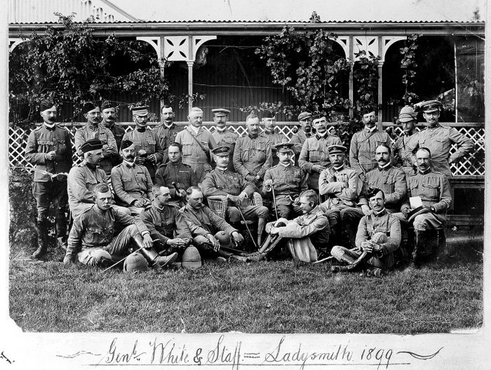
General George Stuart White and staff, Ladysmith, 1899 (photo: Wikimedia Commons).
Ladysmith Siege (02 Nov 1899–28 Feb 1900)
On 02 November 1899, the Boers proceeded to partially surround the town of Ladysmith from the north and settle in for a protracted siege of the town, which turned out to be a mistake, as the Boers outnumbered the British and they could have used this to advantage rather than allow the British to recoup.
Major General French and his chief of staff, Major Douglas Haig, escaped on the last train to leave before the Boers cut the line to Durban. Field Marshal George White was left in command of the British garrison. Ladysmith was besieged for the next 118 days.
Side Note: On 28 November 1899, during a Boer raid near the Tugela River, Piet Joubert, the Commandant-General of the Transvaal Boers, was thrown from his horse and suffered internal injuries. Joubert died soon after on 28 March 1900, succumbing to peritonitis while in Pretoria. Upon Joubert's death, Louis Botha was made Commander-in-Chief of the Transvaal Boers. The town of Pietersburg (now named Polokwane) was named after Piet Joubert.
Ladysmith had around 8 000 civilians (5 500 white and 2 500 Indian or African) and the British garrison held around 13 500 soldiers. The Boers had perhaps 20 000 men at Ladysmith, but sent a detachment to block the British relief routes into the town. The Boers initially attempted to win the siege by using their artillery, but that failed and so they settled in to try and starve out the British.
Sketch map of the Boer and British positions around Ladysmith in November 1899 (image: Wikimedia Commons).
British Relief (1899-1900)
Just prior to the outbreak of war, the British dispatched General Redvers Buller to South Africa with a 40 000-strong Army, appointing him Commander-in-Chief of all British forces in South Africa. On Buller's arrival at Cape Town in November 1899, his plan was to march with a single large force to the Boer capitals of Bloemfontein and Pretoria; however, the Boers had already besieged the British garrison at Ladysmith, and had done the same at Kimberley and Mafeking, which forced him to change his plans.
Due to public opinion, much of it directed by Cecil Rhodes, who was in the besieged diamond-ming town of Kimberley, Buller was forced to divide his troops and relief armies to relieve the besieged British garrisons. One army would march to relieve Kimberley and then continue on to relieve Mafeking, while Buller himself would lead the relief effort towards Ladysmith.
The Boers, led by General Louis Botha, had dug in south of Ladysmith at Colenso. The town was a strategic position where the rail line from Durban crosses the Tugela River en route to Ladysmith. The Boers held the northern bank of the Tugela, as well as occupying key positions on the southern bank, which is where the British would arrive.
General Louis Botha during the Boer War (photo: Wikimedia Commons).
Battle of Colenso (15 Dec 1899)
Boer General Louis Botha had 4 500 men concentrated south of Ladysmith at Colenso, with another 2 500 spread out along 50 miles (80 kms) of the northern banks of the Tugela, in case the British tried to cross away from the town and railway bridge. Botha also had numerous field guns concealed in the hills north of the river.
Buller used an artillery bombardment of the area around Colenso for two days starting on 14 December 1899, but with no apparent results and not a single sighting of the Boers. Buller's officers were not even sure the position was defended, so great were the Boers at staying concealed.
On 15 December 1899, Buller began his attack on Colenso. Buller had 18 000 men and divided them into five brigades: one would attack across a ford (drift) left of the bridge, another to the right of the bridge, one would attack straight down the railway line, and two would remain in reserve.
Photo from a Boer position overlooking the Tugela River before the Battle of Colenso. In the foreground is a Boer field gun commanding the loop of the Tugela River, into which the British Brigade marched (photo: Wikimedia Commons).
Key:
1 General Louis Botha’s Commando
2 Boksburg Commando
3 Colenso
4 Krugersdorp Commando
5 Wakkerstroom Commando
6 Ermelo Commando
7 Swaziland Police
8 Ermelo Commando
9 British Camp, Chievely
10 Tugela River
The British brigade attacking on the west (left) met devastating fire from the Boers and within two hours suffered 532 casualties. One of the reserve brigades was sent to rescue the men. The center attack went poorly as well, though it could have been worse, as one Boer man opened fire too early instead of waiting for the British to get into closer range. By 7am, the British big guns at the bridge had been abandoned under heavy Boer fire. The right side assault had some success, but its attempt to take the Boers off 'Hlangwane Hill' on the southern banks of the Tugela was also repelled.
By 2pm, the battle was over with the British suffering a terrible defeat. Boer losses were 8 killed and 30 wounded. British losses were 145 killed, 762 wounded, and 220 missing or captured. The defeat was largely blamed on Buller, who was not a field general and his weaknesses in battle had been exposed. On 17 December 1899, Buller was replaced by Field Marshal Frederick Roberts as commander of the British forces. Roberts' only son, Lieutenant Frederick Roberts, had died the same day from wounds he received at Colenso. Buller remained in overall command of the Natal troops.
Sketch map showing British and Boer positions at the Battle of Colenso, 15 December 1899 (image: Wikimedia Commons).
Battle of Platrand/Wagon Hill (06 Jan 1900)
On 06 January 1900, Battle of Platrand (or Wagon Hill) became the only serious Boer attack on the British during the Ladysmith siege. The British held a 2.5-mile-long (4 kms) ridge that dominated the southern side of Ladysmith, known as Platrand and the Boers stormed the ridge in the wee hours of 06 January. The British had fortified the ridge and had a 12-pounder gun emplaced there as well.
Chaotic fighting began in total darkness at 2:30am and continued until noon. Finally as evening and darkness arrived, the Boers retreated. The British suffered big losses, with 168 killed and 249 wounded. Boer losses are not reliably known, reported at 64 dead and 119 wounded, although the actual numbers were likely far higher. The failed attempt to capture Ladysmith proved demoralizing for the Boers.
The Ladysmith siege continued and the British defenders suffered greatly from food shortages. The Boers controlled the clean water supply and the British could only utilize the muddy Klip River. Near the end of the siege, the garrison and town citizens were surviving on oxen and horse meat (which they called "chevril", a meat paste named after the commercial beef extract "Bovril").
Memorial at Platrand outside Ladysmith to those members of the Imperial Light Horse that died during the Siege of Ladysmith (photo: Wikimedia Commons).
Battle of Spion Kop (20-24 Jan 1900)
After the disastrous British defeat at Colenso, Buller received more reinforcements and he devised a plan to cross the Tugela River at two drifts (Trichardt's Drift and Potgieter's Drift) and then attack Boer positions on the northern side of the river.
The key objective was to take Spion Kop, a hill rising 1 410 feet (430 meters) above the plains above Trichardt's Drift and situated around 18 miles (30 kms) west of Colenso. Spion Kop was also situated in the middle of the Boers' defensive line. The British forces numbered 20 000 and they had 35 field guns. The Boer Forces numbered around 8 000, with 4 field guns.
On 18 January 1900, The British crossed the Tugela successfully at Trichardt's Drift with a small group of men and quickly constructed a pontoon bridge across the river (over which 11 000 soldiers subsequently crossed), while a diversionary and smaller group crossed at Potgieter's Drift, 2.5 miles (4 kms) to the east.
Boer commandos at Spion Kop, January 1900 (image: Wikimedia Commons).
On 23 January 1900, under cover of night and in dense fog, the British climbed what they believed was Spion Kop, driving off a small group of Boers, but by morning realized that they only held the smaller and lower portion of Spion Kop, while the Boers held the higher ground on three sides of the British position.
The Boers began an artillery bombardment of the British position at a rate of ten rounds per minute. The Boers also utilized a rare tactic for them, they swarmed the British and engaged in hand to hand combat, using only knives and their rifles as bludgeons, while the British had bayonets.
Over the ensuing few hours, a stalemate occurred on Spion Kop, with the Boers in a commanding position, but the British still not driven off the hill. The Boers lacked discipline, with many refusing to attack the bayonet-wielding British, as can be expected in a civilian army, while the continuous Boer shelling was taking a toll on the British. Major-General Edward Woodgate, one of the British on the hill, was killed by a shell fragment and several other British officers also fell.
British casualties after the battle at Spion Kop, 24 January 1900 (image: Wikimedia Commons).
Winston Churchill (see side note just below) acted as a courier/runner between Spion Kop and Buller's headquarters and later made this report on the battle: "Corpses lay here and there. Many of the wounds were of a horrible nature. The splinters and fragments of the shells had torn and mutilated them. The shallow trenches were choked with dead and wounded."
Eventually, late in the day, the British troops, with no water and almost out of ammunition, retreated and the Boers regained full control of Spion Kop. The British suffered 243 fatalities at Spion Kop, with another 1 250 wounded or captured.
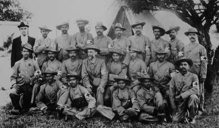
Stretcher-bearers of the Indian Ambulance Corps during the war, including the future leader of India Mohandas (later Mahatma) Gandhi (middle row, 5th from left) (image: Wikimedia Commons).
Mohandas Gandhi (later Mahātmā), who volunteered in 1900 to form a group of stretcher-bearers known as the Natal Indian Ambulance Corps, was a stretcher bearer at the battle. Boer casualties were 68 killed and 267 wounded. The British retreated back south across the Tugela River, but the Boers did not pursue them.
Memorial grave site at Spion Kop. Many of the fallen British soldiers were buried in the trenches where they died (photo: Wikimedia Commons).
Side Note: Winston Churchill
Winston Churchill, a journalist for the Morning Post, had travelled to the Cape Colony as a war correspondent in October 1899. Churchill joined a British military reconnaissance mission aboard an armored train headed towards Colenso, when it was ambushed by the Boers on 15 November 1899. Churchill was captured and imprisoned at a prisoner of war (POW) camp in Pretoria.
On the night of 12 December 1899, Churchill scaled the prison fence and escaped. A manhunt ensued, but Churchill hid by day and travelled at night, before he met a British coal mine manager, who helped smuggle the reporter aboard a freight train to Portuguese East Africa at Maputo (formerly known as Lourenço Marques). The escape was highly publicized and followed by the British public back home in England.
In January 1900, Churchill briefly rejoined the British Army as a lieutenant in the South African Light Horse regiment, joining Redvers Buller's fight to relieve the Siege of Ladysmith.
As a war correspondent for the Morning Post, Winston Churchill was captured by the Boers while traveling in an armored train which was wrecked. Photo shows a group of prisoners, with Churchill on the right (photo: Wikimedia Commons).
Battle of Vaal Krantz (05-07 February 1900)
After twice failing to cross the Tugela River and lift the Boer siege at Ladysmith, General Buller decided to attack again, this time just east of Spion Kop, but still on the western side of Colenso.
A ridge of small hills ('kopjes' in Afrikaans) known as Vaal Krantz was defended by the Boers and the British spent three days trying unsuccessfully to break through. In the end, the British again fell back across the Tugela, with casualties of 30 killed and 350 wounded. Boer losses were 30 killed and 50 wounded. The battle was not a major defeat, and Buller would not give up.
British 4.7-inch naval guns in action at the Battle of Vaal Krantz (photo: Wikimedia Commons).
Battle of the Tugela Heights (14–27 Feb 1900)
Buller's army had now made three failed attempts to break through the Boer lines at the Tugela River in efforts to lift the siege at Ladysmith. The Boer irregulars under General Botha, had handed the British embarrassing defeats at this location and over those battles, British casualties had risen to over 3 400, with Boer losses substantially lower. The British had further replenished their troops and had around 20 000 soldiers and 50 big guns, while the Boer army numbered 5 000, with 8 field guns.
The main Boer strongholds at Colenso were on the northern side of the Tugela, but they also held the strategically positioned 'Hlangwane Hill', which rises 500 feet (150 meters) above the river on the southern banks and overlooking the rail line and bridge. The British tried unsuccessfully to take Hlangwane during the Battle of Colenso (read above) and since that time, the Boers had greatly strengthened their defenses on the hill.
Buller's main objective on this fourth attempt to break through the Boers, was taking Hlangwane, but even in doing so, he would still have to fight through the Boer positions on the northern side of the river. In addition to Hlangwane, the Boers held multiple other high ground locations on the southern side of the Tugela, and the British attacked these first.
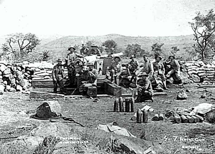
A British 4.7-inch naval gun at the Battle of the Tugela Heights, February 1900 (image: Wikimedia Commons).
On 14 February 1900, a British force succeeded in taking Hussar Hill and the British installed 34 field guns on the ridge. The next day, with support from these guns, they took Cingolo Hill. On 18 February, they took two more hills from the Boers: Monte Cristo and Green Hill. The Boers on Hlangwane were now outflanked, and they abandoned the main British objective and the south side of the Tugela entirely on 19 February 1900. The British moved their heavy artillery to Hlangwane Hill.
On 21 February 1900, with Colenso and the entire south side of the Tugela under its control, the British constructed a pontoon bridge over the river and the army began to cross.
On 22 February 1900, the British took two key Boer high-ground positions, Horseshoe Hill and Wynne's Hill. The next day, 23 February 1900, they attacked the next high ground position at Hart's Hill and were repulsed, suffering almost 500 casualties, including two colonels killed. The Royal Inniskilling Fusiliers, an Irish infantry regiment, lost 72% of their officers and 27% of their rank and file soldiers.
Finally, on 27 February 1900, the British succeeded in forcing the Boers to retreat, using field artillery pieces as heavy as 4.7-inch naval guns and numerous bayonet charges against the Boers trench lines. The Boer line was broken and they fled. British casualties were immense, with 2 300 killed, wounded, or missing, while the Boers lost 200 fighters.
Depiction of the Battle of Tugela Heights, by artist Lance Thackeray (image: Wikimedia Commons).
Ladysmith Siege Ends (01 Mar 1900)
On 28 February 1900, the British defenders at Ladysmith observed a long column of Boers on horseback and in wagons moving quickly north outside of their artillery range. Buller's men arrived at Ladysmith on 01 March 1900, and ended the 118-day siege. Botha and the Boers retreated to a line 60 miles (200 kms) further north. The relief of the Ladysmith siege was costly for the British, with around 7 000 British killed, wounded, or captured.
Photo showing the destroyed railroad bridge across the Tugela River after the battles to relieve Ladysmith (image: Wikimedia Commons).
Siege of Kimberley (14 Oct 1899-15 Feb 1900)
On 14 October 1899, a regiment of Transvaal Boers under the command of General Piet Cronjé, laid siege to the diamond-mining town of Kimberley, which was part of the British Cape Colony near the border with the Boer republics. Cecil Rhodes, whose De Beers Corporation controlled all mining activities in the town, had made a great personal fortune there and he moved into Kimberley at the onset of the Boer siege.
In anticipation of the siege, the Boers had severed the rail lines connecting Kimberley to Mafeking in the north, and to the Orange River and eventually Cape Town in the south, giving the Boers control of the rail lines from the Orange River all the way to Mafeking. The Boers also shut off Kimberly's main water supply, which came from the Vaal River in the north. Suddenly, water became more precious in Kimberley than even the diamonds. On the day of the siege (14 October), the Boers cut the telephone line to the Cape.
A Boer 'Long Tom' field gun en route to the Siege of Kimberley, January 1900 (photo: Wikimedia Commons).
The Boer plan was not to assault the town with an attack, but rather to force the British defenders to surrender by putting pressure on them in terms of food and water shortages. The Boers started shelling Kimberley on 07 November 1899. Rhodes operated under his own agenda, which was completely independent of the British war goals, and he demanded relief in the press and directly from the British government.
The commander of the British garrison at Kimberley was Major-General Robert George Kekewich, and he and Rhodes were constantly at odds with each other. Rhodes owned the local newspaper in Kimberley and ignored military censorship, publishing his views and other information at will, some of which compromised the military's position. Kekewich received permission to place Rhodes under arrest if the situation became worse.
Food and water rationing was implemented, with the citizens eventually resorting to eating horse meat. Vegetables could not be grown due to the water shortage, and this hit the poorest inhabitants of the town, the 15 000 indigenous people, who were forced to eat Aloe leaves to avoid getting scurvy.
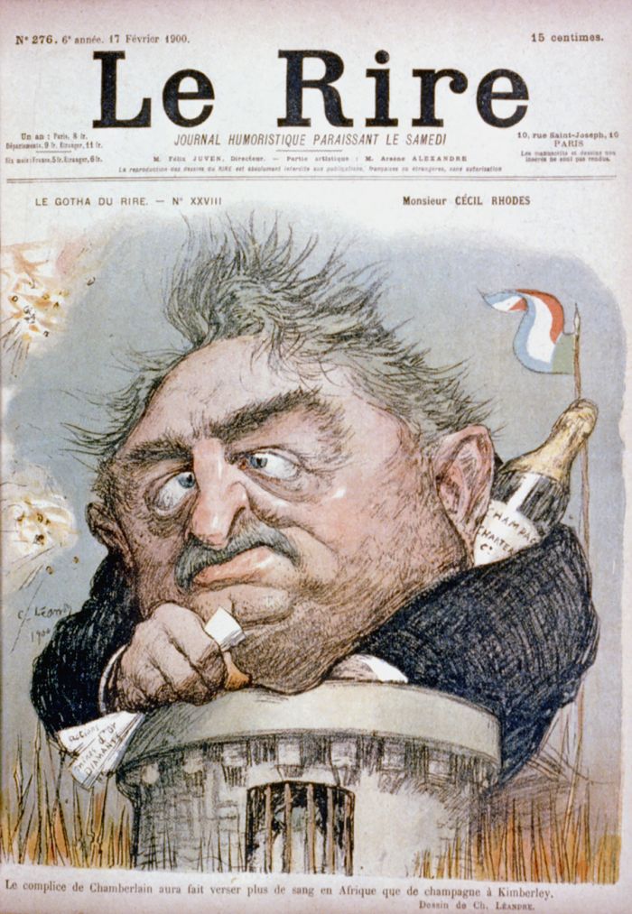
Cover of Le Rire, 17 February 1900, showing a caricature of British financier Cecil Rhodes trapped in Kimberley during the Second Boer War. Rhodes is shown emerging from a tower, whilst clutching papers with a Champagne bottle behind his collar (image: Wikimedia Commons).
Battle of Belmont (23 Nov 1899)
Field Marshal Paul Methuen led a British force of some 8 000 soldiers toward Kimberley to lift the Boer siege on the diamond-mining town. The British crossed the Orange River on 21 November 1899, with the plan of following the rail line to Kimberley. The Boers set up at the small town of Belmont, about 20 miles (30 kms) north of the Orange River along the rail line.
The Boer force at Belmont was led by Jacobus Prinsloo and included about 2 000 men from the Orange Free State. The battle was the first for Methuen's men and they were without much calvary, so effective forward reconnoissance was not possible, which gave the Boers an element of surprise when the British arrived at Belmont.
The British managed to capture two key hills, but took substantial losses in doing so. The Boers fell back to two other high ground positions, but the British managed to overcome them again with artillery. The Boers decided to withdraw, turned to their horses, and escaped north. Lacking any real calvary, the British were unable to pursue. An additional 800 Boers from the Transvaal, led by General Jacobus 'Koos' De la Rey arrived near the end of the battle and helped cover the Boer retreat.
British losses were 74 killed and 220 wounded, while the Boers lost an estimated 30 dead, 40 men wounded, and 40 taken prisoner.

Artwork depicting the Battle of Belmont, 23 November 1899. Artwork restoration by Adam Cuerden (image: Wikimedia Commons).
Battle of Modder River (28 Nov 1899)
After defeating the Boers and driving them from their positions at Belmont, the British continued north along the rail line and assumed the only possible place they would again be confronted by the Boers would be at the hills at Magersfontein. They were in for a surprise before that though.
Having been pushed off their hills at Belmont, De la Rey's forces moved north and set up positions at the Modder River, just south of Kimberley town. The ensuing battle, which in Afrikaans was called 'Slag van die Twee Riviere', which means 'Battle of the Two Rivers', referring to the battleground location at the confluence of the Riet and Modder rivers, was a major battle of the war.
General De la Rey decided to utilize trench warfare instead of waiting for the British on high ground, as the Boers had been easily driven off hills at Belmont already by British artillery and Boer rifle expertise and modern Mauser rifles would be more effectively used from flat ground. The Boer rifles shot projectiles at long range and at a very flat trajectory, while also utilizing a smokeless powder, which meant that they wouldn't give way the Boer positions.
Map showing the Boer and British positions at the Battle of Modder River, 28 November 1899 (image: Wikimedia Commons).
The Boers dug lengthy trenches on the southern banks of the Modder River, with more Boer gun positions on the northern side. De lay Rey's plan was to attack the British from the trenches as they advanced towards the river over the open ground. General Cronjé soon arrived with the main Boer force and, despite ill will between the two generals, Cronjé was forced to go along with De la Rey's plan, as it was already too far advanced to be changed.
The Boers had six field guns and a Maxim 'pom-pom' (rapid-fire gun), which they positioned north of the river with several emplacements pre-dug in case they needed to be moved during the battle. The Boer forces numbered around 3 500 men, all of whom were well concealed and unnoticed even when British scouts investigated the river from a distance.
On the morning of 28 November 1899, the British arrived from the south and were surprised to see no Boers. They knew that the railway bridge across the river was likely defended, but the river banks seemed vacant. As Methuen's troops advanced closer, the Boers opened fire. There was almost no cover on the approach to the river and few British troops were able to get closer than 3 000 feet (1 100 meters) from the Boer trenches.
Most of the British infantry remained prone and trapped on the open veld, pinned down and suffering through the heat of the day with little or no water, but unwilling to move due to the sharpshooting Boers in the trenches. Those who tried to advance were shot by the Boers. One British contingent managed to cross the river on the far left flank under the cover of a dam in the river.
Artist's sketch of the Battle of Modder River, as seen by the British Grenadier Guards (image: Wikimedia Commons).
The Boer troops guarding this position withdrew, and by early afternoon, the British had captured the village of Rosmead on the north bank of the river. However, Methuen was wandering around and showing his lack of command experience, so this tactical advantage was never exploited and as night fell, most of the British troops were still flat on the ground in front of the Boer trenches.
British losses on the day numbered 70 killed and 413 wounded, making it one of the most costly battles thus far for the British in South Africa. The Boers lost an estimated 150 men, including General De la Rey's son, Adam, who was killed by shrapnel.
Despite his son's death, De la Rey was in favor of his troops remaining in their trench positions overnight, but Cronjé and other subordinate commanders disagreed, feeling that the British position on the north bank meant they needed to withdraw to Jackobsdal on the northern side of the river and then on to the hills south of Kimberley. The two generals, Cronjé and De la Rey, had a brutal argument after the battle and De la Rey accused Cronjé of shirking his duties as a commander.
Methuen decided to pause for ten days, during which time the British could receive reinforcements, evacuate their casualties, and repair communication lines. This British delay allowed the Boers to fall back to the hills at Magersfontein, where they constructed trenches and set up their defenses.
The British built a pontoon bridge was built over the Modder River in just two hours after the railway bridge was demolished by the retreating Boer forces (image: Wikimedia Commons).
Battle of Magersfontein (10-11 Dec 1899)
The Boer forces that had fought the British at Modder River 12 days prior had moved north and set up defenses 10 miles (16 km) north at Scholtz Nek and Spytfontein. General De la Ray was absent, as he had stayed back to bury his son, who was killed at Modder River, at Jacobsdal. The Free State government decided to supplement Cronjé's forces and sent 1 000 additional men, giving the Boers a force of around 8 500 irregular soldiers, plus a large number of African laborers who performed tasks like trench digging.
When De la Rey arrived at the Boer defenses on 01 December, he found them to be vulnerable, stating that the British could shell them with artillery from the nearby Magersfontein Hills and recommended that they move and set up there to deny the British this opportunity. General Cronjé was the more senior officer and he did not concur, so De la Rey telegraphed his concerns to Martinus Steyn, President of the Free State Republic. Steyn consulted with Paul Kruger, President of the Transvaal Republic, who recommended that Steyn visit the site himself.
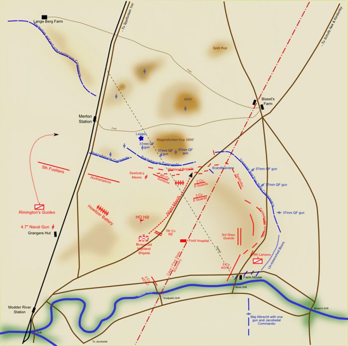
Disposition and movement of forces in the Battle of Magersfontein, 11 December 1899 (image: Wikimedia Commons).
President Steyn arrived at the Boer defensive position the next day, hoping to settle the rift between De la Rey and Cronjé. Steyn convened a 'krijgsraad' (war council meeting) and it was decided to go with De la Rey's plan and move the Boer defenses to the base of Magersfontein Hills and dig in using trenches, as had been done at Modder River. The trench line spanned a wide half-moon shape, stretching for 6 miles (10 kms) and crossing both the road and rail line. Two more trenches were dug to protect the left and right flanks. Wire fences from the surrounding farms added further obstacles, as did the thick scrub in the area.
This entrenching tactic was again contrary to the usual Boer practice of positioning themselves on high ground and the British commander, Lord Methuen, had failed to conduct adequate reconnaissance of the Boer position, even after being defeated at Modder River so recently, and so he believed that the Boers had positioned themselves atop the line of hills, as they had done at the Battle of Belmont. Methuen's forces now numbered around 15 000 men, some of which were left behind at Modder River to guard the camp.
On the afternoon of 10 December 1899 and under a steady rain, the British began an artillery bombardment from a distance of 3 miles (5 kms) away, using 24 field guns, a 4.4-inch naval gun, and four howitzers. Instead of doing any damage, since the guns were all aimed on the slopes above the trenches where the British incorrectly assumed the Boers were positioned, the exploding shells only alerted the Boers to the impending British attack.
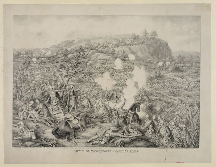
A British sketch of the Battle of Magersfontein, circa 1900 (image: Wikimedia Commons).
The British plan was to advance to the base of the hills under cover of darkness and attack at first light. The rain increased to a downpour and the British advance, which was done in tightly packed columns of men (96 lines, each with 100 soldiers) using ropes along the edges as guides, was further hampered by thorn scrub and rocky terrain. The advancing soldiers were ordered to grasp ahold of their nearest neighbor to prevent losing contact in the dark and rain.
As morning light arrived, the British were far from their intended objective, still 3 000 feet (910 meters) from the base of the hills. Ignoring advice from one officer to separate the troops and fan out, Major-General Andrew Wauchope, who was leading the advance, decided to continue a little further in tight formation, despite the fact that dawn was arriving. One of the British soldiers tripped an alarm set up using tin cans on the fence in front of the Boer trenches, which was about 1 200 feet (370 meters) away, and the Boers opened fire.
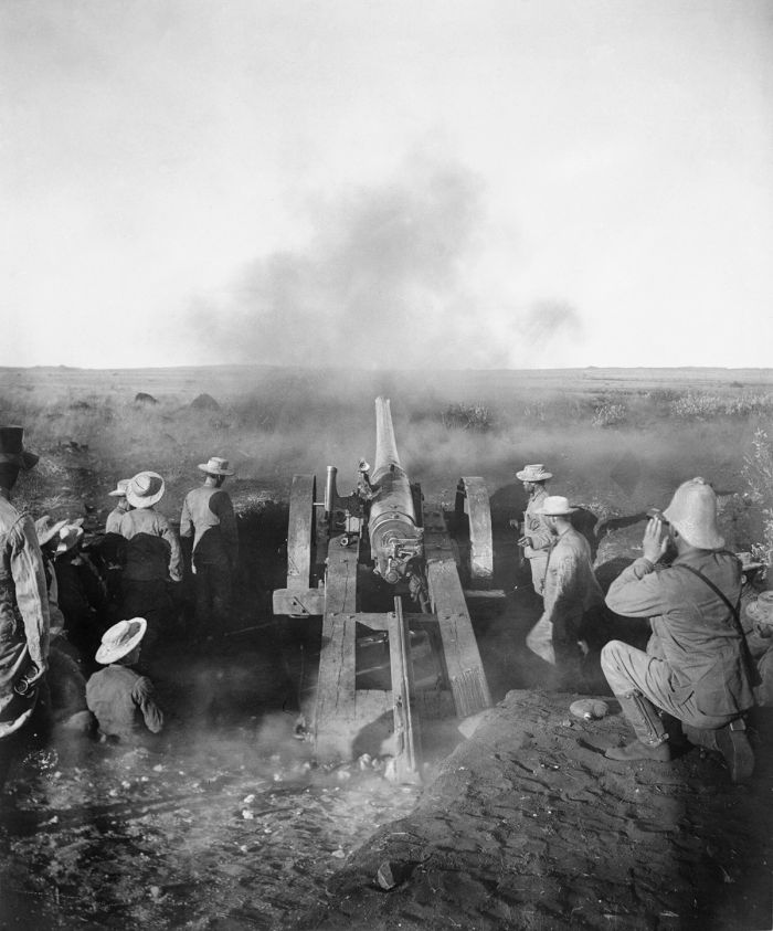
A British 4.7-inch gun known as 'Joe Chamberlain' firing on the Boer positions during the barrage of Magersfontein (photo: Wikimedia Commons).
The close-range Boer rifle fire into the tightly packed British columns caused instant confusion and chaos amongst the British. General Wauchope was killed by the first volley, as was another commanding officer of one of the infantry regiments. Most of the British men fled, while some charged the trenches, only to be killed. The British suffered an estimated 700 casualties in the first five minutes of being fired upon.
After sunrise, the British field guns were brought forward a ways and provided some cover and allowing some British to retreat, although most of the artillery was still targeting the lower slopes and not the Boer trenches. Most of the initial troops from the might advance were pinned down and lying prone in front of the Boer trenches.
As the day wore on, British reinforcements, brought forward from their camp at Modder River, began arriving. A second British attack was attempted in the late morning, but this failed and the soldiers were also pinned down by small-arms fire from the trenches.
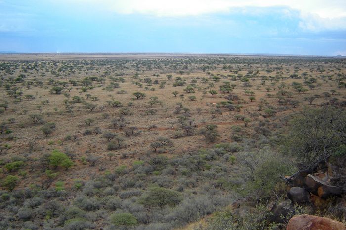
Present-day view looking south from the Boer position towards the British position in the distance. Remnants of the Boer trenches can still be seen in the foreground (image: Wikimedia Commons).
In the early afternoon, the Boers made an advance to try and gain a flanking position where they could fire on the pinned down British troops. Seeing what was happening, some of the soldiers began to flee this positions on the ground, and suddenly more and more British soldiers followed suit, which turned it into a rout for the Boers, causing even more casualties than the initial early morning attack. The Boers followed up with artillery fire, causing even more casualties.
That night, the British waited out of range of the Boer field guns, hoping that by the next morning, the Boers would have retreated, but this was not to be. The British finally fell back to their camp at Modder River at midday on 12 December 1899, where they would remain until January 1900.
The battle had been disastrous for the British, with 210 killed, including 22 officers, 675 wounded, including 46 officers, and 62 missing or captured. Boer casualties were estimated at around 240 killed or wounded. Many of the British casualties, including General Wauchope, were from Scottish Highlander regiments, and news of the devastating defeat and troop losses caused great consternation in Scotland.
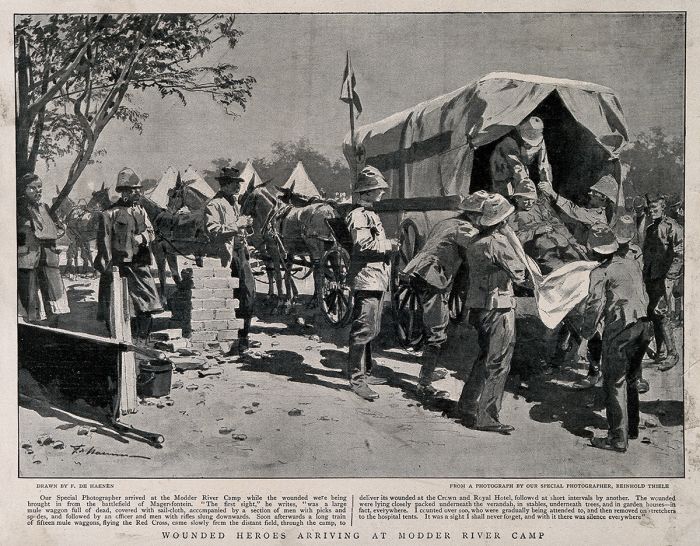
After the Battle of Magersfontein, wounded soldiers were brought to the British camp at Modder River (image: Wikimedia Commons).
Relief of Kimberley (15 Feb 1900)
On 17 December 1899, General Buller was replaced by Field Marshal Frederick Roberts as commander-in-chief of the British forces in South Africa. Roberts arrived in Cape Town on 10 January 1900, along with two more divisions of British troops and over the following two months, Roberts assembled a much larger British force. The British also brought in more artillery, which now numbered 120 big guns.
By the end of January 1900, the British forces in South Africa amounted to the largest overseas deployment in its history, having sent more than 180 000 troops.
Roberts' plan was to march a large force to Bloemfontein and take the city using the town of Colesberg as a staging point, but first he would need to relieve the besieged town of Kimberley. Roberts moved a substantial force into the area between the Orange and Modder Rivers in preparation for heading to Kimberley.
Roberts placed his new army which included some 30 000 infantry, 7 500 cavalry, and 3 600 mounted infantry, under the command of Major-General John French, who moved it into the area north of the Orange River but still south of the Modder River. General Cronjé awaited the new British forces with the increasingly strong Boer army at Magersfontein, convinced that the attack would again be full frontal along the railway line or possibly from the west as a flanking attack. He was wrong.
Lord Roberts arriving in Cape Town and stepping onto the gangway from the RMS Dunottar Castle, 10 January 1900 (photo: Wikimedia Commons).
On 11 February 1900, Roberts sent the army led by General Methuen, which was still stationed south of the Modder River after their defeat at Magersfontein, on a feinting movement towards the Modder River once again along the railway, while another brigade headed west, in hopes of leading Cronjé to believe the attack would come from those two directions. The bulk of the newly arrived British forces, including the substantial calvary, headed east and deep into the Orange Free State.
On 13 February, the calvary separated itself from the slower moving infantry and headed back west towards the Modder River, just to the east of Jacobsdal with the intent of crossing the river. As French's calvary approached the river, they were engaged by around 1 000 Boer soldiers, but the British changed directions at the last moment and headed further west, crossing the river at full gallop at Klip Drift. The small Boer force station at Klip Drift was surprised and abandoned their camp, leaving all their provisions behind.
French waited on the northern side of the Modder River for the slower infantry to arrive, which they did on 14 February. Meanwhile, General Roberts led his main forces onward towards the Free State capital at Bloemfontein. The flanking maneuver by French and his calvary took a high toll on the horses in the blazing summertime heat, and about 500 horses died or became too tired to ride further.
John French's english Cavalry crossing the Modder River at Klip Drift, on their way to relieve the siege of Kimberley, 13 February 1900 (image: Wikimedia Commons).
General Cronjé assumed that the British were trying to bait him into leaving his defensive position at Magersfontein and heading east. He sent 900 Boer men to attempt to impede French's troops from moving north away from the Modder River.
On 15 February 1900, French's troops moved out from the river and were met by the Boer forces sent to stop them. In a daring move, French sent his calvary on a charge right through the Boer crossfire and this caused chaos. The Boers were surprised at the speed of the attack and were defeated.
British casualties were 56 dead and 10 wounded, with 70 more horses lost due to exhaustion. Cronjé immediately ordered his forces remaining at Magersfontein to head east back towards Bloemfontein, though he was still unaware that the capital was the true target of the British.
French proceeded onward to Kimberley, passing through the abandoned Boer lines at Magersfontein and arriving during the evening hours (15 February 1900), to finally relieve the besieged town. When French arrived in the town, he snubbed the British commander in charge, Major-General Robert George Kekewich, and instead presented himself to Cecil Rhodes.
Lord Roberts enters the city of Kimberley in February 1900, following the successful relief of a four-month Boer siege (image: Wikimedia Commons).
Battle of Paardeberg (17-27 Feb 1900)
After freeing Kimberley from the siege that had been in place since 14 October 1899, French's troops spent most of the day on 16 February searching for the Boer force that had been besieging Kimberley, but they had managed to escape. That evening, he received orders to leave Kimberley and head east to cut off Cronjé's escape, as it was marching east along the Modder River towards Bloemfontein.
On 17 February, French and his depleted troops set out to find the Boer army. Out of French's original force strength of 5 000 men, only about 1 200 calvary were still fit to ride and the horses were nearly all gone.
The Boers left a huge dust cloud as they marched and were easy to locate from a distance, marching with around 5 000 Boers in total, a convoy of 400 wagons, large numbers of cattle, as well as women and children tagging along. As the Boers were preparing to cross the Modder River at Paardeberg Drift, the British began shelling them, causing complete chaos among the completely surprised Boers.
Sketch of the battlefield at Paardeberg Drift (image: Wikimedia Commons).
Not realizing that French's troops were seriously diminished and only 1 200 strong, Cronjé decided to form a laager and dig in on the banks of the river, rather than continuing onward, allowing French to call for reinforcements from the south. An additional Boer force under the command of General Christiaan de Wet was only 30 miles (48 kms) from Paardeberg.
On 18 February 1900, General Roberts had taken ill, so Kitchener led the reinforcements, and Roberts assigned Kitchener as overall commander at Paardeberg. Lieutenant General Kelly-Kenny, who led one of the British divisions that also arrived to reinforce French, suggested an artillery bombardment to force the Boers into a surrender. This was a sound plan, as the British had a significant advantage in artillery, but Kitchener disagreed, instead opting for a frontal assault by his infantry and mounted troops.
Kitchener ordered the infantry and mounted troops to attack in a series of frontal assaults on the Boer lager. This in spite of the recent failures of such tactics against the Boers over recent months. This time was no different, and the Boers shot the British down in huge numbers. It was reported that few, if any, British soldiers made it to within 600 feet (180 meters) of the Boer laager. By evening, the British had lost 320 soldiers, including 24 officers, plus an additional 942 wounded, including 59 officers. It was the worst single day of the war for the British and it became known as "Bloody Sunday".
Painting of the Battle of Paardeberg by Sylvester Reisacher, depicting British shelling of the Boer position along the Modder River (image: Wikimedia Commons).
General De Wet arrived late that evening with his additional Boer army and took up a position on a 'kopje' overlooking the southeast flank of the British position and adding to the defense of Cronje's laager position at the river. However, the Boer situation was dire, with the British having done some artillery shelling during the day, destroying many wagons, oxen, horses, ammunition, and supplies.
At dawn on 19 February 1900, General Roberts arrived from his sick bed to take control. Cronjé asked for a temporary truce to bury the dead, but the British refused, although the negotiations took much of the day, so not much shelling nor fighting occurred the rest of the day.
Roberts was determined not to let Cronjé escape and resumed artillery attacks on 21 February. General De Wet, faced with the might of the 15 000-strong British division and fearing for the safety of his men, withdrew his Boer soldiers from the hill and retreated, leaving only Cronjé's Boers at the river.
Lord Frederick Roberts receiving the surrender of General Piet Cronjé at Paardeberg, 27 February 1900 (photo: Wikimedia Commons).
General Roberts offered free passage to the Boer women and children, but Cronjé refused. Over the following five days, the British brought more big guns to their position, including another one-pounder 'pom-pom' and a battery of medium howitzers, increasing their artillery bombardment of Cronjé's encampment.
With De Wet's Boers gone, the British could fire their guns from all sides and they killed nearly all the horses, pack animals, and cattle the Boers had. The stench of rotting animals in the sun soon became intense.
Late on 26 February, with conditions in the camp deplorable and his supplies exhausted, Cronjé decided he would surrender the next morning. Cronjé's planned surrender was unknown to the British, and during the night of 26 February 1900, a regiment of Canadian infantry, which had lost over 70 soldiers in earlier charges against the Boer laager, advanced to within 200 feet of Cronje's camp and quickly dug trenches on high ground.
On 27 February at 4am, the Canadian infantry attacked the Boers from the trenches. Rather than surrender, Cronjé fought back for two hours, costing the Canadians 15 to 20 men, with many other wounded. Piet Cronjé finally surrendered at 6am, with his 4 019 men and 50 women still alive. British losses over the 10-day battle numbered 348 killed and 942 wounded, while the Boers lost an estimated 350 killed or wounded, plus the 4 019 captured.
General Piet Cronje (in broad brimmed hat) seated in the shade with British officers after his surrender at the Battle of Paardeberg, 28 February 1900 (photo: Wikimedia Commons).
Battle of Poplar Grove (07 Mar 1900)
With the surrender of General Cronjé, Christiaan De Wet was appointed the new commander-in-chief of the Boer Free State forces. After retreating at Paardeberg, De Wet assembled his remaining Free State forces, which now numbered only 6 000 men, at Poplar Grove, which was around 10 miles (16 kms) upstream and east of Paardeberg and on the way to the Free State capital, Bloemfontein. Low morale was now a major problem for the Boers after the surrender of Piet Cronjé.
General Roberts sent two British infantry divisions directly at De Wet's position, while his calvary made a flanking maneuver to prevent the Boers from escaping. Roberts' main problem was that his horses were now in very poor condition after their heavy use over the prior several weeks.
Upon seeing the large number of British infantry coming straight for them, the demoralized Boers turned in panic and fled. The British calvary was not in position on time, so De Wet's men were able to escape and move some 18 miles (29 kms) further east. The next day the British attacked them again, but when the fighting started, the Boers again abandoned their positions and fled north.
Sketch of British (red) and Boer (green) positions at the Battle of Poplar Grove, 07 March 1900 (image: Wikimedia Commons).
Battle of Driefontein (10 Mar 1900)
After fleeing from Poplar Grover three days earlier, Christiaan De Wet's Boer forces were in disarray and many had abandoned the war effort on that day. President Paul Kruger made a final plea to the Free State Boers, but only around 1 500 of the original 6 000 that were with De Wet decided to stay and try to defend Bloemfontein. The Boers final stand would be made at Driefontein, very near to the capital.
The last 1 500 Boers set up a defensive line stretching 7 miles (11 kms) covering the western approach to Bloemfontein. General Roberts attacked with three lines, hitting the entire Boer line, and despite being heavily outnumbered, the Boers held the British off throughout the day. Once night fell however, the British broke through the northern end of the Boer line and, this caused panic and the Boers fled. British losses were 82 killed and 342 wounded. The Boers suffered 102 dead and 22 captured.
British soldiers caring for the wounded after the Battle of Driefontein, 10 March 1900 (image: Wikimedia Commons).
Capture of Bloemfontein (13 Mar 1900)
Three days after the British victory against the Free State Boers' last holdout at Driefontein, the British march into Bloemfontein and occupied the Free State capital without any significant resistance on 13 March 1900.
Relief of Mafeking (17 May 1900)
The siege on Mafeking had been ongoing since 13 October 1899. It was the third British garrison city that the Boers had held captive since October/November 1899, and due to its much more remote location near the Bechuanaland (present-day Botswana) border, the last to be reached by the British relief forces.
Shortly before the start of the war, Lieutenant General Robert Baden-Powell had been sent by Britain to establish a mobile mounted force on the frontier with the Boer Republics. Baden-Powell recruited two regiments of mounted rifles, mainly from Rhodesia, with the task of helping defend the British colony of Natal from Boer invasion, which many though was coming.
After recruiting his two regiments, Baden-Powell decided to use Mafeking as his garrison, as it was on the railway line between the Rhodesian city of Bulawayo and Kimberley. The downside of the location is that Mafeking was isolated and close to the Boer-controlled lands.
The Boer fort, which covered their 'Long Tom' field gun at the Siege of Mafeking. Illustration by George Montbard for The Illustrated London News, 31 March 1900 (image: Wikimedia Commons).
Baden-Powell's forces at the garrison in Mafeking numbered 2 000 men, which included 500 men from the British Army unit called the Protectorate Regiment, another 300 men from the Bechuanaland Rifles, and 300 men from the town. A special unit of African natives known as the 'Black Watch' were armed with rifles and tasked with guarding the perimeter of the garrison.
Baden-Powell's troops at Mafeking were always outnumbered by the Boer,s who kept it under siege, but the Boers never placed a high degree of strategic importance on taking the town, so they shelled the town only sporadically. On 19 November, only a month after the siege began, the Boers moved roughly half their forces away from Mafeking to be utilized in more important areas.
The Boers had taken control of the railway line and roads outside the town and essentially used the town as a staging point. Most of the Boers that arrived at the siege were merely moving through the area on their way elsewhere. Sundays were ceasefire days, so that sporting events, most notably the Sunday cricket match, and theatrical performances could be held.
The Boer 'Long Tom' gun in action during the Siege at Mafeking (photo: Wikimedia Commons).
On 12 May 1900, with news that the British forces were on their way to relieve the besieged garrison, the Boers mounted an attack on the town. Guided by a British deserter from the garrison, a force of 240 Boer soldiers assaulted Mafeking and breached the town's defenses. The Boers set fire to buildings, seized the police barracks, and captured 29 British soldiers.
Baden-Powell soon organized his men and repelled the Boer attack. British losses were 12 killed and 8 wounded, while the Boers lost an estimated 60 dead or wounded, plus 108 men captured.
The siege on Mafeking finally ended five days later on 17 May 1900, when a column of 2 000 British soldiers, including numerous native volunteers from Kimberley, arrived and fought their way past the remaining Boers. The siege had lasted for 217 days.
Major-General Baden Powell (seated in chair, center) and his staff, who defended the British outpost at Mafeking (photo: Wikimedia Commons).
Typhoid Fever
After the battles at Magersfontein, large numbers of British troops were camped out at the Modder River for weeks and the water in the river, which the troops used for drinking, became contaminated with the typhoid (Salmonella genus) bacteria, which causes enteric (or typhoid) fever. The army had already been passing the disease around in small numbers, but at the Modder River, a major outbreak occurred.
When the troops occupied Bloemfontein, the British Army became incapacitated by the disease. Within one month, around 5 000 troops had contracted typhoid and the field hospitals that moved with the troops were insufficient to deal with the epidemic.
Every possible space was used to house the growing number of patients, from churches to schools. The official numbers after the war ended revealed that out of a total British force of 556 653 men who served in the Second Boer War, 57 684 (over 10%) contracted typhoid, of whom 8 225 died from the disease. The total British killed in action number was less than that, at 7 582.
Sketch (by A.S. Hartrick) depicting Private Joseph Hinton, of the British Royal Army Medical Corps, tending to soldiers with enteric fever (image: Wikimedia Commons).
Side Note: Arthur Conan Doyle
Arthur Conan Doyle, who was already famous for his Sherlock Holmes novels, was also a retired ophthalmologist, who joined the medical staff at Langman Hospital. Doyle stated publicly that the British Army had made a tactical error by not requiring its troops to take the recently developed anti-typhoid vaccine. Due to the vaccine's side effects, 95% of the British soldiers had refused immunization.
Upon returning from Africa in 1903, Robert Baden-Powell found that his military training manual, Aids to Scouting, had become a best-seller back home and was being used for teaching in schools and youth organizations.
In 1908, Baden-Powell penned a book on the growing scouting movement called Scouting for Boys (the book sold over 150 million copies during the 20th century). Soon after the release of the book, the boys and girls scouting movements started spontaneously in Britain and later, internationally. The Boy Scouts of America was founded in 1910 followed by the Girl Scouts of the USA in 1912.
Arthur Conan Doyle in 1893. Photo taken by the English photographer Herbert Rose Barraud (photo: Wikimedia Commons).
Capture of Johannesburg and Pretoria (May-June 1900)
General Roberts was forced to delay his troops advance towards Pretoria for several weeks while in Bloemfontein while they awaited a replenishment of supplies, as well as to provide medical care for his troops, which were mainly sidelined with typhoid fever (see just above).
The Boers had constructed several forts south of Pretoria before the war, but all of the artillery had been removed from the forts to be used in the field, so when the British arrived, Pretoria was captured without a fight. Johannesburg was occupied on 31 May 1900 and Pretoria on 05 June 1900. Roberts declared the war to be won and declared the war over on 03 September 1900 and the two Boer republics annexed.
The British occupation of Pretoria on 05 June 1900, showing troops passing before Lord Roberts (image: Wikimedia Commons).
Battle of Diamond Hill (11–12 Jun 1900)
Before the arrival of the British forces into Pretoria, Louis Botha, Commander-in-Chief of the Transvaal Boers, led his troops east, establishing a defensive line stretching 25 miles (40 kms) north-to-south and situated 18 miles from the city.
The crucial rail line connecting Pretoria to Delagoa Bay (present-day Maputo) on the coast ran through the Boer position. General Koos de la Rey commanded a force north of the rail line, Botha's men the center, and personnel from the South African Republic Police (Zuid-Afrikaansche Republiek Politie; ZARP) manned the souther part of the Boer line.
The British forces were weakened by their march to Pretoria, with men sick from typhoid and weary and depleted horses. The British had some 20 000 men and 83 guns when they arrived at the Boer lines on 11 June, while the Boers numbered around 6 000, with 30 big guns. Fighting began and was intense, lasting for two full days. The Boers eventually were pushed from their positions and retreated north. British casualties were 28 killed and 145 wounded, while the Boers suffered an estimated 30 dead or wounded and several captured.
Despite being driven off by the British, the Boers did not consider Diamond Hill a defeat, having inflicted significant casualties.
The British attack by the City of London Imperial Volunteers (CIVs) and Coldstream Guards at the Battle of Diamond Hill; from a drawing by William Barnes Wollen (image: Wikimedia Commons).
Battle of Bergendal (21–27 Aug 1900)
Prior to the Battle of Diamond Hill, General Botha had sent some of his officers and troops ahead to Belfast, with orders to prepare defensive ramparts and gun emplacements for the next battle. The site was the only place where the Boers could mount a proper defense against the superior British force.
The Boer forces arrived at the prepared positions and set up to await the British. More Boers arrived to supplant their numbers, giving them around 7 000 men and 20 big guns. The British arrived on 21 August with 19 000 men and 82 big guns. The British troops attacked the Boer positions on 21 August 1900, commanded by Generals Roberts, Kitchener, French, and Buller, and fighting ensued until early evening. The British lost 7 dead 26 wounded, and 3 missing the first day.
Add a caption (optional).The Boer positions during the battle of Bergendal, 27 August 1900 (image: Wikimedia Commons).
Intense fighting continued for the next 6 days. On 27 August 1900, the British big guns proved too much for the Boers, and their line was broken, sending the Boer army into retreat eastward to Nelspruit. British casualties were 385 dead or wounded, while the Boers suffered 78 killed or wounded, with some also captured.
A few days after this protracted battle, General Roberts proclaimed that the South African Republic was now a British territory; however, once again, Botha's main force had stayed intact and escaped. The Boer army dispersed to the towns of Lydenburg and Barberton, where they would start the guerrilla war phase of their resistance.
War memorials at the site of the Battle of Bergendal, a large pylon for Boers and a stone pyramid for British soldiers (photo: Wikimedia Commons).
Continued Boer Resistance (Sep 1900-May 1902)
Despite the British declaration that it had won the war, many Free State Boers continued to convene at their new temporary capital in Kroonstad, between Johannesburg and Bloemfontein, and were planning a commando campaign of guerrilla warfare to disrupt the British supply and communication lines. The last Boer combatants were often known as "Bittereinders" ("bitter enders").
President Kruger and the last members of his Transvaal government sought asylum in Portuguese East Africa (present-day Mozambique), but the hard core remnants of the Boer army were still at large under Generals Botha and De Wet, accompanied by Free State President Martinus Steyn.
A group of Boer commandos, circa 1900 (photo: Wikimedia Commons).
Side Note: Boer Sympathy
Sympathy for the Boers was widespread in Europe and in October 1900, President Kruger and his Transvaal government were offered permanent asylum by Queen Wilhelmina of the Netherlands, who sent her Dutch warship Gelderland to provide them transport. President Kruger left behind his wife, who was too ill to travel, and he never saw her again. Kruger eventually moved to Clarens, Switzerland, where he died in exile on 14 July 1904.
By September 1900, the Boer Republics of the Free State and Transvaal were both controlled by the British, with the exception of the northern Transvaal. However, the British soon became aware that they only controlled land that was physically occupied by British forces.
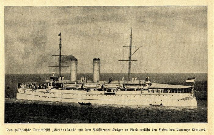
The Dutch cruiser Gelderland with Boer President Paul Kruger on board leaves the port of Lourenço Marques in 1900 (image: Wikimedia Commons).
Revised Boer Tactics
Despite the fact that the Boers had lost half their army and both of their capital cities (Bloemfontein and Pretoria), the Boer generals continued to wage resistance and adopted guerrilla tactics to disrupt the operational capacity of the occupying British forces. The Boers avoided any direct battles, instead opting to conduct quick-hit raids on railways and supply facilities.
The Boers organized into smaller units of men, each heading back to their home ranges so they could operate efficiently and with local support, while living off the land they knew best. The Boer Commando units hit quickly to cause maximum damage and then disappear just as quickly before the British could confront them. The large area of the Boer Republics made it impossible for the 250 000 British troops to effectively keep control over every town and once they left a district, their control of that area would vanish.
A Boer family with their wagon on a farm in South Africa, circa 1900 (photo: Wikimedia Commons).
Revised British Tactics (1900-1902)
The British soon revised their tactics to combat the continued raiding and harassment by the Boers. One effective method employed by the British was the construction of fortified 'blockhouses' along supply routes and at key positions like bridges. Blockhouses were small, isolated, multi-story forts that could house between 6-8 armed British soldiers and constructed so that the soldiers could fire safely in any direction from within.
Ammunition and supplies were stored on the lower floor, while the middle floor was used for 'living' and was accessible by a retractable ladder. The top floor was the "look-out" deck. About 1 000 of these blockhouses were built and few remain. They were very effective deterrents against the Boers, and few actually saw any action.
Each blockhouse cost the British between £800 to £1 000 and three months to build. Eventually, around 8 000 blockhouses were constructed across the two Boer Republics.
A British 'blockhouse', built in 1901 to protect the railway bridges from Boer guerrilla attacks (photo: Wikimedia Commons).
The other significant policy employed by the British against the Boers was that of 'scorched earth', meaning that they destroyed any structure or resource within a controlled area that could be utilized by the Boer guerrillas to give them shelter or sustenance. The British troops swept through the countryside, burning homesteads and farms, destroying crops, and imprisoning Boer men, women, and children, as well as their African workers in newly constructed British prison camps.
In spite of the new tactics used by the British, the hard-line Boer resistance continued, with General Christiaan de Wet leading attacks in the Free State, General Koos De La Rey doing the same in the Western Transvaal, and the combined forces of Generals Botha and Ben Viljoen in the Eastern Transvaal.
The British policy of 'scorched earth' devastated many Boer families, leaving them homeless (photo: Wikimedia Commons).
Numerous battles were fought during this late stage of the conflict, including the Battle of Bothaville (06 November 1900), which ended in a rare defeat fo De Wet, who was the most successful of the Boer Commanders during the war. In this event, De Wet had a Boer force of around 800 men, including Free State President, Marthinus Steyn.
The Boers clashed with a British Mounted Infantry division of 600, with the battle lasting four hours. The Boers lost 25 killed and 130 captured, including 30 that were wounded. De Wet fled and the other Boers escaped, including President Steyn. The Boers had to abandon 6 field guns, a Maxim gun and a pom-pom gun, as well as all of their wagons carrying ammunition, clothing, and other supplies.
On 17 September 1901, Boer General Louis Botha attacked an outnumbered British force commanded by General Hubert Gough at the Battle of Blood River Poort. During the battle, General Gough was captured, but managed to escape. The British losses were heavy, with 23 killed, including 4 officers, 21 wounded, and 241 men, two field guns, and large numbers of small arms and ammunition captured. Boer losses were light.
General Christaan de Wet, posing with a restored Mauser rifle in Potchefstroom (photo: Wikimedia Commons).
Battle of Bakenlaagte (30 Oct 1901)
On 30 October 1901, Botha's Boer commandos attacked the feared British No. 3 Flying column, which comprised 3 000 men that were known to attack Boer positions in night raids and were terrorizing Boer positions in the Eastern Transvaal.
The No 3 Flying column had been conducting farm clearing operations just east of Johannesburg, when rain and foggy weather arrived, causing the British troops to become spread out. Boer sniping teams harassed the British column, and Colonel Benson, the British commander, sent most of his men out in detachments to hunt down the Boer snipers.
General Botha arrived at the scene with 800 commandos and found the British strung out in a long, disorganized column. The rear guard of the British numbered only 210 men, and Botha attacked them with a force of 900 commandos. The British forces were annihilated, suffering 73 killed and 134 wounded. Colonel Benson was mortally wounded and died the next day. The Boers suffered 14 killed and 48 wounded.
John Charlton's depiction of the Boer attack at the Battle of Bakenlaagte, 30 October 1901 (image: Wikimedia Commons).
Battle of Groenkop (25 Dec 1901)
At the battle of Groenkop (25 December 1901), General De Wet's 600-strong Boer army surprised and defeated a force of around 550 Imperial Yeomanry (British volunteer mounted force), killing 68, with 77 wounded and 206 captured. The Boers lost 11 killed and 30 wounded.
Various Late Battles (Oct 1901-Mar 1902)
In the Western Transvaal, Koos De La Rey's forces fought with the British at Battle of Moedwill (30 September 1901) and then at the Battle of Driefontein (24 October 1901), meeting stiff resistance and eventually retreating.
Later, on 25 February 1902, De La Rey successfully attacked at the Battle of Ysterspruit, capturing large numbers of British soldiers and ammunition. British General Methuen responded by moving his column to Klerksdorp to deal with De La Rey.
At the Battle of Tweebosch on 07 March, 1902, De La Rey's force ambushed Methuen's column at the Little Harts River. Methuen had 1 250 men, included almost 1 000 mounted and four field guns, but these were mostly untested soldiers, and they panicked at the ambush, fleeing or surrendering. The British regulars in the column did fight, but were outnumbered by the 2 000 Boers. The result was a sound defeat for the British, who lost 68 killed, 121 wounded, 205 captured, and six field guns. General Methuen was wounded twice, suffering a broken leg when his horse fell on him, and was captured, making him the only British general captured during the war.
These Boer victories led to a stronger focus by the British on the Western Transvaal, and heavy reinforcements were sent to the region.
A drawing by Richard Caton Woodville, depicting the defeat of Lord Methuen's Force by General De La Rey at Tweebosch, 07 March 1902 (image: Wikimedia Commons).
Battle of Rooiwal (11 Apr 1902)
On 11 April 1902, a Boer commando led by Jan Kemp and Ferdinandus Jacobus Potgieter (both of whom reported to the overall Boer commander, Koos De La Rey), attacked a large British column at the Battle of Rooiwal. The Boers still had around 3 000 guerrilla fighters operating in the Western Transvaal, and they had around 1 700 present for this attack.
The Boers scouted Rooiwal days before, finding it weakly defended, but a British column led by Colonel Robert Kekewich arrived the next day with 3 000 mounted infantry and dug in on the hillside.
Fighting was intense and losses significant, particularly for the Boers, who were surprised and outnumbered by the presence of the British column. The Boers lost 50 killed, including Commander Potgieter, 130 wounded, 50 captured, and also abandoned 3 field guns and a pom pom. The British suffered 70 killed or wounded.
Commander Potgieter, shown lying dead near the British line, after the battle of Rooiwal on 11 April 1902 (photo: Wikimedia Commons).
Boer Surrender (Apr-May 1902)
The British had been offering peace terms to the Boers since March 1901, but General Botha rejected all such offers, pledging to fight to the bitter end. However, the British policy of 'scorched earth' was taking an immense toll on the Boers, with farms destroyed in huge numbers and thousands of Boers, including women and children, placed into British concentration camps.
On 09 April 1902, with their safety guaranteed by the British, the holdout Boer leadership met at Klerksdorp in the Transvaal to discuss the status of the Boer resistance and whether to agree to negotiations with the British. Present at the meeting were Marthinus Steyn, President of the Free State, Schalk Burger, acting Transvaal president (since Paul Kruger was in exile), and Boer generals Christiaan de Wet, Koos De La Rey, Louis Botha, and Jan Smuts.
On 12 April 1902, the Boers submitted a proposal for peace, which essentially returned them to pre-war status governing their republics, but with concessions granting votes for non-Boer residents, equal languages in schools, and an amnesty for the Boers. The British rejected the Boer terms, but declared an armistice to continue talks.
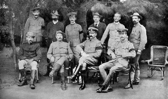
British and Boer leaders at the Peace Conference that ended the Second Boer War. Standing (left to right): Colonel G. F. R. Henderson, Dirk Overgaauw (“Dick”) van Velden, Major Watson, H. Fraser, Captain Maxwell, H. de Jager. Seated (left to right): General Christiaan de Wet, General Louis Botha, Lord Kitchener, Colonel Ian S. M. Hamilton. Note the black armbands worn by all five British officers to commemorate Queen Victoria's death a month earlier (photo: Wikimedia Commons).
The Boers reconvened on 15 May 1902, with the Transvaal representatives wanting peace due to the deplorable conditions for its civilians, while the Free State Boers wanted to continue the war. The generals submitted a new proposal to the British on 19 May, with terms that included Boer self-government under British rule, ceding of Swaziland, and relinquishment of the Witwatersrand gold fields. The debate and negotiations for peace continued for many days.
Finally, on 31 May 1902, the Treaty of Vereeniging (named for the town where the negotiations took place) was signed, officially ending the all hostilities and formalizing the terms of the Boer surrender. The treaty provided for the eventual self-government of the South African Republic (Transvaal) and Orange Free State, but as British colonies.
Other terms of the surrender and peace included:
- Boer fighters must give themselves up.
- All Boer combatants to be disarmed.
- All Boers to swear allegiance to the Crown.
- No death penalties.
- Use of Dutch/Afrikaans permitted in schools and courts.
- Payment of £3 000 000 in reconstruction aid to the Boers.
- No land taxes.
- Registered private guns permitted.
A gathering of Boer leaders in the Kimberley area near the end of the Second Boer War. General Koos de la Rey is the man in the right foreground with a black beard (photo: Wikimedia Commons).
British Concentration Camps
The British's 'Scorched Earth' policy, which was implemented by General Kitchener as a counter-measure against the Boer guerrilla tactics, entailed the systematic destruction of Boer resources, including crop burning, the slaughter or theft of livestock, and burning down of farm buildings and homesteads.
The widespread destruction of Boer resources also entailed taking thousands of Boer prisoners, many of whom were women and children, as well as black Africans, who were employed as farm workers by the Boers.
Eventually, there were 45 tented concentration camps built to keep Boer prisoners and another 64 camps built for black Africans. Some 28 000 Boer men were taken as prisoners of war, of which 25 630 were sent to overseas camps at Saint Helena (a remote, volcanic island in the South Atlantic Ocean), Ceylon (present-day Sri Lanka), Bermuda, and India. Most of the Boers who were held in the domestic camps were women and children.
Boer General Piet Cronjé was taken prisoner by the British after surrendering at the battle of Paardeberg on 27 February 1900. The photo shows Cronjé as prisoner of war on Saint Helena, where he remained until the conclusion of the war on 31 May 1902 (photo: Wikimedia Commons).
A total of 116 000 Boer soldiers and civilians were confined in Commonwealth concentration camps, where around 28 000, mostly women and children, died from disease and malnutrition. Of the Boers that perished in the camps, an estimated 22 000 were children.
Conditions in the camps were deplorable, mainly due to neglect, bad sanitation, and poor hygiene. Diseases, including measles, typhoid, and dysentery ran rampant in the camps. The black African camps had similarly poor conditions, and an estimated 20 000 native African prisoners also perished in the camps.
Famous photo of the desperately malnourished Lizzie van Zyl at the British concentration camp in Bloemfontein. She was placed on lowest food rations because her father, Hermanus Egbert Pieter van Zyl, had refused to surrender, Lizzie died in 1901 at the age of seven years (photo: Wikimedia Commons).
Costs of the War
British casualties were 22 092 dead, 75 430 returned home wounded or sick, and 934 missing, for a total of 98 456. Boer casualties, though not accurately confirmed, are given as 6 189 soldiers killed in action and 24 000 captured and sent to concentration camps, for a total of 30 189. Civilian casualties included around 28 000 Boer women and children, and at least 20 000 native Africans, most of whom died in concentration camps.
Horses also died in unprecedented numbers during the war. During General French's dash to relieve the siege on Kimberley, his calvary rode some 500 horses to their death in a single day. The horse fatalities were heavily slanted towards to British side, as they used them as pack animals and failed to acclimatize them after the long sea voyage and did not properly rest the animals. The average life expectancy for a British horse after arrival at the Cape Colony was about six weeks. The Horse Memorial in Port Elizabeth pays tribute to the 300 000 horses that perished during the war.
The cost of the war to Britain was calculated at £211 million (equivalent to £2.65 trillion in 2020).
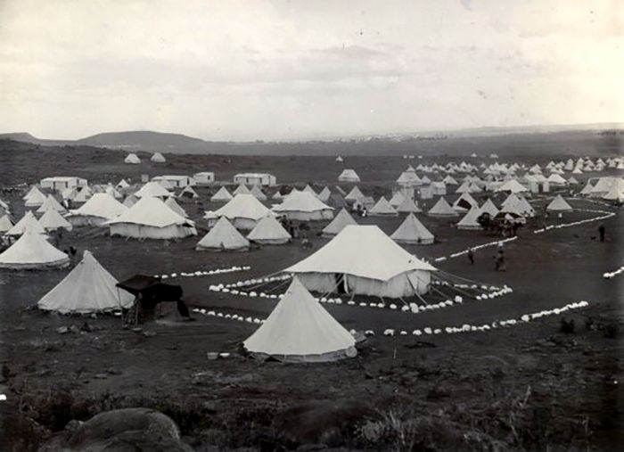
Tents at the concentration camp for Boer prisoners at Bloemfontein (photo: Wikimedia Commons).
Union of South Africa (1902-1910)
After the conclusion of the Second Boer War, Britain began work to unify its four colonies (Cape, Natal, Free State (name changed to Orange River), and Transvaal) into a unified self-governed country. The British granted 'responsible government' to the former Boer Republics in 1907 and officially combined the four colonies via the South Africa Act 1909.
The Union of South Africa was established on 31 May 1910 as a self-governing dominion of the British Empire. Basutoland (present-day Lesotho), Swaziland, and Bechuanaland (present-day Botswana) remained under direct rule from Britain.
In 1910, Boer General Louis Botha was appointed the first Prime Minister of the Union of South Africa, with Jan Smuts as deputy. Botha and Smuts had founded the 'Het Volk' (The People) political party in the Transvaal Colony in May 1904. In 1911, Het Volk merged with 'Afrikaner Bond', the 'South African Party', and the 'Orangia Unie', the dominant political parties of the Cape Colony and Orange River Colony, creating the pan-Union 'South African Party' (SAP).
J. B. M. (Barry) Hertzog, a Boer general during the Second Boer War and chief organizer of the Orangia Unie Party, was the acting Minister of Justice in the newly formed Union of South Africa. Hertzog publicly opposed British authority and Prime Minister Botha, leading to a ministerial crisis, causing Botha to remove Hertzog from his cabinet in 1912.
In 1913, Hertzog led a group of his Free State followers and others in the SAP party to establish a new political party called the National Party (NP). The NP was rooted in anti-British sentiment and espoused a policy of equal rights from the English and Afrikaner communities.
The first cabinet of the Union of South Africa in 1910 under the leadership of Prime Minister Louis Botha. Back (left to right): J. B. M. Hertzog, Henry Burton, F. R. Moor, C. O'Grady Gubbins, Jan Smuts, H. C. Hull, F. S. Malan, David Graaff. Front (left to right): J. W. Sauer, Louis Botha, Abraham Fischer (photo: Wikimedia Commons).
First World War (1914-1918)
As a dominion within the British Empire, South Africa did not have the authority to declare its own foreign policy and so by default, South Africa was brought into World War I when the British declared war on Germany in August 1914. The government of the Union of South Africa, headed by Prime Minister Botha, was aware of the significance of its common border with German-controlled South West Africa (present-day Namibia).
Botha declared that the Union Defense Force, under the command of Jan Smuts, was well equipped to defend itself, and that the British troops in South Africa could depart for the war in France. Botha also agreed to invade German South West Africa and in September 1914, he mobilized his troops, under the command of General Henry Lukin and Lieutenant Colonel Manie Maritz, along the border between the two countries.
Louis Botha (left) and Jan Smuts (right) in military uniform, 1919 (photo: Wikimedia Commons).
Maritz Rebellion (Sep-Dec 1914)
Many Boers in the Union government were opposed to helping the British in a war effort after the suffering they had endured at the hands of the British during the very recent war. Brigadier-General Christiaan Frederick Beyers of the Union Defense Force was outwardly critical of helping the British against the Germans, who had provided support for the Boers during the recent war. General Koos de la Rey, a Boer general during the war and now an elected senator, was also against helping the British against the Germans.
On 15 September 1914, General Beyers resigned his commission and together with Senator De la Rey, departed for Potchefstroom to visit Boer General Jan Kemp, who was a Nationalist Afrikaner with a force of 2 000 men and an armory. The purpose of the visit is not known with certainty, but the Union government is on record as saying it was to instigate a rebellion.
On the way to their meeting with Kemp, the car in which Beyers and De la Rey were riding met a police roadblock that had been set up to catch members of a local criminal gang from Johannesburg (the Foster gang) and one of the officers fired on the car, killing Senator De la Rey. Many Boers believed that De la Rey was deliberately assassinated by the pro-British faction of the government.
Lieutenant Colonel Manie Maritz, who led a 1914 rebellion over South Africa's support of Britain in World War I (image: Wikimedia Commons).
News of De la Rey's death spread, including rumors the event was was actually a planned government assassination. On the border with German South West Africa, Lieutenant Colonel Maritz rebelled, aligning himself with the Germans and declaring a new provisional government to be headed by himself and Generals De Wet, Beyers, Kemp, and Bezuidenhout.
Maritz's commandos occupied the town of Keimoes near Upington, while General De Wet's forces took possession of the town of Helibron, where they ambushed a government train and captured stores and ammunition. General Beyers gathered a force in the Magaliesbrg region and in total, the generals convinced 12 000 Boer rebels to join their cause.
On 12 October 1914, Prime Minister Botha declared martial law and sent Jan Smuts to put down the rebellion. Botha had a Union army of some 32 000 loyalists, many of whom were Afrikaners. Maritz's force was defeated on 24 October and he fled to South West Africa, seeking refuge with the Germans. General Beyers' forces were attacked and dispersed on 28 October, after which Beyers joined forces with Kemp.
De Wet was defeated at Winburg in the Free State on 12 November and he fled to Bechuanaland, where he and over 50 of his men were captured on 01 December. General Beyers was still a fugitive, but was located on 08 December and in an effort to swim across the Vaal River to escape, he drowned.
Christiaan Frederik Beyers, circa 1899 (image: Wikimedia Commons).
General Kemp retreated with his commando across the Kalahari Desert on a month-long, 700-mile (1 100-km) trek, losing 300 of his 800 men and most of their horses on their way. Kemp joined up with Maritz in German South West Africa, but returned to South Africa and surrendered on 04 February 1915.
The Boer leaders of the Maritz Rebellion (also known as the Five Shilling Rebellion or Boer Revolt), received prison sentences of 6 to 7 years and heavy fines. They were all released within 2 to 3 years, with the exception of Josef Johannes "Jopie" Fourie. Fourie had led a band of the rebels against the government without resigning his position as an Active Citizens Force (ACF) officer in the Union Defence Force, and was thus guilty of treason.
Fourie was executed by firing squad on 20 December 1914 and the event was decisive in South African white politics, with members of the Afrikaner right wing viewing Fourie as a hero and martyr.
Jopie Fourie, a South African rebel executed in 1914 by firing squad (photo: Wikimedia Commons).
Invasion of South West Africa (1914-1915)
After some skirmishes between Boer and German troops along the shared border between South Africa and German South West Africa in late 1914 and early 1915, South African forces began to occupy the German-controlled territory beginning in February 1915. An invasion force led by Prime Minister Botha landed by sea at the coastal town of Swakopmund on 11 February 1915 and began moving inland along the Swakopmund-Windhoek rail line.
Botha's forces captured towns on their way south and occupied the colonial capital of Windhoek on 05 May 1915. Meanwhile, concurrent with the events in the north, General Smuts landed at the southern coastal enclave of Lüderitzbucht and advanced inland, capturing Keetmanshoop on 20 May 1915 and joining forces with two other South African columns that had invaded by land across the Orange River. Smuts also advanced along the rail line and the German troops fled north to Windhoek, where they were met by Botha's troops and surrendered.
South Africa committed 78 000 troops to its South West Africa campaign, 45 000 of them white, and the rest comprised of unarmed African, Coloured, and Indian volunteers, who assisted as laborers, drivers and railway workers.
During the campaign, South Africa suffered 113 killed in action, 263 wounded, and another 153 who died from disease or accidents. Germany had only around 2 000-3 000 infantry troops, plus a reserve of some 3 000 volunteers, supported by artillery, machine guns, and three aircraft. German casualties were 103 killed in action, 890 taken prisoner, with 37 field guns and 22 machine guns captured.
South Africa continued to occupy the German territory through the remainder of World War I.
South African military officers pose with German flag at the governor's residence in Windhoek, 1915 (photo: Wikimedia Commons).
German East Africa Campaign (1916-1918)
German East Africa was colonized in the 1880s, covering an area of some 384 180 square miles (995 000 sq kms) of land that is today the countries of Tanzania, Rwanda, and Burundi. Some 5 300 Germans governed this land and its 7.5 million indigenous people. The German colonial military forces in Africa were widely dispersed, small in number, and poorly equipped.
The German forces in East Africa were led by Lieutenant-Colonel Paul von Lettow-Vorbeck, whose mission was to divert Allied forces and supplies from Europe to Africa. Britain sought to deny the German Navy control over the Indian Ocean coast, particularly the important port towns. In November 1914, Britain requested that Botha's South African forces invade German East Africa and defeat the German troops.
After completing the successful invasion and occupation of German South West Africa, Jan Smuts was sent to German East Africa and in early 1916, Smuts replaced General Sir Horace Smith-Dorrien as commander-in-chief of all British forces in East Africa. Smuts began replacing the British officers with his own, including Lieutenant-General Jacob van Deventer, who had fought for the Boers in the Second Boer War.
A German Schutztruppe Askari Company in German East Africa, 1914 (photo: Wikimedia Commons).
Smuts commanded a force of some 40 000 South African and Indian soldiers, and through numerous offensives, pushed Von Lettow-Vorbeck and his much smaller army of around 4 000 Europeans and local askaris south into the interior of the colony.
The rain and and jungle conditions took their toll on Smuts' forces, and by June 1916, only 1 000 of the original 4 000 horses were alive and fit to ride. Vehicles were of limited use in this land, and by September 1916, over 53 000 draught animals had died from illness and many of his soldiers had become unfit for duty. After only six months on the offensive, some 12 000 white South Africans had to be sent home due to sickness and exhaustion.
In early 1917, Smuts left Africa for London, where he joined the Imperial War Cabinet, Britain's wartime coordinating body, leaving General Jacob van Deventer in command of the Imperial force in East Africa. Despite having secured roughly three-quarters of German East Africa territory, Von Lettow-Vorbeck's small force refused to surrender and engaged in guerrilla tactics that drew huge Allied resources away from Europe.
Lieutenant-General Sir Jacob Louis van Deventer (right), Commander-In-Chief East African Field Force, and Brigadier-General Seymour Hulbert Sheppard (left), Chief-of-Staff East African Field Force (photo: Wikimedia Commons).
By July 1917, Von Deventer's forces were mainly comprised of Indians and Africans, including the expanding King’s African Rifles, a division made up of native African soldiers.
Between 15-18 October 1917, the Battle of Mahiwa was waged, which resulted in the loss of some 2 700 Allied soldiers killed or wounded. The Germans lost 500-600 killed or wounded and although the Allied army suffered far greater losses, the Germans had lost over 30 percent of their force, as well expending almost all of their ammunition and supplies over the four days of fighting.
By November 1917, Von Lettow-Vorbeck was forced to abandon German East Africa for Portuguese East Africa, where he hoped to capture supplies from the Portuguese Army there.
Van Deventer pursued the German force into Portuguese East Africa in July 1918, but Von Lettow-Vorbeck was able to outmaneuver the South African, whereupon he returned to German East Africa to conduct supply raids on the undefended border of Northern Rhodesia. During the last phases of the war, the Imperial forces in East Africa totaled 52 000 men, of which only 2 500 were South Africans, mostly in support roles.
General Paul von Lettow-Vorbeck commanded the German troops in East Africa during World War I (image: Wikimedia Commons).
The Armistice was signed on 11 November 1918, officially ending the fighting, with Germany surrendering to the Allied forces. Two weeks later, on 25 November 1918, Von Lettow-Vorbeck finally surrendered near Lake Tanganyika after evading capture for over four years. The German general's strategy of drawing Allied resources away from the European theater had been tremendously successful.
Von Lettow-Vorbeck's small force of at most 14 000 mainly colonial and local fighters, had managed to frustrate and keep occupied a British deployment of 114 000 men, of which 10 000 died, mainly due to disease. The Treaty of Versailles, which was signed on 28 June 1919, officially ended the war between German and the Allied Forces.
Artwork by William Orpen, depicting German delegate Johannes Bell signing the Treaty of Versailles in the Hall of Mirrors, with various Allied delegations sitting and standing in front of him.
Front Row: Dr. Johannes Bell (Germany) signing with Herr Hermann Muller leaning over him.
Middle row (seated, left to right): General Tasker H Bliss, Col E M House, Mr Henry White, Mr Robert Lansing, President Woodrow Wilson (United States); M Georges Clemenceau (France); Mr D Lloyd George, Mr A Bonar Law, Mr Arthur J Balfour, Viscount Milner, Mr G N Barnes (Great Britain); The Marquis Saionzi (Japan).
Back row (left to right): M Eleutherios Venizelos (Greece); Dr. Affonso Costa (Portugal); Lord Riddell (British Press); Sir George E Foster (Canada); M Nikola Pachitch (Serbia); M Stephen Pichon (France); Col Sir Maurice Hankey, Mr Edwin S Montagu (Great Britain); the Maharajah of Bikaner (India); Signor Vittorio Emanuele Orlando (Italy); M Paul Hymans (Belgium); General Louis Botha (South Africa); Mr W M Hughes (Australia) (image: Wikimedia Commons).
South African Contributions to WWI
South Africa's population during World War I was roughly 6 million people and over 250 000 South Africans of all races voluntarily served their country in the war effort. Many thousands more joined the British Army directly and an estimated 50% of all white South African men of military age served in some capacity during the war.
South African casualties during the war numbered around 7 000 killed and almost 12 000 wounded. Eight South Africans won the Victoria Cross, the highest and most prestigious award of the British honors system, awarded for valor "in the presence of the enemy" to members of the British Armed Forces.
Military artist's drawing of the Battle of Delville Wood during the Somme Offensive in France. July-September 1916. Delville Wood was one of the costliest battles for South Africa during the First World War (image: Wikimedia Commons).
Between the World Wars (1920-1945)
On 10 January 1920, the League of Nations (LON) was founded as a worldwide inter-governmental organization, whose mission was to maintain world peace. Jan Smuts was one of the two principal drafters and architects of the LON's original charter (the other being British politician Lord Robert Cecil). On 20 December 1920, South Africa obtained a LON Mandate to be the official administrator of South West Africa (present-day Namibia).
Note: Visit our Namibia page to read full historical details of South Africa's administration over South West Africa after World War I.
In 1924, the National Party came into power by defeating Smuts' South African Party at the polls and Barry Hertzog became the new Prime Minister of South Africa. In 1930, Hertzog's administration sought to undermine the vote of coloured people by granting voting rights to white women, thereby doubling the political power of white South Africans.
General James Barry Munnik Hertzog became Prime Minister of South Africa in 1924 (photo: Wikimedia Commons).
In 1934, the National Party merged with the rival South African Party of Jan Smuts, to form the United Party, with Hertzog as leader of the new party. Under Hertzog, a wide range of economic and social measures were enacted which dramatically improved the welfare of working-class whites snd, to a lesser degree, coloureds.
Hertzog's coalition cabinet during the 1930s consisted of a pro-British group headed by Deputy Prime Minister Jan Smuts, a pro-German group headed by Oswald Pirow, the far-right and openly pro-Nazi/anti-Semitic Minister of Defense, and Hertzog himself, who despite also being a lifelong Germanophile, nonetheless occupied the middle-ground. Besides for these three, the "inner cabinet" also included Finance minister N.C. Havenga, and Native Affairs minister P.G.W. Grobler.
Hertzog was an autocratic leader and expected his cabinet to approve his decisions rather than discuss them. His inner cabinet would meet intermittently to decide on important matters, after which their decisions would be submitted to the cabinet for endorsement with no debate. Although Hertzog was not as openly pro-German as the Pirow faction, he viewed Nazi Germany as a 'normal state' and a potential ally.
Prime Minister Barry Hertzog (seated, center) with his second cabinet in 1929. Front (left to right): Frederic Creswell, D.F. Malan, J.B.M. Hertzog, N.C. Havenga, P.G.W. Grobler. Back (left to right): Oswald Pirow, Jan Kemp, Adriaan Fourie, E.G. Jansen, Henry Sampson and C. Malan (photo: Wikimedia Commons).
When Nazi Germany remilitarized the Rhineland beginning in March 1936, which contravened the Treaty of Versailles, neither Britain nor France was willing to risk war and neither decided to act. This lack of enforcement by the two strongest nations in Europe, encouraged Hitler to pursue a policy of aggression in Western Europe.
Hertzog informed the British government that South Africa would not take part if Britain decided to go to war over the issue, arguing that Germany was justified in violating the Treaty of Versailles.
In September 1938, with Britain on the verge of war with Germany over its continued militaristic expansion along its borders into the former Czechoslovakia (where the people mainly spoke German), Hertzog again publicly sided with the Germans. Hertzog stated that the mostly German-speaking 'Sudetenland' should be allowed to join Germany.
Hertzog clashed with his cabinet over what should be South Africa's official position regarding the potential war in Europe, with Smuts favoring siding with Britain, Pirow of course favoring an alliance with Germany against Britain, and Hertzog himself favoring neutrality.
On 30 September 1938, the Munich Agreement was signed by the United Kingdom, France, Italy, and Germany, granting cessation to Germany of the Czechoslovak borderland areas named the Sudetenland, where more than 3 million people, mainly ethnic Germans, lived, The Munich Agreement essentially countermanded the previous 1924 alliance agreement between France and the Czechoslovak Republic. Most of Europe viewed the Munich Agreement as a successful effort to prevent war on the continent.
South African Defense Minister Oswald Pirow (walking, center) in Berlin, Germany, with soldiers of the Luftwaffe in front of the Anhalter Bahnhof (railway station); on his right is German Admiral Wilhelm Canaris and on his left is the Commandant of Berlin, Lieutenant General Johannes "Hannes" Seifert; November 1938 (photo: Wikimedia Commons).
Second World War (1939-1945)
Nazi Germany attacked Poland on 01 September 1939 and two days later, Britain declared war on Germany. On 04 September 1939, the United Party caucus revolted against Hertzog's stance of neutrality in the war causing a split in the coalition government. A Parliamentary vote on Hertzog's motion to remain out of the war was defeated by a vote of 80 to 67 and Hertzog resigned in protest.
Governor-General Sir Patrick Duncan invited Jan Smuts to form a government and become the new Prime Minister of South Africa for the second time. Smuts was sworn in as Prime Minister on 06 September 1939 and promptly declared South Africa officially at war with Germany.
South Africa's standing army numbered only 5 300 regulars, plus over 14 000 men in the Active Citizen Force (ACF), which were peacetime volunteers ready if called upon in a war effort. The shortage of fighting men was a problem for South Africa, mainly because it was only willing to arm white men, which had a population of around 320 000 between the ages of 20 and 40. Furthermore, the war against Germany was only supported by a slim majority in the South African Parliament and was not universally popular amongst the white citizens, making conscription impossible.
Adolph Gysbert 'Sailor' Malan in the cockpit of his Supermarine Spitfire at Biggin Hill, Kent, England. Malan was a South African fighter pilot and flying ace in the Royal Air Force (RAF), who led the No. 74 Squadron RAF during the Battle of Britain in 1940 (photo: Wikimedia Commons).
Despite its manpower limitations, South Africa did contribute in many areas in the Second World War, most notably in the North African Campaign (June 1940-May 1943) and the Italian Campaign (July 1943-May 1945).
South Africans also participated in the Battle of Madagascar, which was fought from 05 May-06 November 1942. The battle was a British-led campaign to capture the Vichy French-controlled island in order to deny its strategic ports to the Japanese Navy. The Allied forces were victorious and securing the island was one of the most crucial events in the war.
The South African 1st Infantry Division fought in several battles in North Africa in 1941/192, including the Second Battle of El Alamein in Egypt. The battle was won by the Allied forces, eliminating the Axis threat to Egypt, the Suez Canal, and Middle Eastern oil fields.
The South African 2nd Infantry Division fought in several actions in North Africa during 1942, but at the Allied failure to defend the Libyan port of Tobruk, 33 000 Allied soldiers were captured, including two complete infantry brigades of South Africans.
The South African 3rd Infantry Division did not see direct action in any battles, but performed training of soldiers in South Africa and supplied replacement troops for the 1st and 2nd Infantry Divisions.
A Sherman tank from the South African 6th Armoured Division in the Chianti Highlands, Italy, overlooking the approaches to Florence in 1944 (photo: Wikimedia Commons).
The South African 6th Armoured Division was formed primarily around a core of soldiers from the 1st Infantry Division, who had returned after the Second Battle of El Alamein in late 1942. After being sent to Egypt for training, the division served in Italy as part of the British Eighth Army during 1944 and 1945.
The South Africa Air Force (SAAF) participated in numerous war efforts, including the air war in North Africa, East Africa, Italy, Sicily, and the Balkans. By the end of the war, SAAF aircraft, working with British and Dutch aircraft stationed in South Africa, had intercepted 17 enemy ships, attacked 26 enemy submarines operating around the South African coast, assisted in the rescue of over 400 survivors from sunken ships, and flown over 15 000 coastal sorties.
Over the course of the Second World War, around 334 000 South Africans volunteered for full-time service in the South African Army, including 211 000 whites, 77 000 blacks, and 46 000 coloureds or Indians. The Commonwealth War Graves Commission shows that 11 023 South Africans died as a direct result of the war, including over 9 000 killed in action.
Members of the South African Royal Naval Volunteer Reserve serving on board the British battleship HMS Nelson. The group is sitting on one of the ship's nine breech-loading 16-inch gun barrels (photo: Wikimedia Commons).
After the war ended, South Africa enjoyed enhanced international standing for its determined contributions to the Allied victory. Prime Minister Jan Smuts had joined the Imperial War Cabinet in 1939 (as he had during World War I) and had been appointed the rank of Field Marshall in the British Army in 1941. Smuts' importance to the war strategy was so important that he was discussed as a successor to the UK Prime Minister Winston Churchill, should Churchill die or become incapacitated during the war.
In May 1945, Smuts represented South Africa in San Francisco at the drafting of the United Nations Charter. As he did in the formation of the League of Nations after World War I, Smuts played a significant role again in the initial formation of the United Nations. Smuts was a signatory of the Paris Peace Treaties in February 1947, thus becoming the only person to sign the treaties ending both World War I and World War II.
Despite his great successes gained during the war, Smuts ultimately paid a significant political price back home due to his close association with the British and Churchill, as it made him extremely unpopular with the conservative Afrikaner nationalists, who would vote Smuts from office in the 1948 elections.
Attendees of the Commonwealth Prime Ministers' Conference in London, 1944. Left to Right: Prime Minister William Lyon Mackenzie King (Canada), Prime MInister/General Jan Smuts (South Africa), Prime Minister Winston Churchill (United Kingdom), Prime Minister Peter Fraser (New Zealand), Prime Minister John Curtin (Australia) (photo: Wikimedia Commons).
Ossewabrandwag (OB)
In commemoration of the centennial anniversary of the Great Boer Trek away from the Cape and into what became Natal and the Transvaal, an organization called 'Ossewabrandwag' (Afrikaans for 'ox-wagon guard') was established in February 1939.
The OB was led by Johannes Van Rensburg, a Boer lawyer who had served as Secretary of Justice under Jan Smuts, who was Minister of Justice. Van Rensburg had travelled to Germany in his official capacity as Secretary, where he met Adolf Hitler, Hermann Göring, and other top Nazi officials.
Ossewabrandwag was anti-British/pro-German and when war was declared, the OB stood in staunch opposition to South Africa's involvement. The OB's paramilitary wing, the Stormjaers (assault troops) committed acts of sabotage against the South African government in efforts to hamper its war efforts, including staging a major riot in Johannesburg on 01 February 1940. The Stormjaers also blew up electrical power lines, telegraph and telephone lines.
One of the prominent members of the OB was John Vorster, a young lawyer who would become South Africa's Prime Minister in 1966, and who soon rose up the ranks to become a general in the Stormjaers.
Smuts' Union government cracked down on the OB and imprisoned thousands of its members, including Vorster, in internment camps for the duration of the war. The OB was absorbed into the National Party and ceased to exist as a separate entity after the war ended.
Seal of the Ossewabrandwag (image: Wikimedia Commons).
Apartheid Era (1948-1994)
The Afrikaans word 'Apartheid' translates literally as 'aparthood', and refers to the segregation of racial classes, as occurred in South Africa and South West Africa (present-day Namibia) from 1948 until the early 1990s.
Apartheid involved the political, social, and economic supremacy of the minority white population in these two countries, with a strict social stratification giving whites the top status, followed by Asians and Coloureds, and then black Africans. Apartheid involved the racial segregation of public facilities and events, as well as segregated housing and employment opportunities.
In 1946, Prime Minister Smuts appointed the Fagan Commission (named for one of its Parliamentary members, Henry Allan Fagan) to investigate whether changes should be made to South Africa's system of racial segregation. The commission's findings were that controls over African people moving into urban areas should be relaxed to increase the labor force for business and an increased consumer base for retailers.
An Apartheid-era sign (Witten in English and Afrikaans) in South Africa designating the use of public premises and amenities for the exclusive use of white people (image: Wikimedia Commons).
In 1947, in response to the Fagan Commission, the far-right Afrikaner-based Herenigde Nasionale Party, led by Minister Daniël François (D.F.) Malan, appointed the Sauer Commission (named for Cabinet Minister Paul Sauer), to investigate the same issue.
The commission found in total contrast to the Fagan Commission, stating that the influx of African people into urban areas represented a threat to white jobs because African workers would take semi-skilled positions for lower wages than white workers. The result was the creation of 'practical Apartheid', which permitted some African people to work in urban areas, with the goal of 'complete Apartheid' envisioned for the future.
Daniël François Malan, leader of the far-right Afrikaner-based Herenigde Nasionale Party (photo: Wikimedia Commons).
1948 General Elections
Elections were held in South Africa on 26 May 1948, with the results being a turning point in the country's history. The major contenders were the incumbent United Party (UP), led by Prime Minister Jan Smuts, and the the Herenigde Nasionale Party (HNP), led by D. F. Malan, a Dutch Reformed cleric who had been a Minister of Parliament since 1924.
Malan first entered politics as part of Barry Hertzog's National Party and served as Minister of the Interior, Education and Public Health until 1933. In 1934, the United Party was formed via the combination of Hertzog's National Party and Jan Smuts' South African Party. Malan was opposed to this party merger, and along with 19 other hardline Afrikaner ministers, defected from the party and joined with the Purified National Party to form the new Herenigde Nasionale Party.
Malan's Herenigde Nasionale Party (HNP) only won 37.7% of the votes, but managed to win the highest number of Parliamentary seats (70), while Smuts' United Party (UP) received 49.2% of the total votes, but won less seats (65). The Afrikaner Party, which was aligned with Malan, won 9 seats and the left-leaning Labour Party, aligned with Smuts, won 6 seats. Existing legislation prevented almost all black and Asian South Africans from voting.
DF Malan's cabinet in 1948. Front (left to right): J.G. Strydom, N.C. Havenga, D.F. Malan, E.G. Jansen, C.R. Swart. Back (left to right): A.J. Stals, P.O. Sauer, E.H. Louw, S.P. le Roux, T.E. Dönges, F.C. Erasmus, B.J. Schoeman (photo: Wikimedia Commons).
The HNP campaigned on a policy of strict racial segregation (Apartheid), taking advantage of white-fear and promising the whites safety and security from black violence. In contrast, the UP campaigned on a pragmatic vision that eventual racial integration was inevitable and that the government should relax segregationist laws. The results of this election began a period of 46 years of nationalist rule and Apartheid in South Africa.
Having won the most Parliamentary seats, the Herenigde Nasionale Party (or National Party) leader D. F. Malan become the new Prime Minister of South Africa. Malan's party had three main factions, with the 'baasskap' (white supremacists) being the dominant group.
The baasskap favored systematic racial segregation, while allowing a controlled black labor to advance the economic gains of Afrikaners. A second faction was the 'purists', who believed in compete segregation, with blacks living in native reserves separate from the whites and a long-term goal of a white South Africa living independent from black labor. The third faction, which included future prime minster Hendrik Verwoerd, was sympathetic with the purists, but allowed for the use of black labor while still implementing the vertical segregation of native reserves for blacks.
J.G. Strijdom (left), D.F. Malan (center), and P.O. Sauer (right), in 1948 (photo: Wikimedia Commons).
Apartheid Legislation
A distinguishing characteristic of Apartheid compared to segregation in many other countries was the systematic way it was enforced through laws.
The National Party (NP), which came into power after the 1948 elections, stipulated that South Africa was not a single nation, but was comprised of four distinct racial groups: white, black, Coloured, and Indian. These groups were further split into 12 racial federations, with the black populace making up 10 of these groups.
The NP began passing legislation to separate the country's races into separate living places. Hendrik Verwoerd, the NP's Minister of Native Affairs since 1950, played a significant role in crafting Apartheid laws, which led to him being called the 'Architect of Apartheid'.
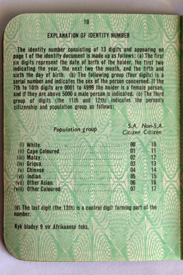
The Population Registration Act of 1950 required that each inhabitant of South Africa be classified and registered in accordance with their racial characteristics. Shown is an identity document, which includes the various racial classifications (image: Wikimedia Commons).
Major Apartheid legislation passed by the NP includes:
- The Prohibition of Mixed Marriages Act of 1949 prohibited marriage between "Europeans" and "non-Europeans". This was despite the fact that mixed-race relationships had been commonplace in South Africa dating back to the 1650s, when Dutch colonizers had relationships and often married indigenous Africans. This law applied even to marriages that had already occurred in other countries, with such marriages not being recognized in South Africa. It was a criminal offense to break this law.
- The Immorality Amendment Act of 1950 amended the Immorality Act of 1927 (passed by the British), which prohibited sexual intercourse outside of marriage between "Europeans" (white people) and "natives" (black people). The 1950 amendment was more specific, prohibiting sexual intercourse between "Europeans" and anyone not "European" (which was meant to include not just blacks, but also Coloureds, and Asians). It was a criminal offense to break this law.
- The Population Registration Act of 1950 required that all South Africans be classified and registered in accordance with their racial characteristics. There were four basic racial classifications: white, black, coloured (mixed), and Indian. The Act established the segregation of schools, residential areas, and public facilities. A person's classification determined their social rights, political rights, economic status, and educational opportunities. The identity card was introduced for all persons over the age of 18, specifying their racial group. In the case of Coloureds, who were of mixed race, this sometimes meant the forced separation of family members.
- The Group Areas Act of 1950 sought to end settlements with people of different races living side by side, with determination of where one could live based on one's race. Forced removals in later years were justified based on this law.
- The Prevention of Illegal Squatting Act of 1951 permitted the government to tear down black shanty towns or slums.
- The Suppression of Communism Act of 1950 formally banned the Communist Party of South Africa and any other party subscribing to Communism. The act defined 'Communism' in such broad terms that essentially anyone who opposed the government risked being labeled as a Communist, with the practical intent being to silence any voice of dissent, especially with regard to Apartheid. Specifically, 'Communism' was defined as any act designed to achieve change "by the promotion of disturbance or disorder" or any act encouraging "feelings of hostility between the European and the non-European races." Anyone deemed a communist could be imprisoned by the government.
- The Reservation of Separate Amenities Act of 1953 legalized racial segregation of public services, premises, and vehicles. Places such as beaches and public parks could be designated as 'whites only', and public transportation, hospitals, and universities were also separated by race, with the superior services reserved for whites.
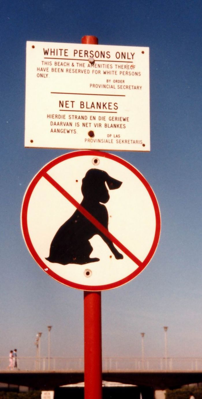
Apartheid-era signs on a public beach in Muizenberg, Cape Town, South Africa (photo: Wikimedia Commons).
Bantustans
The Bantu Authorities Act of 1951 stipulated separate government structures for blacks and whites and was the first legislation passed to move toward the goal of separate, self-governing homelands for blacks, thereby ensuring an all-white South Africa.
The Promotion of Bantu Self-government Act of 1959 allowed for the conversion of traditional black tribal lands into independent states called 'Bantustans'. It also abolished all parliamentary representation for blacks, as they would now have representation in the specific bantustan to which they would be assigned. This act was instrumental in the creation of the so-called "Grand Apartheid", whereby South Africa would be partitioned into national 'homelands' for each 'people' (race).
Under Grand Apartheid, the Afrikaner people would control the majority of South Africa, while the native African population would be divided into ten peoples based upon their language group and would be forced to live in geographically and politically separate nation-states demarcated by the white government.
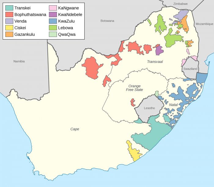
Map of bantustans in South Africa created via the Promotion of Bantu Self-government Act of 1959 (image: Wikimedia Commons).
Under this system of homelands, blacks would no longer be citizens of South Africa, becoming instead citizens of one of the new independent bantustans. Blacks would only be permitted to work in South Africa as foreign migrants on temporary work permits. Many black South Africans were subsequently forcibly removed from their present homes in cities into their assigned Bantustan, where most had never lived.
The same legislation of physically moving blacks into Bantustan homelands also applied to South African-controlled South West Africa (present-day Namibia). In total, 20 Bantustans were created, ten in South Africa and ten in South West Africa (Namibia). Out of the 20 homelands, 19 were designated for blacks and one was set aside for coloureds (mixed-race).
Four of the Bantustans were ultimately declared as independent by the South African government: Transkei (in 1976), Bophuthatswana (in 1977), Venda (in 1979), and Ciskei (in 1981). Once a Bantustan was officially created and granted its nominal independence, its designated citizens had their South African citizenship revoked.
Out of the 20 Bantustans, 10 were 'non-self-governing', 10 were 'self-governing', and 4 were 'independent'. However in reality, none of the Bantustans had any significant economic infrastructure and were just physically demarcated and disorganized swaths of land. Essentially, all of the Bantustans were puppet states under the control of South Africa. Throughout the existence of the Bantustans, the only country to recognize their independence was South Africa.
During the 1960s, 1970s, and early 1980s, the government implemented its "resettlement" policy and millions of blacks were forced to relocate to the Bantustans. This included slum removals, labor tenants living on white-owned farms, and blacks living in urban areas that had been designated for whites only.
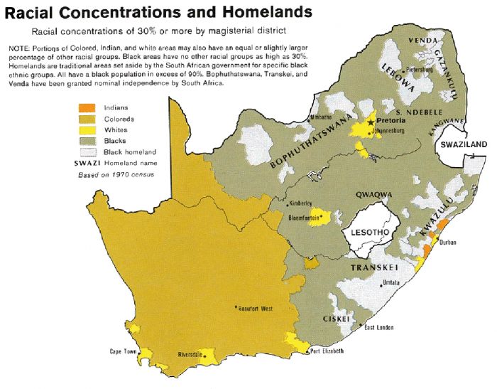
Map showing territorial make-up of South Africa's four main races/ethnicities/colors in 1979: Whites, Coloureds, Blacks and Indians. The gray areas indicate the Apartheid-era Bantustans, which are almost exclusively black (image: Wikimedia Commons).
1953 General Elections
On 15 April 1953, General Elections were held in South Africa, and the incumbent National Party (NP) of D. F. Malan consolidated its power, winning 94 of the 156 elected Parliamentary seats (an increase of 24 seats). The United Party (UP), led by Jacobus Gideon Nel (J.G.N. or 'Koos') Strauss, lost 8 seats and now had only 57 seats in Parliament. The Labour Party won 5 seats. Six of the NP's seats were won from the South Africa-controlled territory of South West Africa (present-day Namibia). Malan was sworn in for another term as Prime Minister.
Malan Retires (Nov 1954)
On 30 November 1954, the NP's President and Prime Minister of South Africa, D. F. Malan resigned from politics at the age of 80. In the ensuing battle for party leadership, Malan's chosen picks were defeated and Johannes Gerhardus (J. G. Or 'Hans') Strijdom was elected as NP president and became the country's new prime minister. Strijdom had been Minister of Lands and Irrigation under Malan and was known as an uncompromising Afrikaner nationalist.
D.F. Malan, Prime Minister of South Africa, with his wife on arrival at Schiphol Airport (Amsterdam), 09 June 1953. Photo Ben van Meerendonk / AHF, IISG collection, Amsterdam (photo: Wikimedia Commons).
Forced Evictions
By 1955, the Johannesburg suburb of Sophiatown was one of the last urban areas where blacks were still allowed to own land and it was developing into a multiracial slum. As business thrived in Johannesburg and the whites living there prospered, Sophiatown became the main location for the expanding black workforce which supported 'Joburg'.
Sophiatown's land was originally purchased by Hermann Tobiansky in 1897, which he used as a farm. It became a township in 1903 and was named for Tobiansky's wife, Sophia.
At this early time, Coloured South Africans were permitted to hold land, and they purchased freehold rights in the new suburb. Its distance from the City Centre eventually made it an undesirable location to live, and by 1920, most of Sophiatown's wealthier residents had moved out. By the late 1940s, Sophiatown had a population of nearly 54 000 blacks, 3 000 Coloureds, and 2 100 Asians (mainly Indians).
White working-class suburbs, including Newlands and Westdene, developed adjacent to Sophiatown and its residents began complaining about the proximity of the mainly black Sophiatown to the west. After the 1948 election, the ruling National Party began making plans to move the black population out of the area and the Group Areas Act of 1950 gave it the right to move them out.
A mural in Sophiatown depicting Bishop Trevor Huddleston, an anti-Apartheid activist who lived there in the 1940s and 1950s (image: Wikimedia Commons).
On 09 February 1955, some 2 000 police entered Sophiatown, armed with handguns, rifles and clubs, and began forcibly removing black families to Meadowlands, (now a suburb of Soweto). Coloured families were moved to Eldorado Park and Noordgesig (both now also suburbs of Soweto) and Indian families moved to Lenasia.
Over the ensuing eight years, Sophiatown was cleared of all its residents and eventually bulldozed and rezoned for whites only. The suburb was renamed as 'Triomf' (meaning 'Triumph'). Note: in 2006, Triomf was renamed back to its original name, Sophiatown.
A similar mass eviction took place in Cape Town in the late 1960s, when 66 000 residents of 'District Six' were forcibly moved to the outlying Cape Flats area. Like Sophiatown, District Six was completely razed (other than churches and mosques) and redeveloped for whites only settlement.
Away from the cities, black African farm laborers were also affected on a grand scale by the forced removals and they made up the largest number of forcibly evicted people.
In total, some 3.5 million non-white South Africans were forcibly moved by the Apartheid government between 1960 and 1983.
District Six memorial plaque at the Moravian Church in District Six, Cape Town, South Africa. It commemorates the victims of Apartheid-era forced removals through the racially divisive Group Areas Act. Picture by Henry Trotter, 2000 (photo: Wikimedia Commons).
Apartheid Resistance
The African National Congress (ANC) was founded on 08 January 1912 by John Dube and others in Bloemfontein, as the South African Native National Congress (or SANNC), with its main goal being to bring all South Africans together as one people and to defend their rights and freedoms. It was renamed to the ANC in 1923.
In 1944, the ANC Youth League (ANCYL) was founded by Anton Lembede and, amongst others, Walter Sisulu and Oliver Tambo. A young Nelson Mandela was made a member of its executive committee. By the late 1940s, the ANCYL began a program of civil disobedience and protests against the Apartheid regime and legislation. In 1946, the ANC allied itself with the South African Communist Party (SANC) and assisted in the formation of the South African Mine Workers' Union.
Beginning in June 1952, the ANC joined with other anti-Apartheid groups in what is known as the 'Defiance Campaign against Unjust Laws'. Protests and other acts of civil disobedience and defiance began in all of the country's major cities, but they were largely non-violent on the part of participants. The protestors wore tri-colored arm bands signifying the ANC, burned their 'pass books' (a form of internal passport required to allow blacks into restricted whites-only areas), and illegally entered whites-only areas in organized marches. Over 2 000 black protestors were arrested, leading to large-scale imprisonment.
Walter and Albertina Sisulu's wedding in 1944, with Nelson Mandela (standing, far left) and Anton Lembede (right of bride) (photo: Wikimedia Commons).
The South African government called the protests acts of anarchy and communism. Police began using batons against protestors and on 09 November 1952, police fired on a group of black protestors in Kimberley, killing 39 people and wounding 39 others.
In March 1953, the Public Safety Act was enacted by the government, allowing it to declare strict states of emergency and enhanced penalties for anyone caught protesting against or supporting the repeal of a law. International coverage of the protests against Apartheid began receiving interest from the United Nations and the global community at large.
In December 1952, Mandela, Sisulu, and 18 other ANC members were arrested and tried in court under the Suppression of Communism Act for leading the Defiance Campaign. The group each received a nine-month prison sentence, which was suspended for two years, but they were proscribed (banned) from leaving their home areas and forbidden to attend public gatherings.
Nelson Mandela in Umtata at the age of 19, 1934 (photo: Wikimedia Commons).
In 1955, Sisulu was banned by the Apartheid government under the Suppression of Communism Act. Sisulu was jailed seven times during the 1950's and early 1960s, and after the Treason Trial (1956-1961), he was sentenced to six years in prison, but released on bail pending his appeal. Sisulu went underground in 1963.
In 1955, Oliver Tambo took over as Secretary-general of the ANC after Sisulu was banned, but in 1958, Tambo was also given a five-year banning order. In response, Tambo went into exile in London to help mobilize opposition to Apartheid abroad.
In 1967, Tambo was elected acting president of the ANC following the tragic accidental death of Albert Lituli, who was struck by a train near his home. Tambo assisted in the planning of guerrilla activity from abroad, communicating with his comrades Nelson Mandela, Joe Slovo, and Walter Sisulu.
Albert Lituli in Oslo, Norway, December 1961, where he was awarded the 1960 Nobel Peace Prize for his role in the non-violent struggle against apartheid in South Africa (photo: Wikimedia Commons).
Congress Alliance (1954-1955)
In March 1954, the ANC met with other anti-apartheid groups, including the Coloured People's Congress, the South African Indian Congress, and the South African Congress of Trade Unions, to found the Congress Alliance. Delegates were chosen from the various groups and plans began to draft a Charter. The ANC sent out 50 000 volunteers into townships and the countryside to collect 'freedom demands' from the people,
In June 1955, the Congress of the People gathering was held in Kliptown (now a suburb of Soweto), with 3 000 delegates in attendance under police scrutiny to officially ratify its 'Freedom Charter' based on the collection of 'freedom demands' collected from the people. The Charter stated the core principles of the Congress Alliance and began with an opening demand of "The People Shall Govern!".
The Freedom Charter included the following:
- The People Shall Govern
- All National Groups Shall Have Equal Rights
- The People Shall Share in the Country's Wealth
- The Land Shall Be Shared Among Those Who Work It
- All Shall Be Equal Before The Law
- All Shall Enjoy Equal Human Rights
- There Shall Be Work And Security
- The Doors of Learning And of Culture Shall Be Opened
- There Shall Be Houses, Security And Comfort
- There Shall Be Peace And Friendship
The meeting was broken up by police on its second day, but after the full Charter had already been read in full and adopted. Nelson Mandela managed to escape arrest by disguising himself as a milkman, as his movements were under intense scrutiny at the time and he had been banned from attending public meetings.
The Freedom Charter memorial in Kliptown, Soweto, South Africa (photo: Wikimedia Commons).
1956 Treason Trial
The government denounced the Congress of the People as treason and banned the ANC, arresting 156 of its members, including Nelson Mandela. Mandela and the others arrested were held in the Johannesburg Prison (also known as The Fort) amid mass protests, but were granted bail.
In December 1956, the arrested ANC members were put on trial in the well publicized 1956 Treason Trial. Preliminary hearings lasted until January 1958, during which time the government released 61 of the original 156, leaving 95 defendants to stand trial for treason. The trial began in Pretoria on 01 August 1958.
After successful motions by the defense to replace two of the three judges and challenges to the indictment evidence from the defense, the trial collapsed and it was decided to resume again in January 1959 after a decision by the prosecution to drop all charges against another 60 of the accused.
In November 1958, the remaining 61 defendants were re-indicted on the lesser charge of conspiracy. The trail resumed in April 1959 and the judge declared the defendants could not be accused of conspiracy due to lack of evidence and the case was dismissed.
On 29 March 1961, six years after the Treason Trial began, the judges reached a verdict of not guilty, on the grounds that there was insufficient evidence to convict any of the defendants.
One of the final defendants in the 1956 Treason Trial was Helen Joseph, a founding member of the Federation of South African Women and a prominent anti-Apartheid activist (photo: Wikimedia Commons).
1958 General Elections
On 16 April 1958, general elections were again held. The ruling National Party (NP) under the leadership of Prime Minister J. G. Strijdom further consolidated their already heavy dominance of Parliament by winning an additional 9 seats, while the opposition United Party (UP), under leadership of De Villiers ('Div') Graaff, lost 4 seats. The NP now had 103 out of 162 elected seats on Parliament. Strijdom was sworn in to begin his second term as Prime Minister.
Soon after the election, it became clear that Strijdom was suffering from poor health and on 24 August 1958, Prime Minister Strijdom died from what is thought to have been cancer. The party nominated three candidates to potentially succeed Strijdom, with Hendrik Verwoerd, the Minister of Native Affairs, winning in a runoff election. Verwoerd was sworn in as South Africa's sixth Prime minister on 02 September 1958.
Hendrik Verwoerd, commonly regarded as the architect of Apartheid, took over as Prime Minister in 1958 after the death of J. G. Strijdom (image: Wikimedia Commons).
Pan Africanist Congress
In April 1959, the hard-core 'Africanist' faction of the ANC broke away to form the Pan Africanist Congress of Azania (PAC). The PAC's first president was Robert Sobukwe, a prominent ANC member and teacher. The PAC's principles were radically exclusionary, disagreeing with the ANC's views of a multiracial South Africa, instead espousing total black nationalism to the exclusion of all other ethnicities.
Sharpeville Massacre (21 Mar 1960)
On March 21 1960, the PAC staged a demonstration in the township of Sharpeville, south of Johannesburg. The demonstration's main purpose was to protest 'pass laws', which restricted where blacks were allowed to travel. As the protest wore on, the crowd grew to 20 000. The large crowd prompted the arrival of 130 police reinforcements, who traveled in armored personnel carriers.
A crowd of 7 000 protestors, all of whom had discarded their passbooks earlier in the day, marched to the Sharpeville police station to offer themselves up for arrest (it was an arrestable offense to be without one's passbook in public). As the crowd got close to the police line, they were fired upon by police, resulting in 69 killed and 180 injured.
Painting of the Sharpeville massacre, which took place 21 March 1960, in Sharpeville, Transvaal Province, South Africa. The painting currently resides in the South African Consulate in London, England (image: Wikimedia Commons).
State of Emergency and Arrests (1960)
Outrage over the shootings at Sharpeville was immediate amongst the black populace of South Africa, and the following week saw many demonstrations and riots across the country. Nelson Mandela famously burned his passbook in solidarity.
On 30 March 1960, the government declared a state of emergency and proceeded to detain some 18 000 people, including many of the leaders of the ANC and PAC, including Nelson Mandela. Martial law was imposed and both the ANC and PAC were officially banned.
Mandela and the other arrested party leaders were imprisoned without official charges in the Pretoria Prison, which interfered with the Treason Trial, which was still ongoing (see above). After five months and the defense attorneys refusing to carry on with the Treason Trial, Mandela and the other arrested party leaders were finally released from prison.
Nelson Mandela famously burning his passbook in 1960. All black South Africans were required to carry a passbook under the Apartheid regime. This was a political act of defiance and carried out in front of press (photo: Wikimedia Commons).
South African Republic (1960-1961)
On 05 October 1960, a referendum was held to decide whether the Union of South Africa should become a Republic, thereby officially freeing itself from British imperialism. The Afrikaner-dominated ruling National Party (NP) was outwardly republican, while the English-speaking whites favored remaining a part of the Commonwealth.
The vote was restricted to whites only, and was narrowly approved by 52.3% of the voters. The Republic of South Africa was officially constituted on 31 May 1961.
The ballot paper used in the 1960 South African Republic referendum (image: Wikimedia Commons).
Verwoerd Assassination Attempt (09 Apr 1960)
On 09 April 1960, Prime Minister Hendrik Verwoerd opened the Union Exposition in Milner Park, Johannesburg, which marked the jubilee of the Union of South Africa. After giving an opening address, Verwoerd was shot twice at point blank range with a 22 calibre pistol by David Pratt, a South African businessman and anti-Apartheid activist. One bullet pierced the Prime Minister's right cheek and the second bullet hit his right ear.
Bodyguards overpowered the gunman and he was arrested. Verwoerd was rushed to Johannesburg Hospital and he underwent surgery to remove the bullets. Verwoerd miraculously survived and returned to public life on 29 May 1960.
Pratt was declared incapable of standing trial and committed to a mental hospital in Bloemfontein. On 01 October 1961, on his 53rd birthday, Pratt committed suicide. The actual cause of his death in not certain, and many theorize that he was killed.
Hendrik Verwoerd is attended to by an associate, who attempts to stop the bleeding after the assassination attempt, 09 April 1960 (image: Wikimedia Commons).
1961 General Elections
With the successful referendum to change the country to a republic, general elections were held on 18 October 1961. The ruling National Party, under Hendrick Verwoerd won a majority of the House of Assembly seats (the new name for the Parliamentary House), gaining 2 seats for a total of 105 of the 156 electable seats.
The United Party lost 4 seats and now held only 49 seats. This was the first election after the reduction of the voting age in South Africa from 21 to 18, which occurred in 1958. Verwoerd was sworn in for a five-year term as Prime Minister.
uMkhonto we Sizwe
In 1961, in the aftermath of the Sharpeville Massacre, an armed wing of the ANC was formed called uMkhonto we Sizwe (MK), which means 'Spear of the Nation'. Co-founded by Nelson Mandela, Walter Sisulu, and Joe Slovo, its mission was to fight against the Apartheid government. Although MK was declared as officially separate from the ANC in order to avoid tainting the ANC's reputation, MK was widely recognized as part of the ANC.
An arrest warrant had been issued for Mandela, and he was forced to travel around in disguise and remain hidden in various safe houses, including the homes of white communists and most notably at the South African Communist Party's Headquarters at Liliesleaf Farm in the Johannesburg suburb of Rivonia. Mandela lived at the farm under the assumed name of David Motsamayi. Other MK and ANC members also hid out at Liliesleaf.
MK's goal was to carry out acts of sabotage against the oppressive Apartheid government, but inflicting minimum casualties. Having studied literature on guerrilla warfare by Marxist militants Mao and Che Guevara, Mandela instead chose sabotage, as it involved the least harmful action and did not involve intentional killing, offering the best chance for racial reconciliation should they succeed in changing the government.
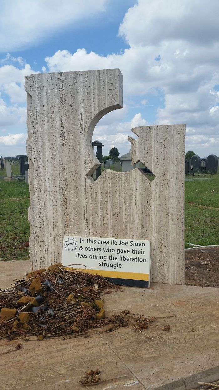
The grave of Joe Slovo in Avalon Cemetery, Soweto, South Africa. Slovo was a co-founder (along with Nelson Mandela and Walter Sisulu) of uMkhonto we Sizwe (photo: Wikimedia Commons).
The MK carried out its first significant acts of sabotage, carrying out 57 bombings on Dingane's Day (16 December) 1961. This was a religious holiday in South Africa and important to Afrikaners, as it was the anniversary of the Battle of Blood River between the Boers and the Zulu in 1838. Further attacks occurred on New Year's Eve 1961.
In February 1962, Mandela, who was secreted out of the country through Bechuanaland (Botswana), attended the meeting of the Pan-African Freedom Movement for East, Central and Southern Africa (PAFMECSA) in Addis Ababa, Ethiopia. On this trip, Mandela visited numerous Africa countries, whose leaders offered to support his freedom struggle.
Mandela's tour included stops in Tanzania, Egypt, Tunisia, Morocco, Guinea, Mali, Liberia, Senegal, and Sierra Leone. Afterwards, Mandela flew to London, where he met with anti-Apartheid activists and politicians.
Arrest of Activists (1962-1963)
After returning to South Africa, Mandela was captured near the town of Howick in the Natal on 05 August 1962. MK members suspected that police were tipped off with regards to how to find Mandela and one undocumented rumor is that the US Central Intelligence Agency (CIA), who were concerned about Mandela's associations with communist countries, had informed on his whereabouts.
Mandela was imprisoned in Johannesburg's Marshall Square Prison, charged with inciting worker strikes and illegally leaving the country without permission.
The thatched room at Liliesleaf Farm in Rivonia, South Africa, where several ANC activists were meeting when the police raided the Farm on 11 July 1963. The structure is now a South African Protected Site (photo: Wikimedia Commons).
On 11 July 1963, police raided the South African Communist Party (SACP) Headquarters located at Liliesleaf Farm in Rivonia and arrested 19 anti-Apartheid activists on charges of sabotage. Informants had led police to the previously unknown location.
The activists had been planning to move their headquarters and were conducting their last meeting at Liliesleaf, when police surprised them. Mandela was already serving a 5-year sentence, having been arrested the prior year. Documents seized at the farm incriminated Mandela and as a result, he was also charged with those arrested this day.
The prisoners were permitted to be held for 90 days without trial and were done so incommunicado. It was later reported that some of the arrested activists were subjected to torture during this time. Four of the arrested, including Arthur Goldreich, a South African-Israeli abstract painter and co-owner of Liliesleaf Farm, managed to escape with the help of one of the prison wardens, which infuriated the prosecutors.
The outbuildings at Liliesleaf Farm in, Rivonia, South Africa, a "safe house" purchased on behalf the then-banned anti-Apartheid organization, the African National Congress in 1961. These buildings appeared to be servants quarters and storerooms, but were in reality accommodation and office-space for top ANC officials. Visitors to the house would normally have no interest in the servants quarters (photo: Wikimedia Commons).
Rivonia Treason Trial (Oct 1963-Jun 1964)
The trial location was set for Rivonia, a suburb of Johannesburg, and proceedings began on 09 October 1963. Besides Nelson Mandela, the other 10 defendants included Walter Sisulu, Govan Mbeki (father of future South African President, Thabo Mbeki), various Jewish South Africans, Indian Muslims, and other anti-Apartheid activists.
The defendants were charged with sabotage and furthering the objectives of communism to countermand the South African government. Mandela chose to represent himself, with Joe Slovo, a Lithuanian-born Jew, long-time Minister of Parliament, and leader in the South African Communist Party, as his legal advisor. Mandela planned to use the publicity from the trail to further the ANC's moral opposition to systematic racism.
Before the trial began, Nelson Mandela and the other defendants agreed that instead of testifying as witnesses and subjecting themselves to cross-examination, Mandela would make a prepared speech from the defendant's dock and in effect, put the Apartheid government on trial for the injustices it was placing on the non-white communities.
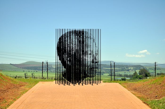
Memorial to Nelson Mandela at the site of his capture by police on 05 August 1962, in Howick, South Africa, near Pietermaritzburg in KwaZulu-Natal Province (photo: Wikimedia Commons).
Mandela worked on his speech, which has become famously known as the "I Am Prepared to Die" speech, for weeks before the trail and received help from South African author Nadine Gordimer and British journalist Anthony Sampson. The defense lawyers pleaded with Mandela to leave out the final statement in the speech, but he refused.
Mandela's speech began with him describing why the ANC had decided to go beyond its initial non-violent resistance and adopt a policy of sabotage against property to protest against the Apartheid policies of the government. He also admitted being one of the founders of Umkhonto we Sizwe, the armed wing of the ANC, and that he had been involved in planning sabotage saying: "I did not plan it in a spirit of recklessness, nor because I have any love for violence. I planned it as a result of a calm and sober assessment of the political situation that had arisen after many years of tyranny, exploitation, and oppression of my people by the whites."
Mandela also refuted the prosecution's charges that he and the ANC were acting as part of the Communist Party of South Africa, saying that it was alliance that was based on the common goal of ending Apartheid, but that he and the ANC did not want a communist state, but rather a constitutional democracy and a free market economy.
Govan Mbeki (father of Thabo Mbeki, who later became President of South Africa), pictured after his arrest by police during the Liliesleaf Farm raid in July 1963 (image: Wikimedia Commons).
Mandela addressed the court for three hours, before ending with the following: "I have dedicated my life to this struggle of the African people. I have fought against white domination, and I have fought against black domination. I have cherished the ideal of a democratic and free society in which all persons will live together in harmony and with equal opportunities. It is an ideal for which I hope to live for and to see realized. But, my Lord, if it needs to be, it is an ideal for which I am prepared to die."
Although the prosecution did not formally request the death penalty, most observers considered that to be the implied intent of the prosecution's case. The defense made specific arguments against the death penalty, including a comparison of the African struggle for rights to the Afrikaner struggle, asking for lenience in sentencing.
On 12 June 1964, eight defendants were sentenced to life imprisonment, with one defendant, Lionel Bernstein, who was a key leader of the South African Communist Party, acquitted. Mandela, Sisulu, Mbeki and three others, including Denis Goldberg, a white South African, were convicted on all four counts.
The convicted were initially incarcerated in Pretoria Central Prison, but soon after, Mandela and the rest (except for Goldberg) were sent to Robben Island to serve their life sentences.
A mural in Soweto commemorating the Rivonia Trial, with excerpts from Nelson Mandela's famous 'I am prepared to die" speech, which he gave in court on 20 April 1964 (photo: Wikimedia Commons).
1966 General Elections
On 30 March 1966, general elections were held in South Africa with the ruling National Party (NP) under Hendrik Verwoerd further consolidating is majority in Parliament. A constitutional change in 1965 had increased the number of electable Assembly seats from 156 to 166, which included the six seats for white voters in South West Africa and four seats reserved for Coloured representatives.
The NP gained an additional 21 seats, while the minority United Party (UP) under the leadership of De Villers Graaf, lost 10 seats. The NP now had 126 of the 166 electable seats and Hendrik Verwoerd, who had held his office since 1958, was sworn in for another 5-year term.
Verwoerd Assassination (06 Sep 1966)
On 06 September 1966, Prime Minister Hendrik Verwoerd was assassinated in Cape Town just after he entered the House of Parliament. The assassin, a uniformed parliamentary messenger named Dimitri Tsafendas, stabbed Verwoerd in the neck and chest four times before being subdued by other members of Parliament. Verwoerd was rushed to Groote Schuur Hospital in Cape Town, but was pronounced dead on arrival.
Tsafendas admitted to killing the prime minister in protest of Apartheid, but escaped the death penalty on grounds of insanity. Verowred's funeral was held in Pretoria on 10 September 1966, and was attended by over 250 000 people. He is buried in the Heroes' Acre, a section of Church Street Cemetery in Pretoria. Tsafendas died at age 81, while still imprisoned in 1999.
Balthazar Johannes (B. J. or John) Vorster, the Minister of Justice, succeeded Verwoerd as the sitting Prime Minister of South Africa on 13 September 1966. Vorster had been a dedicated member of the anti-British organization, Ossewabrandwag (OB, see above), during World War II. Vorster participated in acts of sabotage at the start of the war in protest and, along with numerous other OB members, was held in an internment camp at Koffiefontein from 1942 to 1944.
The gravesite of Hendrik Frensch Verwoerd at Hero's Acre in Pretoria, South Africa (photo: Wikimedia Commons).
South African Border War (1966-1988)
Concurrent with the struggle for freedom taking place in South Africa, similar movements were taking place in South West Africa (present-day Namibia), which was under the control of South Africa. Apartheid policies, including forced segregation, led to the formation of nationalist organizations like the South West African National Union (SWANU) and the South West African People's Organisation (SWAPO).
During the period between 1961 and 1968, the United Nations unsuccessfully attempted to cancel South Africa's trusteeship over South West Africa.
In 1966, SWAPO launched an armed insurgency that escalated into what is known as the South African Border War or the Namibian War of Independence. South Africa's army, the South African Defence Force (SADF) fought with the People's Liberation Army of Namibia (PLAN), which was the armed wing of SWAPO for several years, with numerous bloody battles taking place.
In 1968, the United Nations (UN) declared that South Africa's occupation of South West Africa was illegal, the the country name was changed to Namibia. The UN also attempted to enforce international sanctions against South Africa, but this largely failed due to Western countries like the USA refusing to participate, as they were reticent to risk their foreign investments in South Africa.
In December 1988, the South African Border War finally ended and South Africa withdrew all its forces from Namibia and Angola.
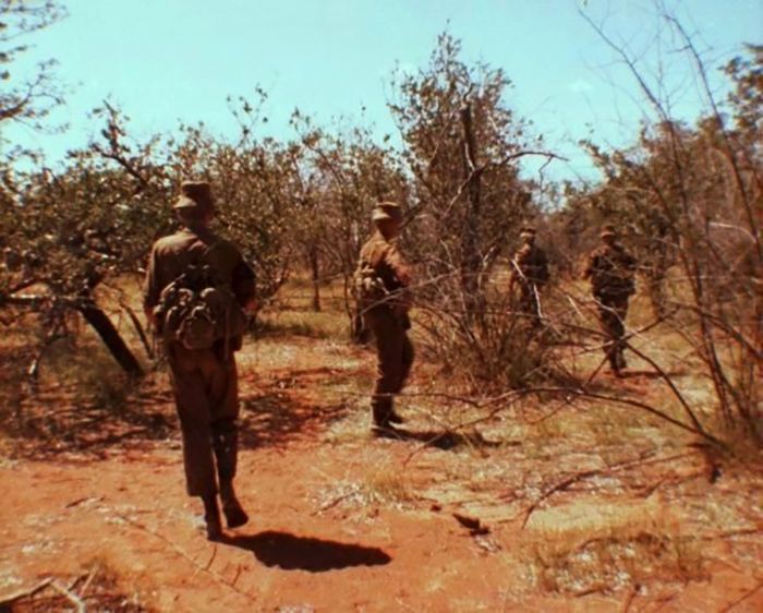
Members of the South African Army's 44 Parachute Brigade, on patrol during the South African Border War (photo: Wikimedia Commons).
1970 General Elections
On 22 April 1970, general elections were held in South Africa. With the expiration of the last four Parliamentary seats dedicated to 'qualified' Coloured voters in the Cape, the government was now entirely elected by white voters only.
The National Party continued its streak of dominance, but for the first time since 1948, lost a little of its support, dropping 8 seats, all of which were won by the minority United Party.
B. J. Vorster, who had succeeded Hendrik Verwoerd as prime minister in 1968 after he was assassinated, was sworn in again as prime minister for a five-year term.
Helen Suzman, an anti-Apartheid activist representing the affluent Johannesburg suburb of Houghton, retained her seat as the liberal Progressive Party's only member of The House of Assembly (which she had held since 1953).
Helen Suzman, an anti-apartheid activity and politician (photo from 1959), was the National Party's only Member of Parliament in 1970 (photo: Wikimedia Commons).
The Black Consciousness Movement
After the arrest and imprisonment of Nelson Mandela and many of the prominent anti-Apartheid activists and the banning of the ANC and PAC, a new grassroots movement called the Black Consciousness Movement (BCM) emerged in the late 1960s.
The BCM spawned many new black liberation organizations and the South African government retaliated by increasing its reliance on armed police to impose order. BCM sought an end to Apartheid, with universal suffrage and a socialist economy.
Steve Biko
The leading figure in the BCM was Steve Biko, a student and anti-Apartheid activist, who formed the South African Students' Organisation (SASO) in 1968. Membership in SASO was open only to people of color and excluded whites, as Biko felt that organizations led by white liberals failed to comprehend the black experience and were therefore less effective in fighting Apartheid. Biko and his compatriots developed SASO's ideology based on the philosophy of Black Consciousness.
In 1972, Biko was hired by the Black Community Programmes (BCPs), an organization that sought to improve healthcare and education in black communities, as well as foster black economic self-reliance.
As unrest continued in the early 1970s, the government banned all black organizations, as well as a long list of individuals viewed as subversive threats, including Biko in 1973. Despite his banning order, Biko continued his work for the black communities in various endeavors.
Biko's banning order prevented him from leaving his home district of King William's Town (near East London in the Eastern Cape), prohibited him from speaking in public or being quoted by the media, and barred him from any membership of a political party.
Portrait of Steve Biko, likely taken in the 1970s (photo: Wikimedia Commons).
1974 General Elections
On 24 April 1974, general elections were held in South Africa. Prime Minister Vorster called for the elections a year earlier than scheduled to take advantage of divisions within the opposition United Party, which had come to a boil when the party's leadership changed, with the previous leader Marais Steyn defecting to the National Party.
The House of Assembly was increased from 166 to 171 members and the National Party again won, receiving 56% of the popular vote but adding 5 additional Parliamentary seats. The United Party lost six seats and for the first time ever, the Progressive Party had more than a single seat, adding six seats, including one by party leader Colin Eglin from Sea Point in Cape Town. Prime Minister B. J. Vorster was sworn in for another term.
B. J. Vorster, who had replaced Prime Minister Hendrik Verwoerd after his assassination in September 1966, was re-elected as Prime Minister in 1970 and again in 1974 (image: Wikimedia Commons).
Soweto Uprising (1976)
In 1974, the government issued the 'Afrikaans Medium Decree', which declared that in black schools across the country, the Afrikaans language (the native tongue of the Afrikaners) must be used equally with English as a medium of instruction. The requirement applied to students in grades from Standard 5 onwards (equivalent of 7th grade thru the last year of high school).
Afrikaans would be used for teaching mathematics and social studies, while English would be used for general science and practical subjects like agriculture, metalworking, and art. Indigenous languages would only be used to teach religion, music, and culture.
English was gaining prominence as the preferred language most often used in commerce, and the decree was primarily intended to reverse the decline in the use of the Afrikaans language amongst blacks. The decree was not only extremely difficult for black schools to implement, but it was also deeply resented as Afrikaans was the language of the oppressive Apartheid government. In many of the black schools, very few students spoke Afrikaans, and forcing them to learn a subject in a language they did not know was simply ridiculous.
On 30 April 1976, students at the Orlando West Junior School in Soweto (close to Johannesburg) organized a strike and refused to go to school. The student rebellion caught on and soon other schools followed suit. Students across several schools in Soweto organized the Action Committee of the Soweto Students Representative Council (SSRC), to plan a mass student rally to make themselves heard.
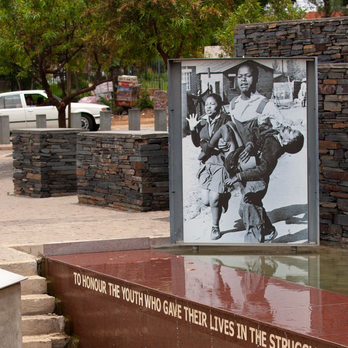
A memorial in Soweto, showing Hector Pieterson being carried by Mbuyisa Makhubo after being shot by the South African police. His sister, Antoinette Sithole, runs beside them. Pieterson was rushed to a local clinic and declared dead on arrival. This photo, taken by Sam Nzima, became an icon of the Soweto Uprising (Copyright © James Weis).
On the morning of 16 June 1976, over 10 000 black students walked from their schools to Orlando Stadium to protest the Afrikaans Medium Decree. A large majority of students were unaware of the planned rally when they went to school that morning, but participated anyway. The teachers had been informed of the rally and told by the student committee that they would maintain good discipline and remain peaceful.
The march to Orlando Stadium began at Naledi High School and gained numbers as students from the other Soweto schools, including Morris Isaacson High School, joined the march. The students encountered a police barricade along the way, but the dispersed and reformed beyond the barricade and continued on to what is now Hector Petersen Square, close to Orlando High School.
The details of what happened next are unclear, with numerous eyewitness accounts, but most accounts agree that a tear gas canister was lobbed at the front of the students, but the students did not retreat and kept singing, chanting, and waving their anti-Afrikaans placards. Then a gunshot was heard, as a police officer fired his revolver into the crowd of students and then pandemonium ensued, with students running in all directions and more gunshots fired. At least four student were hit by the police guns.
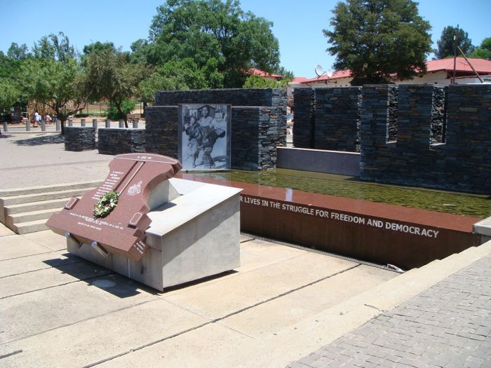
The Hector Pieterson Memorial on Vikalazi Street in Soweto, is named after the 14-year-old boy, who was the first killed by police during the Soweto student's uprising on 16 June 1976. The memorial was created to "honour the youth who gave their lives in the struggle for freedom and democracy" (image: Wikimedia Commons).
The students reorganized and took retaliatory action. Governmental administrative buildings and vehicles were set alight and one white official was pulled from his car and beaten to death. Bottlestores (liquor stores) and beer halls were targeted, looted, and burned. Throughout the day, police clashed with the growing crowd of students, with gunfire and tear gas used against the protestors. Fires continued blazing well into the night and armored police vehicles began patrolling the streets of Soweto.
Officially, 23 people died on this first day, but the number was surely much higher and scores more were wounded. Most of those who died were black students, but a notable exception was Dr. Melville Edelstein, who ran various projects aimed at social welfare in Soweto. Dr. Edelstein was at a Youth Centre in Soweto when a group of students broke into the building and stoned him to death. It was tragic, as the students surely had no idea who he was.
On the morning of 17 June 1976, there was a large police presence, with some 1 500 officers traveling in armored personnel carriers and armed with Sten guns, automatic rifles, and machine carbines, with police helicopters flying overhead. The South African Army was placed own standby. Police fired using live ammunition, as they did not have prior experience using non-lethal crowd control measures.
Dr. Melville Edelstein, a white anti-Apartheid activist and Soweto community supporter, was unfortunately killed by the students during the Soweto Uprising in 1976. Pictured here is the house where Dr. Edelstein lived at the time in Soweto (photo: Wikimedia Commons).
By the end of the second day, almost all of the government buildings in Soweto had been destroyed, amounting to 21 offices, as well as three schools and unknown numbers of beer halls, bottle stores, and municipal halls. Casualties were even higher than on the first day.
On the third day, 18 June 1976, the situation in Soweto was still volatile. Cars and buses were burning in the streets, more buildings were set ablaze, and the police intensified their aggressive crowd control measures. The Soweto events spawned violence in other black townships, including Alexandria, and violence and protests continued through the end of 1976. By year end, an estimated 700 people had been killed in various protests and thousands more injured.
In remembrance of the Soweto Uprising, 16 June is now a public holiday in South Africa, named Youth Day.
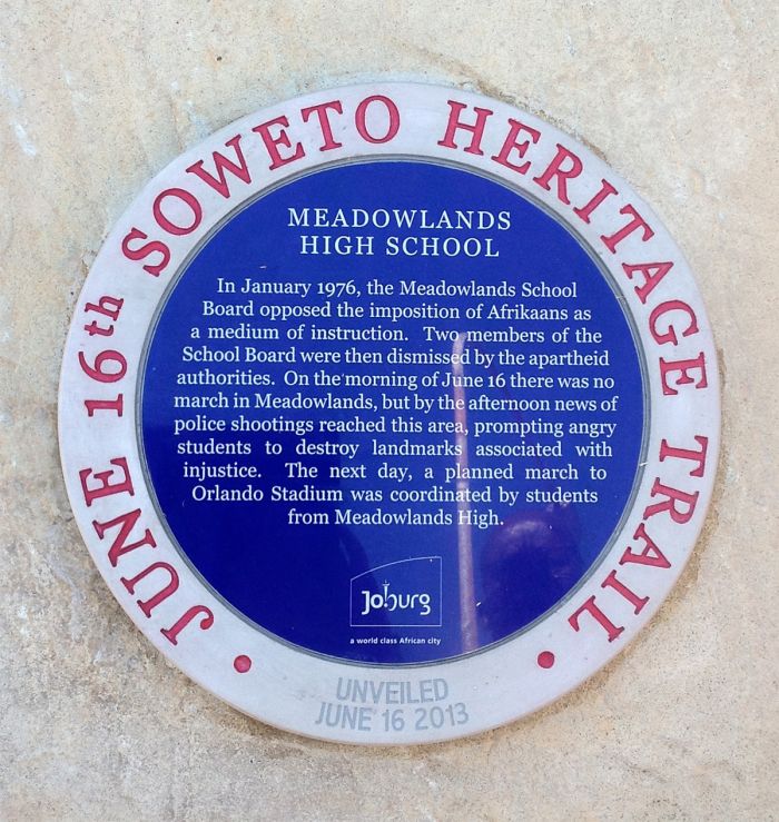
A plaque at Meadowlands Secondary School in Soweto, commemorating the Soweto Uprising of 1976 (photo: Wikimedia Commons).
1977 General Elections
On 30 November 1977, general elections were held in South Africa. The National Party, under the leadership of John (B. J.) Vorster won with a commanding 65% of the popular vote, while adding another 12 Assembly seats.
The main opposition was now the Progressive Federal Party (PFP), which was formed when liberal members of the United Party (UP) left to join the Progressive Party, which was led by Colin Eglin. The PFP picked up 17 seats, while the New Republic Party (NRP), which was the successor to the disbanded United Party, picked up 10 seats. Vorster was sworn in for another term as prime mister.
Steve Biko Arrest and Death (1977)
On 17 August 1977, Steve Biko (see more above) broke his banning order and drove with his friend Peter Jones to Cape Town, where he planned to meet with Neville Alexander of The Non-European Unity Movement of South Africa. Alexander was a radicalized anti-Apartheid activist who had been imprisoned from 1964-1974 in Robben Island. The meeting never happened, as Alexander refused to meet with Biko, fearing he was being watched by the police, so Biko drove back to his home in the Eastern Cape.
En route driving back to King William's Town on 18 August 1977, Biko and Jones were stopped at a roadblock near Grahamstown, where they were arrested. Unsubstantiated claims were made that the roadblock was set up specifically to catch Biko, but this was never confirmed. Biko was taken to the Walmer police station in Port Elizabeth, where he was held naked and shackled in a cell.
Biko was transferred to the security policy headquarters in Port Elizabeth, where he was interrogated for 22 hours. During the interrogation, Biko was beaten and on 06 September 1977, he suffered a massive brain hemorrhage. On 11 September 1977, after being visited by several doctors, Biko was loaded naked and manacled into the back of a vehicle and driven 740 miles (1 190 kms) to a hospital in Pretoria, where the next day, on 12 September 1977, Biko died.
Stained glass window by Daan Wildschut in the Saint Anna Church, Heerlen (the Netherlands), circa 1976. Photographer: Sergé Technau (photo: Wikimedia Commons).
News of Biko's death attracted international attention and soon became a symbol of the abuses of Apartheid. Biko's funeral attracted 20 000 people, including a delegation led by Bishop Desmond Tutu. Biko's coffin was decorated with what would become the popular motif of a black clenched fist, symbolizing the Black Consciousness Movement.
Biko's legacy lives on and he is recognized as having been the anti-Apartheid movement's first icon. Nelson Mandela called him "the spark that lit a veld fire across South Africa". Two weeks after Biko's funeral, the government banned all Black Consciousness organizations and seized all their assets.
Side Note: Biko's friend Steve Jones, who was arrested with him, was ultimately held without trial for 533 days, during which time he was reportedly interrogated regularly.
Biko's coffin featured this motif of a clenched black fist. Many in the Black Consciousness Movement used this fist motif as a symbol of their struggle (image: Wikimedia Commons).
Muldergate / Vorster Resignation (1978)
In 1978, Prime Minister B. J. 'John' Vorster became involved in a political scandal which led to his resignation. Working with other members of Parliament, including Dr. Connie Mulder (Minister of Information), Dr. Eschel Rhoodie (Secretary of the Department of Information), and General Hendrik van den Bergh (Head of the Bureau of State Security), Vorster was accused of illegally using government funds for Apartheid propaganda.
Vorster reportedly shifted 64 million rand from the defense budget to use for, amongst other things, bribes of international news agencies, and the attempted purchase of the Washington Star newspaper in the USA. He also reportedly used the funds to establish The Citizen, an English-language newspaper in South Africa with a decidedly pro-National Party bent. The Auditor General uncovered the misappropriation of funds and filed a critical report, which led to the scandal.
Due to the scandal, Vorster resigned as Prime Minister on 02 October 1978. The hardline Minister of Defence, Pieter Willem (P. W.) Botha was chosen to succeed Vorster and became the 8th Prime Minister of South Africa on 09 October 1978. Vorster remained in the cabinet, acting in the largely honorary position of State President.
In 1979, an inquiry into the corruption concluded that Vorster was complicit, and he resigned from politics in disgrace. Vorster died in 1983 at the age of 67 years.
Information Minister Petrus Cornelius ("Connie") Mulder, was involved in the political scandal that led to the resignation of Prime Minister B. J. 'John' Vorster in 1978 (photo: Wikimedia Commons).
Apartheid under Botha (1978-1984)
Under the leadership of Prime Minister P. W. Botha, the Apartheid government doubled down on its efforts to combat all anti-Apartheid movements in South Africa. Although Botha ultimately allowed for some minor reforms, his stance was strongly in favor of continuing white dominance in all facets of life in the country.
In the early 1980s, international pressure was mounting to free Nelson Mandela from prison and in April 1982, Prime Minister Botha had Mandela moved from Robben Island to to Pollsmoor Prison in Tokai, Cape Town. Other ANC leaders, including Walter Sisulu, Andrew Mlangeni, Ahmed Kathrada, and Raymond Mhlaba were also moved to Pollsmoor.
Pieter Willem ("P. W.") Botha assumed the position of prime minister after the resignation of B. J. Vorster in 1978 (photo: Wikimedia Commons).
United Democratic Front
In 1983, some 15 000 anti-Apartheid delegates from 400 anti-Apartheid organizations, met at Mitchell's Plain near Cape Town to form the United Democratic Front (UDF). Its goal was to establish a "non-racial, united South Africa in which segregation is abolished and in which society is freed from institutional and systematic racism." The UDF's slogan was "UDF Unites, Apartheid Divides".
The UDF sought to coordinate anti-Apartheid activism inside South Africa. The founding leaders of the UDF were Albertina Sisulu (wife of Walter Sisulu, who was still in prison), Archie Gumede, and Oscar Mpetha. UDF patrons included Nelson Mandela (who was still in prison), Archbishop Desmond Tutu, Dr. Allan Boesak, and Helen Joseph. The UDF essentially became a proxy for the banned ANC, and it organized numerous boycotts, strikes, and protests over the ensuing two years.
Tricameral Parliament (1980s)
In 1982, Prime Minister Botha initiated proposals to change the constitution to allow for some moderate reforms. The main proposal included power sharing, whereby the all-white government would allow representation for Coloured and Indian communities (but still enclosing black representation).
The hardline faction of the National Party (NP) strongly disagreed with the proposal, and a group of NP ministers defected from the party to form the new Conservative Party (CP), led by Dr. Andries Treurnicht, who was the leader of the NP in the Transvaal Province.
On 02 November 1983, a referendum was held amongst white voters to decide on Botha's proposed changes to the constitution. Both the the Progressive Federal Party (PFP), which objected only because the proposal still excluded blacks, and the Conservative Party (CP), which objected to any non-white representation, campaigned for a 'No" vote on the referendum. The CP campaign included banners with slogans such as "Rhodesia voted yes – vote no!", referring to Rhodesia's recent capitulation (in 1976) from all-white government to black majority rule.
Andries Treurnicht defected from the National Party to form the new Conservative Party (photo: Wikimedia Commons).
The referendum passed with 66.3% of the voters approving with a "Yes" vote. The Republic of South Africa Constitution Act of 1983 became the country's third constitution. Besides for giving Indians and Coloureds Parliamentary representation on a segregated basis, the new constitution abolished the office of Prime Minister in favor of the executive office of State President, which was assumed by P. W. Botha.
On 22 August 1984, elections were held to elect members to the two new Houses of Parliament: the 80-member House of Representatives for the coloured representatives, and the 40-member House of Delegates for Indian representatives. The white representatives would be members of the 178-seat House of Assembly.
Rubicon Speech (15 Aug 1985)
Sparked by years of isolation from the international community amidst mounting pressure to end Apartheid in South Africa, the ruling National Party held a meeting to propose reforms in the government. During the secret meeting, President Botha remained silent and did not participate, but a speech was prepared for him to deliver, which was to tell the world of the impending changes.
The speech was dubbed the 'Prog Speech' alluding to the progressive changes that it would announce, including the eradication of black discrimination. Botha was under immense pressure to announce changes, as international banks were threatening to call in loans made to South Africa. However, Botha, who had earned the nickname 'Die Groot Krokodil' (The Great Crocodile), simply refused to deliver the prepared speech, instead deciding to secretly prepare his own speech.
P. W. Botha (left), talks with the South African Ambassador to the Netherlands in 1963 (photo: Wikimedia Commons).
On the evening of 15 August 1985 in Durban, Botha went on live television to deliver the speech. Due to huge publicity and anticipation, the live television coverage had a worldwide audience of 200 million viewers, who expected the announcement of radical reforms in the South African government, including the end of Apartheid and the release of Nelson Mandela. Instead, Botha delivered his self-prepared speech, which delivered none of the expected news.
Botha stated that he was unwilling to change the government's position with regards to Apartheid and that Nelson Mandela would remain in prison. Botha said that he would press ahead with reform programs, but would not give in to hostile pressure from the international community, which he claimed only encouraged militants at home.
At the closing of his speech, Botha stated that "I believe that we are today crossing the Rubicon", referring to to Julius Caesar's crossing of the Rubicon River on 10 January 49 BC, a phrase that is a metaphor for 'passing the point of no return'.
After the speech, the South African Rand lost value as a world currency and economic sanctions against South Africa followed. Later in 1985, the South African government defaulted on debt obligations, which were called in by foreign banks.
Global pressure to free Nelson Mandela was on the rise at the time of the Rubicon Speech. Here, a protest in Berlin, Germany, 1986 (photo: Wikimedia Commons).
Comprehensive Anti-Apartheid Act (1986)
In 1986, the United States Congress submitted a bill called the Comprehensive Anti-Apartheid Act, which would impose sanctions against South Africa until it ended its system of Apartheid. The bill was passed by Congress, but President Ronald Reagan vetoed the bill on 26 September 1986, calling it "economic warfare". Congress ultimately voted to override Reagan's veto, making it the first time in the twentieth century that a US president had a foreign policy veto overridden.
After the US sanctions were imposed, civil unrest spread in South Africa, with support from neighboring black-majority governments. Botha warned neighboring states against unsolicited interference in South Africa's domestic affairs. On 20 May 1986, Botha ordered air strikes against ANC targets in Harare (Zimbabwe), Lusaka (Zambia), and Gaborone (Botswana).
President Ronald Reagan During a Meeting for a Briefing on The Upcoming Statement About South Africa in The Oval Office, 09 September 1985 (photo: Wikimedia Commons).
Domestic Violence (1986-1987)
The following years under Botha's presidency proved to be the most brutal, with thousands of black South Africans detained without trial, and untold numbers beaten, tortured, and killed. Anti-Apartheid resistance continued, with the banned ANC committing 231 attacks in 1986 and 235 more in 1987. The government responded violently, using its police and South African Defense Force (SADF) to combat the resistance.
Years later, the Truth and Reconciliation Commission (TRC), found that Botha's regime was responsible for gross violations of human rights, including instances of planned assassination.
1987 General Elections
On 06 May 1987, general elections were held for the white-only House of Assembly. The National Party (NP) and P. W. Botha won again, but faced opposition from the right-wing opposition Conservative Party (CP) of Andries Treurnicht.
The Progressive Party of Colin Eglin won 19 seats, while the CP won 22 seats. The ruling NP party won 123 seats and Botha was sworn in as President.
Colin Eglin, the future leader of the Progressive Party, photographed during World War II (photo: Wikimedia Commons).
End of Namibian Border War (1988)
In late May/early June 1988, the USA and Russia held a summit in Moscow, with USA President Ronald Reagan and Russian leader Mikhail Gorbachev paving the way for the withdrawal of Soviet and Cuban troops from the South African Border War. South Africa had been fighting nationalist rebels in Namibia along the Angola border, who were aided by Russia and Cuba, since August 1966.
The Tripartite Accord was signed on 23 December 1988, effectively granting independence to Namibia from South Africa, ending the long war.
Negotiations with Mandela
In February 1985, President Botha offered to release Mandela from prison if he "unconditionally rejected violence as a political weapon". Mandela refused the offer, releasing a statement that read "What freedom am I being offered while the organisation of the people (the ANC) remains banned? Only free men can negotiate. A prisoner cannot enter into contracts."
In 1987, Mandela requested talks with President Botha, but was denied. The government eventually sent a team of representatives, including Minister of Justice Kobie Coetsee to negotiate with Mandela in May 1988.
The government agreed to the release of political prisoners and the legalization of the ANC, on the condition that it break ties with the Communist Party of South Africa, renounce violence, and not insist on majority rule. Mandela rejected this offer.
Mandela's 70th birthday was on 18 July 1988, and it attracted widespread international attention, including a televised tribute concert held at London's Wembley Stadium, which was watched by some 200 million viewers worldwide. Mandela was at this time a heroic figure across the world and a symbol of the fight for freedom being waged by persecuted cultures across the globe.
Nelson Mandela's birthday (18 July), is now celebrated internationally.
Side Note: Mandela's Personal Life
On a personal front, Mandela was dealing with problems being caused by his wife Winnie Mandela, who had set herself up as the head of the 'Mandela United Football Club', which was a front for a violent gang. Years later, the Truth and Reconciliation Commission (TRC) uncovered her role as the boss of this gang.
Winnie had her 'security detail' perpetrate 'necklacing' of alleged police informers and apartheid government collaborators, ordering the kidnapping, torture, and murder of numerous people, most notably that of 14-year-old Stompie Sepei, for which she was convicted. Many of Nelson Mandela's advisors encouraged him to divorce Winnie, but he declined.
In 1988, Nelson Mandela was rushed to Tygerberg Hospital in Cape Town, suffering tuberculosis, which had been exacerbated by the damp conditions in his cell at Pollsmoor Prison. By October 1988, Mandela recovered but was not returned to Pollsmoor, instead being sent to Victor Verster Prison (now called Drakenstein Prison) near Paarl. Mandela was given a personal residence at the prison, with a personal cook and he took the time to complete his law degree.
The Mandela House, located in Soweto, is the former home of Nelson and Winnie Mandela. The home is now a museum (photo: Wikimedia Commons).
F. W. De Klerk
On 18 January 1989, President Botha (aged 73 years) suffered a stroke, and on 02 February 1989, he resigned as leader of the National Party, who replaced him with Education Minister Frederik Willem (F. W.) de Klerk.
Botha initially refused to resign as President of the country, but in negotiations, Botha agreed to step down after the Parliamentary elections in September 1989, which had been called early (no election was scheduled until 1992) to gauge support for De Klerk.
On 06 September 1989, general elections were held and although the National Party (NP) won a sound majority of the Assembly seats, it only received 48.2% of the popular vote. The NP lost a substantial number of seats, dropping 29 seats for a total of 94 seats, while the right-wing Conservative Party (CP) gained 17 seats, giving it a total of 39 seats as the main opposition of the NP.
F. W. De Klerk was sworn in as President of South Africa. These were the last elections held in an Apartheid-based South Africa.
Frederik Willem (F. W.) de Klerk took over as president after the resignation of President Botha in January 1989 (photo: Wikimedia Commons).
As acting President, De Klerk authorized secret talks in Geneva, Switzerland between the government's National Intelligence Service and two exiled ANC leaders, Thabo Mbeki and Jacob Zuma.
In October 1989, De Klerk personally met with Desmond Tutu and others in Pretoria, where he agreed to release a number of elderly anti-Apartheid activists prison, including Walter Sisulu.
In December 1989, De Klerk visited Nelson Mandela in prison to discuss the end of white-minority rule.
On 02 February 1990, De Klerk addressed Parliament, introducing plans for large-scale reforms of South Africa's political system, including the legalization of the ANC, the South African Communist Party, and 33 other political organizations, though he made sure to state that he was opposed to their political views. Finally, the president announced that all persons currently imprisoned solely for belonging to a political organization would be released, including Nelson Mandela.
Nelson Mandela Freed (11 Feb 1990)
On 11 February 1990, Nelson Mandela was freed from Victor Verster Prison near Paarl in front of a huge crowd and international press. The event was broadcast live around the globe.
Mandela was driven to Cape Town, where he gave a speech declaring his commitment to peace and equal rights for blacks in South Africa, stating that he hoped the acting government would agree to negotiations, so that the need for any armed struggle would no longer be needed.
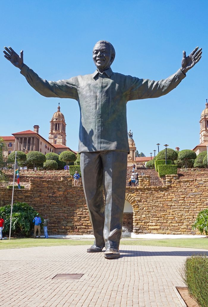
The Nelson Mandela statue commemorating his freedom from prison in 1990, Union Buildings, Pretoria (photo: Wikimedia Commons).
Negotiations to End Apartheid (1990-1994)
In May 1990, Mandela represented the ANC in talks with F. W. De Klerk that resulted in a signed agreement known as the 'Groote Schuur Minute', between the two parties to work to resolve the existing atmosphere of political violence in South Africa. Other items agreed to were the immunity from prosecution for returning political exiles and the further release of political prisoners. The agreement was named for Groote Schuur, an historic estate in Cape Town, built in 1657 and long used as the official residence of the Prime Minister.
In June 1990, Mandela began a world tour that began in Botswana and other African nations, before heading to Sweden, the United Kingdom, the United States, Cuba, India, Australia, Japan, and others.
After his world tour, Mandela returned home where he signed a further agreement, signed on 06 August 1990 and known as the 'Pretoria Minute', which ended the state of emergency in South Africa and included a ceasefire by the ANC and its armed wing, wing Umkhonto we Sizwe.
F. W. de Klerk (left) and Nelson Mandela wait to speak in Philadelphia, Pennsylvania, 1993 (photo: Wikimedia Commons).
Mandela Personal Notes
Mandela was given an office at the ANC Headquarters at the 22-story Shell House in Johannesburg and he moved into his wife Winnie's large home in Soweto. Their marriage became strained after he learned of her reported affair with Dali Mpofu, a South African lawyer. Nelson supported Winnie at her trail for kidnapping and assault (see above), but she was found guilty and sentenced to prison. In April 1992, Mandela announced his legal separation from Winnie. Mandela moved into the mostly white Johannesburg suburb of Houghton.
CODESA
In December 1991, the Convention for a Democratic South Africa (CODESA) began at the Johannesburg World Trade Centre. CODESA was attended by 228 delegates from 19 political parties, including the ANC, which was led by Cyril Ramaphosa. Mandela attended and was of course, a key figure. The convention was dominated by the ANC and the National Party, with both sides condemning the other and very little negotiation was achieved.
CODESA 2
In May 1992, CODESA 2 began, with the aim of again negotiating a way forward for South Africa. De Klerk insisted that a post-Apartheid South Africa must use a federal system of governance, whereby a rotating presidency would exist to ensure the rights of the ethnic minorities (whites). The ANC rejected this idea, demanding a majority-rule system.
A London bus promoting "Boycott Apartheid" in 1989 (photo: Wikimedia Commons).
Boipatong Massacre (17 Jun 1992)
On 17 June 1992, whilst CODESA 2 was still ongoing, some 200 armed militants of the Inkatha Freedom Party (IFP), a rival party of the ANC, attacked residents of the black township of Boipatong south of Johannesburg. Forty-five residents were killed and many others gravely injured. Eyewitnesses claim the attackers arrived in police vehicles, prompting the ANC to accuse the government inciting ANC-IFP violence; as a result, the ANC ended its participation in the CODESA 2 talks.
In retaliation for the Boipatong attack, the ANC took to the streets in a widespread program of protest they called 'rolling mass action', which involved regular marches and protests throughout the country.
Bisho Massacre (07 Sep 1992)
On 03 September 1992 the ANC sent a memorandum to the government demanding that free democracy be permitted in the Xhosa Bantustan of Ciskei in the Eastern Cape, but De Klerk refused.
On 07 September 1992, about 80 000 protestors gathered outside the town of Bisho in Ciskei. Among the leaders of the protest were Chris Hani, the leader of the Communist Party of South Africa, Cyril Ramaphosa, Steve Tshwete, and Ronnie Kasrils.
The government had erected razor wire fencing around the town to prevent the marchers from entering, but Kasrils led a group to break through the fencing anyway, whereupon Ciskei Defense Force soldiers opened fire with automatic weapons, killing 28 protestors and injuring over 200 more. In the aftermath of the Bisho violence, Mandela and President De Klerk agreed to resume negotiations to end the violence.
The Bisho Massacre Memorial Site commemorating the victims of the Bisho Massacre on 07 September 1992 (photo: Wikimedia Commons).
Multiparty Negotiating Forum
On 1 April 1993, the Multiparty Negotiating Forum (MPNF) gathered for the first time. Some parties that had boycotted the CODESA talks, including the white right (the Conservative Party and the Afrikaner Volksunie), the KwaZulu homeland government, and the Pan Africanist Congress (PAC), agreed to take part part in the negotiations this time. The two main parties, the ANC and the NP, agreed to reach bilateral consensus on all issues before bringing issues to the other parties.
Hani Assassination (10 Apr 1993)
On 10 April 1993, Chris Hani, the General-Secretary of the South African Communist Party (SACP), was assassinated outside his home in the racially mixed Johannesburg suburb of Boksburg by Janusz Waluś, a Polish anti-communist immigrant with ties to the white nationalist Afrikaner Weerstandsbeweging (AWB).
Hani was widely popular beyond just his party and had been recognized as a potential successor to Nelson Mandela. Hani's death brought widespread protests, but ultimately proved to be a turning point in the negotiations between the ANC and the government.

Chris Hani Monument in Ekurhuleni, Boksburg (photo: Wikimedia Commons).
In the aftermath of Hani's assassination, the country seemed on the brink of collapse into civil war, but Nelson Mandela appeared on prime-time television for three consecutive nights, appealing to the nation for calm. Mandela's pleas were heard and his leadership shown through, keeping the country from falling into chaos.
Over the following months however, black-on-black violence continued to happen, as well as a number of attacks on white civilians by the Azanian People's Liberation Army (APLA), the military wing of the Pan Africanist Congress (PAC).
On 25 July 1993, members of the APLA attacked a church at what is called the St. James Church Massacre. The four attackers entered a Sunday morning church service at St. James Church of England in Kenilworth, Cape Town, armed with hand grenades and R4 assault rifles. They threw grenades and then opened fire on the congregation, killing 11 people and wounding 58.
End of Apartheid (1993-1994)
On 18 November 1993, as negotiations continued at the Multiparty Negotiating Forum, an Interim Constitution was agreed upon, which provided for a major restructuring of South Africa's government and an end to Apartheid.
National elections were scheduled for April 1994 and a Transitional Executive Council (TEC) was established to facilitate the transition to democracy. The 19 members (one from each party that participated in the final negotiations) of the TEC would oversee the running of the government until the new government was elected.
USA President Bill Clinton with Nelson Mandela at the Philadelphia Freedom Festival, 04 July 1993 (photo: Wikimedia Commons).
1994 General Elections
Between 26 and 29 April 1994, general elections were held in South Africa. These were the first elections in the country's history where citizens of all races were allowed to vote. Millions of people who had never voted in a national election in their lives, waited in line over the four-day voting period. In total, over 19 million votes were cast.
As was widely expected, the African National Congress (ANC) won a decisive victory, receiving over 62% of the popular vote, just shy of a two-thirds majority that would have allowed them to unilaterally amend the Interim Constitution.
On 10 May 1994, Nelson Mandela became the new President of South Africa at the age of 75 years. The inauguration was televised live to an estimated one billion viewers worldwide. As required by the Interim Constitution, a new Government of National Unity was formed. The Interim Constitution required that any party winning at least 20 seats in the National Assembly be given representation in the cabinet.
Nelson Mandela casting his vote in the 1994 elections. It was the first time that Mandela had voted in his life. It was taken at Ohlange School, Inanda, Durban, by the IEC's official photographer, Paul Weinberg (photo: Wikimedia Commons).
The 400-member National Assembly were chosen from party lists in proportion to each party's share of the national ballot. The ANC, which had received 62.7% of the votes, had 252 seats on the Assembly, while the minority National Party, which received 20.4% of the votes, had 82 seats. The Inkatha Freedom Party (IFP), led by Mangosuthu Buthelezi, received 10.5% of the vote giving it 43 seats on the Assembly. The ANC had been dominant in all provinces except for the Western Cape and KwaZulu-Natal.
President Mandela's cabinet included two Deputy Presidents: Thabo Mbeki of the ANC and F. W. De Klerk of the National Party. Mandela also invited members of other minority parties to join his cabinet, even through they did not receive the minimum twenty seats in the National Assembly.
Mandela Presidency (1994-1999)
Nelson Mandela and the ANC had won the election and were finally in a position to end the years of Apartheid rule in South Africa thanks to the long and hard-fought struggle for freedom, but this was not the end of their troubles.
The ANC had inherited a South Africa with a population of 38 million people, of which an estimated 11 million (30%) were unemployed, 10 million had no access to running water, 20 million had no electricity, and 9 million were impoverished. Further, an estimated 60% of black adults in South Africa were illiterate and less than half of all black children under 14 years of age went to school.
President of South Africa, Nelson Mandela, with members of the USA Congressional Black Caucus, including Representative Kweisi Mfume, at an event at the Library of Congress, October 1994 (photo: Wikimedia Commons).
Mandela moved into the presidential residence at Westbrooke manor, which he renamed "Genadendal", meaning "Valley of Mercy". He turned 76 years old in July 1994, and he suffered from various minor ailments, but exhibited great energy. The president lived modestly, donating one-third of his annual salary of 552 000 South Africa Rand to his Children's Fund charity.
In December 1994, President Mandela published Long Walk to Freedom, an autobiography that was extracted from a manuscript he had written while in prison and supplemented by interviews given to American journalist Richard Stengel.
In August 1995, Mandela filed for divorce from his wife Winnie and had, by this time, begun a relationship with his long-time acquaintance Graça Machel, a political activist from Mozambique and the widow of former Mozambican President Samora Machel.
USA President George H. W. Bush and Nelson Mandela visit in the Oval Office of the White House, Washington, DC, 25 June 1990 (photo: Wikimedia Commons).
National Reconciliation
Mandela believed the primary task of his presidency was national reconciliation. Mandela wished to avoid having a mass exodus from the country by the elite whites, as he knew this would be highly detrimental to the South African economy.
Upon taking office, Mandela promptly made efforts to reassure the country's white population, saying that they were protected and an integral part of the "Rainbow Nation", a term coined by Bishop Desmond Tutu to describe post-Apartheid South Africa.
Rugby World Cup (1995)
During May and June 1995, South Africa hosted the Rugby World Cup. All matches were played in South Africa and it was the first World Cup in which the Springboks, the national team of South Africa, was permitted to play. The International Rugby Football Board (IFRB) had only admitted South Africa to international rugby play in 1992, after the coming end of Apartheid had been announced.
In the final match at Ellis Park in Johannesburg, South Africa defeated New Zealand 15-12, with a drop goal kicked in extra time. After the thrilling victory on its home turf, President Mandela, wearing a Springboks rugby shirt, presented the Webb Ellis Cup to François Pienaar, an Afrikaner and the South African captain. The event and Mandela's presence was a major step in winning him the hearts of millions of white rugby fans.
South Africa hosted the 1995 Rugby World Cup and was victorious in the final match played against New Zealand.
Truth and Reconciliation Commission
The Promotion of National Unity and Reconciliation Act of 1995 became the basis for the formation of the Truth and Reconciliation Commission (TRC). The TRC's purpose was to investigate crimes committed during Apartheid by both the government and anti-Apartheid activists and groups and in some cases, grant amnesty to the perpetrators of crimes, as well as offering reparations and rehabilitation to the victims.
Desmond Tutu was appointed chairman of the TRC, which began proceedings in February 1996. Hearings were broadcast on live television from April 1996 to June 1998.
The TRC issued its final report in October 1998, having found that 19 050 people had been the victim of gross human rights violations. A total of 5 392 applications for amnesty were submitted, with 849 of those granted. The TRC was widely viewed as having been successful in helping the country move away from its past and look towards its future.
Desmond Tutu in 1997 (photo: Wikimedia Commons).
Domestic Issues - Mandela Presidency
During Mandela's term, 20% of South Africa's national budget was for debt repayment, which impeded domestic reconstruction and development. Mandela increased welfare spending, introduced community grants for disability, child maintenance, and old-age pensions. Free health care was introduced for children under the age of six years and for pregnant women.
By 1999, the ANC-based government had connected 3 million more people with telephone lines, 1.5 million more children were added to the education system, 2 million more added to the electricity grid, 3 million added to running water access, and public housing created for nearly 3 million people.
International tourism was a major focus of Mandela's administration and it became a major sector of the South African economy.
Mandela was accused of doing little to combat the growing AIDS/HIV epidemic in the country, which by 1999, saw 10% of South Africa's population being HIV-positive. The president was also criticized for failing to adequately address the increasing rate of crime in South Africa. The international media sensationalized the crime situation daily, which gave a poor world view of the new South Africa. By the end of the ANC's first five years in power, the murder rate was 52 per day, a rape occurred every 30 minutes, and a car-jacking occurred every nine minutes.
Houses constructed in Soweto under the government's Reconstruction and Development Programme (photo: Wikimedia Commons).
Despite efforts to reassure white South Africans that their lives would not be negatively impacted by the ANC-dominated government, thousands of skilled white South Africans were leaving the country for good, mainly to escape the risk of crime and the impacts of discrimination in the workplace against whites. The mass exodus of skilled whites from South Africa was dubbed the 'brain drain'. At the same time, South Africa received huge numbers of illegal immigrants from the poorer countries in Africa, exacerbating the crime situation and putting pressure on the country's resources.
In May 1996, the Constitution of South Africa was adopted, replacing the Interim Constitution of 1993. The Constitution was ratified by 86 percent of the members of the Assembly. Deputy President De Klerk opposed the new Constitution for various reasons, and his personal professional relationship with Mandela had become increasingly strained, leading him to resign as Deputy President on 30 June 1996, leaving Thabo Mbeki as the sole Deputy President.
Frederik de Klerk (left), shown here with Nelson Mandela at the 1992 World Economic Forum in Davos, Switzerland, decided to resign as Deputy President in June 1996 (photo: Wikimedia Commons).
Mandela had actively governed during his first two years in office, but by late 1996, he was delegating more and more duties to Mbeki. Mandela resigned as ANC President in December 1997 and Mbeki was elected as his replacement in the party. Jacob Zuma replaced Mbeki as Deputy President of the ANC.
On a personal front, Mandela and his girlfriend, Graça Machel, were married on 18 July, 1998, which was also Mandela's 80th birthday.
South Africa's 1996 Constitution allowed for two consecutive five-year presidential terms, but Mandela had never intended to run for a second term in office. He gave his farewell speech to the Assembly on 29 March 1999, just prior to the coming national elections. While the ANC was suffering from waning public support, Mandela himself was still widely popular, with an approval rating above 80 percent.
Nelson Mandela, shown here in Washington DC in 1994, declared that he would not run for a second term as President of South Africa (photo: Wikimedia Commons).
Recent History (1999-Present)
1999 General Elections
On 02 June 1999, general elections were held in South Africa, with the incumbent African National Congress (ANC) winning 66.4% of the popular vote. After the retirement of Nelson Mandela from politics just prior to the elections, Thabo Mbeki was elected President of the ANC and he became the 2nd President of South Africa on 16 June 1999.
The election was notable in that the New National Party (NNP, previously the National Party), under leadership of Marthinus van Schalkwyk after the retirement of former President F. W. De Klerk, which had ruled throughout the Apartheid era, lost significant support, winning only 6.9% of the votes and losing 54 Assembly seats, leaving it with only 28 seats.
The Democratic Party (DP), under leadership of Tony Leon, narrowly became the main opposition party, with 38 seats, while the Inkatha Freedom Party (IFP), under Mangosuthu Buthelezi, won 34 seats. In total, 13 parties were represented in the 400-seat National Assembly.
Thabo Mbeki was elected as the new President of South Africa in 1999, succeeding Nelson Mandela (photo: Wikimedia Commons).
Thabo Mbeki - Background
Thabo Mbeki earned an undergraduate degree in Economics from the University of London, which he obtained as an external student while he was involved in underground activities for the ANC during Apartheid.
In 1962, after the ANC was banned, Mbeki and a group of his comrades secretly left South Africa, disguised as a football team and traveling by minibus to Botswana. Soon after, Mbeki travelled to Tanzania and then to London, where he continued work as an anti-Apartheid activist. He earned a Master's degree in Economics from Sussex University in May 1968.
In February 1969, Mbeki went to Russia, where he received military training at the Lenin International School in Moscow. While in Moscow, Mbeki trained in advanced guerrilla warfare. After his military training, Mbeki returned to London and then moved to Lusaka, Zambia in April 1971, where he was given the position of Assistant Secretary of the ANC's Revolutionary Council (RC).
In 1975, Mbeki moved to Swaziland, where he worked to recruit people into the ANC. In 1977, Mbeki was sent to Nigeria to establish a lasting relationship with its ruling government.
Moeletsi Mbeki, Thabo's younger brother, receives an honorary doctorate in social sciences from the University of Amsterdam in 1978, on behalf of their father, South African freedom fighter Govan Mbeki (photo: Wikimedia Commons).
In 1978, Mbeki became political secretary to Oliver Tambo, who was then the President of the ANC and operating out of Lusaka, Zambia. Mbeki became a close confidant of Tambo, writing many of his speeches and advising him.
Mbeki continued to rise up the ranks in the ANC, and in the lead up to the end of Apartheid, Mbeki played a crucial role in transforming the ANC from a revolutionary activist organization into a legal organization. Mbeki played a key role during the negotiations between the ANC and the National Party government and when Mandela became President of South Africa, Mbeki was chosen over Cyril Ramaphosa to be Mandela's Deputy.
Thabo Mbeki's ascension to the top of South Africa politics was received with great hopefulness by the country, who believed that their new well-educated leader would transform the country's economy and create badly needed jobs.
Mbeki enacted numerous pro-business policies, which led to significant economic growth, created a rapidly expanding black middle-class, and facilitated an exclusive group of elite, mega-wealthy black entrepreneurs. Unfortunately, South Africa's economic gains did little to nothing to help the poorest people in the country, which made up nearly 50% of the population.
Thabo Mbeki at the 2005 World Economic Forum in Davos, Switzerland. Shown are (left to right): William J. Clinton, President of the United States (1993-2001); William H. Gates III, Bill & Melinda Gates Foundation; Thabo Mbeki, President of South Africa; Tony Blair, Prime Minister of the United Kingdom; Bono, Musician; and Olusegun Obasanjo, President of Nigeria (photo: Wikimedia Commons).
HIV/AIDS Denialism
Mbeki was widely criticized for his misguided AIDS policies during his presidency. In 1995, the International Conference for People Living with HIV and AIDS was held in South Africa, at a time when 850 000 South Africans (2.1% of the population) were believed to be HIV-positive. Mbeki was Deputy President at this time and he acknowledged the seriousness of the epidemic. However, after becoming president, Mbeki changed his stance and sided with a small group of eminent scientists that believed AIDS was not caused by HIV.
Throughout Mbeki's term as President, he introduced policies that denied anti-retroviral drugs to AIDS patients in state hospitals and even withdrew support from clinics that used azidothymidine (AZT), which was a proven drug that prevents mother-to-child transmission of HIV during pregnancy. Mbeki described these and other drugs used to combat HIV as "poisons".
Mbeki's appointed Minister of Health, Manto Tshabalala-Msimang, promoted the use of unproven herbal remedies, such as beetroot, garlic, and lemon juice to treat AIDS, which led to international criticism. It is estimated that Mbeki's AIDS policies, as well as the advice from the country's top health official, led to the AIDS-related deaths of 300 000 people and the birth of 35 000 HIV-infected babies.
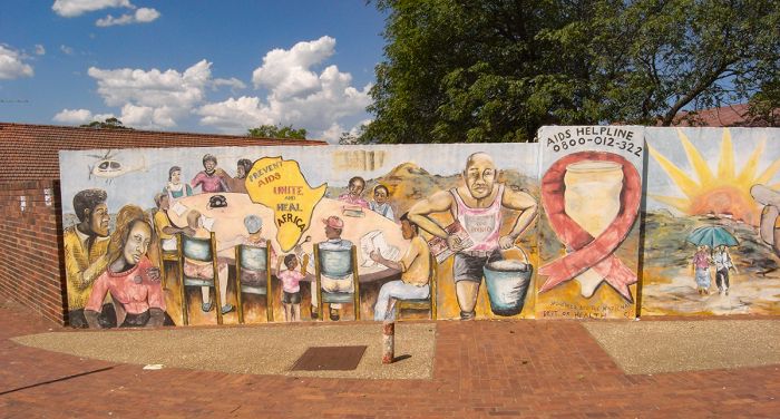
Outdoor AIDS awareness art in Alice, Eastern Cape, South Africa, 2008 (photo: Wikimedia Commons).
2004 General Elections
On 14 April 2004, general elections were held in South Africa. The ANC increased its majority to 279 Assembly seats (up 13 seats), while the minority party, the Democratic Alliance (DA), also increased its representation by an additional 12 seats. Thabo Mbeki was sworn in for a second five-year term as President of South Africa.
Zuma Corruption Charges (2004-2005)
In October 2004, Durban-based businessman Schabir Shaik was charged by the South African government with fraud and corruption as part of his involvement in an illegal arms deal involving a French arms contractor and the South African Navy.
Shaik was also the personal financial advisor for the country's Deputy President, Jacob Zuma. On 30 May 2005, Shaik was found guilty of soliciting bribes for Zuma, totaling 1.2 million Rand in exchange for Zuma's support in securing the arms contract.
The trail was a well publicized media circus, which only ended on 04 May 2005. The verdict handed down by Judge Hilary Squires found that there was overwhelming evidence of a corrupt relationship between Shaik and Zuma. Shaik was found guilty on two charges of corruption and one of fraud, and sentenced to two terms of 15 years, plus and additional 3 years to be served concurrently.
Jacob Zuma was removed as Deputy President in June 2005, due to his involvement in alleged corruption (photo: Wikimedia Commons).
On 14 June 2005, President Mbeki removed his Deputy President, Jacob Zuma, from the presidential cabinet. Zuma's dismissal was interpreted in two ways, one being that the government was determined to eliminate corruption within its ranks, while the alternate viewpoint was that Mbeki and Zuma represented two distinct factions within the ANC, and that Mbeki removed Zuma to entrench his own dominance within the party.
In December 2005, Zuma was again charged with a crime, this time for raping a 31-year-old woman at his home in Johannesburg. The alleged victim was a member of a prominent ANC family and an AIDS activist, who was known to be HIV-positive. Zuma claimed that the sex was consensual. During Zuma's rape trial, thousands gathered outside the Johannesburg High Court, some supporting Zuma and others condemning him as a rapist.
A huge controversy ensued when, during court proceedings, Zuma, who was head of South Africa's National AIDS Council, admitted that he had not used a condom during the sex with his accuser despite admitting that he knew she was HIV-positive. Zuma explained to the court that he had taken a shower afterwards, to "cut the risk of contracting HIV". Health experts condemned Zuma's statement, assuring the public that showering would do nothing to prevent HIV transmission. On 08 May 2006, Zuma was acquitted of the rape charges, finding that the sex was consensual.
A crowd of supporters and onlookers outside the Johannesburg High Court while Judge Willem van der Merwe delivered judgement on the Jacob Zuma trial, 08 May 2006. Photo by James Francis (photo: Wikimedia Commons).
Despite standing trial for rape, Jacob Zuma had managed to retain his political power within the ANC, and was elected President of the ANC on 18 December 2007, defeating Thabo Mbeki, who despite being ineligible to run for a third term as South Africa's president, still wished to retain his presidency in the ANC.
On 28 December 2007, the National Prosecuting Authority (NPA) served Zuma an indictment to stand trial on numerous counts, including money laundering, racketeering, fraud, and corruption, related to his involvement with Schabir Shaik and the arms deal. Over the next 16 months, various appeals and court proceedings ensued in the case against Zuma, but on 06 April 2009, just prior to the national elections, the NPA dropped all charges against Zuma, stating that there were flaws in the prosecution.
William Hague (left), British Secretary of State for Foreign and Commonwealth Affairs with Jacob Zuma in 2012. Picture courtesy UK in South Africa (photo: Wikimedia Commons).
Mbeki Resignation (2008)
Nearing the later stages of Mbeki's second term, South Africa continued to suffer an array of social problems. By the end of 2006, millions of South Africans were still without electricity or proper sewerage, 8-10 million people were living in basic shacks, and unemployment was at thirty percent.
Black South Africans had expected the end of Apartheid to bring positive changes in these areas, but most, except for a select group of black elite and those that were well educated, had seen little to no positive changes in their lives.
Tensions were rising in the townships, and protests were becoming common again. In 2005-2006, there were thousands of protests against the Mbeki government and the poor living conditions still being endured throughout much of the urban areas of South Africa.
Due the the growing unrest in the country and pressure from the ANC, Mbeki decided to step down as President of South Africa, announcing his formal resignation on 21 September 2008. The House of Assembly accepted Mbeki's resignation, and ANC Deputy President Kgalema Motlanthe was voted in to serve as President for the remainder of Mbeki's term, which ended in May 2009.
President Jacob Zuma at the 2009 World Economic Forum on Africa in Cape Town, South Africa (photo: Wikimedia Commons).
Jacob Zuma - Background
Jacob Gedleyihlekisa Zuma was born in Nkandla, Natal Province on 12 April 1942. His father was a policeman and his mother a domestic worker. His middle name is a Zulu word meaning "one who smiles while causing you harm". He received no formal education. He grew up with two brothers Joseph and Michael.
Zuma joined the ANC in 1959 (age 20) and became an active member of Umkhonto we Sizwe, the militaristic wing of the ANC in 1962 after the government banned the ANC the prior year. The same year, Zuma was arrested in Zeerust (western Transvaal), along with over 40 other recruits and convicted of conspiracy to overthrow the Apartheid government. Zuma was given a 10-year prison sentence, which he served on Robben Island, alongside Nelson Mandela. On 30 December 1963, at the age of 21 years, Zuma arrived at Robben Island and shared a communal cell with around 40 other prisoners.
While in prison, Zuma never received a single visitor, as his mother was too poor to make the trip. Like the other prisoners on the island, Zuma labored as a quarry worker, digging blue stone and crushing slate to be used in the construction of more prison cells.
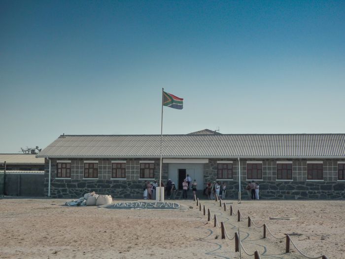
Jacob Zuma spent 10 years imprisoned on Robben Island, alongside Nelson Mandela, beginning in 1963 (photo: Wikimedia Commons).
Zuma played in the prisoners' football league, which had several teams and their own official sporting body called the Makana Football Association. Zuma was released from prison on 29 December 1973 and taken back to his home town of Nkandla. Zuma retuned to his work in the ANC's underground organization in the Durban area.
Zuma left South Africa in 1975, moving to Swaziland, where he met Thabo Mbeki. Soon after, in 1976, Zuma moved to Mozambique, where he served as the ANC's Deputy Chief Representative and later the Chief Representative.
While in Mozambique, Zuma worked with the thousands of exiles that arrived there after the Soweto Uprising. In 1977, Zuma was appointed a member of the ANC National Executive Committee. Zuma began working with the South African Communist Party (SACP) in 1977 and traveled to Russia in 1978, where he completed a three-month military leadership course.
In 1986, the South African government requested that Mozambique deport the ANC's leadership there, including Zuma, forcing Zuma to flee and move to Lusaka, Zambia. In Lusaka, Zuma was appointed Head of Underground Structures and shortly thereafter, Chief of the Intelligence Department.
During the late 1980s and early 1990s, Zuma was a member of the ANC's negotiating team under ANC President Oliver Tambo, participating in numerous meetings with the South African government to discuss ways to end Apartheid.
BRICS (Brazil, Russia, India, China, and South Africa) heads of state and government hold hands at the 2014 G-20 summit in Brisbane, Australia. Shown are (left to right): Russian President Vladimir Putin, Indian Prime Minister Narendra Modi, Brazilian President Dilma Rouseff, Chiinese President Xi Jinping, South African President Jacob Zuma (photo: Wikimedia Commons).
After the unbanning of the ANC in February 1990, Zuma returned to South Africa and was elected Chairperson of the ANC’s Southern Natal region, where he worked to end the internecine political violence between the ANC and its rival, the Inkatha Freedom Party (IFP).
In December 1991, at the ANC's first official conference in South Africa since 1959, Zuma was elected Deputy Secretary General of the ANC. In this role, Zuma attended the Convention for a Democratic South Africa (CODESA), where he acted as chairperson of the ANC’s negotiations commission. Zuma officially left the SACP in late 1990, focusing all his efforts on the ANC.
In 1994, after Mandela was elected President of South Africa, Zuma was appointed as a Member of the Executive Council of Economic Affairs and Tourism for the KZN provincial government.
At the ANC's 1994 national conference in Bloemfontein, Zuma was elected as Chairman of the ANC and Chairperson of the ANC in Natal, which required an exception be made to the ANC Constitution, allowing Zuma to hold both positions concurrently.
After Thabo Mbeki was elected President of South Africa in 1999, Zuma was appointed to the presidential cabinet as Deputy President. He was relieved of his position as Deputy President by Mbeki in 2005 after being implicated in a corruption case (see above).
President Jacob Zuma in North London, England, speaking to staff and students at the Alexandra Park School, 03 March 2010 (photo: Wikimedia Commons).
2009 General Elections
On 22 April 2009, general elections were held in South Africa, the fourth since the end of Apartheid. The result was a dominating victory for the ANC, which secured 65.9% of the popular vote, with Helen Zille's Democratic Alliance (DA) coming second with 16.7% of the votes.
Despite its victory, the ANC lost 15 Assembly seats, barely losing its two-thirds supermajority, while the DA picked up an additional 17 seats. On 09 May 2009, Jacob Zuma was sworn in as the 4th President of post-Apartheid South Africa.
USA President Barack Obama and First Lady Michelle Obama pose for a photo during a reception in 2009 at the Metropolitan Museum in New York, with Jacob Zuma, President of South Africa, and one of his wives (photo: Wikimedia Commons).
Zuma's First Term (2009-2014)
In March 2009, Zuma's long-time business acquaintance and former financial advisor, Schabir Shaik, was released on medical parole after having served only 15 months of his 30-year prison sentence. Media coverage speculated that Zuma may have had a role in negotiating Shaik's release, but the President denied it.
Marchers express their feelings about President Zuma's public stance regarding AIDS at the Soweto Pride event in 2012 (photo: Wikimedia Commons).
2010 FIFA World Cup
During Zuma's second year as president, South Africa hosted the 2010 FIFA World Cup, the world championship for men's national football (soccer). The matches were held in ten stadiums across South Africa between 11 June and 11 July 2010. South Africa had won the bid to host the tournament in 2004, beating out Egypt and Morocco, becoming the first African nation to host the event.
Later, in 2015, it was revealed through an FBI investigation that members of the FIFA Executive Committee had accepted bribes to ensure that South Africa won the bid for the 2010 tournament.
After the FIFA World Cup, South Africa enjoyed increased international tourism, but millions of South Africans were still poor and dispossessed after twenty years of ANC leadership. The South African Rand was still highly devalued against Western currencies and public frustration with the ruling party was at an all-time high. Public protests were an almost daily occurrence and criticism of Zuma were now also coming from within the ANC.
Fans celebrating the 2010 FIFA World Cup in South Africa (photo: Wikimedia Commons).
Julius Malema
Julius Malema, the leader of the ANC Youth League (ANCYL), who had been instrumental in gathering support for Zuma's candidacy in the 2009 elections, stated that Zuma was "worse than Mbeki", causing a rift between the two.
Subsequently, in April 2010, Malema faced disciplinary charges by the ANC for his involvement in several controversial incidents, including a public confrontation with a BBC journalist, as well as publicly criticizing Zuma after the ANC had censured him. Charges were ultimately dropped against Malema, but he was warned of a suspension from the party if he re-offended within two years.
In August 2011, Malema was again subjected to a disciplinary hearing by the ANC and was found guilty of expressing views that portrayed the ANC and President Zuma in a negative light. The ANC's National Disciplinary Committee expelled Malema from the ANCYL.
Julius Malema in 2011, while a member of the ANC Youth League (photo: Wikimedia Commons).
In October 2012, Malema visited Zimbabwe and addressed the ZANU-PF Youth Wing, stating that youth in South Africa were calling for the whites to surrender land and mineral resources, as they had stolen the land from the native blacks and that whites had committed murder to obtain these assets. He also called on black South Africans to have as many children as possible, which was necessary to gain dominance of their ideas across the world.
In July 2013, Malema founded a new political party called the Economic Freedom Fighters (EFF), with an initial membership of over 1 000 members and intentions of running in the next national elections. The EFF was strongly anti-white and anti-Indian from the outset and critical of both the ANC and Democratic Alliance (DA) parties.
The EFF promised to combat corruption in government, while providing good-quality social housing and free primary healthcare and education for all. Additionally, the EFF proposed to expropriate all white-owned farmland, nationalize the mining and banking industries, increase minimum wage and welfare payments, and end the proposed highway tolls. Public support for the EFF is predominantly black males under 34 years of age, with a large proportion living in the provinces of Gauteng and Limpopo.
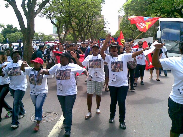
Julius Malema t-shirts worn by supporters at the World Festival of Youth and Students in Johannesburg, 2010 (photo: Wikimedia Commons).
Marikana Massacre (2012)
In August 2012, workers at the Lonmin platinum mine near Marikana (Northwest Province near Rustenburg) staged a wildcat strike. Protests occurred over several days, and between 12-14 August 2012, 43 miners were killed and 35 more injured by police using R5 assault rifles. Two police officers and four security guards were also killed. The event caused huge political backlash against the ANC government.
Days after the incident, Julius Malema, the recently banned former leader of the ANC Youth League, visited the scene of the shootings and called for President Zuma to resign, stating "A responsible president says to the police you must keep order, but please act with restraint. He says to them use maximum force. He has presided over the killing of our people, and therefore he must step down. Not even [the] apartheid government killed so many people."
In the aftermath of Marikana, workers at various other mines in South Africa staged similar walkouts and protests, including at the Gold Fields mine outside Johannesburg, Anglo American Platinum, Impala Platinum, and others. Some of the protests turned violent, with police using tear gas and rubber bullets in efforts to maintain order. Collectively, 2012 saw more protests than any year since the end of Apartheid.
A church on Green Market Square in Cape Town, South Africa, with a banner commemorating the 2012 Marikana Massacre (photo: Wikimedia Commons).
Nelson Mandela Death (2013)
In February 2011, Nelson Mandela was hospitalized with a respiratory infection, but released soon after. He was again hospitalized in June 2013, as his lung infection had returned and his condition was serious. Mandela was discharged in September 2013, but his condition remained unstable.
On 05 December 2013, Nelson Mandela died in his home in Houghton at the age of 95 years, surrounded by his family. President Zuma announced Mandela's passing on television and proclaimed that there would be ten days of national mourning.
Mandela's memorial service was held at FNB Stadium in Johannesburg on 10 December 2013. His body lay in state at the Union Buildings in Pretoria from 11 to 13 December 2013. His funeral was held on 15 December 2013. Mandela's estate, valued at US $4.1 million, was left to his widow, other family members, staff, educational institutions, and charities.
Flowers and tributes left in memory of Nelson Mandela on the announcement of his passing (photo: Wikimedia Commons).
Zuma Nkandla Scandal
Throughout his first term in office and continuing into his second term, President Zuma made substantial upgrades to his personal residence in Nkandla (in rural KwaZulu-Natal). Constitutional regulations permit the use of government funds up to 100 000 rand for security improvements at the private houses of certain public officials, including the president. Any costs above that amount must be covered personally by the official.
Investigations into complaints received about the massive construction project at Zuma's Nkandla homestead were initiated by the Public Prosecutor, Thuli Madonsela in late 2012. Madonsela's preliminary report, published in November 2013, was entitled "Opulence on a Grand Scale", while her final and official report, issued on 19 March 2014, was titled "Secure in comfort". Both reports concluded that President Zuma had illegally used state funds to upgrade his personal residence in the amount of 246 million rand.
Side Note: In May 2015, Parliament cleared Zuma of wrongdoing with regards to spending on his private estate, stating that the upgrades were necessary for the president's security and that Zuma did not owe anything to the state.
President Jacob Zuma's homestead/compound between in the Nkandla District, Eastern Cape (photo: Wikimedia Commons).
2014 General Elections
On 07 May 2014, general elections were held in South Africa, and despite the Nkandla scandal, the ANC maintained its grip on national power, but fell short of a two-thirds supermajority, winning 62% pf the popular vote, but dropping 15 Assembly seats.
The Democratic Alliance Party (DA), under Helen Zille, was the main opposition, winning 22% of the vote and gaining 22 Assembly seats. Julius Malema's anti-ANC Economic Freedom Fighters (EFF) came third, with over 6% of the vote and winning 25 seats on the Assembly.
The EFF won over 10% of the vote in three provinces: Gauteng, Limpopo, and North West, beating the DA for second place in the last two. The North West is the only province not won by the ANC, with the DA increasing its majority to 59% there. Jacob Zuma was sworn in for his second term as president.
Helen Zille, leader of the Democratic Alliance Party (photo: Wikimedia Commons).
Zuma and Gupta Family
In 2015, allegations of corruption involving President Zuma and the Guptas, a wealthy Indian-born family with business interests in South Africa. The Guptas operate a family-owned business empire that includes mining, media, and computer equipment.
Investigations led many high-level officials to believe that the Guptas had significant influence over policy decisions made by Zuma. Several House of Assembly members also admitted that they were offered Cabinet positions by, or on behalf of, the Gupta family in exchange for promises of future decisions on policy that would benefit Gupta-owned businesses.
A placard of Atul Gupta is carried by two Economic Freedom Fighters (EFF) members at the "Zuma Must Fall" protests in Cape Town, 07 April 2017 (photo: Wikimedia Commons).
Finance Minister Controversies (2015-2017)
On 09 December 2015, President Zuma replaced his Finance Minister Nhlanhla Nene with Des van Rooyen in what became a costly and controversial move. The reasons for the change are suspected to have been due to Nene having vetoed several suspect uses of public funds that Zuma was not happy about.
Note: A few months after the Nene was replaced as Finance Minister, media reports linked two of Van Rooyen's top advisors with the Gupta family, prompting speculation that the move was orchestrated by the Guptas.
Nene's dismissal caused a strong negative reaction in the international markets, with the rand losing 10% of its value and the Johannesburg Stock Exchange seeing total withdrawals of around 200 million rand within two days following the announcement.
Public outcry for Zuma to reverse his decisions came from various political parties, including from within the ANC, as well as the South African business community.
On 13 December 2015, a senior ANC delegation met with Zuma and requested that he replace Van Rooyen with the more qualified Pravin Gordhan. Zuma agreed and appointed Gordhan as the new Finance Minister. Unfortunately, the earlier move had already done what would be lasting damage to the South African economy.
Note: Nhlanhla Nene was again appointed Minister of Finance under President Cyril Ramaphosa in 2018.

Nhlanhla Nene (left), with Steven Mnuchin, USA Secretary of the Treasury, at the at 2018 G20 Finance Meeting (photo: Wikimedia Commons).
On 31 March 2017, Zuma again replaced his Finance Minister, this time dismissing Pravin Gordhan along with his deputy and installing Malusi Gigaba. The reshuffle affected a total of ten cabinet ministers, five of whom were dismissed, and ten deputy ministers. The personnel changes were strongly criticized by Deputy President Cyril Ramaphosa, as well as by other senior ANC and SACP leaders.
Calls for Zuma to resign from office began to emerge, including opposition party members calling for a motion of no confidence and impeachment. Shortly after this move by Zuma, Standard and Poor's downgraded South Africa's sovereign debt to BB+, otherwise known as junk status. On 07 April 2017, partly in response to Gordhan's dismissal, several marches and protests were held in major cities around the country.
Pravin Gordhan, Minister of Finance of South Africa, at the 2012 World Economic Forum in Davos, Switzerland (photo: Wikimedia Commons).
New Presidential Candidates (2017)
On 22 April 2017, Deputy President Cyril Ramaphosa announced that he would campaign for South Africa's presidency in the next elections, scheduled for 2019. Incumbent President Jacob Zuma, now serving his second term, would be ineligible to stand for re-election.
Nkosazana Dlamini-Zuma, President Zuma's third wife (now ex-wife, they divorced in 1998), announced that she too would run for president in 2019. Critics claimed that her candidacy was a scheme for Zuma to retain his power over the ANC and the country through her and also to avoid prosecution on pending criminal charges against him.
President Zuma's term as ANC president ended in December 2017, and at the 54th National Conference of the ANC, Cyril Rhamaphosa and Nkosazana Dlamini-Zuma both vied for the position of ANC president, with Rhamaphosa narrowly defeating Dlamini-Zuma by a count of 2 440 votes to 2 261 votes.
Cyril Ramaphosa announced that he would run for president in the next elections (photo: Wikimedia Commons).
Motion of No Confidence (2017)
On 07 August 2017, the speaker of the National Assembly, Baleka Mbete, announced that a motion of no confidence against Zuma would be held via secret ballot. This was the eighth motion brought against Zuma during his presidency, but the first to be held by secret ballot. The motion was defeated 198-177, with 25 abstentions.
Zuma Resigns (2018)
Despite the defeat of the no confidence vote, pressure grew from within the ANC to replace Zuma.
On 13 February 2018, the ANC announced that it had requested a resignation from the president, but that Zuma had refused and that the ANC was therefore "recalling" him from the presidency. Another motion of no confidence against Zuma was scheduled for 15 February, and instead of facing what seemed a likely ouster, Zuma announced his resignation on 14 February 2018.
The National Assembly voted Deputy President Cyril Ramaphosa in as Zuma's replacement for the remainder of his term. David Mabuza was selected by Ramaphosa as his new Deputy President.
President Cyril Ramaphosa and his wife, First Lady Tshepo Motsepe (photo: Wikimedia Commons).
2019 General Elections
On 08 May 2019, general elections were held in South Africa. The ruling ANC party and President Cyril Ramaphosa won the elections, but lost 19 Assembly seats, while winning 57.5 percent of the popular vote.
The main opposition Democratic Alliance (DA) party won 20.8% of the vote, but lost 5 seats. The far-left and anti-ANC Economic Freedom Fighters (EFF), led by Julius Malema since 2013 after his expulsion from the ANC, gained 19 Assembly seats.
Great Good Fair Poor
- Jan
- Feb
- Mar
- Apr
- May
- Jun
- Jul
- Aug
- Sep
- Oct
- Nov
- Dec
The chart directly above should be taken as a very rough overall indicator of best times to visit South Africa, as there are variations regionally. More information on the specific national parks and reserves is found on the previous Details tab.
Click on a Region Link above to read more about best times to visit a specific region or destination.
Year-Round Destination
South Africans like to boast that they have the best climate of anywhere on Earth. This may be true and the country is certainly a year-round destination, but there are seasonal and regional weather variations to consider when planning your trip.
The majority of the country is sunny and warm for much of the year, being located just below the Tropic of Capricorn. For visitors from the Northern Hemisphere, including the USA, this means that summer and winter are inverted from ours, with winter falling between May and August and summer from November to March.
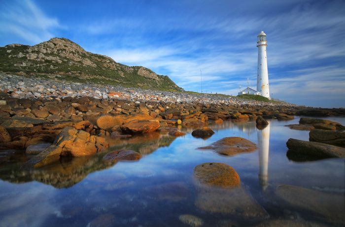
Slangkop Lighthouse at Kommetjie on the Cape Peninsula.
RAINFALL
South Africa's rainfall is dependent on season and location, with two distinct regions. The southwest coast, including Cape Town and the Western Cape province is subject to a Mediterranean climate that receives winter rainfall and has hot, dry summers.
The rest of the country receives the majority of its precipitation in the summer, with short, but sometimes heavy afternoon rainfalls being the norm, and cool, dry winters.
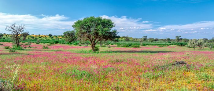
Wildflowers in bloom after the rains, Kalahari region of South Africa.
Safaris & Game Viewing
The game reserves around Kruger National Park are best visited in the dry fall and winter months. Water becomes scarce in the dry winter months and animals are forced to spend more time around permanent water sources, such as rivers and waterholes. Demand and prices are highest at this time, so book well in advance.
The secret season in the Kruger Reserves is during the spring, when rains are still lights and infrequent and the landscape becomes transformed from brown to green. Many herbivores also give birth to coincide with the rains, so baby animals are more prevalent in the spring and summer. Migratory birds also arrive in the spring to breed during the summer, departing before winter. The summer season will mean price discounts at most safari camps.
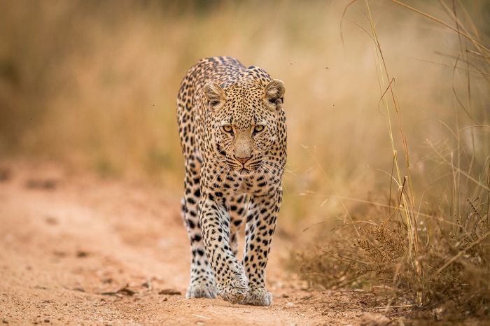
A leopard walking the safari track in the Kruger region of South Africa.
Cape Town
Cape Town experiences its best weather in the summer, with almost no rain, lots of sun, and long, warm days. Cape Town does however experience lots of very windy days in summer and can be crowded, with international and South Africans heading there to enjoy the region.
Cape Town in the winter is also very nice, but the chance of rain is much higher, with about one of every two days being rainy. Price discounts at lodging and restaurants are commonplace in Cape Town during the winter.
The Cape West Coast of the country has some spectacular wildflower displays in the spring, especially in August and September.
For more detailed regional information on weather and when to visit, please click on the region links above.
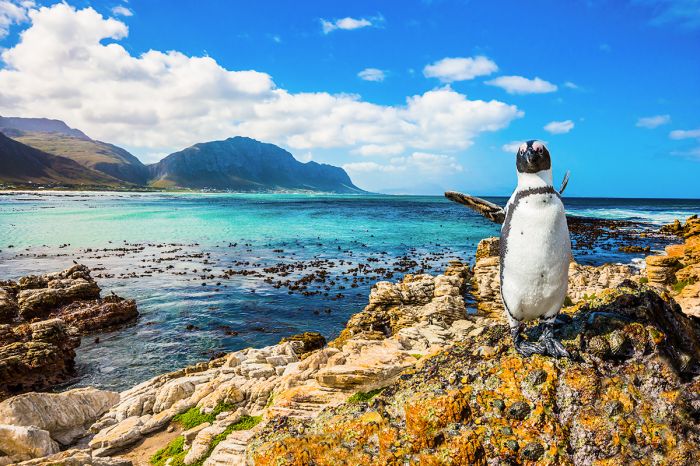
African penguin at Boulders Beach near Cape Town.
Showing 1–14 of 14 results
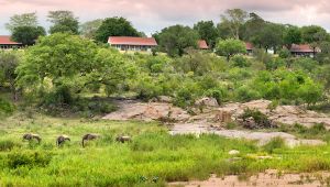
An original homestead dating back to the 1920s and named for one of the founders of the Sabi Sand Reserve. Evokes old-world charm in an area with outstanding wildlife viewing, including all of Africa's Big Five animals. Great location on the bank of the Sand River.…
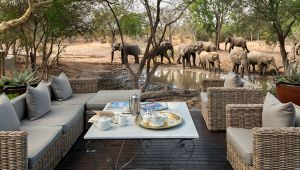
Located in the Timbavati Reserve, which shares an unfenced border with Kruger National Park. Outstanding wildlife viewing, including all of Africa's Big Five animals, in a massive, exclusive-use land concession with just two lodges.…
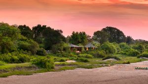
Located in the Timbavati Reserve, which shares an unfenced border with Kruger National Park. Outstanding wildlife viewing, including all of Africa's Big Five animals, in a massive, exclusive-use land concession with just two lodges.…
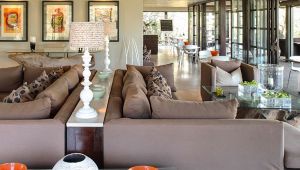
Situated in a rare sand forest within a large, privately-managed wildlife and conservation reserve. Diverse wildlife, including all of the Big Five, cheetah, plus adventures in the nearby Indian Ocean.…
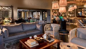
Excellent safari experience in a large, privately-managed wildlife and conservation reserve with diverse wildlife, including all of the Big Five, cheetah, and all the regional plains game species. Great for families with children.…
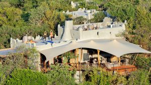
Small and intimate lodge offering an excellent safari experience in a large, privately-managed wildlife and conservation reserve. Diverse wildlife, including all of the Big Five, cheetah, and all the regional plains game species. No children under 12 years.…
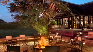
Offers an excellent safari experience in a large, privately-managed wildlife and conservation reserve with diverse wildlife, including all of the Big Five, cheetah, and all the regional plains game species.…
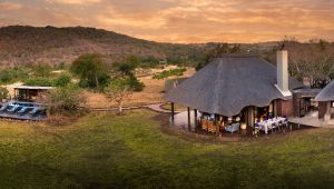
Offers an excellent safari experience in a large, privately-managed wildlife and conservation reserve with diverse wildlife, including all of the Big Five and cheetah. Ideal as an exclusive-use booking for a group or extended family.…
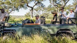
Singita Boulders Lodge is located in the Sabi Sand Game Reserve bordering Kruger National Park. The reserve is renowned for its outstanding wildlife viewing, including all of Africa's Big Five animals.…
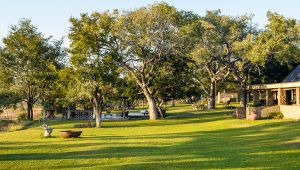
Singita Castleton is a private-use homestead located in the Sabi Sand Game Reserve bordering Kruger National Park. The reserve is renowned for its outstanding wildlife viewing, including all of Africa's Big Five animals.…
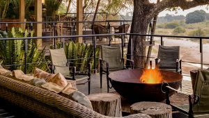
Singita Ebony Lodge is located in the Sabi Sand Game Reserve bordering Kruger National Park. The reserve is renowned for its outstanding wildlife viewing, including all of Africa's Big Five animals.…
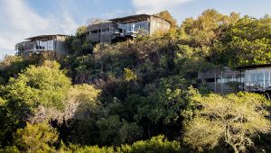
Singita Lebombo Lodge is located in the Singita Private Concession in Kruger National Park. There are only two lodges and guests enjoy exclusive use of this wildlife-rich area in the foothills of the Lebombo Mountains.…
Singita Sweni Lodge is located in the Singita Private Concession in Kruger National Park. There are only two lodges and guests enjoy exclusive use of this wildlife-rich area in the foothills of the Lebombo Mountains.…