
Uganda
Region Links: Bwindi
Known as "The Pearl of Africa" (a phrase popularized by Winston Churchill after his 1907 visit), Uganda boasts a remarkable diversity of wildlife, habitats, and adventures.
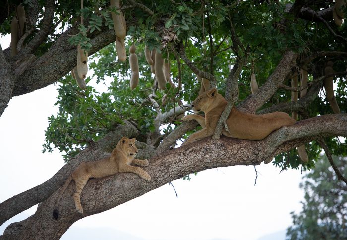
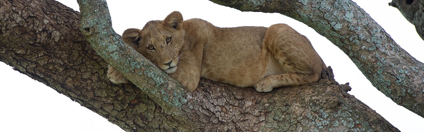
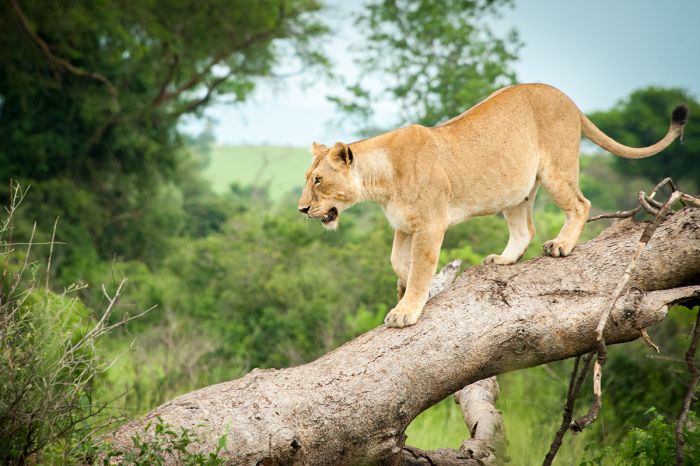
"Tree-climbing" lions in Kidepo Valley NP (Copyright © James Weis).
Uganda's ten national parks offer visitors classic East African savanna safaris, highland forests with gorillas and chimpanzees, alpine hiking, high mountain peaks, and boating on its Great Lakes.
The country was a British Protectorate from 1894-1962, after which Uganda became an independent country. The 1970s and 1980s were a period of civil unrest and political turmoil in Uganda, which did great harm to its previously world-class national parks and reserves.
Today, Uganda has long-since moved forward from its earlier struggles and progressively protects its natural resources and wildlife, making it a very good destination for eco-tourism.
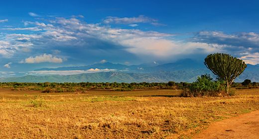
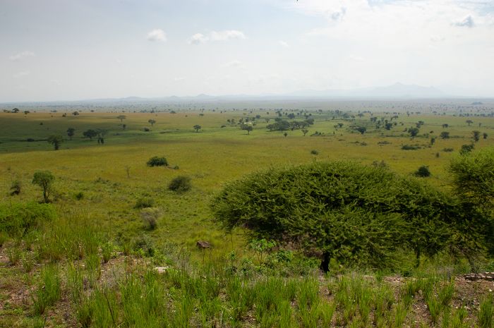
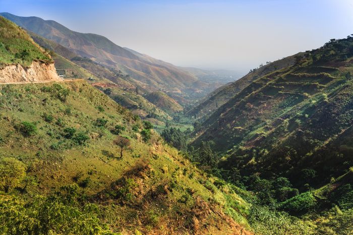
The country's position on the equator and high annual rainfall make it one of the greenest and most fertile countries in East Africa. Uganda is located in Africa's Great Lakes region, which was created as the continent was carved open by the tectonic activity that formed the Great Rift Valley.
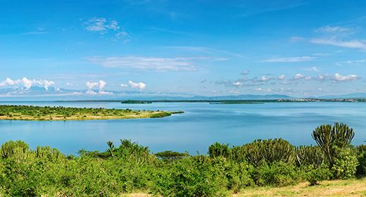
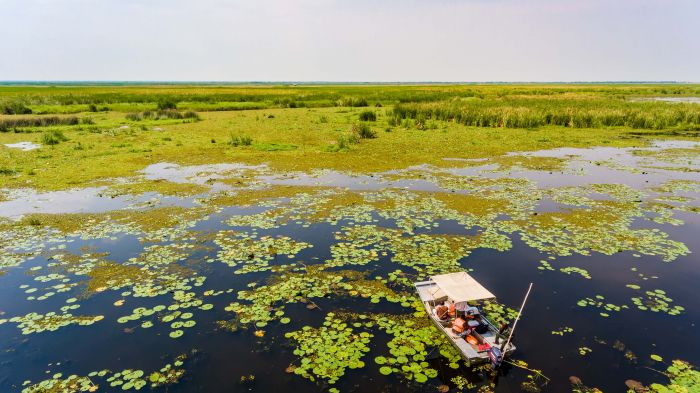
Permanent water, including Lakes Victoria, Albert, Edward, and George, numerous small crater lakes, assorted wetlands and numerous rivers, including a portion of the Nile, make up 17% of Uganda's surface area.
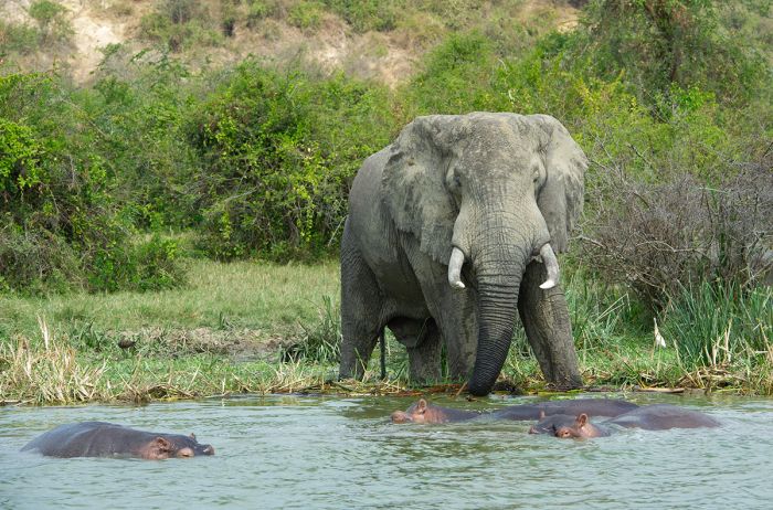
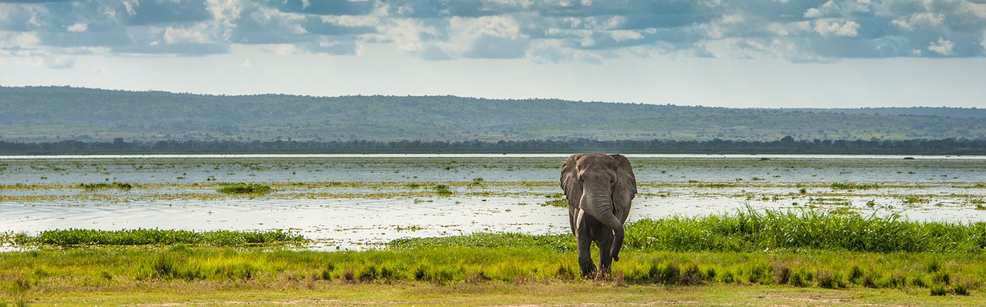
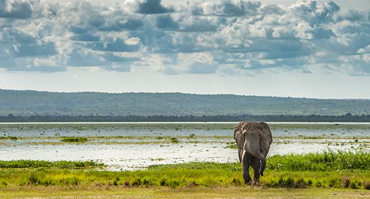
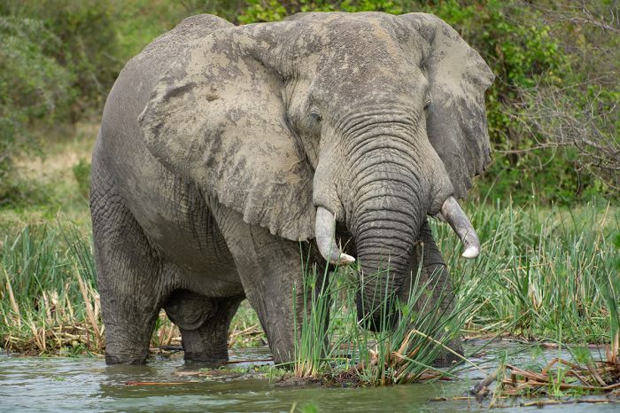
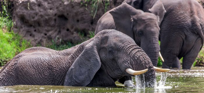
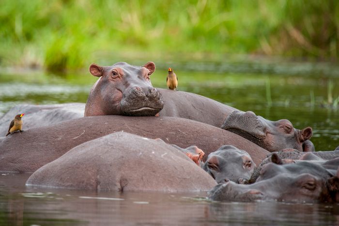
Elephant and hippos in the Kazinga Channel, Queen Elizabeth NP (Copyright © James Weis).
Uganda's protected areas are best categorized by habitat type. The country's classic wildlife safari destinations, offering game drives and iconic African species such as lion, elephant, buffalo, hyena, and other plains game include: Queen Elizabeth National Park, Murchison Falls National Park, Kidepo Valley National Park, and Lake Mburo National Park.
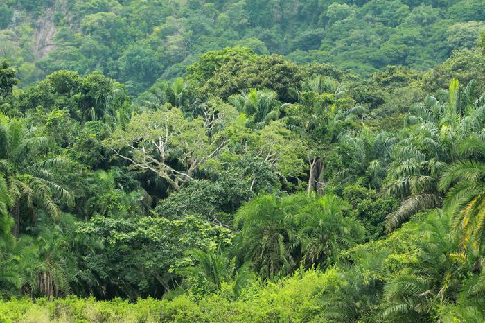
In addition to traditional wildlife safaris conducted in 4x4 vehicles in open grasslands and woodlands, Uganda boasts several outstanding closed-canopy forest destinations. These protected forests are mostly located on the western side of Uganda, close to its border with the DRC (Democratic Republic of the Congo) and they offer visitors a chance to explore on foot and observe over a dozen species of primate, as well as several hundred species of bird.
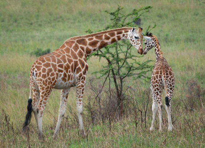
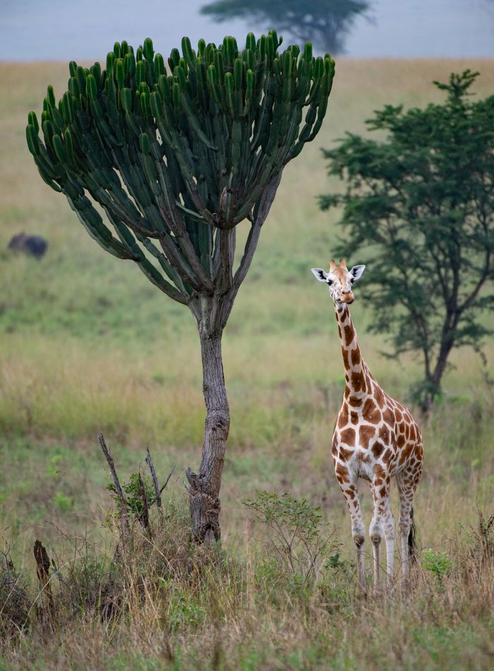
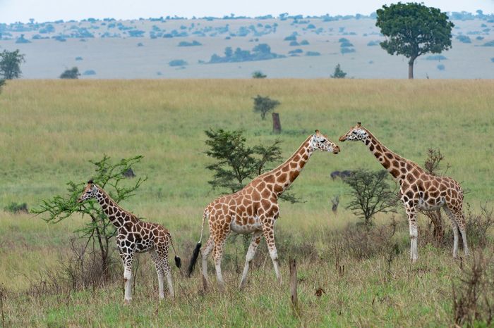
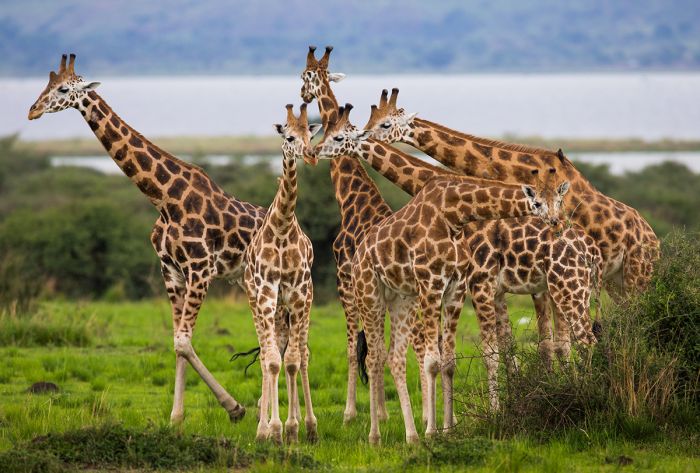
A small population of highly endangered Rothschild's giraffe (Giraffa camelopardalis rothschildi) live in Kidepo National Park (Copyright © James Weis).
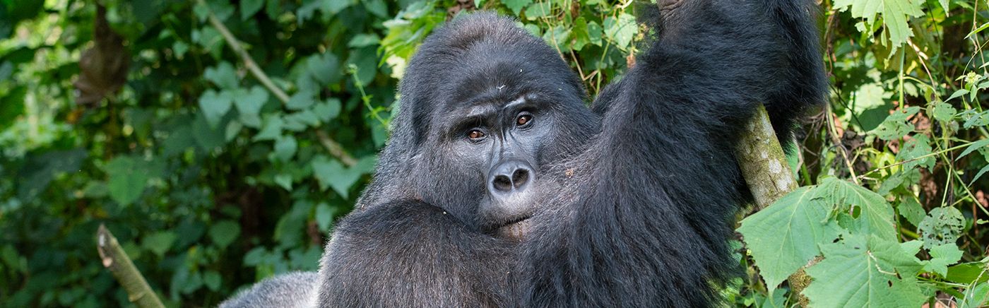
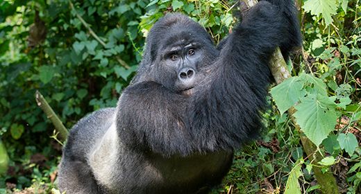
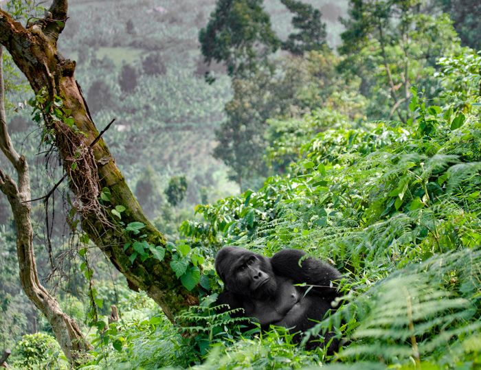
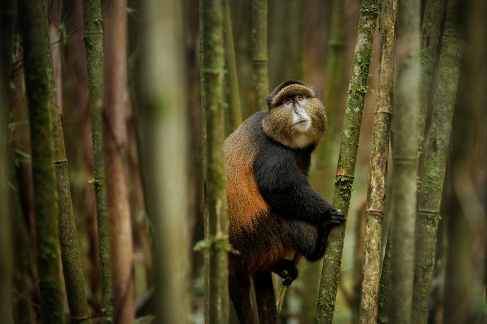
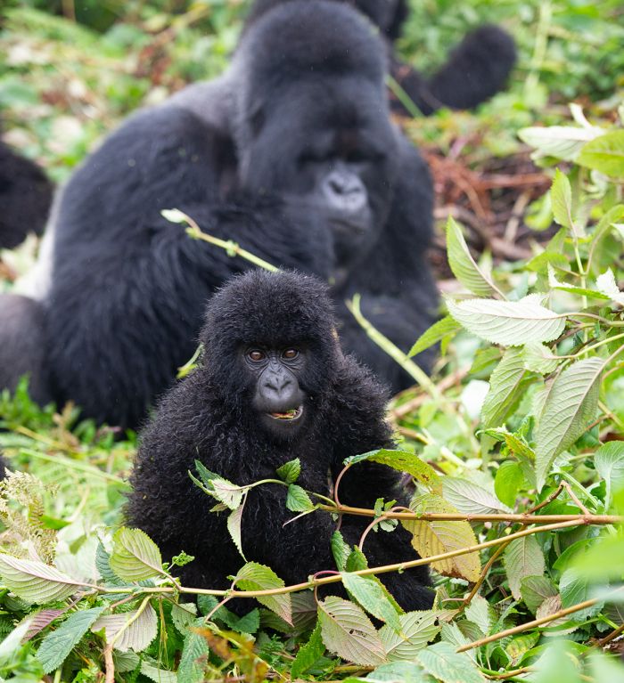
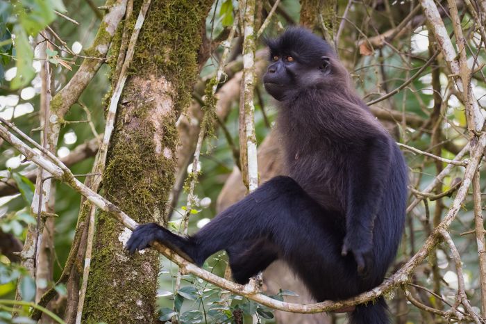
Uganda's most popular forest ecosystem is Bwindi National Park, which is home to half the world's remaining mountain gorillas and where tourists can partake in a gorilla trek to observe these beautiful animals in their natural environment. It is an experience like no other and highly recommended. More gorilla trekking is offered in the Mgahinga Gorilla National Park, a small park in the Virunga Mountains, which span across Uganda, Rwanda and the DRC.
Another forest-based experience is chimpanzee trekking, which, like gorilla trekking, gives an up-close wildlife encounter with Uganda's other great ape species. Several Ugandan parks offer chimpanzee treks, the best of which is offered in Kibale National Park.
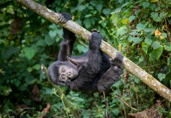
A baby mountain gorilla in Bwindi Impenetrable Forest NP (Copyright © James Weis).
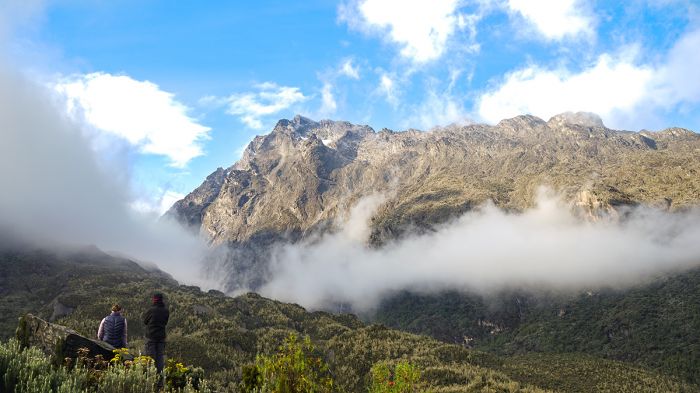
Finally, for those who love to explore wild and untouched mountains, Uganda's Rwenzori Mountains on the western side of the country are the highest range in Africa, with six peaks in the top ten highest on the continent.
Guided, multi-day treks are offered, including summit hikes and those that wind around the peaks at lower altitudes. On Uganda's eastern border with Kenya is Mount Elgon, a long-extinct shield volcano with several peaks that can also be explored.
Uganda is an excellent travel destination, offering a diverse array of habitats, wildlife, and experiences and one could easily spend several weeks to see. A smart option is combining Uganda with other nearby countries such as Kenya, Tanzania, or Rwanda.
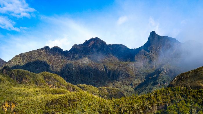
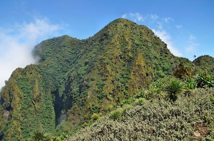
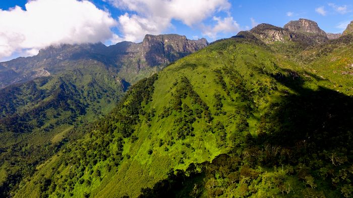
The Rwenzoris are Africa's highest mountain range.
Uganda Regions
Bwindi Impenetrable Forest
Join one of the greatest adventures in Africa - a gorilla trek! Bwindi is home to one-half of the world's 1 000 mountain gorillas and observing them up close in the wild is an experience like no other. more
For additional Uganda Regions, check links on the Details Tab...
Read More...
Main: Flora, Geography, Important Areas, National Parks, Protected Areas, Ramsar Sites, UNESCO Sites, Urban Areas, Wildlife
Detail: Bigodi, Bwindi, Entebbe, Kampala, Kibale, Kidepo Valley, Lake Mburo, Lake Victoria, Mgahinga, Mount Elgon, Murchison Falls, Ngamba Island, Queen Elizabeth, Rwenzori Mountains, Semliki, Semuliki
Admin: Travel Tips, Entry Requirements/Visas
Geography
Uganda is a landlocked country located in Central Africa in what is known as the Great Lakes Region, bordered by five countries: the Democratic Republic of the Congo (DRC, formerly Zaire) in the west, Rwanda in the southwest, Tanzania in the south, Kenya in the east, and South Sudan in the north. Lake Victoria covers a large portion of southeast Uganda. The equator passes through the the country about one-quarter of the way north from its southern border.
Much of Uganda lies on a plateau, which is actually an elevated portion of the basin between the eastern and western branches of the East African Rift, which runs from the Red Sea in the far north to Mozambique in the south. The plateau is mainly flat, with elevations that slope gently from around 5 000 feet (1 500 meters) in the south, to around 3 000 feet (900 meters) in the north. Uganda's plateau is flanked by mountains and lakes that fill the valleys.
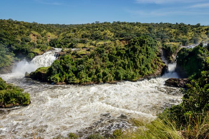
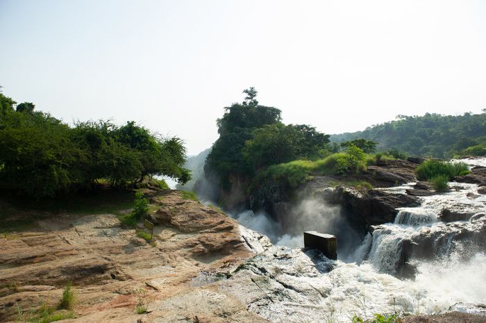
Murchison Falls on the Victoria Nile River, Uganda.
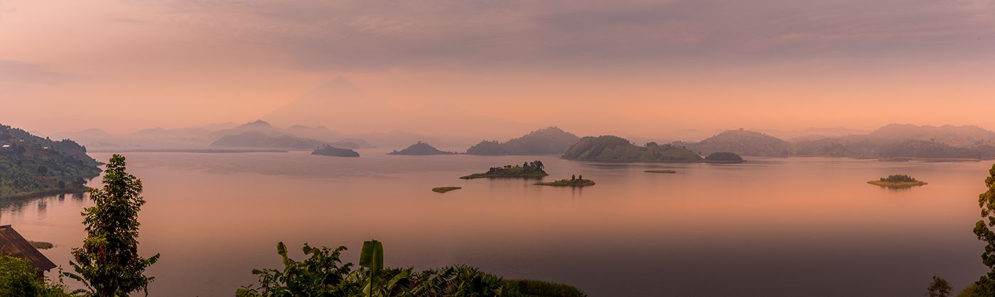
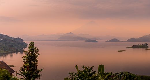
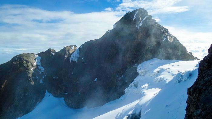
Uganda's southwest border is defined by mountain ranges that include the Virunga Mountains (on the shared borders between Uganda, Rwanda, and DRC) and the Rwenzori Mountains (on the border with DRC). The Rwenzoris are the highest mountain range in Africa, with its highest peak on Mount Stanley (16 760 feet/5 109 meters) only exceeded in altitude on the continent by Mount Kenya and Mount Kilimanjaro (both free-standing volcanos). On the country's eastern border with Kenya is Mount Elgon (14 177 feet/4 321 meters), a massive extinct volcano.
Uganda is a mostly fertile land, receiving ample rainfall over much of its area. About 20% of Uganda's surface area is covered by lakes, the most notable of which is Lake Victoria, Africa's largest and the world's second largest freshwater body (by area). Lake Victoria is shared by Uganda, Tanzania and Kenya. Uganda's other major lakes include Lake Albert, Lake Edward, and Lake George, which occupy the valleys of the Albertine Rift on Uganda's western boundaries. The vast, swamp-filled marshes of Lake Kyoga lie roughly in the center of the country.
Margherita Peak in the Rwenzori Mountains, Africa's third highest peak.
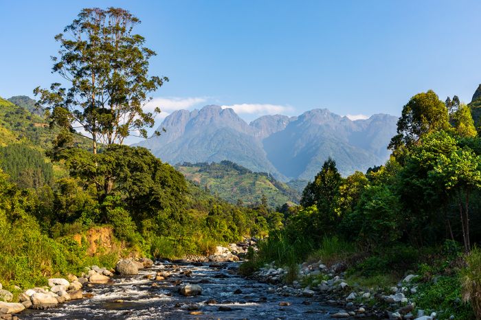
There are several major rivers flowing through Uganda, the two most prominent being the Victoria Nile in Central Uganda and the Albert Nile in the northwest. Both of these are the southernmost extensions of the White Nile River, a major tributary of the main Nile River. Uganda's other significant rivers include the Ojok, Pager, and Achwa in the north and the Katonga, Mpongo, and Kafu in the west.
Uganda's southern rivers flow into Lake Victoria, which drains northward via the Victoria Nile River into Lake Kyoga. From there the river traverses north and then west, flowing over the Murchison Falls, before emptying into Lake Albert. Lake Albert drains north via the Albert Nile, which become the Mountain Nile after crossing into South Sudan. Rivers rising in the southwest flow into Lakes George and Edward, which empties north via the Semliki River into Lake Albert. The northern rivers flow south into either Lake Kyoga or north as tributaries of the Nile.
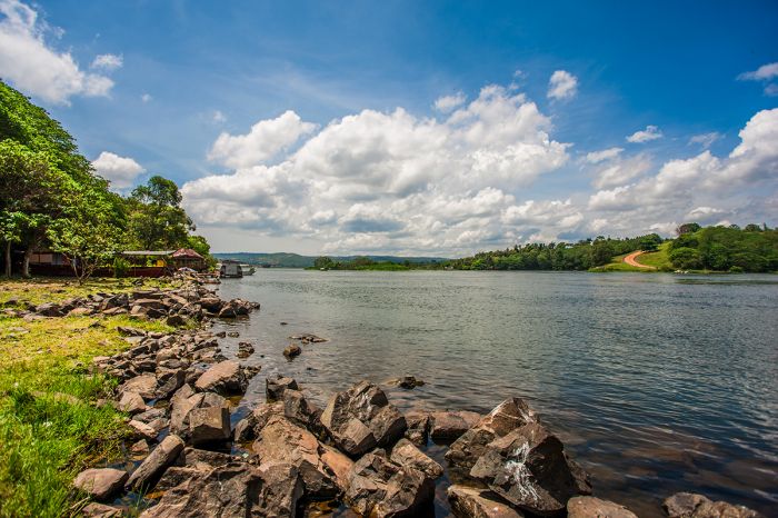
The Victoria Nile River as it leaves Lake Victoria at Jinja.
Flora
A defining feature of Uganda is that it receives substantial rainfall over much of its land. Uganda's healthy local rainfall, combined with its location straddling the equator, makes for a moist and tropical climate that supports year-round vegetation growth. In fact, Uganda is one of the greenest and most fertile countries in sub-Saharan Africa.
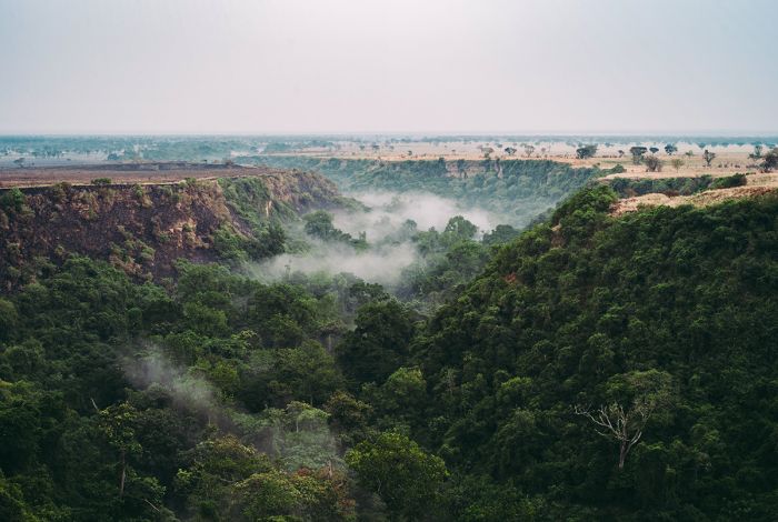
The southwest portion of the country is dominated by several mountain ranges, the lower elevations of which are covered closed-canopy forests and rich grasslands. This region has remnants of what was once an expansive lowland and montane forest that spanned from Lake Albert, all the way south into Rwanda and Burundi.
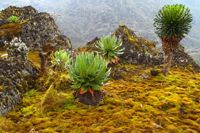
The incredible Afro-montane moorland vegetation of the Rwenzori Mountains.
Most of Uganda's forests were cleared for agriculture over a century ago, but the remaining pockets of forest are now protected and include Bwindi Impenetrable Forest and Semuliki, which is an extension of the lowland rainforests in the Congo Basin to the west.
The southern region, particularly around Lake Victoria, boasts extremely rich soils that originally supported forests and swamps. These forests have mostly been cleared for agriculture, specifically bananas.
Uganda boasts a number of protected forests, including Bwindi, which is home to half the world's mountain gorillas.
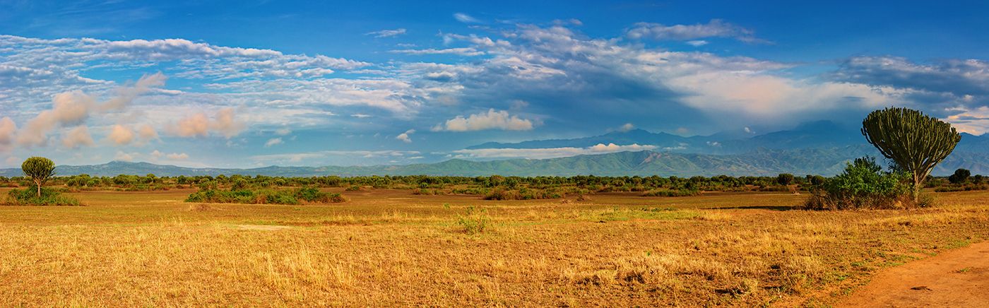
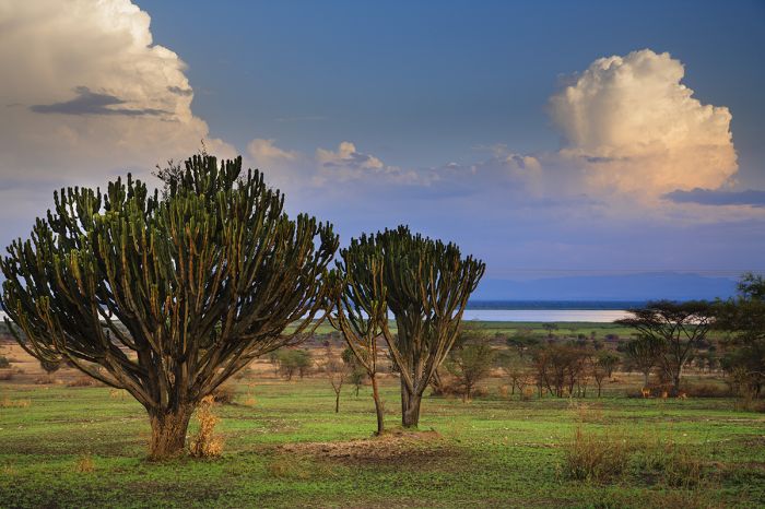
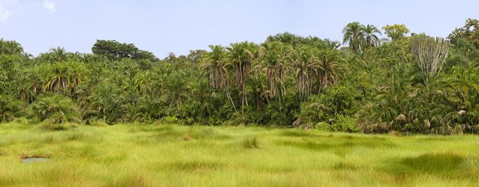
Central Uganda is dominated by savanna grasslands, interspersed with open woodlands that support acacia, candelabra, and euphorbia trees. There are large swamps around the fluctuating edges of Lakes Kyoga, Kwania, Bisina, and Opeta, supporting papyrus and rich floodplain grasslands.
Northern Uganda is the country's driest region, with semi-arid desert along the border with South Sudan.
A Rothchild's giraffe next to a candelabra tree in Kidepo National Park (Copyright © James Weis).
Wildlife
In the late 1960s, Uganda was visited by over 100 000 tourists per year, but this ended during the political instability during the tumultuous 1970s and 1980s (read more in the History section below). During this difficult period, Uganda's once wildlife-rich national parks were abused, with significant loss of wildlife and rampant encroachment into protected areas. The loss of its wildlife during these two decades put Uganda at a significant disadvantage in terms of wildlife tourism versus competing countries like Kenya and Tanzania.
Beginning in the 1990s, Uganda began re-focusing on conservation of its natural resources and today, although not at the levels of the 1960s in terms of wildlife numbers and diversity, the country's national parks and resident wildlife are again a major draw for international tourists.
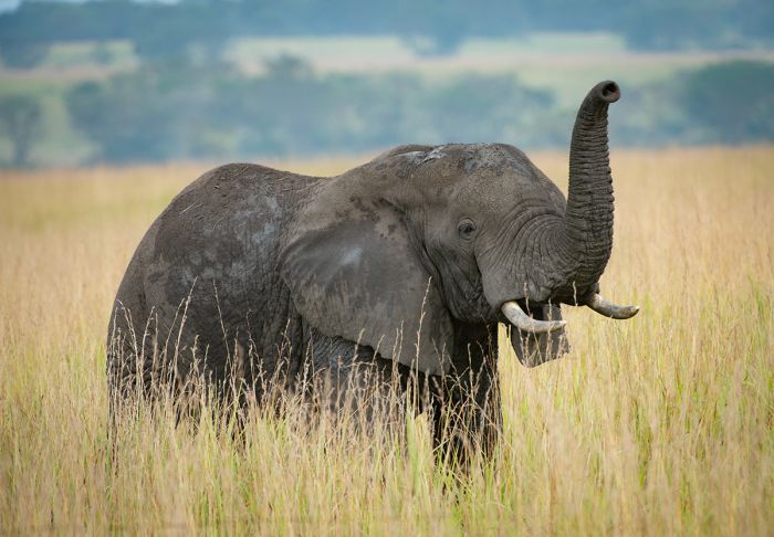
An elephant in the grassland savanna of Queen Elizabeth NP - Ishasha Sector (Copyright © James Weis).
The advent of mountain gorilla trekking in the late 1980s was a major driver in rebuilding Uganda's wildlife tourism, as roughly one-half of the world's population of these animals resides in Bwindi Impenetrable National Park. Uganda has recently developed its chimpanzee trekking industry (most notably in Kibale National Park) into arguably the best in Africa.
Uganda's wildlife is protected in 10 national parks, which cover a wide range of habitats and species. Four of Africa's Big Five animals (only rhinos excluded) can be seen in several of its parks, while the forested parks offer over a dozen species of primate. Lions are found rather easily in Murchison Falls, Queen Elizabeth, and Kidepo Valley. Cheetah are rare in Uganda and only seen regularly in Kidepo Valley.
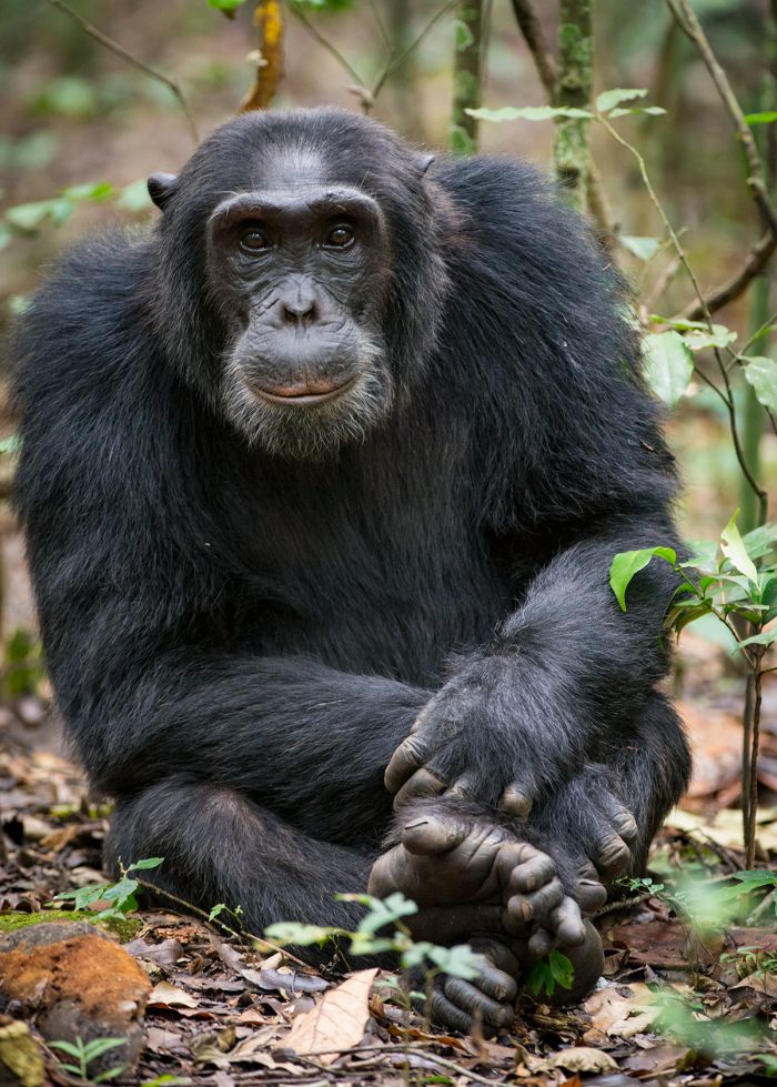
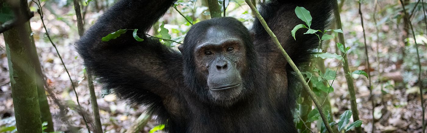
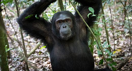
A chimpanzee in Kibale National Park (Copyright © James Weis).
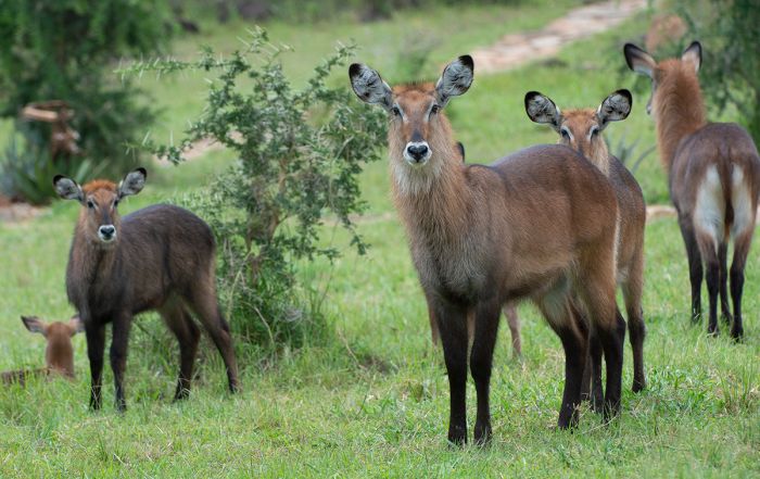
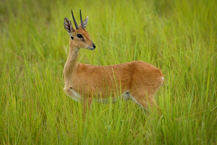
Roughly 30 species of antelope can be found in Uganda, which equates to around 30 percent of the total for Africa. Commonly seen species in Uganda's four savanna-based national parks include Eland, Defassa waterbuck, Ugandan kob, Jackson's hartebeest, bushbuck, and Bohor reedbuck. Burchell's Zebra, common throughout most of southern and East Africa, are notably absent from most of Uganda and can only be seen in Lake Mburo and Kidepo Valley.
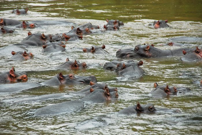
Elephant are found widely throughout Uganda's national parks (except for Lake Mburo), including the 'forest' race in parks such as Bwindi and Semuliki. Both species of rhino are locally extinct in Uganda. Hippos are very common, especially in Murchison Falls, Queen Elizabeth, and Lake Mburo.
Buffalo can be reliably seen in nearly all of the national parks, except sin forested areas, where they do exists but are harder to locate. Giraffe (the localized Rothschild's sub-species) were once common throughout in Uganda, but are now only found in Kidepo Valley and Murchison Falls.
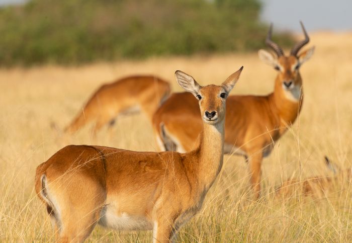
Ugandan kob are found in several of the country's protected areas (Copyright © James Weis).
Birding in Uganda can only be described as outstanding. Uganda is one of Africa's top destinations for birders, offering relatively easy access to avian species not easily seen elsewhere on the continent, as well as a huge number and diversity of species overall.
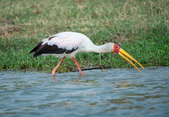
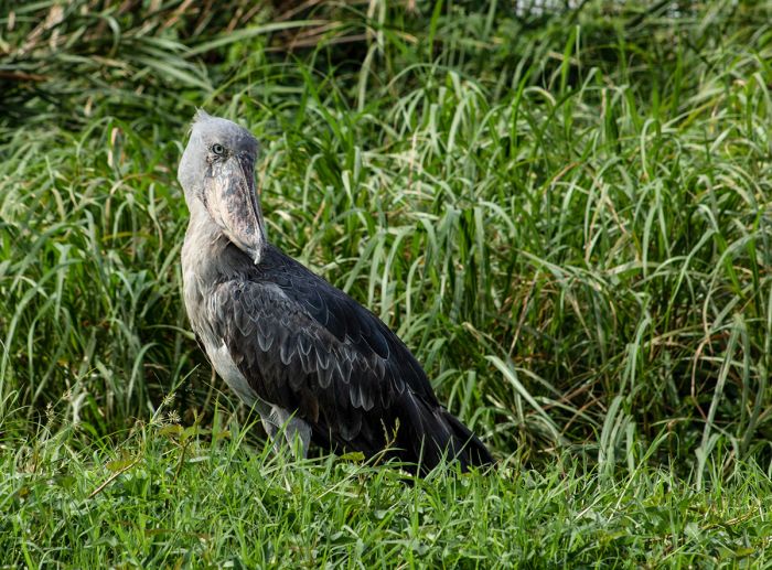
Over 1 000 avian species are on the Uganda list, an incredible number owing to the country's diversity of habitats, including savanna, rainforest, montane forest, wetlands, and highlands. While the country has only one endemic species (Fox's weaver), there are over 150 species found in Uganda that can not be seen anywhere else in East Africa. The highly sought-after shoebill stork is reliably seen in several wetland areas in Uganda.
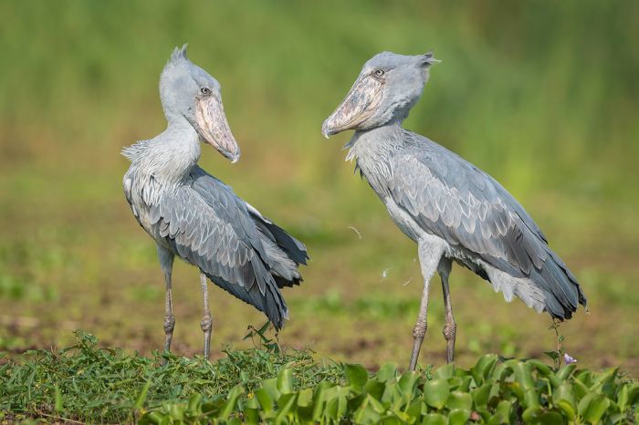
Uganda has several reliable sites for seeing the unusual looking shoebill stork.
Protected Areas
Uganda's rich diversity of ecosystems, which includes lakes, swamps, mountains, forests, and savanna, is protected by ten national parks and numerous other wildlife reserves and forest reserves.
Defassa waterbucks in Kidepo Valley National Park (Copyright © James Weis).
National Parks
Following are Uganda's ten national parks (with the type of ecosystem shown in parentheses). Additional information on each is included further below this list:
- Bwindi Impenetrable NP (Forest) - Uganda's top wildlife destination protects rich forest and 11 species of primate. Mountain gorilla treks are the main attraction. Outstanding for birds.
- Kibale NP (Forest) - Protects rich forest and is home to 13 species of primate. Chimpanzee trekking is the main attraction. Excellent birding.
- Kidepo Valley NP (Savanna) - Uganda's most remote wildlife destination, bordering South Sudan. Classic savanna ecosystem with big cats, elephants, buffalo, and a multitude of plains game. Tree-climbing lions. Authentic cultural visits to the Karamojong people.
- Lake Mburo NP (Savanna) - Small park positioned between Kampala and the western parks, with large wetlands habitat. Diverse antelope and great birding. No large predators nor elephants.
- Mgahinga Gorilla NP (Montane) - Small park in the Virunga Mountains bordering Rwanda and DRC. Home to mountain gorillas and other primates. Gorilla trekking, but Bwindi is more often chosen.
- Mount Elgon NP (Montane) - Protects the extinct volcano straddling the border with Kenya. Once Africa's tallest peak, now 4th highest. Great hiking and birding.
- Murchison Falls NP (Savanna) - Uganda's largest and oldest protected area. Four of the "Big Five", big herds, more than 450 bird species. The Famous "Murchison Falls" on the Victoria Nile River.
- Queen Elizabeth NP (Savanna) - Large and diverse ecosystem with multiple 'sectors' bordering Lakes Edward and George. High diversity of mammals and birds. Straddles the equator.
- Rwenzori Mountains NP (Montane) - World class hiking and multi-day mountain trekking in a spectacular setting. Margherita Peak (16 795 feet) is third highest in Africa. Excellent birding.
- Semuliki NP (Forest) - Lowland rainforest bordering DRC. Exceptional birding with several dozen species found nowhere else in Uganda. Cultural visits to Batwa pygmy people.
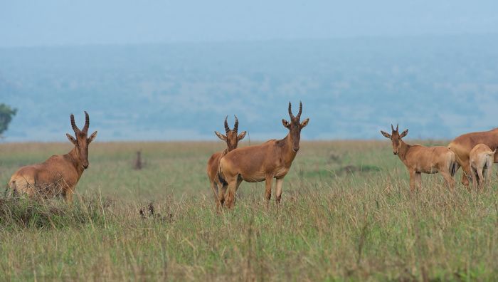
A herd of Jackson's hartebeest in Kidepo Valley NP (Copyright © James Weis).
Important Areas
Other areas of interest in Uganda include:
- Bugungu Wildlife Reserve (Savanna) - Adjoins Murchison Falls NP and offers good wildlife, including lion, elephant, buffalo and a good variety of antelopes and other plains game. Well-known for chimpanzees.
- Kyambura Wildlife Reserve (Savanna) - Bordering the Kazinga Channel, which is productive for diverse wildlife and birding. Similar wildlife to Queen Elizabeth NP, including lion, buffalo, elephant, and a variety of plains game. Habituated wild chimpanzees can be visited. Good birding.
- Lake Victoria - Africa's largest lake, shared by three countries (49% is in Uganda). Various islands and wildlife/birding areas along its shores.
- Semliki Wildlife Reserve (Savanna) - Grasslands with open acacia woodlands. Game drives will provide views of elephant, buffalo, and other plains game. Nature walks and boating (Lake Albert). Primate walks and excellent hiking. Cultural visits to local communities.
UNESCO World Heritage Sites
The United Nations Educational, Scientific and Cultural Organization (UNESCO) is a specialized agency of the United Nations whose mission is to promote world peace and security through international cooperation in education, the arts, the sciences, and culture. The Convention concerning the Protection of the World's Cultural and Natural Heritage was signed in November 1972 and ratified by the 189 UN member "states parties".
A World Heritage Site is a landmark or area which is geographically and historically identifiable and has special cultural or physical significance. To be selected as a World Heritage Site, a nominated site must meet specific criteria and be judged to contain "cultural or natural heritage of outstanding value to humanity". An inscribed site is categorized as cultural, natural, or mixed (cultural and natural). As of 2021, there were over 1 100 sites across 167 countries.
Uganda has three UNESCO World Heritage Sites:
- Bwindi Impenetrable National Park (since 1994, Natural) - Synonomous with the national park, which protects the home of the endangered mountain gorillas.
- Rwenzori Mountains National Park (since 1994, Natural) - Synonomous with the national park, which protects diverse flora and fauna, as well as glaciers, waterfalls, lakes, and pristine montane habitat.
- Tombs of Buganda Kings at Kasubi (since 2001, located in Kampala city, Cultural) - Site of former palace of the Kabakas (kings) of the Buganda Kingdom. The site is a culturally significant spiritual center for the local people.
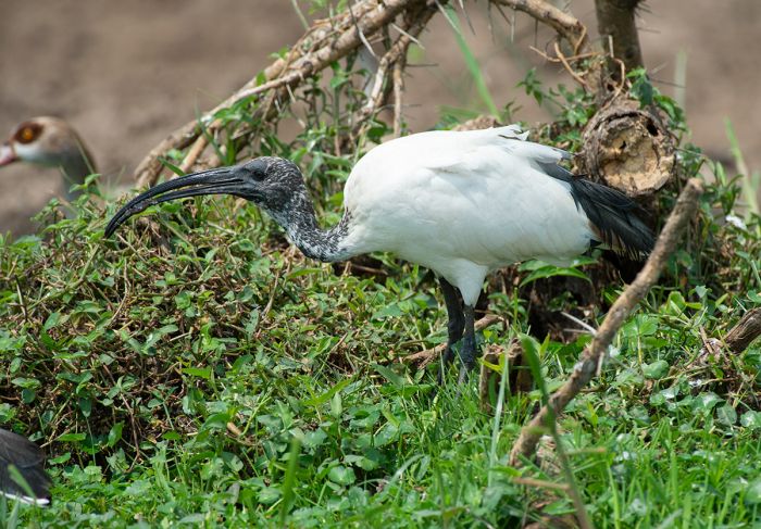
A sacred ibis along the banks of the Kazinga Channel, Kyambura Reserve (Copyright © James Weis).
Ramsar Wetlands of International Importance
The Ramsar Convention on Wetlands is an international treaty for the conservation and sustainable use of wetlands. It was the first of the modern global nature conservation conventions, negotiated during the 1960s by countries and non-governmental organizations concerned about the increasing loss and degradation of wetland habitat for birds and other wildlife. The convention is named after the city of Ramsar in Iran, where the convention was signed in 1971.
Presently there are some 75 member States to the Ramsar Convention throughout the world which have designated over 2 300 wetland sites onto the Ramsar List of Wetlands of International Importance.
Uganda has 12 sites designated as Wetlands of International Importance (Ramsar Sites) as follows.
- Lake Bisina Wetlands - Shallow freshwater lake with papyrus swamp forming part of the Lake Kyoga Basin. Crucial habitat for wading birds, including the shoebill stork, as well as numerous fish species that have become extinct in the large lakes of Kyoga and Victoria. The lake is important for surrounding communities for fishing, and water for domestic use and livestock. (209 sq miles/542 sq kms)
- Lake George - Network os rivers flowing from the Rwenzori Mountains supplies permanent swamps on Lake George. Crucial habitat for numerous large mammal species and important site for resident and migratory birds. Threats include mine water seepage, agricultural runoff, and effluent inputs. Partially protected by Queen Elizabeth National Park. (384 sq miles/150 sq kms)
- Lake Mburo-Nakivali Wetland System - Open and wooded savanna and combination of seasonal and permanent wetlands, including five lakes (Lake Mburo by far the largest). Habitats have a high biodiversity, including globally threatened resident and migratory species of bird, such as shoebill stork, several threatened fish species. Immense socio-economic value as a water source for people. Threats include hunting, over-fishing, habitat destruction. (104 sq miles/169 sq kms)
- Lake Nabugabo Wetlands - Situated directly north and contiguous with the Nabajuzi Wetlands. Lake Nabugabo and 3 smaller freshwater lakes separated from Lake Victoria by a sand bar 1.2 miles (2-kms) wide. No surface outflows from the lakes, just seepage via the sand bank. The lakes have been separated from L Victoria for ~3 700 years. Several endemic fish remain that are now extinct in L Victoria due to the introduction of the Nile perch. Lakes are important for migratory birds, some globally threatened, and are also habitat and breeding grounds for shoebill storks. (85 sq miles/220 sq kms)
- Lake Nakuwa Wetlands - Permanent wetland associated with Lake Kyoga system. Dominated by papyrus swamps, with a number of satellite lakes and pools of water containing floating papyrus. Habitat for sitatunga antelope, crocodile, and a large diversity of cichlid fishes no longer found in Lake Kyoga or Lake Victoria that were protected by thick aquatic vegetation around these lakes, which prevented the introduced Nile perch from spreading here. One of the most pristine wetlands remaining in Uganda. (352 sq miles/912 sq kms)
- Lake Opeta Wetlands - One of the most important intact wetland marshes in Uganda, with aquatic hippo grass to the east and dry grassland savanna to the south. Provides important habitat for numerous birds, including breeding ground for Uganda's sole endemic species, Fox's weaver. Also provides crucial refuge for numerous fishes that have gone extinct in the larger lakes, including Kyoga and Victoria. Provides wthe only dry-season water for animals in the Pian-Upe Reserve. (266 sq miles/689 sq kms)
- Lutembe Bay Wetlands - Located between Entebbe and Kampala at the mouth of Murchison Bay on Lake Vocyoria. Shallow swamp cut off from the main body of L Victoria by a papyrus island. Habitat for globally threatened birds, endangered cichlid fishes, and over 100 species of butterfly. Breeding grounds for lungfish. Threatened by the large population of people living in close proximity. (0.4 sq miles/1 sq km)
- Mabamba Bay Wetlands - Extensive marsh and long, narrow bay fringed with papyrus on Lake Victoria shore very close and southwest of Kampala. Shoebill storks are fairly easy to locate and habitat supports 190 000 birds, including several globally threatened species. Poaching, over-fishing, agrochemicals used for nearby flower farms, and over-utilization of papyrus are main threats. (9 sq miles/24 sq kms)
- Murchison Falls-Albert Delta Wetland - Site spans from top of the Murchison Falls to the delta of the Victoria Nile River as it enters Lake Albert. Important habitat for waterbirds, including the shoebill stork, pelicans, darters, various herons. Spawning and breeding grounds for indigenous fishes. Feeding and watering refuge for wildlife, especially in dry season. Threats include livestock grazing, illegal hunting, and over-fishing. Fishermen-crocodile conflicts are common. (67 sq miles/173 sq kms)
- Nabajuzi Wetlands - Long, narrow stretch of swamp along Lake Victoria shoreline due east of Masaka town and extending to Katonga and Nabajuzi Rivers. Crucial spooning grounds for mudfish, lungfish and supports globally threatened birds. Protects good numbers of sitatunga antelope. Pollution and over utilization of fish and water by surrounding towns are threats. (7 sq miles/18 sq kms)
- Rwenzori Mountains - High annual rainfall and snowmelt creates various wetlands in these "Mountains of the Moon", including peatlands, lakes, and tundra. Habitats are crucial for protecting 21 species of small mammal, numerous species of indigenous fish and bird. Protected as a national park and is also a World Heritage Site. (58 sq miles/995 sq kms)
- Sango Bay-Musambwa Island-Kagera River Wetland - Mosaic of wetlands, including swamp forest, papyrus swamp, herbaceous swamp, with palms and seasonally flooded grasslands, rocky and forested shorelines, and three rocky islets just offshore in Lake Victoria. Rich biodiversity. Habitat for huge numbers of waterbirds, as well as elephants and primates. (213 sq miles/551 sq kms)
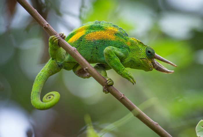
A Jackson's three-horned chameleon in Bwindi Impenetrable NP (Copyright © James Weis).
Urban Areas
Uganda has only two substantial urban areas, both of which are located along Lake Victoria. See details below.
- Entebbe - The smaller of two notable cities in Uganda, both of which are located on the shores of Lake Victoria in close proximity to one another.
- Kampala - Uganda's capital and by far its largest city, though most international visitors fly into Entebbe, where the main airport is located.
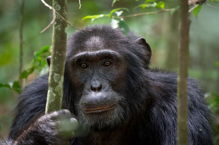
Bwindi Impenetrable National Park
The Bwindi Forest covers 124 square miles (321 sq kms) and is one of the world's most biodiverse ecosystems, protecting more than 1 000 flowering plant species, more than 200 species of tree, and over 100 species of fern. Bwindi dates back 25 000 years, making it one of the oldest forests on earth.
Bwindi is Uganda's top wildlife destination for one reason: the mountain gorillas that live in its rich, Afro-montane rainforest. Gorilla trekking has become very popular in both Uganda and neighboring Rwanda. These treks involve hiking with expert guides to visit one of the "habituated" gorilla families in the forest. Participants are able to spend time on the ground with wild gorillas, often only 10 feet from these incredible animals. The experience is unlike anything else offered in Africa or the world.
Bwindi offers incredible mountain gorillas trekking (Copyright © James Weis).
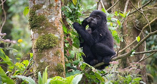
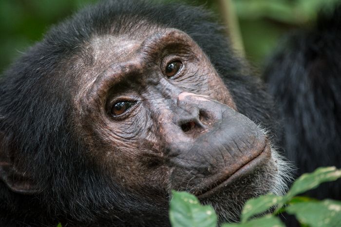
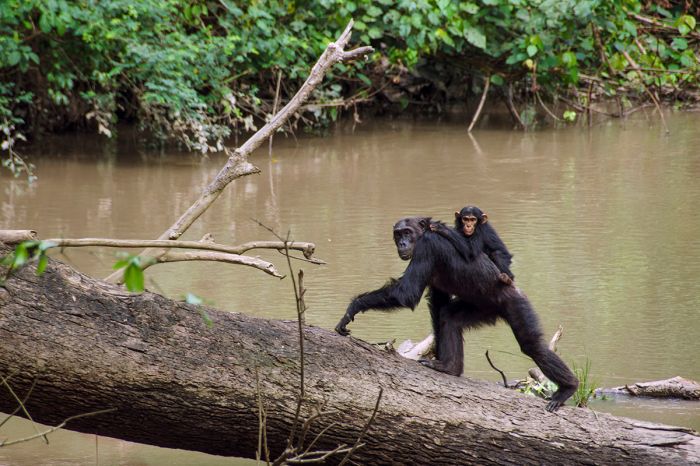
Besides the main attraction of mountain gorilla trekking, Bwindi is also home to 10 additional species of primate, including a healthy population of some 400 chimpanzees.
Bwindi also offers spectacular birding, especially with a local guide. There are around 350 species to be found in Bwindi, including two dozen range-restricted species. Nature hikes in the forest will also provide a good chance of seeing chimpanzees, monkeys, and some of Bwindi's 200+ species of butterfly.
Read full details on the gorillas, gorilla trekking, and Bwindi Impenetrable National Park here.
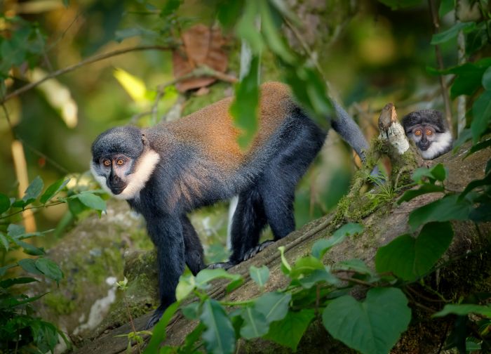
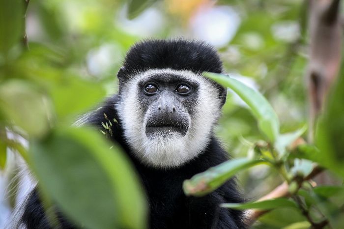
L'Hoest's monkeys are one of 11 species of primate found in Bwindi.
Kibale National Park
Kibale offers Uganda's "other" great primate experience: chimpanzee trekking. Some 1 500 chimpanzees are protected in the Kibale Forest and guided treks, sometimes with researchers, but always with expert guides, allow visitors to see our closest extant species (chimps are 98% genetically identical to Homo sapiens) in their natural habitat.
The Kibale Chimpanzee Project, established in 1987, is an ongoing, long-term study of the behavior, physiology, and ecology of Kibble's chimpanzees. The revenue earned from chimpanzee trekking supports the research project and helps protect the forest habitat. The chimps in Kibale are well-habituated due to the long-term presence of the researchers and now tourists. The chimps are mainly very relaxed and, when on the ground, provide incredible up-close observation.
The chimpanzee trekking experience in Kibale is outstanding (Copyright © James Weis).
While gorilla trekking (in Bwindi or in Rwanda) is certainly described as incomparable, the full-day chimpanzee experience in Kibale rivals or even exceeds that of gorilla trekking. A gorilla trek can take the better part of a day, but the actual interaction time with the gorillas is limited to one hour, while the full-day chimp trek (called "chimp habituation experience") involves following and observing chimpanzees for the better part of the daylight hours.
Besides chimpanzees, Kibale is home to 60 mammal species, including twelve additional species of primate. Primates that are regularly seen in on a hike or chimpanzee trek in Kibale include red-tailed monkey, black-and-white colobus monkey, red colobus monkey, L'Hoest's monkey, blue monkey, grey-cheeked mangabey, and olive baboon. Bush baby and potto are nocturnal primates, so are infrequently seen except on a guided night walk, which almost assuredly will provide views.
A chimpanzee in Kibale National Park (Copyright © James Weis).
Other mammals in Kibale include elephant (forest race, seldom seen), lion and leopard (both are rarely seen), buffalo, bush pig, hippo, warthog, red, blue, and Peter's duiker. Butterflies are abundant and incredibly diverse, with over 250 species recorded. Birding in Kibale is sensational, with over 375 species possible, including many regional endemics.
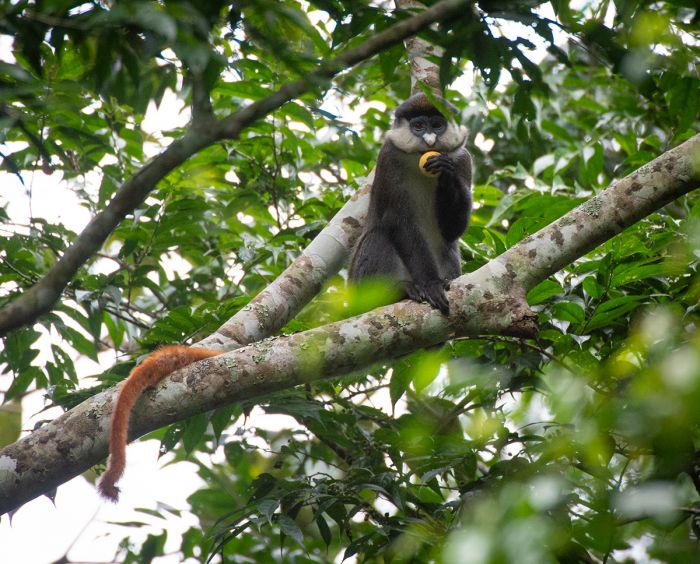
A red-tailed monkey in Kibale National Park (Copyright © James Weis).
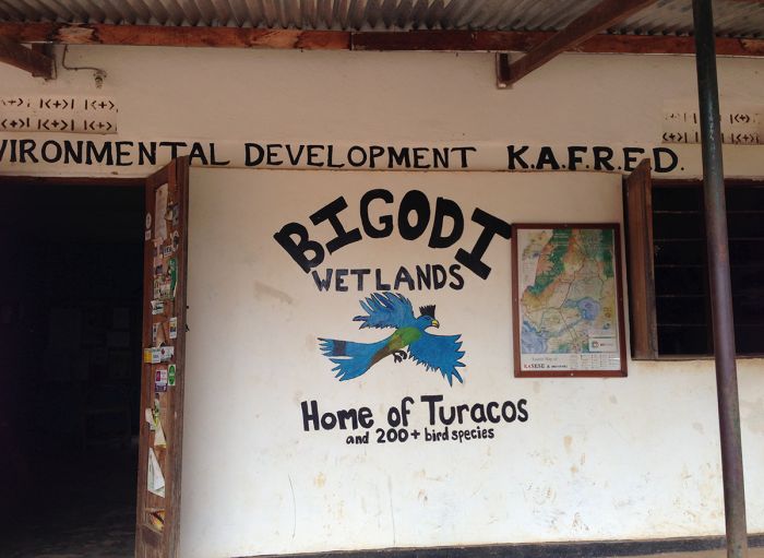
Bigodi Wetland
A must-do for birding enthusiasts or keen nature lovers is a guided walk at the nearby Bigodi Wetland Sanctuary, which protects the Magombe Swamp. The four-hour trail is laid out to cover a good portion of this rich swamp habitat and the expert guides will gladly point out a large variety of birds (30-40 species easily), many of which will be "specials" at the eastern limit of their range.
In addition to birds, Bigodi will almost surely provide views of several monkey species, the most likely being red-tailed, L'Hoest's, black-and-white colobus, and grey-cheeked mangabey. There are myriad butterflies, flowers, and fish that the guides can point out. If you're lucky, you may see a sitatunga antelope or one of the mongoose species that live here. Fees charged for the trail are used for community projects in Bigodi.
The Bigodi Wetland Sanctuary offers guided nature walks (Copyright © James Weis).
Weather and When to Go
Kibale experiences a moist tropical climate all year, with stable temperatures averaging 78-83°F (26-28°C) during the day and dropping to 57-61°F (14-16°C) at night. There is no actual dry season, with rain possible throughout the year, but Jan/Feb and Jun/Jul are the driest months. Waterproof clothing is recommended for chimp trekking regardless of the time of year.
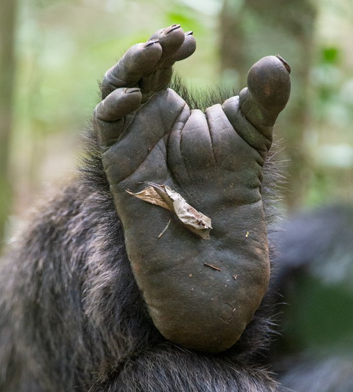
Close-up of a chimpanzee foot, Kibale NP (Copyright © James Weis).
How to Get There
Kibale is best reached via flight (scheduled or charter) from Kampala/Entebbe to Fort Portal. The flight duration is around 1.5 hours, with a short 40 minute drive to the park. The trip from Kampala/Entebbe to Kibale by road will take 4.5 hours.
Overall, the experience at Kibale, including a visit to Bigodi, is something that should not be missed. Combining a few days in Bwindi with a few days at Kibale will give a forest exploration experience that is arguably unmatched in Africa.
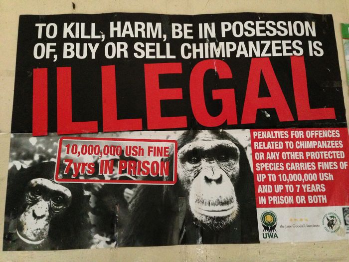
A warning sign posted in Kibale NP (Copyright © James Weis).
Kidepo Valley National Park
Uganda's most remote national park is the 552-square-mile (1 430-sq-km) Kidepo Valley, located in the far northeast corner of the country, on the border with South Sudan and a stone's throw from the Kenya border. This is the Karamoja region and home to the Karamojong people, whose villages offer an authentic cultural experience for visitors to the park.
Kidepo's remote location means it is much less visited than the parks on Uganda's western side, but for those that take the time, it offers one of the best wilderness experiences anywhere in Africa. The park offers excellent wildlife viewing, with an astounding diversity of species, plus raw mountain scenery, and outstanding birding.
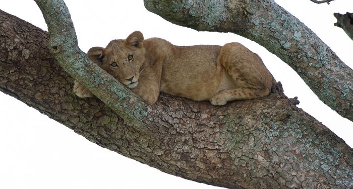
Kidepo Valley has some "tree climbing" lions (Copyright © James Weis).
The park's rugged terrain includes several substantial peaks, including Mount Morungole, which rises 9 022 feet (2 750 meters). Two river valleys define the park's main game-viewing regions, with the Narus River Valley in the southwest and the Kidepo River Valley in the northeast. Both rivers are seasonal and stop flowing during the dry months, but leave behind crucial pools that sustain the wildlife.
Kidepo's predominant habitat is open grassland savanna, interspersed with sparse woodlands, thick stands of miombo woodland, and rocky outcrops. The river valleys support riparian woodland and towering borassus palms. The higher elevations support montane forests.
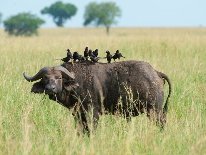
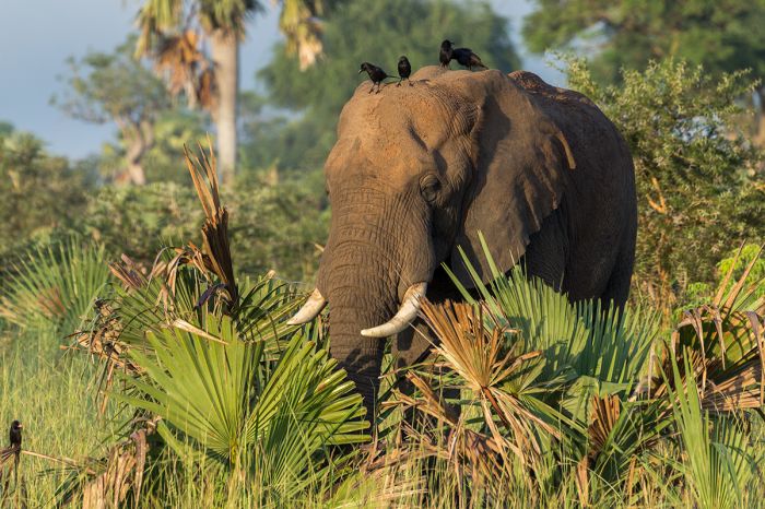
A buffalo is attended by a small flock of piapiac birds (Copyright © James Weis).
There are 77 species of mammal in Kidepo, including twenty species of predator. Lions are fairly easy to locate and this is the only place in Uganda where cheetah are found. Other predators found nowhere else in Uganda include black-backed jackal, caracal, bat-eared fox, and aardwolf. Both spotted and striped hyena are here, as well as leopard, side-striped jackal, genets, several species of mongoose and sometimes African wild dogs are seen.
Antelopes are well represented and several, including both greater and lesser kudu, mountain reedbuck, and Guenther's did-dik are found nowhere else in Uganda. Other antelopes found in Kidepo include eland, bushbuck, Defassa waterbuck, Grant's gazelle, Jackson's hartebeest, klipspringer, oribi, common duiker, and bohor reedbuck.
The regionally endemic Rothchild's giraffe are found in Kidepo Valley (Copyright © James Weis).
Elephants are common, especially during the rainy season when Kidepo's grasses are a favorite food for them. Large numbers of buffalo can also be seen, with groups of bachelor bulls spending time away from breeding herds that can number several hundred.
Other plains game includes zebra, Ugandan kob, warthog, and a small population of Rothschild's giraffe. There are several primate species found in Kidepo, including the localized patas monkey. Both black and white rhinos once roamed Kidepo, as did roan antelope, but these are now extinct due to hunting years ago.
Kidepo's bird checklist is outstanding, which, at around 450 species, is only rivaled in Uganda by Queen Elizabeth National Park. Many of Kidepo's "specials" are dry-land species that are not found in any other region in the country.
View over grassland savanna in Kidepo Valley National Park (Copyright © James Weis).
Weather and When to Go
Kidepo is located in a semi-arid region and experiences only one wet season, which spans from April thru August, when afternoon showers are common. The dry season is from September thru March and during the months of December, January, and February, there is virtually no rain. The dry season is an excellent time to visit, as most of the wildlife congregates in the Narus River Valley for water, as the Kidepo River becomes dry.
Temperatures are warm all year, averaging 80-86°F (27-30°C) during the day and dropping down to 60-65°F (16-18°C) at night. Daytime temps can reach as high as 105°F (41°C) during the dry months of January and February.
A cultural visit to a Karamojong village near Kidepo Valley NP (Copyright © James Weis).
How to Get There
Visiting Kidepo Valley is best done on a chartered flight from Kampala. The flight takes 2-2.5 hours. Driving is possible but not recommended, as the roads are not great and the trip will take between 7-10 hours. It is possible to fly from Kidepo to Murchison Falls if one is doing a circuit of Uganda (a great experience and highly recommended).
Kidepo Valley is one of the few places in East Africa to see the patas monkey (Copyright © James Weis).
Queen Elizabeth National Park
Queen Elizabeth National Park (QENP) is Uganda's most popular savanna-ecosystem safari destination. The park covers 764 square miles (1 978 sq kms) with a number of natural and man-made barriers dividing QENP into various "sectors".
Originally protected as two separate game reserves (Lake George and Lake Edward Game Reserves declared by the Belgian Colonial Administration) in the 1920s, it became a single protected area dubbed Kazinga National Park in 1952.
An elephant along the bank of the Kazinga Channel, Queen Elizabeth NP (Copyright © James Weis).
The park was renamed in 1954 to commemorate a visit by the British Queen. QENP was then briefly renamed as Rwenzori National Park (during the Idi Amin regime), which is confusing, as in 1991, the upper slopes of these nearby mountains were also declared as Rwenzori National Park!
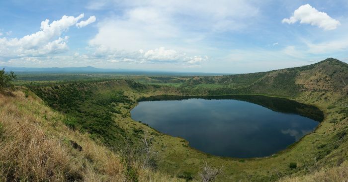
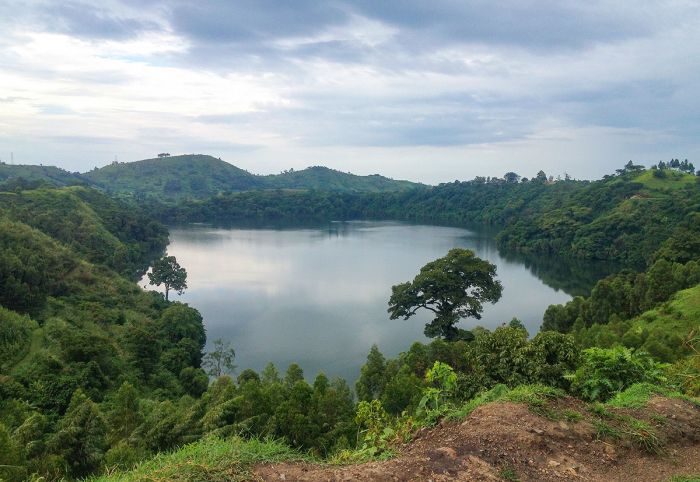
QENP is primarily dominated by an open grassland, savanna habitat, but is incredibly diverse, with lake front, extensive wetlands, dense acacia woodlands, and vast tracts of forest. There are over ten crater lakes in QENP (some 35 in the region, as well as numerous dry calderas), caused by volcanic activity in the region several hundred thousand years ago.
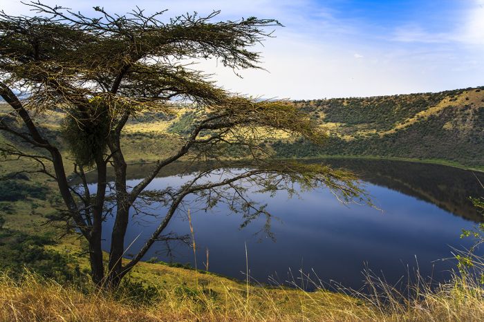
One of many crater lakes in Queen Elizabeth National Park.
QENP Wildlife
Owing to its extremely high level of habitat diversity, QENP is home to some 95 mammal species, the most for any park in the country. Predators are well represented, with more than twenty species, including lion, leopard, spotted hyena, and side-striped jackal. Some of QENP's lions (in the Ishasha Sector) are "tree-climbing" and spend their time during midday relaxing on the limbs of sycamore figs and albezia trees.
Antelopes are also here in abundance, with the most common species being Ugandan kob, topi, Defassa waterbuck, and bushbuck. The sitatunga, an aquatic species can sometimes be found in the papyrus swamps around Lake George. Other herbivores include buffalo, which can be found in healthy herds throughout much of the park. Several species of duiker are found in the Maramagambo Forest in the south. Elephants are commonly seen throughout the park.
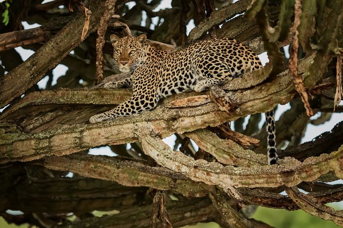
A leopard in repose in a large candelabra tree in Queen Elizabeth National Park.
Wildlife in the park suffered greatly during the Amin presidency. Elephants were especially hard hit, with ivory poaching reducing their numbers in QENP from some 4 000 in the late 1950s, to only 100 or so individuals by 1980. Buffalo numbers were reduced by 50% from around 20 000 during the same period. Wildlife has since recovered, with elephants now numbering around 2 500, buffalos numbering over 10 000, and hippos at around 5 000. There are an estimated 200+ lions in the park.
There are ten species of primate in QENP, including chimpanzee, red-tailed monkey, L'Hoest's monkey, vervet monkey, blue monkey, olive baboon, and black-and-white colobus.
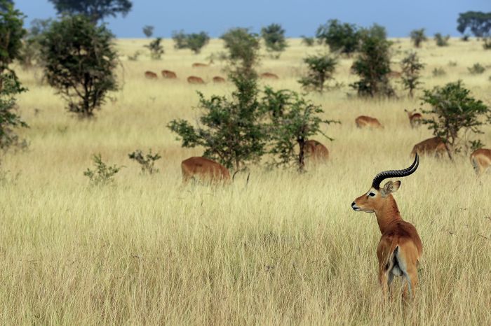
Ugandan kob in the grasslands of QENP's Ishasha Sector.
Notably absent from QENP are several iconic species, including giraffe and zebra, both of which were poached to extinction during Uganda's long and tumultuous civil war years. Also missing are rhinos, which were also poached out. The lack of rhinos is the main reason that many areas in the park are dominated by candelabra trees (Euphorbia candelabrum), which are inedible to most animals, but are a favorite of black rhinos.
Interestingly, one species that was, until quite recently, notably missing from QENP, is the nile crocodile. The crocodiles' absence during the colonial times, as well as any archeological evidence of their existence in the area seemed unexplainable, especially since the region had near-perfect habitats for the crocs.

A nile crocodile in Queen Elizabeth National Park.
It was later determined that during the most recent period of heavy volcanic activity around Lakes George and Edward (some 7 000 years ago), the entire region was decimated in terms of animal and plant life. Most species were subsequently able to recolonize the region, but crocodiles faced impassable barriers, including large tracts of forest, as well as rapids and gorges along the waterways leading to the lakes.
In the 1980s, widespread destruction of riparian forests along the Semliki River allowed crocodiles to migrate along the cleared banks of that river and the first appearance of crocodiles in Lake Edward was in the late 1980s. Today, nile crocodiles are common in both Lake Edward and Lake George, as well as in the Kazinga Channel that connects the two lakes.
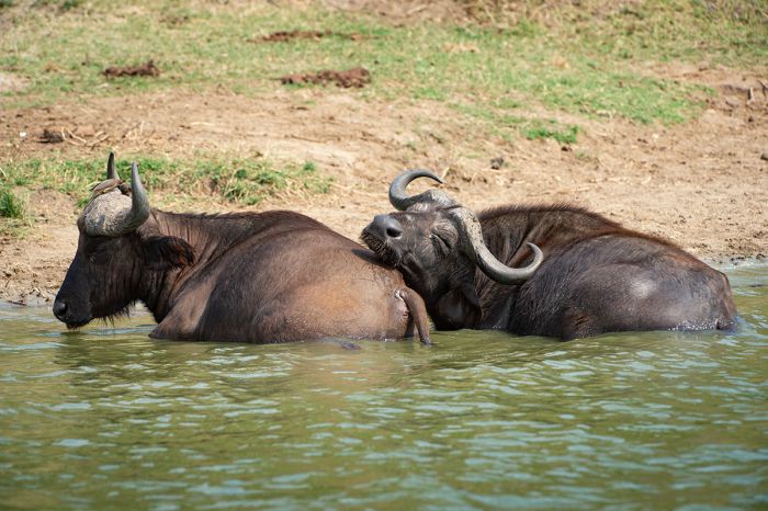
Buffalos cooling off in the Kazinga Channel, Queen Elizabeth NP (Copyright © James Weis).
As would be expected in a national park with a diversity of habitats, QENP is spectacular for birding. Over 600 species have been recorded, which it the most for any protected area in Uganda. QENP's large number of birds is a reflection of its varied habitats that include lakes, wetlands, rivers, forest tracts, and grasslands.
A boat trip on the Kazinga Channel is a particularly great way to get good views of waterbirds, while the Maramagambo Forest will yield excellent results for rarer species and 'specials'.
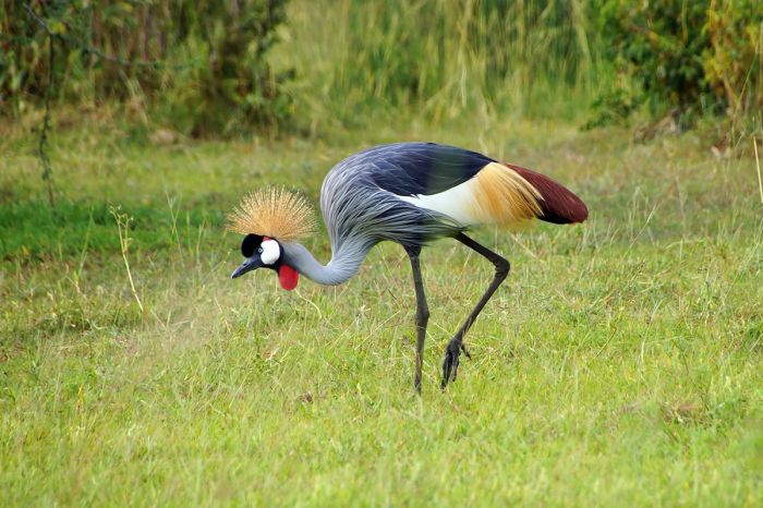
Queen Elizabeth NP offers excellent birding; here a gray crowned-crane.
QENP Sectors
Queen Elizabeth NP is partitioned into several sectors by a series of natural dividers. The Kazinga Channel is the most obvious barrier, effectively dividing the park into a northern and southern sections. The two main parts of the park are linked only by a bridge over the channel along the road connecting Kasese and Mbarara.
Within the two main park sections (north and south) are several more focused 'sectors', each of which is discussed below with regards to habitat, wildlife and activities.
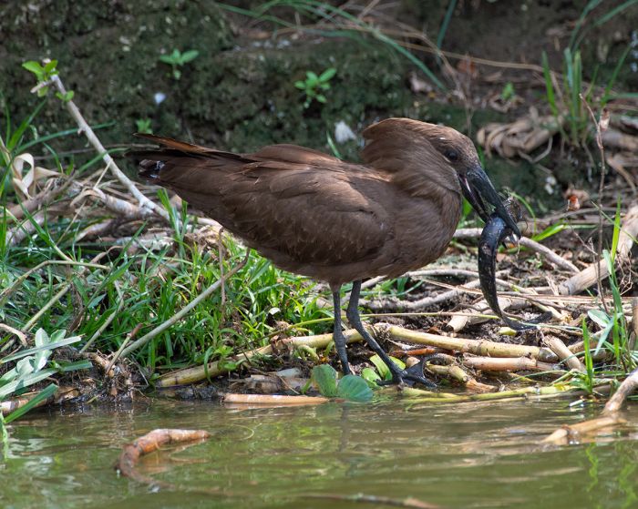
A hamerkop with its catch (a barbel) on the bank of the Kazinga Channel (Copyright © James Weis).
Ishasha Sector
The Ishasha Sector is located in the far southwest of QENP, and although commonly overlooked and the least visited, its plains are some of the most beautiful in the country and they offer good wildlife viewing. There are two excellent game-drive circuits, one to the north of Ishasha Camp and the other heading south, and each covering around 12 miles (20 kms). The southern loop passes thru productive plains use by big herds of kob (which means good chances to see lions), while the northern loop is generally more productive overall, with floodplains and wetlands.
Ishasha is perhaps best known for its 'tree-climbing' lions. Lions do not typically spend any time in trees, except perhaps in an effort to steal a leopard's food, and tree-climbing lions are only found in a few places in Africa (Lake Manyara is another such location). The reason that some lion prides habitually spend time relaxing in trees is a topic of speculation, with theories including evasion of biting insects or to stay cool, but one thing seems clear: it is a learned behavior that is passed down and prides exhibiting this behavior continue to do so over time.
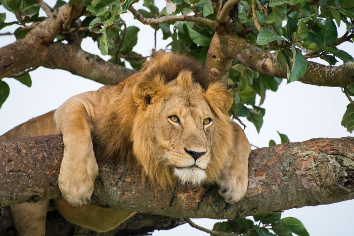
The Ishasha Sector is best known for its "tree-climbing" lions.
The banks of the Ishasha River, which feeds into Lake Edward, provide good wildlife viewing and the river supports a healthy hippo population. The riparian forests along the river are also home to good numbers of bushbuck and black-and-white colobus monkey, as well as diverse birds. East from the river are the Ishasha Plains, which are popular with large herds of Ugandan kob, buffalo, waterbuck, and topi. Elephants are also common, especially during and after the rains.
The Kigezi Game Reserve borders the Ishasha Sector to the east, forming a buffer for wildlife between QENP and the heavily populated public lands further east.
Verdant plains and candelabra trees along Lake Edward, Queen Elizabeth NP.
Maramagambo / Kyambura Sector
The southeast section of QENP is dominated by the incredible rich and biodiverse Maramagambo Forest. Guided walks in the forest are the best way to experience the birds and animals, but trails can be walked without a guide. There are plenty of primates, including chimpanzees, L'Hoest's monkey, black-and-white colobus, vervet monkey, and red-tailed monkey.
Other forest mammals include yellow-backed duiker, Bates' pygmy antelope, and giant forest hog. The forest birding is incredible and only exceeded in terms of elusive Central African species by the Semuliki Forest. A birding guide is highly recommended for identifying the myriad shy and elusive forest species in Maramagambo.
The Kyambura River Gorge.
North of Maramagambo Forest is the Kyambura Gorge, which is carved out by the Kyambura River and forms the border between QENP and the Kyambura Reserve to the east. The gorge is home to a habituated community of chimpanzees and guided chimpanzee treks (permits required) in the forested river gorge are the major tourist draw for this sector of the park.
East of the gorge is the Kyambura Reserve, which is primarily a savanna ecosystem, but not especially notable for its wildlife. There are several crater lakes in the reserve that provide good birding, especially for waterbirds and often flamingos.
Chimpanzees in the Kyambura River Gorge.
Mweya / Northern Sector
North of the Kazinga Channel, which connects Lakes Edward and George, is QENP's Northern Sector. This region of the park can be further divided into two popular sub-sectors: the Mweya Peninsula and the Kasenyi Plains. Mweya was once the site of the QENP headquarters (which has now moved) and the Northern game drive circuit between Mweya and the Kasenyi Plains is still the most visited tourist area of the park.
The Mweya Peninsula is a small, wedge-shaped bit of hilly land jutting out into northeast Lake Edward from the northern side of the mouth of the Kazinga Channel. The views from the peninsula are spectacular across the channel and lake and to the north, the Rwenzori Mountains. The network of game-viewing tracks leading from Mweya along the northern banks of the Kazinga Channel will provide abundant game and good birding.
Crater lake Kitagata in Queen Elizabeth's Mweya Sector.
Mweya's location at the confluence of the Kazinga Channel and Lake Edward is very popular with wildlife, and species such as elephant, buffalo, Defassa waterbuck, and warthog are a near certainty. Hippos are also common at Mweya. Lion and spotted hyena sightings are a good possibility at Mweya and along the game drive roads north of the channel and west of the main Kasese road.
East of the Kasese Road, which bisects the Northern Sector, is the most popular game drive area in QENP: The Kasenyi Plains. These plains stretch from the road all the way to Lake George, and are home to large concentrations of plains game. Large herds of Ugandan kob use this grassland savanna as their breeding grounds, with thousands congregating here at times. Buffalo are also fond of this area for its rich grazing.
Elephants in the Kazinga Channel, Queen Elizabeth NP.
Reaching the Kensenyi Plains takes about an hour from the Mweya Peninsula, and exploration as early as possible in there morning will provide the best chance of seeing Kasenyi's lions, which do well here with all the prey species. Spotted hyenas are also resident in good numbers. Birding in Kasenyi is also very good, with numerous grassland species.
North of Lake George is an extensive wetland that is almost totally inaccessible to tourists. The main attraction in the swamp is the incredible shoebill stork, which thrives in this remote area. Sitatunga antelope, an aquatic species, are also found north of the lake and waterbirds are prolific. It may be possible to reach the southern end of this swamp in a good 4x4 vehicle, depending on the time of year and how much water exists.
A yellow-billed stork seen on a boat cruise on the Kazinga Channel (Copyright © James Weis).
Weather and When to Go
QENP is a year-round destination, but rainfall can occur at any time throughout the year. The months with the least chance of rainfall are June/July and January/February. The heaviest rains occur from March thru May and again mid-August thru November. The climate in QENP is tropical all year, with static temperatures year round, averaging 82-88°F (28-30°C) during the day and 60-68°F (16-20°C) at night.
Wildlife viewing in QENP is best, especially around the rivers and lakes, during the dry periods, but the park is most scenic during the rainier months. Chimpanzee trekking and forest hiking are also much better when the trails are dry versus after heavy rains.
Hippos in the Ishasha River, Queen Elizabeth National Park.
How to Get There
QENP is reachable by either road or air. Those on a circuit of Uganda's wildlife regions often arrive from the north, after visiting Murchison Falls National Park and head to Bwindi after visiting QENP. Driving to QENP from Kampala takes a minimum of six hours, while a flight from Kampala takes 1-2 hours depending on the aircraft.
The Kazinga Channel is great for seeing a diversity of wildlife, including birds (Copyright © James Weis).
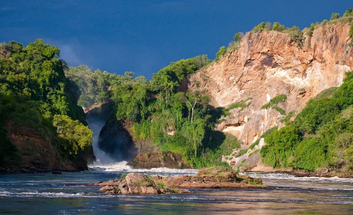
Murchison Falls National Park
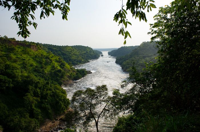
Covering an area of 1 505 square miles (3 898 sq kms), Murchison Falls National Park (MFNP) is Uganda's largest protected area. The park straddles the Victoria Nile River as it approaches Lake Albert just to the west. The famous waterfall, which gives the park its name, is the main attraction for most tourists, but the park also offers excellent game viewing, as well as boating on the river.
Bordering MFNP on the south and east are three buffer reserves: Bugungu Wildlife Reserve (183 sq miles/474 sq kms), Karuma Wildlife Reserve (262 sq miles/678 sq kms), and the Budongo Forest (318 sq miles/825 sq kms). Together with the national park, this Greater Murchison Falls Conservation Area protects a significant area with diverse habitats and wildlife.
The famous Murchison Falls which gives the national park its name (Copyright © James Weis).
History of MFNP
The first foreigners to visit the MFNP region were John Speke and James Grant, who arrived in 1862. The famous explorers Samuel and Florence Baker arrived in 1863 on their expedition to discover the source of the Nile River. The Bakers became the first Europeans to see the narrow waterfall plunging thru a gorge on the Victoria Nile, which they named the Murchison Falls after the then-president of the Royal Geographical Society, Sir Roderick Murchison.
During the period between 1907 and 1910, the local human population of a huge area (some 5 000 sq miles/13 000 sq kms) that includes present-day MFNP were evacuated due to an outbreak of "sleeping sickness" (African trypanosomiasis), which is caused by the tsetse fly. In 1910, the land south of the Nile River was declared as the Bunyoro Game Reserve and in 1928, the boundaries were extended to include the land north of the river.
In 1952, the British Colonial Administration established the National Parks Act of Uganda and the Bunyoro Game Reserve was renamed as Murchison Falls National Park. During the Idi Amin regime in the 1970s, MFNP was renamed as Kabalega Falls, after the former Omukama (King) of the Bunyoro Kingdom, but this name fell into disuse after the ousting of President Amin in 1979.
View upriver to the Murchison Falls.
The Waterfall and Nile River
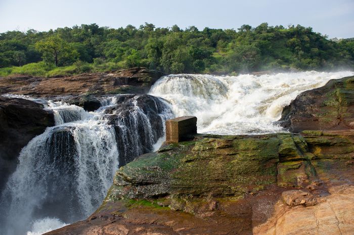
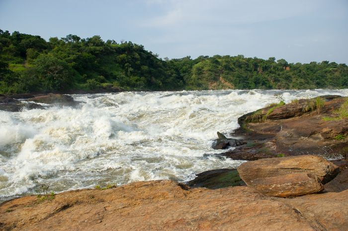
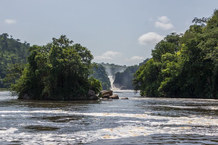
The Murchison Falls are an impressive sight to see, as the water of the 165-foot-wide (50-meter-wide) Victoria Nile River is forced through a narrow gap in the rocks spanning a width of only 23 feet (7 meters) and then falling 141 feet (43 meters) to the continuing river below. The rush of the huge volume of water crashing thru such a narrow gorge causes a deafening roar and copious rising spray.
The waterfall was famously featured in the 1951 British-American adventure film The African Queen, which starred Katharine Hepburn and Humphrey Bogart. The falls were even more powerful in those days, but in 1962, massive flooding cut a second channel into the river above the falls, creating the smaller Uhuru Falls that is situated 650 feet (200 meters) to the north.
The Victoria Nile River as it enters the Murchison Falls (Copyright © James Weis).
MFNP is divided into a northern and southern sector by the east-to-west flowing Victoria Nile River. The northern section is defined by tall-grass savanna with sparse acacia scrubland, isolated patches of borassus palms, and riparian woodland. The southern section is dominated by more consistent woodlands that become denser as one moves further south from the river, eventually becoming closed-canopy forest.
The Victoria Nile River just below the Murchison Falls (Copyright © James Weis).
Wildlife in MFNP
In the 1960s, MFNP was one of Africa's most popular wildlife destinations, with huge numbers of animals and several outstanding tourist lodges. Elephants in particular were abundant, with herds of several hundred not uncommon and a total population of some 12 000 in the park. In the late 1960s, a park census revealed 10 000 Ugandan kob, 30 000 buffalo, 12 000 hippo, 16 000 Jackson's hartebeest, 11 000 warthog, and healthy populations of Rothschild's giraffe and both black and white rhino species.
Shortly after the 1971 coup that gave Idi Amin complete power in Uganda, foreign visitors were banned from the country, and soon afterward, conservation efforts in Uganda's national parks essentially halted. This lack of protection subjected Uganda's wildlife to heavy poaching, which decimated wild animal populations in its national parks, including those in MFNP.
An elephant with piapiac birds in Murchison Falls National Park.
By the end of Amin's regime in 1979, the situation in MFNP was critical, with elephant numbers reduced to an estimated 1 500 and hippos to 1 000. Buffalo and other large herbivores were reduced by 50% or more, and rhinos were nearly reduced to extinction. During the ensuing turbulence in the early 1980s, wildlife persecution continued unabated, and by 1984, wildlife in MFNP was almost gone, with estimated populations as follows: elephant 250, buffalo 900, kob 6 000, lion extinct, giraffe nearly extinct, rhino extinct.
After the ousting of the Obote regime in 1985, rule of law was restored in Uganda and national park protection was again enforced. The country re-opened for eco-tourism and wildlife numbers slowly began to recover.
Rothschild's giraffes and the Victoria Nile River in Murchison Falls NP.
A 2010 census of wildlife numbers in MFNP (including Bugungu and Karuma Wildlife Reserves) funded by CITES, revealed wildlife populations as follows: buffalo 9 200, Rothschild's giraffe 900, hippo 1 000, Ugandan kob 36 600, elephant 900, Defassa waterbuck 6 400, warthog, 2 000, Jackson's hartebeest 3 600. While these wildlife numbers are a far cry from the numbers in the 1960s, the data do show that the park's wild animal populations are indeed recovering.
Lion numbers in MFNP are healthy, with a population of 150 in some 15-20 prides. Other species often seen on game drives in MFNP include spotted hyena, leopard, side-striped jackal, Bohor reedbuck, bushbuck, oribi, olive baboon, vervet monkey, and the localized patas monkey. Forested regions in the south of the park and in Bugungu and Budongo provide good chances to see chimpanzee, black-and-white colobus, and several other species of monkey.
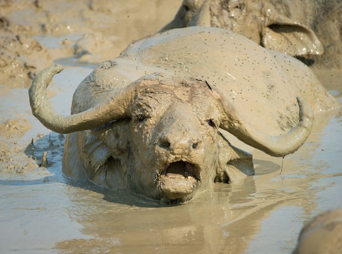
A buffalo luxuriates in a mud bath, Murchison Falls NP (Copyright © James Weis).
A 2015 biodiversity survey of MFNP (including Bugungu and Karuma Wildlife Reserves) conducted by Wildlife Conservation Society (WCS) and Uganda Wildlife Authority (UWA) revealed a list of 144 mammal species, 556 bird species, 51 reptile species, and 51 amphibian species.
Birding in MFNP is very good, with plenty of the more common dryland species seen on both side of the river, as well harder to find 'specials' in the very productive forests in the south. There is a popular red-throated bee-eater colony that nests in the Nile River bank downstream from the Murchison Falls and the highly sought-after shoebill stork can sometimes be seen near the estuary of the Nile as it enters Lake Albert.
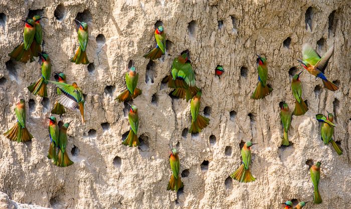
Red-throated bee-eaters nesting in the river bank in Murchison Falls NP.
Activities in MFNP
Game drives are the best way to experience wildlife in MFNP, especially on the northern side of the Nile River. The area near Paraa and the Victoria Nile delta is particularly good for game viewing. Lions are seen often in this section of the park, as are herds of buffalo, kob, and other plains game. The area south of the river is much less productive for game viewing, as the denser vegetation is less suitable for plains species.
Hippos in the Victoria Nile River, Murchison Falls National Park.
Nile River Boating
The boat excursion from Paraa to the base of the Murchison Falls is the most popular activity in MFNP. The waterfall cruises have been running since the 1950s (except when the park was closed in the 1970s), with several departures daily. Smaller boats seating around 5 passengers are available, as well as the 40-passenger double-decker boat, and mid-sized boats seating groups of up to 16 passengers. The round trip adventure takes around 3 hours.
Game viewing from the river on board the boat is usually superb, with lots of hippos, large crocodiles, buffalo, Defassa waterbuck, kob, and sometimes giraffe and bushbuck. Elephants are occasionally seen drinking on the banks or in the water swimming and playing. Birding from the boat is also excellent.
Boat excursion from Paraa looking towards the Murchison Falls.
Another boating option from Paraa is the Nile Delta Cruise, departing from Paraa and heading downstream towards Lake Albert. This scheduled excursion departs early morning and lasts 4-5 hours. Birding is exceptionally good, with a good chance of spotting the shoebill stork.
All Nile River boating trips may also be booked privately, as well as tailored towards special interests, such as birding or photography.
A lioness in Murchison Falls National Park, Uganda.
The Falls from Land
Visiting the Murchison Falls on foot is another very popular activity in MFNP. A road leads to a picnic site on the south bank of the Nile River, and from there, a short hike brings you to a spectacular viewpoint the the edge of the waterfall. The vantage point permits one to get a true feel for the power of the water as it rushes thru the narrow gap into the gorge.
A second walking path leads to another viewpoint that gives excellent views of both cataracts: the Uhuru Falls and Murchison Falls. A third pathway leads down to the bottom of the small gorge at the base of the main waterfall. Visiting all three viewpoints will take at least two hours. The afternoons are best for photographing the waterfalls.
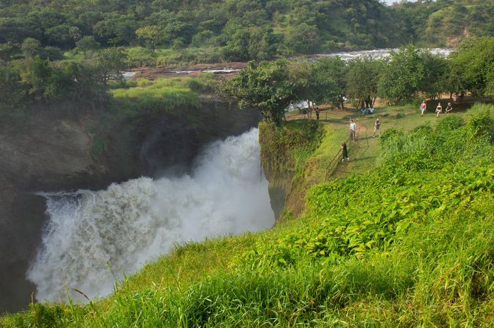
Visitors view the impressive Murchison Falls (Copyright © James Weis).
Weather and When to Go
Like much of Uganda, MFNP's location near the equator means it enjoys a warm, tropical climate all year. This park is also uniformly lower in elevation (2 000-3 900 feet/615-1 190 meters) than the parks to its south, and it therefore experiences warmer temperatures than any other park in the country. Temperatures in MFNP are uniformly warm all year, averaging 86-90°F (30-32°C) during the day and only dropping to 62-66°F (17-19°C) overnight.
MFNP experiences a short dry season that runs from December thru February, when rainfall is uncommon (though still possible) and the days can be stiflingly hot. The lack of humidity does moderate the feel of the heat somewhat.
The Murchison waterfall as it flows through a narrow opening in the rocks (Copyright © James Weis).
The wetter season runs from March thru November, although the region is comparatively dry and does not receive a large amount of rain (average annual rainfall is only around 40 inches (1 000 mm). The rainiest months are April/May and August thru mid-October. Heavy storms are possible.
As in most savanna ecosystems, game drives are most productive during the dry season, especially along the Nile River, where herds of elephant, buffalo, and kob congregate to drink. Scenically, the wet season is spectacularly beautiful, and the the slightly lower rainfall in June/July make this period a great time to visit.
The diminutive oribi can be seen in Murchison Falls NP.
How to Get There
MFNP is reachable by road from Kampala in 4-5 hours and from Fort Portal (if on a circuit traveling from the southwestern parks) in around six hours. Scheduled and charter flights are available from Kampala/Entebbe and from all of Uganda's other protected areas, including from the remote Kidepo Valley.
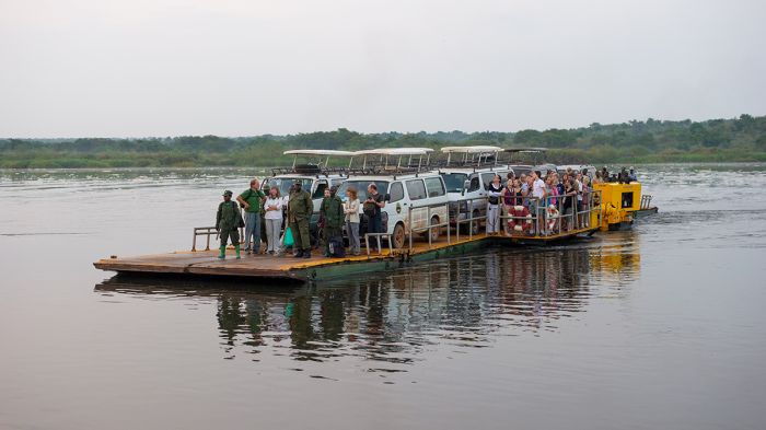
The ferry crosses the Nile River near Paraa in Murchison Falls NP (Copyright © James Weis).
Mgahinga Gorilla National Park
Uganda's smallest national park is Mgahinga Gorilla National Park (MGNP), which covers a mere 15 square miles (38 sq kms) and forms a portion of the much larger trans-frontier area protecting the Virunga Mountains.
The Virungas are volcanic mountains that straddle the shared borders between Uganda, Rwanda, and the DRC and are afforded protection via three contiguous national parks (MGNP in Uganda, Virunga NP in the DRC, and Volcanoes NP in Rwanda).
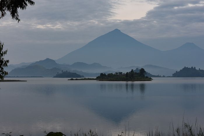
View from Lake Mutanda to Mgahinga Gorilla National Park, showing the volcanic peaks of Muhabura (left) and Gahinga (right).
Mgahinga was originally established by the British Colonial Administration in 1930 as the Gorilla Game Sanctuary, but it only received national park status much later, in 1991. The new national park status resulted in the forced eviction of over 2 000 Batwa people, who had lived in the forests of the Virungas for centuries.
MGNP protects portions of three volcanic peaks: Gahinga (11 398ft/3 474m; shared with Rwanda), Muhabura (13 540ft/4 127m; shared with Rwanda), and Sabyinyo (12 037ft/3 669m; shared with Rwanda and the DRC).
A golden monkey seen in Mgahinga Gorilla National Park.
Gorilla Trekking
Guided hikes to visit habituated family groups of the endangered mountain gorilla are the main attraction in the Virunga Mountains and Mgahinga National Park. The 'gorilla trek' experience is unlike anything else in Africa and although most gorilla treks in Uganda take place in Bwindi Impenetrable National Park, Mgahinga also offers this amazing experience.
Mountain gorilla tourism became very popular after the release of Gorillas in the Mist, a 1988 major motion picture adaptation of the autobiography of Dian Fossey. Fossey lived and worked with the mountain gorillas for 18 years in the Rwandan section of the Virungas (Volcanoes National Park). Fossey's book and the movie brought global attention to the plight of these great apes, which share over 98% of the human genetic code.
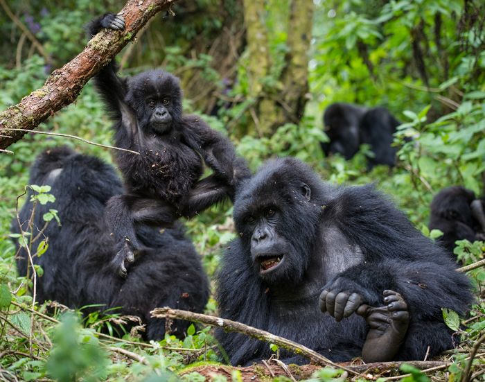
Mgahinga Gorilla National Park protects part of the Virunga Mountains, which is home to one-half of the world's mountain gorillas (Copyright © James Weis).
Mgahinga's small size has meant that Bwindi, and to a larger extent Rwanda, have become the main destinations for mountain gorilla tourism. There has historically been only one habituated gorilla group in Mgahinga, while Bwindi and Volcanoes National Park (Rwanda) each have over ten habituated groups. Moreover, Mgahinga's gorilla group, known as the 'Nyakagezi group' sometimes crosses over into Rwanda, which means that trekking in Mgahinga is not possible until the gorillas cross back into Uganda.
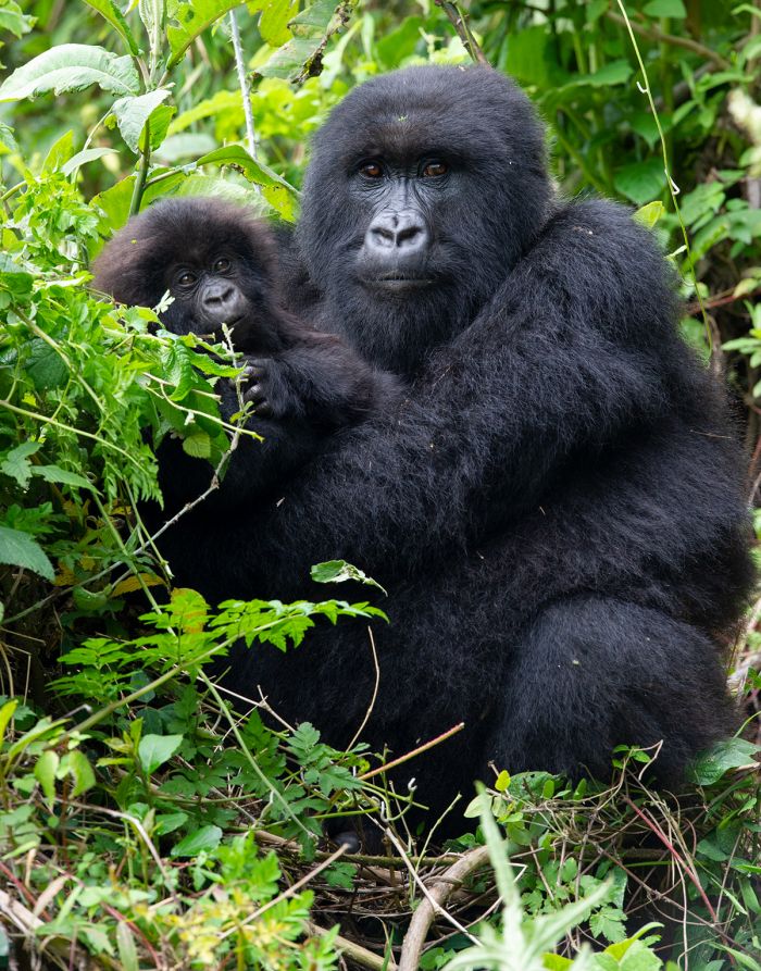
A female mountain gorilla holds her youngster in the Virunga Mountains (Copyright © James Weis).
Other Activities
Besides gorilla trekking, MGNP offers a guided forest hike to visit Garama Cave. The cave was used by early humans during the late Iron Age, and later by the forest-dwelling, hunter-gatherer Batwa people. The cave can be explored for around 330 feet (100 meters). The Garama hike takes around 3 hours round-trip.
Other activities in MGNP include guided day hikes to any of the three volcanic peaks. A level of physical fitness is required for these mountain treks and each will take the better part of a day to complete.
Mountain hikes are available in Mgahinga NP - here a view to Mount Gahinga.
The Gahinga hike is the least challenging, taking roughly 6-7 hours, while Sabinyo takes a minimum of 8 hours, and Muhabura at least 9 hours. All three ascents offer incredible views and pass through interesting montane habitats, offering chances to see elephant, duiker, and bushbuck, as well as birds in the incredible Afro-montane and moorland habitats.
Treks to see and photograph the beautiful golden monkeys are offered daily in MGNP. Golden monkeys live in the lower-elevation bamboo forests in large troops and are typically encountered feeding up in the trees, rather than on the ground.
Cultural visits to a Batwa community, which may also include a visit to Garama Cave, are available on request.
The highest peak on Mount Sabyinyo, an extinct volcano shared by Uganda, Rwanda, and DRC.
Wildlife
Besides the mountain gorillas, MGNP is home to the golden monkey (Cercopithecus kandti), an endangered primate that lives in the bamboo forests of the Albertine Rift Mountains, (which includes the Virungas). Other species in the park include black-and-white colobus, bushbuck, buffalo, black-fronted duiker, elephant (rarely encountered), bush pig, giant forest hog, and various bats, rodents, and small predators.
Weather and When to Go
Rain can fall on the forested slopes of the Virungas Mountains at any time throughout the year, so bringing rain gear is essential for any hiking in the park. Gorilla trekking in MGNP is available year-round (provided that the gorilla group is spending time in the park and hasn't crossed into Rwanda), but the short dry season from June thru August provides the best chances for a rain-free experience.
The regionally endemic golden monkey can be seen in the bamboo forests of Mgahinga NP.
The montane climate in MGNP is defined by regular rainfall throughout much of the year, with misty and chilly air common in the upper elevations of the volcanoes. Air temps are relatively constant through the year, with daytimes averaging 58-63°F (14-17°C) and dropping to 40-45°F (4-7°C) overnight.
Temperatures will drop as you ascend to higher elevations, and sudden weather changes, including rain and cloud cover, are common and impact the temperatures. Dressing in layers is crucial to moderate your body temp. Please read our Gorilla Trekking Clothing and Gear section on the Bwindi Details tab for info on what to bring.
Unusual moorland vegetation in the high elevations of Mgahinga Gorilla NP.
How to Get There
MGNP is located only 8 miles from the small town of Kisoro, but the road to the park is slow going, so allow an hour to reach the park. Most visitors to MGNP will arrive via road from one of the Ugandan parks to the north, including Bwindi (~2 hours) or Queen Elizabeth (~6 hours). Flights to Kisoro from Kampala/Entebbe take about 90 minutes, and although driving from Entebbe/Kampala is possible, it will take around 9 hours.
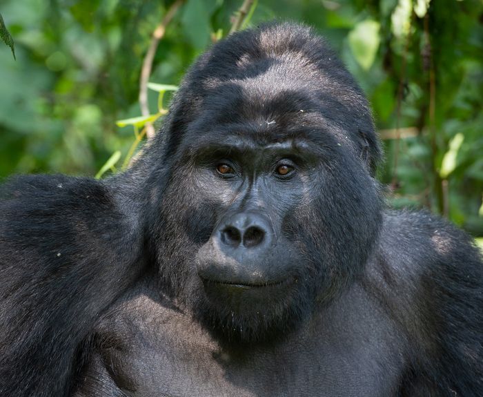
A juvenile mountain gorilla under the watchful eye of the "silverback" (Copyright © James Weis).
Semuliki National Park & Semliki Wildlife Reserve
The Semliki River, which drains Lake Edward north into Lake Albert, gives its name to two of Uganda's most extraordinary protected areas: Semuliki National Park and the Semliki Wildlife Reserve (formerly the Toro-Semliki Wildlife Reserve). The lower reaches of the Semliki River form part of the international border between Uganda and the DRC, as it flows through a valley at the base of the Albertine Rift.
The low-lying tropical rainforest of Semuliki National Park is located along the river and country border, while the savanna-based Semliki Wildlife Reserve lies just to the east, with the northern foothills of the Rwenzori Mountains separating the two protected areas.
The grey-cheeked mangabey is one of over 50 mammal species found in Semuliki NP.
Semuliki National Park
Semuliki National Park (SNP) was first given protection as a forest reserve by the British Colonial Administration in 1932 (then known as the Bwamba Forest Reserve). It remained a forest reserve until 1993, when it was declared a national park. SNP is an extension of the DRC's Ituri Rainforest, which covers a massive 24 300 square miles (63 000 sq kms) of mostly unspoiled lowland forest that extends from the Uganda border all the way west to the Congo River Basin. This forest, including SNP, is considered one of the richest areas of floral and faunal diversity in all of Africa.
Semuliki NP covers 85 square miles (220 sq kms) of rainforest at elevations ranging from 2 200-2 490 feet (670-760 meters). It is a true rainforest, receiving an average annual rainfall of around 50 inches (1 270mm), which peaks from March thru May and again from September thru December.
Semuliki is predominantly lowland tropical rain forest.
Semuliki is home to an astounding diversity of birds, with 441 species recorded to date (40% of Uganda's total species), including 216 true forest species (66% of Uganda's forest species) and numerous "tough-to-see" specials associated with the Congo Basin. SNP's bird list includes some 50 species found nowhere else in Uganda. In essence, SNP is a birder's paradise. Besides birds, the park has a list of over 450 known species (and counting) of butterfly, including over 50 species of forest swallowtails.
The park is also home to 53 species of mammal, including buffalo, leopard, hippo, elephant, African civet, bush pig, sitatunga, pygmy antelope, eleven species of primate, nine species of duiker, and an assortment of smaller species, including various squirrels and bats. Primates in SNP include chimpanzee, red-tailed monkey, vervet monkey, blue monkey, grey-cheeked mangabey, black-and-white colobus, olive baboon, Dent's mona monkey, De Brazza's monkey, and two nocturnal primates - potto and bushbaby (galago).
A black-and-white-casqued hornbill in Semuliki National Park.
One mammal species of note found in SNP is the water chevrotain (also called mouse deer), a tiny nocturnal ungulate similar to a duiker, that is associated with permanent streams or rivers. Crocodiles and hippos are found in good numbers in the Semliki River.
Activities in SNP center around forest walks, but one interesting attraction is a collection of natural hot springs at a mineral-encrusted swamp called Sempaya. The site attracts a large number of shorebirds and provides a natural salt lick for forest mammals. Cultural visits to a local Batwa pygmy village can be arranged.
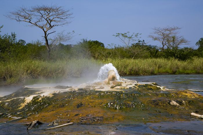
Sempaya swamp's hot springs attract myriad wildlife.
Semliki Wildlife Reserve
First protected in 1929 and situated just to the east of Semuliki National Park, Semliki Wildlife Reserve (SWR) occupies 209 square miles (542 sq kms) of the Albertine Rift Valley floor between Lake Albert and the Rwenzori Mountains. The nearest town is Fort Portal, which is 6 miles (10 kms) south of the the reserve (but 20 miles/32 kms driving distance).
To the west of SWR is the western rift escarpment and the vast rainforests of the Congo Basin (of which Semuliki National Park is a part), which is mainly located across the Semliki River in the DRC. The steep eastern slopes of the valley, which are located inside the reserve, rise up 6 200 feet (1 900 meters) and are home to SWR's chimpanzees.
Hill landscape in Semliki Wildlife Reserve.
Most of SWR consists savanna grasslands on the Rift Valley floor, with elevations between 2 000-2 950 feet (620-900 meters). Portions of the reserve are quite different though, with steep hills and valleys. Southwest of SWR are the northernmost peaks of the Rwenzori Mountains, which continue southward for 75 miles (120 kms). The northern boundary of SWR is Lake Albert, the northernmost of the Great Rift Lakes.
A 1969 wildlife census of SWR revealed some of the highest plains game densities in the country, with nearly 20 000 Ugandan Kob, 650 Jackson's hartebeest, over 500 Defassa waterbuck, 700 buffalo, and healthy populations of elephant, lion, leopard, hippo, reedbuck, warthog, and more. Unfortunately, as with all of Uganda's protected areas, SWR was adversely impacted by the effects of war and neglect during the country's turbulent 1970s and 1980s and wildlife was decimated by poaching.
Boating is offered seasonally at Semliki Safari Lodge (image: Copyright © Semliki Safari Lodge).
It wasn't until after the opening of Semliki Safari Lodge in 1997, that wildlife numbers in the reserve slowly began to recover. Today, SWR is carefully managed and protected and wildlife have recovered dramatically, although not to levels seen in the 1960s. Jackson's hartebeest were eliminated completely, but other species populations have stabilized or are increasing.
The center portion of SWR is dominated by an ecosystem of grasslands, acacia/combretum woodland, and stands of borassus palms, which supports herds of kob, buffalo, elephant, reedbuck, and warthog. Lions and spotted hyenas are sometimes seen. The riparian forests in the east support waterbuck, bushbuck, warthog, duiker, giant forest hog, bush pig, forest elephant and various primate species. Hippo and crocodile are found in the far north, along the Lake Albert shore.
The strange-looking shoebill stork can be found in Semliki Reserve's far north, on its boundary with Lake Albert.
Other species sometimes seen include banded mongoose, civet, and pangolin. SWR's primates include chimpanzee, red-tail monkey, blue monkey, vervet monkey, black-and-white colobus, olive baboon, two species of galago (bushbaby), and potto. There is an ongoing chimpanzee research project conducted by the University of Indiana in SWR.
The reserve also boasts an impressive bird list, with over 450 species recorded. The much sought-after shoebill stork can sometimes be found in the marshes at Lake Albert.
Activities in SWR include game drives on the savanna plains, primate walks to see chimpanzees and the various monkey species, nature walks, and boat rides on Lake Albert to see hippos, crocs, and water birds.
Black-and-white colobus are one of Semliki's numerous primate species.
Weather and When to Go
The Semliki region has a hot, tropical climate, with consistent temperatures all year that average 84-90°F (29-32°C) during the day and 62-70°F (17-21°C) overnight. In terms of rain, it can occur any time in the rainforest of the national park, as well as in the wildlife reserve and as such, there is no true wet or dry season. Given the consistent temperatures and unpredictable rain, Semliki can be visited at any time.
How to Get There
Semliki is accessed from Fort Portal, which has a small airstrip and is a reasonably short drive from both the national park and wildlife reserve. Reaching Fort Portal from Kampala takes 7-8 hours by road or 1.5 hours by air. Most visitors arrive on a circuit from other destinations in Western Uganda, which would mean a much shorter drive.
Grassland meets lowland rain forest in Semuliki.
Rwenzori Mountains National Park
The Rwenzori Mountains were created three million years ago by tectonic upheaval along the western branch (Albertine Rift) of the Great East African Rift. The uplift that created the Rwenzoris also segmented the great paleo-lake Obweruka into three smaller lake (Albert, Edward, and George).
The Rwenzori range traverses around 75 miles (120 kms) in a roughly north-south direction along the western border of Uganda and the DRC and is the highest range of mountains in Africa. The range consists of six massifs separated by deep gorges: Mount Stanley, Mount Soeke, Mount Baker, Mount Emin, Mount Gessi, and Mount Luigi di Savoia (all six peaks are in the top ten tallest in Africa).
View of the Rwenzori Mountains from a stream in the foothills.
The highest peaks in the Rwenzoris are Margherita (16 762ft/5 109m) and Alexandra (16 677ft/5 083m), the twin peaks on Mount Stanley. The only African peaks higher than Margherita are Mount Kilimanjaro and Mount Kenya, both of which are freestanding extinct volcanes and not part of a true mountain range.
The Rwenzoris are usually associated with the legendary "Montes Lunae" (Mountains of the Moon), which in ancient times were described as being the source of the Nile River, particularly by the Egyptian mathematician Ptolemy in the 2nd century AD. While it is true that the Rwenzoris are the source of some of the Nile's waters, it is only a small percentage of the total.
Watching the sunrise in Rwenzori Mountains National Park.
The origins of Rwenzori Mountains National Park (RMNP) began in 1937, when the boundaries of a reserve were demarcated. In 1941, all terrain above 7 200 feet (2 200 meters) was officially designated as the Rwenzori Mountains Forest Reserve (RMFR). During Uganda's war with Tanzania (1978-79) and Civil War (1981-86), all of Uganda's protected areas suffered, including RMFR, as hunting and encroachment ran unchecked.
In 1989, the upper elevations of the reserve were gazetted as Rwenzori Mountains National Park (RMNP); Bwindi and Mgahinga were also declared national parks at this time. In 1991, the lower-elevation montane forests were added to the national park. RMNP was designated a UNESCO World Heritage Site in 1994.
One of the crater lakes in the foothills of the Rwenzori Mountains.
Today, RMNP protects 385 square miles (996 sq kms) of steep and extremely rugged terrain covering the central and eastern side (Ugandan portion) of the Rwenzori range. The park is contiguous with Virunga National Park across the border in the DRC. Approximately 70% of the park's area is at altitudes above 8 200 feet (2 500 meters) and an additional 28% at altitudes between 6 500-8 200 feet (2 000-2 500 meters). The Rwenzori range contains 23 peaks above 14 750 feet (4,500 meters).
The range's three highest peaks, Mounts Stanley, Speke and Baker (the third, fourth, and fifth highest peaks in Africa), are permanently covered by snowfields and retreating glacial ice. The ice is shrinking with climate change and the remaining glacial ice is only around a quarter of what it was 100 years ago. The lower peaks (Emin, Gessi and Luigi di Savoia) also retain more or less permanent snowfields.
Spectacular scenery high in the Rwenzori Mountains.
Flora
The slopes of the Rwenzoris can be divided into five distinct altitudinal 'zones', each having its own flora, fauna, and microclimate. The Rwenzori zones are: Montane Forest, Bamboo Forest, Heath/Heather, Afro-Alpine Moorland, and Rock/Glacier.
In the low-lying foothills from around 5 600-7 900 feet (1 700-2 400 meters), the vegetation is described as montane forest. These forested areas contain few large trees, with characteristic species including Albizia, Symphonia, Dombeya, Prunus, and others. The forest canopy is typically open, except along valley floors and on ridge tops with a gentle gradient.
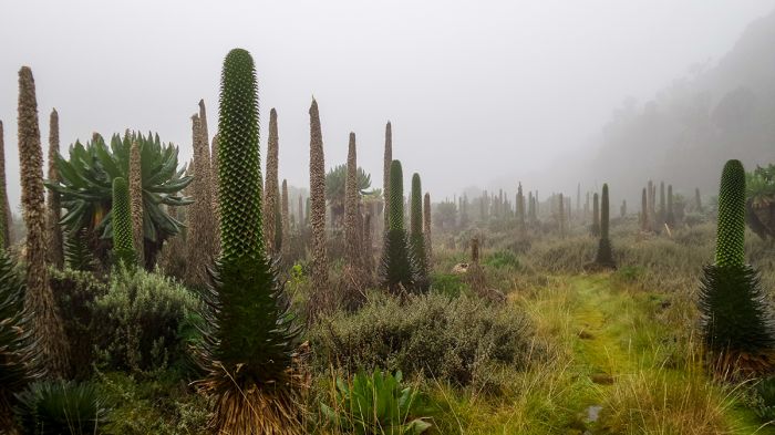
The other-worldly moorland vegetation of the Rwenzoris have plants like the giant lobelia.
The next higher zone, which covers elevations between 7 900-9 800 feet (2 400-3 000 meters) its dominated by African alpine bamboo (Yushania genus), which forms pure, dense stands in many areas.
Above 9 800 feet (3 000 meters) and extending up to 13 000 feet (4 000 meters) is the Heath/Heather vegetation zone. Here there are giant heather (Phillipia) trees and tree groundsels, with their lower trunks, stems, and the ground covered in thick Sphagnum moss and tree limbs draped in Usnea beard lichens. Colorful orchids, impatiens, and balsam flowers are common. Valleys at this elevation are often filled with bogs, covered in various sedges.
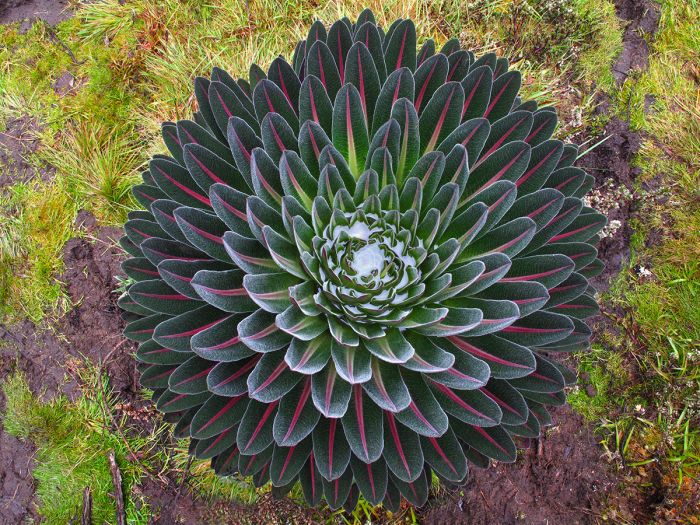
Giant lobelia (Lobelia bequaertii) are common in the upper-elevation moorland zone of the Rwenzori Mountains.
Above 13 000 feet (4 000 meters) and continuing up to the snow-line at around 14 400 feet (4 400 meters), is the Afro-alpine moorland zone, which is dominated by the giant groundsel (Senecio adnivalis) that can reach 30+ feet (10 meters) in height. Other flora includes the giant lobelia (Lobelia wollastonii), St. John’s Wort (Hypericum becquaeritii), and the silvery-leafed Alchemilla.
Above 14 100 feet (4 300 meters), the vegetation becomes thin, until nothing can grow except moss, black-colored lichens, and everlasting flowers. Above 14 750 feet (4 500 meters), no vegetation grows and the terrain is just rocks that are sometimes covered in snow and/or ice.
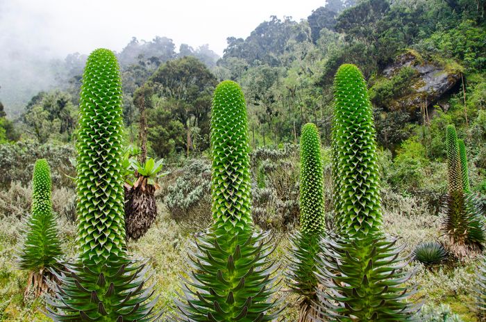
High elevation plants in Rwenzori Mountains National Park.
Wildlife
The montane forest zone supports the greatest variety of wildlife. Here you can find several primates, including black-and-white colobus, chimpanzee, and blue monkey. If you're lucky, you may see other mammals, such as elephant, one of the duiker species, bushbuck, and giant forest hog. Animals such as leopard, elephant, and chimpanzee are more often heard than seen. In the early evening or at night you may hear the strange and unearthly call of the tree hyrax.
In terms of birds, 217 species have been recorded in RMNP, but it has never never been comprehensively surveyed, so further additions are expected. The park is home to the second-highest number of Albertine Rift endemics of any Important Bird Area (IBA) in Uganda (after Bwindi).
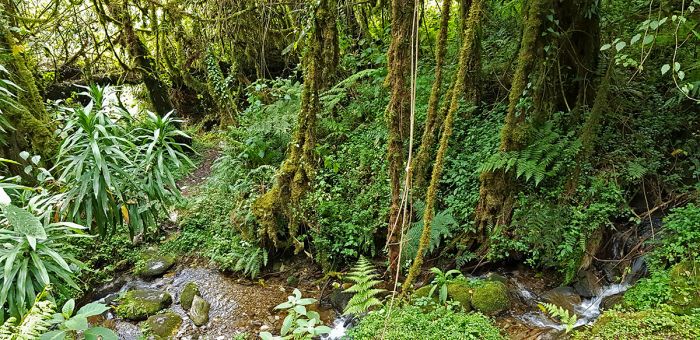
The lower elevations of there Rwenzoris support tropical rainforest with birds and other wildlife.
Mountain Trekking
Today, RMNP is best known as a mountain trekking destination. There is a wide assortment of multi-day trails and overnight huts in the mountains, but the snowy summits are only for experienced climbers.
Guided summit expeditions in RMNP take 8-10 days on average, but most visitors to RMNP do not come to summit the high peaks, but rather to traverse the routes that wind through the mountains. These mid-altitude routes allow trekkers to take in the spectacular scenery and natural beauty of the mountains, valleys, lakes, flora, and fauna. Guided non-summit treks generally have a duration of 6-9 days. Shorter duration hikes that explore the lower elevation montane forests are also possible.
Two climbing routes traverse into the high Rwenzoris; the traditional Central Route begins at Nyakalengija (13 miles/22 kms northwest of Kasese), and the more recently established Kilembe Route, which begins further south at Kilembe (9 miles/14 kms from Kasese).
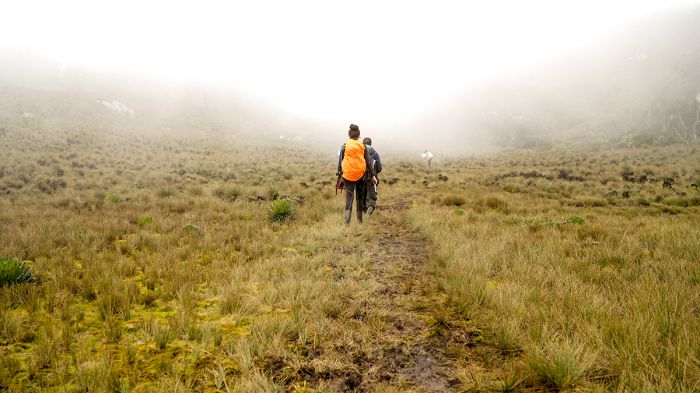
Hikers exploring the Rwenzoris on a guided trek.
Hiking in the Rwenzoris is physically challenging and certainly requires trekkers to have good fitness and endurance. Guides and porters are practically essential. The conditions are typically cold, wet, muddy, and foggy, and the terrain is steep and boggy. Expect frequent, but short rain showers, often accompanied by thunder. Altitude is always a factor above the forested zone.
Compared to the ever popular Mount Kilimanjaro, the Rwenzoris are only slightly lower in altitude, but the prime advantage is the Rwenzoris' pristine environment and lack of crowds. Some 50 000 hikers climb Kilimanjaro every year, while the Rwenzoris, which cover a much larger area, only receive around 1 000 visitors per year. Trekking in the Rwenzoris is widely considered more difficult than the summit ascents of Mount Kilimanjaro or Mount Kenya, but the payoff in terms of lack of crowds and incredible scenery is certainly worth it.
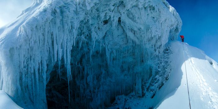
Only experienced climbers should attempt the high summits like Margherita Peak.
Weather and When to Go
The Rwenzori Mountains are located less than one degree north of the equator, putting the range squarely within the tropics. Temperatures in the mountains are chilly to cold, fluctuating from above to below freezing as day becomes night. Due in part to the frequent cloud cover and fog, daytime temps vary only slightly.
At altitudes between 9 800-13 000 feet (3 000-4 000 meters) temps average 50-59°F (10-15°C) during the day and 35-43°F (2-6°C) at night. At higher elevations, temps can drop to 28°F (-2°C) during the day. In the open areas above the forest zone, wind also causes colder conditions.
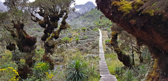
A walking bridge across a boggy area in the Rwenzori Mountains.
In terms of precipitation, the plains below the foothills are located in a rain shadow and receive only 30 inches (750 mm) of rain per year. The mountains themselves receive far more rain, as humid air flowing from the Congo River Basin is trapped by the higher ground and rain falls on an almost daily basis, even in the dryer months.
Above 8 200 feet (2 500 meters), annual precipitation averages almost 100 inches (2 500 mm) per year, with two peak rain periods: March thru May and September thru December. Monthly rain during these wetter periods can exceed 15 inches (375 mm). Despite being located virtually on the equator, snow is common above the snow-line at 14 400 feet (4 300 meters).
The months receiving the least rain are July thru October and December thru February. July thru September are the most popular months for climbing in the Rwenzoris.
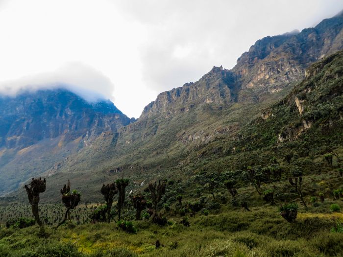
The Rwenzoris are often wet and covered in fog and/or clouds.
How to Get There
The small town of Kasese is the main access point for RMNP. Kasese is located on the northern border of Queen Elizabeth National Park. Climbing routes begin from two locations: Nyakalengija (13 miles/22 kms northwest of Kasese), which offers the tradition Central Route, and Kilembe (9 miles/14 kms from Kasese), which uses a newer southern route. Kasese is easy to access by road from any of Uganda's western parks or by air to Kasese Airport (1.5 hours from Kampala/Entebbe).
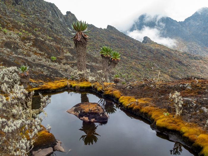
A pool of water in the upper elevations of the Rwenzoris.
Lake Mburo National Park
Originally designated as a controlled hunting area in 1933, Lake Mburo was upgraded to a game reserve in 1963. The Ankole people continued to use the reserve for grazing their cattle until 1983, when Lake Mburo was gazetted as a national park. The move to make Lake Mburo a national park was made during the Obote regime, and was done for political purposes to weaken the Banyankhole (Ankole kingdom citizens), who supported anti-Obote rebels at the time.
In 1986, when the second Obote regime was ousted, the previously evicted Banyankhole re-occupied Lake Mburo, evicted the park staff, destroyed infrastructure, and began poaching wildlife. Later in 1986, a revised Lake Mburo National Park (LMNP) was confirmed by the new Ugandan government.
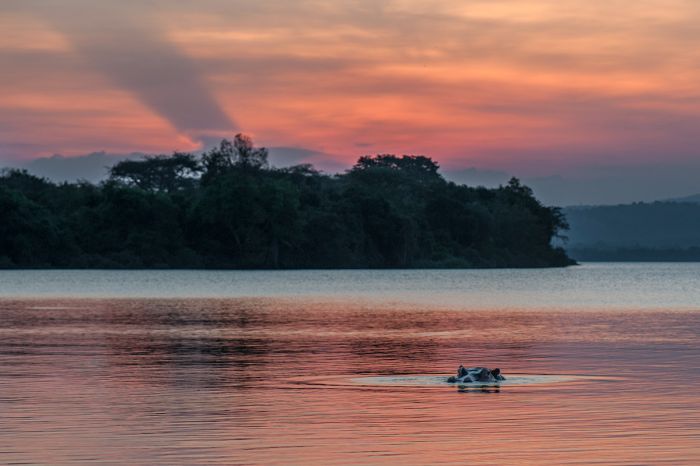
Hippos are common in Lake Mburo.
Today, LMNP covers 143 square miles (370 sq kms) of open, hilly savanna, sparse acacia woodland, and a network of small lakes that are surrounded by papyrus swamps and thin riparian woodlands along the Rwizi River. Elevations in the park range between 3 950-6 000 feet (1 200-1 850 meters).
The park was historically comprised almost entirely of grasslands and swamps, but the absence of elephants has resulted in the expansion of the woodlands. Wetland habitat occupies roughly 20% of the park, including Lake Mburo itself and another five lakes lying within the park. The western side of the park contains rocky outcrops and small forested areas.
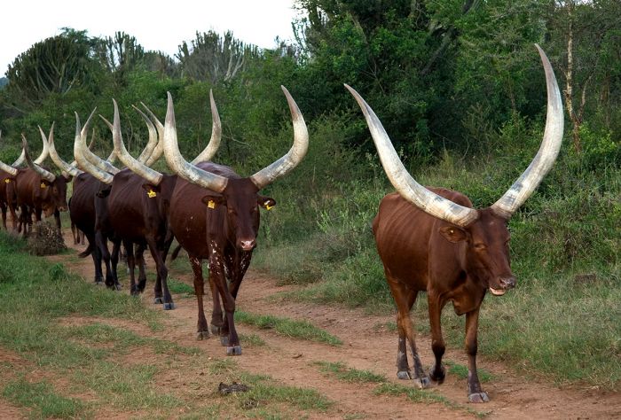
Traditional Ankole cattle are sometimes seen around Lake Mburo.
Wildlife & Activities
LMNP is somewhat unique in terms of its wildlife, as it is home to several species not easily found in Uganda's more popular protected areas. Lake Mburo is one of only two places in Uganda with populations of impala (Katonga Wildlife Reserve is the other). LMNP is also home to good numbers of Burchell's zebra, which can otherwise only be seen in the much more remote Kidepo Valley National Park and Pian Upe Wildlife Reserve.
Other plains game in LMNP include buffalo, eland, Defassa waterbuck, Bohor reedbuck, topi, bushbuck, common duiker, oribi, warthog, and bush pig. Roan antelope, once common in the park, were unfortunately poached to extinction. The wetlands are home to hippo, crocodile, and the shy sitatunga antelope.
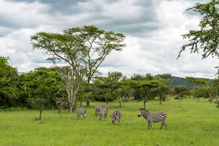
Lake Mburo National Park is one of only three places in Uganda to see Burchell's zebras.
In 2015, a group of highly endangered Rothschild's giraffes were relocated from Murchison Falls National Park to Lake Mburo National Park. Additional giraffes were subsequently moved, adding to the population in LMNP and the first offspring were seen soon after.
Predators in the park include leopard, spotted hyena, and side-striped jackal. Lions, which were once common in the park before the 1970s, have only been seen sporadically since then and are not resident. Primates are restricted to olive baboon and vervet monkey.
Birding in LMNP is very good due to its variety of habitats. Over 300 species have been recorded, with good numbers of drylands species in the acacia woodlands and savannas. Waterbirds are common in the lakes and papyrus swamps.
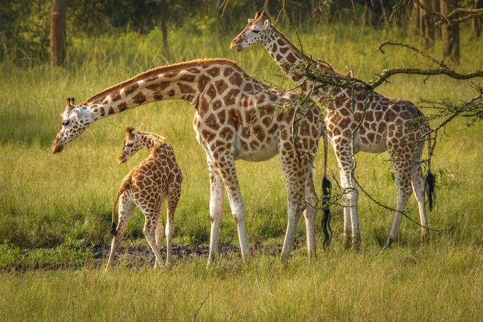
Rothchild's giraffes were recently translocated into Lake Mburo National Park.
LMNP offers game drives, boating on Lake Mburo, fishing, guided walking safaris, and two activities not offered in any other national park in the country: quad-biking and horseback riding.
LMNP is seldom included on Ugandan safari circuits, mostly because it lacks some of the "Big Five" (only leopard and buffalo are resident), but it provides a very good stop-over for those driving from Kampala towards the various national parks and reserves in Western Uganda.
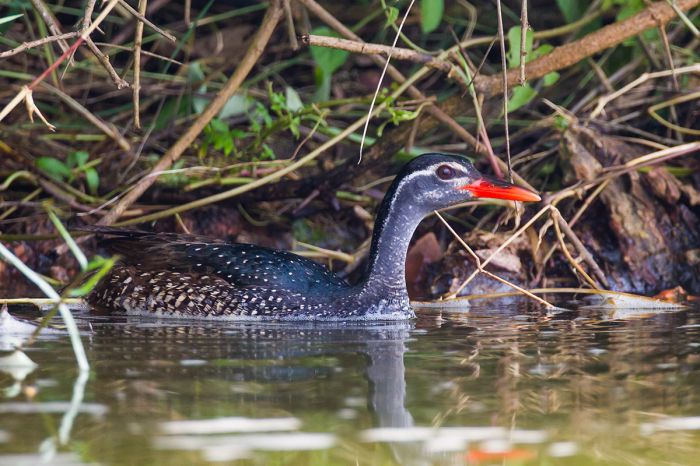
Waterbirds like this African finfoot can be seen in Lake Mburo's wetland habitat.
Weather and When to Go
Lake Mburo's location very near the equator gives it a mild, tropical climate. Daytime temps are static all year, ranging between 78-84°F (25-29°C) and dropping to 54-60°F (12-15°C) overnight. Rain is possible at any time, though the months of June and July are usually quite dry. January and February are the next driest months. The rainiest periods are March thru May and September thru mid-December.
During the drier periods of June thru mid-August and mid-December thru February, game viewing is at its best in LMNP, as wildlife tends to congregate more around the lakes and wetlands. The roads in the park can become difficult during the wet periods.
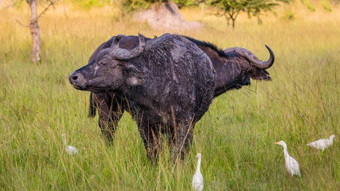
Buffalo are commonly seen in Lake Mburo National Park.
How to Get There
Lake Mburo is best reached by road from Kampala and is a good place for a day or two stopover en route to Bwindi or the other western parks and reserves. The drive from Kampala takes roughly five hours. Driving from LMNP onward to Bwindi or the Ishasha sector of Queen Elizabeth National Park takes another six hours. Flights to the nearby town of Mbarara are possible.
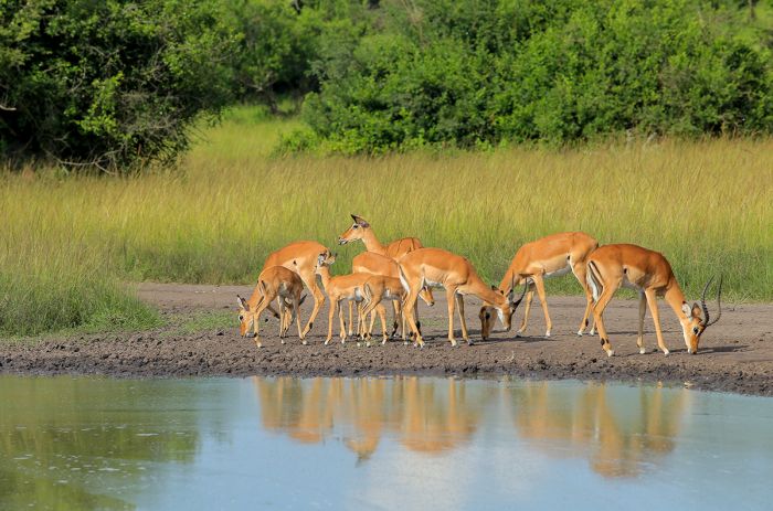
Impala are rare in most of Uganda, but are common in Lake Mburo NP.
Mount Elgon National Park
Mount Elgon, Africa' eighth tallest peak, is a long-extinct shield volcano rising on Uganda's eastern border with Kenya. Elgon is estimated to have first erupted around 24 million years ago and remained active for some 14 million years. During its active period, it would have been taller than Mount Kilimanjaro is today. Elgon's caldera is mostly intact and has a diameter of 5 miles (8 kms), which makes it one of the world's largest (Tanzani's Ngorongoro Crater is the biggest).
Mount Elgon consists of five major peaks, which form a circle around the caldera rim:
- Wagagai - 14 177 feet (4 321 meters) on the southwest caldera rim in Uganda;
- Sudek - 14 114 feet (4 302 meters) on the Kenya/Uganda border;
- Koitobos - 13 852 feet (4 222 meters) a flat-topped, basalt column in Kenya;
- Mubiyi - 13 816 feet (4 211 meters) in Uganda;
- Masaba -13 652 feet (4 161 meters) in Uganda.
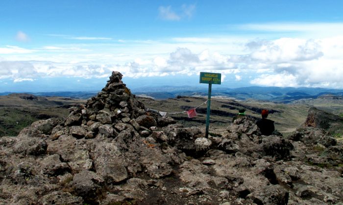
The view atop Mount Elgon's Wagagai peak at 14 177 feet /4 321 meters (photo: Wikimedia Commons).
On the Ugandan side, Mount Elgon National Park (MENP) protects the mountain at elevations above 6 560 feet (2 000 meters), effectively covering an area of 429 square miles (1 110 sq kms). MELP is contiguous with the national park and reserves on the Kenyan side of the massif.
Kenya protected the mountain in 1968 and the Ugandan national park was proclaimed in 1992. The first European known to have seen Mount Elgon was the explorer Henry Morton Stanley in 1875, but only from a distance.
Mount Elgon has similar vegetation zones to other East African massifs, with tall evergreen forests below 8 200 feet (2 500 meters) and African alpine bamboo (Yushania genus) above this, extending up to 9 800 feet (3 000 meters). Higher up is the heather/moorland zone, which reaches to 11 500 feet (3 500 meters) and then gives way to the high-altitude Afro-montane zone, with its incredible giant-sized lobelia and groundsel vegetation.
The low-elevation forests once extended much further down the mountain, but the land outside the national park has now been completely cleared for agriculture.
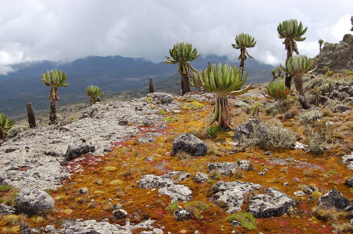
Upper-elevation vegetation on Mount Elgon.
Wildlife
Large mammals living in the mountain's forests include elephant, leopard, buffalo, common duiker, bushbuck, bush pig, giant forest hog, black-and-white colobus, blue monkey, and De Brazza's monkey. The primates are often encountered by hikers, while the other mammals are shy and not often seen.
Birding in the lower elevations is very good, with a species list topping 300 and including numerous species at the westernmost edge of their range seen nowhere else in Uganda.
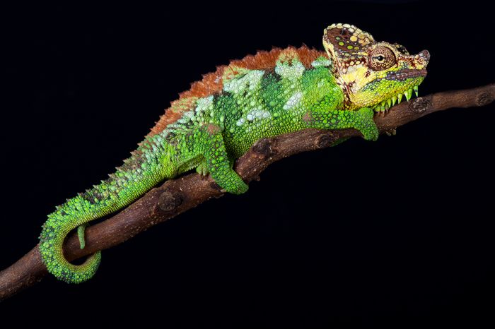
The helmeted chameleon (Trioceros hoehnelii) is endemic to Mount Elgon.
Activities
Mount Elgon offers guided, multi-day treks to any of the summits. Like any high-altitude adventure, the treks do require physical fitness and endurance, but no specialized skills or equipment are required to reach the peaks. Moreover, the summits are not so high as to cause any major risk of altitude illnesses that can be a problem on higher climbs.
Several routes are available, with most summit treks taking between four and six days. Tents, sleeping bags, and other gear and supplies can be arranged at the national park's headquarters, along with guides and porters. Day hikes in the foothills and lower-elevation forested sections are also available, starting from various spots, including the Mount Elgon Exploration Centre at Kapkwai (near Sipi Falls).
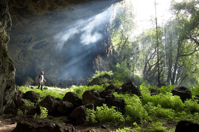
The Sipi Trail leads to several caves, including this one: Tutum Cave with waterfall cascading.
Sipi Falls is a very popular attraction and easy to reach. The Sipi River originates high up on the mountain, and at an elevation of 5 825 feet (1 775 meters) in the northwestern foothills, forms a series of four waterfalls, the last of which drops 325 feet (99 meters). This area is also great for day hikes in the forest, including trails that lead to a network of caves, some of which can be explored.
Sipi Falls is a popular attraction at Mount Elgon.
Weather and When to Go
Hiking and summit treks on Mount Elgon can be undertaken at any time, but the drier months (December thru March and June thru August) will provide the best chances for clear weather and dry hiking conditions. The profusion of highland wildflowers that bloom during November/December make this a prime to to visit.
How to Get There
Mount Elgon can be reached by road from Kampala via Jinja and Mbale towns. The drive will take around 7-9 hours.
Hikers exploring one of the many trails on Mount Elgon.
Lake Victoria
History and Geology
Lake Victoria is one of Africa's Great Lakes (along with Lakes Malawi and Tanganyika) and, like most of the continent's large lakes, is situated in the Great Rift Valley. Lake Victoria is the largest lake in Africa by surface area; it is also the world's largest tropical lake and the second-largest fresh water lake on Earth. Approximately 45% of Lake Victoria is in Uganda and the remainder lies in Tanzania (49%) and Kenya (6%).
The lake's name was given by John Hanning Speke, the British explorer who, in 1858, became the first European to see the lake. Speke was told of the lake and made a side journey while leading an expedition with fellow explorer Richard Francis Burton to discover the source of the Nile River.

Lake Victoria, the largest lake in Africa, covering over 23 000 square miles.
Note: Years after the Speke/Burton expedition, it was determined that the headwaters of the Nile River was the Victoria Nile River (also called the White Nile). The Victoria Nile is the only outlet from Lake Victoria, beginning at Jinja, Uganda on the northern shore of Lake Victoria. The Blue Nile River, which originates further north in Ethiopia's Lake Tana, is the other main source of the Nile River.
Ongoing discussion as to the most distal source of the Nile River is still inconclusive, but it is certainly one of the tributaries to the Kagera River (exactly which one is still not clear), which begins in Burundi or Rwanda and flows into Lake Victoria.
Fishermen heading out to work on Lake Victoria, Uganda.
Africa's largest lake by area, Lake Victoria covers 23 145 square miles (59 947 sq kms). Victoria is also the second-largest freshwater lake (by area) in the world, exceeded only by Lake Superior in North America. If measured by volume of water, Lake Victoria is the world's ninth-largest lake (not including dam-created reservoirs).
Note: Interestingly, the much deeper (but smaller by surface area) Lakes Tanganyika (3rd largest in world by volume) and Malawi (5th largest in world by volume) hold more water than Victoria. Asia's Caspian Sea is the largest lake on Earth by volume of water.
Lake Victoria reaches a maximum depth of 276 feet (80 meters) and has an average depth of 130 feet (40 meters). Like the other Great Lakes of Africa, Victoria's waters hold an astounding diversity of fish, the majority of which belong to the diverse and much studied (for their clues to evolution) Cichlidae family of bony fishes (known as cichlids).
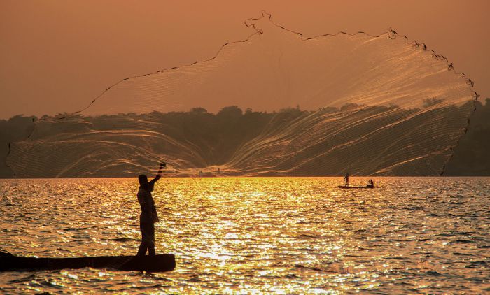
Traditional fishing using throw nets on Lake Victoria.
Geologically speaking. Lake Victoria is a young lake, formed 400 000 years ago when an uplifting of the Earth's crust occurred along Africa's Great Rift, effectively blocking westward flowing rivers, which then emptied into the depression which was formed to the east. Based on evidence obtained from core samples taken beneath Victoria, the lake has completely dried up on at least three occasions. These drying cycles are believed to have happened during past ice ages, when the Earth's precipitation was dramatically reduced. The most recent historical dry period for Lake Victoria started some 17 300 years ago and lasted until 14 700 years ago.
The majority of Lake Victoria's water (about 80%) is obtained via direct rainfall. The other 20% of Victoria's water arrives via rivers and many smaller streams. The most substantial river flowing into Lake Victoria is the Kagera River, which enters the lake on its western boundary. The Kagera River originates to the south and has tributaries in Burundi, Rwanda, Tanzania, and Uganda. The solitary outflow from Lake Victoria is the Victoria Nile River (sometimes called the White Nile), which exits the lake on its north near the small town of Jinja (in Uganda).
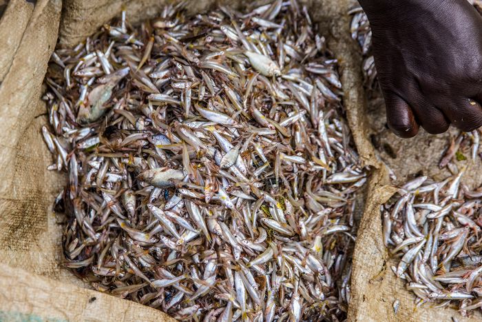
Freshly caught fishes from Lake Victoria, ready to be sun dried.
Nile Perch
The controversial and ecologically disastrous introduction of the highly predacious 'Nile perch' (Lates niloticus) to Lake Victoria in the 1950s has resulted in the extinction of hundreds of its indigenous cichlids fishes, many of which were endemic. The idea was to kick-start the fisheries industry around the lake by increasing exports and providing a source of protein to locals. The Nile perch is also a prized sporting fish.
Prior to the presence of the Nile perch, Victoria's indigenous cichlid fishes were traditionally sun-dried before consumption by the local villagers around the lake, but this is not possible with the Nile perch. Because the Nile perch grow to a substantial size, some attaining a length of 6.5 feet/2 meters and weighing up to 450 pounds/200 kgs, and also have a high body-fat content, the fishes must be smoked locally before exporting in order to avoid spoiling. This requirement increases the need for collection of firewood around the lake, which has greatly increased deforestation around the Victoria.
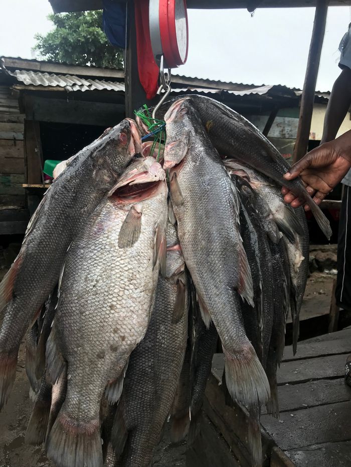
Freshly caught Nile perch (Lates niloticus) being weighed before sale. in Entebbe, Uganda.
Commercially fished Nile perch are exported in large number (mostly to Europe), which brings in millions of Euros in revenue each year, but ecologists and conservationists rue the decision to introduce these predators, which eat anything they can swallow, including their own kind.
Those interested in learning more about the social and environmental impacts of Nile perch introduction to Lake Victoria can do so by watching the 2004 documentary film "Darwin's Nightmare".
Although the Nile perch introduction to Lake Victoria resulted in the loss of hundreds of species of fishes (almost all of which were endemic cichlids), Lake Victoria is still home to an estimated 500+ species of fish, which makes it the world's second-most diverse in terms of fish species (after Lake Malawi).
Astatotilapia latifasciata, one of Lake Victoria's endemic cichlid fishes, known as 'zebra obliquidens' in the aquarium hobbyist trade.
Kampala
Uganda's capital city and largest urban area (by far) is Kampala, with a population of around 1.35 million people. The country's next largest town is Gulu, with only 147 thousand residents.
The city is located in the historic kingdom of Buganda and the various hills onto which the city has grown were once the site of the political centre for the kingdom. The land surrounding the palace of Buganda's Kabaka (king) were reserved as the royal hunting grounds and stocked with various species of antelope, the most abundant of which were impala.
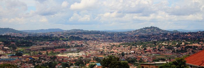
Wide view of Kampala showing its hilly terrain.
When the British Colonial authorities were allocated one of the hills in the reserve (Old Kampala Hill), they referred to it as the "Hill of the Impala". In the local language, this translated to "Akasozi ke'Empala", which was eventually shortened to "K'empala", and finally Kampala.
In 1890, Frederick Lugard, a representative of the Imperial British East Africa Company, built Fort Lugard on Old Kampala Hill. The fort was the first British structure in the country and Lugard proclaimed the site as the capital of the British Protectorate of Uganda. A short time later in 1894, the British decided to relocate the capital from Kampala to Entebbe. It was not until Uganda gained its independence from the British in 1962, that the capital reverted back to Kampala.
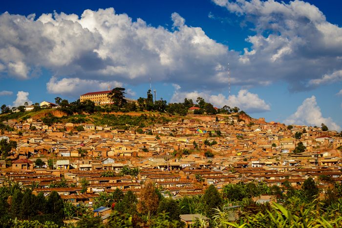
One of Kampala's seven hills.
Today, Kampala is a sprawling city, covering 73 square miles (189 sq kms) of rolling hills and valleys. The city's southern borders are on the banks of Lake Victoria. Kampala is not exactly a city geared for tourism (like Cape Town for example), but it does offer some things to see and do if you are here for a day or two. The National Museum of Uganda, Kasubi Tombs, and Wamala Tomb are all worth a look for interesting historical perspectives on Uganda.
For most visitors to Uganda, Kampala is not a destination, but rather an overnight on the front end, and perhaps another on the way out of the country. The city and suburbs have a wide range of accommodation, from budget to ultra-chic.
A craft market in Kampala, Uganda.
Entebbe
Entebbe is best known as the site of Entebbe International Airport, Uganda's largest commercial airport and the entrance point for nearly all international tourists to Uganda. Entebbe is located only 23 miles (37 kms) southwest from Kampala and was the capital city for many years (Kampala has been the capital since 1962).
Like Kampala, Entebbe is situated on the shores of Lake Victoria, but the similarities between the two cities ends there. While Kampala is a huge and busy, with an established city centre and sprawling suburbs, Entebbe feels more like a resort town than an African city. Entebbe's population is just over 60 000 residents.
Lake Victoria harbor in Entebbe, Uganda.
Many international tourists stay in Entebbe for a night, before heading out by road or air to Uganda's various national parks, and the city has a wide range of accommodation to choose from. Generally speaking, Entebbe's hotels are on the upmarket side, but offer the convenience of being close to the airport if flying onward the next day.
The Entebbe Botanical Gardens are worth a visit if you have the time. Entebbe also offers an 18-hole golf course.
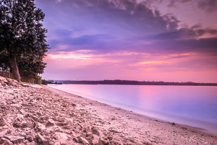
Sunset on Entebbe beach.
Ngamba Island Chimpanzee Sanctuary
A worthwhile day trip from either Kampala or Entebbe is the Ngamba Island Chimpanzee Sanctuary. Located on a small island in Lake Victoria, some 14 miles (25 kms) southeast of Entebbe, the sanctuary is open to the public (prior booking required).
The Chimpanzee Trust, which operates the sanctuary, was founded in 1998, with a mission of conserving chimpanzees in the wild and providing care and welfare for rescued chimps that can no longer survive in the wild.
Ngamba Island in Lake Victoria near Entebbe.
The sanctuary is home to around 50 orphaned or confiscated (from illegal pet and bushmeat trade) chimpanzees, giving the animals a safe and semi-natural environment in which to live out their lives. The island habitat offers 95 acres of natural forest, where the chimps roam and forage daily. The chimps are free to overnight in the forest or return to the sanctuary.
Half- and full-day experiences are offered, as well as overnight accommodation in a tented camp. Visitors can reach the island by speedboat (45 mins), traditional motorized canoe (90 mins) or helicopter (quick flight).
More information about the Ngamba Island Chimpanzee Sanctuary can be found here.
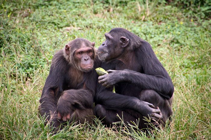
Chimpanzees at the Ngamba Island Sanctuary.
Quick Facts & Travel Tips
- Uganda is considered part of East Africa (but is sometimes grouped with Central Africa). It straddles the equator and has a tropical climate that is somewhat moderated by its elevated altitude.
- Uganda receives plentiful rainfall (except in the semi-arid far north), with most of the country receiving 40-80 inches (1 000-2 000 mm) of rain annually. There are generally two "rainy" seasons: the long and more regular rains fall from March thru May, while the short rains fall from mid-September thru November. Rain can fall at any time in most regions, especially in the mountainous western highlands.
- There are over forty languages in Uganda, most of them being dialects of three main families: Bantu, Nilotic, and Central Sudanic. The official languages are English (which was introduced during the colonial period) and Swahili.
- The national currency is the Ugandan Shilling (UGX). US Dollars (old bills often not accepted) are widely accepted in the cities and hotels. US Dollars are also preferred as gratuities, especially for gorilla trekking and safari guides.
- Uganda uses 240v electricity and type G plug adapters.
- Uganda time is GMT+3 and it does not observe daylight savings time (DST); 8 hours ahead of New York (7 during DST).
- The population of Uganda is around 47 million, with about 1.35 million living in its largest metro area, Kampala/Entebbe. About 26% of the population is urban.
- Uganda's land area covers 77 147 square miles (199 810 sq kms) with around 593 people per sq mile (229 people per sq km).
- Uganda's main ethnic groups are the Baganda (16.5%), Banyankhole (9.8%), Basoga (8.8%), Bakiga (7.1%), Iteso (7%), Langi (6.3%), Bagisu (4.9%) and numerous others. These ethnic groups are broadly defined based upon the historic kingdoms that existed for centuries before the arrival of Europeans.
- Asians, which numbered around 80 000 in Uganda by the late 1960s, were expelled from Uganda by the Amin regime in 1972. There are some 10 000 whites of European descent and several thousand Arabs living in Uganda.
- The majority of Ugandans are Christians, accounting for 84% of the population. The largest minority group is Islam (14%).
ENTRY / VISA REQUIREMENTS
- Passport holders from USA/Canada/Australia/UK/EU can obtain a visa on arrival, from their local embassy, or online.
- Passports must be valid for six (6) months from the date of entry.
- Passports must have one (1) unused (blank) page labeled Visa.
- Note: Visa pages referred to above do not include pages reserved for Endorsements, Amendments or Observations.
- To save time at the airport, it is recommended to obtain a visa in advance.
- Multiple-entry visas must be obtained in advance.
- Single-entry visas are valid for three (3) months. Multiple-entry visas are valid for six (6) months. East African Tourist visas (see below) are valid for ninety (90) days.
- Proof of yellow fever vaccination is required on arrival if you are traveling from a country with a risk of yellow fever, including transit >12 hours in an airport located in a country with risk of YF virus transmission.
- Children under five years require proof of Polio vaccination.
Note: Entry/visa requirements are subject to change without notice, so please check with the official government pages shown below.
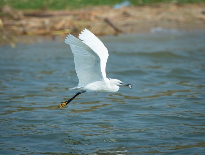
A little egret with its catch, Kazinga Channel, Queen Elizabeth NP (Copyright © James Weis).
EAST AFRICAN TOURIST VISA
- Travelers who will visit Kenya, Rwanda and Uganda can apply for an East Africa Tourist Visa, which allows entry to all three countries on a single visa.
- A tourist using the East Africa Tourist Visa must start travel from the country that has issued the visa.
- Travelers must stay within only Kenya, Rwanda, and Uganda to continue to use the visa; entry into a different country will terminate the validity of the visa.
- East Africa Tourist visas may be obtained online or on arrival at the first port or entry into Kenya, Rwanda or Uganda.
- To apply for the East African Tourist Visa online, use the consulate website for the FIRST COUNTRY you will visit.
- East African Tourist Visas are valid for ninety (90) days.
OFFICIAL GOVERNMENT PAGES
- US Department of State info: click here.
- Uganda Consulate - USA: click here.
- Uganda eVisa application: click here.
- Uganda Home Affairs: click here.
- CDC information: click here.
Read More...
Main: Flora, Geography, Important Areas, National Parks, Protected Areas, Ramsar Sites, UNESCO Sites, Urban Areas, Wildlife
Detail: Bigodi, Bwindi, Entebbe, Kampala, Kibale, Kidepo Valley, Lake Mburo, Lake Victoria, Mgahinga, Mount Elgon, Murchison Falls, Ngamba Island, Queen Elizabeth, Rwenzori Mountains, Semliki, Semuliki
Admin: Travel Tips, Entry Requirements/Visas
Read More...
Amin Rule, British Control, Buganda, Bunyoro, Civil War, Colonization, Coup D'état, Early History, Early Independence, Early Kingdoms, Kingdoms (1450-1650), Kingdoms (1650-1850), Obote Rule, Post-Amin, Pre-Independence, Recent History, Tanzania War
Early History
Prehistoric
Stone Age tools discovered along the Kagera River Valley suggest that early Hominins existed in present-Day Uganda at least as early as 50 000 years ago and perhaps as early as 100 000 years ago. Further evidence of early humans exists in various rock art sites in Eastern Uganda, which date back to the Later Stone Age (39 to 50 thousand years ago).
Early Bantu-speaking people known today as the Twa (or Batwa) arrived in present-day Uganda and throughout Central Africa as early as 3 500 BC. The Twa were forest-dwelling hunter-gatherers and very slight of build, sometimes known as pygmies.
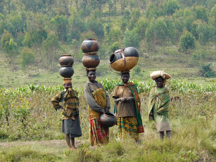
Twa (Batwa) women (photo: Wikimedia Commons).
Additional Bantu speaking tribes expanded into most of sub-Saharan Africa during the period from 700 BC to 500 AD and the fertile soils and favorable climate in present-day Uganda would have been very attractive to these early African cultivators and pastoralists. The newly arrived Bantu tribes gradually displaced the indigenous Batwa, who were forced into less hospitable mountainous areas.
During the period from 400 BC to 100 AD, some of the Bantu people in the region began perfecting metallurgy, using the process of iron smelting to make carbon steel-based tools for farming and weapons. Prior to this period, much of the land around Lake Victoria was covered in rain forest, but the steel tools helped the farmers clear the forest for agriculture.
Map showing the distribution of Bantu and other African languages. The Bantu area is in orange (image: Wikimedia Commons).
Clans
The earliest forms of society and government in present-day Uganda were the clans, which were formed in the early part of the first millennium AD. The purpose of the clans was observing religious deities, settling disputes, and organizing work projects. Clans were generally made up of small groups of related people and were led by a clan chief, with a kin-group of elders also holding positions of power.
The clans persevered for centuries, but generally moved towards larger groups of people organized into kingdoms or dynasties. The first such dynasty, which like most pre-colonial history in Africa, is only known from oral legends, traditions, and myths passed down from generation to generation, was that of the Batembuzi.
Early Kingdoms (1100-1450)
The Batembuzi, which translates as pioneers, are reputed to have ruled over the Lake Victoria region from around 1100-1350 AD. Various oral histories list around 20 Batembuzi kings, with Ruhanga, a mythical figure, as the founder of the dynasty. Descriptions of the physical features of the Batembuzi people suggest that they may have migrated southwards from modern-day Ethiopia or Sudan. The Batembuzi integrated with the existing Bantu-speaking culture already existing in the region.
The second major dynasty were the Bachwezi, which ruled the region after the Batembuzi reign ended. Like the Batembuzi, the Bachwezi adopted the culture and language of the Bantu people over whom they ruled. The original ruler of the Chwezi was a legendary king named Ndahura, who is credited with introducing Ankole cattle and the cultivation of coffee to Uganda.
In the latter part of the 1400s, the Luo people arrived from their homeland in the north (present-day Sudan). The Luo were a Nilotic-speaking tribe and they migrated along the course of the Nile River into present-day Uganda, whereupon they displaced the Bachewzi people.
The Bachwezi moved south and splintered into several related groups, establishing new kingdoms in present-day Uganda, northwest Tanzania, Rwanda, and Burundi. These new kingdoms included the Bunyoro, Buganda, Ankole, Busoga, Tutsi (in Rwanda), and Karagwe (in Northern Tanzania).
Early kingdoms in present-day Uganda (image: Wikimedia Commons).
Kingdoms (1450-1650)
Bunyoro Kingdom
The Bunyoro kingdom, located in Western Uganda, became the largest and most powerful dynasty in all of Central and East Africa up to the end of the 17th century. The Bunyoro enjoyed an economic advantage, as it had exclusive control of the region's salt mines at Kibiro, on the eastern shores of Lake Albert.
The Bunyoro Kingdom also had control of the lucrative trade routes over Lake Victoria and all the way to the Indian Ocean. In particular, the Bunyoro benefited greatly from the trade in elephant ivory. The Bunyoro were ruled by a king known as an Omukama.
A reconstruction of an early Bunyoro house at the Uganda Museum in Kampala (photo: Wikimedia Commons).
Buganda Kingdom
The Buganda Kingdom was located east of Bunyoro and south to the northwestern shores of Lake Victoria. The land bordering the lake was mostly swamp and dense rainforest and not attractive to the pastoralist kingdoms to the north and west.
The Buganda's land was not tenable for cattle, but it was extremely fertile, so bananas became the dominant economic engine for the Buganda. The kingdom also became a refuge for those who wished to escape the Bunyoro rule. The Buganda were ruled by a king known as an Kabaka.
Ankole Kingdom
The Ankole Kingdom, located in far southwestern Uganda and east of Lake Edward, placed great importance on cattle. The Ankole classified its citizens into two class groups: those who owned cattle (the Bahima) and those who were agriculturalists (the Bairu). The Ankole ruler was known as an Omugabe.
Busoga Kingdom
The Busoga Kingdom was located to the east of the Buganda Kingdom, covering a small region bordered on the north by Lake Kyoga and Lake Victoria to the south. The Busoga were culturally and linguistically linked to the Buganda, but oral traditions indicate that their people originated from the Mount Elgon area in eastern Uganda.
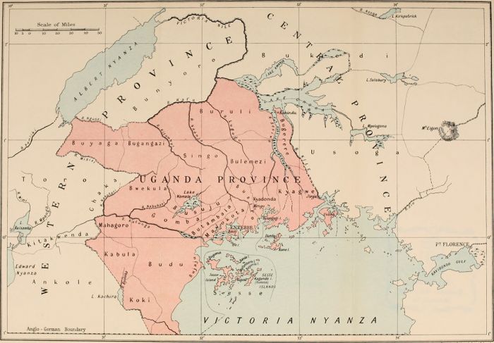
A 1911 map showing the southwestern kingdoms; Buganda is in red (photo: Wikimedia Commons).
Kingdoms (1650-1850)
Beginning around 1650, the Bunyoro Kingdom began to shrink in size, while the Buganda Kingdom was expanding its influence over the region. The Bunyoro decline accelerated during the early 1700s, when its herds were inflicted with an epidemic of disease, forcing them to kill all of their cattle. To replace their herds, the Bunyoro invaded the Ankole Kingdom, occupying their lands and taking control of their herds.
The ambitious Bunyoro decided to further extend their kingdom southwards into the Kingdom of Rwanda, but the Bunyoro king, Omukama Cwa I, was killed in Rwanda and the Bunyoro troops were subsequently evicted from Ankole on their return to Uganda. After chasing the Bunyoro out of their lands, the Ankole extended their kingdom north to the Katonga River, taking over long-held Bunyoro territory.
The death of Omukama Cwa I and the loss of lands to the Ankole resulted in disarray within the Bunyoro Kingdom, leading to a succession struggle for the throne. The Buganda took advantage of the Bunyoro's political turmoil, doubling its own lands by taking over territory from the Bunyoro.
By the late 1700s, Buganda had become the dominant regional power, having gained the loyalties of numerous clan chiefs that had previously been loyal to the Bunyoro. A rebellion by several Bunyoro princes resulted in the Toro clan becoming autonomous and claiming much of the Bunyoro's salt mines, depriving the kingdom of a major trade resource.
By the mid-1800s, the Bunyoro had shrunk to less than one-quarter of its former size, but was still wealthy due to the income it continued to derive from its ongoing control of the trade routes to the Indian Ocean; in particular the lucrative ivory trade, which it still commanded.
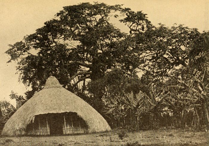
An early photo (1911) of a Baganda hut (photo: Wikimedia Commons).
Bunyoro Kingdom (1850-1890)
In the 1840s and 1850s, the Bunyoro Kingdom experienced continued instability, with weak omukamas. In 1852, a new omuakma named Kamurasi seized the throne and started restoring some stability. In 1862, James Augustus Grant and John Hanning Speke became the first Europeans to visit Bunyoro during their expedition to locate the source of the Nile River.
Two years later, in 1864, Samuel White Baker, who had met up with Speke and Grant in Gondokoro (Sudan), entered Bunyoro from the north in search of a reputed Lake named Mwitanzige, from which the Nile River flowed. The name means "locusts killer", likely referring to the local belief that locusts could not survive crossing the large lake. Baker, who always traveled with his wife, Florence. Traveling south down the White Nile, the Bakers encountered Murchison Falls and eventually arrived at the lake, which they renamed Lake Albert (after the recently deceased Prince Albert, consort of Queen Victoria).
Omukura Kamurasi died in 1869, which once again resulted in a power struggle for the Bunyoro throne. A new omukama named Kabalega eventually took control and soon became one of the greatest of all Bunyoro rulers. Omukama Kabalega initiated political and military reforms, creating disciplined and supremely organized military battalions led by well trained commanders rather than incapable, birth-based leaders. He is regarded as having been a military genius with comparisons to Shaka of the Zulus.
Sir Samuel Baker in 1870, wearing hunting attire with trophies of rhino and buffalo (photo: Wikimedia Commons).
In 1871, the recently knighted Sir Samuel Baker was appointed by Khedive Ismail, Viceroy of Egypt, to a newly created post of Governor General of the new territory of Equatoria in Egyptian-controlled southern Sudan. Baker was paid an annual salary of £10,000, a substantial rate indeed.
In 1872, exceeding his mandate, Baker declared that Bunyoro was an annex of Equatoria, which prompted Omukama Kabalega to attack Baker's Egyptian garrison at Masindi. Kabalega soundly defeated Baker's Egyptian troops, forcing them them to retreat back to Sudan and effectively ending all foreign attempts to gain control of northern Uganda.
In 1875, Kabalega continued his efforts to restore the Bunyoro's dominance in the region and overthrew the Kingdom of Toro, successfully restoring the recently-independent kingdom to Bunyoro control. Through military dominance, Kabalega also reclaimed numerous clans that had been annexed to Buganda. Bunyoro was once again dominant under Kabalega's reign.
Buganda Kingdom (1850-1890)
Buganda was the dominant kingdom in the region in the mid-1800s and Kabaka Mutesa I, the current Buganda ruler, welcomed Swahili slave traders from the Indian Ocean to his kingdom. The Muslim slave traders based their slave trading operations at Buganda's capital of Kampala and Mutesa worked together with the Swahili's to capture slaves from the neighboring regions.
Kabaka Mutesa I died in 1884 and his son, Mwanga II, who was only in his teens, ascended the throne. Meanwhile, various religious factions, including the Swahili Muslims, Protestants from Britain, and Catholics from France, were competing with one another to convert the indigenous Baganda people.
In 1885, Kabaka Mwanga II had his troops detain an Anglican Bishop named James Hannington, who was attempting to pioneer a new road between Mombasa (Kenya) and Buganda, which would have undercut the Arab slave route to the south. Mwanga ordered the execution of Bishop Harrington, along with several dozen of Harrington's Christian converts. Widespread persecution of Christians soon followed, with many killed or sold to the Arab slavers.
Kabaka Mwanga II became king of Buganda in 1885 as a teenager (image: Wikimedia Commons).
In 1889, a civil war broke out in Buganda between Christians and Muslims, which ended quickly in victory for the Christians and leading to the expulsion of all Muslims from the capital (Kampala).
With the Muslims out of the way, the fertile lands of Buganda were becoming increasingly attractive to several European nations. In 1890, Carl Peters, the founder of the German East Africa Company (the administrative arm for Germany's colonization efforts in Africa), arrived in Kampala with a treaty to obtain administrative authority over Buganda.
Kabaka Mwanga II readily signed the treaty, hoping it would provide protection for his kingdom and gain him more power over the region. A few months later, Germany agreed to give Buganda and other African territories to Britain in exchange for Heligoland, a strategic island in the North Sea.
Carl Peters, the founder of the German East Africa Company (photo: Wikimedia Commons).
British Colonization (1890-1899)
In August 1890, Frederick Lugard, a representative of the Imperial British East Africa Company (IBEAC), departed on foot from the Indian Ocean Coast and headed towards Uganda, with the mission of opening a trading route between Lake Victoria and the coastal port of Mombasa (present-day Kenya). Lugard's overall mandate was to secure British influence and predominance over German influence in the lands between Zanzibar and present-day Uganda.
Lugard arrived in Kampala in December 1890 and after more than a year of conflicts with Mwanga II, finally obtained (by force) a signed treaty giving the IBEAC administrative authority of Buganda. Lugard returned to Britain in October 1892 and the British government agreed to the acquisition of Buganda and other territories in the region.
An 1892 cartoon in the British magazine Punch, showing Uganda as a 'white elephant', which the East Africa Company is attempting to sell to Britain. Note that a white elephant is a metaphor for a valuable possession with a cost that ends up being out of proportion to its usefulness or worth and which cannot easily be disposed of (image: Wikimedia Commons).
In November 1892, the British government assigned Gerald Portal as British Special Commissioner to East Africa. Portal was sent Uganda to report on the desirability of setting up a British Protectorate to replace the IBEAC, which was becoming increasingly ineffective in its venture as a commercial company with colonial administrative rights. The IBEAC was experiencing ongoing conflict between Kabaka Mwanga, as well as with the rival French Catholic and British Protestant missionaries.
Portal arrived in Kampala in March 1893, whereupon he was able to settle the disputes between the rival missionaries and in April 1893, he took down the flag of the IBEAC and raised the Union Jack over Kampala. In May 1893, Portal signed a formal treaty with Kabaka Mwanga II, who was essentially unwilling, but had little choice other than to sign. The treaty offered British protectorate-ship in exchange for the right to collect taxes.
Portal retuned to Britain, recommending that the government declare Buganda as a protectorate, but unfortunately, Portal died of typhoid fever in January 1894, at the age of 36. In June 1894, Uganda (now named as such instead of Buganda) was declared a British Protectorate. The town of Fort Portal in Western Uganda, where Mr. Portal was based, is named after him.
Portrait of Gerald Herbert Portal, British Special Commissioner to Uganda (image: Wikimedia Commons).
Hostilities between Buganda (now the Uganda Protectorate) and the Bunyoro Kingdom continued, with numerous skirmishes in 1893-1894. In 1894, Bunyoro's Omakuma Kabalega led several attacks on newly built British forts on the southern borders on the Bunyoro territory, but by this time, the Bunyoro were running low on supplies and losing too many soldiers.
Eventually, after losing thousands of men, Kabalega was forced to flee Bunyoro and go into hiding in Achioli (on the northern border with Sudan). He continued sporadic raids on British targets from his remote outpost, but was increasingly unsuccessful. In June 1896, the Bunyoro Kingdom was unilaterally appended to the British Protectorate of Uganda.
Back in Kampala, Kabaka Mwanga II was growing increasingly unhappy with the British presence and the elevation in power being given to Christian converts at the expense of his traditionalist clan chiefs. In 1897, Mwanga II fled the capital and launched a weak raid against the British forces in Kampala, but was easily defeated. Fleeing to Bukoba (western shores of Lake Victoria in Tanzania), Mwanga was captured by the German authorities.
Henry Hesketh Bell, Commissioner of the Ugandan Protectorate, with hunting trophies in Uganda, 1908 (image: Wikimedia Commons).
Mwanga II somehow managed to escape the Germans in late 1897 and decided to join forces with his former enemy, Omukama Kabalega. After two years of running, Kabalega and Mwanga II were captured in the Lango region (north-central Uganda) and the two former kings were sent into exile in the Seychelles. Mwanga II died in Seychelles in 1903. In 1923, Kabalega was given permission to return to Uganda, but he died in Jinja, en route back to his homeland.
In 1898, the British occupied the Ankole Kingdom's capital at Mbarara and easily assumed control of the Kingdom. Earlier in the 1890s, the Ankole had suffered great population losses (including its king, Omugabe Ntare) due to horrible epidemics of tetanus and jiggers, which drastically weakened their power and it offered little resistance to the British forces.
The southeast territories (which had no formal kingdoms) also fell under British control with no resistance and by the end of the 19th century, the protectorate of Uganda included the Kingdoms of Buganda, Bunyoro, Ankole, and Toro.
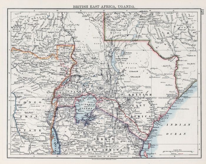
Map of East Africa in 1906, showing political boundaries (photo: Wikimedia Commons).
British Control (1899-1945)
In 1899, Harry Johnston, who was already a key player for the British in the Scramble for Africa, was appointed as Special Commissioner and Governor of the Uganda Protectorate. Johnston's mandate was to bring permanent stability to the new British colony. In March 1900, Johnston signed the "Buganda Agreement", which officially made Buganda a federal province of the British protectorate, with its kabaka (who incidentally was four years old at the time) and his government conditional upon their loyalty to Britain.
During the period from 1900-1915, more territories in the south and west were incorporated into the Uganda protectorate, mainly to prevent them from falling under the control of the neighboring German and Belgian colonies. Territories in the far north were initially disregarded as being too costly to incorporate, but this policy was reversed when Lango (north/central) was annexed in 1911, Karamoja (far northeast), and Achioli (far north) were added in 1913. The final territory to be annexed was West Nile (far northwest), which was added in 1914.
Harry Johnston, Special Commissioner and Governor of the Uganda Protectorate (photo: Wikimedia Commons).
Britain ruled Uganda in a much more light-handed manner than any of its other African colonies, allowing the indigenous chiefs a great level of autonomy, as well as discouraging settlement by foreigners, including its own citizens. Regional autonomy grew through the first half of the 20th century, with each of Uganda's 18 districts administering their own governments, which contributed to an atmosphere of regional unity, but also one of national disunity.
In 1920, Britain's Colonial Office, which dealt with all its colonial matters worldwide, created the Uganda Legislative Council (LEGCO), which was made up of five officers, all of whom were European. LEGCO essentially functioned as the legislative body of Uganda during the colonial days. Some years later, in 1926, representation in LEGCO was adjusted to include Indians, who outnumbered Europeans five to one in Uganda.
The first three African members of LEGCO were admitted in 1945, one representative each from Buganda, Bunyoro, and Busoga. Notably absent in LEGCO's members were all of territories in the north of British-controlled Uganda. Britain's continued policy of neglect when it came to the northern territories would have repercussions down the road as the country approached independence.
A station on the Uganda Railway, 1912 (image: Wikimedia Commons).
Lead up to Independence (1945-1962)
Following the end of World War II in 1945, movements towards independence in colonial Africa were gaining strong momentum; however, Uganda was, for the most part, contented with its situation compared to the rest of the continent. The reasons for Uganda's acceptance of its status quo include the following: Uganda had not experienced widespread settlement by foreigners; the preponderance of regional administrative autonomy; and the significant involvement of African representation in Uganda's federal government. Uganda's first anti-colonial political party, the Uganda National Congress (UNC) was only formed in 1952.
In 1952, Britain appointed a new Governor of Uganda named Sir Andrew Cohen, giving him the mandate of preparing the protectorate for independence. Cohen began by reorganizing LEGCO to include representatives elected from all districts throughout Uganda, including those in the north that had previously been excluded from the Council. Cohen also established the Uganda Development Corporation, which facilitated various economic reforms, including the removal of obstacles to cotton ginning, rescinding price discrimination against African-grown coffee, introducing new cooperatives, and financing new projects.
The Omukama of Toro (center) and the British Governor of Uganda, Sir Frederick Crawford at the signing of an agreement in Kabarole, Toro, Uganda, late 1950s (image: Wikimedia Commons).
In 1953, Kabaka Mutesa II of Buganda, demanded that Buganda be granted independence from the rest of the protectorate. Cohen denied the request and sent Mutesa into comfortable exile in London, which made the Kabaka an instant martyr back home in Uganda. Two years of growing resentment against Governor Cohen finally caused him to reinstate Kabaka Mutesa, with significantly increased federal powers given to the king instead of just a figurehead position.
In 1956, a political party called the Democratic Party (DP) was founded. The DP was comprised mainly of Roman Catholics from Buganda. In October 1958, Uganda held its first national elections to elect indigenous Africans to ten seats on the Legislative Council (LEGCO). The UNC won 5 of the ten seats, the DP won one seat, and independents won the other four seats.
In the wake of the 1958 elections, the Uganda People's Union (UPU) was formed under the leadership of non-Buganda Africans in order to oppose the perceived preferential status of Buganda in federal matters. Political parties were now polarizing in such a way that it was Buganda versus everybody else.
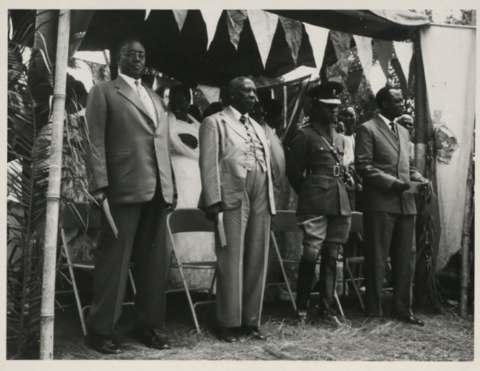
At the signing of an agreement in Kabarole, Toro, Uganda between the British governor, Sir Frederick Crawford and the Omukama of Toro are shown four other kings of Ugandan kingdoms, from left to right: The Omugabe of Ankole, Omukama of Bunyoro, Kabaka Mutesa II of Buganda, and Won Nyaci of Lango (photo: Wikimedia Commons).
Further to this growing regional polarization, in 1959, the UNC split along ethnic lines, with the non-Baganda members merging with the UPU to form a new party, the Uganda People's Congress (UPC). The UPC continued the UPU's mission to erode the influence and power of traditionalist Bagandans leading the sub-nationalist kingdom of Buganda. The newly combined party was led by Milton Obote, who hailed from Lango - a northern district.
Two years later, in 1961, the Baganda faction of the UNC formed an alliance with Bagandan traditionalists in the federal government, including Kabaka Mutesa II. The two groups were united in their shared resentment of the Catholic-dominated Democratic Party (DP). The Bagandan UNC faction decided to create a new political party called Kabaka Yekka (KY), which means 'king only' or 'forever king' in the Luganda language.
The British announced that national elections would be held in March 1961. In the run-up to the elections, the DP, UPC, and KY were the chief contenders. Bagandan leaders, who still wanted independence but were denied by the British, called for a boycott to the elections, with the result being that the DP won 20 of the 21 seats allocated to Buganda.
In the final build-up to full national independence (which was planned for October 1962), general elections were again held in April 1962, and this time, the new UPC-KY alliance won 58 (UPC 37 and KY 21) of 82 seats and the DP won the other 24 seats. The new UPC-KY majority meant that Milton Obote (of the UPC party) became the new Prime Minister and Kabaka Mutesa II, the Bagandan king, became Head of State.
Milton Obote (center) shown with Gerald Götting (right), President of the German Democratic Republic, in 1960 (photo: Wikimedia Commons).
Early Independence (1962-1966)
Uganda was declared an independent country on 09 October 1962, with a fragmented UPC party leadership in control. No common ideology united the various ethnic and regional factions within the UPC party and each of the regional political leaders within the party expected to receive a ministerial post within the new Uganda government. Failing to grant them such positions meant risking their withdrawal from the UPC-KY coalition.
Obote faced a difficult responsibility for keeping the loose UPC-KY coalition of divergent interest factions intact. Buganda was still recognized as holding full federal status, while the other kingdoms, including Bunyoro, were only granted semi-federal status, and non-kingdom regions in the country essentially had no representation in the new government.
Statue of Mutesa II, the first President of Uganda (photo: Wikimedia Commons).
An early challenge to the Obote government occurred in January 1964, when the Ugandan Army mutinied and demanded higher pay. Obote's Minister of Defense went to negotiate with the army's generals, but he was seized and taken hostage. Obote was forced to request help from the British troops to restore order. In the end, Obote agreed to all of the Army's demands and this move led to the military gaining immense political power and a significantly enhanced role in the country's politics.
After the quelling of the army uprising, Obote selected a popular and fast-rising army officer named Idi Amin Dada as his personal protégé, promoting Amin to Deputy Commander of the Army.
After two years of independence, Obote felt confident enough to address the issue of the "lost" counties of the Bunyoro Kingdom that had been annexed to Buganda in 1900. Obote gained agreement from several DP parliamentary members to join the UPC government side if Obote agreed to hold a referendum to allow the inhabitants of the "lost" counties to decide whether to remain part of Buganda or to revert back to Bunyoro. The result of the voting was 80% in favor of reincorporating into Bunyoro. The referendum results caused a major rift between Obote and Kabaka Mutesa II.
Miriam Eshkol joining Idi Amin in a tribal dance during a party given for Israeili Prime Minister Levy Eshkol at Jinja military camp, Uganda, June 1966 (photo: Wikimedia Commons).
UPC-KY Disintegration (1965-1966)
In spite of the rift between Obote's Uganda People's Congress (UPC) and Mutesa's Kabaka Yekka (KY), by early 1966, Obote had swayed enough DP and KY members of parliament to join his UPC side, so that parliament now consisted of 74 UPC, 9 DP, 8 KY, and one independent. Obote and the UPC now had a commanding majority and the UPC-KY coalition was about to break apart.
Perhaps the final nail in the coffin of the UPC-KY coalition was an event that occurred in early 1966, when Idi Amin walked into a Kampala bank and traded a gold bar bearing the stamp of the Belgian Congo for cash. The bank agreed and deposited 17 000 British pounds into Amin's personal account. Rivals to Obote in the UPC claimed that the prime minister and his associates were corrupt and using foreign policy for personal gain.
Obote denied the charges of corruption, claiming that the gold was payment for Uganda munitions that were to be given to support Congolese rebels in their opposition to the American-backed Congo government.
Prime Minister Milton Obote with USA President John F. Kennedy in 1962 (photo: Wikimedia Commons).
In February 1966, the UPC's parliamentary ministers passed a "no confidence" vote to oust Obote as prime minister. Instead of resigning, Obote turned to Idi Amin, who was now Commander of the Ugandan Army, which essentially carried out a coup d'état against his own government in order to keep Obote in power.
Obote suspended the constitution, had the offending UPC ministers arrested, and resumed control of the country. Obote then unilaterally passed a new constitution, which abolished all federal powers of the kingdoms, particularly the autonomy enjoyed by Buganda. Kabaka Mutesa and his supporters prepared for a legal battle and demanded that Obote's illegal government step down.
Again, Obote turned to Idi Amin and the military and in May 1966, Obote sent troops to attack the kabaka's palace at Mengo Hill (a neighborhood in Kampala). The palace was defended by a small group of bodyguards with small arms and an estimated 2 000 Buganda loyal to Mutesa also rallied around the palace. The Ugandan military had heavy weaponry, so only two days after it was surrounded, the palace was easily overrun, thereby ending the "Mengo Crisis". Most of those who resisted the Army at the palace were loaded on trucks and never seen again.
During the attack on the palace, the kabaka was somehow able to escape and was transported to a nearby cathedral, where he was hidden by Catholic priests. Mutesa was secreted out of Uganda and into exile in Burundi. Mutesa was eventually given asylum in the United Kingdom, where he died (under suspicious circumstances) in 1969.
USA President John F. Kennedy escorts Prime Minister of Uganda, Milton Obote (left), to a car following a meeting at the White House, October 1962 (photo: Wikimedia Commons).
Obote Rule (1966-1971)
After the Mengo Crisis, Obote's rule was essentially free from any open opposition and in April 1966, Obote announced a new constitution, naming him "Life President of Uganda".
In September 1967, another new constitution was unveiled, which abolished the five kingdoms of Uganda altogether. This constitution divided Uganda into four districts and created rule under martial law, giving the military unlimited power of detention against any citizen without trial. Further, it gave parliament the power to appoint council members of the new districts, rather than having them elected.
In January 1968, there was an assassination attempt on Obote, when his motorcade, en route from Kampala to Entebbe, was shot at by unknown assailants. None in the presidential convoy was killed, but some security personnel were injured.
In December 1969, a second attempt on President Obote's life was made while he was at the annual UPC conference in Kampala. Disguised as UPC party members, one assailant fired his pistol at Obote from ten meters away and the single bullet went through Obote's mouth, broke two teeth, and exited his cheek. A second would-be assassin threw a hand grenade at President Obote, but it failed to explode.
Both culprits were caught within 24 hours. During interrogation, the assassins revealed that the chief architect of the plot was Benedicto Kiwanuka, the head of the DP. Infuriated and paranoid, Obote banned the DP and all rival political parties, making his UPC the only legal political party in Uganda and creating an authoritarian regime.
President Milton Obote with Pope Paul VI in 1969 (photo: Wikimedia Commons).
Obote then created a "secret police" or intelligence agency called the General Service Unit (GSU), which was headed by a relative of Obote and recruited members heavily from Obote's own region and ethnic group. The GSU sought out and reported on suspected subversives. Numerous arrests and detentions followed, including the former DP leader, perceived rivals in the UPC, the Buganda royal family, various Muslim leaders, and scores of students, journalists, doctors, lawyers, and suspected dissidents.
During 1969-1970, Obote published a series of articles that outlined his political and economic polices. His "The Common Man's Charter" was a document submitted to the UPC, detailing his approach for moving the country towards socialism and nationalism, which later became known as the "Move to the Left".
In May 1970, Obote declared the Nakivubo Pronouncement (NP), which outlined the increased nationalization of major industries in Uganda. The NP proclaimed that, with immediate effect, the Obote government would take an ownership position of 60% in over eighty private corporations in Uganda, all of which would now be run by state-controlled entities. The list included all banks, insurance companies, mining and manufacturing industries, oil companies, and transportation businesses
The NP also declared that all import-export markets (with the exception of oil) would be monopolized by the government. Obote never thought this move through well enough though, and amid pressure from multinational companies like Shell and BP, this nationalization effort was never full realized and the government never took control of Uganda's major industries.
Welcome ceremony for Ugandan Prime Minister Milton Obote (3rd from left) on his arrival in Israel in 1966. Front left: Israeli Deputy Prime Minister Aba Eban, front right: Israeli Prime Minister Levi Eshkol (photo: Wikimedia Commons).
Coup d'état (1971)
A rift had been forming between President Obote and Idi Amin since 1969, primarily due to Amin's continued preferential recruitment of soldiers from the Sudan and his West Nile home region, which Obote realized was giving Amin more and more power within the military. Obote also learned that Amin had been illegally misappropriating millions of US dollars from the military coffers to use in support of the rebellion in southern Sudan.
In January 1970, the commander of the Ugandan Army’s Second Infantry Brigade, Brigadier Pierino Yere Okoya and his wife Anna, were shot dead outside their home in Gulu, by unknown assailants. Brigadier Okoya was outwardly critical of Amin, especially for reputedly fleeing the scene of the 1969 assassination attempt on Obote. Okoya publicly suggested that Amin may have been behind the attempt on Obote's life. Amin was under investigation for the murders and faced a potential trial.
In October 1970, Obote's growing paranoia and fear over Amin's rising influence in the military led him to seize control of the country's military and he summarily demoted Amin from his recently appointed post of Commander of all armed forces to Commander of the Army only. In response to Amin's preferential recruiting policies, Obote began recruiting more soldiers from Acholi and Langi to counter the larger numbers of troops from Amin's home district of West Nile.
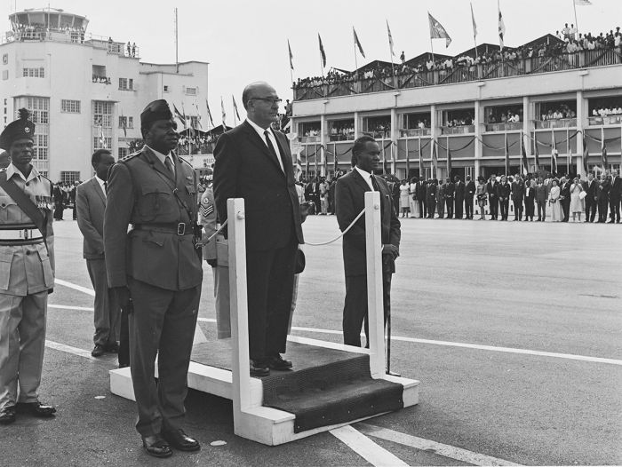
Ugandan Army Chief of Staff Idi Amin with Israeli Prime Minister Levy Eshkol at Entebbe Airport in 1966 (photo: Wikimedia Commons).
On 11 January 1971, Obote travelled abroad to attend a Commonwealth summit in Singapore, and while the President was away, Amin learned that Obote planned to arrest him for his misappropriation of military funds. Before departing, Obote left instructions to loyal Army officers that Amin and his supporters in the Army were to be arrested. The information regarding Obote's orders was leaked to Amin, and Amin decided to overthrow Obote while he was away and before his possible arrest could take place.
On 25 January 1971, Army and military police loyal to Amin secured strategic positions in and surrounding Entebbe and Kampala and sealed off the International airport in Entebbe to prevent Obote's return. Obote's residence was surrounded and all major roads in the two cities were blocked.
Ugandan Army soldiers and tanks took to the streets of both cities. Soldiers loyal to Obote, including members of Obote's GSU unit, resisted the coup forces in fierce fighting. The Obote loyalists were too disorganized to mount an effective resistance to Amin's troops, and they were quickly overwhelmed. At 16:30, it was announced over the radio that Amin's forces had taken control of the country and an overnight curfew was announced.
Radio broadcasts the following day accused the Obote regime of major corruption and policies that gave preferential treatment to certain regions in the country. Cheering crowds filled Kampala in support of Amin. Julius Nyerere, President of Tanzania, refused to recognize Amin's military regime and offered Obote asylum in Tanzania.
It has been suggested that Obote's strong anti-foreign sentiments, as illustrated by the Nakivubo Pronouncement (see above), may have brought foreign support to aid in the overthrow of Obote.
Idi Amin ruled Uganda in a despotic regime from 1971-1979 (photo: Wikimedia Commons).
Amin Rule (1971-1979)
On 02 February 1971, Amin declared himself President of Uganda, Commander-in-Chief of the Armed Forces, Army Chief of Staff, Chief of Air Staff, and Chairman of the Defence Council.
Amin's coup was welcomed by many in Uganda, particularly in Buganda, which Obote was in the process of dismantling. Amin made conciliatory announcements that his regime would only play a "caretaker" role until Uganda could recover from the corrupt Obote regime and that civilian rule would then take over.
Amin's new government was quickly recognized by Britain, the United States, and Israel (which had taken part in supporting the coup). Tanzania, Zambia, and Kenya initially refused to accept the legitimacy of Amin's new military government.
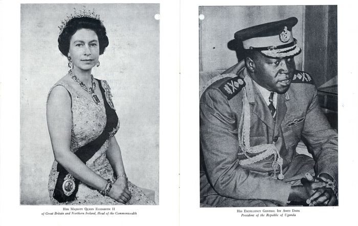
Idi Amin was immediately recognized as the new leader of Uganda by Britain, the United States, and Israel (image: Wikimedia Commons).
Amin's new position of President, along with certain provisions of the Constitution that Amin suspended, essentially made him the despotic dictator of Uganda. Amin immediately disbanded the General Service Unit (GSU), Obote's very unpopular intelligence agency, and replaced it with his own secret police organization called the State Research Bureau (SRB). The SRB headquarters in the Kampala suburb of Nakasero would become the site of torture and untold numbers of executions during Amin's rule.
After seizing power, Amin immediately began rooting out Obote loyalists, particularly in the armed forces. He recruited new military personnel heavily from within his own ethnic group, the Kakwas, as well as from the South Sudanese. By 1977, these groups accounted for 60 percent of the military's top officers and 75 percent of Amin's cabinet. By 1978, the Ugandan Army had grown from 10 000 when Amin had seized power to 25 000 soldiers. Amin's military became a mercenary force comprised of 50% South Sudanese, 26% Congolese, and only 24% Ugandan, which were mainly Muslim and Kakwa.
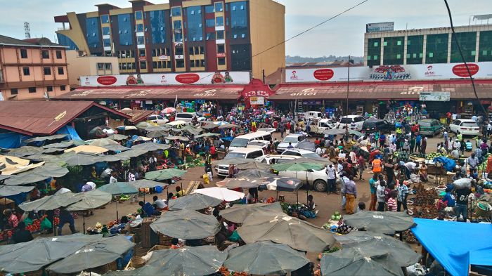
The Nakasero Market in Kampala, built in 1927 (photo: Wikimedia Commons).
Asian Expulsion (1972)
In August 1972, Amin decreed that Uganda's 80 000 Asians, most of whom were descendants of laborers from India, had 90 days to exit the country permanently and seized all Asian business, homes, and other assets. Amin's rationale for the decree was that the Asian population was disloyal and that he wished to give Uganda back to the ethnic Ugandans.
Amin proclaimed that the Common man of Uganda was the beneficiary of the Asian expulsion, which made the move very popular amongst the Ugandan populace. In truth, it was the Ugandan Army elite that ended up being given the cars, houses, and businesses of the departed Asians.
The expropriation of the Asian businesses was an economic disaster, with inexperienced Ugandan Army officers running a large segment of the country's economy. Most of the businesses soon failed due to mismanagement, including major cement factories and sugar production businesses.
Expelled Asians in the Netherlands after leaving Uganda, 1972 (photo: Wikimedia Commons).
Obote Counter-Coup Attempt (1972)
In September 1972, Obote, who had been given asylum in Tanzania, along with a force of some 1 000 Ugandan exiles loyal to Obote, invaded southwestern Uganda from Tanzania, and occupied the towns of Mbarara and Masaka. The attack was an attempt to persuade defections within Uganda's Army, but this did not happen, and the attackers were soon repelled by Amin's soldiers.
Amin claimed that such an attack could only have come with the knowledge and support of the Tanzanian government and, in retaliation, Amin sent aircraft to bomb the Tanzanian town of Bukoba, just south of the Ugandan border, killing some civilians.
The town of Bukoba, in northwest Tanzania (photo: Wikimedia Commons).
Amin's Reign of Terror
The failed incursion by Obote fueled Amin's obsession with threats to his supreme power and he embarked on a program to uncover all subversives and enemies of his regime, be they real or imagined. Thousands of people "disappeared" as Amin's GSU (secret police) apprehended anyone suspected of being a subversive.
During the first two years of Amin's regime, most members of the military that were identified with the Obote regime were purged by execution. By early 1972, some 5 000 Acholi and Lango soldiers that were presumed to be loyal to Obote had "disappeared", as well as double that many civilians. Besides soldiers, the main targets of the assassinations were religious leaders, journalists, senior bureaucrats, lawyers, judges, students, professors, and foreign nationals.
By the end of 1973, 13 of 23 high-ranking officers at the time of the 1971 coup had been executed or simply went "missing" and of the 20 ministers in Obote's 1971 cabinet, eight had been murdered and four were exiled.
Numerous prominent people were victims of Amin's terror, including Benedicto Kiwanuka, the former head of the banned Democratic Party (DP) and the country's first prime minister. Kiwanuka was one of 55 political detainees released from prison by Amin after the coup in January 1971 and Amin appointed him Chief Justice of Uganda in June 1971. Amin's disregard for the rule of law often meant that Kiwanuka was unable to properly administer the rule of law, and he sometimes countermanded some of Amin's more draconian orders.
Benedicto Kiwanuka with USA President John F. Kennedy in 1961 (photo: Wikimedia Commons).
After Obote's failed counter-coup in September 1972 (see above), President Amin received information that Kiwanuka had secretly agreed to support Obote's return to power, with the proviso that Kiwanuka be involved in the new government. Amin had Kiwanuka seized directly from his courtroom as he was presiding over a session of High Court. Kiwanuka was detained at Makindye Military Prison in Kampala, where he was subjected to prolonged torture and eventual execution.
During Amin's eight years in power, the exact number of Ugandans killed by his regime is unknown, but is estimated to be between 300 000 and 500 000. Most executions were carried out under the guise of his SRB, many of them involving horrific torture.
International Relations
Western nations, including the United States, Israel, West Germany, and especially Great Britain, initially supported the Amin regime, mostly due to their displeasure with Obote's unpopular socialist movement and his nationalization of foreign businesses.
During his youth, Amin had served in the King's African Rifles and taken part in Britain's suppression of the Mau Mau uprising in Kenya prior to Ugandan independence and he was viewed as being extremely loyal to Britain. This perceived loyalty to Britain made Amin a good choice to replace Obote.
Following Amin's decree that all Asians, the majority of whom were Indians, were to be expelled from Uganda in 1972, India severed diplomatic relations with Uganda. Later that same year, Amin broke all relations with Britain and nationalized all British-owned businesses in Uganda.
Also in 1972, Amin expelled all Israeli military advisors from the country and turned instead to Libya's Muammar Gaddafi and the Soviet Union for military support, both of whom began to support Amin financially and militarily, with the Soviets becoming the chief arms supplier for Amin.
Muammar Gaddafi, Prime Minister of Libya, pictured in 1970 (photo: Wikimedia Commons).
Despite the thousands of executions ordered by Amin to root out his rivals and anyone suspected of subversiveness, many of them well publicized, the majority of African leaders supported Amin's despotic regime. In 1975, Amin was even made President of the Organization of African Unity (AOU).
The only outwardly dissenting voice to Amin's rule amongst the national of Africa was Tanzania's Julius Nyerere, who had granted exile to numerous Amin opponents, including Milton Obote. Nyerere refused to attend the 1975 AOU summit in Kampala.
Air France Hijacking (1976)
On 27 June 1976, an Air France Airbus A300 flight from Tel Aviv to Paris, with 242 passengers on board, was hijacked by two members of the Popular Front for the Liberation of Palestine (PFLP) and two members of the German Revolutionary group Revolutionäre Zellen.
President Amin, who had been informed of the plan from the beginning, supported the hijacking and permitted the hijackers to land the flight at Entebbe Airport, where he personally welcomed them. The in-air hijackers were joined by three more on the ground at Entebbe. Once on the ground, the hijackers were allowed to move all passengers and crew from the aircraft to a disused airport building, whereupon the Israeli Jews were separated from the larger group into a separate room.
The hijackers demanded the release of 40 Palestinian militants from Israeli prisons, as well as 13 prisoners from four other countries in exchange for the passengers being held hostage. Over the next two days, the 148 non-Israeli passengers were released and flown out to Paris, while 94 mostly Israeli Jews, along with the 12-member Air France flight crew were kept as hostages.
During the night of 03 July 1976, a group of 100 commandos from the Israeli Defense Force (IDF) flew in from Israel to conduct a rescue mission. The operation, dubbed Operation Thunderbolt, had been planned in Israel during the days since the hijacking.
Commandos from the Israeli Defense Force with the Mercedes they used to deceive the Ugandans (photo: Wikimedia Commons).
After freeing the hostages in a daring raid, the Israeli assault team returned to their aircraft and were loading the freed hostages on board when Ugandan soldiers shot at them from the ground and from the airport control tower. The Israelis returned fire, inflicting heavily casualties. Five Israeli commandos were wounded and the Israeli unit commander, Yonatan "Yoni" Netanyahu, the older brother of Benjamin Netanyahu, (future Prime Minister of Israel) was killed.
After subduing the Ugandan attack, the Israelis loaded all hostages and their fallen leader onto their planes and left the airport. The entire operation lasted 53 minutes. All seven hijackers and around 40 Ugandan soldiers were killed. The assault team also destroyed eleven Soviet-built MiG-17 and MiG-21 fighter planes of the Ugandan Air Force on the ground at Entebbe Airport. The rescued hostages were flown to Israel, via Nairobi, Kenya.
Of the 106 hostages, 102 were successfully rescued and three were killed. The remaining hostage, 75-year-old Dora Bloch, a dual Israeli-British citizen, who had served as an interpreter between the hostages and hijackers, had become ill while at the airport. The hijackers permitted Ms. Bloch to be transferred to a Kampala hospital before the rescue operation, so she was not present when the hostages were freed. When British officials went to visit Bloch in the hospital, they were denied entry.
It was later learned (via testimony by Uganda's Minister of Justice at the time) that Bloch had been executed on orders from President Amin. Her remains were recovered in a sugar plantation in 1979 after Amin's rule had ended.
Publicity photo of Charles Bronson, who starred in the film, Raid on Entebbe (1977) (photo: Wikimedia Commons).
War with Tanzania (1978-1979)
Tensions between the Countries
By early 1978, the Ugandan Army had become dangerously destabilized, caused by years of violent ethnic purges and rivalries amongst the officers. Moreover, the Amin regime was rapidly declining due to the country's failing economy.
Concurrently, relations between President Amin and Julius Nyerere, the President of Tanzania, continued to deteriorate. Nyerere, who had given safe exile to Milton Obote, supported the failed Obote coup attempt in 1972, and was outwardly critical of Amin's despotic rule, was a constant irritant and worry for Amin.
In October 1978, Ugandan troops began incursions into Tanzania, west of Lake Victoria, invading the land known as the Kagera Salient, a small region north of the Kagera River in Northwest Tanzania. Amin had long expressed that this land should in fact belong to Uganda, and not Tanzania.
Julius Nyerere, President of Tanzania, pictured in 1965 (photo: Wikimedia Commons).
The reasons for the armed invasions by Ugandan soldiers are not clear, and numerous differing accounts for the events exist. One theory is that Amin ordered the invasion to distract the public and his military from the growing domestic crises. Another theory is that military troops dissatisfied with the Amin regime mutinied and were chased across the Tanzanian border by Amin loyalist soldiers.
A third possibility is that Amin sent suspected disloyal troops to the border and ordered them to invade Tanzania on what he believed would be a suicide mission, hoping that the weakened troops could then be easily purged by his soldiers upon their return to Uganda. Finally, it is possible that Ugandan troops stationed along the border caused skirmishes with Tanzanian soldiers that escalated out of control and the Ugandan soldiers invaded on their own accord, causing Amin to sanction the invasion to save face.
Whatever the actual reason for Uganda's invasion of Tanzania, it resulted in outright war with Tanzania.
Ugandan Invasion
On 25 October 1978, the Ugandan Army launched a large-scale attack over the border, but it was repelled by Tanzanian artillery. The Ugandans launched a second attack on 30 October 1978 and successfully overwhelmed a small contingent of Tanzanian soldiers and proceeded to occupy the Kagera Salient.
President Amin declared victory and that Uganda was annexing the captured territory. Soon after, Ugandan troops destroyed the only bridge over the Kagera River in order to hamper any counter attacks by Tanzania. Although successful in this initial attack on Tanzania, critical weaknesses in the Ugandan Army were quickly apparent, as instead of focusing on securing the captured territory or preparing defenses, the Ugandan soldiers went on a rampage.
The Ugandan officers and troops focused their attention on pillaging the villages, and stealing cattle, cars, and personal items from homes in the occupied territory. They also raped women and killed some 1 500 Tanzanian civilians, with thousands more fleeing south. Hundreds of Ugandan soldiers took their loot and then deserted.
Tanzania was caught by surprise by the Ugandan Army offensive, but quickly reacted by instructing their armed forces, the Tanzania People's Defence Force (TPDF), to prepare a counter-offensive. The Organisation of African Unity (OAU) attempted to initiate a diplomatic solution, but President Nyerere refused to participate in mediation with Amin.
Idi Amin (left) and Joseph-Désiré Mobutu, the President of Zaire, pictured in 1977 (photo: Wikimedia Commons).
Ugandan Rebels and Exiles
Following Uganda's invasion of the Kagera Salient, President Nyerere declared that Tanzania would train, finance, and arm any Ugandans that were willing to fight to overthrow Idi Amin. Multiple groups of Ugandan exiles responded, many of them political rivals of each other, as well as opposition members within Uganda.
Included in the larger rebel groups that joined the Tanzanian efforts were Kikosi Maalum, a militia of Ugandan exiles in Tanzania loyal to Milton Obote, the Front for National Salvation (FRONASA), an opposition group operating from Tanzania and led by Yoweri Museveni, and the Save Uganda Movement (SUM), a militant group opposed to Amin operating mainly from Kenya and Tanzania.
Tanzanian Counter-Offensive
The TPDF immediately initiated its counter-offensive, dubbed "Operation Chakaza", and by the second week in November, it had amassed a substantial force on the southern bank of the Kagera River. The TPDF deployed heavy shelling on the Ugandan forces across the river to the north, causing most of the Ugandan soldiers to retreat.
Sensing defeat and lack of support from the OAU and other African states, President Amin announced an unconditional withdrawal of the Ugandan Army from Tanzania. The Tanzanian government denounced Amin's claim of withdrawal, calling it a lie.
On 19 November 1978, the TPDF, using a pontoon bridge they assembled, crossed the Kagera River and immediately began scouring the land north of the river, where they discovered untold numbers of dead civilians and destroyed property left behind by the Ugandans. They encountered no Ugandan troops, since most had fled under the barrage of artillery from the Tanzanian forces.
By the third week of December 1978, all Ugandan troops had been forced out of Kagera and back into Uganda; however the Ugandan Army maintained a force just across the border at the border town of Mutukula. Tanzanian commanders feared that if they withdrew from the border region, that the Ugandan Army would again launch an attack. President Nyerere visited the border area and, seeing the Ugandan troops encamped just across the border, was convinced of the same. Nyerere ordered his troops to capture Mutukula.
By now, militants from the Palestine Liberation Organisation (PLO) had joined the Ugandans to assist at the frontline. The PLO had been allies of the Amin regime for years, and had 400 fighters already stationed for training in Uganda. The PLO militants were sent to assist Amin's troops to protect PLO interests in the region. Amin's army also had the assistance of around 300 Pakistani Air Force personnel, who had been stationed in Uganda since early 1978.
A Soviet-made, truck-mounted BM-21 Grad rocket launcher like the ones used by the TPDF (photo: Wikimedia Commons).
On 25 December 1978, the TPDF launched a large-scale artillery bombardment along the border using Soviet-made, truck-mounted BM-21 Grad rocket launchers. The Ugandans lacked weaponry to counter such an attack and were terrified of the destruction caused by the rockets. The TPDF shelled the border for weeks and on 28 January 1979, the TPDF crossed the border into Uganda and attacked Mutukula. The Ugandans were easily overwhelmed and fled the border town, leaving behind crucial weaponry.
TPDF Siege on Masaka and Mbarara
Although Nyerere did not intend to press the offensive into Uganda, he thought it best to have Tanzanian troops occupy southern Uganda, specifically the towns of Masaka and Mbarara. The TPDF was ordered to siege the two towns as revenge for the devastation caused by the Ugandan Army when it invaded the Kagera Salient.
Milton Obote, who was advising Nyerere on the war, believed that if the towns were taken, there would be a mass uprising against Amin and that the Ugandan Army would collapse.
The TPDF, with the assistance of about 1 000 Ugandan rebels that were exiled in Tanzania, launched an offensive to take the towns of Masaka and Mbarara in mid-February 1979. They advanced steadily, killing scores of Ugandan soldiers and destroying Ugandan Army supplies along the way. The TPDF sustained some losses, but pushed forward, often cheered on by Ugandan civilians as they passed.
On 23 February 1979, the TPDF captured and occupied the town of Masaka. Tanzanian troops proceeded to destroy most buildings in the town with explosives. Two days later, the TPDF, with assistance of several dozen Ugandan rebels led by Yoweri Museveni, captured and occupied Mbarara town, razing all major buildings with dynamite.
At this point, Libyan leader Muammar Gaddafi, an ally of Amin, sent Libyan troops to Entebbe to assist the Uganda Army. Concurrently, Amin requested further assistance from Palestine, which was granted by Yasser Arafat, Chairman of the PLO, who sent more PLO forces to augment Amin's troops and protect his regime.
The Ugandan town of Mbarara was captured by the TPDF in February 1979 (photo: Wikimedia Commons).
Rebel Siege on Tororo
Meanwhile on 02 March 1979, some 200 Ugandan rebels launched an attack on the town of Tororo in eastern Uganda, which was the location of the Ugandan Army's Air and Sea Battalion. The battalion was grossly understrength, having only 1 000 to 2 000 soldiers. The attack originated from Tanzania and crossed into Uganda by boat over Lake Victoria, with some of the leaders sneaking in by land through Kenya.
The rebels successfully routed the Amin soldiers (with assistance from mutineering Ugandan soldiers at the barracks) and captured the army barracks and the town of Tororo, but their plan to evacuate the Ugandan weapons failed, as all the Ugandan military vehicles had been used by fleeing army officers.
On 04 March 1978, Amin sent troops from the base at Jinja to block any rebel/mutineer advancements from Tororo towards Kampala. The Ugandan Army battalion soon surrounded many of the rebels at Tororo and inflicted heavy casualties. The Ugandan Air Force arrived in MiGs and started a mass bombardment of the area on orders from Amin, inflicting heavy casualties on rebels, civilians, and Ugandan soldiers, causing complete chaos.
The battle at Tororo was a defeat for the Ugandan rebels loyal to Milton Obote. Amin was overjoyed by the victory and was convinced to sanction a large counter-offensive at Lukaya to drive back the TPDF forces.
The Battle of Lukaya
Following the capture of Masaka and Mbarara, the TPDF halted its advance to reorganize and prepare for further movement towards Kampala. The only road to the capital passed through the town of Lukaya and then through a swamp, which was only passable via a causeway. If the Ugandans destroyed the causeway that passed over the swamp, it would mean serious delays for the TPDF in terms of reaching Kampala.
In early March 1979, despite the risks involving the causeway and the swamp, the TPDF launched a multi-prong attack on Lukaya from three sides. Additional sieges by TPDF and Ugandan rebel brigades were planned for the towns of Mpigi and Mityana, from which the final attack on Kampala could be launched.
Amin was presented with a plan to destroy the causeway, but the President rejected it, thinking that it would only impede his army's ability to launch a counteroffensive. Amin was also confident that with the victory at Tororo and the substantial Libyan support, that he would soon defeat the TPDF and that he would then not have to rebuild the causeway.
After the occupation of Masaka by the TPDF, Amin ordered his forces to recapture the town. A force consisting of Ugandan troops, Libyan soldiers, and small numbers of PLO guerrillas was assembled to take back Masaka.
Map of troop movements in Uganda before and after the Battle of Lukaya, 1979 (photo: Wikimedia Commons).
On the morning of 10 March 1979, the TPDF and a battalion of Ugandan rebels moved on Lukaya and occupied the town without incident. Later that afternoon, Libyan troops attacked the town using rockets and the TPDF scattered into the nearby swamp.
The next day (11 March 1979), another TPDF brigade flanked the Ugandan-Linyan forces for a counterattack. The two TPDF brigades attacked simultaneously from the front and rear, inflicting heavy casualties. Hundreds of Ugandan and Libyan troops were killed, including the Ugandan Army colonel leading the Amin troops. The heavy losses caused the remaining Libyan and Ugandan troops to flee the town and head back to Kampala.
Lukaya was effectively retaken by the Tanzanian forces. The Ugandan-Libyan forces left behind large numbers of weapons, as well as a copy of their battle plan, which were seized by the Tanzanians. Some 7 000 TPDF and Ugandan rebel soldiers took part in the battle and a reported Ugandan 400 soldiers were killed, including about 200 Libyans, with many more wounded.
The battle of Lukaya was the largest engagement of the war and it was a devastating loss for Amin's forces. Morale in the Amin forces was shattered and the Ugandan resistance was crumbling rapidly.
Plan to Take Kampala
After capturing Masaka, President Nyerere's plan was to halt his TPDF forces there and allow Ugandan rebel forces to continue on to Kampala and overthrow Amin. He feared that the sight of his Tanzanian forces occupying the Ugandan capital would have a negative effect on his country from a global viewpoint. Unfortunately, the Ugandan rebel forces were not strong enough to defeat the combination of Ugandan forces supplemented by Libyan forces, so Nyerere was forced to take the capital.
As part of the plan to take Kampala, the TPDF was to advance on Mpigi during early March 1979, and from there to Mityana. Once both towns were occupied, the final attack on Kampala would begin. Amin had a large regiment stationed at Mubende and, to prevent that unit from heading south toward the Tanzanian positions, a TPDF brigade was dispatched north to seal off the route.
The Tanzanian forces regrouped in the town of Masaka before pushing on towards Kampala (photo: Wikimedia Commons).
Uganda National Liberation Front (UNLF)
In preparation for the assumed downfall of the Amin regime in the coming weeks, a meeting of the leaders of the various Ugandan rebel groups was held from 24-26 March 1979 in Moshi, Tanzania. Known as the Moshi Conference, a total of 28 rebel groups were represented, with the larger and most important groups being Kikosi Maalum (led by Milton Obote), the Front for National Salvation - FRONASA (led by Yoweri Museveni), and the Save Uganda Movement - SUM (led by Akena p'Ojok).
The conference resulted in the formation of the Uganda National Liberation Front (UNLF), a political group combining each of the Ugandan exile groups with the intention of taking initial rule over Uganda once Amin's regime was ousted. UNLF's initial leaders were Chairman Yusuf Lule, Vice-Chairman Akena P'Ojok, and a National Consultative Council which included one member from each of the 28 groups represented at the conference. The military wing of the UNLF was named the Uganda National Liberation Army (UNLA).
Battle of Sembabule
The Tanzanians encountered an Ugandan regiment entrenched in the town of Sembabule, where a three-week-long battle for the town ensued. The TPDF unit was rather new and inexperienced, and was therefore unable to make headway into the town. More than 20 Tanzanian soldiers were killed and morale in the TPDF declined, with the Ugandans repelling every effort by the TPDF to advance.
After more than two weeks of heavy fighting, two additional TPDF battalions were dispatched to Sembabule to add support for the stalled Tanzanian assault. With the help of the additional troops, the TPDF was finally able to overrun the Ugandan regiment, capturing Sembabule on 06 April 1979. The Ugandans regiment fled from the town, leaving behind some two dozen dead.
After taking Sembabule, one of the TPDF battalions moved north and occupied the town of Mubende, which they found deserted. The battle for Sembabule was the longest battle of the Tanzania-Uganda war.
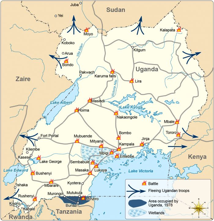
Map showing the key battles in the Uganda - Tanzania War in 1978-1979 (photo: Wikimedia Commons).
Liberation of Kampala
With all prior Ugandan strongholds west and north of Kampala now secured by the combined TPDF and UNLA rebel forces, the assault on the Ugandan capital of Kampala was imminent. President Amin gave final orders to his forces for the defense of the capital, but Amin himself, along with most of his trusted aides, security personnel, and other regime leaders, fled Kampala to the east well before the assault began.
On the morning of 03 April 1979, the first TPDF brigade advanced from the west to take Entebbe. It subjected the city to three days of light shelling. President Amin had been at the Entebbe State House at the time of the initial attack, but was evacuated via helicopter to Kampala. The bombardment of Entebbe was intensified on 06 April 1979, and by the flowing morning, the TPDF had taken the city. Hundreds of Ugandan Army Air Force personnel surrendered, effectively marking the de facto end of Amin's Air Force.
With Entebbe secured, the TPDF began its assault on Kampala. One TPDF brigade advanced from Entebbe in the south, a second TPDF brigade, augmented by an UNLA battalion, moved in from the west, while a third brigade established roadblocks to the north to prevent Ugandan forces from withdrawing. A corridor to the east was left open, which would allow the Libyans to escape to Jinja, from where they could fly out of the country. President Amin left Kampala by this route and was flown to Libya.
The combined TPDF and UNLA forces encountered only sporadic resistance and were openly greeted by cheering crowds of civilians. The Tanzanians secured the national radio station and the Ugandan Army headquarters unopposed, but met some resistance taking the State Research Bureau (Amin's secret police) headquarters and Ugandan soldiers reportedly killed all remaining political prisoners at the SRB before abandoning it. The remaining Libyans in the city fled to Jinja, as was anticipated.
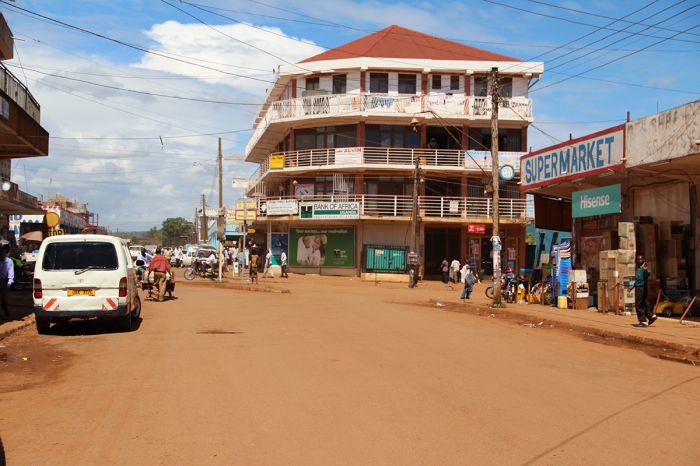
Before the siege on Kampala, Idi Amin fled east to the town of Jinja, shown here in 2012 (photo: Wikimedia Commons).
By early morning on 11 April 1979, TPDF troops had severed all routes out of Kampala, including the road to Jinja, and began eliminating any last pockets of resistance. Remaining Ugandan soldiers tried desperately to escape the city, disguising themselves in civilian clothing and stealing civilian cars. Casualties were light on both sides, though Ugandan rebels reportedly conducted revenge killings against suspected Amin collaborators, as well as Kakwa and Nubian soldiers known to be loyal to Amin.
On 11 April 1979, Kampala's residents engaged in rampant looting and destruction of property, despite attempts by the Tanzanian and UNLA troops to keep order. A new Ugandan government was established by the UNLF in the immediate aftermath of the seizing of Kampala. Pro-Amin forces were left scattered throughout the country, and the Tanzanian and UNLA troops moved steadily north into all regions of Uganda to clear out all remaining resistance. Combat operations concluded on 03 June 1979, when the Tanzanian forces reached the Sudanese border.
The occupation of Kampala marked the first time in post-colonial history that an African state had seized the capital of another African country and deposed its government.
Uganda after Amin
Interim Government
In mid-1979, the newly formed Uganda National Liberation Front (UNLF) became the interim government of Uganda, with the UNLA becoming the new national army. As head of the UNLF's Executive Committee, Yusuf Lule, an Ugandan professor at Makerere University, became Uganda's new president. As an academic rather than a politician, Yule lacked political ambitions or ties to any of the UNLF's rival factions, making him a good initial choice. Yule was advised by a temporary parliament, the National Consultative Council (NCC), which was composed of representatives from each of the 28 groups in the UNLF.
Meanwhile, Tanzanian troops still controlled Kampala, mostly to maintain order while the new government took hold and to ensure any remaining Amin loyalist groups were subdued.
Unsurprisingly, conflict within the UNLF surfaced quickly, with some of the more radical council members accusing Lule of being too conservative and autocratic, while favoring the legitimate interests of Buganda. Lule's plans to disband the UNLA, which was largely made up of Obote-loyal soldiers, outraged the Obote-loyal members of the council. After only 68 days as president, Lule was forcibly removed and exiled to Tanzania, where he was put under house arrest. He later relocated to London.
Yusuf Lule, a professor at Makerere University (shown here), became the interim president of Uganda after Amin was ousted (photo: Wikimedia Commons).
Replacing Lule as President of Uganda (on 20 June 1979) was Godfrey Binaisa, who had previously served as Attorney General of Uganda from 1962 to 1968 during the Obote presidency. President Binaisa enlarged the NCC to 127 members and quarrels within the NCC continued to escalate, with rivals vying for position to take control and exercising their power for their own self-interests.
The UNLA troops that had fought alongside Tanzania soldiers to oust Amin now numbered only 1 000 soldiers and there was a push, particularly by Yoweri Museveni and Major General David Ojok, to recruit more Ugandans to the UNLA. Both Museveni and Ojok enrolled thousands of new recruits during 1979. President Binaisa mistrusted the growing military, with its militias harassing and detaining political adversaries of Ojok in particular.
In early May 1980, Binaisa removed Ojok, who was then Army Chief of Staff. The UNLF's Military Commission, a powerful wing of the UNLF headed by Paulo Muwanga and Yoweri Museveni, acted quickly and removed Binaisa from the presidency on 12 May 1980.
Replacing Binaisa was a new Presidential Commission of Uganda, which members included Paulo Muwanga, Yoweri Museveni, Oyite Ojok, and Tito Okello, among some others. The Presidential Commission was to rule the country for six months until general elections, which were planned for December 1980, could be held.
Shortly after Binaisa was removed from office, Obote returned to Uganda from Tanzania and began rallying his former UPC party loyalists and actively campaigned for his own reelection and the return of a one-party UPC-controlled state.
Obote Again
The 10 December 1980 national elections were the first in the country in eighteen years (since 1962). Competing parties in the elections were Obote's United People's Congress (UPC), the Democratic Party (DP), headed by Paul Kawanga Ssemogerere, Museveni's United Patriotic Movement (UPM), and the Conservative Party (CP).
The fact that the Military Commission, as the acting government, was dominated by Obote supporters (notably chairman Paulo Muwanga) meant that the DP and other parties faced serious obstacles in the election. Seventeen UPC candidates ran "unopposed", as reportedly other candidates were prohibited from running against them. UPC party members replaced local voting supervisors and the Chief Justice of Uganda, to whom voter fraud complaints would be made, was also replaced with a UPC member.

The Uganda People's Congress (UPC, flag shown above) won the majority of seats in the 1980 elections (photo: Wikimedia Commons).
Voting turnout was strong and the DP, based on its internal estimates, declared victory in 81 of the 126 constituencies. The BBC and Voice of America radio broadcasts reported news of the DP's victory and Kampala's streets were filled with joyous DP supporters.
Muwanga immediately seized control of the Electoral Commission and took control over ballot counting, declaring that anyone disputing his official results would be subject to heavy fines and imprisonment. Less than a day later, Muwanga declared that the UPC had won 75 of 126 seats. Popular perception pointed to a stolen election. Nonetheless, Obote was declared the new president-elect.
In February 1981, Obote took office as Uganda's president for the second time, with Paulo Muwanga as Vice President and Minister of Defense.
Ugandan Civil War
Early Rebel Movements (1981)
Yoweri Museveni, along with the other rival candidates, declared that the 1980 elections had been rigged, claiming electoral fraud. These opposition groups knew that a military coup was impossible, as the UNLA was comprised mainly of pro-Obote forces, so instead they started launching armed rebellions against Obote's government.
Museveni formed small and very mobile groups of armed fighters to conduct guerrilla warfare raids. Many of Museveni's rebel soldiers at this time were Rwandan refugees, including unit commanders Paul Kagame and Fred Rwigyema.
Tanzanian President Julius Nyerere helped defend the Obote regime for a time through the ongoing presence of 10 000 TPDF troops and another 1 000 police, but the growing cost of these troops meant that Nyerere had to gradually reduce his troops in Uganda. By mid-1981, only around 800 Tanzanian advisors remained in Uganda, which drastically weakened Obote's position.
North Korea was one of Obote's crucial allies at this time. Obote visited North Korea in late 1981 and enlisted military support for his regime. President Kim Il-sung sent 30 North Korean officers to train the UNLA's newly recruited soldiers and help run anti-insurgency operations for Obote.
In June 1981, Museveni travelled to Nairobi, Kenya to meet with Yusuf Lule, who was leading a group called the Uganda Freedom Fighters (UFF). Museveni had recently organized his militant supporters as a group called the Popular Resistance Army (PRA) and at their meeting, the two agreed to unite their forces.
North Korean President Kim Il-sung supported Obote's regime (photo: Wikimedia Commons).
The combined opposition group was dubbed the National Resistance Movement (NRM), with the armed wing called the National Resistance Army (NRA). Lule was appointed overall NRM Chairman, while Museveni became Vice-Chairman. Both leaders benefitted from the merger, as Lule lacked military strength, which Museveni supplied, and Museveni gained legitimacy from Lule, who was much respected among Uganda's southern population. By December 1981, the NRA had grown to 900 militants that were well trained and highly disciplined.
Meanwhile, Obote's UNLA had rapidly expanded to around 15 000 soldiers, but most were untrained, poorly armed, and often unpaid. Corruption amongst the UNLA was rampant and rival factions emerged within its troops. It is now believed that the UNLA would have collapsed by the end of 1981 without the Tanzanian support.
Obote Counter-Offensives (1982-1984)
The West Nile region was a growing problem for Obote's government, with various rival rebel groups controlling much of this area in northwest Uganda. By November 1982, the rebels formed an alliance called the "Uganda Popular Front" (UPF). Godfrey Binaisa, who briefly served as Uganda's president in the interim government in 1980, now exiled in London, was appointed head of the UPF.
The UPF launched an offensive into West Nile from Zaire, but it failed due to poor planning and lack of funding. Obote's UNLA forces repelled the attack and retaliated against locals, inflicting widespread destruction and massacres that caused tens of thousands of refugees to flee to Sudan and Zaire.
In the south, the Obote regime launched Operation Bonanza, a major military offensive in the Luwero region north of Kampala, where much of the main insurgents were based. Obote's troops killed tens of thousands of Bugandan civilians in a brutal campaign of genocidal slaughter that rivaled or even exceeded the brutality imposed by the Amin regime.
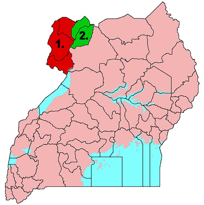
Rebel groups still loyal to Amin controlled the West Nile region (photo: Wikimedia Commons).
By late 1983, Obote's government was in control of much of Uganda, mostly thanks to the military efforts of David Oyite-Ojok, Army Chief of Staff, but it was still dealing with rebel attacks. The UNLA was able to contain the NRA troops for the most part, but it could not defeat them. Oyite-Ojok suggested to Obote that it would be best to negotiate with Museveni and the NRM, but Obote refused.
In December 1983, Oyite-Ojok was killed under suspicious circumstances in a helicopter crash. Rumors spread regarding his death, some pointing the finger at Obote as having orchestrated the "accident". With Oyite-Ojok gone, infighting amongst the UNLA's tribal factions escalated and the UNLA itself began to unravel. Concurrently, the NRA focused on anti-Obote propoganda and foreign support for the Obote government was waning.
By mid-1984, The UNLA had grown to 40 000 troops, but suffered greatly from lack of training, tribalism, corruption, and factional rivalries. Obote's troops were undisciplined, unreliable, and as most of the UNLA troops were not being paid, they also frequently harassed and sometimes killed civilians in order to steal from them.
Obote Overthrown (1985)
The chaos and unrest in the UNLA boiled over in June 1985 when Lieutenant General Bazilio Olara-Okello and Tito Okello (not related to each other), both commanders in the UNLA, revolted and marched on Kampala. On 27 July 1985, the capital fell in a short battle, but Obote had already escaped to Tanzania. Obote later fled to Kenya and then Zambia.
After the coup, Tito Okello was installed as the new head of state, with Paulo Muwanga as his prime minister. The coup was disastrous for the UNLA, which divided into its various ethnic factions and thus devolved into "marauding bands", declining in numbers to around 15 000 troops by the end of 1985.
The situation in Kampala was volatile, with rival ethnic factions controlling different parts of the city, making for an extremely fragile situation for Okello's new government. Soldiers and various militants acted with impunity on the capital.
Okello managed to open negotiations with most of the competing political factions, but Museveni's NRM refused to compromise or discuss a power-sharing deal. With the collapse of the UNLA, the NRA became the de facto superior militant force and it proceeded to take full control of the Lowero region north of Kampala, as well as much of the west and south of the country. Museveni's group now held a position of strength, which it planned to use.
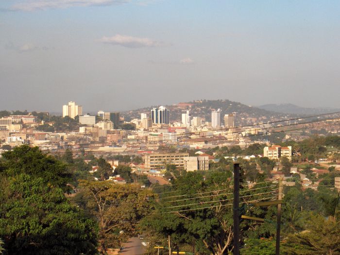
After Obote was overthrown, the situation in Kampala became dangerous and volatile (photo: Wikimedia Commons).
NRA Victory (1985-1986)
In August 1985, the NRA launched coordinated attacks that resulted in the capture of the crucial garrison towns of Masaka and Mbarara, further weakening the UNLA. The NRA absorbed huge numbers of defecting government troops, furthering its dominance. By December 1985, the NRA had grown to 10 000 armed soldiers.
On 26 January 1986, the NRA captured Kampala, effectively ending Okello's regime. Yoweri Museveni was sworn in as Uganda's new president on 29 January 1986 and the NRA became the the national army of Uganda. Tito Okello fled to Sudan.
The UNLA made a final attempt at rallying against the NRA in an attempt to defend its holdings in Northern Uganda. After bitter fighting, the NRA overwhelmed the UNLA's last defenses in the north and inflicted horrible losses on the UNLA troops. The UNLA effectively disbanded after the last-ditch efforts failed. The Ugandan Civil War appeared to be over.
Aftermath of Civil War
Estimates of the total lives lost in the Ugandan Civil War range from 100 000 to 500 000 combatants and civilians. Obote's second regime is widely considered to have been even more brutal and killed more people than Amin's.
The new NRM government led by Museveni was initially viewed with fear by most Ugandans. The populace were used to tyrannical leaders and expected more of the same, but after a few months, a large proportion of the country's civilians began to view the NRM with approval.
The exception to the growing acceptance of the new government was in the north, where anti-NRA rebel groups were still active and ex-soldiers, who were still armed and not content to go back to being peasant farmers, banded together and roamed as bandits.
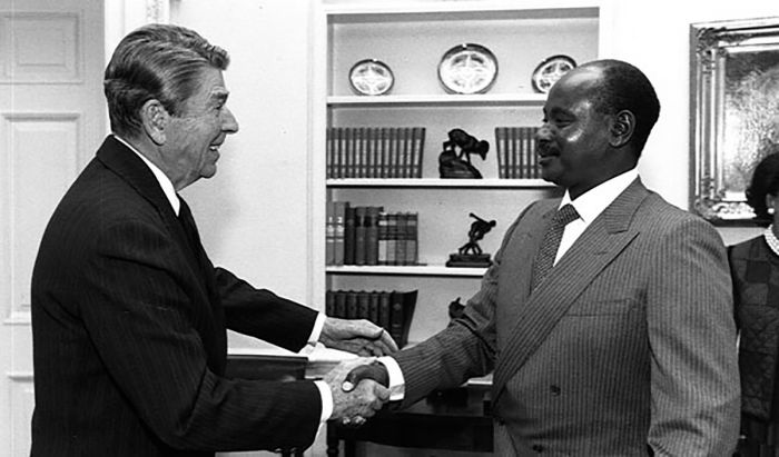
President Yoweri Museveni meets with USA President Ronald Reagan at the White House, October 1987 (photo: Wikimedia Commons).
Recent History
Uganda's seemingly endless cycle of coups, military rule, and brutality meant that Museveni faced an extremely difficult challenge in bringing peace and stability to a country that had suffered for decades.
In spite of the apparently insurmountable hurdles the NRM government faced, it quickly proved itself to be the opposite of the regimes of Amin and Obote.
Museveni succeeded in creating a diverse government that included ethnic representation across all regions and reestablished the rule of law. He invited Asians and other exiles to return to Uganda. His focus on human rights garnered foreign approval and resulted in a return of foreign investment and tourism. Perhaps most importantly, Museveni chose to move the country away from its obsession with ethnic and religious rivalries.
In 1993, Museveni granted recognition of Uganda's abolished kingdoms of old, restoring them and allowing them to reinstate their kings.
Initially, Museveni installed a form of "no-party democracy", banning political parties from fielding candidates directly in elections. Museveni felt that the country needed stability and that a no-party system would prevent the ignition of ethnic rivalries brought by a multi-party democracy.
In the no-party elections of 1996, Museveni defeated Paul Ssemogerere and Mohamed Mayanja by a landslide. Although international and domestic elections observers stated that the voting was free from fraud, both of the losing candidates rejected the results. In the following presidential election, held in 2001, Museveni won by a large majority, with Kizza Besigye, an officer in the Ugandan military, as the only challenger.
After the 2001 elections, Museveni declared that he would stand down from the presidency in 2006, when the next elections were scheduled to take place, which was in line with the NRM's national constitution that limited the presidential office to a maximum term of two terms.
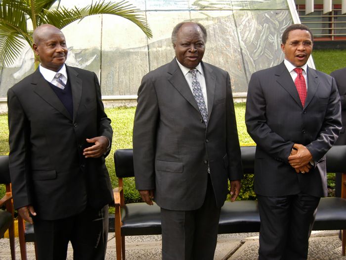
Left to right: Ugandan President Yoweri Museveni, Kenyan President Mwai Kibaki and Tanzanian president Jakaya Kikwete, during the 8th East African Community (EAC) summit in Arusha (photo: Wikimedia Commons).
In 2005, a constitutional referendum passed which effectively restored Uganda to a multi-political system, removing the 19-year ban on multiple political parties. Only weeks later, Museveni pushed through an amendment to the constitution that removed the presidential term limit, which would now allow him to seek a third term in the upcoming elections.
In November 2005, just three months before the elections, Kizza Beigye, the only serious contender to Museveni for president, was imprisoned and charged with terrorism. Besigye was released on bail in January 2006 and was allowed to run for president.
In February 2006, Uganda's first multi-party national elections in twenty-five years were held, with Museveni receiving 59% of the vote. The elections were deemed fair by international observers.
General elections were again held in February 2011. Incumbent President Yoweri Museveni was re-elected for a third time, retaining his ongoing presidency since 1986. The NRM also won 263 of the 375 seats in Parliament.
In the 2016 general elections, Museveni was again victorious, winning 61% of the vote. Opposition candidates claimed that the elections were marred by widespread fraud, voting irregularities, and voter intimidation.
On 18 November 2020 in the lead-up to the elections, opposition candidate Bobi Wine was arrested for allegedly violating COVID-19 protocols during his presidential campaign in Uganda. Wine's National Unity Platform (NUP) claimed that the arrest was designed to disrupt his campaign efforts. NUP supporters protested in the streets of Kampala and clashed with police, resulting in 100 killed and more than 500 injured.
Wine was again arrested in late December 2020, while he was holding a rally. Numerous aides, bodyguards and members of Wine's entourage were arrested, jailed, or killed during his campaign.
Uganda's most recent elections were held in January 2021. Eleven candidates were registered to contest in the election, and incumbent president Museveni won his fifth term with 58.4% of the votes, while Bobi Wine received 35.1%. The US Department of State qualified the electoral process as "fundamentally flawed" and other international observers also deemed that they witnessed significant irregularities.
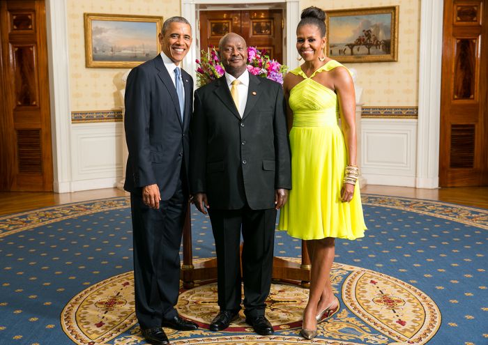
Ugandan President Yoweri Museveni poses at the White House with USA President Barack Obama and First Lady Michelle Obama in 2014 (photo: Wikimedia Commons).
Read More...
Amin Rule, British Control, Buganda, Bunyoro, Civil War, Colonization, Coup D'état, Early History, Early Independence, Early Kingdoms, Kingdoms (1450-1650), Kingdoms (1650-1850), Obote Rule, Post-Amin, Pre-Independence, Recent History, Tanzania War
Great Good Fair Poor
- Jan
- Feb
- Mar
- Apr
- May
- Jun
- Jul
- Aug
- Sep
- Oct
- Nov
- Dec
The chart directly above should be taken as a very rough overall indicator of best times to visit Uganda, as there are significant variations regionally. More information on the specific national parks and reserves is found on the previous Details tab.
Click on a Region Link above to read more about best times to visit a specific region or destination.
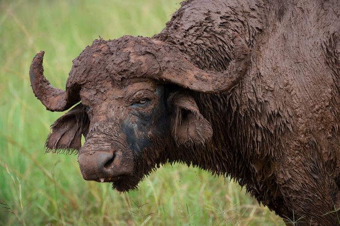
A buffalo bull after a mud bath in Kidepo Valley NP (Copyright © James Weis).
Temps
Uganda's location straddling the equator gives it a warm, tropical climate; however, most parts of the country never get overly hot owing to altitudes that average 3 000-5 00 feet (900-1 500 meters) over most of its land.
Average daily temps in much of the country are 68-80°F (20-27°C) and dropping to 54-64°F (12-18°C) overnight. The warmest temps are in the lowland plains east of Lake Albert and in the dry, far north region bordering South Sudan. The coldest temps are in the high-elevation, ice-capped peaks of the Rwenzori Mountains on Uganda's western border.
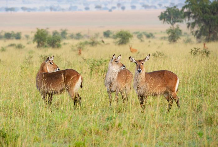
Defassa waterbucks and Jackson's hartebeests in Kidepo Valley NP (Copyright © James Weis).
RAIN AND SEASONALITY
Most of Uganda receives substantial annual rainfall (40-80 inches / 1 000-2 000 mm), which means the land is quite verdant and fertile. The exception is the semi-desert lands bordering South Sudan in parts of the far north. There is also substantial variation in precipitation amongst Uganda's various regions (see the Details tab for specifics by regional destination).
Western Uganda, which is where the majority of the country's wildlife destinations and national parks are located, does not have a dry season per se, with rain possible at any time throughout the year. That being said, there are two rather distinct 'rainy' seasons which receive more rain than other times: March thru May and mid-September thru November. April and May are typically the rainiest months in most regions.
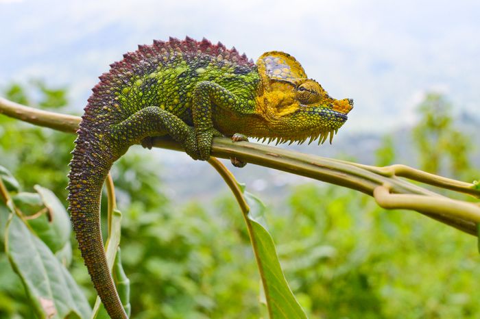
Uganda receives healthy rain throughout most of its regions.
GORILLA TREKKING
Uganda offers mountain gorilla trekking in two locations: Bwindi National Park and, to a lesser degree Mgahinga Gorilla National Park. Both of these areas can experience rain throughout the year, even in the 'drier' months. June thru August are the best months to go if you want to minimize the chances for rain. These are the busiest months and obtaining trekking permits early in advance is wise.
Gorilla treks proceed regardless of the weather, so there is not a risk of weather-caused cancellation, but dry conditions mean better footing on the trails, as recent rain can cause muddy and slippery conditions. Rain gear (pullover waterproof pants, rain shell, boots/hiking shoes, and hat) should be brought along on any trek, regardless of the time of year. Be sure to bring protection for cameras and other electronics. More info on gorilla trekking can be found on our Bwindi pages.
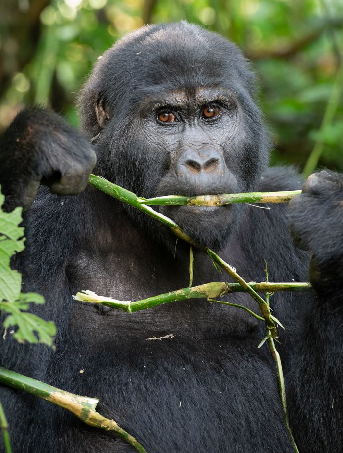
One of Bwindi's mountain gorillas (Copyright © James Weis).
CHIMPANZEE TREKKING
Uganda offers chimpanzee trekking with wild, but habituated groups of chimps in multiple locations in its western parks, but the trekking in Kibale National Park is our favorite locale. As with gorilla trekking (read above), chimpanzees activities proceed rain or shine and permits are required.
Contrary to gorillas, chimps tend to range further afield during certain times of year, based on the seasonal availability of fruiting trees. The seasonal movements of the chimps can affect the time needed to locate them on any given day. Proper rain gear is also required for chimpanzee treks, as it can rain at any time throughout the year.
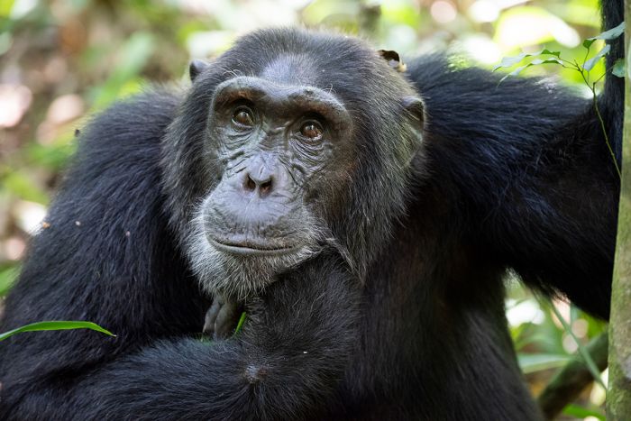
Chimpanzee trekking in Kibale National Park (Copyright © James Weis).