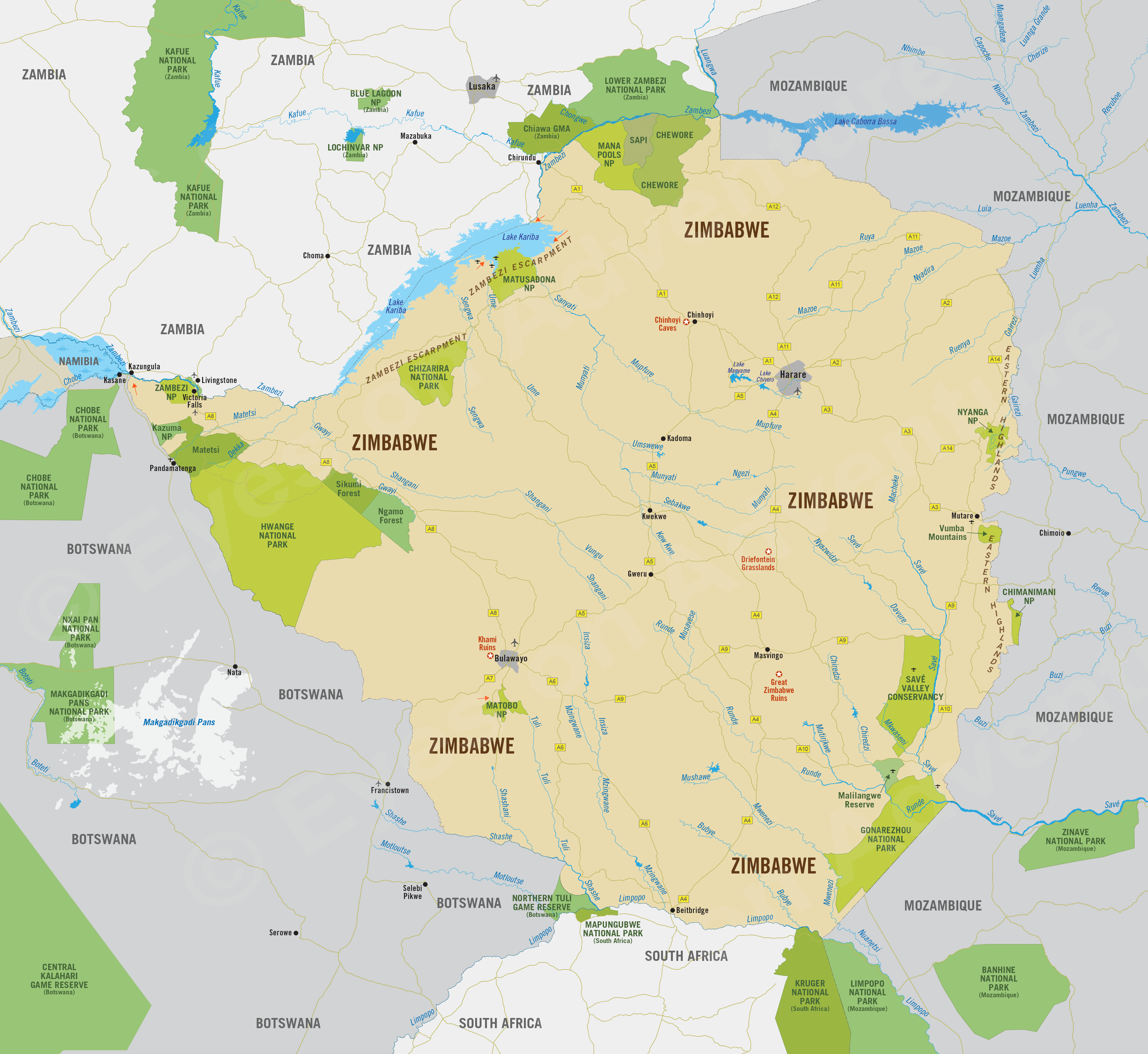
Zimbabwe
Region Links: Hwange, Lower Zambezi (Zimbabwe), Victoria Falls
Highlights
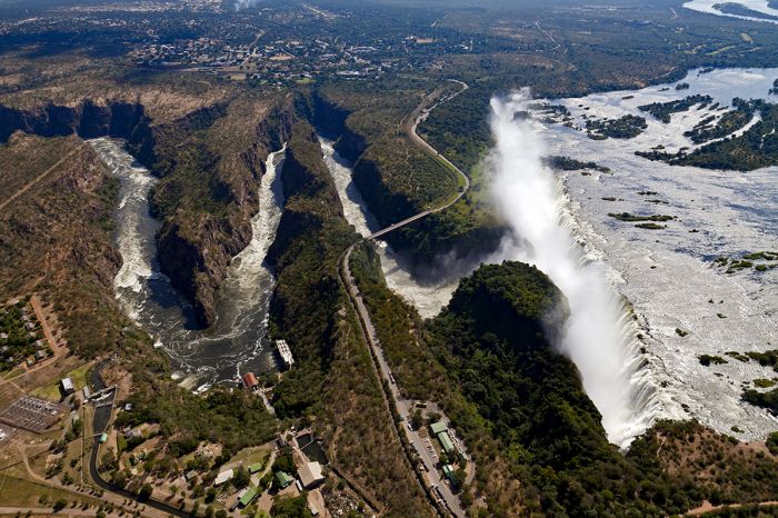
- Victoria Falls is one of Africa's great natural wonders.
- Hwange offers superb safaris with abundant wildlife.
- Lower Zambezi game drives, boating, diverse wildlife on the Zambezi River.
- Remote safaris in Malilangwe, Gonarezhou, and Savé Valley.
- The Eastern Highlands offer active adventures in picturesque mountains.
Zimbabwe offers some of Southern Africa's finest safari destinations at arguably the best values in the entire region.
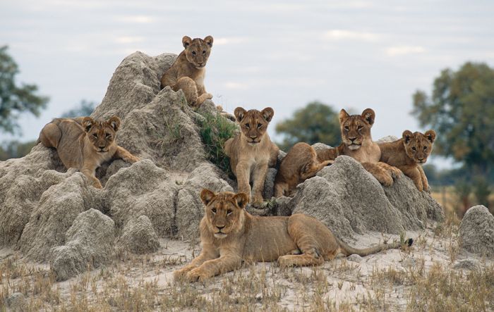
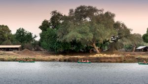
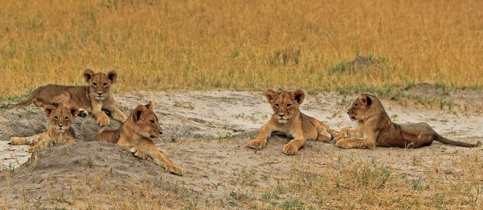
Young lions in Hwange National Park (Copyright © James Weis).
As a travel destination, Zimbabwe is often only included as a stopover at The Victoria Falls, while the rest of the itinerary is a safari to one of its neighboring countries. This is unfortunate, as the country offers some superb safari experiences in some of Africa's most beautiful natural areas.
The walking path at Victoria Falls and one of the vantage points.
Zimbabwe's most visited protected natural areas are along or just inland from the Zambezi River, which demarcates the majority of the country's northern border. Besides The Victoria Falls, there is Hwange National Park and Mana Pools National Park.
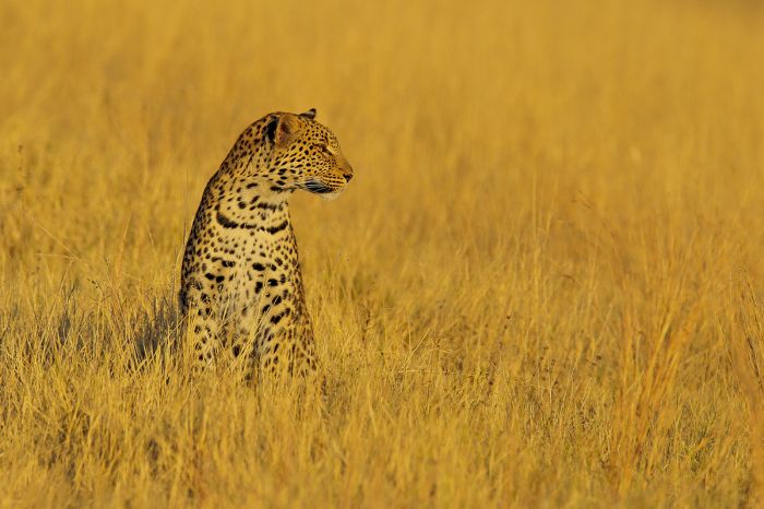
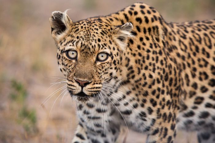
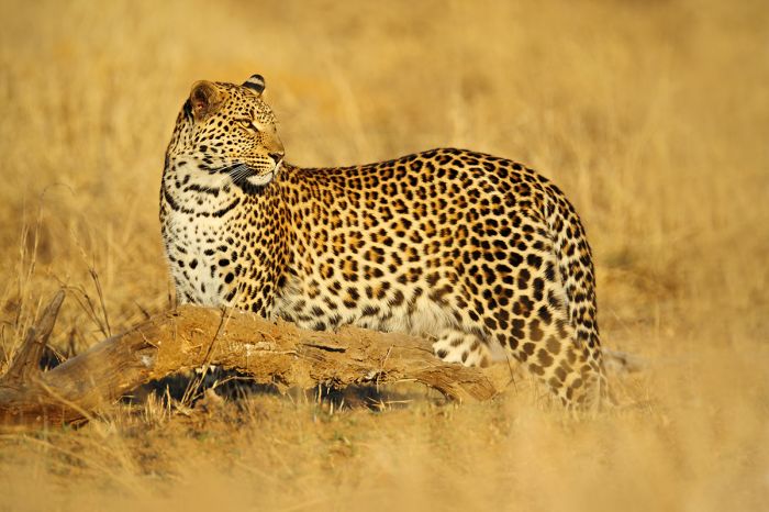
A leopard in golden grass, Mana Pools National Park.
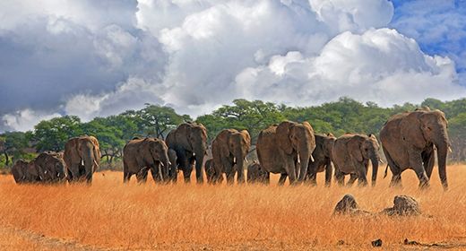
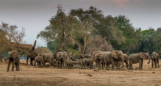
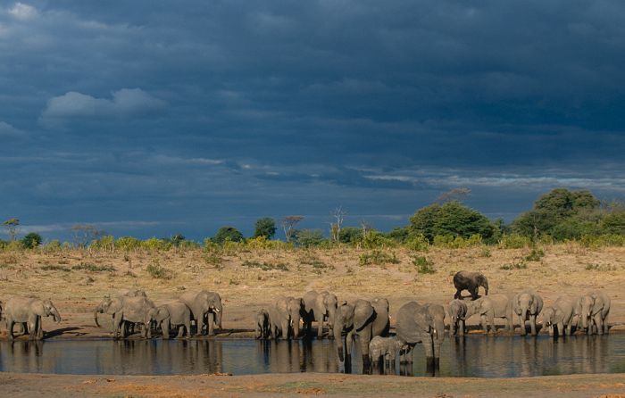
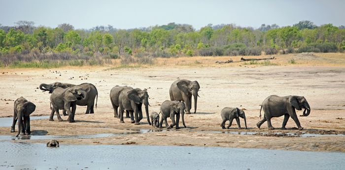
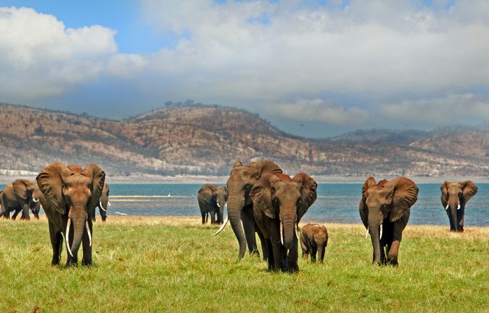
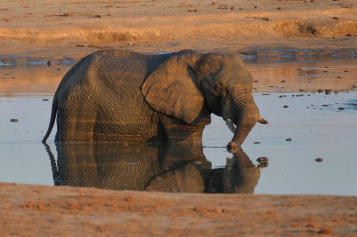
Hwange is Zimbabwe's largest national park and its oldest and is within driving distance of Victoria Falls. The park offers exceptional variety and density of wildlife and some truly outstanding safari camps and lodges. The park is sustained during the dry winter by over 60 pumped water-holes, which attract big herds of herbivores and the attendant predators.
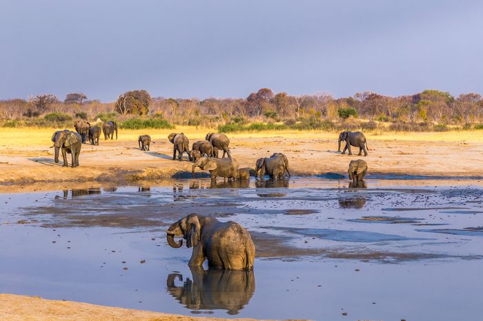
Elephants visiting one of Hwange's waterholes.
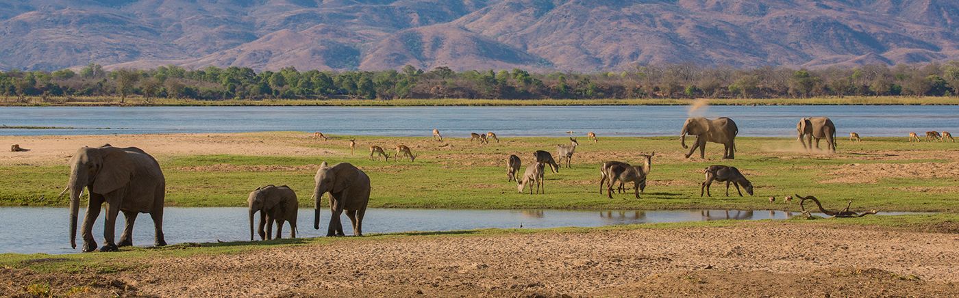
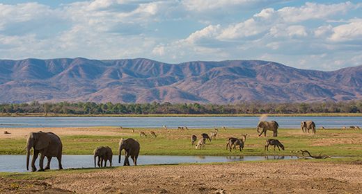
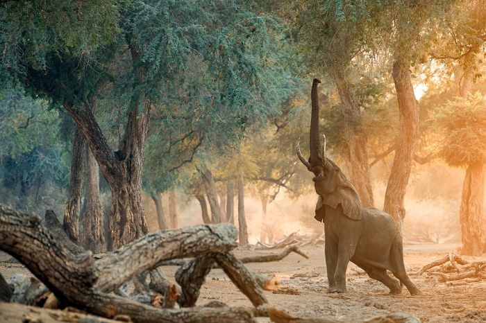
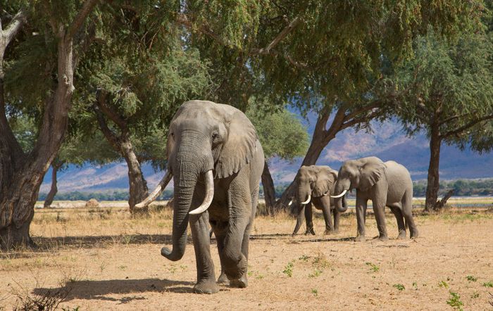
Mana Pools is a remote and pristine national park located in an area called the Lower Zambezi. The park's northern boundary is the Zambezi River, across which is Zambia's Lower Zambezi National Park. This entire area is protected as a UNESCO World Heritage Site.
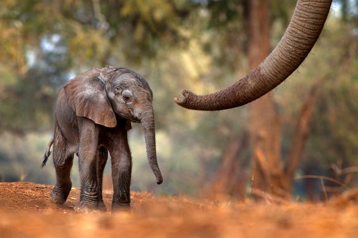
The park is one of Southern Africa's most beautiful destinations, with plentiful elephants, lots of plains game, and predators in good numbers. The very low density of accommodations can make it feel like you are alone in this lovely wilderness.
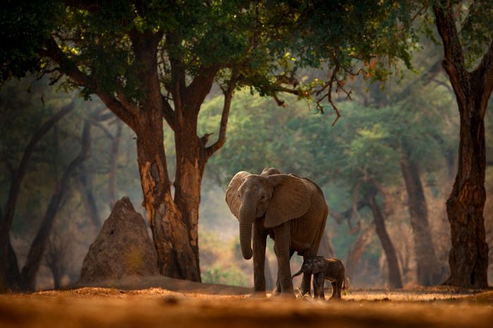
Elephants and forest scenery in Mana Pools National Park.
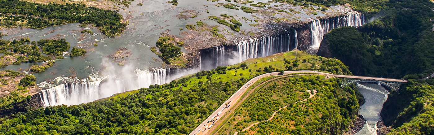
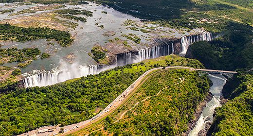
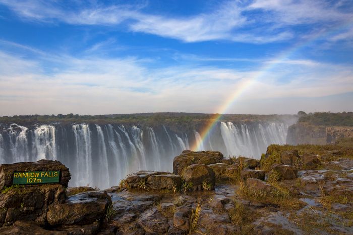
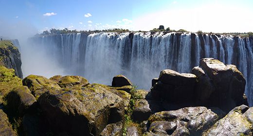
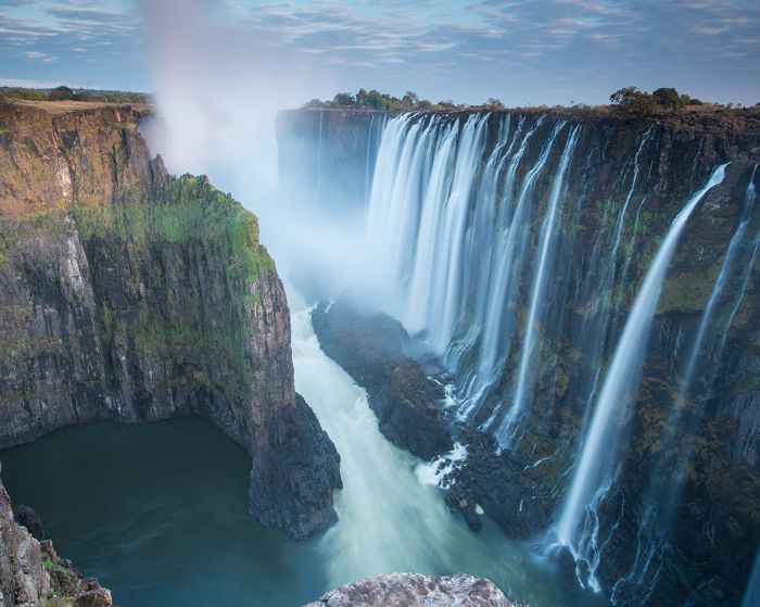
Of course, Zimbabwe's biggest tourist draw has always been The Victoria Falls, which ranks as one of Africa's most visited destinations and a true natural wonder.
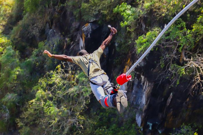
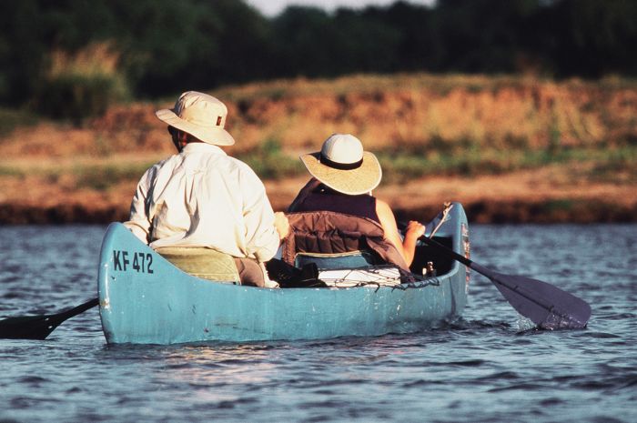
The Falls is also considered the adventure capital of Southern Africa, offering world-class white water rafting, bungee jumping, microlight flights, gorge swings, abseiling, zip-lining, and more. Just upstream from The Falls is Zambezi National Park, where game drives offer a chance to see good numbers of wildlife on a safari.
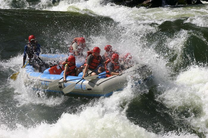
White-water rafting in the gorge at Victoria Falls (Copyright © Wild Horizons).
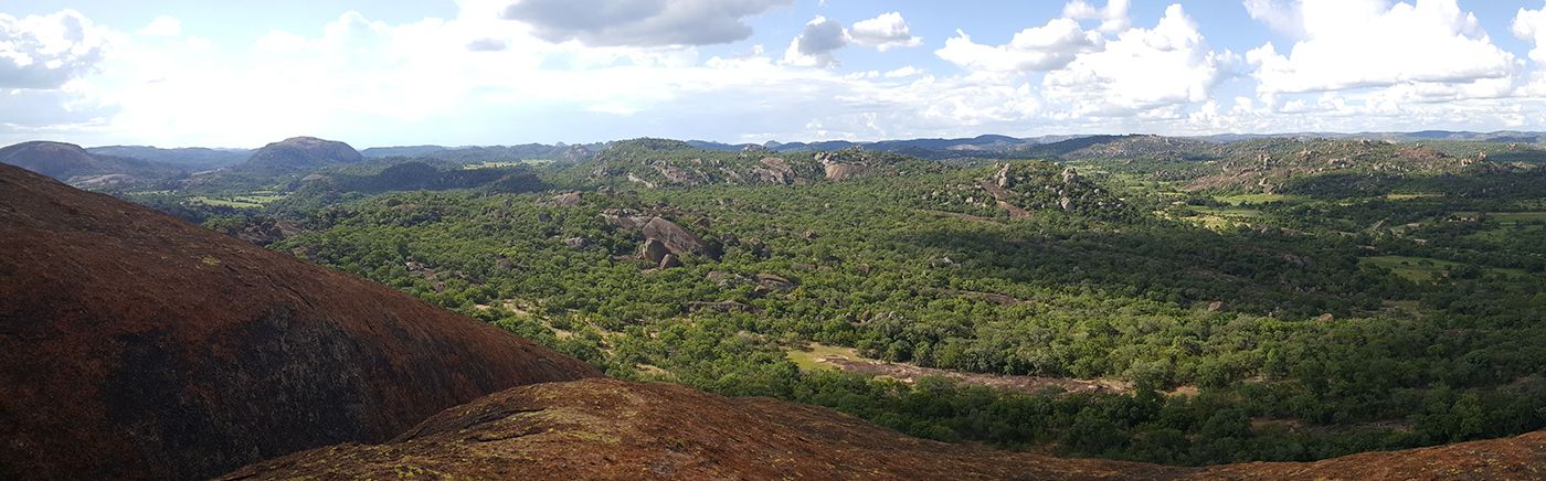
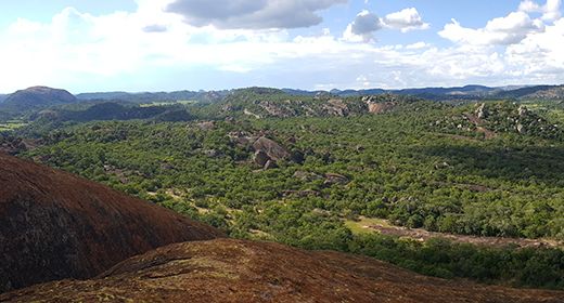
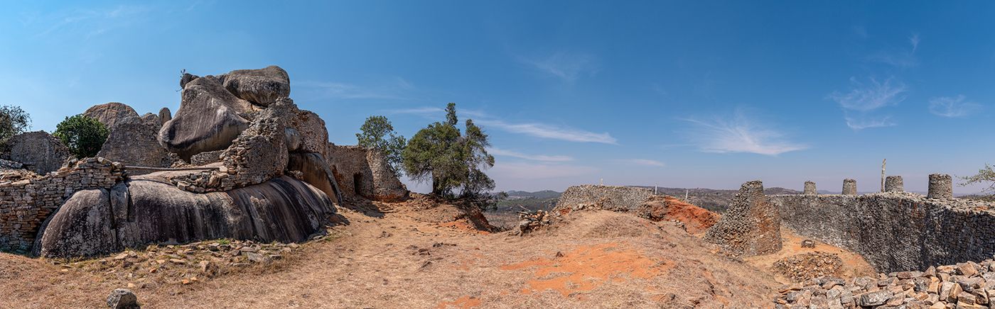
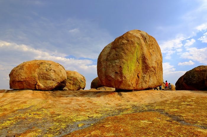
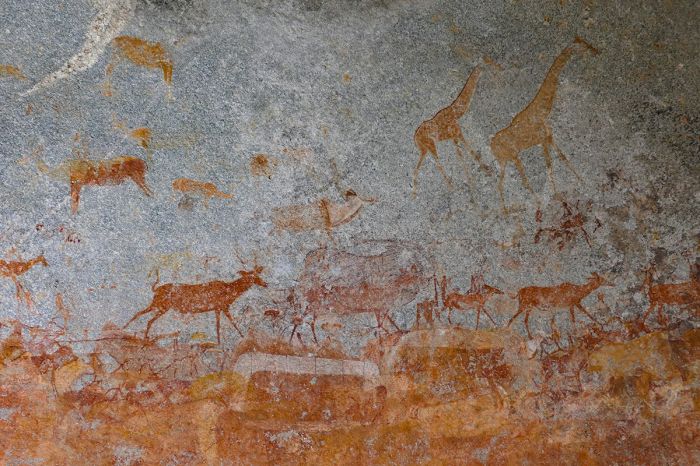
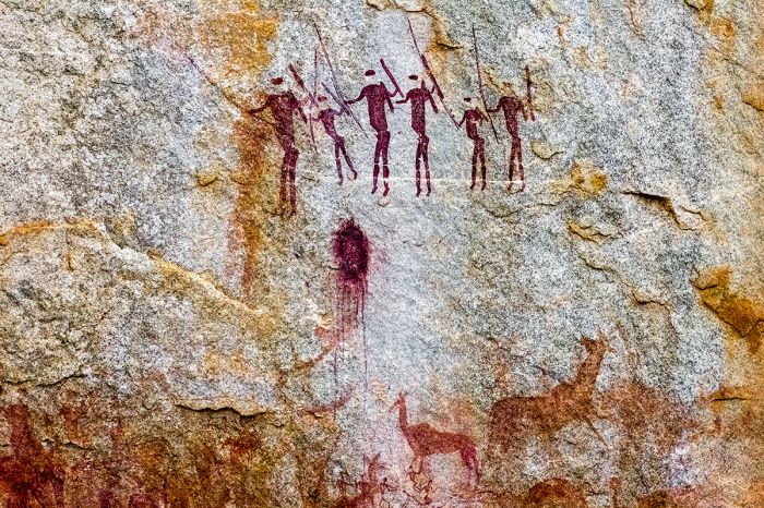
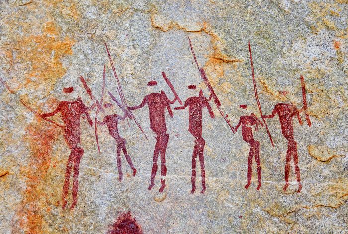
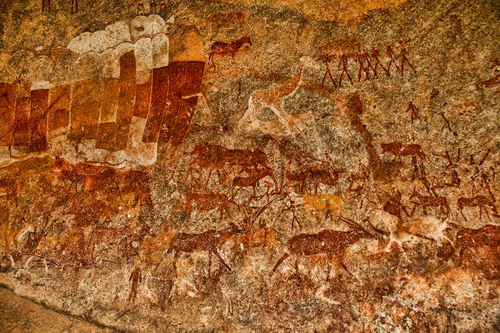
Besides its popular northern circuit, Zimbabwe's less visited and more remote destinations include the Matobo Hills, a UNESCO World Heritage Site offering ancient rock paintings and geological wonders.
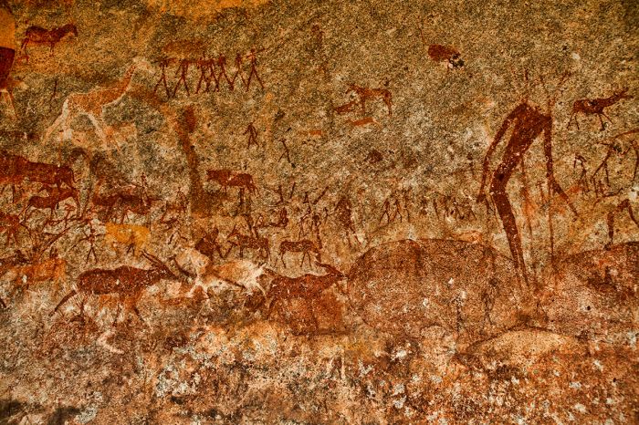
Ancient rock paintings in Matobo National Park.
In the far southeast of the country are the Savé Valley Conservancy, Gonarezhou National Park, and the Malilangwe Reserve, all offering wildlife and safaris.
Fishing in the Malilangwe Reserve at Singita Pamushana.
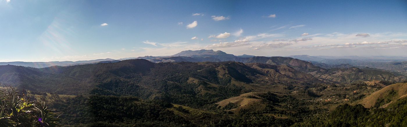
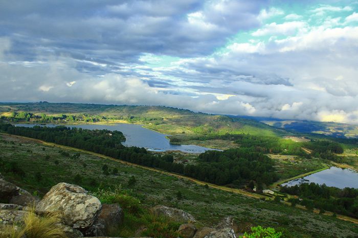
Finally, the Eastern Highlands are a chain of mountains situated on Zimbabwe's eastern border with Mozambique. The region offers natural beauty, hiking, fishing, birding, horseback riding, and more.
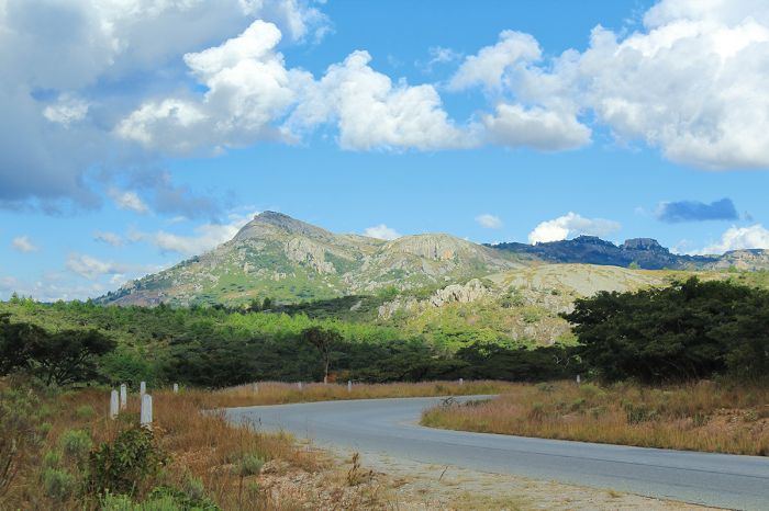
View of the Nyanga Mountains in Zimbabwe's Eastern Highlands.
Zimbabwe Regions
Hwange National Park
Zimbabwe's oldest and largest national park offers diverse and abundant wildlife, including Africa's Big Five (lion, leopard, elephant, buffalo, rhino). Dry season game viewing is superb at Hwange's network of waterholes. more
Mana Pools National Park
Part of the renowned Lower Zambezi (a UNESCO World Heritage Site), Mana Pools is a pristine wilderness. The Zambezi River and its floodplains attract big herds of plains game, as well as predators like lion, leopard, and wild dog. more
Victoria Falls (incl. Victoria Falls NP, Zambezi NP)
Experience one of the world's greatest natural wonders at The Victoria Falls. The Falls is a popular add-on to a safari in Botswana, South Africa, Zambia, or Zimbabwe. Go white-water rafting, bungee jumps, canoeing, fishing, micro-lighting, and more! more
Read More...
Main: Flora, Geography, Important Areas, National Parks, Protected Areas, Ramsar Sites, UNESCO Sites, Urban Areas, Wildlife
Detail: Bulawayo, Chimanimani, Chizarira, Eastern Highlands, Gonarezhou, Harare, Hwange, Kazuma Pan, Lake Kariba, Malilangwe, Mana Pools, Matobo, Matusadona, Nyanga, Savé Valley, Victoria Falls, Victoria Falls NP, Victoria Falls Town, Zambezi NP
Admin: Travel Tips, Entry Requirements/Visas
Geography
Zimbabwe is a tropical, landlocked country located in the Southern Africa region and bordered by four countries: Botswana to the south and west, South Africa to the south, Mozambique to the east and north, and Zambia to the northwest. There is also a tiny patch of land almost touching Namibia's Zambezi (Caprivi) region in the northwest along the Zambezi River.
Most of Zimbabwe sits on a plateau, with an altitude between 3 900-5 200 feet (1 200-1 600 meters) and a higher plateau in the central part of the country. This raised land forms a watershed between the two major rivers: the Zambezi to the north and the Limpopo to the south. The Zambezi and Limpopo rivers form the the northern and southern borders of the country respectively, and both flow eastward through Mozambique and into the Indian Ocean.
A leopard in Zimbabwe's Hwange National Park.
The Zambezi River flows into Lake Kariba, the world's largest man-made lake/reservoir. The Kariba Dam was constructed between 1955-1959, supplying hydroelectric power to both Zambia and Zimbabwe. The country's best-known geographic feature is The Victoria Falls, which are shared by Zambia along the Zambezi River in the far northwest of the country.
The highest point in the country is Mount Nyangani at 8 504 feet (2 592 meters), which is located in Nyanga National Park near the Mozambique border. On the other side of the country, the western landscape descends gradually into the Kalahari sand basin.
Hwange's waterholes support its abundant wildlife.
Flora
Zimbabwe's primary biome is savanna (also called bushveld), which is comprised of tropical grasslands interspersed with trees and pockets of woodland. The country's savanna can be further classified as moist savanna, which occurs in the middle of the country on its higher plateau, and dry savanna, which occurs along the northern, western, and southern lowlands.
Zimbabwe's only lush forests occur on the slopes of the Eastern Highlands along the border with Mozambique. Once a massive Afromontane rain forest covering miles of the highlands, isolated patches are all that remain today.
An elephant stretches for seed pods in Mana Pools National Park.
Wildlife
Zimbabwe has long been a preferred destination for wildlife lovers, but as discussed below, its political instability over the last three decades have damaged its tourism industry. Today the country is stable and safe for travelers, and wildlife and safari tourism is again flourishing in Zimbabwe.
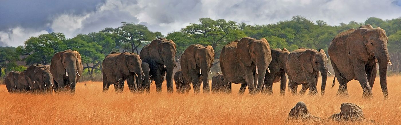
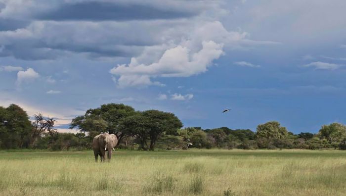
Zimbabwe's protected natural areas are home to diverse wildlife and offer excellent photographic safaris. More than 350 species of mammal can be found in Zimbabwe, plus over 500 species of birds. Elephants are particularly abundant, especially in the national parks along its northern border, which is formed by the Zambezi River.
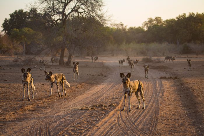
African wild dogs are often encountered in Mana Pools.
Four of Africa's Big Five animals - lion, leopard, elephant, and buffalo, are commonly seen on most safaris in Zimbabwe, while sadly, the rhino has been essentially eliminated in most of the country's protected areas due to poaching.
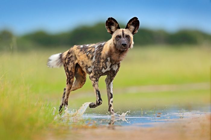
Other major predators that can be seen include cheetah, spotted hyena, and African wild dog. The smaller predators are well represented and include jackal, serval, and caracal.
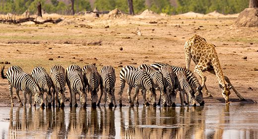
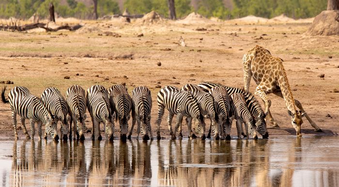
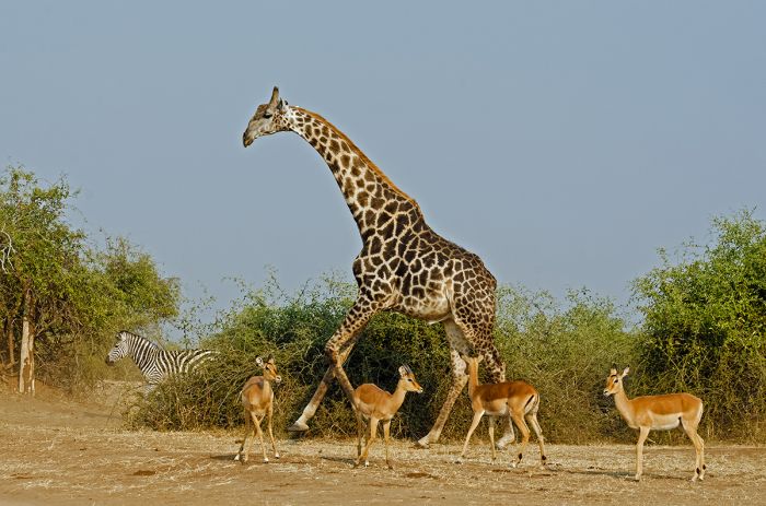
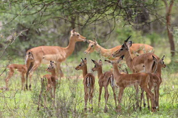
Antelopes and other herbivores are abundant in the national parks and include elephant, buffalo, giraffe, zebra, blue wildebeest, greater kudu, impala, waterbuck, red hartebeest, eland and nyala. Oryx is a desert-adapted antelope that can be seen where the Kalahari desert pushes into western Zimbabwe.
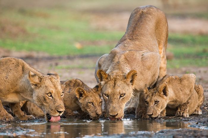
Lions are a safari favorite and can be seen in Zimbabwe's national parks.
Zimbabwe boasts the largest number of sable antelope of any country in Southern Africa. Roan antelope are only found in small numbers wherever they still exist, and can be seen in Hwange, the Zambezi Valley, and Gonarezhou.
Crocodiles and hippos are found in good numbers along the Zambezi River in the north of the country, as well as in the larger waterholes in Hwange and major river systems in the southeast.
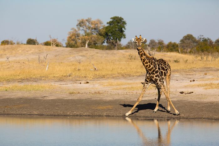
A giraffe prepares to drink at a waterhole in Hwange National Park.
Protected Areas
Zimbabwe has an assortment of national parks, and privately owned/managed conservancies or reserves, the majority of which are located along the perimeter of the country and the most visited by far lying along its northern border. Three of the country's national parks are, or are part of, UNESCO World Heritage Sites: Mana Pools, Victoria Falls, and Matobo.
Zimbabwe's other major land designation is the "Safari Area", which means the land has been set aside for a variety of uses, which can include photo safaris, commercial hunting, and resource collection by locals.
Hwange's waterholes are popular with elephants (Copyright © James Weis).
National Parks
Following are Zimbabwe's eleven national parks. Additional information on each is included further below this list:
- Chimanimani National Park - Known for its hiking trails, the Chimanimani mountains are located in the southern portion of the Eastern Highlands, with most of the range lying in Mozambique.
- Chizarira National Park - Remote and seldom visited, with no permanent accommodations. Located along the Zambezi Escarpment, with deep gorges, valleys, natural springs and grassy plains. Beautiful scenery.
- Gonarezhou National Park - Large, remote park in the far southeast on the border with Mozambique. Diverse habitats, including two major rivers support growing numbers of wildlife, although poaching is still an issue.
- Hwange National Park - The country's largest national park is hime to high densities of wildlife, including elephant, diverse plains game and all the major large predators. Good selection of safari camps and lodges.
- Kazuma Pan National Park - Small park on the border with Botswana not far from Victoria Falls. Benefits from wildlife movements between Chobe NP and Hwange NP. Self campers will enjoy the wildlife with literally no other tourists.
- Mana Pools National Park - One of Zimbabwe's finest safari destinations, set along the Zambezi River and part of a UNESCO World Heritage Site. Plenty of wildlife to see in a spectacular setting. Known for its relaxed elephants, big herds of buffalo, plentiful hippos, packs of African wild dog, and lots of general game.
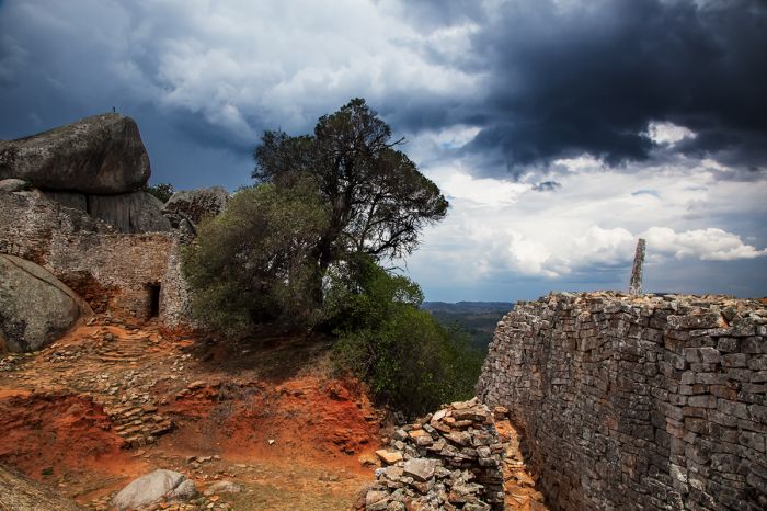
- Matobo National Park - Protects The Matobo Hills, a UNESCO Heritage Site with hundreds of rocky caves where early humans dwelled going back 40 000 years. Well preserved rock art can be viewed on guided tours. Cecil Rhodes' gravesite is a popular tourist draw.
- Matusadona National Park - Diverse park with Lake Kariba shoreline, the Zambezi Escarpment, two significant rivers, floodplains, hills, and woodlands. Good variety of wildlife, although not up to the safari standard of Mana Pool or Hwange.
- Nyanga National Park - Located in the northern portion of the Eastern Highlands on the border with Mozambique. Popular with hikers and birders. Great trout fishing in the rivers and streams.
- Victoria Falls National Park - Protects a small section of land at The Victoria Falls and the gorges downstream. Popular walking trail through the rainforest on the cliff opposite The Falls.
- Zambezi National Park - Protects a large section of land upstream from the Victoria Falls along the Zambezi River. Guided or self-drive safaris to see elephants, buffalo, hippo, crocodile, and other plains game, which mostly congregate close to the river.
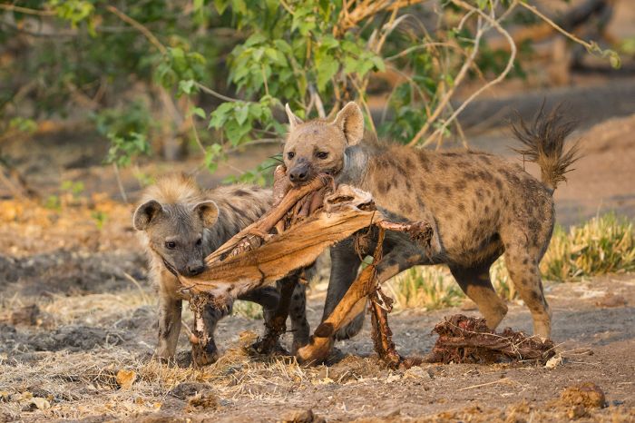
Spotted hyenas tussle over the remains of an impala in Mana Pools NP.
Important Areas
Other important areas to note include "Safari Areas" (land that has been set aside for a variety of uses, which can include photo safaris, commercial hunting, and resource collection by locals), and privately managed reserves.
- Chewore Safari Area - Adjoins the Sapi Safari Area (and Mana Pools NP) and is included as part of the greater UNESCO World Heritage Site for the Lower Zambezi region.
- Malilangwe Wildlife Reserve - Pristine wilderness area bordering Gonarezhou National Park. Diverse wildlife, including both black and white rhino species, lion, leopard, cheetah, spotted hyena, and abundant plains game. Over 80 rock art painting sites. Excellent lodge.
- Sapi Safari Area - Adjoins Mana Pools National Park (and Sapi Safari Area) and is included as part of the greater UNESCO World Heritage Site for the Lower Zambezi region.
- Savé Valley Conservancy - One of the largest private game reserves in Africa. Offers all of the Big Five species, including black and white rhino. Healthy populations of plains game and predators, but the the conflicting land use may pose future problems.
UNESCO World Heritage Sites
The United Nations Educational, Scientific and Cultural Organization (UNESCO) is a specialized agency of the United Nations whose mission is to promote world peace and security through international cooperation in education, the arts, the sciences, and culture. The Convention concerning the Protection of the World's Cultural and Natural Heritage was signed in November 1972 and ratified by the 189 UN member "states parties".
A World Heritage Site is a landmark or area which is geographically and historically identifiable and has special cultural or physical significance. To be selected as a World Heritage Site, a nominated site must meet specific criteria and be judged to contain "cultural or natural heritage of outstanding value to humanity". An inscribed site is categorized as cultural, natural, or mixed (cultural and natural). As of 2021, there were over 1 100 sites across 167 countries.
Zimbabwe has five UNESCO World Heritage Sites:
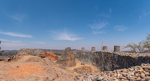
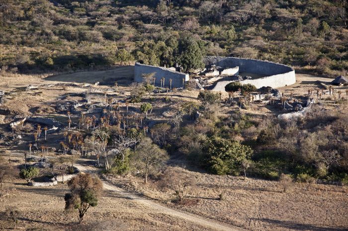
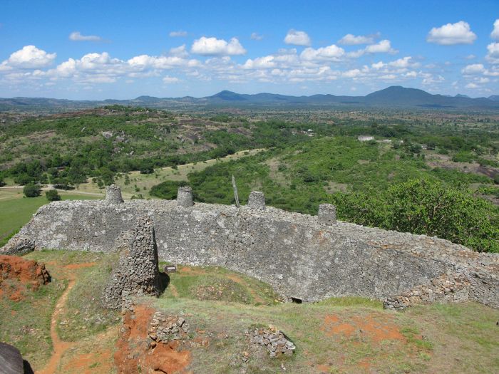
- Great Zimbabwe National Monument (since 1986, Cultural) - Ruins of the capital of the Shona empire between the 11th and 15th centuries.
- Khami Ruins National Monument (since 1986, Cultural) - Ruins of the capital of the Torwa dynasty, which came to power between AD 1450-1650 after the collapse Great Zimbabwe.
- Mana Pools National Park, Sapi and Chewore Safari Areas (since 1984, Natural) - One of Africa's great wildlife destinations along the banks of the Zambezi River. Home to diverse and abundant flora and fauna.
- Matobo Hills (since 2003, Cultural) - Home to distinctive rock formations, with caves and other natural shelters associated with early Stone Sage humans. Numerous rock art sites.
- Mosi-oa-Tunya / Victoria Falls (since 1989, Natural) - One of the world's greatest waterfalls, the area provides exceptional examples of geological and geomorphological processes.
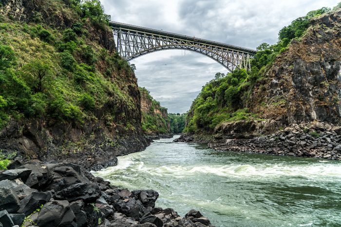
The Victoria Falls Bridge from the gorge below.
Ramsar Wetlands of International Importance
The Ramsar Convention on Wetlands is an international treaty for the conservation and sustainable use of wetlands. It was the first of the modern global nature conservation conventions, negotiated during the 1960s by countries and non-governmental organizations concerned about the increasing loss and degradation of wetland habitat for birds and other wildlife. The convention is named after the city of Ramsar in Iran, where the convention was signed in 1971.
Presently there are some 75 member States to the Ramsar Convention throughout the world which have designated over 2 300 wetland sites onto the Ramsar List of Wetlands of International Importance.
Zimbabwe has 7 sites designated as Wetlands of International Importance (Ramsar Sites) as follows.
- Chinhoyi Caves Recreational Park - Located at the north-central town of Chinhoyi, it is the most extensive cave system in Zimbabwe. The site exhibits a rare, near-natural Karst topography (the dissolution of soluble rocks like limestone, which creates an underground drainage system with sinkholes and caves). Site receives high annual rainfall and support rich flora. Important habitat for numerous bird and fish species. Camping and recreation site for thousands of visitors per year. (0.1 sq miles/0.3 sq kms)
- Cleveland Dam - Located on the outskirts of Zimbabwe's capital city, Harare, this wetland offers a crucial stopover for thousands of migrating birds. The dam holds 240 millions gallons (910 million liters) of water and is the source of the Mukuvisi River, which drains into Lake Chivero, which supplies most of the drinking water for the greater Harare metro area. (4 sq miles/11 sq kms)
- Driefontein Grasslands - Located due south of Harare and north of Masvingo, the site is a unique habitat of swamps, lakes, miombo woodland, Kalahari sands, and grassland. Home to 85% of the country's population of the endangered wattled crane. It also provides ideal breeding grounds for the secretarybird, saddle-billed stork, marsh harrier, various duck species, and others. Threats are from maize farmers, fishing, and cattle grazing. (777 sq miles/2 012 sq kms)
- Lakes Chivero and Manyame - The wetland around these two lakes won the outskirts of Zimbabwe's capital city, Harare, are of great hydrological importance to the country. Over 400 species of bird use this area for habitat, many for breeding, including 20 species of migratory waterbirds. During the height of the dry season, over 20 000 birds can congregate on the two lakes. Greatest threats are water hyacinth invasion, pollution, and siltation. (113 sq miles/293 sq kms)
- Mana Pools National Park - Centered around four large, permanent pools formed by course changes in the Zambezi River, with rich vegetation. Huge concentrations of large mammals including elephant, buffalo, hippo, and giraffe, plus predators including crocodile, leopard, lion, spotted hyena, and more. The river banks support hundreds of nesting bee-eaters that feed on insects found near the water pools. Over 450 bird species, both resident and migratory, breed here. (850 sq miles/2 200 sq kms)
- Monavale Wetland - An urban wetland with miombo woodlands located in the Monavale neighborhood of Zimbabwe's capital city, Harare. Habitat for a variety of birds, amphibians, reptiles, and small mammals. Plays an important role in water purification, storage, and groundwater recharge. (2 sq miles/5 sq kms)
- Victoria Falls National Park - Deep basaltic gorges shaped by the Zambezi River, the site is a natural wonder and biodiversity hotspot. One of the world's largest and most spectacular waterfalls, with large mammals including elephant, buffalo, giraffe, lion, hippo, crocodile, and many more living upstream in the Zambezi National Park and along the river banks. The area provides habitat for over 500 species of bird and rich flora. Thousands of tourists visit each year. A World Heritage site includes portions of three national parks, two on the Zimbabwean side and one of the Zambian side. (7 sq miles/18 sq kms)
Urban Areas
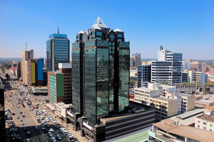
Zimbabwe has three significant urban areas worth mentioning, two of which are not often on international eco-tourism itineraries, while the third is visited as a major tourism hub. See details on each below.
- Bulawayo - Historic city dating back to the times of Mzilikazi and the formation of the Ndebele empire. Retains a colonial feel.
- Harare - Zimbabwe's capital and by far its largest city. Not a destination city for most eco-tourists.
- Victoria Falls Town - Tourist-driven town located at the popular tourist destination. Dubbed the adventure capital of Southern Africa.
Victoria Falls
(Including two national parks: Victoria Falls NP and Zambezi NP)
By far Zimbabwe's most popular tourist attraction and one of the most popular in all of Africa are The Victoria Falls. Known locally as 'Most-oa-Tunya', which means "the smoke that thunders", The Victoria Falls are nothing short of spectacular.
The Falls occur along the Zambezi River, which is the border between Zimbabwe in the south and Zambia in the north. The historic Victoria Falls Bridge spans the gorge just below The Falls, connecting the two countries by both road and rail. Visitors can choose to stay on either side of The Falls (Victoria Falls Town in Zimbabwe or Livingstone town in Zambia).
The Victoria Falls is Zimbabwe's top tourism attraction.
Besides the waterfall itself, the area is renowned for offering the best adventure sports in Southern Africa. Activities include white-water rafting in the gorges below the waterfall, bungee jumping off the bridge, canoeing on the Zambezi River above the waterfall, zip lining, and much more.
There are two national parks on the Zimbabwe side of The Falls: Victoria Falls National Park, which protects the waterfall itself and the gorges below, and Zambezi National Park, which is located upriver from the waterfall, and offers wildlife safaris via 4x4 game drives.
Read full details on Victoria Falls here.
Thrill seekers can take the bungee jump off The Victoria Falls Bridge.
Hwange National Park
Zimbabwe's largest national park and one of its oldest (only Matobo is older), Hwange is home to one of the highest wildlife densities in all of Africa and is well-known for its abundance of elephants that congregate in massive herds, especially at waterholes during the dry season.
In 1939, Hwange's first warden, Ted Divison, began what would become a network of over sixty pumped waterholes that provide water for the animals during the dry season.
Elephants at one of the waterholes in Hwange National Park.
Besides elephants, Hwange has healthy populations of a variety of plains game, including, buffalo, giraffe, zebra, blue wildebeest, impala, greater kudu, roan antelope, sable antelope, waterbuck, tsessebe, hartebeest, reedbuck, and warthog.
Hwange offers excellent predator viewing, with good numbers of lion, spotted hyena, leopard, African wild dog, and black-backed jackal. Cheetah are sometimes seen.
Hwange has a variety of all-inclusive camps and lodges, as well as more basic accommodations offered by the Zimbabwe Parks and Wildlife Management Authority.
Read full details on Hwange National Park here.
Lion cubs in Hwange National Park, Zimbabwe.
Mana Pools National Park
Arguably the best wildlife safari destination in Zimbabwe, and one of the best in all of Southern Africa, Mana Pools National Park (MPNP) is located in the remote Zambezi River Valley. MPNP forms part of a much larger protected area that includes Zambia's Lower Zambezi National Park directly across the Zambezi River to the north.
Four of the Big Five (only rhino missing) are found in Mana Pools, with lion and leopard seen regularly, along with good herds of buffalo and some of Africa's best elephant viewing. Many of Mana Pools' resident elephant bulls have become so relaxed around people that they regularly pass through campsites as calm as can be.
Mana Pools is renowned for its relaxed and abundant elephants.
Besides game drives, guided bush walks and canoeing on the Zambezi are both exciting ways to get close to the wildlife in Mana. Mana is popular with safari aficionados for being an uncrowded and authentic wilderness destination with spectacular natural beauty and superb wildlife viewing.
Read full details on Mana Pools National Park here.
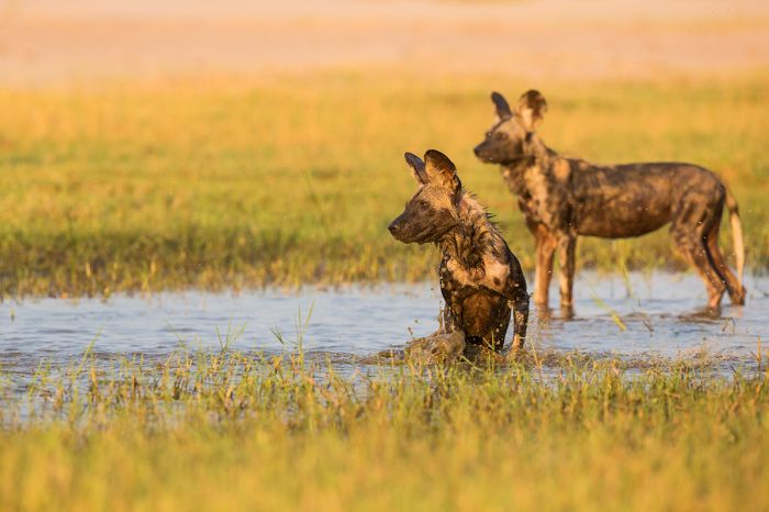
African wild dogs in Mana Pools National Park.
Sapi and Chewore Safari Areas
These two protected areas adjoin Mana Pools National Park, extending eastward almost all the way to the Mozambique border along the Zambezi River. While Mana Pools receives full protection for its habitat and wildlife, Sapi and Chewore permit a mixture of hunting, fishing, and photo safaris.
The three reserves (Sapi, Chewore, and Mana Pools) are one contiguous area, with no fences and together compromise Zimbabwe's Lower Zambezi region, which has been declared an UNESCO World Heritage Site.
This land is protected for its crucial importance as habitat for immense numbers of wildlife. The terrain includes the Zambezi River on the north, riparian woodlands and floodplains along the banks, and the Zambezi Escarpment further inland to the south.
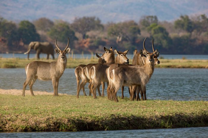
Waterbuck and elephant along the Zambezi River, Zimbabwe.
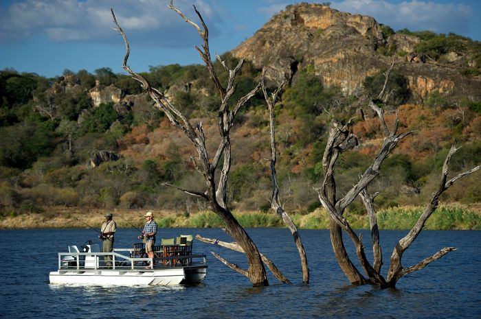
Matusadona National Park
Matusadona is one of Zimbabwe's most diverse national parks, with habitats that include the Lake Kariba shoreline, perennial rivers on its eastern and western borders, and the Zambezi Escarpment, which cuts east-west through the middle of the park.
Matusadona was proclaimed a non-hunting area in 1958 and gained national park status in 1975. The park covers 568 square miles (1 470 sq kms) of low-lying plains, rolling hills and open woodlands, as well as the rugged escarpment. The man-made Lake Kariba on Matusadona's northern boundary was created when the Kariba Dam was constructed on the Zambezi River between 1958 and 1963, effectively filling the Kariba Gorge with river water.
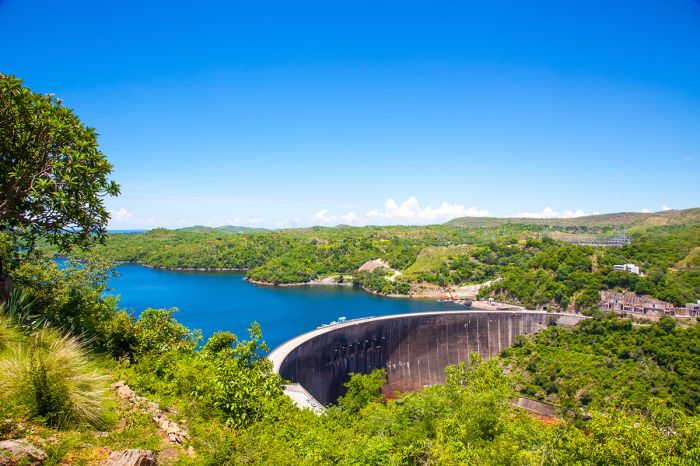
Kariba Dam and Lake Kariba.
Once a haven for wildlife, especially elephant and the endangered black rhino, Matusadona was a well-visited and sought-after safari destination. Sadly, years of neglect and diminished financial resources resulting from the country's political turmoil, led to rampant poaching, which severely impacted wildlife numbers and virtually eliminated the black rhinos.
Although the wildlife is still recovering, the beauty of this wilderness area remains the same, so there is great hope that the park will be restored to what it once was. In 2019, African Parks, a non-profit conservation group that partners with governments and local communities to rehabilitate and manage national parks, signed a 20-year agreement to manage Matusadona.
A good variety of mammals can be seen in Matusadona, including lion, leopard, spotted hyena, elephant, buffalo, waterbuck, impala, zebra, greater kudu, sable, roan, and eland. Giraffe are conspicuously absent. Black rhino are reportedly here in small numbers. Crocodile and hippo are also found along the shores of Lake Kariba. Birdlife in the park is excellent, with over 400 species recorded.
Matusadona receives few visitors, so the experience is very exclusive. There are several good lodges and tented camps to choose from in Matusadona, most of them along the lakeshore.
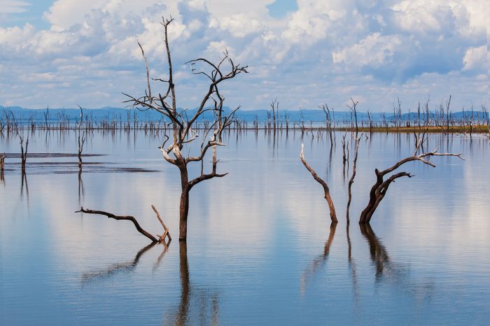
Tree skeletons created when the Kariba Gorge was dammed.
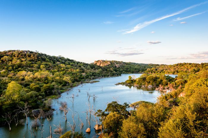
Lake Kariba
Lake Kariba is the world's largest man-made (artificial) body of water (by volume). The lake was created between 1958 and 1963 after completion of the Kariba Dam along the lower Zambezi River, effectively flooding of the Kariba Gorge.
The lake measures 139 miles (223 kms) in length and a maximum width of 25 miles (40 kms), covering an area of 2 150 square miles (5 580 sq kms). The mean depth of the lake is 95 feet (29 meters), with a maximum depth of 318 feet (97 meters). There are a good number of islands in the lake.
Elephants in Matusadona National Park on the Lake Kariba shore.
During the period of years when the lake was filling up, the nutrient level was very high due to the decomposing vegetation, which created a thick layer of fertile soil on the lake bed. The lake is rich in fishes, some of them introduced (such as the Tanganyika sardine) and many more that were indigienous to the Zambezi River, including the African tigerfish (Hydrocynus vittatus), which is a popular sport species.
The lake contains healthy populations of hippo and Nile crocodile, while a good variety of land mammals are present along the lakeshore, including good numbers of elephant and buffalo. Other herbivores living around Lake Kariba include waterbuck, impala, zebra, greater kudu, sable, roan, and eland. Giraffe are conspicuously absent. Predators around the lake include lion, leopard, and spotted hyena. Birdlife on the lake is diverse and abundant, with over 400 species recorded.
Chizarira National Park
Chizarira is Zimbabwe's third largest national park, covering 737 square miles (1 910 sq kms) of spectacularly scenic landscapes. The Zambezi Escarpment forms the park's northern border and the average elevation in the park is roughly 3 300 feet (1 000 meters). The park's highest point is Tundazi Mountain, which rises to 4 700 feet (1 433 meters).
Chizarira was declared a non-hunting reserve in 1958 as a sanctuary for some of the wildlife displaced from the Zambezi Gorge when the Kariba Dam was built. The park's name comes from the Batonga word chijalila, which means "great barrier", referring to the near-vertical slopes of the 2 000-foot (600-meter) escarpment. It received national park status in 1975.
The park protects a diverse range of biomes, with deep gorges, steep and craggy outcrops, lowland valleys, and open grassy plains south of the escarpment. Natural springs feed pockets of lush vegetation in the valleys and mountainous ridges.
Chizarira's rugged terrain is prime leopard habitat.
In spite of its incredible natural beauty, Chizarira receives very few visitors, mostly owing to its remoteness, but also because there are no permanent accommodations in or near the park, so camping is the only option.
The park is not known for large numbers of wildlife, but the landscape is especially suitable for leopard, which are here but not easy to see. The park is also home to good numbers of lion and spotted hyena. Other wildlife that can be seen include elephant, impala, buffalo, greater kudu, tsessebe, roan, sable, and various other antelopes. Black rhino were once abundant, but most were poached and the rest relocated to Matusadona.
The major draw for most visitors to this rugged and stunningly beautiful destination is hiking in a true wilderness. Visiting with a knowledgeable guide is the best way to experience a walking and camping safari in Chizarira.
A very young baby elephant.
Matobo National Park
Matobo is Zimbabwe's oldest national park, established in 1926 as Rhodes Matopos National Park and located 20 miles (35 kms) south of Bulawayo. The original park was much larger than the current park, extending further to the south and east. The park was reduced in size in order to accommodate the resettlement of local people living in the core area.
The greater Matopos, which includes the surrounding communal areas, spans some 1 200 square miles (3 100 sq kms) and was declared a UNESCO World Heritage Site in 2003. The national park protects the fully protected core area, which covers 164 square miles (425 sq kms).
The Matobo Hills are a UNESCO Heritage Site.
The park itself covers the core of a much larger area of geological significance called the Matobo Hills (or Matopos). The region is defined by dramatic granitic hills, which have been pushed up over time as molten rock by continuous pressure from below. The granite eventually pushes above the surface as dome-like hills, which over time are weathered by wind and rain. Fractures in the granite eventually cause boulders and the outer layers to peel off, exposing newer granite layers below.
Within the hills are hundreds of rocky caves, which were home to our early human ancestors going back at least 40 000 years. Numerous examples of ancient rock art have been discovered in these rock shelters.
The park is the country's second most popular in terms of tourist numbers (after Victoria Falls). Besides the spectacular natural beauty, interesting rock formations, and thousands of well-preserved examples of early rock art, the park is home to good numbers of leopards, klipspringers, and raptors.
The Matobo Hills protect thousands of ancient rock paintings.
There are numerous accommodations to choose from within and just outside the national park, ranging from upscale to vey basic. Tours of the caves and rock art sites are of course, a must do. Some of the recommended sites are Pomongwe Cave, Bambata Cave, White River Shelter, Silozwane Cave, Nanke Cave, Nswatugi Cave, and Gulubahwe Cave.
Another interesting site in the Matopos is Cecil Rhodes' gravesite, which is open to the public and a very popular tourist draw. Rhodes visited the area when he was negotiating with the Matabele to end their uprising and declared it was here that he wanted to be buried. He died in Cape Town in 1902 and was immediately brought to the site for his burial. Threats to destroy the grave have been made by the government, but the site is a big revenue earner, so it is unlikely.
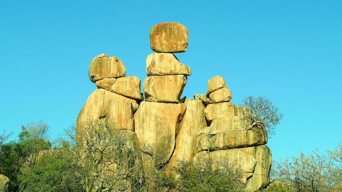
Rock formation in Matobo National Park.
Gonarezhou National Park
Covering 1 951 square miles (5 053 sq kms), Gonarezhou is Zimbabwe's second largest national park (after Hwange). The park is situated in the remote far southeast of Zimbabwe, on the border with Mozambique and not far from South Africa. The name derives from a Shona word meaning "place of elephants".
Gonarezhou was first established as a game reserve in 1936 and became a national park in 1975. Sadly, the park has had a turbulent past, with never enough funding or protection from the authorities, leading to widespread poaching and subsistence hunting.
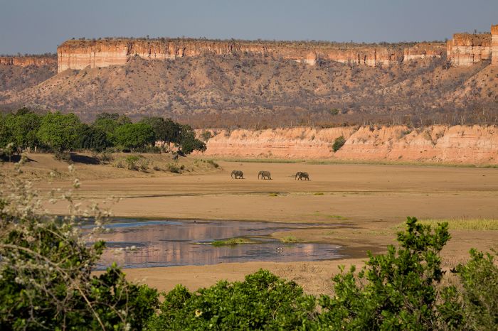
Elephants walking in the Runde River Valley with the Chilojo Cliffs - Gonarezhou NP.
Like many of Zimbabwe's parks, it was closed during the Rhodesian Bush War (1964-1979) and thru the Mozambique Civil War (1977-1992), but was finally re-opened in 1994. Between 1994 and 2007, Gonarezhou was managed by Zimbabwe's Parks and Wildlife Management Authority (ZimParks), but the country's political turmoil led to the park being largely ignored in terms of investment. In 2007, ZimParks teamed with the Frankfurt Zoological Society to co-manage the park.
Owing to its history of neglect, Gonarezhou's wildlife have suffered persecution on a large scale going back to the early years of the 1900s and later on, from Mozambique military troops, who decimated the animals during their civil war. Accordingly, the elephants that survived here became notoriously wary of any vehicles and often became aggressive towards those on a safari.
The Runde River Valley as viewed from the Chilojo Cliffs - Gonarezhou NP.
However, in the past decade, things have dramatically improved, and although poaching does occur in this massive reserve, the presence of some safari camps and improved tourism are having a positive effect on the resident wildlife and the game viewing.
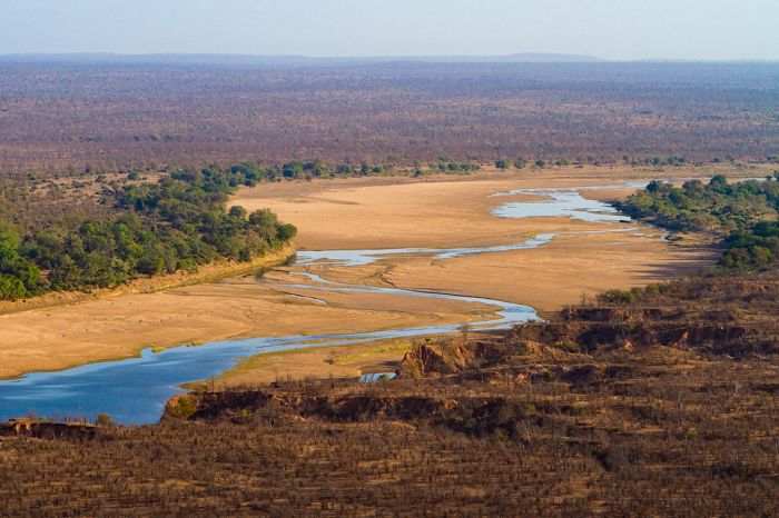
The park boasts an incredible diversity of habitats, including two significant rivers: the Savé and the ephemeral Runde (which joins the Save). The delta of these two rivers, near the southeast corner of the park, harbors mangrove forests and a crucial wetland habitat for animals and birds.
The red sandstone Chilojo Cliffs tower 590 feet (180 meters) high and span about 12 miles along the banks of the Runde River. The Mwanezi River valley forms the western boundary and flows during the rainy months between November and April.
African wild dogs in Gonarezhou National Park.
Wildlife is rebounding and predators that can be seen include lion, leopard, spotted hyena, and cheetah. African wild dogs do well in this large wilderness, with numerous packs living in the park. Elephants are doing well and are a sure bet.
Other plains game likely to be encountered includes buffalo, giraffe, impala, greater kudu, blue wildebeest, sable, roan, eland, zebra, nyala, and suni antelope. Hippos and crocodiles are common in the rivers. Birding in Gonarezhou is excellent, with a checklist of over 400 species.
There are no permanent lodges within Gonarezhou, but two excellent accommodations located just outside the park.
Spectacular rock formation on the Chilojo Cliffs, Gonarezhou NP.
Kazuma Pan National Park
The small and seldom-visited Kazuma Pan National Park (KPNP) is located between the more popular Zambezi NP and Hwange NP, on the border with Botswana. Originally proclaimed in 1949, Kazuma lost its national park status in 1964, due to lack of funding, but was re-proclaimed in 1975. KPNP covers just 121 square miles (313 sq kms) and was created to provide a safe refuge for wildlife from the neighboring Matetsi Safari Area, which allows hunting.
Kazuma's terrain is primarily flat, but it has numerous pans, some of which are fed by natural springs, some that only fill during the summer rains, and some that are filled via pumped boreholes. The terrain his primarily grassland savanna, with acacia scrub and small mopane woodlands.
Buffalo are commonly found in Kazuma National Park.
Owing to its proximity to Botswana's Chobe National Park, Kazuma sees a steadily flow of elephants that move between Chobe and Hwange. Other species commonly seen in KPNP include buffalo, zebra, impala, giraffe, tsessebe, roan antelope, sable antelope, reedbuck, eland, and sometimes gemsbok (oryx).
Predators seen often in Kazuma include lion, spotted hyena, and sometimes African wild dog. Cheetah are seen on occasion. The park is also excellent for birding especially during the rains, which fall between mid-November and early April.
There are two campsites in KPNP, but visitors must be entirely self-sufficient. The park closes during the heavy rain months of January and February.
Giraffe, impala, and zebra are common species in Kazuma.
To reach Kazuma, take the road west to Pandamatenga from the main Bulawayo-Victoria Falls road, continuing to the Matetsi Rangers Office, where you pay park fees. Continue west to the border post and check in with the authorities. The roads are gravel and can be very rough.
Access to KPNP is via the Zimbabwe-Botswana border road north of Pandamatenga. Leave the park via the same route and don't forget to check out with the border post and Matetsi Office. Access to KZNP via Kazungula along the Zimbabwe-Botswana border road is strictly prohibited.
An elephant enjoys one of Kazuma's waterholes.
Savé Valley Conservancy
Located just north of Gonarezhou, Savé Valley Conservancy (SVC) covers 1 329 square miles (3 442 sq kms) consisting of multiple properties owned by private ranchers, local councils, government, and one local community.
During the 1920s, the Savé Valley (SV) was settled by European farmers, who set up large cattle ranches and by 1925, there were over 25 000 cattle on ranches in the area. During the 1960s, the Rhodesian government financially supported the SV cattle industry and eradicated the buffalo and most of the elephant to reduce the risk of foot-and-mouth disease.
An elephant in a lovely Savé Valley landscape (Copyright © Sango Camp).
During the War for Independence in the 1970s, cattle rustling drastically reduced the herds in SV and after independence in 1980, economic incentives from the new Zimbabwean government were reduced and stringent beef export restrictions by the EU curtailed ranching profits. At the same time, a prolonged drought hit Southeast Zimbabwe, further exacerbating the dismal situation for the SV ranchers.
In 1975, the Parks and Wildlife Act was passed, giving landowners the right to use wildlife on their lands for consumptive purposes. Some of the SV ranchers began to experiment with wildlife as a profitable land use and even introduced waterbuck, nyala, giraffe and other species to complement the remaining game on their land.

Caring for an orphaned baby elephant (Copyright © Sango Camp).
Between 1986 and 1988, twenty black rhinos were relocated from the Zambezi Valley, where poaching was a major problem, onto the Humani Ranch in the SV, as part of the government's Black Rhino Conservation Project. The government retained ownership of the rhinos, with custodianship given to the ranch owner.
Interest grew among the neighboring ranchers, who were also interested in a more profitable use for their land, and meetings were held between the SV landowners, the World Wildlife Fund (WWF), and ZimParks, to discuss the idea of cooperative management of the SV as a wildlife conservancy. With funding from the Beit Trust, in June 1991, 18 ranchers signed a constitution and the SVC was formally created. All internal fencing and domestic livestock were to be removed and a perimeter fence was planned.
Rhinos are well protected in the Savé Conservancy (Copyright © Sango Camp).
During the horrible drought of 1991-1992, the Zimbabwe government initiated an elephant culling program in Gonarezhou National Park, but the SVC Chairman intervened and offered to pay for elephants to be relocated to the SVC instead of being killed. In the largest known relocation of elephants ever undertaken, 533 individuals comprising entire elephant families were relocated from Gonarezhou to the SVC.
By 1995, the twin perimeter game fencing was completed and all internal fencing and remaining livestock were removed and the reintroduction of wildlife began in earnest. Between 1992 and 2006, over 3 000 individual animals comprising 13 species were introduced to the SVC, including elephant, buffalo, wildebeest, eland, waterbuck, zebra, giraffe, tsessebe, sable, nyala, black rhino, white rhino, and lion.
Baby impalas in Savé Valley (Copyright © Sango Camp).
As with much of the country, the SVC was hit hard by the 'fast track' land reforms instituted by the government during the early 2000s. The land in the SVC was 95% owned by either white Zimbabweans or white foreign investors, with the remaining 5% owned by the government. By 2003, one-third of the SVC land had been taken over by local black peasant farmers.
Anti-poaching patrols were interrupted on the resettled land and the conservancy fence was partially dismantled, with wire from the fence being used to create bush meat snares. Additionally, large areas of woodland within the SVC were cleared by the new settlers for subsistence farming.
Today, the future of the SVC is uncertain, with the land inside being used for a conflicting mix of purposes, including subsistence farming, commercial hunting, and photographic safaris. That said, wildlife in the SVC is doing well, with large populations of plains game and good numbers of predators, including African wild dog (10+ packs), lion, leopard, hyena, and jackal. There are several lodges in the SVC offering game drives, walking safaris, and rhino tracking.
Rhino checkup at Sango in the Savé Valley Conservancy (Copyright © Sango Camp).
Malilangwe Reserve
The 203-square-mile (526-sq-km) Malilangwe Reserve was created in 1994 to restore and protect the flora and fauna on land bordering Gonarezhou National Park. The reserve protects a varied habitats and geological diversity, including rugged sandstone hills harboring nearly 100 ancient rock art sites.
An ancient baobab tree in the Malilangwe Reserve (Copyright © Singita Pamushana).
Malilangwe offers excellent wildlife viewing, including lion, leopard, cheetah, spotted hyena, cheetah, and African wild dog. The reserve offers arguably the best rhino viewing in Zimbabwe, with healthy populations of both white and black rhino. There are a wide variety of herbivores, including buffalo, giraffe, zebra, wildebeest, sable, roan, greater kudu, Lichtenstein’s hartebeest, and eland. Elephants are also present and very common.
Pamushana Lodge offers a superb safari experience and we highly recommend it if visiting this special destination.
The gorge at Pamushana Lodge in Malilangwe (Copyright © Singita Pamushana).
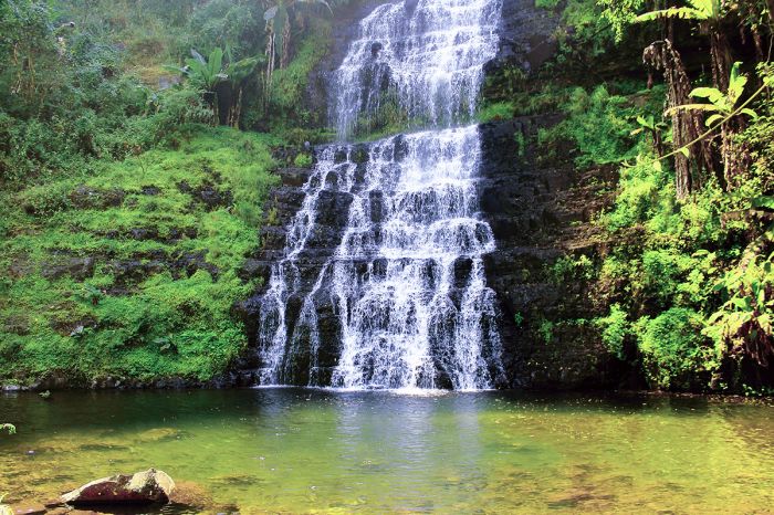
Eastern Highlands
(Including two national parks: Chimanimani and Nyanga)
Zimbabwe's Eastern Highlands are a range of mountains spanning about 190 miles (300 kms) along the country's eastern border with Mozambique. The highlands are comprised of three main mountain groups: the Nyanga in the north, the Vumba (or Bvumba) in the middle, and the Chimanimani in the south. The combined area covers roughly 3 000 square miles (7 770 sq kms) of montane grasslands, shrublands, mist-filled valleys, rivers, waterfalls, and craggy peaks.
There are two national parks in the mountains - Nyanga and Chimanimani, but much of the area is used for commercial forestry, with large plantations of eucalyptus and pine. The national parks protect what remains of the region's natural vegetation.
Bridal Veil Falls in Chimanimani National Park, Eastern Highlands.
Wildlife is not a major draw to the region, although there are antelopes such as duiker, reedbuck, greater kudu, and klipspringer, plus several species of primate. Leopard are present but rarely seen. Most visitors come to the highlands for the hiking, trout fishing, horseback riding, and birding.
Nyanga is one of Zimbabwe's oldest national parks, established in 1926 as Rhodes Inyanga National Park via a bequest from Cecil Rhodes. The park's elevation ranges between 6 560-7 540 feet (1 800-2 593 meters) and includes Zimbabwe's highest point, Mount Nyangani (8 504ft/2 592m). Mutarazi Falls, the highest in the country, are located in the park.
The Nyanga range offers excellent birding and fishing is another major draw, with brown and rainbow trout in the many streams and rivers.
Scenic valley in the Nyanga Mountains, Eastern Highlands.
The misty Vumba Mountains are popular for birding, with many specials on offer. The lovely Vumba Botanical Gardens are definitely worth visiting and there is a scenic golf course at the Leopard Rock Hotel.
Chimanimani National Park is known for its hiking trails, which can be tackled on your own or with a guide. Horseback riding is another popular activity in the park. Camping is allowed anywhere in the park, including in the numerous caves found here.
The Chimanimani range is further protected across the border as the Chimanimani National Reserve in Mozambique. The park includes Mount Binga, the highest mountain in Mozambique and the second highest mountain in Zimbabwe, which rises to 8 004 feet (2 440 meters).
Ancient rock paintings in the Vumba Mountains, Eastern Highlands.
The mountains are home to diverse vegetation, including submontane and montane grasslands, dry montane forest, moist evergreen forest, miombo woodland, and heathland. Most of the surrounding area is covered in rolling grasslands that are renewed annually by controlled burning. The dry winter months (April to July) are good for a visit, but you may encounter smoke from plantation burns. Many roads and trails become muddy and difficult during the rains from November to April.
The region is mostly sparsely populated, with only one substantial city - Mutare, with a population of around 250 000, located in the saddle between the Nyanga and Vumba mountains. There is a good range of lodging to choose from throughout the mountains, including upscale hotels, English-style inns, and bed and breakfasts.
Montane forest in the Vumba Mountains, Eastern Highlands.
Victoria Falls Town
One of two towns located at the waterfall destination, one on either side of The Falls. Victoria Falls town is on the Zimbabwean side, while Livingstone Town is on the Zambian side.
The town is small, with a population that ranges between 35 000 (latest census) to a more likely 65 000, and a majority of its residents are somehow involved in the tourism industry. After decades of being the only urban area at The Victoria Falls, Zimbabwe's political unrest in the early 2000s allowed Livingstone Town (across the river in Zambia) to capitalize and grow. Today, both towns are doing well and visitors can choose to stay on either side of The Falls.
Victoria Falls Airport (VFA) was upgraded in 2016 with the addition of a new runway allowing long-haul aircraft to land. Two luxury trains (Rovos Rail and the Blue Train) offer upscale rail journeys to and from South Africa and The Falls.
Victoria Falls Town is seen at the top of this image, above The Falls and gorges.
Harare
Originally established in 1890 as a fort by Cecil Rhodes' "Pioneer Column" (settlers and armed guards from the British South Africa Company), the growing town was declared a municipality in 1897 and became the capital of Rhodesia in 1923. The fort and later the city, were named Salisbury after the then-Prime Minister of the UK. In 1982, two years after Zimbabwe's independence, Salisbury was renamed to Harare in honor of the Shona chief, Neharawa.
Downtown Harare, Zimbabwe.
Located in the Mashonaland region, Harare is the country's most populous city with a population of over 1.5 million in the city proper and over 2.8 million in the metro area. The city is located on a plateau with an elevation of 4 865 feet (1 483 meters).
Zimbabwe's political and economic turmoil, which began in 2000, has sadly turned Harare from a once-thriving city to one of the world's least livable cities.
Even during Zimbabwe's days of thriving tourism and before its economic decline, Harare was almost never included on travel itineraries except as a stopover on a connecting flight. Most trips instead route through Victoria Falls.
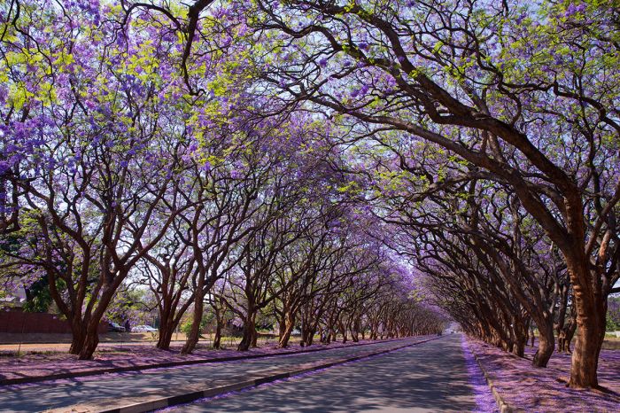
Jacaranda trees in bloom on a suburban avenue in Harare.
Bulawayo
Bulawayo dates back to 1840, when Mzilikazi, the Zulu warrior and first king of the Matabele people, fled with his followers from present-day South Africa, and set up a kraal on the site. His son, Lobengula, later ruled from the settlement from 1860 to 1893, until it was captured by Cecil Rhodes' British South Africa Company. It was Lobengula who named the place KoBulawayo, meaning "place of slaughter". Today, the country prefers to market Bulawayo as the "city of kings".
Located in Zimbabwe's Matabeleland region, Bulawayo is Zimbabwe's second most populous city, with an official population of around 700 000, but with a city-run census putting the number at 1.1 million. Bulawayo sits at an elevation of 4 430 feet (1 350 meters) and enjoys a nice climate with rather cool evenings.
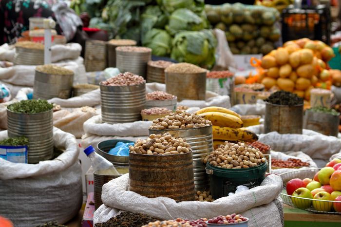
A street-side market in Bulawayo, Zimbabwe.
Unlike Harare, Bulawayo has managed to retain is colonial charm, with wide avenues lined with lovely purple jacaranda trees and red flame trees. The city offers a good variety of hotels and is most often included on itineraries to visit the nearby Matobo Hills and Matobo National Park.
Khami Ruins
On the outskirts of Bulawayo are the Khami Ruins. Khami was the capital of the Kalanga people's Butwa Kingdom from 1450 to 1683, which arose after the collapse of Great Zimbabwe. The ruins have been protected as a UNESCO Heritage Site since 1986.
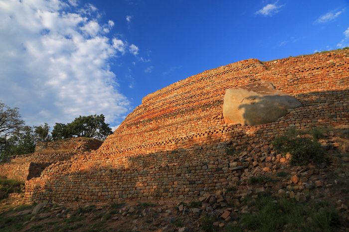
The Khami Ruins, located on the western outskirts of Bulawayo.
TRAVEL TIPS
- Zimbabwe is considered part of the Southern Africa region. Most of the country lies on a plateau and it enjoys a temperate sub-tropical climate all year.
- Rainfall defines Zimbabwe's two main seasons, with the cooler winter months (May-October) being almost rain-free and the warmer summer months (November-April) experiencing most of the rain. Dec/Jan are the wettest months.
- There are 16 official languages in Zimbabwe, with Shona being the most widely spoken (70%), followed by Ndebele (20%). English is widely used in government and business and is the second language amongst most black Zimbabweans.
- After being abandoned in 2009, in 2019, Zimbabwe re-adopted the Zimbabwean dollar and abolished its multiple currency system. US Dollars (old bills often not accepted), UK Pounds, and Euros are still widely accepted in the larger cities, hotels, and safari camps.
- Zimbabwe uses 240v electricity and types D and G plug adapters.
- Zimbabwe time is GMT+2 and it does not observe daylight savings time (DST); 7 hours ahead of New York (6 during DST).
- The population of the country is around 15 million, with about 2.8 million in its largest metro area, Harare. About 38% of the population is urban.
- Zimbabwe covers 149 364 square miles (386 850 sq kms) with around 100 people per sq mile (38 people per sq km).
- Most Zimbabweans (98%) and all of its indigenous people are of Bantu-speaking origin. Shona is the largest ethnic group (70%), followed by Ndebele (20%), who are descendants of the Zulu.
- Most whites, originally of European descent, left the country after independence in 1980 and today number less than 30 000.
- The majority of Zimbabweans are Christians, accounting for around 95% of the population. Few have totally abandoned their traditional beliefs systems.
Canoeing on the Zambezi River at Mana Pools NP.
ENTRY / VISA REQUIREMENTS
- A passport valid for at least six months beyond the date of entry into Zimbabwe is required by nationals of USA/Canada/Australia/UK/EU.
- Possession of valid return air tickets is required on entry.
- The passport must contain at least three (2) unused (blank) pages labeled Visa when presented for entry.
- Note: Visa pages referred to above do not include pages reserved for Endorsements, Amendments or Observations.
- Entry visas can be obtained on arrival, but it is recommended to apply for a tourist visa in advance from the embassy/high commission in your home country or through the e-visa facility.
- If you are planning to visit Zimbabwe from South Africa, please ensure that you have at least 6 blank pages in your passport. South Africa requires two clean, consecutive pages for each transit through South Africa. You will need two pages to transit South Africa in each direction, and two pages to enter Zimbabwe.
- Single- and double-entry visas are valid for 90 days from the date of issuance, but can be extended. Multiple-entry visas are valid for one year from the date of issuance.
- Visas issued for tourism purposes are valid for 30 days (single-entry), 45 days (double-entry), or 12 months (multiple-entry) within a 12-month period.
- Proof of yellow fever vaccination (travelers age 9 months or older) is required on arrival if you are traveling from a country with risk of yellow fever, including transit >12 hours in an airport located in a country with risk of YF virus transmission.
Note: entry/visa requirements are subject to change without notice, so please check with the official government pages shown below.
Official Government Pages
- US Department of State info: click here.
- Zimbabwe Consulate - USA: click here.
- Zimbabwe eVisa application: click here.
- Zimbabwe Home Affairs: click here.
- CDC information: click here.
Read More...
Main: Flora, Geography, Important Areas, National Parks, Protected Areas, Ramsar Sites, UNESCO Sites, Urban Areas, Wildlife
Detail: Bulawayo, Chimanimani, Chizarira, Eastern Highlands, Gonarezhou, Harare, Hwange, Kazuma Pan, Lake Kariba, Malilangwe, Mana Pools, Matobo, Matusadona, Nyanga, Savé Valley, Victoria Falls, Victoria Falls NP, Victoria Falls Town, Zambezi NP
Admin: Travel Tips, Entry Requirements/Visas
Read More...
1500s-1600s, Bush War, Cecil John Rhodes, Colonialism, Coup d'état, Early 1900s, Early History, Early Land Reform, Economic Decline, Fast Track Land Reform, Fight for Independence, Great Zimbabwe, Ndebele, Recent History, Robert Mugabe, Shaka
Early History
Ancient History
Paleontological discoveries throughout areas of northern Zimbabwe, including around Victoria Falls and along the Zambezi River, suggest that our the earliest hominids lived in this region of Africa beginning some 2 to 3 million years ago. Central (Zambia, northern Zimbabwe) and East Africa (Kenya and Tanzania area) are typically considered to be the origin of the human species.
In more recent history, early Stone Age tools dating back around 50 000 years ago have been discovered in present-day Zambia, indicating that our ancestors lived there at that time and presumably, ever since. Evidence suggests that the Stone Age culture developed in a southerly direction and that these early people only reached present-day Zimbabwe some 20 000 years later. This may have been due to climate and/or less suitable habitats for hunting further south at that time.
Stormy sky over the Great Zimbabwe ruins.
Late Stone Age people are believed to have lived in present-day Zimbabwe beginning around 30 000 years ago. The people of the late Stone Age are referred to as the Khoisan people (today called 'bushmen'), which are defined as belonging to two separate but related groups, the San and the Khoi. Both groups used a language with distinctive 'clicking' sounds that are still evident in various languages used today in various parts of Southern Africa.
Although related, the Khoi and San lived different lifestyles, with the San being hunter-gatherers and and Khoi being largely pastoralists. It is believed that the two groups coexisted peaceful in present-day Zimbabwe during the late Stone Age. There are still small populations of Khoisan people living in isolated regions of Botswana, Namibia, and Zimbabwe.
Ancient San ("Bushman") rock art in Zimbabwe's Vumba Mountains.
Iron Age
The earliest evidence of Iron Age cultures in present-day Zimbabwe are those of pottery found in Bambata Cave (in the Matobo National Park), which date to around 2 200 years ago. This pottery style has been linked to Bantu-speaking peoples, who migrated from East Africa.
The Bantu people intermingled with the Khoisan, with the Bantu language and farming culture displacing those of the Khoisan. Some of the Khoisan remained distinct and retained their hunter-gatherer lifestyle, but they fast became marginalized and pushed away to more remote and less hospitable lands.
Bushman paintings in Zimbabwe's Matobo Hills.
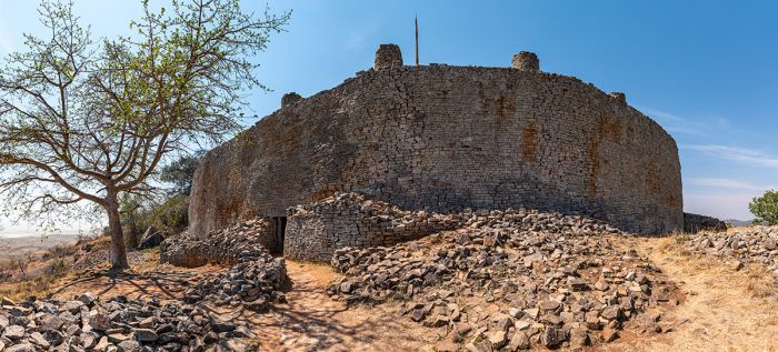
Great Zimbabwe (1200-1500)
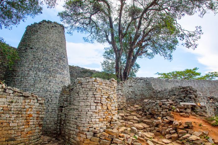
The discovery of copper and gold in present-day Zimbabwe led to a flourishing trade with merchants from the Indian Ocean coast, bringing wealth and leading to the development of Great Zimbabwe, which was located just south of the present-day town of Masvingo. Great Zimbabwe, which began as a small hilltop village and culminated as a large walled citadel, is estimated to have begun in the ninth century.
The Great Zimbabwe ruins.
Great Zimbabwe served as the royal palace and home of the Shona monarchs, who had political power over the area and controlled the trade route to the coast. The shona exported gold, ironware, ivory, and slaves, in exchange for fabrics, glassware, porcelain, and other items from Europe and the Far East. The Shona dynasty ruled over a community of thousands living in the city, plus many thousands more in the surrounding hills, who provided labor for the metal industry and also farmed goods.
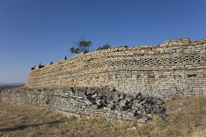
The walls of the city, most standing over 16 feet (5 meters) high and some towering 36 feet (11 meters) tall, were made from local stone and constructed without mortar. The interior of the city covered an area of 2.8 square miles (7.2 sq kms) and was home to an estimated 10 000 citizens at its peak. The city was the largest ancient structure in Africa south of the Sahara Desert.
Ruins of the city at Great Zimbabwe.
Great Zimbabwe is believed to have flourished from around 1200 to 1500, but came to a rapid demise, with evidence suggesting that the city was completely abandoned within the timespan of around 500 years. Different theories exist regarding the reason(s) for Great Zimbabwe's sudden decline, including the exhaustion of the gold mines, water shortages and famine caused by climate change, and political instability.
The surviving ruins of Great Zimbabwe are comprised entirely of stone, and include three distinct sites known as the Hill Complex, the Valley Complex, and the Great Enclosure. The Hill Complex is the oldest and was occupied from the ninth to the thirteenth centuries. The Great Enclosure was occupied from the thirteenth to the fifteenth centuries, and the Valley Complex from the fourteenth to the sixteenth centuries.
Great Zimbabwe ruins, a UNESCO World Heritage Site.
One theory postulates that the separate complexes represent the works of successive rulers. An alternate interpretation suggests that the complexes had different functions, with the Hill Complex serving as a temple, the Valley Complex as home for the citizens, and the Great Enclosure as the home of the king.
After the abandonment of Great Zimbabwe, the Shona empire splintered into various small dynasties that dispersed into the far reaches of today's Zimbabwe and even into eastern Botswana. The splinter groups of Shona continued to trade gold, cattle, ivory, and slaves with the Arab merchants on the Indian Ocean coast.
The Great Zimbabwe ruins are open to the public and are protected as a UNESCO World Heritage Site.
Ruins at Great Zimbabwe.
1500s & 1600s
During the 16th and 17th centuries, there was no dominant dynasty amongst the Shona, with political turmoil defining the period and various Shona factions controlling smaller regions and often in conflict with one another.
By the early 1500s, the Portuguese had established a stronghold along the coast of present-day Mozambique, and also taken control of the Zanzibar Islands off the coast of present-day Tanzania, usurping the trading empire built by the Arabs.
Portugal remained in control of the coast and its lucrative trade routes for the next two centuries, during which time they exploited vast areas of the interior, including present-day Zimbabwe, for its gold, ivory, and slaves.
In 1698, the Sultanate of Oman ousted the Portuguese from Zanzibar, effectively taking over most of the trade.
Ruins of Great Zimbabwe.
Rise of the Ndebele
1700s & 1800s
Throughout much of the 1700s, the lands south of the Limpopo River and north of the Orange River (the northeast of present-day South Africa) experienced tumultuous fighting between rival Nguni clans (the Nguni are a large group of various Bantu-speaking people present in the East and Southern Africa for around 7 000 years).
The fighting and struggles between the increasingly militaristic ethnic groups is thought to be due to competition over land suitable for farming maize (corn), which was introduced from the Americas by the Portuguese in around 1750. The widespread maize production resulted in a dramatic increase in the population of the local people living in the Natal region of South Africa.
The cultivation of maize requires more water than native grains and a ten-year drought in the early 1800s resulted in fierce competition for water resources amongst the three major ethnic groups (the Ngwane, the Ndwandwe and the Mthethwa) living in the area of South Africa then called Natal.
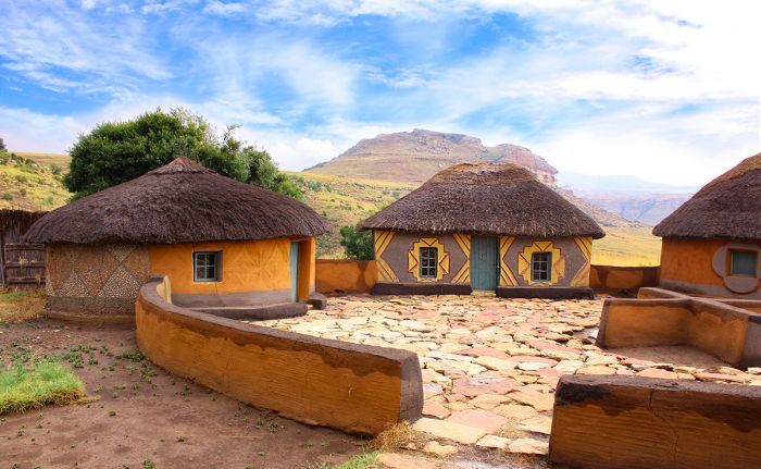
Traditional Ndebele dwellings made from clay and thatch.
Mfecane (1815-1840)
The word Mfecane is an Nguni word meaning 'crushing' and is used to describe the violent period of chaos and war among the ethnic groups living in northeast South Africa between 1815 and 1840. The Sotho people call the period Defecane or Lifaquane, meaning 'scattering' or 'forced migration'.
During this period of great upheaval, an estimated two million people in the region (present-day northeast South Africa and southern Zimbabwe) were killed. This period was significant for Zimbabwe as it gave rise to the Zulu and Ndebele nations.
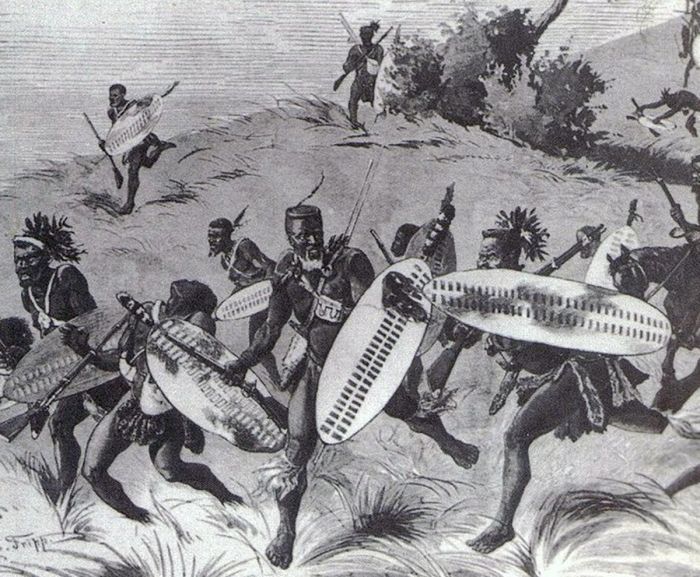
Zulu "impi" (warriors) during a battle (image: Wikimedia Commons).
Dingiswayo (1780-1817)
The son of the chief of the Mthethwa ethnic group was a young man named Godongwana, who was exiled after he plotted a coup against his father. During his exile, Godongwana changed his name to Dingiswayo and became exposed to the highly organized and disciplined military tactics of the Europeans.
Upon the death of his father in around 1800, Dingiswayo returned to claim the chieftainship of the Mthethwa and began implementing his newly learned European military ideas within his regiments. The new chief also brought numerous other autonomous ethnic chiefdoms into his fold, creating the region's first organized and well-trained military regiment comprised of local Nguni warriors.
An early Zulu warrior in the time of Dingiswayo (image: Wikimedia Commons).
Shaka of the Zulus (1787-1828)
One of Dingiswayo's promising young soldiers was Shaka, the illegitimate son of the chief of the Zulu clan. At that time, the Zulus were a mostly peaceful and minor Nguni clan. Shaka was spurned by his father and spent his childhood amongst his mother's settlement, later joining Dingiswayo's regiment. Shaka rose quickly in the ranks of the warriors and after the death of his father in 1816, he took control of the Zulu clan, while still recognizing the larger Mthethwa clan with Dingiswayo as their chief.
In 1817, a bitter war was waged between King Zwide of the Mthethwa people and King Dingiswayo of the Ndwandwe people over control of lands and trade routes, including Delagoa Bay (now Maputo). The Mthethwa were victorious and Dingiswayo was executed. The surviving Mthethwa forces allied in confederation with the Zulu clan under the leadership of Shaka. Shaka continued to assimilate smaller clans in the region and in 1818, when the Ndwandwe clan attacked the Zulus at the Battle of Gqokli Hill, the Zulus were victorious.
King Shaka of the Zulu people (image: Wikimedia Commons).
Shaka initiated a practice of absorbing the young men and most women of his defeated enemies, while killing the elderly and all men of fighting age. Shaka's innovative and harshly disciplined military tactics allowed the Zulus to become the dominant clan in the region. By the late 1820s, the Zulus had effectively developed a vast kingdom and taken control of all land in what is current-day KwaZulu-Natal, South Africa. In 1828, Shaka was assassinated by his half brothers Dingane and Mhlangana, with Dingane assuming the Zulu throne.
Mzilikazi (1790-1868)
One of Shaka's generals was Mzilikazi, a Khumalo clan chief and the grandson of King Zwide. Instead of aligning with his grandfather, Mzilikazi chose to join Zwide's greatest rival, Shaka and the Zulus. Mzilikazi quickly rose through the Zulu ranks, but in 1821, a disagreement between Shaka and Mzilikazi over cattle ownership led to a falling out between the two. Shaka attacked and killed many of Mzilikazi's army, but the general and the survivors escaped.
Other clans joined with Mzilikazi and over the next five years or so, he led his new kingdom on military campaigns into inland territories north and west of the Zulus. Mzilikazi made many enemies along the way, including the Boers (European immigrants fleeing British rule in the Cape Colony). Mzilikazi called his growing empire the AmaNdebele (called the Matebele by the British), meaning 'people of the long shields' and in 1826, they settled on land northwest of what is today Pretoria, South Africa.
Mzilikazi, first ruler of the Ndebele people (image: Wikimedia Commons).
Mzilikazi and his growing Ndebele army soon dominated what is today the Transvaal region of South Africa. The Ndebele waged a brutal and devastating war on the clans in the area, eliminating all opposition and leaving a trail of destruction in their wake. His 'scorched earth' methods (destroying anything that might be useful to the enemy, including land, crops and homesteads) proved highly successful in maintaining a safe buffer between the Ndebele and their enemies.
In 1837-1838, the arrival of large numbers of Boer settlers led to fierce battles between the Ndebele and the armed Boers, taking a great toll on Mzilikazi's forces. To avoid further losses, Mzilikazi decided to abandon the region and lead the Ndebele north , across the Limpopo River into what is today Zimbabwe. Mzilikazi and his followers settled in the area now known as Matabeleland, which covers all of western Zimbabwe, with his new capital at Bulawayo (meaning 'place of slaughter').
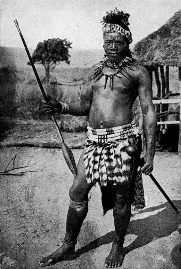
An Ndebele warrior in the time of Mzilikazi (image: Wikimedia Commons).
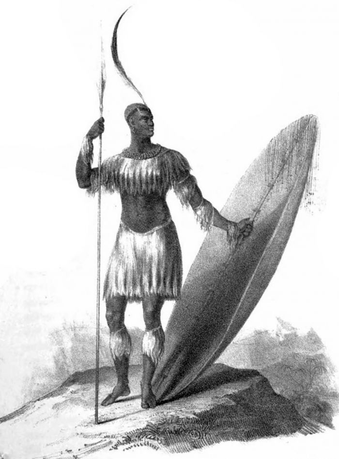
Lobengula (1845-1894)
Mzilikazi died in 1868, creating a power struggle between his two sons - Lobengula and Nkulumane. After more than a year of civil war between the two, the younger son, Lobengula, was appointed king of the Ndebele.
Lobengula continued his father's policy of friendly dealings with white traders and hunters, allowing them access to Ndebele lands in exchange for guns, cloth, liquor, and other items of trade. The discoveries of gold and the Great Zimbabwe ruins (which were believed to be King Solomon's mines) by white explorers led to a gold rush.
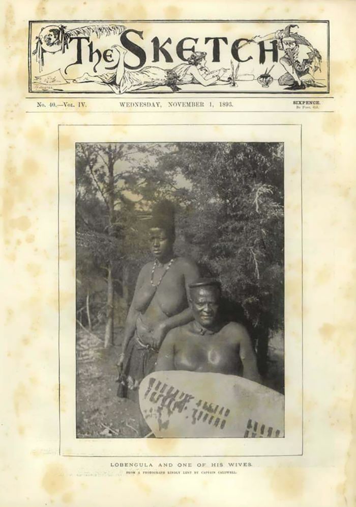
Lobengula at 60 years old, with one of his wives (image: Wikimedia Commons).
Early colonialism (1885-1900)
Cecil John Rhodes
A long-held belief that the Ndebele land was rich in mineral deposits, including gold, brought more and more white fortune-seekers to Lobengula's land. The eventual discovery of gold in Ndebele territory caught the attention of Cecil John Rhodes, the British businessman who had made a huge fortune in diamonds at the Kimberley mines in South Africa.
Rhodes was extremely ambitious and sought to expand his wealth by tapping into the promising Ndebele land for minerals, but he also had aspirations to build a railway connecting the Cape of South Africa with Cairo, Egypt and he wanted to route the railway through Lobengula's land.
By the late 1880s, there were numerous British companies vying for access to the Ndebele land, but in 1888, Lobengula signed a concession granting Rhodes' British South Africa Company (BSAC) exclusive access to all mineral rights on the Ndebele land between the Zambezi and Limpopo rivers (essentially the western half of present-day Zimbabwe). It is widely accepted that the illiterate Lobengula was duped into signing away much more than he intended, and in 1889, Britain granted the BSAC full administrative control of the lands.
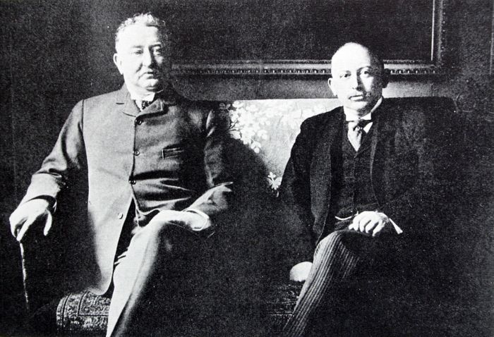
Cecil John Rhodes (left) and Alfred Beit (photo: Wikimedia Commons).
Rhodes promptly invited 200 white settlers (many of them Boers from South Africa) to settle on the lands he had acquired (now referred to as Matabeleland). In 1890, guided by the famous hunter Frederick Courtney Selous and accompanied for 500 armed guards, the settler caravan skirted east of the Ndebele land, traveling through Mashonaland and arriving at the site of present-day Harare, where they built a fort, which they named Salisbury.
Lobengula had by now realized that he had been duped and that the BSAC wanted more than just mineral rights to his land, but he still considered himself the sovereign ruler of Matabeleland. Furthermore, the gold deposits that Rhodes had hoped for were not materializing, and the BSAC needed to recover costs on the failed venture, leading Rhodes to attack Lobengula in 1893.
Vintage train cars from the Rhodesian Railway.
Once again, Rhodes used deception and falsely claimed that the Ndebele had attacked first and that his men acted defensively (which was untrue). The BSAC, with their superior weaponry, including the rapid-fire Maxim Gun and canons, inflicted heavy casualties on the Ndebele, and Lobengula was forced to abandon his city at Bulawayo. The city was burnt and he fled northwest with his followers. Lobengula was never captured nor heard of again and reports of his death in 1894 were never confirmed.
With Lobengula defeated, nothing stood in Rhodes' way and in 1894, Britain granted the BSAC full administration over both Matabeleland and Mashonaland (effectively all of present-day Zimbabwe), plus unspecified lands north of the Zambezi River (present-day Zambia).
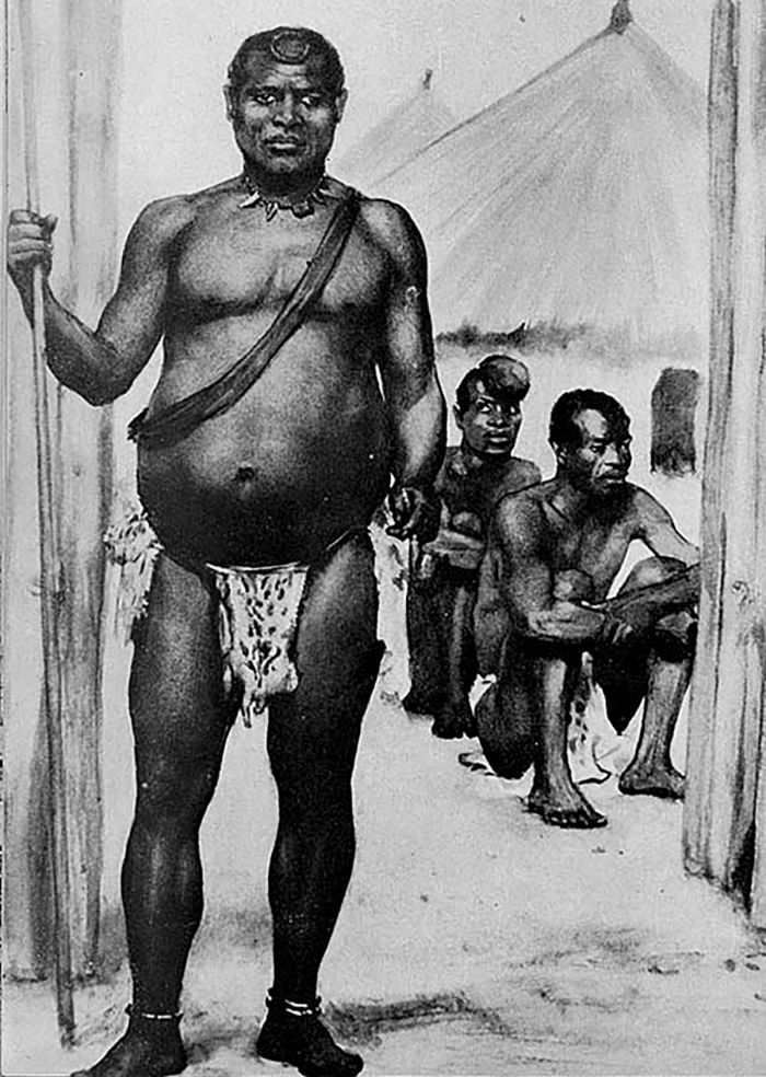
An illustration of Lobengula, second king of the Ndebele (image: Wikimedia Commons).
Rhodes now considered all of this land as the property of the BSAC and confiscated all cattle and huge tracts of prime farming land, which he bestowed on the white settlers. Hut taxes were imposed on the locals and they became nothing more than marginalized labor for the whites. Life became nearly intolerable for both the Ndebele and the Shona.
In 1896, the Ndebele organized and rose up against the BSAC, laying siege to Bulawayo, but they were no match for the superior weaponry of Rhodes' troops. The Shona also revolted in the east, but they too were repelled. The Ndebele continued to raid white farms, using guerrilla tactics and eventually Rhodes was forced to make concessions, leading to a peaceful settlement. In 1897, the British government officially renamed the colony as Rhodesia, elevating Rhodes' status yet further.
In 1902, Cecil Rhodes passed away at the age of 48 years old after contracting a chest ailment onboard a ship back to Cape Town, where he died a few weeks later.
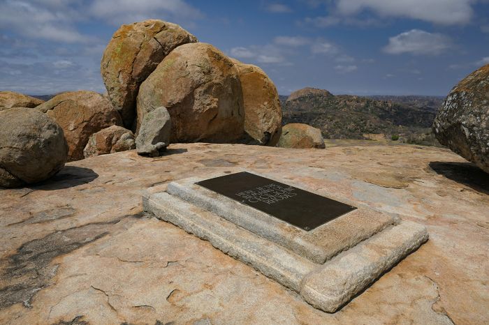
The gravesite of Cecil Rhodes in Matobo National Park.
Colonial Era (1900-1979)
Early 1900s
The early 1900s was a time of large-scale European immigration into Rhodesia, which had been renamed Southern Rhodesia in 1899, so as to differentiate it from Northern Rhodesia (present-day Zambia). Meanwhile, without Rhodes, the BSAC was struggling financially and in 1923, it handed over administration of the country to the British government. The all-white settlers then filed a referendum for self-government, which was granted.
In the 1930s, white empowerment continued to increase, with 75 000 square miles (195 000 sq kms) of fertile farmland allocated to 50 000 whites and 44 000 square miles (115 000 sq kms) allocated to one million blacks. Laws were enacted prohibiting blacks from holding skilled jobs and preventing them from living in the white areas. Essentially, blacks were predestined to live lives of subservience to the whites.
The word apartheid is almost always associated with the country of South Africa, but in fact, Southern Rhodesia's institutionalized policies of racial segregation with authoritarian white supremacy predates such practices in South Africa by several decades.
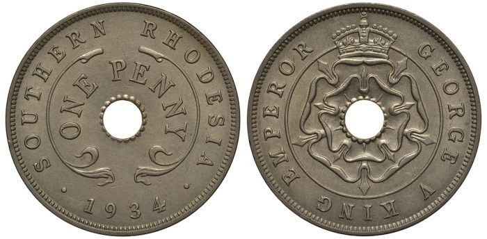
Southern Rhodesia one penny coin from 1934.
Fight for Independence (1950-1979)
By the 1950s, the first organized black resistance to minority rule was formed as the Southern Rhodesia African National Congress (SRANC) under the leadership of Joshua Nkomo. The SRANC was officially banned in 1959, but reformed in 1960 as the National Democratic Party (NDP). The NDP gained more and more followers and staged a number of strikes and protests, some turning violent, leading the government to declare a state of emergency and to ban the NDP.
By now, Britain had mandated that it would only grant independence to its African protectorates if there were racial equality and black majority rule. Subsequently, in 1964, two neighboring British protectorates, Northern Rhodesia and Nyasaland, both gained their independence from Britain with black majority rule, as Zambia and Malawi, respectively.
Southern Rhodesia's all-white government, headed now by Prime Minister Ian Smith, worried that the tide was moving their country to a similar fate, and in 1965, in an effort to maintain power, declared a Unilateral Declaration of Independence (UDI) from the United Kingdom. The UDI was not recognized by Britain and economic sanctions were imposed by the United Nations. Despite international condemnation, Rhodesia's government endured with the assistance of South Africa, Portuguese-run Mozambique, and others.
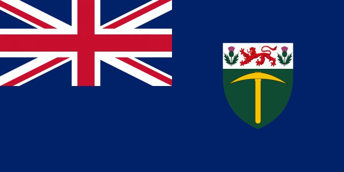
The flag of Southern Rhodesia (1924-1964) (image: Wikimedia Commons).
Following the banning of the NDP, Joshua Nkomo resurfaced as the leader of a newly formed independence movement called the Zimbabwe Africa People's Union (ZAPU). ZAPU gained strength, but in 1963, part of the group's membership split from ZAPU and formed as the Zimbabwe African National Union (ZANU), with Robert Mugabe as its Secretary. Both organizations were fighting against white minority rule, but were predominantly aligned based on tribal lines, with ZAPU's membership largely comprised of Ndebele and ZANU's mostly of Shona.
ZAPU and ZANU were banned by Ian Smith's government, forcing both movements to relocate their operations from Southern Rhodesia to outside locations, including Lusaka, Dar-es-Salaam, and London, where they began organizing their military wings.
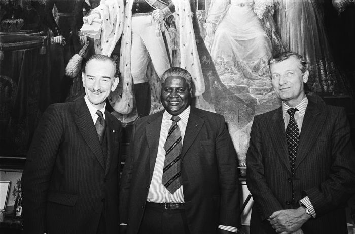
Joshua Nkomo (center) in a photo from 1978 (photo: Wikimedia Commons).
Rhodesian Bush War (1964-1979)
ZAPU unsuccessfully attacked Rhodesian forces in 1964 and ZANU launched its first attack on Rhodesian forces at Chinhoyi in April 1966, setting off the Rhodesian Bush War (also called the Second Chimurenga or Zimbabwe War of Liberation). Although both ZANU and ZAPU were fighting for the same thing, they were not working together nor coordinating their efforts, so the first years of the war were largely ineffective in terms of gains against the government forces.
Both factions operated from outside the country, with ZAPU (funded and trained by the Russians) based in Zambia and ZANU (funded and trained by the Chinese) located in Mozambique. By the early 1970s, the war had become extremely bloody and many of the whites living in the country had fled.
The freedom fighters were making good progress against Ian Smith's government and in 1974, Mozambique won its independence from Portugal. Mozambique's new black-majority government withdrew its support for Rhodesia, leaving only South Africa lending support to Smith's regime. However, South Africa soon bowed to international pressure as well and withdrew its support as well.
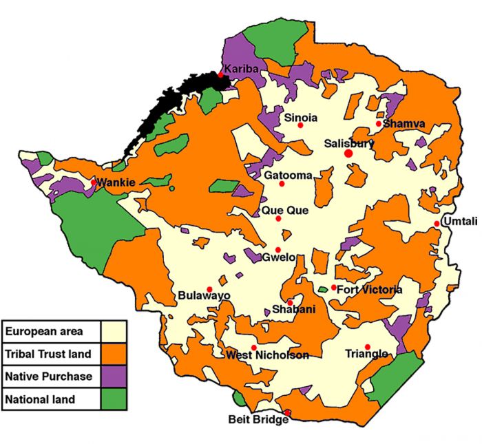
Land allocations in Rhodesia in 1965 (image: Wikimedia Commons).
In 1979, after several failed negotiation attempts between Smith and ZANU/ZAPU, Margaret Thatcher, the newly elected Prime Minister of Britain, held talks at Lancaster House in London. An agreement was finally reached after more than forty meetings. A ceasefire and amnesty were declared, the UDI was dismantled, international sanctions were removed, and free elections were to be held within six months.
Although the war was now over, the agreed upon compromise was still unfairly skewed towards white interests. The whites comprised less than 3% of the population but retained 20% of the new parliamentary seats.
Land reform was a key element of the negotiations and the agreement held that there was to be no mandatory land redistribution for at least ten years, offering a smooth transition period and farmers wishing to sell would be bought out by the British government. The white-owned farms in Rhodesia were crucial to the country's survival, providing roughly 50% of the country's foreign export revenue, as well as feeding the entire domestic population.
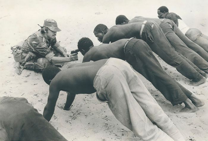
A Rhodesian soldier questions villagers in 1977 (photo: Wikimedia Commons).
Early Independence (1980-1989)
Robert Mugabe
In March 1980, the newly named country of Zimbabwe held its first general elections, with Robert Mugabe of the Zimbabwe African National Union – Patriotic Front (ZANU–PF) defeating Joshua Nkomo and the Zimbabwe African People's Union - Patriotic Front (ZAPU-PF) by a 3-to-1 margin.
Mugabe gained international popularity, receiving acclaim for promising fair treatment for all Zimbabweans, including whites. In an effort to create a government of national unity, Mugabe invited members of his rival ZAPU party (including Nkomo) and even some whites to join his cabinet.
In the first year of Mugabe's term as Prime Minister, disgruntled former guerrillas of the mostly Ndebele ZAPU party initiated factional uprisings in Matabeleland. The situation worsened in 1982 after arms caches were discovered, leading Mugabe to fear a civil war was being planned. Prominent ZAPU supporters were imprisoned, Joshua Nkomo was removed from the cabinet (he fled to England), and all former ZAPU members in the Zimbabwe National Army (ZNA) deserted the army to avoid imprisonment.
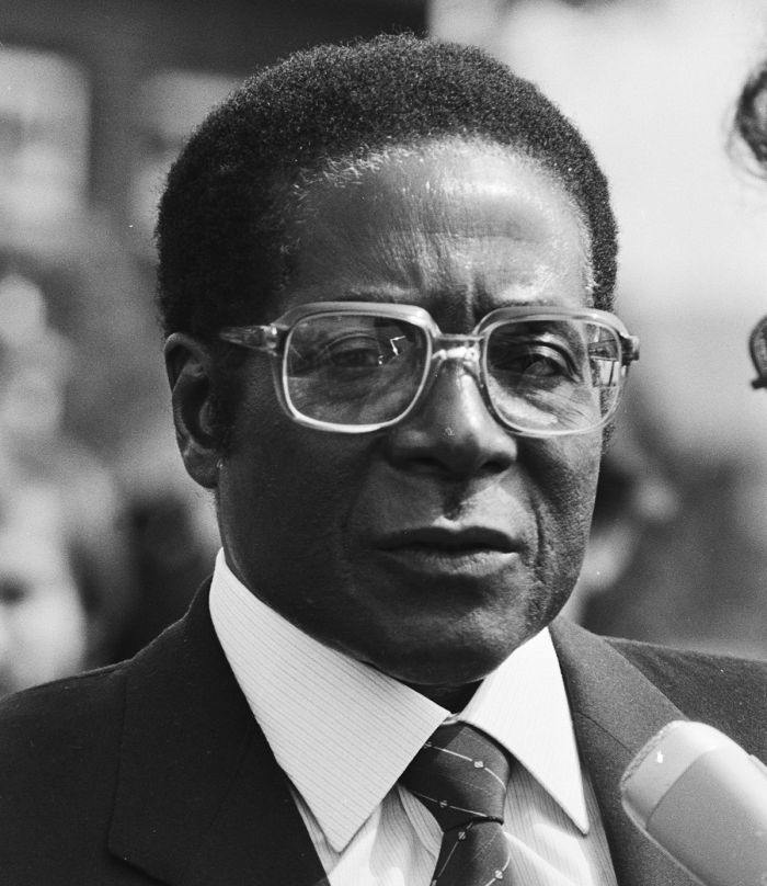
Robert Mugabe in 1982 (photo: Wikimedia Commons).
Gukurahundi (1983-1987)
In 1983, Mugabe sent his North Korean-trained Fifth Brigade, a special operations infantry division reporting directly to him, to put a halt to the unrest by the Ndebele "dissidents".
What ensued can only be called ethnic cleansing, with thousands of Ndebele detained and sent to re-education camps or executed. Many of the executions were held in public, with the condemned forced to first dig their own graves, before being shot in front of their family and fellow villagers. The two-year operation was called Gukurahundi, which means "the rain which washes away the chaff".
From 1983 to late 1984, the Fifth Brigade committed widespread human rights abuses against the Ndebele people, including rape, murder, and torture. In some cases, entire villages were purged. In the end, the International Association of Genocide Scholars (IAGS) estimated that over 20 000 people were killed and classified the events as a genocide. The international community essentially took little notice nor did anything to interfere.
Besides the devastating Gukurahundi, the first ten years of Zimbabwe's independence did little to change the lives of most of its people. The Lancaster House Agreement's ten-year transition period for land reform kept white-owned farms running and the country's economy grew, with an emerging black middle-class.
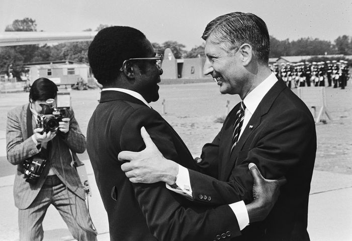
Robert Mugabe with Dries van Agt (1982), Prime Minister Netherlands (photo: Wikimedia Commons).
Early Land Reform (1980-2000)
A key component of the Constitution agreed upon at Lancaster House in 1980 was a ten year postponement of any land redistribution from white owners to the impoverished blacks. A principle of "willing buyer, willing seller" was included, whereby white land owners could sell their properties with funding offered by the British government thru 1990.
The Zimbabwe government had first option to purchase the land and if it declined, it could then be sold on the open market. Many whites were happy to sell and offered their farms for sale, but Mugabe's government overwhelmingly declined to purchase most land. Selling the farms on the open market was also nearly impossible, as most Zimbabweans had very little money.
Britain gave Zimbabwe millions of dollars during the 1980s to fund the purchase of white-owned farms, with almost none used by the government for that purpose, the majority having been diverted into defense expenditures.
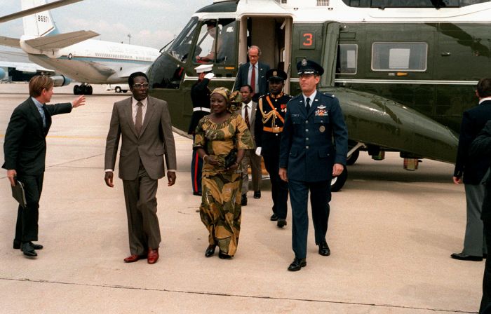
President Mugabe visits the USA in 1980 (photo: Wikimedia Commons).
In 1990, when the ten-year land reform holding period ended, the government passed an amendment to the constitution allowing for the confiscation of land from white-owners with "fair compensation" without agreement from the owner.
In 1992, the Land Acquisition Act was passed, which allowed confiscation of white-owned land without any compensation. Roughly 1 500 white-owned farms were soon taken over and the owners were evicted, often violently. The voluntary land redistribution program hoped for by the British had failed. The productive farms which accounted for a large amount of the country's exports and most of its domestic food were now in disuse.
Further, instead of being given to Zimbabwe's landless poor, most of the roughly 500 farms that were purchased by the government (using British funding), were instead given to Mugabe's supporters, including military officers, influential businessmen, cabinet ministers, police officials, and other personal friends. Britain was understandably unhappy about the misuse of these funds and pulled all future funding.
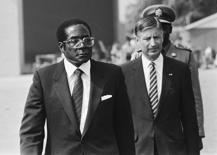
President Mugabe (photo: Wikimedia Commons).
The poor and landless Zimbabweans that took possession of the remaining farms received no title to the land, no agricultural training, nor any funding to purchase equipment, seed, or fertilizer, thus forcing them into subsistence farming on the once commercially productive real estate they now occupied.
The dispossessed white farmers stopped paying on their mortgages, leading to massive losses for Zimbabwe's banks. In light of Mugabe's mishandling of the British funding, the international community, including the World Bank, offered no aid and froze all Zimbabwe assets. The loss of most of its productive farming now turned Zimbabwe into a food importer for the first time ever and its economy was in rapid decline.
Robert Mugabe in 1979, with South African Peter van Staal (photo: Wikimedia Commons).
Mugabe Secures Control (1985-1987)
The large-scale slaughter of the Ndebele people during Operation Gukurahundi caused a growing distrust and resentment towards the ZANU-PF party and Mugabe was concerned about the upcoming national elections to be held in June 1985. In an effort to secure votes, ZANU-PF Youth League brigades used wide scale harassment, intimidation and violence against many of ZAPU-PF's supporters. In spite of these tactics, ZAPU-PF won all 15 parliamentary seats in Matabeleland.
Violence continued between the two parties and Mugabe ordered numerous ZAPU officials, including the mayor of Bulawayo, be detained. Additionally, the ZAPU party offices were forcibly closed and all ZAPU-controlled district councils were dissolved.
In an attempt to avoid further unrest, negotiations began and after two difficult years, ZANU-PF and ZAPU-PF merged in December 1987, with the ZAPU name eliminated. The merger resulted in 99 of the 100 parliamentary seats being held by ZANU-PF. Zimbabwe had effectively become a de-facto one-party state.
After the elimination of ZAPU-PF, Zimbabwe's constitution was amended to declare Robert Mugabe as Executive President, a new position that afforded him the combined roles of head of state, head of government, and commander of the armed forces. He also had the power to dissolve parliament, declare martial law, and run for President for an unlimited number of terms. The amendments also abolished the 20 parliamentary seats reserved for whites per the Lancaster House Agreement.
President Mugabe accepts a gift from New Zealand in 1980 (photo: Wikimedia Commons).
Economic Decline
The 1990s
With the expiration of the ten-year land reform transition period (in 1990) and the onset of the confiscation of white-owned farms, Zimbabwe's economy began to deteriorate. Once called "the bread basket of Southern Africa", with a very strong farming export industry, this began to change in the 1990s. The 1990s were a time of negative economic growth in Zimbabwe, and several events exacerbated its economic woes.
War Veterans (1997)
In 1997, a group of disgruntled soldiers calling itself the Zimbabwean Liberation War Veterans Association (ZLWVA) organized. The group had some 50 000 members claiming to be ex-soldiers (from both ZANU and ZAPU) from the recent war. The group staged several violent protests, demanding cash gratuities and pensions for their service, as they saw politicians growing rich while they suffered.
It should be stated that many of the "so-called" veterans, most notably its leader Chenjerai "Hitler" Hunzvi, took no part in the war as soldiers or otherwise. A large portion of its membership would have been mere children at the time of the war. As the intensity of the war veterans' strikes and pressure tactics grew, Mugabe decided that rather than further aggravating the situation and in hopes of gaining the support of this obviously dangerous group, he would pay them off.
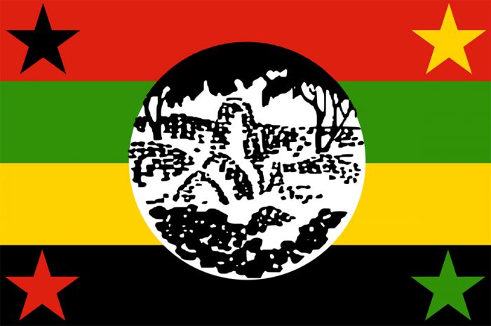
Flag of the Zimbabwe African People's Union (image: Wikimedia Commons).
Accordingly, in early 1998, although the country's treasury could not afford it, each member of the War Veterans Association was paid 50 000 Zimbabwe Dollars (ZWD), as well as a tax-free monthly pension of ZWD 2 000 (roughly double the average monthly black wage at the time). A special levy was imposed to fund the payments, but the work force revolted and the country had to borrow to meet the obligations.
Congo War (1998)
In 1998, in a highly controversial move, President Mugabe entered Zimbabwe into the civil war (called the Second Congo War) in the Democratic Republic of Congo. Mugabe aligned Zimbabwe with the government forces of Laurent Kabila, who had seized control of the country in 1997 and was now fighting former Tutsi allies from Rwanda and Burundi, who had turned on him.
The move clearly lacked any political or strategic advantage for Zimbabwe, and it is widely believed that Mugabe's motivation was for personal financial enrichment. In return for committing his country's troops and equipment to help keep Kabila in power, Mugabe received business deals within the booming Congolese diamond and gold mining industries.
The costs of this venture were estimated to have been 3 million USD per day, a huge drain on Zimbabwe's already dwindling treasury. Most economists agree that this venture was the beginning of Zimbabwe's economic downfall.
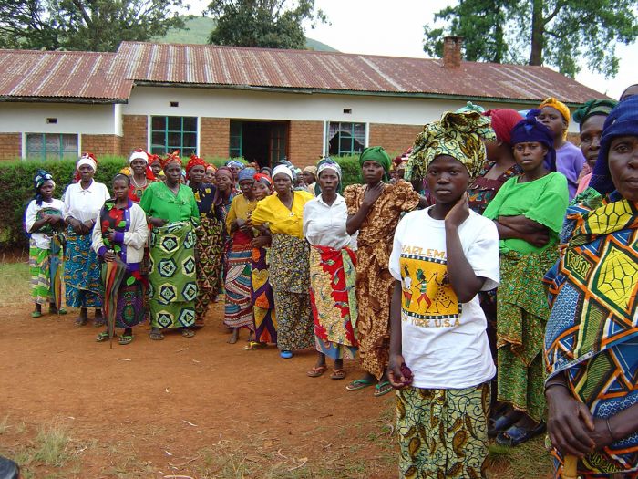
Displaced victims of the civil war in DRC (photo: Wikimedia Commons).
Fast Track Land Reform (2001-2005)
As of 1997, most of Zimbabwe's most fertile land was still in the hands of thousands of white farmers, with the small percentage of farms that had been purchased by the government since 1980 distributed among Mugabe's ministers and other ruling party loyalists and government officials.
In 2001, President Mugabe launched the Fast Track Land Reform Programme (FTLRP), which permitted white-owned farms to be taken by force without any compensation required. The farm invasions, which mostly occurred between 2000 and 2003, were mainly carried out by members of the War Veterans Association in a countrywide assault on its 4 000 commercial farms.
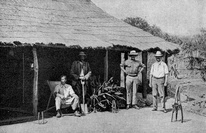
British South Africa Company settlers in Southern Rhodesia in 1922 (photo: Wikimedia Commons).
Farm owners and their employees were typically given one day to vacate the land with no prior warning given. Those who resisted were beaten and some were murdered. Livestock, pets, horses, and wildlife were slaughtered and the homes were ransacked and often burned. The local police were directed not to interfere. According to UN data, approximately 300 000 black Zimbabwean farm workers lost their jobs and over one million black Zimbabweans were displaced, most ending up in squatter camps.
Sadly, most of those that partook in the land grab rampage had no interest in setting themselves up as farmers; rather, the main activity in the land seizures was the theft and consumption of farm assets. Besides displacing thousands of families, the consequences included the disruption of bond payments on the properties and a dramatic decline in the country's agricultural production.
The fast track land grab can surely be said to be the main impetus that started the country into its coming economic collapse. Zimbabwe's commercial farms were some of the most productive in the world and domestically, they accounted for much of the country's economic growth since independence, generating one-half of Zimbabwe's export revenue and employing one-third of the country's workforce.
Tobacco farm in Zimbabwe.
Agricultural Collapse (1998-2008)
By 2003, Zimbabwe had the fastest declining economy in the world, shrinking at a rate of 18% per year. This was largely due to the un-budgeted expenditures outlined above, combined with the worsening agriculture situation, which was primarily due to the farm invasions.
Zimbabwe's previously efficient and productive commercial farms had now been divided up into smaller landholdings occupied by unskilled farmers. The smaller farms eliminated economies of scale available to the once larger farms. Furthermore, the new farmers did not have access to bank loans, as they were not given deeds nor official ownership, meaning that the land could not be used as collateral.
Between 1998 and 2007, commercial farm production in Zimbabwe dropped significantly as follows: maize (corn) down 69%, wheat down 77%, soybeans down 43%, tobacco down 69%, sugar down 31%, dairy down 53%, and beef down 66%.
Village women receiving food aid near Harare (photo: Wikimedia Commons).
2002 Presidential Election
In 1999, a new political party called the Movement for Democratic Change (MDC), under the leadership of Morgan Tsvangirai, was formed to oppose the ruling ZANU-PF in the upcoming 2002 elections. Tsvangirai was a former ZANU-PF member and a prominent trade union leader. The MDC opposed the increasing powers granted to Mugabe's position as executive president.
The MDC gained strong support, especially amongst the educated and urban populace. Fearing he may not win in the 2002 elections, Mugabe sent the War Veterans and ZANU-PF Youth Militia groups on a mission to ensure his victory. The groups roamed the country, using violence and intimidation to "persuade" anyone not producing a ZANU-PF membership card into voting for Mugabe. Allegations of beatings, rape, torture, and even murder were widespread.
Due to the growing food shortage in the country resulting from drought and the farm seizures, much of Zimbabwe was increasingly hungry and government-controlled grain supplies were used as further incentive, with grain allocations given only to ZANU-PF card holders.
Unsurprisingly, the results of the 2002 elections had Mugabe elected as the winner (for a 6-year term) with 56% of the vote, while Tsvangirai received 42%. Reports of fraud, poll tampering, and vote rigging were widespread and the results were condemned by the international community. The USA, EU, UK, and Australia all refused to recognize the obviously flawed results and imposed sanctions on personal assets held by Mugabe and various ZANU-PF officials.

Flag of the Movement for Democratic Change (image: Wikimedia Commons).
2005 Parliamentary Elections
Parliamentary elections for all 120 elected seats were held in March 2005. Mugabe's ZANU-PF party won 78 of the 120 seats, while the MDC secured 41 seats, with one independent winner. The results meant that ZANU-PF held a two-thirds majority and could change the Constitution.
Similar intimidation tactics were once again used to secure votes throughout the country and as in the 2002 elections, widespread electoral fraud was alleged by international observers.
Operation Murambatsvina (2005)
In May 2005, following the parliamentary elections, President Mugabe initiated Operation Murambatsvina, which translates to "remove the rubbish". The project was a large-scale governmental campaign to forcibly clear township slums in urban areas across the country.
Mugabe stated the project was "a vigorous clean-up campaign to restore sanity" and called the program an "urban renewal campaign." However, Murambatsvina is widely considered to be an attempt to punish the urban poor, who had overwhelmingly supported the MDC in the 2002 and 2005 elections, by moving them into rural areas, where their votes could be more easily controlled and manipulated.
The national police carried out the demolitions, with the support of the military and the National Youth Service. Many of those removed were forced to destroy their own homes, often at gunpoint, before being evicted with whatever they could carry. While some homes were shacks, many were solid permanent structures owned by citizens with established, though informal businesses.
The United Nations estimates that more than 700 000 people were directly affected via the loss of their homes or livelihood and that more than 2.4 million were indirectly affected.
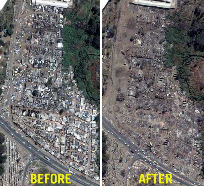
Mbare Township (in Harare) before and after Operation Murambatsvina (images: Wikimedia Commons and Wikimedia Commons).
Hyperinflation (2005-2009)
As of April 2006, Zimbabwe's inflation rate exceeded 1 000 percent and the national currency was almost useless. Re-denominated notes were issued in August 2006 and inflation continued to skyrocket. By the end of 2008, the inflation rate was estimated at 98% per day, meaning that the prices of goods essentially doubled every day.
The precursors leading to the high inflation are discussed above, with the primary factors being the continued printing of money to fund the country's involvement in the Congo war and payouts to war veterans. Additionally, the sharp decline in agricultural output resulting from the land reforms led to a severe shortage of grains and other food. Finally, it is widely believed that President Mugabe was funneling money from the national treasury into foreign personal bank accounts.
In June 2007, the government instituted a price freeze on all goods, making it illegal to raise prices on goods sold publicly. Unfortunately, this made the cost of manufacturing goods higher than producers could charge, causing them to stop production and leading to a serious shortage of most items.
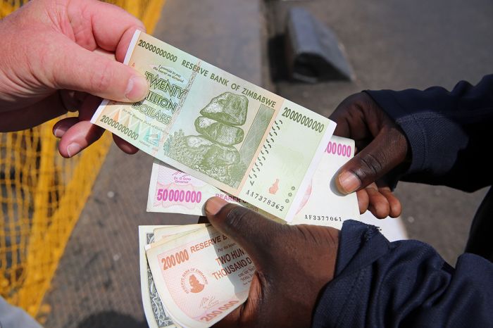
Zimbabwean bank notes reached astronomical denominations.
The shortage of staple items led to a run on the shops as people rushed to purchase what goods remained. The shelves at the shops were increasingly empty and most people used a barter system on the surging black market to obtain food and other staple items.
The final printing of Zimbabwean bank notes included a denomination of 100 trillion Zimbabwe dollars. The paper bank notes were needed in such supply that people had to carry bags of money to the shops in order to pay for only a few staple items. Sadly, it was cheaper to use paper bank notes for toilet paper than to use them to purchase actual toilet paper.
With the price of goods raising daily, people had to spend whatever money they received immediately to mitigate the devaluation. The price of a bus commute in the morning would be far more expensive for the ride home that same day. People who had savings in local banks lost pretty much everything and only those who had invested or saved in foreign bank accounts survived this crisis.
In January 2009, Zimbabwe's dollar collapsed and the government stopped printing its currency and lifted the restriction to use only Zimbabwean dollars. After this collapse, the public was allowed to use the foreign currency of their choice, with most using the US dollar.
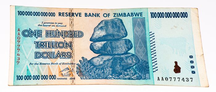
One hundred trillion Zimbabwean dollar bank note (2008).
Recent History
2008 Elections
Elections were scheduled for March 2008 to elect the President and Parliament. Due to the dire economic situation in Zimbabwe, this election was expected to be the toughest challenge to date for Mugabe. As in the past, voter intimidation and vote tampering were expected.
In February 2008, Simba Makoni, a long-time senior member of ZANU-PF and former Finance Minister, announced that he was leaving ZANU-PF to run as an independent candidate. Morgan Tsvangirai also announced his candidacy, running under his faction in the Movement for Democratic Change (MDC) party. As the elections approached, both opposition candidates and their followers were subjected to harassment and violence by the police and ZANU-PF members.
Voting took place on 29 March and unofficial preliminary results indicated very favorable results for Tsvangirai and the MDC parliamentary candidates. Days went by with no results announced, leading to fears that Mugabe and the ZANU-PF were manipulating the voting results.
Over a month passed and on 02 May, results were finally announced. Tsvangirai had received 47.9% of the votes, while Mugabe received 43.2% of the votes. Zimbabwe's constitution requires over 50% of the voting to elect the President, meaning a runoff election would be required, which was scheduled for 27 June.
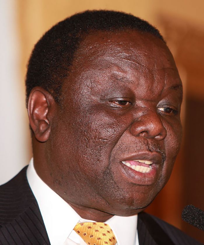
Morgan Tsvangirai (Photo: Harry Wad via Wikimedia Commons).
In the weeks leading up to the runoff, MDC supporters were subjected to violent attacks by ZANU-PF supporters, which the government claimed were perpetrated by MDC itself. The situation worsened when Tsvangirai and several other MDC officials and supporters were arrested by the government. Several diplomats from the US and UK, who were in Zimbabwe to investigate reports of pre-election results, were also detained.
Mugabe stated that he would not relinquish power if he lost in the runoff election and that the War Veterans would be armed and ready to ensure his continuing rule.
As the date of the runoff election approached, the inflammatory rhetoric, violence, and intimidation escalated and on 22 June, Tsvangirai announced that he was withdrawing from the election. Tsvangirai stated that the election would be a "violent sham", that it had no chance of being free and fair, and that his supporters were at risk of being killed if they voted for him.
The runoff election was held anyway and Mugabe declared the winner. The election was criticized by independent observers as being neither free nor fair, and was condemned by the international community.
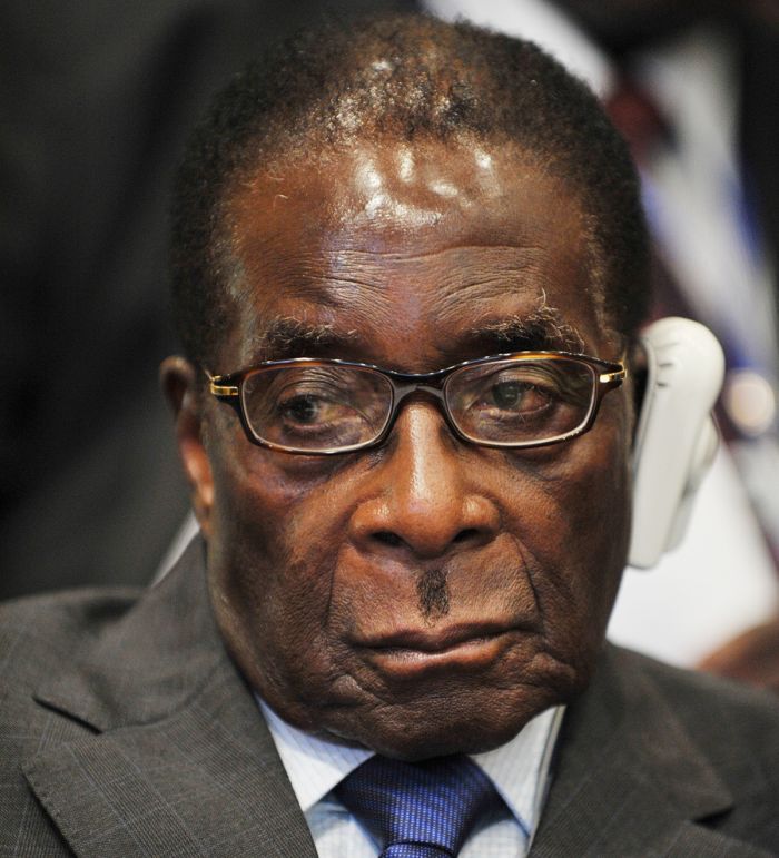
Robert Mugabe was again elected President in 2008 (photo: Wikimedia Commons).
Power Sharing (2009)
In January 2009, under pressure from South Africa's Thabo Mbeki and the South African Development Community (SADC), Mugabe announced that he would accept a power-sharing government with Tsvangirai in the new position of Prime Minister.
Mugabe and the ZANU-PF retained control over the police and armed forces, which left Tsvangirai and the MDC relatively powerless. While Tsvangirai had veto power to block any proposed parliamentary proposals, this only served to perpetuate the uneasy truce between the two parties and stalemate all governmental progress.
In the meantime, Zimbabwe's economy continued to stagnate, causing local and foreign investment to drop off dramatically.
Prime Minister Morgan Tsvangirai meets with President Obama in 2009 (photo: Wikimedia Commons).
2013 Elections
In March 2013, a new constitution was agreed upon by both parties and passed by public referendum by an overwhelming vote. The constitution called for immediate elections, which were to be held in July. The new constitution declared that presidents would be limited to two five-year terms and removed presidential veto power over proposed legislation. It also created new offices, including an independent electoral committee, an independent prosecuting authority, and an anti-corruption department.
As in all prior elections, accusations of widespread voter intimidation in rural areas, vote rigging, and tampering with electoral rolls were made by independent observers and electoral commissioners. Upon investigation it was revealed that the electoral rolls included roughly one million invalid names, including many deceased voters and excluded one million valid voters, mostly in urban areas (where Mugabe lacked support).
Once again, Robert Mugabe was was elected as president with 61% of the vote and claimed his sixth term as president. His ZANU-PF party also dominated in the parliamentary elections, winning 160 seats, while Tsvangirai's MDC party won 49 seats. Tsvangirai called the elections a "huge farce" and stated that the MDC would not participate in Mugabe's government.
Robert and Grace Mugabe in 2013 (photo: Wikimedia Commons).
Coup d'état (2017)
In October 2017, tensions escalated between rival factions within ZANU-PF, one backing Emmerson Mnangagwa, the country's Vice-President and the other supporting First Lady Grace Mugabe, the President's wife. Grace Mugabe was backed by the Generation 40 (G40), a faction of younger officials within ZANU-PF. Mnangagwa, a long-time ally of the President and a veteran of the war, had the support of several prominent generals within the Zimbabwe Defense Forces (ZDF).
Robert Mugabe was now 93 years old and Mnangagwa and Grace Mugabe were both vying for position to succeed the President, whose health was fading. Mnangagwa alleged publicly that he had been poisoned at a political rally in August and accused Grace Mugabe of ordering the poisoning via a dairy farm she owned. Grace Mugabe denounced the accusation as ridiculous and untrue and publicly criticized Mnangagwa, saying he was attempting to destabilize the country and undermine the Presidency.
On 06 November, President Mugabe dismissed Vice-President Mnangagwa, leaving Grace Mugabe as the only contender to succeed Robert Mugabe as President. Several generals in the ZDF publicly declared that only a veteran of Zimbabwe's war for independence, should rule the country.
On 08 November, Mnangagwa, who was receiving threats against him and his family, fled Zimbabwe to Mozambique and then to South Africa. Mnangagwa, speaking from South Africa, vowed to return and called for members of ZANU-PF to abandon the President. Many of Mnangagwa's senior supporters were then targeted for disciplinary sanctions by Grace Mugabe.
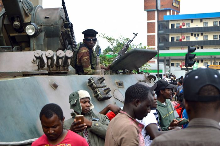
A tank in downtown Harare during the 2017 Coup (photo: Wikimedia Commons).
Constantino Chiwenga, a war veteran and current Commander of the ZDF, was at this time on an official visit to China, where he learned that Robert Mugabe had ordered his arrest upon his return to Zimbabwe. This advance notice allowed him to make plans to avoid arrest and on 12 November, soldiers loyal to Chiwenga disguised as baggage handlers, overpowered the Zimbabwean police at the airport and escorted him to his military headquarters.
On 13 November, Chiwenga released a statement chastising the government for the dismissal of officials in the ZANU-PF party and warned that the military would intervene if the "treacherous shenanigans" continued.
On 14 November, convoys of Chiwenga's soldiers and armored military vehicles embarked from their headquarters and into Harare. Several roads were blocked by the soldiers, including the one leading the President Mugabe's private residence and the one leading to the Zimbabwe Broadcasting Corporation (ZBC), the state broadcaster.
On 15 November, the homes of numerous high ranking ZANU-PF officials and other supporters were raided by the military, including those of the Minister of Higher Education, the Minister of Local Government, as well Ignatius Chombo, the Minister of Finance and a Grace Mugabe supporter, in whose home around US$10 million in cash was discovered.

ZANU-PF Youth League members marching (photo: Wikimedia Commons).
Later that day, Major General Sibusiso Moyo, the army's Chief of Staff, spoke on a ZBC broadcast, stating that it was not a military takeover and that President Mugabe was safe and unharmed, but was under house arrest. Moyo also said that the military was targeting criminals in the government who were responsible for the country's dire socio-economic problems.
On 19 November, President Mugabe was officially removed from the ZANU-PF party, along with the First Lady Grace Mugabe and more than 20 of her associates. Mugabe responded in a public speech, saying he would not resign the presidency. The ZANU-PF then issued Mugabe a deadline of noon the next day to step down or face impeachment.
On 21 November, a ZANU-PF caucus made a motion to impeach Mugabe, alleging the following: serious misconduct; failure to obey, uphold and defend the Constitution; willful violation of the Constitution; and inability to perform the functions of the Office because of physical or mental incapacity. That evening, President Mugabe officially resigned.
On 22 November, the ZANU-PF party nominated Emmerson Mnangagwa to take over as interim President. Mnangagwa returned from South Africa the next day and on 24 November, he was sworn in to serve out the remainder of Mugabe's term ending in 2018.
Zimbabwean citizens celebrating on Nov 19, 2017 (photo: Wikimedia Commons).
Mugabe Post-Presidency
There was little interest among the ruling ZANU-PF officials in prosecuting Mugabe after his resignation and both he and his wife were granted immunity from prosecution via full diplomatic status. Mugabe was also granted a five-bedroom house, two dozen staff members, personal vehicles, and a payment of around ten million US dollars. He was also permitted to keep all personal wealth and business interests amassed during his long rule.
In early 2019, it became known that Mugabe had been receiving medical treatments in Singapore for around eight weeks. The former president remained hospitalized in Singapore, where he died at the age of 95 on 06 September 2019. The cause of his death was not officially disclosed, but was reported to be from advanced cancer.
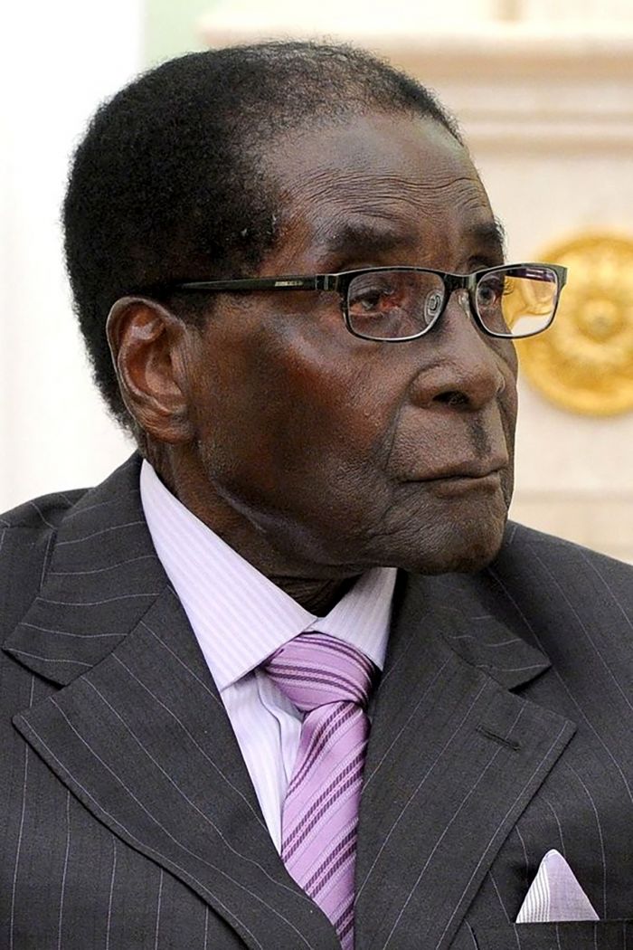
Robert Mugabe in 2015 (photo: Wikimedia Commons).
2018 Elections
In the July 2018 general elections, Emmerson Mnangagwa, running for the ZANU-PF party, won with 50.7% of the votes. Morgan Tsvangirai, who was expected to run against Mnangagwa for the MDC party, died in February 2018, so Nelson Chamisa, the MDC's new leader, ran instead. Chamisa received 44.4% of the votes.
Allegations of continued improprieties in Zimbabwe's voting system were again cited and the credibility of its electoral process are still in question by its citizens and the international community. Although the 2018 elections were peaceful for the first time ever, the MDC claim that the elections were rigged in ZANU-PF's favor.
The ruling ZANU-PF party has rejected the idea of forming a government of national unity with the MDC party. The next general elections in Zimbabwe are scheduled for 2023. The ZANU-PF has approved Mnangagwa as its candidate in 2023.

President Mnangagwa with Vladimir Putin in 2019 (photo: Wikimedia Commons).
Read More...
1500s-1600s, Bush War, Cecil John Rhodes, Colonialism, Coup d'état, Early 1900s, Early History, Early Land Reform, Economic Decline, Fast Track Land Reform, Fight for Independence, Great Zimbabwe, Ndebele, Recent History, Robert Mugabe, Shaka
Great Good Fair Poor
- Jan
- Feb
- Mar
- Apr
- May
- Jun
- Jul
- Aug
- Sep
- Oct
- Nov
- Dec
The chart directly above should be taken as a very rough overall indicator of best times to visit Zimbabwe, as there are significant variations regionally and based upon elevation. More information on the specific national parks and reserves is found on the previous Details tab.
Click on a Region Link above to read more about best times to visit a specific region or destination.
Climate and Seasons
Most of Zimbabwe enjoys a warm, tropical climate throughout the year, with plenty of sunshine. The Central Zimbabwean Plateau, which covers much of the interior of the country, has an elevation of 2 600-5 000 feet (800-1 500 meters), which moderates the temperatures substantially.
Temperatures on the central plateau generally max out at 80-82°F (27-28°C). This central area is much less visited by tourists, with most of the popular tourist destinations lying on the northern and southeastern perimeters of the country.
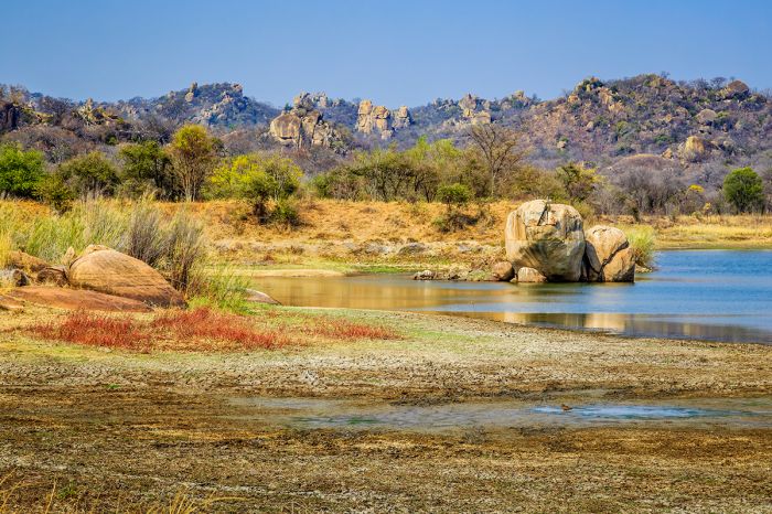
Picturesque scenery in Matobo National Bank.
The northern boundary of the country, which includes Hwange, Mana Pools, and Victoria Falls, is the most popular for tourism. This region is defined by the lower-elevation Zambezi River Valley, which enjoys warmer temps all year, reaching as high as 93-95°F (34-35°C) in the summer months.
Zimbabwe's seasons, like much of Southern Africa, are primarily defined by rain moreso than temperature. The rains occur during the warmer summer months between November and April. The wettest months are December, January, and February. May thru October are virtually rain-free. June and July enjoy the coolest temps, and October is the hottest and driest month by far.
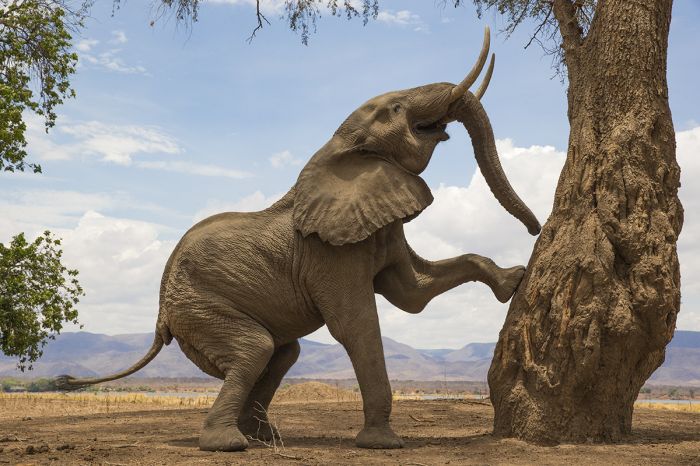
An elephant prepares to reach for tasty seed pods in Mana Pools NP.
Wildlife and Safaris
The best time to visit Zimbabwe depends on where you are going and what you plan to do.
For wildlife viewing, the dry, winter months are generally the most productive, as the animals are forced to remain near the permanent water sources. Once the rains begin, there is ground water available in more places and the animals are able to disperse, meaning that they are more spread out, requiring more effort to find them.
The best months for wildlife are July thru October. Hwange National Park has no natural occurring permanent water, but has an extensive network of pumped waterholes to sustain wildlife during there dry season. Game viewing at the permanent waterholes or along the rivers in other parks is very good during the dry season.
During the summer, game viewing is still good in many parks and for photographers and/or birders, the "green season" is spectacular. While the wildlife may be more spread out, the scenery is defined by more color, with verdant landscapes and dramatic skies making for incredible imagery. Birding is much better during summer (Nov-Mar), as migratory species arrive in huge numbers from Europe and Asia to breed and raise their young.
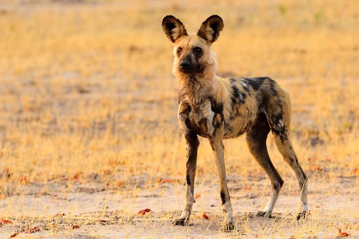
An African wild dog in Hwange National Park.
Victoria Falls
Victoria Falls is a year-round destination, but the water levels at the Falls make the experience quite different depending on the time of year. High water levels occur from February thru May, with peak levels in March/April. At this time, the spray is massive and the roar of the water thundering, but actually seeing the Falls is difficult due to the rising spray. The best way to see them at this time is from above, in a helicopter or microlight.
Low water season at The Falls is June thru early December, with the lowest levels in October/November. At this time, the water flowing over Victoria Falls becomes a slow trickle, with some parts of the waterfall becoming completely dry. Visiting at low water allows one to see the rocks and geology of The Falls and the popular Devil's Pool activity is only available at this time.
White water rafting in the gorge downstream from The Falls is a popular, but seasonal activity. Rafting at low water (generally July thru December) is the most popular and exciting time, with lots of white water and more dramatic rapids. High water rafting trips are shorter (the first 9 rapids must be skipped due to increased danger) and less dramatic, with less exposed rocks and less white water. Rafting is postponed when the water becomes very high (usually Mar-May).
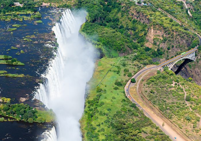
The Victoria Falls viewed from a helicopter tour.
Showing 1–18 of 18 results
Located in a private conservancy on the Lake Kariba shoreline. Luxurious accommodations with excellent food and services. Wildlife viewing on land and boat, fishing, walking, and cultural visits.…
Located in the spectacular Lower Zambezi region, the camp literally borders Mana Pools National Park and lies within an UNESCO World Heritage Site. Seasonally superb wildlife viewing via game driving, boating, and walking.…
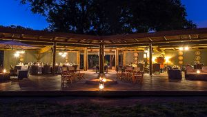
An authentic, lower-cost bush camp located in a wildlife-rich private concession, giving guests a very exclusive experience. Activities include day and night game drives, walking, and cultural experiences.…
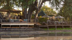
Seasonal camp with a wildlife waterhole that is the only drinking spot for many miles during the dry season. No other camps nearby, providing a very exclusive experience. Very good wildlife viewing, game drives, walking safaris, and 'arm-chair' safaris from the camp.…
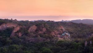
Lovely, exclusive-use home located in the Matobo Hills on 1 200 acres of private land. Ideal for extended family or group of friends. Activities in the nearby national park include game drives, rhino tracking, Bushman rock art, culture.…
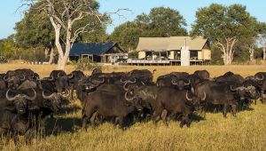
Located within a wildlife-rich private concession of Hwange, giving guests a very exclusive experience. Activities include day and night game drives, walking, and cultural experiences.…
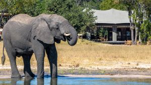
A small and relaxed bush camp located in a wildlife-rich private concession, giving guests a very exclusive experience. Activities include day and night game drives, walking, and cultural experiences.…
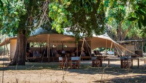
Little Ruckomechi is a small (4 tents) camp located in the spectacular Lower Zambezi region in a private concession adjoining Mana Pools National Park. Seasonally superb wildlife viewing via game driving, boating, and walking.…
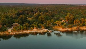
Situated on a sandy section of the river in Zambezi National Park. Far from the crowded, tourist areas, yet close enough to experience everything at The Falls. No other camps nearby. Safari drives, boating, walking, and the numerous adrenaline activities at The Falls.…
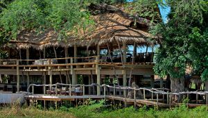
Lovely camp located in the core area of Mana Pools National Park along the Zambezi River. No other camps nearby, providing a very exclusive experience. Superb wildlife viewing, game drives, walking safaris, canoeing, fishing, and seasonal boating.…
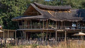
Family-friendly and no other camps nearby, providing a very exclusive experience. Located in the central portion of Mana Pools National Park on the Zambezi River. Abundant and diverse wildlife, game drives, walking safaris, canoeing, fishing, and seasonal boating.…
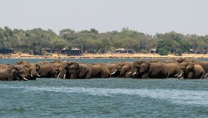
Located in the spectacular Lower Zambezi region in a private concession adjoining Mana Pools National Park. Seasonally superb wildlife viewing via game driving, boating, and walking.…
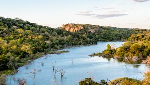
Singita Pamushana Lodge is located on a large reservoir in the Malilangwe Wildlife Reserve in far southeastern Zimbabwe. The lodge offers excellent wildlife viewing, boating, fishing, hiking, and more.…
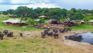
Family-oriented, eco-friendly, upscale, tented camp overlooking a well-used waterhole in one of the park's best wildlife areas. Game drives, bush walks, sleep-outs at a platform hide, cultural visits, children's activities.…
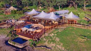
Eco-friendly, tented camp overlooking a well-used waterhole in one of the park's best wildlife areas. Game drives, bush walks, sleep-outs at a platform hide, cultural visits. Up-close elephant viewing at the camp's 'elephant drinking pool'.…
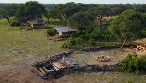
Small, classic-style, tented camp that evokes safaris from the days of early explorers, but with modern day comforts. Located in one of the park's best wildlife areas. Game drives, bush walks, sleep-outs at a platform hide, cultural visits.…
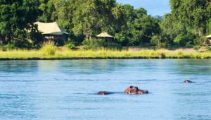
Located in the wildlife-rich Lower Zambezi within in a private concession adjoining Mana Pools National Park. Offers a true wilderness experience with no other camps for many miles. Very good wildlife viewing via game driving, boating, canoeing, and walking.…