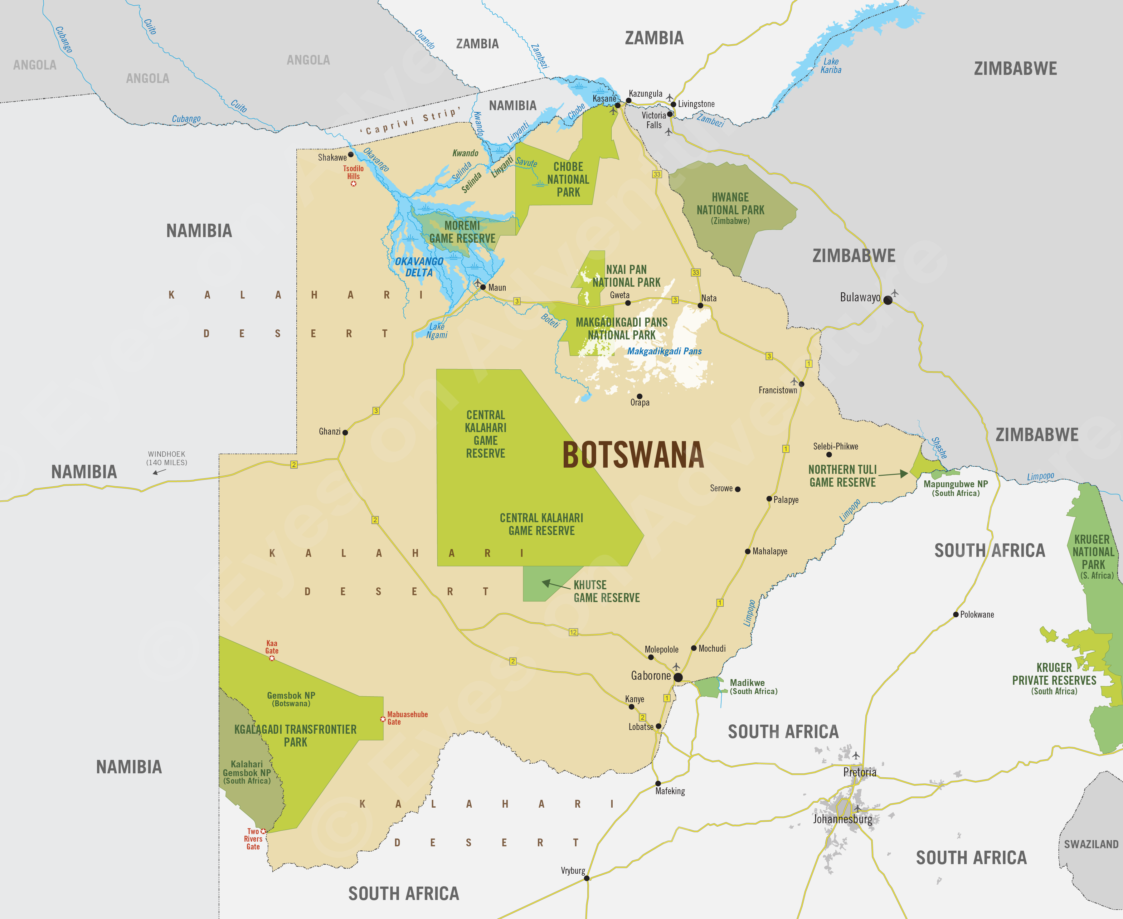
Botswana
Region Links: Central Kalahari, Linyanti & Chobe, Makgadikgadi, Okavango Delta, Okavango Panhandle, Tuli Block
Highlights
- One of Africa's top safari destinations.
- The Okavango Delta is a UNESCO World Heritage Site and a unique safari destination.
- The Chobe river for seasonally superb wildlife viewing from the water.
- Join adorable meerkats as they go about their day in the Makdagikgadi region.
- Go on a 'mekoro' (traditional canoe) excursion in the Okavango.
- Victoria Falls easily added to a northern Botswana safari itinerary.
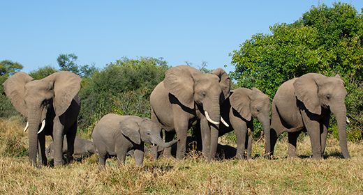
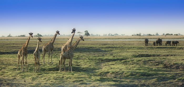
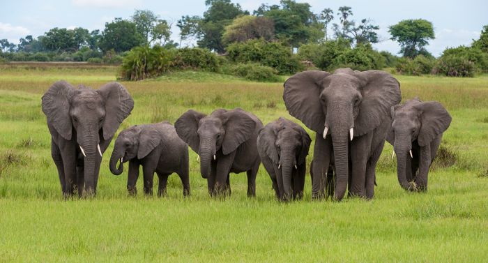
Botswana is one of the world’s most beautiful and sparsely populated countries. In terms of safaris, it is undoubtedly one of Africa's premier destinations, with well-managed game reserves, plentiful wildlife, and some of Africa's last remaining wilderness.
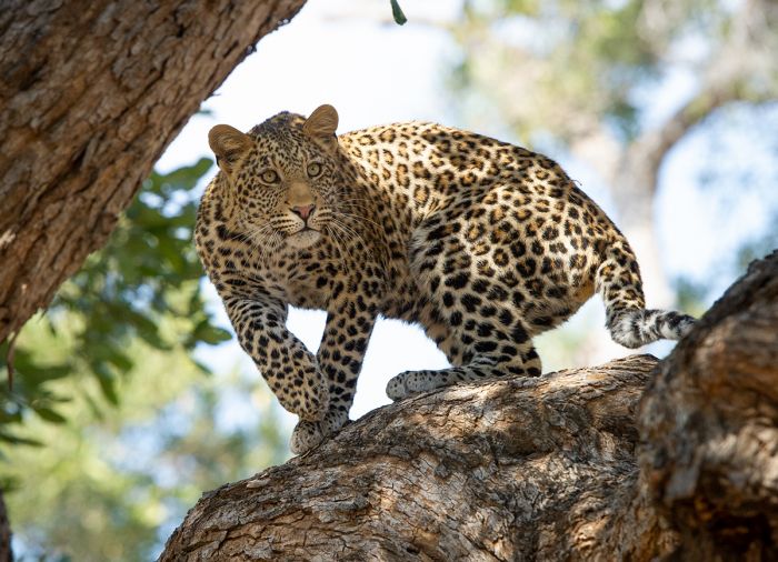
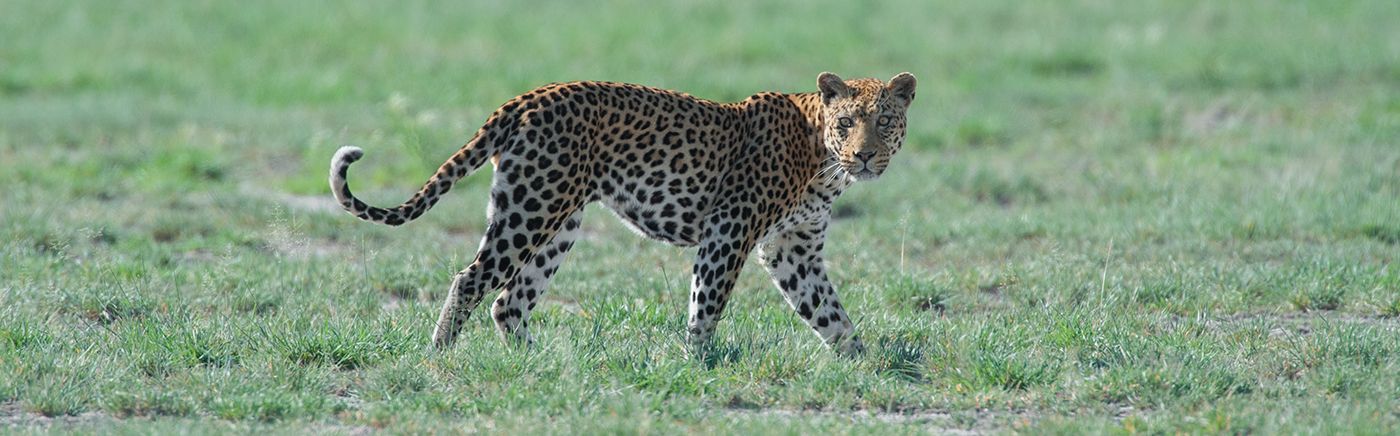
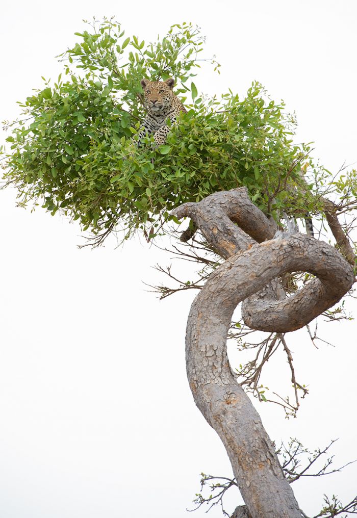
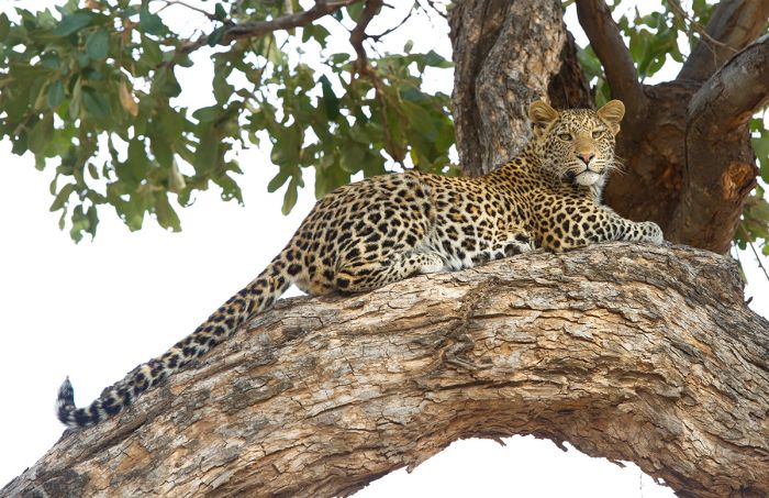
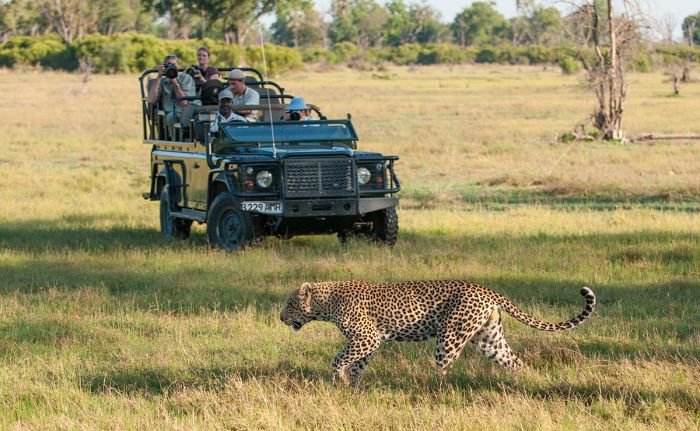
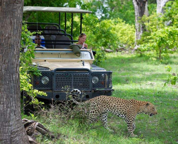
Young leopard in Botswana's Northern Tuli Game Reserve (Copyright © James Weis).
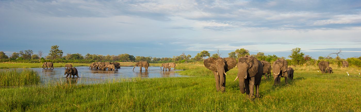
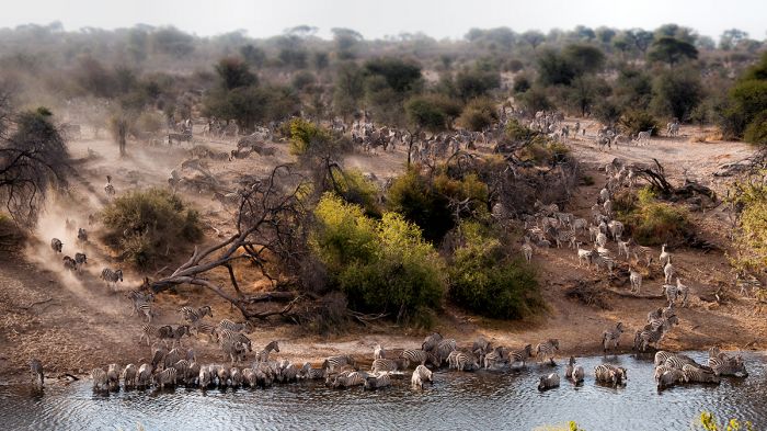
The Okavango Delta is arguably the most unique and spectacular safari destination on the continent, with miles upon miles of wilderness, crystal clear waters flowing in a myriad and ever-changing network of rivers and islands, plentiful wildlife, and top-notch safari lodges.
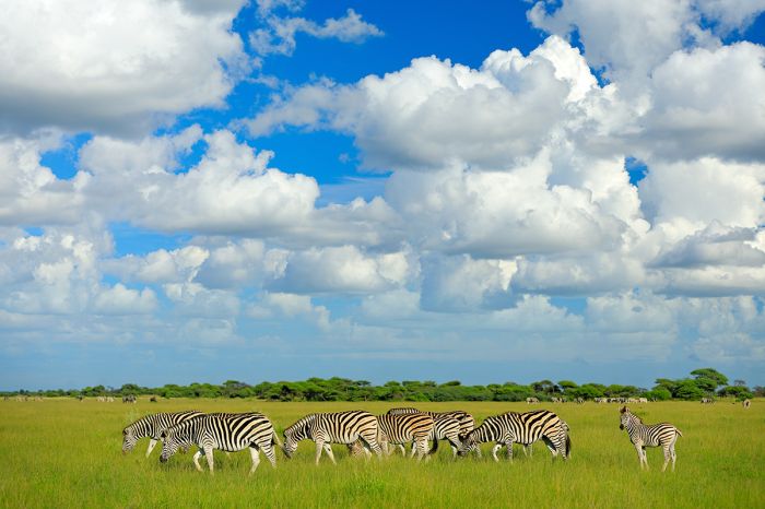
Most of the country is flat and dominated by the spectacular Kalahari Desert. In fact, the Kalahari sands cover over two-thirds of Botswana. The Central Kalahari Game Reserve and the awe inspiring Makgadikgadi Salt Pans are two destinations in this dry, desert habitat, and both offer safari-goers a chance to marvel at the wildlife that thrives in this unforgiving ecosystem.
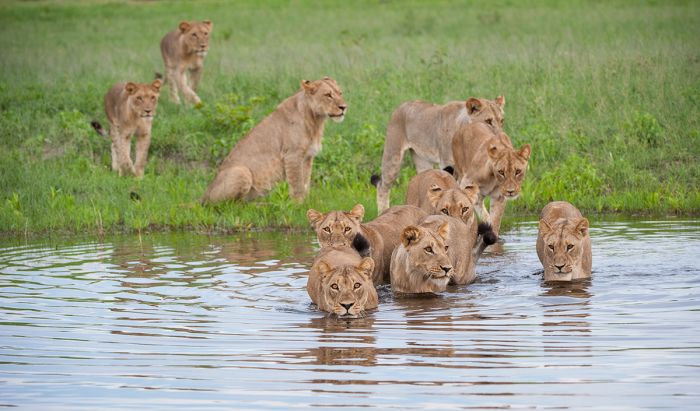
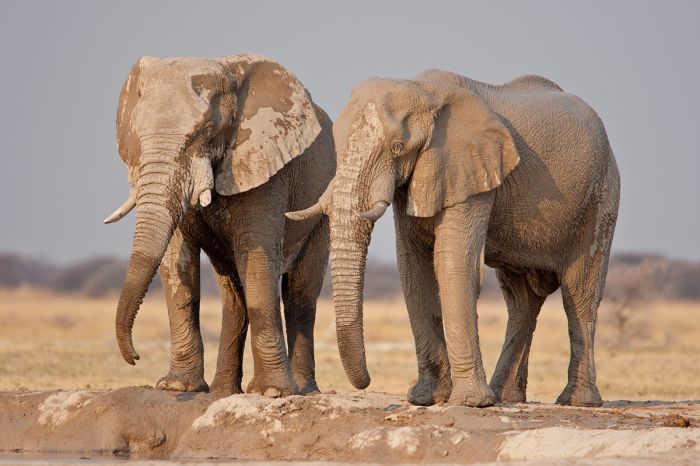
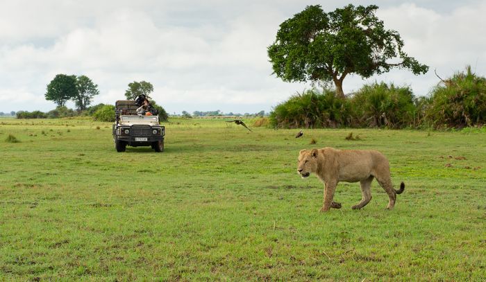
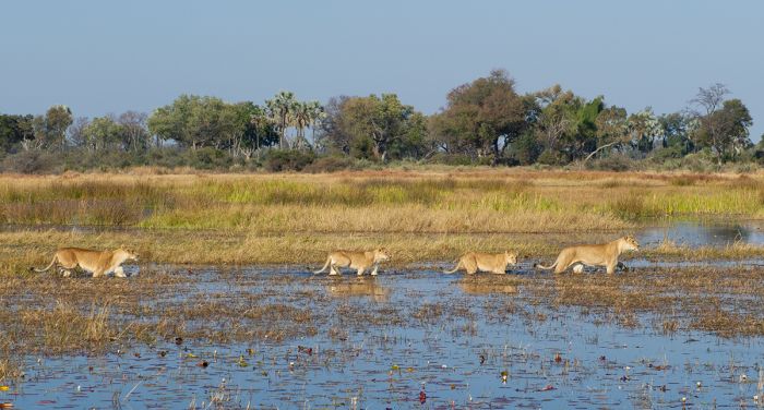
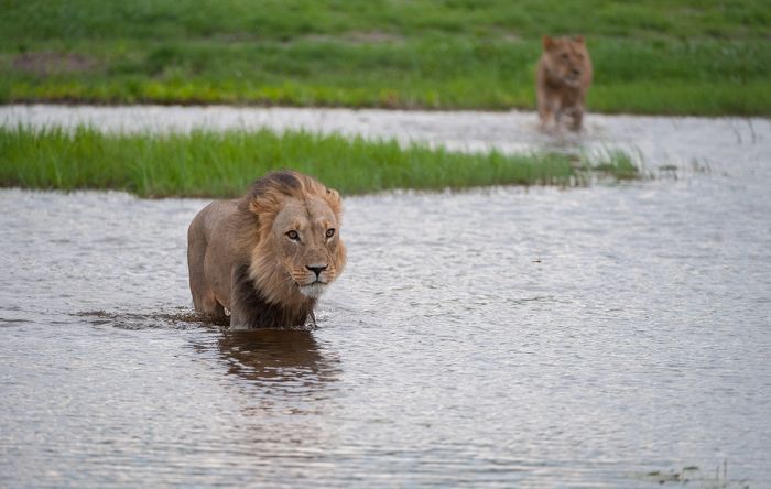
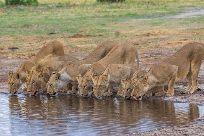
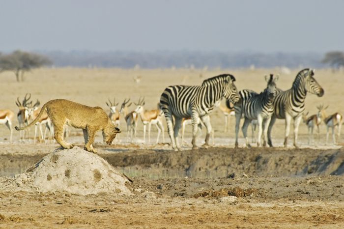
Lions crossing water in the Okavango Delta (Copyright © James Weis).
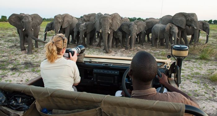
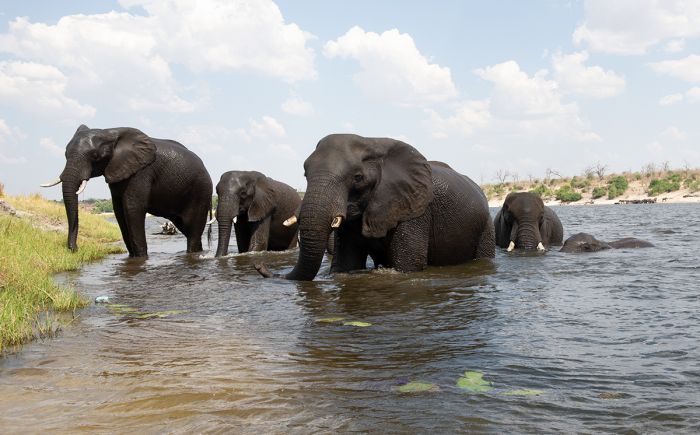
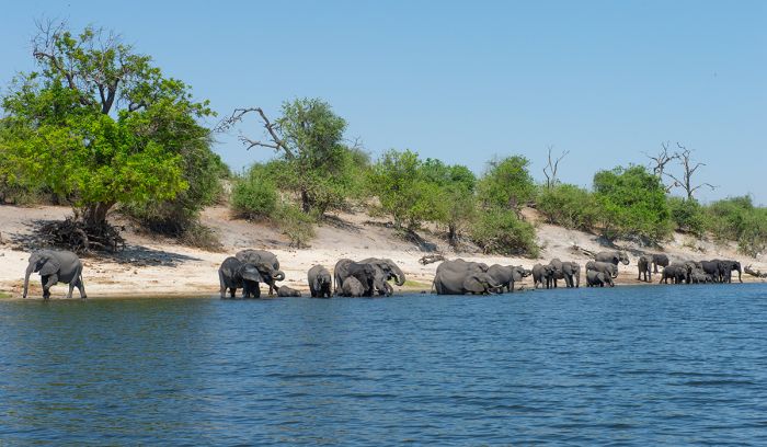
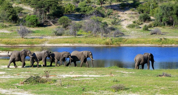
Along Botswana's northern border are the Chobe National Park and the Linyanti Reserve. Chobe is famous for its boating safaris on the Chobe river, with thousands of elephants and other wildlife that are sustained by this perennial waterway. The Linyanti a patchwork of private game reserves and offers a similar and spectacular experience to the Okavango Delta.
The lesser known Tuli Block is far removed from the northern wildlife reserves, bordering both Zimbabwe and South Africa in southeast Botswana. The Tuli region is gaining popularity, but still retains the feel and theme of most Botswana safaris, one of wilderness and wildlife.
Eyes on Adventure has a very special love for Botswana and we are eager to introduce travelers looking for the ultimate African safari to this exceptional destination.
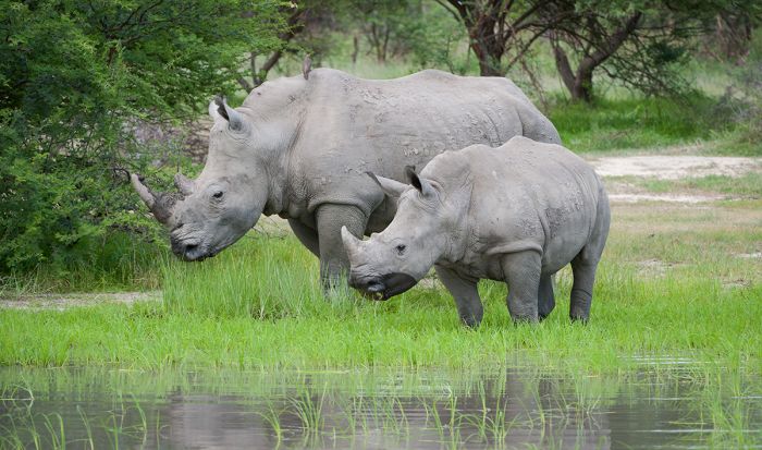
White rhinos in Moremi Game Reserve (Copyright © James Weis).
Botswana Regions
Okavango Delta (incl. Moremi Game Reserve, Maun)
Botswana's premier wildlife destination offers one of the finest safari experiences in Africa. A UNESCO World Heritage Site, this vast wetland is a pristine wilderness, packed full of plentiful wildlife with superb camps and lodges. More
Linyanti & Chobe (incl. Kwando, Selinda, Savuti Channel, Savute Marsh, Chobe River)
Bordering the Okavango Delta on the north, the Linyanti, Selinda and Kwando Reserves offer exclusivity in a pristine wilderness. East of the Okavango, Chobe National Park and the Chobe River offer land and water-based safaris. More
Makgadikgadi Pans (incl. Nxai Pan, Boteti River, Nata Sanctuary)
The incredible Makgadikgadi salt pans are a truly unique and unforgettable safari destination. The harsh environment is home to big herds of zebra the migrate seasonally between Nxai Pan and the Boteti River. See lions, meerkats and more! More
Central Kalahari (incl. Central Kalahari Game Reserve)
The Central Kalahari Game Reserve is one of Africa's great wilderness destinations with endless plains and fossilized rivers. See desert-adapted wildlife including cheetah, lion, herds of springbok, and more. Deception Valley is the setting for the best-selling book Cry of the Kalahari. More
Tuli Block (incl. Northern Tuli Game Reserve, Mashatu Game Reserve)
Bordering Zimbabwe and South Africa in the far southeast of Botswana, The Tuli Region offers a unique destination for Botswana safaris. The privately-owned, well-managed land offers superb game viewing with elephant, cheetah, lion, leopard and even horseback safaris. More
Okavango Panhandle (incl. Tsodilo Hills)
The Okavango River as it flows into Botswana and before it spreads out into the Okavango Delta, forms a region called the 'Panhandle'. Visitors can enjoy world-class fishing, endless beauty and solitude, and the historic Tsodilo Hills with its ancient rock art paintings. More
Read More...
Main: Flora, Geography, Important Areas, National Parks, Protected Areas, Ramsar Sites, UNESCO Sites, Urban Areas, Wildlife
Detail: Chobe NP, Chobe Riverfront, Central Kalahari, Conservation, Francistown, Gaborone, Kasane, Kgalagadi, Khutse, Kwando, Linyanti, Makgadikgadi, Makgadikgadi Pans NP, Maun, Moremi, Nxai Pan, Okavango Delta, Okavango Panhandle, Savute Channel, Savute Marsh, Selinda, Tsodilo Hills, Tourism, Tuli Block
Admin: Travel Tips, Entry Requirements/Visas
Geography
Botswana is located in the Southern Africa region and is completely landlocked. The majority of the country is covered by the Kalahari Desert, with a very flat topography and only occasional rocky outcrops that rarely exceed 100 meters in elevation. The country's two most notable features are the Okavango Delta, which is not a true delta (as it doesn't reach an ocean), and the massive salt pans of the Makgadikgadi.
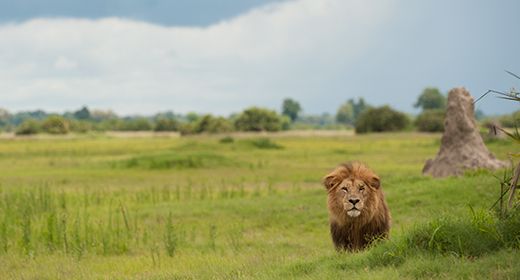
A male lion in Botswana's Okavango Delta (Copyright © James Weis).
Botwana's lowest elevation point is in the extreme southeast, along its border with Zimbabwe and South Africa at the confluence of the Shashe and Limpopo Rivers, with an elevation of 1 683 feet (513 meters). The highest elevation point in Botswana is Monalanong Hill located just outside Gaborone, with an elevation of 4 902 feet (1 494 meters).
The country is bordered by South Africa to the south and east, Zimbabwe in the northeast, a tiny stretch of border with Zambia along the Zambezi River in the extreme north, Namibia's 'Caprivi Strip' in the north and Namibia in the west.
Most of Botswana's population and its only two notable cities, Gaborone (metro area: 400 000 people) and Francistown (metro area: 150 000 people), are situated along the southeast border of the country, where the land is less sandy and more suitable to agriculture.
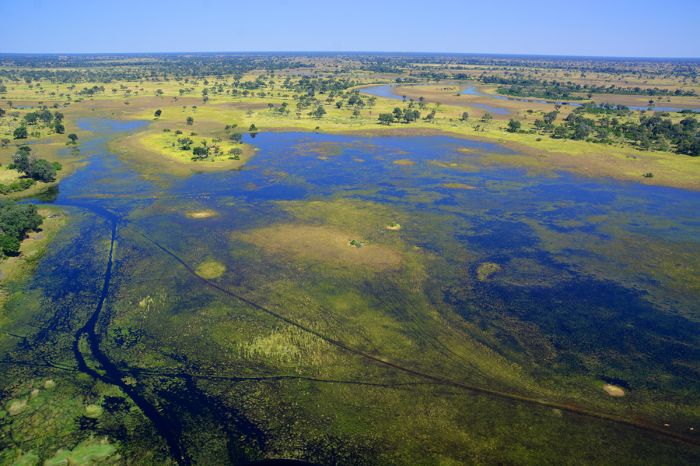
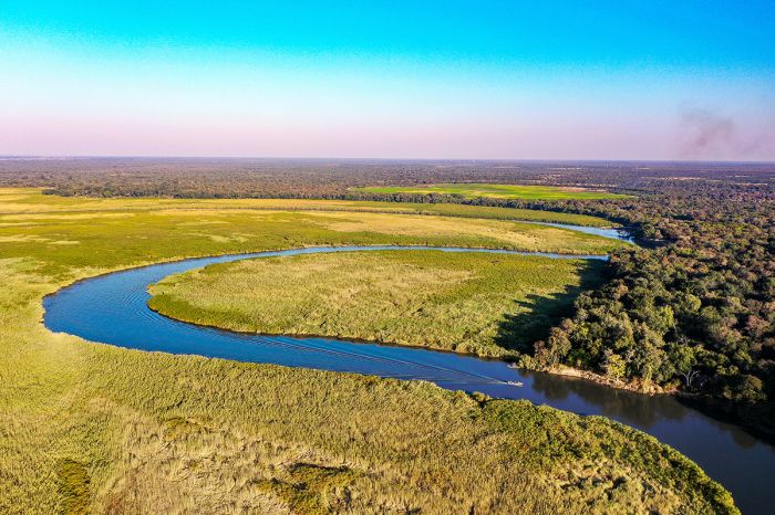
Aerial view above the Okavango Delta, showing the annual flood water covering the desert sand.
Northern Botswana (Geography)
Northern Botswana is the country's main safari region. The region is a paradise for wildlife and is utilized, in large part, for photographic safari tourism. Although divided and designated as distinct regions in northern Botswana, the Okavango Delta, Chobe National Park, and Linyanti / Selinda / Kwando wildlife reserves are in fact one contiguous environment, with abundant wildlife living and moving freely across these large ecosystems. This combination of open, uninterrupted, vast ecosystems explains why northern Botswana is such a spectacular destination for safaris.
Aside from the towns of Maun (at the southern boundary of the Okavango) and Kasane (on the northern border of Botswana), and a few small local villages scattered across the north, there are very few people living in the region. Northern Botswana is certainly one of the world's last great natural environments, where wildlife still mostly exists as it did many centuries ago.
Northern Botswana offers superb wildlife habitat and is one of Africa's best destinations for a safari.
The Okavango Delta (Geography)
The Okavango Delta is technically not a delta, but rather an 'alluvial fan', as a true delta is created by rivers reaching the sea, and the Okavango River empties into the Kalahari sands and never reaches the sea. It has the shape of a fan or delta when viewed from high above.
The Okavango River is sourced by two rivers to its north: the Cuito and the Cubango, which both have a catchment area in the highlands of Angola, far to the north. As the rivers reach the southern Angola border, they join and become the Okavango River, which flows south across the Caprivi Strip (Namibia) and into Botswana.
Flowing southeast into Botswana, the Okavango River spills into a shallow tectonic trough created between two fault lines running northeast and forming the northern and southern boundaries of the Okavango Delta, the southern fault running through the town of Maun. The trough is relatively flat and the water from the Okavango River spreads out as it fills the trough, creating the seasonally flooded Okavango Delta. The delta is situated at the far southern point of Africa's Great Rift.
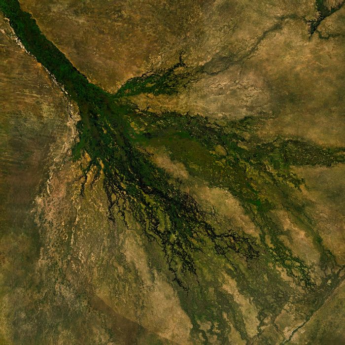
Satellite image of the Okavango Delta in Botswana.
Makgadikgadi (Geography)
Prior to the formation of the Okavango trough, the Okavango River once flowed further southeast, where it is thought that it joined either the Limpopo River (which flows east into the Indian Ocean) or the Orange River (which flows west into the Atlantic Ocean).
Later, some time between two and five million years ago, an upliftment in Botswana's Kalahari Desert blocked the Okavango River and created a massive paleo-lake (Lake Makgadikgadi).
Lake Makgadikgadi eventually overflowed its banks around 20 000 years ago, creating a new river which flowed northeast and joined the Linyanti/Chobe River system, forming the middle Zambezi River. This water eventually eroded basalt rock as it flowed east, creating deep gorges and The Victoria Falls.
When the southern fault of the Okavango Delta began uplifting, the river's flow was further blocked and this began the formation of the Okavango Delta. Millions of years of water entering the lake and with no outlet, would have meant that the lake was quite brackish and as the river was cut off from reaching it, Lake Makgadikgadi eventually dried up, leaving behind the salt pans that exist today.
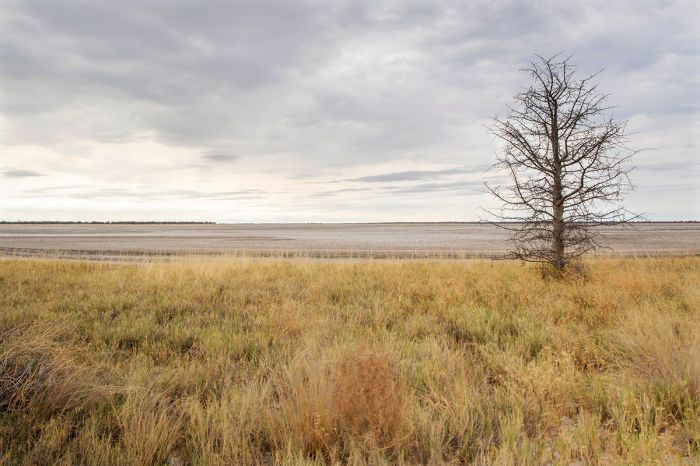
Grasslands at the edge of the salt pans in Makgadikgadi, Botswana.
Flora
Kalahari Sandveld
Most of Botswana (over 90 percent) is covered with the sand of the Kalahari Desert, but still supports a savanna biome of grassland and in some places, open woodland. This biome is called Kalahari Sandveld. Besides various species of grass which thrive atop the majority of this biome are trees and bushes, including those of the genera Acacia, Combtretum, and Terminalia.
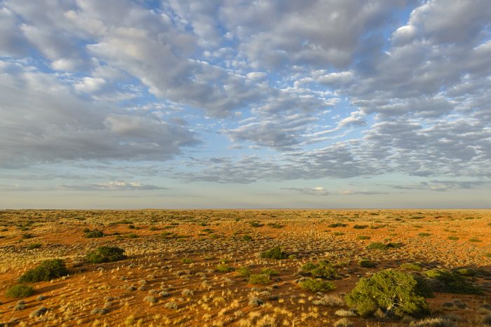
Early morning view of the Kalahari Desert in Botswana's Gemsbok National Park.
Mopane
The second largest major biome in Botswana is the mopane (pronounced "mope-ON-eee") biome. Named for the mopane tree (Colophospermum mopane), which is the most common and widespread of all the trees in northern and northeast Botswana, this biome has a variety of deep Kalahari sand and in some place, alluvial soils.
Mopane trees can exist as cathedral forest in better soils, with a hight of up to 80 feet (25 meters) or, in less productive, low-nutrient sandy substrate, they often only grow into low shrubs, known as 'mopane scrub' or in the Setswana language, 'gumane'.
Compared to other local trees, mopane are quite tolerant of poorly-drained soils, particularly where there is a high clay content, so they dominate large swaths of the permanent dry areas of the Okavango and Linyanti, as well as the region further southeast surrounding the Makgadikadi Pans.
Many herbivores favor the mopane's leaves, which are very nutritious, and they attract browsers such as elephants, impala, kudu and giraffe. The leaves retain their nutritional value even after falling, and are eagerly eaten. The mopane worm, the caterpillar of the mopane moth (Gonimbrasia Selina), provides important protein to a variety of birds and is a sought-after delicacy for the local people.
A herd of impala feeding amongst mopane trees (Colophospermum mopane) in northern Botswana.
Miombo Woodland
The dominant biome across many parts of South-Central Africa, including much of nearby Zambia to the north, Botswana has only a relatively small area in the extreme northeast (in and around Chobe National Park). Miombo is characterized by large wooded areas, interspersed with smaller semi-open spaces supporting some trees and shrub thickets.
The dominant trees in miombo woodland are Brachystegia and Julbernardia species. These trees shed their leaves for a short time in the dry season to reduce water loss and produce fresh foliage just prior to the rainy season (around November in northern Botswana). The name 'miombo' comes from the Bemba (a tribe from northeastern Zambia) word for the Brachystegia tree.
Shallow, grassy depressions, sometimes referred to as a 'dambo' or in South Africa, as a 'vlei', are often associated with miombo woodland. Dambos are typically damp for much of the year and therefore support neither trees nor bushes, but are home to rich grasses, flowering plants, and herbs, making them popular with grazing animals.
Elephants walk along the edge of miombo woodland in Botswana's Chobe National Park.
Forest
In the seasonally flooded areas of of northern Botswana, there are smaller biomes that support moist evergreen forests on islands in the Okavango Delta and along the major waterways including the Kwando, Selinda, Savute, Linyanti, and Chobe Rivers.
The numerous islands in the Okavango support water-adapted trees including the lofty real fan palm (Hyphaene petersiana), wild date palm (Phoenix reclinata), several species of fig tree (Ficus), willows, waterberries, and others. Over time, salts leach up into these islands from the surrounding water, and only the salt-tolerant spiky Sporolobus grass can grow there once the salts become too plentiful in the sand.
Riparian forests along the major rivers of northern Botswana, as well as throughout the Okavango Delta, support evergreen and deciduous forests, with trees such as the African mangosteen (Garcinia livingstonei), baobab (Adansonia digitata), African ebony (Diospyros mespiliformis, also known as jackalberry), sausage tree (Kigali africana), raintree (Lonchocarpus capassa), marula (Sclerocarya birrea), leadwood (Combretum imberbe), and many others.
An aerial view of one of the many private airstrips in the Okavango Delta, showing forested patches amongst the grassland.
Seasonal Floodplain
Seasonally flooded grassland is another minor biome, found mainly in the Okavango Delta, but also along the Linyanti, Kwando, Chobe, and Zambezi Rivers in northern Botswana. These floodplains typically support only grasses and other ground cover, including some flowers, that can survive being submerged for part of the year.
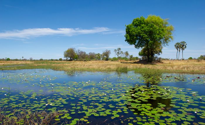
The Okavango Delta also has areas of perennial swamp, supporting papyrus (Cyperus papyrus), common reed (Phragmites australis), waterlilies, and other aquatic vegetation.
To read more about regionally specific flora in Botswana, click on the protected area links below and/or the region links at the top of the page.
Seasonally flooded grassland on the edge of Botswana's Okavango Delta and dry woodland to the north.
Wildlife
Botswana offers some of the greatest wildlife destinations in all of Africa. The Okavango Delta (often referred to simply as 'the Delta') in particular, along with the reserves located directly to the north - Linyanti, Kwando, and Selinda, have very low tourist-to-land-area ratios in spectacular wilderness settings and are home to abundant and diverse wildlife.
Other regions in Botswana, such as the Central Kalahari, Makgadikgadi and Nxai Pans, and Gemsbok National Park, offer wildlife safaris in areas that are vastly different from the Okavango. Central and Southern Botswana receives far less rain than northern Botswana, so the wildlife densities are much lower, but still worth visiting.
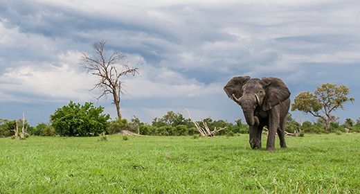
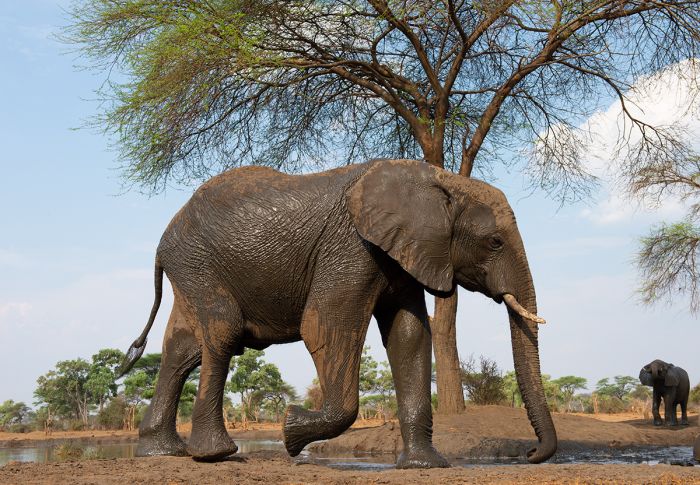
Elephants enjoying the rainy season in Botswana (Copyright © James Weis).
Northern Botswana (Wildlife)
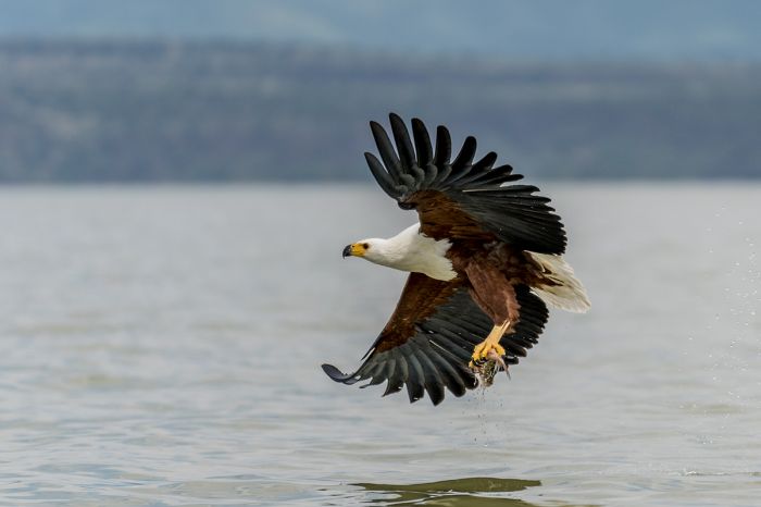
Botswana's crown jewel of wildlife safaris is surely the Okavango Delta. The beauty of this wetland paradise, with blue waters, abundant wildlife, rich vegetation, and superb safari camps is without peer on the continent.
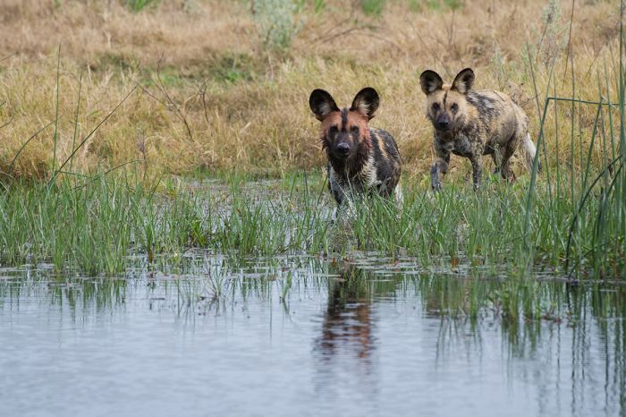
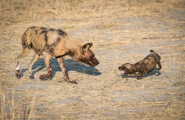
Wildlife in the Okavango includes all the iconic animals of Africa, including all of the Big Five - lion, leopard, elephant, buffalo, and rhino. Besides lion and leopard, large predators in the Okavango include cheetah, African wild dog, and spotted hyena. Smaller predators include two species of jackal, caracal, African wild cat, numerous species of mongoose, honey badger, and others.
Leopards are common throughout northern Botswana. Here one scans the plains from the top of a rain tree (Lonchocarpus capassa) in the Okavango Delta (Copyright © James Weis).
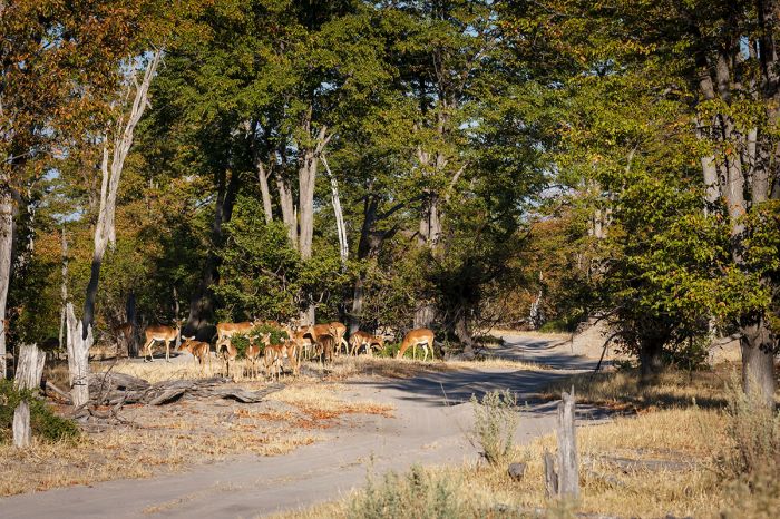
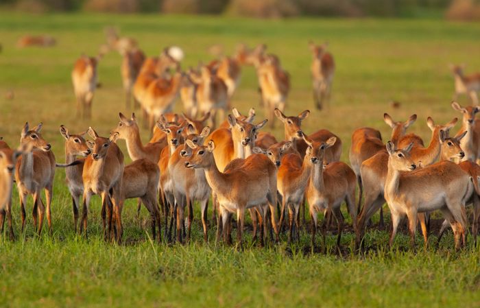
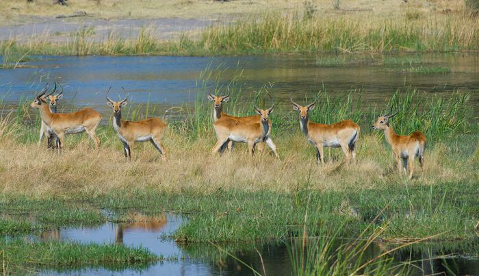
Plains game includes giraffe, Burchell's zebra, impala, blue wildebeest, greater kudu, common reedbuck, tsessebe, waterbuck, and warthog. The abundance of water in the Delta means that it is home to water-adapted species such as sitatunga and red lechwe. Bushbuck are common in the forested areas and are often seen in and around safari camps. Hippo and crocodile are here in large numbers in the deeper waterways. Primates include chacma baboon and vervet monkey.
Birding in the Okavango is outstanding, with a diverse mix of water birds and dryland species. The best months for birding are in the Spring (November thru March), when untold numbers of migrant species arrive from Europe and other Palearctic areas to breed.
To the north of the Okavango is a drier regio known as the Greater Linyanti. Most of the same species found in the Okavango also exist in this area, although the water-adapted species are restricted to the smaller sections along the rivers and in the Linyanti Swamp. Roan and sable antelope are both found in these areas north of the Delta.
The shy and water-adapted sitatunga is never found far from water, where it is able to stay safe from predation. Botswana's Okavango Delta is one of the best places in Africa to see these elusive antelopes.
The Okavango Delta and the Greater Linyanti are two of the best places in Africa to see the highly endangered African wild dog. Rhinos, both black and white species, were essentially wiped out in Botswana and only relatively recently reintroduced in the Moremi Wildlife Reserve, which is part of the Okavango Delta.
Northeast of the Okavango is Chobe National Park. Chobe is mainly a dry region, but like most of Northern Botswana, receives decent rainfall during the rainy season (December thru March) and offers water-based wildlife viewing along the Chobe River. The Savute Marsh, which fills seasonally and sporadically over the years via the Savute Channel offers excellent wildlife viewing in the less visited southern part of the park.
The Chobe wildlife experience is different from the rest of northern Botswana in that self-driving and camping is permitted, whereas most of the Okavango (some camping available in the Moremi Game Reserve) and the other northern reserves are private and only accessible by guests staying in one of the private safari camps.
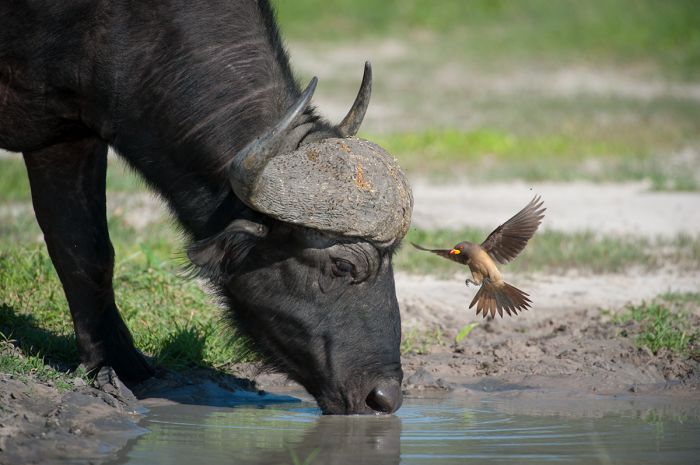
Buffalo and yellow-billed oxpecker in the Linyanti Reserve in northern Botswana (Copyright © James Weis).
Chobe's best wildlife viewing is along the Chobe River, with boating safaris a specialty where one can observe wildlife in and along the river from the water. Excellent sightings of hippo, elephant, buffalo, crocodile, and red lechwe are a near guarantee during the driest months (July-October), as well as good chances of seeing other plains game and even lion, wild dog, or other predators.
Birding along the Chobe River is also outstanding, with lots of raptors like African fish-eagle, tawny eagle, snake eagles and more. Water birds are abundant, with many species of heron, egret, bee-eater, and plenty more. Boating on the river provides for up-close views of many birds not otherwise easily approached on land.
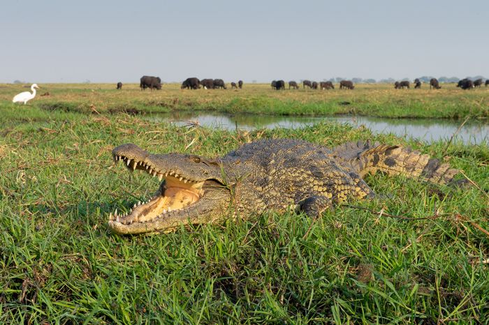
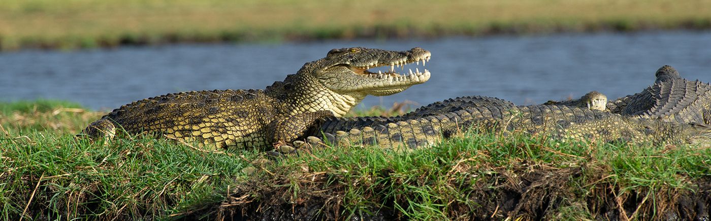
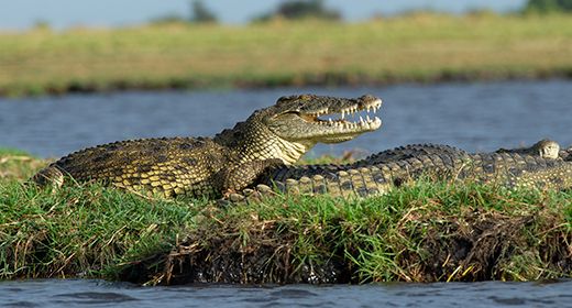
A boating safari on the Chobe River allows up-close views of wildlife, like this Nile crocodile (Copyright © James Weis).
Central Kalahari (Wildlife)
The Central Kalahari Game Reserve (CKGR) offers a distinctly different environment from the more lush northern reserves of Botswana. The CKGR is an arid region with less diverse wildlife that is more spread out due to the shortage of water for most of the year. The reserve has two pumped waterholes to help sustain the animals during the long dry months between May and October.
The best game viewing is during the rainy period from mid-December thru April, when large numbers of springbok, which are the most common large mammal in the reserve, congregate on the plains in the north of CKGR to enjoy the fresh short grass. Other large herbivores commonly seen in CKGR include blue wildebeest, oryx (gemsbok), red hartebeest, eland, and giraffe. Greater kudu are found in the reserve, but in small numbers.
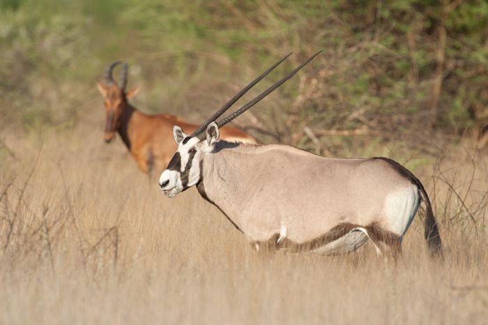
The distinctive and desert-adapted oryx is a common resident of the Central Kalahari. A red hartebeest looks on in the rear (Copyright © James Weis).
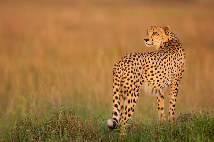
Predators include leopard, lion, spotted hyena, and cheetah. Lions do not form big prides in CKGR, due to the sparse prey populations, and are usually encountered alone or in pairs. Cheetah do quite well in CKGR due to the wide open terrain that suits their hunting technique. Small numbers of lion, leopard, and spotted hyena, which always outcompete cheetahs in other areas where their numbers are greater, are also found in the reserve.
Other wildlife in CKGR include brown hyena, Cape fox, black-backed jackal, aardwolf, bat-eared fox, African wild cat, caracal, meerkat, genet, honey badger, and yellow mongoose.
Bird life in the reserve is restricted mainly to drylands species, such as ostrich, northern black korhaan, kori bustard, and various grassland birds. Raptors are quite common and include a variety of eagles, kites, Lanner falcon, and pale-chanting goshawk.
The arrival of the first rains is welcomed by the wildlife in the Central Kalahari of Botswana.
Makgadikgadi (Wildlife)
Although it at first appears a lifeless place and nothing lives atop the salt pans themselves, the Makgadikgadi region offers good wildlife, and seasonally, it offers superb wildlife.
The Boteti River, which forms the western boundary of Makgadikgadi National Park, is fringed with riparian vegetation and attracts herds of blue wildebeest and Burchell's zebra if the river has water (some years are dry and others the river flows).
Between June and December, herds of grazing mammals begin migrating from the north (Chobe and the Okavango) towards the Makgadikgadi to feed along the Boteti River's banks, which even in drier years, can sustain vegetation and enough water during these dry months. Besides the zebra and wildebeest, smaller numbers of eland, red hartebeest, and oryx (gemsbok) also arrive at the Boteti.
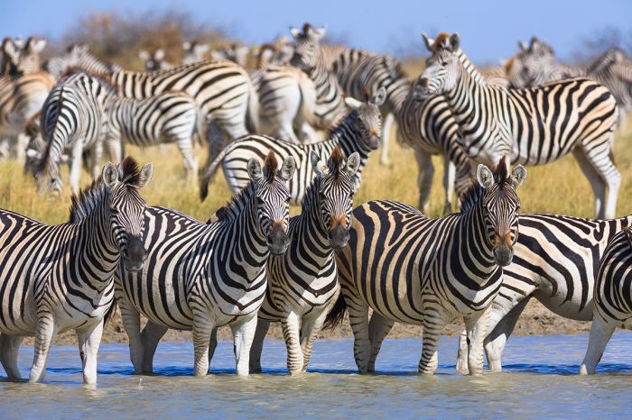
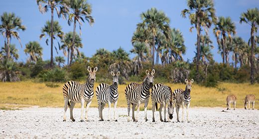
Zebras are seasonally abundant in Botswana's Makgadikgadi, particularly along the Boteti River.
When the first rains arrive (typically in November), the area around the Boteti is full of wildlife and the resident predators, including spotted hyena, lion, and black-backed jackal are here as well. Once the rains arrive in earnest (usually in late December), the herds disperse away from the Boteti to feed on the fresh grass that erupts across the Makgadikgadi plains surrounding the pans.
Nxai Pan in particular provers excellent grazing and becomes a great place for wildlife during the rainy months between December and April, but the Central and Eastern side of the Makgadikgadi is also excellent during this time.
Bull elephants arrive to drink at Nxai Pan in Botswana's Makgadikgadi region.
The area around Nxai Pan is also well known for attracting good numbers of springbok and impala, which in turn attract predators that favor them, including cheetah, leopard, and African wild dog. The Nxai Pan area is one of the few places where springbok and impala are commonly seen together.
The Makgadikgadi region is a very good place to see the uncommon and solitary brown hyena, which is resident here.
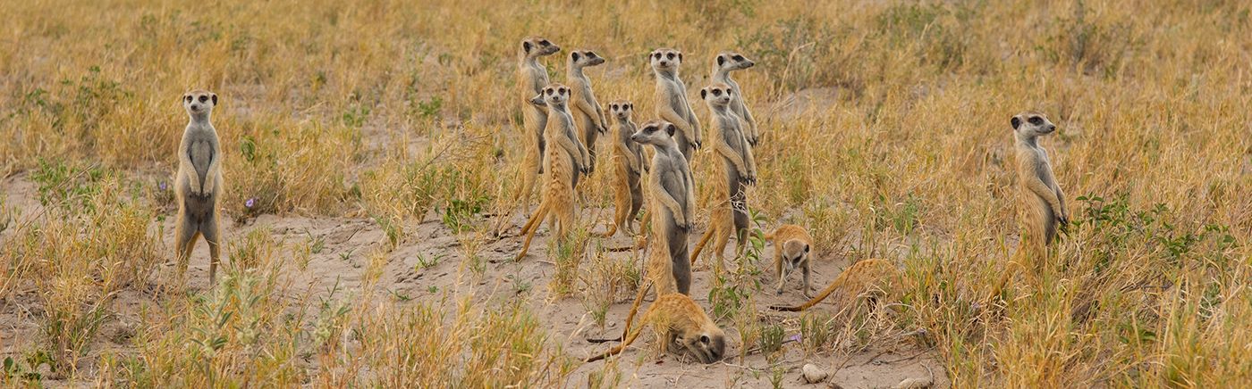
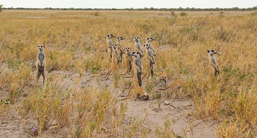
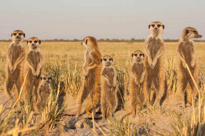
Another denizen of the Makgadikgadi is the enchanting meerkat (or suricate). These highly social mammals live in groups (or packs), spending their nights in excavated burrows and foraging for insects, scorpions, and other small animals during the day. Certain meerkat groups in the Makgadikgadi have become semi-habituated to seeing human visitors spending time with these animals is a very special experience for visitors.
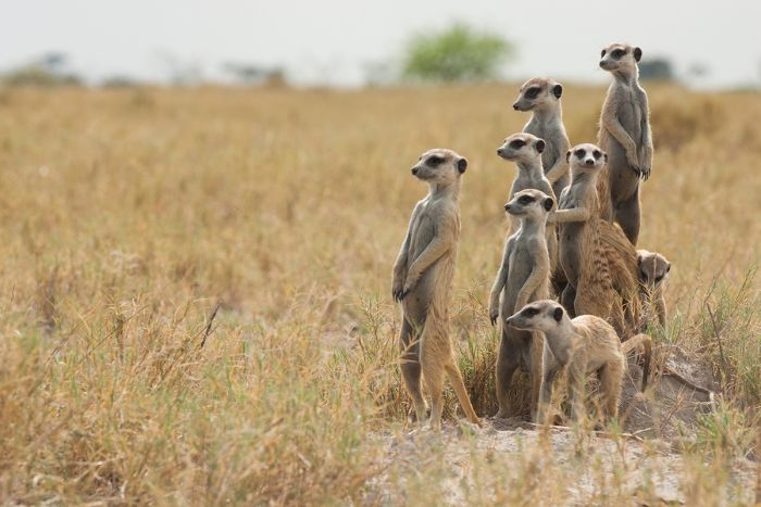
Meerkats in the Makgadikgadi region (Copyright © James Weis).
Gemsbok National Park (Wildlife)
The remote and least visited of Botswana's national parks is Gemsbok National Park, which is part of the Kgalagadi Transfrontier Park (KTP) that is shared by Botswana and South Africa. The South African side of KTP is the Kalahari Gemsbok National Park.
Gemsbok NP and the Kgalagadi TP are unfenced and open between the two countries. The park offers a self-drive safari experience with camping at designated campsites. The park is located in the Kalahari Desert and experiences a semi-desert climate; as such, the wildlife one can expect to see here is adapted to living in this rather harsh environment.
The names of both national parks come from one of the resident species found here, that of the gemsbok, which is a local name for the oryx. Oryx are found in the park in good numbers, as are springbok, eland, red hartebeest, and blue wildebeest, all of which are fairly common seasonally. Meerkats are another favorite species found in the park.
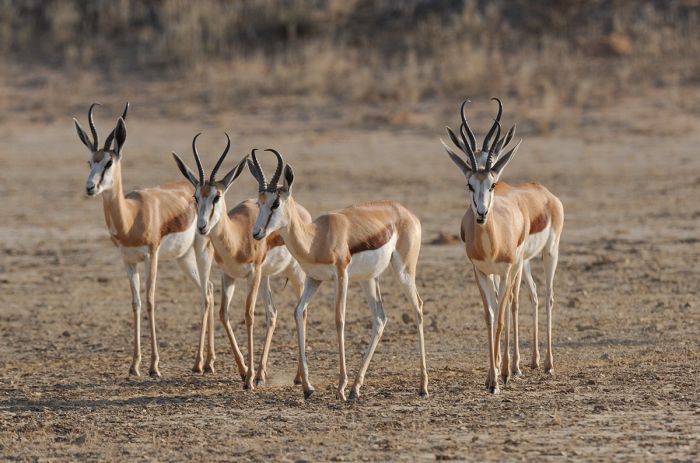
Springboks in Botswana's Gemsbok National Park.
Predators include lion, leopard, both brown and spotted hyena, cheetah, African wild dog (occasionally), black-backed jackal, and bat-eared fox. Male lions in this region have developed darker manes and are sometimes referred to as black-maned Kalahari lions. Cheetah are present in good numbers and are seen regularly.
Birders will also find KTP to be excellent, with vultures, eagles, bustards and ostrich all common. The birding list is around 250 species in KTP.
The best wildlife viewing in the Kagalgadi Park is from March thru May, which is the end of the rainy season.
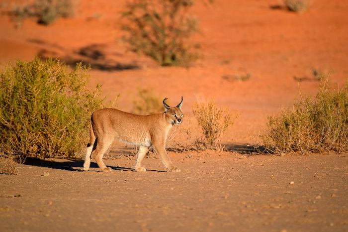
A caracal walks along red Kalahari sand in Gemsbok National Park (part of Kgalagadi Transfrontier Park).
Tuli Block (Wildlife)
The small Tuli Block and Northern Tuli Game Reserve are located in the extreme southeast of Botswana, bordering Zimbabwe and South Africa. This small region is surely one of the country's best-kept safari secrets.
Wildlife in Tuli is superb, with a high diversity and abundance of animals and birds. The stars of the show in Tuli are certainly its resident population of elephant. It's hard to take a game drive without seeing them and they are quite relaxed and used to vehicles, so the experience is greatly enhanced by being able to see them at close quarters.
Besides elephant, other large mammals in the Tuli Block include eland, giraffe, Burchell's zebra, blue wildebeest, greater kudu, waterbuck, impala, warthog, bushbuck, klipspringer, and common duiker. Primates include vervet monkey and chacma baboon. Hippo and crocodile can sometimes be seen in the deeper parts of the Limpopo River.

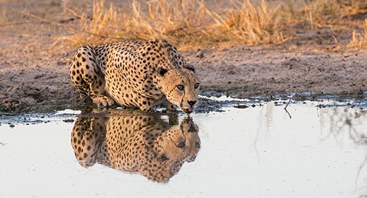
A cheetah with her small cubs in Botswana's Tuli Block (Copyright © James Weis).
Predators commonly seen in Tuli include lion, cheetah, and leopard and a 3-day visit will give a very high probability of seeing all three of these cats. Other predators present in smaller numbers include spotted hyena, black-backed jackal, bat-eared fox, honey badger, serval, and African wild cat.
Birding in Tuli is excellent, with over 350 recorded. Ostrich are commonly seen, as is the huge kori bustard, the world's largest flying bird.
The Northern Tuli Game Reserve offers a superb wildlife experience (Copyright © James Weis).
Birds in Botswana
For hard-core birders or just the casual observer, Botswana offers an excellent birding experience and the country's diversity of avian fauna is an added bonus to any wildlife safari, regardless of one's degree of birding enthusiasm.
Seasonally, as is the case with neighboring South Africa, the best months for maximizing bird species is during the summer months between November and February, when resident populations are boosted by the numerous Palearctic migrant species that arrive from Europe, Asia, and North Africa to breed.
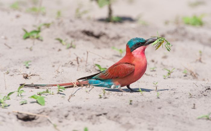
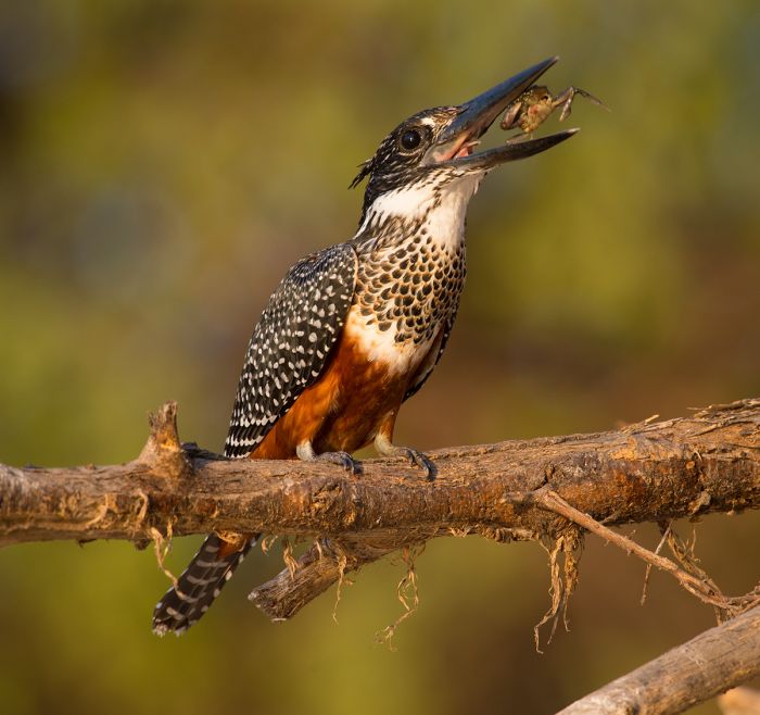
A carmine bee-eater with a mantid, photographed in northern Botswana's Linyanti Reserve (Copyright © James Weis).
Botswana has no endemic birds but the total checklist over 600 species, of which 169 are migratory. The Okavango is surely the best overall destination for total birds, with the abundant water habitat adding to the total species possible. Botswana has 12 Birdlife International Important Birding Areas (IBA's)
Most of the safari guides in Botswana's national parks and reserves are also adept birders, and one can expect to get 100 species in a day and maybe double that during the summer.
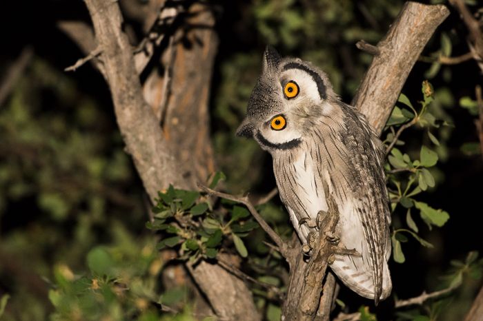
A southern white-faced owl (Ptilopsis granti) in Botswana.
CONSERVATION & TOURISM
The National Parks and Reserves in Botswana are a haven for wildlife and offer outstanding photographic safaris. Administratively, Botswana is divided into parcels of land called Wildlife Management Areas (commonly referred to as concessions).
Concessions in the Ngamiland District, which includes the Okavango Delta, Moremi Game Reserve, and Greater Linyanti reserves, are identified by codes beginning with 'NG' and numbered NG1 to NG51 (see map at top for details). The concessions are owned by the government and most are managed by local communities. Some of the concessions are leased to safari operators, who contstruct camps or lodges and market eco-tourism experiences to a global market.
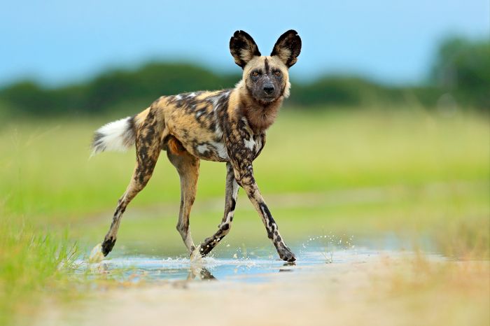
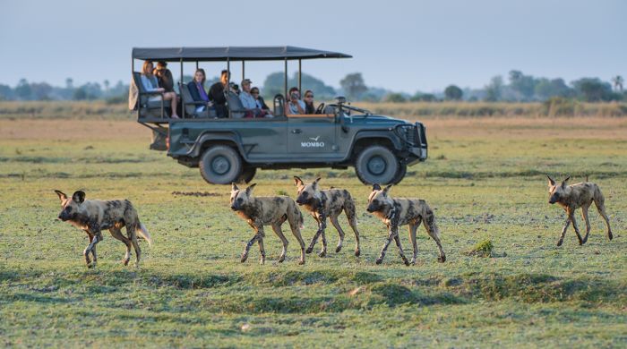
Northern Botswana is one of the best places to see the endangered African wild dogs (Lycaon pictus). Here is one seen in the Okavango Delta.
Botswana has conserved 17% of its land as National Parks and Reserves and an additional 22% as protected Wildlife Management Areas (WMA's). This foresight, along with strong conservation policies and minimal population pressure, has given Botswana its unique position for exclusive eco-tourism.
Botswana's primary policy regarding tourism is a premier price, low volume strategy. The country has chosen not to overexploit its wildlife and wilderness resources with mass tourism, as has happened in some areas of East Africa. Botswana is committed to long-term gains, with an emphasis on uplifting its citizens through tourism and wildlife.
Botswana's National Parks and Game Reserves are set aside such that no one may live within their borders (the one exception being the traditional San people in the Central Kalahari Game Reserve). All visitors must pay an entrance fee to enter and the number of beds inside these parks and reserves is strictly limited.
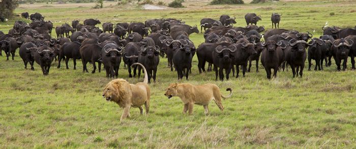
Lions and buffalos in the Okavango Delta, Botswana.
Protected Areas
Botswana has protected roughly 17% of its land as national parks, reserves, and wildlife management areas. Read about the details of each below.
National Parks
Following are Botswana's four national parks (including one that is part of a Transfrontier Park). Additional information on each is included further below this list:
- Chobe National Park - Botswana's oldest national park offers great game viewing along the Chobe River during the dry season, especially from July thru October when animals congregate at the river. The Savute Marsh experiences its best game viewing during the rainy months.
- Gemsbok National Park - The Botswana portion of the Kgalagadi Transfrontier Park, which is shared with South Africa.
- Kgalagadi Transfrontier Park - Shared park with South Africa, located in the Kalahari Desert on the border with Namibia. Good for predators and desert-adapted antelopes. Self-drive or visit on an organized tour.
- Makgadikgadi Pans National Park - Protects the western side of desert savanna and large salt pans. The pans are the remnants of Lake Makgadikgadi, which dried up 10 000 years ago.
- Nxai Pan National Park - Protects the northern extent of the Makgadikgadi Pans. Seasonally superb wildlife viewing from December-April, with large herds and good predators.
Kubu Island in Botswana's Makgadikgadi Pans.
Important Areas
Other important areas of note in Botswana include wildlife and nature reserves, wildlife management areas (also called concessions), and regions that are worth consideration when planning your trip.
- Central Kalahari Game Reserve - Massive desert landscape reserve in central Botswana offering seasonally good wildlife viewing during the green summer months.
- Chobe Riverfront - Seasonally superb wildlife viewing along the banks of the Chobe River in Chobe National Park. Boat-based safaris are the specialty during the dry season when big herds gather.
- Greater Linyanti Region - Prime wildlife region located directly north of the Okavango Delta. Includes three important reserves: Linyanti, Selinda, and Kwando.
- Khutse Game Reserve - Smaller adjoining reserve on the southern boundary of the Central Kalahari Game Reserve, offering a similar semi-desert experience. Good, but low-density, wildlife viewing. Popular with locals visiting from Gaborone.
- Kwando Reserve - Private concession located north of the Okavango, offering a superb wildlife experience.
- Linyanti Reserve - Private concession located north of the Okavango, offering a superb wildlife experience.
- Makgadikgadi - Area with large salt pans that are remnants of a long-dried paleo-lake. Includes two national parks: Makgadikgadi and Nxai Pan.
- Moremi Game Reserve - Protects the central core and prime wildlife habitat of the Okavango Delta. Only a few safari camps and some camping areas permitted in this massive reserve. Excellent safari region due to decades of wildlife protection.
- Northern Tuli Game Reserve - Privately-owned land made up of land previously used for farming that has been converted into a wildlife and eco-tourism reserve. Located in the Tuli Block, which borders South Africa and Zimbabwe.
- Okavango Delta - Botswana's premier wildlife destination. A huge and spectacularly beautiful destination that is a wetland that exists atop Kalahari Desert sand. A paradise for wildlife with superb safari camps. Highly recommended.
- Okavango Panhandle - The long stretch of the Okavango River as it flows across the Kalahari Desert en route south to the main Okavango Delta. Basic lodges offer fishing, boating, and birding. Not a big game destination. Water-based safaris as they were 50 years ago.
- Savute Channel - Waterway connecting the Linyanti Swamp to the Savute Marsh. Flows sporadically and has had long, historical cycles of flowing and dryness.
- Savute Marsh - Seasonal marsh in southern Chobe National Park with good wildlife, permanent safari lodges, and overland camping sites.
- Selinda Reserve - Private concession located north of the Okavango, offering a superb wildlife experience.
- Tsodilo Hills - A series of four hills rising in the otherwise flat Kalahari plains of northwest Botswana. The site has significant cultural value to the local San and Bantu people. Many examples of superb bushman rock art paintings. A UNESCO World Heritage Site open to tourists.
- Tuli Block - Located in far southeastern Botswana on the border with South Africa and Zimbabwe. Farmland converted to wildlife tourism with excellent safaris and few guests. Highly recommended.
Guests on safari in Botswana's Moremi Game Reserve with African wild dogs on the hunt (Copyright © James Weis).
UNESCO World Heritage Sites
The United Nations Educational, Scientific and Cultural Organization (UNESCO) is a specialized agency of the United Nations whose mission is to promote world peace and security through international cooperation in education, the arts, the sciences, and culture. The Convention concerning the Protection of the World's Cultural and Natural Heritage was signed in November 1972 and ratified by the 189 UN member "states parties".
A World Heritage Site is a landmark or area which is geographically and historically identifiable and has special cultural or physical significance. To be selected as a World Heritage Site, a nominated site must meet specific criteria and be judged to contain "cultural or natural heritage of outstanding value to humanity". An inscribed site is categorized as cultural, natural, or mixed (cultural and natural). As of 2021, there were over 1 100 sites across 167 countries.
Botswana has two UNESCO World Heritage Sites:
- Okavango Delta (since 2014, Natural) - Inland delta (does not drain to a sea or ocean) system of permanent marshland and seasonally flooded plains. Home to some of the world's most endangered species of large mammal, including cheetah, rhino (both black and white species), African wild dog, lion, and others.
- Tsodilo Hills (since 2001, Cultural) - Site that has provided shelter to humans for over 100 000 years. Contains over 4 500 rock paintings of cultural significance dating from the Stone Age up to the 19th century. Revered as a place of worship for local communities.
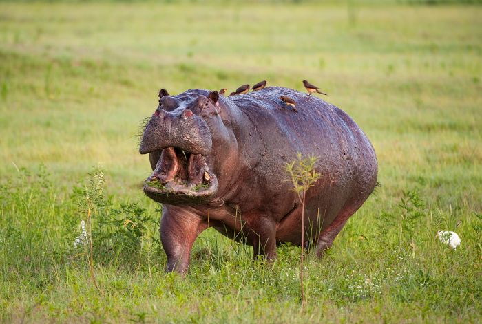
The Okavango Delta is one of two UNESCO World Heritage Sites in Botswana. Hippos are found throughout the Okavango wherever there is deep enough water. This one has some yellow-billed oxpeckers hitching a ride (Copyright © James Weis).
Ramsar Wetlands of International Importance
The Ramsar Convention on Wetlands is an international treaty for the conservation and sustainable use of wetlands. It was the first of the modern global nature conservation conventions, negotiated during the 1960s by countries and non-governmental organizations concerned about the increasing loss and degradation of wetland habitat for birds and other wildlife. The convention is named after the city of Ramsar in Iran, where the convention was signed in 1971.
Presently there are some 75 member States to the Ramsar Convention throughout the world which have designated over 2 300 wetland sites onto the Ramsar List of Wetlands of International Importance.
Botswana has one site designated as a Wetland of International Importance (Ramsar Site) as follows.
- Okavango Delta - Combination of permanent and seasonal swamps, floodplains, and freshwater lakes that provides critical habitat for many species of birds and other wildlife. Home to over 1 000 species of flora, 650 species of bird, 32 species of large mammal, 68 species of fish, and a highly diverse insect population. Used for tourism, subsistence farming and fishing. (21 380 sq miles/55 374 sq kms)
The entirety of the Okavango Delta has been declared Ramsar Wetland of International Importance. Here a young male lion strides past some lucky safari guests in the Moremi Game Reserve (Copyright © James Weis).
Urban Areas
Botswana's urban areas are not destinations in their own right, but two of them - Maun and Kasane, are important hubs that serve the country's eco-tourism industry. Info on Botswana's most important urban areas follows below.
- Francistown - Botswana's second largest city, but below 100 000 residents. Located in the central-eastern part of the country near the border with Zimbabwe. Rarely visited by eco-tourists.
- Gaborone - Botswana's capital and largest city located in the far south of the country very close to the border with South Africa. The economic hub of Botswana. Rarely visited by eco-tourists.
- Kasane - Small town on the northern border of the country along the banks of the Chobe River. Visited by eco-tourists visiting Chobe National Park or en route to or from the Okavango Delta and Victoria Falls.
- Maun - The small and dusty gateway frontier town on the southern edge of the Okavango Delta. The most common entry point for air travelers heading to a safari in northern Botswana. The tourism capital of the country.
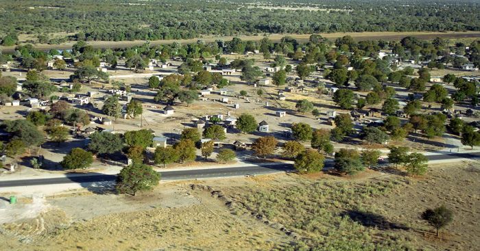
View over Maun, the small frontier town on the southern edge of Botswana's Okavango Delta.
Okavango Delta
Botswana's top wildlife destination is also one of the most incredible wildernesses left in Africa and on Earth. Formed by rivers that partially empty into a wide, but shallow trough between fault lines in the Kalahari Desert, the Okavango is not a true delta (since it does not exist at a river's exit to a sea), but its shape looks like a delta from far above, thus giving it this name.
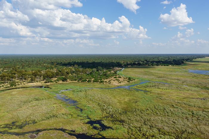
Millenia of silted river water have turned the otherwise sterile Kalahari Desert sands of the Okavango Delta into a lush network of palm islands, woodlands, rich floodplain grasslands, papyrus-lined channels, and deep freshwater lagoons, that have become a haven for diverse wildlife.
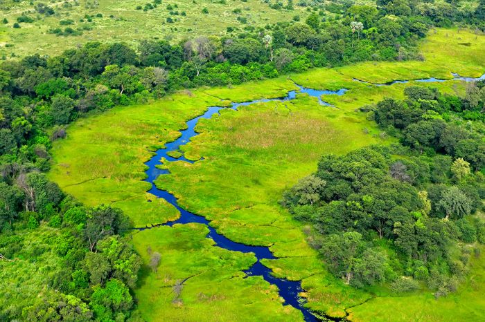
The wildlife-rich Okavango Delta, with a channel in flow, flanked by riparian forest of palms, figs, and other trees and with seasonal floodplain/grassland beyond.
The Okavango is one of the last places in Africa where it can be said that the environment and most of its wildlife is little changed from hundreds of years ago, long before Europeans colonized the region.
Wildlife in the Okavango is diverse and abundant, with all of the Big Five (lion, leopard, elephant, buffalo and rhino) present, as well as all of Southern Africa's plains game and predators.
Black rhino were locally extinct in Botswana by the early 1990s, with only about a dozen white rhinos remaining in the wild. To save the last wild white rhinos in Botswana, the animals were captured and given safety in sanctuaries. In 2000, a rhino reintroduction program was initiated, and today, both species of rhino can be seen in the Okavango, albeit only in small numbers.
Animals that typically avoid water, such as lions, have adapted to living with the seasonal flooding of the Okavango Delta (Copyright © James Weis).
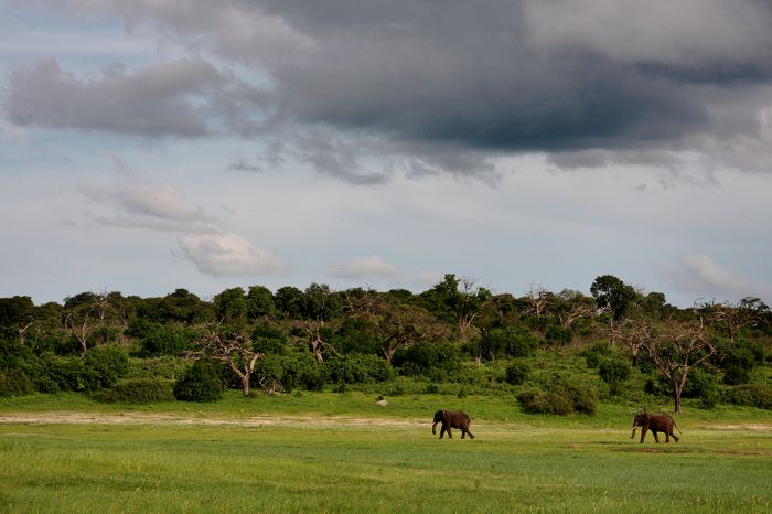
Herds of elephant roam freely in this large ecosystem, traversing the deep channels and feeding on abundant vegetation in the Delta's network of islands and waterways year-round. Buffalo are also quite abundant, forming herds in the hundreds in some places where rich grasslands are present.
Commonly seen plains game includes giraffe, Burchell's zebra, blue wildebeest, impala, greater kudu, tsessebe, waterbuck, common reedbuck, and warthog. The Okavango's abundance of water provide habitat for water-dependent antelopes like red lechwe and the shy and elusive sitatunga.
Common predators in the Okavango include lion, which are found in large prides in some areas of the Delta, leopard, spotted hyena, African wild dog, cheetah, black-backed jackal, serval, caracal, honey badger, and various species of mongoose.
Crocodile and hippo are abundant and seen throughout the Okavango, especially in the deeper lagoons and waterways. Primates in the Okavango include large numbers of both chacma baboon and vervet monkey.
Game drives in the Okavango are in open safari vehicles and frequently give visitors exceptional wildlife experiences (Copyright © James Weis).
Birding in the Okavango is outstanding, with a huge variety of both dryland and water species. Okavango 'specials' like the slaty egret, wattled crane, and Pel's fishing owl are just a few of the over 400 species that can be seen in the Delta. A typical day on safari in the Okavango can easily produce in excess of 100 species.
The Okavango has numerous safari camps for visitors, some are very high-end and luxurious, while others are more classic in style. None of the camps can be considered inexpensive. Most camps have accommodation for 10-24 guests and are physically distant from any other camps, such that guests will see few to no other tourists and have the feeling of being in a true wilderness.
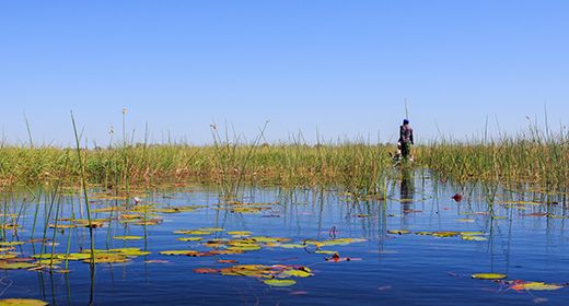
Activities in the Okavango Delta include a mixture of game drives in open 4x4 vehicles and water-based activities (seasonally and depending on the specific camp) like motor boat outings and mokoro (dugout canoe) safaris.
Read full details on the Okavango and its safari camps and lodges here.
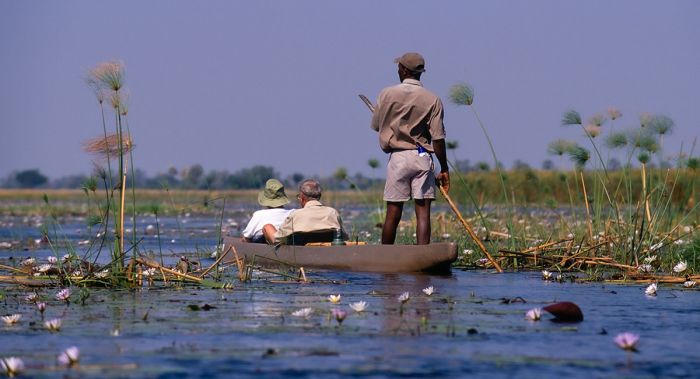
A mokoro safari is a must for all visitors who want to experience the traditional form of transport in the Okavango Delta (Copyright © James Weis).
Moremi Game Reserve
Established in 1963 to protect the core area of the Okavango Delta, the reserve was named for Chief Moremi III of the Batawana people. The chief was killed in a car accident in 1946 and his widow, Elizabeth Pulane Moremi, who was acting regent at the time, proclaimed the reserve in her husband's honor.
Moremi Game Reserve covers 1 881 square miles (4 871 sq km) of the central and eastern portion of the Okavango, including Chief's Island, the largest land mass in the Delta. The reserve occupies around one-third of the total area of the Okavango Delta. As the reserve has protected the core area of the Delta for over 50 years, the wildlife in Moremi has been relatively undisturbed by humans for many generations.
Cheetah are found in certain parts of the Okavango Delta, like this one seen in the Moremi Game Reserve (Copyright © James Weis).
Besides Chief's Island, Moremi protects vast areas of seasonal floodplains, permanently flooded shallows, deep lagoons and ever-changing papyrus-lined channels that are opened up by elephant and hippo. There area areas of savanna grassland, particularly on Chief's Island, mopane-tree and mixed-tree woodland, acacia scrub, riparian forest, numerous small, palm-fringed islands (most of which began as termite mounds), and permanent swamp.
Moremi offers arguably the best combination of wildlife and wilderness in all of Africa. Tourist densities in Moremi (and most of the Okavango outside Moremi) are some of the lowest of any of Africa's most popular wildlife destinations. The safari experience here cannot be overstated, it is pure magic and very difficult to beat.
As in much of the Okavango Delta, Moremi's wildlife is prolific and offers a dizzying variety of predators, plains game, big herds, water-dependent animals, and birds.
Red lechwe antelope are a water-dependent species that are found throughout the Okavango Delta and Moremi (Copyright © James Weis).
With the reintroduction of both black and white rhino on Chief's Island in the early 2000s, all of Africa's Big Five animals (lion, leopard, elephant, rhino, and buffalo) can be seen in Moremi.
Moremi has healthy populations of all the regional predators. Leopards are particularly abundant and the chances of seeing one on a safari are very good. Lions are present in good numbers and form prides of between 4 and 20 members, especially on Chief's Island. Spotted hyenas are also abundant and can be seen individually or in small groups, especially of there has been a kill. Cheetah are hit or miss in Moremi and the best chances of seeing them is on Chief's Island.
The endangered African wild dog is seen regularly in Moremi, though they are even more prevalent in the private reserves north of the Okavango (Linyanti, Selinda, and Kwando). The dogs' favored prey is the impala, which are present in huge numbers in Moremi.
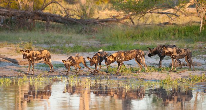
The Okavango Delta and Moremi Reserve offer decent opportunities to see the endangered African wild dog. Here a pack cautiously stops to drink at the edge of water (Copyright © James Weis).
Other predators found in Moremi, as well as throughout the Okavango, include black-backed jackal, side-striped jackal, caracal (seldom seen), serval, bat-eared fox, African wild cat, honey badger, and various species of mongoose.
Common plains game in Moremi (and the Okavango Delta) includes elephant, impala, Burchell's zebra, giraffe, buffalo, greater kudu, waterbuck, tsessebe, warthog, blue wildebeest, and red lechwe. Other less frequently seen animals include sable antelope, bushbuck, common reedbuck, and roan antelope. Primates are restricted to chacma baboon, vervet monkey, and lesser bushbaby (galago).
Aardwolf, aardvark, and pangolin are found throughout the Okavango and Moremi, but are seldom seen. Hippo and crocodile are common in Moremi and all throughout the Okavango Delta in the deeper waterways and lagoons.
A male leopard seen on a safari in Botswana's Okavango Delta (Copyright © James Weis).
Birding in Moremi is fantastic, as it is throughout most of the Okavango, with a diverse mix of drylands species, waterbirds, and raptors. The bird life is abundant all year, but peaks when summer migratory species arrive en masse starting in September and leaving again around late March/early April.
Safari activities in Moremi include wildlife viewing via open 4x4 vehicles and boating / mokoro (dugout canoe) safaris at certain camps and dependent on water levels.
Read full details on the Okavango and Moremi and its safari camps and lodges here.
Nearing the end of the dry season in Moremi Game Reserve, this peaceful lagoon is a typical scene found throughout the Okavango Delta (Copyright © James Weis).
Okavango Panhandle
Viewed from far above, the Okavango River and Delta forms a shape that looks similar to that of a frying pan, the main area of the Delta waters spreading out in a roughly oval shape while to the northwest, the Okavango River that feeds the main delta forms a long diagonal 'handle'. The portion of the Okavango River from the northern Botswana border before its waters spread out into the delta itself, is known as the Okavango Panhandle.
Two parallel fault lines below the Kalahari sand have created steep banks that constrain the Okavango River from spreading out as it travels southeast towards the main Okavango Delta.
The two fault lines that flank the Okavango River in the Panhandle are situated roughly 6-9 miles (10-15 kms) apart. The river meanders between the steep banks, with frequent curves and the occasional lagoon, as it flows towards the main body of the Delta.
The main Okavango River in "the Panhandle", flowing south before it spreads out into the fan-shaped network of channels, swamps and islands that forms the Okavango Delta.
There are several villages with local people along the banks, including Shakawe, Sepopa, and Seronga, with subsistence farming and fishing being the main activities.
Safaris in the panhandle are quite different from those in the Okavango Delta. The camps are mostly low-key and offer a look back in time at what the entire safari industry of the Okavango was like some 50 years ago. The lodges and camps are very affordable compared to those in the Delta and far more basic in terms of amenities.
The Okavango River in the Panhandle is fringed in tall papyrus and reedbeds, with deep channels and some areas of sandy banks. Water lilies abound in the small lagoons, but the dominant vegetation is papyrus.
The African fish-eagle is found in the Panhandle and throughout northern Botswana.
The main activities for visitors to the camps in the Panhandle are boating (both motorized and mokoro - the traditional canoe propelled by a long pole), fishing, and birdwatching.
Wildlife in the Panhandle does not compare to that in the Delta, but there are antelope like sitatunga and red lechwe, plus an abundance of hippo and crocodile. If you're lucky, you may see the shy spotted-backed otter.
Birding in the panhandle, particularly for waterbirds, is superb. Common species include African fish-eagle, pygmy goose, African and lesser jacana, reed cormorant, darter, lesser gallinule, several species of bee-eater and kingfisher, herons, and egrets, and many more.
Read full details on the Okavango Panhandle and its safari camps and lodges here.
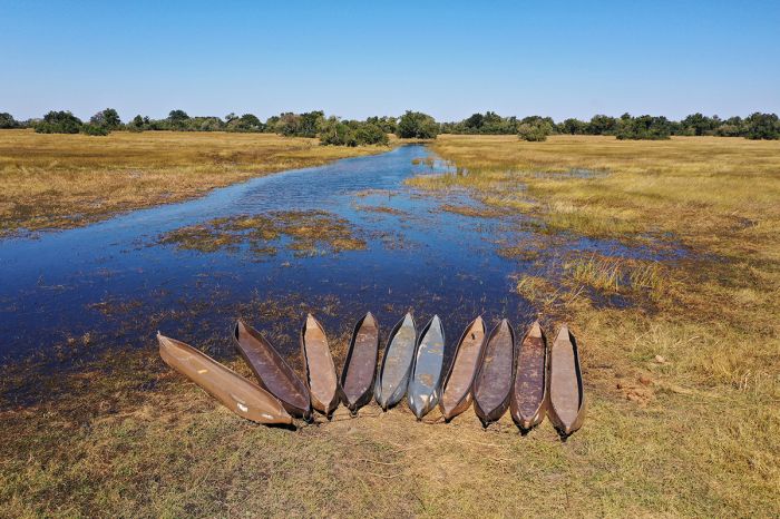
Shallow canoes called "mekoros" near the village of Seronga on the Okavango Panhandle. A mokoro is 'poled' through the water and is the traditional mode of transportation in the waterways of the Okavango (and still used today by locals). In days gone by, a mokoro was carved from wood, but today they are more eco-friendly and typically made from fiberglass.
Greater Linyanti Region
(including Selinda, Kwando, and Linyanti Reserves/Concessions)
Botswana's land is divided into tracts called Wildlife Management Areas (WMAs), which are more commonly referred to as 'Concessions' or sometimes 'Reserves'. The boundaries of these concessions are typically situated around a local community, which is given management of the land and its resources, including wildlife, subject to government restrictions.
Some of the concessions are 'leased' by the managing community to private interests, and in the case of the Okavango and areas to its north, the concessions are primarily leased (typically for a term of 15 years) to private safari companies, which build safari camps and operate wildlife safaris, with tourism revenue shared with the managing community.
Several decades ago, most of the concessions outside of the Moremi Game Reserve, which is fully protected, were leased to commercial hunting operators, but today hunting has mostly been pushed aside in favor of ecotourism.

The northern reserves (Linyanti, Selinda, Kwando) offer some of Africa's best elephant viewing opportunities. Here a breeding herd enters the Linyanti River (Copyright © James Weis).
Linyanti Geography & Habitats
The three most important ecotourism concessions outside of the Moremi Game Reserve are those in the 'Greater Linyanti', which include three Wildlife Management Areas (or Concessions): Kwando, Linyanti, and Selinda. Each of these private concessions are leased to a safari operator and offer an exclusive wildlife and nature experience for guests staying at one of the safari camps located inside these concessions.
The three concessions border one another but are not separated from one another by fences. The Selinda Concession is named for the Selinda Spillway, which connects to the Okavango Delta (some years flowing and some years mostly dry), while the Kwando and Linyanti Concessions are named for the perennial rivers of the same names.
The reserves are similar in terms of overall habitat, with areas of floodplain, grassland, riparian forest, and open woodland. There are significant areas of low shrub mopane and Kalahari apple-leaf, both of which are kept in check by the steady browsing of elephants, which relish the green leaves of both. There are also some smaller areas of well established cathedral mopane-tree forest.
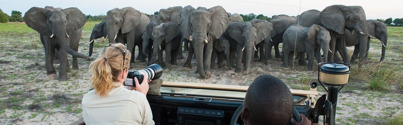
Open game drive vehicles and very low tourist numbers make the Greater Linyanti region one of the best safari regions in all of Africa (Copyright © James Weis).
All three of these concessions are situated around the Linyanti Swamp, which consists of a large area of river channels, reedbeds, and papyrus marshes, created by the Kwando River as it flows south along the border between Botswana and Namibia. The water fills a shallow trough, creating the Linyanti Swamp and then continues eastward as the Linyanti River (which eventually joins with the Zambezi River as it heads to Victoria Falls).
During years of higher water in the Kwando River (which is sourced in the highlands of Angola), some water may overflow the Linyanti Swamp in flow into either or both of two additional channels: the Selinda Spillway, which flows westward toward the main Okavango Delta, and the Savute Channel, which flows eastward and can reach all the way to the Savute Marsh in Chobe National Park. Tectonic movements beneath the deep sand substrate in this region also affect the on-again, off-again flow of these two channels.
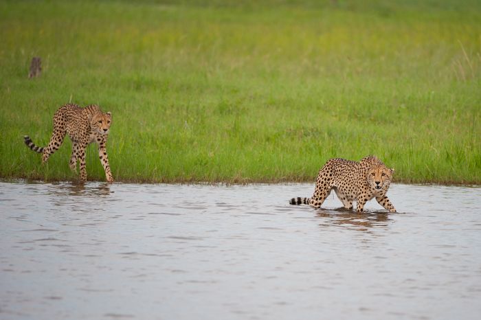
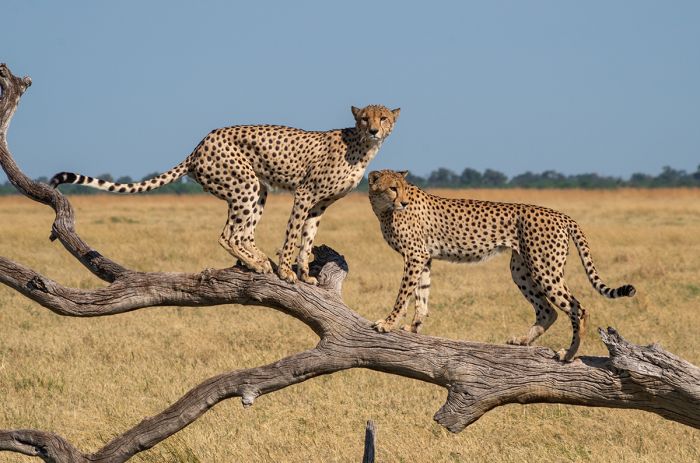
The Savute Channel fills with water some years and is dry in others. During a recent wet cycle, animals like these two male cheetah had to cross water to hunt their territory (Copyright © James Weis).
Savute Channel
The Savute Channel has experienced long cycles (sometimes decades) of alternating wet and dry periods. The area of the channel itself becomes a rich grassland during the channel's dry periods, attracting cheetah and herds of herbivores. The well documented 'drying up' of the Savute Channel in the 1980s, saw many thousands of animals, particularly hippos, perish when the channel dried after many years of flowing.
After the channel completely dried, pumped waterholes were created by safari operators along the channel to help sustain the wildlife, like elephant and buffalo, which had become used to the Savute's water over many years. Then in 2008, water began to creep down the Savute Channel again, with water again filling the channel by 2010 after 30 years of being dry.
Underground movements that cause slight shifts in the ground around the Linyanti Swamp are now understood to be the cause of the changes in the flow of water into the Savute Channel.
Lions crossing the newly flooded Savute Channel in the Linyanti region of Botswana (Copyright © James Weis).
Wildlife in the Greater Linyanti
The Linyanti area, including the Kwando and Selinda, is a superb destination for wildlife and certainly in most ways equal to that of Moremi and the main Okavango region. Elephants are very common, and found here all year, as are impala, greater kudu, giraffe, warthog, and reedbuck.
Blue wildebeest and zebra are present all year, but their numbers increase significantly from May through October. When the rains begin in November, the majority of zebra and wildebeest move towards Chobe National Park and the Savute Marsh. Buffalo arrive near the end of the rains or just after (May-June) to enjoy the fresh grasses and then disperse like the zebra when the rains begin.
African wild dogs are particularly cautious about entering deep water, as they know the dangers that can lie below the surface (Copyright © James Weis).
Lion are common in the Linyanti region, as are leopard and spotted hyena. Cheetah are seen occasionally on the open plains, particularly on the grassy bed of the Savute Channel if it is not full of water. The region is one of the best areas in Botswana, and indeed all of Africa, to see and enjoying sightings of the endangered Africa wild dog. The area has an abundance of impala, which are the favorite prey of the dogs.
Both black-backed and side-striped jackal are found in the Linyanti, as are African wild cat, serval, caracal, bat-eared fox, aardwolf, and various species of mongoose.
Sable and roan antelope, which are uncommon throughout their limited ranges in Botswana, are both found in the Linyanti region. Red lechwe antelope, which are never found far from permanent water, live along the Linyanti River system and seen in good numbers along the floodplain and in the reed beds. Hippo are likewise found alongside the red lechwe. The shy and elusive sitatunga is also here, though difficult to see.
Red lechwe antelope are never found far from permanent and sufficiently deep water, which they run into to escape predation. The hind quarters of these animals have evolved to allow them to leap through deep water at high speed (Copyright © James Weis).
Birding in the Greater Linyanti
The diversity of habitats and the relative prevalence of year-round water makes this region a very good one for birds. The numbers and diversity of species jumps during the summer months, when huge numbers of Palearctic species arrive to breed beginning around September, before departing in late March/April.
Raptors and vultures are very common, as are a multitude of drylands species like starlings, barbets, coucals, cuckoos, bustards and so many more. Waterbirds and found in good numbers along the permanent waterways and throughout the region during the rainy summer season (December thru March).
Read full details on the Linyanti, Kwando, and Selinda and its safari camps and lodges here.
Birding in the Greater Linyanti is very good, especially during the spring and summer months (November thru March) when numerous migratory species arrive from the Palearctic region. Shown are a kori bustard with a Carmen bee-eater as passenger (Copyright © James Weis).
Chobe National Park
Botswana's first proclaimed national park, Chobe (pronounced "CHO-bee") is located to the northeast of the Okavango and borders the Chobe River in the far north of Botswana.
The best wildlife viewing in Chobe is along the Linyanti and Chobe Rivers on the park's northern boundary. This riverfront area is especially productive for wildlife during the latter part of the dry season, between July thru October. As the rains end around late March or into April, the natural waterholes start to dry up and the wildlife begins moving off to the Okavango Delta or north towards the permanent water of the rivers.
Elephants often swim in the Chobe River; here a herd emerges onto the Namibian banks after swimming across, while another large herd can be seen drinking on the distant Botswana bank (Copyright © James Weis).
Chobe is situated on Kalahari Desert sand, with vegetated sand ridges and areas of sand dunes. Chobe has a lot of clay pans that provide drinking water for the animals during the rainy season between December and March.
Large mammals in Chobe include elephant, Burchell's zebra, giraffe, impala, blue wildebeest, tsessebe, greater kudu, and warthog. Eland, roan, and sable antelope are also present in small numbers.
Lion and spotted hyena are the most common predators and both species are seen regularly. Other predators seen on occasion include African wild dog, cheetah, and leopard. Caracal, serval, black-backed jackal, and side-striped jackal are also found in Chobe.
Critically endangered African wild dogs are seen throughout Northern Botswana, including the occasional sighting in Chobe National Park (Copyright © James Weis).
Hippo and crocodile are found in huge numbers in the Chobe River. Rhinos once lived in Chobe, but have been locally extinct in the park since the 1990s. Note that the rhino reintroduction program initiated on Chief's Island in the Okavango Delta during the early 2000s resulted in a wide dispersal of some of the released animals, some moving as far as Nxai Pan, so it is possible that rhinos could one day be seen again in Chobe.
Birding in Chobe is very good, with a bird list of around 450 species. The Chobe River offers superb opportunities for up-close viewing of waterbirds, raptors, kingfishers, bee-eaters and many more. Inland from the river are a good variety of woodland and grassland species.
Chobe offers two prime wildlife areas within its boundaries: the Chobe Riverfront on its northern boundary and the Savute Marsh, which is located inland further south.
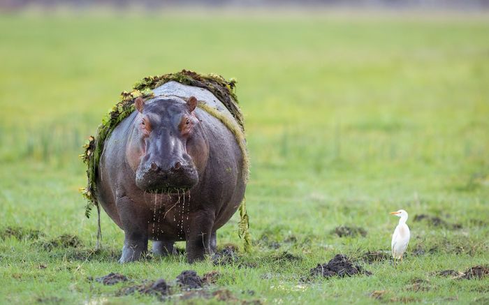
A hippo out for grazing along the Chobe River, as a cattle egret watches.
Chobe Riverfront
The Chobe Riverfront offers extremely good wildlife viewing between July and October, which is the middle to the end of northern Botswana's dry season. During these dry months, little to no rain falls and any rainwater and natural waterholes in the park have become mostly or completely dried up. For this reason, large numbers of elephant, buffalo, and other plains game are forced to stay close to the Chobe River to have access to drinking water.
Wildlife viewing along the Chobe River is mainly done from a boat, with twice daily excursions, but the roads within the park that run parallel to the river also offer excellent game viewing during this time.
The Chobe River is a great place to get up close views of elephants drinking along the banks and oftentimes they can be seen swimming or just frolicking in the river. The river is also full of crocodiles, including many that are huge, as well as an abundance of hippos. Photographic opportunities from the safari boats are superb.
The dry season, especially from late July to mid-October, is a spectacular time for boat-based safaris on the Chobe River. During this time, large numbers of elephant and other wildlife gather on the banks of the river to drink (Copyright © James Weis).
Besides elephant and buffalo, common animals along the Chobe river include red lechwe, waterbuck, greater kudu, impala, and many more species. Lion are seen often and African wild dogs are also possible. Leopard are seen from the boats on occasion but are more easily seen on a game drive from a vehicle. Baboon and vervet monkey are seen in the riparian trees along the river, but are also seen more easily from a game drive.
Raptors and water birds along the river are another feature of river-based safaris, with plenty of fish-eagles, tawny eagles, snake eagles, kites, and vultures. Other birds common along the river include African skimmers, which nest on the sand banks in some places, bee-eaters, kingfishers, herons, egrets, and a multitude of passerines.
During the rainy months, between mid-November and early May, the wildlife disperses inland, and the game viewing along the river is nowhere near as good.
There is a wide range of accommodation located along the Chobe Riverfront, as well as in the tourism-based small town of Kasane, and all offer game drives and boating safaris on the river.
Boating on the Chobe River provides excellent opportunities to see large mammals, reptiles, and birds. Here is a giant kingfisher eating a crab she has caught (Copyright © James Weis).
Savute Marsh
Most of Chobe National Park away from the far northern stretch along the Chobe River is a mix of sand, thick scrub, mixed woodland, and cathedral mopane-tree forest. Located in the southwest of Chobe National Park is a marshy area that is fed by seasonal rain and sometimes by the on again, off again water that flows in via the Savute Channel.
The Savute Channel empties out of the Zibadianja Lagoon at the southern tip of the Lintantyi Marsh, but only flows depending on tectonic shifts in the ground far below the sands around the marsh. The channel has undergone long periods of alternating flow and dryness lasting decades, changing it from an open grassland to a flowing river.
The area around the Savute Marsh is mostly thorn scrub, with Acacia, Terminalia, and mopane trees dominating the landscape. Other vegetation includes tracts of Combretum bushes and Kalahari apple-leaf shrub. Baobab trees are interspersed in the dry areas outside of the marsh.
The Savute Marsh area is well-known its lions. Here a pride drinks at a waterhole near the marsh.
The alluvial deposits brought in by the centuries of water flowing from the Savute Channel have resulted in rich grasslands in the channel and around the marsh itself. The 'skeletons' of long-dead camelthorn (Acacia erioloba), umbrella-thorn (Acacia tortilis), and leadwood (Combretum imberbe) trees still stand in the grasslands. These trees grew in the long dry period between 1885 and 1955, when the Savute Marsh was dry and subsequently perished when the marsh flooded again in the late 1950s.
To support wildlife in the area around the marsh, several permanent waterholes have been built with pumps to keep them filled. During the dry season these pumped waterholes sustain the region's animals.
Wildlife around the Savute Marsh is seasonally abundant, with large numbers of blue wildebeest and Burchell's zebra moving into the marsh at the end of the rainy season (April/May) to take advantage of the fresh grass. Herds of buffalo are also sometimes seen, especially if the Savute Channel has water.
Chobe National Park is well known for elephants, with many bulls that are resident in the park (Copyright © James Weis).
The marsh is well known for its elephants, with numerous old bulls that are residents of the area, as well as breeding herds that pass through on their way to the Okavango or north to the Chobe River.
Lion and spotted hyena are found around the marsh in good numbers and leopard also do well in Savute. On the southern side of the marsh, giraffe and oryx are sometimes seen. Other predators commonly seen include cheetah, African wild dog, and black-backed jackal.
Birding around the Savute Marsh is very good, with water birds in the marsh during the wet months (December thru March) and drylands species in the wooded areas throughout the year.
There are permanent safari lodges located near the pumped waterholes on the northern side of the marsh and several camping sites, which are used by overland safari operators.
Read full details on the Chobe National Park and its safari camps and lodges here.
Cheetah brothers in the Savute Marsh, Chobe National Park, Botswana.
Makgadikgadi
(including two national parks: Makgadikgadi Pans NP and Nxai Pan NP)
Makgadikgadi History
The Makgadikgadi region is dominated by a series of large salt pans, situated in dry northern Kalahari Desert in north-eastern Botswana. The pans are the remnants of a large paleo-lake that formed some 2 million years ago, fed by the Okavango, Chobe, and Upper Zambezi Rivers.
These rivers had previously flowed south through Botswana, all the way to the Limpopo (on the southern border of Botswana), which flows east to the Indian Ocean. Tectonic uplifting in central Botswana cut off the southward drainage of these rivers, diverting the flow and leading to the formation of Lake Makgadikgadi. Over millennia, the lake levels rose, eventually covering an area of 100 000 square miles (275 000 sq kms).
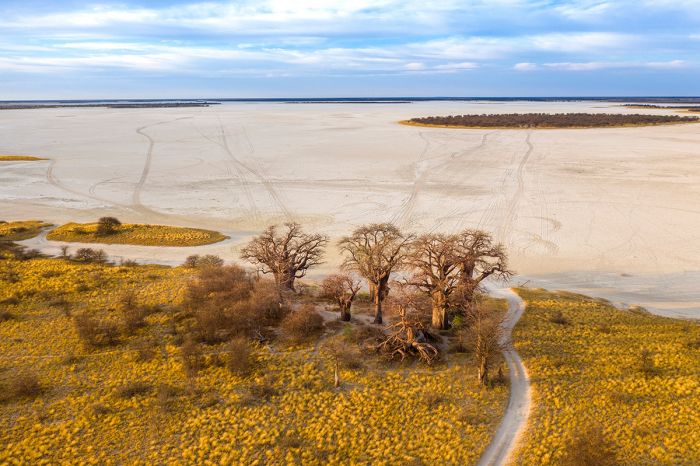
Kudiakam Pan in Nxai Pan National Park, with Baines' Baobabs in the foreground.
Some 20 000 years ago, the lake filled to capacity and began to overflow to the northeast as a river that eventually connected with the middle Zambezi River, which eventually led to the formation of a gorge and the Victoria Falls. As time passed, the levels in Lake Makgadikgadi decreased and a drier climactic period in the region ensued, increasing evaporation of the lake's water.
Around 10 000 years ago, further tectonic movements formed a basin to the northwest of Lake Makgadikgadi, leading to the formation of the Okavango Delta, which further decreased the inflow of water into Lake Makgadikgadi. As the lake levels shrank, smaller lakes formed with progressively smaller shorelines. Eventually, the continued evaporation of water in these lakes led to the complete drying of all permanent water, leaving behind a series of salty, clay pans.
Makgadikgadi's salty, clay-covered pans are the remnants of a vast paleo-lake that dried up around 10 000 years ago.
Makgadikgadi Geography
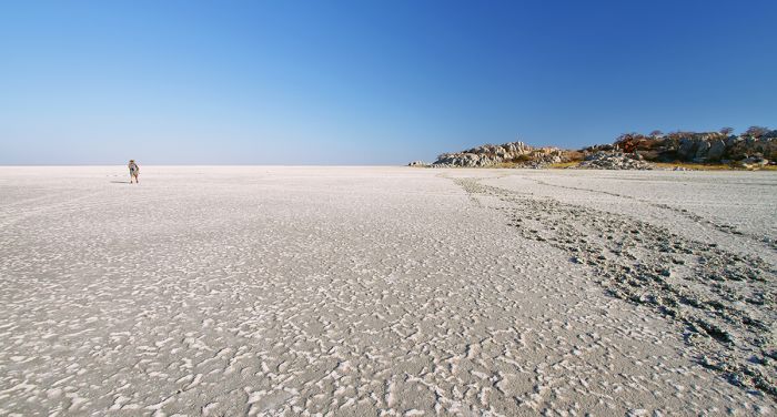
The Makgadikgadi is actually a series of pans, the largest of which are Ntwetwe Pan and Sua Pan. A large number of smaller pans are interspersed between and around the two large pans. The pans are covered in a whitish or gray, salty, clay crust, but in years of good rainfall, the pans may temporarily become filled with shallow water with fresh grass in the surrounding savanna.
Around the pans are grasslands, fossilized dunes, and acacia scrub. The are also some small, granite outcrops scattered across the region. There are long lines of fencing bordering the pans on the south, with large openings on the north and east, allowing wildlife to pass through the region.
The famous baobab tree known as Chapman's Baobab, which until 2016 stood just north of Ntwetwe Pan, was estimated to be around 1 500 years old and was famously used as an early 'postal drop off' by early European explorers passing thru the area. The tree unfortunately fell in January 2016. Another large and renowned baobab known as Green's Baobab still stands nearby.
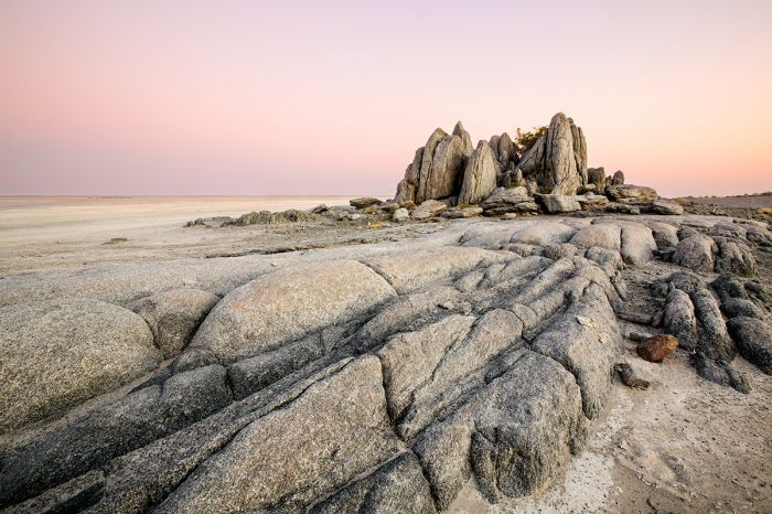
The small granitic Kubu Island in Sua Pan.
Besides seasonal rains, which fall between December and March, the only significant source of water to the pans is the Nata River, which originates to the northeast in Zimbabwe (where it is called the Amanzanyama River). On the western side of the pans, the Boteti River, which drains from the southern Okavango Delta and only flows during years of large flooding, also supplies water to the area.
Two small granitic rock islands (Kokome Island and Kubu Island) are located in Sua Pan. Kubu Island is the site of archeological findings showing the existence of ancient humans living around Lake Makgadikgadi and is protected as a national monument. The island is also the site of a number of old baobab trees and is used as an overland camping site.
The small Nata Sanctuary, which was established to provide protected seasonal habitat for breeding waterbirds, is located at the northeast corner of Sua Pan, at the Nata River delta.
Read full details on the Makgadikgadi and its safari camps and lodges here.
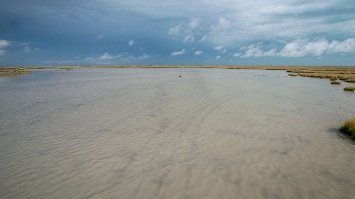
During the summer rains (December through March), the pans in Makgadikgadi may fill with shallow water.
Makgadikgadi Pans National Park
A portion of the western side of Ntwetwe Pan, as well as a vast area of sandy savanna grassland and fossilized dunes is protected by the Makgadikgadi Pans National Park (MPNP). The park extends to the usually mostly-dry Boteti River.
Wildlife in MPNP is seasonally excellent, when large numbers of Burchell's zebra and blue wildebeest gather along the Boteti watercourse during the winter months between June and December. These grazers begin moving towards the Boteti at the end of the rainy season, usually around May, to take advantage of the fresh grasses along the western side of the park.
Zebras gathered at the Boteti River in Makgadikgadi Pans National Park, Botswana.
Besides the zebra and wildebeest, the Boteti attracts smaller numbers of elephant, greater kudu, waterbuck, eland, oryx, red hartebeest, and bushbuck. The occasional white rhino has been spotted in the park.
When the rains begin to fall in summer, usually by mid-December, much of the wildlife around the Boteti River disperses to take advantage of the grazing that becomes available in the interior of the park, as well as further north outside of the park around Nxai Pan and beyond.
Predators found in MPNP include lion, which due to the low densities of their prey, are typically found in small groups, as well as cheetah, leopard, brown hyena, black-backed jackal, and spotted hyena.
Elephants at the Boteti River, Makgadikgadi Pans National Park.
Birding in MPNP is good, with several distinct habitats adding to the diversity of the species. Ostrich and kori bustard are the largest and most obvious species. The vast grasslands covering the majority of the park are home to a variety of bustards, pipits, larks, and sandgrouses. Other common grassland birds include the secretarybird, greater kestrel, marsh owl, and pale-chanting goshawk. Eagles, vultures, goshawks and falcons are also seen regularly.
All of the permanent safari camps are located outside of the park, with those on the eastern side situated near the northern edge of Ntwetwe Pan and those in the west along the Boteti River.
Read full details on the Makgadikgadi Pans National Park and its safari camps and lodges here.
Greater flamingos arrive to feed on algae in the Makgadikgadi Pans.
Nxai Pan National Park
Adjoining the Makgadikgadi Pans National Park to the north (with the Maun-Nata Road as the separating boundary), is Nxai Pan National Park (NPNP). This northern section of the remnants of Lake Makgadikgadi, a huge paleo-lake that dried up around 10 000 years ago, sits at a slightly higher elevation than the southern pans, so it has less leached salts and supports more vegetation.
The Nxai Pan area is characterized by grassy savanna with Acacia tortilis scrub and it has a similar look to the Serengeti and Masai Mara grasslands of East Africa (but without all the tourist vehicles). Within the grasslands are several small pans left over from Lake Makgadikgadi. Today, these small pans are mostly covered in grass, but there are small pans that fill with water during the rains. Surrounding the pans are fossilized dunes of Kalahari sand.
The cluster of baobab trees known as Baines' Baobabs situated on the edge of Kudiakam Pan, were famously immortalized by artist and adventurer Thomas Baines in 1862. Baines accompanied the famous explorer David Livingstone on his Zambezi expedition and painted the trees when the group visited the region. The trees have changed little since that time.
Zebras grazing on the rich grass in Nxai Pan National Park.
The major rivers that once fed Lake Makgadikgadi have diverted their courses to the Okavango and Zambezi, so there are two pumped pans that support the area's wildlife during the long dry season between June and October.
During the rainy season (December thru April), Nxai Pan National Park becomes a lush, green grassland that attracts large herds of blue wildebeest and Burchell's zebra, many of which arrive from the Boteti River area in Makgadikgadi Pans National Park, while others arrive from the north (Chobe and Okavango Delta). Large numbers of springbok are found in the Nxai Pan area, as well as good numbers of oryx, eland, and red hartebeest.
Greater kudu and impala arrive to browse and graze around the mopane-tree woodland and herds of giraffe come to feed on the Acacia trees north of the pans. The Nxai Pan area is one of the few places where impala and springbok are commonly seen together. Tsessebe are found in small numbers, this being the southern extent of their range. Breeding herds of elephant arrive as well, feeding on the new grasses, Acacia trees, and mopane trees.
A lion scans a waterhole in Nxai Pan National Park, with zebras and springboks.
Of course, the big herds attract predators, including lion, cheetah, African wild dog, and spotted hyena. Bat-eared fox are abundant, as are black-backed jackal. Meerkats are always fun to watch and there is a habituated group that can be visited from Jack's Camp or San Camp.
With all of this wildlife and the spectacular setting, game viewing in Nxai Pan during the green season (December-April), especially during the onset of this period, can be nothing short of superb. Many of the herbivores give birth at this time as well, adding to the overall drama and making for interesting wildlife interactions.
Birding in Nxai Pan is very good, with over 200 species possible, consisting of a mix of grassland and woodland species.
There is one permanent safari camp in NPNP, as well as several camping sites, which are used by self-campers and organized overland group safaris.
Read full details on the Nxai Pan National Park and its safari camps and lodges here.
Meerkats (or suricates) are a special treat to see in the Makgadikgadi (Copyright © James Weis).
Central Kalahari Game Reserve
Named for the Kalahari Desert, within which it is located, the Central Kalahari Game Reserve (CKGR) covers a massive area situated roughly in the center of Botswana. The CKGR is one of the world's largest reserves, covering some 20 400 square miles (52 800 sq kms).
The reserve was originally created (in 1961) to protect the homeland of the indigenous San people, who have lived here for centuries in a hunter-gatherer lifestyle.
CKGR became better known to the world after the publication of Cry of the Kalahari, a book written by wildlife researchers Mark and Delia Owens. The Owens' book details their time living and working in CKGR's Deception Valley during the 1970s.
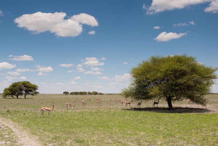
Typical scenery in the Central Kalahari, with open grassland, Acacia trees, and springbok grazing (Copyright © James Weis).
Most of the CKGR consists of sparsely vegetated sandy plains, with only limited variation in scenery. The northern portion of the park contains the most varied topography, with ancient and mostly dry riverbeds and numerous clay and salt pans.
Two significant depressions, or minor valleys, are located in the northern portion of the park: Passage Valley and Deception Valley. Around these two valleys are a network of waterholes, a circuitous game viewing track, numerous camping sites, and the park's only permanent safari camps.
Water is scarce in CKGR outside of the rainy season (December thru March) and the park authorities maintain two pumped waterholes in the northern safari area to help sustain wildlife during the dry months.
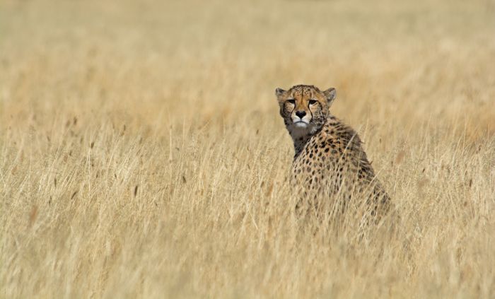
Cheetah are well suited for the Central Kalahari, with plenty of flat grasslands in which to hunt.
Wildlife in CKGR is seasonally superb during and just after the rainy or green season from mid-December thru April (and sometimes into May). During the summer rains, the normally well dispersed herbivores converge on the short grass plains in the northern sector of the park to graze on the nutritious new grasses.
During summer, the landscape transforms from a dry and brown desert habitat into a lush and verdant scene. When the new grasses emerge, springbok, oryx, ostrich, and giraffe congregate in the northern section in large numbers to feast for several months until the grasses have dried again in May. The sight of hundreds of springbok and oryx grazing on the plains, often accentuated by dark dramatic skies, is one that will long be remembered for those who see it.
Springbok are the most common large mammal in CKGR, appearing in small groups throughout the year, but congregating in the north huge numbers during the green season. Oryx are also present in good numbers and there are small numbers of blue wildebeest, red hartebeest, eland, and giraffe. Small antelopes include common duiker and steenbok.
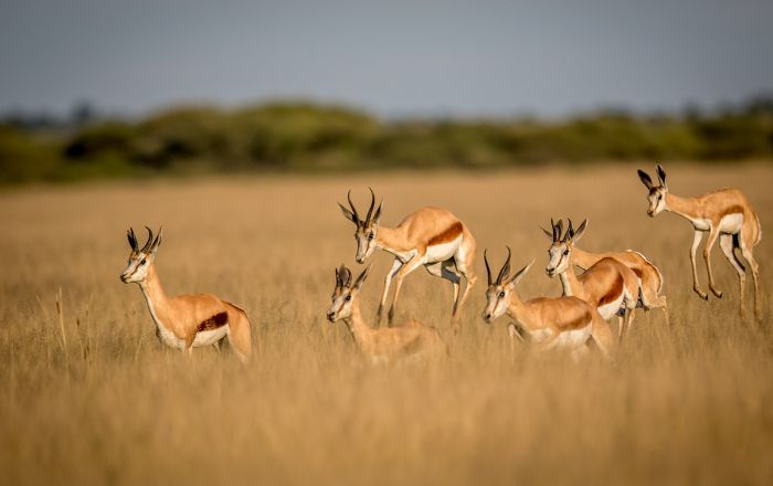
Springbok are the most common large mammal in the Central Kalahari.
Predators that can be seen in the CKGR include leopard, cheetah, lion, spotted hyena, brown hyena, black-backed jackal, Cape fox, aardwolf, caracal, and bat-eared fox.
Birding is quite good, with numerous dryland species and good numbers of raptors present. Ostrich are the most obvious birds, but the large kori bustard and northern black korhaan are both fairly common and can be seen walking the plains.
A variety of doves, sandgrouse, and starlings are easy to spot, and sometimes huge flocks of the grass-seed-loving red-billed quelea can be seen. Common raptors include yellow-billed kite, pale-chanting goshawk, black-shouldered kite, bateleur, brown snake eagle, black-chested snake-eagle, martial eagle, and tawny eagle.
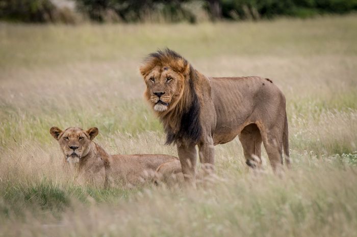
Lions are seen regularly in CKGR, but not in large prides due to the low density of their prey species.
The CKGR is often included in overland safari itineraries and there are numerous self-camping sites that can be reserved in the northern part of the park. Two permanent safari camps offer excellent guided safaris and CKGR is an excellent add-on for an Okavango Delta safari, with easy access by air from Maun.
As mentioned above, the best time for wildlife viewing in CKGR is from mid-December thru April and sometimes into May, when large numbers of herbivores gather on the northern plains to graze.
Read full details on the Central Kalahari Game Reserve and its safari camps and lodges here.
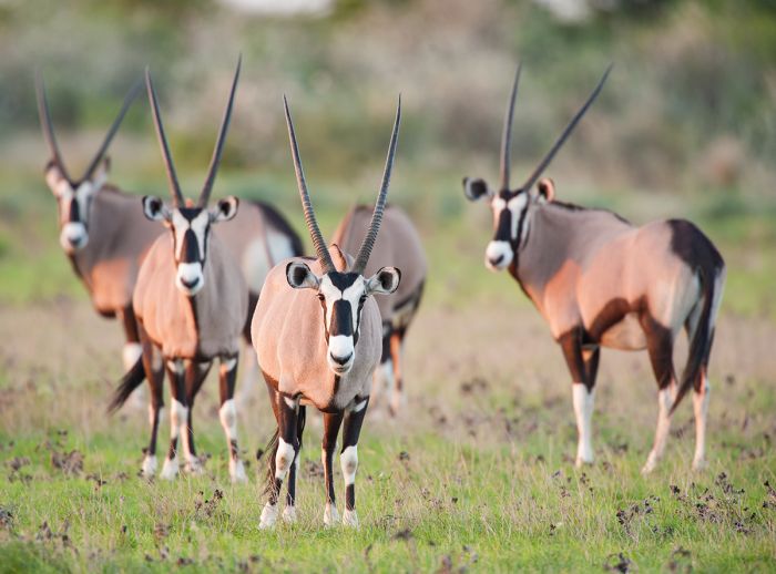
Oryx are well adapted to living in the harsh semi-desert environment of the Central Kalahari (Copyright © James Weis).
Tuli Block
(including Northern Tuli Game Reserve)
Located in the far southeast corner of Botswana, bordering both Zimbabwe and South Africa is a region known as the Tuli Block. The Limpopo River forms Tuli's southern boundary with South Africa, while the Shashe River flows along the eastern border with Zimbabwe. The confluence of the two rivers forms a point where all three countries meet.
The land in Tuli was used for farming as far back as 900 AD and European settlers moved in during the late 1880s, whereupon they attempted to raise cattle. To protect their livestock, the white settlers killed off all large predators, and in particular, the resident lions.
The farmers eventually realized that the climate and habitat was not suitable for cattle and in 1964, some of the landowners decided to combine their farms and create a reserve for wildlife. In the late 1980s, more landowners joined and the Northern Tuli Game Reserve (NTGR) was created.
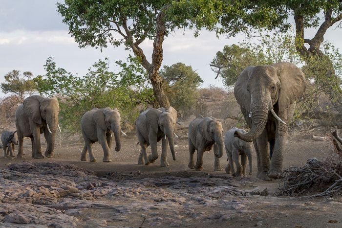
The Northern Tuli Game Reserve is an excellent place to observe elephants.
Wildlife was reintroduced and today, the NGTR offers high quality game viewing, with several permanent safari camps. The main reserve is organized into several sub-reserves, including the very popular Mashatu Game Reserve. Activities in Northern Tuli include guided game drives in 4x4 vehicles, horseback safaris, and walking safaris.
Many of the species that originally lived in the region were successfully reintroduced or repopulated themselves naturally from the surrounding area, but some species, including white rhino, roan antelope, sable antelope, oryx, buffalo, and others are still missing.
The most notable animal in Northen Tuli is certainly the elephant. NGTR has a very healthy population of elephant, with plenty of breeding herds and large bulls that are typically quite relaxed around the safari vehicles, allowing guests intimate viewing.
Other notable wildlife in Tuli includes giraffe, eland, Burchell's zebra, blue wildebeest, impala, greater kudu, waterbuck, warthog, and klipspringer. Primates include chacma baboon and vervet monkey.
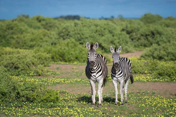
Burchell's zebras during the summer season in Northern Tuli.
Predators in Northern Tuli include healthy populations of lion and leopard, both of which are good bets to see on a 3-day visit. Cheetah are also present and are seen regularly as well. Other predators include black-backed jackal, spotted hyena, bat-eared fox, caracal, serval, and African wild cat. There are crocodiles in the deeper areas of the Limpopo River.
Birding in the Tuli region is very good, with a species list of over 350 birds. The most obvious and largest birds seen in Tuli are ostrich and the world's largest flying bird, the kori bustard.
Mashatu offers excellent safaris and lodging for guests to Northern Tuli and we definitely recommend them if visiting the region. There are also several other operators with camps in the reserve and for those wanting an exciting adventure, horseback safaris are an exciting option not offered in most places in Southern Africa.
Read full details on the Tuli Block, including the Northern Tuli Game Reserve and its safari camps and lodges here.
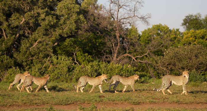
Cheetahs are commonly seen in Botswana's Tuli Block.
Kgalagadi Transfrontier Park
(including two national parks: Gemsbok National Park in Botswana, Kalahari Gemsbok National Park in South Africa)
Africa's first official multi-country 'peace park', the Kgalagadi Transfrontier Park protects land in both Botswana and South Africa, with the two previously designated national parks formally joining together in 1999 to cooperate in tourism. Tourism facilities are separately managed on either side by the respective country's authorities.
The combined park covers a 13 861 square miles (35 900 sq kms), of which the larger Botswana side spans 10 159 square miles (26 310 sq kms), and the South African side comprises 3 702 square miles (9 590 sq kms). The perpetually dry Nossob River, as well as one of the park's roads, form the national boundary separating the two countries. This border is unfenced, allowing wildlife to roam freely across the park in age-old migration routes. The western boundary of the park is the Namibian border.
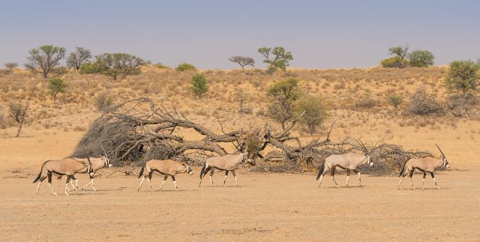
Gemsbok National Park, (the Botswana portion of the Kgalagadi Transfrontier Park) is named for the oryx, which is also called the gemsbok.
Most of the park's landscape is dominated by the reddish sand of the Kalahari Desert, with sparsely vegetated dunes and the occasional desert-adapted tree. The two main rivers, the Auob and the Nossob, almost never flow, but there is water beneath the sandy riverbeds, which provides enough moisture for camelthorn trees and sparse grasses to grow along the banks of the dry rivers.
Boreholes have been drilled and are maintained along the riverbeds to help sustain the park's wildlife. The best game-viewing in Kgalagadi is along these dry riverbeds and the sand roads that follow their routes.
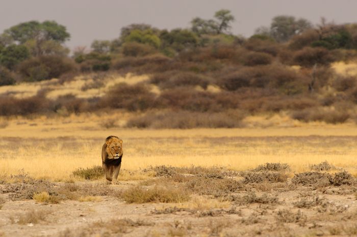
A male lion crosses the dry landscape of Botswana's Gemsbok National Park.
Wildlife in Kgalagadi
Despite the arid desert conditions in Kgalagadi, the park is renowned for good wildlife viewing. The game is far from abundant, but visitors willing to spend long hours out on game drive are usually rewarded with good sightings of animals.
Oryx, which are well adapted to living in semi-desert conditions, are present in good numbers, as are springbok. Other herbivores one may see include blue wildebeest, eland, red hartebeest, and giraffe.
Predators in the park include cheetah, lion, leopard, two species of hyena (brown and spotted), black-backed jackal, bet-eared fox, caracal, and meerkat. African wild dogs are only seen on occasion.
Birding in Kgalagadi is very good, with lots of raptors, ostrich, and bustards. The spring and summer months (November thru March) offer the most species, with many migrants arriving to breed.
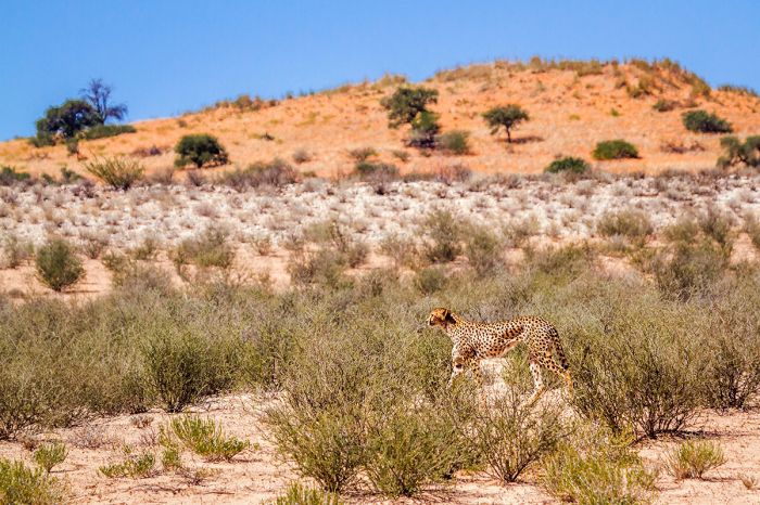
Cheetah are fairly common in the Kgalagadi Transfrontier Park.
Weather in Kgalagadi
Weather in the Kgalagadi Transfrontier Park can be extreme, with very warm temperatures during the summer. January and February may experience daytime temps of around 104°F (40°C), but dropping to comfortable temps overnight. The winter months are far more pleasant, with daytime temps averaging 74°F (23°C) but overnight and morning temps regularly fall below freezing. Warm clothes will definitely be needed!
Rain is typically only possible during the summer months, between November and April. Occasional showers or dramatic storms bring welcome relief to the oppressive heat, but is far from a certainty on any given day. Mid-May through mid-October are almost entirely rain-free.
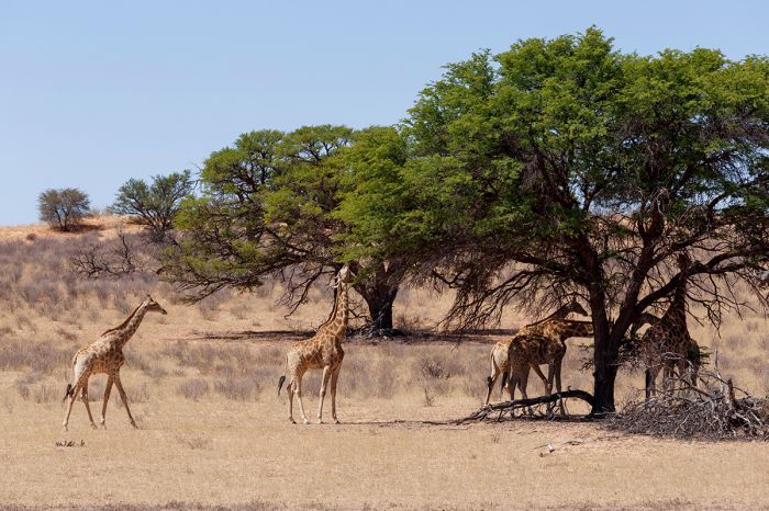
Giraffe browsing on Acacia trees in Gemsbok National Park, Botswana.
Facilities in Kgalagadi
Accommodations and facilities in the park consist mainly of basic rest camps and self-camping sites. There are a few traditional safari lodges on the South African side, offering full amenities, but most visitors come as self-drivers or as part of an organized and guided overland tour.
Self-campers must be entirely self-sufficient in terms of food and water when staying at the rustic camping sites. Campsites must be reserved in advance with Botswana Department of Wildlife & National Parks.
The Botswana side of the park can be accessed by road from Gaborone (300 miles/500 kms; ~12 hours) to the Mabuasehube Gate, but the drive requires a good 4x4 vehicle.
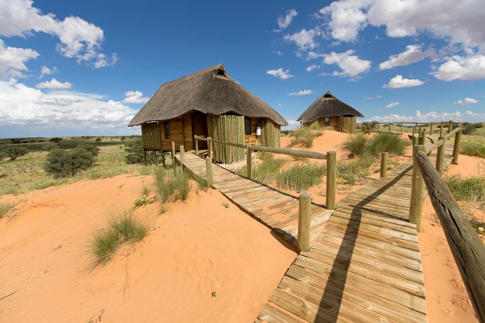
A rest camp in Botswana's Gemsbok National Park.
Khutse Game Reserve
Covering 965 square miles (2 500 sq kms) of Kalahari Desert terrain, the Khutse Game Reserve was proclaimed in 1971 to protect a network of natural clay pans that provides water for local wildlife.
Khutse adjoins the southern boundary of the much larger Central Kalahari Game Reserve in Central Botswana. Khutse encompasses the same semi-desert habitat as CKGR does, with numerous grassed-over or bare mineralized clay pans, undulating sandy grasslands, fossilized dunes, and usually dry riverbeds.
Game viewing in Khutse can be considered good, albeit low density due to the very arid conditions. There are well-maintained sand-covered roads for game driving, as well as a network of some 60 clay pans, some of which are pumped via borehole, that are good places for watching wildlife.
A road through the grassland in Khutse Game Reserve, Botswana.
Wildlife one can expect to see in Khutse includes springbok, oryx (gemsbok), and giraffe. Other herbivores that are sometimes seen include blue wildebeest, red hartebeest, greater kudu, common duiker, and steenbok. Predators in Khutse include lion, leopard, cheetah, African wild dog, brown hyena, bat-eared fox, and black-backed jackal.
Birding in Khutse is good all year, but November thru April see a major influx in species and overall numbers, with many migratory species arriving to breed in the spring and summer. Ostrich and kori bustard are commonly seen on the grasslands, and there are a good variety of dryland species and good numbers of raptors.
Khutse is a popular weekend getaway for locals from Gaborone, but overland safaris sometimes stop at Khutse for its remote and almost tourist-free Kalahari Desert experience. The name 'Khutse' translates to "where one kneels to drink" in the local Tswana language dialect.
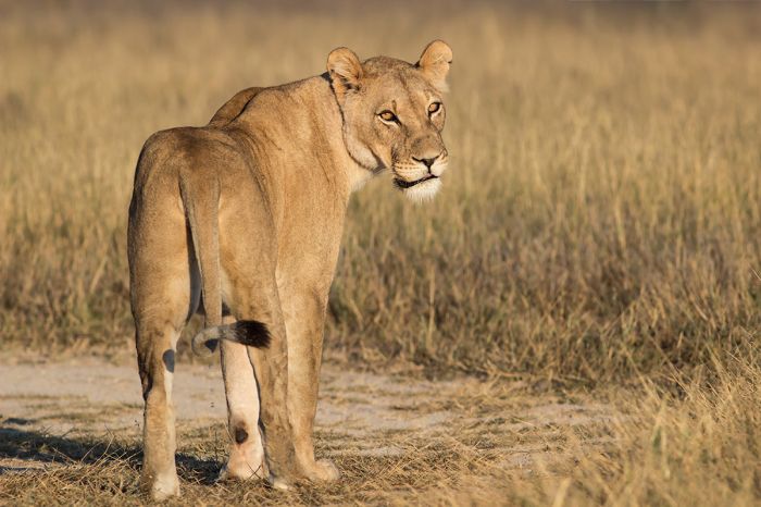
A lioness in the Khutse Game Reserve.
The best time to visit Khutse is during the wetter, summer months from December thru March, when wildlife gather near the rain-filled pans to drink; however, some of the roads become muddy and difficult when there have been good rains.
The winter months of July thru October are very dry, but the temperatures are cooler during the day (often freezing overnight). A few of the pans are pumped with water to sustain the wildlife during the dry season, and these spots can be terrific for game viewing.
Accommodation in Khutse consists of self-camping sites, all of which are in good game-viewing locations. Facilities at the camp sites include pit toilets, bucket showers, and barbecue pits. Access to Khutse is by road from Gaborone (145 miles/235 kms; 4 hours).
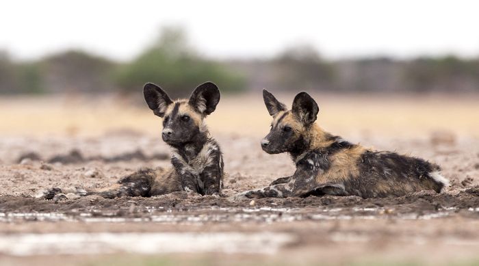
African wild dogs in Khutse Game Reserve.
Tsodilo Hills
The Tsodilo Hills rise up from the almost entirely flat and sand-covered Kalahari Desert in northwest Botswana, just west of the Okavango River Panhandle, which feeds the Okavango Delta. Tsodilo consists of four aligned hills containing caves, rock shelters, and natural springs in the otherwise mostly flat and rock-free topography of the region.
The hills themselves are formed out of quartzite shist and are a dramatic site, with hues of yellow, lavender, orange, and turquoise against the surrounding desert plain.
Tsodilo has significant cultural and spiritual significance to the local San people that have long lived in the Kalahari. Archeologists estimate that these hills have been used for shelter and religious purposes by ancestors of the San people dating back at least 30 000 years, but perhaps as much as 50 000 years ago, making Tsodilo one of the oldest known historical sites on Earth.
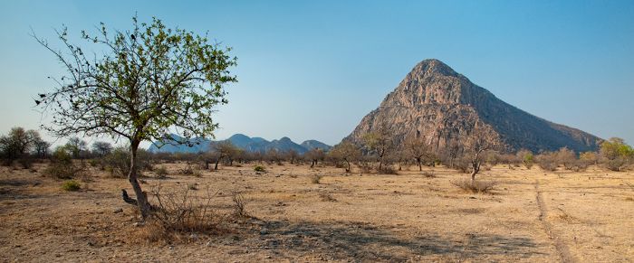
'Male Hill', the tallest of the Tsodilo Hills.
Both the San, and later the Bantu people, revere Tsodilo as a mystical place, and believe that the spirits of their ancestors inhabit the hills. There are over 4 500 rock paintings at Tsodilo spread over 200 sites, with some dating back to as early as 24 000 years ago.
Many of the rock paintings at Tsodilo are located in caves that are accessible to visitors via hikes of varying duration. The paintings are mostly made using dyes of red or white color and depict of variety of wild animals, geometric objects, and human figures.
The four hills at Tsodilo, which are situated roughly in a line, have been named by the San people. Male Hill is the most southerly and highest, rising some 1 345 feet (410 meters). San tradition holds that the top of Male Hill is the most sacred spot at Tsodilo, as this is where the first spirit knelt to pray after creating the world.
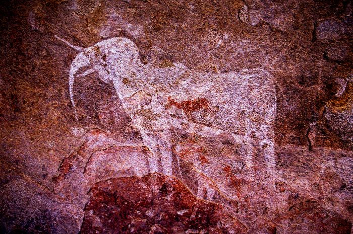
Ancient rock painting at Tsodilo Hills, a UNESCO World Heritage Site.
Just to the north of Male Hill is Female Hill, which is the next highest hill, rising 985 feet (300 meters), but covering a much larger area. Many of the best-known rock paintings are at Female Hill.
Some 1.2 miles (2 kms) north of Female Hill is Child Hill, which is much smaller, rising only 130 feet (40 meters). Another 1.4 miles (2.2 kms) north of Child Hill is the last hill, which is unnamed, but said to be the first wife of Male Hill, who was left behind in favor of Female Hill.
Tsodilo is a cultural UNESCO World Heritage Site (Cultural, declared in 2001) and also the site of several archeological studies.
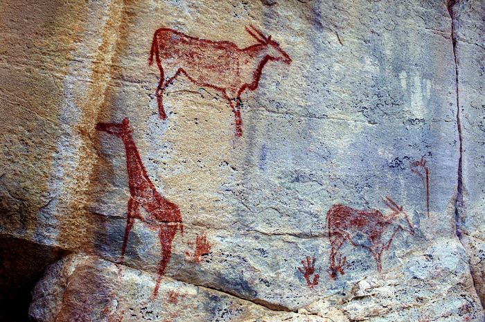
Rock paintings at Tsodilo Hills in northern Botswana.
Tsodilo is open for tourist visitation, but bringing a local guide is almost a must in order to truly understand this place. There are numerous marked-out trails leading to the more signifiant rock art sites, including the Rhino Trail, Lion Trail, Male Hill Trail, and Cliff Trail.
A single day will hardly give enough time to explore the various sites at Tsodilo, so we suggest at least two nights. Accommodation is available at several self-camping sites.
Access to Tsodilo is via a long drive on a gravel road from Maun or from Shakawe just to the north. There is also an airstrip at Tsodilo.
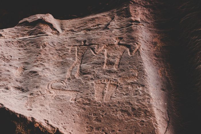
Tsodilo Hills are a sacred site, with thousands of rock art sites.
Maun
As the gateway to the Okavango Delta, the town of Maun is the tourism capital of Botswana. Most safaris in Northern Botswana pass through Maun on the way in, out, or in both directions. Maun started out as a small settlement in 1915 that served as the capital of the local Batawana people. The name is derived from the word 'maung', which means 'place of reeds' in the San language.
The now legendary Riley's Hotel was opened in 1910 by Harry Riley and became a popular place with tired and thirsty visitors (mostly big game hunters) after their long journey from Francistown. Maun slowly developed into a rural frontier town with a "Wild West" feel, with a mix of residents involved in hunting and/or cattle ranching operations.
The town expanded in an elongated shape along the Thamalakane River and as tourism in the Okavango really caught on in the late 1980s, Maun expanded quickly, with numerous independent safari operators offering made-to-order camping expeditions into the Okavango. Travelers arrived in Maun and booked a trip on the spot and off they would go in a 4x4 vehicle with a guide.
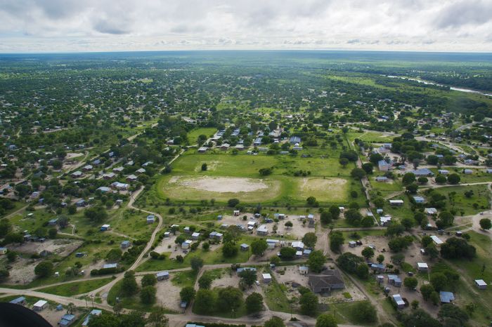
Aerial view over Maun, the gateway to the Okavango Delta.
Several safari camps, mostly quite basic in those days, sprang up in the southern Okavango Delta, including Crocodile Camp, Okavango River Lodge, and Island Safari Lodge, offering overnight accommodation for safaris departing out of Maun.
As the Botswana safari industry continued to grow in the early 1990s, many permanent lodges built further north in the heart of the Okavango and up into Linyanti, and Maun expanded further. The small Maun Airport became the busiest in all of Africa, with shuttle flights taking off and landing throughout the day to service the influx of safari guests on their way to or from safaris the Okavango, Linyanti, and Kwando.
Today, last-minute overland safaris booked out of Maun are uncommon, as almost all visitors pre-book their safaris overseas with reputable agents (like us) and Maun is now almost entirely just a stopover point en route to safari camps.
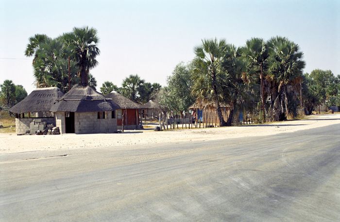
A palm-lined street in Maun, Botswana.
Visitors to the Okavango region typically arrive at Maun Airport on a non-stop flight from Johannesburg, South Africa, where they collect the luggage and are met by a travel representative assigned to their tour. Guests then take another flight on a single-engine Cessna Caravan or similar aircraft, departing Maun and landing at one of the numerous private airstrips around the Okavango Delta at their first safari lodge or camp.
After visiting the Okavango, Selinda, Chobe, or other regions in northern Botswana, guests typically depart via Maun back to Johannesburg, but some may choose to continue on to Victoria Falls or other countries like Zambia or Zimbabwe for further adventures.
Maun is not typically used for overnight stays and is most commonly only a stopover lasting no more than two hours en route to or from safari camps further north. This said, there are a variety of hotels and lodges available in Maun, most of which are located along the Thamalakane River.
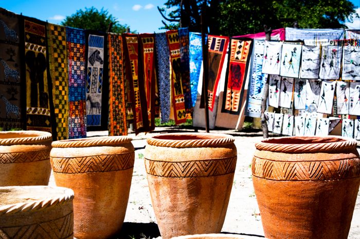
Craft market in Maun, Botswana.
Maun Airport was recently renovated at a cost of P120 million (USD 11 million). The project was completed in 2020 and included major upgrades to the check-in and baggage collection areas, as well as adding a meet-and-greet area, improving the air-conditioning, adding a PA system, enlarging the departure halls, improving flight information displays, bathrooms, and water supply. Security screening was also upgraded and separated for domestic and international travelers.
Maun has a population of around 50 000 people, most of whom are involved in some way in the eco-tourism industry or cattle ranching.
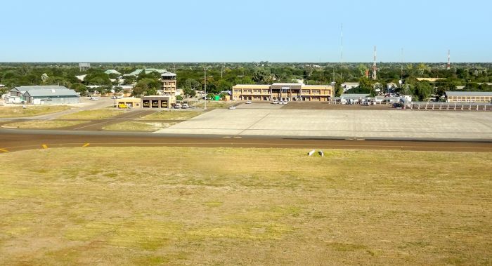
Maun Airport is one of the busiest in Africa in terms of flights.
Kasane
Situated in the far northeast corner of Botswana, the small town of Kasane is Botswana's 'other' (Maun being the primary) eco-tourism frontier town. Kasane is smaller than Maun and far less visited, but like Maun, its airport is a common stopover point for tourists traveling in northern Botswana (mainly between the Okavango Delta and Chobe National Park and/or Victoria Falls).
Kasane town sits on the southern banks of the Chobe River, very close to the confluence of the Chobe and Zambezi Rivers and the 'four corners', where four countries (Botswana, Namibia, Zambia, Zimbabwe) meet.
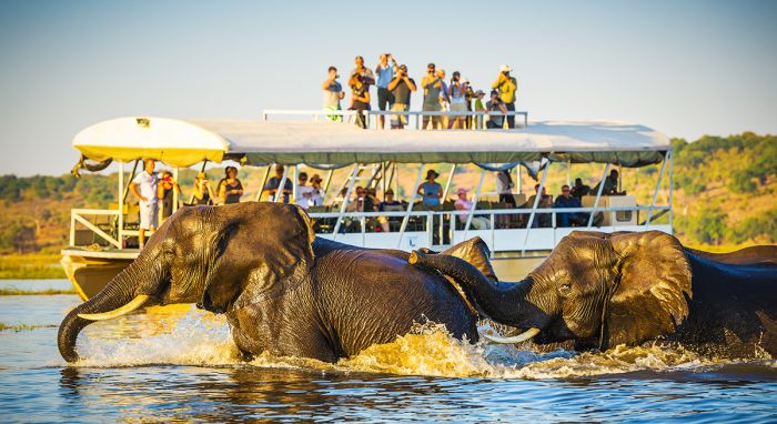
Boat-based safaris on the Chobe River are available from the town of Kasane, Botswana.
Kasane offers numerous accommodation options for visitors to Chobe National Park and the Chobe Riverfront, with multiple tour operators based in the town and offering a variety of day or half-day trips into the national park and boat-based safaris on the river.
Kasane Airport is most commonly used by guests coming from safaris in the Okavango and heading to see The Victoria Falls, which is a short drive (90 minutes) or flight (20 minutes) from Kasane.
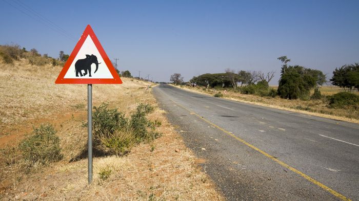
A road just outside Kasane, Botswana, with a sign warning drivers to watch out for wildlife.
Kazungula
The small border crossing town of Kazungula (Zambia) is located just east of Kasane and across the Zambezi River in Zambia. Up until 2021, the Kazungula Ferry was used to transport vehicles across the Zambezi River between Botswana and Zambia, but a new vehicle bridge opened in May 2021, allowing easy and quick vehicle access over the river. The bridge curves to avoid crossing into either Zimbabwe or Namibia.
Gaborone
Situated very close to the border with South Africa in southern Botswana, Gaborone is the capital and largest city in Botswana, with a population of 230 000, which is roughly 10% of Botswana's total population. The area around Gaborone is one of the more suitable for farming in Bostwana, and it has a dependable water supply, so more than 50% of Botswana's populace lives within 60 miles (100 kms) of the city.
The city's name comes from Chief Gaborone, a leader of one of the Batlôkwa clans, who established the small settlement of Moshaweng in the late 1880's, which is located just north of present-day Gaborone. Early European missionaries named the settlement Gaborone's Village, which later became shortened to 'Gaborones' (much later in 1968, the 's' was dropped from the name).
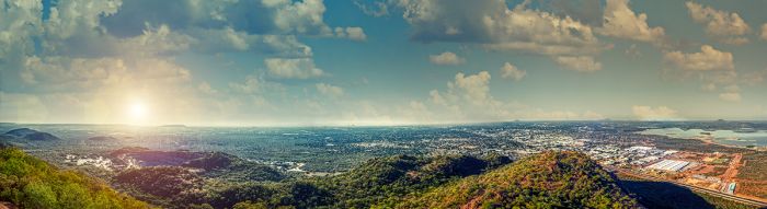
View of greater Gaborone from the top of Kgale Hill, which rises 4 222 feet (1 287 m) just outside the city.
During the late 1800's, Cecil John Rhodes and his British South Africa Company constructed a rail line connecting South Africa - most notably Kimberley and the diamond mines, with Bulawayo, Rhodesia (present-day Zimbabwe).
The rail line passed very close to Gaborone's Village and a small settlement called Gaborone's Station soon developed along the railway. The city is still sometimes called 'GC' by locals, which stands for 'Government Camp', referring to the colonial fort built by Cecil Rhodes here in 1890.
When Bechuanaland (present-day Botswana) was granted independence from Great Britain in 1966, Gaborones was selected as the capital based on its location near the rail line. At the time of independence (1966), the population in Gaborone was only around 4 000 people.
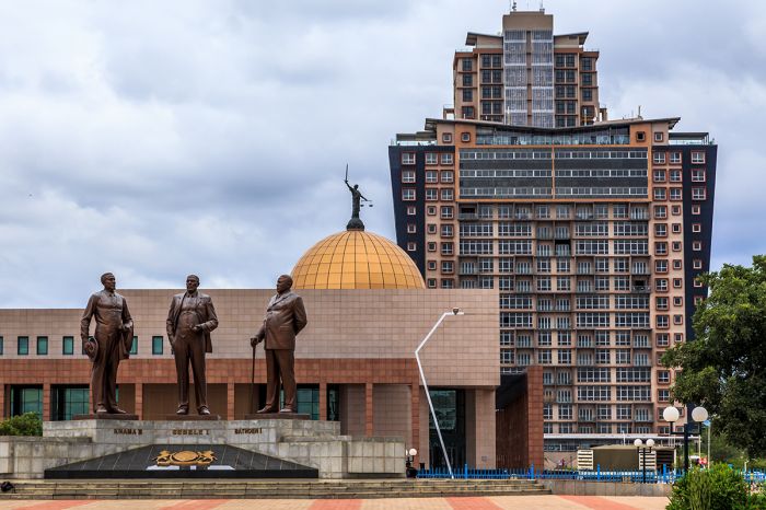
The Three Dikgosi Monument located in the Central Business District of Gaborone, Botswana. The statues depict three dikgosi (tribal chiefs): Khama III of the Bangwato, Sebele I of the Bakwena, and Bathoen I of the Bangwaketse.
Known to locals as 'Gabs', the city is the economic hub of the country, with government buildings, banks, shopping malls and seemingly unending urban sprawl. The city could be described as fairly low key and unexciting, but this may not be a bad thing when compared to many of Africa's more hectic capital cities.
In terms of tourism, Gaborone primarily receives domestic and international business travelers. The city is seldom visited by eco-tourists, who mainly come to Botswana for its exceptional wildlife safaris that are mainly conducted far from Gaborone in northern Botswana.
Accommodation is easy to find in Gaborone, with a decent selection of hotels and guest houses. Gaborone is very spread out, so visitors will definitely want a rented car to get around.
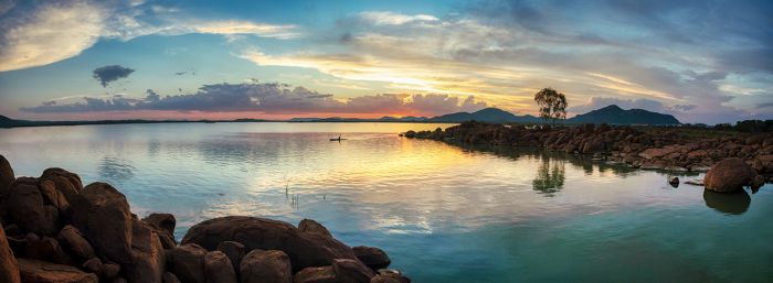
The Gaborone Dam on the Notwane River. The dam lies just south of the city and supplies water to the area.
Francistown
Botswana's second most populous city, Francistown has a population of around 90 000 and like Gaborone, is located along the rail line built in the 1890s, connecting South Africa with Bulawayo, Zimbabwe.
The town originated after gold was discovered along the Tati Rivwater (a tributary of the Shashe River) in 1867 by Karl Mauch, a German explorer and geographer. Over the next couple years, a small gold rush, the first in Africa, ensued and miners arrived to stake their claims.
One of the main buildings on the town square in Francistown, Botswana (image: Wikimedia Commons).
One of the early mining prospectors was Daniel Francis, an Englishman from Liverpool. Francis arrived in Bechuanaland (present-day Botswana) and purchased a mining license, but left for Kimberley (South Africa) in 1870 to get in on the diamond rush there.
Francis later returned to Bechuanaland in 1880 and his Northern Light Mining Company (later renamed Tati Concessions, Ltd) obtained the Tati gold mining concession, which was on land obtained via negotiation with King Lobengula of the Ndebele people.
Lots were immediately sold off to prospectors and the small settlement began with one street running parallel to the rail line. In 1897, the Tati Company sold part of its land for residential and commercial purposes, marking the birth of the town, which was named Francistown after Danial Francis.
Similar to Gaborone, Francistown is not a tourist destination, with most visitors arriving for business purposes. There is a small assortment of decent accommodations for those that want to visit. There is a small museum, but not much else to offer in terms of sights or things to do.
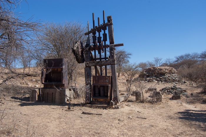
An old stone crusher (circa 1890), at one of the historic, but long since abandoned gold mines near Francistown, Botswana.
Quick Facts & travel tips
- Botswana straddles the Tropic of Capricorn, with the northern two-thirds of the country sitting in the tropics. Winter mornings can be quite cold with temperate days.
- October can be extremely hot until the rains begin, usually sometime in November. Game viewing is superb at this time though.
- Botswana's tourism model of vast natural areas with few safari camps means that, overall, Botswana safari camps are not on the inexpensive side.
- Botswana's safari lodges experience high demand for most of the year. Book your trip up to one year in advance so availability is not an issue.
- The months of June-October are 'high season' for safaris.
- Rainfall in most regions occurs between December and April, with the heaviest rains falling from late January thru March.
- English and Tswana are the official and widely-spoken languages of Botswana.
- The national currency is the Botswana Pula (BWP), but US Dollars, Euros, UK Pounds, and South African Rands are accepted almost everywhere throughout the country.
- The US Dollar and Euro have consistently favorable exchange rates (10+ to 1) versus the Botswana Pula.
- Credit and debit cards are widely accepted at hotels and safari camps.
- Botswana uses 230v electricity and type D, G and M plug adapters.
- Botswana time is GMT+2, does not observe daylight savings time (DST); 8 hours ahead of New York (7 during DST).
- Botswana is one of the world's most sparsely populated countries, with a population of only 2.3 million. Around 210 000 live in its its largest city, Gaborone.
- Botswana covers 231 804 square miles (600 370 sq kms), with only 11 people per sq mile (4 people per sq km).
- The majority of the population (79%) are Setswana (a Bantu-speaking of Southern Africa). There are smaller populations of Kalanga (11%) and Basarwa (3%) (San Bushmen). The remaining 7% are made up of Kgalagadi, Indians, and Whites.
- The majority of Botswana's population (79%) are Christian with the remainder either espousing no religion or various indigenous faiths.
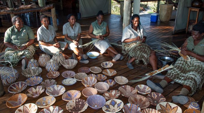
Ladies weaving 'Botswana baskets' at a safari camp in the Okavango Delta (Copyright © James Weis).
ENTRY / VISA REQUIREMENTS
- A passport with at least six months of validity remaining is required.
- USA/Canada/Australia/UK/EU nationals are permitted stays of up to 90 days total within a 12-month period without a visa.
- Travelers who attempt to enter Botswana with a temporary passport must have a visa to enter.
Note: entry/visa requirements are subject to change without notice, so please check with the official government pages shown below.
Official Government Pages
- US Department of State info: click here
- Botswana Consulate - USA: click here
- Botswana Home Affairs: click here
- CDC information: click here
Read More...
Main: Flora, Geography, Important Areas, National Parks, Protected Areas, Ramsar Sites, UNESCO Sites, Urban Areas, Wildlife
Detail: Chobe NP, Chobe Riverfront, Central Kalahari, Conservation, Francistown, Gaborone, Kasane, Kgalagadi, Khutse, Kwando, Linyanti, Makgadikgadi, Makgadikgadi Pans NP, Maun, Moremi, Nxai Pan, Okavango Delta, Okavango Panhandle, Savute Channel, Savute Marsh, Selinda, Tsodilo Hills, Tourism, Tuli Block
Admin: Travel Tips, Entry Requirements/Visas
Read More...
Botswana Independence, Bechuanaland, Diamonds, Dynasties, Early History, Festus Mogae, Hunting Ban, Ian Khama, Independence Movements, Jameson Raid, Khama the Great, Mfecane, Mokgweetsi Masisi, Quett Masire, Sekgoma II, Semane Setlhoko Khama, Seretse Khama, Seretse Khama Presidency, Tourism Growth, Tshekedi Khama, Tswana
Early History
Human history is widely believed to have had its origin in Africa and evidence of the earliest known hominids has been discovered in several places in East and Southern Africa. Just south of present-day Botswana (in present-day South Africa), hominid bones of the Australopithecus genus have been unearthed that date back over 2 million years.
Descendants of these early hominids were the semi-nomadic, hunter-gatherer people known as the San (or Bushmen) people. The San lived throughout the entire southern African region, including present-day Botswana, Namibia, Zimbabwe, and South Africa. Evidence of these Stone Age people can be seen in a multitude of rock-art sites across the region, including at the Tsodilo Hills in Northwest Botswana.
"Mrs. Ples" is the popular nickname for this skull of an Australopithecus africanus, an early hominid that lived throughout Southern Africa, including present-day Botswana. The skull is currently held at the Ditsong National Museum of Natural History in Pretoria, South Africa (image: Wikimedia Commons).
The Tsodilo Hills is a UNESCO World Heritage Site and evidence suggests that the San people used the many caves at Tsodilo as shelter, as well as for religious purposes. Tsodilo is still a sacred place for the local people today. There are some 4 500 rock paintings in the Tsodilo Hills, with over 200 known sites. Some of the paintings at Tsodilo date back 24 000 years.
The rock paintings at Tsodilo depict a variety of wild animals, such as antelopes, giraffes, and rhinos, as well as some that show groups of humans. Some of the humans are shown with the characteristic erection, that is a distinctive feature of San paintings of men. Later paintings that date back less than one thousand years, feature black men and sometimes scenes of battle, which is thought to depict the period during which Bantu pastoralist tribes arrived in the region from Central Africa and began displacing the San.
Livestock herding is known to have existed in Egypt by around 8 000 years ago, with people keeping cattle, goats, and sheep obtained from the 'Fertile Crescent', an area encompassing the Euphrates and Tigris Rivers in Mesopotamia and extending into Egypt's Nile River Valley. These early pastoralists slowly expanded southward and had occupied much of East Africa (including present-day Kenya and Tanzania) by around 3 000 years ago.
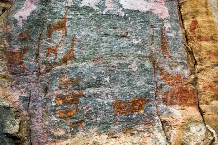
Early rock paintings made by the San people at Tsodilo Hills in Botswana.
Another group of people known as the Khoikhoi, who are ethnically similar to the San, but lived a different lifestyle, with pastoralism (instead of hunter-gathering) being their main activity. It is presumed that the Khoikhoi obtained their goats, sheep, and cattle from the Bantu-speaking 'black African' tribes in Eastern Africa.
The Khoikhoi migrated south with their livestock and are known to have reached the Cape Peninsula in present-day South Africa by 2 000 years ago. The Khoikhoi surely integrated with the San people in the region and some of the San at least partially converted their lifestyle from hunter-gathering to pastoralism.
The Bantu tribes, who were distinct in their language and in the darkness of their skin, also slowly expanded southward from equatorial Africa over the course of several thousand years. Besides raising livestock, the Bantu were also agriculturalists, growing various grains and they arrived with Iron Age tools, which were used for farming and weaponry. Physically, the Bantu were taller and larger-bodied than the Khoisan (a term used now to describe the related San and Khoikhoi people).
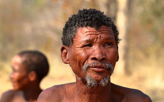
Descendants of the early San (or 'Bushmen') are still living in small populations in the Kalahari Desert of Namibia, Botswana, and South Africa.
The fabrication of iron tools required a smelting furnace that could reach very high temperatures and associated with this technology was a new type of pottery, which was also made by firing at high temperatures. Archeological finds of this type of pottery in the Southern African region is used to date the arrival of the Bantu people.
The Bantu had reached Southern Africa, including present-day Botswana and South Africa, by around 400 BC and their arrival was bad news for the Khoisan. The Khoisan, with their more simple Stone Age tools and weapons, simply could not compete against the more advanced iron weapons and technology of the Iron Age Bantu and so the smaller-bodied and less warlike Khoisan were quickly displaced from the good farming areas.
The Khoisan were forced to retreat into more marginalized areas such as the arid Kalahari Desert, which is too dry for cultivation. Because much of present-day Botswana consists of a semi-desert Kalahari biome, the Stone Age culture of the Khoisan persisted for much longer in present-day Botswana than in most of the rest of Southern Africa.
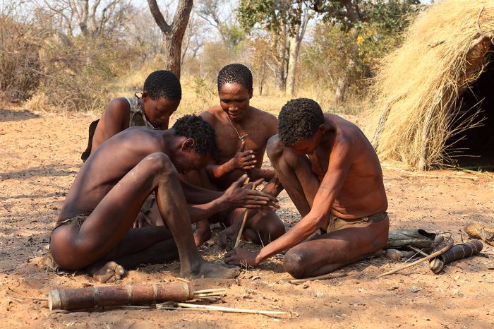
The San people were marginalized and forced into the arid Kalahari by Bantu-speaking tribes that migrated into Southern Africa from the north.
While the Bantu tribes mostly displaced the weaker Khoisan from the best farming areas, the Khoisan culture managed to survive and they continued to live peacefully side-by-side with the Bantu. Some of the cultures in Botswana today are a mixture of the Bantu and Khoisan, with centuries of intermarriage taking place.
Most of the native people in Botswana (the 'Batswana' or 'Tswana') today are descended from a mix of the indigenous Khoisan and the later-arriving Bantu people, showing a lighter skin color than Bantu tribes further north in Central Africa. They also exhibit the more almond-shaped eyes, thinner lips, and high cheekbones that are characteristic of the Khoisan.
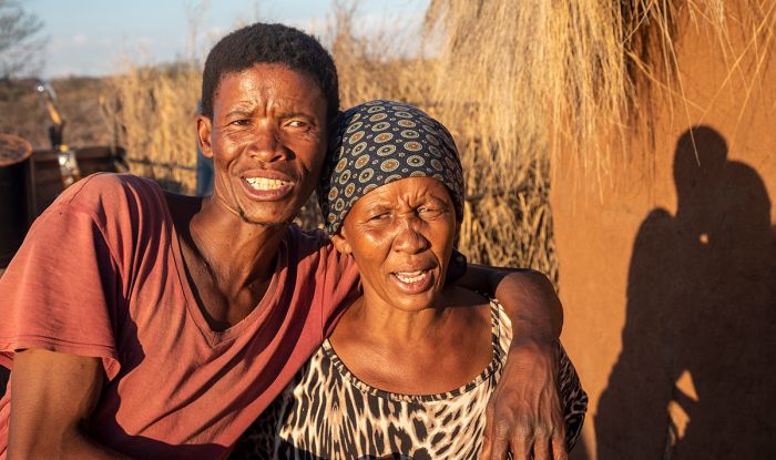
Many of the contemporary people of Botswana are descendants of a mix of Bantu and Khoisan ancestors.
Early Dynasties (900-1500)
Several known Iron Age cultures existed in present-day Botswana beginning around 900 AD, including one at Toutswemogala Hill, which is located just north of the present-day town of Palapye. The site is named for an early Bantu tribe known as the Toutswe, who occupied the area and farmed sorghum and millet, while also raising livestock.
It is believed that the Toutswemogala Hill site was a major center of animal husbandry, raising what are known today as Tswana cattle. The large livestock-raising complex prospered until around 1300 AD, when it appears to have been conquered by the neighboring dynasty at Mapungubwe (in present-day South Africa). Mapungubwe had been developing since around 1050 AD, but it was superseded by the new dynasty state at Great Zimbabwe, which became the dominant dynasty in the region between the 13th and 15th centuries.
Between around 1200 and 1500, various dynasties existed in present-day Botswana, but eventually, the Batswana rose to become the dominant tribe in the region.
Early Iron Age people raised cattle in present-day Botswana.
Mfecane (1815-1840)
The years between 1815 and 1840 were a tumultuous time in Southern Africa, with widespread warfare and chaos between the various indigenous tribes living in present-day South Africa, Zimbabwe, and Botswana. The name 'mfecane' is a Nguni word meaning 'crushing' or 'scattering', and refers to the violent dispersal of various tribes and cultures due to the unrest and fighting between tribes. The Sotho people call this period Defecane or Lifaquane, while the Tswana people call it Difaquane.
Notable warrior kings that participated in the chaos of Mfecane include King Shaka of the Zulu tribe, and Mzilikazi, who was one of Shaka's generals that broke away to form the Ndebele empire in present-day Zimbabwe. The British, who were in the process of colonizing much of the region, referred to the Ndebele as the Matabele.
Note: for a detailed history of Mfecane, please read the History tab on the Zimbabwe page.
The chaos caused by Mfecane, which included widespread slaughter (an estimated two million indigenous people were killed), cattle raiding and slave taking, caused a huge disruption to many tribes, including those living in present-day Botswana.
Map showing the rise of the Zulu Empire and the flight routes of various other tribes during "Mfecane" (image, which was altered to show present-day country borders and names: Wikimedia Commons).
Early Tswana
After the violence of the Mfecane period ended around 1840, oral history tells that three Batswana tribes rose to prominence in present-day Botswana: the BaKwena, BaNgwato, and BaNgwaketse. As is the practice amongst such tribes, they are named for their founding chief, which in this case were three brothers, Kwena, Ngwato, and Ngwaketse. The chiefs were descendants (great-great-great grandsons) of Chief Mogale, who reigned during the 14th century.
Competition between the tribes over control of the flourishing trade in ivory and ostrich feathers (which were shipped south the the Cape Colony in present-day South Africa) finally resulted in the dominance of the Bangwato tribe.
Drawing of Tswana Warrior (circa 18th century) from the book "Africa - Stanford's Compendium of Geography and Travel" by Alexander Keith Johnston (1878) (image: Wikimedia Commons).
Khama the Great (1837-1923)
Chief Ngwato's son, Segkoma I, became chief of the Ngwato tribe upon his father's death. Segkoma's eldest son was Khama III, who was born around 1837. During the late 1840s, the famed Scottish explorer and Christian missionary David Livingstone, visited present-day Botswana and the Bangwato tribe. Livingstone managed to convert the young Khama, who would have been in his teens, to Christianity. Although Chief Segkoma was welcoming towards Livingstone and the missionaries, he refused to give up the tribe's traditional beliefs.
Chief Khama III (1837-1923), Paramount Chief of the Bamangwato people (photo: Wikimedia Commons).
Conversion to Christianity
In 1860, while in his early twenties, Khama III, and five of his younger brothers were baptized by the German missionary Heinrich Christoph Schulenburg. The brothers were amongst the first of the Bamangwato (a word which describes members of the Bangwato tribe) to officially convert to Christianity, but many more followed.
Becoming a Christian was a not insignificant step for young Khama III, who had already gone through bogwera, his tribe's traditional initiation into manhood ceremony alongside the other members of his mephato regiment (boys of similar age). Bogwera entailed rigorous tests of endurance, as well as circumcision.
Chief Sekgoma initially acquiesced with his son's new affiliation with the church, although he did not trust nor follow suit himself, believing that Christianity was essentially a white colonialist religion that was in sharp contradiction with the values and beliefs of his tribe.
Photo of Chief Khama III from the book "Twenty years in Khama's country, and, pioneering among the Batauana of Lake Ngami" (1896) (image: Wikimedia Commons).
In 1862, Khama III married a Bangwato woman named Mabisa, who had been baptized into Christianity in 1862. Mabisa was also known as Elisabeta Gobitsamang Khama, taking the name Elisabeta in honor of Elizabeth Moffat, the wife of the prominent Scottish missionary, Robert Moffat. Their marriage was the first Christian faith wedding held in Shoshong, the tribe's base near present-day Mahalapye.
Tribal custom included polygamy, but Khama III, now of Christian belief, refused to take a second wife and tensions between Chief Segkoma and his son continued to escalate over their divergent beliefs.
Soon Khama III was forced into exile along with the tribe's substantial number of Christian converts. Khama III led his followers into the hills surrounding Shoshong. While in exile, Chief Segkoma attempted to have his son assassinated, but the plot failed.
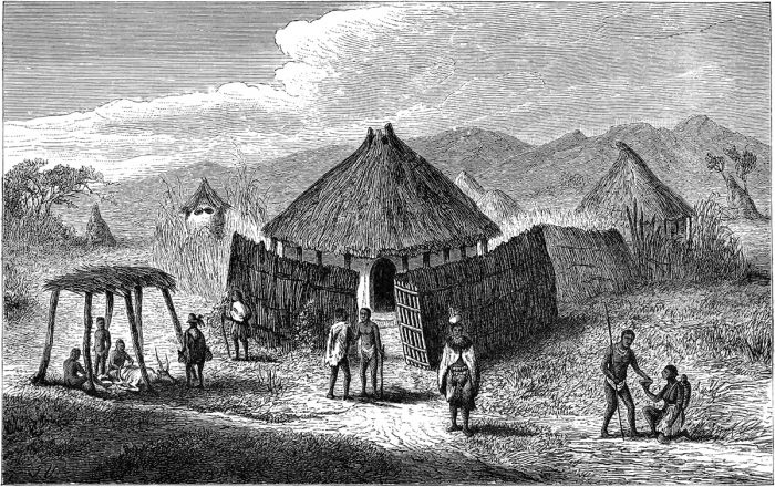
Bamangwato huts at Shoshong, from the book "Seven Years in South Africa, volume 1" (1881) (image: Wikimedia Commons).
Ascension to Ruler (1872-75)
The division of the tribe took a great toll and Chief Sekgoma and his faithful followers headed into exile after installing his brother, Macheng, as the new chief of the splintered tribe at Shoshong. Soon, Khama III and Macheng clashed, leading to a further attempt on Khama III's life by Macheng, which was also a failure.
In 1872, Khama III and his followers successfully ousted Chief Macheng and Khama III's followers now made up the majority of what remained of the tribe at Shoshong. Khama III decided to relocate his followers north to the small village of Serowe. Still in exile, Segkoma and his followers prepared for war with Khama III.
In 1875, the war between Khama III and his father, Segkoma, began, but it was short-lived, only lasting about one month. It culminated with Segkoma's defeat at the hands of his son. Having ousted his rivals, Khama III assumed the chiefdom of the Bangwato tribe.
Artist's drawing of graduation daggers given to Tswana fighting regiments (image: Wikimedia Commons).
Khama III's Chieftainship (1875-1923)
As the new chief of the Bangwato, Khama III abolished some traditions including the bogwera ceremony (passage to manhood explained just above). On the other hand, Khama greatly increased the tribal responsibilities of the mephato regiments (groups of same-age young men and women in the tribe).
The mephato groups were required to perform long-term work projects when called into service by the chief. When the call came, each member of his or her mephato had to immediately report for work detail and perform whatever project they were assigned to for up to six months without any official material support from the tribe in terms of food or other supplies.
At the time of Khama III's ascension to the chieftainship, the lands in present-day Botswana, including that of the Bangwato, were under continual threat from incursions by the Ndebele people (from present-day Zimbabwe). Other threats to Khama III's land came from the 'Boers' (Dutch-speaking European farmers that had fled British rule in the Cape and were expanding into the interior in search of land for homesteads).
Khama III saw that the best way to protect his land from being seized was to align himself and the Bangwato with the British, who controlled about two-thirds of present-day South Africa already and were in the process of dealing with the Boers as well.
The 'Boers' of South Africa were threatening Bamangwato land ini their expansion inland from the British-controlled Cape (image: Wikimedia Commons).
Bechuanaland Protectorate
In terms of what to do about Bechuanaland (the British name for the lands encompassing most of present-day Botswana), there were two main factions amongst those in power in the British Cape Colony.
One faction was headed by Cecil Rhodes, a young but already wealthy mining magnate with substantial interests in the diamond mining operations in Kimberley (present-day South Africa). Rhodes was adamant that Bechuanaland should be opened up for settlement by European colonists and economic exploitation.
The second faction was headed by John Mackenzie, a Christian missionary from Scotland, who had worked with the Tswana people for years and argued for them to keep their land and be protected from incursions by the Boers. Mackenzie urged that Bechuanaland should become a British protectorate. Bothe Rhodes and Mackenzie had significant political influence in the Cape Colony.
When Germany annexed South West Africa (present-day Namibia) in 1884, Britain became concerned that the Boer Republics may link up with the Germans and prevent British access to the interior of Africa, which lay north and through Bechuanaland. In order to safeguard against this possible occurrence, Britain decided to grant protection to Bechuanaland and make it a protectorate.
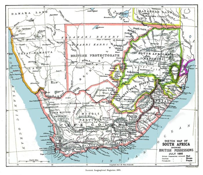
An 1885 map showing the Bechuanaland Protectorate prior to the creation of the Crown colony of British Bechuanaland (image: Wikimedia Commons).
In 1885, a compromise was reached and the land south of the Molopo River (which begins near the present-day town of Mafeking and flows southwest, where it eventually joins the Orange River) was declared the colony of British Bechuanaland, while all land to the north of the river became the Bechuanaland Protectorate. The colony was annexed into the Cape Colony in 1895 and is now part of South Africa.
Despite the compromise and the formation of the Bechuanaland Protectorate, Rhodes, who had become the Prime Minister of the Cape Colony in 1890, continued to petition the British government to annex what was left of the Tswana land.
In 1895, the Tswana were facing dual threats to their land: from the north by Cecil Rhodes' British South Africa Company (BSAC) in what would become Rhodesia (present-day Zambia and Zimbabwe) and from the south by Afrikaner Boers expanding northward in search of homesteads.
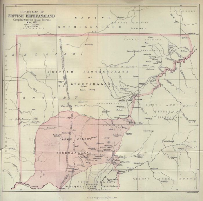
An 1887 map showing the Crown Colony of British Bechuanaland, which was carved out of the Bechuanaland Protectorate and is now part of South Africa (image: Wikimedia Commons).
Fearing that he would soon lose his homeland, Chief Khama III traveled to Britain to lobby Queen Victoria for protection. Accompanying Khama on the trip were two other Tswana chiefs from neighboring tribes: Bathoen I of the Ngwaketse tribe and Sebele I of the Kwena tribe.
The trip was organized by John Mackenzie and the London Missionary Society and they made Khama III's Christianity a central issue of their campaign to save the Tswana lands. The three chiefs campaigned across Britain and spoke to large evangelical audiences, which garnered widespread press coverage and brought Khama III almost legendary status as an African Christian.
A portrait of Botswana's Three Chiefs (left to right: Sebele I, Bathoen I, Khama III) on a 100 Pula Botswana banknote.
Jameson Raid (1895-96)
In late December 1895, Cecil Rhodes organized a raid (now known as the Jameson Raid) against the Boer-controlled Transvaal Republic in an attempt trigger an uprising by the primarily British expatriate gold mine workers living there in hopes of facilitating an excuse to annex the Republic and give Rhodes control of their gold deposits.
The raid was led by Leander Starr Jameson, Administrator of Southern Rhodesia, which was then under the control of Rhodes' British South Africa Company (BSA). Jameson and his company police, who were under the employ of the BSAC, as well as British Bechuanaland police carried out the raid over the New Year weekend of 1895-96.
The raid failed and no uprising took place. The result was an international scandal and public embarrassment for the British, which had allowed its Protectorate to be used for an attack on another country. Rhodes was removed as Prime Minister of the Cape Colony ten days later.
The Jameson Raid fiasco greatly tarnished Rhodes' reputation and was also instrumental in the decision by the British government to side with the three Tswana chiefs. In terms of Botswana's history, the trip made by Khama, Bathoen, and Sebele, combined with the failed Jameson Raid, were tremendously important.
Had these events not taken place, it is quite likely that most of what is today the independent country of Botswana would have been absorbed into Rhodesia and South Africa.
Cecil Rhodes orchestrated the failed Jameson Raid insane attempt to take over the Boer-controlled Transvaal Republic. Rhodes (left) is shown here with business partner Alfred Beit (photo: Wikimedia Commons).
Khama III Death (1923)
Khama III continued as chief (or 'Kgosi') of the Bamanagwato people until his death in 1923. After helping to secure the Tswana lands via the formation of the Bechuanaland Protectorate in 1875-76, he continued his steadfast Christian faith on the tribe. Khama created Christian missionary schools and gave preference to hiring Christians in jobs of importance. He also banned alcohol from tribal lands, though, as might be expected, this was only partially successful.
Khama III forbade the sale of Tswana cattle outside the Tswana territory and placed a moratorium on any tribal land concessions to foreign mining or cattle ranching interests. The chief also abolished polygamy, which is argued to have been his most controversial move, as the extended family structure created via this tradition was lost and perhaps this was detrimental to societal cohesion amongst the Bamangwato.
The 'famous duiker' headstone stands as a memorial to Chief Khama III at his grave in Serowe. The grave with the open book on the left is that of Semane, Khama's wife (image: Wikimedia Commons).
Sekgoma II (chief: 1923-1925)
During his adult life, Khama III married four times, divorcing one wife and widowed twice. Khama III's eldest son from his first marriage (to Elisabeta - read above) was Sekgoma II and when Khama passed in 1923, Sekgoma II became the new chief at the age of 54 years. Sekgoma II's reign was short-lived, lasting only two years due to his death in November 1925.
Semane Setlhoko Khama
Khama III's fourth and last wife was a woman named Semane, who was born from members of the Birwa and Seleka tribes, both of which were traditionally vassals of the Bangwato. Semane attended missionary school and excelled in her studies, so much so that by at the age of 16, she assisted her teachers in the instruction of her fellow students in various subjects while herself still a student.
As a commoner, Semane was looked upon by many in the Bangwato as an inappropriate choice for a wife of the chief, but Khama and Semane wed nonetheless in 1900.
Semane continued to teach at the missionary school after her marriage and ascension to mohumagadi (queen or queen mother) and one of her students was Seretse Khama, the future first President of Botswana.
Semane was one of the first well-educated women amongst the Bamangwato and was a staunch advocate of modern medicine versus traditional healing. She was also a senior deaconess and advocated for women to join the church and become instructors for other women and girls.
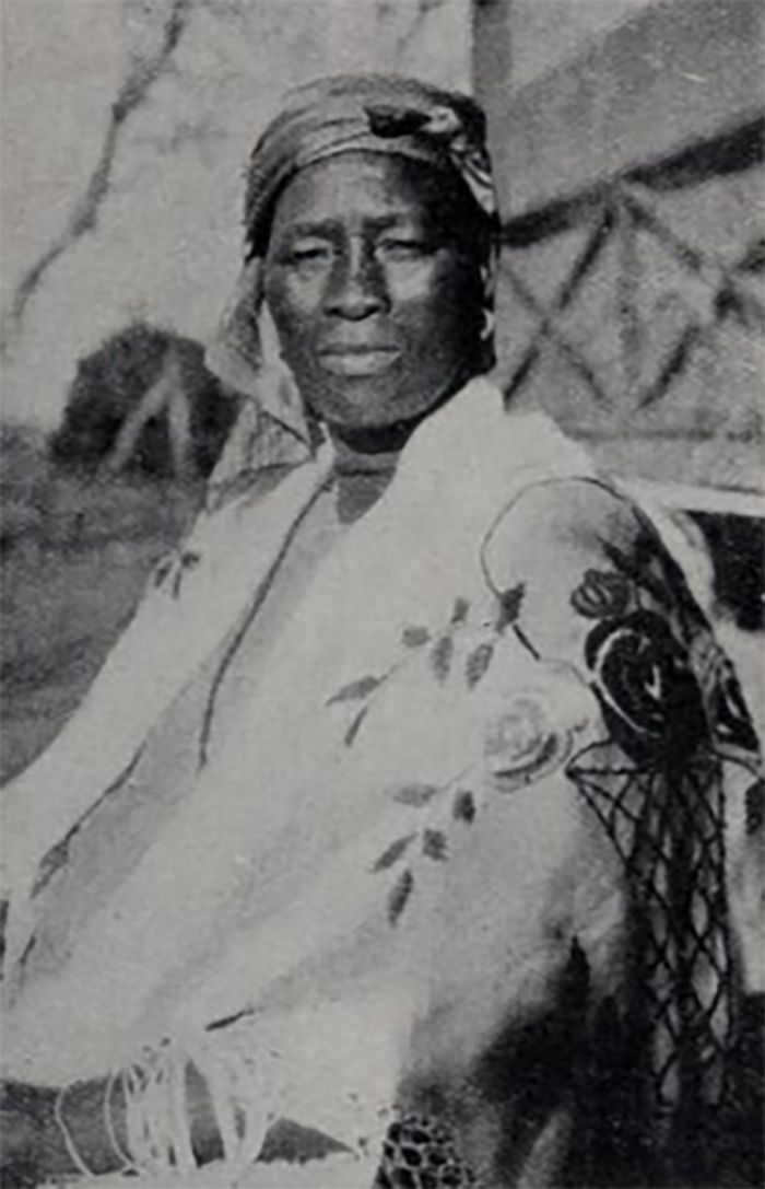
Semane Setlhoko Khama (1881-1937) was mohumagadi (queen mother) of the BaNgwato and fourth wife of Chiefe Khama III (photo: Wikimedia Commons).
During their marriage, Semane and Khama III had five children together, though only two survived childhood: a daughter named Bonyerile and a son named Tshekedi.
After the death of Chief Khama III, in 1923, his son from his first marriage, Sekgoma II, became the new chief. Semane remained in the royal household, but her position became much less prominent.
When Sekgoma II became ill not long after he became chief, Semane became his nurse, but this caused conflict in the household, as the chief's sisters wanted him treated by traditional healers, while Semane used modern medicine. When Sekgoma died in 1925, Semane was accused of causing his death and she narrowly avoided being lynched.
The Three Dikgosi monument in Gaborone, Botswana, The statues commemorate (from left to right) Khama III, Sebele I, and Bathoen I (image: Wikimedia Commons).
Tshekedi Khama (regent-chief: 1926-1959)
The son of Khama III and his fourth wife, Semane Setlhoko Khama, Tshekedi Khama became the regent-king of the Bamangwato after the death of Sekgoma II.
The heir to the chieftainship was Sekgoma's son, Seretse, who became the new kgosi (king/chief), but who was only 4 years old at the time and too young to rule. As a result, Tshekedi, who was Sekgoma's younger step-brother, was named regent and guardian of Seretse until Seretse reached adulthood and could rule.
Tshekedi was initially named as heir by his father Khama III (over Sekgoma II), but this was later set aside by Khama III and on his death, Sekgoma II had ruled, albeit for only a short time.
Tshekedi was born in Serowe and educated at Lovedale, a Church of Scotland Christian school in the Cape Province. He later enrolled at the South African Native College (now called the University of Fort Hare in the Eastern Cape of South Africa).
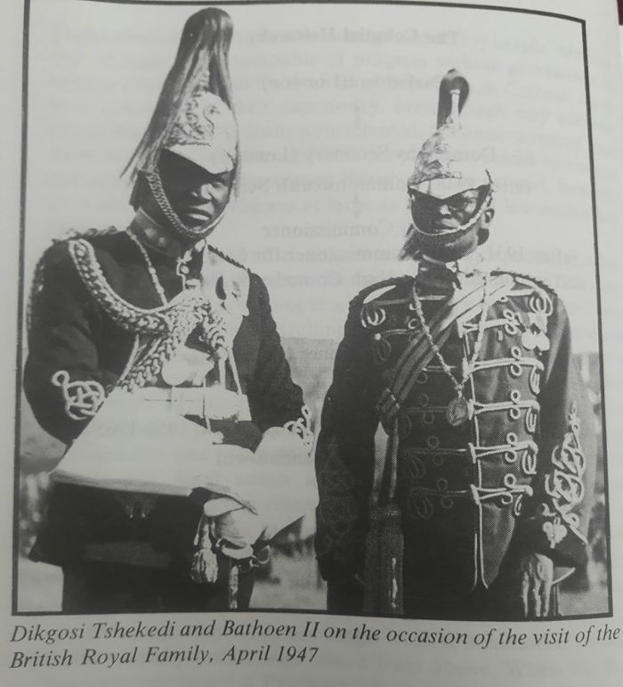
Regent-chief Tshekedi Khama and Chief Bathoen II on the occasion of the visit of the British Royal Family in April 1947 (image: Wikimedia Commons).
The McIntosh Incident (August 1933)
During the early period of Tshekedi's regency, there were numerous white men living and working in the Bechuanaland Protectorate and many had personal relationships with Bamangwato women, some resulting in pregnancies out of wedlock. Tshekedi was profoundly disturbed by this and considered it wrongful of the white men to behave this way and made numerous complaints to the resident British magistrate, but to no avail.
In August 1933, a young white trader named Phineas McIntosh injured a Bamangwato youth when the two quarreled over a young Bamangwato girl. McIntosh was a known troublemaker in Serowe, often drinking and rabble rousing and Tshekedi felt that because no actions were taken, despite repeated complaints to the magistrate, that he would try McIntosh at the tribal kgotla (a traditional public community meeting used to solve disputes in the tribe).
The tribe found McIntosh guilty and sentenced him to flogging, which was the usual punishment given to young men who misbehaved. Most of the white population living in Serowe supported the punishment, but Sir Charles Rey, the British Resident Commissioner of the Protectorate removed Tshekedi as regent. Per British law, no native authority could try a white person, so Tshekedi was put on trial, deposed, and exiled from Serowe, leaving the Bangwato tribe without a kgosi (chief).
The British attempted to install a new chief, but the Bamangwato refused to accept the situation and demanded that Tshekedi be reinstated. Eventually the British relented and Tshekedi was officially reinstalled as regent.
Informative signboard describing the 'kgotla' at the National Museum of Botswana in Gaborone (image: Wikimedia Commons).
Seretse Khama
Seretse Khama was born in 1921 in Serowe and was the eldest son of Chief Sekgoma II and Queen Tebogo. As discussed above, Seretse became the kgosi (king) of the Bamangwato people at the age of four years when his father died. Sekgoma II was only chief for two years before he died.
As Seretse was a child king, his uncle Tshekedi Khama was appointed as Seretse's regent and guardian until the time when Seretse was of age to rule.
The name 'Seretse' means "the clay that binds" and he was so named to signify the reconciliation between his father (Chief Sekgoma II) and his grandfather (Chief Khama III) that occurred just before his birth.
Khama III had exiled his son over disagreements and Sekgoma II had been gone for ten years, governing his own branch of the Bangwato. However, Chief Khama III invited Sekgoma II and his followers to come back to Serowe. The reconciliation meant that Sekgoma II was again next in line to become kgosi and cemented Seretse himself as a future chief when it was his turn.
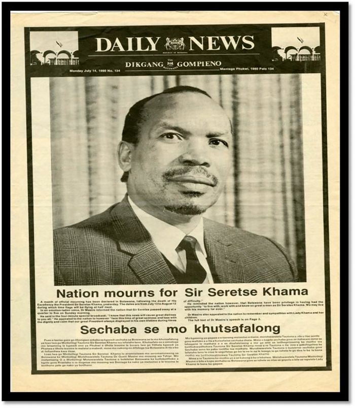
An article in the Daily News after the passing of Seretse Khama in July 1980 (image: Wikimedia Commons).
Seretse attended school at the Tiger Kloof Educational Institute near Vryburg in present-day South Africa. Tiger Kloof was part of the educational endeavors of the London Missionary Society.
Seretse then attended Fort Hare University College in the Eastern Cape, graduating with a B.A. in 1944. Fort Hare was an educational facility for black Africans between 1916 and 1959, offering a Western-style education to students across Southern Africa and is the alma mater of other well-known Africans like Nelson Mandela, Desmond Tutu, and Oliver Tambo.
After graduation from Fort Hare, Seretse traveled to the United Kingdom, where he studied for a year at Oxford's Balliol College. In 1946, he joined the Honourable Society of the Inner Temple in London to study law. The Inner Temple is one of four Inns of Court responsible for training, regulating, and selecting barristers within England and Wales. These Inns are the only bodies allowed to call a barrister to the Bar and allow him or her to practice law.
A bust of Sir Seretse Khama at the National Archives and Records of Botswana in Gaborone (photo: Wikimedia Commons).
Marriage and Exile
In 1946, Seretse met a white Englishwoman named Ruth Williams. The two were introduced by Ruth's sister at a university dance organized by the London Missionary Society. Seretse was the first black man to whom Ruth had ever spoken. Both were avid fans of jazz music and they developed a romantic relationship. After a year of courtship, they announced their plan to be married.
In 1948, Seretse wrote his uncle (Tshekedi, the acting regent in Seretse's place) to declare his intent to marry Ruth. Tshekedi opposed the planned marriage on the grounds that a kgosi of the Bangwato could not simply marry whomever he wanted, as he was the servant of his people. Traditionally, the chief's wife would be chosen by the tribal elders, but Seretse was adamant that he would marry his chosen partner.
South Africa's apartheid-based government, headed by Daniël François (D.F.) Malan had banned interracial marriages and vehemently opposed having an interracial couple ruling in the Bechuanaland Protectorate across their northern border.
Daniël François Malan, leader of South Africa's apartheid regime, was instrumental in getting Seretse Khama banned from Bechuanaland (photo: Wikimedia Commons).
The South African government supplied Great Britain with both uranium and gold at a price far cheaper than available elsewhere. South Africa was able to offer the lower prices due to the fact that these metals were mined by blacks who were paid very low wages.
Britain was heavily in debt after World War II and could not afford to lose the cheap uranium and gold supplies from South Africa. The South African government made it clear that its willingness to continue supplying Britain with gold and uranium was contingent on them stopping the marriage between Seretse Khama and Ruth Williams.
Bowing to the pressures from South Africa, Britain intervened to prevent the interracial marriage. Seretse and Ruth wished to be married within the Church of England, but could not find a priest who was willing to marry them, as the British government was forbidding the union. The couple nonetheless went forward with their marriage and on 29 September 1948, the Seretse and Ruth were wed at the Kensington and Chelsea Register Office in London. The interracial marriage attracted worldwide media attention.
In August 1949, Seretse and Ruth returned to Serowe in Bechuanaland, where Seretse's uncle and acting regent, Tshekedi Khama, informed him that a white woman could not play the role of wife of the king of the Bamangwato people. Tshekedi lobbied the British government, which still controlled Bechuanaland as a protectorate, to either force Seretse to renounce his wife or renounce his claim to the throne.
An Apartheid-era sign in South Africa. South Africa's apartheid policies were the main reason that Seretse and Ruth Khama were banned from their own country (image: Wikimedia Commons).
Despite the opposition by Tshekedi, the arrival of Ruth and Seretse coincided with the onset of the best rainy season in decades, and this was seen as a good omen by the Bamangwato, who began referring to Ruth as the "Rain Queen". The tribe held a series of kgotlas (public meetings) and Seretse was reaffirmed as kgosi (king) of the Bangwato tribe.
Across the border to the south, the apartheid government of South Africa barred the couple from the country, including the town of Mafeking, which at the time was the administrative capital of Bechuanaland. South Africa continued to exert pressure on Great Britain to have Seretse removed from his chieftainship and the British feared that South Africa may take more direct action against Bechuanaland, either via economic sanctions or military invasion.
To appease South Africa, the British government made a judicial investigation into Seretse Khama and specifically as to whether he was fit to be chief of the Bangwato. The findings of the enquiry did not specifically disapprove of interracial marriage and found that Seretse was in fact, completely qualified to rule. However, the study also found that his "unfortunate marriage" prevented good relations with "neighboiring apartheid regimes". The report was ordered by the government to be suppressed.
Mailing cover issued in conjunction with the Royal Visit to Bechuanaland in 1947 (image: Wikimedia Commons).
In March 1950, Seretse was requested to fly to London to meet with British officials. Ruth advised Seretse not to go, later stating that she had a premonition that they may try to keep him there. Also at this time, Ruth was pregnant and wanted to make sure she gave birth in Bechuanaland, as tribal custom dictated that a future king must be born on their land.
After arriving in London, Ruth's premonition came to fruition, as the British officially told Seretse that he was officially exiled from Bechuanaland and must remain in Britain for five years.
The British government offered Seretse one thousand British pounds if he would renounce his claim to the throne, but he refused. In a telegram to Ruth, who had remained in Bechuanaland, he wrote: "Tribe and myself tricked by British government. Am banned from whole protectorate. Love Seretse".
Winston Churchill publicly criticized the ban put on the Khamas, but he later supported it after winning the election in 1951 (image: Wikimedia Commons).
After the birth of her daughter, Ruth and her baby left Bechuanaland to join Seretse in exile in England. Winston Churchill, as the leader of the official opposition party in England, publicly criticized the ban of the Khamas, but changed his mind after winning the 1951 election, when he extended the five-year ban to a lifetime ban.
While in England, the Khamas had another child, this one a son named Ian, who was born in 1953. Ian would later become President of Botswana.
Popular support for Seretse in Bechuanaland continued over the ensuing years while the couple were in England and in 1956, the Bamangwato people sent a telegram to Queen Elizabeth II, asking for a lift of their ban. The queen was sympathetic and allowed Seretse and Ruth to return to Bechuanaland as private citizens, but Seretse had to renounce his claim to the throne.
Back in Bechuanaland, Seretse and Ruth attempted cattle ranching for a time, but soon Seretse became involved in local politics and he was elected to the Tribal Council as secretary in 1957.
Queen Elizabeth II (shown here with her husband, Prince Philip, in Brisbane during the Queen's World tour in 1954) was sympathetic to the Khamas' situation and allowed them to return to Bechuanaland as private citizens in 1956 (photo: Wikimedia Commons).
Independence Movements
Britain disliked spending money on its colonies and from the early 1900s, there was agreement in the British government that the Bechuanaland Protectorate would eventually be transferred to the Union of South Africa. However, global distaste for the apartheid measures being enacted by the South African government in the 1950s led to strong and outward resistance to any combination of British land with that of South Africa. The only option was to move towards an independent Bechuanaland.
Britain was in favor of granting the protectorate its independence and in 1961, a legislative council called the African Advisory Council was created. Seretse Khama and Quett Ketumile Masire, a cattle rancher and aspiring politician, joined the council and began working on drafting an interim constitution to be used prior to official national elections and eventual independence.
The first political party formed in Bechuanaland was the Bechuanaland People's Party (BPP), which was formed in 1960 by Kgalemang Tumediso (K. T.) Motsete and Motsamai Mpho. Motsetse was an accomplished musical composer and Mpho had been tried for treason in South Africa under its Terrorism Act and imprisoned in Pretoria Prison earlier that same year.
Some historians espouse that Mpho was the first to introduce the term 'Botswana' into formal political lexicon, replacing the colonialist name of Bechuanaland. Motsetse wrote and composed the song Fatshe leno la rona, which means "Blessed be this noble land" and is now the national anthem of Botswana.
K. T. Motsete, founder of the Bechuanaland People's Party and writer/composer of Botswana's national anthem (image: Wikimedia Commons).
The BPP advocated for radical changes after independence, including the abolishment of all chiefs, the removal of white people from civil service positions, and the nationalization of some of the land.
In November 1961, Seretse Khama and Quett Ketumile Masire founded the Bechuanaland Democratic Party (BDP) in Lobatse. Khama and Masire finished drafting an interim constitution and the party held its first public meeting in Gaborone on 28 February 1962.
Seretse feared that the opposition BPP party posed dangers to an independent Bechuanaland with its radical agenda and policies. Khama felt that more gradual changes after independence were crucial to the future success of the country.
The partnership and collaboration between Khama and Masire worked well, as together they had links to both the educated elite and the poor rural people of the land. They both campaigned and their more conservative political messages began to win them popularity amongst the populace over the more socialist and Pan-Africanist agenda of the rival parties.
Meanwhile, Great Britain was doing its part to assist Bechuanaland in making preparations for its coming independence. During the first half of the 1960s, the British invested millions of British pounds into Bechuanaland, with much of the funding being used to build a new administrative capital at Gaborone. The previous administrative center was in Mafeking, which lay across the border in South Africa.
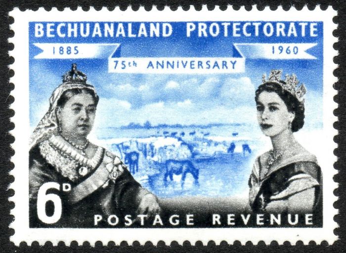
A 1960 postage stamp of the Bechuanaland Protectorate showing British Queens Victoria (left) and Elizabeth (right) (image: Wikimedia Commons).
1965 Elections
On 01 March 1965, the first ever general elections under universal suffrage were held in the Bechuanaland Protectorate. The elections were peaceful and without incident. As most of the people in Bechuanaland were illiterate, voting was conducted using colored symbols, which were placed in envelopes.
The result was a resounding victory for the Bechuanaland Demorcratic Party (BDP), which won 80.4% of the votes. The Bechuanaland People's Party (BPP) came second, with 14.2% of the votes. Seretse Khama of the BDP became the first Prime Minister of Bechuanaland, while Ketumile Masire became Deputy Prime Minister.
A total of 31 Legislative Assembly seats were created for the new government, with the BDP winning 28 seats and the BPP winning the other 3 seats. Some British public servants were maintained in the new government, including the Attorney General and Minister of Finance.
In recognition of his efforts to establish an independent Bechuanaland, Queen Elizabeth II promoted Seretse Khama to Knight Commander in the Most Excellent Order of the British Empire, giving Khama the new title of Sir Seretse Khama, KBE.
The Bechuanaland Legislative Council created in 1964 in preparation for national independence (image: Wikimedia Commons).
Independence (September 1966)
After 80 years of being a British protectorate (since 1885), the Republic of Botswana became an independent country on 30 September 1966. Seretse Khama's title changed from Prime Minister to President, and Ketumile Masire became Vice President.
At the time of its independence, Botswana was officially the third-poorest country in the world, with poor infrastructure and very few formally educated citizens. The country had only 7.5 miles (12 kms) of paved roads, 22 university graduates and 100 secondary school graduates. The population of Botswana at this time was around 550 000.
The national flag of Botswana has remain unchanged since its independence in 1966. The blue represents rain/water, which is highly valued in this mostly arid country, while the black and white has dual meanings: racial diversity and the stripes of the zebra, Botswana's national animal (image: Wikimedia Commons).
Diamonds in Botswana
In April 1967, Botswana's economy was given a significant boost when diamonds were discovered just south of the Makgadikgadi Pans by team of geologists from the De Beers mining company. The diamond mines and small town that resulted is called Orapa, which means "resting place for lions".
In June 1968, the De Beers Botswana Mining Company was formed. Over the next five years, the government of Botswana increased its ownership stake from an initial 15 percent to 50 percent. In March 1992, the name of the company was changed to Debswana Diamond Company Limited (or simply Debswana).
The Orapa mine began production in July 1971 and by year end, had produced 1.4 million carats.
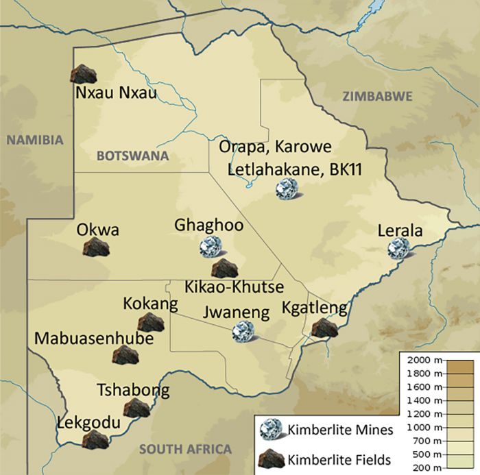
A map showing the locations of kimberlite mines and fields in Botswana (image: Wikimedia Commons).
The Orapa diamond mine is now the largest diamond mine by area in the world. Additional diamond pipes were discovered since the original one at Orapa, and today Debswana operates four diamond mines in Botswana: Orapa, Letlhakane, Jwaneng and Damtshaa.
The Lucara Diamond Corp., a Canadian mining company also operates mines in Botswana, including two at Karowe, located just south of Orapa.
Several extraordinary rough diamonds have been discovered in the Botswana mines, including the 'Sewelô' (1 758 carats/Karowe mine, third-largest rough diamond on record), the 'Lesedi La Rona' (1 098 carats/Jwaneng mine; third largest gem quality on record), and the 'Constellation I' (813 carats/Karowe mine; cut into the largest ever D-color polished stone at 313 carats). The 'Cullinan' diamond, discovered in 1905 in present-day South Africa, remains the largest gem-quality rough diamond ever discovered, weighing 3 107 carats.
Since the initial discovery of diamonds at Orapa, Botswana has become the world's largest producer of diamonds by value, with most of its production being of gem quality.
The nine major stones cut from the rough Cullinan diamond (image: Wikimedia Commons).
Seretse Khama Presidency (1966-1980)
Seretse Khama was President of Botswana from 1966 until his death on 13 July 1980. After being elected as the first Prime Minister of Bechuanaland in 1965 (which became President of Botswana in 1966), Khama's Botswana Democratic Party (BDP) remained in power until his death while still in office.
The Botswana Constitution states that general elections shall be held every five years. Following independence, the BDP and Seretse Khama won successive national elections, maintaining at least three-quarters of the National Assembly seats each time as follows:
- 1965 Bechuanaland general elections: BDP won with 80.4% of votes (28 of 31 Assembly seats, Seretse Khama President);
- 1969 Botswana general elections: BDP won with 68.2% of votes (24 of 35 Assembly seats, Seretse Khama President);
- 1974 Botswana general elections: BDP won with 76.6% of votes (27 of 36 Assembly seats, Seretse Khama President);
- 1979 Botswana general elections: BDP won with 75.2% of votes (29 of 36 Assembly seats, Seretse Khama President).
A Daimler limousine used by Sir Seretse Khama after becoming Botswana's first president (image: Wikimedia Commons).
During Seretse Khama's 15 years of Prime Minister/President, Botswana's financial situation improved dramatically, due initially to the discovery of rich diamond deposits in 1967 (see above).
Khama used the capital earned from the sale of diamonds to transform Botswana into a global export-based economy focused on diamonds, copper, and beef. As of 2017, Botswana is the world's second largest producer of diamonds after Russia.
During the 1970s, Botswana experienced strong economic growth, averaging around 12% per annum and basic infrastructure in the country was vastly improved. The government also invested heavily to improve its health care and education systems.
The cattle industry was also given significant assistance under Khama, with substantial subsidies given to veterinary services, vaccines, and cattle fencing. The country's sole slaughterhouse was nationalized and two more were constructed.
The Botswana Meat Commission was created as the sole seller of beef, allowing the government to set prices and control its sales on the international market. Khama was directly involved with a lucrative deal for beef exports with the European Economic Community (EEC), relieving the country from full dependence on sales to South Africa.
Statue of Seretse Khama in Gaborone, Botswana (image: Wikimedia Commons).
Despite Botswana's very positive economic gains during Khama's presidency, the country was still bordered by apartheid regimes in South Africa and Namibia, while to its east, Rhodesia was in the midst of a civil war. Refugees from these countries were accepted by Botswana, but Khama dod not permit factions from outside the country to use Botswana for a base of operations for any resistance movements.
Unlike so many of the other newly independent countries in Africa, Botswana managed to remain free of corruption under Khama's presidency. As of 2020, Botswana has consistently ranked as the least corrupt country in Africa since its independence according to the corruption perception index (CPI).
In 1970, the government-owned Botswana Development Corporation (BDC) was established as the country's main agency for commercial and industrial development and to attract foreign investment in the country.
In August 1976, the government introduced the country's first national currency, called the 'Pula', replacing the South African Rand at par.
In 1976, Botswana issued its first national currency, the Pula. The banknotes included an image of their first president, Seretse Khama.
Khama focused the government's budget on improving economic development and very little of the national budget was spent on defense, with only a small military police force maintained for security in place of a national army. This changed after numerous cross-border incursions by South African and Rhodesian security forces in the mid-1970s. Anti-apartheid groups from South Africa used Botswana as a safe refuge and this led to raids into Botswana by the South African Defence Force (SADF).
The Botswana Defense Force (BDF) was established in 1977 as a small professional military unit. The BDF began patrolling Botswana's border with Zimbabwe during the latter part of the Rhodesian Bush War, as well as the southern border with South Africa.
During the late 1970s, Seretse Khama's heath was deteriorating and he suffered from kidney and heart problems. He had long been a diabetic and in 1976, Khama had surgery in Johannesburg to install a pacemaker. He frequently flew to London, England for various treatments. In June 1980, while in London, Khama was diagnosed with terminal pancreatic cancer and he died on 13 July 1980. Seretse Khama served 15 years, 194 days as head of government in Bechuanaland and Botswana.
On 18 July 1980, as per the Constitution, Vice President Quett Masire was elected by the National Assembly as the second President of Botswana. Lenyeletse Seretse was appointed Vice-President to placate his fellow Northerners following the ascension of Southerner Quett Masire to the Presidency.
Botswana's national coat of arms. Two zebras (the national animal) hold a traditional African shield. On the shield are three cogwheels (representing industry), three waves (representing water, a scarce and valued resource), and the head of a bull (cattle herding is also of great importance). The zebra on the right holds an ear of sorghum, an important crop, while the zebra on the left holds an elephant tusk, showing the value placed on these animals. At the bottom is a blue banner with the Setswana word 'PULA', which has several meanings, including "rain", "water", and "good luck" (image: Wikimedia Commons).
Quett Masire Presidency (1980-1998)
After the death of President Seretse Khama, Quett Masire, who had co-founded the Botswana Democratic Party (BDP) with Khama, became the second President of Botswana.
Background
Ketumile Quett Joni Masire was born on 23 July 1925 in Kanye, Botswana, just southwest of Gaborone. Masire's family was involved in cattle herding. The young Masire excelled in academics, winning a scholarship to attend the Tiger Kloof Educational Institute in South Africa.
In 1950, after graduating from Tiger Kloof, Masire helped found the Seepapitso II Secondary School, the first institution of higher learning in the Bangwaketse Reserve. He served as headmaster at Seepapitso for six years.
In 1958, Masire was elected to the Bangwaketse Tribal Council and in 1960, the protectorate-wide African and Legislative Councils.
In 1961, Masire helped found the Botswana Democratic Party (BDP) with Seretse Khama. In the 1965 Bechuanaland general elections, the BDP won a resounding victory and Masire became Deputy Prime Minister of Bechuanaland under Seretse Khama. Upon the country's independence, Masire's title became Vice-President of Botswana and he remained as VP until President's Khama's death in 1980, whereupon Masire became President.
Quett Masire visiting the Dutch Royal Family at 'Paleis Lange Voorhout' in The Hague, Netherlands, in 1980 (photo: Wikimedia Commons).
Presidency
Masire was reelected three times after assuming the Presidency in 1980, as follows:
- 1984 Botswana general elections: BDP won with 68.0% of votes (29 of 38 Assembly seats, Quett Masire President);
- 1989 Botswana general elections: BDP won with 64.8% of votes (31 of 38 Assembly seats, Quett Masire President);
- 1994 Botswana general elections: BDP won with 54.7% of votes (27 of 44 Assembly seats, Quett Masire President).
Following the 1991 census, constituency boundaries were redrawn and six new constituencies/Assembly seats were created, increasing the size of the National Assembly from 38 to 44 seats.
Masire's three-plus terms as President continued to build upon the economic and infrastructural improvements set in motion by Seretse Khama's government, of which Masire was a key component and architect.
During his lengthy term in office, Masire served as Chairman of the Southern African Development Community (from 1980-1989), Vice-Chairman of the Organisation of African Unity, Co-Chairperson of the Global Coalition for Africa, and a member of the United Nations Africa Development Group.
Quett Masire prepares to depart the USA after a state visit with President Ronald Reagan in May 1984 (photo: Wikimedia Commons).
During the 1980s, President Masire continued to accept refugees from neighboring countries, in particular from South Africa, where the white apartheid regime continued to discriminate against people of color. The African National Congress (ANC) was an active anti-apartheid faction fighting against the white South African government, but Masire continued to deny the ANC safe harbor in Botswana.
Although Botswana was calling for an end to apartheid, it was economically dependent on South Africa and could not afford to apply the economic sanctions that were widely being applied by other countries.
During the 1980s, relations between Botswana and Robert Mugabe's government in Zimbabwe were amiable, yet standoffish. In early 1980s, Mugabe's ruthless persecution of Zimbabwean citizens living in Matabeleland (which borders northeastern Botswana) led to a flood of refugees into Botswana.
In 1989, Botswana revoked the refugee status of Zimbabweans living in Botswana and expelled most of the refugees, though many remained in Botswana illegally.
During 1985-86, South African troops conducted raids on alleged ANC offices located in Gaborone, but this proved to be the last of the tensions between Botswana and the apartheid regime in South Africa, as the early 1990s saw the release of Nelson Mandela from prison and his ascension to the Presidency of South Africa.
Ketumile (Quett) Masire, at the Free Market Foundation (FMF) ceremony in Johannesburg, South Africa, where he received the "Free Market Award" in 2000. Shown are (from left to right): Masire, Leon Louw (FMF Executive Director), and Nelson Mandela (former President of South Africa) (photo: Wikimedia Commons).
Botswana National Front
By the early 1990s, the Botswana National Front (BNF) had long been the main opposition party in Botswana, but had never seriously challenged the Botswana Democratic Part (BDP) in the national elections.
The BNF was traditionally a regional party associated with the Ngwaketse tribe since its formation in 1965, but by the late 1980s, it had gained support in other regions throughout Botswana. In 1984, the BNF gained control of the Gaborone constituency, as well as other urban councils, winning 5 of 34 elected Assembly seats.
Prior to the 1994 general elections, the BNF adopted the motto "Time for Change", campaigning on the basis that the longstanding BDP was responsible for the general decreased standard of living and rising level of AIDS in Botswana.
In the October 1994 general elections, the BNF won almost 37% of the vote and secured 13 seats in the Assembly. The BNF was most popular in urban areas, while the winning BDP continued to have the support of the rural constituencies. The election results were the closest ever since Botswana's independence.
In the early 1990s, the number of urban constituencies in Botswana had increased to 8 out of the 40 electable seats (from 2 out of 31 in 1965), and this was the key to the BNF increasing its representation in the government. The BNF campaigned as the champion of the urban citizens and vowed to look after their interests.
The Botswana National Football (Soccer) Team, The Zebras, shown here sometime in the 1980s (photo: Wikimedia Commons).
Tourism Growth (1990s)
Botswana's tourism industry began to develop rapidly in the early 1990s and particularly after the official end of the apartheid regime in South Africa in 1994.
While commercial hunters had been coming to Southern Africa, including Botswana, for decades, the advent of photographic tourism led to huge growth in the tourism sector for the region during the 1990s.
Botswana implemented a tourism policy that was aimed at attracting upmarket international visitors from North America, Europe, Australia, and New Zealand. Northern Botswana, and in particular the Okavango Delta, was gradually opened up to tourism, with revenues shared by safari companies, local communities, and the Botswana government.
One of the first photographic safari camps built in Botswana's Okavango Delta. Image of Mombo Camp in the Moremi Game Reserve, September 1996 (Copyright © James Weis).
Land concessions managed by the government and/or local communities gradually shifted from hunting to ecotourism and new safari camps proliferated. The beauty of and relatively untouched wilderness of much of Northern and Central Botswana, combined with a very small rural population and plenty of wildlife gave Botswana all it needed to capitalize on the growing global demand for eco-travel.
Land concessions were leased to safari operators, mainly from South Africa, who built safari camps and lodges and marketed photographic safaris to a global network of travel agents. Tourist numbers were kept low, but this was offset by generally higher pricing than other safari destinations in Africa. Botswana soon became known as the destination for 'exclusive' safaris.
The Botswana Defense Force (BDF), which serves as the country's only military force, is responsible for anti-poaching operations to protect the country's valuable wildlife, which is crucial for its tourism revenue.
Local people were hired by the safari companies as guides, and camp staff, but most higher-paying management positions in Botswana's tourism industry were reserved for expatriate workers, many from South Africa and other Commwealth countries.
Today, the tourism sector contributes around 13% of Botswana's Gross Domestic Product and accounts for about 9% of employment.
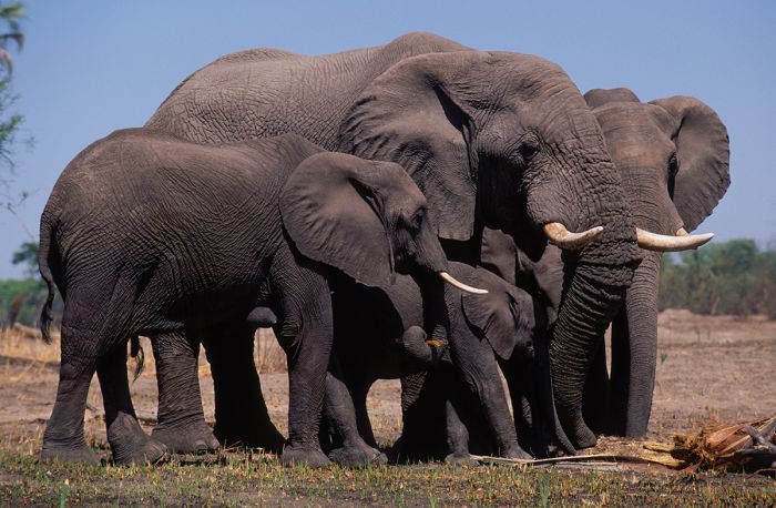
Elephants feeding on a palm tree in the Okavango Delta, October 1999 (Copyright © James Weis).
Constitutional Reform (1995-97)
In January 1995, the almost always peaceful country of Botswana experienced rare civil unrest in Mochudi, close to Gaborone. In response to a highly publicized ritual murder of a young girl, youths demonstrated against the release of the suspects that had been detained. A subsequent march by university students on the parliamentary buildings in Gaborone turned violent and was met my excessive force by the BDF, who killed one demonstrator.
The uprising ended after a few days, but it highlighted to President Masire that many people felt frustrated, particularly young people and those living in urban areas.
In response to the unrest, President Masire established an independent electoral commission to address multiple issues underlying the demonstrations. In May 1996, a special conference was attended by the BDP and all opposition parties to discuss various amendments to the constitution.
Botswana 150 pula gold coin, issued 1978. A brown hyena is on the front and the Botswana coat of arms on the facing side.
The resulting agreed upon changes to the Constitution included a reduction in the voting age from 21 to 18, a limit to the tenure of the country's president to a maximum of 10 years (two 5-year terms), the elimination of non-elected parliamentary members nominated by the ruling party, the automatic appointment of the Vice-President to the presidency should the President leave office, and allowing citizens living abroad to vote.
The ruling BDP realized that these reforms were risky, but crucial if it wished to make electoral gains in Gaborone and other urban areas, particularly amongst the urban youth.
The proposed constitutional amendments were put to a referendum in October 1997 and the changes passed.
In March 1998, President Masire stepped down as President of Botswana and his Vice-President, Festus Mogae succeeded him as Botswana's third president.
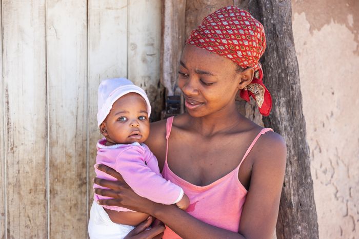
A young mother with her baby in rural Botswana.
Festus Mogae Presidency (1998-2008)
Background
Festus Mogae was born in 1939 in Serowe and later matriculated at Moeng College. He studied economics at University College of Oxford and the University of Sussex. After completing his studies abroad, Mogae returned to Botswana where he held various civil servant positions.
Mogae served in Washington, DC as Alternate and Executive Director of the International Monetary Fund for Anglophone Africa from 1976 to 1980. He returned home to Botswana in 1980 and held the position of Governor of the Bank of Botswana from 1980 to 1981.
Mogae was appointed Minister of Finance and Development Planning in 1989 and served as Botswana's Vice President from 1992 until 1998 under President Quett Masire. He was also Director and later Chairman of the Botswana Development Corporation and Director of the De Beers Botswana Mining Company.
Newly elected President, Festus Mogae, being sworn in, April 1998 (photo: Wikimedia Commons).
Presidency
After serving out the remainder of his predecessor's term as Presdeint, Mogae's Botswana Democratic Party (BDP) retained power in the 1999 general elections, winning 57.15% of the vote and 33 of 44 Assembly seats. The Botswana National Front (BNF) was the main opposition, winning 25.95% of the vote and 6 seats.
The 1999 elections were low key, with campaigns focused on unemployment, poverty, and the AIDS epidemic. Opposition candidates criticized the incumbent BDF as being too complacent and saying that the country needed new leadership.
President Mogae's first full term as President was mostly uneventful on a national level, with his administration focusing on combating poverty, unemployment and the spread of HIV-AIDS in the country, which he pledged to end by 2016.
Botswana President Festus Mogae with USA President George W. Bush in the Oval Office, June 2005 (photo: Wikimedia Commons).
The 2004 general elections again saw the BDP victorious, but with a narrow majority of only 51.7% of the votes. They did however manage to retain 44 of the 63 seats in the National Assembly. The BNF again came second, winning 26.1% of the vote and doubling its seats on the assembly (from 6 to 12).
Fifty-six of the 57 constituencies were contested, with Vice-President Ian Khama running unopposed in the Serowe North constituency.
The BDP campaigned on promises to expand electricity and water availability, unemployment, and discrimination against women. The opposition candidates campaigned on poverty and unemployment.
In July 2007, President Mogae announced that he would resign as President nine months later and on 01 April 2008, he stepped down and was succeeded in office by his Vice-President, Ian Khama.
Former President of Botswana, Festus Mogae, in 2009 (photo: Wikimedia Commons).
Ian Khama Presidency (2008-2018)
Background
Ian Khama (full name: Seretse Khama Ian Khama) was born in 1953 and is the second child of Botswana's first president, Sir Seretse Khama and Ruth Williams Khama.
Ian was born while his mother and father were living in England, having been exiled from Botswana due to opposition to their interracial marriage from both the British colonial government and apartheid regime in South Africa.
Ian's blood heritage comes from the lineage of Bamangwato chiefs, including Sekgoma II (his grandfather), Khama III (his great-grandfather), and Kgosikgolo Sekgoma I (his great-great-grandfather). He is named Ian Seretse Khama to differentiate him from his father of the same name, "Seretse", which means “the clay that binds together”, a name given Ian's father to celebrate the recent reconciliation between his father and grandfather at that time.
Ian's brother is Tshekedi Khama II, who was named for their great-uncle, Tshekedi Khama I, who was the regent and guardian for Ian's father Seretse from the time he became a child chief/king.

Botswana Vice President, Ian Khama (left), meets with U.S. Army General William Ward, Commander of the U.S. Africa Command, during the general's visit to Gaborone, Botswana in December 2007. Also shown is U.S. Ambassador to Botswana, Katherine Canavan (photo: Wikimedia Commons).
Ian graduated from Waterford Kamhlaba United World College of Southern Africa in Swaziland. Ian later attended the Royal Military Academy Sandhurst, one of several military academies in the United Kingdom and the British Army's initial officer training centre, where he became a qualified pilot.
In 1977, at the age of just 24 years, Ian was appointed the position of Brigadier General in the newly formed Botswana Defense Force (BDF) during his father's presidency. In 1989, Khama was appointed Commander of the BDF, a position he held until his retirement from the army in 1998 to enter politics.
In December 1997, Ian Khama announced that he would retire from his command of the BDF in March 1998 to coincide with the planned retirement of then-President Quett Masire. Ian's announcement fueled speculation that he may be planning to enter politics.
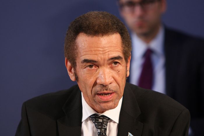
President Ian Khama in 2014 (photo: Wikimedia Commons).
On 01 April 1998, President Masire succeeded Mogae as President of Botswana and Ian Khama was immediately appointed as the country's new Vice-President. However, as Khama did not hold a seat in the National Assembly, he was not permitted under the Constitution to immediately take office as VP.
A special election was held in the Serowe North constituency and Ian was overwhelmingly elected, giving him a seat on the Assembly, whereupon he took office.
By taking an official position in the government, Ian effectively renounced his unclaimed hereditary chieftaincy of the Bamangwato people, as Constitutional monarchs in Botswana are legally barred from taking part in politics. Nevertheless, many of the Bamangwato people still consider him their Kgosi (chief).
After the 1999 general election, with President Mogae being reelected, Ian Khama remained as Vice-President, as well as holding the cabinet position of Minister of Presidential Affairs and Public Administration.
In July 2003, Khama was elected as Chairman of the Botswana Democratic Party (BDP), paving the way for him to eventually succeed Mogae as President.
President Ian Khama with Quentin Bryce, Governor-General of Australia, on her arrival at the airport in Gaborone, Botswana, in March, 2009 (photo: Wikimedia Commons).
Interim Presidency (2008-09)
Upon succeeding his predecessor, President Ian Khama announced changes to the cabinet, including the appointment of Mompati Merafhe, the acting Minister of Foreign Affairs and a retired Lieutenant-General in the BDF, as Vice-President.
Although Khama declared that he would not make radical changes to policy, he announced his desire to impose a 70 percent levy on alcohol sales in Botswana to combat the excessive drinking. The plan was met with widespread opposition from the brewing industry and bars and other drinking establishments, so the eventual levy imposed was reduced to 30 percent.
First Term (2009-2014)
In the 2009 general elections, the ruling Botswana Democratic Party (BDP) won with 53.3% of the vote and 45 of 63 Assemble seats. The main opposition Botswana National Front (BNF) won 21.9% of the vote and 6 seats. Voter turnout was 76.7% and the elections were deemed free and fair.
In July 2012, Vice-President Mompati Merafhe was forced to retire due to ill health. He was succeeded by Ponatshego Kedikilwe, an MP and current Minister of Minerals, Energy, and Water Resources.
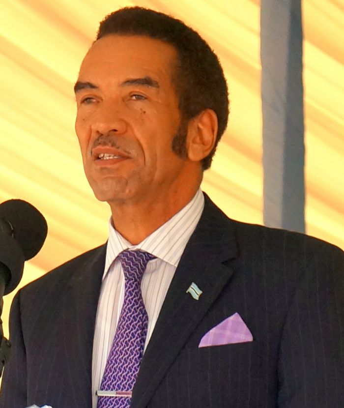
President Ian Khama in 2013 (image: Wikimedia Commons).
Hunting Ban (2014)
In 2014, President Khama imposed a country-wide ban on killing elephants to protect them from trophy hunters and ivory poachers. The move also included a ban on all trophy hunting. Concurrently, President Khama also implemented a "shoot-to-kill" policy with regards to anti-poaching measures, giving the Botswana Defense Force (BDF) license to shoot anyone caught or suspected of poaching.
The ban and anti-poaching policy received worldwide recognition and were applauded by animal welfare organizations, but in rural areas like Kasane, a small town on the Chobe River in far Northern Botswana, the move was not as popular. Many people in the hunting industry lost their source of income and farmers were now defenseless against elephants eating their crops, which led to increased human-elephant conflict.
At the time of the ban on hunting elephants, tourism was (and still is) Botswana's second highest source of foreign revenue after diamond mining.
Under Khama's presidency, the BDF engaged in numerous gunfights with armed poachers his shoot-to-kill policy served as a major deterrent to poaching in Botswana. (Note that Khama's successor, Mokgweetsi Masisi, lifted the ban on killing elephants and trophy hunting soon after taking office in 2018).
Ian Khama with other delegates at the London Conference on the Illegal Wildlife Trade in February 2014. Shown are (from left to right): President Idriss Deby of Chad, President Kikwete of Tanzania, President Ian Khama of Botswana, President Ali Bongo Ondimba of Gabon, Minister of Foreign Affairs of Ethiopia Dr Tedros Adhanom Ghebreyesus, and U.K. Foreign Secretary William Hague (photo: Wikimedia Commons).
Second Term (2014-2018)
The BDP won its eleventh consecutive general elections and Ian Khama was reelected as President. The BDP's representation in the Assembly fell from 45 of 63 seats to 37 seats, while winning just 46.45% of the vote.
The main opposition was the Umbrella for Democratic Change (UDC), formed in 2012 by combining three opposition parties: the Botswana National Front, the Botswana People's Party and the Botswana Movement for Democracy. The UDC won 30.0% of the vote and 17 seats in the Assembly.
President Khama appointed Mokgweetsi Masisi as Vice-President, replacing the prior and interim VP, Ponatshego Kedikilwe.

President Ian Khama (seated left, facing camera) during his state visit to Chile, shown with Chilean President Michelle Bachelet (seated right, facing camera) at the Palacio de la Moneda in July 2017 (photo: Wikimedia Commons).
During Ian Khama's tenure as President, he focused on diversifying Botswana's economy away from its over-reliance on diamonds and beef exports by growing other sectors, including agriculture and tourism. Botswana still receives around US$3 billion per year from the sale of diamonds.
In March 2018, in accordance with Botswana's Constitution which limits the President to a maximum of 10 years in office, President Khama stepped down as President and Vice-President Mokgweetsi Masisi was sworn in as interim President.
After stepping down as president, Ian Khama remained active in politics, leaving the BDP and joining the Botswana Patriotic Front (BPF), for whom he campaigned in the 2019 general elections. Khama also became a Director Emeritus of the USA-based Conservation International environmental organization.
Ian Khama pictured on a 10-Pula Botswana banknote, issued in 2018.
Mokgweetsi Masisi Presidency (2018-present)
Background
Mokgweetsi Masisi is the son of the late Edison Masisi, a long-time member of Parliament from the Moshupa constituency. As a young man, Masisi participated in theatre, playing the lead role in a Gaborone production of Cry the Beloved Country and has had roles in several South African films.
He graduated from the University of Botswana in 1984, with a degree in English and History. After graduation, Masisi worked as a teacher at Mmanaana Secondary School and later as a curriculum development specialist at the University of Botswana.
In 1989, Masisi attended Florida State University in the USA, where he earned a Master's degree in social sciences education. He later returned to Botswana, where he took a job working for UNICEF.

Botswana President Mokgweetsi Masisi at the United Nations World Investment Forum in 2018 (photo: Wikimedia Commons).
Politics
In 2004, Masisi sought the nomination of the ruling Botswana Democratic Party (BDP) to stand in the Moshupa constituency, but was defeated. He sought the same nomination in the 2009 general election and won the seat on the Assembly, where he was appointed Assistant Minister for Presidential Affairs and Public Administration in October 2009.
In the 2014 general elections, Masisi was reelected and was appointed Minister of Education and Skills Development. President Ian Khama selected Masisi as his Vice-President after the elections and he was approved by the National Assembly.
Masisi lifted the controversial ban on elephant hunting put in place by his predecessor and also removed the country's "Shoot to Kill" anti-poaching policy. In 2019, Masisi presented foot stools made from elephant feet to the national leaders of Namibia, Zambia and Zimbabwe, a move that earned him international criticism.

Botswana President Mokgweetsi Masisi with Robert Barchi, President of Rutgers University, while at a football game in September 2018. The University of Botswana and Rutgers University have formed a partnership to help improve Botswana’s health care system (photo: Wikimedia Commons).
Read More...
Botswana Independence, Bechuanaland, Diamonds, Dynasties, Early History, Festus Mogae, Hunting Ban, Ian Khama, Independence Movements, Jameson Raid, Khama the Great, Mfecane, Mokgweetsi Masisi, Quett Masire, Sekgoma II, Semane Setlhoko Khama, Seretse Khama, Seretse Khama Presidency, Tourism Growth, Tshekedi Khama, Tswana
Great Good Fair Poor
- Jan
- Feb
- Mar
- Apr
- May
- Jun
- Jul
- Aug
- Sep
- Oct
- Nov
- Dec
The chart directly above should be taken as a very rough overall indicator of best times to visit Botswana, as there are variations regionally. More information on the specific national parks and reserves is found on the previous Details tab. Click on a Region Link above to read more about best times to visit a specific region or destination.
Year-Round Destination
Botswana is a year-round destination but it does experience seasonal climatic changes as it sits at the southern end of the tropics.
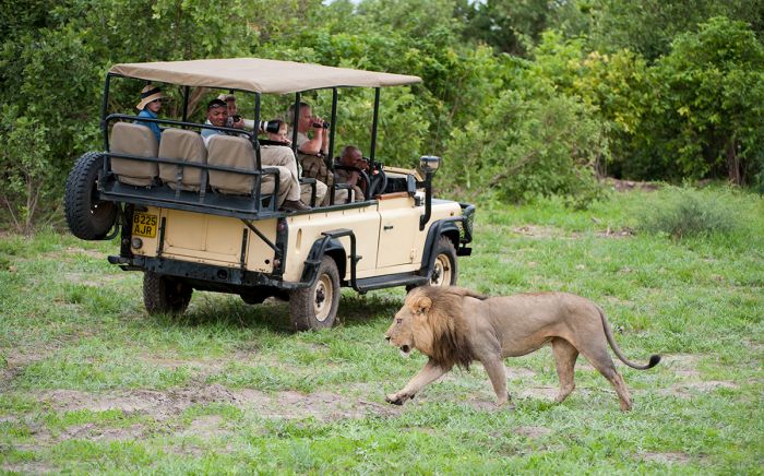
Male lion and safari vehicle; image taken in December (Copyright © James Weis).
The rains generally start sometime in mid-November and continue until late March or early April. Most of the rains are sporadic showers up until January, when heavier rain systems often occur. By May the rains are mostly gone. Overall humidity is very low, as Botswana is mostly covered by the Kalahari Desert sands.
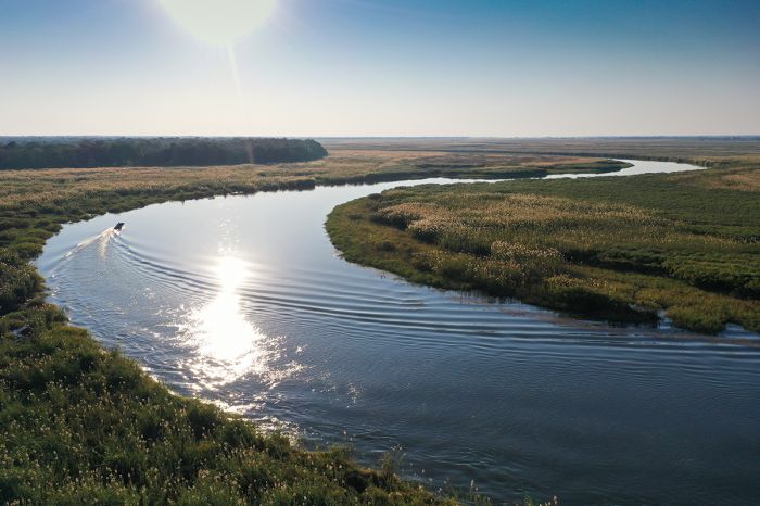
The main Okavango River in what is called "the Panhandle", before it spreads out into the Okavango Delta.
Winter
The winter months of May-July are typically very dry, with little to no rainfall. Early morning temperatures can be very chilly at 30-40°F (-1 to 5°C) while overnight temps can drop below freezing. However, afternoons in the winter warm up to 75-80°F (24-26°C). Game viewing is excellent during this time.
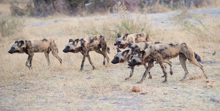
African wild dogs hunting; image taken in October (Copyright © James Weis).
SPRING
The springtime months of August to October are generally the busiest for safari tourism, with most camps and lodges at or near capacity. Rains are usually nonexistent and temperatures are warm in the mornings. October can be extremely hot, dry and dusty until the coming rains (usually November) arrive. Game viewing is at its best during this time.
Although the local rains are long gone during Botswana's winter, the permanent rivers and channels of the Okavango Delta are at their highest levels during the months of June-August. This is because rainwater from far north in the Angola highlands finally arrives and pours into the Okavango depression, creating a stunning contrast of flowing 'flood' water in a dry environment.
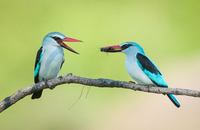
The springtime is a very good time to visit Botswana. One of the highlights is the arrival of untold numbers of migratory birds, like these woodland kingfishers, that arrive to breed (Copyright © James Weis).
SUMMER
The summer months of November to January coincide with the rains. Clouds begin to build in November and the first rains bring fresh grass and flowers to the dry and dusty land at the end of winter. Occasional afternoon showers become more regular and morning temperatures range from around 69°F/20°C to 91°F/33°C in the afternoons.
January and February receive the most rainfall, with afternoon downpours that can sometimes be torrential. Daytime temperatures are around 90°F/32°C.
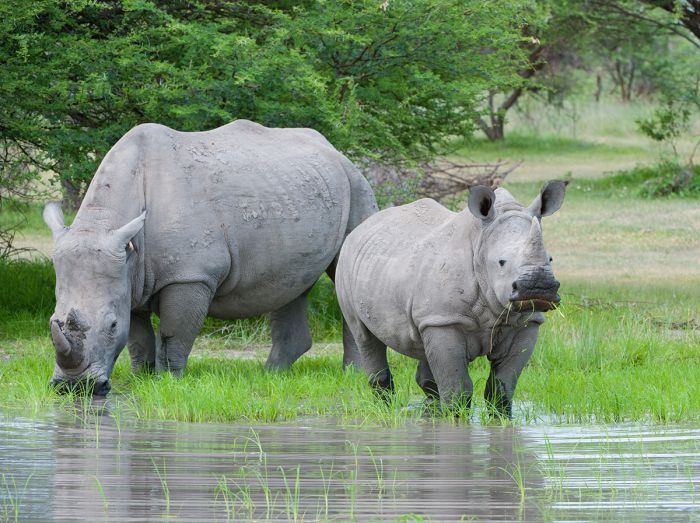
White rhino with her calf; image taken in December (Copyright © James Weis).
Fall
The autumn brings an end to the summer rains. March and April still receive some rain but decreasing amounts and the temperatures begin too cool. April is mostly clear, with few clouds, but the grass and pollen are high. Daytime temps average 87°F/30°C. March and April are the least busy in terms of safari tourism. Good deals are often available at the lodges.
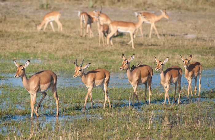
Impalas in the Okavango; image taken in July (Copyright © James Weis).
Showing 1–20 of 38 results
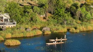
Abu is a luxurious getaway in the remote western Okavango, offering both land and water activities and diverse wildlife. The camp is renowned for its elephant conservation project and guests may interact with the Abu herd.…
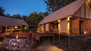
Chitabe Camp is situated in one of the best game-viewing areas of the Okavango Delta. The camp is a favorite amongst safari enthusiasts for its high densities of predators and plains game.…
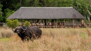
Chitabe Lediba Camp is a small, private camp that is ideal for groups or families traveling together. The camp is a favorite amongst safari enthusiasts for its high densities of predators and plains game.…
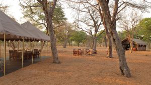
Offers an authentic and rustic safari experience in a small camp with meals cooked over an open fire. Located on the Chobe Riverfront, which attracts huge numbers of animals during the dry winter season. Game drives and boating.…
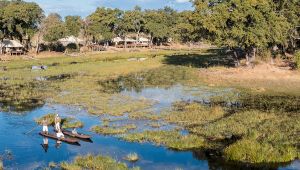
Small and remote camp modeled after the luxury mobile camps used by Africa's early explorers, but with modern-day conveniences and luxuries. Located in a wilderness area with both seasonal floodplains and permanent water. Game drives, boating, mokoros, walking, fishing.…
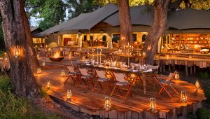
One of Botswana's most exclusive camps with only two properties in a huge, private concession. Excellent service, luxurious suites, fine dining. A prime wildlife destination with activities on land and water.…
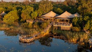
Located in the Linyanti Reserve on the banks of a large lagoon, DumaTau Camp offers day and night safari drives, seasonal walking, and boating. The area is superb for wildlife, particularly during the dry season.…
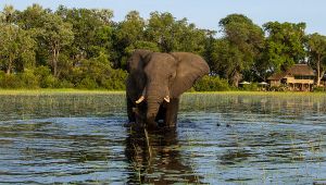
Jacana Camp offers one of the best water-based experiences in the Okavango Delta. The area is beautiful year-round and offers diverse wildlife. The maintains a 'classic' feel that is missing from the luxury camps.…
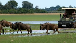
Jao Camp is located in beautiful water-based portion of the Okavango Delta and offers both land and water activities. The camp itself is one of the most luxurious in Botswana.…
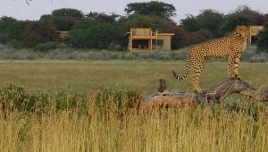
Located in the Kalahari Desert, the camp offers one of southern Africa's best summertime (rainy season) wildlife experiences. Game drives to see cheetah, lion and herds of herbivores, plus cultural activities with the indigenous San (bushmen) people.…
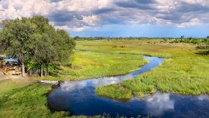
Located on a beautiful, permanent waterway in the northern Okavango with access to the Moremi Reserve. Excellent wildlife, especially during the dry season. Day and night game drives, bush walks, mokoroing, scenic helicopter flights, and cultural visits.…
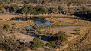
Located in a wildlife-rich location overlooking the Linyanti River, the camp offers day and night safari drives, seasonal walking, and boating. The area is well known for predators and elephants.…
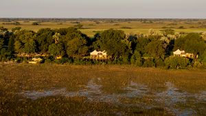
A remote camp in the western Okavango, offering a mix of activities on both land and water. Wildlife is diverse and the camp is a mix of classic and luxury.…
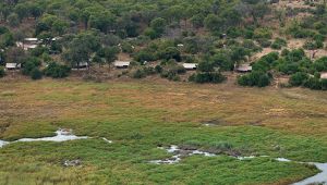
A small, remote, classic-style camp located in a private concession on the bank of the Linyanti River. Abundant wildlife, especially during the dry season. Day and night game drives, bush walks, mokoroing, scenic helicopter flights, and cultural visits.…
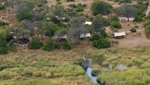
Small, intimate, classic-style, tented camp located in a private concession on the bank of the Linyanti River. Very good wildlife viewing, especially during the dry season. Day and night game drives, bush walks, mokoroing, scenic helicopter flights, and cultural visits.…
A small, seasonal, classic-style, tented camp that evokes safaris from the days of early explorers of this wild region, but with modern day comforts. Located in a private concession on the bank of the Linyanti River. Open only during the dry season, when wildlife viewing is best.…
This small classic-style camp is reminiscent of the early days of safari in Botswana. Ideal for families or small groups. Superb wildlife viewing during the dry season. Offers safari drives, seasonal walking, and a log-pile hide.…
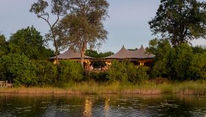
Little DumaTau is an intimate 4-tented camp which adjoins the larger DumaTau Camp in the Linyanti Reserve. The camp offers day and night safari drives, boating, and seasonal nature walks. The are teems with wildlife during the dry season.…
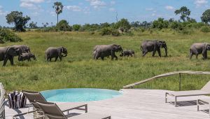
Little Mombo is an intimate 4-suited camp which adjoins the larger Mombo Camp in the Okavango Delta. Together, these camps are known as the "Place of Plenty" for the abundance of wildlife found here.…
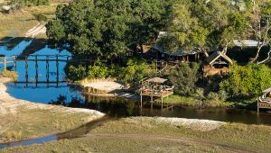
.jpg)