
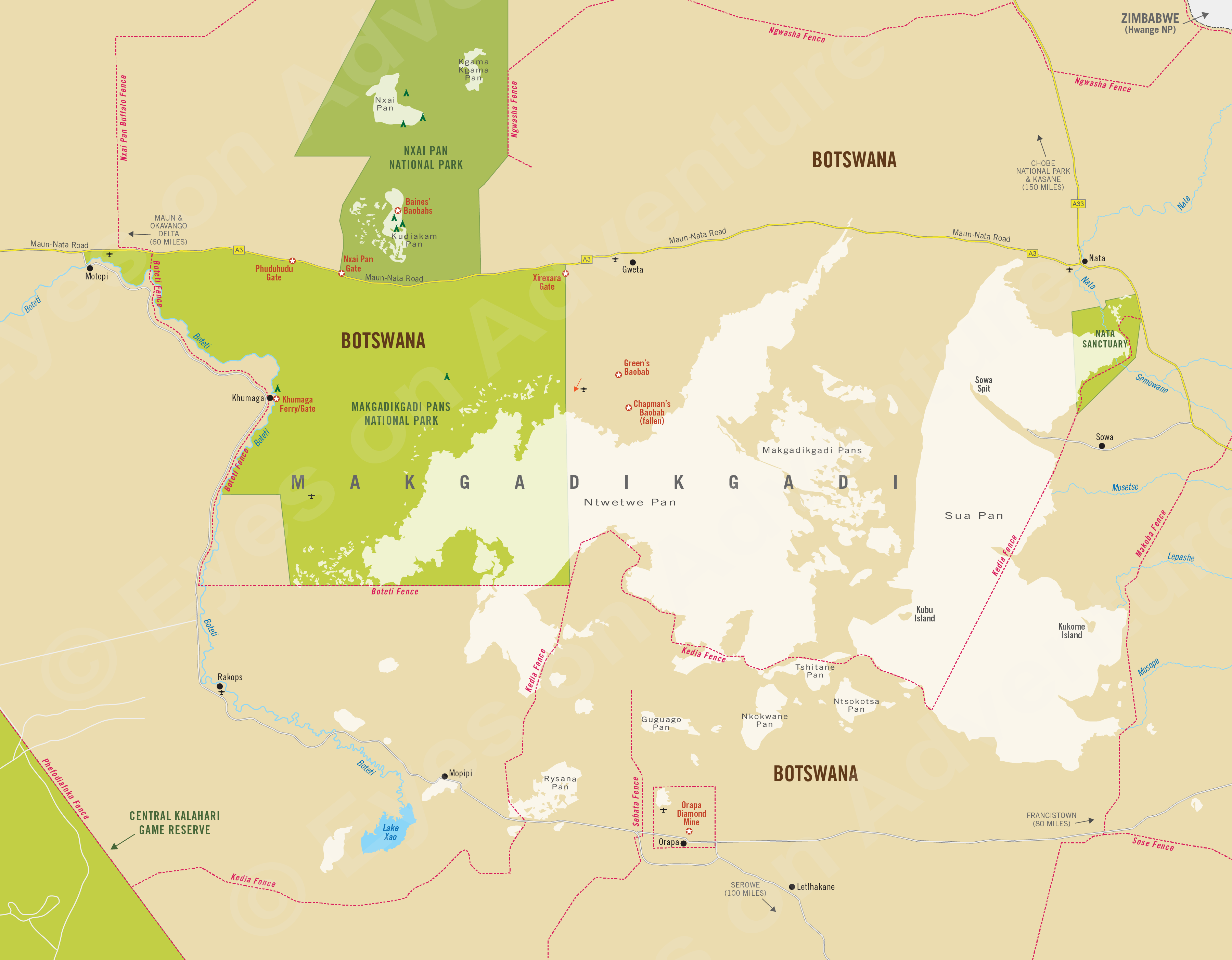
Makgadikgadi
(incl. Nxai Pan, Boteti River, Nata Sanctuary)
Region Links: Central Kalahari, Linyanti & Chobe, Makgadikgadi, Okavango Delta, Okavango Panhandle, Tuli Block
Highlights
- See the zebra migration at Nxai Pan or the Boteti River.
- Spend a morning walking with meekats.
- Spend a night camping at mysterious Kubu Island on Sua Pan.
- See flamingos at Nata Sanctuary (seasonal and only good rain years).
- Quad bike across the seemingly endless salt pans.
EOA Recommends: Jack's Camp, Leroo La Tau, San Camp
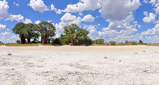
Southwest of the Okavango and Chobe lies the Makgadikgadi region, dominated by the largest expanse of salt pans in the world. This is a harsh place, where water is scarce most of the year, yet it offers seasonally superb game viewing.
Elephants at Nxai Pan.
The Makgadikgadi Salt Pans are remnants of a prehistoric super lake, which once covered most of central Botswana. Climatic and geological changes caused the lake to dry up, leaving its clay seabed surrounded by an arid savanna.
The network of pans evoke a feeling of emptiness and endless heat haze, but there is life here in abundance too. Makgadikgadi Pans and Nxai Pan, both national parks, include vast tracts of shimmering white salt pans, palm islands and grassland, but these protected areas are only a small portion of this region, which is roughly the size of Switzerland.
Male lion in Nxai Pan National Park.
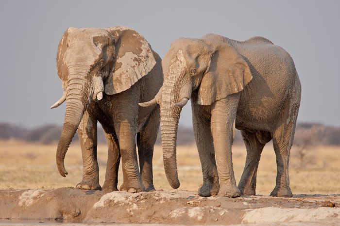
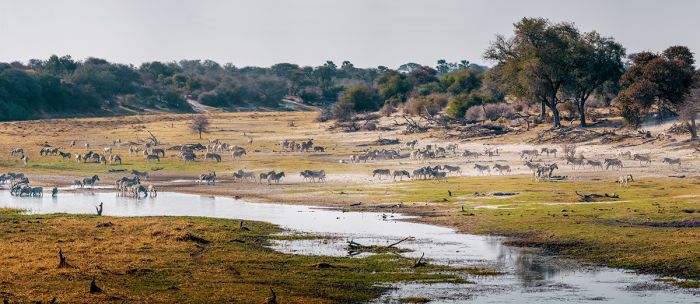
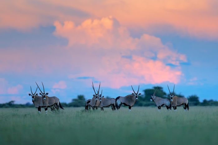
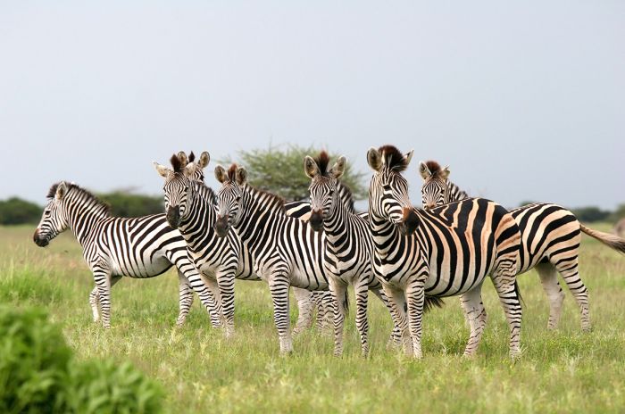
The Boteti River forms the western boundary of the Makgadikgadi National Park and brings overflow water from the Okavango on heavier flood years. Zebra and wildebeest migrate here from the north in the tens of thousands, joined by smaller numbers of red hartebeest, gemsbok (oryx), eland, and elephant.
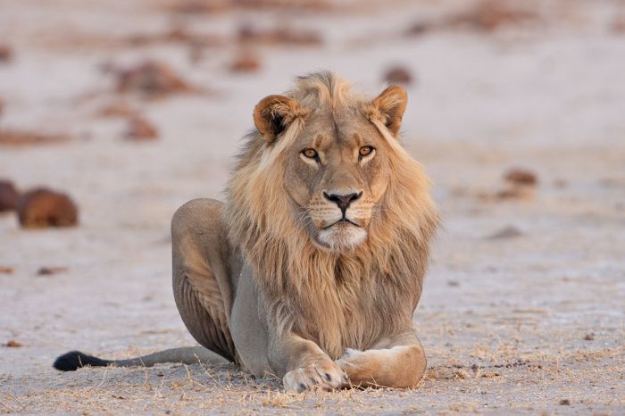
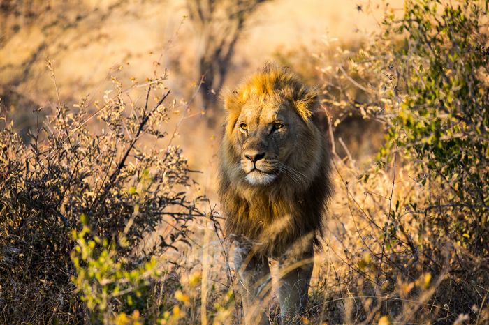
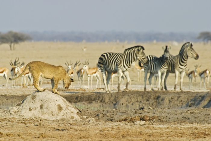
Predators are here as well, mainly lions and jackals in the Boteti area, but cheetahs can be seen around Nxai Pan and brown hyena are a specialty of this arid Kalahari region.
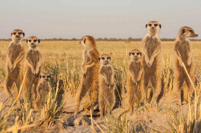
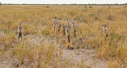
Meerkats in the Makgadikgadi (Copyright © James Weis).
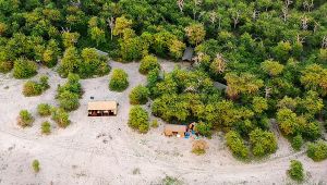
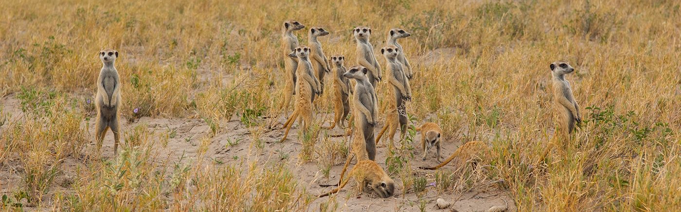
Meerkats are a specialty of the Makgadikgadi region and some of the safari camps offer a meerkat encounter where guests spend the morning following these fascinating animals as they forage and visit their network of dens.
After good rains, some of the pans fill with water and turn into shallow lakes, attracting waterbirds in the thousands, especially greater and lesser flamingos. The flamingos build their clay nests under the hot Kalahari sun and feed on brine shrimp and algae in these temporary lakes.
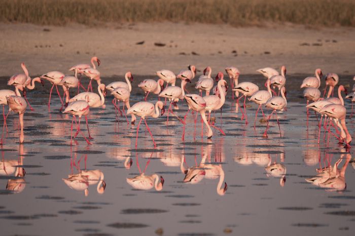
Flamingos at Nata Sanctuary, Makgadikgadi.
Read More...
Baines' Baobabs, Chapman's Baobab, History, Kubu Island, Makgadikgadi Pans National Park, Nata Sanctuary, Ntwetwe Pan, Nxai Pan National Park, Sua Pan
History
The Makgadikgadi Pans are the remnants of a massive lake that once covered much of northern and central Botswana, fed by rivers carrying salts leached from the lake's catchment area. This super lake covered an area of 23 000 square miles (60 000 sq kms).
Because the lake's basin had no outlet, large amounts of salt were concentrated in low lying areas. Less than 10 000 years ago, climactic changes caused the lake to evaporate, leaving only salt deposits.
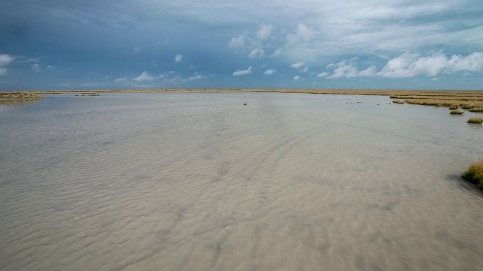
Shallow rainwater on Makgadikgadi Pans.
Makgadikgadi Pans National Park
Makgadikgadi Pans National Park covers 1 500 square miles (3 900 sq kms) on the western side of the pans and includes a portion of Ntwetwe Pan. The southern portion of the park was protected as a game reserve in 1970. Additional land extending north to the Maun-Nata Road was incorporated in 1992 and the reserve was given national park status.
The western border of the park is the Boteti River, which on years with exceptional floods, flows south out of the Okavango Delta. The Boteti's steep banks and width of its sandy course are evidence that it was once a major river that fed the great Makgadikgadi super lake.
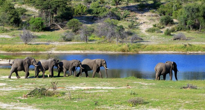
Elephants about to cross the Boteti River, Makgadikgadi Pans.
The normally mostly-dry Boteti watercourse is lined by riparian forest and attracts good wildlife, especially zebras and wildebeests, which migrate here in huge herds, along with smaller numbers of eland, gemsbok (oryx) and red hartebeest.
The majority of the Makgadikgai National Park is sandy grassland and fossilized dunes with thicker hills marking the edges of the prehistoric lake. The western portion of the park is Ntwetwe Pan.
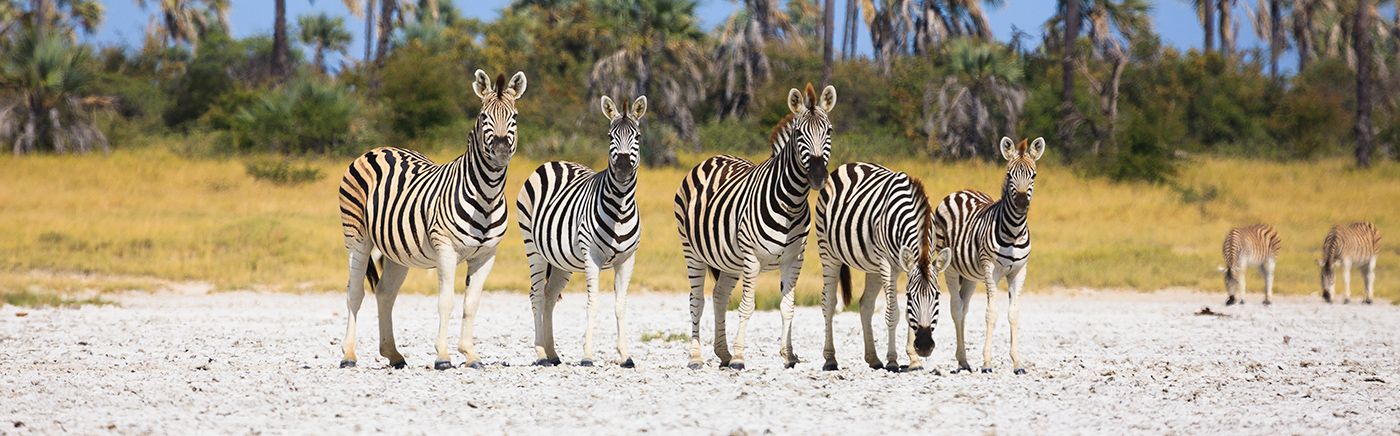
Zebras amass along the Boteti River, western Makgadikgadi.
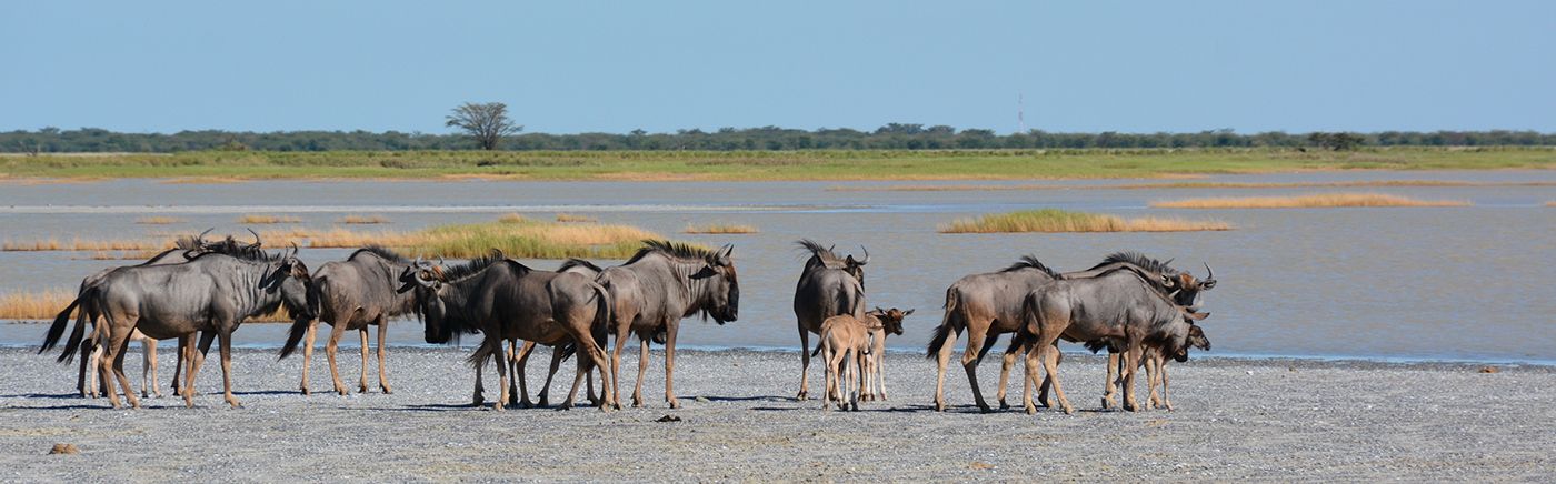
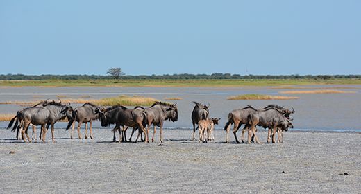
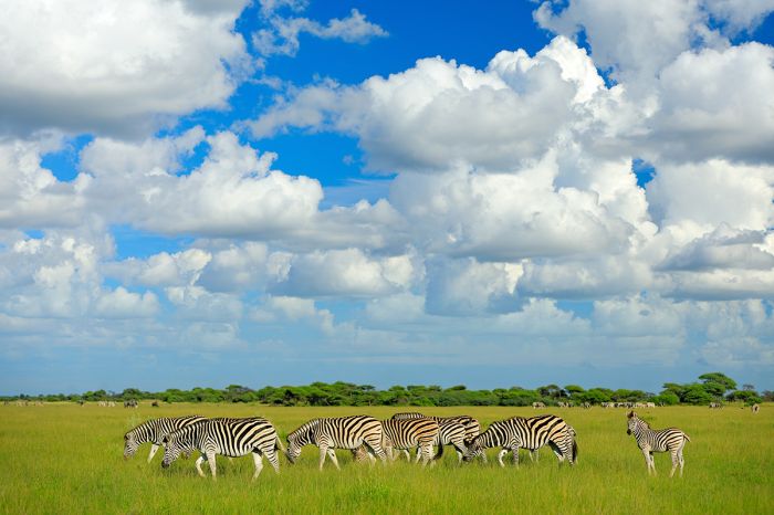
Wildlife in the center of the park is best in the wet season, but the best wildlife viewing occurs along the Boteti River in winter. Large herds of Burchell's zebra and blue wildebeest begin migrating west towards the Boteti river in late May, once the rains have abated.
The zebra and wildebeest herds amass along the Boteti all through the dry winter months and by November, the Boteti region is packed with wildlife. Kudu, bushbuck, waterbuck, elephant, and even white rhino (that made their way here from Chief's Island in the Okavango) can be found here in smaller numbers.
Giraffes, zebras and wildebeests along the Boteti River, Makgadikgadi.
Once the summer rains begin, the wildlife disperses to take advantage of food sources away from the Boteti, and between February and April, the huge herds of zebra and wildebeest migrate north to Nxai Pan and beyond, only returning to the Boteti when the rains diminish around early June.
Lions are here, but not in big prides, as the prey species do not support it for most of the year. Other predators include cheetah, leopard, brown hyena, spotted hyena and black-backed jackal.
Lion in Makgadikgadi Pans National Park.
NXAI PAN NATIONAL PARK
Nxai Pan National Park covers 1 026 square miles (2 658 sq kms) and is contiguous with the Makgadikgadi Pans NP to the south, separated by the Maun-Nata Road.
Nxai Pan and Kudiakam Pan are both a part of the ancient lake bed that formed Sua and Ntwetwe Pans, but due to its higher elevation, Nxai Pan is not covered in leached salts and supports more vegetation.
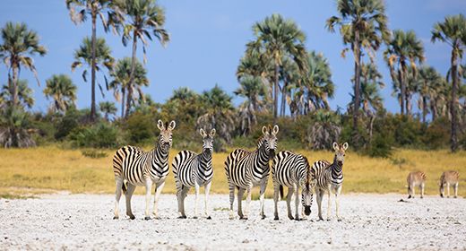
Zebras grazing in Nxai Pan National Park.
The Nxai Pan region is dominated by grassland and scattered Acacia tortilis trees and resembles the Serengeti in many respects (but without all the tourists). The pans themselves are covered with grass and surrounded by fossilized dunes of Kalahari sand.
There are numerous pans that fill with water during the rains and two pumped waterholes that are kept full in the dry season by the park authorities. The rivers that once filled the pans from the northeast have long since dried up.
Oryx in Nxai Pan National Park.
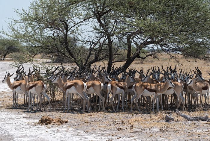
During the wet season months from December thru April, the lush, green grasslands around Nxai Pan become a haven and breeding ground for large herds zebras, wildebeests, and springbok. Also present are good numbers of red hartebeest, oryx, and eland.
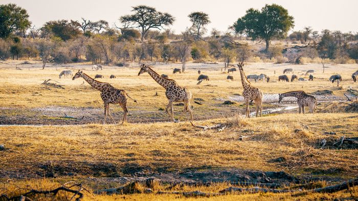
Big herds of giraffe move through the savannas to feed on the Acacia trees, while to the north of the pans, the mopane woodland supports browsing and cover for greater kudu and impala, which are often seen drinking and consuming salts at the waterholes. Occasional tsessebe can also be seen - this being the southern extent of their Kalahari range.
Young lion, zebras and springboks in Nxai Pan National Park.
During the verdant summer months, small breeding herds of elephant can be seen around Kgama Kgama Pan in the northeast and lone bulls can be seen wandering through the mopane and at the waterholes. Bat-eared foxes are here in large numbers, as well as lion and spotted hyena that follow the grazers.
Most of the grazers disperse once the rains have ended (around May), with the exception of the hardy springboks, which remain in the area throughout the dry winter months. The springboks and open grasslands are perfect hunting grounds for cheetah and African wild dogs and both are sighted here occasionally.
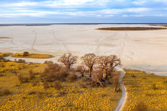
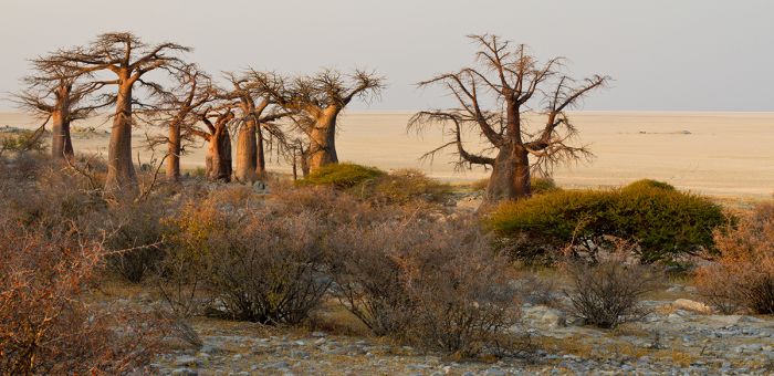
Aerial view over Kudiakam Pan with Baines' Baobabs in the foreground.
Baines' Baobabs
Originally known as the 'Sleeping Sisters', Baines' Baobabs are located on the edge of Kudiakam Pan. This cluster of baobab trees was famously painted by artist and adventurer Thomas Baines in 1862. Baines was a member of David Livingstone's expedition to the Zambezi.
The trees have changed very little in the years since Baines painted them, including the one tree lying on its side, which is still thriving.
Springboks seeking shade from the sun in Nxai Pan NP.
makgadikgadi PANS
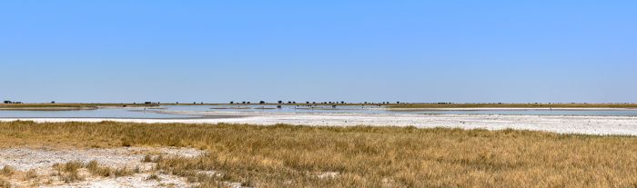
The two largest pans in Makgadikgadi are Sua Pan and Ntwetwe Pan, which together cover 4 600 square miles (12 000 sq kms). Various other small pans are interspersed around the two major pans.
SUA PAN
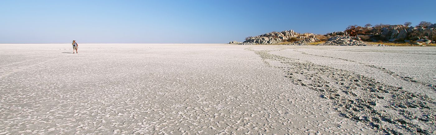
Sua Pan is the eastern of the two 'twin' pans and is mostly a mineral-covered mud expanse, stretching across a low basin. 'Sua' means salt in the language of the San people.
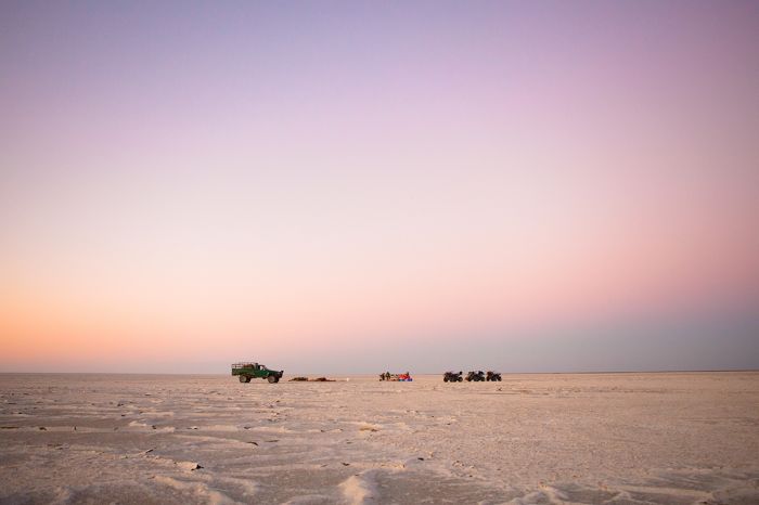
Quad biking excursion on Sua Pan.
Sua Spit, a long, slender protrusion of sand extending into the heart of Sua Pan, is the focal point of the country's soda ash production. Sodium carbonate is mined on an industrial scale by Botswana Ash (Botash), a joint venture in which the government is the majority owner.
The Nata River brings seasonal water to the pan from Zimbabwe and in heavier rain years, the pan floods from December to April with shallow water. The temporary lake, covered only by a few centimeters of water, creates a shimmering effect that reflects the sky and seems to dissolve the horizon.
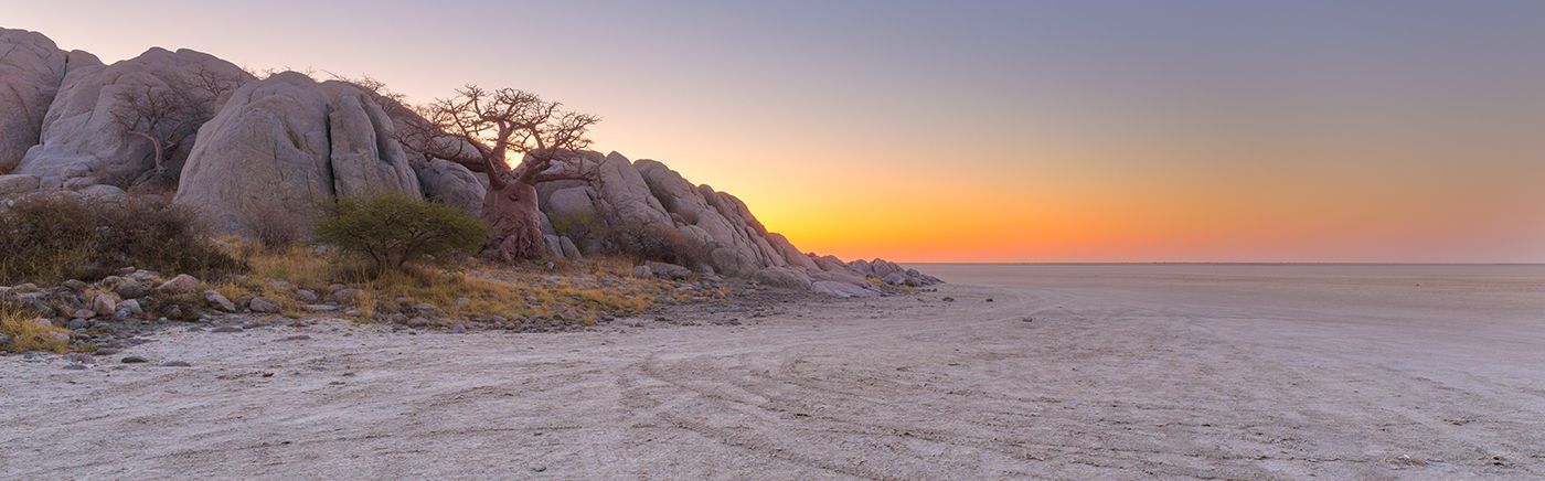
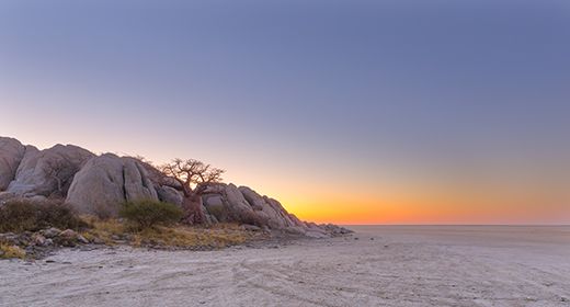
Baobab trees on Kubu Island, Sua Pan.
Nata Sanctuary
At the delta where the fresh water from the Nata River meets the saline pan, reed beds have formed and the brackish water attracts large numbers of water birds, most notably flamingos, that come here to breed. This delicate ecosystem is now protected within the Nata Sanctuary.
The community-run Nata Sanctuary sanctuary covers 89 square miles (230 sq kms) and 45% of the reserve is on the pan. The sanctuary was was created in 1992 with help from the Kalahari Conservation Society and funding from national and international organizations. To facilitate the reserve, local people voluntarily relocated 3 500 cattle onto adjacent rangeland and established a network of dust roads.
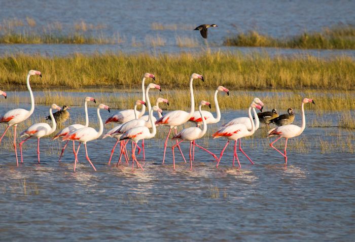
Flamingos in the Nata Sanctuary.
Kubu Island
Near the south-western corner of Sua Pan is Kubu Island, a granite outcrop which is a popular overnight camping location and offers lovely photo opportunities. Except for a the stretch of grass, the ancient scrap of granite and its ghostly baobab trees lies surrounded by a sea of salt.
It is believed that the site was inhabited as recently as 500 to 1 500 years ago and on one of the ancient lake shores of the island, numerous pot shards, stone tools and ostrich egg shell beads have been discovered.
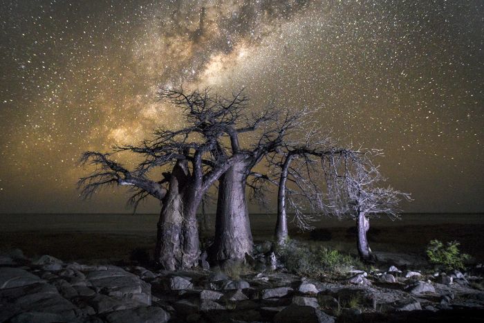
Kubu Island baobab trees and starry sky.
Ntwetwe Pan
Ntwetwe Pan is the western twin of Sua Pan, although it is slightly larger. It was once fed by the waters of the Boteti River, but they were diverted at Mopipi Dam to provide water for the Orapa diamond mine and the pan is now almost permanently dry. The western shore of Ntwetwe Pan is probably the most interesting in the Makgadikgadi area, with landscapes of rocky outcrops, dunes, islets, channels and spits.
Ntwetwe Pan with summer rain water and wildebeests.
Chapman's Baobab
Chapman's Baobab, one of the largest and oldest trees on the African continent was located just north of Ntwetwe Pan. Unfortunately, Chapman's Baobab fell and died in January 2016. The tree was estimated to be 1 500 years old. Green's Baobab, another famous landmark tree still stands nearby.
A cavity on one side of Chapman's was used as a 'post office' by early European explorers, who left packages to be picked up by those following the early route in the other direction. Both trees served as landmarks and camping sites and many famous explorers left inscriptions in the trees.
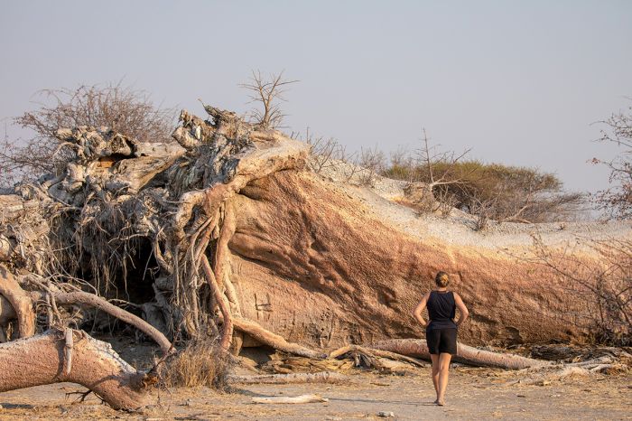
Chapman's Baobab tree, shortly after falling in 2016.
Read More...
Baines' Baobabs, Chapman's Baobab, History, Kubu Island, Makgadikgadi Pans National Park, Nata Sanctuary, Ntwetwe Pan, Nxai Pan National Park, Sua Pan
Boteti River / Western Makgadikgadi
Great Good Fair Poor
- Jan
- Feb
- Mar
- Apr
- May
- Jun
- Jul
- Aug
- Sep
- Oct
- Nov
- Dec
The western boundary of the Makgadikgadi Pans National Park is the Boteti River, which flows intermittently with overflow water from the Okavango Delta to the north. Although the river is normally not in flow, the watercourse provides the only water for miles during the winter months.
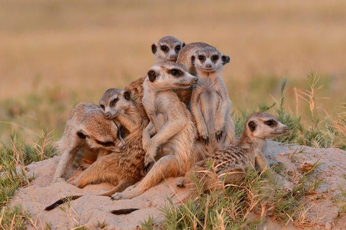
Meerkats in the Makgadikgadi.
From June thru December, large herds of Burchell's zebra and blue wildebeest migrate from the north to feed along the Boteti River. Smaller numbers of red hartebeest, eland, and gemsbok (oryx) also arrive. Lions and hyenas are here, as well as black-backed jackal, all looking to prey on the abundant wildlife.
By November the area around the Boteti River is pumping with wildlife. After the rains begin to come with regularity (normally late December), the big herds migrate away from the Boteti towards the fresh grazing around Nxai Pan and other areas to the west and north.
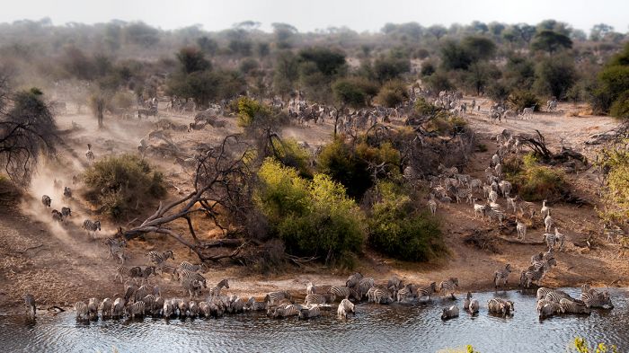
The zebra migration arrives at the Boteti River, Makgadikgadi Pans NP.
Nxai Pan / CENTRAL & EASTERN MAKGADIKGADI
Great Good Fair Poor
- Jan
- Feb
- Mar
- Apr
- May
- Jun
- Jul
- Aug
- Sep
- Oct
- Nov
- Dec
The best wildlife viewing in the Nxai Pan area occurs during the wet season months from December thru April. The lush, green grasslands around Nxai Pan become a haven and breeding ground for large herds zebras, wildebeests, and springbok. Also present are good numbers of red hartebeest, oryx, and eland.
Zebras in Nxai Pan National Park.
The large herds of blue wildebeest and Burchell's zebra migrate from the western side of the Makgadikgadi to take advantage of the sweet grasses at Nxai. Springbok are also here in great numbers.
Lion and spotted hyenas are best seen during the rainy months when the big herds have arrived. Small breeding herds of elephants also arrive for the fresh grazing and red hartebeest, eland and oryx as well. Bat-eared foxes are a specialty of the Nxai Pan region. Cheetah and African wild dog are seen occasionally, preying on springbok and the impala. This is one of the few places one can see both springbok and impala together.
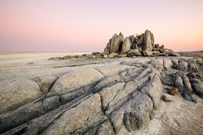
Kubu Island and Sua Pan.
The dry season in Nxai Pan is far less productive, with only the drought-tolerant springbok remaining here in big numbers. The park authorities maintain several pumped waterholes and these provide some year-round water for the winter months. These waterholes can be extremely productive for game viewing.
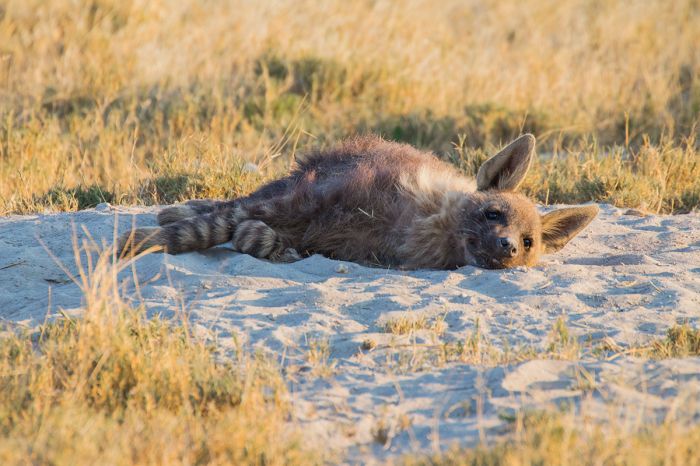
Brown hyena in the Makgadikgadi, Botswana.
Showing 1–1 of 1 results