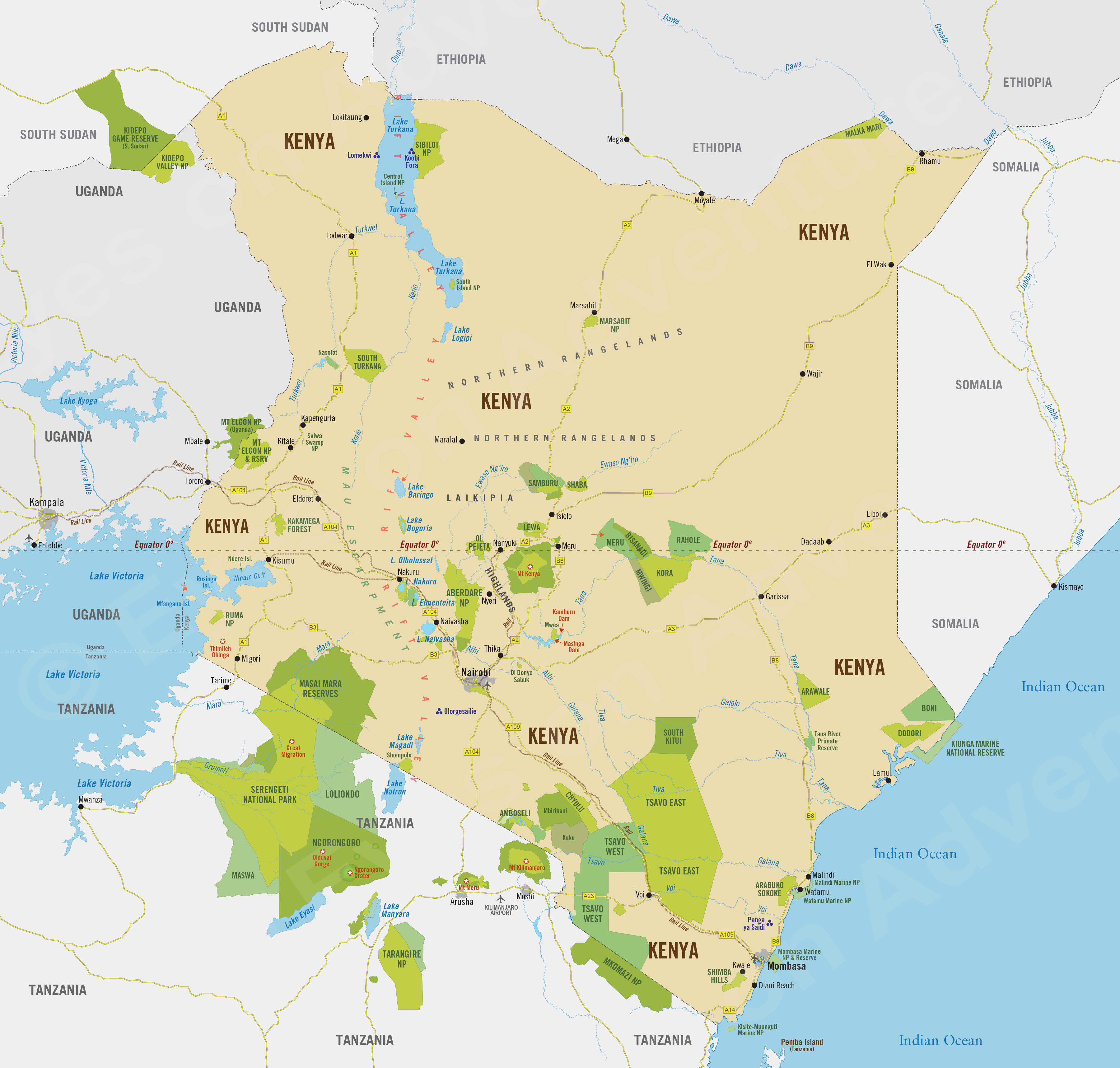
Kenya
Region Links: Amboseli & Chyulu Hills, East Coast Kenya, Great Migration, Laikipia, Masai Mara, Nairobi, Rift Valley & Central Highlands, Samburu, Tsavo
Highlights
- One of Africa's top safari destinations.
- Masai Mara's wildebeest and zebra migration (August-October) and big cats year-round.
- Amboseli's elephants with stunning views of Mount Kilimanjaro, a photographer's paradise.
- Lewa and Ol Pejeta Conservancies for great rhinos and other wildlife.
- Lakes Nakuru and Naivasha in the Great Rift Valley.
- Mount Kenya, Africa's second-highest peak.
- Indian Ocean coastal resorts for beautiful beaches and history/culture.
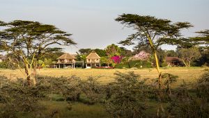
Kenya is one of Africa's prime safari destinations and home to the Masai Mara and the Great Migration. Amboseli offers wildlife with Mount Kilimanjaro as a backdrop and the East Coast boasts pristine Indian Ocean beaches and resorts.
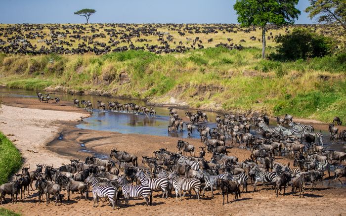
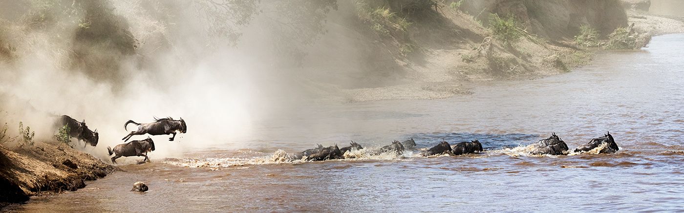
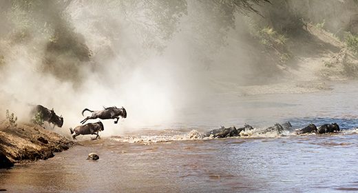
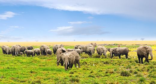
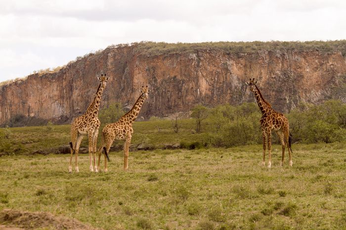
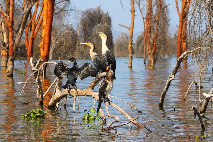
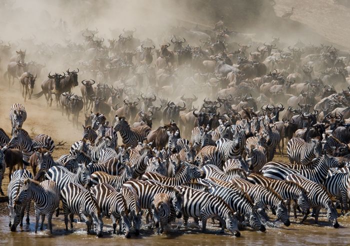
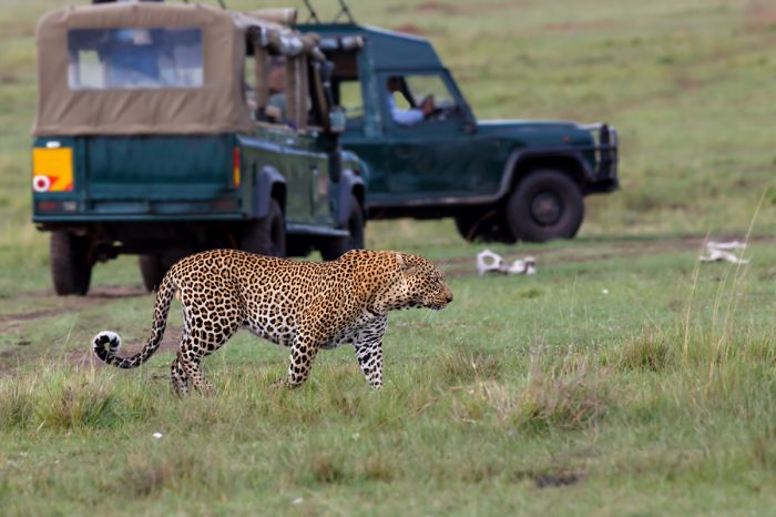
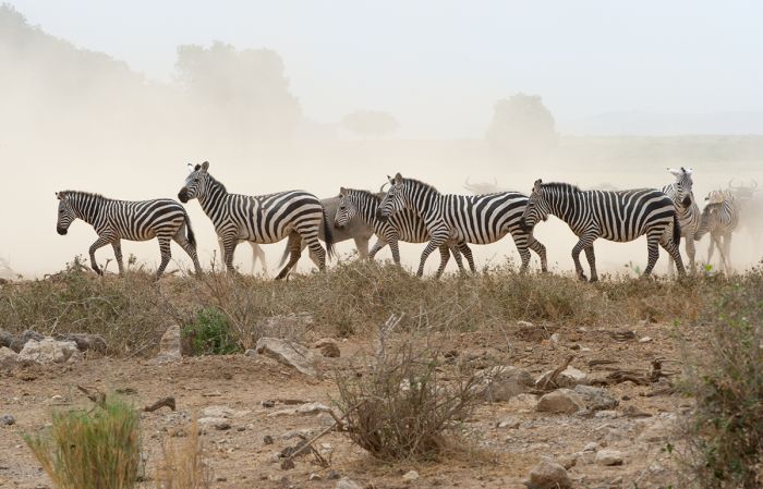
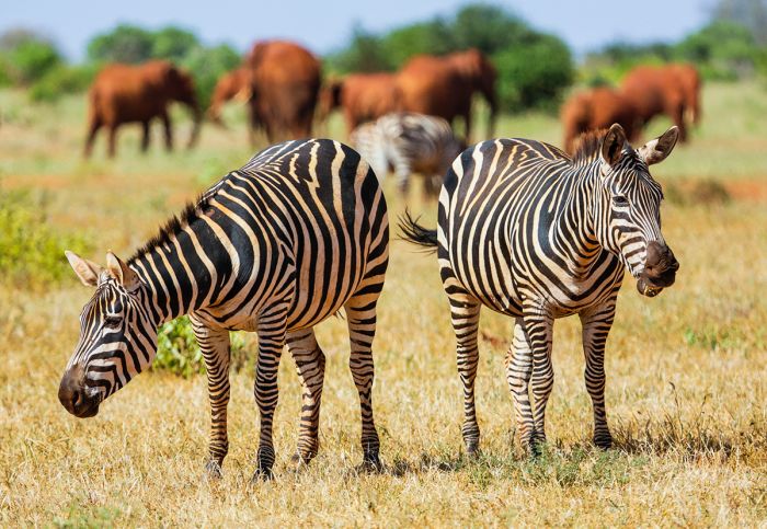
The Great Migration of wildebeests and zebras in the Masai Mara.
The Masai Mara National Reserve and the surrounding private conservancies are certainly Kenya's top wildlife destination. The 'Mara' adjoins Tanzania's Serengeti across the border and together, they host the largest mammal migration on Earth. A safari to the Masai Mara is included on most Kenya itineraries.
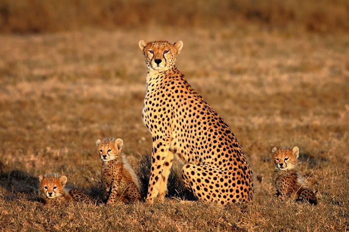
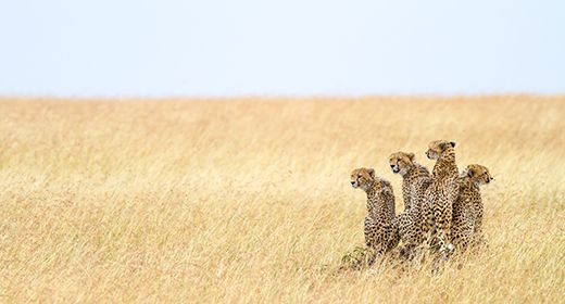
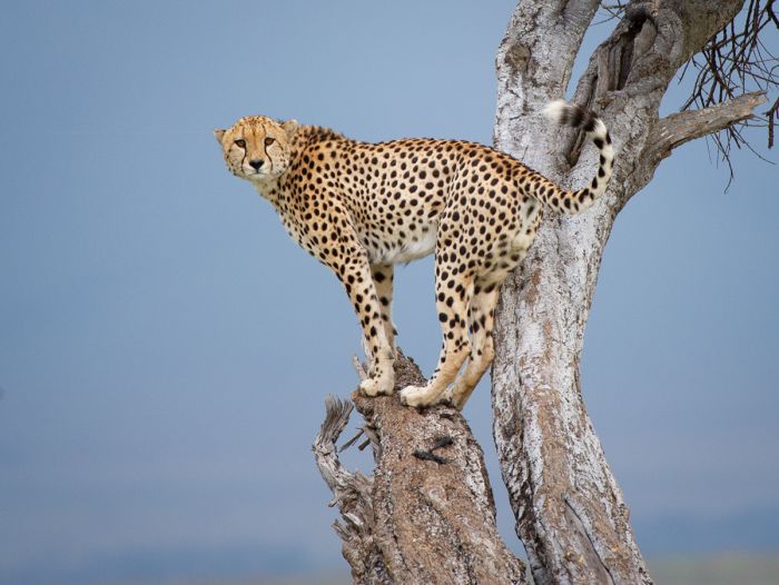
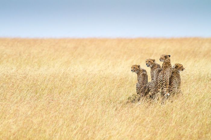
Cheetah and small cubs in the Masai Mara.
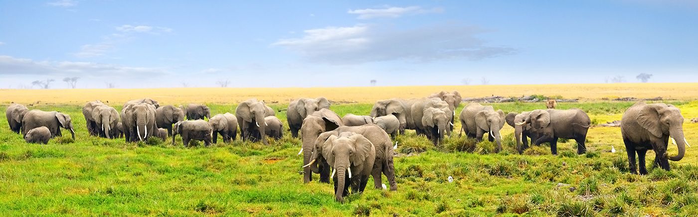
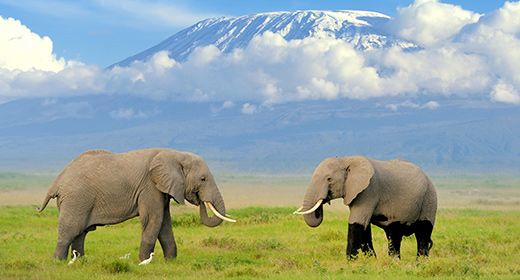
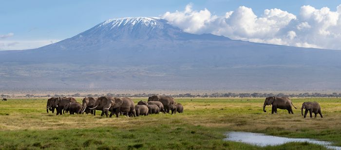
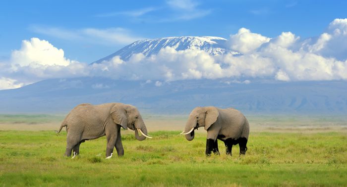
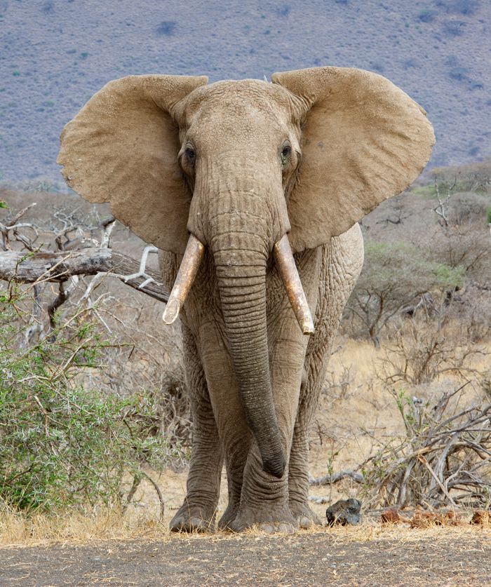
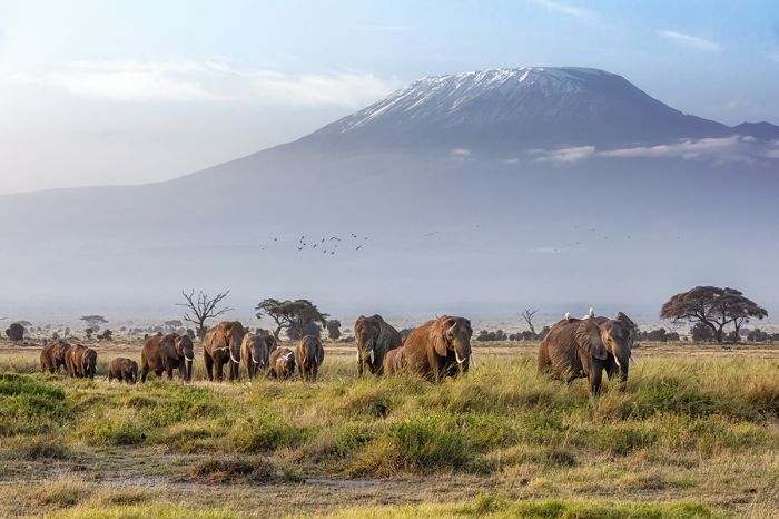
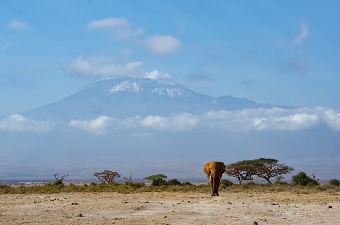
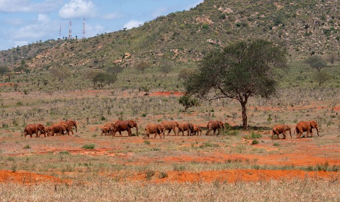
Amboseli National Park lies on Kenya's border with Tanzania and is famous for its abundant herds of relaxed elephants and its setting beneath Africa's highest peak, Mount Kilimanjaro. Some of Africa's last "big tusker" elephants are known from the region.
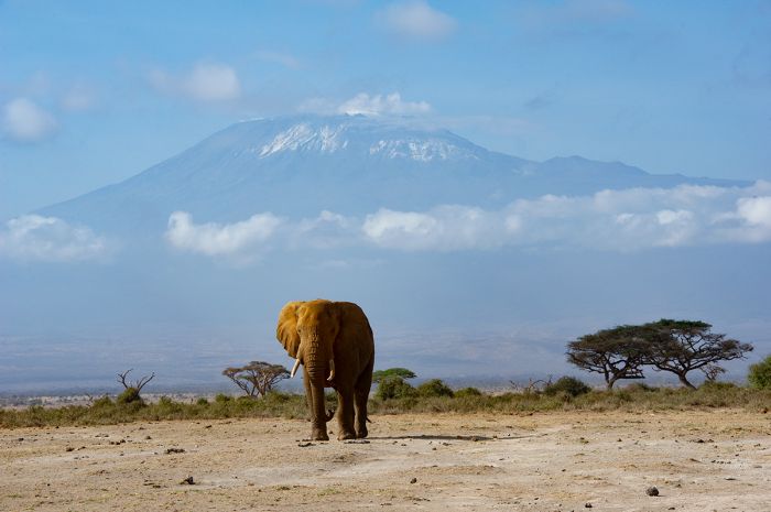
An elephant in Amboseli and Mount Kilimanjaro (Copyright © James Weis).
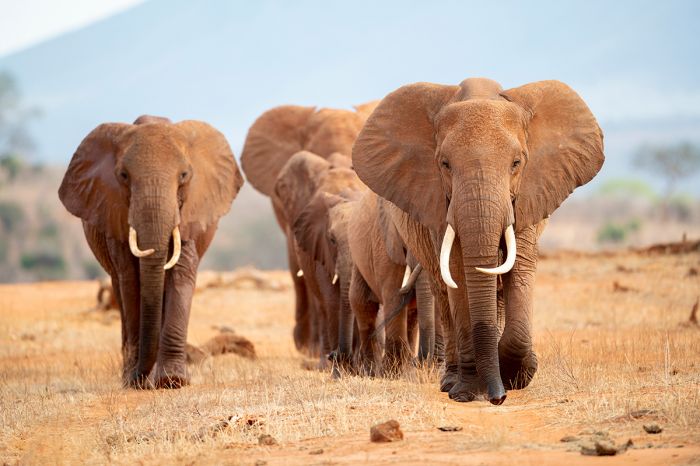
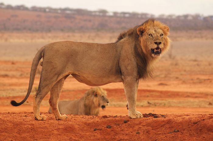
The Tsavo region encompasses two massive national parks, Tsavo East and Tsavo West, which combined make up one of the world's largest protected wildlife reserves. Tsavo is mostly wild and undeveloped, giving it a feeling of true wilderness, yet still offering very good safaris, especially along the perennial rivers.
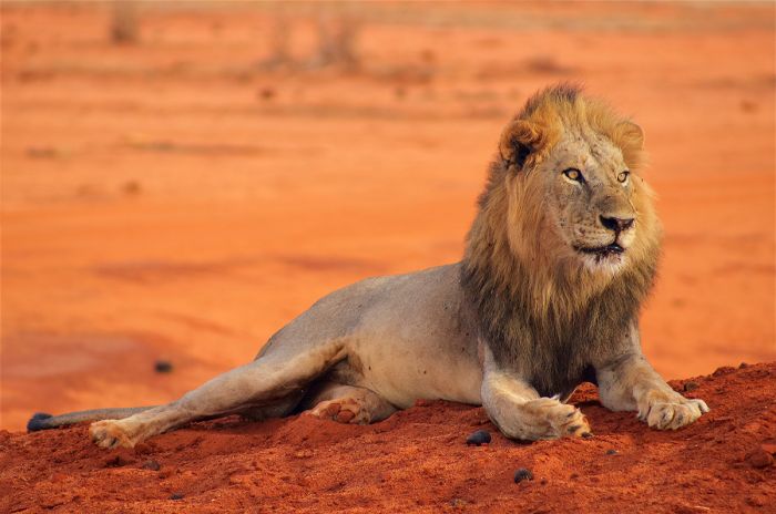
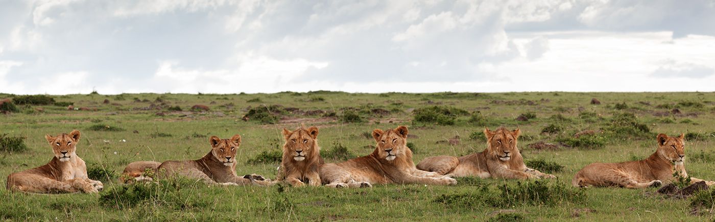
A male lion in Tsavo with its distinctive red sand.
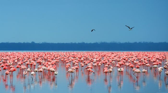
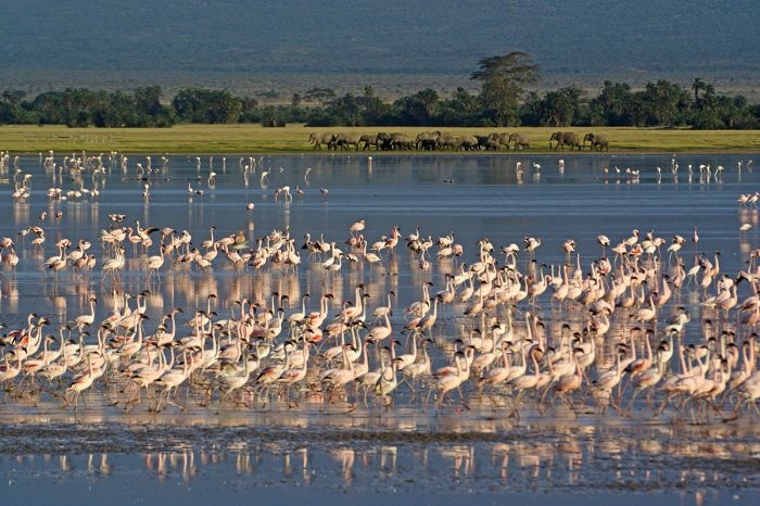
Africa's Great Rift Valley cuts through Kenya and along its edges are the Central Highlands, which includes Mount Kenya and the Aberdare Mountains. Several Rift Valley lakes, including Naivasha and Nakuru offer wildlife reserves and adventure.
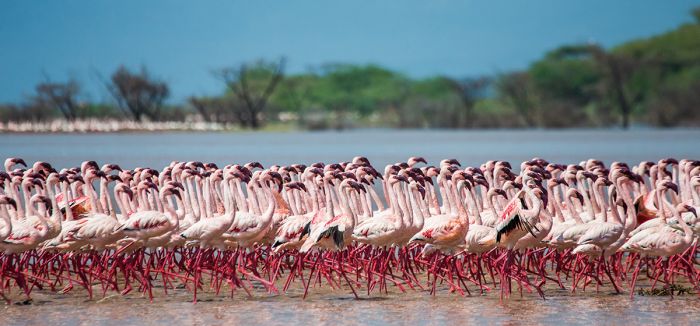
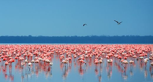
Lesser flamingos at Lake Nakuru in Kenya's Rift Valley.
The Laikipia region is known for its patchwork of conservancies and working cattle ranches that coexist with the abundant local wildlife. It is considered Kenya's greatest conservation success region, with no national parks, but numerous community-run ranches that offer safaris and accommodations. It is a unique and rewarding destination to visit.
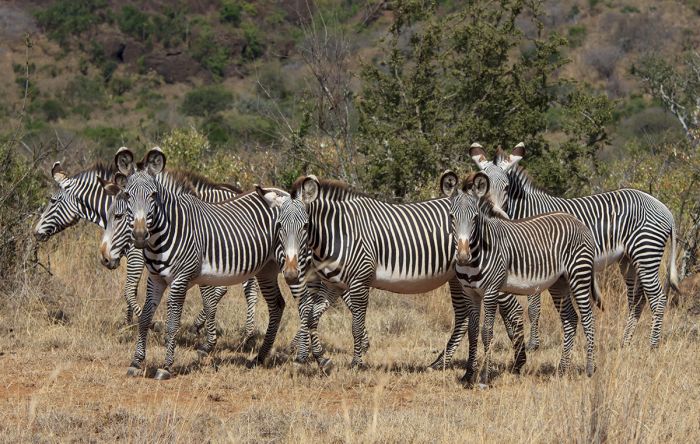
Grevy's zebras in Kenya's Laikipia region.
The Samburu region is Kenya's northernmost safari destination and is so named for the colorful Samburu people who inhabit this dry low-lying region. Samburu is rich in cultural experiences and offers year-round viewing of dry-land wildlife. The life-giving Ewaso Ng'iro River flows through the reserves of Samburu, Buffalo Springs, and Shaba.
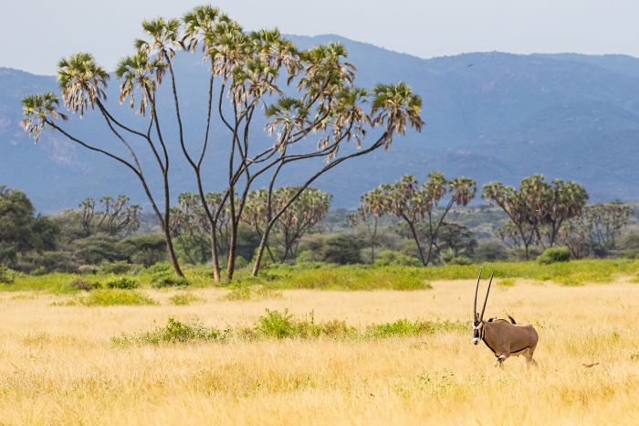
An beisa oryx in Kenya's Samburu National Reserve.
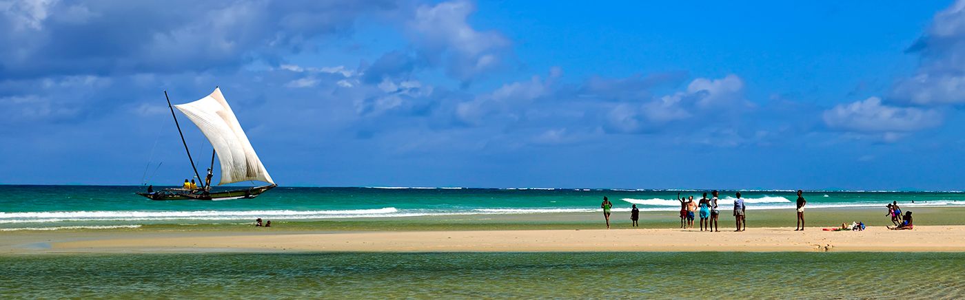
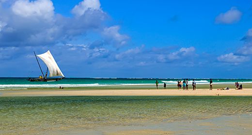
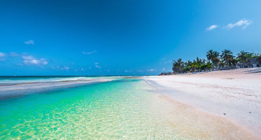
Kenya's East Coast offers miles of Indian Ocean shoreline, with rich history, some good wildlife reserves, and uncrowded beaches. The historic town of Lamu in the far north is remote and full of culture while the south coast at Diani Beach offers superb resort getaways. Mombasa, Kenya's second-largest city is the major port on the coast.
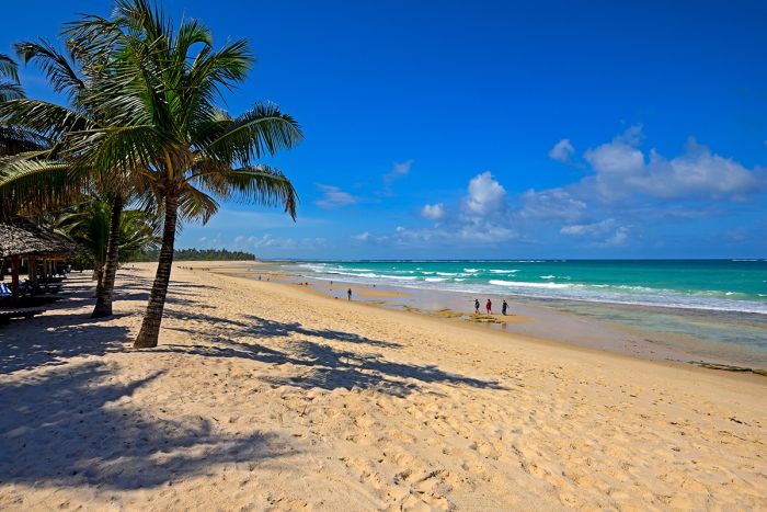
Indian Ocean beach at Diani Beach, Kenya.
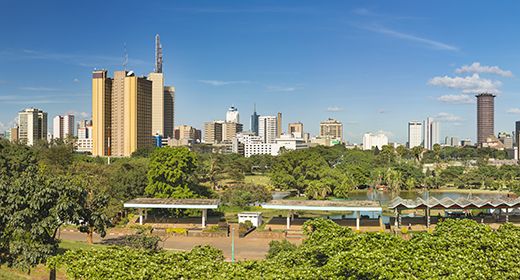
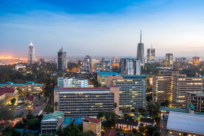
Nairobi is the main gateway for most international travelers and is normally a stopover rather than a destination. Surprisingly, Nairobi National Park offers good wildlife viewing in the shadows of the city and is worth a visit on a spare morning or afternoon.
A safari in Kenya holds the promise of once-in-a-lifetime sights and special memories!
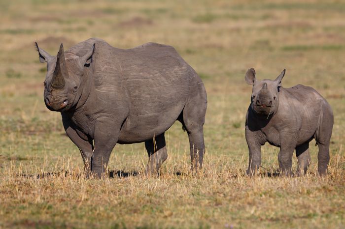
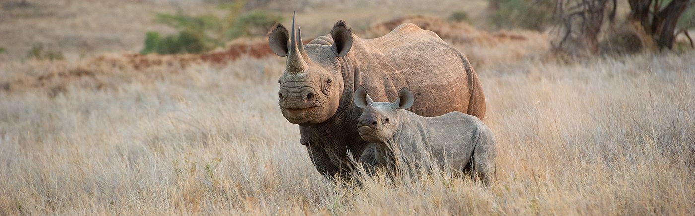
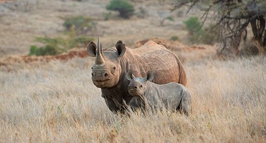
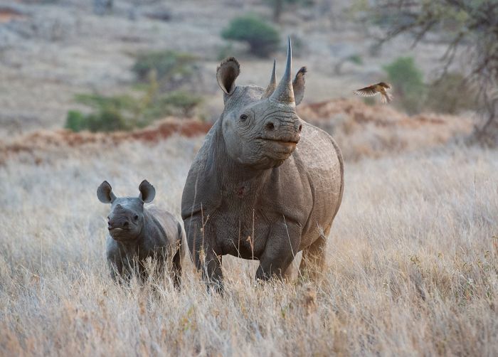
Black rhino female and her calf in the Masai Mara National Reserve.
kenya regions
Masai Mara (incl. surrounding conservancies)
Visit Kenya's premier wildlife destination for an incredible wildlife experience. Watch the annual great migration of wildebeests and zebras as they follow an ancient cycle in search of grazing. All the big cats and iconic wildlife here year-round. More
Amboseli (incl. Chyulu Hills)
Discover this wildlife haven with its herds of elephants marching in the dust with Mount Kilimanjaro in the background. A photographer's paradise! More
Laikipia Plains (incl. Lewa, Borana & Ol Pejeta)
The Laikipia region is one of Kenya's great success stories. Ranchland merged with indigenous tribes and superb wildlife make it more than worth adding to an itinerary. The Lewa and Ol Pejeta Conservancies protect rhinos and other species and offer numerous lodges and excellent game viewing. More
Mount Kenya
Mount Kenya, a 3.5-million-year-old extinct volcano, is Africa's second-highest peak. The National Park of the same name, encompasses all parts of the mountain above 3 200 meters. Climb on any of its routes to the top or explore the slopes by staying in one of its lodges. More
Rift Valley & Highlands (incl. Aberdare, Lake Nakuru, Lake Naivasha)
The Rift Valley region includes Lakes Nakuru and Naivasha, both offering relaxing safaris on and around the water. Hell's Gate National Park offers wildlife and walking safaris in the gorge. The Aberdares offer lovely, high moorland exploration and is famous for its elephants. More
Samburu (incl. Buffalo Springs, Shaba)
Home to the semi-nomadic Samburu people on the frontier of Kenya's arid north. The reserves here offer a wide variety of wildlife and drylands birds. The beautiful, palm-lined Ewaso Ng'iro river flows through the region. Elephants, baboons and hippo are here in large numbers. More
Tsavo (incl. Tsavo East, Tsavo West)
The adjacent national parks of Tsavo East and West combine to form Africa's largest wildlife reserve. Dry bush lands offer wild and untamed habitat with plenty of animals. Mzima Springs is a lush oasis with underwater viewing of hippos and crocs! More
Indian Ocean Coast (incl. Diani Beach, Lamu, Malindi, Watamu, Mombasa)
Kenya's Indian Ocean coast offers a multitude of resorts and several marine national parks. South of Mombasa lies Diani Beach, with an assortment of oceanfront accommodation. Lamu in the far north is a World Heritage Site offering a lazy and relaxed atmosphere and perhaps Kenya's best-kept secret. More
Nairobi (incl. Nairobi National Park)
Kenya's capital city is most likely on everyone's Kenya itinerary at some point. The city is bustling place with a population of over 6 million in the metropolitan area. A visit to the David Sheldrick Elephant Orphanage is a must! More
Read More...
Main: Flora, Geography, Important Areas, National Parks, Protected Areas, Ramsar Sites, UNESCO Sites, Urban Areas, Wildlife
Detail: Aberdare, Amboseli, Central Highlands, Chyulu Hills, Diani Beach, Great Migration, Laikipia, Lake Naivasha, Lake Nakuru, Lake Turkana, Lake Victoria, Lamu, Lewa, Mara Conservancies, Masai Mara, Mombasa, Mount Kenya, Nairobi, Ol Pejeta, Rift Valley, Samburu, Tsavo, Watamu
Admin: Travel Tips, Entry Requirements/Visas
GEOGRAPHY
Kenya is located in the greater region known as East Africa. It shares border with Tanzania, Uganda, South Sudan, Ethiopia, and Somalia. Kenya's east coast is formed by 333 miles (536 kms) of Indian Ocean shoreline. The equator passes through the middle of the country.
A cheetah in the Masai Mara (Copyright © James Weis).
Kenya's topography is varied, with mountain ranges formed by the East African Rift, lakes, a few significant rivers, grasslands, forests, and a long Indian Ocean coastline. Mount Kenya is the highest peak in the country and Africa's second-highest at 17 057 feet (5 199m).
Kenya can be generally described in the following geographic regions: the semi-arid and arid regions in the north, the Rift Valley and its associated Central Highlands, the eastern plateau and ocean coast, the Lake Victoria basin, and the southern grasslands.
The Gregory Rift, which forms part of the East Africa Rift, cuts through Kenya north-to-south on a vector just west of Nairobi. In the valley of this rift are numerous notable lakes, including Turkana, Baringo, Bogoria, Nakuru, Elmenteita, Naivasha and Magadi. This rifting has also been responsible for the formation of Kenya's Central Highlands, which include Mount Kenya and the Aberdare Mountains.
West of Kenya's Rift is the westward-sloping Mau Escarpment, which gradually descends to its lowest point at Lake Victoria on Kenya's western border with Uganda.
Elephants in Amboseli National Park and Mount Kilimanjaro in the distance.
Kenya's notable rivers are the the Tana and Galana, which rise in the eastern highlands and flow southeast to the Indian Ocean, and the Ewaso Ng'iro, which rises on the slopes of Mount Kenya and flows north and then northeast into Somalia. The Mara River originates in the Napuiyapi swamp in the Mau Forest and flows south through the Masai Mara Reserve, into the Serengeti of Tanzania, and then west into Lake Victoria.
Kenya's protected areas are categorized as national parks (managed by the Kenya Wildlife Service-KWS), national reserves (managed by county governments and/or KWS), and conservancies (privately managed, often in joint ventures with local communities). The country's national parks and reserves cover about 8% of the total land area, with conservancies protecting an additional 11% of land. Tourism accounts for roughly 10% of Kenya's GDP.
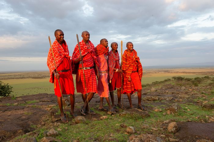
Maasai men in the Masai Mara Game Reserve (Copyright © James Weis).
Flora
Kenya's position atop the equator, as well as the wide range of elevations created by the Great Rift Valley that runs through the western side of the country, give it a huge diversity of habitats and flora. High mountains, deep valleys with lakes, Indian Ocean coastline, and arid semi-desert are some of the biomes that can be found in Kenya, each with its own distinctive vegetation.
Generally speaking, the northern half of Kenya is quite dry, covered by sparse vegetation, while areas to the south receive more rain. The volcanic Central Highlands, including Mount Kenya and the Aberdare Mountains, provide water for the country's major rivers, most of which flow eastward towards the Indian Ocean.
High elevation vegetation near the summit on Mount Kenya.
Forests
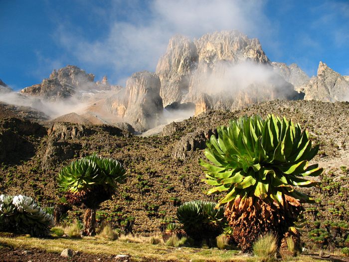
Kenya's most diverse floral regions are along the volcanic highlands associated with the Rift Valley. Mount Kenya, the Aberdare Mountains, Mount Marsabit, Mount Elgon, and the Mau Escarpment are rich in floral diversity, with montane forests that are mostly protected in national parks. Vegetation zones change as the elevation increases, with bamboo forest on the lower slopes, alpine forest further up, and moorlands at the higher elevations. Mount Kenya's highest elevations are deprived of most vegetation and often still covered in snow.
Another of the country's diverse floral areas is the relatively small and isolated Kakamega Forest in Western Kenya, just north of the equator. Kakamega is all that remains of the easternmost portion of the ancient Guineo-Congolian rainforest that once spanned most of the continent.
Kakamega is a floral island in the middle of a highly populated rural part of the country, but still survives under various forms of local protection. Kakamega contains around 400 species of plants, including 170 flowering species, 150 different trees, and 60 species of orchid, of which nine are endemic to the forest. More species are still being discovered here.
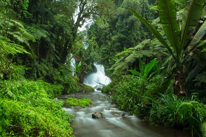
A waterfall in lush forest, Aberdare Mountains, Kenya.
Most of Kenya's low-elevation forests have disappeared outside of the protected parks and reserves, having been cleared long ago by humans for agriculture. What still remains is mostly restricted to small bands and pockets of forest along the Indian Ocean coastal strip and some riparian forest along the lower Tana River in southeast Kenya.
The coastal forests that remain in Kenya are small remnants of a once vast band of coastal forest that stretched from present-day Somalia in the north, all the way to Mozambique south of Tanzania. The largest and best preserved of Kenya's coastal forest is the Arabuko Sokoke Forest, located just inland from Malindi town. The forest contains zones of mixed lowland rainforest, Brachystegia woodland, and Cynometra forest, all of which are rich in both flora and bird life, with over 500 species of plants recorded.
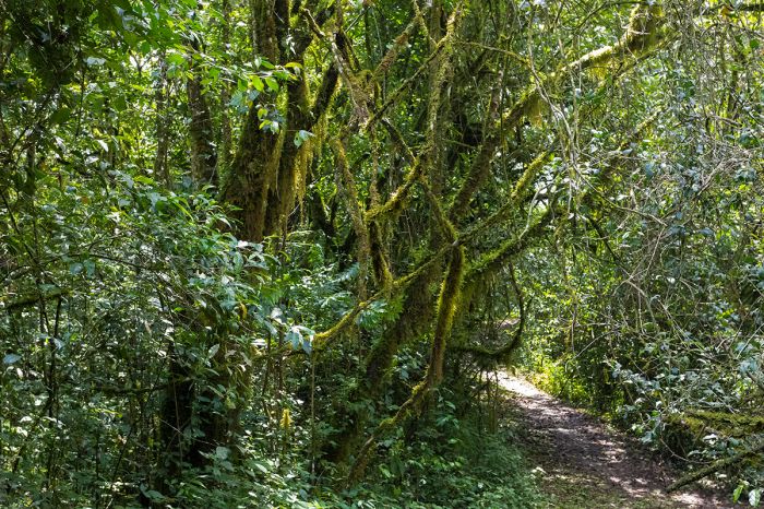
Walking trail thru Kakamega Forest, Kenya.
Grasslands
Open savanna covered in grass and interspersed with Acacia trees is the iconic ecosystem of the Masai Mara and Serengeti. The Mara-Serengeti plains are home to East Africa's greatest concentration of wildlife, with millions of herbivores feeding on the rich grasses that cover this region.
The richness of these grasses is due to the fertile volcanic soils that cover the area, combined with good rains that come twice a year and last for several months. These tropical grasslands are considered part of the 'Southern Acacia–Commiphora bushlands and thickets' ecoregion or biome.
Beyond the Masai Mara, much of the country, including most of southeast, central and northwest Kenya is part of the 'Northern Acacia–Commiphora bushlands and thickets' biome. Similar to the Masai Mara grasslands, but typically more arid, these grasslands, scrublands, and savannas stretch from the Kenya-Tanzania border east of the humid coastal belt and include Tsavo, Meru, Nairobi, Samburu, South Turkana, Marsabit, and northwest into parts of Uganda and South Sudan.
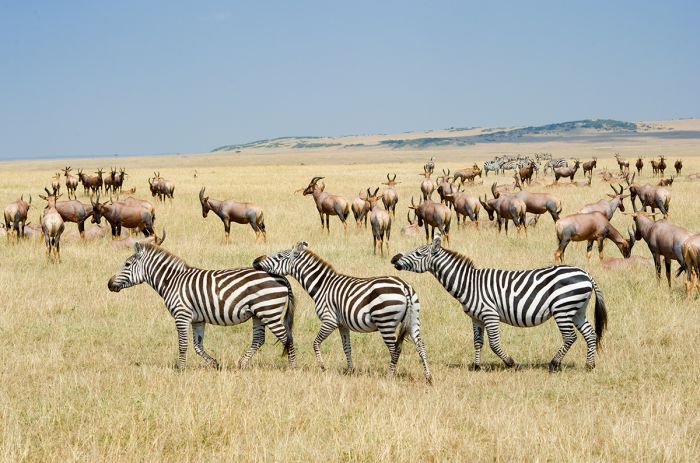
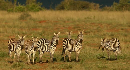
Zebras and topi on the short grass plains of the Masai Mara (Copyright © James Weis).
Wetlands
Kenya's wetlands are limited to its lakes and rivers, as well as some estuaries and wetlands along its eastern coastline. The Rift Valley cuts through western Kenya in a roughly north-south direction, and the valley contains lakes, most of which are endorheic (no outlet) and thus quite high in salts and minerals. Kenya's major Rift Valley lakes include (from north to south) Turkana, Logipi, Baringo, Bogoria, Nakuru, Elmenteita, Naivasha, and Magadi.
The highlands to the east of the Rift Valley, including the Aberdare Mountains and Mount Kenya, are the only major watersheds in Kenya, and the precipitation on these high slopes creates Kenya's only major rivers, including the Tana, Ewaso Ng'iro, and Athi-Galana.
Amboseli National Park has a series of small swamps that are fed from underground water flowing from Mount Kilimanjaro, located to the south in Tanzania. Lake Amboseli fills seasonally to a shallow depth depending on local rains.
Mangrove wetlands are found in the Lamu Archipelago on Kenya's northernmost coastline. In the southwest, the small portion of Lake Victoria that falls in Kenya contains papyrus swamps and marshlands along the shores.
Mangrove wetland at Mida Creek near Watamu, Kenya.
Wildlife
Masai Mara Wildlife
Kenya is one of Africa's top destinations for wildlife safaris and the Serengeti-Mara ecosystem is arguably Africa's premiere wildlife viewing venue. This ecosystem spans the border of Kenya and Tanzania, with the Masai Mara and its surrounding private conservancies forming the Kenyan portion of the land, while the Serengeti lies south of the border in Tanzania.
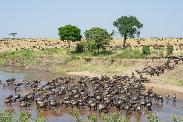
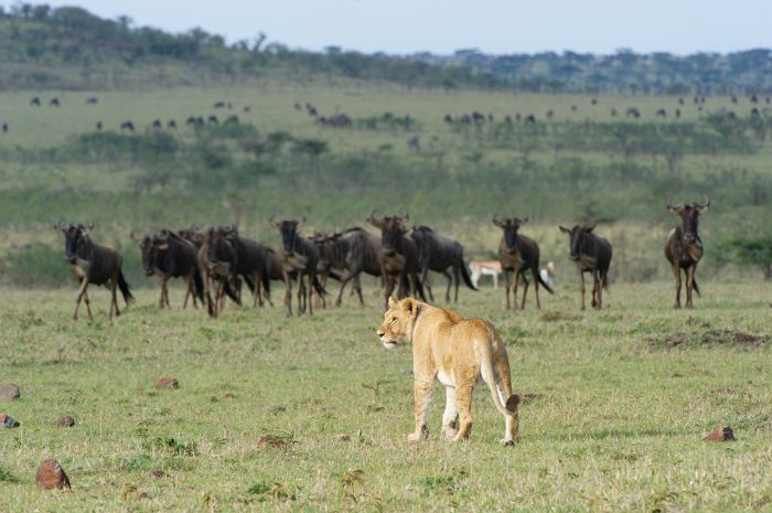
Africa's Great Migration, which sees roughly two million blue wildebeest and zebra on a continuous, clockwise trek across the Mara and Serengeti, attracts wildlife enthusiasts from around the world. The Masai Mara is known for this spectacle, as well as all its other resident wildlife, including lion, cheetah, leopard, elephant, giraffe, buffalo, spotted hyena, gazelles, antelopes, and many more iconic species.
The Great Migration arriving at the Sand River in the Masai Mara (Copyright © James Weis).
Beyond the borders of the Masai Mara National Reserve (MMNR) are multiple conservancies that are managed by various Maasai communities. Many of these conservancies (some are called Group Ranches), particularly those that directly border the MMNR, offer wildlife safaris that are as good or arguably superior to those inside the national reserve, as the safari camps and tourist numbers are far fewer than in the national reserve.
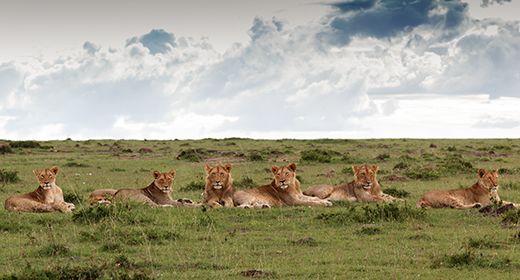
Big cats are a major draw in the Masai Mara, and it is surely one of Africa's best places to see them, especially cheetah, which do well in the Mara's wide-open grasslands, where they chase down Thomson's gazelle and other antelopes. Lions are also present in the Mara, often forming large prides and they sometimes compete with sizable 'clans' of spotted hyena for food, which can be an interesting interaction to see.
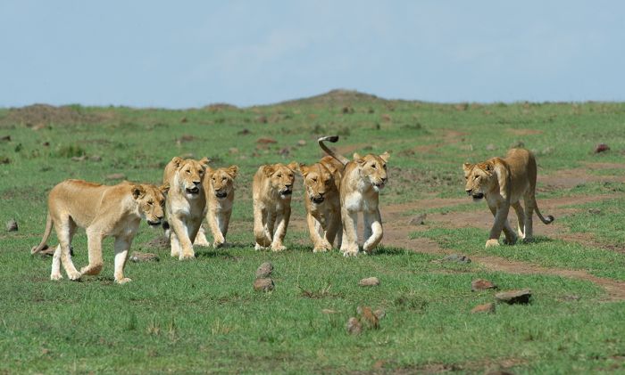
A pride of lions in the Masai Mara National Reserve (Copyright © James Weis).
Amboseli & Tsavo Wildlife
East of the Masai Mara along Kenya's southern border with Tanzania are Amboseli and Chyulu Hills, two national parks which lie in the shadows of Mount Kilimanjaro (which is located just across the border in Tanzania) and offer more wildlife safaris.
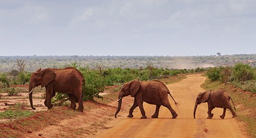
Amboseli is known for having some of Africa's last remaining "big tusker" elephants, owing to their decades-long protection from hunting and poaching here. The Chyulu Hills, lies east of Amboseli and offer a spectacularly scenic destination, with lower wildlife densities, but very few tourists.
Further to the east is the well-known Tsavo region, with two enormous national parks, Tsavo East and Tsavo West. Together these two parks make up the largest protected area in Kenya and one of the largest in the world. Tsavo is far less visited than Kenya's more popular reserves and it retains a wilderness feel. Tsavo West is the more visited of the two parks, but both offer good wildlife safaris, although the game viewing is a bit more challenging here than in the parks further west like the Masai Mara and Amboseli.
Elephants in Amboseli National Park, with Mount Kilimanjaro in the background.
Tsavo's landscape is one of red sand and wide-open spaces, with small regions of riverine forest and volcanic ridges. Tsavo's wildlife is abundant but often spread out in the large expanse of the parks. Species include elephant, lion, cheetah, giraffe, zebra, buffalo, various antelopes, and more.
Elephant and buffalo are a sure thing in Tsavo and they sometimes appear reddish, due to the color of the volcanic soil here. All of Africa's Big Five can be seen in Tsavo, including rhino, though they are only found in a protected sanctuary in Tsavo West. One of Africa's most unique animals, the gerenuk antelope, which is often seen standing on its hind legs to browse, can be seen in Tsavo.
Elephants in Tsavo East National Park, Kenya.
Nairobi Wildlife
Central Kenya is home to Nairobi, the country's capital and largest city, as well as the East Africa's main gateway for international travelers. Most visitors do not linger long in the city and head to other destinations the same day or spend a night before continuing on with their itinerary.
Nairobi National Park, which borders the city, offers surprisingly good wildlife viewing for those with an extra day to spend. The David Sheldrick Wildlife Trust, which rehabilitates orphaned baby elephants, is located within Nairobi National Park and is highly recommended.
Lions in Nairobi National Park, Kenya.
Rift Valley & Central Highlands Wildlife
Africa's Great Rift Valley, which begins at the top of Africa in the Red Sea and cuts through Kenya, create habitats that are home to diverse wildlife. In the valley are Kenya's major lakes, which are bordered by grasslands and woodland and are home to good numbers of grazers and predators.
Along the eastern ridge of the rift are Kenya's Central Highlands, including Mount Kenya, Africa's second-highest peak, and the Aberdare Mountains, both of which also support iconic species, including elephant, buffalo, and leopard.
Flamingos on Lake Nakuru, one of Kenya's Central Rift Valley lakes.
Laikipia Wildlife
Located north of Kenya's Central Highlands and east of the Rift Valley is the wildlife-rich and diverse Laikipia Plateau. This region has no national parks, but instead has numerous privately run and community-based wildlife conservancies, some of which double as working cattle ranches.
Laikipia is considered a model of conservation success, where local people, ranching, diverse wildlife, and ecotourism coexist together. The major conservancies include Lewa, Ol Pejeta, Borana, Sosian, and Mugie. The Laikipia conservancies are one of the last places where wild rhinos can be seen reliably.
Masai giraffes in Hell's Gate National Park, Kenya.
Samburu Wildlife
Directly east of Laikipia is the Samburu Region, with three notable reserves: Samburu, Buffalo Springs, and Shaba. The Ewaso Ng'iro River, which rises from the western slopes of Mount Kenya and flows all the way to Somalia, provides the only year-long source of water to this otherwise arid region.
Samburu is home to diverse wildlife, including many regional dry-land species such as Grevy's zebra, beisa oryx, lesser kudu, Guenther's dik-dik, and gerenuk, The region also offers rewarding cultural experiences with the local Samburu people.
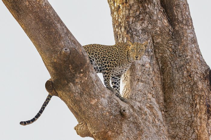
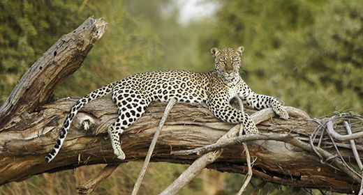
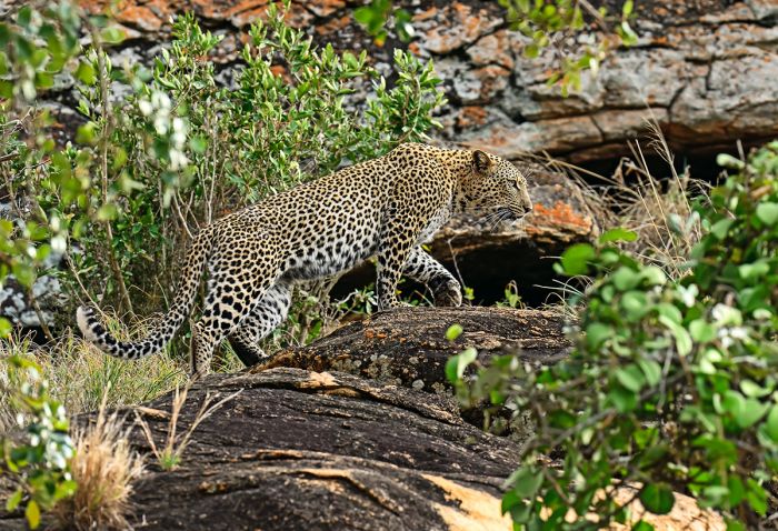
A leopard in Samburu National Park, Kenya.
East Coast Wildlife
Kenya's East Coast runs for 882 miles (1 420 kms) miles along the warm, turquoise waters of the Indian Ocean. There are white-sand beaches, historic towns like Lamu in the far north, Malindi and Watamu further south, and the major port of Mombasa. The south shores boast the popular Diani Beach, with resorts and private villas. Several wildlife reserves are situated just inland from the coast and there are numerous marine reserves protecting the fragile reefs offshore.
Kenya has set aside 26 national parks and another 19 as national reserves. There are also numerous privately managed wildlife conservancies that offer good wildlife viewing. Read more about each below.
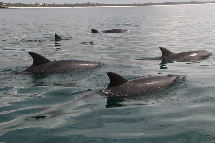
Indo-Pacific bottlenose dolphins (Tursiops aduncus) in the Watamu Marine National Park, Kenya.
Protected Areas
Kenya has protected numerous national parks, reserves, and wildlife management areas (called group ranches or conservancies). Read about the details of each immediately below.
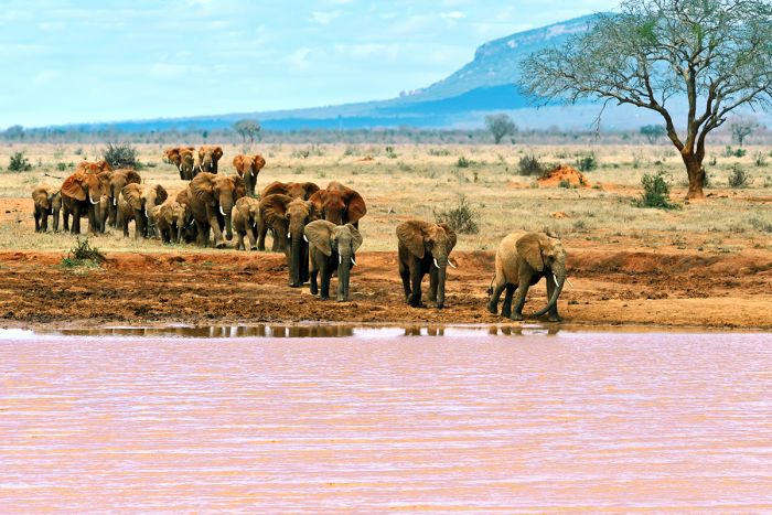
A bull elephant in Chyulu Hills National Park, Kenya (Copyright © James Weis).
National Parks
Following are Kenya's 26 national parks. The majority of the parks are situated in the central and southern portions of the country, with just a handful located in the remote and seldom visited northern portion. Additional information on each is included further below this list:
- Aberdare National Park - Protects the middle and upper elevations of the Aberdare Mountains. Beautiful and pristine habitat and plentiful wildlife. Completely fenced to minimize human-wildlife conflict. 'Tree' lodge accommodations.
- Amboseli National Park - Famous wildlife destination near the Kenya-Tanzania border. Plentiful wildlife, especially elephants, with Mount Kilimanjaro as a postcard-like backdrop. Protects several seasonal swamps and Lake Amboseli.
- Central Island National Park - One of two small island national parks in Lake Turkana in remote northern Kenya. Part of a UNESCO World Heritage Site.
- Chyulu Hills National Park - Protects a highland lava ridge east of Amboseli, with bordering 'group ranch' conservation areas in between the two parks. Seldom visited and spectacular scenery. Excellent wildlife safaris with very few tourists.
- Hell's Gate National Park - Small park on the southern side of Lake Naivasha protecting a deep gorge and plentiful seasonal plains game. Walking in the gorge (while sometimes viewing wildlife) is a highlight.
- Kisite-Mpunguti Marine National Park - Protects offshore Indian Ocean waters and Wasini Island near the southern border Kenya. Excellent snorkeling.
- Kora National Park - Part of a contiguous protected area that includes Meru NP, and several reserves (Bisanadi, Mwingi, Rahole) with semi-desert scrub habitat. Home of the late wildlife conservationist George Adamson. Seldom visited, but decent though sparse wildlife.
- Lake Nakuru National Park - Very popular destination in Kenya's Central Rift Valley, with diverse and abundant wildlife, including rhino, buffalo, giraffe, lion, leopard and many other species. Large numbers of flamingos gather seasonally on the lake. Self-drive or stay at one of the fully inclusive lodges.
- Malindi Marine National Park - Protects Indian Ocean water and marine life offshore from the town of Malindi. Good diving and snorkeling. Adjoins the Watamu Marine National Reserve.
- Malka Mari National Park - Located along the remote northeast border with Ethiopia. Protects semi-arid scrub and home to a variety of wildlife. Due to its location, very seldom gets visitors.
- Marsabit National Park - Located in seldom visited northern Kenya; protects land around Mount Marsabit, a massive, dormant shield volcano. The park has a variety of wildlife, notably elephants and offers very good birding.
- Meru National Park - Made famous by George and Joy Adamson, who lived and worked with lions here. Seldom visited, but offers good wildlife, lovely and unspoiled scenery, and a noticeable absence of tourists.
- Mombasa Marine National Park and Reserve - Protects waters offshore from Mombasa. Part national park, but the majority is a national reserve. Very good snorkeling and diving, with some very nice coral reefs.
- Mount Elgon National Park - Protects a small portion of Mount Elgon, an extinct volcano which straddles the western border with Uganda. Excellent hiking and rock climbing and some wildlife, but mainly a scenic park visited for the caves, forest, moorland, and trekking.
- Mount Kenya National Park - Protects the mid- and upper-elevations of Mount Kenya, Africa's second-tallest peak. Excellent hiking in the lower elevations and treks to the peak for the more intrepid. Forest lodges outside the park in the lower-elevation buffer zone.
- Mount Longonot National Park - Small park just south of Lake Naivasha protecting the stratovolcano of the same name (last eruption in 1860s). Hiking to the rim of the caldera is the main attraction; circumnavigating the rim takes 2-3 hours.
- Nairobi National Park - On the southern boundary with Kenya's capital city, the park offers surprisingly good game viewing and is unfenced on its southern border. Four of the Big Five animals are here (elephants missing), plus abundant plains game and very good birding. Worth a visit for those with a spare day or two in the city.
- Ndere Island National Park - Small uninhabited island just offshore in Lake Victoria. Protects hippos, crocodiles, various antelopes, and abundant bird life.
- Ol Donyo Sabuk National Park - Protects the mountain of the same name located just northeast of Nairobi. Offers good hiking and views of both Kilimnajaro and Mount Kenya. Wildlife still live on the slopes and is a popular day trip for locals living in Nairobi.
- Ruma National Park - Located in southwest Kenya, very close to Lake Victoria, the small park was created to protect Kenya's only population of roan antelope. Other species include Jackson's hartebeest, oribi, and Rothschild's giraffe. Leopard present but seldom seen. Visitors may have the park to themselves.
- Saiwa Swamp National Park - Tiny national park, created specifically to protect habitat and population of the semi-aquatic sitatunga antelope. Walking only on trails around the jungle and swamp. Various monkeys and birds.
- Sibiloi National Park - Remote park consisting of rocky, arid desert in far northern Kenya on the eastern shore of Lake Turkana. Created to protect numerous prehistoric hominid fossil sites. Part of a UNESCO World Heritage Site.
- South Island National Park - One of two small island national parks in Lake Turkana in remote northern Kenya. Part of a UNESCO World Heritage Site.
- Tsavo East National Park - Largest national park in Kenya protects grassland and semi-arid Acacia scrubland. Much less visited than its sister park (Tsavo West), the park feels wild and remote. Wildlife viewing can be excellent and all the Big Five are present.
- Tsavo West National Park - Adjoins Tsavo East and has more varied terrain than its sister park. Game viewing is good, but the thick Acacia scrub can make finding animals difficult. All of Africa's Big Five are here. Mzima Springs' underwater observation hide is a top attraction.
- Watamu Marine National Park and Reserve - Protects Indian Ocean, tidal habitats (including Mida Creek) and marine life offshore from the town of Malindi. Good diving, snorkeling, and other water sports. Adjoins Malindi Marine National Park.
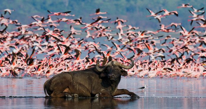
A buffalo relaxes on the shore of Lake Nakuru while flamingos take flight. The national park protects the lake and its wildlife.
Important Areas
Other important areas of note in Kenya include national reserves, national forests, group ranches, conservancies, general regions, and other attractions that are worth consideration when planning your trip.
- Arabuko Sokoke National Forest - Protects East Africa's last remaining tract of coastal forest. Superb for birding and also supports some primates and a small population of elephant.
- Arawale National Reserve - Borders the eastern side of the Tana River in northeast Kenya. Protects the only in-situ site of the critically endangered hirola antelope.
- Bisanadi National Reserve - One of three reserves contiguous with Meru and Kora National Parks. Semi-desert scrub habitat, except along the Tana River, where there is riparian forest. Good, though sparse wildlife and excellent birding. Few to no tourists.
- Boni National Reserve - Located on the Somali border along the Indian Ocean coast in northeastern Kenya. Protects the Boni Forest, which has been declared a biodiversity hotspot. The indigenous Awer and Watta people live in the forest. Due to its location, it is not recommended for tourists at present.
- Borana Conservancy - Combined cattle ranch and wildlife conservancy in the Laikipia Region north of Mount Kenya and contiguous with the Lewa Wildlife Conservancy. Horse riding and game drives to see rhino and other wildlife.
- Buffalo Springs National Reserve - Located in the Samburu Region and the furthest north of Kenya's most popular reserves. Adjoins Samburu National Reserve (the two are separated by a river) and offers diverse wildlife in a mostly dry, semi-arid habitat.
- Central Highlands - Region located north of Nairobi in the center of Kenya that is defined by high altitude mountains including the Aberdares and Mount Kenya.
- David Sheldrick Wildlife Trust - Located in a reserved section of Nairobi National Park, the DSWT is a non-profit conservation organization that rescues and cares for orphaned elephants and rhinos, many of which are then released back to the wild in Tsavo East National Park. Visits are highly recommended.
- Diani Beach - Indian Ocean beach destination. Mostly upscale villas and all-inclusive resorts, though never overly crowded. White sands, palm trees, and beautiful blue waters with snorkeling, diving, fishing, and more.
- Dodori National Reserve - Situated just inland and north of Lamu along the northeast coast and not far from the Somalia border. Habitats include swamp, mangrove, woodland, forest, thorn veld, and coastal beach. Good numbers of wildlife, including a healthy population of topi. Seldom visited and not currently open for tourism due to the presence of Somali terrorists sometimes found in the region.
- Great Migration - The continuous movement of hundreds of thousands of animals, all of them blue wildebeest and Burchell's zebra, across the Masai Mara (Kenya) and Serengeti (Tanzania) ecosystem.
- Kakamega Forest - Located in western Kenya, it is the country's only tropical rainforest. Comprised of various, separately managed reserves, which protect a huge diversity of flora and is most famous for birding. Primates and other mammals also present. Under threat from large human population living around the forest.
- Kalama Community Conservancy - Adjoins Samburu National Reserve to the north and along with the neighboring West Gate Conservancy, provides tourism revenue for the local pastoralist Samburu people. Diverse wildlife and birding and easy day trips into Samburu/Buffalo Springs.
- Kisumu Impala Sanctuary - Located on the shores of Lake Victoria at the town of Kisumu. Small sanctuary offering 'a lakeshore walk with impalas'.
- Kiunga Marine National Reserve - Protects Indian Ocean waters and fifty calcareous offshore islands and coral reefs in the Lamu Archipelago in far northeast Kenya. Refuge for myriad sea life and birds. Excellent snorkeling, diving, sailing.
- Laikipia - Vast plateau situated between the Central Highlands and the semi-desert regions to the north. A patchwork of private and community-run conservancies and ranches offer superb wildlife experiences, as well as ranch activities and wildlife conservation.
- Lake Baringo - Freshwater lake in the North-Central Rift Valley. Excellent birding and a few good places to stay.
- Lake Bogoria National Reserve - Protects Lake Bogoria and land immediately surrounding the lake in Kenya's North-Central Rift Valley. The lake is often visited by enormous numbers of flamingos and a variety of large mammals also live around the lake.
- Lake Elmenteita - Small, saline, Central Rift Valley lake between Lakes Nakuru and Naivasha. Partially protected by the Soysambu Conservancy, with good plains game. Flocks of flamingos sometimes feed on the lake.
- Lake Magadi - Located in the Southern Rift Valley near the border with Tanzania. The lake's hypersaline waters are an important source of soda and the nearby Shompole Conservancy offers exploration and wildlife.
- Lake Naivasha - One of Kenya'a Central Rift Valley lakes. A popular eco-tourism destination, although it is not afforded protection via reserve or national park. Several private sanctuaries are located around the lake and Hell's Gate National Park is located very close to the south.
- Lake Turkana - Northern Rift Valley desert lake and the largest expanse of water in Kenya. Located in the far north and barely reaching into Ethiopia, with brackish water. Three national parks but seldom visited due to its remoteness.
- Lake Victoria - The largest lake in Africa, but only around 6% of the lake is located within Kenya. Not a heavily visited area for tourists, as there is little to offer other than a few island retreats.
- Lamu Archipelago - Indian Ocean islands located just offshore in remote northeast Kenya, very close to the Somali border. Lamu town is a popular cultural destination dating back to the 8th century.
- Lewa Wildlife Conservancy - Renowned wildlife conservation initiative that has successfully transformed farmland into a wildlife haven for rhinos, cheetah, zebra, lion, and many more species. Superb destination with top-notch safaris and game viewing.
- Masai Mara Conservancies and Group Ranches - Privately owned and managed land surrounding the Masai Mara National Reserve.
- Masai Mara National Reserve - Together with its adjoining private reserves, this is Kenya's premier wildlife destination. Popular for its incredible densities of plains game and attendant predators. Together with Tanzania's Serengeti, it is the location of the Great Migration of zebras and blue wildebeests.
- Mwea National Reserve - Small savanna ecosystem northeast of Nairobi and along the Tana River. Protects a diverse array of mammals, including elephant, giraffe, and buffalo. Birding, particularly for water birds and waders, is superb.
- Mwingi National Reserve - One of three reserves contiguous with Meru and Kora National Parks. Semi-desert scrub habitat except along the Tana River, where there is riparian forest. Good, though sparse wildlife and excellent birding. Few to no tourists.
- Nasolot National Reserve - Located a short distance west of South Turkana National Reserve and north of Mount Melo in northwest Kenya. Mainly a hiking destination, but there is some wildlife, though seeing the animals is challenging in mostly thick bush prevalent here. Almost no-one visits the reserve due to its remote location.
- Ngare Ndare Forest Reserve - Protects forest adjoining both Lewa and Borana conservancies to the south and offers additional land for use by elephants and other wildlife in the area. Maintained primarily by the local communities as the Ngare Ndare Forest Trust, under the supervision of Kenya Forest Service (KFS).
- Ol Pejeta Conservancy - Located in the Laikipia Region, this non-profit is one of several dual-purpose reserves that combines wildlife conservation with cattle ranching. Habitat is mainly grassland and Acacia scrub and wildlife here is diverse and abundant.
- Rahole National Reserve - One of three reserves contiguous with Meru and Kora National Parks. Semi-desert scrub habitat except along the Tana River, where there is riparian forest. Good, though sparse wildlife and excellent birding. Few to no tourists.
- Rift Valley (Central) - A popular wildlife destination in the center of Kenya's Great Rift, which spans the country north to south. The valley is home to rich grasslands and several important lakes, including Nakuru, Elmenteita, and Naivasha. Escarpments and volcanic highlands fringe the valley.
- Rift Valley (North-Central) - Directly north of the commonly visited Central Rift Valley are two lakes that are less often explored by tourists: Lake Baringo and Lake Bogoria, as well as Lake Bogoria National Reserve. Drier and much more harsh environment than the Central Rift Valley further south.
- Rift Valley (Northern) - A dry and remote area that extends all the way to the northern border and into Ethiopia. Dominated by Lake Turkana, the world's 4th largest saline lake. Several national parks and important archeological sites.
- Rift Valley (Southern) - The southern extent of Kenya's rift includes the hypersaline Lake Magadi and the northern tip of Lake Natron, which is mainly in Tanzania. A dry, sparsely populated, and interesting area, though not often visited.
- Samburu National Reserve - Along with its sister reserve, Buffalo Springs (the two are separated by a river), offers diverse wildlife in a semi-arid zone. Home of the colorful and rich Samburu people, who are conspicuous and welcoming to tourists.
- Shaba National Reserve - Located only a few kilometers east of Samburu and Buffalo Springs and offers an even more wild-feeling experience than its more visited neighboring reserves. Good wildlife viewing with very few visitors.
- Shimba Hills National Reserve - Situated near the coast in far southeastern Kenya. Good wildlife viewing but no lions (leopards are present though). Elephants, buffalo and a variety of other plains game. Popular day or short visit for anyone staying at Diani Beach on the Indian Ocean coast.
- Shompole Conservancy - Private venture run by the local Maasai people, located on the Tanzanian border at the northern tip of Lake Natron. Decent wildlife viewing.
- South Kitui National Reserve - Remote and seldom visited reserve adjoining Tsavo East National Park to the north. Plenty of wildlife and no tourists likely.
- South Turkana National Reserve - Located in northwest Kenya southwest of Lake Turkana. Rugged and desolate, with dense bush and some riparian forest. Plains game is scarce, although elephants migrate here between March and July. Seldom visited.
- Soysambu Conservancy - Converted ranch land created during the British colonial era now protects two-thirds of Lake Elmenteita's shores and surrounding land. Good plains game and several choices for accommodation.
- Tana River National Primate Reserve - Created to protect populations of two species of monkey, the Tana River red colobus and Tana River mangabey. The reserve has essentially been abandoned for years and its habitat has become seriously degraded. Efforts are underway to try and rescue the project.
- West Gate Community Conservancy - Adjoins Samburu National Reserve to the west and along with the neighboring Kalama Conservancy, provides tourism revenue for the local pastoralist Samburu people. Diverse wildlife and birding and easy day trips into Samburu/Buffalo Springs.
A white rhino with her calf in the Lewa Wildlife Conservancy, Kenya (Copyright © James Weis).
Masai Mara Conservancies & Group Ranches
Outside of the boundaries of the Masai Mara National Reserve (MMNR) are numerous tracts of land owned by local Maasai tribes. Many, especially the ones directly bordering the national reserve, offer exceptionally good wildlife safaris on a par with, or arguably even better (due to lack of crowds) than inside the MMNR. Below is a list of the private conservancies around the MMNR.
- Enonkishu Conservancy - Enonkishu is located well north of and not directly bordering the MMNR.
- Kerinkani Group Ranch - Kerinkani is located directly west of the MMNR, along the escarpment and near the Tanzania border.
- Kimintet Group Ranch - Kimintet is located northwest of the MMNR, on the western banks of the Mara River. Excellent game viewing in its southern portion closest to the MMNR.
- Koiyaki Game Ranch - Koiyaki is located north of and not directly bordering the MMNR.
- Lemek Conservancy - Lemek Conservancy is located north of and not directly bordering the MMNR, but is along the Mara River.
- Lemek Group Ranch - Lemek Group Ranch is located well north of and not directly bordering the MMNR.
- Maji Moto Conservancy - Maji Moto is located well northeast of and not directly bordering the MMNR.
- Mara North Conservancy - Mara North directly borders the MMNR to the north and its western border is the Mara River; prime safari territory. Numerous safari camps with game drives in the conservancy and also into the MMNR
- Naboisho Conservancy - Naboisho directly borders the MMNR to the north and is in prime safari territory. Numerous safari camps with game drives in the conservancy and also into the MMNR.
- Naikarra Conservancy - Naikarra is located well east of and not directly bordering the MMNR.
- Olare Motorogi Conservancy - Olare Motorogi directly borders the MMNR to the north and is prime safari territory. Numerous safari camps with game drives in the conservancy and also into the MMNR.
- Olderikesi Group Ranch - Olderikesi directly borders the MMNR to the east along the Tanzania border.
- Oloirien Group Ranch - Oloirien is located directly west of the MMNR, along the escarpment. Some lodges atop the escarpment and game drives into the MMNR.
- Oloololo Game Ranch - Oloololo directly borders the MMNR to the northwest and has some Mara River frontage; prime safari territory. Very small landholding with some safari camps and game drives mostly into the MMNR.
- Ol Chorro Conservancy - Ol Chorro is located well north of the MMNR along the Mara River. Some safari camps.
- Ol Kinyei Conservancy - Ol Kinyei Conservancy is located northeast of the MMNR and is good safari territory. Small landholding with some safari camps and game drives mainly in the conservancy, but access to MMNR possible.
- Ol Kinyei Group Ranch - Ol Kinyei Group Ranch is located well northeast of and not directly bordering the MMNR.
- Siana Group Ranch - Siana is located directly east of the MMNR. Some safari camps with game drives on the group ranch and also into the MMNR.
- Talek Group Ranch - Talek directly borders the MMNR to the north. Small landholding with some safari camps and game drives mostly into the MMNR.
Read full details on the Mara Private Conservancies and its safari camps and lodges here.
A lioness is watched carefully by blue wildebeests in the Olare Motorogi Conservancy, Masai Mara, Kenya (Copyright © James Weis).
UNESCO World Heritage Sites
The United Nations Educational, Scientific and Cultural Organization (UNESCO) is a specialized agency of the United Nations whose mission is to promote world peace and security through international cooperation in education, the arts, the sciences, and culture. The Convention concerning the Protection of the World's Cultural and Natural Heritage was signed in November 1972 and ratified by the 193 UN member 'states parties'.
A World Heritage Site is a landmark or area which is geographically and historically identifiable and has special cultural or physical significance. To be selected as a World Heritage Site, a nominated site must meet specific criteria and be judged to contain "cultural or natural heritage of outstanding value to humanity". An inscribed site is categorized as cultural, natural, or mixed (cultural and natural). As of 2021, there were over 1 100 sites across 167 countries.
Kenya has seven UNESCO World Heritage Sites:
- Fort Jesus, Mombasa (since 2011, Cultural) - Large fortress built by the Portuguese at the end of the 16th century to protect their control of the strategic port of Mombasa and the lucrative Indian Ocean trade routes, which had previously been controlled by the Omani Arabs. The fort was constructed using coral, stone, and lime mortar and has imposing walls and five bastions. Its design reflects the military architecture of the Renaissance.
- Kenya Lake System in the Great Rift Valley (since 2011, Natural) - Comprises three alkaline lakes and their surrounding land: Lake Bogoria, Lake Nakuru, and Lake Elmenteita. The lakes are located on the floor of the central portion of Kenya's Rift Valley and they support a great diversity of bird and mammal species. Up to 4 million lesser flamingos move between these lakes for much of the year and are a major breeding ground for great white pelicans.
- Lake Turkana National Parks (since 1997, Natural) - Comprising three national parks located at Lake Turkana in far northern Kenya: Sibiloi, Central Island, and South Island. Turkana, often called the Jade Sea for its incredible color, is the most saline lake in East Africa and the largest desert lake in the world, surrounded by a desolate landscape. There are over 100 identified archeological and paleontological sites at Lake Turkana, with numerous volcanic flows and petrified forests. The island parks are breeding grounds for nile crocodile and hippopotamus and and the lake is a crucial stopover for migrating palaearctic birds.
- Lamu Old Town (since 2011, Cultural) - The Swahili town of Lamu is located on Lamu Island in the extreme north of Kenya's Indian Ocean coastline and has been continuously inhabited for over 700 years. The section called "old town" is the original settlement and is characterized by narrow streets and lovely old architecture influenced by a mix of Arabic, Persian, Swahili, Indian, and European styles. The town has managed to retain much of its traditional culture.
- Mount Kenya National Park/Natural Forest (since 1997, Natural) - Mount Kenya, a massive extinct volcano, is Africa's second tallest peak (17 057 feet/5 199 meters) straddling the equator in Central Kenya. There are four secondary peaks and 12 remnant glaciers, which are all retreating rapidly. The property also includes Lewa Wildlife Conservancy and Ngare Ndare Forest Reserve, located to the north, and the two properties are connected by a wildlife corridor, which is crucial for numerous mammals, and in particular elephant. The forested foothills and valleys of the lower slopes of the mountain are also incorporated in the site.
- Sacred Mijikenda Kaya Forests (since 2008, Cultural) - Remains of numerous fortified villages, known as Kayas, built in the 16th century and belonging to the Mijikenda people. The villages were all abandoned by the 1940s, and are spread out inland and around present-day Mombasa. The sites are now regarded as the sacred abodes of their ancestors and are maintained by a council of elders. The small pockets of forest surrounding the various Kayas are now almost the only remains of a once extensive coastal lowland forest in present-day Kenya.
- Thimlich Ohinga Archaeological Site (since 2018, Cultural) - Situated near the town of Migori in southwest Kenya and very close to Lake Victoria, Thimlich is the largest and best preserved example of an early pastoral community 'ohinga' (enclosure). The site includes typical examples of dry stone walled enclosures that served as a protective fort and enclosure for people and livestock, dating back to sometime in the 16th century.
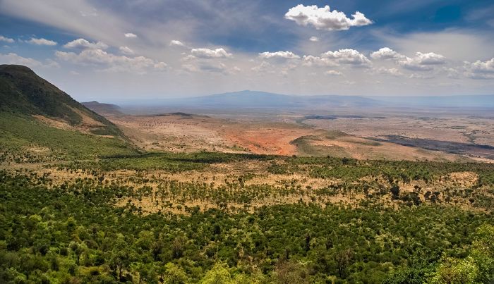
View into the Rift Valley in Kenya.
Ramsar Wetlands of International Importance
The Ramsar Convention on Wetlands is an international treaty for the conservation and sustainable use of wetlands. It was the first of the modern global nature conservation conventions, negotiated during the 1960s by countries and non-governmental organizations concerned about the increasing loss and degradation of wetland habitat for birds and other wildlife. The convention is named after the city of Ramsar in Iran, where the convention was signed in 1971.
Presently there are some 75 member States to the Ramsar Convention throughout the world which have designated over 2 300 wetland sites onto the Ramsar List of Wetlands of International Importance.
Kenya has six sites designated as Wetlands of International Importance (Ramsar Sites) as follows.
- Lake Baringo - An important freshwater lake in Kenya's North-Central Rift Valley. Ol Kokwe Island is the remnant of a small volcano. The lake is fed by freshwater inflows from nearby hills and provides crucial habitat for around 500 species of birds and seven freshwater fish species, one of which is endemic. The lake is also habitat for hippo, crocodile, and a variety of mammals, reptiles, amphibians, and invertebrates. Human activities include fishing, water usage for drinking and irrigation, and boating. (121 sq miles/315 sq kms)
- Lake Bogoria - Another of Kenya's North-Central Rift Valley lakes, Bogoria has alkaline waters that are dominated by hot springs. The lake is a critical refuge for lesser flamingos, which at times gather in the hundreds of thousands to feed. The lake and surrounding acacia woodland are protected as a national reserve and are home to a variety of mammals. The region around the lake is semi-arid, but the lake's water levels are consistent, which is crucial, particularly during times of drought. Human activities include pastoralism by the local Tugen and Jemps tribes, as well as tourism. (41 sq miles/107 sq kms)
- Lake Elmenteita - A shallow, alkaline, saline lake in the Central Rift Valley that supports healthy environment for blue-green algae and diatoms. The algae is a favored food for the lesser flamingo, which gather here in large numbers to feed. The lake is also a favored breeding ground for great white pelicans. Human activities include tourism, subsistence irrigation, water for livestock, and grazing, though most of the land directly surrounding the lake is protected. (42 sq miles/109 sq kms)
- Lake Naivasha - A high altitude, freshwater crater lake in Kenya's Central Rift Valley that includes a river delta and separate smaller lake dominated by blue-green algae and soda tolerant vegetation. There is no visible outlet, but because the lake's water is fresh, there is assumed to be an underground outflow. Naivasha provides habitat for over 400 species of birds and a sizeable population of hippo. Other mammals living along the lakeshore include buffalo and waterbuck. Human activities include livestock ranching, agriculture, fishing, freshwater usage, and tourism. Kenya is a leading exporter of cut flowers, and the area around the lake is used for floriculture, which employs thousands of Kenyans, but poses a major threat due to its use of pesticides and fertilizer. (116 sq miles/300 sq kms)
- Lake Nakuru - A shallow, strongly alkaline Central Rift Valley lake with surrounding woodland and grassland. The lake is fed by four seasonal rivers and one perennial river. Habitats include seasonally flooded and dry grassland, swamps, riparian forest, sedge marsh, and various types of scrub. The lake and surrounding land are protected by Lake Nakuru National Park. The park protects numerous endangered mammals, including black rhino, as well as regionally endangered bird species, including the gray-crested helmetshrike. Human activity is primarily tourism inside the national park, but outside the park there is large-scale agriculture and cattle ranching. (73 sq miles/188 sq kms)
- Tana River Delta - Second most important estuarine and deltaic ecosystem in East Africa. Includes a variety of habitats, including freshwater, estuary, mangrove, marine, marine/brackish intertidal, beach, and marine shallows. Supports rich biodiversity including shrimps, bivalves, prawns, fish, and five species of marine turtle. Mammals include elephants Tana River red colobus, Sykes' monkey, and Tana mangabey. Serves as a critical wintering and feeding grounds for numerous migrating waterbirds. Human activities include fishing, small-scale agriculture, wood collecting, tourism, and research (turtle and dugong). (631 sq miles/1 636 sq kms)
Great (white-breasted) cormorants (Phalacrocorax carbo lucidus) at Lake Naivasha. The lake is one of Kenya's six Ramsar Wetlands of International Importance.
Urban Areas
Kenya has four significant urban areas, with two being quite large in terms of population. Info on each follows below.
- Kisumu - Kenya's third most populous city on the shores of Lake Victoria. The original terminus of the Uganda Railway line from Mombasa. Not much to see or do.
- Malindi - Historic town on the Indian Ocean coastline. Today the town is primarily a tourism center, especially with Europeans, who come for the beach and water sports.
- Mombasa - Significant port city on Kenya's Indian Ocean coast. The country's second largest city by population (after Nairobi). Long history dating back to around 900 AD. Not considered a tourist destination.
- Nairobi - Kenya's capital and largest city, as well as a major international arrival gateway to all of East Africa. The Nairobi National Park, situated south of the city, is surprisingly good for wildlife safaris.
Evening view over Nairobi, Kenya's capital city.
Masai Mara
The Masai Mara is located along Kenya's southern border with Tanzania and is contiguous with that country's Serengeti region. The Kenya side of this large ecosystem includes the Masai Mara National Reserve (MMNR), as well as numerous private conservancies that surround the MMNR on the west, north, and east.
Kenya's Masai Mara is certainly the country's top wildlife destination and one of the most popular in all of Africa. Often referred to simply as 'the Mara', these extensive grasslands are part of a greater ecosystem that spans across Southeast Kenya and into northeast Tanzania's Serengeti National Park.
The combined Serengeti-Mara ecosystem, which includes adjoining parks and private reserves, covers some 15 000 square miles (39 000 sq kms) and is a haven for huge numbers of large mammals.
Kenya's Masai Mara is a very good place to see cheetah.
The Great Migration
The Mara-Serengeti ecosystem is the setting for one of the animal kingdom's greatest spectacles, the 'Great Migration'. Throughout the year, some two million herbivores, primarily blue wildebeests and Burchell's (or plains) zebras complete a clockwise cycle around the Serengeti and Masai Mara in a never ending search for good grazing.
The movement of the herds is coordinated and yet imprecise, with the timing of their arrival somewhat determined by local rainfall. The herds are always very spread out due to their number, but in general, the bulk of the animals spend around three months (from late July thru early October) on the Kenya side (Masai Mara) of the grasslands and the other nine months in Tanzania's Serengeti, which covers a far greater portion of the overall ecosystem.
The 'Great Migration' of blue wildebeest and zebra is a spectacular event to experience.
There are no substantial fences in the Mara-Serengeti, so to the animals, it is just one large environment with the only barriers being rivers. The biggest obstacle, and one that brings safari enthusiasts to the region time and again, is the dramatic scenes that unfold when big herds of wildebeest and zebras swim across the Mara River. Hungry crocodiles, including some that are massive beasts and have not eaten anything substantial for many months, lie in wait to catch their long awaited meal.
Masai Mara Resident Wildlife
Besides the annual and endless trek of the wildebeest and zebras, the Mara is home to a multitude of other resident wildlife, which may move around some, but do not follow the Great Migration.
Other commonly seen plains game in the Mara include elephant, giraffe, Thomson's gazelle (or 'tommies', as they are sometimes called), topi, eland, Coke's hartebeest (a local subspecies of hartebeest also known as 'kongoni'), roan antelope, Grant's gazelle, common reedbuck, waterbuck, warthog and more. A small population of black rhino still live in the Mara.
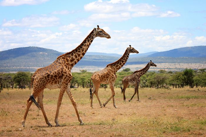
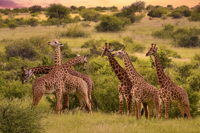
Giraffes in Kenya's Masai Mara National Reserve.
Predators, especially big cats, are found throughout the Mara-Serengeti, with the habitat being very suitable for cheetah, which need wide open plains to run down their prey. Cheetah are a highlight to be sure, but there are also good populations of lion, spotted hyena, leopard, two species of jackal (black-backed and side-striped), and serval.
The 'Mara Triangle'
The Mara River separates the reserve into two separately managed sections: the main reserve, which lies east of the river, the a triangular-shaped section of land known as 'the Mara Triangle', which lies west of the river and is bounded by a steep escarpment at the western edge of the overall reserve.
Almost all the safari accommodations in the reserve are on the eastern side of the river, with only a small number of lodges and camps in 'the triangle' or outside the reserve atop the escarpment (these have amazing views over the reserve).
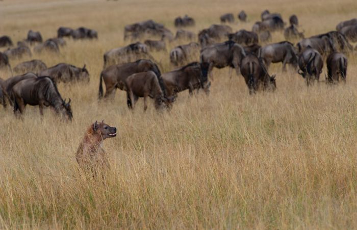
A spotted hyena searches for potential prey amongst the herds of blue wildebeest (Copyright © James Weis).
Visiting the Masai Mara
Visitor accommodations in the Masai Mara Reserve are numerous and range between rustic, bucket-shower 'bush' camps, to extravagant five-star luxury lodges, with pricing also accordingly covering a large range.
Game drives are the main activity in the Mara, with both a morning and an afternoon drive being the norm. Full-day drives are also an option, with a packed lunch, particularly for those that wish to wait alongside the Mara River in hopes of seeing a river crossing.
Other activities in the Mara include the very popular hot-air balloon safaris, which depart daily just before sunrise and offer an incredible experience. The views over the Mara from above give a totally different perspective of the vastness and diversity of habitats in the reserve. After the ride, which lasts 60-90 minutes, guests are treated to a Champagne breakfast and then the morning game drive ensues.
Another component of visiting the Masai Mara is the Maasai people themselves, after whom the reserve is named. Most of the safari guides are of Maasai heritage, as are almost all the staff and workers in the safari camps and lodges.
The Maasai have lived in the region for centuries and their characteristic tall, slender shapes, adorned in the traditional colorful 'kikoi' (body wrap) and beaded jewelry are a common sight in the Mara. Visits to a Maasai village are available from almost any safari camp.
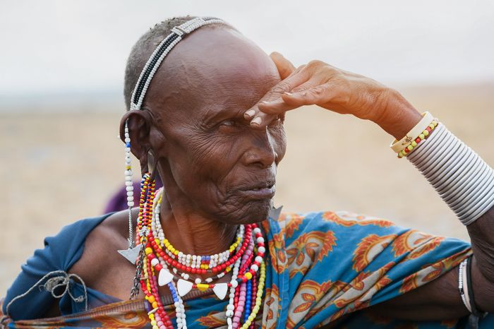
The Maasai people are present throughout the region and visiting a local village provides a look into their traditional way of life.
Choosing when to visit the Mara is important, as it will determine much of your experience.
The rains in the Masai Mara are most common between November and May, with two somewhat distinct seasons: the 'short rains', which fall in November and December, followed by a drier period from January to sometime in March, followed by the 'long rains' in March and April. The short rains in November/December are not usually anything to worry about in terms of interfering with safari activities, but March thru May is the wettest time and rains occur almost every day.
Another consideration on timing one's visit to the Masai Mara is the Great Migration. The annual movement of wildebeests and zebras are at their peak from late July until sometime in October, so this is an ideal time to be in the Mara for viewing this spectacle. That said, the game viewing is excellent outside of these peak migration months, with all of the predators, other plains game, and even some of the wildebeests and zebras present throughout the year. Keep in mind that the migration months in the Mara are also the busiest in terms of visitors.
Surrounding the Masai Mara National Reserve are a good number of privately managed reserves that offer more accommodation and game viewing. Read more below.
Read full details on the Masai Mara National Reserve and its safari camps and lodges here.
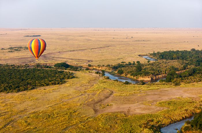
Early morning hot-air balloon safaris are an exciting way to get a bird's eye view of the Masai Mara.
Masai Mara Private Conservancies
The land bordering the Masai Mara National Reserve (MMNR) is owned by various different communities of Maasai people and over the last two decades, the landowners have organized to create private reserves, mainly to take advantage of tourism revenue opportunities. Many of these private reserves (some are called conservancies, others are called group ranches) have signed leases with safari companies, allowing them to build safari camps and market tourism activities to travelers.
This tourism model, in which the community shares in tourism revenue and/or receives monthly lease payments, was based on the successful model used in Botswana. The land-owning Maasai communities around the national reserve earn tourism revenue, which allows for more visitors to come to the Mara, while investing these communities in the sustainable conservation of the wildlife and land.
The Mara private reserves, particularly those that directly border the MMNR, offer a safari experience that matches or arguably exceeds that within the national reserve, as these private reserves are generally less crowded and have abundant wildlife.
The private conservancies bordering the Masai Mara Reserve offer excellent game viewing with far fewer tourists.
Only guests staying at one of the safari camps in a specific private reserve are permitted to be on safari there, while the MMNR itself is open to anyone paying the gate fees, so the reserves generally offer more exclusive experience with far fewer people and never any crowds. Day visits into the MMNR are still an option to guests staying in one of the private conservancies.
Wildlife in the Mara conservancies is essentially the same as in the national reserve, and the Great Migration reaches north into some of the conservancies as well. The conservancies directly bordering the national reserve are generally the best for wildlife viewing, as well as those along the Mara River.
Lion, leopard, and cheetah are good bets in many of the conservancies, including Mara North, Olare Motorogi, Talek, and Naboisho. General plains game is superb in those conservancies as well. The further outlying conservancies also have good wildlife, though game viewing is generally better closer to the national reserve. The conservancies further to the north and northeast are still developing tourism, but are on their way and should provide similar game viewing experiences once they become more established.
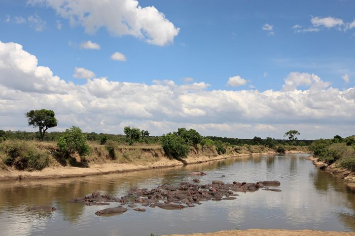
A large 'pod' of hippos in the Mara River, Masai Mara National Reserve, Kenya.
Visiting the Mara Conservancies
Safari accommodations are available in many of the conservancies, particularly in those mentioned in the previous paragraph. Game drives in the conservancies are offered exclusively to safari camp guests and the land is off limits to anyone not staying in the same conservancy (except in special cases where neighboring conservancies allow limited access to each other).
Guests staying in the conservancies may also pay to drive in the Masai Mara National Reserve if so desired; this is particularly common during migration season (late July thru September) when Mara River crossings occur in the national reserve.
Timing your visit to the Masai Mara is discussed just above.
Read full details on the Masai Mara Private Conservancies and its safari camps and lodges here.
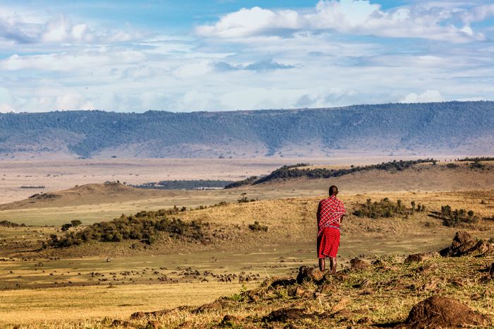
A Maasai man watches as herds of grazing animals go about their day on the grasslands of the Masai Mara.
Amboseli National Park
Located very close to the Tanzanian border, Amboseli is famous for two things: elephants and its amazing views of Africa's tallest peak, Mount Kilimanjaro, which lies just south of the park in Tanzania.
Amboseli has a colored past, as the area that is now national park was historically used by the Maasai people for grazing and watering their cattle. When the park was declared in 1974, the Maasai were formally excluded from their traditional land, causing terrible conflict. The Maasai retaliated by killing nearly all of the black rhinos and lions in Amboseli, which greatly damaged tourism to the park. Eventually the government built a water pipeline for the Maasai cattle, after which the Maasai gave up their land.
The park is named for the Maasai word meaning "salty dust" and the park is sometimes referred to as the 'Maasai place of dust'. Those who have visited can attest to the accuracy of this description. Much of Amboseli is covered with very fine saline, volcanic ash, which was deposited by ancient eruptions of Mount Kilimanjaro. The movements of animals and wind sometimes creates interesting 'dust devils', which swirl across the plains.
Elephants in Amboseli National Park with Mount Kilimanjaro as a backdrop.
Despite the dust and its relatively small size, Amboseli has a diversity of habitats, including large freshwater swamps and marshes (fed by underground streams from Kilimanjaro), Acacia scrub, Acacia woodland, and open grassy plains. Lake Amboseli is typically completely dry and only ever fills during substantial rains and even then, it is quiteshallow. When the lake has water, it attracts large numbers of pelicans and flamingos.
Mount Kilimanjaro provides a spectacular backdrop to Amboseli's wildlife and on clear days, when the mountain is visible, images of elephants walking in long lines across the plains with the mountain filling the background are the stuff of dreams for anyone with a camera. Kilimanjaro looms huge to the south, but is often shrouded by clouds and/or dust at its upper elevations.
The keystone species at Amboseli is the elephant, which are easy to see and will often provide up-close views, as they are very used to 4x4 vehicles and are almost always very relaxed around them. The calm temperament of Amboseli's elephant population, which includes some old bulls with sizable tusks, and the incredible backdrop provided by Mount Kilimanjaro, makes the park a candidate for Africa's top place for elephant viewing and photography.
Amboseli can be quite dusty, but this provides for interesting images (Copyright © James Weis).
Besides the elephants, Amboseli is home to a variety of other plains game, with giraffe, Burchell's zebra, and buffalo being the most common. Other large mammals living in Amboseli include blue wildebeest, impala, Grant's gazelle, Thomson's gazelle, and gerenuk. The odd-looking gerenuk is a slender antelope with a very long neck, which has adapted to feeding on vegetation most other antelope cannot reach by standing upright on its hind legs and stretching its neck upward. Baboon are also present in good numbers in the forested and wetter areas of the park.
Predators in Amboseli are tough to see, other than spotted hyena and black-backed jackal. There area some lions in the area of the park, and they can sometimes be seen if you are lucky. Leopard are also present, but are very elusive and seldom seen.
Wildlife viewing in Amboseli is good all year, but is best from June thru October and again in January/February. Like much of southern Kenya and northern Tanzania, there is a short rainy season that occurs in November/December and a longer rainy period from late March thru May. As discussed above, the dry season is very dusty and hazy, but wildlife viewing is very good.
Lake Amboseli fills seasonally in some years and when it does, it attracts flamingos and other waterbirds.
Despite the promise of rain during the two rainy periods, these can be wonderful times to visit Amboseli, as the landscape transforms from brown to green and Lake Amboseli may fill with water, attracting flamingos, pelicans and other migrant bird species, making for incredible imagery. Elephants and other large mammals may disperse outside the park if the rains are good in the region.
There are a selection of safari camps and lodges located inside Amboseli National Park, as well as some outside the park that are still close enough to allow for easy day trips into the park.
Read full details on Amboseli National Park and its safari camps and lodges here.
A lone bull elephant in Amboseli with Tanzania's Mount Kilimanjaro in the distance (Copyright © James Weis).
Tsavo
(Including two national parks and one national reserve: Tsavo West NP, Tsavo East NP, and South Kitui NR)
Located along the Tanzanian border in southeast Kenya, Tsavo's total protected area stretches northward for some 170 miles (275 kms) and covers an area of 8 743 square miles (22,645 sq kms). The parks were originally one entity, but were divided by the Mombasa-Nairobi Railway and road and so became two national parks in 1948. With Tsavo West on the southern side and Tsavo East to the north. The small and very remote South Kitui National Reserve is situated at the far north of the area.
The Tsavo region was immortalized by John Henry Patterson's 1907 book, The Man-eaters of Tsavo, which details the authors' experiences while he oversaw the construction of the Uganda Railway through British-controlled land in 1898. The book recounts the attacks on railway workers by two male lions, which reportedly killed and devoured 135 workers in under one year's time before the author was able to shoot the lions.
Male lions in Tsavo, Kenya.
In more recent times, Tsavo has experienced periods of drought and horrible persecution of its wildlife, especially elephants, at the hands of poachers. The 1970s were a time of mass poaching throughout much of Africa and Tsavo was particularly hard hit. By the 1990s, Tsavo's elephants had been reduced from around 35 000 in the late 1960s to only 6 000 animals. Tsavo's once numerous black rhinos were on the verge of local extinction.
In 1992, the Kenya Wildlife Service performed a globally publicized burning of its ivory (elephant tusk) stockpile and implemented a new "shoot on sight" policy regarding poachers, which effectively put an end to poaching in Tsavo. Elephant numbers today are about 12 000 in Tsavo and black rhinos number an estimated 150, most of which are under full-time guard in the protected Ngulia Rhino Sanctuary in Tsavo West.
In terms of differentiating the two parks, Tsavo West has more sources of water, with several swamps, Lake Jipe, and the Mzima Springs. It is also generally much more mountainous, which makes this park very popular for rock climbing enthusiasts. In terms of tourism, Tsavo West has a far more developed road network and more accommodations, so it receives by far the most visitors, with the more remote and wild Tsavo East rarely included on itineraries.
Burchell's zebra are commonly seen in the national parks of Tsavo.
Tsavo West National Park
Although Tsavo West covers a vast area of 3 500 square miles (9 065 sq kms), only the much smaller area between the Tsavo River and the Mombasa-Nairobi road (the developed area covering less than 15% of the park) receives many visitors. This area has the best game viewing due the combination of the rich volcanic soil and the Tsavo River frontage.
The dominant habitat in Tsavo West is Acacia scrub, which is very thick in most areas, as well as Acacia woodland. The areas along the Tsavo River have patches of riparian woodland, with palms and other large trees fringing the waterway. There are also areas of open plains, with volcanic cones interspersed seemingly all over.
Wildlife in Tsavo West is abundant, with Maasai giraffe, Burchell's zebra, buffalo, impala, Grant's gazelle, and elephant all fairly easy to encounter. The elephants in Tsavo often appear to be a reddish color, which is due to the color of the volcanic earth that they use for covering their skin as protection from the sun and insects.
All of Africa's Big Five (lion, leopard, rhino, elephant, buffalo) are found in Tsavo, with elephant, buffalo, and lion a good bet to see, while leopard are more challenging, as they are everywhere. Black rhino are best seen in the Ngulia Rhino Sanctuary, which is a cordoned-off area that still allows the rhinos to roam free.
Maasai giraffes in Tsavo.
Other common animals in Tsavo West include spotted hyena, black-backed jackal, warthog, and baboon. Less common are lesser kudu, Coke's hartebeest, eland, and fringe-seared oryx.
One of the biggest attractions in Tsavo West is Mzima Springs. Mzima's waters are filtered by the porous underground lava rock, making them crystal clear. The site has two large pools of water, which are connected by a cascade of rapids that are fringed by palms.
Mzima's upper pool is favored by hippos, while the more open lower pool is where most of the crocodiles are found. The top pool also has an underwater viewing room, where one can get otherwise impossible views of hippos (and sometimes crocs) in their environment below the surface. Mzima also has walking trails that are well marked and very informative in terms of learning about the various trees and other plants along the way.
Read full details on Tsavo and its safari camps and lodges here.
Leopard are never easy to find, but are present in areas with good cover in both of Tsavo's national parks.
Tsavo East National Park
Kenya's largest national park, Tsavo East covers 5 290 square miles (13 747 sq kms) on the northeastern side of the Mombasa-Nairobi road, which separates it from its sister park, Tsavo West.
Although Tsavo East is massive, only the area south of the Galana River is used regularly for safaris, while the northern section, with very few vehicle roads, seldom sees any visitors. Those who do visit Tsavo's East will surely feel as if they are the only people in the park, with hours, if not an entire day, that can be spent exploring without ever passing another vehicle.
The park receives water from the perennial Galana River, which crosses Tsavo East en route to the Indian Ocean, as well as from the seasonal Voi River to the south. The park's wildlife depend on these rivers for water and the best game viewing is usually along the rivers and in the riparian woodlands that fringe these waterways.
Elephants coming to drink in Tsavo East National Park, Kenya.
Tsavo East's terrain is dominated by a seemingly endless flat plain of open bushland and Acacia scrub. The Yatta Plateau rises just east of the park's western boundary, which is defined by the Galana River.
Tsavo East is home to four of Africa's Big Five (lion, leopard, elephant, buffalo), with elephant and buffalo being the most common and easiest to find. Lion and leopard are here and are best seen along the rivers, while black rhino are only found in Tsavo West's Ngulia Rhino Sanctuary.
Other wildlife that can be seen is the same as in Tsavo West, and includes Maasai giraffe, impala, Burchell's zebra, Grant's gazelle, eland, oryx, Coke's hartebeest, spotted hyena, black-backed jackal, baboon, and warthog.
One very popular spot in Tsavo East is Lugard Falls, along the Galana River. These rapids lead to several pools just downstream that usually have hippos and crocodiles.
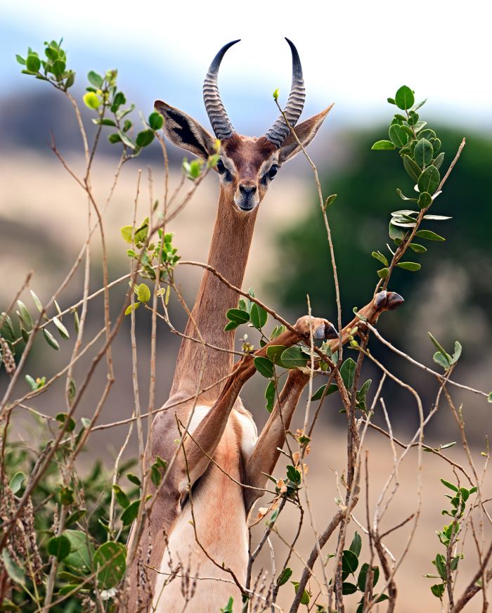
The gerenuk (Litocranius walleri) is a range-restricted antelope found in Tsavo. It has adapted such that it often feeds while standing on only its two hind legs.
Tsavo's elephants were badly persecuted by poachers in the 1970s and 1980s, but today Tsavo is a relatively safe place for them. The David Sheldrick Wildlife Trust (DSWT) has been paramount in the conservation of Kenya's elephants and their two release facilities (for rehabilitated rescues) are both located in Tsavo East. Visiting their facilities (prior arrangement required) is a wonderful experience. The DSWT rescue center is in Nairobi and this too is a highly recommended activity for anyone with a few hours in the city.
Accommodation in Tsavo East includes a handful of camps in both the south (those near the Galana River are a good option) and in the north, where the Ithumba camps are great for those that want to experience the true wilderness of the park's northern section. The small town of Voi, which lies just outside one of the park gates along the Voi River, also offers some accommodation.
Read full details on Tsavo and its safari camps and lodges here.
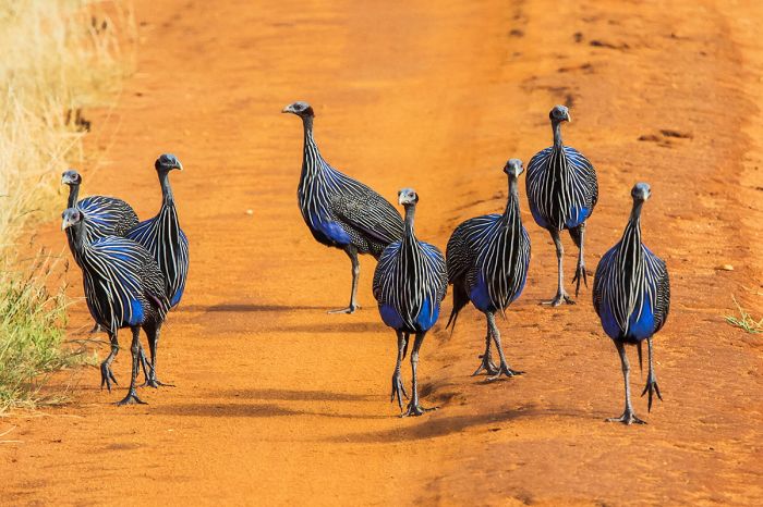
Tsavo offers good dryland birding; here a group of vulturine guineafowl (Acryllium vulturinum).
South Kitui National Reserve
The extremely remote far north of the Tsavo region includes the South Kitui National Reserve, which adjoins the northern boundary of Tsavo East National Park.
The reserve is characterized by open grassland, Acacia scrub, and patches of thick bush. Wildlife in the reserve is essentially the same as the Tsavo parks, with elephant a good bet.
South Kitui is seldom visited due to its very remote location and there is no permanent accommodation.
Elephants in Tsavo East National Park.
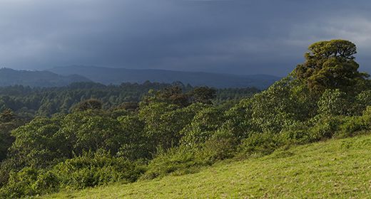
Chyulu Hills National Park
Named for the highland ridge of hills that spans roughly 60 miles (100 kms), the Chyulu Hills are one of Kenya's most beautiful destinations. The hills are formed by a volcanic ridge that rises to a maximum elevation of 7 180 feet (2 188 meters), creating a transition zone between the low elevation plains of Tsavo and Amboseli.
Chyulu Hills National Park was created in 1983 to protect the wildlife, pristine grasslands, and verdant hills, as well as lava tube caves, the best known of which is Leviathan Cave. The park is one of the least visited in Kenya, but offers an amazing wilderness experience for those who venture here.
There are only a few accommodations located in the Chyulu Hills, but there is plenty to do. Activities include game drives to search for wildlife, horseback riding, and hiking.
Horseback riding in Chyulu Hills National Park (Copyright © Ol Donyo Lodge).
Wildlife in the Chyulu Hills is diverse but not present in huge numbers. Some of the last great 'big tusker' elephants in Africa are still somewhat common in the Chyulu's and they are a magnificent and rare sight to see. Other species likely to be seen include Maasai giraffe, buffalo, eland, and Burchell's zebra. Less commonly seen species include mountain reedbuck and gerenuk. There are a small number of black rhino still surviving in the Chyulu's as well.
Predator sightings are uncommon, but the Chyulu's have healthy but small populations of spotted hyena, lion, leopard, black-backed jackal, and cheetah.
Access to the Chyulu Hills is mainly via charter flight to private airstrips maintained by the few lodges in the park. Driving is possible, but a lengthy trip from either Amboseli or Tsavo.
Read full details on Chyulu Hills National Park and its safari camps and lodges here.
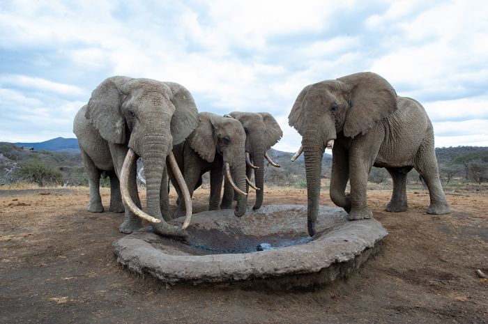
Elephants at a pumped waterhole in the Chyulu Hills (Copyright © James Weis).
Samburu
(Including three national reserves: Samburu NR, Buffalo Springs NR, and Shaba NR)
Located in the arid and low-elevation land north of Mount Kenya is the region known as Samburu. Named for the indigenous people that inhabit this scenically beautiful land, Samburu offers diverse wildlife and plenty of culture with very few tourists and is well worth considering for any Kenya itinerary.
The Ewaso Ng'iro River, which usually has some flow for most of the year (it may stop flowing for a month or more around December) is the life-sustaining force on this otherwise very dry land. The river has its origin on Mount Kenya to the south, flowing northwards into the dry low-lying land of Samburu, before diverting eastward.
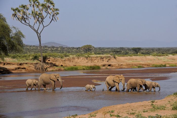
Elephants crossing the Ewaso Ng'iro River in Samburu, Kenya.
Samburu Reserves
The region includes three national reserves: Samburu, Buffalo Springs, and Shaba. All three reserves border the Ewaso Ng'iro River, with Samburu and Buffalo Springs bordering each other on either side of the Ewaso Ng'iro (Samburu to the north and Buffalo Springs to the south) and Shaba lying a short distance away to the east on the southern side of the river. Samburu and Buffalo Springs were once a single reserve, declared in 1948 and only became separate entities in 1963.
In addition to the national reserves, there are two large 'community conservancies', West Gate and Kalama, both of which provide a mix of tourism revenue and pastoralism for the local Samburu tribes. These conservancies border the national reserves to the north.
The habitats protected in Samburu's reserves and conservancies is predominantly a mix of Acacia scrub and grassland, with riparian vegetation, including lofty doum palms, along the Ewaso Ng'iro River. Buffalo Springs is named for freshwater springs that create a small marshy area south of the river.
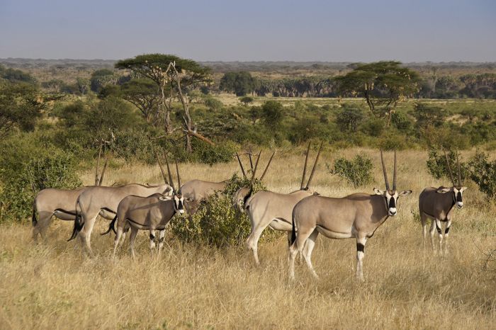
Beisa Oryx in the Shaba National Reserve, Kenya.
Samburu Wildlife
Wildlife in the Samburu region is much more sparse than Kenya's southerly reserves due to the very arid climate here, but there is a great diversity of species in Samburu, including many subspecies of more common animals seen in the more mainstream reserves like the Masai Mara.
Commonly seen wildlife in Samburu includes elephant, reticulated giraffe, Grevy's zebra, beisa oryx, gerenuk antelope, lesser kudu, greater kudu, local races of both Grant's gazelle and impala, warthog, and others. Baboon and vervet monkey are found along the river.
Buffalo are sparse in the region but can still sometimes be found in small numbers. Predators in Samburu include lion, cheetah, leopard, African wild dog, spotted hyena, striped hyena, and black-backed jackal.
Birding in Samburu is diverse, with many dryland species, including the localized 'Somali ostrich', with its bluish-colored legs and neck. Other specials in the region include Donaldson-Smith's sparrow-weaver, golden-breasted starling, golden pipit, Somali bee-eater, and many more.
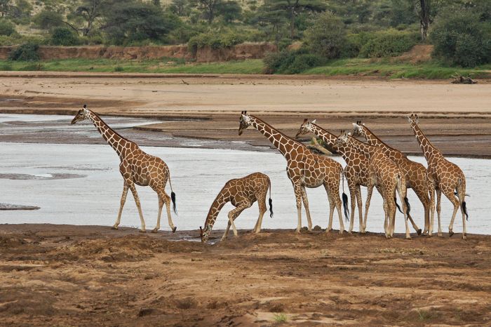
Reticulated giraffes at the Ewaso Ng'iro River in the Samburu region of Kenya.
Samburu People
The Samburu people are a major element of any visit to the region. Their history, which is only known via stories passed down from early generations, is believed to have originated in present-day Egypt or Sudan. The Samburu are close relatives of the Maasai people that inhabit southern Kenya and northern Tanzania and the Samburu language is a dialect of 'Maa', the language of the Maasai.
The Samburu live a pastoral lifestyle (like the Maasai), raising goats, cattle, and sheep, with cattle being a symbol of wealth and thus receiving the primary importance to the tribe. The Samburu have managed to hold on to the traditional lifestyle and culture, including their attire and manner of dressing, which includes colorful garments and decorative beadwork and metal ornamentation.
Anyone visiting the region should certainly include a visit to a local Samburu 'manyatta' (village) to learn about their culture. Taking part in or just observing their celebratory dances and ceremonies is something that will not be forgotten.
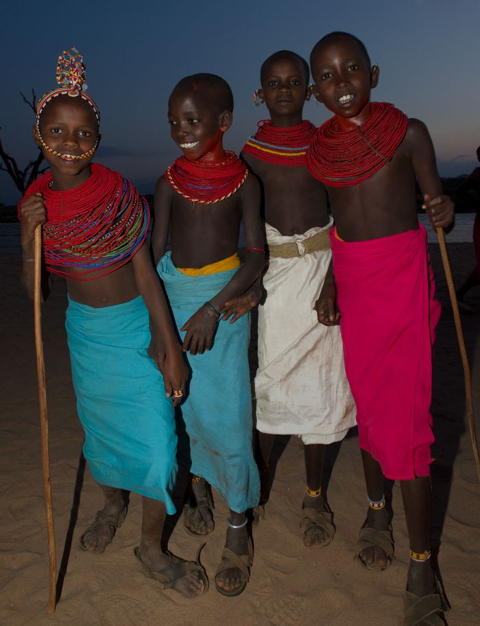
Meeting children from the Samburu tribe (Copyright © James Weis).
Visiting Samburu
Samburu is a year-round destination, with the best game-viewing during the dry season (June through October) and particularly then along the Ewaso Ng'iro River. The region experiences 'short rains' during November and early December and a longer, heavier rainy period in April/May. April is the wettest months, with regular downpours expected.
Samburu's climate is warm all year, as it is located just north of the equator.
There are numerous safari camps and lodges to choose from in Samburu, the majority of which are in the Samburu National Reserve and located mainly along the Ewaso Ng'iro River. Shaba is by far the least visited of the Samburu reserves, with most tourists staying in Samburu or Buffalo Springs. There are some excellent choices outside the reserves and located in either the Kalama or West Gate conservancies.
Read full details on Samburu, its reserves, and safari camps and lodges here.
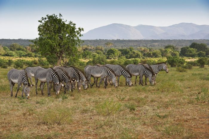
Grevy's zebras in Samburu, Kenya.
Laikipia
(Including multiple wildlife conservancies: Lewa Wildlife Conservancy, Ol Pejeta Conservancy, Borana Conservancy, Ngare Ndare Forest Reserve)
Covering a vast plateau situated northwest of Mount Kenya, the region (and district) known as Laikipia forms a transitional zone between Kenya's Central Highlands to the south and the semi-desert Samburu region to the north.
Laikipia covers around 3 125 square miles (8 100 sq kms), but without any well-known national parks or reserves, it is relatively unknown to most safari enthusiasts. Despite being somewhat off the tourism radar, Laikipia is home to some of Kenya's best conservation successes, with a number of wildlife conservancies and private and community-managed group ranches that offer some of the country's best wildlife safari experiences.
Wildlife refuges including Lewa, Borana, and Ol Pejeta are instrumental in protecting Laikipia's diverse wildlife and in some cases, like at Borana and Ol Pejeta, have harmoniously merged the traditional cattle ranching history that dates back to colonial times with both eco-tourism and wildlife conservation.
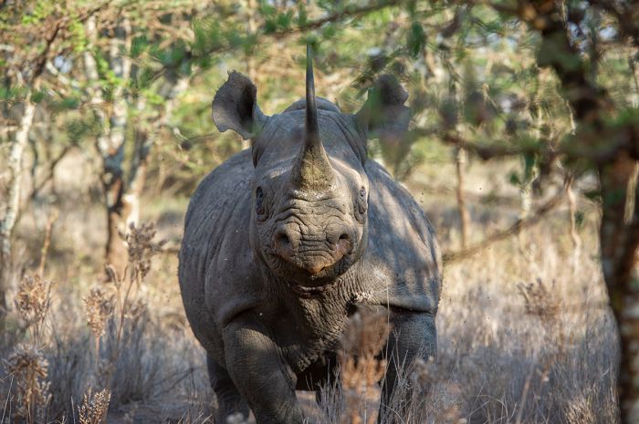
Laikipia's private conservancies are working to protect rhinos, like this black rhino at Lewa Conservancy (Copyright © James Weis).
Safaris in Laikipia are generally excellent, with diverse and abundant wildlife, particularly in the conservancies, with some of the best rhino (both black and white species) viewing anywhere in Africa. Some of the private ranches on the western side of Laikipia, which is vast and mostly unfenced, offer arguably the best opportunity in East Africa to see the endangered African wild dog.
The dual-purpose nature of Laikipia's ranches means that guests can enjoy unique opportunities to participate in activities not offered in Kenya's more mainstream safari destinations. The ranches often have a colonial history and feel, while offering a range of activities such as horseback riding, walking safaris, camel riding, wildlife research participation, standard game drives, night drives, and wildlife tracking of radio-collared species like rhino, cheetah, and African wild dog.
Wildlife in Laikipia includes some of Africa's most endangered species, with an estimated one-quarter of the world's remaining population of Grevy's zebra, a species that has disappeared from much of its former range. Laikipia also has a good population of African wild dog, which require vast tracts of land in which to live. Black rhinos, which are also fast disappearing across the continent, are protected in good numbers in Laikipia's conservancies, which offer excellent opportunities to see these animals.
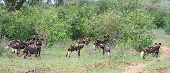
African wild dogs are doing well in the Laikipia region of Kenya (Copyright © James Weis).
Laikipia is a year-round destination, but wildlife viewing is at its best during the dry months from June through September. As in much of Kenya, the 'short' rains, which are typically not heavy, fall sometime between October and December, while the longer and heavier rains occur from March through May. The equator runs through the southern portion of Laikipia, so the temperatures are warm throughout the year.
There is a good selection of accommodation throughout Laikipia, with an assortment in the safari camps in the conservancies, plus private ranches and colonial homes that have been converted to tourist lodges. Despite the superb safari experience, Laikipia is seldom busy with visitors, except during the busier dry season. Some lodges may be closed during part or all of the rainy months (April, May and November).
The top three conservancies in Laikipia are Lewa, Ol Pejeta, and Borana, but there are many others to choose from as well, including Sosian Ranch, Loisaba Ranch, and Mugie Ranch.
Read full details on Laikipia, its conservancies and ranches, and safari camps and lodges here.
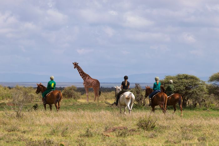
Horseback riding is offered at some of the Laikipia properties. Shown are guests at on a riding safari at Loisaba (Copyright © Loisaba).
Lewa Wildlife Conservancy
Initially a cattle ranch which was converted into the Ngare Sergoi Rhino Sanctuary in 1983, the Lewa Wildlife Conservancy is today one of Laikipia's best wildlife destinations. The entire conservancy, which measures 96 square miles (250 sq kms) is completely fenced and is painstakingly managed.
The land at Lewa is predominantly hilly grassland, Acacia scrub, and woodland, which is superb habitat for the conservancy's healthy populations of both white and black rhino. Lewa also protects over 300 Grevy's zebra, which is the largest population of these critically endangered animals anywhere in the world.
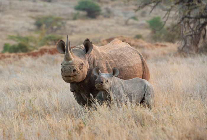
Laikipia's private conservancies are some of the best places in Africa to see rhino. Shown here are a female white rhino and her young calf at Lewa Wildlife Conservancy (Copyright © James Weis).
All of Africa's Big Five (lion, leopard, elephant, buffalo, rhino) can be seen at Lewa and both plains game and predators are well represented. The conservancy is home to good numbers of elephant, reticulated giraffe, buffalo, eland, impala, Grant's gazelle, beisa oryx, blue wildebeest, and gerenuk. Hippos are found in Lewa's swamp, as are the elusive sitatunga antelope.
Predators at Lewa include cheetah, lion, leopard, spotted hyena, black-backed jackal, and African wild dog.
Lewa offers a small number of very good accommodations, all of which offer fully-inclusive meals and wildlife viewing activities.
Read full details on Lewa and its safari camps and lodges here.
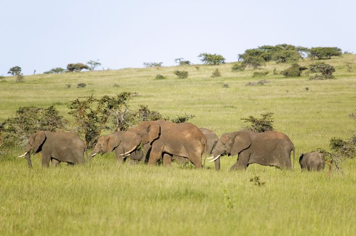
Elephants in the Lewa Conservancy, one of Laikipia's private managed reserves.
Ol Pejeta Conservancy
A dual-use property like others in Laikipia, Ol Pejeta Conservancy began as a cattle ranch, but now combines cattle ranching with wildlife protection and tourism. Ol Pejeta protects 141 square miles (365 sq kms) of land just west of the town of Nanyuki in southern Laikipia and not far west of Mount Kenya.
Ol Pejeta boasts the world's largest herd of Boran cattle, which are protected from the conservancy's wild predators by keeping them inside mobile 'bomas' at night, The bombs allow the cattle to range across the land under watchful eyes during the day while resting safely overnight. The strategy used at Ol Pejeta is considered a model in the industry, effectively combining wildlife conservation and ranching and allowing the property, which is a non-profit organization, to earn revenue from both tourism and beef cattle sales.
The landscape at Ol Pejeta is predominantly grassland with sparse Acacia scrub. There is plenty of fresh water for both the wildlife and cattle via the numerous waterholes that are kept full via borehole pumps. The entire property is protected by an electric fence and is patrolled by rangers daily. The Ewaso Ng'iro River flows through the property.
Ol Pejeta is home to all of Africa'a Big Five animals (lion, leopard, elephant, rhino, buffalo), plus an abundance of plains game species. Commonly seen herbivores include elephant, buffalo, reticulated giraffe, gerenuk, Jackson's hartebeest, beisa oryx, Grevy's zebra, blue wildebeest, hippo, and more.
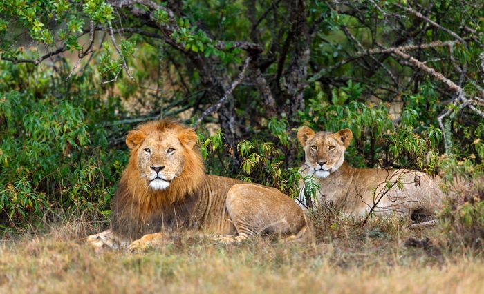
Lions in the Ol Pejeta Conservancy, Laikipia region, Kenya.
Predators at Ol Pejeta include the aforementioned lion and leopard, plus cheetah, spotted hyena, African wild dog, black-backed jackal, bat-eared fox, serval, and caracal.
The eastern portion of the Ol Pejeta land was formerly used as a rhino sanctuary and today the conservancy has healthy populations of both black and white rhino species. There is also a chimpanzee sanctuary on the property that houses orphaned and rescued chimps.
There are various accommodation options at Ol Pejeta and guest activities include both day and night game drives, walking safaris, horse riding, cycling, and wildlife tracking with researchers.
Ol Pejeta can be reached by road from Nairobi in four hours. There are regular scheduled flights from Nairobi to Nanyuki (flight time 75 minutes), which is a 45-minute drive to Ol Pejeta.
Read full details on Ol Pejeta and its safari camps and lodges here.
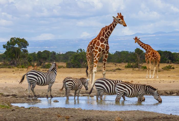
Some of Ol Pejeta's wildlife, reticulated giraffes and Burchell's zebras, gather at a waterhole.
Borana Conservancy
Borana is another of Laikipia's cattle ranch turned dual-purpose wildlife conservancies, combining beef cattle ranching with wildlife conservation and eco-tourism.
Borana adjoins the Lewa Conservancy to the west and in 2013, the fencing that once separated the two reserves was removed, creating 147 square miles (380 sq kms) of continuous range land for the wildlife and Borana's 2 000+ Borana cattle. The ranch also raises sheep.
Plains game and predator species are the same as those found at Lewa and Borana'a rangers monitor multiple species via radio-collar. There is ongoing research at Borana, studying species such as cheetah, lion, elephant, spotted hyena, and African wild dog.
Guests staying at the conservancy's lodge accommodation are invited to participate in a variety of activities, including game drives, walking safaris, horseback riding, mountain biking, and guests can also join the staff on some of their wildlife management work.
Read full details on Borana and its safari camps and lodges here.
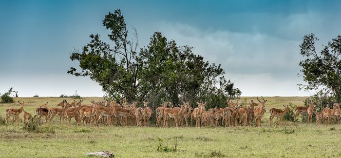
Impalas gather as a rain shower passes over in the Laikipia region of Kenya.
Ngare Ndare Forest Reserve
Adjoining Lewa Wildlife Conservancy to the south is the Ngare Ndere Forest Reserve. This pristine forest is lush and protects an important corridor that has been used for centuries by elephants to move between Mount Kenya to the south and the Northern Rangelands north of Laikipia. Many of the indigenous trees are over 200 years old.
Visitors to Ngare Ndere can enjoy a bird's-eye view from the 1 480-foot (450-meter) long canopy walkway that traverses part of the reserve 100 feet (30 meters) above the forest floor. The walkway terminates at a viewing platform, where elephants can often be seen in the swamp below.
Self-driving is permitted and rock climbing is also popular. The reserve has several lovely waterfalls where swimming is allowed in the pool below. Walking is permitted with a ranger (booking in advance is recommended).
Elephants are seen regularly in Ngare Ndare, as are buffalo, baboons, and monkeys. For a much better wildlife experience, head to the adjoining reserves just to the north at Lewa or Borana.
There are two basic self-camping sites in the reserve that have running water and toilets.
The name of the reserve comes from the Maa language (spoken by the Maasai people) and means 'a watering place for goats'.
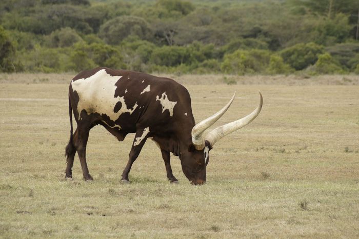
Many of Laikipia's conservancies combine wildlife protection and cattle ranching.
Central Highlands
(Including two national parks: Mount Kenya NP, Aberdare NP)
Kenya's Central Highlands are so named for the high altitude landscape in the center of the country that has elevations above 5 000 feet (1 524 meters). The Central Highlands are dominated by Mount Kenya, Africa's second highest peak, as well as the Aberdare Mountains.
The Central Highlands were created long ago as part of the Gregory Rift, which is the eastern side of Africa's Great Rift Valley. There are numerous volcanoes in the highlands, the largest being Mount Kenya. Directly to the west of the highlands is the Rift Valley, with numerous lakes in the valley floor.
Many of Kenya's most important rivers, including the Tana and Ewaso Ng'iro, originate in the Central Highlands.
Read full details on Kenya's Central Highlands and its safari camps and lodges here.
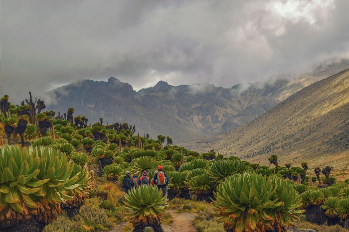
Walking through the highlands on Mount Kenya.
Mount Kenya National Park
Mount Kenya is Africa's second highest peak (after Kilimanjaro in Tanzania) and at 17 058 feet (5 199 meters), it is one of the world's highest free-standing mountains. It is believed that Mount Kenya, which is an extinct volcano dating back 3.5 million years, once rose to a height of 23 000 feet (7 000 meters), but has shrunk due to glaciation of the millennia.
Mount Kenya National Park was established in 1949 and protects the mountain above 10 500 feet (3 200 meters), as well as various salients to protect crucial streams below this elevation. Below 10 500 feet, the lower elevations of Mount Kenya are afforded lesser protection as the Mount Kenya Forest Reserve.
There are still glaciers atop the mountain, but these are quickly retreating due to global warming. The slopes of Mount Kenya are lush and covered in dense, pristine forest vegetation. The mountain's watershed provides crucial fresh water to a vast area in all directions, including Samburu to the north, and the Rift Valley to the west.
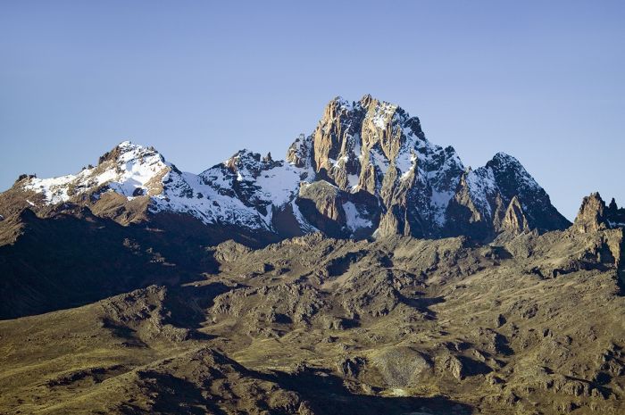
View of Mount Kenya, the second highest peak in Africa (after Tanzania's Mount Kilimanjaro).
Hiking the forested trails of Mount Kenya is a popular activity and more experienced mountaineers can climb to the top of Batian Peak. Lower peaks like Lenana can be scaled by anyone with stamina and fitness with no technical skills. Most of the ascents to the tall peaks require a minimum of one week and experienced guides are recommended.
Those wishing to visit Mount Kenya can stay at Serena Mountain Lodge, which is located in the forested lower foothills of the buffer zone outside the national park. The lodge is a 'tree' lodge overlooking a pumped waterhole that attracts wildlife day and night and is lit throughout the dark hours, so guests can observe the comings and goings of animals from the lodge's observation deck at any time.
Wildlife on Mount Kenya includes buffalo, elephant, bush pig, giant forest hog, and black rhino. Birding in the forest is outstanding.
Read full details on Mount Kenya and its safari camps and lodges here.
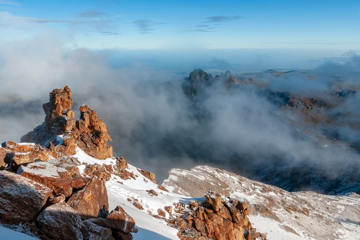
View from the summit of Mount Kenya.
Aberdare National Park
The Aberdare Mountains are located just west of Mount Kenya and are part of Kenya's Central Highlands region. The Aberdare Range is one of the most scenically beautiful and untouched places in the entire country. The Aberdares span 100 miles (160 kms) and reach a maximum elevation atop Mount Satima at 13 126 feet (4 001 meters).
The middle elevations of the Aberdares are covered in lush montane forest, while the lovely moorland region above 11 000 feet (3 350 meters) is vegetated with alpine grasses, bushes, and bog-mosses. Bamboo forest covers much of the lower elevations. There are numerous rivers and streams that supply water to the surrounding region, some joining with rivers originating atop Mount Kenya to the east.
Wildlife in the Aberdares includes elephant, buffalo, defassa waterbuck, black rhino, giant forest hog, bush pig, bongo, warthog, bushbuck, blue duiker, olive baboon, black-and-white colobus, and Sykes' monkey. The most common predators are leopard and spotted hyena.
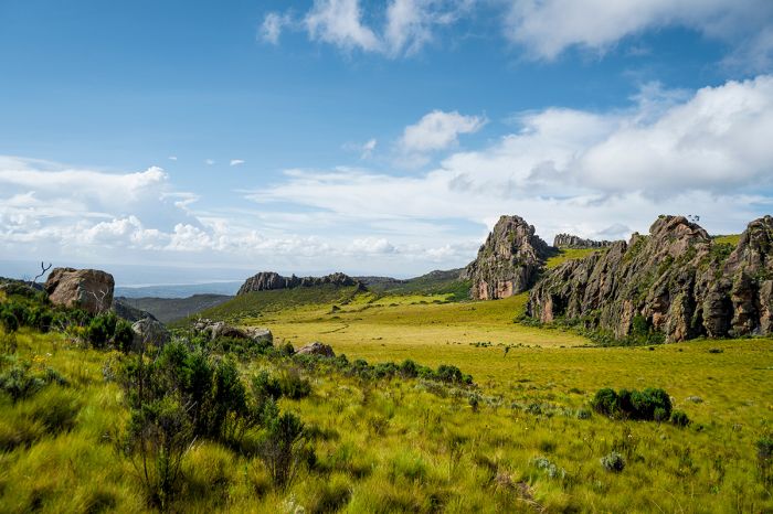
Beautiful scenery in the highlands of the Aberdare Mountains, Kenya.
Aberdare National Park was declared in 1950 and protects some 295 square miles (766 sq kms) of the middle and upper elevations of the range. The park is completely fenced to minimize conflict between the park's wildlife, especially elephants, and the human population that lives just outside the park.
Many visitors choose to stay for more than a day and if this is the case, then staying at one of the 'tree' lodges is a good choice. These lodges - The Ark and Treetops - are located in a low-altitude area on the eastern side of the mountains called "The Salient". These lodges have viewing platforms overlooking waterholes that attract wildlife day and night. The platforms are open to guests 24 hours per day and the waterholes are lit with soft lighting at night, so guests can watch the wildlife come and go at any hour.
Driving through the national park, regardless of whether one stays at one of the 'tree lodges' or comes for a day visit, is highly recommended. The views are breathtaking, with lush rainforest vegetation, waterfalls, occasional wildlife sightings, and excellent birdwatching opportunities.
Read full details on the Aberdare Mountains and its safari camps and lodges here.
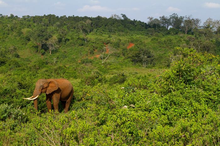
An elephant on the slopes of the Aberdare Range in Kenya's Central Highlands.
Rift Valley (centraL)
(including three national parks: Lake Nakuru NP, Hell's Gate NP, Mount Longonot NP; three major lakes: Nakuru, Naivasha, and Elmenteita, and one conservancy: Soysambu)
Africa's Great Rift, also called the East African Rift, is one of the most significant topographic features on our planet. As has already happened with India and Madagascar, which were once connected to present-day Africa, the Great Rift will eventually (in a few million years) lead to further separation of the African continent.
The Rift begins in the far north of Africa, at the Red Sea and moving southwest, it branches into a 'Y' shape. The western branch, known as 'Albertine Rift', runs along the border between Tanzania and Democratic Republic of the Congo and into Rwanda, Uganda, and Burundi, while the eastern branch, known as the 'Gregory Rift', runs into Ethiopia and Kenya. The entire extent of this lengthy fault system extends for thousands of kilometers all the way into Botswana and Mozambique.
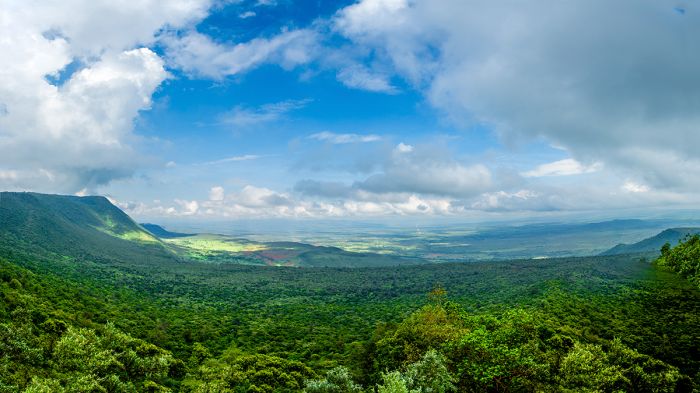
View of part of Kenya's Gregory Rift, the eastern branch of Africa's Great Rift.
The portion of the Gregory Rift extending into Kenya includes numerous significant lakes, including (from north to south) Lakes Turkana, Baringo, Bogoria, Nakuru, Elmenteita, Naivasha, Magadi, and Natron.
Wildlife in the Central Rift Valley of Kenya is very good, with several national parks, reserves, and conservancies offering safari opportunities.
The Central Rift Valley destinations, like much of southern Kenya, have two rainy seasons, a 'shorter' period during November and December, and the 'long' period from March thru May. Wildlife viewing is good year round and the region's proximity very close to the equator means that temperatures are warm to hot all year. The period during the long rains can mean poor driving conditions and interruption of activities during downpours.
Read full details on Kenya's Rift Valley and its safari camps and lodges here.
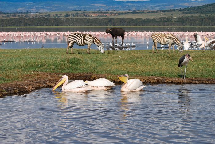
Wildlife at Lake Nakuru, one of Kenya's Central Rift Valley lakes.
Lake Nakuru National Park
Lake Nakuru is one of Kenya's Central Rift Valley lakes and one of the country's most visited eco-tourism destinations. The national park includes the lake itself plus an area of land surrounding it. The entire park is enclosed by electric fencing to protect the abundant wildlife living on and around the lake.
Lake Nakuru is perhaps best known for the huge flocks of flamingos, sometimes numbering up to 1.5 million birds, that gather seasonally on the fringes of the lake to feed. Lake Nakuru's waters, which are fed by underground springs and several small rivers, are highly alkaline and support high concentrations of Spirulina algae, which is a favored food of the flamingos. The lake is also popular for pelicans, waterfowl, and waders.
The wooded areas and grassy plains surrounding the lake support good numbers of large mammals, the most common of which are buffalo, black rhino, white rhino, Rothschild's giraffe, waterbuck, impala, Burchell's zebra, hippo, eland, Thomson's gazelle, Grant's gazelle, warthog, olive baboon, and vervet monkey. The park is one of the better places in Kenya to see both species of rhino. Birding in the park is excellent both along the lakeshore and inland from the lake.
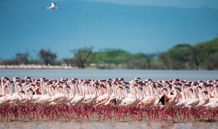
Lesser flamingos often gather in huge numbers on Lake Nakuru.
There are a small number of safari lodges with in the national park, as well as nearby but outside the park. Self-driving is allowed and the main driving track, which encircles the lake, has various places to get out and take photos and takes about two hours, but will surely take much of the day with all the stops for animal sightings.
Driving to Nakuru takes about three hours from Nairobi, but nearby Nakuru town has a small airport and there are two landing strips inside the park, so flying from Nairobi (40 minutes) or elsewhere in Kenya is also an option.
Lake Nakuru, like most of Kenya's Rift Valley lakes, has been designated a Ramsar Wetland of International Importance and along with Lake Elmenteita and Lake Naivasha, forms an UNESCO World Heritage Site.
Read full details on Lake Nakuru National Park and its safari camps and lodges here.
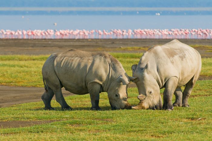
White rhinos grazing on fresh grass in Lake Nakuru National Park, Kenya.
Lake Naivasha
One of Kenya's Central Rift Valley lakes, Lake Naivasha has no official protection via reserve or national park, but there are two national parks (Hell's Gate and Mount Longonot) situated just to the south of its shores.
Naivasha is a rather shallow (average depth 20 feet/6 meters) lake, with fresh water fed by small rivers on its northern shore. Although there is no surface outlet, the water is very fresh, so it is believed the lake is drained via underground outlet, flowing into Lake Magadi to the south. The water levels in Lake Naivasha have fluctuated dramatically over the years, with the lake almost completely drying in the late 1940s and its surface area and shorelines are constantly shifting.
The nearby small town of Naivasha was once a popular place for British colonial socialites in the 1930s and some of the beautiful large homes from that era still remain and are used as tourist accommodations. The famous author, Joy Adamson, who wrote the popular book Born Free about her experiences raising a lion cub named Elsa, lived on the shores of Lake Naivasha for a time in the 1960s.
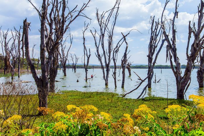
Fluctuating water levels at Lake Naivasha is evident with the growth and subsequent submersion of littoral trees.
Lake Naivasha has been designated a Ramsar Wetland of International Importance and is also part of (along with neighboring lakes Nakuru and Elmenteita) an UNESCO World Heritage Site. There are three small private wildlife reserves (Oserian Wildlife Reserve, Crescent Island, and Green Crater Lake) on or very close to Lake Naivasha.
Despite the small protection in the reserves around the lake, much of the land surrounding Lake Naivasha is used for the commercial cultivation of flowers, mainly in large greenhouses, for export to Europe.
Large areas of Acacia scrubland around the lake were cleared beginning in the 1980s to make way for the floriculture plantations and housing for the workers. Kenya is one of the world's leading exporters of cut flowers and the industry employs thousands of workers, but the fertilizer and runoff from the industry threaten the lake.
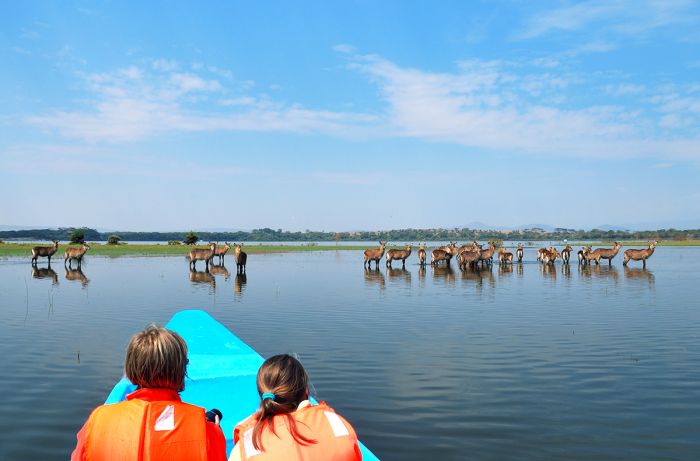
Watching waterbucks from a boat on Lake Naivasha, Kenya.
Lake Naivasha is home to a large population of hippo and several other species of large mammal, the most common of which are buffalo and waterbuck, that live along the shores. Naivasha also attracts huge numbers of flamingos seasonally, as well as many other species of waterbirds, which gather on the lake to feed and/or breed.
Accommodation at Lake Naivasha includes colonial-era guest houses on the lakeshore, and some more basic accommodations in the town of Naivasha.
Driving to Naivasha takes a little over two hours from Nairobi and there are two landing strips just offshore from the lake, so flying from Nairobi (35 minutes) or elsewhere in Kenya is also an option.
Read full details on Lake Naivasha and its safari camps and lodges here.
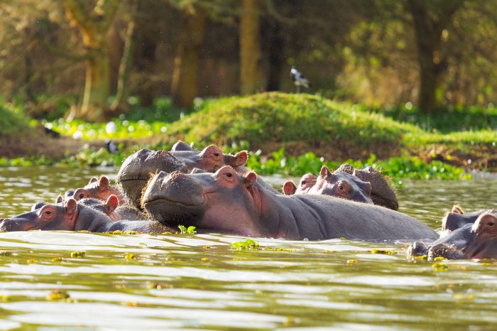
There is a healthy population of hippos in Lake Naivasha.
Hell's Gate National Park
Located just a couple of miles south of Lake Naivasha is Hell's Gate National Park. The gorge of the same name that runs through the park was named by European explorers in the 1880s for the narrow gap in the high cliffs lining the gorge. The gorge itself was carved out of the volcanic rock by a river that was once an outlet for a substantial lake that once spanned all the way north to Lake Nakuru. There are two extinct small volcanos in the park.
The red cliffs that line the gorge are spectacular and visitors are permitted to walk and bike through the gorge, with a chance of seeing some animals.
Wildlife in the park include Masai giraffe, Burchell's zebra, Grant's gazelle, Thomson's gazelle, Coke's hartebeest, impala, defassa waterbuck, buffalo, and Chanler's mountain reedbuck (a local subspecies). Spotted hyena, black-backed jackal, cheetah, and leopard are sometimes seen as well. Olive baboons are numerous, especially along the gorge cliffs.
Most visitors to Hell's Gate come for only the day and stay somewhere outside the park, which only offers basic self-camping sites.
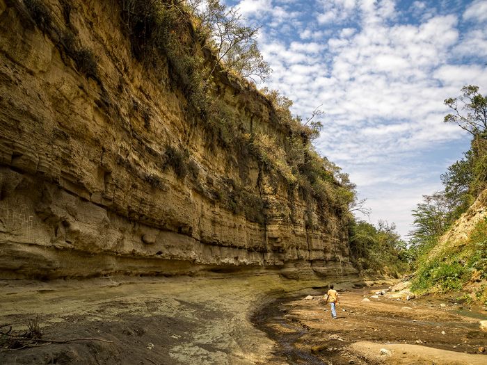
Hiking in the gorge at Hell's Gate National Park, Kenya.
Mount Longonot National Park
Like Hell's Gate National Park, Mount Longonot and the national park that protects it are located a short distance away from the southern bank of Lake Naivasha. Mount Longonot itself is a dormant volcano which last saw activity in the 1860s. The crater rim rises 9 107 feet (2 776 meters) above the Rift Valley floor and can be seen from many miles away.
The park covers an area of just 20 square mile (52 sq kms) and besides the volcano, protects the surrounding land, which is dominated by Acacia scrub, savanna grassland and sparse forest.
Ascending Mount Longonot is the main activity in the park, and the climb is relatively easy, with no technical skills required. The climb to the crater rim takes around an hour and once at the top, hikers can descend into the crater (be on the watch for buffalo) or circumnavigate the rim, which takes two to three hours.
There is a basic camping site in the park, but visitors are allowed to camp anywhere with prior approval from the park rangers.
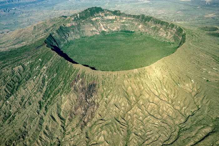
Aerial view of Mount Longonot and its crater in Kenya's Central Rift Valley.
Lake Elmenteita
Located in the Central Rift Valley, between Lake Nakuru (7 miles/11 kms to the northwest) and Lake Naivasha (20 miles/30 kms to the southeast), is Lake Elementeita. The lake has no outlet and so, like most of the other Rift Valley lakes in Kenya, its waters are quite saline and alkaline. Evidence shows that at times in the geological past, Elmenteita was merged with a much larger lake that included present-day Lake Nakuru.
Elementeita is small, covering just 6.9 square miles (18 sq kms) and shallow, with a maximum depth of 4-5 feet (1.2-1.5 meters), but in most places, its depth is under 3 feet (1 meter). During the dry months, the lake recedes and the fringes become salt-encrusted mud flats.
The name of the lake derives from the Maa (language of the Maasai people) "muteita", which means 'place of much dust", referring to the dry and arid conditions in the area around the lake, particularly between January and March.
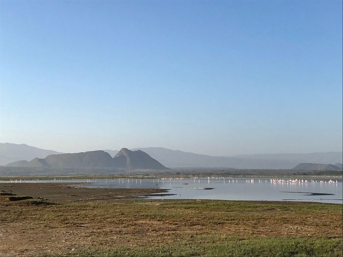
Lake Elmenteita and eroded volcanic caldera remnants in the background.
In 1901, during the British colonization of present-day Kenya, Hugh Cholmondeley, the 3rd Baron Delamere, moved to the colony and acquired large land holdings from the Crown. Lord Delamere's land included over 50 000 acres (210 sq kms) around Lake Elementeita, which he converted to a ranch called 'Soysambu'. Delamere and his wife, Lady Florence Anne Cole, worked doggedly over many years and were pioneers in the development of early agriculture in the colony.
Lord Delamere is credited with helping to found the so-called 'Happy Valley Set', the cliquish group of British aristocrats that lived the high life in the colony. Delamere died in 1931 at the age of 61 years. After his passing, Lord Delamere gifted part of his land (that on the eastern side) to his brother-in-law, Galbraith Lowry Egerton Cole.
Delemere's widow and second wife, Gwladys Helen Beckett, later became the second female mayor of Nairobi. Lord Delamere is also one of the characters in Karen Blixen's book, Out of Africa.
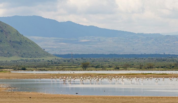
Lesser flamingos feeding in the shallow water of Lake Elmenteita, Kenya.
Soysambu Conservancy
In 2007, Lord Delamere's (read just above) Soysambu Ranch became the private and fully fenced Soysambu Conservancy, which protects 75 square miles (195 sq kms), including two-thirds of Lake Elmenteita's shoreline along the northern, western, and southern sides.
The eastern side of the lake had been the Kekopey Ranch, which in 1977, was sold to a local cooperative, with the land apportioned into small plots for individual shareholders. The ranch's brick farmhouse, built during 1917-18, still exists and is now used for tourism as part of Lake Elementaita Lodge.
The setting around the lake is dramatic, with grasslands and woodland framed by eroded caldera walls from several long-extinct volcanos. On the southern end of the lake are the Kekopey Hot Springs. Further south of the lake are the Elementeita Badlands (also known as the Otutu Forest), which is covered by an ancient lava flow covering some 14 square miles (36 sq kms). This land was previously part of the Kekopey Ranch.
Commonly seen plains game in the conservancy includes Rothschild's giraffe, buffalo, waterbuck, eland, Thomson's gazelle, Grant's gazelle, common reedbuck, impala, Burchell's zebra, and warthog. Predators include lion, leopard, spotted hyena, striped hyena, caracal, and black-backed jackal. Primates include olive baboon, vervet monkey, and black-and-white colobus.
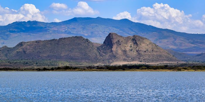
Dramatic scenery in the Soysambu Conservancy on the shoreline of Lake Elmenteita.
Lake Elmenteita has a bird list of over 350 species and at times is a good place to observe both greater and lesser flamingos. Large numbers of white pelicans also breed on the lake.
Lake Elmenteita is home to a single species of fish, the Lake Magadi tilapia (Alcolapia grahami). This species has adapted to live in hypersaline waters. The Lake Magadi tilapia was introduced to Lake Elmenteita from Lake Magadi and now thrives here.
There are a few good accommodations at Lake Elmenteita, as well as self-camping sites. Activities on the conservancy include game drives, horseback riding, and camel treks.
Lake Elmenteita, along with its neighboring lakes (Nakuru and Naivasha) are an UNESCO World Heritage Site. Elmenteita is also a Ramsar Wetland of International Importance.
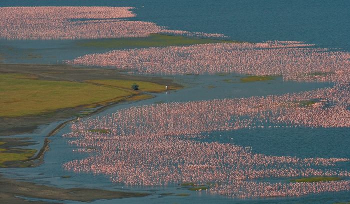
Lakes Nakuru, Naivasha, and Elmenteita are together an UNESCO World Heritage Site. Shown is the incredible spectacle of thousands of flamingos gathered on Lake Nakuru.
Rift Valley (North-central)
(Including Lake Bogoria, Lake Baringo, and Lake Bogoria National Reserve)
Located to the north of Kenya's Central Rift Valley with its popular lake destinations, including Nakuru and Naivasha, the elevations drop and the landscape becomes much more arid and harsh. The human population is much lower in this more unforgiving region. In recent times, this has become the northernmost frontier for tourism, with the lands beyond in the far Northern Rift Valley, including the remote Lake Turkana, virtually unvisited.
The North-Central Rift Valley has two lakes that are worthy of consideration for those wanting to get away from crowded reserves: Lake Bogoria, which is completely protected within a national reserve, and a bit further north, Lake Baringo.
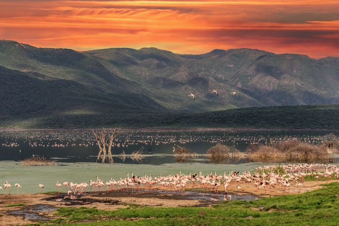
Beautiful sunset over Lake Baringo and flamingos.
Lake Bogoria
One of the lakes in the infrequently visited North-Central Rift Valley, Lake Bogoria has been designated as both an UNESCO World Heritage Site and a Ramsar Wetland of International Importance. Lake Bogoria covers 13.1 square miles (34 sq kms) and is located roughly 40 miles (65 kms) north of Lake Nakuru National Park.
Bogoria is a long, narrow lake, with a maximum length of 21 miles (34 kms) and a maximum width of 2.2 miles (3.5 kms), running roughly north-south. Bogoria is shallow, only reaching a maximum depth of around 28 feet (8.5 meters) and because the lake has no surface outlet, its waters are hypersaline.
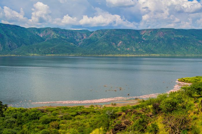
Lake Bogoria, with flamingos along the near shoreline and the dramatic Siracho Escarpment rising on the opposite side.
Lake Bogoria is geothermically active (mainly on its western shores) and has numerous hot springs and geysers, some of which erupt periodically with vertical sprays reaching 15 feet (5 meters) into the air above the lake. Along with Lake Nakuru further south, Lake Bogoria is frequently a gathering and feeding grounds for thousands of lesser flamingos, which congregate in enormous flocks on the fringes of the lake to feed on blue-green algae and diatoms, which grow in the lake.
The lake is fed by the numerous hot springs below the lake, as well as by the Waseges River, which rises on the northern slopes of the Aberdare Mountains and flows north to the lake. The land surrounding the lake is mainly grassland, low scrub, barren sand, and rocks.
The Siracho Escarpment rises abruptly from the eastern shores of the lake, with towering cliffs reaching 2 000 feet (600 meters) high. South of the lake there is some Acacia and fig tree woodland, while on the northern side, which is where the Wasages River enters, there is the papyrus-dominated Kisibor Swamp.
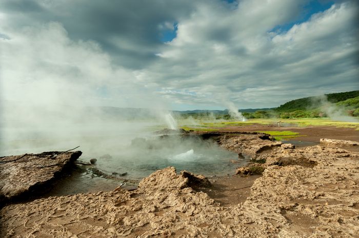
Steaming hot springs at Lake Bogoria, Kenya.
Lake Bogoria National Reserve
Designated in 1970, the national reserve protecting Lake Bogoria covers an area of 41 square miles (107 sq kms) that includes all of the lake, as well as the land immediately surrounding the lake.
Overgrazing due to encroaching livestock has degraded some of the reserve's land, but there is some wildlife to be seen. Wildlife that can be seen at Lake Bogoria include greater kudu, Burchell's zebra, buffalo impala, Kirk's dik-dik, Grant's gazelle, klipspringer, and warthog.
Lesser flamingos are often seen in large flocks on the lake and Africa fish-eagles are fairly common. Lake Bogoria's bird list is over 300 species and waterbirds are the easiest to see along the shores of the lake.
There are camping sites in the reserve on the south end of the lake and some basic options near the Loboi Gate on the north side of the reserve.
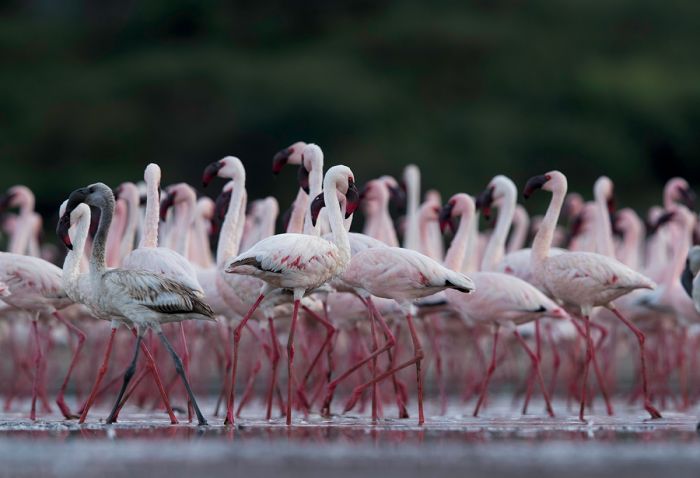
Lesser flamingos on Lake Bogoria in Kenya's Northern Rift Valley.
Lake Baringo
Located some 10 miles (16 kms) north of Lake Bogoria is Lake Baringo, another of Kenya's North-Central Rift Valley lakes (only Lake Turkana is located further north). Besides Lake Naivasha, Lake Baringo is the only other fresh water Rift Valley lake in Kenya (the others are all saline).
Lake Baringo covers an area of 50 square miles (130 sq kms), with a maximum length of 15 miles and a maximum width of 9 miles. The lake is fed by several seasonal rivers, including the Perkerra, Makutan, Molo, and Ol Arabel. There is no surface outlet from the lake, so it is assumed (based on the freshness of its water) that water seeps out through the lake sediments into faults in the volcanic bedrock below the lake.
Baringo is a rather shallow lake, reaching a maximum depth of 11.5 feet (3.5 meters) and an average depth of 8 feet (2.5 meters). Evaporation of Baringo's water is high, due to the harsh arid environment and it depends heavily on the seasonal water brought in by rivers and local rains.
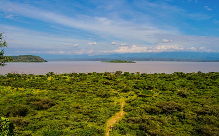
View of Lake Baringo and islands in Kenya's North-Central Rift Valley.
There are several islands on Lake Baringo, the largest of which is Ol Kokwe Island, which is a remnant of an extinct volcano and has several fumaroles and hot springs.
Baringo is rich in bird life and the lake is home to large populations of hippo and crocodile. Wildlife in the dry thorny scrubland surrounding the lake is sparse, but you may see Grant's zebra, impala, waterbuck, warthog, and ostrich. There are seven fish species in the lake, including one cichlid (Oreochromis niloticus baringoensis) that is endemic.
There are several decent choices for accommodation around the lake and one very good lodge (Samatian Island) on one of the lake's smaller islands.
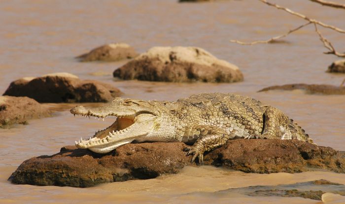
Lake Baringo is home to a healthy population of Nile crocodiles.
Rift Valley (northern) - Lake Turkana
(including three national parks: Sibiloi NP, Central Island NP, South Island NP)
The world's 4th largest salt lake, Lake Turkana covers an area (which fluctuates) of roughly 2 470 square miles (6 400 sq kms) in Kenya's northern desert region within the Gregory Rift, which is the eastern branch of Africa's Great Rift. The northern tip of the long and slender-shaped lake reaches just across the border into Ethiopia. The lake is approximately 180 miles (290 kms) long, with a maximum width of 20 miles (32 kms).
In prehistoric times, Lake Turkana water levels were much higher and the lake overflowed into the Nile River basin and as a result, there are still plenty of Nile perch and Nile crocodiles in its waters. The lake reaches a maximum (but decreasing) depth of around 350 feet (106 meters) and an average depth of 100 feet (30 meters).
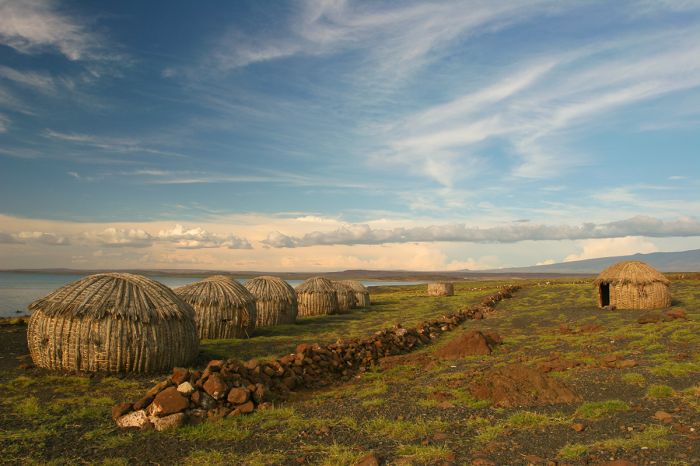
Turkana dwellings on the shore of Lake Turkana in Kenya's Northern Rift Valley.
Lake Turkana is fed by three rivers: the Omo River which originates in the Shewan Highlands of southern Ethiopia, the Turkwel River, which begins atop Mount Elgon to the southwest on the border with Uganda, and the Kerio River, which rises on the Amasya Hills, west of Lake Bogoria in central Kenya. The Omo flows south into the lake, while the Turkwel and Kerio flow north.
Turkana is an endorheic basin (has no outflow) and loses water only via evaporation, which causes its water to be quite brackish. The salty waters in Lake Turkana make it unsuitable for drinking or irrigation, and the sparse population of people living around the lake rely on underground springs for their water.
Volcanic rock surrounds much of the lake to the east and south, while sand flats and dunes cover the western and northern shores. Central Island, located roughly in the center of the lake, is an active volcano that emits vapor. The climate in this region is hot and dry.
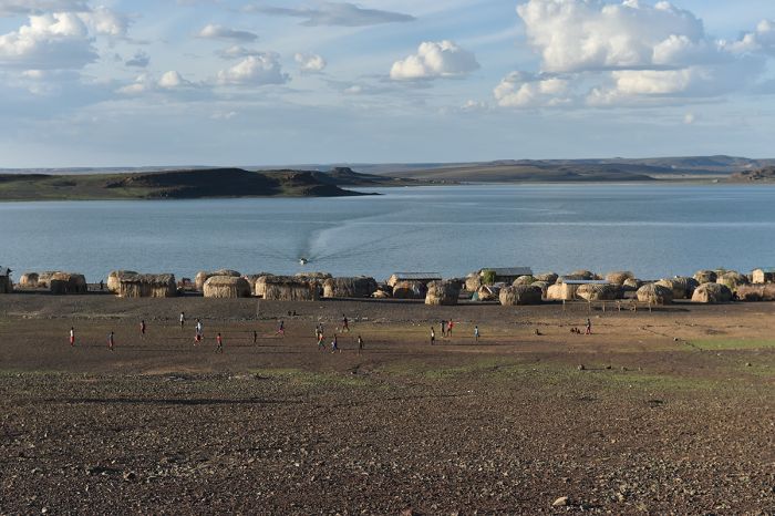
Villagers playing football (soccer) beside Lake Turkana in Northern Kenya.
The first Europeans to see the lake (although its existence was well known in Europe already) were Count Sámuel Teleki de Szék, a Hungarian explorer, and his second-in-command, Lieutenant Ludwig Ritter Von Höhnel, an Austrian explorer, who together led the first expedition to survey the unexplored portion of the East African Rift north of Lake Baringo between February 1887 and October 1888.
Teleki and von Höhnel reached the lake in March 1888 and named it Lake Rudolph, in honor of their benefactor, Crown Prince Rudolf of Austria. The explorers noted that the color of Turkana's waters seem to shift and can can appear turquoise, grey, deep blue or emerald green. The lake was famously nicknamed the 'Jade Sea' by author John Hillaby in his 1964 book Journey to the Jade Sea, describing his camelback journey to the region in the early 1960s.
Lake Rudolph remained the official name throughout British colonial rule and was only changed to Lake Turkana in 1975, when many of the longstanding British names of places were changed. The name 'Turkana' was chosen for the indigenous people that live around the lake.
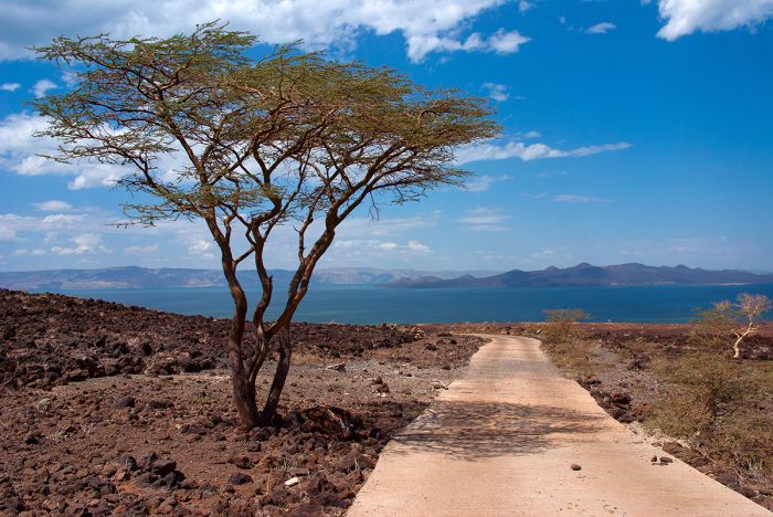
The road leading to Lake Turkana in Northern Kenya.
There are three national parks at Lake Turkana, one on its northeastern shores (Sibiloi NP), while the other two are island parks. Together, the three parks make up an UNESCO World Heritage Site (since 1997).
The climate at Lake Turkana is very hot and extremely dry for much of the year. High winds are common. Fish are abundant in Lake Turkana, but the number of species is relatively low compared to other African Rift Valley lakes, with only about 50 species, including 12 that are endemic. Despite the richness of the lake, it suffers from overfishing.
Besides crocodiles, which are abundant at Lake Turkana, there is a small population of hippo hanging on, though they have been greatly reduced by hunting. Bird life at Lake Turkana is prolific, particularly when migrant species arrive to use the lake for feeding en route to breeding grounds further south on the continent.
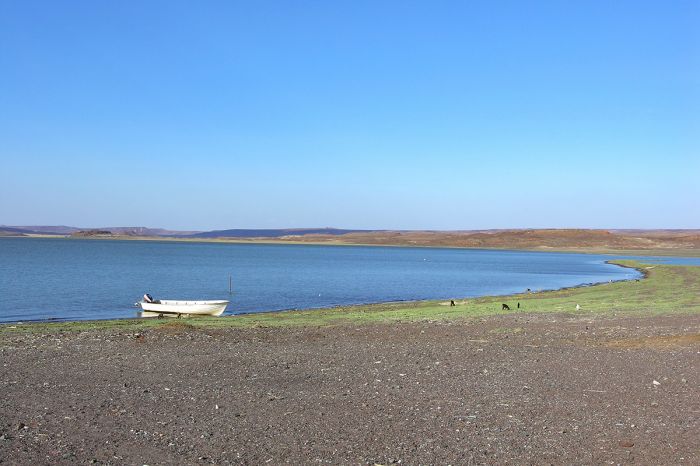
Take Turkana in Northern Kenya.
Human history around Lake Turkana dates back to the earliest of hominid existence. Richard Leakey, the famous Kenyan paleontologist, led numerous anthropological expeditions to Lake Turkana that resulted in the discovery of many early hominid fossils around the Lake.
In 1994, Maeve Leakey (Richard's spouse) and archaeologist Alan Walker excavated the Allia Bay site (in Sibiloi National Park on the northeast shore of the lake), uncovering fossils that have been assigned to Australopithecus anamensis and dating back to over 4 million years ago.
On the southeastern shores of the lake is a small village called Loiyangalani, which is also the location of Kenya's Desert Museum. The museum has artifacts and good information on the history of the lake and the culture of the region's indigenous tribes.
Lake Turkana is under threat from the construction of the Gilgel Gibe III Hydroelectric Dam along the Omo River in Ethiopia. Lake Turkana receives 90% of its water from the Omo River.
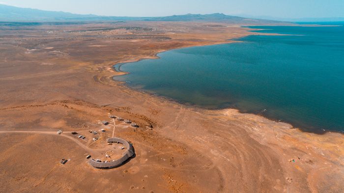
The Desert Museum on the Shores of Lake Turkana in far Northern Kenya.
Sibiloi National Park
Located on the wild and rugged northeastern shore of Lake Turkana, Sibiloi National Park was gazetted in 1973 to protect archeological sites that have rendered numerous important early hominid fossils.
The park covers 606 square miles (1 570 sq kms) of mostly volcanic rock strewn desert and sparse bush in an arid landscape. There are also volcanic formations here, including Mount Sibiloi, which is the site of the Sibiloi Fossil Forest, a once lush but now petrified forest of prehistoric trees.
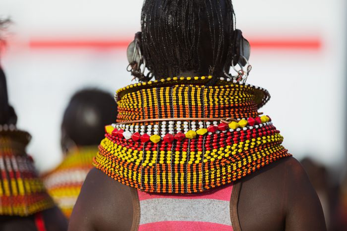
A Turkana woman wearing traditional beadwork neck ornamentation.
The fossil discoveries have been ongoing in Sibiloi since early expeditions by Richard Leaky in 1968. The windy conditions in this desert region have aided the fossil discoveries, as many fossils have been discovered on the surface, blown clean by the wind.
On his initial visit to Lake Turkana in 1968, Leakey established his base camp (Koobi Fora Base Camp) on a large sand-spit projecting into the lake that is part of Koobi Fora Ridge and his discoveries soon led to the national protection of the area.
Wildlife in the park is sparse, other than the abundant crocodiles and some hippos along the lakeshore. There are zebras (both Burchell's and Grevy's), Grant's gazelle, beisa oryx, topi, gerenuk, and greater kudu, although seeing them may be a challenge. There are also supposedly lion, cheetah, and striped hyena in the park. Birding on the other hand is a sure bet, particularly along the lake.
Together with Lake Turkana's two island-based national parks, Sibiloi is an UNESCO World Heritage Site (since 1997).
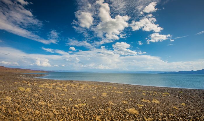
Sibiloi National Park at Lake Turkana, Kenya's desert lake, protects important archeological sites.
Central Island National Park
Located roughly in the center of Lake Turkana is Central Island. The entire island, which covers 1.9 square miles (5 sq kms), was declared a national park in 1983 to protect the wildlife and habitat.
The island is roughly circular and around 3 kilometers wide. The highest point on the island is a volcanic cone that reaches 1 800 feet in elevation (550 meters), but is only about 625 feet (190 meters) above the lake surface.
There are several smaller islands just offshore Central Island, formed by partially submerged crater rims, as well as numerous nearby volcanic plugs and cones beneath the lake's surface. Some of the cones on the island still emit sulfurous steam and in 1974, one of the cones emitted intense molten sulphur.
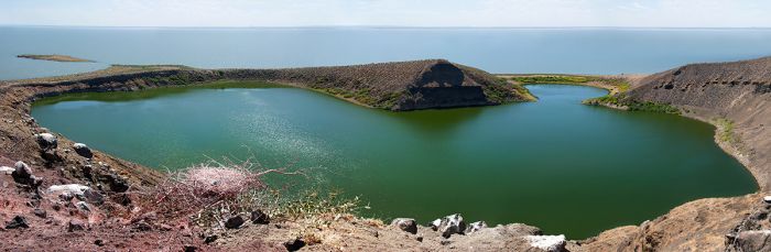
Crocodile Lake on Central Island, Lake Turkana, Northern Kenya.
Central Island, also known as Crocodile Island, is made up of various volcanic cones and more than a dozen craters, three of which are crater lakes (named Crocodile Lake, Flamingo Lake, and Tilapia Lake), which take up about one-half of the island. The two largest lakes fill craters that are nearly one kilometer wide and one of these lakes (Tilapia Lake) is home to an endemic cichlid fish (Tilapia spp.) that now lives exclusively in the lake.
The island is home to one of Africa's densest population of Nile crocodiles, which use the island for breeding and nesting. The crocodile hatchlings use the crater lakes as habitat until they grow large enough to move into Lake Turkana itself.
Central Island is also a nesting location for large numbers of water birds.
Boat trips to Central Island are available from the tiny village of Kalakol, due west of the the island on the mainland shore. Visitors can spend the day and return or camp overnight on the island.
Together with Lake Turkana's other two national parks, Central Island is an UNESCO World Heritage Site (since 1997).
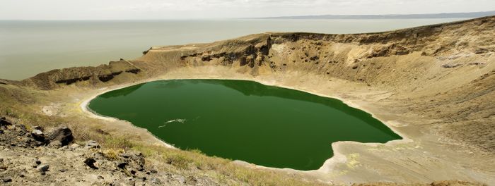
Flamingo Lake, one of Central Island's greater lakes. Lake Turkana in Kenya's Northern Rift Valley.
South Island National Park
Designated in 1983, South Island is located in the far southern end of Lake Turkana and covers an area of 15 square miles (39 sq kms). Like Central Island, South Island is also formed by volcanic cones, some rising to almost 1 000 feet (300 meters) above Turkana's waters.
The island's vents give off a reddish luminance as darkness falls, leading to many local tales of evil spirits and the island is thus uninhabited and avoided by many fishermen.
Besides the crocodiles that breed on the island, there is a population of feral goats. Over 20 species of birds, some migratory and some resident, are known to nest on the island. Water birds, including ducks and gulls are common, and there are often good numbers of flamingo on the shores.
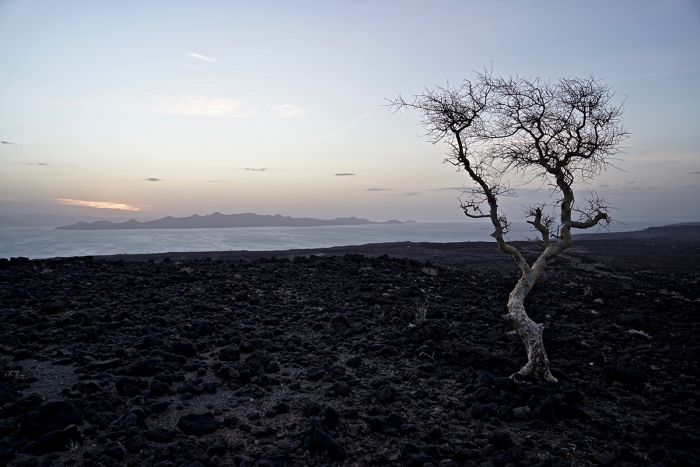
Volcanic rock covers the margin of Lake Turkana. South Island can be seen in the distance.
Day trips to the island can be arranged (from Kalokol, which is due west of Central Island) and overnight camping is possible with prior permission from the park warden.
Together with Lake Turkana's other two national parks, South Island is an UNESCO World Heritage Site (since 1997).
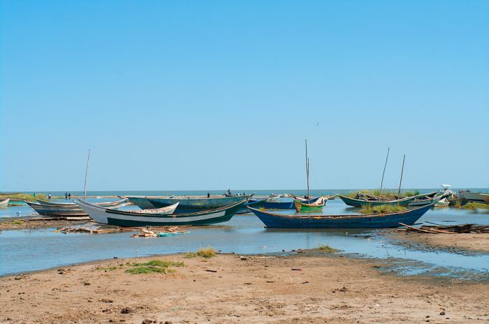
Traditional fishing boats on Lake Turkana.
Rift Valley (Southern)
The southern extent of the Kenyan Rift Valley includes Lake Magadi and the northern tip of Lake Natron, which is mostly located further south in Tanzania. The area is very hot and dry, with only sparse human population.
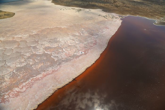
Aerial view over part of Lake Magadi, a soda lake in Kenya's Southern Rift Valley.
Lake Magadi
The southernmost lake in Kenya's Rift Valley system is Lake Magadi. The lake lies in a depression formed by an endorheic basin (no outflow) and covers around 38 square miles (100 sq kms). Magadi's waters are hypersaline and highly alkaline and the lake is quite shallow, with a maximum depth of around 6 feet (2 meters). Lake Magadi is fed almost entirely by saline hot springs that discharge into alkaline lagoons around the margins of the lake.
Lake Magadi is essentially a brine of sodium carbonate and is the world's second largest source of soda (after the Salton Sea in southwest USA). The Magadi Soda Company, owned by the Indian company Tata, operates on a spit of land that extends out into the lake.
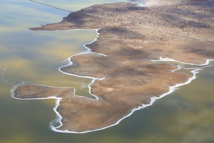
Bird's-eye view over Lake Magadi, showing the causeway that extends out over the lake. The salt deposits can be seen around the lake's margin.
Visitors to Lake Magadi come mainly for the harshly beautiful scenery and the bird life, which is abundant and diverse and sometimes includes large numbers of flamingos that gather on the lake to feed. A single species of fish has evolved to survive in Magadi's waters, the Lake Magadi tilapia (Alcolapia grahami), which can be seen in some of the hot springs around the lake's shoreline.
There are causeways that can be used to walk out over the lake. On the western side of the lake is the Nguruman Escarpment.
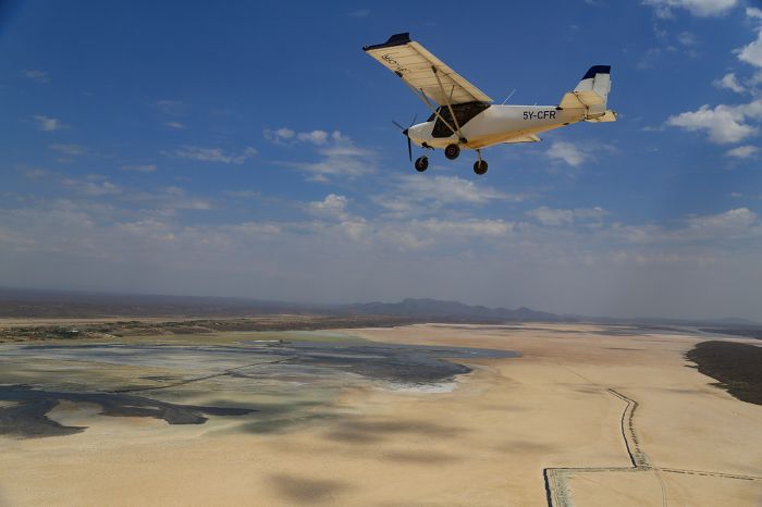
Flying over Lake Magadi, which is used for soda production.
Shompole Conservancy
South of Lake Magadi is the Shompole Community Conservancy, a private venture operated by the local Loodokilani Maasai people and located in the Shompole Group Ranch. The conservancy covers 55 square miles (142 sq kms) of land at the southern end of the Nguruman Escarpment and borders the northernmost tip of Tanzania's Lake Natron along the Kenya-Tanzania border.
Wildlife in Shompole includes four of Africa's Big Five (lion, leopard, elephant, and buffalo); only rhino are absent. Shompole is also home to a diversity of plains game, including Maasai giraffe, Burchell's zebra, blue wildebeest, eland, Grant's gazelle, beisa oryx, gerenuk, olive baboon, and more. Cheetah and African wild dog are also sometimes seen.
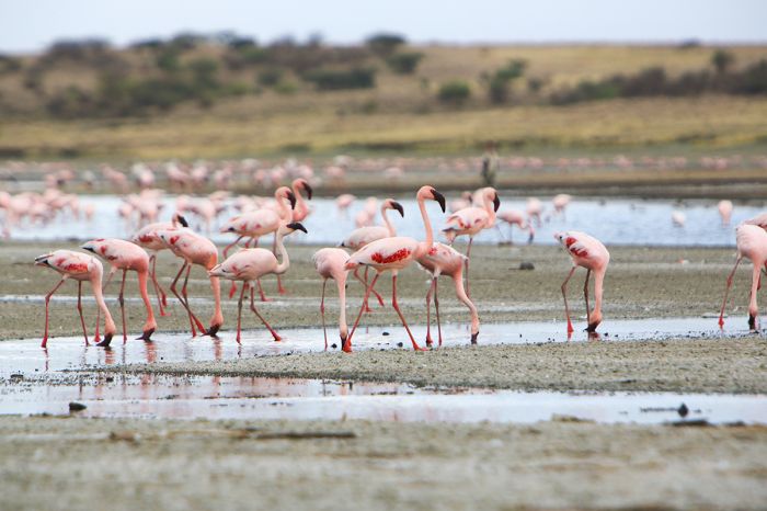
Lesser flamingos on Lake Magadi, Kenya.
Accommodation in the conservancy is at two private safari lodges that offer game drives, guided walks, and some water-based activities (on the Ewaso Ng'iro River) including fishing, tubing, and kayaking. Bird watching in Shompole is very good, with over 400 species recorded. Helicopter flights over Lakes Magadi and Natron are great for photography.
Access to Shompole is by road (around 2.5 hours from Nairobi) or charter flight to the conservancy airstrip.
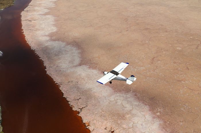
Lake Magadi's water is often pink-hued, due to the high soda content in the lake.
Nasolot & South Turkana
Located close to one another on either side of the A1 roadway in northwestern Kenya are South Turkana National Reserve and the much smaller Nasolot National Reserve.
Nasolot National Reserve
Created in 1979, Nasolot National Reserve covers just 35.5 square miles (92 sq kms). The reserve includes the southern reaches of the Turkana Plains and the northern slopes of the Northwest Highlands and Mount Mtelo. Nasolot is bordered on the west by the Turkwel River, which rises on the slopes of Mount Elgon, en route to Lake Turkana.
The climate is hot and dry and the habitat in the low elevations is dry bush and Acacia thickets interspersed onto the grassy savannas. The highlands provide spectacular scenery and views over the plains lying to the north and the mountains to the south. A road cuts through the reserve and connects to the Turkwel River Dam, which provides hydroelectric power and creates a large reservoir, that is a great place to see birds.
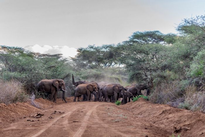
Elephants are a good possibility when visiting Nasolot Reserve in Northern Kenya.
Wildlife in Nasolot includes elephants, which are somewhat abundant, but not easy to see due to the thick bush. Other plains game includes a variety of herbivores, including buffalo, Rothschild's giraffe, lesser kudu, greater kudu, bushbuck, warthog, Kirk's dik-dik, impala, fringe-eared oryx, common waterbuck, Grant's gazelle, Burchell's zebra, common duiker, and others. Predators include lion, leopard, black-backed jackal, and spotted hyena.
Nasolot receives very few visitors, as is the case with most of Northern Kenya. Camping is permitted anywhere in the reserve, but there are no formal camp sites. There is an airstrip near the Turkwel Dam, but most visitors arrive via the A1 road.
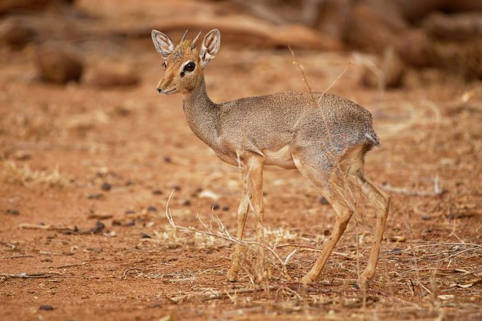
The diminutive Kirk's dik-dik (Madoqua kirkii) is found in the Nasolot National Reserve.
South Turkana National Reserve
Located due east and on the other side of the A1 road from Nasolot National Reserve is South Turkana National Reserve. South Turkana covers 421 square miles (1 091 sq kms) in the foothills of Mount Mtelo and the Northwest Highlands.
The reserve is characterized by dense Acacia scrub and thicket, as well as grassy savanna, woodlands, and riparian forest along the waterways. The Kerio River, which flows north to Lake Turkana, forms the eastern boundary of the reserve.
Wildlife includes elephant, buffalo, Rothschild's giraffe, zebra, Grant's gazelle, Burchell's zebra, greater kudu, lesser kudu, bushbuck, Kirk's dik-dik, common waterbuck, common duiker, beisa oryx, impala, warthog, and others. Elephants are especially common from March thru July, when they migrate into the reserve.
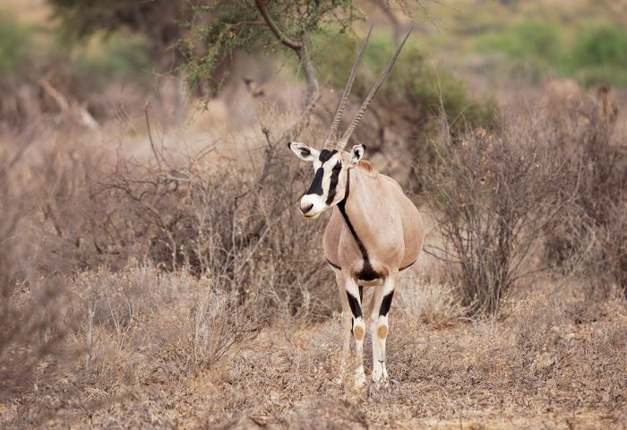
The beisa oryx (Oryx beisa) is another dryland species found in small numbers throughout parts of Northern Kenya, including at South Turkana National Reserve.
Predators include leopard, lion, and spotted hyena. Birding in the reserve is good, with a diverse mix of species due to the varied habitats. The grasslands are a good place to find ostrich and Africa's heaviest flying bird, the kori bustard.
Accommodation is available as a self-camping site near the park's headquarters. Rangers can be hired for guiding to help find wildlife in the reserve.
Activities include game drives and hiking. Those who want a challenge can climb Mount Kailongol, which rises to 6 780 feet (2 067 meters). Visits to the salty hot springs situated on the eastern side of the mountain can be interesting, as they are used for drinking by wildlife and cattle of the local Pokot herdsmen.
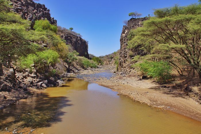
The Kerio River forms the western boundary of South Turkana National Reserve.
Lamu Archipelago
(including the Kiunga Marine National Reserve)
The group of low-lying islands known as the Lamu Archipelago are located along the far northern Indian Ocean coastline of Kenya, very close to the border with Somalia. The largest of the islands are Pate, Lamu, and Manda, but there are numerous other small islets, some of which are protected as part of the Kiunga Marine National Reserve.
The islands of Lamu are the site of East Africa's oldest and best preserved Swahili settlements. Early use of the islands by traders from Arabia, Persia, and India created a diverse mix of cultures alongside the local African people, thus creating the culture known as Swahili.
Lamu Town on Lamu Island dates back to the 1370s and its design is based on narrow, winding roads. Today, as in the past, people in Lamu Town get around almost entirely on foot or by donkey. The use of motor vehicles is prohibited for the general public.
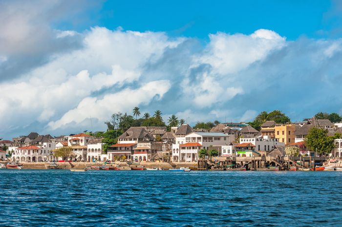
Historic Lamu Town on Lamu Island is an UNESCO World Heritage Site.
Lamu Town's architecture dates back to the time when the islands were under control of the Omani Empire from the late 1600s up until the early 1800s. Lamu "Old" Town, which refers to the oldest section of the town, has been declared an UNESCO World Heritage Site.
Today, Lamu Town is the main destination for visitors and it offers very good options for accommodation. The town has a relaxed and lazy atmosphere and gives one the feeling of being in a time warp. The two-kilometer stretch of waterfront is the center of activity, with beaches, boats, and buildings lining the seashore.
Snorkeling around the Lamu Archipelago is excellent, as is diving and fishing. Beach resorts are popular and all offer a variety of water sports and tours to the remote and mostly deserted smaller islands.
Lamu is best reached from Mombasa, with a drive time of around 5 hours and a flight time of under an hour. One can also get to Lamu from Nairobi, but the drive time is long (over 9 hours), so most people fly (2 hour flight time).
Read full details on Lamu and its accommodation options here.

Boats along the waterfront at Lamu Town on Kenya's northeast coast.
Kiunga Marine National Reserve
The northernmost section of the Lamu Islands and coastline are protected by the Kiunga Marine National Reserve. The protected area covers 111 square miles (287 sq kms) and includes about 50 calcareous islands, as well as extensive coral reefs, marine wildlife, and open water.
Kiunga was proclaimed in 1979 to give protection to important marine habitats that include reef systems, beds of sea grass, coastal scrubland, and mangroves. Marine life is abundant in Kiunga, with the dugong being one of its most endangered animals. Other marine species living in the reserve include sea turtles, whales, dolphins, numerous species of fish, octopus, starfish, and many more.
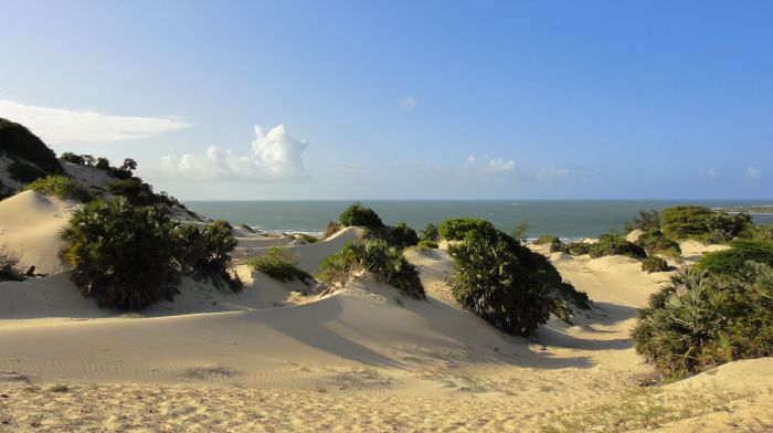
The Kiunga Marine National Reserve protects pristine islands in the northern portion of the Lamu Archipelago.
The outer islands in the reserve are important nesting sites for sea birds, including crab plover, sooty gull, bridled tern, roseate tern, white-cheeked tern, and brown noddy.
Kiwayu Island is a desert island that is popular for day trips or multi-day camping adventures. Charters can be arranged to Kiwayu from Lamu (assume one day to get there on a dhow, but charter flights to the nearby airstrip can also be arranged.)
The primary activities in the reserve are snorkeling, diving and sailing. Wetsuits are optional for divers, as the Indian Ocean waters here are quite warm.
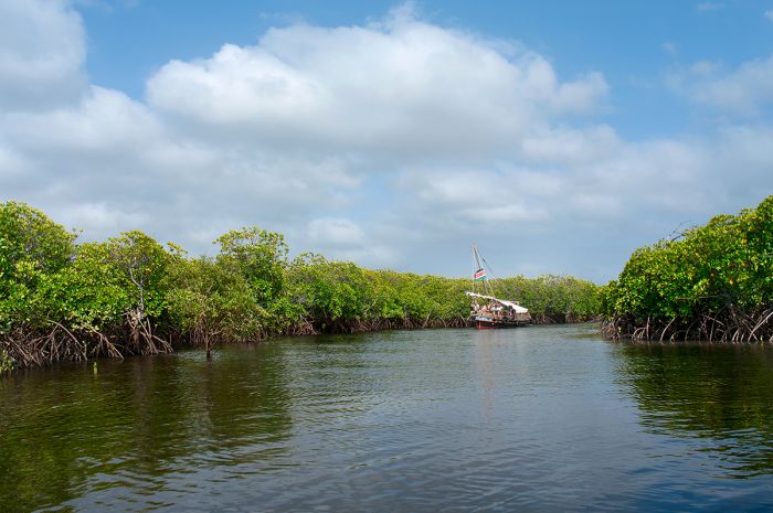
Mangrove forests are protected in Kenya's Kiunga Marine Reserve.
Dodori National Reserve
Designated in 1976, Dodori National Reserve is situated just inland from the Kiunga Marine National Reserve and not far north of Lamu, quite close to the Somali border in extreme northeast Kenya.
Dodori covers an area of 339 square miles (877 sq kms) and is mainly comprised of dense forest, grassland savanna, woodland, mangrove, and coastal sands with palm scrub.
The wooded areas of the reserve support wildlife, including topi antelope, greater and lesser kudu, Burchell's zebra, elephant, buffalo, Aders's duiker, and others. Lion and leopard are also found in Dodori.
Like Boni National Reserve, which is a short distance to the north, Dodori is located very close to the Somali border. Boni Reserve became a hideout for the Somalia-based terrorist jihadist fundamentalist group, Al-Shabaab in recent years, although the Kenyan military has made serious efforts to secure the border. For this reason, Dodori is not recommended as a destination at present.
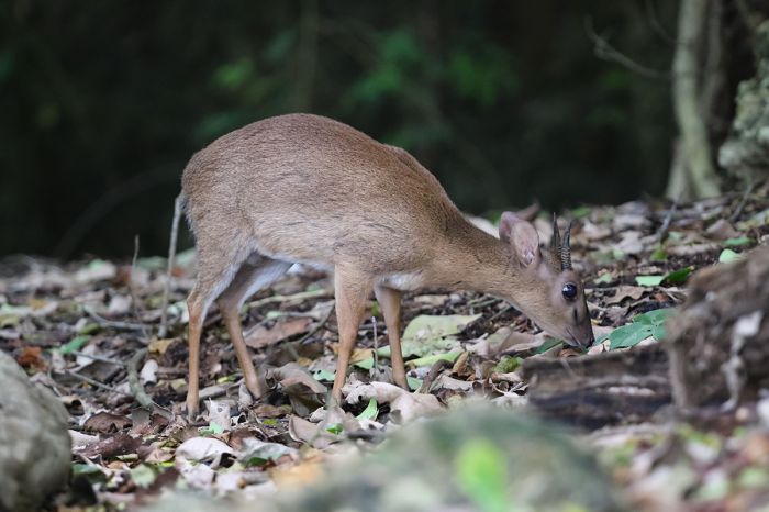
Aders's duiker (Cephalophus adersi), a tiny and endangered antelope, is found in Dodori National Reserve, Kenya.
Boni National Reserve
The Boni National Reserve is located along the Kenya-Somalia border near the Indian Ocean coastline. The reserve covers 517 square miles (1 339 sq kms) and protects the open-canopy Boni Forest, for which the reserve is named. There is a high diversity of flora in the forest, which is also inhabited by the indigenous Awer and Watta people.
Wildlife in the reserve has in the past included elephant, topi, common waterbuck, buffalo, and various species of antelope. Hippo are also found along the coast.
Unfortunately Boni became a no-go zone beginning around 2010, as the Somalia-based terrorist organization Al-Shabaab moved into the reserve, which they used as a hideout. Kenyan forces have fought with the Somalians and are still making efforts to clear them out of the reserve. Tourism is postponed to Boni until this matter is resolved.
Watamu Marine National Park and Reserve
The combined marine national park and reserve at the coastal town of Watamu includes a section of the offshore reefs and water of the Indian Ocean (Watamu Marine National Reserve) plus an inland section, which is a tidal mangrove area known as Mida Creek (Watamu Marine National Park).
The combined area protects 16.2 square miles (42 sq kms) that excludes all but traditional methods of fishing and only of specific species and numbers of fish. Some tourist activities are also permitted in the reserve, such as snorkeling and diving.
Diving and snorkeling offshore from Watamu is excellent and the reefs are home to a high diversity of corals, sponges, and hundreds of species of fish. Whale sharks are seen regularly, as are dolphins rays, octopuses, eels and myriad colorful reef fishes.
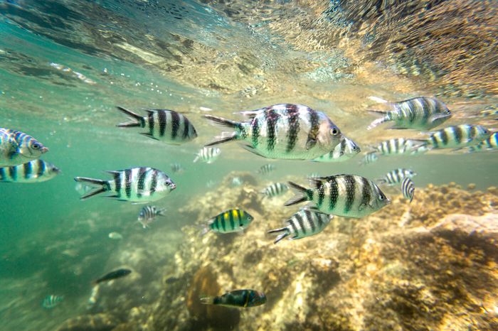
A school of scissortail sergeant (Abudefduf sexfasciatus) (also called striptailed damselfish) seen on a reef offshore from Watamu, Kenya.
The prime season for diving and snorkeling is from October thru March, when the water in the marine reserve is clear. There are numerous popular dive sites in the reserve, including "Turtle Reef" (several hundred yards offshore), "Moray Reef" (further out), and "Drummers Reef".
Watamu has several dive centres that offer guided dives and PADI courses for beginners. A spot known as "Big Three Caves" is located around one kilometer offshore and is popular for its giant groupers.
Sport fishing is very popular at Watamu and highly regulated. The best season for game fishing is from July to mid-April. The seas become very rough from May thru July, so most boats will not even attempt to fish during that time. July thru October also means rough seas, but boats do go out anyway.
Billfish (sailfish and marlin) season is generally from November to mid-March. Other species that are commonly caught include dorado, bonito, wahoo, kingfish, giant trevally, tuna, and several species of shark. Many species are allowed to be kept for eating, but all billfish and sharks are strictly tag-and-realease.
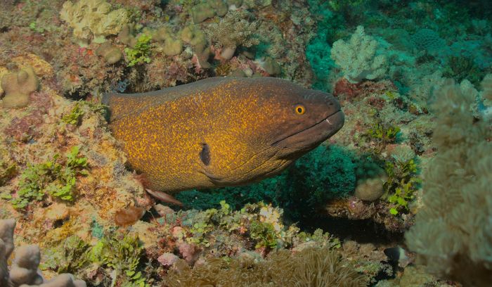
A yellow-edged moray eel (Gymnothorax flavimarginatus) in the Indian Ocean waters of Watamu Marine National Reserve.
Sea Turtles
The beaches within the Watamu Marine Reserve are used as nesting sites by sea turtles, including hawksbill, olive ridley, and green turtles. Leatherback turtles are often seen in the waters, but do not use Watamu for nesting.
The Watamu Turtle Watch (WTW) is run by the non-profit Local Ocean and patrols Watamu's beaches nightly to keep sea turtles and their nesting sites safe.
Additionally, local fisherman are paid to tag and release turtles caught accidentally while fishing and WTW compensates the fishermen for any damage to their fishing gear and for their time in saving the turtles. WTW also operates a local Turtle Rehabilitation Centre to treat sick or injured turtles and return them to the ocean.
WTW also operates a Turtle Watch program further south along Kenya's coast at Diani Beach.
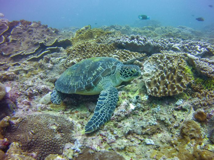
A green sea turtle (Chelonia mydas) in the Watamu Marine National Reserve.
Mida Creek
Extending from the coast at Watamu and inland to the main road is the Mida Creek Estuary. Mida Creek covers 12.3 square miles (32 sq kms) and forms the national park portion of the marine protected area. The area includes mangrove forest, tidal mud and sand flats, shallow open water, and grassland and is very popular with nature enthusiasts and bird watchers.
The Mida Creek Mangrove Board Walk and Bird Hide offer visitors an easy way to observe the abundant nature, particularly the numerous waders and other local and migratory birds that utilize the area for roosting, feeding, and breeding.
Local guides are available and are very knowledgable on the park's diverse flora and fauna. Canoeing, paddle boarding, and kayaking are are also offered to explore the creek and tidal waters. The Mida Creek Conservation Community runs several initiatives, including a crab farm and restaurant.
Kayaking in the mangrove forest at Mida Creek, Watamu, Kenya.
Malindi
(Including Malindi Marine National Park)
History
The historic settlement of Malindi (now a tourism-based city of 120 000) dates back to at least as early as the 13th century and became the site of a Portuguese trading post and rest stop for their ships en route to and from India. Malindi remained the center of Portuguese activity in East Africa until 1593, when the Portuguese moved their base to Mombasa.
Malindi was conquered by the Omani Sultan of Zanzibar in 1861 and it served as a slave trade center until 1890, when the British seized control and abolished the slave trade.
Today the town is mainly a beach and game fishing destination, particularly for Europeans.
The Vasco da Gama Pillar, commemorating the Portuguese explorer's arrival at Malindi in 1498, en route to India.
Malindi Marine National Park
The small Malindi Marine National Park is essentially an extension of the Watamu Marine National Park directly to its south. The Malindi portion of the combined area covers a mere 2.3 square miles (6 sq kms) and protects the beaches, mud flats, mangroves, coral reefs, sea grass beds, and open coastal waters offshore from the town.
Snorkeling, diving, boating, surfing, and other water sports are the main activities offshore, while the town's beaches are popular with tourists and locals alike. Malindi is also a sport fishing destination with operators that will take you out for billfish, tuna, wahoo, and others.
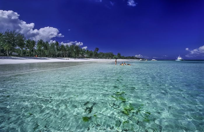
Beautiful white-sand beach and clear Indian Ocean water at Malindi, Kenya.
Arabuko Sokoke National Forest
Located inland from the coastal towns of Malindi and Watamu is the Arabuko Sokoke National Forest. The reserve, which protects 162 square miles (420 square kms), represents the largest tract of indigenous coastal forest in East Africa and all the remains of what was once an extensive belt of coastal forest that stretched from Somalia south to Mozambique.
Wildlife in Arabuko Sokoke includes a small population of elephant (they are not often seen), good numbers of the more conspicuous Sykes' monkey (also called Samango monkey), and yellow baboon. The forest also harbors the geographically restricted Aders' duiker, a tiny and shy forest-dwelling antelope and the near endemic golden-rumped elephant shrew (Rhynchocyon chrysopygus), a small insectivore that has been adopted as the symbol of the reserve.
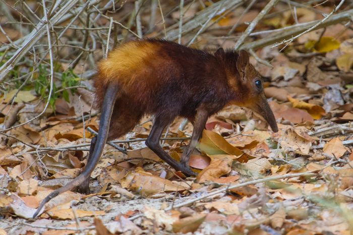
The golden-rumped elephant shrew (Rhynchocyon chrysopygus) is a tiny mammal found only in and around the Arabuko Sokoke Forest.
There are over 230 species of birds living in the Sokoke forest and it has been declared the second-most important forest for bird conservation on mainland Africa by Birdlife International. There are six globally threatened bird species found in the reserve, including the diminutive Sokoke scops owl, Sokoke pipit, Amani sunbird, spotted ground thrush, east coast akalat, and Clarke's weaver. The forest also holds a high diversity of frogs.
There are various trails that can be explored on foot and, unless there has been recent rain, which can lead to muddy and slippery conditions, the forest hiking is easy. There are also several driving routes through the forest, which are only recommended for 4WD vehicles or using bikes.
Between Arabuko Sokoke and Watamu Town are the Gedi Ruins, a medieval Swahili settlement dating back to the 13th century. The ruins have been deserted for over 300 years and the forest is in the process of reclaiming them. The site can be toured on foot and is worth visiting.
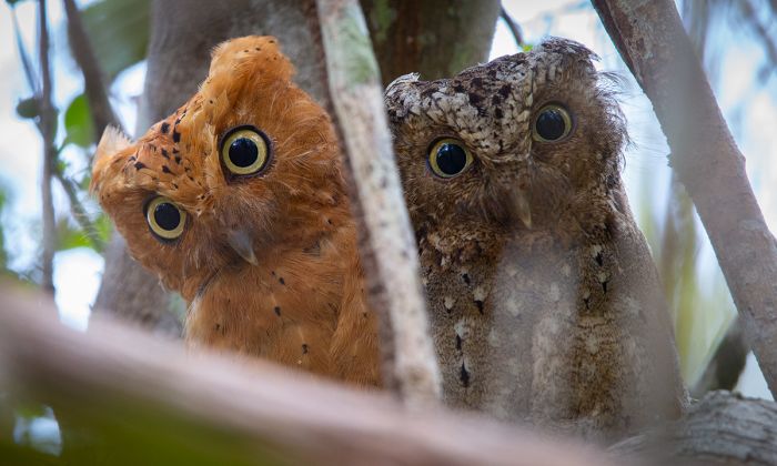
The Sokoke scops-owl (Otus ireneae) is a highly range-restricted species found in the Arabuko Sokoke Forest (Copyright © James Weis).
Shimba Hills National Reserve
Located inland and due west of Diani Beach along Kenya's southern coast is the Shimba Hills National Reserve. The reserve spans 74 square miles (192 sq kms) and is characterized by hilly terrain, with grassland, rain forest, and woodlands.
Shimba Hills is a nice day trip option for those staying in either Mombasa or the south coast beaches, as it can be reached in about an hour from either place.
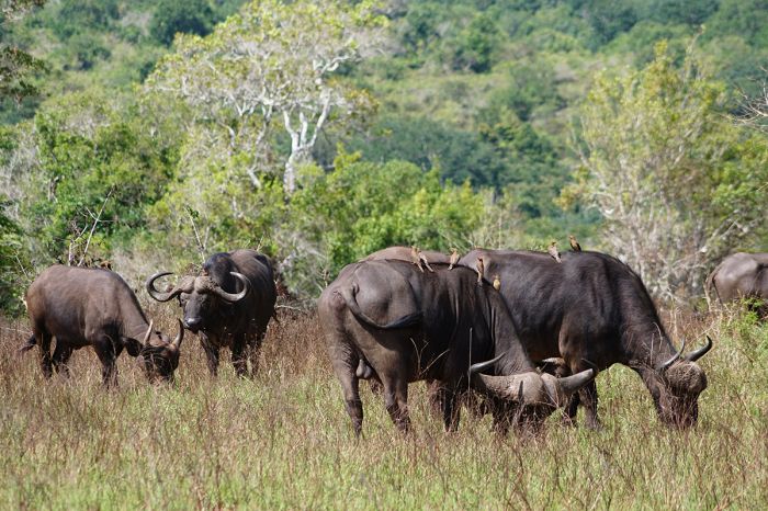
Buffalo are commonly seen in the Shimba Hills Reserve.
Wildlife in the reserve is fairly abundant and visitors can expect to see buffalo, Masai giraffe, Burchell's zebra, elephant, warthog, and hippo. Shimba also has a healthy population of sable and is the only reserve in the country where one can see these antelopes.
Lions are gone from the reserve, but there is a chance of seeing leopard. Primates in Shimba Hills include yellow baboon and Angolan black-and-white colobus monkey.
Shimba Lodge is a recommended option for lunch or overnight stays. The lodge is another of Kenya's 'tree' lodges, like those in the Aberdares or at Mount Kenya, with a viewing deck for observing wildlife.
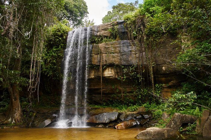
Sheldrick Waterfall in Kenya's Shimba Hills National Reserve.
Diani Beach
Located just 19 miles (30 kms) south of Mombasa along Kenya's southeast coast is the Indian Ocean beach destination of Diani Beach. Frequently voted as Africa's best beach, Diani Beach is one of Kenya's premier tourist destinations and a popular place to end a trip after safaris in the Masai Mara or elsewhere.
The ocean activities are varied and excellent, with warm, normally crystal-clear water that is shallow near the beach. An offshore reef that can be reached by swimming or a quick boat ride offers excellent snorkeling. There is also an inland lagoon that is lovely for a swim.
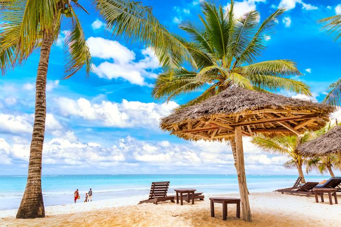
Idyllic Indian Ocean scenery at Diani Beach, Kenya.
There are numerous accommodations at Diani Beach, most of them upscale, with private villas and all-inclusive resort hotels that offer every imaginable water-based activity including snorkeling, sailing, diving, fishing, kite surfing, jet-skiing, and more. There are plenty of restaurants and shopping places nearby.
For those wanting to venture inland, a day trip to Shimba Hills National Reserve provides good wildlife in an uncrowded safari destination. Further south along the coast and close to the Tanzania border is the Kisite-Mpunguti Marine National Park, which is good for a day trip of snorkeling or diving.
Read full details on Diani Beach and its accommodations here.
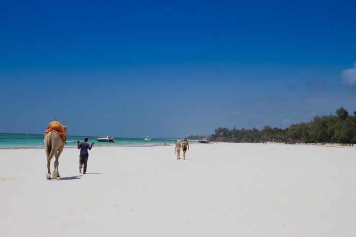
Diani Beach is known for its white-sand beaches and warm, crystal clear ocean waters.
Kisite-Mpunguti Marine National Park
Protecting the waters and pristine coral reefs around the tiny island of Kisite is the Kisite-Mpunguti Marine National Park. Kisite is located just offshore Kenya's far southern coast and almost into Tanzania. The marine park covers 11 square miles (28 sq kms) and the area in and around the park is known for having some of the best snorkeling and diving in the country.
Nearby Wasini Island, as well as several other coral rag islands in the area, offer superb opportunities for snorkelers or divers to explore the vibrant coral gardens and see diverse marine life up close. These warm and usually calm waters also offer a good chance of seeing dolphins, which commonly frequent this area.
Diving and snorkeling excursions can be booked via local operators and those staying at Diani Beach just to the north can easily make a great day trip to Kisite. The islands are also used by numerous species of sea birds.
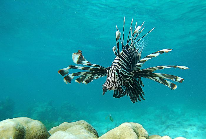
A lionfish (Pterois volitans) seen off Kenya's southeastern coast.
Tana River Parks & Reserves
(including two national parks: Meru NP, Kora NP; four national reserves: Bisanadi NR, Mwingi NR, Rahole NR, Arawale NR; and the Tana River Primate Reserve)
East of Mount Kenya and along the equator are five protected areas (two national parks and three national reserves) that are influenced and/or bounded by the Tana River. The Tana is Kenya's longest river, with its tributaries originating on Mount Kenya and the Aberdare Mountains and flowing for over 600 miles (~1 000 kms) east to the Indian Ocean.
The Tana River forms a boundary for Meru National Park, Kora National Park, Mwingi National Reserve, and Bisanadi National Reserve, while Rahole National Reserve is located just to the north of the river. These parks and reserves are not often visited, but offer good wildlife viewing in an unspoiled wilderness. Read more about these protected areas directly below.
Further to the south and east along the Tana River are two more reserves: Arawale National Reserve and the Tana River Primate Reserve.
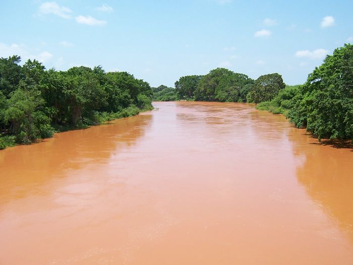
Kenya's Tana River rises in the Aberdare Mountains and flows to the Indian Ocean. It is the longest river in the country.
The Adamson's / Born Free
This Tana River reserves are best known as the location where Joy and George Adamson cared for and released their famous lioness 'Elsa' back into the wild. Born Free, the 1960 book written by Joy Adamson, chronicles the story of the couple's work in both Kora and Meru National Parks, and particularly how they raised three orphaned lion cubs (whom they named Big One, Lastika, and Elsa) to adulthood before successfully returning them to the wild.
The Adamsons later separated and each was murdered in separate incidents by poachers. Joy Adamson was killed in 1980 in nearby Shaba National Reserve and George Adamson was killed by Somali bandits in 1989 in Kora National Park. Joy was buried next to her beloved Elsa in Meru National Park and their memorial site can be visited. George Adamson's grave is located in Kora National Park.
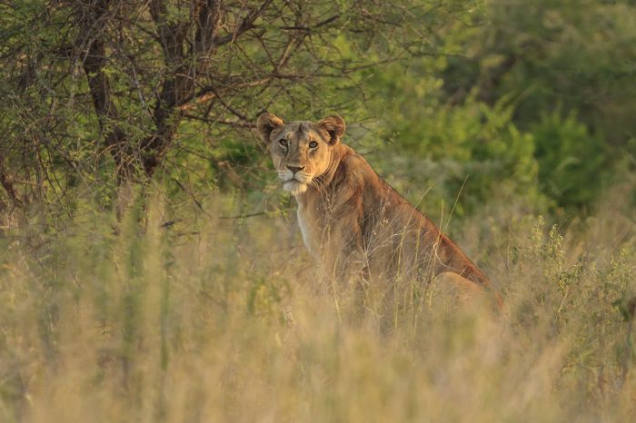
George and Joy Adamson worked in both Kora and Meru and the book Born Free, which tells the story of their adopted lioness Elsa, brought fame to this area of Kenya in the 1960s.
Meru National Park
The westernmost of the Tana River parks is Meru National Park, which is bounded on its south by the river. Meru gained acclaim in the 1960s as the location of Joy Adamson's book Born Free (read more above).
Meru, along with its neighboring parks and reserves, is seldom included on any safari itinerary, as the area suffered greatly from poaching in the 1980s and never recovered from the hit to its tourism.
Meru National Park covers 336 square miles (870 sq kms), with a landscape comprised of lush green hills and multiple seasonal streams that flow into the Tana River. The river is flanked by riparian forests with baobab trees and lofty doum palms. There are also areas of open savanna, similar to those found further south in Tsavo.
All of Africa's Big Five animals (lion, leopard, elephant, buffalo, rhino) can be found in Meru and the savannas in the park's northern sector offer the best game viewing.
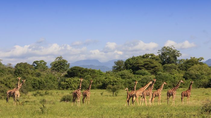
A 'journey' of reticulated giraffes in Meru National Park.
Other species commonly seen in Meru include reticulated giraffe, Grevy's zebra, impala, Grant's gazelle, blue wildebeest, vervet monkey, and baboon (both yellow and olive species). Less common species in Meru include lesser kudu, beisa oryx, Burchell's zebra, common reedbuck, and gerenuk. Hippo and crocodile can be seen in some of the waterways.
The 18-square-mile (48-sq-km) Meru Rhino Sanctuary, which is completely fenced to protect the rhinos, is an excellent place to look for and see both black and white rhino species. The sanctuary was originally stocked with rhinos rescued from Lake Nakuru National Park during the heyday of poaching in the 1980s.
Game viewing in general is best during the dry season months from June through September. There are two rainy seasons: the 'short' rains, which are usually not heavy, in October and November, and the 'long' and more persistent rains from March into May. Some wildlife, especially elephants, tend to disperse during the rains.
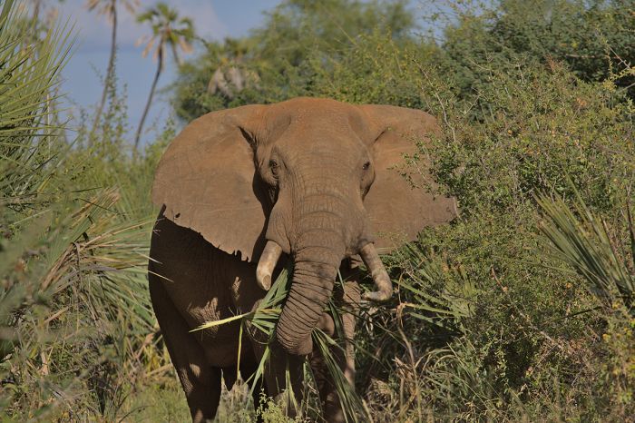
An impressive bull elephant in Kenya's Meru National Park.
Elsa, the famous lioness, is buried in the park next to Joy Adamson and their grave site memorial may be of interest to some visitors. There are camping sites in the park, as well as a few permanent safari lodges and camps.
Meru can be accessed by road, as is often the case for those on a multi-destination organized overland trip, or by air to one of the park's two airstrips. The drive to Meru from Samburu takes about 2.5 hours. Traveling by road from Nairobi takes around 7 hours, but those who fly can get there in 45 minutes.
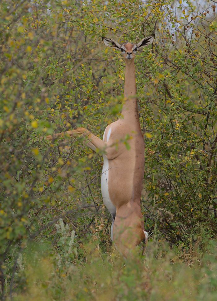
A gerenuk antelope feeding in its characteristic hind-leg stance in Meru National Park, Kenya.
Kora National Park
Even more deserted and wild than neighboring Meru National Park is Kora National Park, a pristine wilderness covering 690 square miles (1 787 sq kms). Kora was originally designated as a nature reserve in 1973 and became a national park in 1989. The park is bounded on most of it northern border by the Tana River and is connected to three national reserves: Rahole and Basinadi to the north, and Mwingi to the west.
Kora, like Meru, gained acclaim in the 1960s after the publication of Joy Adamson's book, Born Free. Joy and her husband George lived and worked in Kora at their camp 'Kampi ya Simba' (read more above). George was murdered by poachers in 1989 and is buried in the park; his gravesite can be visited.
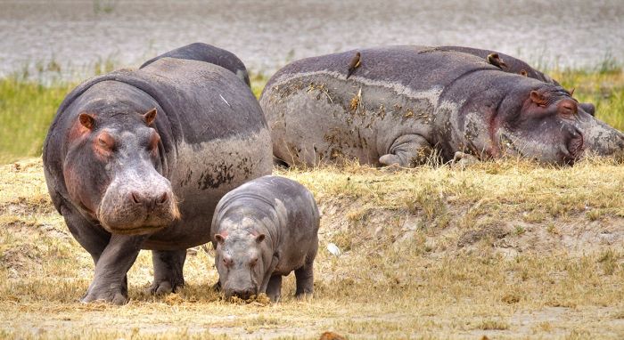
Hippos are common on the banks of the Tana River.
Kora is a very scenic park, with vast grassy plains and Acacia bush and scrub with rocky inselbergs. There are several rivers in Kora that only flow seasonally and connect into the much larger and perennial Tana River.
The Tana is flanked by areas of riparian woodland and the lofty doum palms are prevalent all along the river banks. Features and landmarks of note along the Tana River include Grand Falls, Adamson's Falls, and the Kora Rapids. Kora is linked to Meru National Park by Adamsons Bridge, which spans the Tana River over Adamsons Falls.
Wildlife in Kora has never completely recovered from the tragic poaching of the 1980s, but there is still plenty of wildlife in the park. Kora's wildlife is the same as in Meru. The park is seldom visited and therefore does not have the high level of support from the Kenya Wildlife Service (KWS) that more popular reserves (like the Masai Mara) receive.
There are several private organizations, as well as government initiatives, that are attempting to rejuvenate Kora, but until further notice, the park is really only advisable for intrepid and experienced self-sufficient safari enthusiasts or those on an organized overland journey.
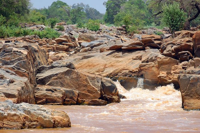
Adamsons Falls on the Tana River, Kora National Park, Kenya.
Bisanadi, Rahole, & Mwingi Reserves
Connected to Meru and Kora National Parks are three national reserves: Bisanadi, Rahole, and Mwingi. Like the adjoining parks, these reserves offer a wilderness experience with little to no infrastructure in terms of permanent accommodation. Most visitors to the area opt to stay in Meru National Park, as there are permanent safari lodges there, but self-campers will enjoy the unspoiled and wild setting in these reserves.
The areas covered by these parks are as follows: Basanadi 234 square miles (606 sq kms); Rahole 490 square Miles (1 270 sq kms); Mwingi 288 square miles (745 sq kms).
Wildlife in these reserves is the same as in Kora and Meru (read above) and includes elephant, lion, leopard and a host of plains game.
The reserves are characterized by a hot, semi-arid climate, Acacia bush, open plains, and some riparian woodland along the waterways, particularly the perennial Tana River.
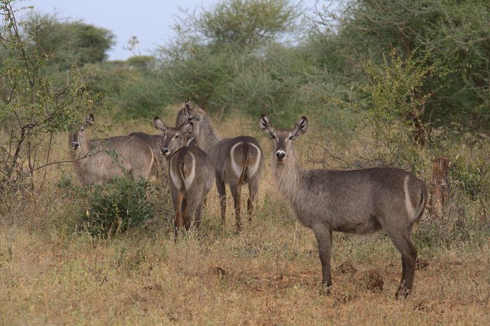
Common waterbucks can be seen in the Tana River parks and reserves.
Arawale National Reserve
Located in southeastern Kenya, the Arawale National Reserve is co-managed by Garissa County and the Kenya Wildlife Service (KWS). Arawale, which covers 206 square miles (533 sq kms), is bordered on the west by the Tana River and on the east by the road connecting Garissa town to Lamu Town.
Arawale was established in 1974 to protect a local population of the critically endangered hirola (Beatragus hunteri). The hirola, which is also known as Hunter's hartebeest, is a geographically restricted species found only along the southern border between Kenya and Somalia. The hirola is the only extant species of its genus and may be the world's most endangered antelope, with an estimated 600 remaining.
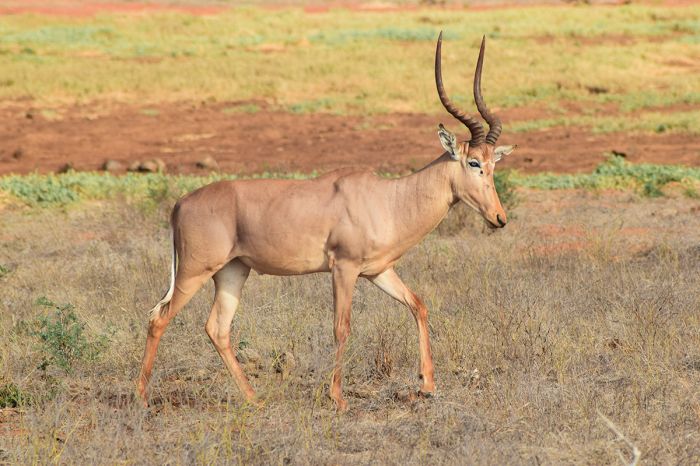
The hirola or Hunter's hartebeest (Beatragus hunteri), is protected in Kenya's Arawale National Reserve.
The name 'hirola' is derived from the pastoralist Somali community of the same name, who give safe refuge to the antelopes, believing them to have spiritual significance. The hirola people fear that if the antelopes disappear, so will their cattle.
Arawale is characterized by semi-arid savanna, Acacia scrub, and some areas of thicker bush. Besides the hirola, Arawale Reserve is also home to a variety of plains game, including Grevy's zebra, buffalo, lesser kudu, elephant, warthog, and more. Cheetah and African wild dog are sometimes seen. Birdlife, particularly along the Tana River, is abundant.
Arawale has no permanent accommodations for visitors, so self-camping is the best option for those wishing to spend more than a day in the reserve.
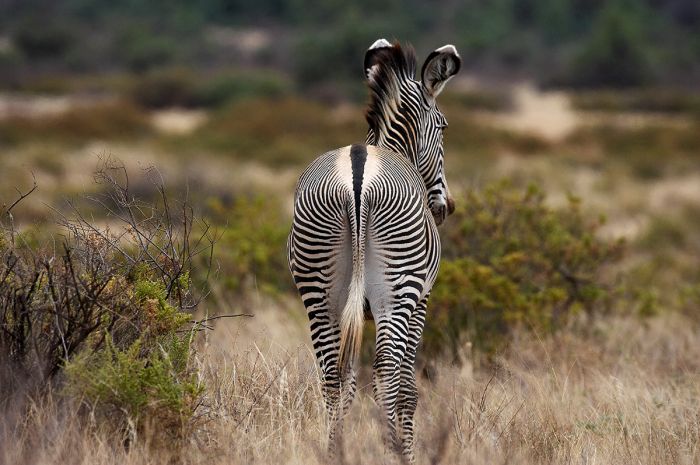
The beautifully patterned Grevy's zebra (Equus grevyi) can be seen in Arawale National Reserve.
Tana River National Primate Reserve
The Tana River Primate Reserve was created in 1974 to protect a small patch of remaining rainforest (a remnant of the once massive Central African lowland rainforest that is now long gone), as well as two critically endangered primate species: the Tana River red colobus and the Tana River mangabey.
The reserve, which covers an area of 65 square miles (169 sq kms), is named for the Tana River, which flows roughly north-south through there reserve. The Tana River is prone to overflowing its banks along this portion of its route towards the Indian Ocean, and in the reserve, there are patches of lush, riparian forest, which are the prime habitat for the wildlife here. Interspersed with these forest patches are open grassland, woodland, and thick bush.
A highly endangered Tana River red colobus (Piliocolobus rufomitratus) (photo: Wikimedia Commons).
Other primates living in the reserve include Sykes' monkey, yellow baboon, and several species of bushbaby (galago).
The reserve has come into serious threat from the local farmers that live around the reserve and the reserve's actual existence as a nationally protected area is in question.
During the 1990s, despite having government protection, the local people cut down roughly half of the forest in the reserve for use as timber and to clear ground for cultivation. Funding for the reserve at that time was being provided by World Bank, and as a result of KWS' inaction to stop the park's degradation, it pulled its support, leaving the status of the reserve in question. There are reportedly some private initiatives underway to try and save what remains of the forest and the reserve.
Sykes' monkey (Cercopithecus albogularis), also known as Samango monkey or white-throated monkey, is also found in Kenya's Tana River Reserve.
Mount Elgon
(including Mount Elgon National Park and Forest Reserve)
Rising 14 114 feet (4 302 meters), Mount Elgon is a massive extinct shield volcano located in Western Kenya, 80 miles (130 kms) northeast of Lake Victoria and straddling the Ugandan border. Elgon is Kenya's second nighest mountain (after Mount Kenya) and is estimated to be around 24 million years old, making it the oldest extinct volcano in East Africa.
The name of the mountain is Anglicized from the Maasai name, "Ol Doinyo Ilgoon", which means the 'breast mountain', due to its shape. Elgon's crater rim is quite eroded, but its caldera, which is around 5 miles (8 kms) in diameter, is largely intact and one of the largest in the world.
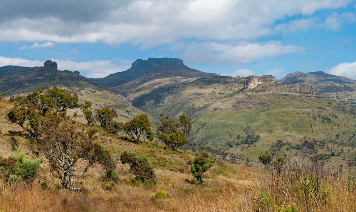
View up towards the crater in Mount Elgon National Park, Kenya.
Elgon covers a vast area, spanning 50 miles (80 kms) in diameter and is similar in total bulk to that of Mount Kenya, but it has a lower profile and is below the snow zone. Elgon's five significant jagged peaks are as follows:
- Wagagai (14 177 feet / 4 321 meters), located in Uganda;
- Sudek (14 114 feet / 4 302 meters) located on the Kenya/Uganda border;
- Koitobos (13 852 feet / 4 222 meters), a flat-topped basalt column located in Kenya;
- Mubiyi (13 816 feet / 4 211 meters), located in Uganda;
- Masaba (13 652 / 4 161 meters), located in Uganda.
Mount Elgon receives protection via two national parks, one in Uganda and one in Kenya and both having the same name (Mount Elgon National Park). The Kenyan park was created in 1968, but covers a mere 65 square miles (169 sq kms), while the Ugandan park is much larger, covering 429 square miles (1 110 sq kms). The Kenyan side receives further (but lesser) protection via a national forest reserve, which surrounds the national park.
Much of Mount Elgon is covered in lush vegetation, similar to Mount Kenya, with bamboo forest on the lower slopes, wet broadleaf montane Hagenia forests further up, and open moorland, heath, and grasses on its upper elevations. The otherworldly giant groundsels (Senecio spp.) and giant Lobelias are worth the climb just to see them.
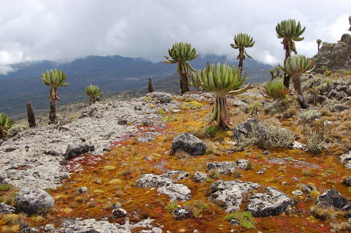
Giant groundsels on Mount Elgon's upper elevation slopes.
Most of Elgon's resident wildlife is not easily seen, particularly its elephants, which suffered harassment and poaching in the 1980s, and are now reclusive. Buffalo are present on the lower slopes, but in small numbers.
Elgon's primates are surely the most likely animals to be seem, with good populations of several species, including olive baboon, black-and-white colobus, Sykes' monkey, red-tailed monkey, vervet monkey, and de Brazza's monkey.
Other wildlife that might be seen includes defassa waterbuck, bushbuck, oribi, and yellow-backed duiker. Lions have long since disappeared, but there are leopard, serval, spotted hyena, and civet still living in the lower elevations.
Bird life is prolific on Elgon's slopes, with over 300 species recorded.
The main activity on Mount Elgon is hiking. Most climbers access the peaks from the Ugandan side, but there are several trails and climbs on the Kenyan side as well. A summit trip can be done in three days, but five days is better to allow time for exploring the hot springs, caves, and crater.
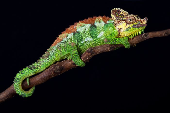
Von Höhnel's chameleon (Trioceros hoehnelli) can be found in the lower elevation forests on Mount Elgon.
A cross-border tourism agreement between Kenya and Uganda allows visitors to climb from either side and explore or even descend on the opposite side. Border crossings must be pre-arranged with the park authorities.
The best time for hiking on Mount Elgon is during the dry periods from mid-December thru February or in June/July.
Those who have time will want to consider visiting the Mount Elgon's caves. The caves are located on the lower slopes and were formed as ancient lava tubes. Elephants and other wildlife are known to visit some of the caves to eat the salts. 'Kitum Cave' is the most popular and it and others can be explored; a guide is recommended.
Accommodation is typically wild camping for those on a summit trip, but there are some public campsites in the park and a lodge located just outside the park. Access to Mount Elgon is typically by road from Eldoret or Kitale, both of which also have airstrips. The park's main gate is located due west of Kitale.
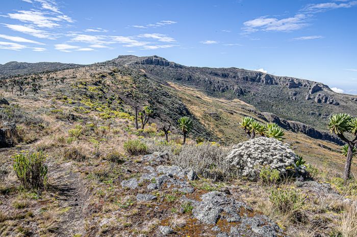
Spectacular landscape in Mount Elgon National Park.
Saiwa Swamp National Park
Kenya's smallest national park, Saiwa Swamp was created in 1974 to protect a population of endangered, semi-aquatic sitatunga antelope that live in the swamp.
The park is located due west of Mount Elgon in Western Kenya and covers only 0.77 square miles (2.0 sq kms). Besides protecting the swamp, in which the antelopes spend almost all of their time partially submerged in water, the park protects the wet forest that fringes the swamp.
The sitatunga antelope looks quite similar to the bushbuck (to which it is closely related), but while the bushbuck is a forest-dwelling antelope, the sitatunga is specially adapted to living in swamps and marshes, where it can hide and seek safety from predators. When threatened, they can almost completely submerge themselves, with only their nostrils above the water.
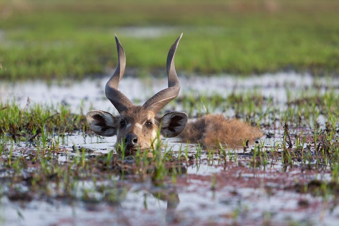
Saiwa Swamp National Park was created to protect the semi-aquatic sitatunga (Tragelaphus spekii).
Sitatunga have elongated hooves, which can splay widely, allowing them to grasp onto and walk in deep water, using papyrus, reeds, sedges, and other aquatic vegetation to remain afloat.
The only mode of exploration permitted in Saiwa Swamp is on the walking trails that have been made to give visitors the best access to the swamp and forest. There are observation platforms where one can sit and watch for sitatunga in the swamp, which are normally very shy and reclusive, but which here have become habituated to human visitors.
Besides the sitatunga, which are normally seen quite easily (although they are almost always partially submerged in the swamp), Saiwa is home to four species of monkey, including the endangered de Brazza's monkey, (also known locally as the 'swamp monkey'), vervet monkey, black-and-white colobus, and blue monkey.
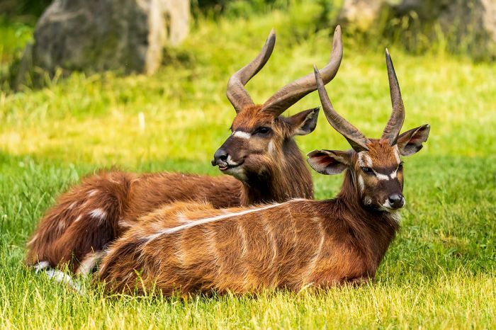
The sitatunga is never found far from water and is usually observed partially submerged.
Other wildlife that might be encountered as you walk on the trails includes, defassa waterbuck, bohor reedbuck, and bushbuck. There are two species of otter that live in the swamp, the spotted-necked otter (Hydrictis maculicollis) and the African clawless otter (Aonyx capensis, also called the Cape clawless otter). Leopard apparently live here, but their status is unknown. Serval can be seen if you are lucky.
Birding in Saiwa Swamp is excellent, with loads of water birds and forest birds, including hornbills, kingfishers, turacos, sunbirds, fish-eagles, and many more. Bird watchers will do well here by walking the trails in the forest or viewing from the observation platforms at the swamp. The park has a bird list of 290 species.
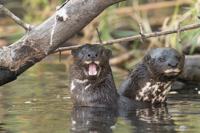
Two species of otter live in the Saiwa Swamp. Shown are two spotted-necked otters (Hydrictis maculicollis).
Kakamega Forest
(including multiple reserves)
Once part of an immense equatorial rainforest that stretched from Western Kenya all the way to the Atlantic coast, the Kakamega Forest is the easternmost relict of the Congo Basin forest.
The forest at Kakamega (named for the nearby town) covers a mere 86 square miles (223 sq kms), about half of which is indigenous forest. The northern section of the forest, which covers 17 square miles (45 sq kms) receives official protection as a national reserve, while the southern portion is managed locally.
Kakamega was first created as a Local Trust Forest in 1933. Today, Kakamega is comprised of multiple sections, managed by different groups and includes the Kakamega Forest National Reserve (managed like a national park by Kenya Wildlife Service-KWS), three locally managed forest reserves (Kisere, Malava, and Bunyala), and two locally-managed nature reserves (Yala River and Isicheno).
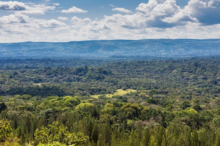
View over a portion of the Kakamega Forest in Kenya.
Kakamega forest, which covers undulating terrain, is heavily fragmented, with many open, grassy clearings, which must have been used for agriculture at some time in the last few centuries. A number of streams run through the forest, and there is a main road which runs east-west and bisects the park. There are also numerous unpaved tracks which can be driven in a high-clearance vehicle.
Kakamega Forest is renowned for its biodiversity, particularly in terms of flora, birds, and butterflies. The bird list tops 360 species, while the 491 butterfly species that have been verified in Kakamega represents 55% of all species found in Kenya. Over 400 species of plants have been recorded in Kakamega, including 150 tree species and 60 species of orchid, including nine that are endemic to Kakamega.
Kakamega is a paradise for birders and the forest is visited by just about any comprehensive Kenya birding trip for two or three nights. Notable species in Kakamega include great blue turaco and black-and-white casqued hornbill, while 'specials' in the forest are numerous, and include Chapin's flycatcher (Fraseria lendu), and Turner's eremomela (Eremomela turneri).
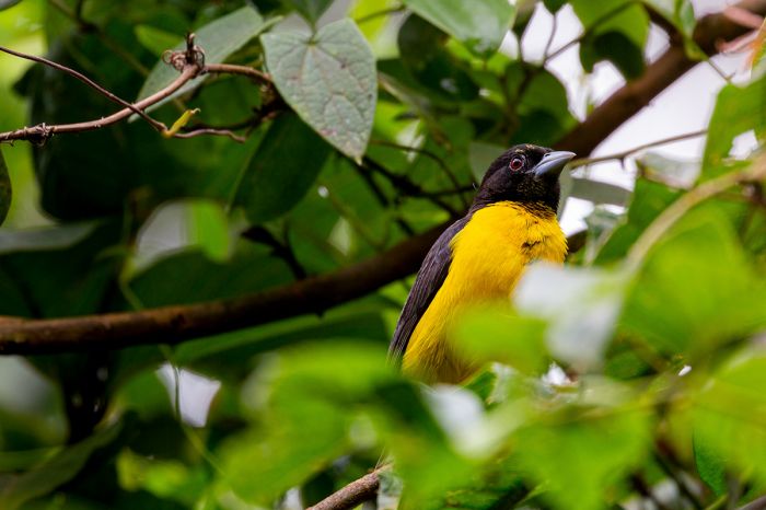
Kakamega is one of the best birding locations in Kenya. Shown is a forest weaver (Ploceus bicolor).
Other wildlife that may be encountered in Kakamega includes bushbuck, bush pig, red-tailed monkey, de Brazza's monkey, vervet monkey, olive baboon, mantled guereza (eastern black-and-white colobus), blue monkey, and potto.
Kakamega is quite wet, receiving an average of 80 inches (2 000 mm) of rain per year. April and May are the rainiest months and a second rainy period occurs in August/September. January and February are the driest months. Temperatures are warm throughout the year, as the forest is located only slightly north of the equator.
Kakamega is a small island of forest in a densely settled area. Some 200 000 people, mainly farmers on small family farms, live around the forest and human impact poses an ongoing threat to its survival. People are forbidden from taking resources from the forest, but they exploit the forest nonetheless, as enforcement is not strict. Fallen trees are commonly collected for firewood, and occasional tree felling also occurs. Cattle are sometimes grazed in the open areas of the forest.
Various conservation initiatives have long been ongoing at Kakamega and the forest is on the tentative list for addition as an Unesco World Heritage Site.
Access to Kakamega is generally by road along the A1.
A small foot-bridge leads over a stream in the Kakamega Forest, Kenya.
Ruma National Park
Located close to the Lake Victoria shoreline in southwestern Kenya, Ruma National Park covers an area of 46 square miles (120 sq kms). The park was established in 1966 as the Lambwe Valley Game Reserve to protect Kenya's only population of the endangered roan antelope and became a national park in 1983. The park is a small refuge for wildlife in an area of relatively high human population.
Ruma's landscape is varied, with rolling grasslands, riparian woodland, and high cliffs within the Lambwe River Valley. The park is bordered by the Kanyamwa Escarpment on the southeast and by the volcanic Ruri Hills to the north.
Besides the aforementioned roan antelope, Ruma is home to other wildlife including Rothschild's giraffe, Jackson's hartebeest, the diminutive oribi antelope, impala, buffalo, bohor reedbuck, Burchell's zebra, and more. Predators in Ruma include leopard, spotted hyena, and serval.
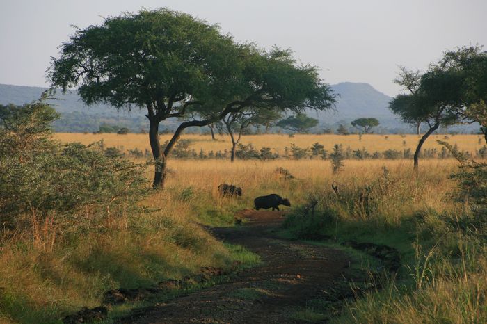
Buffalos in Ruma National Park, Kenya (photo: Wikimedia Commons).
Self-driving is possible in Ruma NP with a good 4x4 vehicle or a guide can sometimes be hired at the park gate. Accommodation is at two self-camping sites. Tsetse flies can be a nuisance and the roads are not in good condition.
The climate in Ruma is warm all year, owing to its location just south of the equator. The best time to visit Ruma is during the dry months in January/February and again from June thru October. November is the short rain season and April/May can experience daily rain.
Lake Victoria
(including Ndere Island National Park, Mfangano Island, Rusinga Island)
History and Geology
Lake Victoria, along with Lakes Malawi and Tanganyika, is considered one of the 'African Great Lakes'. Victoria is Africa's largest lake, the world's largest tropical lake, and the world's second-largest fresh water lake. Only 6% of Lake Victoria lies within Kenya, while the remainder is split between Uganda (45%) and Tanzania (49%).
The lake was named for Queen Victoria by John Hanning Speke, a British explorer who was the first European to see the lake in 1858 during his expedition with Richard Francis Burton to discover the source of the Nile River.
Only 6% of Lake Victoria falls within Kenya.
It was later determined that the Victoria Nile River (also called the White Nile), which begins at Jinja on the Ugandan shores of Lake Victoria, is the headwaters of the Nile River. The other source of the Nile River is the Blue Nile River, which begins much further north at Lake Tana in Ethiopia.
Discussions are still ongoing regarding the most distal source of the Nile, but it is arguably one of the tributaries (precisely which one is still not agreed upon) of the Kagera River, which originates in Rwanda or Burundi and flows into Lake Victoria.
Lake Victoria covers an area of 23 145 square miles (59 947 sq kms), which makes it Africa's largest lake by surface area. In terms of the Earth's freshwater lakes, only Lake Superior in North America is larger. In terms of volume of water, Lake Victoria is the world's ninth-largest lake (excluding dam-created reservoirs).
Note: although far smaller in surface area, both Lake Tanganyika (3rd largest) and Lake Malawi (5th largest) exceed Lake Victoria in volume of water. The Caspian Sea (in Asia) is the largest lake on Earth by volume.
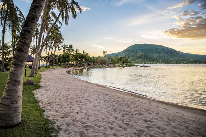
Peaceful beach scene on Takawiri Island, showing nearby Mfangano Island just across the water.
Lake Victoria has a maximum depth of 276 feet (80 meters) and an average depth of 130 feet (40 meters). Like the other Great Lakes of Africa, Victoria is home to a great diversity of fish, many of them belonging to the highly evolved and diverse cichlid family (Cichlidae) of bony fishes.
Lake Victoria is geologically somewhat young, having been formed around 400 000 years ago when westward flowing rivers on the continent became blocked by an uplifting of the land along the Great Rift.
Core samples taken from the bottom of Lake Victoria show that the lake has completely dried up at least three times during its history. Victoria's drying cycles are thought to have occurred during past ice ages, during which global precipitation declined dramatically. The latest dry period for Lake Victoria began 17 300 years ago and the lake then refilled 14 700 years ago.
Lake Victoria receives most of its water (around 80%) from direct local rainfall. The remaining 20% of its water is sourced from rivers and myriad small streams. The Kagera River is the largest river flowing into Lake Victoria, entering on its western shore after flowing through parts of Burundi, Rwanda, Tanzania, and Uganda. The sole outflow from the lake is the Victoria Nile River, which exits northward near the small town of Jinja, Uganda on its northern shoreline.
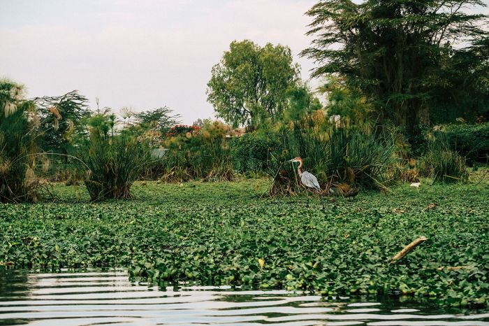
A goliath heron (Ardea goliath) walks atop floating water hyacinth (Pontederia crassipes) on the shore of Lake Victoria near Kisumu Town, Kenya.
Nile Perch
Unfortunately, the introduction of the highly predatory 'Nile perch' (Lates niloticus) to Lake Victoria (as a source of protein and export revenue) in the 1950s, has been an ecological disaster that led to the extinction of hundreds of indigenous cichlids, many of which were endemic to the lake.
Native cichlid fishes were traditionally sun-dried and eaten by local people around Lake Victoria, but as the Nile perch is so large (reaching a length of 6.5 feet/2 meters and weighing up to 450 pounds (200 kgs) and has a high body-fat content, the perch need to be smoked to avoid spoiling, increasing the need for firewood and leading to increased deforestation around the lake.
Sales of commercially fished Nile perch, mainly to Europe, bring in millions of Euros every year, but ecologically, its introduction to the lake has been disastrous. The 2004 documentary film Darwin's Nightmare details the environmental and social impacts of Nile perch introduction to Lake Victoria.
Despite the negative effects of the Nile perch introduction, which resulted in the loss of hundreds of species of Lake Victora's fishes (almost all of which were endemic cichlid fishes), Lake Victoria still has an estimated 500+ species of fish, which is the second-highest (after Lake Malawi) for any lake in the world.
Freshly caught Nile perch (Lates niloticus) being weighed for sale in Entebbe, Uganda.
Ndere Island National Park
Covering just 1.6 square miles (4.2 sq kms), Ndere Island is located just offshore in the Winam Gulf (a northeastern extension of Lake Victoria into western Kenya) and about 10 miles (16 kms) west of Kisumu town. Ndere Island National Park, which covers the entirety of the small island, was created in 1986 to protect the flora and fauna. The island is uninhabited.
The inland portions of Ndere Island are mainly covered in grasslands, while the land fringing the lake is dominated by forest. Wildlife on the island includes an introduced population of impala, as well as olive baboon, Burchell's zebra, waterbuck, warthog.
Along the shores of the island are hippo, crocodile, and Nile monitor lizards. The island is a haven for birds, which are abundant. Ndere Island has a list of around 100 species, included the black-headed gonolek, a papyrus dwelling special.
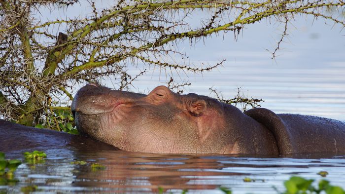
A hippo sleeps peacefully in the water along the shores of Ndere Island National Park, Kenya.
Mfangano Island
Located west of Rusinga Island and just inside the Kenya/Uganda border (which runs roughly north-south through the far northeast section of Lake Victoria), Mfangano Island offers an interesting experience and step back in time.
Mfangano is the largest of Kenya's Lake Victoria islands, covering 25 square miles (65 sq kms) and is dominated by rugged, well vegetated terrain, culminating atop Mount Kwitutu, which rises to an elevation of 5 558 feet (1 694 meters). Most of the island is covered by a combination of forest, low bush, and grassland.
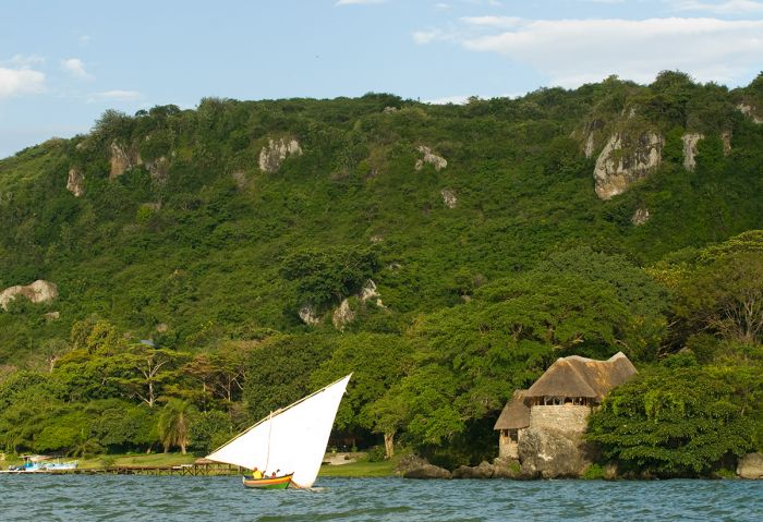
Sailing along the shoreline of Mfangano Island (Copyright © Mfangano Island Camp).
Mfangano Island is inhabited by around 26 000 people, many of whom form Kenya's largest population of the Suba people, who are of Bantu origin. Many of the inhabitants of the island are descended from groups that fled to the island to escape the Luo tribes, who conquered the area during the 16th century. Most of the islanders are concentrated on the eastern side of the island and make a living by fishing or subsistence farming.
The island's most popular attractions are its prehistoric rock art sites which contain paintings thought to be up to two thousand years old. The paintings were made by Twa people, a hunter-forager tribe who are the earliest known inhabitants of the island. The Twa (or Batwa) are also sometimes known as pygmies, due to their diminutively sized bodies.
Mfangano's rock paintings are almost entirely comprised of sets of concentric spirals or circles in red, black, and white colors. The main sites are at Kwitone and Mawanga on the northern coast of the island. The painting, with their whorls of color, some of which include 'spokes' or 'rays' like those from a sun painting, are believed to have been used for various rituals like rainmaking.
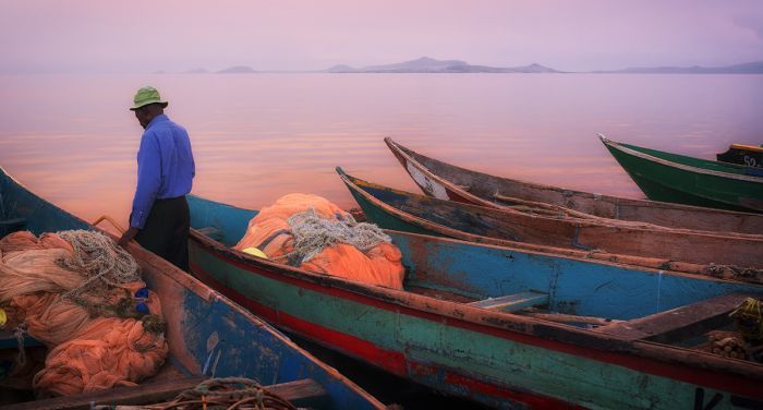
Early morning scene on Mfangano Island, as a fisherman prepares to head out for work on Lake Victoria.
The rock art sites are still used by some of the locals on the island, who observe various taboos and believe these sites to have supernatural powers. Some of the rock art sites also contain detailed depictions of insects. A total of 36 sacred sites exist on Mfangano, of which 19 are still intact and verified, while the others are described as 'extinct' and only exist as oral histories told by elders.
There is accommodation on the island (including the excellent Mfangano Island Camp) and access to the island is via boat or air charter to the island's airstrip. A day trip or a couple of nights on the island makes for a great add-on to a Masai Mara safari.
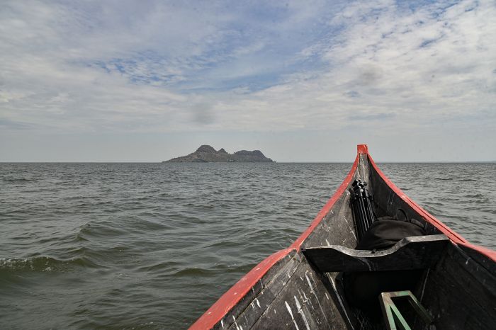
Crossing the open water from mainland Kenya to Mfangano Island.
Rusinga Island
Located just northeast of Mfangano Island, at the western end of the Rusinga Channel, which connects the main body of northeastern Lake Victoria with the Winam Gulf, is Rusinga Island.
Rusinga is slightly smaller than Mfangano Island, but is still substantial, spanning approximately 10 miles (16 kms) long by 3 miles (5 kms) wide and covering an area of 16.6 square miles (43 sq kms). The island is dominated by steep crags and rugged terrain with sparse vegetation. Drought and high winds are commonplace and rainfall is typically washed away or is lost into the volcanic rock that covers the island.
Rusinga's population is roughly 25 000 people, and most, like on neighboring Mfangano Island, are descended from the Suba tribe, a Bantu people. Most of the large trees that once existed on the island have long since been cut down and people on the island mainly survive by fishing and subsistence farming.
Overhead view looking down on the Rusinga Causeway (or Mbita Bridge), as it enters Rusinga Island, Kenya.
Rusinga was connected to the mainland via a causeway in 1984, so self-driving on the island is possible. The causeway opened up the once isolated and seldom-visited island to commerce but had some unpleasant side-effects, including the blocking of the water currents on the southeastern side, which has degraded the fishing in that area.
Rusinga Island is known for its extraordinarily rich fossil beds dating back 18 million years to the Miocene epoch. Mary Leakey, the famous paleontologist and wife of Louis Leakey, explored Rusinga in 1947-1948 and excavated numerous hominid fossils attributed to Proconsul africanus (now reclassified as P. heseloni), an early arboreal primate. Some 15 000 Miocene era fossils have been collected from five major sites on Rusinga.
The early primates on Rusinga are currently considered to be possible ancestors of both Cercopithecids (Old World monkeys) and hominids (great apes and humans). The first true monkeys appeared some 15 million years ago and it is widely agreed that these early apes were their predecessors.
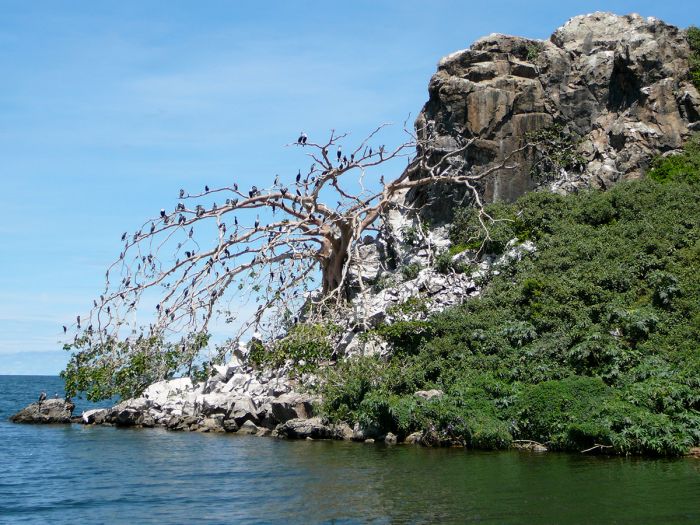
Great cormorants (white-breasted) (Phalacrocorax carbo lucidus) fill the branches of a dead tree on the shore of Rusinga Island, Kenya (photo: Ryan Harvey/Wikimedia Commons).
Rusinga's fossil beds lie in layers of ancient volcanic ash produced by eruptions of a long-extinct, massive volcano. The volcano is now completely eroded down to just low hills and semi-circular remnants of the cone on the mainland to the south. The volcanic eruptions preserved everything from fruits, to insects, apes and other mammals in a rare situation found only in a few other places in Africa.
Fossil walks are an attraction for visitors, who can visit Leakey's excavation sites and learn more about the discoveries made on the island.
Rusinga is also famous for being the birthplace of Tom Mboya, one of the political leaders in Kenya's fight for independence. Mboya was assassinated in 1969 and is buried in a mausoleum on the island. The nearby Rusinga Island Museum contains artifacts of Mboya's life and information about life in general on the island.
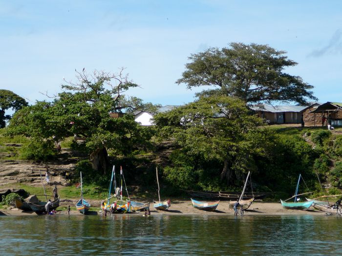
Boats on the shore of Rusinga Island, Kenya (photo: Ryan Harvey/Wikimedia Commons).
Kisumu
(including the Kisumu Impala Sanctuary)
The town of Kisumu is located just south of the equator, on the shore of Lake Victoria in Western Kenya and is the third most populous city in the country (after Nairobi and Mombasa). Kisumu had a population of 366 000 people as of 2021. The town's name is derived from the local Luo language (one of the region's indigenous tribes) and means "a place for barter" or "a place where one can find food".
Aerial view of Kisumu city, on the shores of Lake Victoria, Kenya (photo: Victor Ochieng/Wikimedia Commons).
History of Kisumu
Kisumu was officially founded in 1901 (its was then known as Port Florence) as the terminus of the Uganda Railway line that originates at Mombasa, passes westward thru Nairobi, and continues on to Kisumu at Lake Victoria. Named for its ultimate destination, the British engineered railway originally never made it all the way and in those days, the journey continued via steamer ship across Lake Victoria to present-day Uganda.
British writer and parliamentarian Henry Laboucher's famous satirical poem exemplified the derision felt by many in England at the idea of building there railway:
"What it will cost no words can express; What is its object no brain can suppose; Where it will start from no one can guess; Where it is going to nobody knows; What is the use of it none can conjecture; What it will carry none can define. It is clearly naught but a lunatic line."
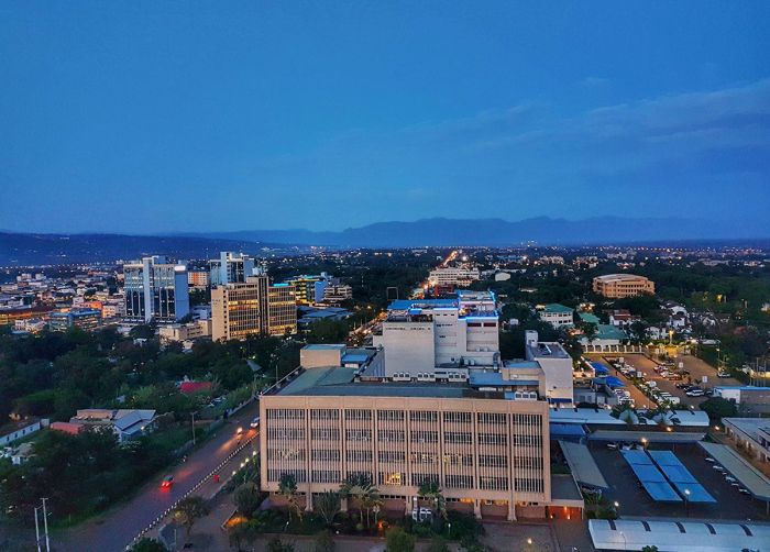
Evening view of Kisumu city, Kenya (photo: Wikimedia Commons).
Years later, the British press adopted the moniker "Lunatic Express" to describe the railway due to the huge cost in terms of wealth (5 million British pounds) and human life (2 493 laborers died during construction, most of them from India) that was suffered during its five years of construction. After World War I, the rail line was extended to Kampala, Uganda.
During the 1930s, Kisumu was included as a stop on one of British Imperial Airways' Flying Boat (seaplane) routes linking Britain with South Africa. The luxury service was used for mail and passenger delivery.
Today, Kisumu is a relatively quiet place, with not much to see nor do, aside from a bustling outdoor market, the Kisumu Museum, and the Kisumu Impala Sanctuary.
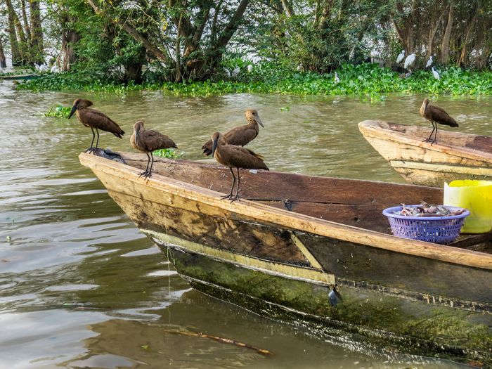
Hamerkops (Scopus umbretta) perched on a fishing boat with a fresh catch at Kisumu, Kenya.
Kisumu Impala Sanctuary
Located on the shores of Lake Victoria and on the south side of Kisumu Town is the Kisumu Impala Sanctuary. The tiny reserve covers just one-third of a square kilometer and is managed by Kenya Wildlife Service (KWS).
There sanctuary hosts a small herd of tame impala that roam freely in the reserve, as well as zebras, vervet monkeys, and plentiful bird life. The sanctuary also has some animal enclosures, with captive animals that make this portion less enjoyable, but strolling on the footpath is a pleasant diversion if you have time to spend in Kisumu.
There are several public campsites and picnic sites in the sanctuary.
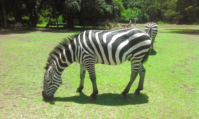
A Burchell's zebra (impalas in the background) at the Kisumu Impala Sanctuary, Kenya (photo: George Kiplagat/Wikimedia Commons).
Marsabit National Park
Located along the A2 main road, which heads northeast out of Nairobi, Marsabit National Park is seldom visited due to its remoteness in far northern Kenya. This is a park for the intrepid explorer and a good 4x4 is a must.
Marsabit covers an area of 56 square miles (145 sq kms) and is named for Mount Marsabit, an ancient shield volcano that has mainly eroded, but is still somewhat active. The park has several 'maars' (low-relief volcanic craters caused by eruptions) that have become crater lakes. Mount Marsabit rises to 5 600 feet (1 707 meters) and it, as well as the various craters, are densely forested.
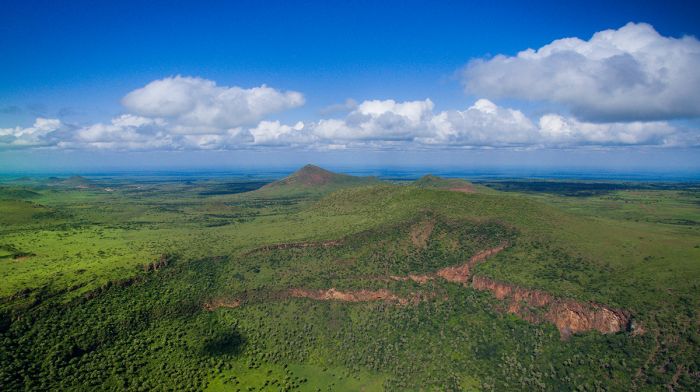
One of the 'maars' at Marsabit National Park. This one looks heart-shaped from above.
Martin and Osa Johnson
Marsabit gained some notoriety during the first half of the twentieth century thanks to Martin and Osa Johnson, an American husband-and-wife couple from Kansas, who were adventurers and documentary filmmakers, who lived and shot footage here between 1924 and 1927.
Both were pilots and together they made numerous films about their global adventures through Africa and the South Pacific. Their popular black-and-white silent documentary film Simba: King of the Beasts (1928) was made with footage they shot at Marsabit.
Osa Johnson with a gibbon in the couple's Sikorsky S-39 amphibious plane (photo: Wikimedia Commons).
Ahmed the Elephant
Marsabit's most conspicuous wildlife residents are its elephants, some of which are descended from the legendary big tusker 'Ahmed', a massive bull that lived in the park. Ahmed was declared a national treasure and given protection by presidential decree by President Jomo Kenyatta in 1970. Ahmed was accompanied round the clock by two armed soldiers throughout the last four years of his life to protect him from poachers and hunters. Ahmed eventually died of natural causes in 1974 at the estimated age 55 years.
After Ahmed's death, President Kenyatta declared that his remains be preserved for future generations of Kenyans. A fiberglass life-size replica of Ahmed is on exhibit outside the National Museum in Nairobi. Inside the museum's main display hall, Ahmed's skeleton, including his actual tusks (which were weighed at the time of his death at 150 pounds / 68 kgs each), is on display.
A reproduction of the 'great tusker' Ahmed ("the King of Marsabit") outside the entrance to the Nairobi Museum (photo: Wikimedia Commons).
Wildlife in Marsabit
Marsabit has a good diversity of plains game including elephant, buffalo, Grevy's zebra, reticulated giraffe, greater kudu, lesser kudu, Peters' gazelle (a subspecies of Grant's gazelle), beisa oryx, suni antelope, bushbuck, Kirk's dik-dik, red duiker, grey duiker, and common duiker. Primates include olive baboon, vervet monkey, blue monkey, and black-and-white colobus.
Predators in Marsabit include leopard, striped hyena, caracal, and black-backed jackal.
Birding in Marsabit is very rewarding and the park has a species list of over 400. Raptors are particularly well represented, including the uncommon bearded vulture (lammergeyer), which nests on cliffs in the park. Ducks and other waterbirds are commonly seen in good numbers on the park's crater lakes. Dryland species are found in the surrounding semi-desert lowlands.
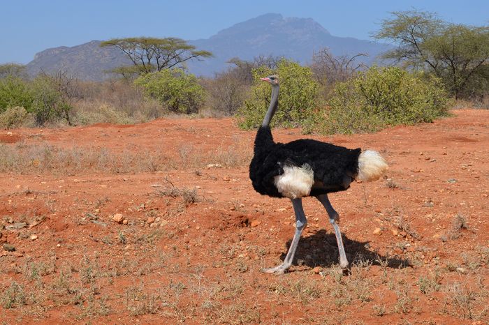
The lowland area around Marsabit is semi-desert and ostrich do very well here.
Activities in Marsabit include game drives and hiking/walking in the forests.
The climate in Marsabit is generally warm to hot all year at the lower elevations, but it can get chilly up on the volcano. The dry seasons (June through early October and December thru March) are the best time to visit for wildlife, particularly around the crater lakes. Many of the animals disperse and become more scarce during the rains (short rains: November; long rains: April/May).
Visitors to Marsabit can self-camp in the park or stay in the town of Marsabit, just north of the main gate to the park. Marsabit Lodge is another option if it is open.
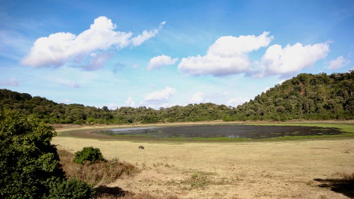
A lone buffalo grazes near 'Paradise Lake' in Marsabit National Park, Kenya (photo: Wikimedia Commons).
Ol Donyo Sabuk National Park
Located about 40 miles northeast of Nairobi is Ol Donyo Sabuk, a volcanic mountain that rises to a modest (in terms of Kenyan peaks) 7 037 feet (2 145 meters). The entirety of the mountain was given protection in 1967 as a national park of the same name. The name is derived from Maa (the language of the Maasai people) and means "large mountain". The local Kikuyu people call it "Kilima Mbogo", which means "Buffalo Mountain".
Ol Donyo Sabuk National Park is a very popular destination for locals in Nairobi, who come for a day trip or a weekend of outdoor activity, including hiking and for the scenic beauty. From the slopes of the mountain, one can (on clear days) have good views of both Mount Kenya to the north and Mount Kilimanjaro, much further away to the southeast.
The park protects dense indigenous forest and there is still wildlife living on the slopes, including buffalo (hikers need to be wary), Masai giraffe, impala, duiker, bushbuck, Kirk's dik-dik, and bush pig. The forests are home to various primates, including vervet monkey, black-and-white colobus, olive baboon, and Sykes' monkey. Leopard also live in the forest, but are almost never seen.
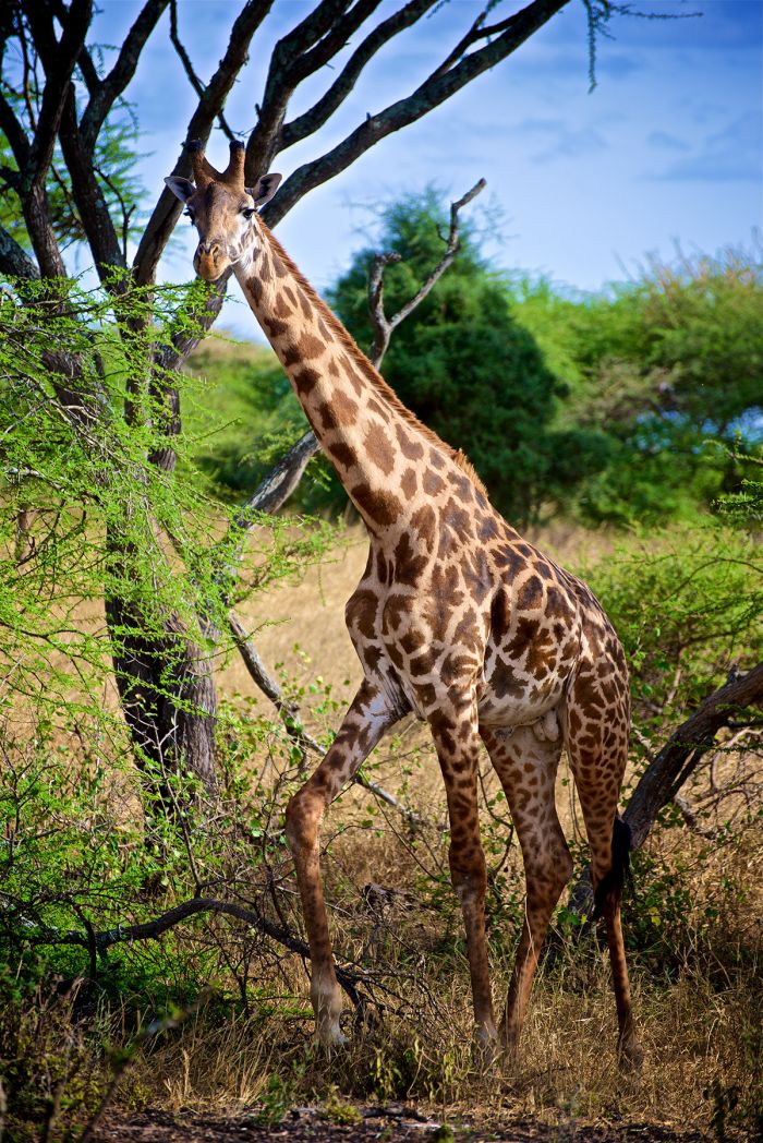
A Masai giraffe at Ol Donyo Sabuk National Park, Kenya.
Besides wildlife viewing, visitors to Ol Donyo Sabuk can explore the scenic montane landscape via hiking trails and the mountain itself can easily be summited and descended on a day hike.
Other sites in the park include the burial site of Sir William Northrup McMillan, a wealthy American, who moved to Kenya in 1904 and constructed a large and extravagant home nearby. Macmillan's home became popular with famous visitors, including Theodore Roosevelt and Winston Churchill. The graves of McMillan, his wife, and his dog, are located just below the summit of the mountain.
Fourteen Falls, a beautiful waterfall that cascades 25 feet (8 meters) over dramatic rocks, is located just north of the park along the Athi River, and is worth the time to see.
Birding in the park is good, with around 50 species possible, including a variety of forest birds, grassland species, raptors, and more.
Accommodation for those wishing to stay more than a day includes several camping sites.
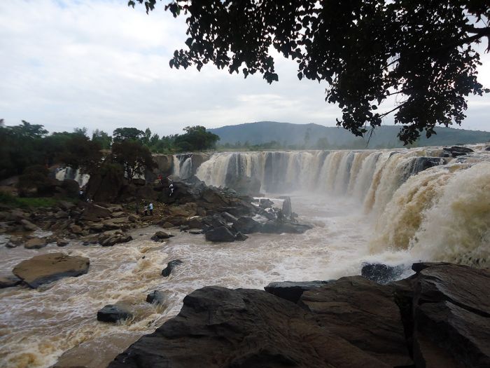
The 'Fourteen Falls' on the Athi River just north of Ol Donyo Sabuk (photo: Wikimedia Commons).
Mwea National Reserve
Located 70 miles (110 kms) northeast of Kenya along the Tana River on the northern banks of the Kamburu Reservoir (which is created by the Kamburu Hydroelectric Power Station), is the Mwea National Reserve.
The reserve was created in 1975 and is small in size, covering just 26 square miles (68 sq kms), but is a worthwhile place to visit, as it is home to good wildlife, birds, and few tourists. The reserve is owned by the local Mbeere County, but managed by Kenya Wildlife Service (KWS).
Mwea is located within a semi-arid ecosystem, with a landscape that is a mix of hilly grassland, Acacia scrub, and open woodland, and thick bush. There are scattered larger trees like baobabs along the Thiba and Tana Rivers, at which confluence is the dam and reservoir.
Wildlife in the reserve is diverse, including some of the more iconic species such as elephant, buffalo, and Rothchild's giraffe. Other wildlife that may be seen in Mwea includes, Grant's zebra, waterbuck, impala, Grant's gazelle, lesser kudu, bushbuck, grey duiker, Coke's hartebeest, warthog, and more. Predators in the reserve include leopard, spotted hyena, serval, and black-backed jackal. Hippo and crocodile are abundant in the reservoir and in the Tana River. Primates include olive baboon, Sykes' monkey, and vervet monkey.
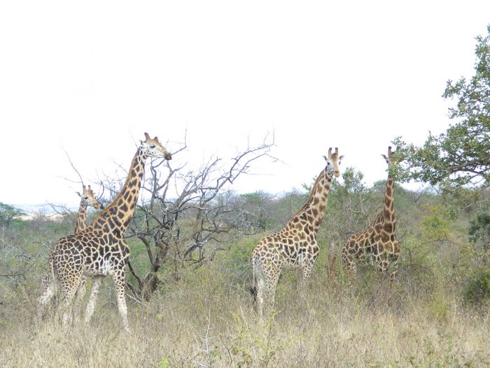
Masai giraffes in Mwea National Reserve, Kenya (photo: Wikimedia Commons).
Mwea is also excellent for bird watching, with a species list of over 200 birds and has been declared a BirdLife International Important Birding Area (IBA). The globally threatened, range-restricted Kenya endemic, Hinde's babbler (Turdoides hindei), is found in Mwea. The Kamburu Reservoir attracts good numbers of waterbirds and shorebirds. Raptors are also abundant in Mwea.
There are no permanent camps or lodges within the reserve itself, but there are several self-camping sites in Mwea. Self-drive safaris are the primary activity in the reserve.
Access to Mwea is typically by road from Nairobi, which is a drive of 100 miles (160 kms), much of which is paved road, but the last stretch is a dusty, dirt road to the Makima Gate. The Masinga airstrip near Masinga Lodge (near the hydroelectric dam) is another option.
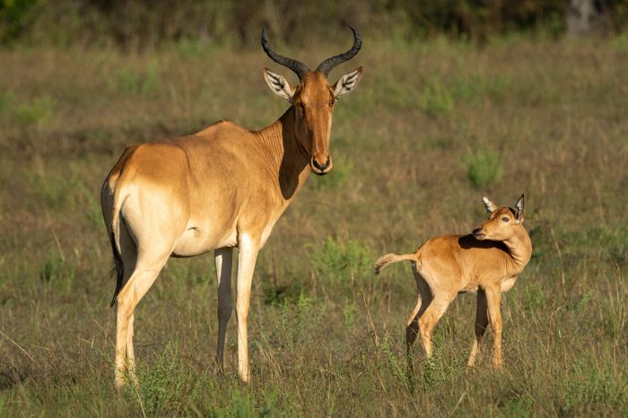
Coke's hartebeest (Alcelaphus buselaphus cokii) are found in the Mwea National Reserve, Kenya.
Malka Mari National Park
Created in 1989, Malka Mari is Kenya's most remote national park, located on the far northeast border with Ethiopia. The park covers 338 square miles (876 sq kms) of semi-arid landscape, defined by rolling hills covered in scrubby grassland and bush. The Dawa River, which is the international border with Ethiopia, forms part of the northern boundary of the park.
The park was created to protect the high diversity of flora, including a large number of endemic plants. There are also some interesting old British colonial buildings and military grave sites.
Due to its location, Malka Mari is Kenya's least visited national park, but offers beautiful scenery to anyone intrepid enough to venture this far afield.
The park is reportedly home to some diverse wildlife, including reticulated giraffe, beisa oryx, greater kudu, waterbuck, Thomson's gazelle, and other plains game. Predators that are likely present are spotted hyena, cheetah, leopard, lion, African wild dog, and black-backed jackal. The Dawa River harbors crocodiles and hippos.
Access to the park will take several days by road. There is also a small airport at the nearby border town of Rhamu.
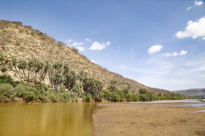
Riparian habitat along the Dawa River in Malka Mari National Park, Kenya.
Nairobi
(including Nairobi National Park and David Sheldrick Wildlife Trust)
Nairobi is Kenya's capital and most populous city, with a city proper population of 2.75 million and a total metro area population of around 6.5 million. Nairobi also has the dubious distinction of having one of the largest slums in the world, with around 2.5 million slum dwellers in the city.
The name of the city comes from the Maa (Maasai language) phrase "enkare nairobi", meaning "cool water", which it was dubbed in colonial times for the river that flows through it.
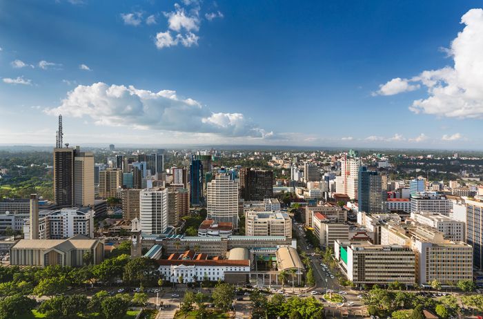
Nairobi is Kenya's capital and its most populous urban area.
Nairobi was founded in 1899 as a temporary settlement, which was used by railway workers that were constructing the Uganda Railway that eventually connected coastal Mombasa with Kampala (present-day Uganda). The workers were mainly Indians employed by the British, which controlled much of East Africa at the time.
After the railway workers moved on, the settlement remained and grew, eventually replacing Mombasa as the administrative capital of British East Africa in 1907. By 1921, Nairobi had 24 000 residents, of which 50% were native Africans.
When Kenya gained its independence in 1963, Nairobi became the capital of the new country. Today Nairobi is a mix of many cultures, with a populace that includes native Africans of various ethnic tribes, Asians, and Europeans.
Read full details on Nairobi and its hotels and lodges here.
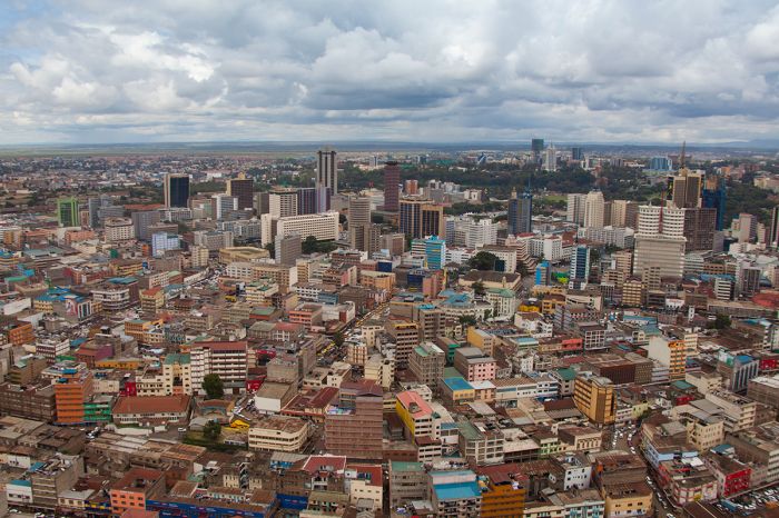
Overhead view of Nairobi, Kenya.
Nairobi National Park
Located directly adjacent to the southern border of Nairobi is the Nairobi National Park. The park covers 45 square miles (117 sq kms) and is fenced on three sides (north, east, and west), but is open on the southern border, which is demarcated by the Mbagathi River and beyond which is largely uninhabited land.
Following the official establishment of the British East Africa Protectorate in 1895, the colonial government decided to set aside protected wildlife areas (which they termed 'game reserves'), primarily for use as sport hunting, and the land south of Nairobi was one such reserve.
In 1945, the British passed the National Parks Ordinance, which led to the formation of protected areas that did not allow hunting and were for the exclusive enjoyment of settlers. Nairobi National Park was officially declared one of the first parks in Kenya in 1946.
Despite being situated alongside Kenya's most populous urban areas, Nairobi National Park is a very good place for day safaris, with a good diversity of wildlife and few visitors most of the time.
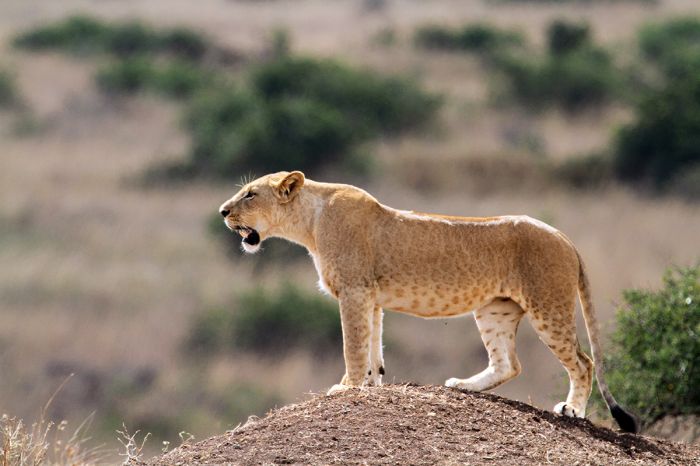
A lioness in Nairobi National Park, Kenya.
Free-roaming wildlife in the park includes four of Africa's Big Five animals (lion, leopard, rhino, and buffalo); only elephant are missing. Note that baby elephants from the David Sheldrick Wildlife Trust orphanage also use the park during the day under watchful protection.
Other wildlife commonly encountered on safari in the park include blue wildebeest, Burchell's zebra, Masai giraffe, Thomson's gazelle, Grant's gazelle, impala, waterbuck, common reedbuck, bushbuck, topi, eland, Coke's hartebeest, both black and white rhino, oribi, Kirk's dik-dik, and warthog. Predators include lion, cheetah, spotted hyena, leopard, black-backed jackal, caracal, and serval. Hippo and crocodile are also found in the park. Primates include olive baboon and vervet monkey.
There are a number of very good accommodations on the bank of the Mbagathi River, which forms the unfenced southern boundary of Nairobi National Park, all of which offer game drive safaris in the park. These lodges are great for anyone spending time in Nairobi that wants to be away from the noise and people in the city, but still with easy access to the airports.
Read full details on the Nairobi National Park and its lodges here.
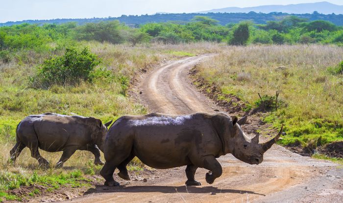
White rhinos in Nairobi National Park.
David Sheldrick Wildlife Trust
The David Sheldrick Wildlife Trust (DSWT) is a non-profit organization that focuses on elephant and rhino orphan rescues. The DSWT is headquartered in Nairobi on the western side of Nairobi National Park. Visitors are welcome and guests are encouraged to "adopt" one of the orphans by contributing money to fund their upkeep.
Baby elephants that have been rescued throughout Kenya are brought to the DSWT orphanage in Nairobi, where they receive round-the-clock care from a dedicated guardian assigned to each animal. Their 'keepers' sleep through the night with their adopted baby elephant. Many of the orphans are traumatized from losing their mothers and, much like primates, including humans, they need constant reassurance and care to become well-adjusted and healthy, without which, most do not survive.
The orphanage in Nairobi rehabilitates the young elephants and during the day, the 'herd' of youngsters, along with their keepers, spend time in the national park, learning to eat the right foods and fend for themselves under the watchful and protective eyes of the DSWT staff.
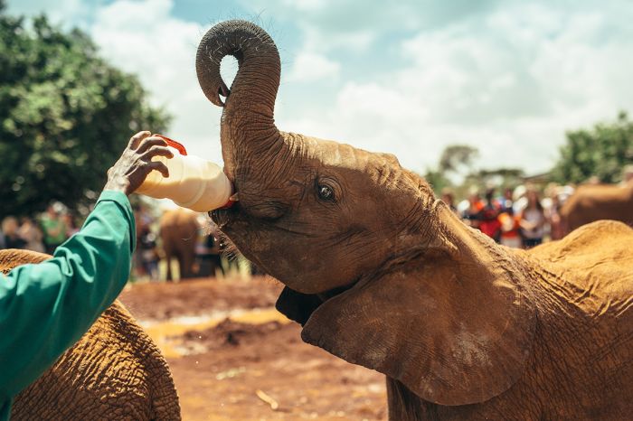
Feeding time for the elephant orphans at David Sheldrick in Nairobi, Kenya.
Visiting the orphanage is a special and memorable experience and we highly recommend it for anyone passing through Nairobi with a half-day of time to spare. Guests may also choose to have the more private experience at extra charge, which permits interaction with the babies at feeding time when they have their milk bottles. Booking in advance is a must.
Once a baby reaches an age when it can be safely integrated into a wild herd, it is transferred to Tsavo East National Park, where a herd of previously released Sheldrick elephants now live wild, and it becomes a member of that herd.
The DSWT was founded in 1977 by Daphne Sheldrick and named in honor of her late husband, David Sheldrick, who was warden of Tsavo National Park beginning in 1948.
For more information on DSWT, please visit their web page here.
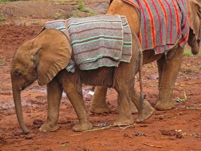
The baby elephants at Nairobi's David Sheldrick orphanage receive 24/7 care from their caretakers.
Mombasa
(including Mombasa Marine National Park and Reserve)
Mombasa is Kenya's second most populous city (after Nairobi), with a total metro area population of over 1.3 million. Mombasa is also East Africa's busiest port and one of the busiest on the continent. The main and oldest section of Mombasa is in fact on an island within an inlet and is connected to the actual mainland by causeways to the west, a ferry going south, and a bridge to the north. To the east is the Indian Ocean.
Mombasa is one of the oldest settlements in East Africa, with some accounts placing its founding around 900 AD, but its true origin is not known with certainty.
The famous Portuguese explorer Vasco da Gama was the first European to visit Mombasa in 1498 and two years later, the town was plundered by the Portuguese. The Portuguese gained control of Mombasa in 1593 as a strategic port and center for their Indian Ocean trade route and they maintained control of the city for over 100 years.
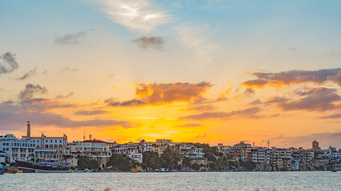
Sunset over Mombasa Island (Old Mombasa) on Kenya's Indian Ocean coast.
In 1698, the Omani Sultanate, who ruled at nearby Zanzibar to the south, attacked the Portuguese's Fort Jesus at Mombasa and gained control of the city. The Omanis ruled over Mombasa until 1887, when the British gained control. The city became part of Kenya on the country's independence in 1963.
Mombasa's Moi International Airport services destinations throughout Kenya and is often a stopover for tourists, but the city is not a tourism destination. Most tourists pass through Mombasa en route to one of Kenya's mostly wildlife-based national parks or coastal beach destinations.
Those who have some time in Mombasa have various tourist options including a city tour, visiting the historic Fort Jesus, some museums, and a few good beaches to the north of the city.
Read full details on Mombasa and its hotels and lodges here.
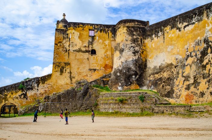
Fort Jesus in Mombasa, Kenya. The fort was built by the Portuguese in the 1590s.
Mombasa Marine National Park and Reserve
Covering 81 square miles (210 sq kms) of offshore waters and underwater marine habitat, the Mombasa Marine National Park and Reserve were established in 1986 to protect the marine life and coral reefs along the northern side of the port city. Only 5% of the area is national park, while the majority of the area has lesser protection as a national reserve.
The combined park and reserve spans the coast between the Mtwapa and Tudor Creeks, which have beaches that are popular for tourists and locals, while the offshore portion protects the Bamburi-Nyali coral reef.
Activities in the park and reserve include snorkeling, diving, wind surfing and other water sports. The reefs offshore are home to abundant and diverse marine fishes, invertebrates and corals. Sea birds are also present along the shoreline and beaches.
A copperband butterflyfish (Chelmon rostratus) swims on a coral reef in the Mombasa Marine National Reserve, Kenya.
Quick Facts & Travel Tips
- Kenya has a diverse climate owing to its large size and variable topography, but is generally temperate throughout the country.
- Rainfall in most regions occurs during two periods: a month from late-Oct to late-Dec (short rains) and Mar-May (long rains).
- Around 70 languages are spoken in Kenya, but Swahili and English are the national languages. English is spoken in the safari camps and most city hotels.
- The national currency is the Kenyan shilling (KSH), but US Dollars, UK Pounds, and Euros are accepted almost everywhere throughout the country.
- The US Dollar and Euro have consistently favorable exchange rates (100+ to 1) versus the Kenyan shilling.
- Credit and debit cards are not widely accepted, except at the city hotels, restaurants, and safari camps.
- Kenya uses 240v electricity and type G (British origin) plug adapters.
- Kenya time is GMT+3 and does not observe daylight savings time (DST). 8 hours ahead of New York (7 during DST).
- The population of the country is around 54 million, with about 2.8 million in Nairobi and 800 thousand in Mombasa.
- Kenya covers 220 000 square miles (569 000 sq kms) with only 245 people per sq mile (94 people per sq km); however, Nairobi and Mombasa have very high population densities.
- The majority of the population (92%) are of Bantu-speaking origin. Kikuyu is the largest ethnic group in the country and represents around 17% of the population.
- There are also groups of Nilotic and nomadic Maasai and Somali populations, along with much smaller populations of non-Africans, including Asians and Europeans.
- The majority of Kenyans are Christians, accounting for over 80% of the population, with an additional 11% being Muslim.
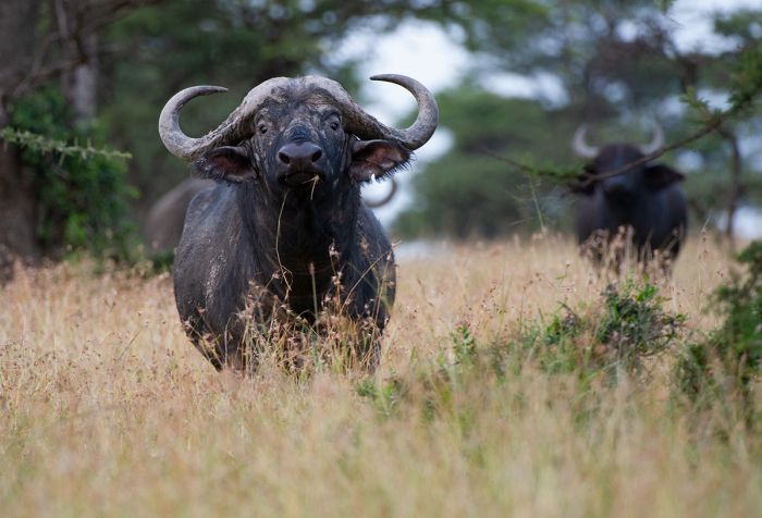
A buffalo stares intently in Kenya's Masai Mara National Reserve (Copyright © James Weis).
ENTRY / VISA REQUIREMENTS
- Passport holders from USA/Canada/Australia/UK/EU can obtain a visa on arrival, from your local embassy, or online.
- Passport must be valid for six (6) months from the date of entry.
- Passport must have two (2) unused (blank) pages labeled Visa.
- Note: Visa pages referred to above do not include pages reserved for Endorsements, Amendments or Observations.
- To save time at the airport, it is recommended to obtain a visa in advance.
- Multiple-entry visas must be obtained in advance.
- Single-entry/East African Tourist visas valid for ninety (90) days; multiple entry visa valid for up to one (1) year.
- Proof of yellow fever vaccination (travelers age one year or older) is required on arrival if you are traveling from a country with risk of yellow fever, including transit >12 hours in an airport located in a country with risk of YF virus transmission.
Note: entry/visa requirements are subject to change without notice, so please check with the official government pages shown below.
East African Tourist Visa
- Travelers who will visit Kenya, Rwanda and Uganda can apply for an East Africa Tourist Visa, which allows entry to all three countries on a single visa.
- A tourist using the East Africa Tourist Visa must start travel from the country that has issued the visa.
- Traveler must stay within only Kenya, Rwanda, and Uganda to continue to use the visa; entry into a different country will terminate the validity of the visa.
- East Africa Tourist visas may be obtained online or on arrival at the first port or entry into Kenya, Rwanda or Uganda.
- To apply for the East African Tourist Visa online, use the consulate website for the FIRST COUNTRY you will visit.
- East African Tourist Visas are valid for ninety (90) days.
Official Government Pages
- US Department of State info: click here
- Kenya Consulate - USA: click here
- Kenya eVisa: click here
- East African Tourist Visa: click here
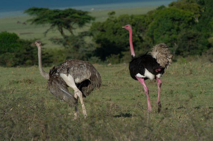
Ostriches in the Olare Motorogi Conservancy, Masai Mara, Kenya (Copyright © James Weis).
Read More...
Main: Flora, Geography, Important Areas, National Parks, Protected Areas, Ramsar Sites, UNESCO Sites, Urban Areas, Wildlife
Detail: Aberdare, Amboseli, Central Highlands, Chyulu Hills, Diani Beach, Great Migration, Laikipia, Lake Naivasha, Lake Nakuru, Lake Turkana, Lake Victoria, Lamu, Lewa, Mara Conservancies, Masai Mara, Mombasa, Mount Kenya, Nairobi, Ol Pejeta, Rift Valley, Samburu, Tsavo, Watamu
Admin: Travel Tips, Entry Requirements/Visas
READ MORE...
Daniel arap Moi, Early Colonization, Early History, Early Immigration, Happy Valley, Independence, Indian Ocean Trade, Iron Age, Jomo Kenyatta, Jomo Kenyatta Presidency, Kibaki Presidency, Mau Mau, Moi Presidency, Mwai Kibaki, Nearing Independence, Neolithic Era, Richard Leakey, Post-WWI Colony, Post-WWII Colony, Stone Age, Swahili, Tom Mboya, Uhuru Kenyatta, Uhuru Kenyatta Presidency, World War I, World War II
Early History
Human Evolution
Current theory holds that the advent of humans began in Africa's Great Rift Valley, which spans from the Red Sea southward into Ethiopia, Kenya, and Tanzania. Olduvai Gorge, which lies between the Serengeti and the volcanic Ngorongoro region in Tanzania, is the site of the first major discoveries of pre-human history. Homo habilis ("handy man") and Homo erectus ("upright man"), two of our earliest known ancestors, were first discovered in 1931 at Olduvai Gorge by the famous paleontologists Louis and Mary Leakey.
Richard Leakey (Mary and Louis's son) and his wife Maeve subsequently explored Kenya's Lake Turkana region and in 1965, discovered an even older hominid species, Australopithecus anamensis, which has been dated back to around 4.2 million years ago.
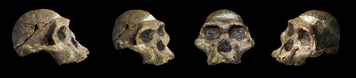
The original complete skull (without upper teeth and mandible) of a 2.1 million year old Australopithecus africanus specimen (photo: Wikimedia Commons).
Australopithecus is currently accepted as the direct ancestor of the genera Homo (which includes Homo sapiens, the modern humans), Paranthropus (an extinct Hominin genus), and Kenyanthropus (another extinct genus of australopithicine). Australopithecus existed in Africa from 4.2 million years ago until becoming extinct around 1.4 million years ago.
Placement and classification of Paranthropus, with two widely accepted species, P. robustus and P. biosei, is disputed, with some considering it synonymous with Australopithecus. Paranthropus dates back to 2.6 million years ago and went extinct 600 000 years ago. Paranthropus are associated with tools crafted from bones and are believed to be the earliest hominins to have used fire.
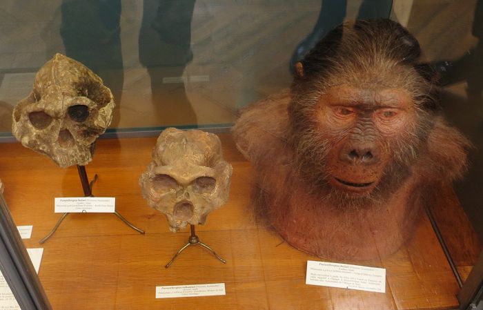
Skulls and reconstruction of Paranthropus robustus (center) and P. boisei (left, right) at Muséum National D'histoire Naturelle, Paris (photo: Wikimedia Commons).
Kenyanthropus includes a single species, K. platyops, which was discovered in 1999 at the Lomekwi dig site at Lake Turkana, Kenya, by a team led by Maeve Leakey and her daughter Louise Leakey. Kenyanthropus dates back to 3.4 million years ago during the Middle Pliocene. Later discoveries at Lomekwi in 2015, uncovered evidence suggesting that K. platyops may have been the earliest tool-users. Studies of the toe bones on K. platyops suggest that the species probably walked upright.
At the time Kenyanthropus was discovered at Lake Turkana, Australopithecus afarensis was the only recognized australopithecine to have existed between 4 and 3 million years ago, aside from its most likely ancestor A. anamensis, making A. afarensis the likely ancestor of all other australopithecines. The Leakeys' discovery suggests that there was greater diversity of australopithecines during this period. Still, the classification and position of K. platyops in the evolutionary tree is disputed, with some claiming it is a variant of A. afarensis or a separate species of Australopithecus.
The renowned archeologist and anthropologist couple, Mary and Louis Leakey in 1962 (photo: Wikimedia Commons).
Stone Age & Early Humans
In 1984, a nearly complete skeleton of a Homo ergaster child (named 'Turkana Boy' and estimated to have been 8-12 years old at death) was discovered on the bank of the Nariokotome River very close to Lake Turkana. The specimen is the most complete early hominid skeleton discovered to date. The child lived 1.5 to 1.6 million years ago. Some paleontologists argue that H. ergaster should not be a species of its own and should be part of Homo erectus (H. erectus ergaster). H. ergaster is believed to have existed until around 600 000 years ago.
Homo erectus first appeared around 2 million years ago and was the first human ancestor to spread throughout Eurasia and the rest of Africa. The last known population of H. erectus is from the island of Java, where the species finally became extinct around 115 000 years ago.
Neanderthals (Homo neanderthalensis) are identified as having lived in Eurasia until around 130 000 years ago. The timing and their "arrival" and also their classification as a species is unclear, with the oldest potential Neanderthal bones dating back to 400 000 yers ago.
A reconstruction of 'Turkana Boy' at the Neanderthal Museum in Mettmann, Germany (photo: Wikimedia Commons).
Homo sapiens, which is the species of contemporary humans, are thought to have become the dominant Hominina species between 300 000 and 200 000 years ago. It is believed that H. sapiens split from H. neanderthalensis. Some estimates put the timing of the split even earlier.
The classification of our ancestors is ongoing, but what is widely accepted is that Africa, including the Rift Valley of Kenya and Tanzania is the so-called cradle of mankind. A key reason why the Rift Valley has been so productive for paleontological discoveries, is that the abundance of volcanoes that were created as part of Africa's rifting laid down thick layers of ash atop fossil beds, preserving them and also lending later proof of the age of the fossils.
East Africa, including Kenya, is an area that is known to have been home to the earliest Homo sapiens (modern humans). The Olorgesailie archeological site, located on the floor of Kenya's Rift Valley on the shore of a now dried-up lake and southwest of Nairobi along the road to Lake Magadi, has produced numerous artefacts used by early modern humans.
Animal fossils from Olorgesailie archaeological site, Hall of Human Origins at the Smithsonian Natural History Museum (photo: Wikimedia Commons).
Amongst the discoveries at Olorgesailie are numerous Acheulean hand axes that are associated with animal butchering. The first discoveries at Olorgesailie were made in 1919 by a British geologist, but excavation work only began in 1943 under the direction of Mary and Louis Leakey.
More recently in 2018, discoveries at Olorgesailie suggest the existence of modern behaviors associated with early Homo sapiens, including trade and transportation of resources, the use of pigments for clothing, and the fabrication of projectile weapons.
In 2021, more evidence of modern behavior in early Homo sapiens was discovered at Panga ya Saidi cave in southeast Kenya just inland from the Indian Ocean and north of Mombasa. Africa's oldest known human burial site was discovered in the cave when workers unearthed the grave of a Middle Stone Age child, whose remains have been dated to 78 000 years ago. The body of the child was laid in the fetal position with his head upon a pillow.
Reconstruction of an elderly Neanderthal man at the Neanderthal Museum in Mettmann, Germany (photo: Wikimedia Commons).
The early Homo sapiens in East Africa were hunter-gatherers that lived off the land and likely lived in small groups consisting of several families and moved around as dictated by seasonal weather and availability of food resources. These early hunter-gatherers are likely the ancestors of the present-day "pygmy", Khoi/San, and Twa people that still live in parts of Southern Africa and Tanzania and likely spoke using "click-sound" speech patterns that are still used today by these descendant groups.
There are small and isolated groups of hunter-gatherer people living in East Africa, including the Aweer (also known as Boni or Sanye), a Cushitic ethnic group that inhabit areas along the Indian Ocean coast in Kenya and Somalia.
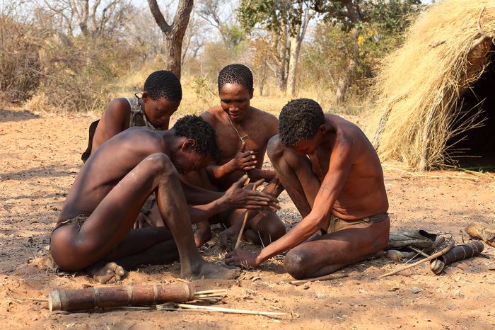
Descendants of early hunter-gatherer people still live in small populations in parts of East and Southern Africa.
Neolithic Era
Following the Stone Age in East Africa was the period described as the Pastoral Neolithic. This era, which spans from 5 000 years ago to around 1 200 years ago, marks the beginning of livestock domestication, food production, and pottery use. Unlike other areas outside Africa, where post-Stone Age people relied on agriculture, the Neolithic period in Africa focused primarily on nomadic herding (goats, sheep, and cattle). Discoveries of the earliest known Pastoral Neolithic people have been made at sites around Lake Turkana in northern Kenya.
Linguistic evidence suggests that Southern Cushitic agro-pastoralists from present-day Ethiopia began migrating southward into the Rift Valley, including northern Kenya, during the third millennium BC, many of them settling around Lake Turkana. Pastoralism spread over time into present-day central Kenya and northern Tanzania, becoming the dominant culture in the Eastern Rift Valley by 1 000 BC. The Cushites were strongly materialistic and used obsidian and other stone to make tools and arrowheads. Later arrivals eventually absorbed the Cushites through inter-marriage.
Further linguistic evidence suggests that Southern Nilotic-speaking people migrated south from present-day South Sudan into northwest Kenya by around 1000 BC. These arrivals were the ancestors of several contemporary ethnic groups living in Kenya, including the Maasai, Samburu, Turkana, Luo, Kalenjin, and Datog.
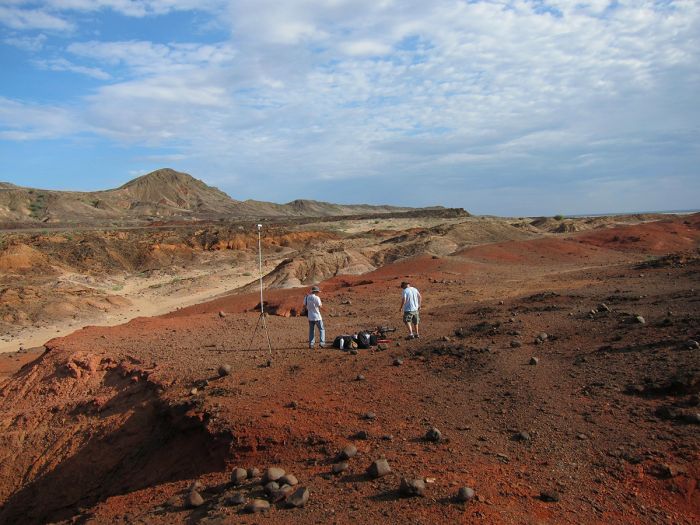
The Lothagam North Pillar Archaeological Site is a communal monumental cemetery at Lake Turkana that dates back to the Pastoral Neolithic. It was built between 3000 and 2300 BC by the region's earliest herders (photo: Wikimedia Commons).
Iron Age
During the first millennium BC, Bantu-speaking people began migrating into Eastern Africa, including Kenya, and brought with them iron-forging technology and novel farming techniques. The iron tools brought with them allowed the Bantu people to clear away trees and prepare ground for agriculture
Note: the term 'Bantu' was coined in the 1800s to refer to a variety of people and languages that is thought to have originated over 5 000 years ago in West/Central Africa in the area that is now Cameroon.
The Urewe culture emerged in and around Lake Victoria during Africa's Iron Age, extending into western Kenya. The Urewe civilization developed highly technical iron working techniques and created stylish pottery. The inhabitants farmed sorghum and millet and were likely cattle herders as well. The Urewe are responsible for much of the deforestation that occurred around Lake Victoria, with the wood used for charcoal for their smelting work and the cleared land for agriculture.
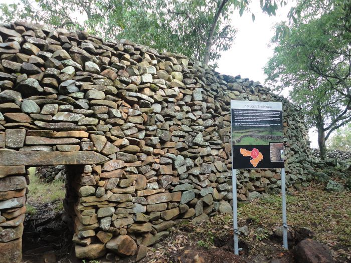
The Thimlich Ohinga Cultural Landscape site near Lake Victoria in Kenya. The walls are over 500 years old and the architectural technique used in its construction of using dry stones meticulously arranged without use of mortare is still a mystery (photo: Wikimedia Commons).
The iron working technology of the Bantu people allowed them to flourish and they expanded over time to the Indian Ocean coast and further south into Tanzania and beyond. At the coast, the Bantu people traded with merchants from the Far East that visited the coast. The Bantu exchanged their iron tools and pottery for various items including Asian foods, including rice and bananas.
The Bantu expanded their economic base via trade and their languages quickly spread as they assimilated existing inhabitants wherever they encountered them. Agriculture was the main Bantu lifestyle, but it was supplemented with pastoralism, hunting, fishing, gathering, and trading of their iron tools.
By the end of the first millennium AD, the Stone Age in East Africa had been mostly replaced by one dominated by iron and the Bantu expansion had covered all of present-day Kenya.
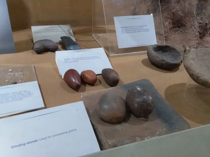
Grinding stones, pestles, and axes of the East African Pastoral Neolithic era (photo: Wikimedia Commons).
Swahili Culture
The Indian Ocean coast of present-day southern Somalia, Kenya, Tanzania, and northern Mozambique, as well as the off-shore islands of Zanzibar, Lamu, Comoro, and northern Madagascar, are collectively known today as the 'Swahili Coast'. During the first millennium AD, the Roman Empire referred to this region of southeastern coastal Africa as 'Azania', while Middle Eastern, Chinese, and Indian literature refer to the region as 'Zanj' or 'Zinj', which is thought to mean "place of the blacks". 'Zanj' is also the origin of the place-name 'Zanzibar'.
The advent of Swahili culture and language is traced back to the expansion of Bantu people during the first millennium BC, who arrived along the Indian Ocean coast and mixed with the already present coastal inhabitants, including Cushitic-speaking people and Arabian and Omani traders and settlers that arrived on ships from across the Indian Ocean to the east. The area in the far southeast corner of Kenya near present-day Kwale town is known to be one of the earliest Swahili settlements.
The mixture of the Bantu with the people already living in the coastal region led to a new and distinct culture, which is called Swahili. The Swahili developed their own language, which was based on the Bantu language, but was also infused with foreign vocabulary from the Middle East and India, and much later, when Portugal occupied the Swahili Coast, Portuguese words.
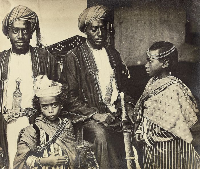
The children of the Sultan of Zanzibar Protected by two palace guards; photograph by John Kirk, 1884 (photo: Wikimedia Commons).
Indian Ocean Trade
The rise of Swahili settlements along the coast can be primarily attributed to the extensive Indian Ocean trade network between Africa and lands to the north and east, including India, Arabia, Persia (present-day Iran), Sri Lanka, China, Greece, Assyria, Babylonia, Phoenicia, Sumeria, and others. The annual monsoon winds that occur along the Swahili Coast provided a predictable catalyst to help reduce the risk of sailing to the eastern Indian Ocean and back. Further south along Africa's east coast, the monsoon winds were weaker and less reliable, so trade settlements were smaller to the south.
African merchants initially traded ivory, animal skins, and gold in exchange for finished products like silk, porcelain, spices, glass, ghee, sugar, metals, and cotton, but centuries later, slaves became the focus of trade across the Indian Ocean.
Historic trade routes connecting Africa and Asia via the Indian Ocean (image: Wikimedia Commons).
By the first century AD, some pre-existing Swahili settlements began growing in size and power, with economic growth fueled by trade with Arab merchants from the east. The Indian Ocean trade also led to the introduction of Islam as a religion along the Swahili Coast, cultural diffusion, and Islamic and Arabic influence on the developing Swahili language. The rise of Swahili 'city-states', which included settlements in present-day Kenya and Tanzania at Mombasa, Malindi, and Zanzibar, began to emerge between 800AD and 1500AD.
The first slave trading in the Indian Ocean is thought to have occurred as early as 2500 BC, with small-scale trade between Ancient Greece, Egypt, Babylonia, Persia, and India. The ancient Indian Ocean slave trade primarily occurred to the north of what is today Kenya and the Swahili Coast, but beginning in the 9th century AD, Arab traders began exporting Bantu-speaking Africans as slaves from the Swahili Coast on ships headed east over the Indian Ocean.
The number of slaves exported from the Swahili Coast during the latter part of the first millennium AD is debated, with estimates ranging from 1 000 per year to 6 000 or more per year.
Ivory (elephant tusks) was a key product in the Indian Ocean trade (photo: Wikimedia Commons).
Vasco da Gama, the famous Portuguese explorer, arrived on the Swahili Coast and visited Mombasa in 1498. In 1503, Portugal established a base at Mombasa, where it took control of the Indian Ocean trade route for the next two centuries. Relations between the local Arabs and Swahili elites and the ruling Portuguese were frequently hostile.
The Portuguese constructed Fort Jesus at Mombasa over three years beginning in 1593, which aimed to protect their dominance of the region and the lucrative Indian Ocean trade. Over 100 years later, in 1698, the Omani Empire captured Fort Jesus and ousted the Portuguese, gaining control of Mombasa. By 1730, the Omanis had totally expelled the Portuguese from the Swahili Coast and had gained full control of the Indian Ocean trade.
In 1840, Said bin Sultan, the Sultan of Muscat and Oman, moved his capital from Muscat in Oman to Stone Town on Unguja Island (Zanzibar). The Omanis furthered their dominance of the region by establishing long-distance trade routes into the interior of Africa, connecting Mombasa to the Kingdom of Uganda and exporting ivory, spices, and slaves.
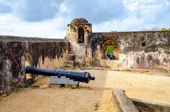
The Portuguese built Fort Jesus in Mombasa to protect their dominance of the East African section of Indian Ocean trade.
Trade in African slaves had been growing exponentially since the late 1600s, with a large slave market at Zanzibar City on Unguja Island. Slaves were brought to the coast in large caravans from the interior, including from many areas in present-day Kenya. An estimated 50 000 slaves and huge quantities of elephant tusks passed through the slave market on Zanzibar during the middle part of the 19th century.
The Omanis continued to control most of the Swahili Coast and its Indian Ocean trade until the late 1880s, when Britain and Germany became serious about colonization of the region as part of the greater 'Scramble for Africa' by the European powers.
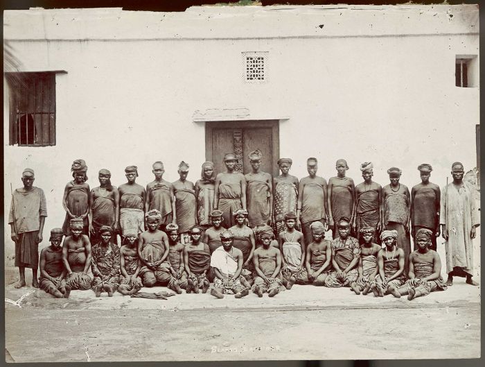
Female African slaves in Zanzibar, circa 1895 (photo: Wikimedia Commons).
Early Immigration
After the Portuguese arrived on the Swahili Cost in the early 1500s, they introduced new crops, including corn and caassava, which soon spread inland and dramatically increased the human carrying capacity of present-day Kenya. Farming of these new food crops led to an increase in settlements and trading and attracted people from less habitable lands in the north, who moved south into Kenya.
One of the earliest Nilotic-speaking tribes to migrate south into present-day Kenya were the Kalenjin, who originated from the middle Nile basin. They are thought to have arrived from the northwest around the area of Mount Elgon. The Kalenjin practiced pastoralism and cultivation and their various tribes, which include the Nandi, Kipsigis, Pokot, Sabaot, Tugen, Marakwet, and others. spread out east and south. The descendants of these early arrivals still live throughout Kenya, including the Nandi, who inhabit the western highlands.
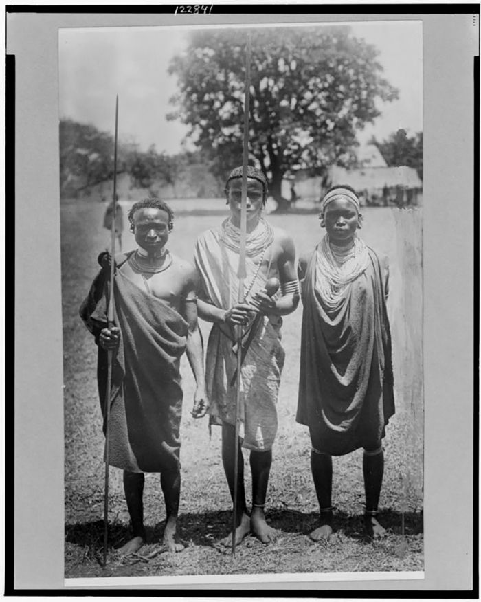
Nandi warriors. The Nandi are one of the tribes making up the Kalenjin people (photo: Wikimedia Commons).
Another of the ethnic groups that began slowly immigrating into present-day Kenya around this time were the Luo, a Nilotic-speaking people who arrived from the northwest (present-day South Sudan). The Luo were a semi-nomadic people, moving around as climate and water availability dictated, in order to survive by planting crops, herding livestock, and hunter-gathering.
The Luo settled on the shores of Lake Victoria, where they farmed and fished. Their arrival in the region displaced many of the early inhabitants, mainly those called the 'Twa' (or pygmy) people, who fled across Lake Victoria's waters to inhabit the nearby islands, including Rusinga and Mfangano.
Later, during the 17th century, another Nilotic-speaking ethnic group that moved south into northwest Kenya were the Turkana people. Like the Luo, the Turkana people were historically semi-nomadic pastoralists. The Turkana settled in the far northwest of present-day Kenya and the lake and region are both named for the Turkana people that still live there today. The Turkana are known for raising camels, but they also keep cattle (known as 'zebu'), donkeys, and goats, which they rely upon for milk, blood, and meat. Sorghum is also cultivated by the Turkana.
Luo dancers in Eldoret, Kenya, 1968 (photo: Wikimedia Commons).
The latest arriving immigrant group was the Maasai, who moved into northern Kenya from the upper Nile valley during the 17th century. The Maasai (and the closely related Samburu people) speak an Eastern Nilotic language called 'Maa' and like the other groups that moved into Kenya from the north, they are semi-nomadic pastoralists.
Within several generations after their arrival, the Maasai managed to become a dominant culture in present-day central Kenya and extending south into present-day northern Tanzania. They raised cattle and goats and raided the settlements of existing Cushitic tribes, stealing their cattle to increase their own herds as they expanded southward.
By the beginning of the 19th century, the Maasai dominated much of the Rift Valley and open plains from south of Lake Turkana into Tanzania and east to Mount Kilimanjaro. Bantu speaking people already established in these areas, in particular the Kikuyu, assimilated into the Maasai culture via intermarriage and merging of customs.
Although the Maasai grew greatly in number, they were not organized on a tribal basis, but rather divided into smaller clans, who commonly raided and fought one another for land and cattle. The colonization of present-day Kenya would have been far more difficult for the European powers had the Maasai people been united, but because they were bitterly divided, the Maasai were unable to provide much resistance to the colonial control that was coming.
Maasai warriors, circa 1910 (photo: Wikimedia Commons).
Early Colonization
During the second half of the 19th century, the main powers in Europe (Britain, France, Germany, Portugal, and Belgium), driven by commercial interests in Africa's resources, began to get serious in their efforts to seize control of Africa's interior. By 1880, European power and influence in Africa was mainly limited to coastal Africa, with trading posts used for shipping routes, but control of Africa's interior was still up for grabs .
Britain had already gained partial control over present-day South Africa with their Cape Colony and had fought two wars, one with the Boers (Dutch settlers who wanted their own independent republic) and one against the Zulus (a powerful Bantu-speaking tribe occupying the eastern side of present-day South Africa), in efforts to control the southern portion of the continent.
Both Germany and France had sent exploratory expeditions to various parts of the continent with plans to annex critical trade routes and competition was leading to potential hostilities between the nations.
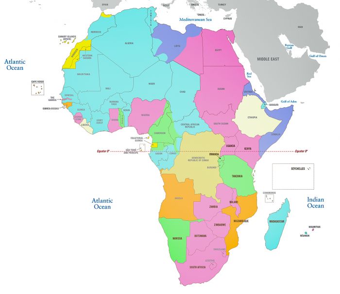
Map of Africa showing the European colonies as of 1913 overlaid on the current country boundaries. Today's boundaries are largely a legacy of the colonial era. See color key below (Map Copyright © James Weis).
Berlin Conference (1884-85)
In 1884, in an effort to avoid outright conflict between the nations, German Chancellor Otto von Bismark, called on the countries to join in a conference to attempt to come to agreement on a formalized mapping of the African continent into European-controlled land. The Berlin Conference opened on 15 November 1884, with representatives from 14 nations in attendance.
The Berlin Conference ended after three months on 26 February 1885 with the following agreed upon and signed by all parties:
- an immediate cessation of slavery and the trade of slaves in Africa.
- open ship traffic on the Niger and Congo Rivers and on Lake Malawi.
- free trade throughout the Congo River Basin
- definition of regions in Africa where each European power had an exclusive right to pursue land ownership.
Great Britain was allocated territory that includes most of present-day Kenya (except for a coastal stretch that remained under the control of the Omani Sultan of Zanzibar) and the Kingdom of Uganda. Germany was allocated land that includes present-day Tanzania, Rwanda, and Burundi under the name German East Africa.
An 1884 illustration of the Berlin Conference of Berlin from "Illustrierte Zeitung" (image: Wikimedia Commons).
Uganda Railway (1895-1901)
In 1890, Britain decided to build a railway in order to connect the Indian Ocean Coast at Mombasa, which was already long-since an important port, to the Kingdom of Uganda. The railway would allow Britain to transport people and soldiers to protect Britain's investments in the Great Lakes region.
The costly venture (5 million British pounds) began in 1895 and took six years to complete. Its construction also cost the lives of 2 493 workers, most of them from India, including 135 that were killed by the famous 'man-eating' lions of Tsavo. The rail line was named the Uganda Railway as that was its intended destination, although the line ultimately ended at Kisumu, Kenya, on the Lake Victoria shoreline. A steamship was then used to cross the lake into Uganda.
The railway ran for 660 miles (1 060 kms), starting at the coastal port of Mombasa and heading northwest to Nairobi, before continuing on to Lake Victoria. The railway was a huge achievement for the British Empire in terms of engineering and logistics. The line was opened in 1901 and proved to be hugely significant in terms of the future of the region, as it allowed travelers from Europe to reach the African interior via ship and rail in about one month.
An advertisement for the Uganda railway (photo: Wikimedia Commons).
Early British Rule
On 01 July 1895, the British government officially established its new African territory as the 'East Africa Protectorate' (also known as 'British East Africa'). Initially, the protectorate only included the Kenya portion, but in 1902, the boundaries were extended to include land on the eastern side of the Kingdom of Uganda. The next step was to encourage settlers to move to the new land and try to recoup some of the substantial cost of the Uganda Railway.
One of the earliest and most influential champions of British settlement in present-day Kenya was Hugh Cholmondeley, 3rd Baron Delamere. Lord Delamere arrived in British East Africa in 1897, at which time he visited the Central Highlands and became enamored of the land, convinced that it held great promise for agriculture and white settlement.
In 1900, Sir Charles Norton Edgcumbe Eliot was appointed as Commissioner of British East Africa. Eliot toured many areas in the protectorate and his glowing reports on the Central Highlands and its suitability for settlement were published back in Britain. Settlers from Europe and South Africa began arriving in small numbers and were given landholdings, where they started farms from scratch in what became known as the 'White Highlands'.
By 1903, there were several hundred settlers in the Highlands, many of them Afrikaner Boers (farmers) from South Africa's Transvaal region. By 1914, just before the outbreak of World War I, there were around one thousand settlers in the Highlands around Mount Kenya.
Theodore Roosevelt and traveling companions mount the observation platform of the Uganda Railway, circa 1909 (photo: Wikimedia Commons).
World War I (1914-1918)
At the outset of hostilities in Europe, the governors of the neighboring British East Africa (present-day Kenya/Uganda) and German East Africa (present-day Tanzania) agreed to a truce in order to keep the nascent colonies from entering into any direct hostilities.
The truce in East Africa did not last and German forces in German East Africa, led by Lieutenant-Colonel Paul von Lettow-Vorbeck, engaged in a mission to divert Allied forces and supplies from Europe to Africa. The German mission was quite successful, and throughout the war a significant number of British and South African troops engaged in battles against the Germans in East Africa.
Relatively few battles occurred in the British colony, but around 200 000 local Africans were conscripted by the British from within its colony and sent south to German East Africa to engage the German troops.
German Schutztruppe in East Africa with a Königsberg gun in 1916 during World War I (photo: Wikimedia Commons).
By early 1916, the Allied forces in East Africa, led by General Jan Smuts of South Africa and numbering some 40 000 South African and Indian troops, had pushed Von Lettow-Vorbeck's much smaller force of 4 000 Europeans and local askaris southwards into the interior of the German colony. However, in spite of having lost over around 75% of Germany's East Africa territory, the smaller German force never surrendered and used guerrilla tactics against Smuts' troops, which drew significant Allied resources away from Europe.
During the last months of the war in 1918, Allied forces in East Africa totaled around 50 000 troops. The Armistice to end the war was signed on 11 November 1918, which ended the fighting and resulted in Germany's surrender. Two weeks later, Von Lettow-Vorbeck finally surrendered to the Allied forces near Lake Tanganyika after four years of evading capture. His small force of 14 000 mostly colonial and local African fighters had occupied an Allied force totaling 114 000 men, of which some 10 000 perished, mainly from disease.
On 29 June 1919, the Treaty of Versailles was signed, officially ending the war between Germany and the Allied forces.
Germann General von Lettow-Vorbeck and German colonial Governor Heinrich Schnee (photo: Wikimedia Commons).
Post-WWI Colonialism
Early Nationalism
In 1920, the Colony of Kenya, commonly known as British Kenya, was established when the former East Africa Protectorate was transformed into a British Crown colony. The 10-mile (16-km) wide strip of land on the eastern Indian Ocean coast was still on lease from the Sultan of Zanzibar and became the Protectorate of Kenya, but the two were controlled as a single administrative entity.
After the war, Edward Northey, a British war veteran in both the European and East African campaigns, was appointed Governor of the British Kenya. Northey began a 'Soldier Settlement Scheme', which aimed to increase the white settler population in Kenya. Three lotteries were held in Nairobi and London to distribute over 1 000 farm plots to existing white residents and potential new settlers from Europe.
The Soldier Settlement policy was understandably resented by local Kenyans, especially those that had fought beside the British in the war but were now excluded from participating in the land giveaway. Anti-colonial sentiment among native Kenyans, especially the ex-servicemen, grew quickly and several movements towards nationalism took root.
Edward Northey, the Governor of the British Kenya from 1920-22; photo from 1918 (photo: Wikimedia Commons).
Mumboism
One of the earliest movements opposed to British rule in Kenya was a religious sect called 'Mumboism'. It was founded in the early 20th century at a time when Christian missionaries were active in Kenya and the movement was most active in the region around Lake Victoria. Mumboism's leader was Onyango Dunde, who preached that he had been swallowed by a serpent-god in Lake Victoria, but was spit out after being given a prophecy to spread to the people. Dunde condemned Christianity, European culture, and colonialism.
Dunde prophesied that soon the Europeans would disappear from Africa and that a "golden age" would arrive for his faithful followers. After World War I, Mumboism followers grew quickly in number due to frustration with the colonial administration's increasingly burdensome demands on Kenyan's to pay taxes, carry registration, and provide unpaid labor to the colonial government. Mumboisim was widely adhered to by the Luo and Kisii people and was seen as a growing threat by the colonial authorities, which suppressed the movement and began imprisoning and deporting its followers during the 1920s and 1930s.
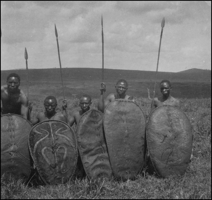
Kisii warriors, circa 1925 (photo: Wikimedia Commons).
Harry Thuku
After World War I, anti-British sentiment grew considerably in Kenya, mainly in response to the repressive demands of the British Colonial Authorities, leading to the establishment of protest organizations. One such movement was the Kikuyu Association (KA), which was formed in 1920.
A year later in 1921, a breakaway group from the KA called the Young Kikuyu Association (YKA) was co-founded by Harry Thuku, who would soon become one of the pioneers of African nationalism in Kenya. Thuku came from a Kikuyu family, an ethnic group that was particularly hard hit by British colonialism, losing much of their homeland in the Central Highlands to British settlers.
In order to grow the movement and include ethnic Kenyans beyond just the Kikuyu, Thuku renamed the YKA as the East Africa Association (EAA) in July 1921. The EAA invited men and women from all tribes to join, including local Indians, and its membership grew. Based in Nairobi, Thuku's EAA operated as a multi-ethnic, non-militant organization protesting against land alienation, colonial taxation without representation, low wages, and poor working conditions.
Harry Thuku helped found the Young Kikuyu Association in 1921 (photo/image: Wikimedia Commons).
The EAA also protested against the 'kipande' system of pass controls imposed by the colonial administration. The kipande was a racially-identifying metal band required to be worn on a chain around the neck by all African males in Kenya over the age of 15 years. Similar to the apartheid-era passbooks required for all residents in South Africa, the kipande was intended to restrict the mobility of black Kenyans.
Thuku also started a printed publication called the Tangazo, which was critical of the British colonial administration. Through the EAA, Thuku advocated civil disobedience and demanded suffrage for all Kenyans.
As Thuku's movement gained traction and its membership grew, the colonial administrators became concerned and decided to ban the EAA. On 14 March 1922, Thuku was arrested for his involvement in the now-banned political organization. Over the following two days, Thuku's supporters protested in Nairobi, demanding his release. The first day's protests were peaceful, but on 16 March 1922, some 8 000 supporters gathered in front of the Nairobi police station and the police opened fire on the crowd, killing 25 protestors.
A Kipande was an identity document kept in a small metal case and worn around the neck of all African men above the age of fifteen years (photo: Wikimedia Commons).
Thuku was summarily exiled from the country without a trial and sent to Kismayu on the Indian Ocean coast in the far northern frontier of the British colony (present-day Somalia). Thuku remained in exile for 11 years and was not permitted to return to Nairobi until January 1931.
After Thuku was exiled, the EAA was dissolved and was succeeded in 1924 by another political organization called the Kikuyu Central Association (KCA), led by James Beauttah and Joseph Kang'ethe. The KCA acted on behalf of the Kikuyu community and lobbied the Colonial Office for the return of their expropriated land, tax reductions, and the inclusion of elected African representatives on the Colonial Legislative Council. The KCA also protested against efforts by the Christian missions to outlaw female circumcision, which was part of their culture.
Portrait of a Kikuyu woman, painted by Akseli Gallen-Kallela in 1909 (photo: Wikimedia Commons).
Education for Kenyans
After World War I, the British began to reevaluate education in its African colonies and started to develop official educational policies for Africans. This marked the beginning of a three-tiered educational system in Kenya with racially segregated schools for Europeans, Africans, and Asians.
At the time, Swahili was the language used to communicate between the Europeans and the Africans and the European settler community was mostly opposed to teaching the English language to black Kenyans, as they feared it would lead to trouble for them and the colonial administration down the road. Although the Colonial Office refused to bar the teaching of English to native Kenyans, educational opportunities for Africans in Kenya were few and mainly provided by Christian mission schools.
During the 1930s, the Kikuyu community set up their own independent schools to fill the demand for education, primarily to teach their children the English language. In spite of the half-hearted effort to provide education for Africans in Kenya, by the late 1930s, there were a significant number of Kenyans that could read, write, and speak English.
A carpentry class at a Church of Scotland mission for Kikuyus, circa 1930 (photo: Wikimedia Commons).
Governmental Representation
In 1906, the East Africa Protectorate's government consisted of the Governor, the Executive Council, and the Legislative Council, the last of which consisted of both official and unofficial members. Both councils at that time consisted solely of persons of European descent. In 1909, Alibhai Mulla Jeevanjee, an Indian-born merchant, was appointed to the Legislative Council, becoming its first Asian and non-European member.
Beginning in 1911, the European settler community in Kenya began asking for the right to elect its unofficial members to the Legislative Council, but that request was always denied by the Colonial office. In 1917, the appointed settlers on the Council resigned their seats in protest and only agreed to return once the Colonial Office agreed to introduce elected settler seats after the end of World War I.
In 1919, the Legislative Council was expanded to 17 official members, including 11 elected seats for the European settler community and the first elections were held in 1920.
In 1924, additional elected seats were added: five for the Indian community and one Arab seat; however, the Indians refused to nominate candidates in protest over not having a parity of seats with the European community. Eliud Mathu, a Kikuyu teacher became the first African member of the Legislative Council in 1944.
U.S. President Theodore Roosevelt (standing left of flag with head turned to the side) during a 1909-1910 hunting trip dubbed the Smithsonian Roosevelt African Expedition. Other men in the image include Kermit Roosevelt, Edgar Alexander Mearns, and John Alden Loring. Photo from the Smithsonian Institution Archives (photo: Wikimedia Commons).
Happy Valley Set
The British colony in Kenya attracted a good number of aristocrats and adventurers from Europe and America. These settlers came to enjoy life in the new frontier of Africa in a land with less regulation and more freedom. During the 1920s-1940s, this group of socialites, big game hunters, and entrepreneurs, most of whom settled in the Wanjohi Valley around Nyeri town, became known as the "Happy Valley Set".
The Happy Valley Set became notorious for their extravagant and hedonistic lifestyle, becoming infamous for decadent parties that involved drugs and alcohol, sexual promiscuity, and often adultery. The group mostly came from upper-class society, some even descended from royalty, and pursued their life with abandon. They sought amusement and lived a promiscuous life that would cause scandal back home, but was mostly overlooked in the colony, where they could mostly do as they pleased.
A popular gathering place for the Happy Valley Set was the Muthaiga Country Club, in Nairobi. The hotel was co-founded by Berkeley Cole (1882-1925), an Anglo-Irish aristocrat from Ulster and brother-in-law of Hugh Cholmondeley. The Club opened on New Year's Eve 1913 and thereafter gained a reputation for being 'the Moulin Rouge of Africa'.
The Club's clientele consisted mostly of elite white settlers, hunters and adventurers, who came to play cards, golf, dine, drink Champagne, and dance through the night, with romantic dalliances commonplace. The Muthaiga Club is featured as a setting in Beryl Markham's 1942 memoir West with the Night.
The front of the Muthaiga Country Club in 1936. Muthaiga was a popular gathering place for the Happy Valley Set in the Kenya Colony. G. Eric and Edith Matson Photograph Collection (photo: Wikimedia Commons).
Notable people in the Happy Valley
Hugh Cholmondeley, 3rd Baron Delamere (1870-1931)
A big game hunter who originally traveled to East Africa on annual lion-hunting trips beginning in 1891, Cholmondeley was famously mauled by a lion in 1894, after which he walked with a limp. Baron Delamere is credited with coining the term "white hunter".
Cholmondeley settled in Kenya in 1896 and in 1906, acquired a large plot of land surrounding Lake Elmenteita, some of which is today the Soysambu Conservancy. Lord Delamere became the unofficial leader of the white settler community in the Kenya Colony and actively recruited European settlers to the colony. Delamere was put in charge of intelligence at the outbreak of World War I, monitoring the movements of German troops in German East Africa (present-day Tanzania).
A 1909 photo of Sir Percy Girouard (left), the incoming Governor of the East Africa Protectorate, listening to a welcome address being read by Lord Delamere (Hugh Cholmondeley, 3rd Baron Delamere) (photo: Wikimedia Commons).
Josslyn Hay, 22nd Earl of Erroll (1901–1941)
The eldest son of the British diplomat Victor Hay, Lord Kilmarnock. His affair with Lady Idina Sackville, then a married woman, caused a great society scandal. Lady Idina divorced her husband and she and Hay were married in 1923 and they moved to the Kenya Colony in 1924, financing their move with Idina's money from her two previous marriages. They built a bungalow on the slopes of the Aberdares, which they called 'Slains' (after Slains Castle, which was the former family seat of the Hay family). Hay and Idina divorced in 1930, as he was spending her inheritance frivolously.
Hay then married the divorced Edith Maude ("Molly") Ramsay-Hill that same year. The couple lived in 'Oserian' a large house on the shores of Lake Naivasha, where they became part of the Happy Valley Set. Hay became a captain in the Kenya Regiment in the late 1930s and at the outbreak of the war, accepted the post of Military Secretary for East Africa. His second wife, Molly, died in 1939, after which Hay had a romantic affair with the Diana, Lady Broughton, the wife of Sir Jock Delves Broughton, 11th Baronet.
After a romantic night spent together with Lady Broughton, Lord Errol (Hay) was found shot dead in his Buick automobile on 24 January, 1941. Sir Jock was accused of the murder and stood trial in May 1941. Due to the lack of any eyewitness and weak evidence against him, Broughton was acquitted in July 1941. (Sidenote: Sir Jock died by suicide in England a year later). The famous murder has been portrayed several times in popular culture, including the 1982 book White Mischief, and the 1987 British film of the same name.
Settlers in the Kenya Colony's Wanjohi Valley near Nyeri town became notoriously known as the Happy Valley Set. G. Eric and Edith Matson Photograph Collection (photo: Wikimedia Commons).
Lady Myra Idina Sackville (1893-1955)
Known by her middle name, Idina was the daughter of Gilbert Sackville, 8th Earl De La Warr. During her somewhat scandalous life, she was married and divorced five times. In 1913, at the age of 20, she married Euan Wallace, but divorced him in 1919. She married again that same year, this time to Capt. Charles Gordon of Park Hill. Her scandalous affair with Josslyn Hay led to another divorce and she married Hay in 1923. The couple moved to the Kenya Colony in 1924, where they helped pioneer the decadent lifestyle of the Happy Valley Set.
Lady Idina was renowned for hosting wild parties, which involved drug use and spouse-swapping. Stories are told of Lady Idina welcoming guests to her home while bathing in a bathtub made of green onyx, before dressing in front of the onlookers. After she and Hay divorced in 1930, Lady Idina married twice more.
Portrait of Lady Idina Sackville, by William Orpen, 1915 (photo: Wikimedia Commons).
Countess Alice de Janzé (1899-1941)
Alice Silverthorne was an American heiress who spent her early years in Chicago and New York City. Alice was the great-niece of Philip Danforth Armour, founder of the Chicago-based meat-packing family. She inherited millions at a young age and was one of the most prominent American socialites. In 1921, Alice married Frédéric de Janzé, a French racer car driver, whom she met while living in Paris.
While in Montparnasse, the couple had two daughters, Nolwén Louise Alice (born in 1922) and Paola Marie Jeanne (born in 1924). During this time they became friends with Josslyn and Idina, Earl and Countess of Erroll, who in 1925, invited them to visit them at their home in the Kenya Colony.
The de Janzés stayed in Kenya for some months and immediately became active members in the partying lifestyle of the Happy Valley Set. Even amongst the hedonistic members and eccentric personalities in the set, Alice soon earned the nickname of "the wicked Madonna", for her physical beauty, sarcastic humor, and mood swings. She engaged in an open romantic affair with Lord Erroll, whom she shared with his wife Idina.
Alice's great-uncle was Philip Danforth Armour, the founder of the Armour meat packing company in Chicago. Photo of the Armour plant and stockyards taken from a balloon, circa 1910 (photo: Wikimedia Commons).
In 1926, the de Janzés returned to the Happy Valley and whilst Frédéric went on an extended lion hunting safari, Alice began a love affair with Raymond Vincent de Trafford, a British aristocrat and the son of Sir Humphrey de Trafford, 3rd Baronet. Their affair was no secret, but Frédéric looked the other way. Later that year, the de Janzés returned to Paris, but Alice and Vincent continued their affair back in France and Frédéric filed for divorce.
Although she was still married to Frédéric, Alice and Raymond planned to be married, but the De Trafford family threatened to disinherit Frédéric if he followed through with the marriage, so the wedding was called off. Raymond decided to end his relationship with Alice and move to London.
On 25 March 1927, as Raymond was preparing to board a train on the platform at Paris' Gare du Nord station and after bidding Alice farewell, she pulled out a revolver and shot him in the chest, puncturing his lung. Alice then shot herself in the torso, but her wound was not serious. Alice was tried with premeditated attempted murder, but only received a suspended sentence of six months and a small fine. In the wake of the shooting incident, Frédéric's divorce from Alice was granted.
Alice Silverthorne (later Alice de Janzé) at a dress rehearsal for the Vanity Fete to be held at the Crystal Ballroom at the Blackstone Hotel, Chicago, November 1919 (photo: Wikimedia Commons).
In early 1928, Alice returned to Kenya, where she stayed at the house of writer Karen Blixen, who was a good friend of Lord Erroll (Josslyn Hay). She resumed her love affair with Lord Erroll, but in light of the Paris shooting scandal, Alice was ordered to leave the colony as an "undesirable alien".
Returning to Paris, Alice and de Trafford, the man she had nearly killed a year earlier, resumed their affair. Finally, in February 1932, Alice and Raymond were married in Paris. The relationship lasted only three months. Alice filed for divorce from Raymond, who had fled to Australia, presumably fearing his wife may again shoot him.
Members of the Happy Valley Set petitioned the Colonial Office in Kenya to permit Alice to return and they agreed to re-admit her and Alice soon settled permanently in a large farmhouse in Gilgil between Lake Nakuru and Lake Naivasha. A passionate animal rights advocate, Alice had numerous African animals as her pets living with her, including lions, leopards, and various antelopes. Many in the Happy Valley Set now avoided her due to her dark mood swings and the shooting scandal. Alice grew lonely, used drugs and became addicted to morphine.
Portrait of Alice Silverthorne, later known as Alice de Janzé, in Chicago, Illinois, taken in 1919 by a Chicago Daily News photographer. Chicago Daily News negatives collection, Chicago Historical Society (photo: Wikimedia Commons).
On 24 January 1941, Lord Erroll, Alice's former lover, was found shot to death in his car at an intersection outside Nairobi. Lord Erroll's mistress at the time was Lady Broughton, and her husband stood trial for the murder, but was found not guilty. Although Alice had an alibi for the night of the murder (she had spent the night with Dickie Pembroke, another Happy Valley member), most in the Happy Valley Set regarded her as the prime suspect due to her previous romantic history with Lord Erroll and the prior shooting incident in Paris. It was rumored that Alice had confided in some that she had killed Lord Erroll.
On 30 September 1941, two days after her 42nd birthday, Alice's servant found her dead on her bed from a self-inflicted gunshot wound. She had used the same weapon she had already used once on herself and Raymond. Alice left three suicide notes, one to her daughters, one to the police, and one to Dickie Pembroke. The contents of the letters were never publicly disclosed, which fueled rumors that the one addressed to the police may have contained revelations about Lord Erroll's murder. The letters were subsequently destroyed by officials.
Alice's life was featured prominently in James Fox's 1982 non-fiction book White Mischief, which detailed the events surrounding Lord Erroll's murder and the notorious lifestyle of the Happy Valley Set. The book was adapted as a film of the same name in 1987, with Alice portrayed by British actress Sarah Miles.
The British actress Sarah Miles portrayed Alice de Janzé in the 1987 film White Mischief (photo: Wikimedia Commons).
Alice "Kiki" (née Gwynne) Preston (1898-1946)
Kiki was an American socialite and relative of two wealthy families, the Whitneys and the Vanderbilts. Kiki and her second husband, Jeromy "Gerry" Preston, moved to the Kenya Colony in 1926 after being offered land on the shores of Lake Naivasha by a friend. The couple enjoyed big game hunting and raised horses together. They quickly became active members of the Happy Valley Set.
Kiki was most notorious for her drug use and was a regular user of heroin and cocaine. Kiki was known as "the girl with the silver syringe" due to her habit of always carrying a syringe in her bag and injecting herself in front of onlookers at social gatherings.
Kiki had numerous well-known affairs, which was almost customary in Happy Valley, one with Raymond de Trafford, who was later famously shot by his lover Alice de Janzé, and another with famous film star Rudolph Valentino. Kiki's most notable lover was Prince George, Duke of Kent, whom Kiki introduced to drugs after they met in the mid-1920s. Prince George was the son of the Prince of Wales (later King George V) and fifth in line for succession to the throne, behind his father and three older brothers (Edward, Albert, and Henry).
Kiki's husband died in 1934, making her a widow at 36 years, after which she sold the farm in Kenya and moved back to New York. Her former lover Prince George was killed in a plane accident in 1942 and in 1944, her son Ethan Allen was killed during the Normandy Landings in World War II. Kiki committed suicide on 23 December 1946, by jumping out of her fifth-floor apartment in the Stanhope Hotel in New York City. She had been depressed and in poor health for several years at the time of her death. Her home on Lake Naivasha and land covering 40 000 acres is still standing and is inhabited by the 7th Earl of Enniskillen.
Kiki Preston had many affairs, including one with Prince George, Duke of Kent, shown here with the Duchess of Kent in 1934 (photo: Wikimedia Commons).
Sir Henry John "Jock" Delves Broughton, 11th Baronet (1883-1942)
Jock was born into aristocracy at Doddington Hall in Doddington, Cheshire and came into the baronetcy upon his father's death in 1914. During the 1930s, Jock, a rampant gambler, acquired massive gambling debts and was forced to sell a portion of his family's 34,000-acre estate to pay them off. He and his wife Vera Edyth Griffith-Boscawen divorced in 1939 and just months later, the 57-year-old Jock married Diana Caldwell, a Sussex woman who was 30 years younger than he, and promptly moved her to his estate in Kenya.
At the Muthaiga Country Club, Diana met and fell instantly in love with the dashingly handsome Josslyn Victor Hay, 22nd Earl of Erroll, and the two proceeded to engage in a torrid and very public affair less than one month after her marriage to Jock. The couple's prenuptial agreement stipulated that due to their age difference, Diana would be permitted to abandon the marriage if she fell in love with another man, so Jock was outwardly accepting of her affair, hoping it would eventually pass.
Jock Delves Broughton was born into an aristocratic family at Doddington Hall, Cheshire (photo: Wikimedia Commons).
On 24 January 1941, after a party at the club, Diana and Lord Erroll spent the night together, but the next morning, Lord Erroll was found on a quiet road, slumped dead over the steering wheel of his car with a bullet hole in his head. Some weeks after, Jock was arrested for the murder.
After a lengthy trial during which Jock testified for over 22 hours in his own defense, Jock was acquitted of the crime due to a lack of evidence and the inability to tie him to the murder weapon. Jock's revolver was a Colt pistol with 6 grooves, but Erroll was killed by a bullet with 5 grooves. Jock testified that two of his pistols had been stolen days before the murder. Many still believe that Jock was the killer.
After the trial and Jock's release, he was never accepted back into the Happy Valley Set and he returned alone to England, as his wife had already taken another lover. In December 1942, Jock was found dead of a morphine overdose at the Britannia Adelphi Hotel in Liverpool. His death was ruled a suicide.
Government Road in Nairobi, 1936. G. Eric and Edith Matson Photograph Collection (photo: Wikimedia Commons).
Diana Caldwell (1913-1987)
Born in Hove, Sussex, Diana married Sir John "Jock" Delves Broughton, a baronet and a man 30 years her senior in 1940 and the newlyweds moved to Jock's country home in the Happy Valley of the Kenya Colony. Within a week, Diana began a steamy and very public romantic relationship with Joss Hay, Earl of Erroll, a handsome and much younger man and a prominent member of the Happy Valley Set. Diana decided to divorce Jock so she could marry Lord Erroll and her prenuptial agreement with Jock stated that she could abandon him if she fell in love with another man.
One night in January 1941, after Diana and Erroll had spent the night together, Lord Erroll was found shot to death in his automobile on a lonely road outside Nairobi. Jock was charged with the murder and stood trial. After a highly publicized trial, Jock was acquitted on lack of evidence and he moved back to England. Diana and Jock were soon divorced.
In 1943, Diana became acquainted with Gilbert Colville, one of the wealthiest and largest landowners in Kenya, who owned various properties totaling 414 square miles (1 072 sq kms) around Naivasha upon which he ranched 20 000 head of native Kenyan cattle. Colville lived alongside the Maasai people, whom he greatly respected. Colville also lived like a Maasai, wearing shabby attire and he was not a part of the Happy Valley Set, neither drinking alcohol nor smoking.
Diana Caldwell married Gilbert Colvile, one of the largest landowners and cattle ranchers in the Kenya Colony. Shown is a cattle ranch near Lake Naivasha (seen in the distance) in 1936. G. Eric and Edith Matson Photograph Collection (photo: Wikimedia Commons).
Colville took pity on the divorced Diana and bought her 'Oserian', the mansion on the shores of Lake Naivasha built by Major Cyril Ramsay-Hill for his wife Molly, who had subsequently married Joss Erroll. Diana and Gilbert were married in late 1943, much to the amazement of most of the Happy Valley socialites. The marriage lasted 12 years and was reportedly a happy one, but the couple divorced in 1955.
Diana eventually fell in love again, this time with Thomas Cholmondeley, 4th Baron Delamere, the son of Hugh Cholmondeley, 3rd Baron Delamere, one of the first settlers in the Happy Valley who had died in 1931. The Cholmondeley family still owned considerable ancestral land and estates in Cheshire, England, but like his father, Tom lived and worked most of his life in Kenya. Cholmondeley, who had been twice married and was recently divorced, ran the substantial ranch his father had built on the shores of Lake Elmenteita.
Through her numerous marriages and divorced, Diana had acquired substantial land and a huge fortune. During the 1960s and 1970s, it is purported that Diana, now Lady Delamere, lived in a three-way relationship with her husband Tom and their permanent house-guest, Lady Patricia Margery Kathleen Mackay, the daughter of Kenneth Mackay, 2nd Earl of Inchcape. By the time her husband Thomas died in 1979, Diana had become perhaps the most powerful white woman in Africa and was dubbed the "White Queen of Africa".
View of Sadler Street in Nairobi in 1936. G. Eric and Edith Matson Photograph Collection (photo: Wikimedia Commons).
Baroness Karen Christenze von Blixen-Finecke (1885-1962) & Denys Finch Hatton (1887-1931)
Karen Christenze Dinesen was born at Rungstedlund, north of Copenhagen, to a wealthy family of landowners closely connected to the Danish monarchy. In her adulthood, Karen authored several notable books, the most popular of which is Out of Africa, which details her life living in the Kenya Colony, including interactions with the Happy Valley Set.
In December 1912, Karen became engaged to wed Baron Bror Fredrik "Blix" von Blixen-Finecke, a Swedish nobleman and member of her paternal cousin's family. After their engagement, Blix's maternal uncle, Count Mogens Frijs, related tales to the couple of his time in the Kenya Colony around Lake Naivasha and with their families' support, they decided to move to Kenya to start a coffee farm.
Karen and Blix moved to Kenya in December 1913 and were married in Mombasa on 14 January 1914. After the wedding, Karen became known as Baroness Blixen. Between 1914-1917, the couple lived and worked on a small coffee farm on the outskirts of Nairobi called M'bagathi. The farm was owned by the Karen Coffee Company, which was started by Aage Westerholz, their uncle. The company name was chosen for Westerholz's own daughter, who was Karen Dinesen's cousin and also named Karen. Karen and Blix lived at M'bagathi, the small house on the farm.
Baroness Karen Blixen and her brother, Thomas Dinesen, on the M'bogani coffee farm, just southwest of Nairobi (photo: Wikimedia Commons).
During World War I, Bror served with Lord Delamere's Kenya border patrol, which guarded the border with the German-controlled colony to the south (present-day Tanzania) and Karen helped transport supplies. In 1916, the company purchased a larger coffee farm, M'bogani, just southwest of Nairobi. The farmhouse where the couple lived is now the Karen Blixen Museum. The farm covered 6 000 acres, with 600 acres used for coffee, 3 400 acres used for natives to graze their cattle, and 2 000 acres of virgin forest that was left untouched.
After initially working the farm, Bror lost interest and left the plantation work to Karen, while he mostly went on hunting safaris. Bror also took to philandering amongst the Happy Valley Set, spending his nights partying at the Muthaiga Club in Nairobi.
In April 1918, Bror and Karen met an English big-game hunter named Denys Finch Hatton, but Finch Hatton was soon sent off to military service in Egypt.
Denys Finch Hatton, circa 1915 (photo: Wikimedia Commons).
By 1919, Karen and Bror's marriage was on the rocks and Bror requested a divorce in 1920. Bror was dismissed as farm manager by his uncle, who was chairman of the company, and Karen was given the position. In 1921, Bror and Karen separated. Finch Hatton returned to Kenya after the end of the war and developed a close friendship with both Karen and Bror. After Bror moved out of their house, Karen and Finch Hatton's friendship became a long-term love affair.
Karen and Bror were officially divorced in 1925 and Finch Hatton moved into the Blixen farmhouse, making it his home base although he also owned his own property near present-day Eldoret. Between 1926 and 1931, Denys led safaris for wealthy hunters, one of which was Edward, Prince of Wales.
Denys loved to fly and owned a de Havilland Gipsy Moth biplane, which he used for his safaris. He often took Karen up to view the land from the sky, and the couple spent many hours flying together, as she truly loved the experience. On 14 May 1931, during an exploratory tour of the bush to scout for safari locations, Denys was killed when his aircraft crashed just after takeoff from Voi (near present-day Tsavo East National Park). As per his wishes, Denys was buried in the Ngong Hills, very close to Karen's farmhouse.
Karen Blixen's home on the outskirts of Nairobi is now the Karen Blixen Museum (photo: Wikimedia Commons).
After Denys' death, and with the coffee farm failing, Karen decided to abandon her life in Africa and now aged 46, she retuned to Denmark in August 1931. Back home at Rungstedlund, she began her successful career as an author. She published her most famous book, Out of Africa in 1937. It was one of two memoirs she wrote about her life in Kenya, the other being Shadows of the Grass.
Out of Africa was adopted as a major motion picture released in 1987 and starring Meryl Streep (as Karen Blixen) and Robert Redford (as Denys Finch Hatton). The film was a huge success and won seven Academy Awards, including Best Picture.
The somewhat upscale Nairobi suburb that emerged after the Blixen coffee farm was sold is now called Karen. The original farmhouse where Karen lived for many years with both Bror and Finch Hatton, changed hands several times after the farm was sold and was eventually bought by the Danish government to preserve it. It was given by Denmark as an independence gift in 1964 to the newly independent country of Kenya. The house was acquired by the National Museum of Kenya in 1985 and a year later, the house became the Karen Blixen Museum.
Karen Blixen at Kastrup Airport, Copenhagen, 1957 (photo: Wikimedia Commons).
Beryl Markham (née Clutterbuck) (1902-1986)
Born in Rutland, England, Beryl Markham was one of the first "bush pilots" (those who fly into rough terrain where there are often no prepared landing strips or runways available). When Beryl was four years old, her father, a horse trainer by profession, moved the family to the Kenya Colony, where he built a horse racing farm at Njoro, just west of Lake Nakuru. Beryl's childhood was one of adventure, learning and playing with local African children.
Beryl married three times, taking her name surname from her second husband, Mansfield Markham, a wealthy British film producer and director. In 1929, Beryl had a notorious public love affair with Prince Henry, Duke of Gloucester, the third son of King George V. The affair caused her husband Mansfield to file for divorce and he indicated he would name the Prince in the legal proceedings, at which time Queen Mary intervened and offered Beryl a small annual income in exchange for cutting off the affair with Henry.
Beryl became good friends with Karen Blixen during the years Karen was living in Nairobi. During the end of Blixen's affair with the hunter and pilot Denys Finch Hatton was winding down, Beryl started an affair with Denys herself. Denys invited Beryl to join him on his final exploratory safari, but she reportedly turned him down after her flight instructor, British pilot Tom Campbell Black, had a bad premonition of her death, which likely saved her life.
Beryl Markham poses by her airplane, circa 1930 (photo: Wikimedia Commons).
After learning to fly, Beryl worked as a bush pilot in Kenya for a time, spotting wildlife from the air and signaling their location to those on a safari on the ground.
In 1936, Beryl made a famous solo flight across the Atlantic Ocean, from England to North America. At that time, no pilot had yet flown from Europe to New York, nor made the flight non-stop, though several had perished trying. Beryl wanted to claim both records. On 16 September 1936, she took off from Abingdon in southern England in her her Vega Gull aircraft, "The Messenger". After flying for 20 hours, the plane's fuel tank vents iced over and she crash landed at at Baleine Cove on Cape Breton Island, Nova Scotia. She survived the landing and became the first person to fly solo from England to North America east to west. The flight made her famous.
Beryl detailed many of her life's adventures in her memoir, titled West with the Night, published in 1942. After living for some time in the United States, Beryl moved back to Kenya in 1952, where she remained for the rest of her life.
Beryl Markham in 1936 (photo: Wikimedia Commons).
World War II (1939-1945)
When the British Empire declared war on Nazi Germany in September 1939, the Colony of Kenya was indirectly involved as well, with German-controlled land directly to its south (present-day Tanzania). The war expanded and in June 1940, Italy declared war on Britain and France, which made Italian forces in Italian East Africa a secondary threat to Kenya.
In August 1940, Italian forces invaded and occupied British Somaliland on the Gulf of Aden and Britain was fearful that the much larger Italian forces in East Africa would now advance southward into Kenya.
To counter Italy's much larger forces, Britain recruited native Africans into its 'King's African Rifles' (KAR), which had existed as a multi-battalion British Colonial force since 1902. Volunteers from within Kenya's native population were easy to find, as they were paid and for thousands of men, it was far better than their current situation in the colony. British propaganda in the colony also raised awareness of Hitler's racist evil and many Kenyans believed that if they assisted in the war effort, that conditions for them would improve after the war was won.
Southern Europe and Northern Africa before the start of the Western Desert Campaign in North Africa during World War II (image: Wikimedia Commons, altered to include text for Kenya and Uganda).
The first hostilities to occur in Kenya began on 13 June 1940, when Italian forces conducted an air raid of 1 Squadron Southern Rhodesian Air Force at Wajir in northeast Kenya. Italian ground troops moved south from Abyssinia (present-day Ethiopia), capturing "Fort Harrington" at the border town of Moyale and by July 1940, had advanced south into Kenya about 60 miles (100 kms).
On 06 September 1940, Italian forces attacked a column of the 2nd East African Brigade consisting primarily of South Africans near Liboi close to the Somalia border in Eastern Kenya. Malindi, on the Indian Ocean coast, became one of the few larger towns bombed by the Italians during the war on 24 October 1940. The port was severely damaged and Allied forces were immediately moved to the town, where they were stationed for the remainder of the war.
South African troops pose with a captured Italian flag at Moyale (on the Kenya/Ethiopia border) after the Italian forces had withdrawn in 1941 (photo: Wikimedia Commons).
In December 1940, British Lieutenant-General Alan Cunningham ordered a full attack on the Italians occupying Eastern Kenya and in late January, two brigades of the 1st South African Infantry Division, led by South African Lieutenant-General George Edwin Brink and based at Marsabit, assaulted the Italian-controlled territory of the colony in the far north. The South Africans pushed the Italians back to the Abyssinian border by the end of January 1941. On 18 February, Commonwealth forced entered southern Abyssinia and occupied the fort-city of Mega. Moyale, the border town was also captured on 22 February 1941.
Throughout the duration of World War II, Kenya was a major recruiting grounds for the British Army in East Africa. Over 98 000 Kenyans were recruited as "Askaris" into the King's African Rifles, which represented 30% of its total manpower. Most of the soldiers from Kenya were black Africans commanded by white officers. Blacks in the army were not allowed to advance above the rank of warrant officer.
During the war, Kenyan soldiers served in the East African Campaign, the invasion of Madagascar, and in the Burma Campaign against the Japanese. Some Kenyans served in the Royal Navy and others in the Royal Air Force.
Soldiers of the King's African Rifles train in Kenya, 1944 (photo: Wikimedia Commons).
Kenya was an important source of tobacco and tea during the war and the Colonial Office ordered some 200 000 Kenyan workers to live and work on white-owned farms until the end of the war.
After the war ended, returning Kenyan soldiers soon realized that they would not be rewarded for their fighting and that they would continue to live in a world of repression under British Colonial domination.
A quote from Kango Muchai, a returning soldier that had served in the KAR during the war, sums up the situation well: "we Africans were told over and over again that we were fighting for our country and democracy and that when the war was over we would be rewarded for the sacrifice we were making... The life I returned to was exactly the same as the one I left four years earlier: no land, no job, no representation, no dignity." (Quote taken the book Mau Mau & Nationhood by E. S. Atieno Odhiambo, John Lonsdale, published 2003).
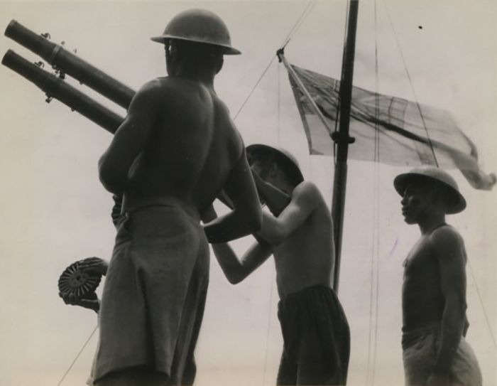
British and African sailors (anti-aircraft gunners of the Kenya Royal Naval Volunteer Reserve) aboard a Royal Navy minesweeper, 1945 (photo: Wikimedia Commons).
Post-WWII Colonialism
Kenya African Union
When World War II reached East Africa in 1940, the Kikuyu Central Association (KCA) was banned, allegedly because it was supporting the fascist Italians; as a result, political activism in Kenya mostly halted. One step in the right direction for native Kenyans was the appointment in 1944 of Eliud Wambu Mathu, a Kenyan teacher, to the Legislative Council of Kenya. Mathu became the first African member of the council.
Mathu then co-founded (with Harry Thuku as its first leader) the Kenya Africa Study Union (KASU) to help co-ordinate and represent African interests in the Council. Two tears later, in 1946, the KASU changed its name to the simpler Kenya African Union (KAU). The KAU was mostly dominated by Kikuyus, but its leadership was multi-tribal.
Unfortunately for the KAU, the organization was split internally into two factions, with one faction being moderate and in favor of negotiating with the Colonial Office for better education and a gradual shift of power to Kenyans, while the other was hardline, demanding radical change, including land reform, representative voting rights, and the abolition of the 'kipande' law, which required blacks to carry an identity document to restrict movement. The moderate members of the KAU favored working with the British, as many had achieved financial gain under the European settler economy.
The internal rift within the KAU led Harry Thuku, one of the moderate leaders, to step down as their leader and in 1947, Jomo Kenyatta, a Kikuyu man educated abroad and recently returned to Kenya, was elected leader of the KAU.
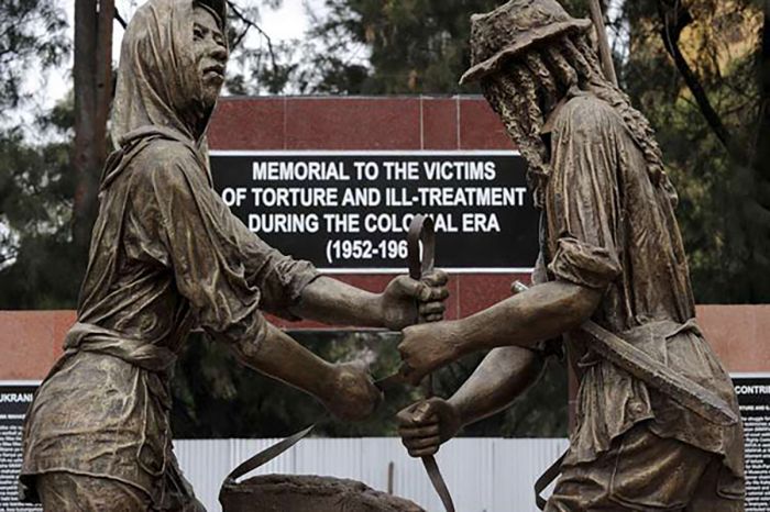
Memorial statue in Nairobi, honoring victims of torture during the later years of Colonialism (photo: Wikimedia Commons).
Jomo Kenyatta
Early Life (1890-1928)
Kamau wa Muigai was born into a Kikuyu family in the village of Nginda, just east of Lake Naivasha near the Aberdare Mountains. His date of birth is unknown, but is estimated to be around 1890, but may have been as late as 1898. His family were subsistence farmers, raising crops, sheep, and goats. His father, who was called Muigai, was sufficiently successful and had several wives, each living in her own hut. After the death of his father, his mother married Muigai's younger brother Ngengi, which was customary in Kikuyu tradition. The young boy then took the name Kamau wa Ngengi ("Kamau, son of Ngengi").
In November 1909, Kamau left his village and enrolled as a student at the Church of Scotland Mission (CSM) at Thogoto on the western outskirts of Nairobi. It was here that Kamau learned to read and write in English. In 1913, Kamau underwent the Kikuyu circumcison ritual, which was disapproved of by the missionaries, but was part of the Kikuyu tradition for boys as they entered adulthood.
In preparation of his coming baptism, he was asked by the missionaries to take a Christian name, and he chose John and Peter, after Jesus' apostles. He was told that he must choose only one name, so he decided upon Johnstone (a combination of John and Peter; the stone being a reference to Peter). In August 1914, he was baptized as Johnstone Kamau.
A reconstruction of a traditional Kikuyu house like the one Jomo Kenyatta would have slept in during his youth in Nginda (photo: Wikimedia Commons).
During World War I, Johnstone's brother Kongo, like many Kikuyu, joined the British Army. Kongo disappeared during the East African conflict and his family never learned of his fate. Johnstone did not join the British Army and instead went to live with an aunt who had married a Maasai chief. The Maasai had refused to fight with the British and so Johnstone avoided any participation in the war. While living with the Maasai, Johnstone adopted their customs, including their attire and took to wearing Maasai jewelry and a beaded belt known as a 'kinyata' in the Kikuyu language. It was during this time that he began calling himself "Kenyatta".
In 1917, Kenyatta moved to Narok and later to Nairobi, working in various forms of employment. In 1919, he met and married Grace Wahu and in 1920, Grace gave birth to a son, Peter Muigai. In April 1922, Kenyatta took a job as a water meter reader, earning a good wage, and was able to afford a house in the upscale Kilmani neighborhood of Nairobi.
In 1926, Kenyatta became secretary for the Kikuyu Central Association (KCA) and he traveled around Kikuyuland and neighboring areas on a motorbike, helping to establish new KCA branches. In May 1928, the KCA launched a Kikuyu-language magazine called Muĩgwithania (which translates as "The Unifier"), which listed Kenyatta as the editor, although it is suspected that his duties were largely to translate English to Kikuyu.
Kenyatta lobbied against many of the policies of Kenya's Colonial Governor Edward Grigg, Governor of Kenya. Grigg was governor from October 1925 to September 1930, during which time he attempted to suppress many of Kenyatta's activities. Photo taken in 1921 (photo: Wikimedia Commons).
Kenyatta Abroad (1929-1946)
In February 1929, the Kikuyu Central Association (KCA) funded expenses for Kenyatta to travel to Britain, where he planned to meet with the Colonial Office to discuss items on the KCA's agenda, including the continued exile of Harry Thuku (he had been sent away in 1922) and the Kikuyu land issues. Kenyatta initially lodged at the West African Students' Union premises in West London. While in London, Kenyatta was introduced to various anti-imperialists, including some in the Communist Party of Great Britain. During the summer of 1929, Kenyatta traveled to Moscow via Berlin, returning to London in October.
After 18 months abroad, Kenyatta was broke and though he feared he may be arrested if he returned to Kenya, he sailed back to Mombasa in September 1930. Upon his return, he was well received by the Kikuyu people.
While Kenyatta was away, the issue of female genital mutilation (FGM) had become a heated topic of debate between missionaries in Kenya and the Kikuyu people, who did not want to be forced to change their traditions. The KCA stepped forward to defend the Kikuyu's right to continue with FGM and Kenyatta, as KCA Secretary, stated that although he was personally opposed to FGM, the Church of Scotland should focus on eradicating the practice using education rather than on pushing for its legal abolition. Neither side was willing to compromise and Kenyatta was later expelled from the church.
A road sign near Kapchorwa, Uganda, advertising a campaign against female genital mutilation, 2004 (photo: Wikimedia Commons).
In May 1931, Kenyatta again sailed for Britain, this time to represent the KCA at a Joint Committee of Parliament to discuss the future of East Africa. Kenyatta would not return to Kenya for 15 years. That summer, Kenyatta attended a school run by the Independent Labour Party and went to Fabian Society gatherings. In November 1931, he met Indian independence leader Mohandas Gandhi while in London. Later in the year, he enrolled in the Woodbrooke Quaker College in Birmingham, earning a certificate in writing.
Late in 1932, Kenyatta met George Padmore (born Malcolm Ivan Meredith Nurse), a leading Pan-Africanist, journalist, and author from Trinidad. Padmore joined the Communist Party USA in 1927 during his college years and was tapped as a rising star in the party. Padmore was working in London for Communist International (Comintern) when he and Kenyatta met and the two began spending time together, with Kenyatta becoming Padmore's protégé. Before year-end, the two men moved to Moscow, where Kenyatta enrolled at the Communist University of the Toilers of the East (also known as Far East University), a revolutionary training school for important Communist political leaders.
Kenyatta returned to London in August 1933 and the British authorities were of course very suspicious of his time spent in the Soviet Union, suspecting that he was now a communist. The British MI5 intelligence service immediately began inspecting Kenyatta's mail.
While in London, Kenyatta continued writing, and between 1933 and 1937, his writings were published in various publications, including The Manchester Guardian, Negro, and Labour Monthly. Kenyatta's views had turned much more radical during his second visit abroad and his published articles called for complete self-rule for Africans in Kenya. Kenyatta's pro-independence ideas would never have been permitted back home in Kenya, but in Britain he could enjoy literary freedom.
Jomo Kenyatta's principal residence while he was in London was at 95 Cambridge Street, where he lived from 1933-37. The building is now an English Heritage Site and marked as such by an official 'Blue Plaque' (photo: Wikimedia Commons).
Following is an extract of one of Kenyatta's pieces published in the November 1933 issue of Labour Monthly:
"With the support of all revolutionary workers and peasants we must redouble our efforts to break the bonds that bind us. We must refuse to give any support to the British imperialists either by paying taxes or obeying any of their slave laws! We can fight in unity with the workers and toilers of the whole world, and for a Free Africa."
In 1935, Kenyatta took a position as a linguistic consultant at the University College London (UCL), where he worked for two years. Later that same year, Kenyatta enrolled in a social anthropology course at the London School of Economics (LSE), taught by renowned anthropologist and author Bronisław Malinowski.
In 1935, Italy invaded Abyssinia (Ethiopia), which led Kenyatta to join the International African Friends of Abyssinia (IAFA), a London-based organization formed to protest against Italian aggression towards Abyssinia. In 1937, the IAFA transformed into the more pan-African-focused International African Service Bureau (IASB), with leadership that included Kenyatta, Cyril Lionel Robert (C.L.R.) James and George Padmore. The IASB's goal was to inform the public about the hardships faced by Africans in the colonies and to seek freedoms and reforms.
While abroad, Kenyatta took a social anthropology course at the London School of Economics, taught by Bronis?aw Malinowski, shown here in 1918 with natives on the Trobriand Islands, Papua New Guinea (photo: Wikimedia Commons).
In his leadership role with the IASB, Kenyatta began giving anti-colonial lectures throughout Britain. In October 1938, Kenyatta addressed the Manchester Fabian Society in which he described British colonial policy as fascism, comparing it to the Nazi treatment of Jews in Germany at that time.
Later that year, Kenyatta published a book called Facing Mount Kenya, which was a collection of the essays he had written on Kikuyu society for his coursework under Malinowski. The book featured an introduction by Malinowski. Kenyatta used the pen-name "Jomo Kenyatta", which was the first time he had used the name Jomo (which in Kikuyu describes the removal of a sword from its scabbard). The book condemned colonialism and the subversion of Kikuyu society.
In September 1939, Kenyatta moved to the small, rural village of Storrington in Sussex, where he rented a small flat, growing vegetables and raising chickens. In August 1940, he took a job working on a local tomato farm, which enabled him to avoid conscription to the military.
On 11 May 1942, Kenyatta married an English woman named Edna Grace Clarke, whose parents had been recently killed in an air raid. The couple had a son, Peter Magana, born in August 1943. It should be noted that Kenyatta was already married in a traditional Kikuyu ceremony to Grace Wahu, who was still living in Kenya. During the years of World War II, Kenyatta was not politically active, but continued to give anti-colonialism lectures to East African soldiers stationed in Britain.
In October 1945, Kenyatta attended the fifth Pan-African Congress held in Manchester, where discussion centered on whether indigenous Africans should continue pursuing a gradual campaign for independence or whether they should seek the military overthrow of the European imperialists. Kenyatta agreed with the possible need for force, but was careful not to make any commitment to violence.
A plaque commemorating the Fifth Pan African Congress/Conference held in Manchester in 1945, which Jomo Kenyatta attended (photo: Wikimedia Commons).
Kenyatta Returns To Kenya (1946-1952)
After the Allied victory in World War II (1945), Kenyatta decided to return home to Kenya, arriving in Mombasa in September 1946. His second wife Edna, who was pregnant with their second child, stayed behind in England, fearing a difficult existence for her and their children in the colony. Kenyatta reconnected with his first wife, Grace Wahu and their children in Gatundu, close to Nairobi, where he farmed the family land.
In 1946, Kenyatta married his third wife, Grace Wanjiku, who was the daughter of Senior Chief Koinange. Kenyattas' new wife's brother Peter Mbiyu Koinange, who was in charge of the Koinange Independent Teachers' College in Githunguri, hired Kenyatta as the school's vice-principal. In 1947, Kenyatta was appointed as principal of the college and helped increase enrollment, while raising funds for the construction of new school buildings.
By August 1944, the Kenya African Union (KAU) had been founded, which at that time, was the only active political organization available for Africans in the colony. In June 1947, James Gichuru, one of KAU's founders and its acting president, stepped down and Kenyatta was elected as his replacement. Kenyatta's public persona grew and he attracted crowds wherever he travelled in Kikuyuland. The Kikuyu press again calling him the "Great Elder" and "Hero of our Race".
Kenyatta designed the flag of the Kenya African Union using the three colors widely used in the Pan-African movement. The KAU flag featured green for the land, black for the skin of the people, and red for the blood of liberty (photo: Wikimedia Commons).
The main problem facing Kenyatta and the KAU was that other tribes, including the Luo and Maasai, which were historically hostile towards the Kikuyu, viewed the KAU as being solely working for the Kikuyu.
Kenyatta worked to counter tribalism within the KAU by adding representatives from multiple tribes to KAU's leadership and changing the standard language of the organization from Kikuyu to Swahili. Kenyatta also attracted support from Kenya's Indian community, but relations with white Kenyans remained strained, with most whites viewing him as an agitator and a threat to their continued white-minority rule.
By 1952, Kenyatta was viewed as a national leader in the Kenya colony, but many Africans in Kenya viewed him as too moderate and conciliatory towards the British authorities. The failure of Kenyatta and the KAU to win any significant reforms from the British was tilting the political initiative to younger, more radically minded militants in the party and Kenyatta was at a loss to stem the shift amongst its members.
Jomo Kenyatta (left), Appasaheb 'Apa' Pant (Indian Commissioner for East Africa, center), and Achieng Oneko (a KAU member), circa 1950 (photo: Wikimedia Commons).
Mau Mau Uprising (1952-1956)
Many in the KAU wanted to take a more radical approach to seeking change, but with Kenyatta in charge of the party, those in favor of a militant approach towards attaining reforms decided to split from the KAU and form a separate group, which they called the Kenya Land and Freedom Army (KLFA). The KLFA's membership grew quickly and although it was dominated by Kikuyus, there was also representation from other tribes, including Meru, Kamba, Maasai, and Embu.
Many within the growing ranks in the KLFA had been reduced to squatters on what was previously their own land, but in order to continue living there, they were now forced into compulsory labor for the European settlers that had claimed the land. Most of the Kikuyu squatters had been forced into poverty.
The KLFA used a radicalized ritual version of the traditional Kikuyu practice of 'oathing', whereby one would swear allegiance to the unity of the Kikuyu. In this case, new members of the KLFA were required to swear their allegiance to the resistance and promise to fight for the cause.
The video below (duration: 63 minutes) presents a good summary of Kenya's history from 1940-1952.
The origin of the term "Mau Mau", which is what the British called the KLFA (and sometimes also the Kikuyu community at large) is not clear and various theories exist. One is that it was an anagram of "Uma Uma", which means "get out, get out". Another possibility is that it derived from "Ma Umau", which means "Our Grandfathers" and refers to the Kikuyu desire to live freely as their ancestors had.
As the KLFA ranks grew, a Swahili backronym emerged: "Mzungu Aende Ulaya, Mwafrika Apate Uhuru", which translates as "Let the foreigner go back abroad, let the African regain independence". According the members of the KLFA, they never referred to themselves as Mau Mau and it is suspected that the British propagated the name in an effort to deny the KLFA any international legitimacy.
For a majority of the young Mau Mau militants, Jomo Kenyatta was regarded as a hero and his name was even included in the oaths they gave to the group. In spite of this, Kenyatta was publicly critical of the Mau Mau and he denounced them in speeches he gave across the country, stating that independence must be achieved through a peaceful process.
Initially, the Mau Mau carried out only small-scale attacks on European settler property, but this would soon shift to more direct violence against both the European community and the local Kenya Regiment (local auxiliary militia and pro-British Kikuyu people). In August 1952, the Mau Mau set fire to the houses of some local Kikuyus that had refused to take the oath and in response, the Colony Governor imposed a curfew in Nairobi.
A British 3-inch mortar team in action during operations against the Mau Mau rebels (photo: Wikimedia Commons).
On 03 October 1952, the Mau Mau uprising claimed the first European victim, when a woman was stabbed to death at her home in Thika. Six days later, on 09 October 1952, Chief Waruhiu wa Kung’u, a senior chief of the Kikuyu tribe, was ambushed and shot to death in broad daylight in his car by three gunmen at Gachie, just outside Nairobi. Chief Waruhiu was a strong and vocal supporter of the British in Kenya, the most senior African official in the colonial government, and had been awarded the MBE (Most Excellent Order of the British Empire), an honor given for contributions to the Empire.
In response to the assassination of Chief Waruhiu, Evelyn Baring, the newly appointed (on 30 September 1952) Governor of Kenya, declared a State of Emergency on 20 October 1952 and also implemented 'Operation Jock Scott' (note that a Jock Scott is a salmon fishing fly created in 1850 that is often used as a metaphor for fly fishing in general). It was hoped that Jock Scott would quickly defeat the Mau Mau, but word of the operation's planned mass arrests leaked out and most of the true militant leaders of the Mau Mau went into hiding in the forests and avoided capture.
On the night of 20/21 October 1952, the British authorities conducted a mass arrest of 186 KAU leaders, including its party chairman, Jomo Kenyatta. The arrested included six senior KAU leaders and alleged Mau Mau supporters (Jomo Kenyatta, Bildad Kaggia, Kung'u Karumba, Fred Kubai, Paul Ngei, and Achieng Oneko) who together were collectively referred to as the "Kapenguria Six".
Bildad Kagia, a Mau Mau Central Committee member and one of the "Kapenguria Six". Photo by Swaran Singh, Nairobi, 1964 (photo: Wikimedia Commons).
By arresting the KAU leaders, and most importantly Kenyatta, the British authorities hoped to quell the Mau Mau and the civil unrest. Many in the white settler community wanted Kenyatta exiled, but the authorities feared this would make him martyr for the anti-colonial cause, thinking it better to imprison him (although they had nothing official with which to charge him).
Kenyatta and the other five leaders were flown to Lokitaung in remote northwest Kenya while the authorities decided what to do. Eventually, Kenyatta and the other five leaders were charged with masterminding the Mau Mau, which was a proscribed organization, and they remained in detention awaiting a trial.
It is widely accepted by most historians today that the British were well aware that Kenyatta was not involved with the Mau Mau, but were determined to silence his calls for an independent Kenya.
On 22 October 1952, the day after the arrests of Kenyatta and the other KAU leaders, Chief Nderi Wango’mbe, another loyal senior African leader that supported the British, was hacked to death at his homestead by members of the Mau Mau. In the months that followed, a series of horrific murders were committed by the Mau Mau against white settlers.
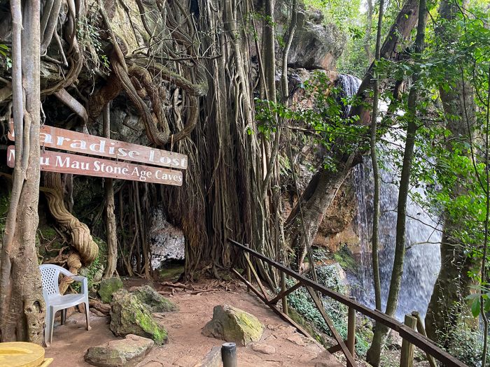
The so-called Mau Mau Cave, located near Nanyuki and west of Mount Kenya. The cave was discovered in 1953 by Mau Mau freedom fighters and used thereafter as one of their hideouts. The British bombed the cave and surrounding area in 1959 after being informed of its location. An estimated 200 Mau Mau lost their lives in the bombardment. The cave was declared a national monument in 2003 and is part of the Museums of Kenya (photo: Wikimedia Commons).
Kenyatta on Trial (1952-53)
The trial against Jomo Kenyatta and the other five KAU leaders was held in Kapenguria, a remote town in midwest Uganda near the Ugandan border. The "Kapenguria Six" were accused of jointly managing a proscribed organization (the Mau Mau) and conspiring to murder all white residents of Kenya. The defendants were defended by a team of international defense lawyers, the most notable of whom was Denis Nowell Pritt, a left-wing Labour Party member of the British Parliament. Opening proceedings began on 03 December 1952.
The judge assigned to the trial was Ransley Samuel Thacker, who was called out of retirement to preside over the trial by Kenya's governor, Evelyn Baring. Thacker was paid £20,000 to oversee the proceedings and was reportedly in secret communication with Baring throughout the trial. The trial went on for five months.
The key prosecution witness was Rawson Mbugua Macharia, who testified that in March 1950, he had taken the Mau Mau oath at the hands of Kenyatta. He also stated that the oath involved stripping naked before drinking human blood. Macharia's testimony was the only direct evidence presented that linked Kenyatta with the Mau Mau.
British barrister and Member of Parliament Denis Nowell Pritt led the defense team for Jomo Kenyatta and the Kapenguria Six (photo: Wikimedia Commons).
In April 1953, Judge Thacker ruled that all six defendants were guilty and sentenced each to seven years of hard labor, followed by a permanent restriction preventing each from leaving a given area without permission.
After sentencing, Kenyatta addressed the court, stating that he and the other defendants did not recognize the court's findings and claimed that they had been used as scapegoats as grounds on which to ban the KAU.
Immediately following the trial, in June 1953, the colonial authorities implemented wider crackdowns and banned the KAU. The government closed most independent schools for black Kenyans, appropriated Kenyatta's family land in Gatundu, and demolished his house.
The Kenya African Union Office in Muranga (north of Nairobi), circa 1952 (photo: Wikimedia Commons).
Note: years after the trial, in 1958, Rawson Mbugua Macharia (the key prosecution witness) swore an affidavit that he and six other witnesses for the prosecution had been coached by the prosecution lawyers and perjured themselves in exchange for plots of land or other payment. Macharia reported that he had been offered a public administration course at Exeter University, protection for his family, and a guaranteed government job on his return from the UK. His affidavit was backed by a letter from the acting attorney-general of Kenya at the time.
Kenyatta and the others appealed the court ruling at the Supreme Court and were freed on technicality in July 1953, only to be immediately re-arrested. In August 1953, the colonial government then took the overturned verdict to the East African Court of Appeal, which reversed the Supreme Court's decision to free the men. The appeals process continued and in January 1954, the Supreme Court upheld the convictions on all but Achieng Oneko. A final appeal by the defendants' lawyers was made to the Privy Council in London, but the petition was refused without explanation.
Troops of the King's African Rifles (KAR) carry supplies on horseback. They are escorted by armed soldiers on watch for Mau Mau fighters, circa 1953 (photo: Wikimedia Commons).
Kenyatta Imprisonment (1954-61)
In January 1954, Jomo Kenyatta and the other four men were imprisoned together in a new specially constructed detention camp in Lokitaung (in remote northern Kenya, just west of Lake Turkana). The younger four men were made to break rocks, but due to his age, Kenyatta was excluded from hard labor and appointed as cook for the other men, preparing their daily meals.
In April 1954, the prisoners were joined by Waruhiu Itote (nom de guerre 'General China'), the first captured senior leader of the Mau Mau rebellion. Itote and his followers had been operating out of the forests around Mount Kenya, where he was in charge of oathing and carrying out attacks on white-owned farms and loyalists to the British living in nearby villages. Itote was shot in the neck and captured during a failed raid against a police post in Mathira (close to Nyeri town). After his capture, Itote was sentenced to hang, but agreed to cooperate with the British to save his life. He was viewed as a turn-coat by his compatriots for his betrayal of the Mau Mau.
Kenyatta befriended Itote in the prison and taught him English. By 1957, the inmates at Lokitaung had formed into two opposing factions, with Itote and Kenyatta on the one side and the other four, who called themselves the "National Democratic Party", on the other. Over the years of his imprisonment, Kenyatta became a symbol of African nationalism throughout the continent and a political martyr for many Kenyans.
Children in Tanganyika (present-day Tanzania) with signs demanding the release of Jomo Kenyatta, March 1961 (photo: Wikimedia Commons).
Operation Anvil (1953-54)
Following the declaration of a State of Emergency and the arrest of Kenyatta in October 1952, hundreds of Mau Mau members and supporters fled to the forests of Mount Kenya and the Aberdares, where a decentralized leadership structure was already in place.
In May 1953, the British sent General George Erskine, a veteran commander of World War II, to Kenya to oversee military operations against the Mau Mau. Under Erskine's leadership, the British created mobile units that delivered "special treatments" to areas where Mau Mau gangs operated, rooting them out and eliminating them. However, the bulk of the Mau Mau insurgents remained active, hiding in the forests and receiving assistance from Kikuyu residents in and around the region, as well as in Nairobi.
On 15 January 1954, one of Erskine's units captured Waruhiu Itote, a senior Mau Mau commander. Itote was interrogated and quickly cooperated with his captors, disclosing valuable information on Mau Mau strategies and deployments.
A British Army patrol crossing a stream during a search for Mau Mau rebels in a forested region of central Kenya (photo: Wikimedia Commons).
On 24 April 1954, General Erskine initiated Operation Anvil, utilizing 25 000 British security forces to close off every road and access point leading into and out of Nairobi. The troops then surrounded areas in the city which were home to substantial Kikuyu populations, in hopes of preventing any Mau Mau or other Kikuyu there from escaping. The troops then conducted a systematic, sector-by-sector purge of the city, using local African informers, whose identities were concealed using hoods, to point out suspected insurgents.
Within two days, the British had captured over 200 known Mau Mau in Nairobi. Over the following weeks, Erskine's troops detained some 50 000 Africans, mostly Kikuyu, but also Embu and Meru people, who were taken to temporary barbed-wire enclosures to await questioning. In spite of the determined efforts by the British, many Mau Mau managed to escape the city and flee back to the forests. Most of the detainees were taken to the Langata Screening Camp west of the city, where they were classified in terms of their potential threat and then deported to ethnic reserves or sent to work camps for "re-education" (read more below).
Operation Anvil concluded on 26 May 1954. The result of the British action was detrimental to the Mau Mau, who were now mostly cut off from supplies and assistance in Nairobi and isolated in the forests. The British continued to maintain a large security force in Nairobi and conducted regular searches of houses in Kikuyu districts in the city. Traffic in and out of Nairobi was monitored at check points through October 1954.
Members of the Kikuyu Home Guard working with the British to track down Mau Mau insurgents. The work of local Kikuyus was paramount in the fight against the rebels (photo: Wikimedia Commons).
Detention and Rehabilitation Camps (1953-56)
In 1953, the British deported almost all Kikuyu, Embu, and Meru people from cities and towns in central Kenya and moved them into large detention camps. By order from Governor Baring and General George Erskine, all detainees were initially screened and classified based on their threat level in terms of the likelihood that they were themselves Mau Mau or were working to help the Mau Mau.
Thomas Askwith, a British Olympic rower (in the 1932 and 1936 Summer Olympics), was posted to Kenya in 1936 as a district commissioner and later, in 1945, became Municipal African Affairs Officer in Nairobi. Askwith was tasked with designing and organizing the British 'detention and rehabilitation' of suspected Mau Mau members and collaborators using a system he called the 'Pipeline'. The system was designed to use socioeconomic and civic reform to stop all support for the uprising.
Askwith's Pipeline used a color code system whereby a screened individual was classified as white, grey, or black. People classified as 'white' were cooperative detainees and were released to live in one of the ethnic reserves. 'Greys' were detainees that had been oathed but were reasonably compliant and entered the Pipeline to work in a series of progressively more lenient camps before being released to a reserve.
The BBC video below (duration 4 minutes) presents a brief look at the Mau Mau Uprising.
Those classified as 'Blacks' were deemed hard-core Mau Mau and these people were moved to the most severe camps in the Pipeline, something akin to a 'Gulag'. These were special detention camps at the 'top' of the Pipeline where prisoners were forced to perform hard labor and were interrogated until they renounced their oaths. 'Black' level detainees were often only able to save their own lives if they became informants for the British. Cooperation was based on a detainee's readiness to confess and renounce their Mau Mau oath. Many detainees were screened and re-screened for intelligence and re-classified accordingly.
The Pipeline itself consisted of a network of concentration camps across the Kenyan countryside, many in the highlands alongside the ethnic reserves. In addition to its plan to rehabilitate Mau Mau members and supporters, the British used the camps as a source of free labor on various colonial infrastructure projects, including crop cultivation on British-owned farms.
One of the most severe work camps, reserved for Kikuyus classified as 'black', was the Embakasi Camp, located on the eastern side of Nairobi. Detainees at the punitive Embakasi Camp were forced to build an airport, which the British wanted completed in short order so that British aircraft could launch air attacks into the forests around Mount Kenya and the Aberdares, where most of the Mau Mau military was based. The Embakasi Airport was a massive effort with a seemingly unending need for labor. Today, that airport is Kenya's most important airport, Jomo Kenyatta International Airport.
Embakasi Airport (now Jomo Kenyatta International Airport-JKIA), started out as Embakasi Detention Camp, one of the harshest work camps where hard-core Mau Mau insurgents were detained and forced into hard labor. The airport was built under grueling conditions by prisoners at the camp. The image shows the airport in 1958 (photo: Wikimedia Commons).
Between June 1953 and October 1955, the Royal Air Force (RAF) provided considerable support to the military efforts against Mau Mau by running bombing missions into the forests where most of the Mau Mau were based. Between November 1953 and July 1955, Avro Lincoln aircraft dropped almost six million bombs on the Mau Mau. The British also used blimps for reconnaissance and to drop leaflets containing anti-Mau Mau propaganda.
The British operated around 100 detention and work camps spread out in central Kenya. Most of the camps were overcrowded and had very poor sanitation, which led to disease outbreaks, including typhoid, which killed many prisoners. Most prisoners in the camps also suffered from malnutrition. The majority of the camps were reserved for men only, but a few thousand women and children, many of them unaccompanied, were housed in the camp at Kamiti. Wamumu Camp was built specifically to house all the unaccompanied boys in the Pipeline, though many boys moved around the camps as adults in the Pipeline.
Signs posted above the entryways of some of the camps had messages that were eerily reminiscent of those seen above Nazi concentration camps during World War II, which the British had itself fought against only a decade earlier. The sign above the camp at Fort Hall read "Abandon hope all ye who enter here" and the sign above the camp at Ngenya read "Labour and Freedom". Compare these slogans with the slogan at the entrance to the infamous Nazi concentration camp at Auschwits, which read "Arbeit Macht Frei", meaning "Work sets you free".
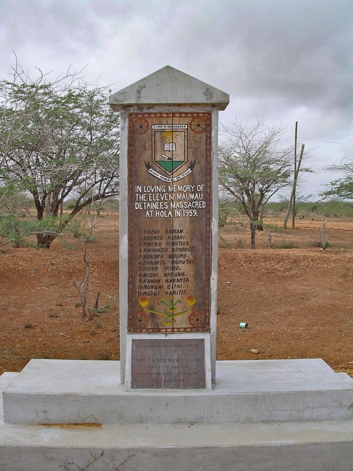
In 1959, eleven Mau Mau prisoners were clubbed to death by guards at the Hola Detention Camp. The incident became known as the 'Hola Massacre'. This monument, unveiled in 1998, honors the detainees who died there that day (photo: Wikimedia Commons).
During the first year of the Pipeline system, the British saw only limited success in getting detainees to cooperate, but by late 1955, the Pipeline had become well organized and fully operational. Guards were moved around between camps to minimize bribery, undercut black markets, and reduce fraternization with the prisoners. Continued pressure via hard labor and interrogation began producing results, with many detainees confessing and large numbers becoming spies and informers for the British.
Some detainees openly switched sides and joined the 'Home Guard', which was the collective term used by the British for native Kenyans that had joined the British side against the Mau Mau. The security forces of the Home Guard eventually numbered around 25 000 men. Many of the interrogators in the camps were comprised of members of the Home Guard. One such Mau Mau member that openly switched sides was Peter Muigai Kenyatta, Jomo Kenyatta's first son (born 1922), who confessed his oath-taking, was made a screener at the Athi River Camp, and later travelled between the camps, assisting with interrogations. It is widely known that torture was an interrogation technique routinely used by the British and even by the recruited Kenyan interrogators.
The Mau Mau continued to operate in secret within the camps and rooted out suspected spies amongst the detainees. Informers that were discovered were dealt with brutally by the Mau Mau, who usually strangled and the mutilated suspected turncoats as a warning to others. Oathing of new initiates was even carried out within the camps, and refusal to join and take the oath often meant facing the same fate as they would have outside the camp: they were killed. Anyone suspected by the British as administering oaths or recruiting for the Mau Mau within a camp was publicly hanged.
Statue of Mau Mau freedom fighter Dedan Kimathi in Nairobi (photo: Wikimedia Commons).
Villagization Program (1954-1956)
The final phase of General Erskine's plan to defeat the Mau Mau was to cut off all supply lines to the insurgents by means of a forced resettlement of the populace that was providing support (food, water, supplies, information) to the uprising.
The resettlement program began in June 1954 and by the end of 1955, over one million Kikuyus living in the reserves had been forced to move into one of over 800 "protected villages" that included over 200 000 huts. The protected villages were surrounded by barbed wire and included watch towers to prevent anyone from leaving. While some of the villages were set up to protect Kikuyus that were loyal to the British, the term 'protected village' was a euphemism for detention camp.
As in the work camps of the Pipeline, malnutrition, starvation, and disease in the protected villages, particularly amongst young children and the elderly, became rampant by early 1955. The Red Cross helped by bringing in food, but were told to prioritize loyalist villages. Over the course of some 18 months, the removal of the Mau Mau's passive wing living outside the forests, broke the Mau Mau.
Lieutenant General Sir George Erskine, Commander-in-Chief, East Africa (center), observing operations against the Mau Mau. In May 1953, the British assigned General Erskine control over all military units, as well as police and auxiliary troops (photo: Wikimedia Commons).
On 21 October 1956, after weeks of planning, the Home Guard were finally able to capture Dedan Kimathi, the senior military officer and spiritual leader of the Mau Mau. Kimathi, who had a 500-British-pound bounty on his head, was found in his hideout in the forests near Nyeri. He was wearing a leopard skin jacket and headdress and was shot in his leg by a member of the Tribal Police during the assault.
Photos of Kimathu being carried on a stretcher by his captors were printed on 120 000 leaflets and distributed to demoralize the Mau Mau. Kimathi's capture was the unofficial end of the uprising and by the end of 1956, the Mau Mau resistance was effectively crushed.
Mau Mau commander Dedan Kimathi (right) with unidentified comrades. Photo by Gopal Singh, Nairobi, 1952 (photo: Wikimedia Commons).
Mau Mau Uprising - Aftermath & Legacy
Over the course of the Mau Mau uprising, the official number of Kenyans interned by the British in the Pipeline work camps was 80 000, but unofficial estimates by historians places that number between 160 000 and 400 000. More than one million Kenyans were also held in the 'protected villages' between 1954 and early 1956. Wangari Maathai, a Kikuyu that lived as a teen during the uprising and was the first African woman to win the Nobel Peace Prize (in 2004), estimates that in 1954, 75 percent of Kikuyu men in Kenya were in detention and their land was taken and given to collaborating Kikuyus.
The British officially executed (mainly by hanging) 1 090 rebels and claimed to have killed 11 000 Mau Mau guerrilla fighters, but most of the documentation about the detention camps was destroyed by the British before the end of their colonial regime.
The number of deaths attributable to the Mau Mau uprising is not known with certainty and there is disparity in the estimates. The lowest estimate of Kikuyu deaths is 25 000, but some historians put the number over 100 000. Many of the native Kenyans that died during the uprising were children and elderly, who perished from disease or starvation in the camps or protected villages. The official number of native Kenyans killed by the Mau Mau is 1 819, but historians place the number around 5 000.
The Mau Mau Memorial Girls Secondary School in Hola (Galole), Kenya. The school was built on the site of the Hola Detention Camp, built by the British during the Mau Mau Uprising (photo: Wikimedia Commons).
A total of 32 Europeans and 26 Asians were officially murdered by the Mau Mau and a similar number wounded. One widely publicized murder of white settlers by the Mau Mau was the Ruck family. On 24 January 1953, Roger and Esme Ruck, as well as their six-year-old child Michael and one of their African servants, were hacked to death in their home by Mau Mau militants. The murders were widely reported in the British press, including graphic photos of the dead child. The incident led to an immediate radicalization of the white settler community in Kenya and helped the British effort to portray the Mau Mau as savage terrorists.
Today, the Mau Mau are recognized by the Kenyan government as heroes and freedom fighters, many of whom sacrificed their lives for independence from colonial rule. Mashujaa Day (which replaced Kenyatta Day), also known as Heroes' Day ("mashujaa" is the Swahili word for "heroes"), is a national holiday in Kenya observed on 20 October (the date in 1952 that the British declared a State of Emergency and began its war against the Mau Mau).
Dedan Kimathi, the top military commander of the Mau Mau guerrillas, whose capture in October 1956 marked the unofficial end of the Mau Mau resistance, was sentenced to death while he lay in a hospital bed recovering from a wound he received during his apprehension. His appeal was summarily dismissed and on 18 February 1957, he was executed by hanging at the Kamiti Maximum Security Prison in Nairobi. A commemorative statue of "Freedom Fighter Dedan Kimathi" was erected in central Nairobi on 11 December 2006.
Statues of Dedan Kimathi and Nelson Mandela at Dedan Kimathi University of Technology in Nyeri, Kenya. The statues were unveiled on 16 January 2019 (photo: Wikimedia Commons).
Tom Mboya
Tom Mboya was an emerging politcal leader and prominent trade unionist, who was born in 1930 to a mixed ethnicity family (his mother was Luo and his father a Suba). His parents worked as sisal cutters on the colonial farm of of Sir William Northrup McMillan. He attended Catholic mission schools as a boy and starting in 1950, he worked as a sanitary inspector employed at the Nairobi City Council. During this time, Mboya was elected as President of the African Staff Association, which he began transforming into a trade union, which was called the Kenya Local Government Workers' Union.
After the arrest of Jomo Kenyatta and other Kenya African Union (KAU) leaders in October 1952, Mboya was asked to take over the party, but the British government soon banned all political African organizations, including the KAU. Mboya then turned to trade unions as a platform to continue the fight for Kenya's independence, becoming Secretary General of the Kenya Federation of Labour (KFL), the umbrella group for all trade unions in Kenya in 1953 (a post he maintained until 1963). In his role for the KFL, Mboya gave anti-colonial speeches in Washington DC and London.
In 1956, Mboya traveled to England to attend Ruskin College in Oxford, England on a scholarship from Britain's Trades Union Congress. After his return to Kenya in late 1956, Mboya won one of the few African seats on the Legislative Council, representing Nairobi. After joining the government, Mboya was elected as secretary of the African Elected Members Organization (AEMO), which was the African Caucus. He continued to give speeches and call for freedom for Jomo Kenyatta and other political prisoners.
Secretary General of the Kenya Federation of Labor, Tom Mboya and his wife Pamela, during their honeymoon in Israel, January 1962 (photo: Wikimedia Commons).
In 1957, Mboya formed a new politcal party called the Nairobi People's Convention Party (NPCP), which later merged into the Kenya Independence Movement (KIM), which was also led by Mboya.
In 1959, at the age of 28 years, Mboya embarked on a speaking tour of the USA seeking scholarships for African students in Kenya. Mboya knew that an independent Kenya would be lacking in educated leaders and this would lead to the failure of any future majority-rule government. Mboya soon obtained funding from numerous educational institutions, foundations, and individuals. Some of the financial supporters included Sidney Poitier, Martin Luther King Jr, Jackie Robinson, and Harry Belafonte.
Mboya's scholarship project gained the attention of Senator John F. Kennedy in September 1960 (during his presidential campaign), who arranged a $100,000 donation from the Joseph P. Kennedy Jr Foundation to cover airfare for the autumn 1960 group of African students, just as the program was running out of funds. The project was henceforth called the Kennedy Airlift.
Over 800 African students, mainly from Kenya, benefitted from the project, which lasted until 1963. Many of the graduates that received scholarships to attend American and Canadian colleges and universities retuned to Kenya help govern Kenya during and after its push to independence.
Tom Mboya lecturing at the Afro-Asian Institute in Tel Aviv, Israel in 1962 (photo: Wikimedia Commons).
Nearing Independence
After serving his full prison sentence, Jomo Kenyatta was released from Lokitaung Prison in April 1959. After his release, the colonial authorities issued a restricting order on Kenyatta, forcing him to reside in the remote town of Lodwar on the Turkwel River near Lake Turkana, where he was required to report to the district commissioner twice per day. Kenyatta was joined in Lodwar by his wife Ngina and they spent two years in the remote village. Calls for Kenyatta's release from indefinite detention came from numerous world governments, as well as from political activists within Kenya.
In 1959, Patrick Muir Renison became the new Governor of Kenya and by this time, it was widely accepted that an independent Kenya was inevitable. By early 1960, it was becoming clear that Britain wanted to divest itself of its remaining colonial holdings and grant independence to those countries across Asia and Africa, including Kenya.
On 12 January 1960, the State of Emergency in Kenya, which had been in place since 20 October 1952, was lifted and Britain invited African and European delegates from Kenya to a conference at Lancaster House in London to discuss the future of the colony. The result of the conference was an agreement to create a 65-seat Legislative Council, with 33 seats reserved for black Africans, 20 for other ethnic groups, and 12 as 'national members' that would be elected from any ethnic group.

Governor of British Guiana, Sir Patrick Muir Renison (walking on left in white) and and J.A. ('Sonny') Rodway, circa 1956. Renison became Governor of the Kenya Colony in 1959 and served there until 1962 (photo: Wikimedia Commons).
On 03 February 1960, British Prime Minister Harold Macmillan gave his famous "Wind of Change" speech to the Parliament of South Africa in Cape Town. Macmillan had spent the prior month visiting the British colonies in Africa and his speech was a clear signal that the British government did not intend to block independence for its colonies. The speech was named from a quote made during Macmillan's address: "The wind of change is blowing through this continent. Whether we like it or not, this growth of national consciousness is a political fact."
After the Lancaster House agreement in 1960, two political parties emerged: the Kenya African National Union (KANU), which was dominated by Luo and Kikuyu people, and the more moderate Kenya African Democratic Union (KADU), which was comprised of members of smaller ethnic groups like the Maasai and Kalenjin. KANU was essentially a merger of the Kenya African Union (KAU), which had been banned since 1952, and the Kenya Independence Movement (KIM), which was established in 1959 by prominent independence activists, including Tom Mboya and Jaramogi Oginga Odinga.
In May 1960, KANU nominated Jomo Kenyatta as its president, but the government vetoed it, as Kenyatta was still under a restricting order. KANU declared that it would not take part in any new government unless Kenyatta was freed from his restricting order. Kenyatta meanwhile, was neutral as to KANU and KADU, insisting that there should be unity between the two parties.
British Prime Minister Harold Macmillan and USA President John F. Kennedy on the South Lawn of the White House. Shown are (left to right), Macmillan, JFK, British Ambassador to the US Sir David Ormsby-Gore, First Lady Jacqueline Kennedy, the Ambassador’s wife, Sylvia Thomas Ormsby-Gore; 29 April 1962 (photo: Wikimedia Commons).
In April 1961, Governor Renison decided to free Kenyatta and he was flown to the small town of Maralal in Samburuland. Kenyatta maintained his innocence of the charges against him and reiterated that he had never supported the Mau Mau Uprising or oathing system. In August 1961, Kenyatta was moved to the town of Gatundu, just north of Nairobi, where he was greeted by a crowd of 10 000. The colonial government had built him a new house to replace the one they had destroyed. Kenyatta was now free to travel around as he pleased, and he gave public speeches to crowds in Mombasa and Nairobi.
In October 1961, Kenyatta officially joined KANU and accepted the position as its president and in January 1962, he was elected unopposed to the legislative council, representing the Fort Hall constituency. In October 1961, Kenyatta travelled to Tanganyika (present-day Tanzania) and Somalia at the invitation of their governments.
Between 1960 and 1962, the white settler community was emigrating from Kenya at a rate of 700 per year, in anticipation of what many saw as radical changes coming to a soon-to-be independent country. Kenyatta sought to reassure Europeans living in Kenya, worrying that the brain drain and resultant skills shortage would hamper future foreign investment.
Tanganyika, Kenya's neighbor to the south, was granted independence in December 1961. The image shows Julius Nyerere, the Republic of Tanzania'a new prime minister, and a jubilant crowd celebrating independence (photo: Wikimedia Commons).
Second Lancaster House Conference (1962)
In 1962, a second conference was held at Lancaster House in London, to negotiate a framework for Kenya's self-governance and a new constitution. Kenya's opposing political parties, the Kenya African National Union (KANU) and the Kenya African Democratic Union (KADU), each sent delegations to the conference.
KADU's delegation, led by led by Ronald Ngala and Masinde Muliro, pushed for a federalist system based on autonomous, ethnically-based regional governance. The system proposed by KADU was given the name "Majimbo" (the Swahili term for "regions"). Governor Renison and most of the white settler community favored the Majimbo system, as it would prevent a strong centralized government from implementing radical changes.
KANU's delegation, which was headed by its president, Jomo Kenyatta, and its secretary, Tom Mboya, opposed Majimbo, believing that it denied equal opportunities throughout the country in favor of entrenched interests. To avoid a prolonged stalemate, Kenyatta urged KANU's members to concede to some of KADU's demands, knowing that he could amend the constitution once in office.
The agreed upon constitution divided Kenya into seven semi-autonomous regions, each with its own assembly, but also called for a strong central government with a bicameral legislature consisting of a 117-member House of Representatives and a 41-member Senate. A temporary coalition government was to be established until independence, with members from both political parties, as well as Asian and European members. Kenyatta took a minor position, the Minister of State for Constitutional Affairs and Economic Planning.
Map of British decolonization in Africa. The light yellow areas came under British military administration after World War II. The different shades of pink refer to the stages of decolonization according to decades (photo: Wikimedia Commons).
Independence (1963)
In January 1963, the British removed Patrick Renison as governor of Kenya, replacing him with Malcolm MacDonald, who was a former Secretary of State for the Colonies (1938-40). It was felt that a new face should help oversee the country towards independence. MacDonald and Jomo Kenyatta quickly formed a friendship and the two worked together to move the country quickly towards independence.
The country's first open elections were held between 18 and 26 May 1963 in anticipation of Kenya's independence later in the year. KANU, headed by Jomo Kenyatta, won 83 of 124 seats in the House of Representatives and 18 of the 38 seats in the Senate. KADU, headed by Ronald Ngala, won 33 of 124 seats in the House of Representatives and 16 of the 38 seats in the Senate. A third party, the African People's Party (APP) was created by Paul Ngei after he left KANU following a disagreement with Kenyatta and Mboya. The APP won 20 seats in the House and 2 seats in the Senate.
Photo of a young Malcom Macdonald in 1931. Macdonald took over as Governor of Kenya in January 1963, tasked with seeing the country through the last phases of independence (photo: Wikimedia Commons).
On 01 June 1963, Jomo Kenyatta was sworn in as prime minister of the new autonomous government of Kenya. Kenya was still a monarchy at this time, with Queen Elizabeth as its head of state. Kenyatta's first cabinet included members from various tribes, including Kikuyu, Luo, Kisii, Kamba, and Maragoli.
Later that same month, Kenyatta met with Ugandan President Milton Obote and Tanzania'a Julius Nyerere to discuss the possibility of merging the three nations into a single East African Federation, but Kenyatta was unconvinced of its merits and the proposal never came to fruition.
In August 1963, Kenyatta met with a large group of white farmers in Nakuru to appease and reassure the white community that they would be safe and welcome in an independent Kenya. By 1962, the white minority was producing 80% of Kenya's exports and Kenyatta knew that this foreign capital could not afford to be lost. Unlike the white community, the minority Indian community did not receive much support from Kenyatta.
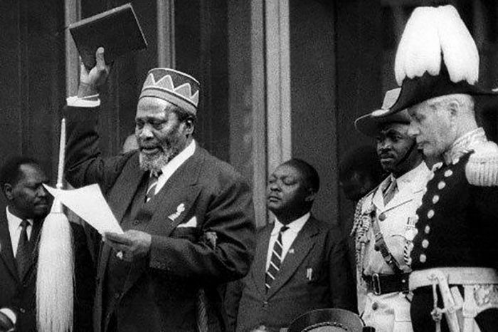
Jomo Kenyatta taking the oath of office on 01 June 1963 (photo: Wikimedia Commons).
On 12 December 1963, a ceremony was held at Uhuru Stadium in Nairobi and Prince Philip, Duke of Edinburgh and husband of Britain's monarch Queen Elizabeth II, officially handed over control of the country to Prime Minister Kenyatta, who described the event as the "greatest day in Kenya's history and the happiest day in my life". Although now an independent country, the Republic of Kenya remained within the Commonwealth.
At the time of independence, there were around 60 000 white people living in Kenya and the British government provided Kenya with 27 million British pounds with which to buy out white farmers in the Rift Valley, so the land could be redistributed amongst the indigenous (mainly Kikuyu) population.
Many of Kenya's white farmers accepted the government's offer, sold their land, and returned to England, but some decided to stay and the descendants of these wealthy land-owning families still live in Kenya's Rift Valley today, including descendants of the somewhat notorious Baron Delamere. Large numbers of Indians, who numbered around 175 000, also left Kenya; many of them emigrating to Britain.
A 1963 postage stamp of newly independent Kenya depicting Jomo Kenyatta, Mount Kenya, and the title of his 1938 book, Facing Mount Kenya (photo: Wikimedia Commons).
Jomo Kenyatta Presidency (1963-1978)
Upon assuming the role of President, the immediate issues that Kenyatta needed to tend to included land reform and the reintegration of the Mau Mau freedom fighters that were either still hiding out in the forests or in detention. Large areas of land that had been in the hands of white owners was purchased and divided up into small plots for landless locals, mostly Kikuyu, Embu, and Meru people.
British military troops remained in Kenya and assisted Kenyan soldiers in the ongoing dispute with ethnic Somali guerillas who lived in northeast Kenya's Northern Frontier District (NFD) along the Somali border. Most of the region had long been occupied by Somalis and the conflict had essentially been created by Britain when it granted independence to the British Somaliland Protectorate in 1960, but carved out the southeast land to become part of Kenya.
Kenyatta sent soldiers to the region in December 1963 and gave them broad powers to seize and arrest Somalis. The so-called "Shifta War" (or "gaf Daba") lasted until 1967, when an official ceasefire was signed, but disorganized banditry continued and the region is still not entirely stable even today.
Kenyan freedom fighters (left to right): Achieng Oneko, Jomo Kenyatta, Makhan Singh, Oginga Odinga; 1961 (photo: Wikimedia Commons).
In January 1964, soldiers in the Kenyan army barracks in Nairobi and Nakuru revolted in mutiny over dissatisfaction with the amount of their wages and in protest that British officers were still in command of their units. More than 2 000 British troops quickly quelled the revolt and restored order. After the insurrection was put down, Kenyatta announced that the Kenyan army would be increased by 1 000 men and announced pay raises for the Kenyan army, police and prison staff. Similar uprisings by African soldiers had also occurred in the prior months in the neighboring and newly independent countries of Uganda and Tanzania, both of which were also put down by British troops.
In anticipation of Kenya's secession from the Commonwealth, the Kenya African Democratic Union (KADU), representing the smaller tribes, dissolved itself voluntarily "in the interest of national unity", with most KADU members joining the ruling Kenya African National Union (KANU), thus making Kenya a de-facto single-party state. Although the position of President of Kenya would be open for election, the move to remove all other political parties meant that Kenyatta would be the sole unopposed candidate. Two of the senior members of the now dissolved KADU, Ronald Ngala and Daniel arap Moi, subsequently became loyal supporters of Kenyatta.
On 12 December 1964, Kenya officially became a republic, with its head of state no longer the Queen of England, but now Jomo Kenyatta, whose title became President of Kenya. Kenyatta was sworn in for his first five-year term as president. In a move to garner support from Kenya's second-largest ethnic group, the Luo, Kenyatta appointed Oginga Odinga, a Luo 'Ker' (king/chief), as his vice president.
Left to right: The Presidents of Tanzania (Julius Nyerere), Kenya (Jomo Kenyatta), and Uganda (Milton Obote) meet in 1967 to discuss the establishment of the East African Community (photo: Wikimedia Commons).
In spite of having appointed a Luo member as his Vice President, Kikuyus, which made up 20 percent of Kenya's population at the time, still held most of the country's most important government and administrative positions, contributing to a widely-held perception that British dominance was now replaced by that of the Kikuyu elite.
Kenyatta made it clear early in his tenure that he did not wish to dwell on the past, but rather to cultivate a new Kenyan culture whereby indigenous people were prioritized. Symbols of colonialism, including statues, street names, and other historic monuments were either removed or renamed to reflect the new Kenya. English remained the main language for government and for instruction in schools, but Swahili was encouraged and remained the official national language.
During the years of early independence, Kenya's economy remained essentially the same as it had during the colonial period, exporting primary goods (mainly farming products), while importing manufactured goods. The country's agricultural and industrial sectors were still dominated by Europeans and most internal trade by the Asians. Growing resentment amongst black Africans towards the Asian domination of small business was also an issue.
In 1965, Kenyatta began a policy of "black capitalization". Establishing loan programs for black-owned business and establishing the Kenya National Trading Corporation to ensure black Kenyan control over all trade in essential commodities, including maize, sugar, and rice. Subsequent measures in the 1970s expanded this policy to include trade in textiles, soap, and cement. Asians in Kenya were adversely affected and many that had retained their British citizenship emigrated to Britain in large numbers.
President Jomo Kenyatta (left) with Levi Eshkol, Prime Minister of Israel, at the State House in Nairobi, June 1966 (photo: Wikimedia Commons).
Land Reform
The main grievance against the British in colonial Kenya was land ownership, with huge areas of the best farmland in the Rift Valley and Central Highlands being given to white settlers. After independence, the British made £27 million available to the Kenyan government, which was to the used to buy out the white farmers who wished to sell and redistribute the land.
In order to facilitate the land buy-outs, Kenyatta appointed Bruce McKenzie, a South-African born white farmer, as his Minister of Agriculture and Land. Land-purchasing companies, often headed by prominent politicians, were set up to buy or lease land which had been bought out by the government, which in turn subdivided the parcels and distributed them to their shareholders. For this reason, the land redistribution favored the ruling party's constituencies. Kenyans who made claims to the land based on their ancestral ownership were often locked out from the process, leading to widespread condemnation of the process.
Many peasant Kenyans who had been made squatters on farms in the Rift Valley and White Highlands now found their condition little changed, except that they were now squatters on black Kenyan-owned land. Continued high rural unemployment under Kenyatta's presidency led to a large-scale migration of Kenyans from the countryside to urban areas. The rural-to-urban migration exacerbated unemployment in the urban areas, especially Nairobi and Mombasa, where squatter settlements and slums grew large and crime rates soared.
President Jomo Kenyatta speaks with USA Secretary of State Henry Kissinger outside of President Kenyatta’s country residence in Nakuru, Kenya; April 1976 (photo: Wikimedia Commons).
Economy, Education, Healthcare
Kenyatta was worried about the ability of trade unions to disrupt the economy and for this reason in 1965, his administration transformed the Kenya Federation of Labour into the Central Organization of Trade (COT), which was under strong influence from his government. It became illegal to carry out a worker strike in Kenya without the approval of the COT.
Kenyatta also took significant measures to transform civil service jobs from whites to Africans. To this end, by 1967, the civil service sector had become over 90 percent African. This growth in the public sector helped grow Kenya's middle class substantially during Kenyatta's tenure.
Kenyatta also focused on expanding and improving education in Kenya. In June 1963, Kenyatta's Education Minister appointed the 'Ominde Commsission' to evaluate and recommend plans to restructure the country's education system. The commission's findings were published in two reports in 1964/65, which endorsed free primary education and recommended a 7-4-2-3 system, (seven years primary, four years secondary, two years advanced secondary, and minimum 3 years university). An emphasis on secondary and higher education was recommended in order to train indigenous Africans to take over civil service and government jobs, which require such an education.
President Jomo Kenyatta (in coat and hat) observes a pedigree cattle inspection at the Eldoret Agricultural Show, February 1968 (photo: Wikimedia Commons).
Kenyatta was also faced with a huge need to improve the country's healthcare services. His long-term goal was to establish a system to provide free universal medical care for all Kenyans. In the shorter term, the country needed more medical professionals and it needed to train indigenous Kenyans for those positions, as most at the time were held by expatriates.
In 1965, Kenyatta's government introduced free medical care for children and outpatients and by the end of his term in office (1978), most Kenyans had better access to healthcare than they had during the colonial period. The life expectancy in Kenya prior to independence was 45 years, but by the end of Kenyatta's term, it had risen to 55 years, the second-highest for any sub-Saharan country in Africa.
The better healthcare in Kenya resulted in a decline in mortality rates and combined with rapidly increasing birth rates, led to a rapid increase in the country's population. Between 1962 and 1979, Kenya's population grew by just under 4% per year, giving it one of the highest population growth rates in the world. The population growth put a severe strain on its civil services and the government introduced family planning initiatives, but these were largely ineffective.
The Lembus Council of Elders (Lembus is one of the sub-tribes of Kalenjin people) visiting President Jomo Kenyatta at his home in Gatundu (photo: Wikimedia Commons).
Foreign Policy
Under Jomo Kenyatta, Kenya remained largely uninvolved in the affairs of other states, even amongst its neighboring countries in the East African Community (Tanzania, Uganda, Rwanda, Burundi, and South Sudan). Kenyatta had reservations about joining an official East African Federation, though he did sign the Treaty for East African Cooperation in 1967.
Like other countries in post-colonial Africa, Kenya faced pressures from the Cold War, but stated that Kenya would publicly pursue a policy of "positive non-alignment". In truth though, Kenyatta was very much pro-West and in particular, pro-British. In 1965, Kenyatta made his anti-communist stance public, stating that "it is naive to think that there is no danger of imperialism from the East. In world power politics the East has as much designs upon us as the West and would like to serve their own interests. That is why we reject Communism".
After independence, Britain continued to be one of Kenya's largest sources fo foreign trade and Kenya received significant aid from Britain. Critics declared that Kenya had become a Neo-colonial country under Kenyatta, which may have been the case, but the relationship was surely beneficial to Kenya at that time.
Kenyatta also maintained a friendly relationship with the United States, as well as with Israel. During the daring 'Raid on Entebbe', Kenyatta allowed Israeli aircraft to land in Nairobi to refuel on their way back to Israel.
President Jomo Kenyatta (far left) speaks with Roy Innis (2nd from left), his spouse Doris Funnye Innis (3rd from left), and other members of The Congress of Racial Equality (CORE) in Kenya, circa 1970 (photo: Wikimedia Commons).
Harambee
The concept of 'Harambee' gained national prominence when Kenyatta mentioned it during his Election Day victory speech in May 1963: “I would suggest we use the Kiswahili word ‘harambee’ to express the mood we want to create... It means ‘let us all work together’. Get up and go!”. The word is now a long-standing Kenyan tradition and means "all pull together". The word can be used to refer to anything from a fundraising event, a wedding, a funeral, assistance to a community member who is ill, or a simple favor.
The word 'harambee' likely originated during the 1890s, when some 30 000 Indians were brought to Mombasa by the British to work on the construction of the Uganda Railway. Working beside local Kenyans, the Indians often called on 'Hare', their God of potency and 'Ambe', the goddess of power, invincibility, and energy. The Kenyan workers often joined in, and soon a combined chant developed: "Hare-Ambe", which began the Kenyan call of unification.
Today, harambee is Kenya's official motto, appearing on its coat of arms and the idea was paramount in helping Kenyans pull together during the first several decades of the country's independence.
Kenya's Coat of Arms, which prominently includes the word "Harambee" (photo: Wikimedia Commons).
Political Division
During the first few years of Kenya's independence and after the dissolution of the African Democratic Union (KADU), which had been the country's only opposition political party, divisions within the ruling Kenya African National Union (KANU) began to emerge.
The assassination in February 1965 of Pio Pinto, a Kenyan journalist of Indian descent and a "Specially Elected Member" of the House of Representatives, led to speculation that Pinto had been eliminated by Kenyatta's regime due to his leftist and socialist views. Pinto had been arrested in April 1954 as part of the colonial administration's Operation Anvil and he spent the next four years in detention on Manda Island.
After Pinto's assassination, opposition to Kenyatta's government within KANU grew and relations between Kenyatta and his vice-president, Oginga Odinga, rapidly deteriorated. At the March 1966 KANU party conference, Odinga's responsibilities as vice-president were divided amongst eight politicians, which drastically reduced Odinga'a power and ended any possibility that he would automatically succeed Kenyatta as president of the party. The move was a clear attempt to get Odinga to resign from KANU.
Relations between President Kenyatta and Vice-President Odinga Oginga deteriorated during the mid-1960s. The image shows Odinga during a visit to India in 1953 (photo: Wikimedia Commons).
In April 1966, Odinga resigned from the KANU and formed the socialist-oriented Kenya People's Union (KPU). Besides Odinga, another 28 senior KANU members and trade unionists, including Bildad Kaggia, one of the "Kapenguria Six", defected to the new KPU and Kenyatta viewed the move as a threat to his position. In reaction to the move, the KANU-dominated Parliament passed a constitutional amendment to ensure that the defectors could not automatically retain their seats in government and would have to stand for re-election.
In June 1966, parliamentary elections were held for the seats held by the 29 defectors and only 9 of them (7 in the House and 2 in the Senate) were reelected, with KANU increasing its majority by 22 seats. Odinga retained his Central Nyanza seat, winning by a large percentage. Odinga was briefly replaced by as vice-president of KANU by Joseph Murumbi, the Minister of Foreign Affairs, but Murumbi was replaced by Daniel Arap Moi in January 1967.
In April 1966, former Vice-President Odinga, and 28 other KANU members. Including Bildad Kaggia (shown here in 1949), resigned from the party and formed the new Kenya People's Union (KPU) (photo: Wikimedia Commons).
Tom Mboya Assassination (July 1969)
Tom Mboya (see details on his earlier life above) was a key figure in Kenya's struggle for independence. After the country gained independence in 1963, Mboya was appointed by Jomo Kenyatta as a Minister of Parliament for the Nairobi Central Constituency. When Kenya became a republic a year later, Kenyatta appointed Mboya as the Minister of Economic Planning and Development.
Mboya was a senior member of the KANU party and one of the few prominent members of government from the Luo community. In addition to his Luo base, Mboya had great appeal to a broad base of Kenyans from different ethnic groups, including thousands of poor Kikuyus. Many of the powerful and elite Kikuyu politicians viewed Mboya as a possible threat to their positions and by the late 1960s, Mboya was viewed as a likely heir apparent to President Kenyatta.
On 05 July 1969, Mboya, who was 39 years old, was gunned down on Government Road in the Nairobi CBD as he exited Chhani’s Pharmacy. Sixteen days later, Nahashon Isaac Njenga Njoroge, a Kikuyu tribesman, was arrested and charged with Mboya's murder. At the time of his arrest, Njoroge was in possession of the murder weapon and he reportedly asked the police "Why don't you go after the big man?". Prison officials announced in late November 1969 that Njoroge had been hanged secretly "in accordance with the law". Due to the controversial comment made by Mboya's killer, suspicions arose as to whether his murder was a political assassination.
Public outrage over Mboya's assassination led to riots and fighting in Kenya's large cities in the following weeks. The fighting was sparked by Mboya's murder, but there was longstanding animosity between the Luo and Kikuyu and discontent amongst the Luo over their exclusion from adequate representation in Kenyatta's government.
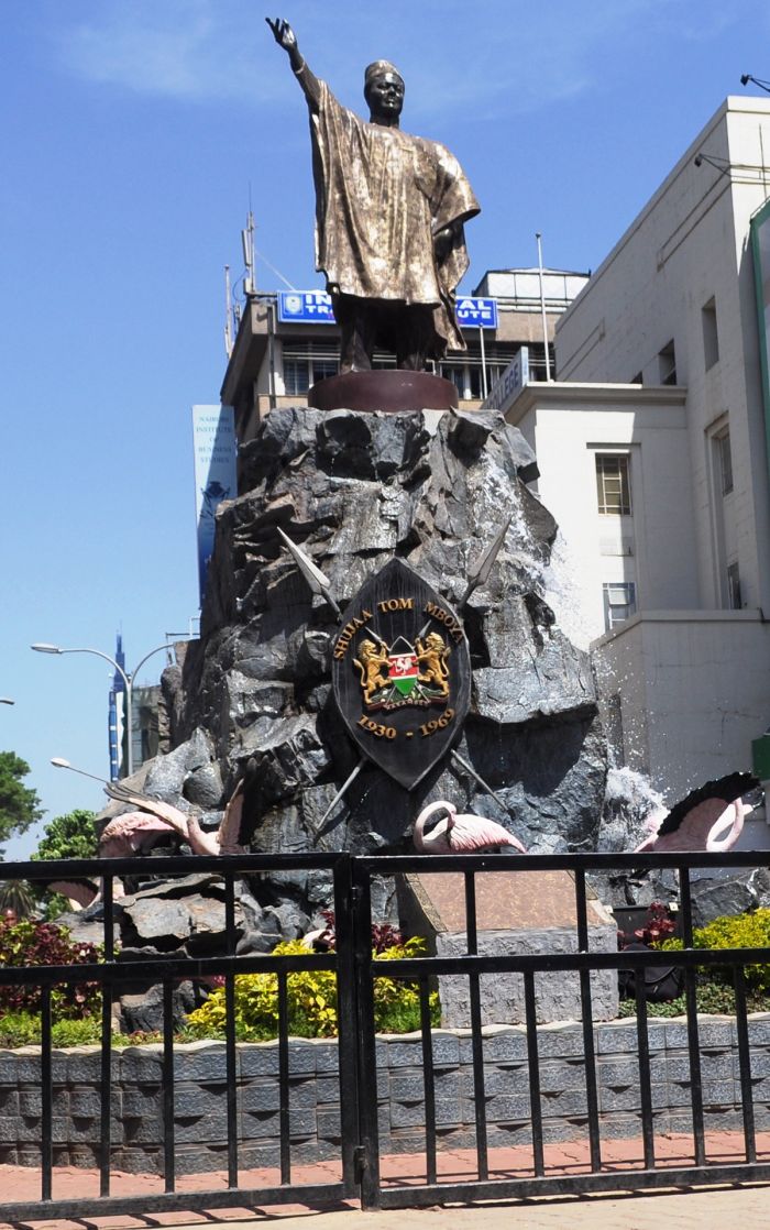
A memorial statue of Tom Mboya (by artist Oshoto Ondula) stands near the spot on Government Road (now Moi Avenue), Nairobi, where Mboya was assassinated on 05 July 1969 (photo: Wikimedia Commons).
Kisumu Massacre (October 1969)
On 25 October 1969, President Kenyatta visited the Luo-dominated town of Kisumu, the capital of what was Tom Mboya's Nyanza Province on the shores of Lake Victoria. The president was in Kisumu to open a new hospital and greeted a large crowd. The crowd soon became disrespectful and began shouting KPU (the opposition party) slogans and openly challenging the president.
The head of the KPU, Oginga Odinga, and many of his supporters were in attendance and a hostile exchange of words between Odinga and Kenyatta further incited the hostile crowd. When members of the crowd starting throwing stones, Kenyatta's bodyguards opened fire on them. The gunfire officially killed 11 people in the crowd, but some sources say that as many as 100 were killed and many more wounded.
President Jomo Kenyatta in August 1978 (photo: Wikimedia Commons).
Kenyatta Strengthens Hold on Power (1969-78)
In response to the disorder and the incident at Kisumu, Odinga was detained 'indefinitely' without trial and the KPU officially banned, making Kenya once again, a de-facto one-party state. Constitutionally, the right to form opposition political parties was permitted, but in reality, non-KANU political parties became unfeasible.
Kenyatta also encouraged a return to traditional Kikuyu 'oathing', with politicans and other people of influence pressured to swear their allegiance to Kenyatta and to help maintain the Kikuyu hold on the government.
1969 General Elections
In the December 1969 general elections, Kenyatta was again unopposed and was automatically elected without a vote. Due to the banning of the the Kenya People's Union (KPU) on 30 October 1969, only candidates from Kenyatta's Kenya African National Union (KANU) stood for seats in the Parliament, and all 158 seats in the newly unicameral National Assembly were thus won by members of KANU, although 77 incumbents were defeated. An additional 12 members were appointed by Kenyatta after the election.
During the early 1970s, Kenya was viewed globally as one of the safest and most stable countries in sub-Saharan Africa, with many of the other countries in this category struggling with civil wars or still fighting for independence. Foreign investment poured into Kenya, leading to economic growth, but the result was mainly to enrich an elite group of politicians and businessmen, who became known colloquially as the 'WaBenzi', a pejorative used to refer to the post-colonial ruling class, most of them known to be corrupt. The term WaBenzi comes from the Bantu "Wa", meaning people, and "Benzi" for the Mercedes Benz luxury cars that were favored by these rich men.

President Jomo Kenyatta (right) escorts Dr Hastings Banda, President of Malawi, at the conclusion of Banda's state visit to Kenya in 1967 (photo: Wikimedia Commons).
Nepotism was rampant and bribes from foreign companies to secure contracts made Kenyatta and his closest ties extremely wealthy. Of course, this corruption came at the expense of the common folk in Kenya, for whom life was little or not at all improved from before independence. The new secondary schools built in the prior decade churned out thousands of graduates, but there were not enough prospects for them. Kenya's population growth continued to be one of the highest in the world and land redistribution was still grossly unfair, heavily favoring elite Kikuyu politicians and businessmen.
1974 General Elections
As had been the case in the 1969, the 1974 general elections in Kenya resulted in a 100 percent victory for the ruling Kenya African National Union (KANU), as it was the sole party to participate in the elections. Kenyatta was deemed the winner of the presidential election without a vote and all 158 seats on the National Assembly were won by KANU members.
In the later part of Kenyatta's term as president, numerous political and intellectual persons considered a threat to Kenyatta's power were detained or imprisoned. Ronald Ngala, the leader of the opposition Kenya African Democratic Union (KADU), which had been banned by Kenyatta in 1964, was killed in a road accident in 1972. The circumstances of his death were suspicious, but there was no inquiry. Many speculated that it was a politcal assassination made to look like an accident. In 1975, JM Kariuki, a political adversary of Kenyatta, was murdered (read below).
President Jomo Kenyatta with the legendary pioneer photographer, news cameraman, journalist, and filmmaker Mohinder Dhillon (photo: Wikimedia Commons).
JM Kariuki
Josiah Mwangi Kariuki, normally known as "JM", was born in 1929 in a small Kikuyu village outside Nakuru in Kenya's Rift Valley. His family were displaced from their land in 1928 by the British and moved to work in the 'White Highlands', where they became squatters on a European settler farm. JM travelled to Uganda to attend secondary school, graduating in October 1952 and he returned to Kenya just days before the State of Emergency was declared by British Governor Evelyn Baring.
Back in Kenya, Kariuki joined the Mau Mau, taking their oath and working as a liaison officer between Kisumu and Eldoret. He also assisted the uprising by raising money and securing food, supplies, and sometimes lodging for Mau Mau fighters living in the forest. Kariuki was arrested in his hotel in 1953 and detained for seven years. Kariuki was released from detention in 1960 at the end of the Mau Mau rebellion.
Kariuki visited Jomo Kenyatta, who was still living under a restriction order, and was given permission to open a KANU office in Nyeri. After Kenya gained independence in 1963, Kariuki was elected to Parliament and served as Kenyatta's personal secretary until 1969. Kariuki's relationship with Kenyatta began to sour as he saw the president and many of his cronies taking bribes and engaging in corrupt business deals to enrich themselves at the expense of the country's common men.
Kariuki began outwardly criticizing Kenyatta's policies, which he claimed were increasing inequalities in the country and leading to a deterioration of relations between Kenya and the other members of the East African Community. He condemned what he claimed were high levels of governmental corruption, and Kenyatta's lack of addressing equitable land redistribution, claiming that most of the land repurchased from the white settlers had not been given back to the Kenyans that had been forcibly removed by the British, but rather to Kenyatta's family, friends, and political allies.
A Nairobi shop window displays a memorial for politician Josiah Mwangi Kariuki, who was murdered in March 1975 (photo: Wikimedia Commons).
Although Kariuki himself was a wealthy man, reportedly backed by foreign investors, his populist ideas and willingness to criticize Kenyatta endeared him to Kenya's masses and he was increasingly seen as a serious threat to Kenyatta's power. Kariuki coined a popular phrase that he did not want Kenya to be a nation of “ten millionaires and ten million beggars”.
In 1974, Kariuki was elected to parliament, representing Nyandarua North District in the Rift Valley, despite Kenyatta's regime doing everything it could to thwart his re-election.
On 02 March 1975, Kariuki was last seen leaving the Nairobi Hilton Hotel, accompanied by a police officer and President Kenyatta's head bodyguard. Kariuki's body was found several days later along a road south of Nairobi, his body burned and riddled with bullet holes. A fifteen-member parliamentary commission was formed to investigate his murder, but its recommendations for further investigation were ignored and no one has even been convicted of his murder.
When news of Kariuki's death became known, students from the University of Nairobi marched in protest in the streets of Kenya's capital. Kenyatta's General Service Unit (GSU) police were sent to break up the protest and the campus was shut down.
Kariuki's popular book, Mau Mau Detainee: The Account by a Kenya African of His Experiences in Detention Camps, 1953-60, was published in 1963.
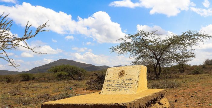
A memorial Stone in Oloshoibor, where the slain body of Josiah Mwangi Kariuki was found on 03 March 1975 (photo: Wikimedia Commons).
Kenyatta Death (1978)
Kenyatta had suffered from poor health for many years, going back to his days of incarceration in the 1950s, where he suffered from gout. He had a mild stroke in 1966 and another in 1968 and was determined to keep his failing health from the public, leading to a reduction in his public appearances. By 1975, the president had stepped back from actively governing, leaving that role to a small group of his inner circle that included and Charles Njonjo, James Gichuru, Mbiyu Koinange, and Njoroge Mungai.
In 1977, President Kenyatta had several more strokes or possibly heart attacks and on 22 August 1978, he died of a heart attack at the State House in Mombasa. The Kenyan government had long ago prepared for Kenyatta's passing and requested the UK to assist in organizing his state funeral. Senior politicians wanted the funeral to project Kenya as a modern nation rather than one clinging to tradition.
Memorial statue of Jomo Kenyatta in front of the Kenyatta International Convention Centre in Nairobi. The statue is cast bronze, 12 feet high, and was created by sculptor James Butler. It was unveiled in September 1973 (photo: Wikimedia Commons).
Kenyatta's funeral was held at St. Andrew's Presbyterian Church in Nairobi and was attended by Prince Charles, the eldest son of Queen Elizabeth II and heir apparent to the British throne, as well as numerous African heads of state including Julius Nyerere (Tanzania), Idi Amin (Uganda), Kenneth Kaunda (Zambia), Hastings Banda (Malawi), and India's Morarji Desai. His body is laid to rest in a mausoleum on the grounds of the Parliament Buildings in Nairobi.
The nation mourned Kenyatta's death, but there was also relief and hopefulness that the country would see renewed ideals and a better future.
As per the constitution, Vice-President Daniel Arap Moi immediately became acting president and a special presidential election was to be held to elect the new president for the balance of Kenyatta's term. The election was scheduled for 08 November 1978, 90 days later. However, a Cabinet meeting was held and it was determined that no one else was interested in running for president, and Moi was therefore sworn in unopposed on 14 October 1978.
Jomo Kenyatta's mausoleum, located on Kenya's Parliamentary grounds in Nairobi (photo: Wikimedia Commons).
Daniel Arap Moi
Background
Daniel Toroitich arap Moi (born Toroitich arap [son of] Moi, Toroitich meaning "welcome home the cattle") was born 02 September 1924 to a family from the Tugen ethnic group (of the Kalenjin people) in Baringo (north-central Rift Valley). His father, Kimoi Arap Chebii, died when Moi was only four (not much is known about his mother), so he was raised by his elder brother.
As a boy, Moi attended the Africa Inland Mission (AIM) School at Kabartonjo. At the mission school, he became a Christian and adopted the name Daniel. He later attended Tambach Teachers Training College, after which he worked as a teacher from 1946 until 1955.
In 1955, Moi entered politics and was elected a member of the Legislative Council for Rift Valley. As Kenya approached independence, Moi traveled to London and took part in the Lancaster House Conferences (1960, 1962, and 1963), where the plans for the country's independence were negotiated.
President Daniel arap Moi (right) with Dries van Agt, Prime Minister of the Netherlands, at Amsterdam Airport Schiphol, June 1979 (photo: Wikimedia Commons).
In 1960, Moi helped found the Kenya African Democratic Union (KADU), which was led by Ronald Ngala, as an opposition to Kenyatta's Kenya African National Union (KANU). In 1961, Moi became Minister of Education in Kenya's pre-independence government. After Kenya's independence in 1963, Prime Minister Kenyatta convinced Moi to disband KADU and merge the party into KANU in order to gain better unity during the process of decolonization and in 1964, KADU was dissolved. In 1964, after Kenya became a republic, Kenyatta became president and appointed Moi to his cabinet as Minister of Home Affairs.
In April 1966, Kenyatta's vice-president Oginga Odinga defected from the KANU party and formed an opposition party called the Kenya People's Union (KPU). Kenyatta replaced him as vice-president with Joseph Murumbi, the Minister of Foreign Affairs, but Moi replaced Murumbi in January 1967, becoming the third Vice-President of Kenya.
As a non-Kikuyu, Moi faced strong opposition from the Kikuyu elite in government and business, a group which were sometimes collectively known as the 'Kiambu Mafia'. These powerful and wealthy Kikuyu wanted a Kikuyu to succeed Kenyatta as president and Moi, as a Luo, was an outsider that they could not trust to have their own interests at heart. The Kiambu Mafia attempted top enact a change in the constitution to prevent the vice-president from automatically assuming the role of president in the event of the president's death, but Kenyatta opposed the change and the enactment failed.
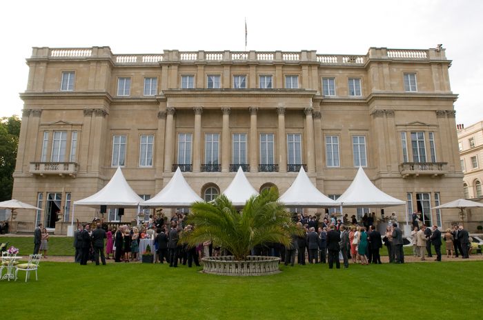
Lancaster House in London, England, where Kenya's constitutional framework and independence were negotiated over a series of meetings in 1960, 1962, and 1963. Daniel arap Moi was one of the representatives from Kenya at these important meetings (photo: Wikimedia Commons).
Moi Presidency (1978-1990)
After being sworn in on 14 October 1978 as Kenya's second president, Moi promised to have an ethnically inclusive government, to fight against corruption, and to improve the economy. Within days of taking power, Moi released 26 prisoners that had been arrested and detained without trial by Kenyatta's General Service Unit (GSU) forces. Moi appointed Mwai Kibaki, a Kikuyu with peasant roots from the Nyeri District, as his vice-president.
Moi moved quickly to consolidate his power by replacing Kikuyu MPs on his cabinet with his Kalenjin countrymen. However, because the Kikuyu elite were numerous and so powerful, Moi relied heavily on his vice-president, a Kikuyu himself, to wield power. Like Kenyatta before him, Moi ruled with an iron fist and those who opposed him were usually arrested and detained. His early promises to improve the economy did not come to fruition and there was soon growing resentment amongst the poor in both rural and urban locations.
1979 General Elections
General elections were again held on 08 November 1979. As in the past elections, there was only one political party, so all 158 seats on the National Assembly were won by KANU members and the post of president required no vote, as incumbent President Moi was unopposed.
On 10 June 1982, after thirteen years of being a de-facto one-party state, Kenya's parliament unanimously approved an amendment to the constitution that made it a de jure one-party state (making it illegal to form any new political party), further cementing KANU's control of the government.
President Daniel arap Moi in The Hague, Netherlands, 1979 (photo: Wikimedia Commons).
Attempted Coup (1982)
At 3am on 01 August 1982, a group of lower-level soldiers in the Kenya Air Force took control of Eastleigh Air Base (now known as Moi Air Base) outside Nairobi and by 4am, Embakasi Airport (now Jomo Kenyatta International Airport) had also fallen. By 6am, soldiers led by Senior Private Hezekiah Ochuka and Sergeant Pancras Oteyo Okumu and backed by university students, captured the Voice of Kenya radio station in Nairobi, where they broadcast in English and Swahili that the military had effectively overthrown the Moi government.
Ochuka then ordered pilots at the Laikipia Air Base in Nanyuki to bomb the State House and General Service Unit (GSU) Headquarters in Nairobi, but the pilots on the mission decided to disobey their orders and instead dumped their bombs in the Mount Kenya forest and returned to their base.
The coup had been planned to take place when most of Kenya's senior military staff were away from Nairobi in the remote town of Lodwar, talking part in War Games. The four most senior officers in the Kenya Army that remained in Nairobi held a private meeting to plan a suppression of the coup. A group of 30 officers were assembled and the team assaulted the broadcasting station and killed or captured all the rebels inside. The General Service Unit (GSU) and Nairobi police then assisted in the retaking of the two airports and the coup was effectively thwarted only six hours after it had begun.
During the 1982 attempted coup d'état, Senior Private Hezekiah Ochuka ordered pilots at the Laikipia Air Base in Nanyuki to bomb the State House in Nairobi using two F-5E Tiger jets and a British Aircraft Corporation (BAC) Strikemaster (pictured above), but the pilots disobeyed their orders and dumped their bombs in the forests of Mount Kenya (photo: Wikimedia Commons).
The coup failed due to infighting amongst the rebels, poor planning, and bad execution. In the aftermath, more than 100 soldiers and around 200 civilians were killed. The organizers of the coup, including Ochuka, Okumu, and others, were tried by court martial, found guilty of treason, and sentenced to death. A total of 900 people were imprisoned for their involvement in the attempted coup and twelve were sentenced to death. The executions (by hanging) were carried out on 10 Jul 1985. They are the last people to date to have been executed under Kenyan law.
During the court martial trials, Oginga Odinga and his son Raila Odinga were mentioned as having been integrally involved in financing the organizers of the failed coup. Both Odinga's were placed under house arrest. Raila Odinga together with numerous University of Nairobi students and lecturers were later charged with treason and sent to detention without trial. Raila remained in detention for six years, before finally being released in February 1988.
In the wake of the coup attempt, the Kenya Air Force was disbanded and there was a renewed clampdown on students from Nairobi University, which was closed down yet again.
1983 General Elections
In the 1983 general elections, which were held on 26 September 1983, the KANU party, which was now the only legal party allowed in Kenya, retained all 158 Assembly seats and President Moi stood unopposed and was declared president without a vote.
Moi Consolidation of Power (1982-1988)
The years following the passing of the constitutional amendment making KANU the sole legal political party saw an uptick of detention without trial of anyone suspected of being a dissident, crackdowns on underground political movements, banning of publications that opposed the Moi regime, and the expulsion of KANU members that in any way failed to fall in line with the party's increasingly dictatorial policies. Public meetings of more than five persons were outlawed.
Despite Moi's efforts to tighten his grip on power, resentment over the one-party state and the president's authoritarian rule continued to grow. A socialist movement called 'Mwakenya' (an acronym derived from the Swahili phrase "Muungano wa Wazalendo wa Kenya", meaning "Union of Patriotic Kenyans") was formed by academics and others opposed to the one-party state. The group's spokesman was Professor Ngũgĩ wa Thiong'o and it held public lectures and distributed leaflets asking for the replacement of the Moi government.
Kenyan writer and professor Ng?g? wa Thiong'o (shown here in 2012) was the spokesman for the Mwakenya movement (photo: Wikimedia Commons).
The government began cracking down on Mwakenya and the organization was forced to become an underground movement. After the attempted coup, the Moi regime, via the General Service Unit (GSU), launched a full scale initiative to hunt down anyone who may have been involved in the coup attempt, including many who were deemed to be part of the Mwakenya movement.
During the government crackdown on dissidents, hundreds of people were arrested. Initially, the majority arrested were academics and professors, as undercover police officers and students recruited to assist in the crackdown sat in on lectures and reported on any lecturers that taught Marxist-Lenninist theories, which the government believed was being advocated by Mwakenya.
Those who were arrested were typically charged and convicted within one day without being permitted any legal representation. The convicted were then tortured and/or subjected to human rights violations until they gave information on other members. The torture was later revealed to have taken place at Nyayo House and Nyati House, both in Nairobi.
Hastings Banda, President of Malawi (center) is greeted at the airport in Nairobi by President Daniel Arap Moi (left) and Vice-President Mwai Kibaki (right), 1978 (photo: Wikimedia Commons).
1988 General Elections
General elections were scheduled for 21 March 1988, but in anticipation of the primary elections in February 1988, the government announced a new voting system called 'mlolongo' (or queue), which abolished the secret ballot system for the primaries, instead requiring voters to line up in public behind photographs of their preferred candidate.
Only KANU party members were allowed to vote in the primaries, but all registered voters were eligible to vote in the upcoming general elections, which would involve secret ballots. Around 25% of Kenya's 20 million citizens were KANU members and the system was widely viewed as an outward effort at voter intimidation and fraud.
As was the case in 1983, Kenya's one-party state meant that all 188 members of the General Assembly were elected from the ruling KANU party and incumbent president Daniel arap Moi was announced the winner without a vote to begin his second full term as president.
Mwai Kibaki, who had been Moi's vice-president since the 1978 elections, had fallen out of favor with Moi, and he was replaced by Josephat Karanja. Shortly over a year later, on 01 May 1989, Karanja stepped down as VP and Moi replaced him with George Saitoti, a British-trained economist and former Head of the Mathematics Department at the University of Nairobi.
After the falling out between President Moi and VP Mwai Kibaki, George Saitoti (shown here in 2011), became vice-president under President Moi in May 1989 (photo: Wikimedia Commons).
End of Cold War (late 1980s)
During the late 1980s and early 1990s, the collapse of the Soviet Union led to a resurgence in global democracy. The fall of the Berlin Wall in 1989 and the overthrow of most communist governments in the Eastern Bloc marked the end of the Cold War. This shift effectively reduced pressure on the West to support unpopular regimes in developing nations that had previously been viewed as necessary regional stabilizers to help prevent the spread of Soviet influence.
During the Cold War, the Moi government was seen as stable and Western governments were willing to overlook its increasing degree of political repression in order to keep communism from further expanding in the region. Now that the Cold War was over, the West had a reduced requirement to counter communist influence in East Africa and policymakers began viewing Moi as a despotic ruler rather than a stabilizing influence.
During the late 1980s, Kenya's economy stagnated due to rising oil prices and falling prices for its agricultural exports.
President Daniel Arap Moi is greeted at Andrews Air Force Base in Maryland on arrival for his visit to the United States, September 1981 (photo: Wikimedia Commons).
Richard Leakey
Background
Richard Leakey was born in Nairobi 1903 to the renowned and pioneering paleoanthropologists and archaeologists, Louis and Mary Leakey, whose work in the Rift Valley of Tanzania and Kenya led to important discoveries on the earliest hominids and human ancestors and demonstrated that humans first evolved in Africa.
In 1955, Richard co-founded the Kenya Museum Associates (now Kenya Museum Society) with various influential Kenyans, the purpose of which was to "Kenyanise" and improve the National Museum.
In 1967, Richard was part of an expedition to the Omo Valley in Ethiopia where the earliest known fossil of a modern human (Homo neanderthalensis), dating back 160 000 years, was found.
Richard also worked at his father's Koobi Fora Camp on the shores of Lake Rudolph (now renamed Lake Turkana), where his work contributed to significant discoveries, including a Homo rudolfensis skull (KNM ER 1470), a Homo erectus skull (KNM ER 3733), and an intact skull of Homo erectus (KNM ER 3883), in 1972, 1975, and 1978, respectively.
In 1984, 'Turkana Boy', an almost complete skeleton of a Homo ergaster (though the Leakey's called it H. erectus), was discovered by Kamoya Kimeu, a member of the Leakeys' team at Lake Turkana. The skeleton was of a boy estimated to have been 9-12 years old when he died 1.6 million years ago.
Richard Leakey, the renowned Kenyan paleo-anthropologist, July 1986 (photo: Wikimedia Commons).
Conservation
Around 1988-1989, Richard's focus shifted from paleontology to wildlife conservation, but his wife Meave Leakey and daughter Louise Leakey continued to work in the field.
In 1977, Kenya ended all legal elephant hunting in an effort to protect its dwindling elephant population and support its growing ecotourism industry. All animal hunting in Kenya without a permit was also made illegal in 1977. By the late 1970s, Kenya's elephant population was estimated at 275 000, but the country had lost 50% of its elephants to poachers by 1977. The continued slaughter of elephants reduced Kenya's population to only 20 000 animals by 1989.
In 1989, amidst international condemnation over the rampant slaughter of elephants and rhinos across Africa, President Daniel arap Moi appointed Richard Leakey as Director of the Wildlife Conservation and Management Department (WMCD), the forerunner of what became the Kenya Wildlife Service (KWS) in 1990. The high international value of ivory was the driving force behind the poaching and Kenya was particularly hard hit. In a May 1989 New York Times article, it was stated that Kenya's Tsavo National Park was "an elephant graveyard - piles of bleached white elephant bones - instead of an elephant habitat".
President Moi was well aware of the damage that elephant poaching was doing to Kenya's growing ecotourism industry and at the October 1989 conference of the Convention on International Trade in Endangered Species (CITES) in Switzerland, Kenya advocated for including elephants on CITES' Appendix I, which effectively bans the species from any international trade.
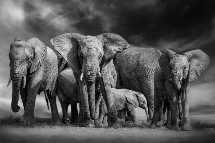
In 1977, Kenya outlawed all hunting of elephants in an attempt to stem the rampant poaching of its elephants. Richard Leakey was appointed Director of Wildlife Conservation and Management in 1989.
Ivory Burning (1989)
At the time of the 1989 CITES Conference, Kenya had 12 tons of elephant tusks in its stockpile. Leakey was urged by many in Kenya's government to sell the ivory in order to help fund conservation efforts, but in a bold move, Leakey convinced President Moi that Kenya should burn the tusks. In a highly successful publicity event, President Moi set fire to the massive pile of tusks in Nairobi National Park
Ivory does not burn easily, but Leakey wanted to produce powerful and lasting images showing Kenya's dedication to conservation. To make the destruction even more spectacular, Leakey hired a Hollywood special effects professional to devise the pyrotechnic method of burning the tusks, which was accomplished using a combination of jet fuel and flammable glue.
The event was a huge publicity success, attracting massive international press coverage as the fire burned nonstop for three days. The event was so impressive that the World Bank approved grants totaling US$140 million to help Kenya in its conservation efforts. It also went a long way towards placing Kenya at the top of counties in terms of its ecotourism and conservation image.
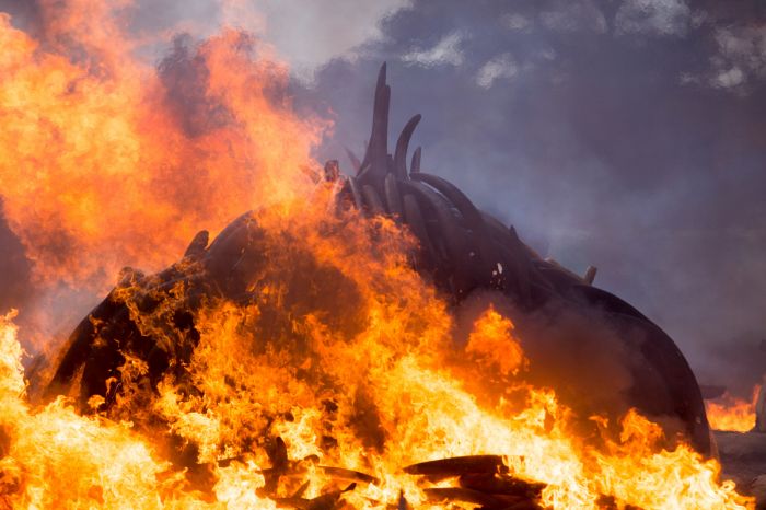
Kenya burned its stockpile of elephant tusks in 1989 and the event received widespread international media coverage. Kenya has held several more ivory burns since then and other countries have followed the example set by the Kenyan government in its efforts to stop elephant poaching and the trade in ivory (photo: Wikimedia Commons).
Later Life
Leakey's bold stance on conservation was a two edged sword, with many politicians opposed to his policies. His confrontational approach to human-wildlife conflict in Kenya's national parks also earned him many opponents. Richard's view was that national parks were self-contained ecosystems and humans should be entirely removed, which adversely affected the Maasai people in various parks and reserves and offended many Kenyan politicians.
In June 1993, while piloting a routine flight in his single-engine Cessna plane, he crashed and both his legs had to be amputated below the knee. Sabotage was suspected, but never proved. Afterwards, Leakey was fitted with prosthetic limbs. Soon afterwards, the government announced that a secret probe had found evidence of mismanagement and corruption in the KWS and in January 1994, an annoyed Richard Leakey resigned as head of the KWS. Leakey was replaced by David Western, who was an advocate of human-wildlife coexistence.
In 2001, Leakey published Wildlife Wars: My Fight to Save Africa's Natural Treasures, which describes his intense fight to save Kenya's elephants from poaching.
Notes: Leakey moved to the USA for a short time in 2002, where he taught anthropology at Stony Brook University, on Long Island, New York. Back in Kenya, Leakey founded and chaired WildlifeDirect, a Kenya-based charitable organization which provides support to conservationists in Africa. The organization played a significant role in helping protect mountain gorillas in the Democratic Republic of the Congo's Virunga National Park in January 2007 after rebels threatened to kill off all the animals.
In 2015, Kenya's President Uhuru Kenyatta appointed Leakey as Chairman of the Kenya Wildlife Service (KWS), which allowed him to take an active role once again in the country's conservation policies. Richard Leakey died in his home in Nairobi on 02 January 2022, at the age of 77 years. He is buried on a hill in the Rift Valley.
Richard Leakey at The Progressive Forum in Houston, Texas, October 2010 (photo: Wikimedia Commons).
Moi Presidency (1990-1993)
Robert Ouko Murder (February 1990)
On the night of 12/13 February 1990, Robert Ouko, a Luo and the Minister of Foreign Affairs in Moi's cabinet, disappeared from his family farm complex near Kisumu. Ouko had been a favorite amongst Western politicians as a potential successor to President Moi.
Ouko's body was supposedly discovered later that day about 3 kms away by a local herding boy, but nothing was reported to authorities. Various investigations were made in the ensuing years, including one by Britain's Scotland Yard, but the crime remains unsolved.
Local police discovered the body on 16 February after a search of the area. Initial police reports suggested that Ouko had committed suicide, but information leaked that he had been killed by a single shot to the head and his body partially burned. News of Ouko's murder sparked a week of rioting across the country, the most violent of which were in Ouko's home town of Kisumu.
Robert Ouko in September 1981 (photo: Wikimedia Commons).
Saba Saba Protest (07 July 1990)
Growing public discontent with the oppressive Moi government mounted throughout Kenya during the first half of 1990 and on 07 July, Kenyans took to the streets in Nairobi to demand a free multi-party democracy. The rally has since become known as the "Saba Saba" rally ("saba" means "seven" in Swahili and denotes the date - 07/07 - of the rally). The protest was called for by a group of young opposition politicians known as the "Young Turks", including Kenneth Matiba, Raila Odinga, and Charles Rubia, all of whom were arrested days before the protest.
The Moi government was prepared for an unruly crowd and armed police wearing riot gear met the protestors with tear gas and batons to beat them into dispersing. The rally soon degenerated into a violent riot, with some 6 000 protestors hurling stones at the police and police cars. The rioting quickly spread to the outskirts of Nairobi and it sparked similar riots in numerous other towns in Central Kenya.
The riots went on for four days and hundreds of civilians were injured and 21 were killed. Over 1 000 protestors were arrested and detained. The impact of the Saba Saba protest became a trigger for the "second" liberation movement in Kenya and July 7th is now known as "Saba Saba Day" in Kenya, though it has never been made an official holiday.
Return to Multi-Party Democracy (1991)
In the wake of the Saba Saba protests, the Moi regime cracked down on journalists and repressed anti-government newspaper articles. It accused the foreign press and in particular, the BBC, of trying to ignite civil unrest and violence in Kenya. News coverage of the protests and Moi's stubborn insistence on a single-party state was upsetting tp foreign investors in the West and led to increased international pressure on Moi to adopt a true democracy in Kenya.
In August 1991, an unofficial opposition lobbyist group called the Forum for the Restoration of Democracy (FORD) was formed by several opposition leaders, including Oginga Odinga, his son Raila Odinga, Paul Muite, Phillip Gachoka, Ahmed Bamahariz, Salim Ndamwe, Masinde Muliro, and George Nthenge. The group's purpose was to fight for political change in Kenya. President Moi declared that FORD was an illegal organization and its leaders were kept under constant surveillance by government security personnel and their meetings outlawed.
In 1991, the United States and other donor nations in the West withheld aid to Kenya pending compliance with economic and political reform, the most important of which was the reintroduction of a multi-party political system.
Many in KANU were against allowing any new political parties, but President Moi managed to convince the party otherwise and in December 1991, he announced his intention to lift the ban in opposition parties. After heated debate and opposition within the government, the resolution was finally passed and the constitution was amended, giving the opposition the legal right to form new political parties.
President Daniel arap Moi in the Netherlands, 1989. Shown are (left to right): unidentified woman, Ruud Lubbers (Prime Minister of the Netherlands), President Moi, Hussein bin Talal (King of Jordan), Hosni Mubarak (President of Egypt) (photo: Wikimedia Commons).
1992 General Elections
After the constitutional amendment made it legal for the Forum for the Restoration of Democracy (FORD) to declare itself as an opposition political party, dozens of KANU party members defected and joined the new opposition party. Unfortunately, during the lead-up to the 1992 general elections, divisions and infighting within FORD quickly emerged along tribal affiliations, dividing its potential to effect change in the government.
Unable to cooperate and produce a single opposition candidate to oppose President Moi and the still powerful KANU party, FORD soon split internally along tribal affiliations. The ambition of some of FORD's leaders to run for presidency and to lead a political party led to a series of splits in the original FORD party. Prior to the 1992 elections, FORD officially divided into FORD-Kenya, led by Oginga Odinga, and FORD-Asili, led by Kenneth Matiba.
Another party, the Democratic Party (DP) was founded by Mwai Kibaki, who had served as Moi's vice-president for ten years (1978-88), but had left KANU in December 1991 after the repeal of the law preventing opposition political parties.
General elections were held on 29 December 1992, marking the first multi-party elections in Kenya since independence and the first to include an actual vote for president by the citizens. In 1964, the office of president was elected by a vote of parliament and every election since featured only one candidate for the position. All seats on the General Assembly were also up for election.
President Daniel arap Moi portrait on the Kenya 1997 20-Shilling Banknote.
The lead up to the election saw targeted ethnic violence in the Rift Valley, mainly involving Kalenjin supporters of President Moi and peasant farmers supporting the opposition groups. Dozens of Kenyans were killed, hundreds injured, and thousands made homeless during the fighting. The Human Rights Watch group accused President Moi and Vice-President Saitoti of inciting and coordinating the pre-election violence.
The voting was marred by widespread voter intimidation, ballot-box stuffing, harassment of voting officials, manipulation of votes, last-minute changing of the polling date (the elections were originally scheduled for 07 December), and other irregularities, most of which was perpetrated by the incumbent KANU administration.
The results of the election were another victory for KANU and incumbent President Moi, who won 36.35% of the votes. Kenneth Matiba of the FORD-Asili party came second with 26.00% of the votes, Mwai Kibaki of the Democratic Party (DP) came third with 19.45%, and Oginga Odinga of FORD-Kenya came fourth with 17.48% of the votes. Voter turnout was 69.4% of the population. It was clear from the results that the divided opposition allowed Moi to retain his presidency.
There were now 188 elected seats on the General Assembly, with an additional 12 seats (making 200 total seats) to be appointed by the president. KANU won 100 seats (plus the 12 appointed by Moi), FORD-Asili won 31 seats, FORD-Kenya won 31 seats, and the DP won 23 seats. Other minor parties won a total of 3 seats.
A Kenya Twenty-Shillings coin issued in 1998 featuring President of Kenya, Daniel arap Moi.
Moi Presidency 1993-2002
After his victory in the 1992 elections, Moi agreed to enact the economic reforms requested by the International Monetary Fund (IMF) and the World Bank, which restored enough of their aid for Kenya to service its US$7.5 billion foreign debt. The reforms included the privatization of various sectors of Kenya's infrastructure, including railways, telecommunications, the postal service, and the National Cereals and Produce Board (NCPB). These demanded reforms were meant to reduce opportunities for corruption at the government level, while also stimulating the economy.
Moi continued to obstruct the press after the 1992 elections and he exploited inter-tribal animosity to keep the opposition focused on each other rather than on attacking KANU policies. The administration relied heavily on the support of the Kalenjin and incited the Maasai and Kikuyu against one another. The Kikuyu in particular were targeted and denounced by President Moi as traitors, threatening them with land and home dispossession. Beginning in 1993, mass evictions in Kikuyu communities took place with assistance from the army and police.
In January 1994, Oginga Odinga, the chairman of the FORD-Kenya party, died at the age of 82 years. He was succeeded as chairman by the party's vice-chairman Michael Kijana Wamalwa.
The long-time Kenyan independence advocate and politician Oginga Odinga died in January 1994. Pictured is a commemorative statue in the Jaramogi Oginga Odinga Mausoleum in Bondo, Kenya (photo: Wikimedia Commons).
1997 General Elections
On 07 July 1997, on the anniversary of the 1990 Saba Saba demonstrations and in anticipation of the general elections coming later in the year, history repeated itself as tensions mounted and protests were held in over 50 urban centers across Kenya. The largest rally was in Nairobi and as in 1990, the protest turned violent, with police storming Nairobi University and 13 people were killed in clashes with police. Protestors were marching to demand free and fair elections. Additional demonstrations occurred on 08 August, 09 September, and 10 October, leading up to the December elections. There were also a series a worker strikes during 1997.
General elections were held on 29 December 1997 to elect the president and members of the National Assembly. As expected, incumbent President Danial arap Moi and his Kenya African National Union (KANU) party won the day, with Moi receiving 40.4% of the vote and KANU winning 107 of 210 Assembly seats (an additional 12 to be appointed by the president). KANU added 7 additional seats to retain a majority on the Assembly. Moi's greatest support was from the Rift Valley, where he dominated and won 69.5% of the votes.
As in the previous elections held in 1992, the lack of a united opposition allowed Moi to win, as he received votes from across the country, while each of the opposition candidates received most of their support from their respective ethnic/regional constituencies. Voter turnout was 68.3% (of just over 9 million registered voters).
President Daniel arap Moi with Queen Juliana and Prince Bernhard of the Netherlands at Soestdijk Palace in 1979 (photo: Wikimedia Commons).
Mwai Kibaki of the Democratic Party (DP) came in second, receiving 30.89% of the votes and its members winning 39 seats (an increase of 16 seats) on the Assembly. Kibaki, a Kikuyu by birth, received a majority of the votes in Kikuyu areas, where Moi barely received any support. Kibaki claimed that the election was rigged and said he was convinced that he was the true winner.
Raila Odinga, who had left the FORD-Kenya party after losing in a battle for leadership of that party to Michael Wamalwa in 1994 and joined the newly formed National Development Party (NDP) won 10.79% of the votes to finish third. The NDP also won 21 seats on the Assembly. Odinga won a majority in the Luo-dominated Nyanza region (Kisumu/Lake Victoria), but fared poorly elsewhere.
Michael Wamalwa of FORD-Kenya came fourth with 8.17% of the votes and his party winning 17 seats (down from 31 prior) on the Assembly. Wamalwa's biggest support was in the West, where he received more votes than any other candidate.
An early photo of then Vice-President Daniel arap Moi (far right) with Paul Kiplimo Boit (left of Moi), a prominent KANU politician, on the occasion of the marriage of Boit's son in 1972 (photo: Wikimedia Commons).
Moi's Final Term (1997-2002)
On 05 January 1998, Daniel Arap Moi was sworn in for his fifth term as president at the age of 73 years, extending the rule of his already 20-year-long administration. It was to be his final term per the constitution, which per a 1992 amendment, allowed for only two full five-year terms (previous terms served by Moi were not counted per the amendment). Moi promised that his final term would be devoted to promoting national unity, eradicating governmental corruption, and implementing economic and democratic reforms.
In an effort to combat corruption, Moi appointed Richard Leakey, the respected and widely popular paleoanthropologist whose parents, Louis and Mary Leakey, were pioneers in the field, to his cabinet as a special secretary in charge of fighting corruption.
On 07 August 1998, the United States Embassies in Nairobi, Kenya and Dar es Salaam, Tanzania were bombed in simultaneous attacks. The Nairobi explosion killed 263 people, of which 12 were American, and injured over 5 000, most of which were not in the Embassy, but rather in the adjacent four-story Ufundi Cooperative House. The attacks were carried out by truck bombs and linked to local members of the Egyptian Islamic Jihad. The attacks brought global attention to the terrorist organization al-Qaeda and its leaders, Osama bin Laden and Ayman al-Zawahiri. Kenya's tourist industry took a serious, but short-term hit due to the attacks.
Daniel arap Moi (left) with USA President George W. Bush (right) and Ethiopia Prime Minister Meles Zenawi (center) in the White House Oval Office, December 2002 (photo: Wikimedia Commons).
In 2000, Moi appointed Yash Pal Ghai, a Kenyan Professor of Constitutional Law, as Chairman of the newly created Constitution of Kenya Review Commission, which Moi directed to spearhead Kenya's first major constitutional reform.
In 2001, Raila Odinga's National Development Party (NDP) surprisingly entered into a formal coalition with President Moi's KANU party to create what some unofficially called the 'New' KANU. Odinga dissolved the NDP and joined Moi's cabinet as Minister for Energy. Moi entered into the agreement in hopes that Odinga would bring Luo voters to the party, but Odinga's move was seen by his supporters as a 'sell-out' and many lost respect for him.
At the KANU elections later in 2001, Odinga was elected as the party's Secretary General and it was widely speculated that Odinga hoped to lead the party in the upcoming national elections with Moi's support.
Raila Odinga shows Gordon Brown, British Chancellor of the Exchequer, around the Kibera Slums in Nairobi, 2001 (photo: Wikimedia Commons).
Lead up to Elections
Leading up to the December 2002 general elections, the outgoing President Moi, who could not stand for reelection due to constitutional limits, endorsed Uhuru Kenyatta, the son of Kenya's first president, Jomo Kenyatta. It was a surprise to many since Uhuru was a relative newcomer to politics, but Moi asked others in the KANU party to endorse Kenyatta as well. Many saw the move as an attempt by Moi to place a figurehead in the position, allowing Moi to retain power after his presidency ended. Raila Odinga was particularly incensed, since he felt sure that he would be KANU's candidate.
Most of the longtime KANU members were offended by Moi's move, feeling that they were being asked to back a politically inexperienced newcomer who lacked any proven leadership experience and had done little to help build the party. Dissent spread through KANU and most of the senior members, led by Raila Odinga, George Saitoti, Kalonzo Musyoka, Joseph Kamotho, and other big names forming a "Rainbow Movement" within the party to oppose Kenyatta's candidacy.
In October 2002, the members of the Rainbow Movement officially left KANU and formed the Liberal Democratic Party (LDP), which soon teamed up with the opposition National Alliance Party of Kenya (NAK), headed by Mwai Kibaki. Other small opposition parties soon joined and a new party called the National Rainbow Coalition (NARC) party was formed to oppose Moi and Kenyatta. NARC's members were all too aware that without a united front, the opposition may fail as it had against KANU in past elections. The new party chose Mwai Kibaki as their presidential candidate.
USA President George W. Bush and Mrs. Laura Bush welcome President Mwai Kibaki and Mrs. Kibaki to the White House, 05 October 2003 (photo: Wikimedia Commons).
2002 General Elections
On 03 December 2002, Mwai Kibaki was injured in a road accident while returning to Nairobi after a campaign meeting outside the city. Kibaki was hospitalized in Nairobi and then flown to London, where his fractured leg was set. The remainder of his campaign was conducted by his party colleagues, led by Raila Odinga and Kijana Wamalwa.
General elections were held on 27 December 2002 to elect the new president and members of the National Assembly. Mwai Kibaki and the new NARC party won a landslide victory, with Kibaki winning 62.2% of the votes and NARC members winning 125 of 210 electable seats on the Assembly (another 12 to be appointed by the president).
Uhuru Kenyatta of the KANU party came in second with 31.3% of the votes and KANU members winning 64 seats (a reduction of 43 seats). Simeon Nyachae of the FORD-People party came third with 5.9% of the votes and James Orengo of the Social Democratic Party came fourth with less than one percent.
Raila Odinga meets with the British Minister for Africa, Henry Bellingham (left), in London, 07 July 2011 (photo: Wikimedia Commons).
The 2002 elections were widely considered to have been the first truly free general elections in Kenya since its independence in 1964 and it saw an end to the longstanding dominance of the KANU party, which had governed Kenya since 1963, including 23 years as the only legally permitted party in what was then a one-party state.
Outgoing president Daniel arap Moi had ruled Kenya unchallenged for 24 years, during which time the standard of living had fallen, human rights had worsened, and ethnic divisions had widened. Now that Moi was out, most of Kenya looked forward in a hopeful way to their future.
On 29 December 2002, the 71-year-old Kibaki was sworn in whilst seated in a wheelchair and his right leg in a cast from his recent motor vehicle accident. In his inaugural speech in front of thousands of cheering supporters at Uhuru Park in Nairobi, Kibaki stated in English "I am inheriting a country which has been badly ravaged by years of misrule and ineptitude". Outgoing president Daniel Moi was greeted by the crowd with jeers and whistling and he sat stone-faced during the ceremony.
President Mwai Kibaki (center) meets with Ugandan President Yoweri Museveni (left) and Tanzanian president Jakaya Kikwete (right) during the 8th East African Community (EAC) summit in Arusha, 30 November 2006 (photo: Wikimedia Commons).
Mwai Kibaki
Background
Mwai Kibaki was born in 1931 in Thunguri village in the Othaya division of the Nyeri District in Kenya's Central Highlands to a Kikuyu peasant family. He attended Mathari School (now Nyeri High School) between 1944 and 1946, where besides his classroom education, he learned masonry and carpentry by helping with maintenance on the school building. Between 1947 and 1950, Kibaki attended Mang'u High School, a Roman Catholic National High School established in 1925, located in the Kiambu District just north of Nairobi.
After high school, Kibaki traveled to Uganda where he attended Makerere University in Kampala, which at that time was a two-year technical college. He graduated best in his class in 1955, having studied Economics, Political Science, and History.
After graduation, he remained in Uganda, working as Assistant Sales Manager for Shell Company of East Africa. That same year, Kibaki was awarded a scholarship to attend any British University, so he enrolled at the London School of Economics, graduating in 1958 with a Bachelor of Science degree in Public Finance. He then moved back to Makerere University in Uganda, where he taught as an Assistant Lecturer in the Economics Department until 1960.
The East African Community Head of States (from left to right): Yoweri Museveni of Uganda, Mwai Kibaki of Kenya, Paul Kagame of Rwanda, Jakaya Kikwete of Tanzania, Pierre Nkurunziza of Burundi; April 2009 (photo: Wikimedia Commons).
Pre-Presidential Politics
In early 1960, Kibaki left his position at Makerere and returned to Kenya at the request of Tom Mboya, the Secretary General of the KANU party, who appointed Mwai an executive officer in the party. In 1963, Kibaki campaigned for election to parliament in Nairobi's Donholm constituency, winning the seat. Kibaki was subsequently appointed the positions of Assistant Minister of Finance and Chairman of the Economic Planning Commission. Mwai was promoted to Minister of Commerce and Industry in 1966 and became Minister of Finance and Economic Planning in 1969, holding that position until 1982.
In 1974, facing strong opposition from another local candidate whom he had narrowly defeated in the 1969 elections, Kibaki moved his political base to his rural home in Othaya, where he was again elected to parliament. Kibaki successfully retained his seat in in the subsequent elections of 1979, 1983, 1988, 1992, 1997, and 2002.
When Daniel arap Moi succeeded Jomo Kenyatta as President in 1978, Kibaki was appointed Vice President, keeping his post as Minister of Finance and Economic Planning until Moi changed his position to Minister of Home Affairs in 1982. Kibaki's record during his time in charge of Finance is regarded to have been very good, with Kenya showing relatively strong economic growth, driven mainly by commodities, especially coffee.
President Mwai Kibaki (right) with Count Gianfranco Cicogna Mozzoni, Ambassador of Order of Malta for Kenya, October 2011 (photo: Wikimedia Commons).
In 1988, Moi and Kibaki began to disagree on various policies and they had a falling out, so Moi replaced Kibaki as Vice President with Josephat Karanja and moved Moi to the post of Minister of Health.
In a surprise move, On Christmas Day 1991, just days prior to the repeal of Section 2A of the Constitution, which restored the multi-party system of government, Kibaki resigned from the KANU party. Soon afterwards, he founded the Democratic Party (DP) and declared himself a candidate in the upcoming 1992 elections. He faced criticism from members of the other opposition parties, who claimed that Kibaki did nothing to fight for multi-party politics, yet was trying to capitalize on it. Kibaki came in third in the December 1992 general elections, placing behind the winner, Daniel arap Moi of KANU, and Kenneth Matiba of the FORD-Asili party.
Kibaki ran for president in the 1997 general elections, but the divided opposition parties were again unable to unseat incumbent President Moi, who won easily. This time Kibaki came in second in the voting, but his Democratic Party (DP) added 16 Assembly seats. In 1998, Kibaki and the DP became the official opposition party in Parliament.
President Mwai Kibaki meets with USA Admiral William J. Fallon, Commander of USA Central Command, Nairobi, 19 July 2007 (photo: Wikimedia Commons).
Kibaki Presidency (2002-2013)
Kibaki took office as Kenya's third president after the 2002 elections (see above), ending four decades of rule by the KANU party. Unlike his predecessors (Jomo Kenyatta and Daniel arap Moi), Kibaki kept a low-key public profile, but he promised much change for the country, including constitutional reform within 100 days.
Entering the presidency having just suffered injuries in a car accident that had him in a wheelchair for his swearing in, Kibaki's health problems continued after taking office. In January 2003, it was announced that Kibaki had been admitted to Nairobi Hospital with a blood clot in his leg, which was deemed to be after effects from his road accident. After the clot was removed, President Kibaki made a televised address, during which he seemed a bit incoherent, leading to speculation that he may have had a stroke.
On 23 August 2003, Vice President Michael Wamalwa died and although he had been admitted to the hospital in mid-2003, the cause of his death was not disclosed, though speculation was that he died of complications related to HIV/AIDS. On 25 September, President Kibaki appeared on live TV to appoint his new vice president Moody Awori, during which broadcast Kibaki again did not appear to be well.
President Mwai Kibaki and USA President George W. Bush observe the State Arrival Ceremonies on the South Lawn of the White House, 05 October 2003 (photo: Wikimedia Commons).
Memorandum of Understanding
Prior to the 2002 election, there was apparently a 'secret' pact between Kibaki and Raila Odinga, which Kibaki had agreed to in exchange for Odinga not fighting him over NARC's candidate. The Memorandum of Understanding (MOU) between Kibaki and Odinga was that Kibaki would appoint Odinga to a new Prime Minister post and also appoint Odinga's Liberal Democratic Party (LDP) faction half of the cabinet positions once he was in office.
The MOU also included a pre-election draft of a new constitution, which included provisions that reduced the powers of the president and increased authority in the country's regional governments. Once in office, Kibaki instead reneged on the pact and sought to increase the power of his own National Alliance Party of Kenya (NAK) faction, as well as his own presidential powers, while weakening regional government. Both of the prior regimes, those of Jomo Kenyatta and Daniel Moi, had been largely autocratic and rife with presidential power abuse and unaccountable leadership and it appeared that Kibaki's regime would continue in the same pattern.
Kibaki's refusal to abide by the MOI began a rebellion within the NARC, with members segmenting along their previous party (now factional) lines. The ruling National Rainbow Coalition (NARC), which had been formed as a coalition between various opposition parties with the initial goal being to defeat KANU in the 2002 election, now began to splinter due to Kibaki's perceived betrayal and without a common opponent to unite it.
Raila Odinga speaking at visit to the Peace Corps, June 2008 (photo: Wikimedia Commons).
Constitutional Referendum
To address the issues at hand in the splintering government, a constitutional convention was held in April 2003, during which Kibaki presented a draft constitution that included no provision for a European-style power-sharing between the president and a prime minister. Kibaki's draft also addressed land reform and the ongoing issue of land disputes between various ethnic groups. European descendants still owned large tracts of land in Kenya and the draft included measures that would disallow land ownership by any foreigners, with a new Land Commission in charge of managing the redistribution of that land.
Kibaki's draft constitution was turned down by the opposing members in the Assembly, so he president decided to take it to a constitutional referendum. The referendum was held on 21 November 2005, with Kibaki campaigning vigorously for a "yes" vote. The paper ballots used two symbols to make voting easier, with a "NO" vote represented by an orange and a "YES" vote represented by a banana.
Politicians who wanted to defeat the referendum joined forces and, led by Raila Odinga, campaigned against it as the grassroots movement they called the "Orange Team". The referendum failed, with 58% voting "no". Many voters used the referendum merely as a way to show their approval or disapproval of the Kibaki government to date.
President Mwai Kibaki with British Secretary of State William Hague in Nairobi, 08 July 2011 (photo: Wikimedia Commons).
After the referendum was rejected by the voters, President Kibaki dismissed his entire cabinet and deputy ministers in a move to consolidate his power, stating "following the results of the referendum, it has become necessary for me, as the President of the Republic, to re-organise my Government to make it more cohesive and better able to serve the people of Kenya."
Only the Attorney General, whose position was constitutionally protected, was spared. Vice-President Awori kept his position, but lost his post as Minister of Home Affairs. Kibaki pledged to appoint his new cabinet within two weeks, but would manage the nation's affairs singlehandedly in the interim.
Raila Odinga and the other dismissed ministers who had been part of the Orange Team promptly left the NARC and formed a new party called the Orange Democratic Movement (ODM). The ODM called for an immediate general election, claiming that Kibaki had lost his mandate, but the idea never gained enough traction and Kibaki simply rejected it on constitutional grounds. As promised, President Kibaki reinstated all ministers who had not been allied with the Odinga-led Orange Team and appointed loyalist MP's to the vacated posts.
Mwai Kibaki and Ethiopian scientist Segenet Kelemu (right) at the Biosciences Eastern and Central Africa International Livestock Research Institute Hun. November 2010 (photo: Wikimedia Commons).
Corruption
In 2003, the World Bank and International Monetary Fund (IMF) resumed their lending to Kenya in exchange for Kibaki's government submitting a five-year economic recovery strategy and a commitment to fight corruption.
In January 2003, Kibaki appointed John Githongo, a well-known Kenyan journalist who had reported on government corruption during the previous Moi regime, to the position of Permanent Secretary for Governance and Ethics, reporting directly to Kibaki. Corruption had been rampant during the Moi presidency and numerous corrupt projects were inherited by the ministers in Kibaki's regime, who gladly nurtured them and reaped the benefits.
In his role, Githongo uncovered numerous kick-back schemes, the largest of which was a multi-million-euro corruption scam which came to be known as the Anglo-Leasing scandal. The scandal began when the Kenyan government (then under the Moi regime) decided to replace its outdated passport printing system in 1997. A French firm submitted a bid of 6 million euros for a new and sophisticated passport printing system, but the project was instead awarded to a British firm called Anglo-Leasing, at a project price of 30 million euros.

John Githongo famously uncovered numerous corruption schemes at the highest levels of government. Image from 2008 (photo: Wikimedia Commons).
Githongo's investigations discovered that Anglo-Leasing was a phantom entity that subcontracted with the same French firm at their quoted price. The massive difference in price was paid out to various individuals in the government. When Githongo submitted his report to President Kibaki, it was met with indignation and nothing was done.
On 07 February 2005, Githongo resigned his position as Permanent Secretary for Governance and Ethics. He later named top politicians that were involved in the Amnglo Leasing scam, including Vice-president Moody Awori, former justice minister and later energy minister Kiraitu Murungi, finance minister David Mwiraria, former transport minister Chris Murungaru, and others.
Githongo concluded that the Anglo Leasing scam and many of the other kick-backs went all the way to the top and that as a consequence, his life was in danger. Githongo started receiving death threats and decided to leave Kenya into exile in the UK. (Note: Githongo returned to Kenya in 2008 and founded a grassroots advocacy organization called Inuka Kenya Trust, aimed at informing the public on various matters.
John Githongo accepting the 2015 Allard Prize for International Integrity (photo: Wikimedia Commons).
2007 General Elections
General elections were scheduled for late December 2007 and President Mwai Kibaki declared his intention to run for re-election on 26 January 2007. Later that year on 26 September, Kibaki announced a new alliance called the Party of National Unity (PNU), which would encompass various different political parties backing him as candidate for president. The PMU included the Democratic Party (DP), the Forum for the Restoration of Democracy – Kenya (FORD-Kenya), FORD-People, Shirikisho Party of Kenya, and other minor parties.
The main opposition party running against Kibaki was expected to be the Orange Democratic Movement (ODM), which was led by Raila Odinga and had the backing of the Kenya African National Union (KANU) and the Liberal Democratic Party (LDP). The LDP had been part of the National Rainbow Coalition (NARC) which had successfully gotten Kibaki elected, but its party ministers had been dismissed from the cabinet after Kibaki's failed 2005 constitutional referendum, as had Odinga and other members of the ODP.
In August 2007, the ODM alliance split into two factions, as the alliance's two leaders, Raila Odinga and Kalonzo Musyoka, both sought candidacy in the upcoming elections. Kalonzo Musyoka and his followers formed the ODM-Kenya party and Raila Odinga and his followers remaining as the ODM party.
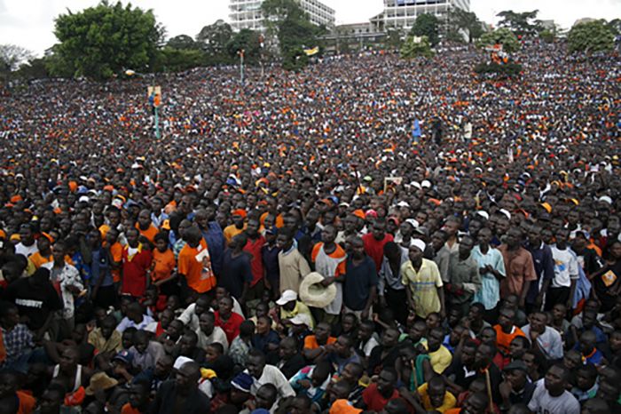
Orange democratic movement supporters attending a rally held by presidential candidate Raila Odinga in 2007 (photo: Wikimedia Commons).
After the split, KANU, which had initially backed the original ODM alliance, left the coalition entirely and KANU's leader and ex-President Daniel arap Moi, announced his support for his former political rival Kibaki and the PMU. Uhuru Kenyatta, who had run as KANU's candidate in 2002 and come in second to Kibaki, also announced his support for Kibaki. KANU decided that it would not nominate a presidential candidate in 2007, but it contested in some of the National Assembly elections.
By mid-November 2007, nine candidates had submitted the required documents to stand for election as Kenya's next president. All nine candidates also ran for a seat on the Assembly, as the constitution requires that the presidential election winner also must win a seat in Parliament. There were 14.3 million registered voters and the election date was set for 27 December 2007.
President Kibaki officially kicked off his campaign on 30 September 2007 at Nyayo Stadium in Nairobi. Raila Odinga launched his campaign to a crowd at Uhuru Park in Nairobi on 06 October 2007. A total of 2 548 candidates ran for seats on the assembly, which was more than twice as many candidates as had run in 2002 and included 269 women candidates.
Opinion polls in late October 2007 had Odinga leading at 50%, with Kibaki second at 39%, and Musyoka third at 8%. A mid-November poll showed Odinga still leading with 45%, but Kibaki closing the gap at 41% and Musyoka up to 11%. A late November poll placed Kibaki and Odinga essentially equal at 43% each.
Orange Democratic Movement (ODM) supporters carry a portrait of Raila Odinga at a rally leading up to the 2007 Kenyan general elections (photo: Wikimedia Commons).
Voting commenced on the morning of 27 December 2007 and Kenyan media published early results giving Odinga a lead of 460 000 votes with 69 of the 210 constituencies reporting. Vote tabulation by the Electoral Commission of Kenya (ECK) continued through the night of 27 December and all day on 28 December. Results on the 28th showed Odinga with a slight lead and on 29 December, the ODM declared victory. During the day of the 29th, Odinga's lead over Kibaki shrank and on 30 December, the ECK declared that Kibaki was the winner by just 232 000 votes.
Odinga's claims of a rigged election rang true with most non-Kikuyus, as the pre-election polls and expectations had been strongly in Odinga's favor. Odinga had also campaigned against the decades-long power dominance of Kikuyu politicians and he had won the voting in most non-Kikuyu constituencies by a large margin. Kibaki had managed to eek out apparent victory with the near-exclusive support of the Kikuyu, Meru, and Embu communities, who turned up in record numbers in response to Odinga's anti-Kikuyu campaign. Furthermore, the ODM had won by far the most Assembly seats, taking 99 of 210 seats, while Kibaki's PNU party only managed 43 seats.
Odinga accused the government of fraud and vote manipulation, urged Kibaki to admit defeat, and called for a recount of the votes. The ECK said that irregularities had occurred, but that this was a matter for the courts, not the Electoral Commission. In a rushed and private ceremony, Kibaki had himself sworn in as president on the evening of 30 December 2007. Kibaki appointed a partial cabinet on 08 January, comprising 17 ministers from his coalition parties (PNU, KANU, ODM-Kenya).
Raila Odinga and his wife Ida Odinga during the Orange Democratic Movement (ODM) Rally at Uhuru Park, Nairobi, 2007 (photo: Wikimedia Commons).
Post-Election Ethnic Violence (2007-08)
Within minutes of the announcement that Kibaki had been sworn in, ethnic rioting erupted on the streets of Nairobi and elsewhere across Kenya. Most of the violence was directed at Kikuyus, the group to which Kibaki belongs and who made up much of his support base. Gangs of Odinga supporters went on targeted ethnic rampages in the Rift Valley, on the east coast, and in Kisumu along Lake Victoria, destroying Kikuyu-owned businesses and homes, and killing Kikuyu men, women, and even children.
Crime was rampant in Kenya's densely populated areas, including Nairobi, Mombasa, settlements in the Rift Valley, and Luoland. Kisumu and Nairobi experienced continuous rioting until the end of January 2008. In the countryside, farms were looted and homesteads burned, roads were blocked, and people were afraid to go to work. Foreigners were commonly attacked and some people even fled to neighboring Uganda to escape the violence.
The violence was certainly triggered by the election results, but the scale of the fighting reflected long-held hatred and grievances, commingled with exclusion and marginalization during the colonial period, followed by decades of Neo-colonial Kikuyu dominance.
Odinga had campaigned on promising much-needed change to Kenya, where over 60% of Kenyans lived off less than US$1 per day and the most fertile land in the country and most of the wealth was in the hands of the families of the political and business elite. The violence that erupted when Odinga lost was a response to the frustration felt by having those promises of change once again snatched away, sentencing most Kenyans to the status quo and a continued life of poverty.
General Service Unit (GSU) paramilitary police wearing riot gear block the entrance to Uhuru Park to prevent the opposition from holding a rally, January 2008 (photo: Wikimedia Commons).
The rioting and violence continued and on New Year's Day 2008, some 200 unarmed Kikuyu women and children in Kiambaa village near Eldoret, who had fled the violence to seek refuge in a church, were locked inside by an angry mob, who then set the church ablaze, killing 35 people inside. The incident received widespread media coverage. The slums of Nairobi experienced some of the worst violence, with gangs attacking each other using machetes and clubs.
As the violence spread, Kibaki was intent on keeping control by use of force and he flooded the streets of Nairobi with security forces and issued a ban on live media broadcasts. International media covered the fighting extensively, giving the world the impression that Kenya was in a bloody war. Tourism was particularly hard hit, with most flights and tours cancelled.
After nearly a month of rioting and violence, the ethnic fighting had left over 500 people dead and an estimated 600 000 displaced. In an effort to end the violence, the United Nations sent its former Secretary-General Kofi Annan to Kenya in January 2008 to broker negotiations between the two sides after African Union (AU) Chariman John Kufuor, the President of Ghana, failed to even get the two sides to sit down together.
Orange Democratic Movement (ODM) leader and presidential candidate Raila Odinga addresses the press on Election Day 2007 (photo: Wikimedia Commons).
Power-Sharing Government (2008)
The peace process officially began on 22 January 2008 with negotiations led by a panel of African personalities, including former President Benjamin Mkapa of Tanzania, former South African First Lady Graça Machel, and Kofi Annan as Chairperson, with added technical support provided by the United Nations. The panel was charged with resolving the conflict and restoring peace to Kenya.
After 41 days of intense negotiations, the Agreement on the Principles of Partnership of the Coalition Government was signed on 28 February 2008 by President Mwai Kibaki and the Honorable Raila Odinga.
The key point in the agreement was the addition to government of the position of Prime Minister (this had already been successfully modeled in neighboring Tanzania), which would held by Raila Odinga and could not be revoked by the president. The signed agreement gave neither side what it had originally wanted and required serious compromise on both sides, with the ODM originally insisting on nothing less than a new presidential election and the PNU refusing to share equal power with the group that it accused of inciting violence and sending Kenya into chaos.
Raila Odinga in 2017 (photo: Wikimedia Commons).
The agreement specified that the cabinet would now consist of the president (Mwai Kibaki), vice-president (Kalonzo Musyoka), prime minister (Raila Odinga), two deputy prime ministers (one from each party), 40 additional appointed ministers (50% from each party), and 50 appointed assistant ministers (50% from each party). The PM must be an elected member of the National Assembly as well as the parliamentary leader of the party or coalition holding a majority of seats in the National Assembly. The position of PM is accountable to the president as well as being immune from civil or criminal prosecution.
The agreement was somewhat vague in that it specified that the duty of the new position of PM was to "coordinate and supervise government affairs", but it was unclear whether the PM could be overruled by the president. Uhuru Kenyatta was named as the PNU's deputy prime minister (as well as minister of trade) and Musalia Mudavadi was named as the ODM's deputy prime minister (as well as minister of local government).
Due to the creation of the coalition government, an official opposition did not exist, so in August 2008, over 70 ministers from the minor parties outside of PNU and ODM created a coalition opposition to ensure democratic governance.
Raila Odinga, Prime Minister of Kenya, and his wife, Ida Odinga with President Barack Obama and First Lady Michelle Obama during a reception at the Metropolitan Museum in New York with, September 2009 (photo: Wikimedia Commons).
New Constitution (2009-10)
In November 2009, the government released a proposed new constitution to the public for debate and review. The public was given 30 days to submit proposals for amendments to the respective local parliamentary representatives, after which a revised draft was presented to parliament on 08 January 2010. Final revisions were made and the final proposed constitution was published and subjected to a referendum on 04 August 2010. The constitution was approved by public vote, with 67% voting 'YES' in the referendum.
Key components and/or changes of the new constitution included:
- separation of power between the three arms of government (executive, legislative, and judiciary);
- only two levels of government: national and county;
- the positions of prime minister and deputy prime minister are to be abolished after the next general elections;
- citizenship: ends the prohibition on Kenyans holding dual citizenship and ending gender discrimination in relation to women passing citizenship to their children;
- gender equality in elective bodies: no more than two-thirds may be comprised of either gender;
- introduction of an upper house (the Senate), with each of the 47 counties having a senator;
- the National Assembly (lower house) will have 290 members representing constituencies and each county will have a female MP in the Assembly (guaranteeing 47 women).
Kenya's new constitution is perhaps Mwai Kibaki's major triumph and legacy. Having served two full 5-year terms, Kibaki was constitutionally ineligible to run for re-election for a third term.
President Mwai Kibaki at the London Conference on Somalia, 23 February 2012 (photo: Wikimedia Commons).
Uhuru Kenyatta
Background
Uhuru Kenyatta was born on 26 October 1961 to Jomo Kenyatta and his fourth wife, Mama Ngina Kenyatta (née Muhoho). The Kenyattas are of the Kikuyu ethnic group and Jomo Kenyatta was a prominent figure in Kenya's struggle for independence and would go on the become the country's first Prime Minister in 1963 and President in 1964. He was given the name Uhuru, which is the Swahili word for "freedom" in anticipation of Kenya's upcoming independence.
Uhuru attended the St Mary's School (commonly known as Saints), a private Roman Catholic primary and secondary school for boys in Nairobi. After finishing studies at St. Mary's, Uhuru attended Amherst College in Massachusetts, where he studied political science and economics. After graduation, Uhuru started an agricultural export company and then entered the political arena.
In 2001, Uhuru was elected to parliament representing the Gatundu South constituency and was appointed by President Daniel arap Moi to the cabinet post of Minister of Local Government.
Uhuru Kenyatta at the age of four years, with his father President Jomo Kenyatta, meeting West German President Heinrich Lübke and his wife, Frau Wilhelmine Lübke on their visit to Kenya, February 1966 (photo: Wikimedia Commons).
In the 2002 presidential elections, Uhuru ran as KANU's candidate, but lost to Mwai Kibaki, with Uhuru becoming the Opposition Leader in parliament. In the 2007 presidential elections, Uhuru backed Kibaki in his successful bid for re-election.
After the power-sharing agreement was adopted in 2008, Uhuru was appointed one of two deputy prime minsters in the new coalition government. In 2009, Uhuru was appointed Minister of Finance, a position he held until 2012.
In 2012, the International Criminal Court charged Uhuru Kenyatta as an indirect co-perpetrator in the violence that followed the 2007–08 Kenyan crisis; Uhuru was a leader in Kibaki's Party of National Unity (PNU) leader at the time. Uhuru resigned as Minister of Finance upon the confirmation of the charges, but he maintained his innocence and the charges were eventually dropped in March 2015 due to lack of evidence.
Uhuru Kenyatta is one of the wealthiest people in Kenya, with an estimated net worth in 2013 of around US$500 million. The Kenyatta family owns over 500 000 acres of land in Kenya, most of which was acquired by his father, Jomo Kenyatta, in post-colonial land transfers after independence when Jomo was the country's president. The Kenyatta's also have significant business ventures in various sectors, including tourism, insurance, dairy farming, and banking.
Indian Prime Minister Narendra Modi presenting new field ambulances to President Uhuru Kenyatta in Nairobi, 11 July 2016 (photo: Wikimedia Commons).
2013 General Elections
In the lead up to the next general elections, which were scheduled for March 2013, two major political coalitions formed to vie for the office of president, with multiple parties combining to form each coalition as follows:
- Coalition for Reforms and Democracy: comprised of the Orange Democratic Movement (ODM), Wiper Democratic Movement–Kenya (WDM-K), Forum for the Restoration of Democracy – Kenya (FORD-Kenya), and various smaller parties. Considered the main opposition party for the elections, its candidate was Prime Minister Raila Odinga and his running mate Vice-President Kalonzo Musyoka.
- Jubilee Alliance: comprised of The National Alliance (TNA), National Rainbow Coalition (NARC), United Republican Party (URP), and Republican Congress. Its candidate was Deputy Prime Minister Uhuru Kenyatta and his running mate William Ruto.
Kenya's new constitution provided for a two-round system of elections for the presidency, whereby a candidate had to receive over 50% of the vote, as well as 25% of the vote in at least 24 counties in order to be declared the winner in round one. If this does not occur, then a runoff is held with only the top two vote getters from round one on the second ballot.
Prime Minister Raila Odinga speaking at the World Economic Forum in Davos, Switzerland, 24 January 2013 (photo: Wikimedia Commons).
The lead-up to the elections did see some ethnic unrest and fighting during party nominations in January 2013. The elections themselves were largely peaceful, other than an incident near Mombasa where a gang associated with a fringe separatist group killed six police officers.
Voting took place on 04 March 2013, and the results were a victory for Uhuru Kenyatta of The National Alliance (TNA). Kenyatta received 50.51% of the votes, meaning that a runoff election was not required. Raila Odinga came in second with 43.70% of the votes. Musalia Mudavadi of the Amani Coalition came a distant third with just 3.96% of the votes.
The Orange Democratic Movement (ODM) won the most Assembly seats with 96 of 349 seats. Second was The National Alliance (TNA) with 88 seats and third was the United Republican Party (URP) with 76 seats. The TNA and ODM each won 17 seats on the senate, while the URP won 12 Senate seats.
Uhuru Kenyatta of the TNA party was sworn in on 09 April 2013, becoming Kenya's fourth president. William Ruto of the URP was sworn in as the vice-president.
Uhuru Kenyatta taking the oath of office during his inauguration as Kenya's fourth president, 09 April 2013 (photo: Wikimedia Commons).
Uhuru Kenyatta Presidency (2013-Present)
During President Kenyatta's inaugural speech, he stated that the major goal of his presidency would be achieving peace and strengthening national unity. He also promised the following:
- to abolish maternity fees and give all Kenyans free access to government health centers and dispensaries;
- the 6 billion Kenya shillings that were allocated for the election runoff (which was unnecessary since he had won over 50% of the votes) would be used to establish a new Youth and Women's Fund;
- to enact measures to ensure that all public school students receive a laptop computer;
- to boost the country's key agricultural and manufacturing sectors;
- to reduce unemployment;
- to have an honest and fair government;
- to swiftly put an end to corruption;
- to extend basic services (electricity and water) to all Kenyans.
President Uhuru Kenyatta poses with USA President Barack Obama and First Lady Michelle Obama in the Blue Room during a USA-Africa Leaders Summit dinner at the White House, 05 August 2014 (photo: Wikimedia Commons).
Westgate Mall Attack (September 2013)
On 21 September 2013, four masked gunmen from the terrorist group al-Shabaab attacked the Westgate Shopping Mall in an upscale Nairobi neighborhood. At least 71 people were killed, including 62 civilians, five Kenyan soldiers, and all four attackers, and over 100 people were injured.
Al-Shabaab claimed that the attack was in response to the Kenya military deployment in southern Somalia. Part of the mall collapsed due to a fire that broke out during the incident. The mall reopened on 18 July 2015.
Smoke over Westgate Shopping Mall on 21 September 2013 (photo: Wikimedia Commons).
Lead up to 2017 Elections
In September 2016, in anticipation of the next general elections, President Uhuru Kenyatta made the decision to transition the Jubilee Alliance (JA) coalition to a single unified party, which was named the Jubilee Party (JP). Tribalism and disagreements in the JA coalition led to the move. Many of the principal leaders and members of the JA joined the JP.
In January 2017, the opposition also reorganized, with Raila Odinga's Coalition for Reforms and Democracy becoming the National Super Alliance (NASA). Raila Odinga's Orange Democratic Movement (ODM) and Kalonzo Musyoka's Wiper Democratic Movement–Kenya (WDM-K) were the principal parties, but the other member-parties of the dissolved coalition also joined NASA.
General elections were scheduled to take place in August 2017 and there were several acts of violence in the months leading up to the voting. Human Rights Watch reported that it had received numerous reports of threats and voter intimidation in the Rift Valley and other parts of Kenya.
President Uhuru Kenyatta speaks at the Pre-Global Entrepreneurship Summit (GES) held in Nairobi, 22 July 2015 (photo: Wikimedia Commons).
On 27 July 2017, Christopher Msando, the head of information, communication, and technology for the Independent Electoral and Boundaries Commission (IEBC), the independent regulatory agency responsible for conducting and supervising all elections in Kenya, was found dead alongside the body of a 21-year-old woman in a forest on the outskirts of Nairobi.
Msando had played a major role in developing Kenya's new electronic voting system. His body showed signs of torture and the clothes had been removed from both bodies. It was speculated that Msando's murder may have been ordered by the ruling party, as his voting system may have made it difficult to rig results without his help. No suspects were arrested or charged in the investigation and his murder remains unsolved.
On 29 July 2017, the home of Vice-President William Ruto in Eldoret was besieged by a man wielding a machete. The vice president and his family were not in the house during the attack, but the assailant managed to take the guard on duty as a hostage. The siege lasted 18 hours before police finally entered, killing the man and freeing the hostage.
In pre-election polling, Uhuru Kenyatta maintained a +10% edge over Raila Odinga in most polls for many weeks, but as the election date drew near, the polls suggested a much closer race.
President Uhuru Kenyatta watches as Kenya burns 105 tons of ivory (elephant tusks) in Nairobi National Park, 30 April 2016 (photo: Wikimedia Commons).
2017 General Elections
Voting took place on 08 August 2017, and the results showed that incumbent President Kenyatta was the winner, with 54.17% of the votes and Odinga coming second with 44.94% of the votes. As per the constitution, the second round runoff vote was not required because Kenyatta received over 50% of the votes. A total of 15.6 million votes were cast, representing a 79.5% turnout amongst registered voters.
After the results were confirmed by the Independent Electoral and Boundaries Commission (IEBC), Odinga alleged that the results had been manipulated by computer hackers and he challenged the results in Kenya's Supreme Court. On 01 September 2017, the Supreme Court ruled in favor of Odinga and nullified Kenyatta's victory, ordering that a new election take place within 60 days. The IEBC set the date for the elections for 26 October 2017. Odinga declared that he would not participate in the repeat elections without "legal and constitutional guarantees" that the results would not be affected by electoral fraud.
In the days just prior to the repeat elections, several IEBC executives expressed skepticism about whether the second election would be fair and free of manipulation. The IEBC announced that it would count back-up paper ballots to confirm the results before announcing a winner. Odinga called on his supporters to boycott the ballot for the repeat elections, saying that no reforms to the voting system had been made.
President Uhuru Kenyatta poses with USA President Donald Trump in the Oval Office of the White House, 06 February, 2020 (photo: Wikimedia Commons).
Voting in the repeat election took place on 26 October 2017 and after more than three days to verify the results, Kenyatta was declared the winner with 98.26% of the votes, which was due to Odinga's boycotting of the election. The elections were suspended in 25 constituencies amidst security fears, but the election commission said that those results would not have changed the outcome. Only 7.6 million votes were counted (versus 15.6 million in the original election). In the weeks since the first election, as many as 50 people were killed by police and there were protests and fighting in many regions of Kenya.
On 28 November 2017, Uhuru Kenyatta was sworn in before a crowd of 65 000 in Nairobi's Kasarani Stadium. A few miles away, Raila Odinga and a large crowd of his supporters gathered in protest, with Odinga calling Kenyatta's government illegitimate. Police shot teargas into the crowd and helmeted security forces attacked the protestors with batons.
Kenya remains an ethnically divided country, with Odinga's supporters mostly coming from the poorer regions that have been marginalized for decades. The opposition accuses the ruling party of manipulating elections to stay in power, engaging in rampant corruption, using its security forces to direct abuse against anyone who dissents, and neglecting large portions of the population.
Kenya is also a country that is divided economically, with nearly two-thirds of Kenya's wealth controlled by just over 8 000 individuals out of over 53 million people.
The next general elections, which President Uhuru Kenyatta cannot contest, are scheduled for 2022.
President Uhuru Kenyatta meets with USA President Joe Biden in the White House, 14 October 2021 (photo: Wikimedia Commons).
READ MORE...
Daniel arap Moi, Early Colonization, Early History, Early Immigration, Happy Valley, Independence, Indian Ocean Trade, Iron Age, Jomo Kenyatta, Jomo Kenyatta Presidency, Kibaki Presidency, Mau Mau, Moi Presidency, Mwai Kibaki, Nearing Independence, Neolithic Era, Richard Leakey, Post-WWI Colony, Post-WWII Colony, Stone Age, Swahili, Tom Mboya, Uhuru Kenyatta, Uhuru Kenyatta Presidency, World War I, World War II
Great Good Fair Poor
- Jan
- Feb
- Mar
- Apr
- May
- Jun
- Jul
- Aug
- Sep
- Oct
- Nov
- Dec
The chart directly above should be taken as a very rough overall indicator of best times to visit Kenya, as there are significant variations regionally and based upon elevation. More information on the specific national parks and reserves is found on the previous Details tab.
Click on a Region Link above to read more about best times to visit a specific region or destination.
Climate, Seasons, Best Times
Kenya's climate can be unpredictable in terms of rain, but generally speaking, January thru March are dry and hot, April thru June are rainy and warm (these are called the 'long' rains), July thru October are dry and warm, and November thru December are again rainy and warm (the 'short' rains).
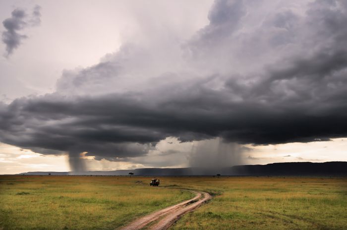
Rains in the Masai Mara.
Kenya's mountainous regions can experience rainy weather at any time and without predictability. The western portion of the country is largely influenced by Lake Victoria and has sporadic rains throughout the year. The east coast along the Indian Ocean has weather dictated by the monsoon, which blows dry from the northeast from November thru March and wet from the southeast during April/May. The biggest rains come to the coastal region in May.
The pricing and crowds generally follow from people's general avoidance of rain on their vacations. July and August are perhaps the busiest and are generally excellent for game viewing throughout the country.
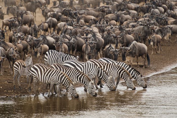
The Great Migration of zebras and wildebeests in the Masai Mara.
The wildebeest and zebra migration moves into the Masai Mara sometime during late July or early August and remains in Kenya for about three months. This is a very popular time to visit the Mara and it can be quite crowded.
Another option is to visit the Mara (and its adjoining private reserves) when the migration has moved into Tanzania, as it affords superb game viewing with no crowds at wildlife sightings.
The short rains in November/December are also typically limited to short afternoon storms and the landscape and skies are lovely for most of the day.
Diving and snorkeling along Kenya's Indian Ocean coast are best in the clear waters in March and October/November.
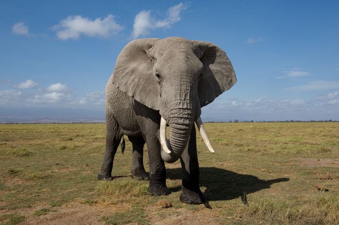
A bull elephant in Amboseli (Copyright © James Weis).
Showing 1–20 of 21 results
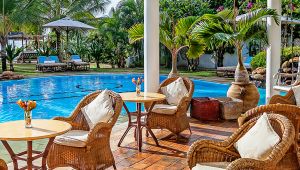
A villa-style, boutique hotel just steps from ocean in one of the top-rated beach destinations in Africa. Plenty to see and do on both land and water. Excellent food and service.…
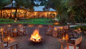
Located in a private concession on the edge of the Mara Triangle, which has low tourist densities. The camp is ideally positioned for the annual Great Migration of over two million herbivores. Families welcome.…

Located in a large, exclusive wildlife reserve, with no crowds and excellent year-round wildlife viewing. Romantic design evokes the early mobile safaris of the British Raj era. Game drives, walking, cultural activities.…
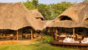
Located in in Meru National Park and named for 'Elsa' the lioness of 'Born Free' fame, where that story took place. Scenic and varied landscape, diverse wildlife, including all of Africa's Big Five. The park is never crowded.…
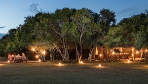
Located within the private Naboisho conservancy bordering the Masai Mara National Reserve but without the crowds. Superb wildlife concentrations and no restrictions regarding night drives and off-roading.…
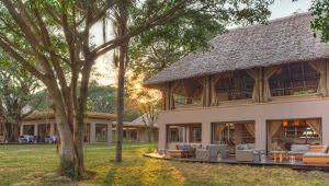
Large camp situated in a private concession on the edge of the Mara Triangle, which has low tourist densities. The camp is ideally positioned for the annual Great Migration of over two million herbivores. Families welcome.…
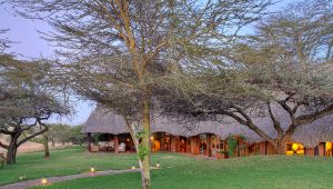
Small and intimate camp with just 5 guest cottages. The Lewa Conservancy has long been at the forefront of rhino conservation efforts and offers a diversity of other wildlife. Game drives, guided walks, horse riding, camel riding.…
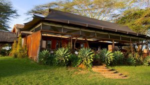
Located in the Lewa Conservancy, which has long been at the forefront of rhino conservation efforts. See diverse wildlife on safari drives, guided walks, and horseback. The camp is 100%-owned by the conservancy.…
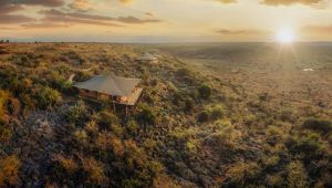
Luxury tented camp in the vast Loisaba Conservancy in Northern Laikipia. The camp offers panoramic views from atop a high ridge. Good wildlife viewing and diverse activities including game drives, mountain biking, walking, horse and camel riding, visits to the local Samburu.…
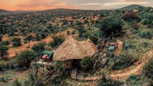
Unique guest rooms offer roll-out beds to sleep under the stars. Good wildlife viewing and diverse activities including game drives, mountain biking, walking, horse and camel riding, visits to the local Samburu.…
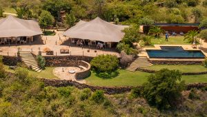
Contemporary and stylish camp in the vast Loisaba Conservancy in Northern Laikipia. The camp offers panoramic views from atop a high escarpment.…
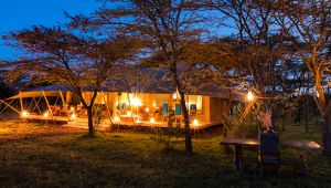
Nostalgic and romantic camp modeled after the luxury mobile camps used by Africa's early explorers, but with modern-day conveniences and hospitality. Located away from the crowded sections of the reserve with excellent wildlife viewing. Game drives, walking, culture.…
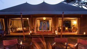
Located within the private Naboisho Conservancy, bordering the Masai Mara Reserve. Very low density of camps and visitors, excellent wildlife viewing, full-day drives into the reserve if requested, night drives, off-roading, culture.…
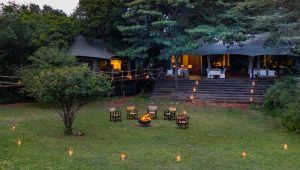
Located within the private Olare Motorogi Conservancy bordering the Masai Mara Reserve. Low density of tourists, excellent wildlife viewing, full-day drives into the reserve if requested, night drives, off-roading, culture.…
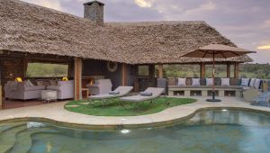
Located within a private conservancy bordering the Masai Mara National Reserve but without the crowds. Superb wildlife concentrations and no restrictions regarding night drives, off-roading, or walking.…
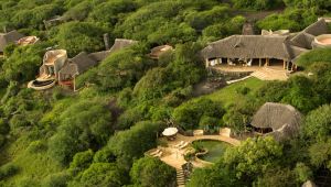
Historic lodge located in an huge reserve with very few camps in the picturesque Chyulu Hills. Good wildlife viewing, especially for 'big tusker' elephants. Game drives, horseback riding, walking, mountain biking, two hides at a productive waterhole, cultural visits.…
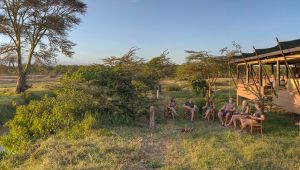
A traditional East African bush camp in a renowned wildlife conservancy protecting endangered species. Diverse and abundant wildlife. Game drive, horse riding, lion tracking, cycling, culture, and more.…
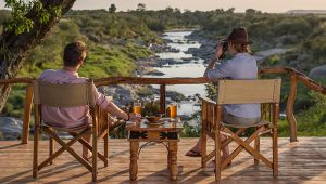
Located on a bend of the Talek River commonly used as a crossing point for resident wildlife. Centrally located in the reserve, with quick access to the Mara River. Families are welcome.…
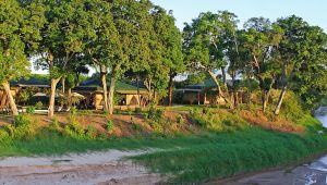
Located on the banks of the Sand River in a remote and uncrowded section of the Masai Mara. The great migration passes through annually and the resident wildlife is very good year-round.…