Rift Valley & Central Highlands
(incl. Aberdares, Nakuru, Naivasha, Mt. Kenya)
Region Links: Amboseli & Chyulu Hills, East Coast Kenya, Great Migration, Laikipia, Masai Mara, Nairobi, Rift Valley & Central Highlands, Samburu, Tsavo
Highlights
- The Aberdares offer abundant wildlife and amazing views in a lush, montane environment
- Lake Nakuru NP safaris for flamingos, rhinos and more
- Relax at historic Lake Naivasha and walk or bike with wildlife in Hell's Gate NP
- Explore Africa's second-highest peak in Mount Kenya National Park
EOA Recommends: Sarova Lion Hill Game Lodge, Serena Mountain Lodge, Solio Lodge
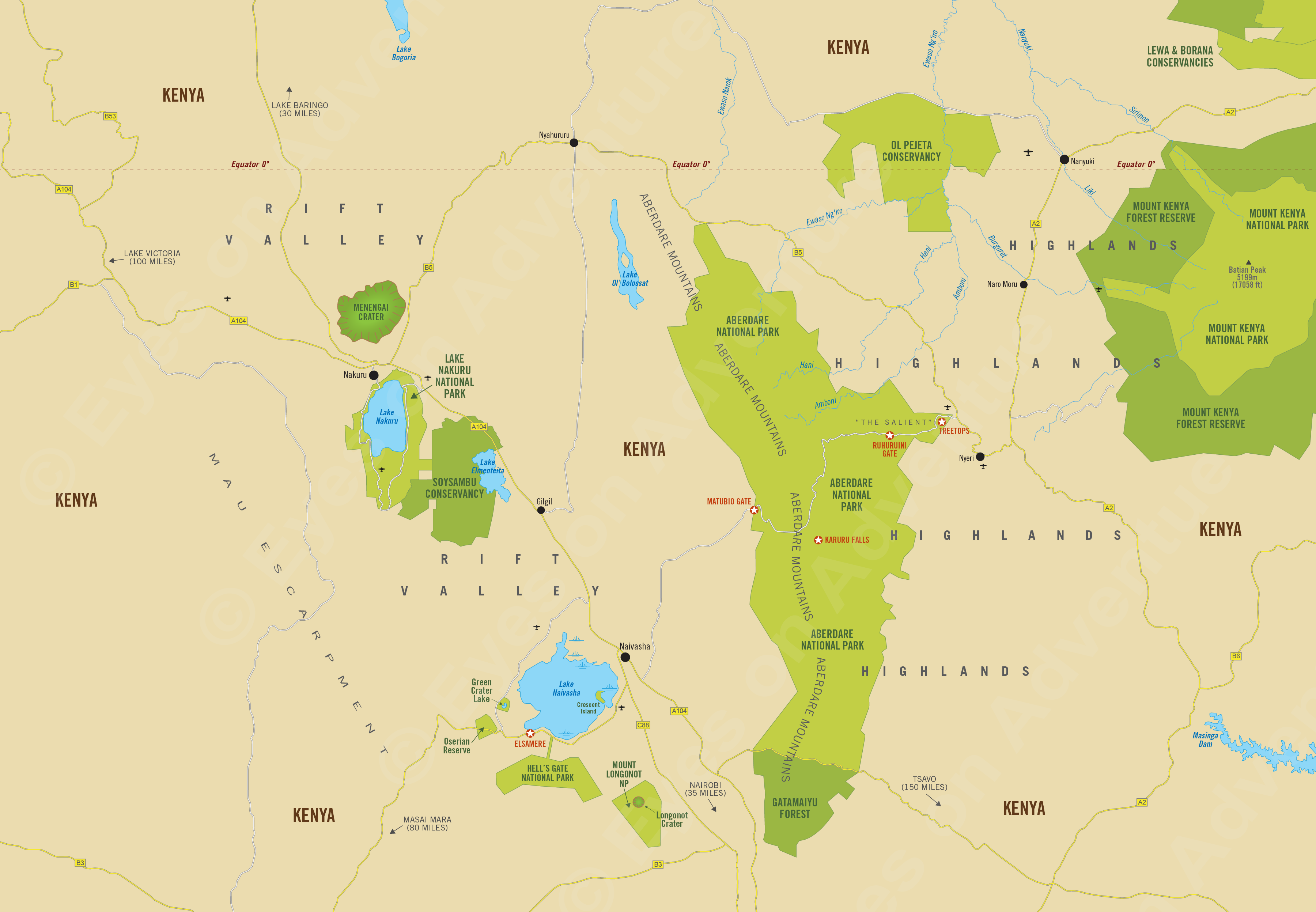
Africa's Rift Valley is one of the Earth's largest topographical features. It spans 3 700 miles (6 000 kms), from Jordan to the Zambezi Valley. Along the rift are volcanoes and mountains and in the valleys, lakes and rich grasslands. Kilimanjaro and Mount Kenya were formed by this rifting.
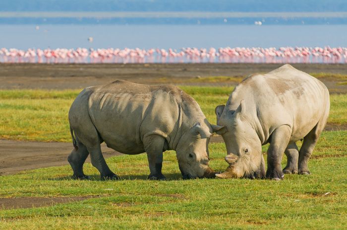
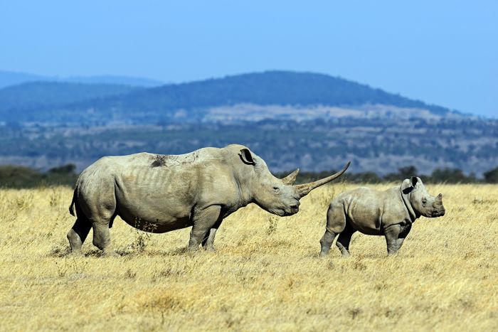
White rhinos on the Lake Nakuru shore.
In a few million years, the rifting will result in the separation of Africa into two or three land masses, as happened when India and Madagascar split away from the African continent a long time ago.
The Great Rift splits into a 'Y' shape going northwards from southern Tanzania. The western branch, known as the 'Albertine' Rift, runs along the eastern Congo border with Tanzania, Burundi, Rwanda and Uganda. The eastern branch, known as the 'Gregory' Rift, runs through Kenya, Ethiopia and the Red Sea.
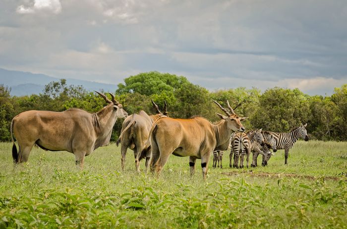
Elands and zebras in Aberdare National Park.
The rift in Kenya includes several lakes, including Naivasha, Nakuru, Bogoria, Baringo and Magadi. The Central Highlands along the Gregory Rift include the Aberdare mountain range and Mount Kenya, Africa's second-highest peak.
Read More...
Aberdare Mountains, Hell's Gate, History, Lake Elmenteita, Lake Naivasha, Lake Nakuru, Menengai, Mount Kenya, Mount Longonot, Solio, Soysambu
history
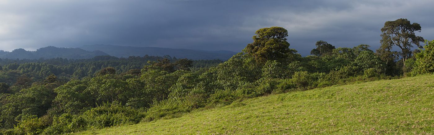
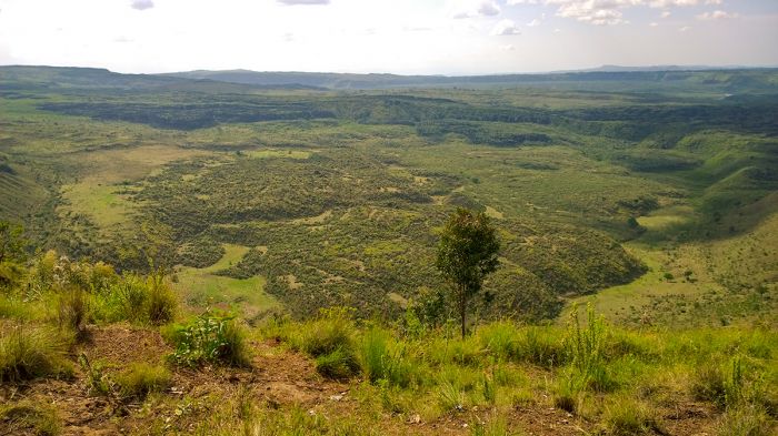
Kenya's Central Highlands are located along a portion of Africa's Great Rift Valley, which begins all the way north at the Red Sea and continues into Kenya and Tanzania. The Great Rift began forming some 35 million years ago.
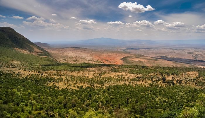
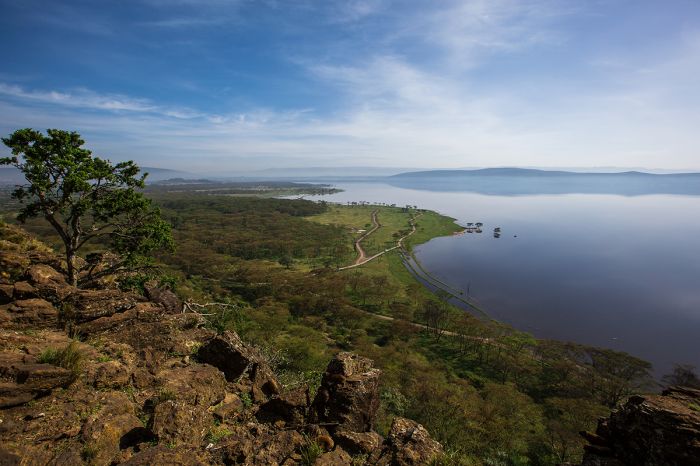
View over the Gregory Rift, part of Africa's Great Rift Valley.
The Kenya highlands sit along the edge of the "Eastern Branch" of the "East African Rift" (also known as the Gregory Rift) and includes Mount Kenya and the Aberdare Mountains along its eastern ridge. The valley just to the west includes Lakes Nakuru, Elmenteita, Naivasha, and Bogoria. The western side of the valley is bounded by the Mau Escarpment.
Historically, the region has been inhabited by the Kikuyu people, who migrated to the Central Highlands from northeast Kenya between the 16th and 18th centuries. The Kikuyu assimilated with hunter-gatherer people of the Athi and Gumba tribes and brought with them agriculture and livestock.
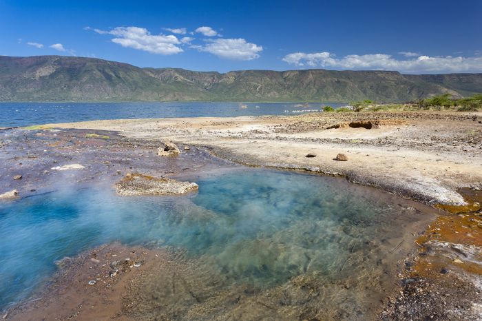
Hot springs at Lake Bogoria in Kenya's Rift Valley.
Since their arrival here, the Kikuyu have had an oft contentious relationship with the Maasai people, who mainly inhabited the lands further south. The Maasai would undertake cattle raids against the Kikuyu, with subsequent retaliation by the Kikuyu. This intertribal warfare reportedly still continues on a small scale even today.
The Kikuyu were eventually displaced from their homes by European settlers, but upon independence, received most of the their land back. Today, the Central Highlands are home to the country's largest rural population and there is farming on the rich soils of the valley and lower slopes of the mountains.
View over Lake Nakuru in Kenya's Rift Valley.
The Aberdares
The Aberdare Mountains are one of the most lush and beautiful places in Kenya. The Aberdare range spans 100 miles (160 kms) and has an average elevation of around 11 480 feet (3 500 meters). The highest peak in the range is Mount Satima, which reaches 13 127 feet (4 001 meters), which is surrounded by a number of sharp volcanic cones known as "the Dragon's Teeth".
The local Kikuyu people call the mountains 'Nyandarua', which means 'a drying hide' and refers to the shape of its silhouette.
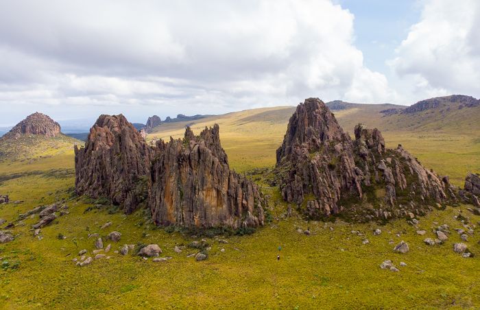
Rock formations known as the "Dragon's Teeth" in the Aberdares.
The thick montane forests in the middle altitudes are home to plentiful wildlife, including buffalo, lion, black rhino, small numbers of the endangered bongo antelope, bushbuck, defassa waterbuck, warthog, giant forest hog, bush pig, blue duiker, and hundreds of elephants.
Commonly seen primates include olive baboon, black-and-white colobus, and Sykes' monkey. There are a variety of predators, the most common of which are leopard and spotted hyena. Birding in the forest is outstanding.
The pristine, cloud-covered moorlands above 11 000 feet (3 350 meters) are the domain of lions, leopards (including rare melanistic black individuals), serval and bushbuck.
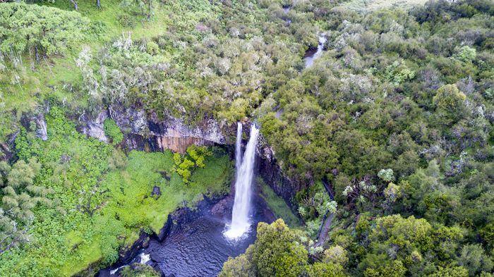
Waterfall in Aberdare National Park.
Declared in 1950, Aberdare National Park covers 295 square miles (766 sq kms) of the mid and upper-elevations and includes a variety of habitat including bamboo forest, rainforest, high moorlands, and deep valleys cut by montane rivers and streams.
Driving through the park offers spectacular birding, occasional wildlife sightings, scenic valleys and waterfalls, and breathtaking views around every curve. The entire park is fenced to avoid conflict between wildlife, especially elephants, and the people living around the park.
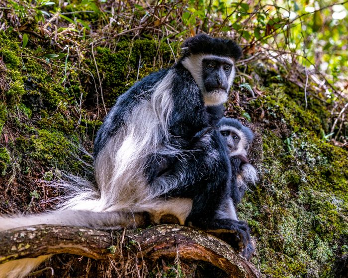
Black & white colobus monkeys in Aberdare NP.
Most vistors to the Aberdares opt to stay at one of the 'Tree' lodges here. These two lodges, 'The Ark' and 'Treetops', are built in the controlled area called 'The Salient', a lower-altitude extension of the park.
Both lodges offer overnight accommodation and serve as live-in, wildlife-viewing hides for their guests. Built on stilts, with viewing decks over pumped waterholes, they offer visitors an opportunity to sit and wait for wildlife to visit. The waterholes are spot-lit at night for a chance to see nocturnal animals.
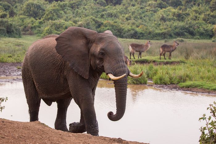
Elephant and waterbucks in Aberdare NP.
Lake Naivasha
Lake Naivasha is located 56 miles (90 kms) northwest of Nairobi, sitting on the floor of the Rift Valley at an elevation of 6 200 feet (1 890 meters). The lake is a shallow body of fresh water covering a surface area of 54 square miles (139 sq kms) and surrounded by fever trees and low hills. The lake has an average depth of 20 feet (6 meters) and maximum depth of 98 feet (30 meters).
Naivasha is fed by rivers flowing into its swamps on the northern shore. Its waters are fresh and, although it has no surface outlet, it is believed that there is an underground outlet that flows to Lake Magadi further south. Historical lake levels have fluctuated wildly, almost completely drying in the late 1940s, and its shores are in a constant state of flux.
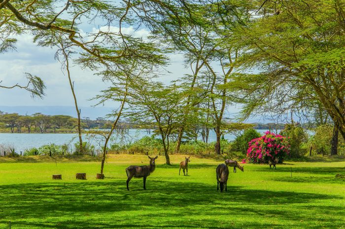
Manicured lawn at a Lake Naivasha lodge.
Naivasha town and the lake were at the center of British colonial socialite culture in the 1930s and some of the magnificent homes from that time are now used as tourist accommodations. Joy Adamson, the author of the famous book "Born Free", lived on Lake Naivasha's shores during the 1960s.
Between 1937 and 1950, Lake Naivasha was used as one of the landing places for Britain's 'flying boats' (fixed-wing seaplanes which landed on water) on the passenger and mail route between Southampton, England and South Africa.
Today the lake and its shores are protected as a Ramsar Wetland, but the surrounding land is used primarily for flower cultivation for the European market. The flower farms threaten the lake in many ways, including the use of fertilizers and use of the lake's water for irrigation. The horticulture industry around Naivasha has also led to a huge increase in the human population around the lake, which has increased sewage and other runoff into the lake.
Lake Naivasha shoreline.
The wildlife is mostly protected in private sanctuaries around the lake, such as Green Crater Lake, Oserian Wildlife Reserve, and Crescent Island. Hippos are plentiful in the lake and giraffes and various antelope species roam the shores. Birding around the lake is superb, with a huge diversity of water-associated species easily seen.
Hell's Gate National Park
Hell's Gate National Park is located just south of Lake Naivasha and was named by early European explorers for its narrow opening in the cliffs that was once an outlet for a substantial prehistoric lake that stretched north into Lake Nakuru. Early humans are thought to have lived along the shores of this lake.
The small park was established in 1984 and is dominated by its deep gorge lined with red cliffs. The park covers a modest 26 square miles (68 sq kms) and encompasses two extinct volcanoes (Olkaria and Hobley's).
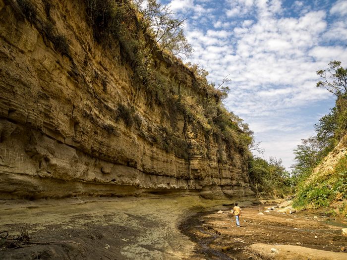
Walking through Hell's Gate National Park.
Hell's Gate offers a dramatic venue for walking or biking, while viewing seasonal herds of wildlife, including buffalo, Burchell's zebra, giraffe, impala, blue wildebeest, both gazelle species, and eland. Leopard, cheetah and spotted hyena are also present, but less often seen.
The only accommodation within the park are three basic self-camping sites and most visitors come on a day trip to hike or bike in the gorge.
The are several geothermal power stations located in Hell's Gate National Park, generating power from hot springs and geysers in the park.
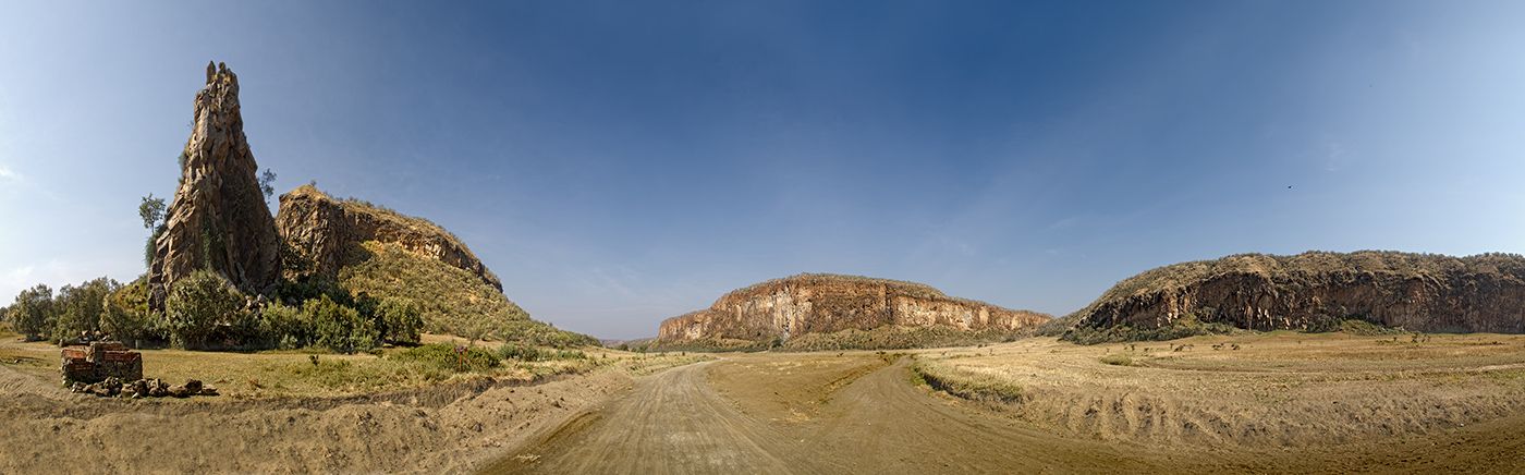
Mount Longonot
Mount Longonot is a dormant stratovolcano that rises to 9 107 feet (2 776 m) and that last erupted in the 1860s. It is protected within the small national park of the same name. Guided walks to the top of the caldera take about 90 minutes and offer amazing views of the crater and surrounding landscape in all directions. The mountain is visible for many miles around.
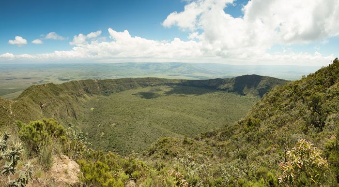
Longonot Crater in Mount Longonot National Park, Kenya.
Mount Longonot National Park covers 20 square miles (52 sq kms), encompassing and protecting the volcano, as well as the acacia scrub and savanna on the lower slopes and surrounding terrain.
Climbers can ascend the volcano on their own or with a local guide. The ascent takes about an hour to the crater rim. Descending into the crater is possible or one can walk around the crater rim (two to three hours to circumnavigate). Be wary of buffalo when climbing and especially within the crater.
Overnight accommodation is available at a basic camping site or at the small town of Longonot. Staying on the mountain is also permitted anywhere (bring your own tent and gear and get formal permission from the park rangers).
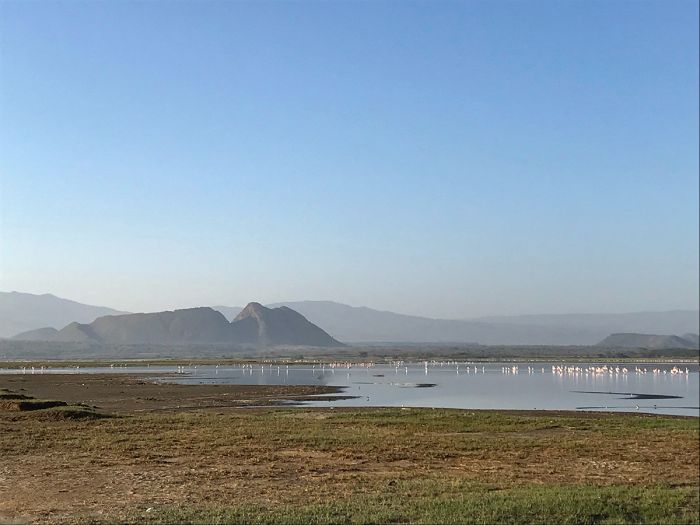
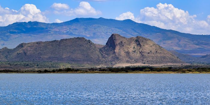
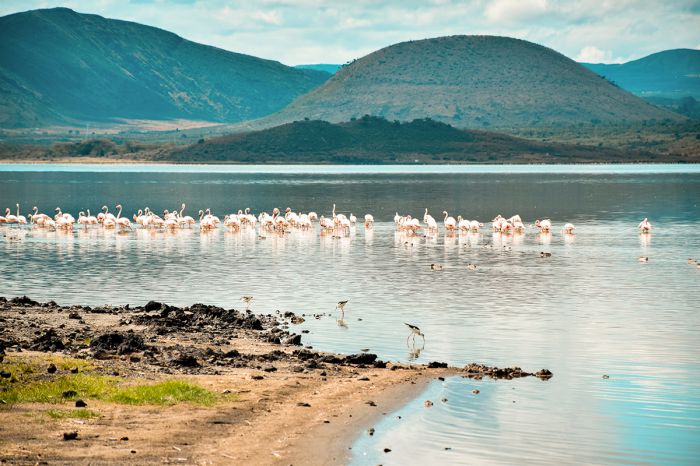
Lake Nakuru
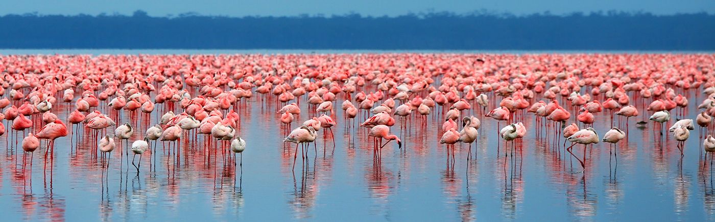
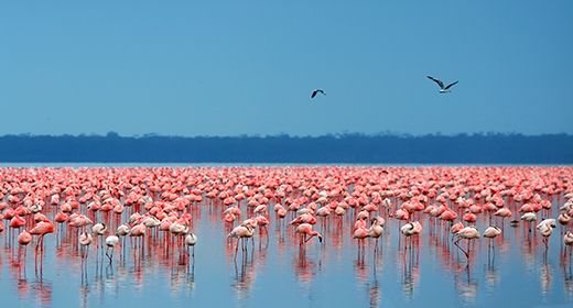
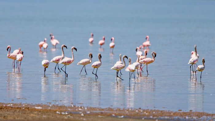
Lake Nakuru National Park is one of Kenya's most popular and visited destinations. The park measures 73 square miles (188 sq kms) and is completely fenced to protect the diverse and abundant wildlife that live there. Lake Nakuru itself is famous for enormous flocks of flamingos, which seasonally gather on the lake in numbers from 500 000 to 1.5 million.
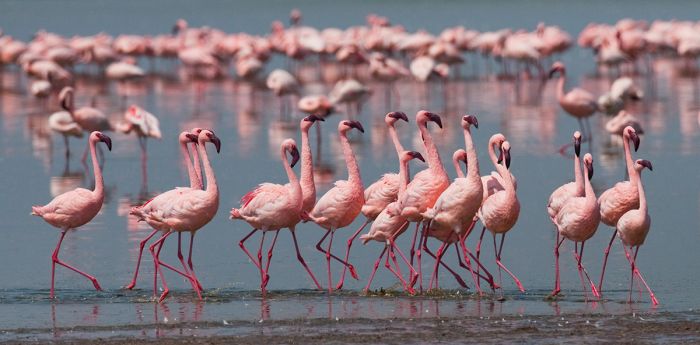
Lesser flamingos on Lake Nakuru.
Lake Nakuru is fed by several small rivers, as well as underground springs, but has no known outlet. The result is that the lake's water is highly alkaline, supporting heavy concentrations of spirulina algae. The algae gives the lake its blue-green color and is also the main food for the flamingos.
There are no native fish in the lake, but some introduced tilapia survive in the alkaline water and this has attracted a multitude of fish-eating birds, including large numbers of pelicans.
There are a few lodges in and just outside the park offering a fully-inclusive game experience. The park does not allow walking, so game drives are the only option. The main driving track encircles the lake and takes about 2 hours (longer for birders).
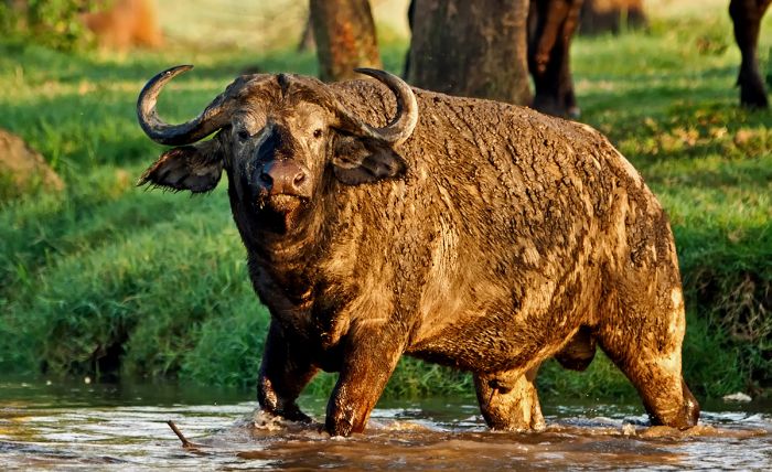
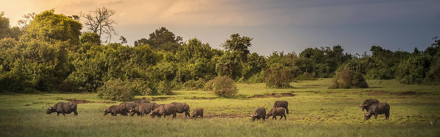
Buffalo bull on the Lake Nakuru shore.
Safaris at Nakuru are very rewarding, with a great diversity of wildlife easily seen, including endangered species such as black and white rhinos and Rothschild's giraffe. Nakuru is in fact one of the best places in Kenya to see rhinos.
Other wildlife commonly encountered includes lion, leopard, impala, waterbuck, buffalo, Burchell's zebra, eland, warthog, olive baboon, Grant's gazelle, Thomson's gazelle, hippo, vervet monkey, and black-and-white colobus. Birding in the areas around the lake is also extremely good.
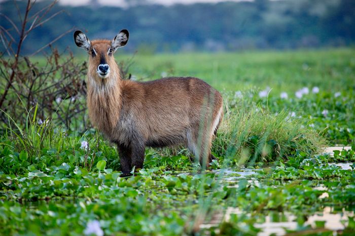
Waterbuck in shallow water - Lake Nakuru National Park.
Menengai Crater
Menengai Crater is the remnant of a once-massive shield volcano located just north of Lake Nakuru in the Gregory Rift Valley. Menengai is the second largest volcanic crater in Africa, after Ngorongoro. The volcano formed some 200 000 years ago and collapsed about 8 000 years ago, leaving behind a 7.5x5-mile (12x8-km) caldera. The outer slopes of the crater are covered in a combination of forest and cultivation. A road from Nakuru town leads to a spectacular view point on the crater rim.
Menengai Crater in the Gregory Rift Valley.
Lake Elmenteita
Situated 7 miles (11 kms) southeast of Lake Nakuru and 20 miles (30 kms) northwest of Lake Naivasha is Lake Elementeita. The lake is an 'endorheic basin' (meaning it has no outlet), so like almost almost all of Kenya's Rift Valley lakes, Elmenteita's water is alkaline and hypersaline. During its geological past, Elmenteita was at times united with present-day Lake Nakuru, forming a much larger lake.
Elementeita surface area is relatively small, spanning 6.9 square miles (18 sq kms). It is also a shallow lake, with a maximum depth of 4-5 feet (1.2-1.5 meters), but in most places, Elmenteita's depth is less than 3 feet (1 meter). During the drier parts of the year, the lake experiences significant evaporation and its waters recede, leaving trona-encrusted mud flats on its fringes.
The name 'Elmenteita' come from the Maa language (spoken by the indigenous Maasai people) word "muteita", which translates highly to "a dusty place", which refers the dry and dusty landscape that characterizes the land surrounding the lake, especially from Junuary thru March.
Lake Elmenteita, with flamingos on the water and eroded calderas in the distance.
During the British colonial period in present-day Kenya, Hugh Cholmondeley, the 3rd Baron Delamere, moved from England to the British colony, and in 1901, he acquired large land holdings around Lake Elmenteita from the Crown. The local Maasai people that had occupied the land for centuries, were displaced to make room for European settlers.
Lord Delamere purchased more than 50 000 acres (210 sq kms) around Lake Elementeita, which he used to start up a ranch, which he called 'Soysambu'. Delamere and his wife, Lady Florence Anne Cole, were determined to initiate a successful agriculture industry in the colony, and they worked tirelessly for years, mostly without success, due to the dry conditions and various diseases that struck his imported cattle and sheep. Nonetheless, Delamere is considered to have been a pioneer in the development of early agriculture in Kenya.
Lord Delamere was a founding member of the colony's 'Happy Valley Set', an exclusive clique of British aristocrats that partied and sought various forms of sometimes scandalous entertainment. Lord Delamere died in 1931 at age 61 and gifted his land on the eastern side of the lake to his brother-in-law, Galbraith Lowry Egerton Cole, who used it for his Kekopey Ranch.
Side notes: Lord Delemere's second wife, Gwladys Helen Beckett, later became Nairobi's second female mayor. Lord Delamere is also a featured character in Karen Blixen's book, Out of Africa.
Dramatic setting at Lake Elmenteita, Kenya.
Soysambu Conservancy
Most of what was Lord Delamere's Soysambu Ranch is now a conservancy that protects Lake Elementeita and its wildlife. The ranch was converted to a fully-fenced private conservancy in 2007, which protects 75 square miles (195 sq kms) around all but the eastern side of the lake (which was the land Delaware bequeathed to his brother-in-law).
The Soysambu Conservancy protects about two-thirds of Lake Elmenteita's shoreline along the south, west, and north. The land on the eastern side of the lake (which was the Kekopey Ranch), was sold to land-holding cooperative in 1977, which allocated small plots to its individual shareholders for homesteads. The original Kekopey Ranch farmhouse, which was contracted of brick in 1917-1918, still stands and now the Lake Elementaita Lodge.
The landscape around the lake is scenic but arid, with Acacia woodland and savanna framed by ancient eroded calderas from extinct volcanos. The southern side of the lake is the location of Kekopey Hot Springs and a favored hangout for water birds.
Lesser flamingos are often seen on Lake Elmenteita.
Beyond the lakeshore further to the south is an area called the Elementeita Badlands and the Otutu Forest. This harsh land is surfaced by lava flows from ancient times, with lava boulders and volcanic rock strewn across 14 square miles (36 sq kms). The land was also previously part of the Kekopey Ranch and is now owned by the Njenga Karume Trust.
Wildlife that can be seen in the Soysambu Conservancy includes buffalo, eland, Rothschild's giraffe, waterbuck, Grant's zebra, Grant's gazelle, Thomson's gazelle, impala, common reedbuck, and warthog. Predators include leopard, spotted hyena, lion, striped hyena, black-backed jackal, and caracal. Primates include vervet monkey, black-and-white colobus and olive baboon.
The region has a bird list that exceeds 350 species. The lake often hosts huge numbers of flamingos and is a favored breeding ground of great white pelicans.
Flamingos on Lake Elmenteita.
Only one fish can live in the Elmenteita's soda waters: the Lake Magadi tilapia (Alcolapia grahami), which has evolved to survive and thrive in hypersaline lakes. Native to Lake Magadi further south, the fish was introduced to Lake Elemteita.
There are a few good choices for accommodation around at Lake Elmenteita and self-camping is permitted within the Conservancy. Activities offered and permitted in the Conservancy include self-driving and walking (a guide is required). Some of the properties may also offer horseback riding.
Lake Elmenteita, along with its neighboring lakes (Nakuru and Naivasha) is an UNESCO World Heritage Site. Elmenteita ia also a Ramsar Wetland of International Importance and a Birdlife International Important Birding Area (IBA).
The Lake Magadi tilapia (Alcolapia grahami) is the only fish that can servive in Lake Elmenteita's warm salty water. (photo: Wikimedia Commons)
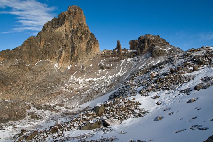
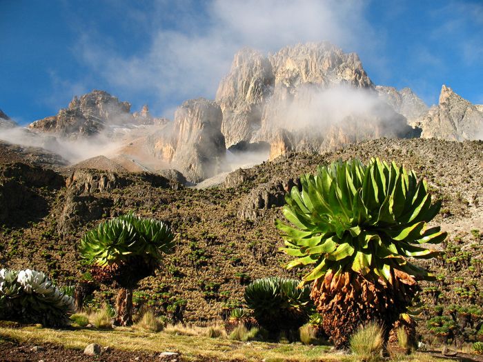
Mount Kenya
Mount Kenya is an extinct stratovolcano dating back 3.5-million years, and is Africa's second-highest peak after Kilimanjaro. The mountain was formed during the opening of Africa's Great Rift. The massive volcano once rose to 23 000 feet (7 000 m), but glaciation has eroded its highest peak, 'Batian', down to 17 058 feet (5 199 m) above sea level.
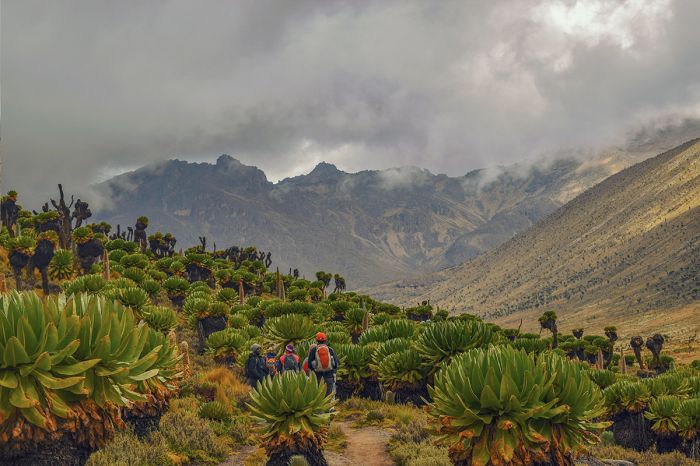
Trekkers on the slopes of Mount Kenya.
The highest points are still permanently covered in snow, but this is slowly retreating due to warming temperatures. The lush slopes are covered in beautiful and dense bands of forest containing numerous endemic, alpine species. Much of the surrounding regions, reaching north to Samburu and west into the Rift Valley depend on the water received from Mount Kenya.
Mount Kenya National Park, established in 1949, protects all parts of the mountain above 10 500 feet (3 200 m), plus various salients down important streams below this elevation. The park covers 275 square miles (715 sq kms) and straddles the equator.
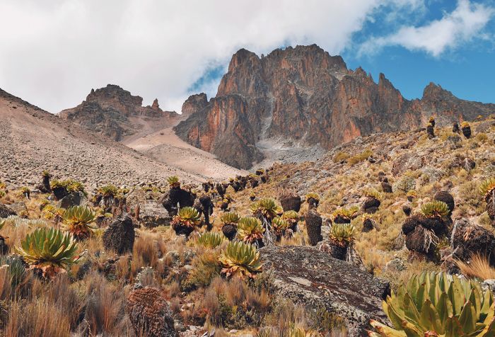
The scenic peaks of Mount Kenya.
Serena Mountain Lodge is situated in the Forest Reserve buffer zone surrounding the national park and offers a similar experience to the 'tree' hotels of the Aberdares, but with a vastly superior game viewing experience. Viewing decks overlook a pumped waterhole that attracts wildlife and birds, giving guests the chance to watch in comfort 24 hours per day. Elephant, buffalo, giant forest hog, bush pig and black rhino are seen almost daily. The forest birding here is outstanding.
Climbing Mount Kenya will never compare in popularity to Kilimanjaro, but the hiking here offers a similar experience, with no crowds, is significantly less expensive, and is far less likely to induce altitude sickness. The climb up Batian peak is only accessible to experienced climbers, but Lenana peak (16 355 ft/4 985 m) requires no climbing experience to summit. Several ascent routes can be taken and a week at minimum is recommended to acclimate and complete the climb.
At the summit of Mount Kenya.
Solio Lodge
Solio is a 27-square-mile (70-sq-km) fully-fenced wildlife sanctuary sitting on the saddle between Mount Kenya and the Aberdares. The lodge is part of the Solio Cattle Ranch, which, like so many ranches in the Laikipia region to the north, combines wildlife conservation, tourism, and ranching activities to its visitors.
Solio was founded in 1970 as a rhino breeding center, but in addition to black and white rhinos, the wildlife here is diverse and includes zebra, buffalo, eland, oryx, giraffe, impala and waterbuck. Predators seen regularly include leopard, lion, cheetah and spotted hyena.
White rhinos at Solio Lodge.
Read More...
Aberdare Mountains, Hell's Gate, History, Lake Elmenteita, Lake Naivasha, Lake Nakuru, Menengai, Mount Kenya, Mount Longonot, Solio, Soysambu
Rift Valley
Great Good Fair Poor
- Jan
- Feb
- Mar
- Apr
- May
- Jun
- Jul
- Aug
- Sep
- Oct
- Nov
- Dec
As with much of Kenya, the Rift Valley experiences two rainy seasons, the short rains for about a month during November and December, and the longer and generally heavier rains from March thru May. Nakuru has good wildlife viewing year-round, but should be avoided during the wettest months of April and May.
Lake Nakuru's flamingo numbers are highly dependent on conditions in the lake and can be hit or miss, as the birds will move to other lakes in the Rift Valley if Nakuru's algae and water are not suitable.
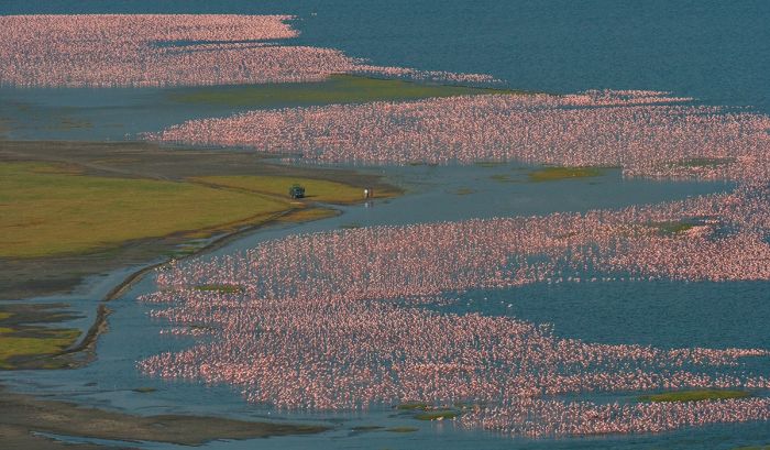
Huge flocks of flamingos on Lake Nakuru.
Central Highlands
Great Good Fair Poor
- Jan
- Feb
- Mar
- Apr
- May
- Jun
- Jul
- Aug
- Sep
- Oct
- Nov
- Dec
The Aberdare Mountains receive rain throughout the year, even during the regional dry season months. The climate in the mountains is typically misty and cool, particularly at the higher elevations.
Mount Kenya's weather is highly unpredictable, with clear days during the rain season and downpours during the dry season. Cool weather clothing as well as rain gear are recommended for visits to Kenya's central highlands year-round.
Near the summit of Mount Kenya.