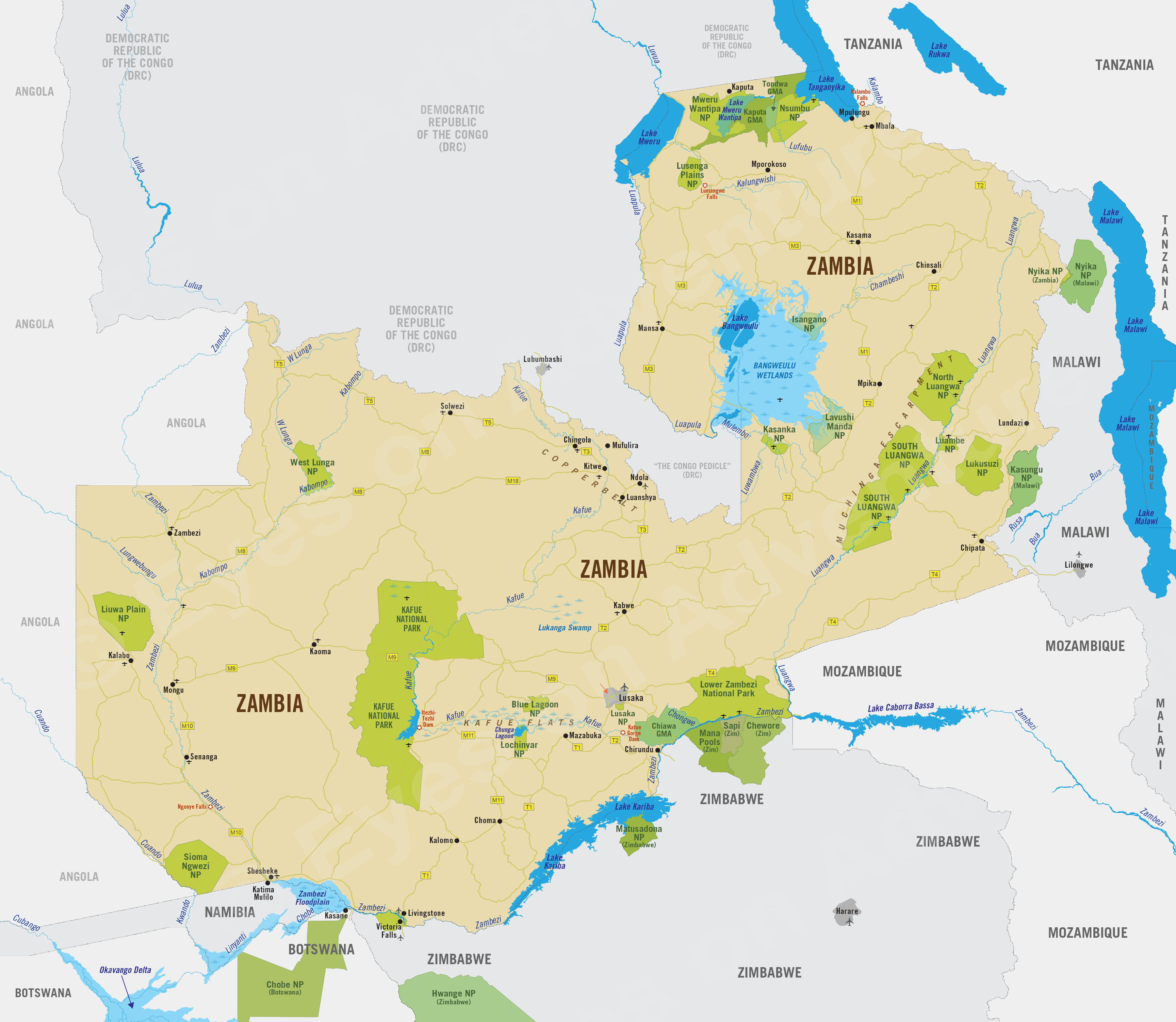
Zambia
Region Links: Kafue, Livingstone, Lower Zambezi (Zambia), North Luangwa, South Luangwa
Highlights
- The Luangwa Valley is Zambia's top wildlife destination.
- Kafue National Park is wild, remote and offers superb safaris.
- The Victoria Falls are one of Africa's greatest natural wonders.
- The Lower Zambezi combines land and river based safaris.
Zambia's location is a bridge between Southern and East Africa, offering a great diversity of wildlife and habitats. Although landlocked, three major river systems define its best safari regions: the Luangwa, the Kafue, and the Zambezi.
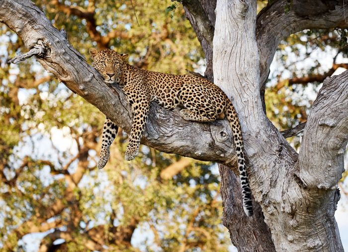
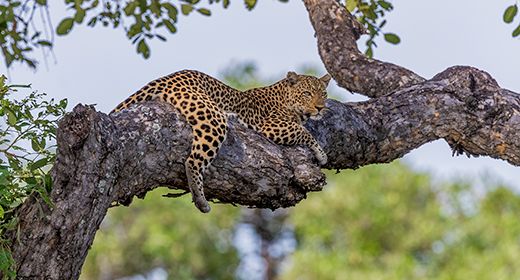
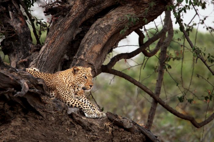
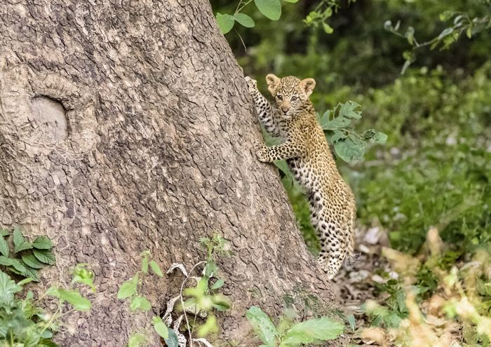
The Luangwa Valley is known for its high density of leopards.
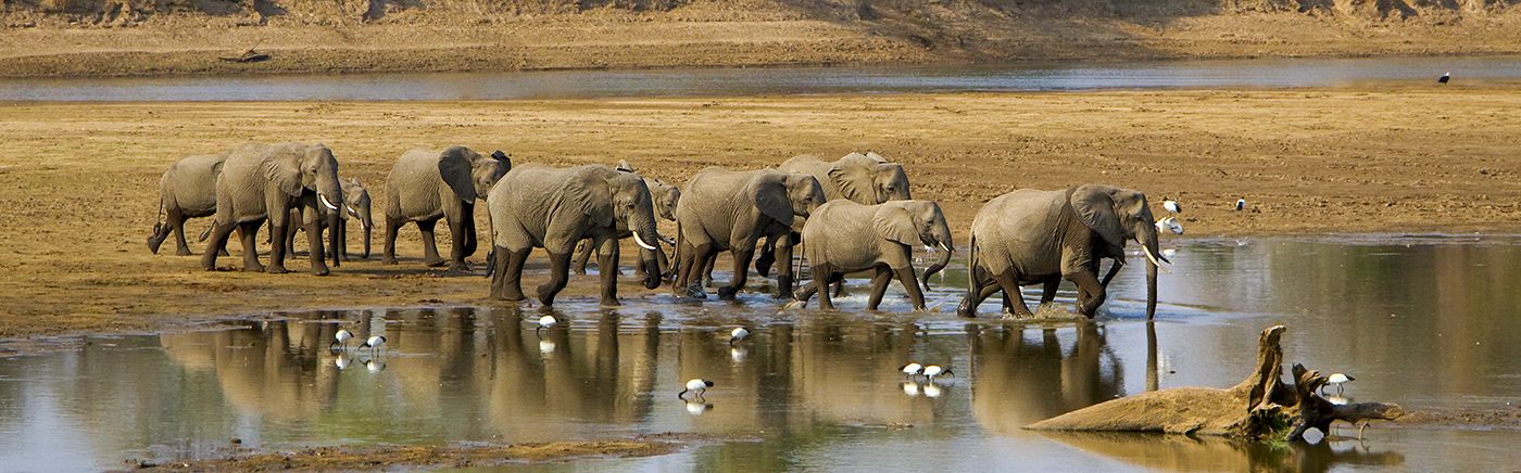
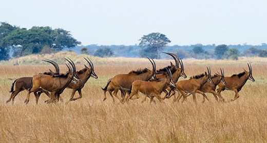
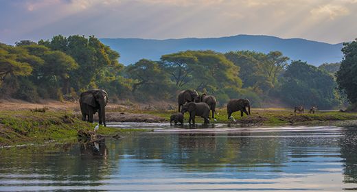
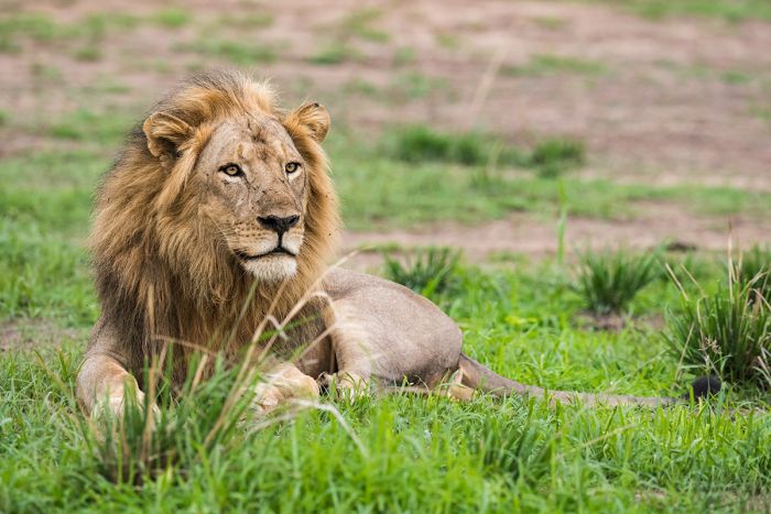
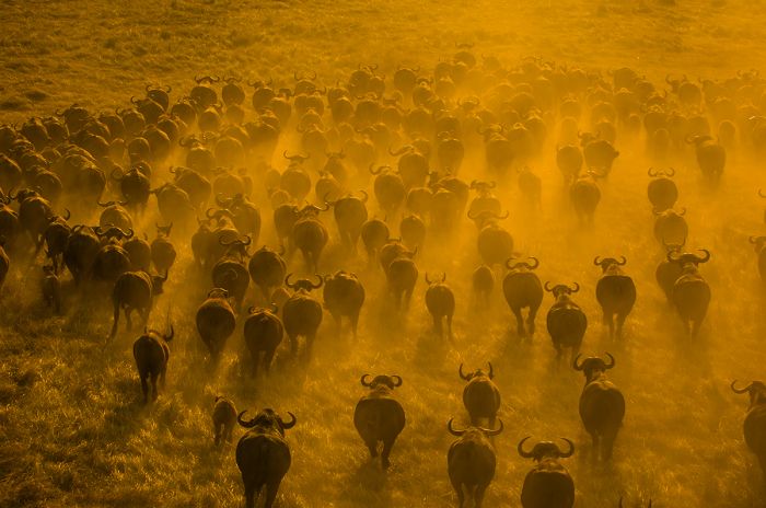
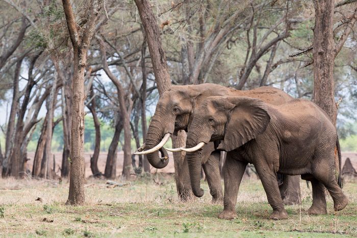
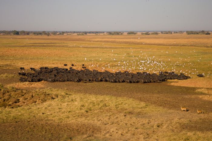
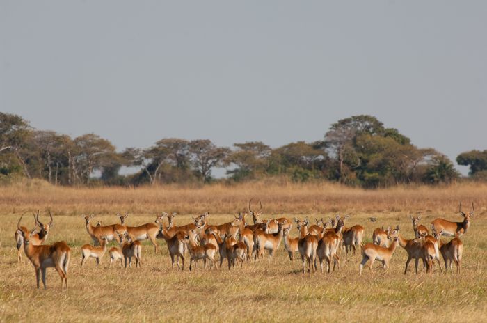
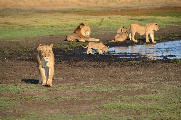
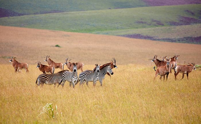
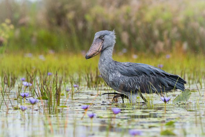
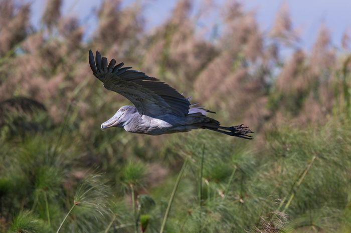
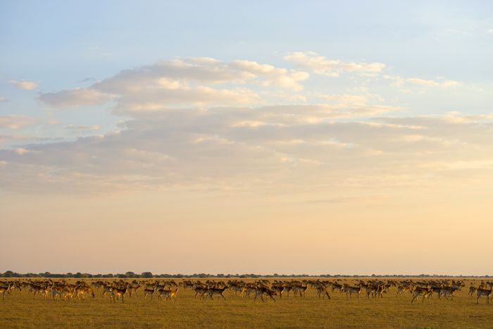
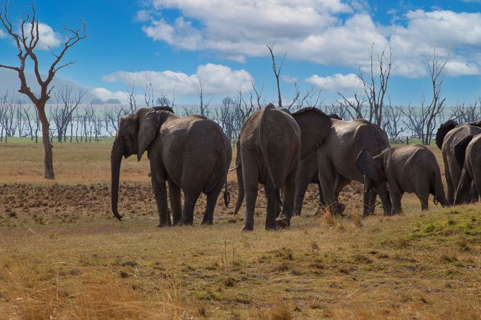
The Luangwa River valley is arguably Zambia's prized jewel for wildlife and its most visited safari destination. The valley offers plentiful big game, including lion, leopard, elephant, hyena, African wild dog, buffalo, zebra, giraffe, puku, kudu, and more.
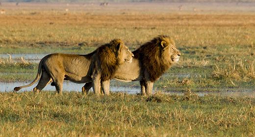
A male lion in South Luangwa National Park.
There are two national parks in Luangwa: South Luangwa is the larger and more established, while North Luangwa is wild, remote and seldom visited. Both parks are somewhat seasonal and some camps close during the rains. The popular "walking safari" was pioneered in Luangwa by its first warden, Norman Carr.
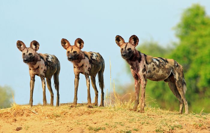
Endangered African wild dogs are found in the Luangwa Valley.
Zambia's largest protected area is Kafue National Park, named for the river that flows through the park. Kafue's northern region is prime wildlife habitat, and it offers one of Africa's most remote and pristine safari experiences.
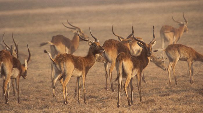
The seasonally inundated Busanga Floodplains are a rich habitat for big herds of grazers, including red lechwe, buffalo, puku, wildebeest, zebra, and hartebeest. Kafue's predators include lion, cheetah, hyena, and wild dog. Elephants can also be seen.
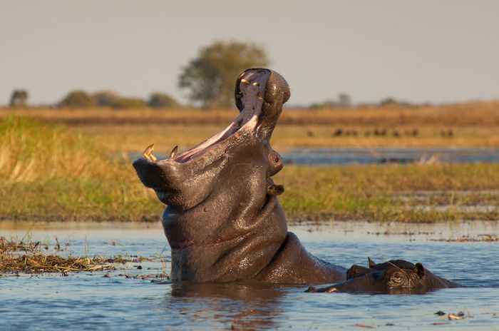
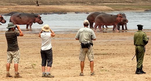
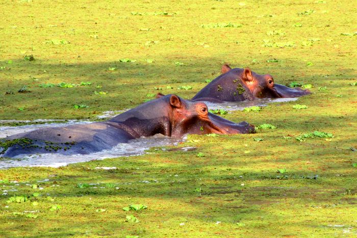
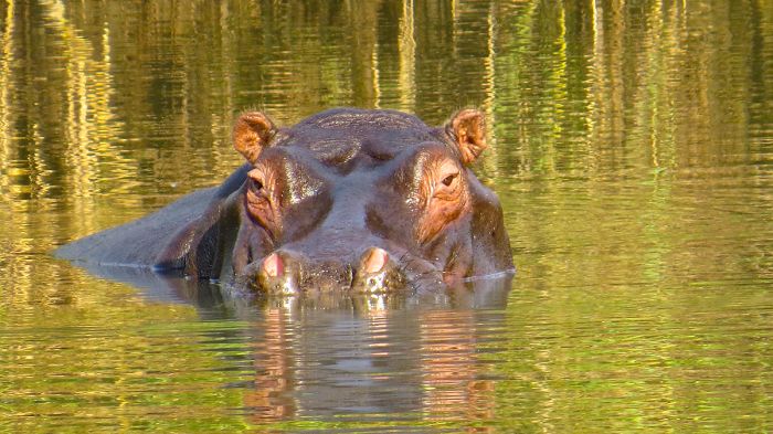
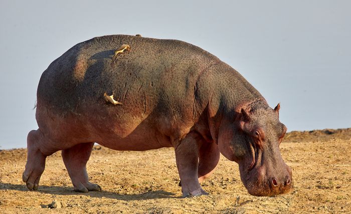
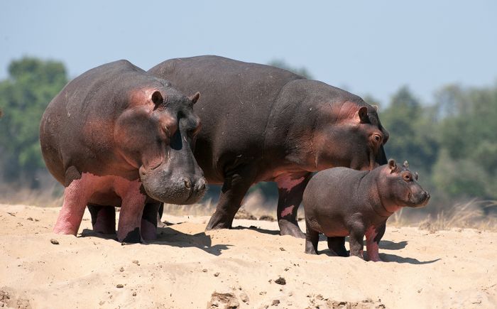
A hippo gives warning in Kafue National Park.
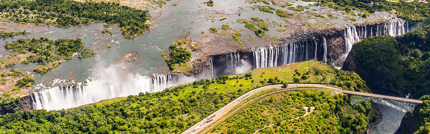
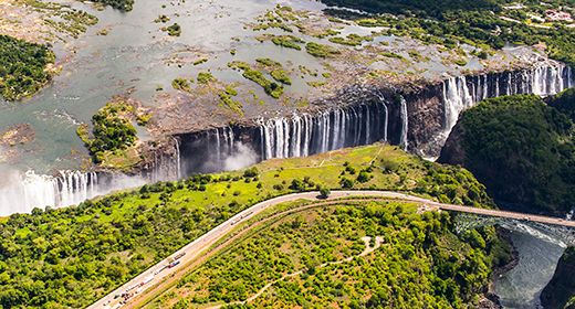
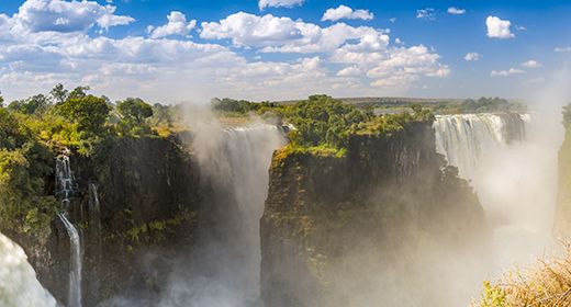
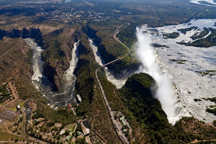
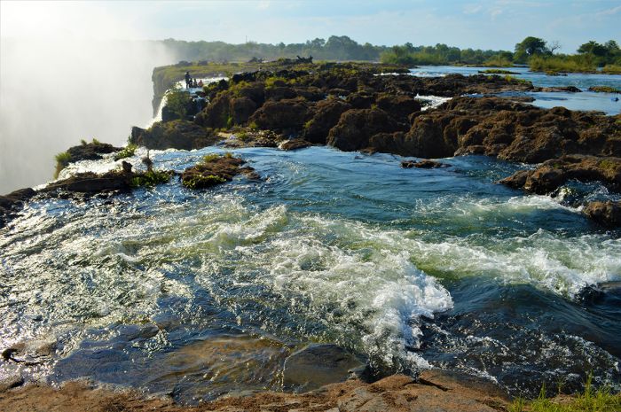
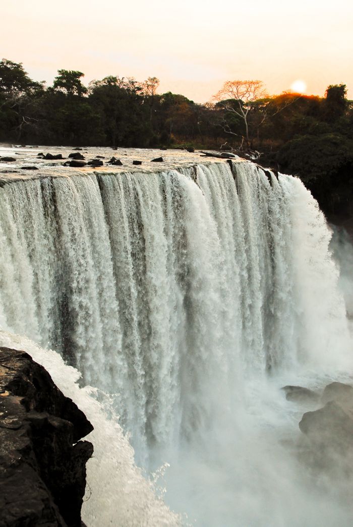
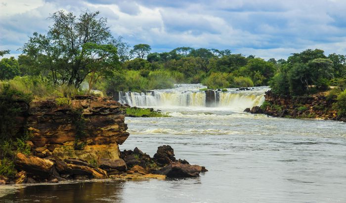
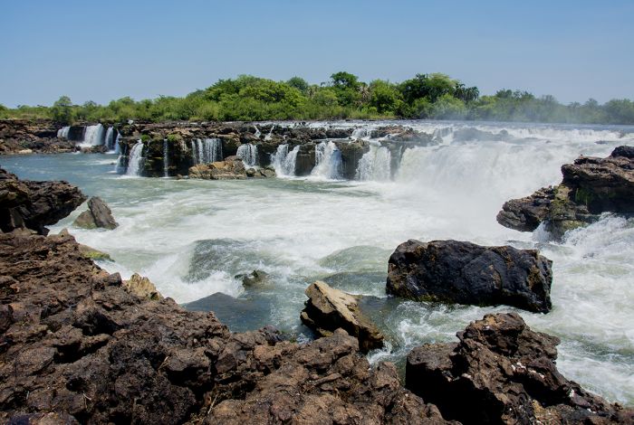
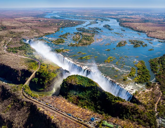
One of Zambia's most visited attractions are The Victoria Falls, which are on the country's southern border with Zimbabwe along the Zambezi River. The Falls are one of the great wonders of the natural world and can be visited from either side of the river.
Adventure activities like white-water rafting, bungee jumping, zip lining, canoeing and more are a popular draw. Safari camps are located along the Zambian aide of the river and in the small town of Livingstone.
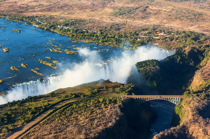
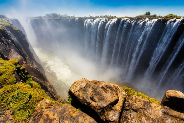
The Victoria Falls are one of Africa's great natural wonders.
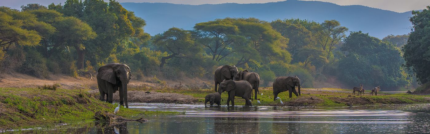
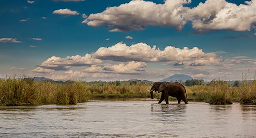
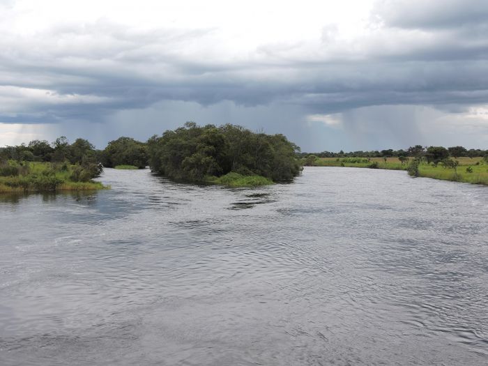
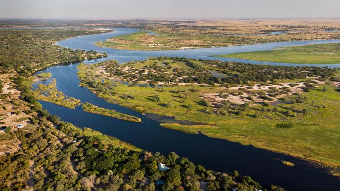
Downstream from The Victoria Falls, the Zambezi River forms the boundary between Zambia and Zimbabwe and just before entering Mozambique, it flows between two national parks, one on each bank of the river.
On the Zambian side is the Lower Zambezi National Park (LZNP) and on the Zimbabwe side is Mana Pools National Park. The LZNP arguably offers the country's most diverse safaris, with game drives and river-based game viewing and an abundance of wildlife.
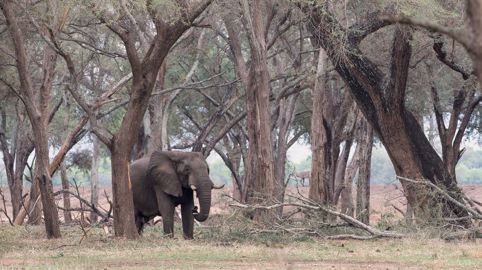
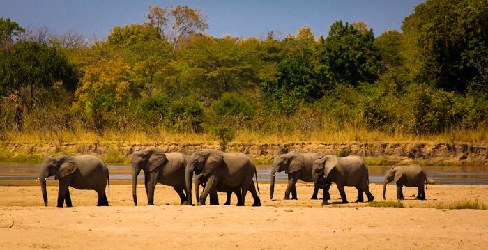
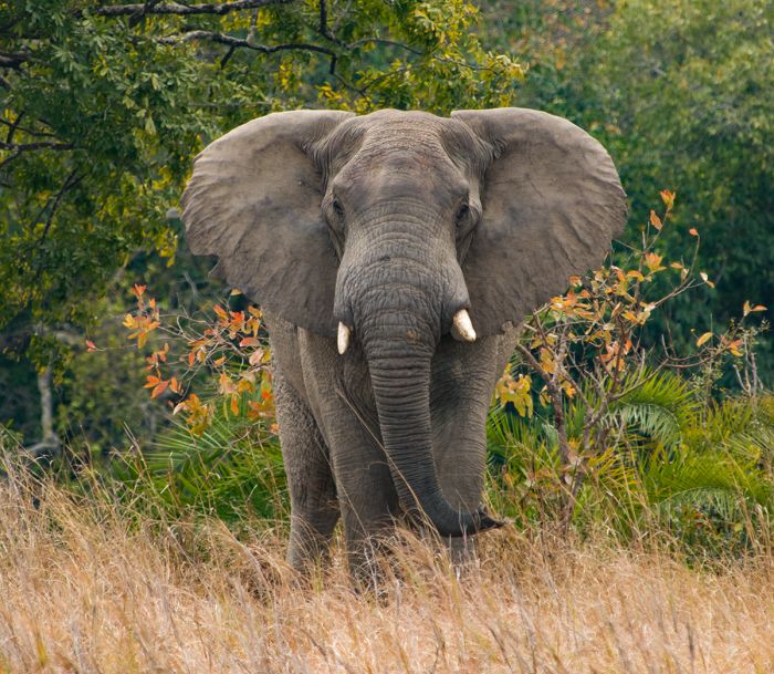
A bull elephant in Lower Zambezi National Park.
Zambia Regions
Livingstone (incl. The Victoria Falls, Mosi-oa-Tunya NP)
Come see one of Africa's greatest natural wonders, The Victoria Falls! Adventure activities including white-water rafting, safaris, river cruises, bungee jumping and more. Easy to combine with a safari to Botswana, South Africa, Zambia or Zimbabwe. more
Lower Zambezi (incl. Chiawa GMA, Lower Zambezi National Park)
The Lower Zambezi Valley is one of Southern Africa's premier safari destinations. Lower Zambezi National Park protects abundant wildlife in a large and remote wilderness. The diversity of river-based safaris and game drives make it a rewarding experience. more
North Luangwa
North Luangwa National Park is one of Africa's wildest and most remote reserves. It is largely undeveloped and based around the Luangwa River, which gives life to the diverse wildlife that live here. Walking safaris are the main activity in this beautiful wilderness. more
Northern Kafue
Kafue National Park is the largest reserve in Zambia, protecting diverse habitats and plentiful wildlife. This untouched wilderness offers a remote safari experience, with large herds of grazers, plus lion, cheetah and more. more
South Luangwa (incl. The Victoria Falls, Mosi-oa-Tunya NP)
South Luangwa National Park is Zambia's top safari destination, offering a high density and diversity of wildlife. The Luangwa River sustains large numbers of elephant, buffalo, giraffe, zebra, wild dog, lion, leopard and more. Walking safaris and game drives are offered more
Read More...
Main: Flora, Geography, Important Areas, National Parks, Protected Areas, Ramsar Sites, UNESCO Sites, Urban Areas, Wildlife
Detail: Bangweulu Wetlands, Blue Lagoon, Isangano, Kafue NP, Kafue Flats, Kasanka, Lavushi Manda, Liuwa Plain, Livingstone Town, Lochinvar, Lower Zambezi, Luambe, Lukusuzi, Lusaka, Lusaka NP, Lusenga Plains, Mosi-oa-Tunya, Mweru Wantipa, North Luangwa, Nsumbu, Nyika Plateau, Shiwa Ng'andu, Sioma Ngwezi, South Luangwa, Victoria Falls, West Lunga, Zambezi Floodplain
Admin: Travel Tips, Entry Requirements/Visas
Geography
Zambia is a landlocked country located in the northernmost edge of the Southern Africa region, but is sometimes grouped into the Central Africa region. To the northeast is East Africa, the original wildlife safari region that includes Kenya and Tanzania. South of Zambia is the more recently developed safari region of Southern Africa, which includes Botswana, Zimbabwe, and South Africa. Zambia offers some attributes of both these regions.
Zambia shares borders with eight other countries: the Democratic Republic of the Congo (DRC), Angola, Namibia, Botswana (a very small border at Kazungula), Zimbabwe, Mozambique, Malawi, and Tanzania.
A walking safari in North Luangwa National Park (Copyright © Remote Africa).
Zambia's terrain consists mainly of a high, rolling plateau with an altitude ranging between 3 200-5 300 feet (1 000-1 600 meters), plus hills, river valleys, and some low mountains.
Two major river systems drain out of Zambia. The Zambezi/Kafue/Luangwa basin covers roughly three-quarters of the country and flows south and out to the Indian Ocean via Mozambique, while the Luapula/Luvua catchment flows north and joins the Congo River, which flows through the DRC and eventually west to the Atlantic Ocean.
There are several significant lakes that lie along Zambia's borders: Kariba on the border with Zimbabwe, Tanganyika on the borders with Tanzania and DRC, and Mweru on the border with DRC.
Lake Bangweulu and the Bangweulu Wetlands cover a large area in the north and drain northwards into Lake Mweru, which empties via the Luvua River into the DRC and the Congo River.
Buffalo in Kafue National Park, Zambia (Copyright © James Weis).
Flora
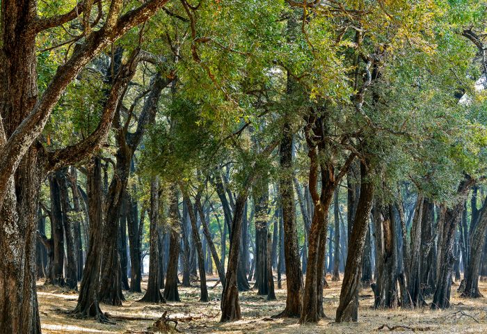
The majority of Zambia is covered in a patchwork of woodlands, tropical grasslands, savannas, and shrub-land. Woodlands are differentiated from forests in that woodlands are more open, with tree canopies that do not interlock, whereas forests are much more dense and have connected canopies. Zambia has very little forested area.
'Miombo' is the predominant woodland, so named for the miombo trees (Brachystegia genus) that are prevalent in much of Zambia. Miombo woodlands are common throughout central Africa and are notable for their high level of plant diversity, which makes them very productive habitats for sustaining diverse wildlife. Besides miombo, there are also areas of mopane tree woodlands and acacia scrub in the lower elevations.
Mahogany trees in South Luangwa National Park, Zambia.
Wildlife
Located on the far northern edge of the Southern Africa region with East Africa directly to the north, Zambia's wildlife includes most species found in both those regions.
Large predators include lion, leopard, spotted hyena, African wild dog, and in the parks with substantial grasslands (like Kafue), cheetah. Buffalo and elephant occur in good numbers in most of the larger national parks and along the Zambezi River in the south. Sadly, rhino are mostly gone from Zambia, having been poached during the turbulent 1970s and 1980s.
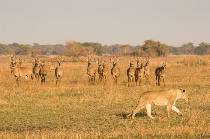
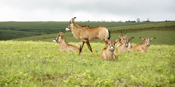
A lioness under the watchful eyes of roan antelopes in Kafue NP (Copyright © James Weis).
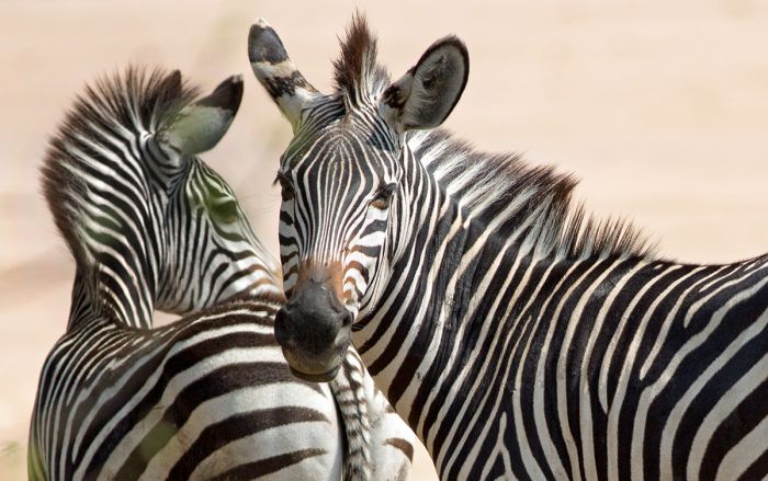
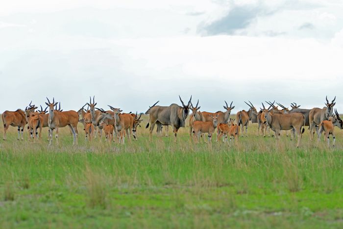
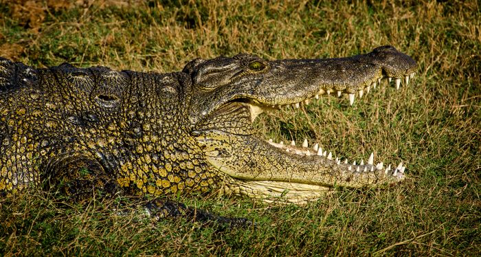
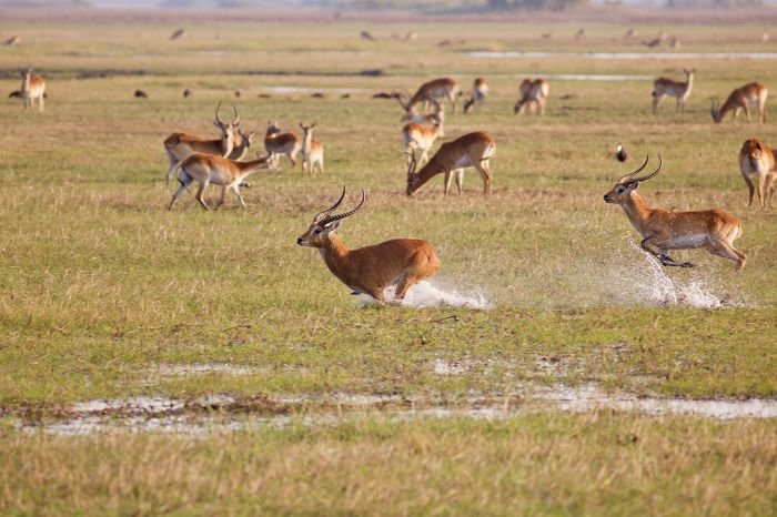
The large antelopes and other herbivores are well represented, with zebra, giraffe, puku, and impala found in most of the protected ecosystems. Hippo and crocodile are abundant in the major river systems, including the Zambezi, Kafue, and Luangwa.
Zambia is also host to some regionally endemic subspecies of the more common iconic animals, including Crawshay's zebra (in the Luangwa Valley), Cookson's wildebeest (Luangwa Valley), Thornicroft's giraffe (Luangwa Valley), Kafue lechwe (in Kafue NP), and black lechwe (in the Bangweulu wetlands).
Crawshay's zebras in the Luangwa Valley.
Birding in Zambia is regionally very good, especially when the migrants arrive from the north to breed. Much of Zambia receives good rainfall from December through April and its major river systems create excellent habitat for a variety of birds. Around 850 species of birds have been recorded in Zambia.
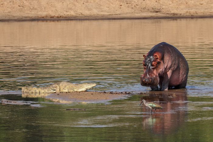
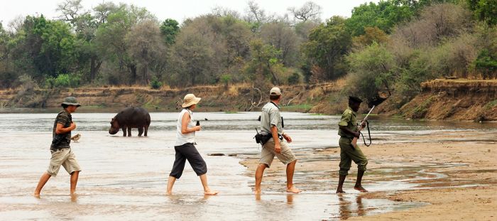
Hippos and crocodiles are found in Zambia'a major river systems.
Protected Areas
Zambia has a great variety of national parks and game management areas (GMAs). The national parks offer full protection for wildlife and the natural resources within their borders. GMAs are typically multi-use land, which usually include villages, farming, controlled hunting, and sustainable resources usage. GMAs are typically located on the borders of national parks and offer a buffer zone to the parks.
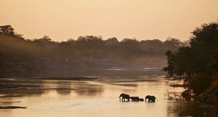
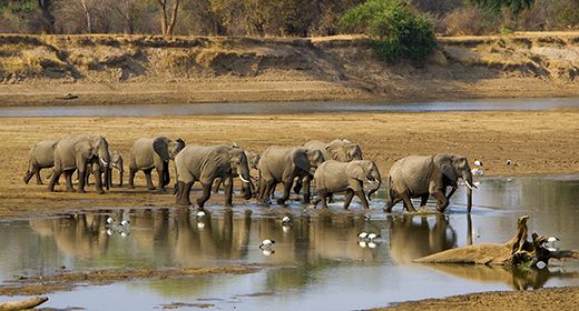
A family of elephants crossing the Luangwa River.
National Parks
Zambia has 20 national parks; however, some of these parks are poorly maintained or not at all. Additional information on each is included further below this list:
- Blue Lagoon National Park - Small park on the northern side of the Kafue Flats, a vast wetland known for birds and large herds of 'Kafue' lechwe.
- Isangano National Park - Borders the Bangweulu Wetlands, but has had significant human encroachment and is mostly depleted of wildlife due to subsistence farming. Not recommended.
- Kafue National Park - Zambia's largest national park. Seasonal destination offers exceptional wildlife viewing, particularly around the Busanga flood plains in north. Diverse plains game, elephant, lion, cheetah, spotted hyena. Big herds of buffalo, red lechwe, hartebeest, and more.
- Kasanka National Park - Small park close to the southern edge of the Bangweulu Wetland. Privately funded and striving to bring tourism back. Good wildlife and superb birding.
- Lavushi Manda National Park - Borders the Bangweulu Wetlands, but human settlement and farming within the park borders has depleted wildlife. Not recommended.
- Liuwa Plain National Park - Remote park in western Zambia. Rich floodplains attract huge herds of blue wildebeest plus a variety of other plains game. Few visitors and a special place to visit.
- Lochinvar National Park - Small park on the southern side of the Kafue Flats, a vast wetland known for birds and large herds of 'Kafue' lechwe.
- Lower Zambezi National Park - Located on the banks of the wildlife-rich Zambezi River, which is home to thousands of diverse animals, this beautiful park is part of a larger protected area that spans the river and into Zimbabwe to the south. Game drive, canoeing and walking and excellent to combine with a Luangwa safari.
- Luambe National Park - Small and seldom visited park in the Luangwa Valley situated across the Luangwa River from the North and South Luangwa parks. Wildlife viewing improving, but not on a par with the larger parks across the river.
- Lukusuzi National Park - Remote, seldom visited, no facilities, and only s single, unmaintained track thru the park. Not recommended.
- Lusaka National Park - Small, fully fenced part on the outskirts of Lusaka city. Variety of antelope and other herbivores, including one rhino. Spotty game viewing.
- Lusenga Plains National Park - Remote and seldom visited park in the far north, near Lake Mweru. Not recommended for a wildlife safari.
- Mosi-oa-Tunya National Park - Meaning 'the smoke that thunders', the park protects the Zambian side of The Victoria Falls and land both upriver and along the gorges below The Falls.
- Mweru Wantipa National Park - Remote and long-neglected park protecting the lake of same name in far north. Wildlife mostly depleted. No tourist facilities and not recommended.
- North Luangwa National Park - Remote and mostly undeveloped park in the Luangwa River Valley. Excellent wildlife that is largely the same as the more popular South Luangwa park. Walking safaris are the main activity at the bush camps here.
- Nsumbu National Park - Remote park on the southern end of Lake Tanganyika. Wildlife safaris, but low game densities. Fishing and boating on the lake. Very scenic along the lakeshore.
- Nyika Plateau National Park - Very small highlands park best accessed from the Malawian side. Beautiful scenery, great hiking and birding.
- Sioma Ngwezi National Park - Undeveloped park in name only bordering Angola and the Caprivi Strip. Long history of poaching has decimated wildlife. Not recommended.
- South Luangwa National Park - Zambia's top wildlife safari destination, with diverse wildlife, top-notch safari camps and lodges, and superb guiding. Renowned for its elephants, leopards, African wild dogs, and guided walking safaris.
- West Lunga National Park - Wild and remote park in far northwest. No accommodation nor visitor facilities. Roads are minimal. Low human population, so wildlife still thought to be decent.
A male leopard scanning for prey in South Luangwa National Park.
Important Areas
Other areas of interest in Zambia include the following:
- Bangweulu Wetlands - A vast and wild wetland that includes a large lake, seasonally flooded grassland, and plenty of wildlife.
- Kafue Flats - An area of seasonal floodplains, marshes, and lagoons along the Kafue River, east of Kafue National Park.
- Shiwa Ng'andu - Historic estate built an English aristocrat in the early 1900s and now a guest house.
- Zambezi Floodplain - Beautiful, seasonally inundated wetland wilderness area at the confluence of the Chobe and Zambezi Rivers.
UNESCO World Heritage Sites
The United Nations Educational, Scientific and Cultural Organization (UNESCO) is a specialized agency of the United Nations whose mission is to promote world peace and security through international cooperation in education, the arts, the sciences, and culture. The Convention concerning the Protection of the World's Cultural and Natural Heritage was signed in November 1972 and ratified by the 189 UN member "states parties".
A World Heritage Site is a landmark or area which is geographically and historically identifiable and has special cultural or physical significance. To be selected as a World Heritage Site, a nominated site must meet specific criteria and be judged to contain "cultural or natural heritage of outstanding value to humanity". An inscribed site is categorized as cultural, natural, or mixed (cultural and natural). As of 2021, there were over 1 100 sites across 167 countries.
Zambia has one UNESCO World Heritage Site:
- Mosi-oa-Tunya / Victoria Falls (since 1989, Natural) - One of Earth's greatest waterfalls, with prime example of geological land formation processes.
Ramsar Wetlands of International Importance
The Ramsar Convention on Wetlands is an international treaty for the conservation and sustainable use of wetlands. It was the first of the modern global nature conservation conventions, negotiated during the 1960s by countries and non-governmental organizations concerned about the increasing loss and degradation of wetland habitat for birds and other wildlife. The convention is named after the city of Ramsar in Iran, where the convention was signed in 1971.
Presently there are some 75 member States to the Ramsar Convention throughout the world which have designated over 2 300 wetland sites onto the Ramsar List of Wetlands of International Importance.
Zambia has 8 sites designated as Wetlands of International Importance (Ramsar Sites) as follows.
- Bangweulu Swamps - Breeding grounds for vulnerable birds, fishes, and other wildlife, including the semi-aquatic black lechwe antelope, wattled crane, and shoebill stork. The swamp is a natural flood controller and crucial for groundwater recharge and water quality. (4 247 sq miles/11 000 sq kms)
- Busanga Swamps - Diverse ecosystem, with swamps, lagoons, rivers, woodlands, grassy plains provide habitat for large numbers and diversity of mammals, birds, and fishes. Crucial for groundwater recharge and flood control for Zambezi and Kafue rivers. (772 sq miles/2 000 sq kms)
- Kafue Flats - Vast expanse of floodplains, woodlands, and grasslands, with lagoons, oxbow lakes, marshes, and small rivers along the Kafue River. Habitats support many endangered species, like Kafue lechwe, wattled crane, sitatunga. Crucial for large numbers of fishes of migratory birds. Important for groundwater filtering and storage. (2 510 sq miles/6 500 sq kms)
- Luangwa Floodplains - Rivers, springs, lakes, lagoons, marshes, and streams provide crucial water for sustaining huge numbers and diversity of wildlife and vegetation. Habitat for over 50 mammal species and important breeding ground for numerous bird species. (965 sq miles/2 500 sq kms)
- Lukanga Swamps - Largest permanent water body in the Kafue Basin, with shallow swamps that provide habitat and breeding grounds for birds, mammals, reptiles, and fishes. Used by locals for fishing and reed collection. (1 004 sq miles/2 600 sq kms)
- Mweru Wantipa - Encompasses portions of Mweru Wantipa NP and Kaputa GMA. Rivers, swamps, Lake Mweru Wantipa basin and surrounding wetland plains, with evergreen forests, itigi thickets and miombo woodlands. The diverse habitats are home to ~400 bird species, plus threatened mammals, reptiles, and fishes. (1 892 sq miles/4 900 sq kms)
- Tanganyika - The Zambian portion of Lake Tanganyika, including shoreline areas of Nsumbu NP and Kaputa GMA. Steep, rocky shoreline with areas of swamp and sandy beach with rich diversity of biomes providing habitat for large numbers of mammals, reptiles, birds, and fishes. (888 sq miles/2 300 sq kms)
- Zambezi Floodplains - Zambezi River and surrounding floodplains are second largest wetland in Zambia, with floods occurring from February thru March. Important habitat and breeding grounds for thousands of blue wildebeest, large numbers of water birds, and over 80 species of fish. Habitat for many other mammals including lion, as well as reptiles. Used by locals for fishing and collection of reeds and sedges. (3 475 sq miles/9 000 sq kms)
The incredible shoebill stork is a main reason people visit the Bangweulu Wetlands.
Urban Areas
Zambia has two significant urban areas worth mentioning, one of which is their capital city and the other is a major tourism hub. See details on each below.
- Livingstone - Located at The Victoria Falls and the destination for travelers wishing to stay on the Zambian side (versus the Zimbabwe side) when visiting the waterfall. Lots of adventure activities, though many choose to stay outside the town in one of the lodges along the Zambezi River.
- Lusaka - Zambia's capital and by far its largest city.
South Luangwa National Park
Undoubtedly Zambia's premier game-viewing destination, South Luangwa National Park (SLNP) protects over 3 000 square miles of the fertile Luangwa Valley, which is an extension of the Great East African Rift. The park was pioneered by the British conservationist Norman Carr, who is also credited with the creation of the commercial 'walking safari', an activity for which South Luangwa is still known today.
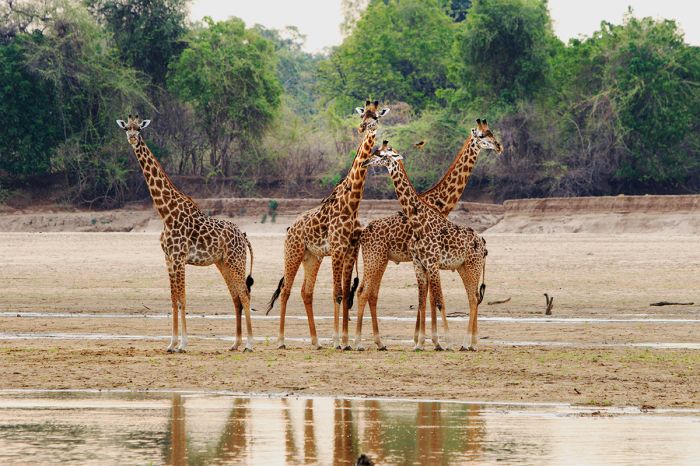
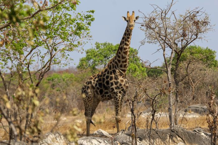
Giraffes are found in South Luangwa, but not North Luangwa.
South Luangwa is bordered by the Luangwa River on the east and the Muchinga Escarpment on the west, with the interior of the park dominated by mature woodlands, dense thickets, and smaller areas of open, tall-grass plains. The Luangwa River is one of the largest in Africa and is essentially a pristine waterway, with no dams nor commercial farming along its route. Wildlife activity and most of South Luangwa's safari camps are located along this river or its numerous tributaries.
The park's diversity of biomes create niche habitats for a variety of herbivorous species, with big herds of buffalo, some numbering in the hundreds, and an abundance of elephant, which are usually seen along or near the Luangwa River. The elephants in SLNP are quite relaxed around game drive vehicles, making it easy to view them up close without disturbing them.
Hippos in duckweed, South Luangwa National Park.
Puku are the most common of SLNP's antelopes and they often congregate in large herds. Impala are common, as are giraffe, zebra, and blue wildebeest. Other species common in the park include greater kudu, bushbuck, and eland. The Luangwa River is home to huge numbers of hippo and crocodile.
South Luangwa's is also home to healthy populations of predator species, including lion, leopard, Africa wild dog, and spotted hyena. Lion are the most easily seen on safari in SLNP, but the park is renowned for being one of Africa's best for leopard. Birding in the park is also very good.
Read full details on South Luangwa National Park here.
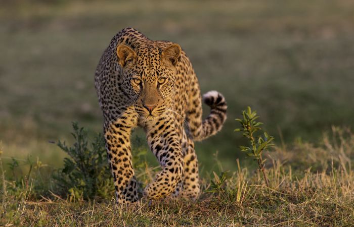
South Luangwa is well known for its leopards.
North Luangwa National Park
Like its much larger sister park to the south, North Luangwa National Park (NLNP) is situated along and bordered in the east by the beautiful Luangwa River. Unlike South Luangwa, NLNP receives very few visitors and remains one of the best kept secrets for safari enthusiasts wanting to experience Africa like it was 200 years ago - wild, untouched, and remote.
Walking safaris are the main activity in North Luangwa, with only a handful of more rustic "bush camps" that are located along both the Mwaleshi and Luangwa rivers. These safari camps are located in the 'Wilderness Zone', which comprises 40 percent of the park and is only accessible to guests staying at one of the permanent camps there. The 'North Zone' is open to self-drive visitors and guided overland trips that utilize camping sites in the park.
Elephants on the banks of the Luangwa River, Zambia.
North Luangwa's habitats are more diverse than in South Luangwa, with the highlands of the Muchinga Escarpment lying almost entirely within the park. The vegetation is generally thicker in NLNP, but there are patches of open savanna, evergreen forest on the escarpment, and miombo woodlands on the lower elevation hills.
The game drive network of roads is much less developed here, so visitors should not expect to explore as much ground in a vehicle here as is possible in South Luangwa. Guided walks in the bush can provide some wildlife sightings and are especially rewarding in terms of the feeling one gets when on foot versus in a vehicle.
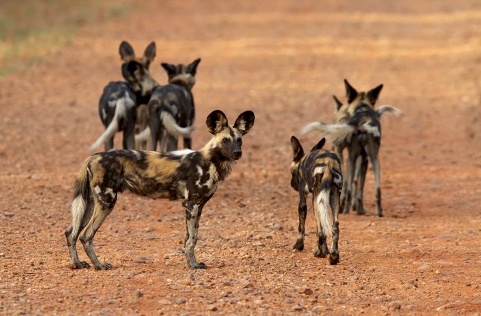
African wild dogs are found in North Luangwa National Park.
Wildlife in NLNP is generally similar to that in South Luangwa, with a good variety of plains game and predators. Common species include puku, impala, and Cookson's wildebeest. Elephant are present, but generally more cautious than those in South Luangwa, as they are not as accustomed to seeing people. Zebra, eland, hartebeest, greater kudu, waterbuck and several other antelopes are also common in NLNP.
Predators include lion, spotted hyena, African wild dog, and leopard. Hippo and crocodile are abundant in the Luangwa River. Bird life is prolific.
Read full details on North Luangwa National Park here.
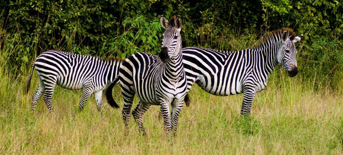
Wildlife in North Luangwa includes a healthy population of the regionally endemic Crawshay's zebra.
Mosi-oa-Tunya National Park & The Victoria Falls
Protecting the Zambian side of The Victoria Falls, as well as a small wildlife section upstream from the waterfall and the gorges below The Falls, Mosi-oa-Tunya National Park is named for the local name for the waterfall, meaning 'the smoke that thunders'.
The Victoria Falls are located along the Zambezi River, which forms the border between Zambia in the north and Zimbabwe in the south. The historic Victoria Falls Bridge spans the deep gorge below The Falls and connects the two countries by road and rail. Visitors can choose to stay on either side of The Falls (Livingstone town in Zambia or Victoria Falls Town in Zimbabwe).
The Victoria Falls at high water is a sight to see.
Besides the waterfall, The Victoria Falls are renowned for being the adventure sports capital of Southern Africa. Activities at The Falls include white-water rafting (in the gorges below the waterfall), bungee jumping from the Victoria Falls Bridge, canoeing above the falls on the Zambezi River, zip lining, kayaking below The Falls, and more.
The national park on the Zambian side has some wildlife, with guided, self-drive, and walking safaris all possible. There are two additional national parks on the Zimbabwe side of The Falls and portions of the three parks are protected as a UNESCO World Heritage Site.
Read full details on Victoria Falls and Mosi-oa-Tunya National Park here.
Devil's Pool adventure at the edge of The Falls.
Lower Zambezi National Park
Home to abundant wildlife and protected areas on both the Zambian and Zimbabwean sides of the Zambezi River, the Lower Zambezi Valley is one of Africa's finest safari destinations. The Lower Zambezi National Park (LZNP) protects 1 600 square miles on the northern banks of the Zambezi River, while directly across the river is Zimbabwe's Mana Pools National Park. Together these two parks protect some of the most pristine and beautiful habitat anywhere in Africa.
The Zambezi Escarpment rises parallel to the river some 5 miles inland, while rich floodplains and open grasslands cover the valley floor along the Zambezi River. The changing course of the river has, over time, created oxbow lagoons and back flows, which are favored by the myriad wildlife species that live in the valley.
Lower Zambezi National Park is an excellent place for elephant viewing.
Elephant and buffalo are abundant in the park, and they cross the Zambezi River to and from Zimbabwe as they choose, stopping on the islands to graze, while other species like impala, zebra, and waterbuck graze on the floodplains. Lion and spotted hyena are common and packs of African wild dog commonly hunt along the river in early morning. Hippo and crocodile live in great numbers in the Zambezi River and can be seen sunning themselves on the banks.
There are plenty of safari camps and lodges in the park, nearly all of them situated along the Zambezi River. Activities offered include game drives, canoeing on the Zambezi River, and bush walks.
Read full details on Lower Zambezi National Park here.
A leopard cub in Zambia's Lower Zambezi National Park.
Kafue National Park
Zambia's largest protected area, Kafue National Park covers 8 650 square miles (22 400 sq kms) and is named for the Kafue River, which flows through the northern half of the park. Other major rivers in Kafue include the Lunga and Lufupa, both of which are tributaries of the Kafue River.
The northern portion of the park is the best for wildlife safaris and contains seasonally flooded plains, particularly along the Lufupa River. The largest of these rich floodplains is called the Busanga Plains. The Busanga Plains offer seasonally excellent game viewing between late June and mid- to late-October. Portions of the Busanga remain wet all year and this important biome supports huge numbers of birds.
A big herd of buffalo on the Busanga Plains in Kafue National Park (Copyright © James Weis).
The rest of Northern Kafue is a mix of miombo woodland, savanna, thicket, mopane woodland, and riparian forest along the numerous smaller rivers. As in Botswana's Okavango Delta, the seasonal floodplains in Kafue are dotted with small 'islands' supporting tall Phoenix palms, wild date palms, fig trees, and baobab trees.
Once the floodplains begin to dry up, they support rich grasses, which attract large herds of grazers, like buffalo, red lechwe, puku, and roan antelope. Other wildlife in Northern Kafue includes good numbers of elephant, zebra, greater kudu, eland, Lichtenstein's hartebeest, and defassa waterbuck. Northern Kafue is also home to healthy populations of lion, cheetah, African wild dog, and spotted hyena. Leopard are common, but elusive, staying mostly hidden in the riparian woodlands.
A blue elephant in Kafue National Park (Copyright © James Weis).
Primates in Kafue include vervet monkey and chacma baboon. Hippo and crocodile are found in the deep sections of the Kafue, Lunga, and Lufupa rivers. Bird life in Northern Kafue is prolific and offers outstanding birding. Kafue's bird list tops 500 species.
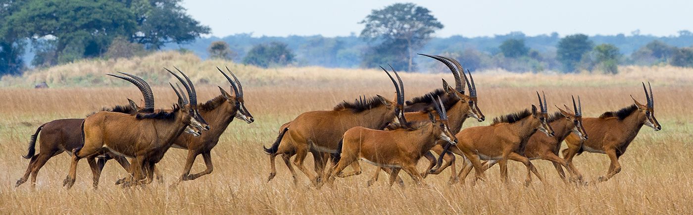
The southern portion of Kafue National Park is much drier than the north and characterized by Kalahari sand. The land becomes more arid as one moves further south. Southern Kafue's wildlife includes impala, which are not found in the north, as well as blue wildebeest, buffalo, greater kudu, puku, Lichtenstein's hartebeest, eland, roan antelope, sable antelope, warthog, and elephant.
The southern section of Kafue National Park has few safari camps and is seldom visited, so the wildlife there is much more skittish and game viewing not on a par with Northern Kafue.
Read full details on Lower Zambezi National Park here.
Red lechwe antelopes in Kafue National Park (Copyright © James Weis).
Liuwa Plain National Park
Certainly one of Africa's most remote reserves, Liuwa Plain was first protected in the early 1880s as a royal hunting ground for King Lewanika, the paramount ruler of the Lozi people. The park covers 1 413 square miles (3 660 sq kms) and was declared a national park in 1972. Liuwa is managed as a joint conservation effort by African Parks and the Zambian government.
Liuwa is a very special and mostly untouched place, dominated by seemingly endless grassy plains, most of which become flooded in shallow water between December and April. During these flood months, huge herds of blue wildebeest, numbering in the thousands, arrive on the plains for the fresh grazing. Although not a true migration, this large gathering of wildebeest is estimated to number 30 000 individuals.
A herd of eland in Liuwa Plain National Park.
Besides wildebeest, the plains attract good numbers of zebra, tsessebe, red lechwe, roan antelope, eland, oribi, and buffalo. Predators include lion, leopard, cheetah, spotted hyena, and African wild dog. November is the one of the best months to visit and the posh King Lewanika safari camp (open October to July) is highly recommended. Birding in Liuwa is excellent, particularly when the plains begin to flood in November and December, coinciding with the arrival of migrant species from the north.
Wildlife is seasonal in Liuwa Plain and the best time to visit the park is the opposite of most wildlife destinations in southern Africa, with the wet season attracting the big herds to Liuwa's grassland plains. Driving becomes impossible at this time, but canoeing and walking offer an outstanding experience.
Lions in Liuwa Plain National Park, Zambia.
The onset of the rains, which usually begin in early November, is a prime time to see Liuwa. Game viewing continues excellent well into December, but the game driving becomes increasingly difficult as the season progresses. The end of the wet season (May and June) is also very good before the herds begin to disperse.
Liuwa's daytime temperatures are warm all year, but can become very hot in September and October, reaching 93-95°F (34-35°C) most days, but dropping to a pleasant 58-60°F (14-16°C) at night. December thru April average daytime highs of 85-87°F (29-31°C), falling to 57-63°F (14-17°C) overnight. June and July are the coolest months, with daytime temps averaging 80-82°F (27-28°C) but getting quite chilly at night, averaging 44-46°F (7-8°C).
Adventure seekers and those that enjoy beautiful wilderness regions will love Liuwa Plain. The park receives very few visitors, making it a truly memorable place to experience.
African wild dogs resting at a pan in Liuwa Plain National Park.
Kasanka National Park
Covering 180 square miles (466 sq kms) just south of the Bangweulu Wetlands, Kasanka National Park was gazetted in 1972 and is one of Zambia's smallest protected areas. Kasanka is unique in that it is privately funded (since 1986 by the UK-based Kasanka Trust, Ltd.).
The park's topography is mainly flat, with a network of small permanent lakes, small rivers, streams, and marshy areas with reed and papyrus beds. Around three-quarters of the park is miombo woodland. Controlled burning by local people living along the park borders has kept mature forests from forming in the park, as their fires often spread into Kasanka.
Wildlife in Kasanka includes puku antelope, which are the most common large mammal in Kasanka, reedbuck, bushbuck, sable antelope, Lichtenstein's hartebeest, defassa waterbuck, common duiker, and warthog. Small numbers of zebra, elephant, and roan antelope are also found in Kasanka. The elusive water-dwelling sitatunga antelope can be found in the papyrus swamps.
A hippo in Kasanka National Park, Zambia.
Primates in the park include vervet monkey, blue monkey, and Kinda baboon. Hippo and crocodile are found in the larger rivers. In terms of predators, lion and hyena are no longer resident, but leopard are present in Kansanka, as are side-striped jackal, caracal, and serval.
Birding is exceptionally good in Kasanka, with over 400 species recorded, a huge number for a park this small. Kasanka's rivers, lakes, and wetlands are excellent for water birds. A popular wildlife spectacle in Kasanka is the nightly emergence of millions of straw-colored fruit-bats. The bats have a huge one-meter wing span and take to the air at dusk each night from their roosting place in the forest near the swamps.
Kasanka receives healthy rains from November into April and roads may become impassible. The dry season, from June thru October is the best time to visit, although October can be brutally hot. Access to Kasanka is from the tarred road west of the park.
Isangano National Park
Declared in 1972, Isangano covers 324 square miles (840 sq kms) of grassland and low-lying floodplains on the northeastern side of the Bangweulu Wetlands. Unfortunately, human settlement by subsistence famers has degraded the park and eliminated much of the wildlife that once existed here.
In 2007, the government began an initiative to evict the illegal settlers, but visitors interested in a Bangweulu experience should explore the western side of the wetlands.
Lavushi Manda National Park
Bordering the Bangweulu Wetlands on the southeast, Lavushi Manda National Park was declared in 1972 and covers 611 square miles (1 582 sq kms) of mostly hilly terrain with miombo woodland, with various streams and small rivers that drain into the Bangweulu basin. There are a few areas of grassland, some of which are seasonally inundated.
As with Isangano, human encroachment and poaching has depleted most of its native wildlife.
Nyika National Park
A tiny national park on the western side of the Nyika Plateau, which adjoins the national park of the same name in Malawi. The combined park was created by the British Colonial Administration, which had authority over what is today Zambia and Malawi, so when the countries were divided, a small portion of the original park became part of Zambia. The Zambian portion covers a mere 32 square miles (84 sq kms) and access to the Zambian side is only possible from Malawi.
The key feature of both parks is the Nyika Plateau, a rolling highland that is part of the western Rift Valley Escarpment with an average elevation of 6 900-7 200 feet (2 100-2 200 meters), covering roughly one-third of the combined area of both parks. The remaining portion on the Malawi side are the lower slopes of the escarpment which descend eastward into the Rift Valley and Lake Malawi.
Spectacular vista on the Nyika Plateau.
The Nyika Plateau is home to rolling hills covered in montane grasses, heather, and fern, with wide valleys, streams, and sections of exotic pine and eucalyptus forest. The highland scenery is spectacular, with wildflowers blooming throughout the year and peaking in January and February. Over 200 species of orchid have been found on the plateau.
Commonly seen wildlife includes roan antelope, eland, Crawshay's zebra (a subspecies of Burchell's zebra), common reedbuck, and bushbuck. Side-striped jackal are common and the only predator seen regularly, although spotted hyena can also be seen on occasion.
Roan antelope and zebra on the Nyika Plateau.
Birding on the plateau is very good, but even better on the lower slopes. The most notable feature of the Zambian park, which is much more forested than the plateau itself, is the Chowo Forest. Chowo offers perhaps the best birding in the entirety of Nyika, with localized specials such as bar-tailed trogon, olive-flanked robin-chat, white-chested alethe, Fülleborn's boubou, a variety of greenbuls, and other forest skulkers.
In terms of accommodation, the Zambian side is undeveloped except for a now-disused colonial-area rest house built in 1946, which at the time, was the only accommodation in Nyika. It closed in 1988.
Roan antelopes in Nyika National Park.
Luambe National Park
Declared in 1938, Luambe National Park is located in the low-lying Luangwa River Valley, with the river forming its western boundary. Luambe covers only 139 square miles (361 sq kms) and is situated in the north-south gap between the valley's better known national parks, North Luangwa and South Luangwa, but on the opposite (eastern) side of the Luangwa River.
The park is characterized by riparian forest along the river with cathedral mopane forest, miombo woodland, and short grass savanna further east away from the river. Luambe is surrounded by a vast Game Management Area (GMA). GMA's are multi-use protected areas that allow controlled hunting, so although Luambe's habitat is roughly identical to that found across the river in the North and South Luangwa parks, Luambe's wildlife is generally more skittish and shy.
Walking safaris are popular in Luambe National Park.
Wildlife in Luambe is generally the same as in South Luangwa, with the endemic Cookson's wildebeest, Crawshay's zebra (a subspecies of Burchell's zebra), impala, warthog, elephant, and buffalo commonly seen. Thornicroft's giraffe, which are common in South Luangwa, are only rarely seen in Luambe.
Hippo and crocodiles are abundant in the Luangwa River and are seen seasonally, but move to deeper sections of the river as water levels drop. Leopard are resident in Luambe, but not easily seen.
Impala on the Luangwa River at low water level.
The park receives few visitors, as most people choose to go to South Luangwa, which offers far better wildlife numbers, but is of course more crowded. Luangwa's dry season is from May thru October, with virtually no rain, while the rainy season runs between November and April. The roads in Luambe are rough, even during the dry season, but become impassable during the heavier rains.
Accommodation in Luambe is limited to one dry-season camp and a basic campsite and it's likely that you will have the entire park to yourself if you choose to visit. Luambe Camp can arrange road transfer from South Luangwa's Mfuwe airstrip or the airstrip located just north of the park.
Hippos are common in the deeper sections of the Luangwa River.
Lukusuzi National Park
Located on the eastern side of the Luangwa Valley, Lukusuzi covers an area of 1 021 square miles (2 646 sq kms) of miombo woodland and patches of grassland savanna. Lukusuzi has never had any management and wildlife numbers are unknown, though poaching has surely been rampant and the animal numbers are presumed to be low.
Access to Lukusuzi is via the Chipata-Lundazi road east of the park, and game scouts are on site at the gate. Lukusuzi has just one very rough dirt track leading west into the park. There are no visitor facilities and no accommodation in Lukusuzi, and an expedition to the park would be a significant undertaking. Anyone considering a visit would be advised to avoid the wet season (December thru April).
There has been mention of plans to bring in private management to develop the park.
Lusaka National Park
Located only 9 miles (15 kms) outside of Zambia's capital city, Lusaka National Park was established on the site of a fenced forest preserve in 2011. The park covers an area of 26 square miles (69 sq kms) and opened to the public in 2015.
The park is stocked with numerous species, none of which are predators. There is a white rhino that is fed in a boma, but is also released to roam the park, where seeing it would be unlikely; call ahead if you are keen to see the rhino.
A giraffe in Lusaka National Park, Zambia.
There are also a variety of other species, including eland, hartebeest, greater kudu, lechwe, puku, zebras, impala, giraffe, sable antelope, duiker, bushbuck, reedbuck, warthog, and more. Unfortunately, seeing the animals is apparently not easy, so we cannot recommend the park as a wildlife destination.
Entry is very inexpensive and self driving in the park is easy. Guided tours are also available.
Lusenga Plains National Park
Covering 347 square miles (898 sq kms) in the Northern Plateau, Lusenga Plains is another of Zambia's seldom visited and mostly unmanaged parks. Lusenga was declared in 1972 to protect a large grassland plain, in the southwest corner of the park. The Kalungwishi River forms most of the park's eastern boundary. And the river passes over three lovely waterfalls: Kundabwika, Kabwelume, and Lumangwe.
The plain, after which the park is named, measures about 13.5 square miles (35 sq kms) and was formed by an ancient volcanic dome. Located towards the center of the plain are wet and swampy areas. Set back from the plain are patches of dry, evergreen forest. The majority of the rest of the park consists of miombo woodland, some of which are tall and dense and others that are more open and stunted.
The Lumangwe Falls on the Kalungwishi River, Zambia.
Lusenga Plains has never received much in the way of funding nor management and wildlife numbers have thus suffered from subsistence poaching. No data on recent wildlife numbers exists and we cannot recommend traveling to this remote corner of Zambia for a safari. Birding is reputedly good, though there has only been one short ornithological survey, that revealed a rich variety of birds including a good number of Zambezian endemics.
There is no accommodation in the park itself, but visitors can find camping areas just north of the park.
The waters of the Kalungwishi River near Lusenga National Park, Zambia.
Mweru Wantipa National Park
Named for the lake within its borders, Mweru Wantipa National Park covers 1 220 square miles (3 161 sq kms) of what was once a thriving haven for wildlife, including elephant, crocodile, and black rhinoceros. Unfortunately, like many of Zambia's more remote protected areas, this park has been almost entirely neglected for decades and its wildlife and habitat have been badly degraded.
Besides the lake itself, Mweru Wantipa's habitat is made up primarily of a vegetation biome called 'Itigi-Sumbu thicket', an almost impenetrable bush consisting of about a hundred plant species meshed together so densely that it is literally impossible to walk through. Itigi-Sumbu is only known from one other location in central Tanzania. Much of this habitat in Mweru-Wantipa has already been destroyed by human encroachment.
The lake and surrounding land lie at a relatively low elevation (3 000-3 300 feet/900-1 000 meters), but further west, the terrain gradually rises and reaches 4 600 feet (1 400 meters), with hilly and craggy terrain near the eastern side of Lake Mweru. In this western area, the vegetation is miombo woodland.
Fishing boat on the shore on Lake Mweru Wantipa, Zambia.
Lake Mweru-Wantipa (which means 'muddy lake') lies within the national park and is part of the East African Rift, situated between Lakes Tanganyika and Mweru. As its name implies, Mweru-Wantipa's waters are muddy in appearance and in the past, the lake's water levels have shown great fluctuation, sometimes becoming a marsh and even drying completely during extended dry periods.
There are no visitor facilities in the park and just a single track running roughly north-south along the western shore of the lake. Camping is possible along the lakeshore. During the wet season (December thru March), the road in the park is typically impassable.
Despite the lack of most large mammals in the park, the lake and swamp are home to the shy Sitatunga antelope and yellow-backed duiker. The lake also supports good numbers of waterbirds at times, with the shoreline visited by large numbers of migrant waders. The national park and lake were designated a Ramsar Wetland of International Importance in 2007.
Nsumbu National Park
Covering 782 square miles (2 026 sq kms) at the southern end of Lake Tanganyika is Nsumbu (sometimes spelled Sumbu) National Park. The park includes roughly 60 miles (100 kms) of the lake's shoreline and extends a short way into the lake's waters.
Nsumbu is adjoined by two Game Management Areas (GMA): Kaputa GMA, which covers about 1 150 square miles (3 000 sq kms) to the north and west, and the smaller Tondwa GMA, covering 170 square miles (439 sq kms). These two GMA's are used primarily for commercial hunting, but act as an effective buffer zone for the park by reducing subsistence hunting and poaching by locals.
The perennial Lufubu River runs through the park, entering from the southwest, before coursing northeast and flowing through a valley then forming the eastern border of the park as it flows into Lake Tanganyika. Much of Nsumbu's terrain is covered by miombo woodland, with Combretum, Acacia, and Trichillia (mahogany) trees, as well as large fig and candelabra trees close to the lakeshore.

Fishermen on Lake Tanganyika near Nsumbu National Park, Zambia.
Like many of Zambia's parks, rampant poaching in the 1970s and 1980s drastically reduced Nsumbu's wildlife numbers, but the animal populations have since been recovering. Wildlife densities are still low, but species that can be seen in the park include buffalo, elephant, puku, bushbuck, sable antelope, roan antelope, eland, hartebeest, zebra, blue wildebeest, and warthog.
Lion, spotted hyena, and leopard are found in the area, but seen infrequently. Hippo and crocodile are abundant on the lake shore (swimming not advised). Birding is very good, particularly along the Lufubu River and near the lake.
There are a few good lodges located along the Lake Tanganyika shore. Land-based activities include game drives and bush walks, while the lake offers boating and fishing.
Game viewing is best during the dry season (July thru October) when the animals are found more easily near the lake and Lufubu River. Birding is best during the wet season (November thru April), but rain can interfere with activities on the lake.
Kalambo Falls, just south of Lake Tanganyika and Nsumbu National Park.
Nsumbu's climate is warm and tropical, with fairly static temperatures all year, averaging 86-90°F (30-32°C) during the day and 59-68°F (15-20°C) at night. June and July experience the coolest temps, while October can be extremely hot. December thru April can also be hot, but the almost daily rain showers keep things cooler.
Like most of Zambia, Nsumbu has two distinct seasons: one rainy and the other dry. Rain falls frequently between mid-November and mid-April, but is seldom an all-day affair, with most days experiencing some sunshine. The wettest months are December thru March. Mid-May through early November are almost completely rain-free. Game drives can become difficult during the rains, as the tracks become muddy.
Access to Nsumbu is by road from the south (a long way from pretty much everywhere) or a not inexpensive charter flight to the park's airstrip.
Fishing boat on Lake Tanganyika, Zambia.
Sioma Ngwezi National Park
Located in the far southwest of the country and sharing a border with both Angola and Namibia's Caprivi Strip, Sioma Ngwezi National Park is another of Zambia's undeveloped parks, with no permanent facilities, nor roads.
Proclaimed in 1972, the park covers 1 734 square miles (4 491 sq kms) of mostly flat and dry terrain comprised of Kalahari sand, with dense Mopane, miombo and Acacia woodland, some grassland, and some pans that only fill with water during the rainy season (December thru March).
Sioma's western border is the Cuando River (called the Kwando once it crosses into Nambia and then Botswana), which flows into the Linyanti swamp and then into the Chobe/Zambezi river system. A long history of poaching in both Sioma Ngwezi and the bordering Caprivi to the south have decimated the wildlife populations, so this is definitely not a recommended wildlife safari destination.
Ngonye Falls on the Zambezi River, Zambia.
Elephants pass through the Caprivi and into Sioma Ngwezi from Botswana's Okavango and Linyanti regions, as do African wild dogs, but overall game populations are low. Species that are likely present in Sioma Ngwezi in small numbers include, roan, sable, tsessebe, greater kudu, impala, zebra, and buffalo. Lion, leopard, and even cheetah are reportedly seen on occasion according to Zambian Wildlife rangers.
Sioma Ngwezi's location near northern Botswana and not far from Victoria Falls would presumably make it a candidate for Zambia to put resources into the park, but unless they do in the future, the park will remain just another national park in name only. Not recommended.
The Ngonye Falls are located close to Sioma Ngwezi National Park.
West Lunga National Park
Covering 650 square miles (1 684 sq kms) in remote northwest Zambia, West Lunga National Park was first proclaimed a protected area (game reserve) in the 1940s to safeguard its population of yellow-backed duiker.
Unique to Zambia's protected areas, West Lunga is primarily covered in forest of a type called 'Zambezian Cryptosepalum dry forest'. The vegetation is characterized by dense evergreen forest of medium height on sandy soil.
The park is bordered by the Kabompo and West Lunga rivers on the east and west, respectively. The Lukwakwa Game Management Area (GMA) is contiguous with the park to the west. There are also some grasslands and miombo woodlands interspersed within the park and the GMA. Papyrus swamps occur along the two rivers close to where they meet in the south and west.
Hippos are common in West Lunga's rivers.
Like many of Zambia's more remote parks, there are no roads in West Lunga, nor any visitor facilities or accommodations. Visitors to this wild destination will need to be self-sufficient.
The park has had some pressure from local people in terms of wildlife poaching, but the human population in this region is sparse, so West Lunga has not been as badly affected as many of Zambia's unmanaged parks. Reports on animal populations only come from the few intrepid visitors that arrive every so often.
Reported species include buffalo, impala, puku, bushbuck, defassa waterbuck, hartebeest, eland, sable antelope, roan antelope, warthog, elephant, hippo, and crocodile. Several species of duiker are likely in West Lunga, including the aforementioned yellow-backed, as well as blue, and common duiker species. Wild dogs have also been reported by some visitors. Primates include yellow baboon, vervet monkey, samango monkey, and thick-tailed bushbaby. Sitatunga may be surviving in the swamps.
Walking is the most common way to get around in West Lunga, as there is little in the way of cleared roads. Canoeing on the rivers is reportedly outstanding. In either case, a good and experienced guide is almost a must for an expedition to this wild and remote part of Zambia.
Getting to West Lunga is only possible by road from either the Copperbelt in the east or from Lusaka.
Crocodiles are plentiful in the rivers bordering West Lunga National Park.
Bangweulu Wetlands
Bangweulu means ‘where the water meets the sky’ and this is an apt description for these vast wetlands and one of Africa's last remaining wilderness areas. The Bangweulu Wetlands have been declared a Ramsar Wetland of International Importance and are one of Zambia's gems, although it is seldom visited by tourists.
This rich 5 800-square-mile (15 000-sq-km) ecosystem is characterized by the 1 160-square-mile (3 000-sq-km) Lake Bangweulu in the northwest, plus permanent swamps, seasonally flooded grasslands, small woodlands, and several rivers that feed the lake and swamps.
The Bangweulu basin receives substantial annual rainfall (over 50 inches / 1 400 mm), with rains falling between December and April (Jan-Feb are peak months). The lake and swamps drain south via the Luapula River, which eventually flows north into the DRC and the Congo River.
The black lechwe (Kobus leche smithemani) is an endemic subspecies of red lechwe found in Bangweulu.
Bangweulu is a community-owned Game Management Area (GMA) and there are some 50 000 local people living in and around the wetlands. Years of unsustainable harvesting of fish and wildlife in Bangweulu was certainly leading to the demise of this rich ecosystem, until in 2008, then the communities around Bangweulu entered into a long-term agreement with the non-profit African Parks (AP) to manage and protect this natural asset.
Since AP took over management of the Bangweulu GMA, poaching has been largely controlled, the black lechwe (a darker race of red lechwe) population has grown from 35 000 in 2010 to over 50 000, fish bans have been imposed and are being adhered to, and the local communities have been given schools and needed food security through funding obtained by AP.
Community programs such as bee-keeping and fishery management have been introduced to provide income for the local people. Local fishermen are also paid to guard known shoebill stork nest sites to prevent poaching of their eggs.
Bangweulu is a breeding stronghold and one of the best places to see the shoebill stork.
African Parks has reintroduced wildlife species that had become extinct in Bangweulu, including impala, zebra, as well as supplementing the local buffalo population to add genetic diversity to the herds.
Bangweulu is classified by BirdLife International as an 'Important Birding Area' and is well-known for being a stronghold of the prehistoric-looking shoebill stork. These incredible birds stand 50-60 inches (1.4-1.5 meters) tall, do not migrate, and are vulnerable to human disturbance.
During and after the rains, the birdlife in the swamps explodes in number, with many waterbirds breeding and nesting in the wetlands. Besides the shoebill, Bangweulu is home to around 400 species of bird and untold numbers of fish.
Wildlife commonly seen in Bangweulu includes black lechwe, sitatunga, reedbuck, puku, impala, hartebeest, tsessebe, oribi, zebra, and common duiker. Buffalo and elephant are often seen. Predators are seldom encountered, but there are side-striped jackal, spotted hyena, and leopard in the area.
A lone tree on the shore of Lake Bangweulu.
The recommended accommodation is at Shoebill Island Camp, which sits on a patch of high ground in the wetland, with a prime position for showing its guests the swamp and its wildlife. The best time for seeing the shoebill is late May to mid-June, with sightings often within shouting distance from the camp.
Wildlife viewing is from boats propelled by long poles by the guides. September thru November offers the best overall birding, with many species of migrant waterbirds coming to the wetland to breed, though seeing the shoebill requires more effort at this time.
The majority of the rain falls between mid-November late March, while May thru October receive little to no rain. The wetlands have receded significantly by June and July, exposing fresh grazing for Bangweulu's black lechwe antelope, which can be seen in high herds at this time. When the swamps are mostly dried, the shoebill storks move further towards Lake Bangweulu, so seeing them requires a longer journey on the water.
The incredible shoebill stork in the Bangweulu Wetland.
By August and September, the water has receded even further and wildlife viewing is done mainly on foot or in 4x4 vehicle. Seeing the shoebills at this time is very difficult, requiring a long journey towards the permanent lake.
October is hot, dry, and dusty, but after the first rains arrive, usually in early November, the wetlands start to revitalize and the heat dissipates. November and December are beautiful, with fresh grass on the plains, which attracts large numbers of black lechwe and more moderate numbers of tsessebe and other plains game.
January and February are the middle of the rainy season, and also the worst time of year for the tiny, but biting lechwe flies that emerge in huge cloud-like swarms. Insect repellent is vitally important and head netting is highly recommended! In spite of the flies and rain, birding at this time is superb, with most species in their full breeding plumage. The lechwe are into the swamp and other grazers, like the tsessebe move away into the marginal woodlands.
The black lechwe that live in Bangweulu are an endemic subspecies of red lechwe.
Temps in Bangweulu follow the general pattern in Zambia, with warm days throughout the year, averaging 78-81°F (25-27°C) and overnights dropping to 57-63°F (14-17°C). October days can be very hot, reaching 90-92°F (32-33°C). June and July are the coolest months, averaging 73-75°F (23-24°C) during the day and falling to 48-50° (9-10°C) at night.
Getting to Bangweulu can be done by road from Lusaka or by air charter to Shoebill Islands Camp's airstrip. Driving from Lusaka is best done over two days, stopping along the way for an overnight, as the drive time is 8-10 hours. Most visitors opt to fly in, which takes around 2 hours from Lusaka or one house from Mfuwe (South Luangwa).
Black lechwe antelopes gather in huge herds in the Bangweulu Wetlands.
Zambezi Floodplain
The area at the far eastern tip of Namibia's "Caprivi Region" is characterized by the confluence of the Chobe and Zambezi rivers. The meeting of these two significant rivers forms the tip of a triangle of seasonally inundated wetland covering roughly 270 square miles (700 sq kms).
Aerial view of the Zambezi River and floodplain (Copyright © Shackletons Lodge).
This beautiful wilderness is a mixture of floodplains, swamps, small islands, flowing channels, reedbeds, and papyrus, framed by the two permanent rivers. The meeting of the rivers is also the spot where the four countries of Zambia, Zimbabwe, Botswana, and Namibia meet.
The Zambian side of the river offers tourist accommodation that base their activities on sport fishing. Tiger fish are a prized catch and anglers worldwide come to try their skills in the pristine blue waters of the Zambezi.
Elephants and buffalo are frequently seen and the birdlife is outstanding. The best fishing is from mid-July to December, but this area offers good fishing year-round.
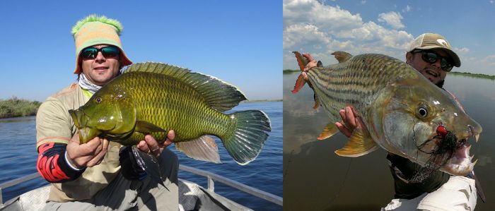
Bream and tiger fish caught on the Zambezi River (Copyright © Sekoma Island Lodge).
Kafue Flats
(Including two national parks: Blue Lagoon NP and Lochinvar NP)
The Kafue Flats are a vast expanse of seasonal floodplains, swamps, and open lagoons located along the Kafue River west of Kafue National Park. The Kafue Flats extend east-to-west for around 150 miles (240 kms) and at their widest point (north-to-south) are roughly 30 miles (50 kms) wide.
The Kafue Flats include two protected areas, Blue Lagoon National Park to the north of the Kafue River, and Lochinvar National Park to the south. The parks were created in the 1970s (Lochinvar in 1972 and Blue Lagoon in 1976) on what was then cattle ranching land. Kafue Flats has been declared a Ramsar Wetland of International Importance, covering some 2 320 square miles (6 000 sq kms).
Kafue lechwe (Kobus leche kafuensis) running on the floodplain in the Kafue Flats, Zambia.
Covering 175 square miles (455 sq kms) north of the Kafue River, Blue Lagoon National Park is known for its large herds of Kafue Lechwe (Kobus leche kafuensis), a subspecies of the red lechwe, that are endemic to the region. The land was previously owned by a British couple named the Critchley's, who converted from farming to conservation and their old farmhouse is now the park reception.
To the south of Blue Lagoon NP is Lochinvar National Park, which protects 157 square miles (406 sq kms) of the Kafue Flats. The Kafue River and the Chunga Lagoon mark Lochinvar's northern boundary. The land gets progressively drier moving south in the park, with open Acacia and Combretum woodland surrounded by grassy plains, dotted with numerous termite mounds.
Elephants on the plain at the Itezhi-Tezhi Dam, where the Kafue Flats begin.
The southern portion of Lochinvar is home to the Gwisho Hot Springs, as well as the remnants of a late Stone Age settlement, both of which are are interesting to visit. Other spots worth checking out are Drum Rocks, an outcrop of rocks that echo when tapped and Sebanzi Hill, which is a national monument where an Iron-Age settlement was excavated in the 1960s.
Beginning around 1908, Lochinvar's land was used for cattle ranching and its owner eradicated nearly all wildlife, which at that time included large numbers of plains game, as well as lion and leopard. Predators and species like eland, sable, roan, wildebeest, and even warthog, were wiped out by the late 1940s. In 1966, the Zambian Government purchased Lochinvar Ranch and converted it into protected land.
The damming of the Kafue River in two places, Itezhi-Tezhi Dam to the west and Kafue Gorge Dam to the east, has negatively impacted wildlife in the Kafue Flats by disrupting the natural seasonal flooding of the Kafue River in this region. Nonetheless, wildlife is fairly abundant along the Kafue Flats, with good herds of Kafue Lechwe, and good numbers of Burchell's zebra, eland, roan antelope, Lichtenstein's hartebeest, blue wildebeest, puku, and reedbuck.
An African fish-eagle, Kafue Flats, Zambia.
The shy sitatunga antelope, a water-dwelling species is found in the permanent swamps of Kafue Flats. The drier areas away from the river and floodplains are home to greater kudu, bushbuck, bush pig, warthog, baboon, and vervet monkey.
Bird life, particularly water birds, is prolific in the Kafue Flats. Birding and wildlife viewing in general are best when the water levels are up, which is typically March thru May. Palearctic migrant birds arrive around September and remain in the region until around April.
The rains fall in the Kafue Flats from December thru April, while the rest of the year is mainly dry. Being a wetland, wildlife viewing, as well as birding, is generally more interesting when water levels are up, even though this means a risk of rain.
Kafue lechwe (Kobus leche kafuensis) drinking, Kafue Flats, Zambia.
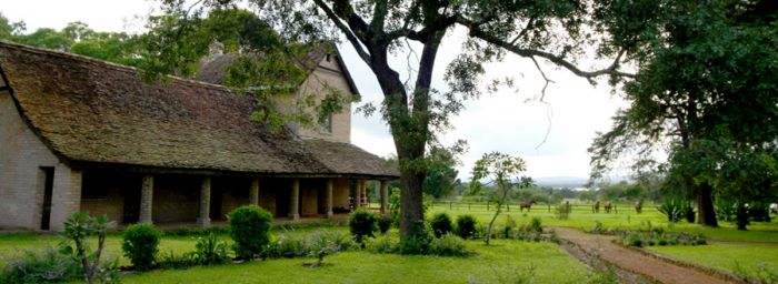
Shiwa Ng'andu
Shiwa Ng'andu is the creation and life-long project of Stewart Gore-Browne, an English aristocrat who came to Africa in 1911 as a member of the Anglo-Belgian Boundary Commission to determine the border between Rhodesia and the Democratic Republic of Congo.
Gore-Browne became enamored with the land around a lake called Shiwa Ng'andu (which means the 'lake of the royal crocodile'), and he negotiated with a local chief to purchase the lake and the surrounding land with an ambition of settling there.
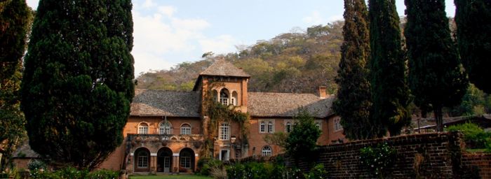
Shiwa Ng'andu House (image: C&J Harvey/Shiwa Ng'andu Estate).
The story of the Shiwa Ng'andu estate and Gore-Browne's life is chronicled in an autobiographic book called The Africa House, The True Story of an English Gentleman and His African Dream, published in 1999.
Today, the Shiwa Ng'andu Manor House is a luxurious guest house with 5 rooms, offering an historic view of this interesting and beautiful estate. The property has a private airstrip and can also be reached by road.
Impandala Farm House at Shiwa Ng'andu (image: C&J Harvey/Shiwa Ng'andu Estate).
Lusaka
Lusaka is Zambia's capital city and home to about 1.3 million people, making it Zambia's most populated urban area. Prior to 1935, the small town of Livingstone at The Victoria Falls, was the country's capital.
Lusaka is not typically a destination for most tourists visiting Zambia. The country's main airport, Kenneth Kaunda International Airport (LUN) is located here, and so the city is often included as the starting and ending point for most visits to the country that include destinations other than The Victoria Falls.
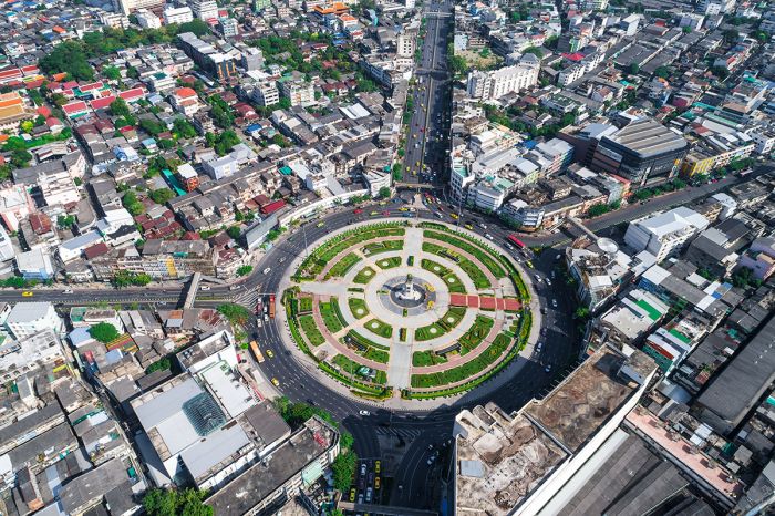
Aerial view over Lusaka, Zambia.
Lusaka does not offer a lot of activities for most visitors, although there are local markets, some museums, and the streets are great for people watching. Like most large cities, do not carry valuables if walking on your own.
There is a small but good variety of hotels and guest houses in Lusaka and in its suburbs, offering various amenities and price points.
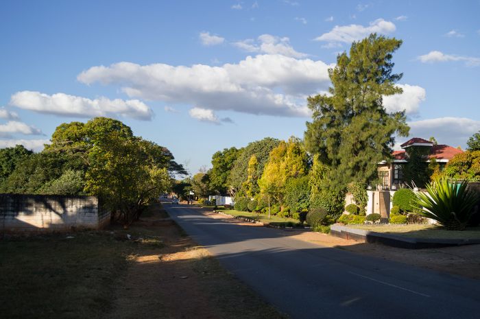
A quiet street in the Woodlands neighborhood of Lusaka.
Livingstone Town
Visitors to The Victoria Falls have a multitude of choices when it comes to where to stay. The Victoria Falls Bridge spans the gorge over just below The Falls and connects Zimbabwe to Zambia, with the Zambezi River forming the border between the two countries.
On either side of the bridge, connected by road and rail, are two towns: Victoria Falls Town on the Zimbabwean side and Livingstone Town on the Zambian side.
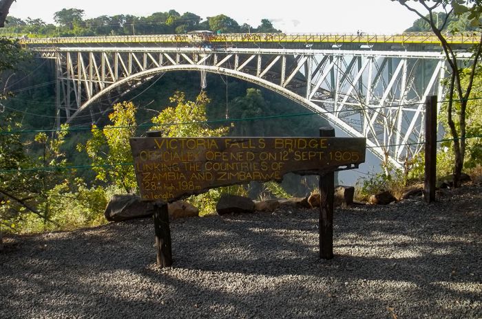
The Victoria Falls Bridge connects Zambia and Zimbabwe.
Many tourists to The Falls choose which side of the river on which to stay based on what makes the most sense considering the rest of their itinerary. Viewing The Falls from both sides of the river is possible, and activities like white-water rafting, bungee jumping, and flights over The Falls are possible regardless of which side one chooses. Besides the two towns, there are a number of lodges and camps situated on both sides of the river both upstream and downstream from The Falls.
Read full details on Livingstone and The Victoria Falls here.
View over Victoria Falls showing the bridge connecting Zambia (foreground/right) and Zimbabwe (background/left).
Quick Facts & Travel Tips
- Zambia is situated directly in the tropics, but its climate is moderated due to its altitude and good rainfall. The low-lying valleys can be very hot between September and December.
- Rainfall in Zambia mainly occurs beginning late Oct/early Nov and continues thru April. Jan/Feb are the wettest months.
- There are abut 70 official languages/dialects in Zambia, mostly of the Bantu family, of which Bemba and Tonga are the most widely spoken. English is the official language and is widely spoken in commercial settings.
- The national currency is the Zambian kwacha (ZMW), but US Dollars (old bills often not accepted), UK Pounds, and Euros are accepted in the larger cities, hotels, and safari camps.
- The US Dollar and Euro have consistently favorable exchange rates (10-20 to 1) versus the Zambian kwacha.
- Credit and debit cards are not widely accepted, except at the higher-end hotels and safari camps. Visa and Mastercard are the most widely accepted.
- Zambia uses 230v electricity and types C, D and G plug adapters.
- Zambia time is GMT+2 and does not observe daylight savings time (DST); 7 hours ahead of New York (6 during DST).
- The population of the country is around 18.5 million, with about 1.3 million in its most populated city, Lusaka. About 45% of the population is urban.
- Zambia covers 287 024 square miles (743 390 sq kms) with only 64 people per sq mile (25 people per sq km).
- Most Zambians are of Bantu-speaking origin. Bemba is the largest ethnic group (~20%), followed by Tonga (~14%).
- There are very few citizens of European decent remaining in Zambia; most left after independence in 1964. The is a growing population of Indian decent, mostly in the major towns.
- The majority of Zambians are Christians, accounting for around 95% of the population. Few have totally abandoned their traditional beliefs systems.
The Victoria Falls are a major attraction for Zambia and Zimbabwe.
ENTRY / VISA REQUIREMENTS
- A passport valid for at least six months beyond the date of entry into Zambia is required by nationals of USA/Canada/Australia/UK/EU.
- Possession of valid return air tickets is required on entry.
- The passport must contain at least three (3) unused (blank) pages labeled Visa when presented for entry.
- Note: Visa pages referred to above do not include pages reserved for Endorsements, Amendments or Observations.
- Single-entry, double-entry, and transit visas can be obtained on arrival, but it is recommended to apply for a tourist visa in advance from the embassy/high commission in your home country or through the e-visa facility.
- Multiple-entry visas are only available in advance through the e-visa facility.
- Single-, double-, and multiple-entry visas are valid for 90 days from the date of issuance, with the exception of USA nationals, whose multiple-entry visa is valid for 3 years.
- Single-, double-, and multiple-entry visas issued for tourism purposes are valid for ninety days within a 12-month period.
- Proof of yellow fever vaccination is required on arrival if you are traveling from a country with risk of yellow fever, including transit >12 hours in an airport located in a country with risk of YF virus transmission.
Note: entry/visa requirements are subject to change without notice, so please check with the official government pages shown below.
Official Government Pages
- US Department of State info: click here
- Zambian Consulate - USA: click here
- Zambia eVisa application: click here
- Zambia Home Affairs: click here
- CDC information: click here
Read More...
Main: Flora, Geography, Important Areas, National Parks, Protected Areas, Ramsar Sites, UNESCO Sites, Urban Areas, Wildlife
Detail: Bangweulu Wetlands, Blue Lagoon, Isangano, Kafue NP, Kafue Flats, Kasanka, Lavushi Manda, Liuwa Plain, Livingstone Town, Lochinvar, Lower Zambezi, Luambe, Lukusuzi, Lusaka, Lusaka NP, Lusenga Plains, Mosi-oa-Tunya, Mweru Wantipa, North Luangwa, Nsumbu, Nyika Plateau, Shiwa Ng'andu, Sioma Ngwezi, South Luangwa, Victoria Falls, West Lunga, Zambezi Floodplain
Admin: Travel Tips, Entry Requirements/Visas
Read More...
Central African Federation, Colonialism, Copper Crisis, Early History, Economic Decline, Frederick Chiluba, Independence, Kenneth Kaunda, Lead Up To Independence, Levy Mwanawasa, Recent History
EARLY HISTORY
Paleontological discoveries from excavations in the Luangwa Valley date the earliest hominid species in Zambia to around two million years ago. These remains are from Homo erectus, a hunter-gatherer people that used fire, made tools, and which is considered to be an ancestor of modern humans.
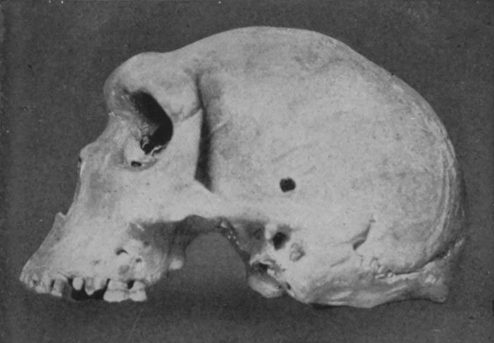
Skull discovered in 1921 in Broken Hill Cave, Northern Rhodesia (photo: Wikimedia Commons).
The renowned "Broken Hill Man", a Middle Stone Age fossil discovered from a cave at Kabwe, Zambia in 1921 is classified as Homo heidelbergensis, widely considered as the common ancestor of Homo sapiens in Africa and also linked to the Neanderthals, who lived in Eurasia and went extinct.
Early pastoralism emerged in north and west Africa around 3000 BC, but took a very long time to spread south into Southern Africa, only reaching the Lake Victoria region around 1000 BC. The emergence of Iron Age tools created further southern migration of the farming peoples, which gradually displaced the existing San/Bushmen people into forested areas, where farming was not possible. By AD 300-400, Iron-Age pastoralists had settled throughout the Southern African region.
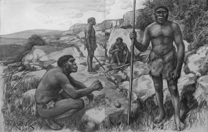
Interpretation of "Rhodesian Men" by Amédée Forestier (1922) (image: Wikimedia Commons).
Early Arab traders began venturing into the African interior around the mid-8th century and one such route followed the Zambezi River, which led them into what is today Zambia.
By the late 1600s, tribes in Zambia were trading ivory, copper, and gold with Portuguese and Arab traders operating out of Mozambique. In the first half of the 19th century, the slave trade emerged and tens of thousands of Africans were sold, some coming from Zambia.
The dominant pre-colonial kingdom in the region of present-day Zambia was that of the Luba people. The Luba Empire began forming around the 5th century and became politically sophisticated, reaching its peak in the 18th and 19th centuries.
The Bemba, along with other related groups like the Lunda, Lamba, Bisa, Senga, Kaonde, Swaka, Nkoya, and Soli, formed integral parts of the Luba Kingdom
The downfall of the Luba Kingdom was caused primarily by the demand for slaves and ivory by the Europeans and Arab-Swahili chiefs, who wreaked havoc and violence on the Luba.
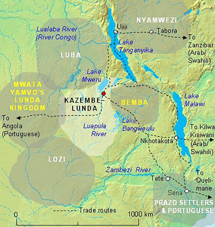
Principal kingdoms and major trade routes in the 19th century in the region of present-day Zambia (image: Wikimedia Commons).
Colonialism
David Livingstone's explorations of Africa in the 1850s led to a European expansion north of the Cape, which had heretofore been mostly ignored. Germany's colonization of South West Africa (Namibia) in 1884 caused the British great concern and they promptly struck deals with the chief of Bechuanaland (Botswana) to gain control of this area and cut off the Germans from linking east via the Limpopo River.
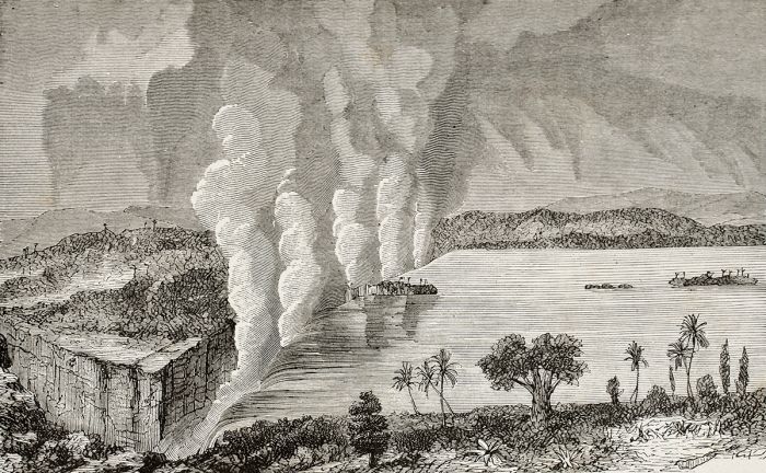
An illustration of The Victoria Falls, circa 1873 (artist unknown).
The British South Africa Company (BSAC), led by wealthy businessman Cecil John Rhodes, had territorial aspirations for the lands around the Zambezi River. Rhodes dreamed of linking the Cape to Cairo via railway and also wanted the mineral wealth he assumed existed in what is today Zambia. Backed by the British, his company was able to make treaties with local tribes in what is today Zambia, Zimbabwe, and Malawi, granting Brtish aid and protection in exchange for exclusive rights to the minerals in these lands.
By the late 1890s, the British had gained control of these lands, but Rhodes' focus was on the lands south of the Zambezi (Southern Rhodesia/Zimbabwe) and Northern Rhodesia/Zambia was largely ignored other than as a source of cheap labor for his mines in South Africa and Southern Rhodesia.
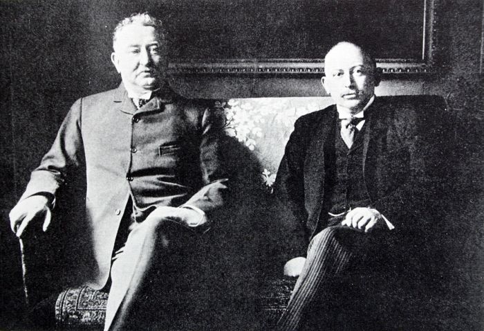
Cecil John Rhodes (left) and Alfred Beit (photo: Wikimedia Commons).
By 1905, Rhodes' railway spanned from the Kimberley diamond mine in South Africa northwards into Northern Rhodesia via a newly constructed bridge over the Zambezi River at The Victoria Falls.
In 1923, Southern Rhodesia became a self-governing British Colony and in 1924, rising administrative costs resulted in the British Colonial Office taking over administration of Northern Rhodesia from the BSAC (but mineral rights remained with BSAC).
In 1928, large copper deposits were discovered near the Kafue River Basin in an area now known as the Copperbelt. Over the next 10-15 years, large copper mines were created to extract these deposits, and the mines paid off, especially leading up to and during World War II, as Zambia became a substantial provider of copper to the Allied Forces.
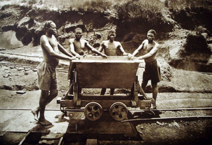
Copper mine workers in 1928 (image: Wikimedia Commons).
Federation of Rhodesia and Nyasaland
In the years leading up to World War II, the blatantly racist white government in Southern Rhodesia (present-day Zimbabwe) was pushing for a combined federation of the three regionally connected British protectorates: Nyasaland (present-day Malawi), Northern Rhodesia (present-day Zambia) and itself. The Southern Rhodesian government wished to gain sovereignty over the other two colonies and hopefully sidetrack the growing movement for African nationalism that threatened to replace them.
Black Africans in both Northern Rhodesia and Nyasaland were opposed the federation for the same reasons that the Southern Rhodesian whites were in favor of it. Despite the opposition of the African people in all three of these protectorates, Britain agreed to the federation, officially creating the Central African Federation (also known as the Federation of Rhodesia and Nyasaland) in 1953.
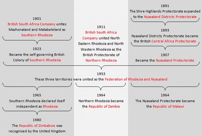
Evolution of the Federation of Rhodesia and Nyasaland (image: Wikimedia Commons).
Kenneth Kaunda
Growing discontent amongst the blacks in Northern Rhodesia stemming from their lack of representation in the country, led to the formation of the Northern Rhodesia African Congress (NRAC) in 1948, making it the first African political party in the country. In 1951 the party adopted the name Northern Rhodesian African National Congress (NRANC) under the presidency of Harry Nkumbula, an educated, articulate and uncompromising opponent of the Federation.
One of the NRANC's prominent members was Kenneth David Kaunda (also known as KK), Secretary General of the NRANC. Kaunda was born at Lubwa Mission in Chinsali, where his father, an immigrant from Nyasaland (present-day Malawi), was a teacher and an ordained minister of the Church of Scotland, and where his mother became the first African woman to teach in Northern Rhodesia.
Following in his parents' footsteps, KK became a primary school teacher at Lubwa and later the headmaster from 1943-45. Kaunda later worked at the Salisbury and Bindura Mine in the Copperbelt and in 1948, he became a teacher in Mufulira for the United Missions to the Copperbelt (UMCB).
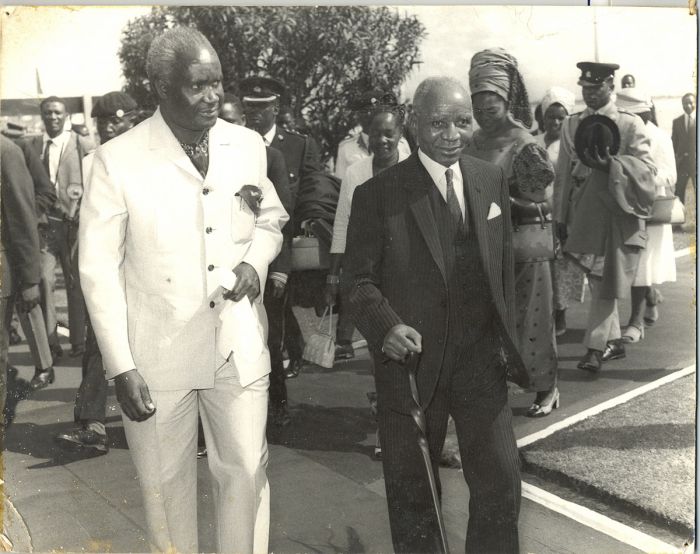
President Kenneth Kaunda with Malawian President Hastings Banda (photo: Wikimedia Commons).
In 1951, Kaunda became Organising Secretary of the Northern Province's NRANC and in 1953 he moved to Lusaka to take up the post of Secretary General of the NRANC, under the presidency of Harry Nkumbula.
The NRANC strove to mobilize native African peoples against the Federation and in 1955, Kaunda and Nkumbula were imprisoned for two months' hard labour for distributing subversive literature. Prison had a radicalizing impact on Kaunda and he became discontent with Nkumbula, who was becaming increasingly influenced by white liberals and was willing to compromise on black majority rule.
In October 1958, Kaunda split from the NRANC and formed his own party, the Zambian African National Congress (ZANC). In June 1959, amid growing rumors that the ZANC was preparing for violent protests and plots against white Europeans, the British Colonial government declared a state of emergency and banned the ZANC.
Kaunda was again arrested for subversive activities and sentenced to nine months' imprisonment, which he spent first in Lusaka and then in Salisbury. During Kaunda's imprisonment, other members formed the United National Independence Party (UNIP), the successor to the recently banned ZANC. On Kaunda's release from prison in January 1960, he was elected President on the UNIP.
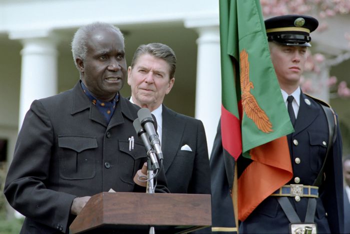
Kenneth Kaunda with US President Ronald Reagan at the White House in March 1983 (photo: Wikimedia Commons).
Lead up to Independence (1960-63)
As pressure from black Africans continued to grow in both Northern Rhodesia and Nyasaland, there was added and opposite pressure being applied by the white government in Southern Rhodesia, which wished to become its own fully independent country under white rule. The combined pressure convinced the British parliament to consider a change in its stance regarding these colonies. In December 1960, the British colonial authorities invited Kaunda and other UNIP leaders to a conference in London to discuss the future of the three colonies.
In early 1961, the British Colonial Office proposed a constitution for Northern Rhodesia which would make it possible to elect a black majority government, but this initial proposal was shot down by the Federation of Rhodesia and Nyasaland's President, Roy Welensky, who feared that this concession would lead to the dissolution of the Federation.
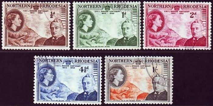
Postage stamps from Northern Rhodesia commemorating the Cecil Rhodes Centenary, 1953 (image: Wikimedia Commons).
During 1961, Kaunda and the UNIP organized a campaign of civil disobedience in the Northern Province, which was dubbed the Cha-cha-cha Campaign. The campaign consisted of boycotts, rallies, roadblocks, pickets, and other acts of mostly nonviolent civil disobedience. The campaign was successful in that it prompted the Colonial government to propose another constitution in 1962, which would allow elections for a black majority rule and subsequent national independence.
The pre-Independence elections were held in October 1962, with Kaunda running as the UNIP candidate and Harry Nkumbula running as the NRANC candidate. Together, the NRANC and UNIP won two-thirds of the total vote between them and gained a majority of the seats. The Federation's United Federal Party (UNP), won a minority of the votes, which led to the dissolution of the Federation in 1963.
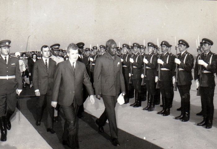
Kenneth Kaunda visits Romania in 1970, shown with Nicolae Ceau?escu, President of the State Council of Romania (photo: Wikimedia Commons).
Independence & Kaunda (1964-1973)
In January 1964, general elections were again held, this time to create the first government for a newly independent country. The UNIP won 69% of the votes and the NRANC won 31% of the votes, making Kenneth Kaunda the country's first Prime Minister.
On 24 October 1964, Northern Rhodesia was granted full independence and became the Republic of Zambia. Later in 1964, Kaunda's title was changed to President, as the country adopted a presidential system of government.
As Zambia's first president, Kaunda inherited a country that was heavily reliant on the world copper market and trade routes that were entirely dependent on Rhodesia (Zimbabwe), South Africa, and Mozambique. Furthermore, Zambia had a substantial national debt left over from the colonial years and a native populace that was mostly uneducated and unskilled.
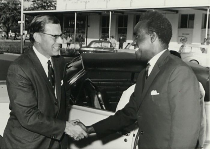
Prime Minister Kenneth Kaunda and British High Commissioner Designate J A Molyneux in Lusaka, 1964 (photo: Wikimedia Commons).
Another issue facing Kaunda was that there were very few black Zambians capable of holding leadership roles in the government. Moreover, there were over 70 000 white European residents who maintained a large proportion of the country's economic significance.
In 1965, the white government of Rhodesia (formerly Southern Rhodesia) made a Unilateral Declaration of Independence (UDI) in an attempt to protect white rule. Global condemnation and sanctions against Rhodesia followed, and because Zambia's trade mostly flowed through Rhodesia, this had a substantial negative impact on Zambia's economy.
During this time, Kaunda gave political support to the growing black movements for independence in South Africa, Rhodesia, and South West Africa, often granting asylum for political refugees from these countries. The result was costly for Zambia, with its white-ruled and economically superior neighbors in Rhodesia and South Africa to the south further cutting off Zambia's trade routes.
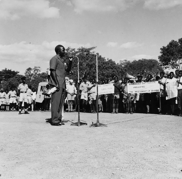
President Kaunda addresses the population during his visit to Solwezi, Zambia in 1967 (photo: Wikimedia Commons).
In December 1968, Kaunda was re-elected president, winning 82 percent of the vote, while Harry Nkumbula received the other 18 percent. Kaunda's UNIP party won 81 of the 105 seats. In 1972, Zambia banned all political parties except the UNIP and in 1973, a new constitution was formalized, adopting the one-party democracy with a unicameral National Assembly.
Zambia's new constitution, in which the UNIP was the only legal political party in the country, ensured that Kaunda could retain absolute power over the country as long as he kept his position as President of the UNIP party. In this way, Kaunda ran unopposed and was re-elected in 1973, 1978, 1983, and 1988.
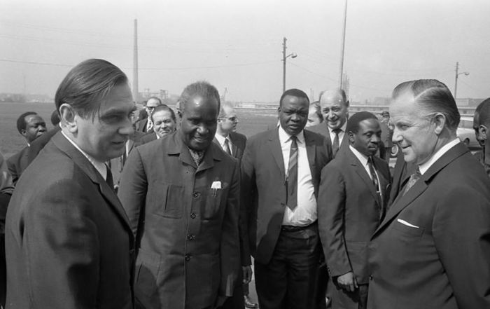
Kenneth Kaunda in Frankfurt, West Germany in May 1970 (photo: Wikimedia Commons).
Copper Crisis & Economic decline (1970-1988)
In January 1970, Zambia initiated a program of nationalizing its copper mines, which provided much of the country's export revenue and had done so for many years. A referendum was held and the government took a 51% ownership in a number of key foreign-owned firms, most significantly, the profitable copper mines, as well as insurance companies, and financial institutions.
Unfortunately for Zambia, in the early 1970s, global copper prices declined dramatically (mainly due to the world's second largest producer, the USSR, flooding the market), while oil prices increased. Zambia's tenuous economy, which relied heavily on copper exports, was brought to its knees.
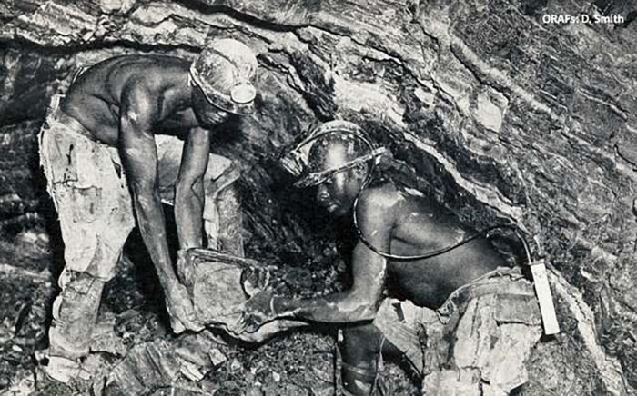
African miners working in an underground copper mine in Northern Rhodesia in the early 1950s (photo: Wikimedia Commons).
The fundamental weakness of Zambia's economy, which had long been designed to fulfill the needs of the colonial rulers at the expense of its citizens, was thus exposed. Concurrently, interest rates on Zambia's national debt increased, which effectively crippled its economy.
To combat its shrinking export revenue and rising debt service, the country borrowed more money, hoping for a copper price recovery that never occurred.
In 1986, the government withdrew food subsidies to save money and this hit the poorest of Zambia's citizens the hardest, leading to major riots. The widespread violence forced the government to reinstate the subsidies.
By the end of the 1980s, Zambia was in serious trouble, with rampant inflation, a worsening debt problem, and a weak currency. The country was now one of the world's poorest.
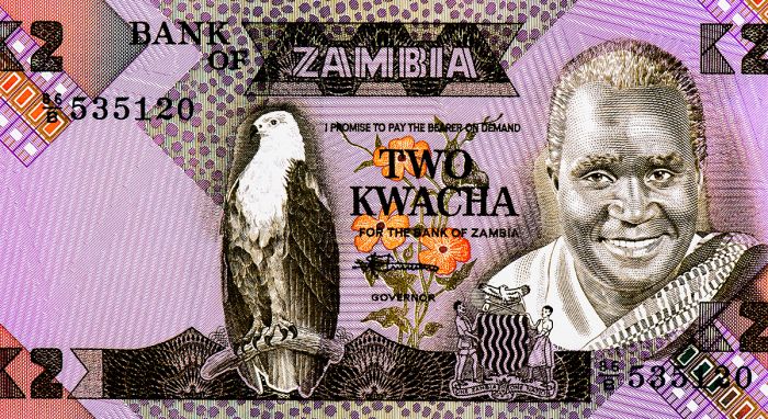
A two-kwacha Zambian banknote, showing the popular images of Kenneth Kaunda and an African fish-eagle.
Kaunda Demise / Rise of Chiluba (1990-2001)
Zambia's failing economy and the very low standard of living for most of its population led to growing discontent and the advent of serious opposition to Kaunda's regime. Riots increasingly became a problem for Kaunda, and in June 1990, riots over increasing food prices turned ugly when 30 protesters were killed and over 100 more injured.
The following week, on 01 July 1990, an attempted coup d'état was carried out by Lieutenant Mwamba Luchembe of the Zambian Army. The coup was defeated and lasted only six hours. Although the coup failed, the national radio station broadcast the events and the reasons for it and it seriously weakened Kaunda's political power and security.
Sensing his weakening political position, Kaunda announced that he would initiate widespread reform and promised a referendum on allowing a multiparty democracy. The referendum never occurred, as Kaunda simply ceded to multiparty participation in the upcoming elections. New political parties quickly sprang up, among them the Movement for Multi-party Democracy (MMD), led by Frederick Chiluba, a trade union leader.
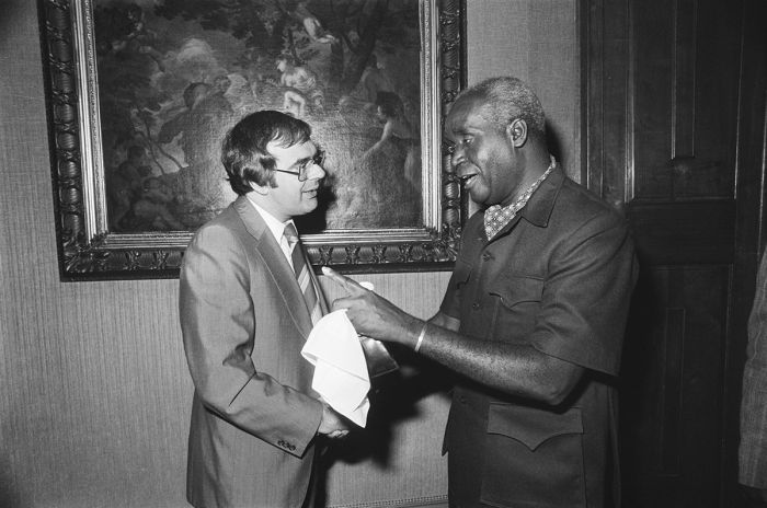
Kenneth Kaunda and Dutch politician Jan Pronk in the Netherlands, 1977 (photo: Wikimedia Commons).
1991 Elections
General elections were held on 31 October 1991 to elect a President and National Assembly, making them the first multiparty elections in Zambia since 1968. Frederick Chiluba and the MMD party received 76% of the vote and won 125 of 150 seats in the National Assembly, soundly defeating Kaunda's UNIP party. Chiluba became Zambia's second president.
Chiluba quickly moved to work with the International Monetary Fund (IMF) and World Bank, to which Zambia was heavily indebted, to liberalize the country's economy. Chiluba re-privatized the state-owned businesses, including the copper mines and financial enterprises, and he removed subsidies on various commodities. Despite these positive changes, allegations of corruption grew regarding the new president over his first term in office.
1996 Elections
Leading up to the 1996 elections, the opposition UNIP geared up by forming an alliance with six other opposition parties and Kenneth Kaunda came out of political retirement to lead the party once again. In a clear move to block the opposition, Chiluba made changes to the constitution, the most important being that "no person born of non-Zambian parents can run for the office of President of Zambia". The move was of course directed singularly at Kaunda, whose parents were both from Malawi.
Kaunda and the UNIP were outraged and called for election boycotts. The results of the November 1996 elections were again heavily in favor of Chiluba and the MMD, with Chiluba winning 73% of the vote and the MMD winning 131 of 150 seats in the National Assembly.
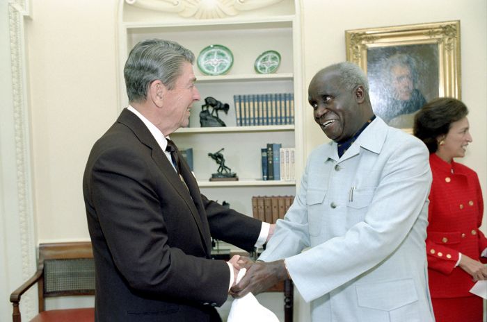
US President Ronald Reagan with President Kenneth Kaunda of Zambia in a Oval Office Meeting in October 1987 (photo: Wikimedia Commons).
Coup Attempt
On 28 October 1997, a coup d'état attempt occurred when a group of army commanders took control over the national radio station, announcing via broadcast that President Chiluba had been removed from office. In fact, this was far from the truth and the soldiers were quickly arrested, while Chiluba instituted a national state of emergency.
The police arrested a total of 84 people accused of being involved in the failed coup, including Kenneth Kaunda and other opposition party leaders. The arrests were seen as unlawful, both within Zambia and among the global community. Some of the detainees alleged that they were tortured during interrogation (the allegations were later substantiated by Zambia's Human Rights Commission). The negative world press had a profound impact on Zambia's debt relief programs as international donors pulled out.
End of Chiluba's Presidency (2001)
Leading up to the 2001 general elections, President Chiluba attempted to change the constitution in order to allow him to run for a third term. Protests from within his own MMD party, as well as widespread public protests against him, caused him to back down.
In August 2001, the MMD elected Levy Patrick Mwanawasa, a practicing attorney and former Vice-President under Chiluba from 1991-94, as its presidential candidate for the upcoming elections. In 1996, Mwanawasa had contested Chiluba for the presidency of the MMD and after losing, he had retired from politics to resume his successful law career.
2001 Elections
On 27 December 2001, general elections were held and Mwanawasa was declared the winner with only 29% of the vote, defeating 10 other candidates and narrowly beating the the United Party for National Development, which received over 27% of the vote. The MMD also claimed 69 of the 150 National Assembly seats. Domestic and international election monitors cited serious irregularities with the campaign and election.
In January 2002, three of the losing opposition candidates petitioned Zambia's Supreme Court to overturn the election results. The court agreed that the vote had been flawed, but that the irregularities did not affect the final results.
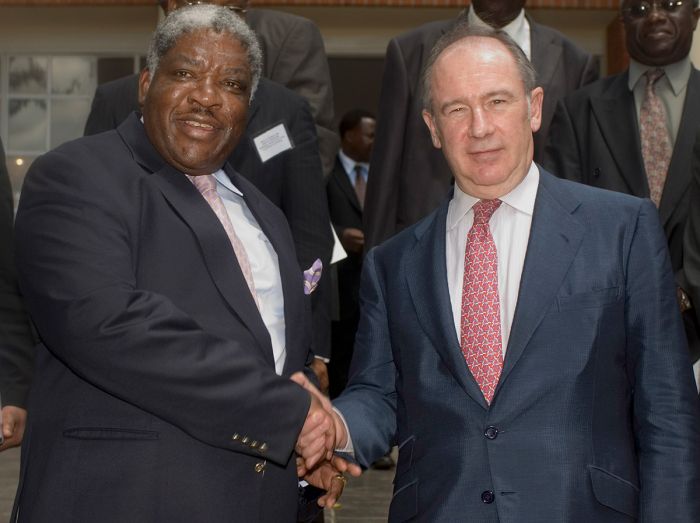
Zambian President Levy Mwanawasa with IMF Managing Director Rodrigo de Rato y Figaredo in 2006 (photo: Wikimedia Commons).
Levy Mwanawasa Presidency (2002-08)
Levy Mwanawasa's first term was marked by his anti-corruption campaign that resulted in the prosecution of Chiluba and many of his supporters, charging the ex-President and other officials with the theft of more than US$40 million. Mwanawasa offered to pardon Chiluba if he admitted his guilt and returned 75% of the allegedly stolen money, but Chiluba denied the allegations.
Notes on Chiluba: Chiluba was later found guilty of stealing US$46 million in a civil case by a UK court. In May 2008, the Zambian government announced that it had recovered almost US$60 million in money and assets stolen by Chiluba during his presidency from bank accounts owned by Chiluba and former government officials in his regime. The criminal case against Chiluba in Zambia continued until 2009, when he was acquitted of all charges in a Lusaka courtroom. Chiluba died on 18 June 2001.
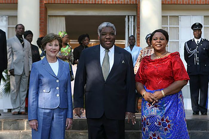
US First Lady Laura Bush with Zambian President Levy Mwanawasa and First Lady Mrs. Maureen Mwanawasa at the State House, June 2007, Lusaka, Zambia. (photo: Wikimedia Commons).
2006 Elections
In the December 2006 general elections, President Mwanawasa was re-elected with 43% of the vote and Michael Sata of the Patriotic Front (PF) came in second, with 29% of the vote. The MMD won 75 of the 150 National Assembly seats. After being sworn on for his second term, Mwanawasa named a new cabinet and appointed Rupiah Banda, a former member of the UNIP and cabinet member in Kaunda's government, as his Vice-President.
President Mwanawasa Dies in Office
On 29 June 2008, while in Egypt for an African Union summit, President Mwanawasa suffered a stroke and was hospitalized. He was flown to France for treatment. Rumors of Mwanawasa's death began spreading in the following days, with false reports broadcast on various radio stations around Africa. Nonetheless, Mwanawasa's condition was serious and he could not run the country from a hospital bed, so Vice-Presdeint Banda took over temporary duty as acting President.
On 19 August 2008, Mwanawasa died at the Percy Military Hospital in Paris. On 03 September 2008, Mwanamasa's body was interred at Embassy Park, opposite the Zambian Cabinet Office. Banda officially took over as acting president prior to a new presidential election, which according to the constitution, should be called within 90 days of the President's death.
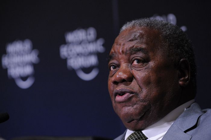
President Rupiah Banda at the World Economic Forum on Africa held in Dar es Salaam, Tanzania, May 2010 (photo: Wikimedia Commons).
Recent History (2008-present)
2008 Elections (Partial-Term)
The MMD confirmed Rupiah Banda's application to stand as their candidate in the upcoming elections. Elections for the office of President were held on 30 October 2008, with Banda receiving 40% of the vote, narrowly defeating Michael Sata, who received 38% of the vote. Sata's PF party alleged fraud and refused to recognize Banda's victory, with riots erupting in Lusaka and Kitwe.
2011 Elections
On 20 September 2011, general elections were held and incumbent President Banda was defeated by his main challenger, Michael Sata of the PF party, who had run three time previously. The results were 43% for Sata, 36% for Banda, and 19% for Hakainde Hichilema of the United Party for National Development (UPND). Results were announced on 23 September and Sata was sworn in the same day as Zambia's fifth president. The PF also won 60 of the 148 seats in the National Assembly.
Two days before the results were officially announced, the Zambian High Court banned three independent media outlets from publishing speculation on the result after The Post published a headline reading "Sata Heads for Victory." The delay in announcing the election results was the cause of rioting in Ndola and Kitwe, where youths fought with police, burning markets and cars.
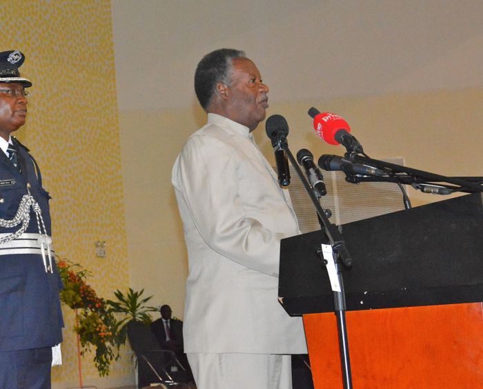
Zambian President Michael Sata in September 2013 (photo: Wikimedia Commons).
President Sata Dies in Office
In 2014, reports about Sata's poor health began emerging and he stopped appearing in public, which was contrary to his characteristic extroverted and outspoken persona.
On 19 October 2014, President Sata left the country for what was supposedly a medical check-up. Sata left Edgar Lungu, the Minister of Defense, in charge of the country in his absence. On 28 October 2014, it was reported that Sata had died in London, where he was receiving treatment for an undisclosed illness.
Vice-President Guy Scott was named acting President of the country until an election could be held. Scott became the first white leader of a democratically elected sub-Saharan African government and the first overall white country leader since F.W. de Klerk, South Africa's last apartheid-era president. After Sata's death, Presidential elections were scheduled for January 2015 to determine who would be president for the remainder of Sata's term.
US President Barack Obama and First Lady Michelle Obama Dr. Guy Scott, Vice President of the Republic of Zambia, and Dr. Charlotte Harland Scott at the White House, Aug. 5, 2014 (photo: Wikimedia Commons).
2015 Elections (Partial-Term)
As president of the MMD, Nevers Mumba declared himself the party's candidate for the presidency, but the MMD Executive Committee unanimously voted to suspend Mumba from the party presidency and adopt former president Rupiah Banda as its candidate. This action was overturned by the Supreme Court, which ruled that Mumba would be the candidate for the MMD. Edgar Lungu was adopted as the candidate for the ruling Patriotic Front (PF) party in the upcoming elections.
On 20 January 2015, Lungu narrowly defeated his main opposition Hakainde Hichilema of the UPND, winning by just 27,757 votes. The results showed Lungu with 48.84% of the votes and Hichilema with 47.16% of the votes. Mumba and the MMD won a paltry 0.88% of the votes. Lungu was sworn in as President of Zambia on 25 January 2015 for the duration of Sata's term.

Zambian President Edgar Lungu with Linda Thomas-Greenfield, US Assistant Secretary of State for African Affairs in 2015 (photo: Wikimedia Commons).
2016 Elections
Full-term general elections were held on 11 August 2016, with the same contenders from 2015 again running for the office of president. A total of nine candidates ran for the presidency, with Edgar Lungu retaining his office, winning with 50.35% of the vote. The margin of victory was only a few thousand votes above the threshhold to win a majority and avoid a run-off. Hakainde Hichilema of the UPND came in second with 47.63% of the votes.
PF members and supporters celebrated in the streets, while rioting broke out in most parts of the country. The UPND condemned and rejected the election results, claiming collusion by the electoral commission to rig the results. The UPND filed a case before the Constitutional Court, asking for the results to be nullified due to irregularities. The court dismissed the case and on 13 September 2016, Lungu was sworn in for a five-year term as president.
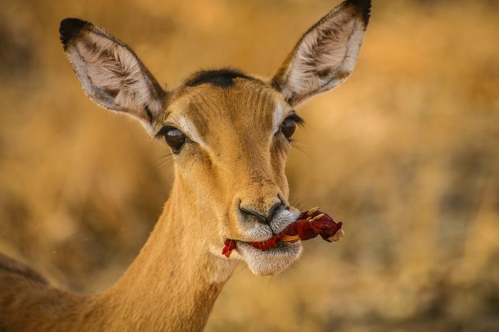
An impala savors a tasty sausage tree flower, South Luangwa National Park, Zambia.
Read More...
Central African Federation, Colonialism, Copper Crisis, Early History, Economic Decline, Frederick Chiluba, Independence, Kenneth Kaunda, Lead Up To Independence, Levy Mwanawasa, Recent History
Great Good Fair Poor
- Jan
- Feb
- Mar
- Apr
- May
- Jun
- Jul
- Aug
- Sep
- Oct
- Nov
- Dec
The chart directly above should be taken as a very rough overall indicator of best times to visit Zambia, as there are significant variations regionally and based upon elevation. More information on the specific national parks and reserves is found on the previous Details tab.
Click on a Region Link above to read more about best times to visit a specific region or destination.
Climate
Zambia is located in the tropics and therefore receives plenty of sunshine and warm weather. However, because much of the country is part of the high, Central African Plateau, with an elevation of between 3 000-5 000 feet (1 000-1 600 meters), the temperatures are moderated.
The lower-elevation river valleys, including the Luangwa, Zambezi, and Kafue, are substantially warmer than the rest of the country throughout the year. October is the hottest month, sometimes reaching over 110°F (44°C) at midday in these low-lying areas. June and July are the coolest months.
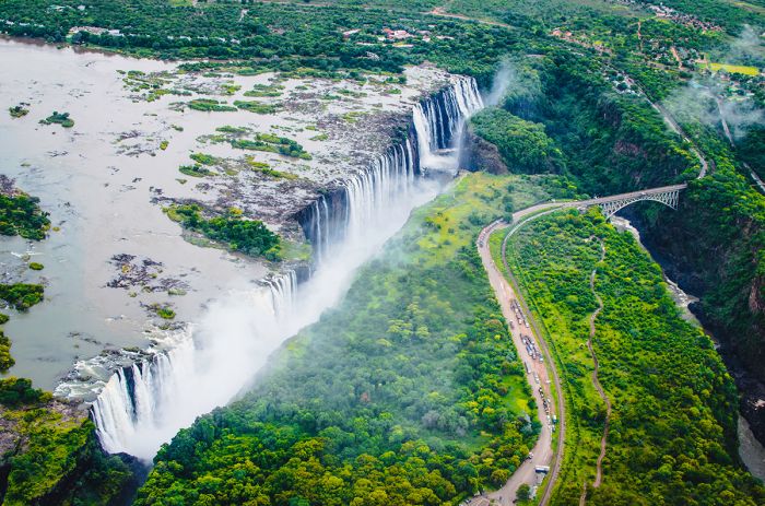
The Victoria Falls on the Zambezi River.
Seasons
Like most of Southern Africa, Zambia's rainfall occurs during its warm summer months (between December and March), with afternoon showers very common. May thru August are dry and cooler, while the springtime months of September thru November are warm and dry. Early rains can begin in October.
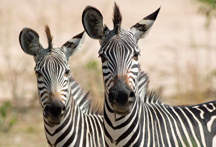
Crawshay's zebras in South Luangwa National Park, Zambia.
Northern Zambia's climate is more characteristic of Central and East Africa, with two rainy peaks, one in December and the other in March, while Southern Zambia's climate is typical of Southern Africa, with one rain season and the heaviest rains falling in January/February.
The northern part of the country around Lake Mweru and Lake Tanganyika receive the earliest rains, often in October, while southern Zambia's rainy season typically arrives in late November or early December. The north also receives the highest annual rainfall, with lower precipitation in the south.
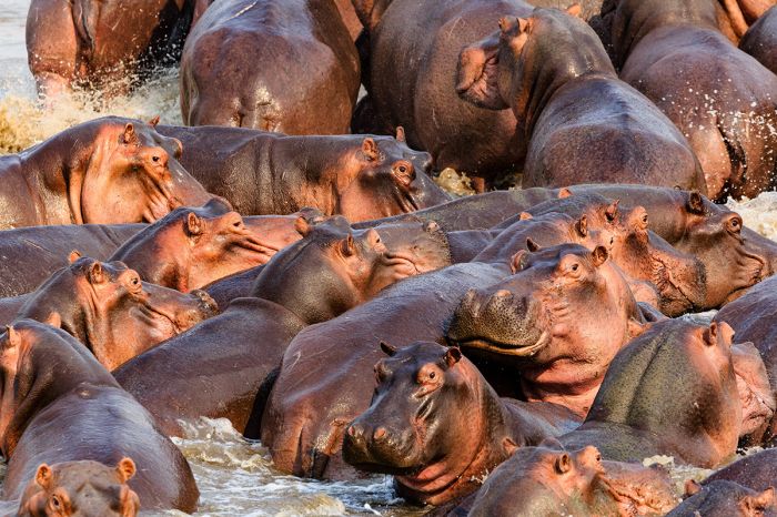
Hippos in the Luangwa River, Zambia.
Showing 1–5 of 5 results
Small, classic-style tented camp located in the remote wilderness of northern Kafue in a dynamic wetland called the Busanga Plains. Offers seasonally superb wildlife viewing via game drives and boating. Open Jun-Oct.…
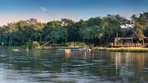
Contemporary, luxury lodge located in the remote Lower Zambezi National Park along the Zambezi River. Few camps nearby, providing an exclusive experience without any crowds. Diverse and abundant wildlife, game drives, walking safaris, canoeing, fishing, and boating.…
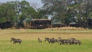
Located in the remote wilderness of northern Kafue in a dynamic wetland called the Busanga Plains, Shumba offers seasonally superb wildlife viewing via game drives and boating. Open Jun-Oct.…
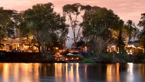
Located away from the crowds around The Falls and within Mosi-oa-Tunya National Park on the bank of the Zambezi River. Easy access to The Falls by road or boat. Endless activities including boating, game drive safaris, fishing, culture, and adventures at The Falls.…