

Lower Zambezi (Zambia)
(incl. Chiawa GMA, Lower Zambezi National Park)
Region Links: Kafue, Livingstone, Lower Zambezi (Zambia), North Luangwa, South Luangwa
Highlights
- The Zambezi River & floodplain are home to abundant wildlife.
- Safaris via game drive and boating/canoeing on the river.
- Lions, leopards, hyenas, elephants, buffalo and antelopes.
- Few safari camps, low tourist numbers in a remote wilderness.
EOA Recommends: Anabezi Luxury Tented Camp, Chiawa Camp, Chongwe River Camp, Lolebezi Lodge, Sausage Tree Camp
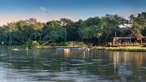
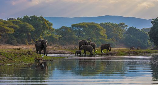
The Lower Zambezi River Valley includes protected areas on both sides of the Zambezi River and is one of Southern Africa's best wildlife safari destinations.
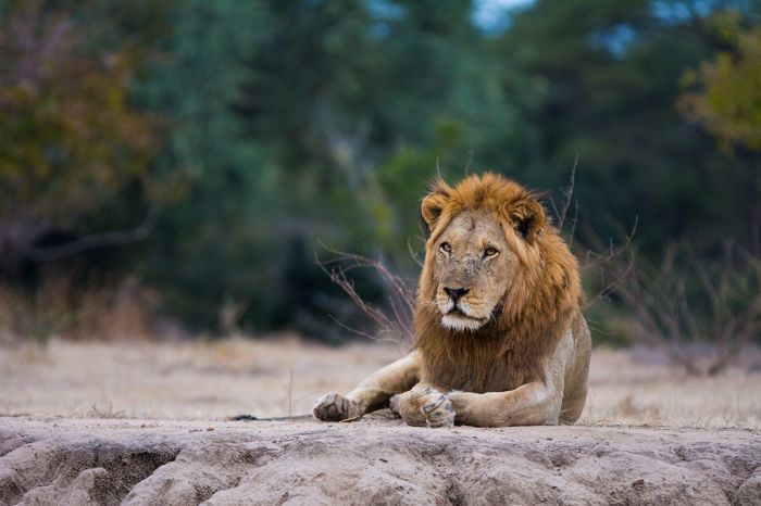
A male lion in Zambia's Lower Zambezi National Park.
On the northern banks of the Zambezi River is Zambia's Lower Zambezi National Park, while the southern side is Zimbabwe's Mana Pools National Park. Together, these two national parks protect a spectacular wilderness that is home to abundant wildlife.

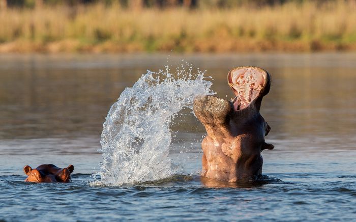
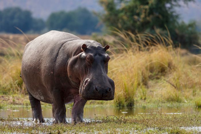
Hippos in the Zambezi River.
The Lower Zambezi National Park and the adjoining Chiawa Game Management Area to the east protect a huge tract of relatively inaccessible wilderness. Safari camps are located along the Zambezi River and the floodplain extending north. Guests enjoy safaris by game drive and on the river itself, in boats and canoes.
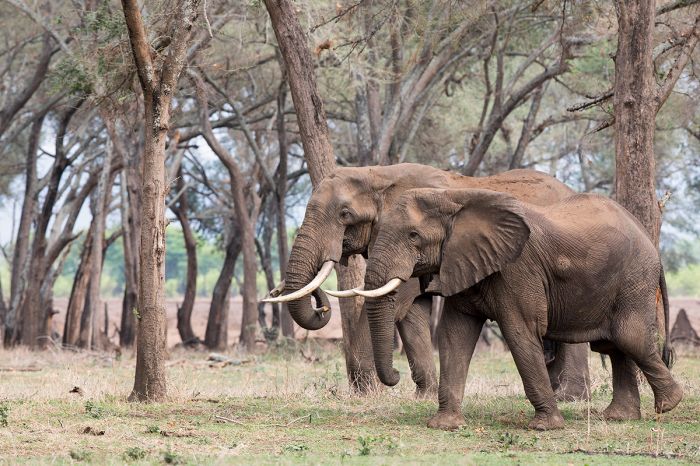
A pair of bull elephants in Lower Zambezi National Park, Zambia.
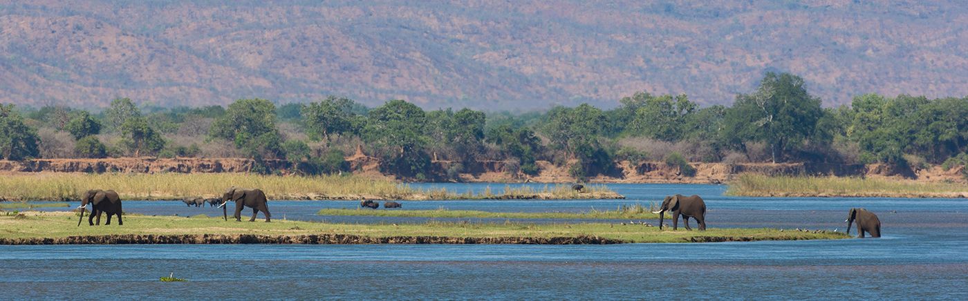
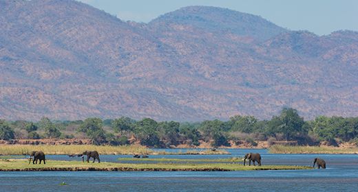
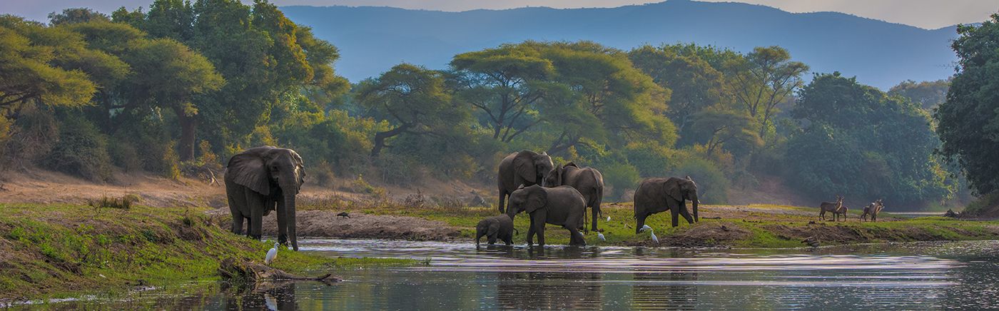
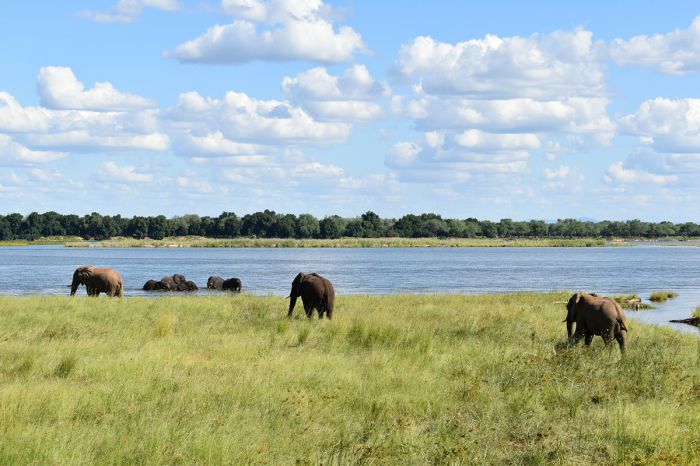
Wildlife that is a sure bet here includes large populations of elephant and buffalo, both of which are often seen on the floodplains and even grazing on islands in the river itself, as they move freely between Zambia and Zimbabwe.
Lions, leopards and spotted hyenas are the commonly seen predators. Impala are quite common and there are good numbers of kudu, zebra and waterbuck. The Zambezi River is a haven for large numbers of hippos and crocodiles. Birding along and on the river is excellent.
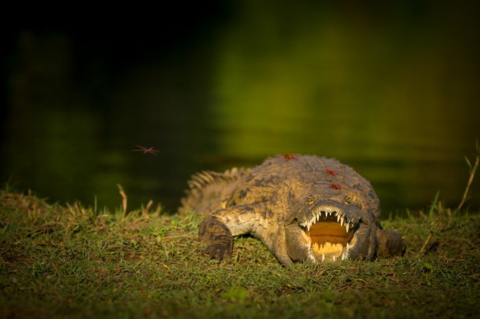
A nile crocodile & dragonflies on the bank of the Zambezi River.
A few days spent at one of the safari camps in the Lower Zambezi is a superb addition to a Zambian wildlife safari, offering the diversity of wildlife viewing along the Zambezi River.
Read More...
Chiawa GMA, Conservation Lower Zambezi, Geography, History, Lower Zambezi National Park, Poaching, Zambezi River, Wildlife
History
Early hominids are known to have inhabited the Lower Zambezi region for at least two million years, with our ancestors living here through the Stone Age. Pastoralist farming people migrated south into the region in approximately 400 AD.

Elephants drinking from the Zambezi River.
The Zambezi River has long been a conduit for trade from the interior to the Indian Ocean. The confluence of the Zambezi and Luangwa rivers was a significant trading center for the Portuguese, establishing the towns of Zumbo and Luangwa here in 1546.
The British South Africa Company (BSAC), a company created to promote colonization and economic exploitation in Africa, gained control of the land north of the Zambezi River in 1889, with the town of Luangwa becoming an administrative post for the BSAC.
Hippos are abundant in the Zambezi River.
At this time, very few people lived in the region, mostly because of the prevalence of tsetse flies, which made cattle farming impossible. The BSAC focused most of its efforts on land south of the Zambezi River, while the land north of the river was primarily used by the British and local people for hunting.
The BSAC administered the region until 1964, when Northern Rhodesia (present-day Zambia) gained its independence from the British.

Leopards are often seen on game drives after sunset.
In 1973, USAID visted the region with the goal of establishing a protected wildlife park. Unfortunately, due to the civil war on the southern side of the Zambezi River (Southern Rhodesia - now Zimbabwe), this initiative was unsuccessful. For the next ten years, Zambia's Lower Zambezi region was the private hunting grounds for the country's first President, Kenneth Kaunda (KK) and other members of government.
In 1983, Zambia established the Lower Zambezi National Park, but it wasn't until 1989 that the first tourist camp was set up. There were very few roads and no infrastructure and it took several years for the pioneering safari companies to establish a road network along the Zambezi River and in its floodplain. Today the park still retains its remote and pristine wilderness feel and has avoided mass tourism.
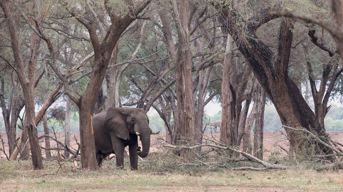
Elephants are one of the Lower Zambezi's most common large mammal.
Poaching
Like most of Zambia's protected wildlife regions, the Lower Zambezi has suffered the ravages of wildlife poaching. The Senga people, who had long inhabited and hunted for food in the region, were forcibly moved out when the national park was established in 1983, but still continued to hunt here.
Throughout the 1970s and 1980s, high demand for ivory and rhino horn in Asia, led to widespread commercial poaching throughout Africa and the Lower Zambezi's elephants and rhinos were hit hard. The black rhino were completely exterminated and elephants nearly so.

An elephant and her calf along the Zambezi River.
The CITES ivory ban in 1975 helped to stem the decimation of Africa's elephants and today, the Lower Zambezi has a very healthy elephant population. Sadly, black rhinos are no longer found here. Small scale poaching still occurs the Lower Zambezi, but the safari camps, park authorities, and CLZ (see below) help to keep it minimized.

African fish-eagles are common in the Lower Zambezi.
Conservation Lower Zambezi
Created in 1994, Conservation Lower Zambezi (CLZ) is a non-profit organization funded by safari operators in the region to support Zambia's Department of National Parks and Wildlife (DNPW) in efforts to combat wildlife poaching.
CLZ has expanded from simple anti-poaching patrols in its early years, and today also operates an Environmental Education Program, a Community Scout Unit, a Community Engagement Program, a Detection and Tracking Dog Unit, and a Rapid Response Unit. The CLZ also operates an annual Safari Guide Training course. Support of the CLZ is crucial to protect the wildlife in the Lower Zambezi.

Lower Zambezi sunset over the river.
Geography
The town of Chirundu, Zambia marks the western edge of the Lower Zambezi safari region. The Chirundu bridge, which spans the Zambezi River and connects Zambia to Zimbabwe, is one of only a handful of bridges over the river.
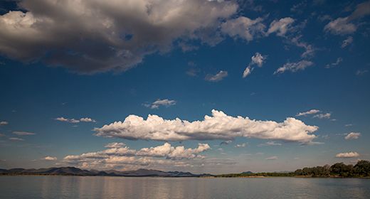
From Chirundu, the Zambezi River flows east to the Mozambique border, covering 95 miles (150 kms) and descending in elevation only about 140 feet (42m). This gradual gradient means that the river flows quite slowly between the two national parks, making it a lovely stretch of river for wildlife and canoeing.

Canoeing on the river is a specialty in the Lower Zambezi.
This section of the Zambezi Valley is a southern rift extension of the Luangwa Rift Valley and is enclosed on the north by the Zambezi Escarpment. The escarpment traverses roughly east-west through the Lower Zambezi National Park at an elevation of 3 950 feet (1 200m) and between 3-5 miles (5-8 kms) north of the Zambezi River.
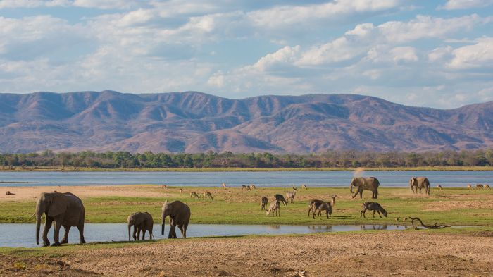
Here the ancient river meanders across the valley floor, and over time, has had its course altered countless times, leaving various oxbows and lagoons. Over the years, the river's slow flowing and varying watercourses, combined with occasional flooding across the valley floor, have deposited volcanic silt and sediment, creating rich soils. The fertile substrate in this alluvial plain results in nutritious grasses and other vegetation that are favored by the valley's plentiful grazers.
Looking across to Zambia from the Zimbabwe side of the Zambezi River.
Most of the Lower Zambezi National Park is comprised of the Zambezi Escarpment. The escarpment is dominated by miombo woodland (broad-leafed, semi-deciduous trees) but because there is not much permanent water in the high ground, most of the wildlife congregates on the valley floor's floodplain and along the river.
The rich soil in the valley support open grasslands, interspersed with acacia scrub and trees, including the iconic baobab. There are also woodlands comprised of mopane, acacia, leadwood, jackalberry, and fig trees. These rich habitats are ideal for the region's wildlife, and it is here that the park's safari camps and game-viewing tracks are found.
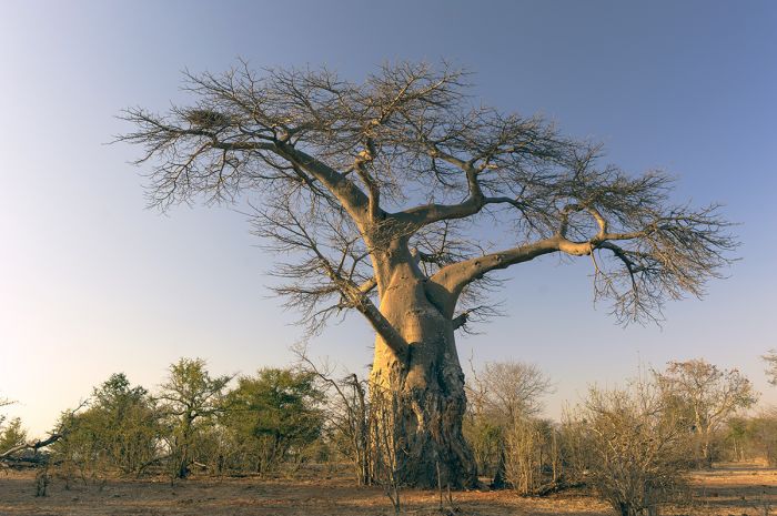
The iconic baobab tree in Lower Zambezi National Park, Zambia.
Chiawa GMA
Moving east from Chirundu is a protected area called the Chiawa Game Management Area (GMA), which acts as a buffer zone for the national park. The GMA covers 925 square miles (2 400 sq kms) and is managed by the safari camp operators located here. The game viewing gets progressively better the further east one goes, and is best inside the national park, which begins at the Chongwe River.
Lower Zambezi National Park
Directly east of the Chiawa GMA is the Lower Zambezi National Park (LZNP). The park covers 1 600 square miles (4 143 sq kms), extending from the Chongwe River east to the Mozambique border at the confluence of the Zambezi and Luangwa rivers. Directly across the Zambezi River to the south of LZNP is Zimbabwe's Mana Pools National Park. Wildlife densities are best inside the park along the river and its floodplain, getting progressively better to the east.
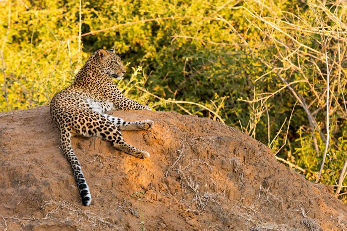
A leopard relaxing near the Zambezi River.
Zambezi River
The Zambezi River is the fourth-longest river in Africa, with an enormous basin covering 540 000 square miles (1.39 million sq kms), which is only slightly smaller than that of the Nile River.
The Zambezi begins in the far northwest of Zambia near the border with DRC and Angola and flows for 1 600 miles (2 580 kms), The river course enters Angola before flowing back into Zambia, continuing south where its course heads southeast, forming the boundary with Namibia's Caprivi region. Heading east from the the intersection with four countries (Zambia, Botswana, Namibia, Zimbabwe), the river meets The Victoria Falls.
The floodplains along the river are productive for viewing wildlife.
The Victoria Falls are considered the boundary between the Upper and Lower Zambezi. The Lower Zambezi flows east from The Falls to Lake Kariba, a man-made dam created in 1959. From Kariba, the Zambezi continues northeast and through the Lower Zambezi / Mana Pools national parks before flowing due east into Mozambique. In Mozambique it flows into Lake Caborra Bassa (a man-made dam created in 1974) and continues southeast for another 400 miles (650 kms), all the way to the Indian Ocean.
The largest tributaries to the Zambezi are the Kafue River, which enters at the boundary of the Chiawa Game Management Area, and the Luangwa River, which enters at the boundary between Zambia and Mozambique. Just before reaching the Indian Ocean, the Zambezi receives the drainage from Lake Malawi via the Shire River.

Canoeing on the Zambezi is a great experience.
Wildlife
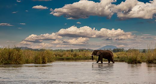
The Lower Zambezi offers a large diversity of wildlife and all the iconic large mammals in Southern Africa except for rhino (which were poached to extinction in the 1980s) and giraffe. The most common species are elephant and buffalo, which are present in good numbers and are often seen grazing along the floodplains and on islands in the Zambezi River.
Impala are the most common antelope, but there are also strong populations of greater kudu, bushbuck, zebra, and waterbuck. Giraffe are notably absent and interestingly, are thought to never have existed here. Duiker and grysbok are found in small numbers.
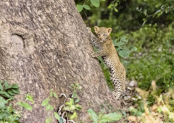
A leopard cub in the Lower Zambezi National Park.
As for predators, lion and spotted hyena are the most commonly encountered. Cheetah are seen on rare occasions, but are not a species one should expect to see. The highly endangered African wild dog is seen fairly often, but packs range widely except during the denning season (June-July).
The Zambezi River is home to huge numbers of hippo and boating on the river always offers excellent views of these magnificent mammals. Crocodiles are also here in large numbers, and can be seen basking on the sand banks to regulate their body temperatures.

Impalas are the most common antelope in Lower Zambezi.
Activities
Game drives are the best way to explore the park and see its wildlife and all the camps and lodges offer guided drives, twice daily. Canoeing on the Zambezi River offers a different perspective and can afford adrenaline rush views of elephant, hippo, and crocodile. Perhaps the most exciting way to explore the park is on a guided bush walk, allowing a completely different experience and feeling.
Birding is very productive as may be expected, with the diversity of habitats and permanent water along the river. Over 380 species have been recorded in the valley. Migrants from the north arrive around early September and remain through the summer breeding months, only departing in March/April.

An elephant and her calf along the Zambezi River, Lower Zambezi National Park, Zambia.
Read More...
Chiawa GMA, Conservation Lower Zambezi, Geography, History, Lower Zambezi National Park, Poaching, Zambezi River, Wildlife
Great Good Fair Poor
- Jan
- Feb
- Mar
- Apr
- May
- Jun
- Jul
- Aug
- Sep
- Oct
- Nov
- Dec
Like many of Zambia's safari destinations, the Lower Zambezi has distinct seasons that are heavily influenced by climate, and in particular rain. The rainy season is generally from mid-November through April and many safari camps and lodges are closed. The best time to visit is during the winter/dry season, which runs from June thru October.

A leopard in the Lower Zambezi National Park.
Winter / Dry Season
The Lower Zambezi's dry season runs from May thru October, with almost no precipitation during these months. Wildlife congregates along the permanent water of the Zambezi River more and more as the bush dries out in the later part of the season. This is peak tourist season, with higher rates and the national park roads become busier.
May is the beginning of the dry season, but the vegetation is still lush and the grasses are high. Some late rains are still possible. Daytime temps average a comfortable 73-77°F (23-25°C) with nighttime lows averaging 49-51°F (9-11°C). Some camps are still not open until June.

An elephant as seen from a boat on the Zambezi River.
June and July are free from rain and the bush is transforming from a lush green to brown and dry. The days are very pleasant and are these are the coolest months of the year. Daytime temps average 75-78°F (24-26°C) and mornings are chilly, so bring a fleece and dress in removable layers for the morning game drives. Nights cool down to around 47-51°F (8-10°C). The safari camps are all open and game viewing is very good.
August and September are very warm and dry and the game viewing is at its best, especially along the Zambezi River. The vegetation is very dry and the river is a haven for wildlife. Daytime temps reach highs of 86-91°F (30-33°C) and overnights and early mornings are a comfortable 55-63°F (13-17°C). The safari camps are at their highest occupancies.
October is the height of the dry season and also the hottest month. Wildlife viewing along the Zambezi River is exceptionally good, with much of the bush away from the river now completely dry. Daytime temps can become intolerably warm, reaching highs of 93-98°F (34-37°C). Overnight temps are warm, only dropping to 66-69°F (19-21°C). The first rains often fall in late October, bringing relief to the region.
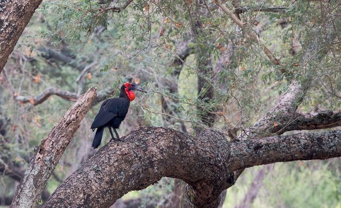
A ground hornbill on an albida tree.
Summer / Rainy Season
Lower Zambezi's rainy season is from November thru April. Some roads in the park become bogged down by mud, reducing the game drive area. Vegetation flourishes as the rains increase and some wildlife move away from the river to take advantage of the fresh grazing on the floodplains and even into the hills of the escarpment.
November is very warm and afternoon rain showers occur about two out of every three days. The bush is transforming, with fresh grass flourishing on the floodplain, and many grazers, like impala and warthog, give birth to their young. Daytime temps are still very warm, averaging 88-92°F (31-33°C) but the rain cools it down in the afternoon. Overnight temps are pleasant, averaging 64-67°F (18-19°).
Hippos are found all along the Lower Zambezi River.
December thru March are the peak rain months in the Lower Zambezi and some safari camps are closed. Rain falls almost every day, although all-day rain is uncommon. Some roads become difficult or impassable, severely limiting the game drive area. Wildlife is more dispersed away from the Zambezi River northwards into the park. Daytime temps reach 82-88°F (28-31°C), while nighttime temps drop to 64-70°F (18-21°C).
April marks the end to the rains, with only sporadic showers. It is a lovely time to visit, with verdant scenery and most days clear and sunny. Some camps are still closed and the roads are still tricky in places. Daytime temps reach 84-86°F (29-30°C) and overnight/early mornings average 51-54°F (10-12°C).
Showing 1–1 of 1 results